GEOSS in Americas Symposium Side Session - Capacity Building ANTARES Network
|
|
|
- Shanon Bell
- 6 years ago
- Views:
Transcription

1 GEOSS in Americas Symposium Side Session - Capacity Building ANTARES Network Milton Kampel Ministry of Science and Technology National Institute for Space Research
2 ANTARES Observation Network Integrated network of in situ and remote sensing stations focused on detecting long-term changes in marine ecosystems around Latin America
3 ANTARES South-American Network First Initiative: IOCCG training course, Concepción, n, Chile (2002) South-American Workshop (IOCCG) Mar del Plata, Argentina (2003) 15 specialists from SA (Argentina, Brazil, Chile y Venezuela) and experts from NA (Canada, EEUU)
4 List of participating institutions Fundación n La Salle de Ciencias Naturales Universidad Simón n Bolívar Fundação Universidade Federal de Rio Grande Instituto Oceanográfico da Universidade de São Paulo Instituto Nacional de Pesquisas Espaciais Universidad de Concepción Instituto Nacional de Investigación n y Desarrollo Pesquero Estación n de Fotobiología a Playa Unión Instituto de Astronomía a y Física F del Espacio Bedford Institute of Oceanography Dalhousie University Institute for Marine Remote Sensing, University of South Florida Scripps Institution of Oceanography Universidad Autónoma de Baja California FLASA USB FURG IOUSP INPE UdeC INIDEP EFPU IAFE BIO Dal ImaRS/USF SIO UABC Venezuela Venezuela Brazil Brazil Brazil Chile Argentina Argentina Argentina Canada Canada USA USA Mexico
5 Goal Promote observations of coastal ecosystems around Latin-America at various scales, ranging from in situ time-series to remote sensing observations, aiming to detect and characterize long-term spatial-temporal temporal variability.
6 ANTARES - Approach The network is built on ongoing initiatives in different countries in the Americas both in the remote sensing area and in situ observations Integrate satellite observations with in situ timeseries data Create a database of in situ and satellite data for scientific applications, educational purposes and management of coastal resources
7 México Colombia Equador ImaRS (USF) CARIACO Peru INPE Ubatuba COPAS Concepción UdeC IAFE EGI EPEA

 It is influenced by the Trade")


 Rosette Milton Kampel")
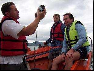
8 Venezuela Cariaco Basin is on the continental shelf of Venezuela It is a depression ~1400 m deep, connected to the Caribbean Sea by two shallow channels (~140 m) It is influenced by the Trade Winds, which induce strong upwelling during the first half of the year High productivity and vertical flux of organic matter leads to permanent anoxia below ~250 m. CARIACO Time-Series program sampled the Basin monthly since October 1995 (hydrography, productivity) Two moorings are maintained (sediment flux traps, current meters) Rosette Milton Kampel ADCP and mooring buoy GEOSS Americas Brazil Sep R/V Hermano Gines
9 Concepción Information DATE 12 July July 2005 SAMPLING STATIONS St. 40 St. 18 ACTIVITY Water column Water column, benthos, primary production, sediments traps


 is to")


10 EGI Main objective of the Estación de Fotobiología Playa Unión (EFPU) is to perform Studies about ultraviolet radiation in aquatic organisms and time-series of radiation measurements in Patagonia


11 Argentina EPEA Estación Permanente de Estudios Ambientales Mar del Plata epea Project Dinámica del Plancton Marino y Cambio Climático (DiPlaMCC)


12 ANTARES-Ubatuba TST 23 o 44 S 45 o 00 W
 Workshop II, I.")
13 ANTARES web portal ( Workshop II, I. Margarita (2005)

14 ANTARES Brazil

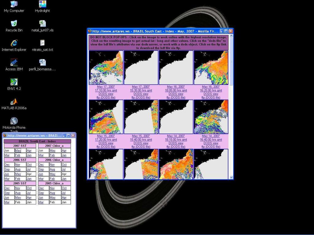
15 ANTARES Satellite Local Data

16 ANTARES Brazil Southeast

17 ANTARES Brazil SE Chlorophyll
18 Chlorophyll
19 Chlorophyll 12/5/07

20 Chlorophyll 12/5/07

21 Temperature

22 Temperature 12/5/07
23 Chlorophyll

24 DODS Distributed Ocean Data System

25 INPE, NF-POGO (2006)
26 ANTARES International Links ANTARES has been promoted: International Ocean-Colour Coordinating Group (IOCCG); Partnership for the Observation of the Global Ocean (POGO). ANTARES has been considered in the Agendas of: Global Ocean Observing System (GOOS) - Proposed as a GOOS Ocean-Colour Pilot Study (ChlorOGIN); Group of Earth Observation (GEO) Task CB Ecosystems in the implementation plan of the Global Earth Observation System of Systems (GEOSS).

27 Plymouth Chlorophyll Meeting and Workshops Extended Antares Network Sept 2006 ChlorOGIN - Chlorophyll Ocean Global Integrated Network
28 Plymouth Chlorophyll Meeting and Workshops The meeting consisted of three components: a plenary planning meeting a satellite remote sensing technical workshop an in situ observations technical and calibration workshop The 44 participants represented Latin America, southern and east Africa, India, China, Thailand, Sri Lanka, the Joint Research Centre of the European Commission, and the sponsors: the PML, GOOS, GEO and POGO
29 Plymouth Chlorophyll Meeting and Workshops Principal recommendations: That the ChlorOGIN network be implemented with immediate effect, linking existing national and regional centres; That the appropriate bodies ensure that continuity of satellite ocean colour sensors is achieved to provide inter-calibrated long time series of surface ocean chlorophyll and SST; That in situ time-series of surface and sub-surface observations be made at each regional centre to support the satellite measurements by integration/combination in a manner that suits local societal and scientific needs; The need for homogeneity/compatibility of protocols (e.g. for match-ups), procedures and analysis tools/practices be recognised and that members of the network move towards common protocols;
30 Plymouth Chlorophyll Meeting and Workshops Principal recommendations: That physical infrastructure (such as the connection between networks and receiving stations, data distribution, materials required to adopt best practice protocols for in situ measurements) and human capacity be developed in existing and new centres to expand the network in two five-year phases; That communications bandwidth be improved in most developing countries, as this limits the delivery of ocean chlorophyll and related products and is more important than satellite ground receiving stations; That funding be sought for development of the ChlorOGIN Network from national bodies, the Large Marine Ecosystem programmes, and other sources.

31 ChlorOGIN Africa

32 ChlorOGIN Africa

33 ChlorOGIN Africa

34 Educational use of ANTARES
35 Future activities Strengthen in situ time-series stations. Standardize a core set of measurements to create a common database Include new time-series stations to gain understanding on a continental-scale Integrate remote sensing data with field data on web sites, to show the degree of comparison at the different stations Include satellite data from other sensors like MERIS and follow-on missions (VIISR, NPP and NPOES) Continue developing the internet web services tools, including data and product descriptions, and tutorials.

36 Thanks! Acknowledgments INPE; USP Univ. Sao Paulo; POGO, IOCCG, IAI, GEO, GOOS, Nippon Foundation and NASA; Veliger-II crew, reserachers,, technicians, students
Time-Series Oceanographic Study at the Coastal Station EPEA (Argentina)
") Time-Series Oceanographic Study at the Coastal Station EPEA (Argentina) 1,2 Vivian Lutz, 2 Rubén Negri, 2 Ricardo Silva Consejo Nacional de Investigaciones Científicas y Técnicas, Argentina Instituto Nacional
Time-Series Oceanographic Study at the Coastal Station EPEA (Argentina) 1,2 Vivian Lutz, 2 Rubén Negri, 2 Ricardo Silva Consejo Nacional de Investigaciones Científicas y Técnicas, Argentina Instituto Nacional
National Remote Sensing Center of China. Space Technology for Sustainable Development in China Status, Achievements and Futures.
 National Remote Sensing Center of China Space Technology for Sustainable Development in China Status, Achievements and Futures Jing Li National Remote Sensing Center of China Ministry of Science and Technology,
Proper Data Management Responsibilities to Meet the Global Ocean Observing System (GOOS) Requirements
 Requirements") Data Buoy Cooperation Panel XXVI Oban, Scotland, UK 27 September 2010 Proper Data Management Responsibilities to Meet the Global Ocean Observing System (GOOS) Requirements William Burnett Data Management
Data Buoy Cooperation Panel XXVI Oban, Scotland, UK 27 September 2010 Proper Data Management Responsibilities to Meet the Global Ocean Observing System (GOOS) Requirements William Burnett Data Management
NCAVES - Global initiative and national pilots
 NCAVES - Global initiative and national pilots Kavita Sharma UN Environment Pretoria, March 2018 Outline 1. Global initiative > Introduction > Objectives and deliverables >Activities in 2017 and 2018 2.
Egypt-NOAA Cooperation: Advancing our Environmental Science, Technology, and Education
 Egypt-NOAA Cooperation: Advancing our Environmental Science, Technology, and Education T. G. Onsager NOAA Space Weather Prediction Center and NWS International Activities Office (one-year detail) Terry.Onsager@noaa.gov
LEVERAGING DWFI RESOURCES TO ADDRESS WATER FOR AGRICULTURE IN LATIN AMERICA UNDER A CHANGING CLIMATE
 LEVERAGING DWFI RESOURCES TO ADDRESS WATER FOR AGRICULTURE IN LATIN AMERICA UNDER A CHANGING CLIMATE Rachindra Mawalagedara Robert J. Oglesby Presented at the DWFI Student Support Research Forum, May 12,
SEAWIFS VALIDATION AT THE CARIBBEAN TIME SERIES STATION (CATS)
") SEAWIFS VALIDATION AT THE CARIBBEAN TIME SERIES STATION (CATS) Jesús Lee-Borges* and Roy Armstrong Department of Marine Science, University of Puerto Rico at Mayagüez, Mayagüez, Puerto Rico 00708 Fernando
SEAWIFS VALIDATION AT THE CARIBBEAN TIME SERIES STATION (CATS) Jesús Lee-Borges* and Roy Armstrong Department of Marine Science, University of Puerto Rico at Mayagüez, Mayagüez, Puerto Rico 00708 Fernando
Areas Beyond National Jurisdiction (ABNJ) 2016 Regional Leaders Program. March 22 to April 1, 2016 United Nations, New York
 2016 Regional Leaders Program. March 22 to April 1, 2016 United Nations, New York") Areas Beyond National Jurisdiction (ABNJ) 2016 Regional Leaders Program March 22 to April 1, 2016 United Nations, New York Welcome and Introductions Biliana Cicin-Sain President, Global Ocean Forum Vladimir
Areas Beyond National Jurisdiction (ABNJ) 2016 Regional Leaders Program March 22 to April 1, 2016 United Nations, New York Welcome and Introductions Biliana Cicin-Sain President, Global Ocean Forum Vladimir
UN-GGIM:Americas Regional Report
 UN-GGIM:Americas Regional Report 2016-2017 Seventh Session of UN-GGIM 2-4 August 2017, United Nations Headquarters, New York. Rolando Ocampo President of UN-GGIM: Americas Content Activities, Areas of
WGCapD Support to AmeriGEOSS Week Disaster Training Report
 WGCapD Support to AmeriGEOSS Week Disaster Training Report 1 6-9 June 2016 CEOS WGCapD Support to AmeriGEOSS Week Disaster training DRAFT REPORT Hosted by: The government's Institute of Hydrology, Meteorology,
Oceanology International, London, March 2012 Ocean Observation & Forecasting programme. An African Network of Offshore Real-Time Metocean Stations
 Oceanology International, London, March 2012 Ocean Observation & Forecasting programme An African Network of Offshore Real-Time Metocean Stations Valérie QUINIOU-RAMUS, Rémi ESTIVAL (TOTAL S.A., EP/DEV/TEC/GEO)
A Glimpse at Geodetic Activities in Latin America
 UNIVERSIDADE DO ESTADO DO RIO DE JANEIRO CENTRO DE TECNOLOGIA E CIÊNCIAS FACULDADE DE ENGENHARIA DEPARTAMENTO DE ENGENHARIA CARTOGRÁFICA A Glimpse at Geodetic Activities in Latin America Prof. Luiz Paulo
Pan American Institute of Geography and History. 12th MACHC 5-9 December 2011
 Pan American Institute of Geography and History 12th MACHC 5-9 December 2011 1 PAIGH Mission and Objectives To encourage, coordinate, and publicize cartographical, geographical, geophysical and historical
SIRGAS: Basis for Geosciences, Geodata, and Navigation in Latin America
 SIRGAS: Basis for Geosciences, Geodata, and Navigation in Latin America Claudio Brunini President of SIRGAS Universidad Nacional de La Plata, Argentina María Virginia Mackern President of SIRGAS/WG-I:
Time-series observations in the Northern Indian Ocean V.V.S.S. Sarma National Institute of Oceanography Visakhapatnam, India
 The Second GEOSS Asia-Pacific Symposium, Tokyo, 14-16 th April 28 Time-series observations in the Northern Indian Ocean V.V.S.S. Sarma National Institute of Oceanography Visakhapatnam, India Seasonal variations
GOES-16 & GOES-S: Natalia Donoho. Preparing Users for New Generation Satellites. WMO IPET-SUP-4 Geneva, Switzerland 26 February, 2018
 GOES-16 & GOES-S: Preparing Users for New Generation Satellites Natalia Donoho Satellite Products and Services Division (NOAA/NESDIS) WMO IPET-SUP-4 Geneva, Switzerland 26 February, 2018 GOES-R series
GEO Coastal Zone Community of Practice (CZCP)
") ! "#$%&" $'( )$*+,-.'// Global, regional and local trends in natural processes and human demands on coastal ecosystems jeopardize the ability of these ecosystems to support commerce, living resources,
! "#$%&" $'( )$*+,-.'// Global, regional and local trends in natural processes and human demands on coastal ecosystems jeopardize the ability of these ecosystems to support commerce, living resources,
Global Drifter Program (GDP)
") Global Drifter Program (GDP) Drifting buoy measurements of Sea Surface Temperature, Mixed Layer Currents, Atmospheric Pressure and Winds http://www.aoml.noaa.gov/phod/dac/gdp.html Rick Lumpkin, NOAA/AOML
Global Drifter Program (GDP) Drifting buoy measurements of Sea Surface Temperature, Mixed Layer Currents, Atmospheric Pressure and Winds http://www.aoml.noaa.gov/phod/dac/gdp.html Rick Lumpkin, NOAA/AOML
Ocean Vector Wind Constellation:
 The CEOS Ocean Vector Wind Constellation: Current Status and Challenges Stan Wilson, NOAA; Hans Bonekamp, EUMETSAT; and B.S. Gohil, ISRO Co Chairs International OVW Science Team Meeting Barcelona 18 20
Group on Earth Observations (GEO) Cold Regions Work Plan Item WA-01-C3
 Cold Regions Work Plan Item WA-01-C3") EC Panel of Experts on Polar Observations, Research and Services Group on Earth Observations (GEO) Cold Regions Work Plan Item WA-01-C3 Barbara J. Ryan Secretariat Director Lanzhou, China 13 March 2013
EC Panel of Experts on Polar Observations, Research and Services Group on Earth Observations (GEO) Cold Regions Work Plan Item WA-01-C3 Barbara J. Ryan Secretariat Director Lanzhou, China 13 March 2013
"Research at the Interface between Ocean Chemistry and Biology"
 "Research at the Interface between Ocean Chemistry and Biology" Purpose: Assess the interest within the OCB community for developing a program to investigate metal-biota interactions, including the implications
Marine Science in the Agulhas and Somali Current Large Marine Ecosystems (ASCLME) Project
 Project") Marine Science in the Agulhas and Somali Current Large Marine Ecosystems (ASCLME) Project Lucy Scott Large Marine Ecosystems The Agulhas and Somali Current and Mascarene region are three Large Marine Ecosystems
Marine Science in the Agulhas and Somali Current Large Marine Ecosystems (ASCLME) Project Lucy Scott Large Marine Ecosystems The Agulhas and Somali Current and Mascarene region are three Large Marine Ecosystems
Numerical Modelling and Data Assimilation applied to the South Atlantic Ocean
 Numerical Modelling and Data Assimilation applied to the South Atlantic Ocean Luiz Paulo Assad / Luiz Landau Universidade Federal do Rio de Janeiro COPPE Laboratório de Métodos Computacionais em Engenharia
REVIEWS ON HYCOM AND MYOCEAN WITH FOCUS ON BRAZIL CURRENT SYSTEM, BETWEEN CABO FRIO AND CABO DE SÃO TOMÉ
 REVIEWS ON HYCOM AND MYOCEAN WITH FOCUS ON BRAZIL CURRENT SYSTEM, BETWEEN CABO FRIO AND CABO DE SÃO TOMÉ BOECHAT, A.C.R.¹* & DA CRUZ, L.M.M. 1 1. Prooceano Serviço Oceanográfico e Ambiental Ltda. *Corresponding
South Asian Climate Outlook Forum (SASCOF-6)
") Sixth Session of South Asian Climate Outlook Forum (SASCOF-6) Dhaka, Bangladesh, 19-22 April 2015 Consensus Statement Summary Below normal rainfall is most likely during the 2015 southwest monsoon season
Sixth Session of South Asian Climate Outlook Forum (SASCOF-6) Dhaka, Bangladesh, 19-22 April 2015 Consensus Statement Summary Below normal rainfall is most likely during the 2015 southwest monsoon season
The National Data Buoy Center: Strategic Ocean Observations and International Collaboration
 2011 International Union of Geodesy and Geophysics General Assembly July 1, 2011 The National Data Buoy Center: Strategic Ocean Observations and International Collaboration William Burnett, Richard Bouchard,
Major Opportunities in Spatial Data Infrastructure Communities
 Major Opportunities in Spatial Data Infrastructure Communities Bas Kok President GSDI June 17 th 2008 FIG Working Week: Integrating Generations 14-19 June 2008 Stockholm, Sweden http://www.gsdi.org 1 GSDI
AREP GAW. Overview of GURME. (The WMO GAW Urban Research Meteorology and Environment project) WMO Secretariat
 WMO Secretariat") Overview of GURME (The WMO Urban Research Meteorology and Environment project) Liisa Jalkanen Liisa Jalkanen WMO Secretariat World Meteorological Organization Independent technical UN agency 187 Members
Overview of GURME (The WMO Urban Research Meteorology and Environment project) Liisa Jalkanen Liisa Jalkanen WMO Secretariat World Meteorological Organization Independent technical UN agency 187 Members
Sea Level Variability in the East Coast of Male, Maldives
 Sea Level Variability in the East Coast of Male, Maldives K.W. Indika 1 *, E.M.S. Wijerathne 2, G. W. A. R. Fernando 3, S.S.L.Hettiarachchi 4 1 National Aquatics Resources Research and Development Agency,
Introduction of the Asia-Oceania Global Earth Observation System of Systems (AOGEOSS) GEO Initiative(GI-22 )
 GEO Initiative(GI-22 )") Introduction of the Asia-Oceania Global Earth Observation System of Systems (AOGEOSS) GEO Initiative(GI-22 ) Prof. Xiang ZHOU Institute of Remote Sensing and Digital Earth, CAS 11 May 2017 Kunming, China
Introduction of the Asia-Oceania Global Earth Observation System of Systems (AOGEOSS) GEO Initiative(GI-22 ) Prof. Xiang ZHOU Institute of Remote Sensing and Digital Earth, CAS 11 May 2017 Kunming, China
THE OPEN UNIVERSITY OF SRI LANKA
 THE OPEN UNIVERSITY OF SRI LANKA Extended Abstracts Open University Research Sessions (OURS 2017) 16 th & 17 th November, 2017 The Open University of Sri Lanka - 2017 All rights reserved. No part of this
The Role of Data & Information Infrastructures in Supporting Climate Change Adaptation in Latin America & the Caribbean
 The Role of Data & Information Infrastructures in Supporting Climate Change Adaptation in Latin America & the Caribbean Emil A. Cherrington Senior Scientist Water Center for the Humid Tropics of Latin
Oceanographic Activities of INCLINE
 Oceanographic Activities of INCLINE Edmo Campos Oceanographic Intitute University of São Paulo Brazil LABMON - GEOCLIM Collaborators: Paulo Nobre (INPE/Brazil); Janice Trotte (MCTI/Brazil); Carlos França,
PAN AMERICAN INSTITUTE OF GEOGRAPHY AND HISTORY Specialized Organization of the OAS
 PAN AMERICAN INSTITUTE OF GEOGRAPHY AND HISTORY Specialized Organization of the OAS 10 th UNRCC Americas United Nations, New York, 20 August 2013 PAIGH, SIRGAS, PC-IDEA and GeoSUR 2013-2015 Joint Action
BRAZILIAN'REMOTE SmSING COMKmUTY: HISTORICAL, GEOGRAPHICAL AND ECONOMICAL ASPECTS
 BRAZILIAN'REMOTE SmSING COMKmUTY: HISTORICAL, GEOGRAPHICAL AND ECONOMICAL ASPECTS Tania Maria Sausen Instituto Nacional de Pesquisas Espaciais Secretaria da Ciencia e Tecnologia Avenida dos Astronautas,
The International AMDAR Program
 Aircraft Meteorological DAta Relay The International AMDAR Program Improving Weather Forecasts With AMDAR data are used operationally to support a wide range of meteorological applications and are considered
African Coastal Atlas developments. 10 July 2008 EEA Copenhagen, Denmark
 African Coastal Atlas developments 10 July 2008 EEA Copenhagen, Denmark Africa Overview Africa has approximately 40 000 km of coast across 32 mainland countries and four island states. Africa's coastal
Contents: LEVANTE DE ALMERÍA A INFORMATION SYSTEM OBJECTIVES AND ACTIONS GEOGRAPHIC INFORMATION SYSTEM RESULTS
 Contents: LEGAL FRAMEWORK: BARCELONA CONVENTION AND ICZM PROTOCOL; COASTAL AREAS MANAGEMENT PROGRAMME; CAMP LEVANTE DE ALMERIA; OVERALL AIM AND KEY IDEAS AREA PHASES PROJECT STRUCTURE ACTIVITIES INSTITUTIONAL
The IHPT Marine Spatial Data infrastructure and its contribution to the INSPIRE Directive
 The IHPT Marine Spatial Data infrastructure and its contribution to the INSPIRE Directive INSPIRE - GWF 2015 - Coastal & Marine session Lisbon Congress Center, Portugal - Thursday, 28 May 2015 Summary
Carbon pathways in the South Atlantic
 Carbon pathways in the South Atlantic Olga T. Sato, Ph.D. Paulo Polito, Ph.D. olga.sato@usp.br - polito@usp.br Oceanographic Institute University of São Paulo Olga Sato and Paulo Polito (IOUSP) Carbon
Do Policy-Related Shocks Affect Real Exchange Rates? An Empirical Analysis Using Sign Restrictions and a Penalty-Function Approach
 ISSN 1440-771X Australia Department of Econometrics and Business Statistics http://www.buseco.monash.edu.au/depts/ebs/pubs/wpapers/ Do Policy-Related Shocks Affect Real Exchange Rates? An Empirical Analysis
Incorporation of the Caribbean to the Geocentric Reference System for the Americas SIRGAS
 Incorporation of the Caribbean to the Geocentric Reference System for the Americas SIRGAS W. Martínez M. V. Mackern V. Cioce R. Rodino S.R. De Freitas UN-GGIM: Americas Third Session, October 5 2016, Mexico
IPWG recent accomplishments and future directions
 IPWG recent accomplishments and future directions Paul Kucera (NCAR, Boulder, USA) And Bozena Lapeta (IMWM Krakow, Poland) with additions by Volker Gärtner (EUMETSAT, IPWG Rapporteur) IPWG Objectives IPWG
MERSEA Marine Environment and Security for the European Area
 MERSEA Marine Environment and Security for the European Area Development of a European system for operational monitoring and forecasting of the ocean physics, biogeochemistry, and ecosystems, on global
Ocean Monitoring and Forecasting core services,
 MY OCEAN Marine Core Service Ocean Monitoring and Forecasting core services, the MyOcean example Pierre BAHUREL MyOcean coordinator Mercator Ocean, France Session 5B "The way forward: delivering societal
Operational Monsoon Monitoring at NCEP
 Operational Monsoon Monitoring at NCEP Wassila M. Thiaw Climate Prediction Center National Centers for Environmental Predictions Operational Monsoon Monitoring at NCEP Wassila M. Thiaw Climate Prediction
Blue Earth Global Expedition (BEAGLE 2003/2004)
") Cruise Report Blue Earth Global Expedition (BEAGLE 2003/2004) Leg 6 Fremantle (Australia) - Fremantle (Australia) January 27 th - February 19 nd, 2004 Milton Kampel INPE, Brazil February, 2004 Milton Kampel
Cruise Report Blue Earth Global Expedition (BEAGLE 2003/2004) Leg 6 Fremantle (Australia) - Fremantle (Australia) January 27 th - February 19 nd, 2004 Milton Kampel INPE, Brazil February, 2004 Milton Kampel
Observation system for early warning of HAB events
 Observation system for early warning of HAB events Vera L. Trainer, NOAA Fisheries Northwest Fisheries Science Center Marine Biotoxins Program Seattle, Washington, USA Juan de Fuca eddy Regional HAB OOS
Implementation Status & Results Mexico Coastal Watersheds Conservation in the Context of Climate Change Project (P131709)
") Public Disclosure Authorized Public Disclosure Authorized Implementation Status & Results Mexico Coastal Watersheds Conservation in the Context of Climate Change Project (P131709) Operation Name: Coastal
Public Disclosure Authorized Public Disclosure Authorized Implementation Status & Results Mexico Coastal Watersheds Conservation in the Context of Climate Change Project (P131709) Operation Name: Coastal
Earth Observations as a Tool To Achieve Sustainable Development Goals
 The image part with relationship ID rid3 was not found in the file. 16/10/2017 Earth Observations as a Tool To Achieve Sustainable Development Goals LI Jing, China GEO On behalf of the Group on Earth Observations
Sea Level Monitoring and the GLOSS Programme
 Sea Level Monitoring and the GLOSS Programme Philip L. Woodworth Permanent Service for Mean Sea Level Proudman Oceanographic Laboratory, UK Port Meteorological Officers Meeting, IMO, 25 July 2003 www.pol.ac.uk
Background Document: Report of the Regional Committee of United Nations Global Geospatial Information Management for Asia and the Pacific
 Background Document: Report of the Regional Committee of United Nations Global Geospatial Information Management for Asia and the Pacific 1. Summary 1. This report highlights the activities carried out
Charles Magori. Status Report of GLOSS Tide Gauges in Kenya
 GLOSS Group of Experts Meeting February 2005 Charles Magori Introduction Status Report of GLOSS Tide Gauges in Kenya There is growing concern about the rise in mean sea level around the globe. To address
Inventory of United Nations Resolutions on Cartography Coordination, Geographic Information and SDI 1
 Inventory of United Nations Resolutions on Cartography Coordination, Geographic Information and SDI I. Resolutions on Cartography Coordination and Establishment of United Nations Regional Cartographic
Main Achievements. New Centre of Excellence in Morocco. Since ET-SUP
 Status and Plans New Centre of Excellence in Morocco Located in the WMO Regional Association I (RAI), the CoE Morocco is hosted by the National Directorate of Meteorology of Morocco and supported by EUMETSAT.
EXPERIENCES, PRIORITIES AND OPPORTUNITIES IN THE SOUTH EAST PACIFIC
 WORKSHOP ON LINKING GLOBAL AND REGIONAL LEVELS IN THE MANAGEMENT OF MARINE AREAS BEYOND NATIONAL JURISDICTION EXPERIENCES, PRIORITIES AND OPPORTUNITIES IN THE SOUTH EAST PACIFIC CN JULIÁN AUGUSTO REYNA
COVERAGE-Sargasso Sea
 COVERAGE-Sargasso Sea A Collaborative Project between NASA and the Sargasso Sea Commission Dr. Vardis Tsontos Dr. Jorge Vazquez NASA Jet Propulsion Laboratory, California Institute of Technology UN-HQ
David Antoine on behalf of the OCAPI science team
 European prospects for a geostationary ocean color sensor: the ocean color advanced permanent imager (OCAPI) David Antoine on behalf of the OCAPI science team Curtin University, Remote Sensing & Satellite
Glaciology Exchange (Glacio-Ex) Norwegian/Canadian/US Partnership Program
 Norwegian/Canadian/US Partnership Program") Glaciology Exchange (Glacio-Ex) Norwegian/Canadian/US Partnership Program Luke Copland University of Ottawa, Canada Jon Ove Hagen University of Oslo, Norway Kronebreeen, Svalbard. Photo: Monica Sund The
Glaciology Exchange (Glacio-Ex) Norwegian/Canadian/US Partnership Program Luke Copland University of Ottawa, Canada Jon Ove Hagen University of Oslo, Norway Kronebreeen, Svalbard. Photo: Monica Sund The
OCEAN COLOUR MONITOR ON-BOARD OCEANSAT-2
 OCEAN COLOUR MONITOR ON-BOARD OCEANSAT-2 Rangnath R Navalgund Space Applications Centre Indian Space Research Organisation Ahmedabad-380015, INDIA OCEANSAT-2 2 MISSION OCEANSAT-2 2 is a global mission
GODAE Status. OSEs/OSSEs meeting objectives. P.Y. le Traon, A. Fischer, E. Harrison, K. Wilmer Becker
 GODAE Status OSEs/OSSEs meeting objectives P.Y. le Traon, A. Fischer, E. Harrison, K. Wilmer Becker Content 3. GODAE Status Achievements and successes Priorities GODAE in 2007/2008 5. Objectives of the
Crisis Support and Disaster Response. in Latin America and the Caribbean
 Crisis Support and Disaster Response in Latin America and the Caribbean The Pan American Agenda 2010-2020 of the Pan American Institute of Geography and History (PAIGH), and the resulting 2010 Implementation
RedLatif Latin American Network of Remote Sensing and Forest Fire Sun City, South Africa Maria Isabel Cruz Lopez May 9th, 2011 RedLatif Coordinator
 RedLatif Latin American Network of Remote Sensing and Forest Fire Sun City, South Africa May 9 th, 2011 Maria Isabel Cruz Lopez RedLatif Coordinator Index 1.- Objective 2.- Members 3.- WEB page 4.- Projects
Global Environment Facility - Integrating Watershed & Coastal Areas Management (GEF-IWCAM): Andros Demonstration Site
: Andros Demonstration Site") Global Environment Facility - Integrating Watershed & Coastal Areas Management (GEF-IWCAM): Andros Demonstration Site Coastal Aquifer Management in Small Island Developing States of the Caribbean: Challenges
Global Environment Facility - Integrating Watershed & Coastal Areas Management (GEF-IWCAM): Andros Demonstration Site Coastal Aquifer Management in Small Island Developing States of the Caribbean: Challenges
Economic and Social Council
 United Nation E/C.20/2012/4/Add.1 Economic and Social Council Distr.: General 2 July 2012 Original: English Committee of Experts on Global Geospatial Information Management Second session New York, 13-15
Update on IPWG Activities
 Update on IPWG Activities Paul Kucera National Center for Atmospheric Research Research Applications Laboratory Boulder, Colorado, USA Bozena Lapeta Satellite Remote Sensing Centre Institute of Meteorology
Emerging Needs and Opportunities in Ocean Remote Sensing
 Emerging Needs and Opportunities in Ocean Remote Sensing Christine Gommenginger National Oceanography Centre, Southampton With thanks to: Chris Banks, Val Byfield, Paolo Cipollini, Nadim Dayoub, Giuseppe
Vision: The National Oceanography Centre will, by 2015, be recognised as the world-leading Centre for integrated ocean sciences and technology".
 National Oceanography Centre from coast to deep ocean Waterfront Campus, Southampton Vision: Joseph Proudman Building, Liverpool The National Oceanography Centre will, by 2015, be recognised as the world-leading
The Australian Integrated Marine Observing System: Present and Future Possibilities
 The Australian Integrated Marine Observing System: Present and Future Possibilities Roger Proctor, IMOS/eMII emarine Information Infrastructure IMOS is supported by the Australian Government through the
INFORMATION RESOURCES FOR MARINE AND AQUATIC SCIENCES RESEARCH IN TRINIDAD AND TOBAGO
 INFORMATION RESOURCES FOR MARINE AND AQUATIC SCIENCES RESEARCH IN TRINIDAD AND TOBAGO Introduction Sharida Hosein The University of the West Indies Campus Libraries St Augustine, Trinidad and Tobago. West
WMO Update on Space Weather Activities. Jérôme Lafeuille (WMO Space Programme Office)
") WMO Update on Space Weather Activities Jérôme Lafeuille (WMO Space Programme Office) Terry Onsager (Co Chair WMO/ICTSW) WMO Inter-Programme Coordination Team on Space Weather (ICTSW) Established in May,
WMO Update on Space Weather Activities Jérôme Lafeuille (WMO Space Programme Office) Terry Onsager (Co Chair WMO/ICTSW) WMO Inter-Programme Coordination Team on Space Weather (ICTSW) Established in May,
JCOMM Overview. Val Swail Environment and Climate Change Canada JCOMM representative to IOGP Metocean Committee
 JCOMM Overview Val Swail Environment and Climate Change Canada JCOMM representative to IOGP Metocean Committee IOGP/JCOMM/WCRP Workshop Our Future Climate Understanding the spread of physical risk for
PORTUGAL NATIONAL REPORT
 PORTUGAL NATIONAL REPORT 13 TH SOUTHERN AFRICA AND ISLANDS HYDROGRAPHIC COMMISSION MEETING Cape Town, South Africa 29 th 31 st August 2016 INSTITUTO HIDROGRÁFICO Miguel Arenga IHPT Head of the Hydrography
Enabling Access to Arctic Location Based Information - the Arctic SDI
 Enabling Access to Arctic Location Based Information - the Arctic SDI Jani Kylmäaho Head of Arctic SDI Geoportal WG National Land Survey of Finland SAO Chair, WG Chairs and Executive Secretaries meeting
CEOS Overview and JAXA Plans for Water Cycle Observation
 CEOS Overview and JAXA Plans for Water Cycle Observation Asian Water Cycle Symposium November 2-4, 2005 Tokyo, Japan Chu Ishida Japan Aerospace Exploration Agency (JAXA) Contents 1. CEOS overview 2. CEOS
Sea Level Anomaly trends in the South Atlantic around 10 o S. Wilton Zumpichiatti Arruda 1 Edmo José Dias Campos 2
 Anais XV Simpósio Brasileiro de Sensoriamento Remoto - SBSR, Curitiba, PR, Brasil, 30 de abril a 05 de maio de 2011, INPE p.7200 Sea Level Anomaly trends in the South Atlantic around 10 o S Wilton Zumpichiatti
NOAA/OAR Observing Systems
 NOAA/OAR Observing Systems Dr. Christopher L. Sabine Director NOAA s Pacific Marine Environmental Laboratory Workshop on Hydroclimate Monitoring Systems and Measurement Needs June, 2014 Global Ocean Observing
Geospatial Information Management in the Americas: Lessons for the Post-2015 development agenda
 Geospatial Information Management in the Americas: Lessons for the Post-2015 development agenda Rolando Ocampo President, UN-GGIM: Americas October 2014 The integration of statistical and geographical
Satellite-derived environmental drivers for top predator hotspots
 Satellite-derived environmental drivers for top predator hotspots Peter Miller @PeterM654 South West Marine Ecosystems 2017 21 Apr. 2017, Plymouth University Satellite environmental drivers for hotspots
From a North American to a Global Drought Monitor Richard R. Heim Jr.
 From a North American to a Global Drought Monitor Richard R. Heim Jr. NOAA/NESDIS/ Asheville, North Carolina, USA GEO-DRI Drought Monitoring Workshop Winnipeg, Manitoba, Canada 10-11 May 2010 NADM History
Report on the Actions Taken on Resolutions of the Eighteenth United Nations Regional Cartographic Conference for Asia and the Pacific
 UNITED NATIONS E/CONF.102/7 ECONOMIC AND SOCIAL COUNCIL Nineteenth United Nations Regional Cartographic Conference for Asia and the Pacific Bangkok, 29 October 1 November 2012 Item 4 of the provisional
LESSON THREE Time, Temperature, Chlorophyll a Does sea surface temperature affect chlorophyll a concentrations?
 STUDENT PAGES LESSON THREE A partnership between California Current Ecosystem Long Term Ecological Research (CCE LTER) and Ocean Institute (OI) Beth Simmons, Education and Outreach Coordinator, CCE LTER,
Black Sea Data Access services
 Black Sea Data Access services PERSEUS Oceanographic Mediterranean and Black Sea Data Management Cast Data Base with vertical profiles of physical, chemical and biological data acquired with Bottle casts
RAMA: Research Moored Array for African-Asian- Australian Monsoon Analysis and Prediction
 RAMA: Research Moored Array for African-Asian- Australian Monsoon Analysis and Prediction Mike McPhaden, NOAA/PMEL with Ravichandran, K. Ando, W. Yu. E. Schulz Status Successes & Challenges Recommendations
Tutorial on Methane Hydrate. Presented by Ad Hoc Group on Methane Hydrate Research March 24, 2004
 Tutorial on Methane Hydrate Presented by Ad Hoc Group on Methane Hydrate Research March 24, 2004 Tutorial on Methane Hydrate What is it and how is it formed? Where is it found? How much may exist? Multi-National
Anjana Dewanji, Anindita Chatterjee & Achyut Kumar Banerjee. Agricultural & Ecological Research Unit Indian Statistical Institute Kolkata, India
 Anjana Dewanji, Anindita Chatterjee & Achyut Kumar Banerjee Agricultural & Ecological Research Unit Indian Statistical Institute Kolkata, India World wide distribution Distribution in India Present scenario
SST (NRL/NLOM, 28 Sept. 2004) (A global, surface layer product)
 (A global, surface layer product)") SST (NRL/NLOM, 28 Sept. 2004) (A global, surface layer product) SST (NRL/NLOM, 28 Sept. 2004) SST Forecast (NRL/NLOM, 20 Oct. 2004) UH/IPRC Asia-Pacific Data-Research Center (APDRC) Jay McCreary, Peter
SST (NRL/NLOM, 28 Sept. 2004) (A global, surface layer product) SST (NRL/NLOM, 28 Sept. 2004) SST Forecast (NRL/NLOM, 20 Oct. 2004) UH/IPRC Asia-Pacific Data-Research Center (APDRC) Jay McCreary, Peter
10 emergency observation requests were successfully processed during the period
 ISRO s Inputs for the Sentinel Asia DPN and JPT meeting being held during 13-16, 16, November 2012 November 2012 Sentinel Asia Activity Spectrum - A dedicated Sentinel Asia server established at NRSC,
Liana Talaue McManus. Division of Marine Affairs and Policy Rosenstiel School of Marine & Atmospheric Science University of Miami
 Liana Talaue McManus Division of Marine Affairs and Policy Rosenstiel School of Marine & Atmospheric Science University of Miami Outline 1. Coasts as vulnerable & resilient social ecological systems 2.
NASE ASTRONOMY COURSES IN SOUTH AMERICA
 member of NFR, South Africa, for Astronomy from 1996 2000. During this period he encouraged black people to participate in astronomy programmes. Second, Prof Okeke and the late Bob Stobie were instrumental
IHO Input to the Report of the UN Secretary General on Oceans and Law of the Sea Executive Summary General
 IHO Input to the Report of the UN Secretary General on Oceans and Law of the Sea The following notes provide information on activities of the International Hydrographic Organization that are relevant to
Regional mechanisms for satellite data access and exchange: RA III/IV
 WORLD METEOROLOGICAL ORGANIZATION COMMISSION FOR BASIC SYSTEMS OPEN PROGRAMME AREA GROUP ON INTEGRATED OBSERVING SYSTEMS EXPERT TEAM ON SATELLITE UTILIZATION AND PRODUCTS ET-SUP-8/Doc. 5.1.3 (25.III.2014)
Experiences on Data and Observational Requirements in the Caribbean
 Experiences on Data and Observational Requirements in the Caribbean UNFCCC Expert Workshop on Methods & Tools and on Data & Observations under the NWP on Impacts, Vulnerability & Adaptation to Climate
Cooperating Country Report of GERMANY
 CCOP-47AS/4.1-19 COORDINATING COMMITTEE FOR GEOSCIENCE PROGRAMMES IN EAST AND SOUTHEAST ASIA (CCOP) 47 th CCOP Annual Session 17-21 October 2010 Manado, Indonesia Cooperating Country Report of GERMANY
2013 Cartographic Country Report Uruguay **
 ADVANCE UNEDITED VERSION UNITED NATIONS _ STATISTICS DIVISION E/CONF.103/IP.5 Tenth United Nations Regional Cartographic Conference for the Americas New York, 19-23, August 2013 Item 6(b) of the provisional
EuroGEOSS Protected Areas Pilot
 EuroGEOSS Protected Areas Pilot Max Craglia European Commission Joint Research Centre Part 1: the present MyNatura2000 Mobile app. Awareness raising & volunteered data collection. Natura2000 covers 18%
Project GlobWave. User Meeting 5 th -6 th October, Geoff Busswell, GlobWave Project Manager
 Project GlobWave User Meeting 5 th -6 th October, 2011 Geoff Busswell, GlobWave Project Manager www.globwave.info Partners ESA: Funding the project through its Data User Element Programme CNES: Providing
Western Boundary Currents. Global Distribution of Western Boundary Currents and their importance
 Western Boundary Currents In previous chapters you have learned about the processes that cause the intensification of currents along the western boundaries of the oceans. In this chapter we will examine
XXII GENERAL ASSEMBLY OF MINISTERS AND MAXIMUM AUTHORITIES OF HOUSING AND URBANISM OF LATIN AMERICA AND THE CARIBBEAN
 XXII GENERAL ASSEMBLY OF MINISTERS AND MAXIMUM AUTHORITIES OF HOUSING AND URBANISM OF LATIN AMERICA AND THE CARIBBEAN Taking into account: Santiago, Chile 1 and 2 October 2013 DECLARATION OF SANTIAGO 1.
Geocentric Reference System for the Americas 4th Session UN-GGIM Americas April 2017, Santiago, Chile
 Geocentric Reference System for the Americas 4th Session UN-GGIM Americas April 2017, Santiago, Chile María Virginia Mackern Vicepresidente SIRGAS Consejo Nacional de Investigaciones Científicas y Técnicas,