OCEAN COLOUR MONITOR ON-BOARD OCEANSAT-2
|
|
|
- Hugh Byrd
- 6 years ago
- Views:
Transcription

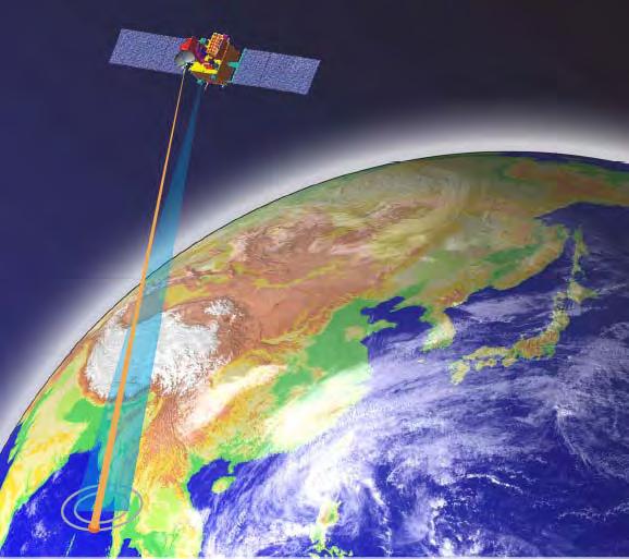
1 OCEAN COLOUR MONITOR ON-BOARD OCEANSAT-2 Rangnath R Navalgund Space Applications Centre Indian Space Research Organisation Ahmedabad , INDIA

 Ku-band Pencil beam Scatterometer Radio")
2 OCEANSAT-2 2 MISSION OCEANSAT-2 2 is a global mission and is configured to cover global oceans and provide continuity of ocean colour data, global wind vector and characterization of lower atmosphere and ionosphere. INSTRUMENTS Modified Ocean Colour Monitor (OCM-2) Ku-band Pencil beam Scatterometer Radio Occultation Sounder for Atmosphere (ROSA) LAUNCH: Third quarter of 2008


3 ORBITAL PARAMETERS The Orbit of Oceansat-2 will be identical to Oceansat-1 Type - Near polar sun-synchronous synchronous Altitude kms Inclination Deg. Eccentricity Period mts. Avg Ground Track Vel km/sec Local time of pass - 12 noon + 10 mts. Repetevity cycle - 2 days
 1820 (outer) 3dB footprint : 26x46 km (inner)")
 Polarization : VV (inner beam) HH (outer beam) Wind speed range : 4 to 24 m/sec Accuracy : 2 m/sec or 10% Frequency of operation - LI &")
4 SCATTEROMETER & ROSA INSTRUMENTS SCATTEROMETER SCAT ROSA rpm Subsatellite Track 1200 Km 1051 Km 720 Km Outer Beam Inner Beam 725 Km 910 Km Swath : 1450 km (inner) 1820 (outer) 3dB footprint : 26x46 km (inner) 31x65 km (outer) Frequency : GHz( Ku Band) Polarization : VV (inner beam) HH (outer beam) Wind speed range : 4 to 24 m/sec Accuracy : 2 m/sec or 10% Frequency of operation - LI & L2 of GPS Codes used - C/A and P code Horizontal resolution kms Vertical Resolution kms (lower Troposphere) 1 3 kms (high Troposphere) Accuracy - 1 K for Temperature - 10 % or 0.2 g/kg for Humidity
 Quantization : 12 Data rate : 21.")

5 OCEANSAT-2 2 OCM Instrument Swath : 1420 km IGFOV : 360x236 m Repetivity : 2 days No. of Bands : 8 (VNIR) Quantization : 12 Data rate : Mbps Changed 765 nm channel into 740 nm to avoid O 2 absorption Replacement of 670 nm channel into 620 nm channel for better quantification of suspended sediments

6 MODES OF OPERATIONS Local Area Coverage (LAC) with 360m, real time transmission Global area coverage (GAC) with 4 km, on-board Recording & playback GAC data coverage between +/ Latitude on a continuous basis, for full cycle of 29 paths
 -Diffused Attenuation Coefficients (K( d -490 nm) -Aerosol Optical Depth (AOD) at 865 nm LEVEL-3 Product: Binned")
7 OCEANSAT-2 2 OCM Data products LEVEL-1 Product: Basic Data Products -L1A RAW Products (Internal Use Only & DQE) -L1B Radiance Product -L1C Radiometrically and Geometrically corrected LEVEL-2 Product: Geo-Physical Parameters -Chlorophyll-a a concentration -Total Suspended Matter (TSM) -Diffused Attenuation Coefficients (K( d -490 nm) -Aerosol Optical Depth (AOD) at 865 nm LEVEL-3 Product: Binned Products (4 km) -Weekly -Monthly -Yearly Products supported in HDF 4 format

8 OCEANSAT-2 2 AO OCEANSAT-2 AO for international users was announced in January 2008 Broad research areas are Retrieval algorithms and Calibration & Validation Application of ocean colour and Scatterometer data for ocean & atmospheric research Synergistic studies using multi-sensor data to understand processes Assimilation of geo-physical parameters in models Details can be obtained on ISRO web site ( Data Product Dissemination: NRSA Data Center (NDC) will carry out data dissemination to users. GAC product of 4 km resolution will be made available on the Internet.
9 OCEANSAT-2 2 OCM chlorophyll algorithm Bio-optical archive data collected in the Arabian Sea and from NOMAD has been used to develop OC-4 type of algorithm The equation has following form Chlorophyll (mg/m3) Rrs443/555 Chlorophyll (mg/m3) Rrs490/555 C = 10 ( a+ br+ cr + dr ) where, C= chlorophyll; R = log 10 [max(rrs443>490>510/rrs555)] a = 0.48; b = -3.03; c = 2.24; d = -1.25; and e = e Chlorophyll (mg/m3) Max (Rrs 443>490>510/Rrs555) Rrs510/ Max (Rrs 443>490>510/Rrs555) Chlorophyll (mg/m3) Max (Rrs 443>490>510/Rrs555) Max (Rrs 443>490>510/Rrs555) Max Ratio= Maximum (R rs 443>R rs 490>R rs 510/R rs 555nm)

10 Cal & Val Experiments A Permanent Cal-Val site is being set up near Kavaratti in Lakashdweep Sea Main buoy Aux. Buoy with yoke Optical buoy is deployed to collect hyperspectral observations of light, chlorophyll-a, temperature and aerosol optical depth Connecting line with separator and floats N ote that the fram e arm s in this view are perpendicular to the paper This in-situ data sets will be used for vicarious calibration of ocean colour sensors Weight Extensive Ship campaigns will also be organized for validation of geophysical data products. Inter-sensor calibration with contemporary missions like MODIS, MERIS etc Lunar calibration of OCM-2


11 OCM-1 1 Cal / Val Experiments Inter sensor calibration of OCM & SeaWiFS Vicarious calibration of OCM was done Validation of derived products using in-situ measurements Chlorophyll-a estimation errors within 30% Validation of OCM Chlorophyll SeaWiFS-OCM inter-calibration


12 Applications of OCM data Potential yield of marine resources using primary production modeling Synergistic use of surface winds, ocean- colour and SST for enhanced PFZ Species specific fish forecast Fluvial fluxes in coastal environment Algal blooms Dust Aerosol Transport
13 Future Ocean Colour sensors High Resolution GEO Imager (HR-GEO) A multi-spectral multi-resolution imaging instrument capable to image full or part of the earth disk from the geo-stationary platform HR-Geo Modules High Resolution multispectral VNIR Imager (HRMX-VNIR) No. of Bands 4 Spectral range 0.45 µm µm 0.52 µm-0.59 µm 0.62 µm-0.68 µm 0.77 µm-0.86 µm Bandwidth (nm) Spatial Resolution (m) 50 Hyper spectral (Hys-VNIR) Imager to 0.87 μm ~ band Ocean Colour Monitor on OCEANSAT-3 including fluorescence bands Hyper spectral (Hys-SWIR) Imager High Resolution multispectral TIR Imager to 2.5 μm 8.2 µm-9.2µm 10.3 µm-11.3µm 11.5 µm-12.5µm?
14 THANK YOU
Status of Indian Satellite Meteorological Programme
 Status of Indian Satellite Meteorological Programme Pradeep K Thapliyal Space Applications Centre (SAC) Indian Space research Organisation (ISRO) Ahmedabad (INDIA) Email: pkthapliyal@sac.isro.gov.in International
Indian Earth Observation Programme
 Indian Earth Observation Programme Dr. Jai Singh Parihar Dy. Director Remote Sensing Applications Area (RESA) Space Applications Centre (ISRO) Ahmedabad 380 015 India jsparihar@sac.isro.gov.in Presentation
HY-2A Satellite User s Guide
 National Satellite Ocean Application Service 2013-5-16 Document Change Record Revision Date Changed Pages/Paragraphs Edit Description i Contents 1 Introduction to HY-2 Satellite... 1 2 HY-2 satellite data
RETRIEVAL AND APPLICATIONS OF ATMOSPHERIC MOTION VECTORS USING INSAT-3D/3DR DATA : ISRO STATUS
 RETRIEVAL AND APPLICATIONS OF ATMOSPHERIC MOTION VECTORS USING INSAT-3D/3DR DATA : ISRO STATUS Sanjib K Deb, D K Sankhala, C M Kishtawal Atmospheric and Oceanic Sciences Group Space Applications Centre
ISRO Report on the Status of Current and future satellites. Presented to CGMS-44 WP-01 Plenary Session
 ISRO Report on the Status of Current and future satellites Presented to CGMS-44 WP-01 Plenary Session CGMS-44-ISRO 05-10 June 2016 Indian Satellite System for weather parameters Satellite Oceansat-1/ MSMR
Radiative Transfer Model based Bias Correction in INSAT-3D/3DR Thermal Observations to Improve Sea Surface Temperature Retrieval
 Radiative Transfer Model based Bias Correction in INSAT-3D/3DR Thermal Observations to Improve Sea Surface Temperature Retrieval Rishi K Gangwar, Buddhi P Jangid, and Pradeep K Thapliyal Space Applications
Megha-Tropiques Presentation by Indian Delegation at the 55th Session of UNCOPUOS Vienna 12 June 2012
 Megha-Tropiques Presentation by Indian Delegation at the 55 th Session of UNCOPUOS Vienna 12 June 2012 Megha-Tropiques Mission Indo-French Joint Satellite for studying tropical atmosphere Megha in Sanskrit
Update on SCOPE-Nowcasting Pilot Project Real Time Ocean Products Suman Goyal Scientist-E
 Update on SCOPE-Nowcasting Pilot Project Real Time Ocean Products Suman Goyal Scientist-E 19-22 Nov 2013 SCOPE-Nowcasting-1 Agenda Item 5 Pilot Projects Overview Users /Clients User requirements Product
C M E M S O c e a n C o l o u r S a t e l l i t e P r o d u c t s
 Implemented by C M E M S O c e a n C o l o u r S a t e l l i t e P r o d u c t s This slideshow gives an overview of the CMEMS Ocean Colour Satellite Products Marine LEVEL1 For Beginners- Slides have been
Meeting the Needs for Satellite OVW
 Meeting the Needs for Satellite OVW NEED Multiple scatterometers to extend the coverage of QuikSCAT and provide continuity UNDERWAY EUMETSAT ASCAT on METOP series 1 st is in orbit ISRO Oceansat-2 Timely
VALIDATION OF INSAT-3D DERIVED RAINFALL. (Submitted by Suman Goyal, IMD) Summary and Purpose of Document
 Summary and Purpose of Document") WORLD METEOROLOGICAL ORGANIZATION COMMISSION FOR BASIC SYSTEMS OPEN PROGRAMME AREA GROUP ON INTEGRATED OBSERVING SYSTEMS INTER-PROGRAMME EXPERT TEAM ON SATELLITE UTILIZATION AND PRODUCTS SECOND SESSION
WORLD METEOROLOGICAL ORGANIZATION COMMISSION FOR BASIC SYSTEMS OPEN PROGRAMME AREA GROUP ON INTEGRATED OBSERVING SYSTEMS INTER-PROGRAMME EXPERT TEAM ON SATELLITE UTILIZATION AND PRODUCTS SECOND SESSION
GOSAT mission schedule
 GOSAT mission schedule 29 21 12 1 2 3 4 6 7 8 9 1 11 12 1 2 214 1 2 3 ~ Jan. 23 Launch Initial Checkout Initial function check Initial Cal. and Val. Mission life Normal observation operation Extra Operati
CGMS Baseline. Sustained contributions to the Global Observing System. Endorsed by CGMS-46 in Bengaluru, June 2018
 CGMS Baseline Sustained contributions to the Global Observing System Best Practices for Achieving User Readiness for New Meteorological Satellites Endorsed by CGMS-46 in Bengaluru, June 2018 CGMS/DOC/18/1028862,
GOSAT update. June Prepared by JAXA EORC Presented by David Crisp
 CEOS AC-VC GOSAT update June Prepared by JAXA EORC Presented by David Crisp GOSAT & GOSAT-2 Organization ORGANIZATION GOSAT is the joint project of JAXA, MOE (Ministry of the Environment) and NIES (National
EUMETSAT STATUS AND PLANS
 1 EUM/TSS/VWG/15/826793 07/10/2015 EUMETSAT STATUS AND PLANS François Montagner, Marine Applications Manager, EUMETSAT WMO Polar Space Task Group 5 5-7 October 2015, DLR, Oberpfaffenhofen PSTG Strategic
Earth Observation Satellite Program updates
 Earth Observation Satellite Program updates Presentation to ETSAT-7 meeting April 17-19, 2012, Geneva Prepared by: Indian Space Research Organisation Presented by Kashyap N. Mankad Space Applications Centre
Updates on CMA FENGYUN Meteorological Satellite Programs
 Updates on CMA FENGYUN Meteorological Satellite Programs Peng ZHANG National Satellite Meteorological Center, China Meteorological Administration (NSMC/CMA) 29 Nov. - 5 Dec. 2017, Darmstadt, Germany 1.
A Comparative Study and Intercalibration Between OSMI and SeaWiFS
 A Comparative Study and Intercalibration Between OSMI and SeaWiFS KOMPSAT-1 Bryan A. Franz NASA SIMBIOS Project Yongseung Kim Korea Aerospace Research Institute ORBVIEW-2 Abstract Since 1996, following
Instrumentation planned for MetOp-SG
 Instrumentation planned for MetOp-SG Bill Bell Satellite Radiance Assimilation Group Met Office Crown copyright Met Office Outline Background - the MetOp-SG programme The MetOp-SG instruments Summary Acknowledgements:
Sentinel 2 Pre-processing Requirements for coastal and inland waters
 Sentinel 2 Pre-processing Requirements for coastal and inland waters K A I S Ø R E NSEN NIVA CARSTEN B R O CKMANN Ecological and chemical classification of water bodies in Norway Water quality - products
GCOM-C SGLI calibration and characterization. Hiroshi Murakami JAXA/EORC Satellite instrument pre- and post-launch calibration
 GCOM-C SGLI calibration and characterization Hiroshi Murakami JAXA/EORC Satellite instrument pre- and post-launch calibration 1 1. SGLI sensor system and onboard calibration system Target: Improvement
Eight Years MOS-IRS Summary of Calibration Activities
 Eight Years MOS-IRS Summary of Calibration Activities Workshop on Inter-Comparison of Large Scale Optical and Infrared Sensors 12 14 October 2004, ESA / ESTEC Noordwijk, The Netherlands Horst Schwarzer,
HICO OSU Website and Data Products
 HICO OSU Website and Data Products Curtiss O. Davis College of Earth Ocean and Atmospheric Sciences Oregon State University, Corvallis, OR, USA 97331 cdavis@coas.oregonstate.edu Oregon State Introduction
Report from CNSA 16th GSICS Executive Panel, Boulder, May 2015
 Report from CNSA 16th GSICS Executive Panel, Boulder, 15-16 May 2015 Peng Zhang, Jun Gao Satellite Introdution GF-1 satellite mission GF-1 satellite is the first CHEOS constellation satellite launched
NASA's Plankton, Aerosol, Cloud, ocean Ecosystem (PACE) mission update
 mission update") NASA's Plankton, Aerosol, Cloud, ocean Ecosystem (PACE) mission update Antonio Mannino1, Jeremy Werdell1, Brian Cairns2 NASA GSFC1 and GISS2 Acknowledgments: PACE Team https://pace.gsfc.nasa.gov 1 Outline
NASA's Plankton, Aerosol, Cloud, ocean Ecosystem (PACE) mission update Antonio Mannino1, Jeremy Werdell1, Brian Cairns2 NASA GSFC1 and GISS2 Acknowledgments: PACE Team https://pace.gsfc.nasa.gov 1 Outline
H U Solanlki, R M Dwivedi & S R Nayak
 Indian Journal of Marine Sciences Vol. 30, September 2001, pp. 132-138 Application of Ocean Colour Monitor chlorophyll and AVHRR SST for fishery forecast: Preliminary validation results off Gujarat coast,
Recent Indian Space Missions : Update Feb 2014
 Recent Indian Space Missions : Update Feb 2014 51 S&T Committee of UNCOPUOS 10-21 Feb, 2014, Vienna V. K. DADHWAL, ISRO, INDIA Mission Summary: 2013/2 2014/2 MISSION THEME (prev. Missions) REALIZED (Under
Minutes of the First Meeting. of the IOCCG Working Group. L1 Requirements for Ocean-Colour Remote Sensing. April 20-21, 2010
 Minutes of the First Meeting of the IOCCG Working Group L1 Requirements for Ocean-Colour Remote Sensing April 20-21, 2010 Bethesda, Maryland (Washington, D.C.), USA Participants: - Charles R. McClain (chair,
IMPORTANCE OF SATELLITE DATA (FOR REANALYSIS AND BEYOND) Jörg Schulz EUMETSAT
 Jörg Schulz EUMETSAT") IMPORTANCE OF SATELLITE DATA (FOR REANALYSIS AND BEYOND) Jörg Schulz EUMETSAT Why satellite data for climate monitoring? Global coverage Global consistency, sometimes also temporal consistency High spatial
IMPORTANCE OF SATELLITE DATA (FOR REANALYSIS AND BEYOND) Jörg Schulz EUMETSAT Why satellite data for climate monitoring? Global coverage Global consistency, sometimes also temporal consistency High spatial
Calibration of Ocean Colour Sensors
 Dr. A. Neumann German Aerospace Centre DLR Remote Sensing Technology Institute Marine Remote Sensing What is Calibration, why do we need it? Sensor Components Definition of Terms Calibration Standards
GEO New Mission and Synergy Joo-Hyung Ryu
 GEO New Mission and Synergy Joo-Hyung Ryu Korea Ocean Satellite Center Korea Institute Ocean Sciences & Technology GEMS GOCI-II GOCI Development : KARI & KIOST Cooperation Development Payload system -
Satellite Position Determination of LEO Spacecraft
 Satellite Position Determination of LEO Spacecraft S.C.Rathnakara ISRO Satellite Centre 5 th September, 2007 International Committee on Global Navigation Satellite Systems(ICG) Things to follow Brief background
CGMS Baseline In response to CGMS action/recommendation A45.01 HLPP reference: 1.1.8
 Prepared by WGIII Agenda Item: 7.1 Discussed in WGIII CGMS Baseline In response to CGMS action/recommendation A45.01 HLPP reference: 1.1.8 In CGMS-45, Working Group III agreed to hold a review of the CGMS
Towards eenvironment Prague, March GMES Space Component. Josef Aschbacher Head, ESA GMES Space Office
 Towards eenvironment Prague, 25-27 March 2009 GMES Space Component Josef Aschbacher Head, ESA GMES Space Office Prague from Space Segment 2 05 Nov 2003 CNES 2003 GISAT 2007 ESA GSELAND GMES is an EU led
Operational systems for SST products. Prof. Chris Merchant University of Reading UK
 Operational systems for SST products Prof. Chris Merchant University of Reading UK Classic Images from ATSR The Gulf Stream ATSR-2 Image, ƛ = 3.7µm Review the steps to get SST using a physical retrieval
Sentinel-3 Sea and Land Surface Temperature Radiometer (SLSTR) Mireya Etxaluze (STFC RAL Space)
 Mireya Etxaluze (STFC RAL Space)") Sentinel-3 Sea and Land Surface Temperature Radiometer (SLSTR) Mireya Etxaluze (STFC RAL Space) RAL Space Radiometry Group Dave Smith Mireya Etxaluze, Ed Polehampton, Caroline Cox, Tim Nightingale, Dan
Sentinel-3 Sea and Land Surface Temperature Radiometer (SLSTR) Mireya Etxaluze (STFC RAL Space) RAL Space Radiometry Group Dave Smith Mireya Etxaluze, Ed Polehampton, Caroline Cox, Tim Nightingale, Dan
THE METOP SECOND GENERATION 3MI MISSION
 THE METOP SECOND GENERATION 3MI MISSION Ilias Manolis, Jean-Loup Bézy, Maurizio Betto, Hubert Barré and Graeme Mason European Space Agency, ESTEC, Keplerlaan 1, 2200 AG Noordwijk ZH, The Netherlands Abstract
Long-Term Time Series of Water Vapour Total Columns from GOME, SCIAMACHY and GOME-2
 Graphics: ESA Graphics: ESA Graphics: ESA Long-Term Time Series of Water Vapour Total Columns from GOME, SCIAMACHY and GOME-2 S. Noël, S. Mieruch, H. Bovensmann, J. P. Burrows Institute of Environmental
REVISION OF THE STATEMENT OF GUIDANCE FOR GLOBAL NUMERICAL WEATHER PREDICTION. (Submitted by Dr. J. Eyre)
") WORLD METEOROLOGICAL ORGANIZATION Distr.: RESTRICTED CBS/OPAG-IOS (ODRRGOS-5)/Doc.5, Add.5 (11.VI.2002) COMMISSION FOR BASIC SYSTEMS OPEN PROGRAMME AREA GROUP ON INTEGRATED OBSERVING SYSTEMS ITEM: 4 EXPERT
WORLD METEOROLOGICAL ORGANIZATION Distr.: RESTRICTED CBS/OPAG-IOS (ODRRGOS-5)/Doc.5, Add.5 (11.VI.2002) COMMISSION FOR BASIC SYSTEMS OPEN PROGRAMME AREA GROUP ON INTEGRATED OBSERVING SYSTEMS ITEM: 4 EXPERT
Next generation of EUMETSAT microwave imagers and sounders: new opportunities for cloud and precipitation retrieval
 Next generation of EUMETSAT microwave imagers and sounders: new opportunities for cloud and precipitation retrieval Christophe Accadia, Sabatino Di Michele, Vinia Mattioli, Jörg Ackermann, Sreerekha Thonipparambil,
GEOG Lecture 8. Orbits, scale and trade-offs
 Environmental Remote Sensing GEOG 2021 Lecture 8 Orbits, scale and trade-offs Orbits revisit Orbits geostationary (36 000 km altitude) polar orbiting (200-1000 km altitude) Orbits revisit Orbits geostationary
HICO Calibration and Atmospheric Correction
 HICO Calibration and Atmospheric Correction Curtiss O. Davis College of Earth Ocean and Atmospheric Sciences Oregon State University, Corvallis, OR, USA 97331 cdavis@coas.oregonstate.edu Oregon State Introduction
Active Sensor Data Assimilation using GSI
 Active Sensor Data Assimilation using GSI Li Bi 1 James Jung 2 1 RTI/NESDIS/JCSDA 2 CIMSS/UW-Madison GSI Tutorial and Workshop, Aug 5-8, College Park 08/07/13 1 Outline Characteristics of the active sensor
In-flight Calibration Techniques Using Natural Targets. CNES Activities on Calibration of Space Sensors
 In-flight Calibration Techniques Using Natural Targets CNES Activities on Calibration of Space Sensors Bertrand Fougnie, Patrice Henry (DCT/SI, CNES, Toulouse, France) In-flight Calibration using Natural
Thermal And Near infrared Sensor for carbon Observation (TANSO) On board the Greenhouse gases Observing SATellite (GOSAT) Research Announcement
 On board the Greenhouse gases Observing SATellite (GOSAT) Research Announcement") Thermal And Near infrared Sensor for carbon Observation (TANSO) On board the Greenhouse gases Observing SATellite (GOSAT) Research Announcement Appendix A Outlines of GOSAT and TANSO Sensor GOSAT (Greenhouse
Thermal And Near infrared Sensor for carbon Observation (TANSO) On board the Greenhouse gases Observing SATellite (GOSAT) Research Announcement Appendix A Outlines of GOSAT and TANSO Sensor GOSAT (Greenhouse
China France. Oceanography S A T. The CFOSAT project. e l l i t e. C. Tison (1), D. Hauser (2), A. Mouche (3) CNES, France (2)
, D. Hauser (2), A. Mouche (3) CNES, France (2)") China France The CFOSAT project C. Tison (1), D. Hauser (2), A. Mouche (3) (1) CNES, France (2) OVSQ, CNRS, LATMOS-IPSL, France (3) IFREMER, LOS, France celine.tison@cnes.fr Oceanography S A T e l l i
China France The CFOSAT project C. Tison (1), D. Hauser (2), A. Mouche (3) (1) CNES, France (2) OVSQ, CNRS, LATMOS-IPSL, France (3) IFREMER, LOS, France celine.tison@cnes.fr Oceanography S A T e l l i
GCOM-C/SGLI and its Lunar Calibration
 GCOM-C/SGLI and its Lunar Calibration Lunar Calibration Workshop December 1-4, 2014 JAXA/GCOM Proj. Yoshihiko Okamura (okamura.yoshihiko@jaxa.jp) 1. Overview of GCOM-C satellite and SGLI (1) Global Change
Comparison of chlorophyll concentration in the Bay of Bengal and the Arabian Sea using IRS-P4 OCM and MODIS Aqua
 Indian Journal of Marine Sciences Vol. 39(3), September 2010, pp. 334-340 Comparison of chlorophyll concentration in the Bay of Bengal and the Arabian Sea using IRS-P4 OCM and MODIS Aqua Ramesh P. Singh
The current status of FY-3D
 The current status of FY-3D Xiang Fang National Satellite Meteorological Center, China Meteorological Administration (NSMC/CMA) OUTLINE Overview Key instruments onboard FY-3D Products and data service
MERIS, A-MODIS, SeaWiFS, AATSR and PARASOL over the Salar de Uyuni March 2006 MAVT 2006 Marc Bouvet, ESA/ESTEC
 MERIS, A-MODIS, SeaWiFS, AATSR and PARASOL over the Salar de Uyuni Plan of the presentation 1. Introduction : from absolute vicarious calibration to radiometric intercomparison 2. Intercomparison at TOA
APPENDIX C OVERVIEW OF THE GLOBAL CHANGE OBSERVATION MISSION (GCOM)
") APPENDIX C OVERVIEW OF THE GLOBAL CHANGE OBSERVATION MISSION (GCOM) C-1 1. Introduction Comprehensive observation, understanding, assessment, and prediction of global climate change are common and important
APPENDIX C OVERVIEW OF THE GLOBAL CHANGE OBSERVATION MISSION (GCOM) C-1 1. Introduction Comprehensive observation, understanding, assessment, and prediction of global climate change are common and important
esa ACE+ An Atmosphere and Climate Explorer based on GPS, GALILEO, and LEO-LEO Occultation Per Høeg (AIR/DMI) Gottfried Kirchengast (IGAM/UG)
 Gottfried Kirchengast (IGAM/UG)") ACE+ An Atmosphere and Climate Explorer based on GPS, GALILEO, and LEO-LEO Occultation Per Høeg (AIR/DMI) Gottfried Kirchengast (IGAM/UG) OPAC-1, September, 2002 1 Objectives Climate Monitoring global
ACE+ An Atmosphere and Climate Explorer based on GPS, GALILEO, and LEO-LEO Occultation Per Høeg (AIR/DMI) Gottfried Kirchengast (IGAM/UG) OPAC-1, September, 2002 1 Objectives Climate Monitoring global
Current Application of Vicarious Calibration for Geostationary Ocean Color Imager (GOCI) DATA
 DATA") Current Application of Vicarious Calibration for Geostationary Ocean Color Imager (GOCI) DATA On behalf of Jae-Hyun Ahn & Young-je Park, Seongick CHO(Secondment at Astrium SAS, France) Korea Ocean Satellite
Current Application of Vicarious Calibration for Geostationary Ocean Color Imager (GOCI) DATA On behalf of Jae-Hyun Ahn & Young-je Park, Seongick CHO(Secondment at Astrium SAS, France) Korea Ocean Satellite
EUMETSAT Activities Related to Climate
 EUMETSAT Activities Related to Climate Jörg Schulz joerg.schulz@eumetsat.int Slide: 1 What we do USER REQUIREMENTS European National Meteorological Services Operating Agency! European Space Industry Private
QuikSCAT High Precision Wind Speed Cross Sections
 QuikSCAT High Precision Wind Speed Cross Sections 2010-2017 Bryan Stiles, Alexander Fore, and Alexander Wineteer Jet Propulsion Laboratory, California Institute of Technology Ocean Vector Wind Science
Sea water dielectric constant, temperature and remote sensing of Sea Surface Salinity
 Sea water dielectric constant, temperature and remote sensing of Sea Surface Salinity E. P. Dinnat 1,2, D. M. Le Vine 1, J. Boutin 3, X. Yin 3, 1 Cryospheric Sciences Lab., NASA GSFC, Greenbelt, MD, U.S.A
Calibration and Validation of the RapidScat Scatterometer Using Natural Land Targets
 Brigham Young University BYU ScholarsArchive All Theses and Dissertations 215-9-1 Calibration and Validation of the RapidScat Scatterometer Using Natural Land Targets Nathan Mark Madsen Brigham Young University
FUTURE PLAN AND RECENT ACTIVITIES FOR THE JAPANESE FOLLOW-ON GEOSTATIONARY METEOROLOGICAL SATELLITE HIMAWARI-8/9
 FUTURE PLAN AND RECENT ACTIVITIES FOR THE JAPANESE FOLLOW-ON GEOSTATIONARY METEOROLOGICAL SATELLITE HIMAWARI-8/9 Toshiyuki Kurino Japan Meteorological Agency, 1-3-4 Otemachi Chiyodaku, Tokyo 100-8122,
The EarthCARE mission: An active view on aerosols, clouds and radiation
 The EarthCARE mission: An active view on aerosols, clouds and radiation T. Wehr, P. Ingmann, T. Fehr Heraklion, Crete, Greece 08/06/2015 EarthCARE is ESA s sixths Earth Explorer Mission and will be implemented
Report on the Status of Current and future satellites by ISRO. Presented to CGMS-46 Plenary, agenda item D.7
 Report on the Status of Current and future satellites by ISRO Presented to CGMS-46 Plenary, agenda item D.7 Current Satellites LAND & WATER HIGH RESOLUTION OCEAN WEATHER; CLIMATE RESOURCESAT-2 LISS-3,
MSG system over view
 MSG system over view 1 Introduction METEOSAT SECOND GENERATION Overview 2 MSG Missions and Services 3 The SEVIRI Instrument 4 The MSG Ground Segment 5 SAF Network 6 Conclusions METEOSAT SECOND GENERATION
Cross-calibration of Geostationary Satellite Visible-channel Imagers Using the Moon as a Common Reference
 Cross-calibration of Geostationary Satellite Visible-channel Imagers Using the Moon as a Common Reference Thomas C. Stone U.S. Geological Survey, Flagstaff AZ, USA 27 30 August, 2012 Motivation The archives
Ocean Observation from Haiyang Satellites:
 SPACE SCIENCE ACTIVITIES IN CHINA Ocean Observation from Haiyang Satellites: 2012 2014 AUTHORS JIANG Xingwei LIN Mingsen National Satellite Ocean Application Service, Beijing 100081 ABSTRACT During 2012
Astrid Bracher PHYTOOPTICS group, Climate Sciences, AWI & IUP, University Bremen
 Breakout session "Hyperspectral science and applications for shelf and open ocean processes" Hyperspectral ocean color imagery and applications to studies of phytoplankton ecology Astrid Bracher PHYTOOPTICS
Atmospheric Lidar The Atmospheric Lidar (ATLID) is a high-spectral resolution lidar and will be the first of its type to be flown in space.
 is a high-spectral resolution lidar and will be the first of its type to be flown in space.") www.esa.int EarthCARE mission instruments ESA s EarthCARE satellite payload comprises four instruments: the Atmospheric Lidar, the Cloud Profiling Radar, the Multi-Spectral Imager and the Broad-Band Radiometer.
www.esa.int EarthCARE mission instruments ESA s EarthCARE satellite payload comprises four instruments: the Atmospheric Lidar, the Cloud Profiling Radar, the Multi-Spectral Imager and the Broad-Band Radiometer.
APPENDIX 2 OVERVIEW OF THE GLOBAL PRECIPITATION MEASUREMENT (GPM) AND THE TROPICAL RAINFALL MEASURING MISSION (TRMM) 2-1
 AND THE TROPICAL RAINFALL MEASURING MISSION (TRMM) 2-1") APPENDIX 2 OVERVIEW OF THE GLOBAL PRECIPITATION MEASUREMENT (GPM) AND THE TROPICAL RAINFALL MEASURING MISSION (TRMM) 2-1 1. Introduction Precipitation is one of most important environmental parameters.
APPENDIX 2 OVERVIEW OF THE GLOBAL PRECIPITATION MEASUREMENT (GPM) AND THE TROPICAL RAINFALL MEASURING MISSION (TRMM) 2-1 1. Introduction Precipitation is one of most important environmental parameters.
MERSEA Marine Environment and Security for the European Area
 MERSEA Marine Environment and Security for the European Area Development of a European system for operational monitoring and forecasting of the ocean physics, biogeochemistry, and ecosystems, on global
Lectures 7 and 8: 14, 16 Oct Sea Surface Temperature
 Lectures 7 and 8: 14, 16 Oct 2008 Sea Surface Temperature References: Martin, S., 2004, An Introduction to Ocean Remote Sensing, Cambridge University Press, 454 pp. Chapter 7. Robinson, I. S., 2004, Measuring
Biological Oceanography by Remote Sensing. M.A. Srokosz
 Biological Oceanography by Remote Sensing M.A. Srokosz in Encyclopedia of Analytical Chemistry R.A. Meyers (Ed.) pp. 8506 8533 John Wiley & Sons Ltd, Chichester, 2000 BIOLOGICAL OCEANOGRAPHY BY REMOTE
Programmatic Perspectives
 NOAA Programmatic Perspectives Stan Wilson NOAA Satellite & Information Service IOVW Science Team Meeting, Annapolis, 9-11 May 2011 1 NOAA Plans Beyond QuikSCAT NOAA has been pursuing two avenues to meet
Spaceborne Atmospheric Boundary Layer Explorer (SABLE)
") Spaceborne Atmospheric Boundary Layer Explorer (SABLE) Earth Venture-2 mission proposal Proposed SABLE objective: Measure cloud top heights and cloud top winds to quantify and map cloud-top entrainment
Spaceborne Atmospheric Boundary Layer Explorer (SABLE) Earth Venture-2 mission proposal Proposed SABLE objective: Measure cloud top heights and cloud top winds to quantify and map cloud-top entrainment
Indian National (Weather) SATellites for Agrometeorological Applications
 SATellites for Agrometeorological Applications") Indian National (Weather) SATellites for Agrometeorological Applications Bimal K. Bhattacharya Agriculture-Terrestrial Biosphere- Hydrology Group Space Applications Centre (ISRO) Ahmedabad 380015, India
Indian National (Weather) SATellites for Agrometeorological Applications Bimal K. Bhattacharya Agriculture-Terrestrial Biosphere- Hydrology Group Space Applications Centre (ISRO) Ahmedabad 380015, India
Ocean Colour: Calibration Approach. CEOS WGCV-39, May The International Ocean Colour Coordinating Group
 Ocean Colour: Calibration Approach CEOS WGCV-39, May 2015 The International Ocean Colour Coordinating Group Ocean Colour requires special calibration considerations Percentage of ocean signal in the total
Report Benefits and Challenges of Geostationary Ocean Colour Remote Sensing - Science and Applications. Antonio Mannino & Maria Tzortziou
 Report Benefits and Challenges of Geostationary Ocean Colour Remote Sensing - Science and Applications Antonio Mannino & Maria Tzortziou Time & Space Scales of OC Relevant Missions GOCI I & II Geo from
VISION FOR THE GOS IN 2025 ( Approved by CBS-XIV and Adopted by EC LXI in June 2009)
") WORLD METEOROLOGICAL ORGANIZATION Weather Climate Water VISION FOR THE GOS IN 2025 ( Approved by CBS-XIV and Adopted by EC LXI in June 2009) PREAMBLE This Vision provides high-level goals to guide the
WORLD METEOROLOGICAL ORGANIZATION Weather Climate Water VISION FOR THE GOS IN 2025 ( Approved by CBS-XIV and Adopted by EC LXI in June 2009) PREAMBLE This Vision provides high-level goals to guide the
Comparison of aerosol radiative forcing over the Arabian Sea and the Bay of Bengal
 Advances in Space Research 33 (2004) 1104 1108 www.elsevier.com/locate/asr Comparison of aerosol radiative forcing over the Arabian Sea and the Bay of Bengal S. Dey a, S. Sarkar b, R.P. Singh a, * a Department
Extending the Deep Blue aerosol record from SeaWiFS and MODIS to NPP-VIIRS
 Extending the Deep Blue aerosol record from SeaWiFS and MODIS to NPP-VIIRS Andrew M. Sayer, N. Christina Hsu (PI), Corey Bettenhausen, Jaehwa Lee Climate & Radiation Laboratory, NASA Goddard Space Flight
Effect of rain on Ku band fan beam Scatterometer
 Effect of rain on Ku band fan beam Scatterometer J. Tournadre, Y. Quilfen, B. Chapron Laboratoire d'océanographie Spatiale Ifremer Brest Problem/Drawback of the use of Ku-Band for radar SCAT on the future
In-flight Evaluation of the SPOT-6 Radiometric Calibration based on Acquisitions over Natural Targets and Automated in-situ Measurements
 In-flight Evaluation of the SPOT-6 Radiometric Calibration based on Acquisitions over Natural Targets and Automated in-situ Measurements Philippe GAMET, Bertrand FOUGNIE, Sophie LACHERADE (CNES), Mathieu
Ocean Color Algorithms for the Southern Ocean Constraining the Carbon cycle
 Ocean Color Algorithms for the Southern Ocean Constraining the Carbon cycle Report Breakout Session No. 5 IOCS 2017 Lisbon, Portugal Maria Vernet Scripps Institution of Oceanography, USA Antarctic Fronts:
Climate data records from OSI SAF scatterometer winds. Anton Verhoef Jos de Kloe Jeroen Verspeek Jur Vogelzang Ad Stoffelen
 Climate data records from OSI SAF scatterometer winds Anton Verhoef Jos de Kloe Jeroen Verspeek Jur Vogelzang Ad Stoffelen Outline Motivation Planning Preparation and methods Quality Monitoring Output
Preparation and dissemination of the averaged maps and fields of selected satellite parameters for the Black Sea within the SeaDataNet project
 Journal of Environmental Protection and Ecology 11, No 4, 1568 1578 (2010) Environmental informatics Preparation and dissemination of the averaged maps and fields of selected satellite parameters for the
Annex VI-1. Draft National Report on Ocean Remote Sensing in China. (Reviewed by the Second Meeting of NOWPAP WG4)
") UNEP/NOWPAP/CEARAC/WG4 2/9 Page1 Draft National Report on Ocean Remote Sensing in China (Reviewed by the Second Meeting of NOWPAP WG4) UNEP/NOWPAP/CEARAC/WG4 2/9 Page1 1. Status of RS utilization in marine
UNEP/NOWPAP/CEARAC/WG4 2/9 Page1 Draft National Report on Ocean Remote Sensing in China (Reviewed by the Second Meeting of NOWPAP WG4) UNEP/NOWPAP/CEARAC/WG4 2/9 Page1 1. Status of RS utilization in marine
Calibration and Validation of the RapidScat Scatterometer. Using Natural Land Targets. Nathan M. Madsen
 Calibration and Validation of the RapidScat Scatterometer Using Natural Land Targets Nathan M. Madsen A thesis submitted to the faculty of Brigham Young University in partial fulfillment of the requirements
Pre-Launch Characterization and In-orbit Calibration of GCOM-C/SGLI
 Pre-Launch Characterization and In-orbit Calibration of GCOM-C/SGLI IGARSS 2018 July 26, 2018 Japan Aerospace Exploration Agency Yoshihiko Okamura T. Hashiguchi, T. Urabe, K. Tanaka (JAXA) J Yoshida, T
Status of CNES Cal/Val Activities
 GSICS Executive Panel Meeting 16-17th May 2014, Guangzhou, China Status of CNES Cal/Val Activities Patrice Henry CNES 1 Summary Overview of CNES Cal/Val Activities Summary Re-Calibration Activities POLDER(s)/PARASOL
Sentinel-2 and Sentinel-3 absolute calibration monitoring. C. Desjardins & V. Lonjou CNES
 Sentinel-2 and Sentinel-3 absolute calibration monitoring C. Desjardins & V. Lonjou CNES Radiometric S2A Calibration RRQI, 28 January Workshop, 2016, 30-31/08/2017 CNES SUMMARY CALCON Aug 22-25 2017 VICARIOUS
In-Orbit Vicarious Calibration for Ocean Color and Aerosol Products
 In-Orbit Vicarious Calibration for Ocean Color and Aerosol Products Menghua Wang NOAA National Environmental Satellite, Data, and Information Service Office of Research and Applications E/RA3, Room 12,
CNES WGCV-36 Report Cal/Val Activities
 CEOS WGCV Meeting 13-17th May 2013, Shangai, China CNES WGCV-36 Report Cal/Val Activities Bertrand Fougnie, Sophie Lachérade, Denis Jouglet, Eric Péquignot, Aimé Meygret, Patrice Henry CNES 1 Summary Pleiades
JRC Activities in Support of Satellite Ocean Color Cal/Val
 JRC Activities in Support of Satellite Ocean Color Cal/Val Ocean Color Team of the Water Resources Unit Institute for Environment and Sustainability Prepared by Giuseppe Zibordi (May 2015) Preface adequately
Tracking On-orbit Radiometric Accuracy and Stability of Suomi NPP VIIRS using Extended Low Latitude SNOs
 Tracking On-orbit Radiometric Accuracy and Stability of Suomi NPP VIIRS using Extended Low Latitude SNOs Sirish Uprety a Changyong Cao b Slawomir Blonski c Xi Shao c Frank Padula d a CIRA, Colorado State
Overview: Scope and Goals
 Overview: Scope and Goals Current operational NOAA instruments: AVHRR, HIRS, SBUV, GOES Imagers/Sounders; Non-NOAA satellites/sensors; Future: MetOP and NPP/NPOESS; GOES-R Assure Functionality of Current/Near-Future
Mapping of Optical Parameters of Aerosols over Land using Multi-Spectral IRS-P4 OCM Sensor Data
 Mapping of Optical Parameters of Aerosols over Land using Multi-Spectral IRS-P4 OCM Sensor Data Rajshree Rege #, M. B. Potdar #, P. C. S. Devara @ and B. P. Agrawal & # Space Applications Centre, Ahmedabad
The current status of FY-3D. (Submitted by Xiang Fang, CMA) Summary and Purpose of Document
 Summary and Purpose of Document") WORLD METEOROLOGICAL ORGANIZATION COMMISSION FOR BASIC SYSTEMS OPEN PROGRAMME AREA GROUP ON INTEGRATED OBSERVING SYSTEMS INTER-PROGRAMME EXPERT TEAM ON SATELLITE UTILIZATION AND PRODUCTS FOURTH SESSION
WORLD METEOROLOGICAL ORGANIZATION COMMISSION FOR BASIC SYSTEMS OPEN PROGRAMME AREA GROUP ON INTEGRATED OBSERVING SYSTEMS INTER-PROGRAMME EXPERT TEAM ON SATELLITE UTILIZATION AND PRODUCTS FOURTH SESSION
CNES Activity Report. Patrice Henry - CNES WGCV Plenary # 41 Tokyo Sept. 5-7, Working Group on Calibration and Validation
 Activity Report Patrice Henry - Tokyo Sept. 5-7, 2016 Working Group on Calibration and Validation SUMMARY Calibration Monitoring of in-flight Missions Preparation of future Missions Involvement in CEOS/WGCV
Comparison between MERIS and GOCI in regional seas around Korea
 Comparison between MERIS and GOCI in regional seas around Korea Young-Je Park, Yu-Hwan Ahn, Jung-Mi Yoo KOSC staff Korea Ocean Satellite Center (KOSC), Korea Ocean Research and Development Institute (KODI)
MERIS SMILE EFFECT CHARACTERISATION AND CORRECTION DOCUMENT. document title/ titre du document. prepared by/préparé par MERIS ESL
 DOCUMENT document title/ titre du document MERIS SMILE EFFECT CHARACTERISATION AND CORRECTION prepared by/préparé par MERIS ESL reference/réference issue/édition 2 revision/révision 0 date of issue/date
GMES: calibration of remote sensing datasets
 GMES: calibration of remote sensing datasets Jeremy Morley Dept. Geomatic Engineering jmorley@ge.ucl.ac.uk December 2006 Outline Role of calibration & validation in remote sensing Types of calibration
IR sounder small satellite for polar orbit weather measurements
 IR sounder small satellite for polar orbit weather measurements Sara Lampen, Sonny Yi, Jared Lang, Caleb Lampen, Adam Vore, David Warren, Eric Herman The Aerospace Corporation John J. Pereira National
The EarthCARE mission: An active view on aerosols, clouds and radiation
 The EarthCARE mission: An active view on aerosols, clouds and radiation T. Wehr, T. Fehr, P. Ingmann, J. v. Bismarck ESRIN, Frascati, Italy 20/10/2015 EARTH Clouds, Aerosols and Radiation Explorer EarthCARE