GEOL 23100: Principles of Geomorphology
|
|
|
- Camron Arnold
- 6 years ago
- Views:
Transcription


1 GEOL 23100: Principles of Geomorphology 1

 features.")
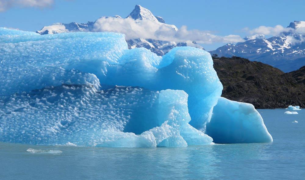
2 Geomorphology The word geomorphology" comes from the Greek roots "geo, morph, and logos, meaning earth, form, and study, respectively. Therefore, geomorphology is literally the study of earth forms. Geomorphologists are concerned primarily with earth s surficial features, including their origin, history, composition, and impact on human activity. Geomorphology concentrates primarily on Quaternary (Pleistocene and Holocene) features. Earth s landforms reflect the local and regional balance between hydrologic, tectonic, aeolian, glacial, atmospheric, and marine processes. Photo by NASA 2

3 Importance of Geomorphology To understand geomorphological processes of various environment. To detect natural and environmental hazards efficiently, e.g. earthquake, flooding, landslide, tsunami, volcanism etc. To identify various landform features and landscapes To identify various landform features from satellite images Coastal and river research Vulnerability studies Geology, Geography, Archeology, Engineering, Planning, Mining, Construction, Urbanization 3

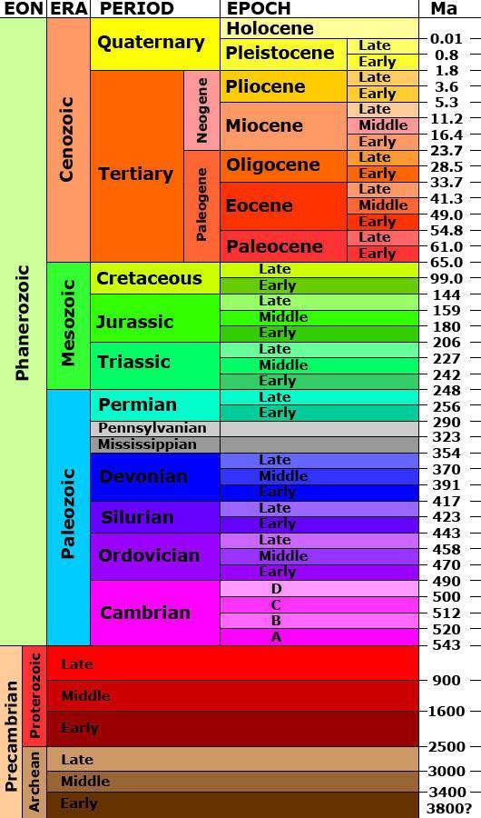
4 Geologic Timescale

5 What past processes created this relict landscape? What modern processes are modifying it? Were the processes that created the relict landforms destructional or constructional? Are the modern processes modifying this landscape destructional or constructional? 5

6 Physiographic Province: Issues of Scale 6
7 7
8 Scale of landforms varies over 15 (!) orders of magnitude. continents (10 7 km 2 ) to microscale features like ripples, glacial striations (10-8 km 2 ). Age of landforms varies over 7-8 orders of magnitude. continents (10 9 years) to microscale features like pools and riffles (10 2 years). Larger landforms most durable (longer-lasting). Smaller landforms created/destroyed faster than larger ones. Rates of geomorphic / geologic change slow for larger areas, faster when measured over small areas. example: earthquakes compared to glaciers rate of erosion in small watershed compared to larger one 8
 All surfaces Correlation Davis (1850-1934) fluvial+ Quantification and prediction now a common goal Geomorphology History flashcards Horn, cirque, col, rock")
9 Rise of Geomorphic Thought Observation and hypothesis Herodotus 450 BC Description Hutton 1700 s+ Explanation 1800 s Agassiz glacial landforms Powell ( ) fluvial/structure Gilbert ( ) All surfaces Correlation Davis ( ) fluvial+ Quantification and prediction now a common goal Geomorphology History flashcards Horn, cirque, col, rock slide
10 Herodotus ( BC): Rocks on land in Egypt contained marine fossils, assumed that the Nile Delta took thousands of years to form. Arisotle ( BC): Dry land can be submerged, land can be raised from beneath the ocean, described erosion by rivers, and deposition in deltas. Lucretius (99-55 BC): Recognized weathering processes on rocks. Seneca (3-65 AD): Observed erosion of valleys by running water. Ibn-Sina ( AD): Concluded that mountains could be uplifted, and later eroded. Leonardo DaVinci ( AD): found marine fossils on land G. Bauer ( AD): hypothesized that mountains were sculpted by weathering and mass movements Steno ( AD) regarded water as the most significant agent of erosion

: theorized that all mountains formed under water as layers of sediment,, and")
11 Landscape Creation vs. Landscape Development Biblical interpretations hindered the proliferation of noncatastrophic landform evolution theories. Werner ( AD): theorized that all mountains formed under water as layers of sediment,, and were ultimately sculpted by rapidly receding oceans. Georges Cuvier: Great catastrophic floods produced unconformities, and carved Earth s landscape.

12 James Hutton ( ) Granites form through heat & fusion deep underground, and are later uplifted and exhumed. Landforms are produced by slow, continuous processes. Uniformatarianism Sediments are eroded from landforms, only to be deposited and later lithified into new rocks. There is neither an apparent beginning nor end to landform development.


13 Uniformitarianism Modern river channels Photographer unknown Photos by W. W. Little Ancient river channels Scientists make observations of an event or an object and then try to explain those observations by organizing them into a logical system. As rock bodies can cover extensive areas and represent vast periods of time, much of geological research cannot be done as controlled experiments in a formal laboratory setting. In these situations, we rely on the assumption that physical, chemical and biological laws are constant. That is, the processes operating today are the same as those that operated in the past. For instance, since water flows down hill today, it must have done so in the past. Therefore, if we identify a body of rocks that exhibits characteristics similar to those found in a modern geological environment, we assume that it must have formed in a similar manner.

14 Hutton s Proponents John Playfair ( ) Illustrations of the Huttonian Theory of the Earth (1802). Streams carve their own drainage systems. Stream reaches and maintains equilibrium, adjusted to local gradient. CONCEPT OF GRADED STREAM The Earth is very ancient; ongoing processes continue to change it. Charles Lyell ( ) The Principles of Geology ( ) A strong promoter of Uniformitarian theory A vehement opponent of Catastrophism
 Louis Agassiz : Recognized glacial")
 Charles Darwin (1809-1882): Recorded his")
15 Other Nineteenth Century European Contributions Venetz, and Bernardhi: Moraines and erratics prove glaciations extended from polal regions(1832) Louis Agassiz : Recognized glacial landforms in Europe & N. Am.- introduced the concept of Ice Ages (1837) Charles Darwin ( ): Recorded his observations during the voyage of the Beagle., suggested an origin for atolls.
 Based on Darwinian Evolutionary Theory")


16 Evolutionary Geomorphology William Morris Davis ( ) Based on Darwinian Evolutionary Theory Landscapes evolve throughout time Stage of evolution can be determined by examining the characteristics of the landscape Implies that TIME is the critical factor in determining what the landscape looks like Structure Process Resulting Landform Time
 modern/relict Time (stage): landforms evolve")
 Time: 10 3 to 10 6 years?")
17 Structure: rock mass (or unconsolidated material mass). Process: constructive or destructive process(es) modern/relict Time (stage): landforms evolve through stages from continued actions of geomorphic process(es). Structure: limestone bedrock Process: weathering (dissolution) Time: 10 3 to 10 6 years? Structure: delta sediments Process: deposition / erosion Time: 10 3 to 10 4 years? 17


18 William Morris Davis Davis' Cycle of erosion An example from an arid climate. Davis' idea of a peneplain: peneplain: an area of low relief form through a long period of continual erosion

19 Grove Karl Gilbert Process Geomorphology (1890) Recognized some Utah landscapes were formed by Pleistocene Lake Bonneville. Great Salt Lake and Bonneville salt flats are remnants, contributed to the understanding of river incision, Identified lunar craters as caused by impacts, and carried out early impact - cratering experiments Landforms are a balance between resisting framework and the forces acting to alter the landscape Implies that time is one component of many that affect the appearance of the Earth Inferred that the landscape was in equilibrium between driving forces and resisting forces
20 Davisian Geomorphology & TIME as the dominant factor dominated the scientific literature until the 1960 s John Hack proposed landscape development occurred similarly to the way Gilbert had espoused, recognizing considerable variability in most geomorphic systems Most were in Dynamic Equilibrium Rise of Quantitative Approaches to Geomorphology Quantitative trends continue (computers, satellite, other remotely sensed data, numerical methods, improved dating techniques, )
21 Rate of Change Types of Geomorphic Equilibria Positive Feedbacks Negative Feedbacks Changes in the balance between forces may destabilize the system The system may cross a threshold, and may initiate a new pattern of equilibrium

22 Concepts of Equilibrium Equilibrium means balance. In geomorphology, it refers to no net change, usually in terms of a balance between deposition and erosion, uplift and downcutting, or soil production and removal. Equilibrium is strived for but seldom achieved. A change in one part of a system affects all others.


23 Fluvial Equilibrium Recent uplift in excess of erosional rates results in a system that is out of equilibrium. Weathering and erosion dominate headland areas with removed material being transported to a depositional basin. As headlands recede, both erosional and depositional rates decrease. If the region remains stable for an extended period, equilibrium, where erosional and depositional rates are equal, might be achieved.


24 Base Level Base level is the level below which erosion cannot occur and above which deposition does not take place. Sea level is the ultimate base level Lakes and reservoirs provide temporary base levels Changes in sea level can be eustatic or relative Changes in base level create and destroy accommodation space

, precipitation changes (discharge), and sediment")
25 Graded (Longitudinal) Profile Stream gradient is related to water velocity and the load it can transport. A change in any of these affects the other two. Each can be influenced by factors outside of the stream system, such as base level fluctuations (gradient), precipitation changes (discharge), and sediment character.

26


27 Coastal Equilibrium (Channel Mouths) Deltas represent a battle between fluvial and marine (wave & tidal) processes. Delta morphologies are highly influenced by which of these processes dominates.
28 Geomorphic Process The process responsible for the formation and alteration of the earth's surface. The physical and chemical interactions between the earth's surface and the natural forces acting upon it to produce landforms. The processes are determined by such natural environmental variables as geology, climate, vegetation and base level, to say nothing of human interference. 28
29 Geomorphic Process (Cont ) Definition: The geomorphic processes are all those physical and chemical changes which effect a modification of the earth s surgical form [W. D. Thornbury (1968): Principles of Geomorphology, pp. 34]. A process by which the earth s land forms are changed or maintained [Jim Gardner (1979): Physical Geology]. 29
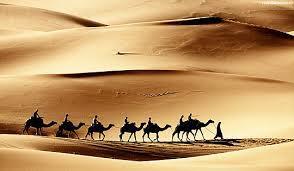
30 Agent, Process & products Agents of Geomorphic Processes River -Humid Geomorphic Environment Wind - Arid Environment Glacier/ice - Polar Environments Wave - Coastal Environment 30
31 Agent, Process & products Process Process includes three types of activities Erosion Transportation Deposition 31
32 Agent, Process & products Products of Geomorphic Processes Process Erosion Products Erosional landform features Transportation Transportation Deposition Depositional landform features 32


33 Agents of Change... River activities Wind activities Glaciers activities Wave activities 33
34 GEOMORPHIC PROCESSES Terrestrial Processes Extra-terrestrial Processes Exogenetic Processes Endogenetic Processes i. Weathering ii. Erosion/Degradation iii. Transportation iv. Deposition/Aggradation v. Mass movement Denudation Physical Weathering Chemical Weathering Biological Weathering i. Faulting and Folding ii. Volcanism iii. Earthquake iv. Landslide v. Diastrophism vi. Metamorphism 34
35 Types of Geomorphic Processes Geomorphic Processes A. Terrestrial processes B. Extra-terrestrial processes, e.g. fall of meteorite (mass/rock from outer space). Terrestrial processes 1. Exogenetic / Exogenous Processes 2. Endogenetic / Endogenous Processes 35


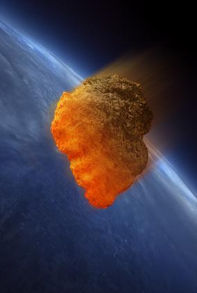

36 Extra-terrestrial processes, e.g. fall of meteorite 36
37 Types of Geomorphic Processes (Cont ) Exogenetic/Exogenous Processes Outer geomorphological processes = exogenetic processes (solar radiation, wind, temperature changes, water) create relief sculptures, surface features. Exogenetic Processes Endogenetic Processes 37
38 Types of Geomorphic Processes (Cont ) Endogenetic Processes Inner geomorphological processes = endogenetic processes (earthquakes, volcanoes, folding and faulting) create rough features of the Earth s relief. e.g. oceanic basins, mountain ranges, oceanic ridges and trenches, rift valleys, folds, faults and volcanoes, etc. Exogenetic Processes Endogenetic Processes 38
39 Basic difference between the two process Processes that are caused by forces from within the Earth are endogenous processes. By contrast, exogenous processes come from forces on or above the Earth's surface. Endogenic Processes Originate in the interior of the earth. Causes sudden or rapid movements Eg: Earthquake, faulting, diastrophism Exogenic Processes Originate on the surface of the earth. Causes slow movements. Eg: Erosional and Depositional 39
40 Types of Exogenetic / Exogenous Processes i. Weathering ii. Erosion/ Degradation iii. Transportation iv. Deposition/Aggradation v. Mass movement 40
41 Denudation It means to make the things exposed. The processes by which the rocks on the earth s surface are broken into pieces through the application of external physical forces and the debris are transported elsewhere is known as denudation. This denudation work is performed through three processes such as weathering, erosion and transportation. Denudation= Weathering + Erosion + Transportation 41

 action on the")

42 Weathering The weathering is a process by which the rocks on the surface of the earth is broken mechanically into pieces due to snow or frost, the variation of temperature and pressure or due to chemical (dissolution) action on the materials. Even the rocks are dislodged by the animals. But the rocks weathered this way, are not transported elsewhere. 42


43 Erosion Erosion and transportation are accomplished together. The process by which the rocks of the earth s crust are eroded by the river, wind, glacier, ocean currents etc. are transported elsewhere is known as erosion. 43
44 Degradation Degradation is the lowering of a bottomland surface through the process of erosion; Conceptually it is the opposite of the vertical component of aggradation and is most frequently applied to sediment removed from a channel bed or other low-lying parts of a stream channel. 44


45 Deposition Deposition is the constructive process of accumulation into beds or irregular masses of loose sediment or other rock material by any natural agent; 45
46 Aggradation Aggradation is the raising or elevating of a bottomland surface through the process of alluvial deposition; Conceptually it is the vertical component of accretion and is most frequently applied to sediment deposition on a channel bed, bar or other near-channel surfaces, flood plain, or, less often, low-lying alluvial terrace. 46


47 Sedimentation Sedimentation is the process by which sediment is mechanically deposited from suspension within a fluid, generally water, or ice, thereby accumulating as layers of sediment that are segregated owing to differences in size, shape, and composition of the sediment particles. 47
")

48 Mass movement/mass Wasting Mass movement is any downslope transfer, through gravitational and generally water-facilitated (viscous) processes, of near-surface soil and rock material; Rates of mass movement range from very slow creep to nearly instantaneous slope failure. 48
49 GEOMORPHOLOGICAL PROCESSES Terrestrial Processes Extra-terrestrial Processes Exogenetic Processes Endogenetic Processes i. Weathering ii. Erosion/Degradation iii. Transportation iv. Deposition/Aggradation v. Mass movement Denudation Physical Weathering Chemical Weathering Biological Weathering i. Faulting and Folding ii. Volcanism iii. Earthquake iv. Landslide v. Diastrophism vi. Metamorphism 49


50 Faulting Fault is a planar or gently curved fracture in the rocks of the earth s crust, where compressional or tensional forces cause relative displacement of the rocks on the opposite sides of the fracture. 50


51 Folding Fold is an undulation or waves in the stratified rocks of the earth s crust. A fold occurs when one or a mass of originally flat and planar surfaces, such as sedimentary strata, are bent or curved as a result of permanent deformation. 51


52 Volcanism Volcanism is the phenomenon of eruption of molten rock (magma) onto the surface of the earth, where lava and volcanic gases erupt through a break in the surface called a vent. Eruption of the volcanoes or the magma is the main sources of igneous rocks on the surface of the earth. 52


53 Earthquake An earthquake is a vibration or oscillation of the surface of the earth caused by sudden release of enormous pressure. 53


54 Landslide A landslide, also known as a landslip, which includes a wide range of ground movements, such as rock fall, deep failure of slopes and shallow debris flows, which can occur in offshore, coastal and onshore environments. 54
55 Diastrophism Diastrophism is also called tectonism, large-scale deformation of earth s crust by natural processes, which leads to the formation of continents and ocean basins, mountain systems, plateaus, rift valleys, and other features by mechanisms such as plate movement, volcanic loading, or folding. Internal forces active here 55

56 Metamorphism Metamorphism is the change in rock structure, minerals or geologic structure. It is a process of change in the physical structure of rock as a result of long-term heat, pressure and introduction of chemically active fluids, especially a change that increases the rock's hardness and crystalline structure. The change occurs primarily due to heat, pressure, and the introduction of chemically active fluids. 56
57 Geomorphological Processes at a glance 57
Intro to Geomorphology Key Concepts
 Intro to Geomorphology Key Concepts Geomorphology Literally means the study of earth landforms - Geo = Earth - Morph=Form - Logos= Study of Involves understanding of - Mineralogy - Structure - Tectonics
mountain rivers fixed channel boundaries (bedrock banks and bed) high transport capacity low storage input output
 high transport capacity low storage input output") mountain rivers fixed channel boundaries (bedrock banks and bed) high transport capacity low storage input output strong interaction between streams & hillslopes Sediment Budgets for Mountain Rivers Little
mountain rivers fixed channel boundaries (bedrock banks and bed) high transport capacity low storage input output strong interaction between streams & hillslopes Sediment Budgets for Mountain Rivers Little
PALEOGEOGRAPHY of NYS. Definitions GEOLOGIC PROCESSES. Faulting. Folding 9/6/2012. TOPOGRAPHIC RELIEF MAP of NYS GRADATIONAL TECTONIC
 TOPOGRAPHIC RELIEF MAP of NYS PALEOGEOGRAPHY of NYS Prof. Anthony Grande AFG 2012 Definitions GEOLOGIC PROCESSES Geography: study of people living on the surface of the earth. Geology: the scientific study
Name. 4. The diagram below shows a soil profile formed in an area of granite bedrock. Four different soil horizons, A, B, C, and D, are shown.
 Name 1. In the cross section of the hill shown below, which rock units are probably most resistant to weathering? 4. The diagram below shows a soil profile formed in an area of granite bedrock. Four different
Weathering, Erosion, Deposition, and Landscape Development
 Weathering, Erosion, Deposition, and Landscape Development I. Weathering - the breakdown of rocks into smaller particles, also called sediments, by natural processes. Weathering is further divided into
core mantle crust the center of the Earth the middle layer of the Earth made up of molten (melted) rock
 rock") core the center of the Earth mantle the middle layer of the Earth made up of molten (melted) rock crust the surface layer of the Earth that includes the continents and oceans 1 continental drift the theory
core the center of the Earth mantle the middle layer of the Earth made up of molten (melted) rock crust the surface layer of the Earth that includes the continents and oceans 1 continental drift the theory
Forces That Shape Earth. How do continents move? What forces can change rocks? How does plate motion affect the rock cycle?
 Forces That Shape Earth How do continents move? What forces can change rocks? How does plate motion affect the rock cycle? Plate Motion Mountain ranges are produced by plate tectonics. The theory of plate
Landscape Development
 Landscape Development Slopes Dominate Natural Landscapes Created by the interplay of tectonic and igneous activity and gradation Deformation and uplift Volcanic activity Agents of gradation Mass wasting
Shape Earth. Plate Boundaries. Building. Building
 Chapter Introduction Lesson 1 Lesson 2 Lesson 3 Lesson 4 Chapter Wrap-Up Forces That Shape Earth Landforms at Plate Boundaries Mountain Building Continent Building How is Earth s surface shaped by plate
Exploring Geography. Chapter 1. Chapter 1, Section
 Chapter 1, Section World Geography Chapter 1 Exploring Geography Copyright 2003 by Pearson Education, Inc., publishing as Prentice Hall, Upper Saddle River, NJ. All rights reserved. Chapter 1, Section
UNIT 3 GEOLOGY VOCABULARY FLASHCARDS THESE KEY VOCABULARY WORDS AND PHRASES APPEAR ON THE UNIT 3 CBA
 UNIT 3 GEOLOGY VOCABULARY FLASHCARDS THESE KEY VOCABULARY WORDS AND PHRASES APPEAR ON THE UNIT 3 CBA A map that shows Earth s Topographic Map surface topography, which is Earth s shape and features Contour
water erosion lithosphere Describe the process of erosion and deposition. chemical weathering Dissolving limestone is an example of.
 At one time, there was one large island off the coast of Mississippi and now it is two separate islands. What caused the island to be split into two? water erosion The crust and the top part of the upper
Landscape evolution. An Anthropic landscape is the landscape modified by humans for their activities and life
 Landforms Landscape evolution A Natural landscape is the original landscape that exists before it is acted upon by human culture. An Anthropic landscape is the landscape modified by humans for their activities
Continental Landscapes
 Continental Landscapes Landscape influenced by tectonics, climate & differential weathering Most landforms developed within the last 2 million years System moves toward an equilibrium Continental Landscapes
Physical Geography A Living Planet
 Physical Geography A Living Planet The geography and structure of the earth are continually being changed by internal forces, like plate tectonics, and external forces, like the weather. Iguaçu Falls at
The Official CA State Science Education Standards for Earth Science K 8
 The Official CA State Science Education Standards for Earth Science K 8 Kindergarten The Earth is composed of land, air and water. As a basis for understanding this concept, students know: a. characteristics
Sediment and Sedimentary rock
 Sediment and Sedimentary rock Sediment: An accumulation of loose mineral grains, such as boulders, pebbles, sand, silt or mud, which are not cemented together. Mechanical and chemical weathering produces
State the principle of uniformitarianism. Explain how the law of superposition can be used to determine the relative age of rocks.
 Objectives State the principle of uniformitarianism. Explain how the law of superposition can be used to determine the relative age of rocks. Compare three types of unconformities. Apply the law of crosscutting
PHYSICAL GEOGRAPHY General Information
 PHYSICAL GEOGRAPHY General Information By understanding the environment we can understand why one place is different or the same as another. See handout Geomorphology Geo --Land morph --Change ology --Study
2011 Pearson Education, Inc. 1
 1 An Introduction to Geology Earth, 10e - Chapter 1 Stan Hatfield Southwestern Illinois College 3 The Science of Geology Geology is the science that pursues an understanding of planet Earth. Physical geology
Directed Reading page
 Skills Worksheet Directed Reading page 185-190 Section: Determining Relative Age 1. How old is Earth estimated to be? 2. Who originated the idea that Earth is billions of years old? 3. On what did the
Chapter 2. Early Geologists Tackle History's Mysteries
 Chapter 2 Early Geologists Tackle History's Mysteries Nicolaus Steno and his Laws Danish (lived in Italy); 1638-1687 Pioneering studies of Italian strata Developed basic principles (laws) regarding age
Principles of Geology
 Principles of Geology Essential Questions What is Uniformitarianism? What is Catastrophism? What is Steno s s Law? What are the other geologic principles? How is relative age determined using these principles?
Tuesday, September 05, 2017 Planet Earth
 Tuesday, September 05, 2017 Planet Earth Objective: Describe the solar system and Earth s location in it. Identify Earth s shape. Discuss Earth s structure. List Earth s landforms Do Now: What is a compass
deep within the planet. They are also shaped by conditions on the planet s surface. In
 Chapter 4 Landforms, Water, and Natural Resources Earth is home to many different types of landforms. These landforms are shaped by forces deep within the planet. They are also shaped by conditions on
Page 1. Weathering & Erosion by Mass Wasting Pre-Test. Name:
 Weathering & Erosion by Mass Wasting Pre-Test 3048-1 - Page 1 Name: 1) As a particle of sediment in a stream breaks into several smaller pieces, the rate of weathering of the sediment will A) increase
1. Any process that causes rock to crack or break into pieces is called physical weathering. Initial product = final product
 Weathering 1. Any process that causes rock to crack or break into pieces is called physical weathering. Initial product = final product End Result of physical weathering is increased surface area. 2. Physical
2011 Pearson Education, Inc. 1
 1 Earth: An Introduction to Physical Geology, 10e Tarbuck & Lutgens An Introduction to Geology Earth, 10e - Chapter 1 Stan Hatfield Southwestern Illinois College 4 The Science of Geology Geology is the
Landscape. Review Note Cards
 Landscape Review Note Cards Last Ice Age Pleistocene Epoch that occurred about 22,000 Years ago Glacier A large, long lasting mass of ice which forms on land and moves downhill because of gravity. Continental
4. The map below shows a meandering stream. Points A, B, C, and D represent locations along the stream bottom.
 1. Sediment is deposited as a river enters a lake because the A) velocity of the river decreases B) force of gravity decreases C) volume of water increases D) slope of the river increases 2. Which diagram
TAKE HOME EXAM 8R - Geology
 Name Period Date TAKE HOME EXAM 8R - Geology PART 1 - Multiple Choice 1. A volcanic cone made up of alternating layers of lava and rock particles is a cone. a. cinder b. lava c. shield d. composite 2.
STREAM SYSTEMS and FLOODS
 STREAM SYSTEMS and FLOODS The Hydrologic Cycle Precipitation Evaporation Infiltration Runoff Transpiration Earth s Water and the Hydrologic Cycle The Hydrologic Cycle The Hydrologic Cycle Oceans not filling
Precipitation Evaporation Infiltration Earth s Water and the Hydrologic Cycle. Runoff Transpiration
 STREAM SYSTEMS and FLOODS The Hydrologic Cycle Precipitation Evaporation Infiltration Earth s Water and the Hydrologic Cycle Runoff Transpiration The Hydrologic Cycle The Hydrologic Cycle Oceans not filling
Lecture Outlines PowerPoint. Chapter 6 Earth Science 11e Tarbuck/Lutgens
 Lecture Outlines PowerPoint Chapter 6 Earth Science 11e Tarbuck/Lutgens 2006 Pearson Prentice Hall This work is protected by United States copyright laws and is provided solely for the use of instructors
Social Studies. Chapter 2 Canada s Physical Landscape
 Social Studies Chapter 2 Canada s Physical Landscape Introduction Canada s geography its landforms and climate - has a great impact on Canadians sense of identity. Planet Earth The earth is divided into
Chapter 5: Glaciers and Deserts
 I. Glaciers and Glaciation Chapter 5: Glaciers and Deserts A. A thick mass of ice that forms over land from the compaction and recrystallization of snow and shows evidence of past or present flow B. Types
1. Which type of climate has the greatest amount of rock weathering caused by frost action? A) a wet climate in which temperatures remain below
 a wet climate in which temperatures remain below") 1. Which type of climate has the greatest amount of rock weathering caused by frost action? A) a wet climate in which temperatures remain below freezing B) a wet climate in which temperatures alternate
1. Which type of climate has the greatest amount of rock weathering caused by frost action? A) a wet climate in which temperatures remain below freezing B) a wet climate in which temperatures alternate
Geology : Embedded Inquiry
 Geology : Embedded Inquiry Conceptual Strand Understandings about scientific inquiry and the ability to conduct inquiry are essential for living in the 21 st century. Guiding Question What tools, skills,
Social Studies 9 UNIT 2 GEOGRAPHIC INFLUENCES ON IDENTITY: PLACE AND PEOPLE
 Social Studies 9 UNIT 2 GEOGRAPHIC INFLUENCES ON IDENTITY: PLACE AND PEOPLE The Structure of the Earth To understand the forces that create Canada's physical landscape we must understand the structure
The performance expectation above was developed using the following elements from the NRC document A Framework for K-12 Science Education:
 MS-ESS2-1 Earth's Systems Students who demonstrate understanding can: MS-ESS2-1. Develop a model to describe the cycling of Earth's materials and the flow of energy that drives this process. [Clarification
Objectives: Define Relative Age, Absolute Age
 S6E5. Students will investigate the scientific view of how the earth s surface is formed. c. Classify rocks by their process of formation. g. Describe how fossils show evidence of the changing surface
Ch 10 Deposition Practice Questions
 1. Base your answer to the following question on the data table below. Six identical cylinders, A through F, were filled with equal volumes of sorted spherical particles. The data table shows the particle
1. Erosion by Running Water Most powerful cause of erosion
 I. Destructive Forces Notes: Destructive force: a process in which land is destroyed or changed such as weathering and erosion. All landforms are a result of a combination of constructive and destructive
COURSE OUTLINE GEOLOGY 101, Sec 002 Fall 2008, Diecchio Text: Lutgens, Tarbuck and Tasa, Essentials of Geology, 10 th edition
 COURSE OUTLINE GEOLOGY 101, Sec 002 Fall 2008, Diecchio Text: Lutgens, Tarbuck and Tasa, Essentials of Geology, 10 th edition Overview Of Earth ch 1 Earth's place in solar system, galaxy, universe Atmosphere,
Name Class Date. Study Guide for 7 th Grade Final Exam (Semester One)
") Name Class Date Study Guide for 7 th Grade Final Exam (Semester One) 1. What are the steps of the scientific method? Define the problem or question Form a hypothesis (MUST BE TESTABLE) o (identify variables)
Name Class Date Study Guide for 7 th Grade Final Exam (Semester One) 1. What are the steps of the scientific method? Define the problem or question Form a hypothesis (MUST BE TESTABLE) o (identify variables)
UNIT 1 - Major Land and Water Forms
 UNIT 1 - Major Land and Water Forms Chapter 1 - Landform Patterns and Processes Topography the natural and human features of the Earth s surface. ie. Surface features elevation - the height of a particular
THE CHANGING SURFACE OF THE EARTH
 THE CHANGING SURFACE OF THE EARTH Key words Drain geological agent weathering erosion Sediment deposition transport The landscape is a consequence of the action of two types of geological processes; internal
What landforms make up Australia?!
 What landforms make up Australia? The tectonic forces of folding, faulting and volcanic activity have created many of Australia's major landforms. Other forces that work on the surface of Australia, and
Mass Wasting. Revisit: Erosion, Transportation, and Deposition
 Mass Wasting Revisit: Erosion, Transportation, and Deposition While landslides are a normal part of erosion and surface processes, they can be very destructive to life and property! - Mass wasting: downslope
Surface Processes Focus on Mass Wasting (Chapter 10)
") Surface Processes Focus on Mass Wasting (Chapter 10) 1. What is the distinction between weathering, mass wasting, and erosion? 2. What is the controlling force in mass wasting? What force provides resistance?
Surface Processes Focus on Mass Wasting (Chapter 10) 1. What is the distinction between weathering, mass wasting, and erosion? 2. What is the controlling force in mass wasting? What force provides resistance?
Mountain Rivers. Gutta cavat lapidem. (Dripping water hollows out a stone) -Ovid, Epistulae Ex Ponto, Book 3, no. 10, 1. 5
 -Ovid, Epistulae Ex Ponto, Book 3, no. 10, 1. 5") Mountain Rivers Gutta cavat lapidem (Dripping water hollows out a stone) -Ovid, Epistulae Ex Ponto, Book 3, no. 10, 1. 5 Mountain Rivers Fixed channel boundaries (bedrock banks and bed) High transport
Mountain Rivers Gutta cavat lapidem (Dripping water hollows out a stone) -Ovid, Epistulae Ex Ponto, Book 3, no. 10, 1. 5 Mountain Rivers Fixed channel boundaries (bedrock banks and bed) High transport
THE EARTH S RELIEF SOCIAL SCIENCES 1º ESO
 THE EARTH S RELIEF SOCIAL SCIENCES 1º ESO 1. THE STRUCTURE OF THE EARTH The Earth is divided into layers: The crust is the surface layer. It is a thin, solid layer made of rock. The Earth s crust has a
Streams. Stream Water Flow
 CHAPTER 14 OUTLINE Streams: Transport to the Oceans Does not contain complete lecture notes. To be used to help organize lecture notes and home/test studies. Streams Streams are the major geological agents
Bell Ringer. Are soil and dirt the same material? In your explanation be sure to talk about plants.
 Bell Ringer Are soil and dirt the same material? In your explanation be sure to talk about plants. 5.3 Mass Movements Triggers of Mass Movements The transfer of rock and soil downslope due to gravity is
Day 3 Weathering and Erosion.notebook. October 02, Section 7.2. Erosion and Deposition. Objectives
 Objectives Describe the relationship of gravity to all agents of erosion. Contrast the features left from different types of erosion. Analyze the impact of living and nonliving things on the processes
A Living Planet. Chapter PHYSICAL GEOGRAPHY. What you will learn in this chapter. Summary of the chapter
 QUIT Main Ideas What you will learn in this chapter Summary Summary of the chapter Test your geographic knowledge by playing the. Main Ideas Section 1: The Earth Inside and Out The earth is the only habitable
Required Materials Plummer, C., Physical geology. Columbus, OH: McGraw Hill Higher Education
 Butler Community College Science, Technology, Engineering, and Math Division Robert Carlson Revised Fall 2017 Implemented Spring 2018 Textbook Update Spring 2018 COURSE OUTLINE Physical Geology Course
WHAT IS THE EARTH MADE OF? LITHOSPHERE AND HYDROSPHERE
 UNIT 8 WHAT IS THE EARTH MADE OF? LITHOSPHERE AND HYDROSPHERE TABLE OF CONTENTS 1 THE STRUCTURE OF THE EARTH... 2 2 THE FORMATION OF THE RELIEF: INTERNAL AND EXTERNAL FORCES.... 2 2.1 Internal forces:
Earth History 870:035
 Earth History 870:035 Course goal: To describe the history of Earth and its inhabitants Most of Earth s history predates humanity, so it has not been observed Therefore, we will emphasize how scientists
Chapter 2. Wearing Down Landforms: Rivers and Ice. Physical Weathering
 Chapter 2 Wearing Down Landforms: Rivers and Ice Physical Weathering Weathering vs. Erosion Weathering is the breakdown of rock and minerals. Erosion is a two fold process that starts with 1) breakdown
Streams. Water. Hydrologic Cycle. Geol 104: Streams
 Streams Why study streams? Running water is the most important geologic agent in erosion, transportation and deposition of sediments. Water The unique physical and chemical properties of water make it
Unit 3 Review - Surface Processes
 Unit 3 Review - Surface Processes 1. Why is the surface of Mercury covered with meteor impact craters, while Earth s surface has relatively few craters? A) Mercury is larger than Earth, so it gets hit
Earth Science. Explain how Earth's biogeochemical cycles create a balance of materials. Examine the importance of biogeochemical cycles.
 Unit 1: DYNAMIC STRUCTURE OF EARTH Introduction to Understand that earth science is based upon the four sciences of astronomy, geology, meteorology, and oceanography. Identify topics studied within the
Page 1. Name:
 Name: 1) Which property would best distinguish sediment deposited by a river from sediment deposited by a glacier? thickness of sediment layers age of fossils found in the sediment mineral composition
What is weathering and how does it change Earth s surface? Answer the question using
 7 th Grade Lesson What is weathering and how does it change Earth s surface? Answer the question using the sentence frame. You have 4 minutes. Weathering is. This changes the Earth s surface because. 1
What are the different ways rocks can be weathered?
 Romano - 223 What are the different ways rocks can be weathered? Weathering - the breakdown of rocks and minerals at the Earth s surface 1. 2. PHYSICAL WEATHERING Rock is broken into smaller pieces with
Examining the Terrestrial Planets (Chapter 20)
") GEOLOGY 306 Laboratory Instructor: TERRY J. BOROUGHS NAME: Examining the Terrestrial Planets (Chapter 20) For this assignment you will require: a calculator, colored pencils, a metric ruler, and your geology
GEOLOGY 306 Laboratory Instructor: TERRY J. BOROUGHS NAME: Examining the Terrestrial Planets (Chapter 20) For this assignment you will require: a calculator, colored pencils, a metric ruler, and your geology
Section 1: Earth s Interior and Plate Tectonics Section 2: Earthquakes and Volcanoes Section 3: Minerals and Rocks Section 4: Weathering and Erosion
 Section 1: Earth s Interior and Plate Tectonics Section 2: Earthquakes and Volcanoes Section 3: Minerals and Rocks Section 4: Weathering and Erosion Key Terms Crust Mantle Core Lithosphere Plate Tectonics
Chapter 1: Earth as a System
 Chapter 1: Earth as a System Science is: Any system of knowledge which tries to observe, identify, understand and describe the nature of the Universe in whole or part. Science explains and predicts the
How do glaciers form?
 Glaciers What is a Glacier? A large mass of moving ice that exists year round is called a glacier. Glaciers are formed when snowfall exceeds snow melt year after year Snow and ice remain on the ground
4 th Grade Science Vocabulary ~ Student List
 Magnetism Attract Force Magnetism Repel Compass Pole Magnetic field Battery Circuit Closed Circuit Open circuit Electricity Conductor Insulator Static Electricity Series Circuit Parallel circuit Electromagnet
A physical feature of the Earth s surface
 Earth s Landforms A physical feature of the Earth s surface A physical feature of the Earth s surface LANDFORM Highest of Earth s physical features Highest of Earth s physical features MOUNTAIN Low area
2/23/2009. Visualizing Earth Science. Chapter Overview. Deserts and Drylands. Glaciers and Ice Sheets
 Visualizing Earth Science By Z. Merali and B. F. Skinner Chapter 6 Deserts, Glaciers and Ice Sheets Chapter Overview Deserts and Drylands Glaciers and Ice Sheets Deserts Geography Categorization of deserts
Environmental Science Institute The University of Texas - Austin
 Environmental Science Institute The University of Texas - Austin Geologic Wonders of Central Texas Dr. Leon Long This file contains suggestions for how to incorporate the material from this CDROM into
Name Date Class. Directions: Use the diagram below to answer question Florida Progress Monitoring and Benchmark Assessments
 b e n c h m a r k t e s t : e a r t h a n d s p a c e s c i e n c e Multiple Choice 1. Geologists obtain indirect evidence about Earth s interior by A measuring pressure differences at Earth s surface.
Chapter 2 Geography. Getting to know Earth
 Chapter 2 Geography Getting to know Earth Our Solar System Sun is at the center of our solar system Contains a lot of Mass» Mass gives the Sun gravitational pull» This keeps the planets in our solar system
Version Date 6/26/17. Disciplinary Core Ideas (Framework)
") 1 Earth Is Rock 1 What's the Story of This Place? Students consider the history of Earth and begin to think about rock and landforms as a source of for Earth s past. An Earth tour provides a sense of the
1 Earth Is Rock 1 What's the Story of This Place? Students consider the history of Earth and begin to think about rock and landforms as a source of for Earth s past. An Earth tour provides a sense of the
Big Idea Clarifying Statement Assessment boundary
 Energy Big Idea Clarifying Statement Assessment boundary HS-PS3-1. Create a computational model to calculate the change in the energy of one component in a system when the change in energy of the other
GEOLOGY. What is geology?
 GEOLOGY What is geology? It is essentially the study of the earth and it s dynamic processes. Features and processes of rocks, the earth s interior and surface. Structure of the Earth Made up of three
Topography the natural and human features of the Earth s surface. ie. Surface features need to understand difference between relief and elevation
 Chapter 1 Landform Patterns and Processes Highlighted script will not be assessed Topography the natural and human features of the Earth s surface. ie. Surface features need to understand difference between
Plate Tectonics. Chapter 17. Great Idea: The entire Earth is still changing, due to the slow convection of soft, hot rocks deep within the planet.
 Plate Tectonics Chapter 17 Great Idea: The entire Earth is still changing, due to the slow convection of soft, hot rocks deep within the planet. 1 Chapter Outline The Dynamic Earth Plate Tectonics: A Unifying
EARTH AND SPACE SCIENCE
 EARTH AND SPACE SCIENCE Content Domain Range of Competencies l. Nature of Science 0001 0003 18% ll. Geology 0004 0007 25% lll. IV. Oceanography and Freshwater Systems 0008 0010 19% The Atmosphere, Weather,
Topic 6: Weathering, Erosion and Erosional-Deposition Systems (workbook p ) Workbook Chapter 4, 5 WEATHERING
 Workbook Chapter 4, 5 WEATHERING") Topic 6: Weathering, Erosion and Erosional-Deposition Systems (workbook p. 95-125) Workbook Chapter 4, 5 THE BIG PICTURE: Weathering, erosion and deposition are processes that cause changes to rock material
Topic 6: Weathering, Erosion and Erosional-Deposition Systems (workbook p. 95-125) Workbook Chapter 4, 5 THE BIG PICTURE: Weathering, erosion and deposition are processes that cause changes to rock material
PART II. Physical Landscape Chapters 2 5
 PART II Physical Landscape Chapters 2 5 Prof. Anthony Grande 2016 Lecture design, content and presentation AFG 0616. Individual images and illustrations may be subject to prior copyright. R E M I N D E
PHYSICAL GEOGRAPHY. By Brett Lucas
 PHYSICAL GEOGRAPHY By Brett Lucas GLACIAL PROCESSES Glacial Processes The Impact of Glaciers on the Landscape Glaciations Past and Present Types of Glaciers Glacier Formation and Movement The Effects of
Grade 8 Learning Objectives MS-PS2-4.
 MS-PS2-4. Construct and present arguments using evidence to support the claim that gravitational interactions are attractive and depend on the masses of interacting objects. [Clarification Statement: Examples
12. The diagram below shows the collision of an oceanic plate and a continental plate.
 Review 1. Base your answer to the following question on the cross section below, which shows the boundary between two lithospheric plates. Point X is a location in the continental lithosphere. The depth
ENVIRONMENTAL GEOSCIENCE UNIFORM SYLLABUS
 ENVIRONMENTAL GEOSCIENCE UNIFORM SYLLABUS The Association of Professional Engineers and Geoscientists of the Province of British Columbia Note: 1. This Syllabus May Be Subject To Change 2. These Courses
Chapter 2: Physical Geography
 Chapter 2: Physical Geography Pg. 39-68 Learning Goals for Chp2: q q q q q Explain how the Earth moves in space and why seasons change. Outline the factors that influence climate and recognize different
UNIT 4: Earth Science Chapter 21: Earth s Changing Surface (pages )
") CORNELL NOTES Directions: You must create a minimum of 5 questions in this column per page (average). Use these to study your notes and prepare for tests and quizzes. Notes will be turned in to your teacher
CORNELL NOTES Directions: You must create a minimum of 5 questions in this column per page (average). Use these to study your notes and prepare for tests and quizzes. Notes will be turned in to your teacher
Geohistory Review. Things you need to know:
 Geohistory Review Things you need to know: a) The earth and the solar system are 4.5 billion years old (4.5 X 10 9 ) b) Law of original horizontality: Sedimentary rock layers are always deposited as horizontal
Potential short answer questions: What is Pangea? Describe at least 4 pieces of evidence that led Wegener to suggest the theory of Continental Drift.
 6th Grade Earth Science Fall Semester Mid-Term Study Guide The mid-term may include: 4 short answer questions,1-2 sketches to draw and/or label, 4 partially filled charts which you should complete, 30
Science EOG Review: Landforms
 Mathematician Science EOG Review: Landforms Vocabulary Definition Term canyon deep, large, V- shaped valley formed by a river over millions of years of erosion; sometimes called gorges (example: Linville
Weathering, Erosion and Deposition
 Weathering, Erosion and Deposition Shaping the Earth s Surface Weathering the process of breaking down rocks into smaller fragments Erosion the transport of rock fragments from one location to another
8. The three points of difference between the systematic and the regional approaches to study geography are:
 Answer Key (Geo) Term I (class XI) (204-5). The exogenic processes derive their energy from the atmosphere determined by the ultimate energy from the Sun. 2. It is the process through which the gases were
ES 105 Surface Processes I. Hydrologic cycle A. Distribution % in oceans 2. >3% surface water a. +99% surface water in glaciers b.
 ES 105 Surface Processes I. Hydrologic cycle A. Distribution 1. +97% in oceans 2. >3% surface water a. +99% surface water in glaciers b. >1/3% liquid, fresh water in streams and lakes~1/10,000 of water
10/27/2014. Surface Processes. Surface Processes. Surface Processes. Surface Processes. Surface Processes
 Hewitt/Lyons/Suchocki/Yeh Conceptual Integrated Science Chapter 25 Surface or surficial processes originate at Earth's surface and reshape its contours. Surface processes include: Weathering Erosion Deposition
L wave Lahar Lava Magma
 Very large collapsed volcanic crater, often containing a lake eg. Lake Taupo The process which provides the force to move the tectonic plates Innermost part of the Earth, made of a liquid outer core and
Read Across America. Listen as I read for facts about Volcanoes. In the Shadow of the Volcano
 Read Across America Listen as I read for facts about Volcanoes. In the Shadow of the Volcano Constructive & Destructive Processes Earth s surface is always changing. Blowing wind and flowing water causes
Running Water Earth - Chapter 16 Stan Hatfield Southwestern Illinois College
 Running Water Earth - Chapter 16 Stan Hatfield Southwestern Illinois College Hydrologic Cycle The hydrologic cycle is a summary of the circulation of Earth s water supply. Processes involved in the hydrologic