City of Florence. Multi-Jurisdictional Natural Hazards Mitigation Plan. Report for: Prepared by: City of Florence, Oregon And Dunes City, Oregon
|
|
|
- Leonard Harris
- 6 years ago
- Views:
Transcription
 And The Oregon Partnership for Disaster Resilience 1209 University of Oregon Eugene, OR 97403")
1 City of Florence Multi-Jurisdictional Natural Hazards Mitigation Plan Report for: City of Florence, Oregon And Dunes City, Oregon Prepared by: Gregory M Butler Resource Assistance for Rural Environments (RARE) And The Oregon Partnership for Disaster Resilience 1209 University of Oregon Eugene, OR October 2008

2 U.S. Department of Homeland Security Region X th Street, SW Bothell, WA February 26,2009 Honorable Phil Brubaker Mayor, City of Florence 250 Hwy 101 Florence, Oregon Dear Mayor Brubaker: The U.S. Department of Homeland Security's Federal Emergency Management Agency (FEMA) has approved the City of Florence Multi-Jurisdictional Natural Hazards Mitigation Plan and Dunes City Addendum as a multi-jurisdictional local plan as outlined in 44 CFR Part 201. With approval of this plan, the following entities are now eligible to apply for the Robert T. Stafford Disaster Relief and Emergency Assistance Act's hazard mitigation project grants and Flood Mitigation Assistance project grants through February 26,2009: City of Florence City of Dunes City The plan's approval provides the above jurisdictions eligibility to apply for hazard mitigation projects through your State. All requests for funding will be evaluated individually according to the specific eligibility and other requirements of the particular program under which the application is submitted. For example, a specific mitigation activity or project identified in the plan may not meet the eligibility requirements for FEMA funding, and even eligible mitigation activities are not automatically approved for FEMA funding under any of the aforementioned programs. Over the next five years, we encourage your communities to follow the plan's schedule for monitoring and updating the plan, and to develop further mitigation actions. The plan must be reviewed, revised as appropriate, and resubmitted for approval within five years in order to continue project grant eligibility. If you have questions regarding your plan's approval or FEMA's mitigation grant programs, please contact our State counterpart, Oregon Emergency Management Division, which coordinates and administers these efforts for local entities. Sincerely, # cc: Eric Hauptman, Mayor, Dunes City Dennis Sigrist, Oregon Emergency Management Enclosure Mark Carey, Director Mitigation Division
3 Special Thanks & Acknowledgements This Natural Hazards Mitigation Plan was developed through a regional partnership funded by the Federal Emergency Management Agency s Pre-Disaster Mitigation Competitive Grant Program. The Oregon Coast Region grant was awarded to support the development of natural hazard mitigation plans for the region. The City of Florence s planning process occurred in four-phases, and was supplemented with plan templates and plan development support provided by the Oregon Partnership for Disaster Resilience at the University of Oregon. Regional partners include: Oregon Partnership for Disaster Resilience at the University of Oregon s Community Service Center Oregon Emergency Management FEMA Region X Project Steering Committee: Western Lane Ambulance District Director -Henry Hanf City of Florence, City Manager Bob Willoughby City of Florence, Assistant to the City Manager - Jacque Morgan Siuslaw Valley Fire and Rescue Chief - John Buchanan City of Florence, Police Chief - Maury Sanders Confederated Tribal Police - Chief Brad Kneaper Dunes City Manager - Bret Feingold Port of Siuslaw - Mark Freeman City of Florence, Public Works Director - Mike Miller Project Managers: Gregory Butler, RARE Participant Jacque Morgan, Assistant to the City Manager, City of Florence Community Service Center Staff: Andre LeDuc, Executive Director, Oregon Partnership for Disaster Resilience Krista Dillon, Associate Director, Oregon Partnership for Disaster Resilience Megan Findley, Program Manager, Oregon Partnership for Disaster Resilience
4 Volume I: Natural Hazards Mitigation Plan City of Florence Natural Hazards Mitigation Plan Table of Contents Executive Summary i Section 1: Introduction Section 2: Community Overview. 2.1 Section 3: Mission, Goals, and Action Items Section 4: Plan Implementation and Maintenance. 4.1 Volume II: Hazard Annexes Coastal Erosion Drought Earthquake 3.1 Flood Landslide Tsunami. 6.1 Volcanic Eruption 7.1 Wildfire 8.1 Wind and Winter Storm Volume III: City/Special District Addenda Dunes City Volume IV: Mitigation Resources Appendix A: Action Item Forms Appendix B: Planning and Public Process Appendix C: Economic Analysis of Natural Hazard Mitigation Projects. 3.1 Appendix D: Regional Household Preparedness Survey.. 4.1
5 Executive Summary The City of Florence and Dunes City, Oregon, developed this Multi-Jurisdictional Natural Hazards Mitigation Plan in an effort to reduce future loss of life and damage to property resulting from natural hazards. It is impossible to predict exactly when these hazards will occur, or the extent to which they will affect communities. However, with careful planning and collaboration among public agencies, private sector organizations, and citizens within the community, it is possible to minimize the losses that can result from natural hazards. Natural hazard mitigation is defined as a method of permanently reducing or alleviating the losses of life, property, and injuries resulting from natural hazards through long and short-term strategies. Example strategies include policy changes, such as updated ordinances, projects, such as seismic retrofits to critical facilities; and education and outreach to targeted audiences, such as Spanish speaking residents or the elderly. Natural hazard mitigation is the responsibility of individuals, private businesses and industries, state and local governments, and the federal government. Why Develop this Mitigation Plan? This natural hazards mitigation plan is intended to assist the City of Florence and Dunes City in reducing the risk from natural hazards by identifying resources, information, and strategies for risk reduction. It will also help guide and coordinate mitigation activities throughout the area. The figure below is utilized throughout the plan to illustrate the concept of risk reduction. Figure i.1 Understanding Risk Source: USGS-Partnership for Disaster Resilience Research Collaborative, 2006 City of Florence Natural Hazards Mitigation Plan October, 2008 Page i
6 A natural hazards mitigation plan can assist jurisdictions in understanding what puts the community at risk. By identifying and understanding the relationship between natural hazards, vulnerable systems, and existing capacity, citizens in Florence and Dunes City become better equipped to identify and implement actions aimed at reducing the overall risk to natural hazards. Who Participated in Developing the Plan? In the fall of 2007, the Oregon Partnership for Disaster Resilience (The Partnership/OPDR) at the University of Oregon s Community Service Center partnered with Oregon Emergency Management (OEM) and Resource Assistance for Rural Environments (RARE) to develop a Pre-Disaster Mitigation Planning Grant proposal to create and/or update existing natural hazards mitigation plans for Oregon s southern coastal cities. FEMA awarded the southern coastal region a grant to support the development of the natural hazards mitigation plans for cities in the region. OPDR, OEM and the communities were awarded the grant in the fall of 2007 and local planning efforts in this region began in the fall of The Florence Multi-Jurisdictional Natural Hazards Mitigation Plan is the result of a collaborative effort between cities, special districts, citizens, public agencies, non-profit organizations, the private sector and regional organizations. A project steering committee guided the plan development process. The steering committee, known as the West Lane Emergency Operations Group, was comprised of representatives from the following organizations. City of Florence Dunes City West Lane Ambulance District Siuslaw Valley Fire & Rescue District Confederated Tribes of the Coos, Lower Umpqua, and Siuslaw Indians Port of Siuslaw West Lane ARES/RACES Siuslaw School District (SJ9) Florence Area Chamber of Commerce and Visitor s Center Greentrees Homeowners Association Peace Harbor Hospital Florence Area Humane Society Senior and Disabled Services Mapleton Fire District The West Lane Emergency Operations Group Chair was designated as the plan s convener and will take the lead in implementing, maintaining and updating the plan. Public participation played a key role in the development of goals and action items. City of Florence Natural Hazards Mitigation Plan October, 2008 Page ii
7 What is the Plan s Mission? The mission of the Florence Natural Hazards Mitigation Plan is two-fold. First the Plan aims to identify all assets within the city limits that are at risk to natural hazards, and to identify potential action items that will mitigate the risk of each. Secondly, the Plan will act as a needs analysis to establish a five year strategic plan for the West Lane Emergency Operations Group. The mission statement was formed by the RARE Participant based on discussions of the West Lane Emergency Operations Group at the June 2008 meeting. What are the Plan Goals? The plan goals describe the overall direction that the participating jurisdiction s agencies, organizations, and citizens can take toward mitigating risk from natural hazards. Goal 1: Protect Human Life, Commerce, Property, and Natural Systems; Goal 2: Enhance Emergency Services; Goal 3: Improve Partnerships for Communication and Coordination to Ensure the Implementation of Mitigation Measures; Goal 4: Increase Awareness among Citizens; Local and Regional Agencies; Non-Profit Organizations; and Businesses. How are the Action Items Organized? The action items are organized within an action matrix (located at the end of this Summary), which lists all the multi-hazard and hazard-specific action items included in the mitigation plan. Data collection, research and the public participation process resulted in the development of these action items. The Action Item Matrix portrays the overall plan framework and identifies linkages between the plan goals and actions. The matrix documents the title of each action along with the coordinating organization, timeline, and the plan goals addressed. How will the plan be implemented? The plan maintenance section details the formal process that will ensure that the Florence Natural Hazards Mitigation Plan remains an active and relevant document. The plan will be implemented, maintained and updated by a designated convener. The convener is responsible for overseeing annual review processes. Cities and special districts developing addendums to the plan will also designate a convener and will work closely with the Florence Plan convener to keep the plans coordinated. The plan maintenance process includes a schedule for monitoring and evaluating the Plan annually, and producing a plan revision every five years. This section describes how the communities will integrate public participation throughout the plan maintenance process. City of Florence Natural Hazards Mitigation Plan October, 2008 Page iii
8 Plan Adoption After the Plan is locally reviewed and deemed complete, the City of Florence will be responsible for submitting it to the State Hazard Mitigation Officer at Oregon Emergency Management. Oregon Emergency Management will then submit the Plan to the Federal Emergency Management Agency (FEMA Region X) for review. This review will address the federal criteria outlined in FEMA Interim Final Rule 44 CFR Part 201. Upon acceptance by FEMA the City will adopt the plan via resolution. Jurisdictions included as addenda will also adopt the plan via resolution. The individual jurisdiction s conveners will be responsible for ensuring local adoption of the Florence Natural Hazards Mitigation Plan and providing the support necessary to ensure plan implementation. At that point the City and jurisdictions included in the plan will gain eligibility for funding with the Pre-Disaster Mitigation Grant Program, the Hazard Mitigation Grant Program, and the Flood Mitigation Assistance program. The accomplishment of the Natural Hazards Mitigation Plan goals and actions depends upon the maintenance of a competent Steering Committee and support from the City and city departments. Together, the Steering Committee and the City should work to incorporate the Plan s action items into existing city plans and procedures. It is hereby directed that the appropriate city departments and programs implement and maintain the concepts in this plan. Thorough familiarity with this Plan will result in the efficient and effective implementation of appropriate mitigation activities and a reduction in the risk and the potential for loss from future natural hazard events. City of Florence Natural Hazards Mitigation Plan October, 2008 Page iv

9 What is Natural Hazard Mitigation? Section1: Introduction Natural hazard mitigation is defined as permanently reducing or alleviating the losses of life, property and injuries resulting from natural hazards through long and short-term strategies. Example strategies include policy changes, such as updated ordinances; projects, such as seismic retrofits to critical facilities; education and outreach to targeted audiences, such as Spanish speaking residents, or the elderly. Mitigation is the responsibility of individuals, private businesses and industries, state and local governments, and the federal government. Engaging in mitigation activities provides jurisdictions with a number of benefits, including reduced loss of life, property, essential services, critical facilities and economic hardship; reduced short-term and long-term recovery and reconstruction costs; increased cooperation and communication within the community through the planning process; and increased potential for state and federal funding for recovery and reconstruction projects. Why Develop a Mitigation Plan? The City of Florence developed this Multi-Jurisdictional Natural Hazards Mitigation Plan in an effort to reduce future loss of life and damage to property resulting from natural hazards. This plan was developed with and for the Cities of Florence and Dunes City. It is impossible to predict exactly when these disasters will occur, or the extent to which they will affect communities. However, with careful planning and collaboration among public agencies, private sector organizations, and citizens within the community, it is possible to minimize the losses that can result from natural hazards. Figure 1.1 i below is utilized throughout the plan to illustrate the concepts of risk reduction. Vol. 1; Page 1-1 Florence Natural Hazards Mitigation Plan October, 2008
10 A natural hazard mitigation plan can assist the community in understanding what puts the community at risk. By identifying and understanding the relationship between natural hazards, vulnerable systems, and existing capabilities, the City of Florence and Dunes City become better equipped to identify and implement actions aimed at reducing the overall risk of hazards. This plan focuses on the primary natural hazards that could affect Florence, Oregon, which include coastal erosion, drought, earthquake, flood, landslide, tsunami, volcanic eruption, wildfire, and wind & winter storms. The Dunes City addendum addresses the primary natural hazards that affect Dunes City. The dramatic increase in the costs associated with natural disasters over the past decades has fostered interest in identifying and implementing effective means of reducing vulnerability. A report submitted to Congress by the National Institute of Building Science s Multi-hazard Mitigation Council (MMC) highlights that for every dollar spent on mitigation, society can expect an average savings of $4. ii This multi-jurisdictional Natural Hazards Mitigation Plan is intended to assist all participating jurisdictions in reducing its risk from natural hazards by identifying resources, information, and strategies for risk reduction. The plan is strategic and non-regulatory in nature, meaning that it does not necessarily set forth any new policy. It does, however, provide: (1) a foundation for coordination and collaboration among agencies and the public in the City; (2) identification and prioritization of future mitigation activities; and (3) aid in meeting federal planning requirements and qualifying for assistance programs. The mitigation plan works in conjunction with other County and City plans and programs including the Lane County Natural Hazard Mitigation Plan, the Florence Comprehensive Plan, the Lane County Community Wildfire Protection Plan, the Florence City Codes, and the City of Florence Storm Water Management Plan, as well as the State of Oregon Natural Hazards Mitigation Plan. The plan provides a set of actions to prepare for and reduce the risks posed by natural hazards through education and outreach programs, the development of partnerships, and the implementation of preventative activities such as land use or watershed management programs. The actions described in the plan are intended to be implemented through existing plans and programs within the City. Policy Framework for Natural Hazards in Oregon Planning for natural hazards is an integral element of Oregon s statewide land use planning program, which began in All Oregon cities and counties have comprehensive plans and implementing ordinances that are required to comply with the statewide planning goals. The challenge faced by state and local governments is to keep this network of local plans coordinated in response to the changing conditions and needs of Oregon communities. Statewide land use planning Goal 7: Areas Subject to Natural Hazards calls for local plans to include inventories, policies and ordinances to guide development in or away from hazard areas. Goal 7, along with other land use planning goals, has helped to reduce losses from natural hazards. Through risk identification and the recommendation of risk-reduction actions, this plan aligns with the goals of the jurisdiction s Comprehensive Plan, and helps each jurisdiction meet the requirements of statewide land use planning Goal 7. Vol. I; Page 1-2 Florence Natural Hazards Mitigation Plan October, 2008
11 The primary responsibility for the development and implementation of risk reduction strategies and policies lies with local jurisdictions. However, resources exist at the state and federal levels. Some of the key agencies in this area include Oregon Emergency Management (OEM), Oregon Building Codes Division (BCD), Oregon Department of Forestry (ODF), Oregon Department of Geology and Mineral Industries (DOGAMI), and the Department of Land Conservation and Development (DLCD). The Disaster Mitigation Act of 2000 (DMA 2000) is the latest federal legislation addressing mitigation planning. It reinforces the importance of mitigation planning and emphasizes planning for natural hazards before they occur. As such, this Act established the Pre-Disaster Mitigation (PDM) grant program and new requirements for the national post-disaster Hazard Mitigation Grant Program (HMGP). Section 322 of the Act specifically addresses mitigation planning at the state and local levels. State and local jurisdictions must have approved mitigation plans in place in order to qualify to receive post-disaster HMGP funds. Mitigation plans must demonstrate that their proposed mitigation measures are based on a sound planning process that accounts for the risk to the individual and their capabilities. How was the Plan Developed? In the spring of 2004, the City of Florence began the development of a natural hazard mitigation plan. The City of Florence s Hazard Mitigation Planning Task Force (HMPTF) developed the City s first draft mitigation plan. HMPTF members were appointed by the Mayor, and included representatives from the following organizations: Siuslaw Fire District Port of Siuslaw Coast Real Estate Peace Harbor Hospital City Residents (2) Public Works Department Community Development Department The HMPTF held monthly meetings to facilitate the planning process. Meetings were publicly advertised, and were held between April and September The HMPTF collected data and compiled research on five hazards: flood, severe weather, earthquake, volcanic eruption, and landslide. A final plan was not completed and/or sent to FEMA for review. In the fall of 2007, the Oregon Partnership for Disaster Resilience (The Partnership/OPDR) at the University of Oregon s Community Service Center partnered with Oregon Emergency Management (OEM) and Resource Assistance for Rural Environments (RARE) to develop a Pre- Disaster Mitigation Planning Grant proposal to create and/or update existing natural hazard mitigation plans for Oregon s southern coastal cities. OPDR, OEM and the communities were awarded the grant in the fall of 2007 and local planning efforts in this region began in the fall of The City of Florence s planning process built upon existing resources from the 2004 planning effort, and a final plan was completed in September, Vol. 1; Page 1-3 Florence Natural Hazards Mitigation Plan October, 2008
12 The Partnership provided the City of Florence with print and web-based resources and facilitated a quarterly series of plan development work sessions that focused on the four phases of the mitigation planning process. In addition, The Partnership provided Florence with a number of regional mitigation products to be utilized in the local process. Those products include: Plan Templates; Training Manual; Regional Profile and Risk Assessment; and Household Preparedness Survey Report. Florence was responsible for facilitating the mitigation planning process locally, with the assistance of a Resources Assistance for Rural Environments (RARE) Participant. Additionally, Florence utilized resources provided by The Partnership, OEM and other state partners. Participating jurisdictions reviewed the resources provided by the various organizations and applied local knowledge, information and data about community characteristics, assets and resources in order to identify potential mitigation actions aimed at reducing overall risk. The planning process and associated resources used to create The City of Florence s multijurisdictional Natural Hazards Mitigation Plan were developed by The Partnership. The planning process was designed to: (1) result in a plan that is DMA 2000 compliant; (2) coordinate with the State s plan and activities of The Partnership; and (3) build a network of jurisdictions and organizations that can play an active role in plan implementation. The planning process included the review and incorporation of existing plans, studies, reports and technical information that was appropriate to the Natural Hazards Mitigation Plan s development. In general, the following regional resources were reviewed and local resources have been cited throughout the plan. State of Oregon Natural Hazards Mitigation Plan Regional Profiles and Hazard Assessments; Oregon Technical Resource Guide; Oregon Natural Hazards Workgroup Training Manual; The Oregon Atlas; and The Oregon Weather Book. The following is a summary of major activities included in the planning process for the City of Florence. A summary of the major activities included in the planning process for the Dunes City Addendum can be found in Volume III of Florence s Multi-Jurisdictional Natural Hazards Mitigation Plan. Phase I: Getting Started In June, 2007, the City of Florence applied for a participant from the University of Oregon s Resource Assistance for Rural Environments (RARE) program to assist in the completion of the Natural Hazards Mitigation Plan in 2007/2008. The RARE Participant worked closely with the West Lane Emergency Operations Group in developing the Plan. Vol. I; Page 1-4 Florence Natural Hazards Mitigation Plan October, 2008
13 The West Lane Emergency Operations Group (WLEOG) is an existing organization that was formed in The mission of the WLEOG is as follows: The mission of the West Lane Emergency Operations Group, as a collaborative group effort between governmental entities and associated private citizen groups, is to identify, productively plan for, mitigate the impact of, react to, and recover from natural or manmade disasters in Western Lane County. The WLEOG consists of leaders from various local entities with an interest in protecting lives and property in the event of a disaster. Members include the City of Florence, Dunes City, the Western Lane Ambulance District, the Siuslaw Valley Fire & Rescue Department, and the Confederated Tribes of the Coos, Lower Umpqua and the Siuslaw Indians. The Group also consists of various associate members, including the Siuslaw School District and Peace Harbor Hospital. In October of 2007, the WLEOG was selected as Florence s Natural Hazard Mitigation Plan Steering Committee. The WLEOG meets monthly, and natural hazard mitigation plan worksessions were planned for four of those meetings throughout the year. On February 11, 2008 Greg Butler developed and facilitated an initial kick-off meeting with the WLEOG to describe: 1) the major components of a natural hazard mitigation planning process; 2) the roles, responsibilities and expectations of the groups involved; 3) the overall mission of the project as well as the plan s goals; and 4) a project timeline. Agendas and meeting minutes for all WLEOG natural hazard work sessions can be found in Appendix B, Public Process. Public participation played a key role in the development of Florence s Natural Hazards Mitigation Plan. The West Lane Emergency Operations Group opened all meetings to the public and posted agendas in concurrence with Oregon state law. The local newspaper, The Siuslaw News, posted stories throughout the planning process, and the Plan was posted on the City s website for review and comment. Public involvement was also achieved through an open house held at the City s Community Development Department on July 16, The Open House and its purpose were advertised via local print and radio media. Finally, the RARE Participant presented the Plan at a City Council meeting on August 4, The Council meeting was broadcast via internet, and was also shown on local television. As part of the regional Pre-Disaster Mitigation grant, The Partnership implemented a regionwide household preparedness survey in January 2008 to engage the public in disaster planning. The survey gauged household knowledge of mitigation tools and techniques and assessed household disaster preparedness. The survey results improve public/private coordination of mitigation and preparedness for natural hazards by obtaining more accurate information on household understanding and needs. While the survey gathered information on community members attitudes of household risks to natural hazards, the survey also served to remind residents of the need to prepare for natural hazard events. Results of the survey are documented in an independent report in Appendix D. The City s project webpage located on The Partnership website ( also served as an outreach tool to the communities. The webpage was used to provide local contact information and updates on the planning process. The final adopted and approved plan will be posted on the University of Oregon Libraries Scholar s Bank Digital Archive. Vol. 1; Page 1-5 Florence Natural Hazards Mitigation Plan October, 2008
14 Phase II: Risk Assessment Phase II of the planning process focused on identifying and understanding the relationship between natural hazards, vulnerable systems within the community, and existing capabilities. To begin the risk assessment process, the RARE Participant reviewed existing research concerning the causes and characteristics of potential natural hazards, as well as their probabilities of occurrence and potential impacts. Resources included Oregon s Technical Resource Guide, and reports produced by the Department of Geology and Mineral Industries (DOGAMI) among others. Please see Volume II, Hazard Annexes, for hazard-specific resources and information. On March 17, 2008 Greg Butler conducted a risk assessment exercise with the West Lane Emergency Operations Group. In addition to discussing the effects of previous hazard events, the committee identified community assets and potential vulnerabilities within the City. The West Lane Emergency Operations Group identified nine hazards as a potential threat to the City of Florence, and analyzed each one to determine how Florence has been, or could be, impacted. The nine hazards include: 1. Coastal Erosion 2. Drought 3. Earthquake 4. Flood 5. Landslide 6. Tsunami 7. Volcanic Eruption 8. Wildfire 9. Wind & Winter Storm Using a map of Florence, WLEOG members identified hazard-specific locations within the community. Once all hazard areas were defined, the group then identified community assets that fell within these areas including human assets, economic assets, cultural assets, infrastructure, and environmental assets. The results were then compared to existing local plans and documents including the Florence Storm Water Management Plan, Lane County Community Wildfire Protection Plan, the City of Florence Comprehensive Plan, and the DOGAMI Tsunami Inundation Map. Data from USGS, DOGAMI, and the Oregon Technical Resource Guide was also incorporated, and the information gleaned from these three arenas serve as the basis for the hazard annexes. The RARE Participant documented information provided by the WLEOG and created the Hazard Annexes found in Volume II. On April 28, 2008 The RARE Participant presented the West Lane Emergency Operations Group with the nine hazard annexes for review. WLEOG members reviewed and edited the Hazard Annexes during the months of May and June, Agendas from the March 17 th and April 28 th meetings can be found in Appendix B, Planning and Public Process, along with minutes from the April 28 th meeting. Phase III: Developing a Mission, Goals and Action Items The Plan s mission statement and goals direct the Plan s action items and reflect the priorities found in the community. The mission of the Florence Natural Hazards Mitigation Plan is twofold. First, the Plan aims to identify all assets within the city limits that are at risk to natural Vol. I; Page 1-6 Florence Natural Hazards Mitigation Plan October, 2008
15 hazards, and to identify potential action items that will mitigate the risk of each. Secondly, the Plan will act as a needs analysis to establish a five year strategic plan for the West Lane Emergency Operations Group. The mission statement was formed by the RARE Participant based on discussions with the West Lane Emergency Operations Group at the June 2008 meeting. At the WLEOG s first meeting, the group decided to adopt goals that were initially agreed upon during the 2004 planning process. Those goals are as follows: Goal 1: Protect Human Life, Commerce, Property, and Natural Systems; Goal 2: Enhance Emergency Services; Goal 3: Improve Partnerships for Communication and Coordination to Ensure the Implementation of Mitigation Measures; Goal 4: Increase Awareness among Citizens; Local and Regional Agencies; Non-Profit Organizations; and Businesses. On May 19, 2008 Megan Findley, with the Oregon Partnership for Disaster Resilience, provided the West Lane Emergency Operations Group with an overview of the mitigation action item development process. Megan provided the WLEOG with action item worksheets, and gave an overview of the types of mitigation actions that communities could implement to reduce their risks to natural hazards. WLEOG members were asked to think of actions before their next meeting on June 16, On June 16 th, Greg Butler facilitated a WLEOG work session devoted to creating and refining a set of mitigation actions for Florence s Natural Hazards Mitigation Plan. Phase IV: Plan Implementation and Maintenance The intergovernmental agreement and rules of procedure adopted by the West Lane Emergency Operations Group naturally serve to establish the implementation and maintenance of the plan. At the WLEOG s meeting on July 21, 2008, the Group discussed the rationale for using the Action Item Matrix as a needs analysis to form a 5-year plan for the group. The WLEOG also agreed to continue serving as the coordinating body of the Florence Natural Hazards Mitigation Plan; the chair of the WLEOG will serve as the plan s convener. Please see Section 4, Plan Implementation & Maintenance for a description of continuing roles and responsibilities. Dunes City developed an Addendum to the Florence Natural Hazards Mitigation Plan in conjunction with Florence s planning process (See Volume III, Dunes City Addendum for a greater description of Dunes City s planning process). Dunes City is a member of the West Lane Emergency Operations Group, and will continue to serve on the WLEOG and participate in all plan update and/or maintenance tasks. On the evening of August 4, 2008 Greg Butler presented a draft of the Florence Natural Hazards Mitigation Plan to the Florence City Council for review and comment. The Council meeting was broadcast via internet and local television. Finally, on August 18, 2008 Greg Butler presented the Florence Natural Hazards Mitigation Plan to the West Lane Emergency Operations Group, to be forward onto the Oregon Partnership for Disaster Resilience, Oregon Emergency Management, and the Federal Emergency Management Agency for approval. Vol. 1; Page 1-7 Florence Natural Hazards Mitigation Plan October, 2008
16 How is the Plan Organized? Each volume of the mitigation plan provides specific information and resources to assist readers in understanding the hazard-specific issues facing citizens, businesses, and the environment. Combined, the sections work in synergy to create a mitigation plan that furthers the community s mission to identify, productively plan for, mitigate the impact of, react to, and recover from natural or manmade disasters in Western Lane County. This plan structure enables stakeholders to use the section(s) of interest to them. Volume I: Multi-jurisdictional Natural Hazards Mitigation Plan Section 1: Introduction The Introduction briefly describes the mitigation planning efforts and the methodology used to develop the plan. Dunes City s planning efforts are documented in Volume III: City/Special District Addendums. Section 2: Community Overview This section provides an overall description of Florence. The section includes a brief community profile, discussion of the government structure, listing of existing plans, policies, and programs, listing of community organizations, summary of existing mitigation actions, and an overview of the hazards addressed in the plan. This section allows readers to gain an understanding of the City s sensitivities those community assets and characteristics that may be impacted by natural hazards, as well as the City s resilience the ability to manage risk and adapt to hazard event impacts. A Community Overview for Dunes City is located in Volume III: City/Special District Addendums. Section 3: Mission, Goals and Action Items This section documents the plan s vision, mission, goals, and actions and also describes the components that guide implementation of the identified mitigation strategies. Actions are based on community sensitivity and resilience factors and the hazard assessments in Section 2 and the Hazard Annexes. Dunes City s action items are located in Volume III: City/Special District Addendums. Section 4: Plan Implementation and Maintenance This section provides information on the implementation and maintenance of the plan. It describes the process for prioritizing projects, and includes a suggested list of tasks for updating the plan to be completed at the semi-annual and 5-year review meetings. Dunes City will utilize this implementation and maintenance process as well. Volume II: Hazard-Specific Annexes The hazard annexes describe the risk assessment process and summarize the best available local hazard data. A hazard summary is provided for each of the hazards addressed in the plan. The summary includes hazard history, location, extent, vulnerability, impacts, and probability. The hazard specific annexes included with this plan are the following: Coastal Erosion; Drought; Vol. I; Page 1-8 Florence Natural Hazards Mitigation Plan October, 2008
17 Earthquake; Flood; Landslide; Tsunami; Volcanic Eruption; Wildfire; Wind & Winter Storms Volume III: City Addenda Volume III includes the Dunes City Addendum to the Florence Natural Hazards Mitigation Plan. Volume IV: Resource Appendices The resource appendices are designed to provide the users of the Florence Natural Hazards Mitigation Plan with additional information to assist them in understanding the contents of the mitigation plan, and provide them with potential resources to assist with plan implementation. Appendix A: Action Item Forms This appendix contains the detailed action item forms for each of the mitigation strategies identified in this plan. Appendix B: Planning and Public Process This appendix includes documentation of all the public processes utilized to develop the plan. It includes invitation lists, agendas, sign-in sheets, and summaries of West Lane Emergency Operations Group meetings as well as any other public involvement methods. Appendix C: Economic Analysis of Natural Hazards Mitigation Projects This appendix describes the Federal Emergency Management Agency s (FEMA) requirements for benefit cost analysis in natural hazards mitigation, as well as various approaches for conducting economic analysis of proposed mitigation activities. This appendix was developed by The Partnership. It has been reviewed and accepted by the Federal Emergency Management Agency as a means of documenting how the prioritization of actions shall include a special emphasis on the extent to which benefits are maximized according to a cost benefit review of the proposed projects and their associated costs. Appendix D: Regional Household Preparedness Survey This appendix includes the survey instrument and results from the regional household preparedness survey implemented by The Partnership. The survey aims to gauge household knowledge of mitigation tools and techniques to assist in reducing the risk and loss from natural hazards, as well as assessing household disaster preparedness. Vol. 1; Page 1-9 Florence Natural Hazards Mitigation Plan October, 2008
18 i USGS The Partnership for Disaster Resilience Research Collaborative, 2006 ii National Institute of Building Science s Multi-hazard Mitigation Council. Natural Hazard Mitigation Saves: An Independent Study to Assess the Future Savings from Mitigation Activities Vol. I; Page 1-10 Florence Natural Hazards Mitigation Plan October, 2008

.")

19 Section 2 Community Overview The Community Overview Section describes Florence from a number of perspectives to help define and understand Florence s sensitivity and resilience to natural hazards. Sensitivity factors can be defined as those community assets and characteristics that may be impacted by natural hazards, (e.g., special populations, economic factors, and historic and cultural resources). Community resilience factors can be defined as the community s ability to manage risk and adapt to hazard event impacts (e.g., governmental structure, agency missions and directives, and plans, policies, and programs). The information in this section represents a snapshot in time of the current sensitivity and resilience factors in the City when the plan was developed. The information documented below, along with the hazard assessments located in the Hazard Annex, should be used as the local level rationale for the risk reduction actions identified in Section 3 Mission, Goals, and Action Items. The identification of actions that reduce Florence s sensitivity and increase its resilience assist in reducing overall risk, or the area of overlap in Figure 2.1 below. Figure 2.1 Understanding Risk i Community Profile Geography and Climate The City of Florence is located on the Central Oregon Coast on a bend of the Siuslaw River, near the river s mouth on the Pacific Ocean. The land on which the City is sited began forming 12 million years ago, when the sea floor of sedimentary rock was pushed up to form the Coast Mountain Range to the east. Strong winds and rain eroded the uplifted sandstone, and rivers carried the sediment back to the Vol. I; Page 2-1 Florence Natural Hazards Mitigation Plan October, 2008
20 ocean where off-shore sand depths currently reach 150 feet. The work of the waves and high tides carried sand back to shore where it was dried by the sun and carried inland by the wind. A chain of coastal lakes were formed as sand dammed mountain rivers and cut off ocean inlets. Some lakes were also formed when depressions in the sand were filled by rising groundwater. Estimates indicate that the present day shoreline stabilized 6,000 years ago. The continuous sand transfer by tides, waves, and wind created an area of dune development 56 miles long that is built on a terrace of solid marine sandstone known as the Coos Bay Dune Sheet. Sand dunes ranging from 5 feet to over 500 feet above sea level were formed along this area, forming the largest expanse of coastal sand dunes in North America. The unique nature of this area was federally recognized in 1972, when 32,186 acres of dunes, forest, streams, and lakes from the south side of the Siuslaw River in Florence to the north side of Coos Bay were set aside as the Oregon Dunes National Recreation Area. In the early 1900 s, this landscape was forever changed by the intentional introduction of beach grass along the lower Siuslaw. The beach grass was introduced to stabilize encroaching sand, and in doing so, it created ocean front fore-dunes that stopped new sand from building up the active dunes behind them. Without new sand to replenish the area behind the fore-dunes, the wind exposed a wet deflation plain capable of supporting greater vegetative growth. The plant succession changed accordingly, with willows dominating the shrub stage and shore pines accounting for the majority of the forested stage. The climate in Florence is temperate with average monthly fluctuations of less than 20 degrees F. Precipitation is concentrated between the months of October and May; localized storm events are common in winter months as well. Winds generally blow from the North and West in the summer and come from the South and West in the winter. Coastal influences can cause rapid changes in the weather on a daily basis. Figure 2.2 Florence, Oregon Climate ii Jan Feb Mar Apr May Jun Jul Aug Sep Oct Nov Dec Annual Ave. Max. Temp. (F) Ave. Min. Temp. (F) Ave. Total Precip. (in) Ave. Total Snow Fall (in) Ave. Snow Depth (in.) Until as late as 1917, travel by boat down the Siuslaw River was the only clear way to reach Florence from inland. Today, the river is used only by a small fishing fleet and recreational boaters. The jetties at the mouth of the river, completed in 1917 and later rehabilitated in 1957, 1962, and 1987, exist to flush sand out of the bar and maintain the channel to the ocean. Presently, inadequate federal appropriations for dredging are threatening the river's future as a navigable river. Florence is more commonly reached by way of one of two highways: Route 101, also known as the Oregon Coastal Highway, which runs parallel to the Pacific Ocean from California north through Washington, and Route 126 runs west to the Cascades and is the main connector to Eugene. Several bridges on these highways enable access to the City. The Siuslaw River Bridge, built in 1936, connects Florence to the Vol. I; Page 2-2 Florence Natural Hazards Mitigation Plan October, 2008
21 South via Highway 101 and a bridge on Route 126 crosses the North Fork of the Siuslaw River just east of the City. Additional bridges built in the 1930's cross streams and canyons to the north, making travel possible to other regional cities. Population and Demographics Approximately 8200 people live within city limits, with an additional 1500 people estimated to be living outside the city s urban growth boundary. Florence's growth rate is higher than in Lane County as a whole, with the average rate of growth increasing from 1.5% between 1980 and 1990 to 4.2% between 1990 and Figure 2.3 Florence, Oregon Population iii Year Lane County Florence Percentage of Lane County ,401 2, % ,226 4, % ,912 5, % ,959 7, % ,085 8, % ,740 8, % ,790 15, % Much of the population growth has been in the 65 and older age group, who make up 38.2% of the population. Over 95 % of the population considers themselves white according to the most recent census data. Florence is the largest city in western Lane County, an area that is geographically separated from the eastern part of the County by the Coast Mountain Range. The Eugene/Springfield metropolitan area is the closest large population area, with over 200,000 residents. Other nearby cities include Newport (50 miles north and a population of 9,532) and Reedsport (23 miles south with a population of 4,378). It is estimated that Florence serves as a regional market center for a rural population of approximately 20,000. Employment & Economics Only 39% of Florence's population is in the labor force, mostly as a result of the large retiree population. Florence's economy was historically based on the Siuslaw River and the Port facilities that enabled industry development in fishing and timber related trades. A decline in these industries has significantly changed the character of work available in the City with tourism/recreation and health care/social services taking the lead. Currently, of those in the workforce, 20.5% are employed in education and health and social service positions; 15% work in retail trade; 14% work in accommodations, food service and entertainment; and 10% work in construction. iv Vol. I; Page 2-3 Florence Natural Hazards Mitigation Plan October, 2008
22 Top employers in the area include Peace Harbor Hospital (375), Fred Meyer (200), the Siuslaw School District (175) and R& R King Logging Inc. (100); the Three Rivers Casino run by the Confederated Tribes of the Coos, Lower Umpqua and Siuslaw Indians, located just east of city limits, recently expanded their operation to include a full service hotel. With the expansion complete, the casino now employs approximately 500 people, making them the area s largest employer. Peace Harbor Hospital is a full-service, 21-bed acute care facility and Level IV Trauma Center. Peace Harbor provides a range of services including emergency and inpatient medical and surgical services, intensive and cardiac care services, labor and delivery, and state-of-the art diagnostic and therapeutic services. Younger Florence residents are served by Siuslaw 97J School District. The district has approximately 1675 children enrolled in Rhododendron Primary/Elementary, Siuslaw Middle and Siuslaw High School. Lane Community College's Florence campus offers advanced job training and educational opportunities. Housing in Florence Housing type and age are important factors in mitigation planning. Certain housing types tend to be less disaster resistant and warrant special attention: mobile homes, for example, are generally more prone to wind and water damage than standard stick-built homes. Generally the older the home is, the greater the risk of damage from natural disasters. This is because stricter building codes have been developed following improved scientific understanding of plate tectonics and earthquake risk. The growth of Florence is reflected in the 2000 housing statistics, which found that of the 4,242 housing units reported, 35.4% were built between 1990 and As shown in Figure 2.4 below, 29% of all residences are mobile homes and 20% are multiple family units. Approximately 44% of the City s housing stock was built prior to 1980, before stronger seismic building codes were put into place. v Figure 2.4 Florence, Oregon Demographic Information vi Demographic Data City of Florence Total housing units 4,242 Occupied housing Units 3,628 Vacant housing units 614 Vacancy percentage 14.5% Owner-occupied housing units 58% Renter-occupied housing units 27.5% Land & Development The City of Florence presently encompasses approximately five and a half square miles. The planned usage of these lands and the land identified as being within the City's Urban Growth Boundary is reflected in the Florence Comprehensive Plan. The Florence Residential Buildable Land Inventory found that a total of 5,237 additional residential units can be accommodated by existing buildable lands, buildable lots and redevelopment within the urban growth boundary. Although concerns linger about the market availability of these developable lands, it is projected that Florence will have sufficient lands to meet population demands for housing through Vol. I; Page 2-4 Florence Natural Hazards Mitigation Plan October, 2008
23 The City of Florence draws its water from a sole source dunal aquifer via twelve operable wells. The City recently completed a Drinking Water Protection Plan to encourage future sensitivity to this unique sole water source. Florence's new Water Treatment Facility has a capacity to provide approximately 3 million gallons of water per day, which is 500,000 gallons in excess of peak summer demand. The City has also recently completed an upgrade on the Wastewater Treatment Plant, increasing capacity to serve double the current population. Government Structure The following is an organizational chart of the City of Florence: Citizens of Flore nce Mayor & Council City Manager Public Works Fi na nce Co mmu nity Development Police Fl ore nce Events Center Airport Water & W astew ater Acco un ts Receivable Planning Building & Street Mai nte na nce Acco un ts Payable Building Parks & Re crea tio n The City of Florence uses a Council-Manager form of government, in which the citizens of Florence elect four councilors to serve four year terms and a mayor to serve a two year term, thus forming the City Council. The City Council appoints a manager to administer the functions of the City and to implement the policies established by the City Council. vii The City Manager oversees the following six departments of the City of Florence: Public Works: The Public Works Department is responsible for maintaining the City s infrastructure and is divided into three main divisions Water & Wastewater, Building & Street Maintenance, and Parks & Recreation. The department also houses the City s GIS division. Finance Department: The Finance Department is responsible for the management of accounts payable and accounts receivable, including utility billing and administering court functions. The department is integral in establishing a Vol. I; Page 2-5 Florence Natural Hazards Mitigation Plan October, 2008
24 balanced budget for the entire City each year, and ensuring that the budget is met during the course of the fiscal year. Community Development: The Community Development Department is divided into two divisions Planning and Building. Planning is responsible for establishing long range comprehensive and zoning plans for the City, and implementing those plans as development occurs. Planning also administers Title 10, Chapter 7 of the Florence City Code Special Development Standards which governs areas that are prone to natural hazards. The department is responsible for maintaining maps related to planning including, but not limited to, those depicting zoning, natural hazards, soil conditions, flood probability, etc. The Building division is responsible for ensuring that the International Code Council and Florence City Codes are followed in all new construction within the City limits. Police: The police department is responsible for protecting the safety and welfare of the citizens of Florence by enforcing the laws and ordinances of the State of Oregon and the City of Florence. The department also houses the Code Enforcement division and operates a jail facility. The police department, in conjunction with the Siuslaw Rural Fire Protection District and the Western Lane Ambulance District, are the first responders in the event that a hazard occurs. Florence Events Center (FEC): The FEC is a non-profit community and events center funded by the City of Florence and operated by a mostly volunteer workforce. The FEC is slated to serve as a staging area in the aftermath of a severe hazard. Airport: The City of Florence owns and operates a municipal airport within the City limits and is considered a critical facility. In the event of a natural hazard Florence is at risk of being isolated due to its location between the Pacific Ocean and the Coast Range. There are only two main thoroughfares through town, and both have been impeded for significant amounts of time during previous natural hazard events, including wind storms, landslides, mudslides, and floods. Existing Plan & Policies Communities often have existing plans and policies that guide and influence land use, land development, and population growth. Such existing plans and policies can include comprehensive plans, zoning ordinances, and technical reports or studies. Plans and policies already in existence have support from local residents, businesses and policy makers. Many land-use, comprehensive, and strategic plans get updated regularly, and can adapt easily to changing conditions and needs. viii The Florence Natural Hazards Mitigation Plan includes a range of recommended action items that, when implemented, will reduce the City s vulnerability to natural hazards. Many of these recommendations are consistent with the goals and objectives of the City s existing plans and policies. Linking existing plans and policies to the Natural Hazards Mitigation Plan helps identify what resources already exist that can be used to implement the action items identified in the Plan. Implementing the natural hazards mitigation plan s action items through existing Vol. I; Page 2-6 Florence Natural Hazards Mitigation Plan October, 2008
25 plans and policies increases their likelihood of being supported and getting updated, and maximizes the City s resources. The following table documents the plans and policies already in place in Florence. Plan Author Adopted or Updated Florence Comprehensive Plan City of Florence 2008 Florence City Codes City of Florence 2008 Lane County Community Wildfire Protection Plan Lane County 2004 Florence Storm Water Management Plan Florence Wastewater Facilities Plan Florence Drinking Water Protection Plan City of Florence, Brown & Caldwell City of Florence, Brown & Caldwell City of Florence Florence to Eugene Corridor Strategy: HWY 126 West US101 to I-5 ODOT, LCOG 1997 City of Florence Public Facilities System Plan City of Florence 1988 Lane County Natural Hazards Mitigation Plan Oregon Partnership for Disaster Resilience 2005 Community Organizations and Programs Social systems can be defined as community organizations and programs that provide social and community-based services, such as health care or housing assistance, to the public. In planning for natural hazard mitigation, it is important to know what social systems exist within the community because of their existing connections to the public. Often, actions identified by the plan involve communicating with the public or specific subgroups within the population (e.g. elderly, children, low income). The City can use existing social systems as resources for implementing such communication-related activities because these service providers already work directly with the public on a number of issues, one of which could be natural hazard preparedness and mitigation. The following table highlights organizations that are active within the community and may be potential partners for implementing mitigation actions. The table includes information on how the organization or program could be involved in natural hazard mitigation. The three involvement methods are defined below. (A) Education and outreach organization could partner with the community to educate the public or provide outreach assistance on natural hazard preparedness and mitigation. Vol. I; Page 2-7 Florence Natural Hazards Mitigation Plan October, 2008
26 (B) Information dissemination organization could partner with the community to provide hazard-related information to target audiences. (C) Plan/project implementation organization may have plans and/or policies that may be used to implement mitigation activities or the organization could serve as the coordinating or partner organization to implement mitigation actions. Community Organizations West Lane Emergency Operations Group Member Category Involvement Method(s) City of Florence WLEOG Member A, B, C Siuslaw Rural Fire Protection District WLEOG Member A, B, C Port of Siuslaw WLEOG Member C Western Lane Ambulance District WLEOG Member C Dunes City WLEOG Member A, B, C Confederated Tribes of the Coos, Lower Umpqua and Siuslaw Indians Police Department WLEOG Member A, B, C West Lane ARES/RACES WLEOG Associate Member C Siuslaw School District (SJ9) WLEOG Associate Member A, B Florence Area Chamber of Commerce and Visitor Center Greentrees Homeowners Association WLEOG Associate Member WLEOG Associate Member A, B A, B Peace Harbor Hospital WLEOG Associate Member A Florence Area Humane Society WLEOG Associate Member A Senior & Disabled Services WLEOG Associate Member A, B Mapleton Fire District WLEOG Associate Member A, B, C American Red Cross WLEOG Associate Member A Citizen Corps/Community Emergency Response Team (CERT) Volunteer Group A, B Existing Mitigation Activities Existing mitigation activities include current mitigation programs and activities that are being implemented by the community in an effort to reduce the community s overall risk to natural hazards. Documenting these efforts can assist participating jurisdictions in understanding their risk and can assist in documenting successes. Florence City Code Title 10, Chapter 7 Special Development Standards: development on dunes is restricted. Florence Comprehensive Plan, Chapter 5 Florence Comprehensive Plan, Chapter 7 Florence Comprehensive Plan, Chapter 16 Vol. I; Page 2-8 Florence Natural Hazards Mitigation Plan October, 2008
27 Florence Storm Water Management Plan Florence Drinking Water Protection Plan Lane County Coastal Resources Management Plan Lane County Community Wildfire Protection Plan Tsunami Inundation Zone & Evacuation Routes Hazard Summary The following is a brief overview of the hazards that can impact the City of Florence. Each of the hazards is described in more detail in Volume II: Hazard Annexes. Coastal Erosion Coastal Erosion poses a consistent and significant threat to Florence. Erosion is a chronic issue along the Siuslaw River and on properties adjacent to the Pacific Ocean. Typically, banks are eroded by wind and water currents. Erosion occurs gradually, providing ample time for response through riparian repairs or the relocation of buildings. Drought An extended drought is unlikely to occur in Florence. However, the Florence Dunal Aquifer is the only sole-source aquifer identified by the Environmental Protection Agency in Oregon. Due to Florence s isolation from neighboring communities, the effect of a situation in which water is not available from the aquifer for a significant amount of time becomes magnified. Earthquake Lane County has no occurrences of historic earthquakes centered within the County, and the probability of an earthquake centered near Florence within the next 100 years is deemed high by the State of Oregon s Natural Hazard Mitigation Plan. Due to soil conditions the City is considered highly vulnerable to such an event as liquefaction would almost certainly occur throughout the City limits. A strong Cascadia Subduction Zone (CSZ) earthquake will likely initiate a tsunami that would inundate a significant number of homes and businesses in Florence. Flood Florence has a long history of flood occurrences, most recently in the 1996 winter floods that caused entire neighborhoods to be inundated with water. Significant damage to buildings, homes, vehicles, and roads occurred within the City and surrounding areas. Floods are typically caused by strong winter storms that pound the coast line, causing flooding along the Siuslaw River or in low-lying areas throughout town. These areas are identified in the Florence Storm Water Management Plan. Landslides Landslides are typically the result of heavy, prolonged rainfall, and due to Florence s level topography pose very little threat to Florence itself. However, landslides are a common occurrence on both Highway 101 and Highway 126 creating situations in which Florence can Vol. I; Page 2-9 Florence Natural Hazards Mitigation Plan October, 2008
28 become isolated. For the purposes of this plan, active dunes (which are dunes that are not stabilized in position) within the City limits are considered to be potential landslide hazards. Tsunami Tsunamis result from earthquakes and undersea volcanic eruptions which cause a sudden rise or fall of part of the ocean floor, producing tsunami waves. In the open ocean tsunami waves may be only a few inches high and thus be virtually undetectable, except by special monitoring instruments. These waves travel across the ocean at speeds of several hundred miles per hour. When such waves reach shallow water near the coastline, they slow down and can gain great heights. Although there is a moderate probability a tsunami will occur, Florence s location on the Pacific Ocean makes it extremely vulnerable to such an event, specifically those areas along the Siuslaw River such as Old Town. Volcanic Eruption Volcanic Eruption is considered a low probability risk by the Western Lane Emergency Operations Group. All of Florence s volcano-related action items seek to protect the City s water supply from potential ash-fall. It was reported during the risk assessment that ash was observed as nearby as Mapleton, 16 miles east on Highway 126, in the aftermath of the 1980 Mount St. Helen s eruption. The closest volcanoes are located in the Cascade Mountain Range east of Eugene. Wildfire The 2005 Lane County Community Wildfire Protection Plan determined that Western Lane County has a very low risk to wildfire due to the cool and wet climate on the Pacific Coast. Under the right conditions, however, wildfires may affect Florence due to its proximity of the Siuslaw National Forest and the National Dunes Recreation Area. Wind and Winter Storms Almost all windstorms occur during the winter months in Florence and come from the Pacific Ocean. Several historic windstorms in 1962, 1971, 1990, and 1995 affected the entire state of Oregon. Windstorms in 1997 and 2002 caused significant damage in Western Lane County. The most recent storm occurred in December 2007 and caused significant damage to areas north of Florence, but did not cause significant damage to the city. Winter storms typically bring high winds along the Pacific Coast, but due to the temperate climate adjacent to the Pacific Ocean, the ground temperature is rarely low enough for the accumulation of snow. Hail, freezing rain, and sleet are common during winter storms. i USGS - Partnership for Disaster Resilience Research Collaborative, ii Oregon Climate Service iii US Census, 2000 iv US Census, 2000 v US Census, 2000 Vol. I; Page Florence Natural Hazards Mitigation Plan October,
29 vi US Census, 2000 vii Florence City Council, Florence Charter Committee. Adopted May 17, Charter of the City of Florence. viii Burby, Raymond J., ed Cooperating with Nature: Confronting Natural Hazards with Land-Use Planning for Sustainable Communities. Vol. I; Page Florence Natural Hazards Mitigation Plan October,
30 Section 3: Mission, Goals, and Action Items Section 3 describes the mission, goals, and action items for the Florence Multi-jurisdictional Natural Hazards Mitigation Plan. It provides information on the process used to develop the mission, goals and action items, and includes an explanation of how the City intends to incorporate the mitigation strategies outlined in the plan into existing planning mechanisms and programs. These programs include: the City s comprehensive land use planning process, capital improvement planning process, and building codes enforcement and implementation. Furthermore, the information in Section 2 and the Hazard Annexes provides the basis and justification for the mitigation actions identified in this section. Each action item also includes the components needed to guide implementation of the identified mitigation strategies, and is based on strategic planning principles. The following are definitions for the Mission, Goals, and Action Items: Mission The mission statement is a philosophical or value statement that answers the question Why develop a plan? In short, the mission states the purpose and defines the primary function of the City s multi-jurisdictional Natural Hazards Mitigation Plan. The mission is an action-oriented statement of the plan s reason to exist. It is broad enough that it need not change unless the community environment changes. Goals Goals are designed to drive actions and they are intended to represent the general end toward which the City effort is directed. Goals identify how the City intends to work toward mitigating risk from natural hazards. The goals are guiding principles for the specific recommendations that are outlined in the action items. Action Items The action items are detailed recommendations for activities that local departments, citizens and others could engage in to reduce risk. Mitigation Plan Mission The mission of the Florence Natural Hazards Mitigation Plan is two-fold. First the Plan aims to identify all assets within the city limits that are at risk to natural hazards, and to identify potential action items that will mitigate the risk of each. Secondly, the Plan will act as a needs analysis to establish a five year strategic plan for the West Lane Emergency Operations Group. The mission statement was formed by the RARE Participant based on discussions with the West Lane Emergency Operations Group at the June 2008 meeting. Mitigation Plan Goals The plan goals help guide the direction of future activities aimed at reducing risk and preventing loss from natural hazards. The goals listed here serve as checkpoints as agencies and organizations begin implementing mitigation action items. Vol. I; Page 3-1 Florence Natural Hazards Mitigation Plan October, 2008

31 In 2004 the City of Florence organized a steering committee of community stakeholders, known as the Florence Hazard Mitigation Planning Task Force (HMPTF), in an effort to create an addendum to the Lane County Natural Hazard Mitigation Plan. Although the planning process stalled with the departure of a key employee, the HMPTF did identify the goals for their plan at a meeting on August 24, After review, the West Lane Emergency Operations Group chose to adopt those same goals identified by the Florence Hazard Mitigation Plan Task Force at the WLEOG meeting on February 11, The Plan s goals are as follows: Goal 1: Protect Human Life, Commerce, Property, and Natural Systems; Goal 2: Enhance Emergency Services; Goal 3: Improve Partnerships for Communication and Coordination to Ensure the Implementation of Mitigation Measures; Goal 4: Increase Awareness among Citizens; Local and Regional Agencies; Non-Profit Organizations; and Businesses Mitigation Plan Action Items Short and long-term action items identified through the planning process are an important part of the mitigation plan. Action items are detailed recommendations for activities that local departments, citizens and others could engage in to reduce risk. They address both multihazard (MH) and hazard-specific issues. Action items can be developed through a number of sources. The figure below illustrates some of these sources. Figure 3.1 Action Item Sources i Vol. I; Page 3-2 Florence Natural Hazards Mitigation Plan October, 2008
32 The action items presented in this plan were developed by the RARE Participant and Steering Committee members, and are derived from a variety of different resources. The action items address the following natural hazards found in the City of Florence: Coastal Erosion Drought Earthquake Flood Landslide Tsunami Volcano Wildfire Wind and Winter Storm In addition, the plan includes actions that address multiple hazards. Most of the actions were derived using information gathered from the risk assessment meeting on March 17, 2008, as well as from individual steering committee members. Additionally, the RARE Participant surveyed actions within existing natural hazard mitigation plans around the state of Oregon. On June 16, 2008, the RARE Participant facilitated a WLEOG work session devoted to creating and refining a set of mitigation actions for Florence s Natural Hazard Mitigation Plan. Local information, state, and federal resources were used to support each action item. Each action item has a corresponding action item worksheet describing the activity, identifying the rationale for the project, identifying potential ideas for implementation, and assigning coordinating and partner organizations. The action item worksheets can assist the community in pre-packaging potential projects for grant funding. The action item worksheets are located in Appendix A of this plan. The different components of the action item worksheet are described below: Rationale or Key Issues Addressed Action items should be fact-based and tied directly to issues or needs identified throughout the planning process. Action items can be developed at any time during the planning process and can come from a number of sources, including participants in the planning process, noted deficiencies in local capability, or issues identified through the risk assessment. The rationale for proposed action items is based on the information documented in Section 2 and the Hazard Annexes. Ideas for Implementation The ideas for implementation offer a transition from theory to practice and serve as a starting point for this plan. This component of the action item is dynamic, since some ideas may prove to not be feasible, and new ideas may be added during the plan maintenance process. Ideas for implementation include such things as collaboration with relevant organizations, grant Vol. I; Page 3-3 Florence Natural Hazards Mitigation Plan October, 2008
33 programs, tax incentives, human resources, education and outreach, research, and physical manipulation of buildings and infrastructure. Implementation through Existing Programs The Florence Natural Hazards Mitigation Plan includes a range of action items that, when implemented, will reduce losses from hazard events in the City. Within the plan, FEMA requires the identification of existing programs that might be used to implement these action items. Florence currently addresses statewide planning goals and legislative requirements through its comprehensive land use plan, capital improvements plan, mandated standards, and building codes. To the extent possible, the West Lane Emergency Operations Group will work to incorporate the recommended mitigation action items into existing programs and procedures. Many of the Florence Natural Hazards Mitigation Plan s recommendations are consistent with the goals and objectives of the City s existing plans and policies. Where possible, the West Lane Emergency Operations Group will implement the Florence Natural Hazard Mitigation Plan s recommended actions through existing plans and policies. Plans and policies already in existence have support from local residents, businesses, and policy makers. Many land-use, comprehensive, and strategic plans get updated regularly, and can adapt easily to changing conditions and needs. ii Implementing the Natural Hazards Mitigation Plan s action items through such plans and policies increases their likelihood of being supported and implemented. Coordinating Organization The coordinating organization is the public agency with the regulatory responsibility to address natural hazards, or that is willing and able to organize resources, find appropriate funding, or oversee activity implementation, monitoring and evaluation. Internal and External Partners The internal and external partner organizations listed in the Action Item Worksheets are potential partners recommended by the project Steering Committee but not necessarily contacted during the development of the plan. The coordinating organization should contact the identified partner organizations to see if they are capable of and interested in participation. This initial contact is also to gain a commitment of time and/or resources toward completion of the action items. Internal partner organizations are departments within the City or other participating jurisdictions that may be able to assist in the implementation of action items by providing relevant resources to the coordinating organization. External partner organizations can assist the coordinating organization in implementing the action items in various functions and may include local, regional, state, or federal agencies, as well as local and regional public and private sector organizations. Plan Goals Addressed The plan goals addressed by each action item are identified as a means for monitoring and evaluating how well the mitigation plan is achieving its goals, following implementation. Vol. I; Page 3-4 Florence Natural Hazards Mitigation Plan October, 2008
34 Timeline Action items include both short and long-term activities. Each action item includes an estimate of the timeline for implementation. Short-term action items (ST) are activities that may be implemented with existing resources and authorities in one to two years. Long-term action items (LT) may require new or additional resources and/or authorities, and may take from one to five years to implement. i Partnership for Disaster Resilience, 2006 ii Burby, Raymond J., ed Cooperating with Nature: Confronting Natural Hazards with Land-Use Planning for Sustainable Communities. Vol. I; Page 3-5 Florence Natural Hazards Mitigation Plan October, 2008
35 Section 4: Plan Implementation and Maintenance This section details the formal process that will ensure that the Florence multi-jurisdictional Natural Hazards Mitigation Plan remains an active and relevant document. The plan implementation and maintenance process includes a schedule for monitoring and evaluating the Plan annually, as well as producing an updated plan every five years. Finally, this section describes how the City and participating jurisdictions will integrate public participation throughout the plan maintenance and implementation process. Implementing the Plan After the Plan is locally reviewed and deemed complete by the West Lane Emergency Operations Group, the City of Florence submits it to the State Hazard Mitigation Officer at Oregon Emergency Management. Oregon Emergency Management submits the plan to the Federal Emergency Management Agency (FEMA--Region X) for review. This review addresses the federal criteria outlined in the FEMA Interim Final Rule 44 CFR Part 201. Upon acceptance by FEMA, the City will adopt the plan via resolution. At that point the City will gain eligibility for the Pre-Disaster Mitigation Grant Program, the Hazard Mitigation Grant Program funds, and Flood Mitigation Assistance program funds. Following Florence s local adoption, Dunes City will adopt its addendum. Convener and Coordinating Body The West Lane Emergency Operations Group (WLEOG) Chair will serve as the convener for the City of Florence Natural Hazards Mitigation Plan. The roles and responsibilities of the convener include, but are not limited to, the following: Coordinate WLEOG meeting dates, times, locations, agendas, and member notification; Document outcome of WLEOG meetings that are devoted to plan maintenance and/or update; and Serve as a communication conduit between the WLEOG and key plan stakeholders. The Rules of Procedure, Intergovernmental Agreement ratified by all WLEOG members, and the letter informing the Oregon Secretary of State of the Group s existence are on file with the City. These rules state that a chair, who will act as the convener of the Natural Hazards Mitigation Plan, will be elected by the Group on an annual basis. The WLEOG was formed to address all four components of the disaster cycle: mitigation, preparedness, response, and recovery. Coordinating Body The West Lane Emergency Operations Group will serve as the coordinating body for the life of the mitigation plan. The WLEOG will include, at the minimum, member and associate member Vol. I; Page 4-1 Florence Natural Hazards Mitigation Plan October, 2008
36 organizations. WLEOG meetings are open to the public, and non-member organizations may be invited as needed. The roles and responsibilities of the WLEOG as coordinating body of the Florence Natural Hazards Mitigation Plan are as follows: Identify emergency management-related funding sources for natural hazard mitigation projects; Utilize the Risk Assessment as a tool for prioritizing proposed natural hazard risk reduction projects; Establish, maintain, and update the City s natural hazard risk GIS data elements; Serve as the local evaluation committee for funding programs such as the Pre-Disaster Mitigation Grant Program, the Hazard Mitigation Grant Program funds, and the Flood Mitigation Assistance program; Document successes and lessons learned; Evaluate and update the Natural Hazards Mitigation Plan following a disaster; Evaluate and update the Natural Hazards Mitigation Plan in accordance with the prescribed maintenance schedule; and Develop and coordinate ad hoc and/or standing subcommittees as needed. Members The following organizations were represented and served on the West Lane Emergency Operations Group during the development of the Florence Natural Hazards Mitigation Plan: West Lane Emergency Operations Group Members City of Florence Siuslaw Rural Fire Protection District Port of Siuslaw Western Lane Ambulance District Dunes City Confederated Tribes of the Coos, Lower Umpqua and Siuslaw Indians Police Department West Lane ARES/RACES Siuslaw School District (SJ9) Florence Area Chamber of Commerce and Visitor Center Greentrees Homeowners Association Peace Harbor Hospital Florence Area Humane Society Senior & Disabled Services Mapleton Fire District American Red Cross Citizen Corps/Community Emergency Response Team (CERT) Membership Type Member Member Member Member Member Member Associate Member Associate Member Associate Member Associate Member Associate Member Associate Member Associate Member Associate Member Associate Member Not Associated Vol. I; Page 4-2 Florence Natural Hazards Mitigation Plan October 2008
37 To make the coordination and review of the Florence Natural Hazards Mitigation Plan as broad and useful as possible, the West Lane Emergency Operations Group will engage additional stakeholders and other relevant hazard mitigation organizations and agencies to implement the identified action items. Specific organizations have been identified as either internal or external partners on the individual action item forms found in Appendix A. Plan Maintenance Plan maintenance is a critical component of the natural hazard mitigation plan. Proper maintenance of the plan ensures that this plan will maximize the West Lane Emergency Operations Group s efforts to reduce the risks posed by natural hazards. This section was developed by the University of Oregon s Partnership for Disaster Resilience and includes a process to ensure that a regular review and update of the plan occurs. The West Lane Emergency Operations Group and local staff are responsible for implementing this process, in addition to maintaining and updating the plan through a series of meetings outlined in the maintenance schedule below. Semi-Annual Meetings The West Lane Emergency Operations Group shall meet on the third Monday of each month at 10:00am as required by the West Lane Emergency Group Rules of Procedure. On a semi-annual basis the Group shall complete the following tasks related to Florence s Natural Hazard Mitigation Plan. During the first meeting the Group will: Review existing action items to determine appropriateness for funding; Educate and train new members on the plan and mitigation in general; Identify issues that may not have been identified when the plan was developed; and Prioritize potential mitigation projects using the methodology described below. During the second meeting of the year the Group will: Review existing and new risk assessment data; Discuss methods for continued public involvement; and Document successes and lessons learned during the year. The convener of the West Lane Emergency Operations Group will be responsible for documenting the outcome of the semi-annual meetings in Appendix B. The process the Group will use to prioritize mitigation projects is detailed in the section below. The plan s format allows the City and participating jurisdictions to review and update sections when new data becomes available. New data can be easily incorporated, resulting in a natural hazards mitigation plan that remains current and relevant to the participating jurisdictions. Project Prioritization Process The Disaster Mitigation Act of 2000 (via the Pre-Disaster Mitigation Program) requires that jurisdictions identify a process for prioritizing potential actions. Potential mitigation activities often come from a variety of sources; therefore the project prioritization process needs to be flexible. Projects may be identified by group members, local government staff, other planning documents, or the risk assessment. Vol. I; Page 4-3 Florence Natural Hazards Mitigation Plan October, 2008
, Flood Mitigation Assistance program (FMA), National Fire Plan")
38 Depending on the potential project s intent and implementation methods, several funding sources may be appropriate. Examples of mitigation funding sources include, but are not limited to: FEMA s Pre-Disaster Mitigation competitive grant program (PDM), Flood Mitigation Assistance program (FMA), National Fire Plan (NFP), Community Development Block Grants (CDBG), local general funds, and private foundations. Figure 4.1 illustrates the project development and prioritization process. Figure 4.1: Project Prioritization Process i. Step 1: Examine funding requirements The West Lane Emergency Operations Group will identify how best to implement individual actions within the appropriate existing plans, policies, or programs. The group will examine the selected funding stream s requirements to ensure that the mitigation activity would be eligible through the funding source. The WLEOG may consult with the funding entity, Oregon Emergency Management, or other appropriate state or regional organizations about the project s eligibility. Step 2: Complete risk assessment evaluation The second step in prioritizing the plan s action items is to examine which hazards they are associated with and where these hazards rank in terms of community risk. The WLEOG will determine whether or not the plan s risk assessment supports the implementation of the mitigation activity. This determination will be based on the location of the potential activity Vol. I; Page 4-4 Florence Natural Hazards Mitigation Plan October 2008
39 and the proximity to known hazard areas, historic hazard occurrence, vulnerable community assets at risk, and the probability of future occurrence documented in the plan. Step 3: Group recommendations Based on the steps above, the WLEOG will recommend whether or not the mitigation activity should be moved forward. If the Group decides to move forward with an action, the coordinating organization designated on the action item form will be responsible for taking further action documenting success upon project completion. The WLEOG will convene a meeting to review the issues surrounding grant applications and to share knowledge and/or resources. This process will afford greater coordination and less competition for limited funds. The West Lane Emergency Operations Group and the community s leadership have the option to implement any of the action items at any time, (regardless of the prioritized order). This allows the WLEOG to consider mitigation strategies as new opportunities arise, such as funding for action items that may not be of the highest priority. This methodology is used by the WLEOG to prioritize the plan s action items during the annual review and update process. Step 4: Complete quantitative and qualitative assessments, and economic analysis The fourth step is to identify the costs and benefits associated with natural hazard mitigation strategies, measures or projects. Two categories of analysis that are used in this step are: (1) benefit/cost analysis, and (2) cost-effectiveness analysis. Conducting benefit/cost analysis for a mitigation activity assists in determining whether a project is worth undertaking now, in order to avoid disaster-related damages later. Cost-effectiveness analysis evaluates how best to spend a given amount of money to achieve a specific goal. Determining the economic feasibility of mitigating natural hazards provides decision makers with an understanding of the potential benefits and costs of an activity, as well as a basis upon which to compare alternative projects. Figure 4.2 shows decision criteria for selecting the method of analysis. Figure 4.2: Benefit Cost Decision Criteria ii Vol. I; Page 4-5 Florence Natural Hazards Mitigation Plan October, 2008
40 If the activity requires federal funding for a structural project, the Group will use a Federal Emergency Management Agency-approved cost-benefit analysis tool to evaluate the appropriateness of the activity. A project must have a benefit/cost ratio of greater than one in order to be eligible for FEMA grant funding. For non-federally funded or nonstructural projects, a qualitative assessment will be completed to determine the project s cost effectiveness. The group will use a multivariable assessment technique called STAPLE/E to prioritize these actions. STAPLE/E stands for Social, Technical, Administrative, Political, Legal, Economic, and Environmental. Assessing projects based upon these seven variables can help define a project s qualitative cost effectiveness. The STAPLE/E technique has been tailored for use in natural hazard action item prioritization by the Partnership for Disaster Resilience at the University of Oregon s Community Service Center. See Appendix C for a description of the STAPLE/E evaluation methodology. After all of the steps above have been completed, and the Group selects a project for inclusion in the plan, the Group will create a letter of support, to be signed by all members of the West Lane Emergency Operations Group. This letter can be utilized in grant applications to show community support for the mitigation action. Continued Public Involvement & Participation The City of Florence is dedicated to involving the public directly in the continual reshaping and updating of the Florence Natural Hazards Mitigation Plan. Although members of the West Lane Emergency Operations Group represent the public to some extent, the greater public will also have the opportunity to continue to provide feedback about the Plan. During plan development, public participation was incorporated into every stage of the plan and development process. To ensure that these opportunities will continue, the City and participating jurisdictions will: Publicize all meetings of the West Lane Emergency Operations Group in accordance with Oregon State Law; Publish mitigation plan project information and hazard preparedness materials on the West Lane Emergency Operations Group webpage available on the City s website; Distribute educational materials at City gatherings such as festivals, open houses, and the proposed annual Emergency Preparedness Expo; and Engage the media to produce stories regarding new and ongoing hazard mitigation efforts in Florence. Local media, including the Siuslaw News, is provided with an agenda prior to all meetings. In addition to the involvement activities listed above, the Florence Natural Hazards Mitigation Plan has been archived and posted on the Partnership website via the University of Oregon Libraries Scholar s Bank Digital Archive. Five-Year Review of Plan This plan will be updated every five years in accordance with the update schedule outlined in the Disaster Mitigation Act of During this plan update, the following questions will be Vol. I; Page 4-6 Florence Natural Hazards Mitigation Plan October 2008
41 asked to determine what actions are necessary to update the plan. The WLEOG will be responsible for addressing the questions outlined below: Are the plan s goals still applicable? Do the plan s priorities align with State priorities? Are there new partners that should be brought to the table? Are there new local, regional, state or federal policies influencing natural hazards that should be addressed? Has the community successfully implemented any mitigation activities since the plan was last updated? Have new issues or problems related to hazards been identified in the community? Do existing actions need to be reprioritized for implementation? Are the actions still appropriate, given current resources? Have there been any changes in development patterns that could influence the effects of hazards? Are there new studies or data available that would enhance the risk assessment? Has the community been affected by any disasters? Did the plan accurately address the impacts of this event? The questions above will help the WLEOG determine what components of the mitigation plan need updating. The WLEOG will be responsible for updating any deficiencies found in the plan based on the questions above. i ii Partnership for Disaster Resilience, 2006 Community Service Center s Partnership for Disaster Resilience at the University of Oregon, Vol. I; Page 4-7 Florence Natural Hazards Mitigation Plan October, 2008
42 Volume II: Hazard Annex Introduction The foundation of the Florence multi-jurisdictional Natural Hazards Mitigation Plan is the risk assessment. Risk assessments provide information about the areas where the hazards may occur, the value of existing land and property in those areas, and an analysis of the potential risk to life, property, and the environment that may result from natural hazard events. This section identifies and profiles the location, extent, previous occurrences, and future probability of natural hazards that can impact the participating jurisdictions, as highlighted in Figure 1 below. The information in this section was paired with the information in Section 2 Community Overview during the planning process in order to identify issues and develop actions aimed at reducing overall risk, or the area of overlap in the figure below. Figure 1. Understanding Risk Source: USGS The Partnership for Disaster Resilience Research Collaborative, 2006 This section drills down to local level information and results in an understanding of the risks the communities face. In addition to local data, the information here relies upon the Regional Risk Assessment in the State Natural Hazards Mitigation Plan. Florence Natural Hazards Mitigation Plan October, 2008 Page HA-i

43 What is a Risk Assessment? A risk assessment consists of three phases: hazard identification, vulnerability assessment, and risk analysis, as illustrated in the following graphic. Figure 2. The Three Phases of a Risk Assessment Source: Planning for Natural Hazards: Oregon Technical Resource Guide, 1998 The first phase, hazard identification, involves the identification of the geographic extent of a hazard, its intensity, and its probability of occurrence. This level of assessment typically involves producing a map. The outputs from this phase can also be used for land use planning, management, and regulation; public awareness; defining areas for further study; and identifying properties or structures appropriate for acquisition or relocation. i The second phase, vulnerability assessment, combines the information from the hazard identification with an inventory of the existing (or planned) property and population exposed to a hazard, and attempts to predict how different types of property and population groups will be affected by the hazard. This step can also assist in justifying changes to building codes or development regulations, property acquisition programs, policies concerning critical and public facilities, taxation strategies for mitigating risk, and informational programs for members of the public who are at risk. ii The third phase, risk analysis, involves estimating the damage, injuries, and costs likely to be incurred in a geographic area over a period of time. Risk has two measurable components: (1) the magnitude of the harm that may result, defined through the vulnerability assessment, and (2) the likelihood or probability of the harm occurring. An example of a product that can assist communities in completing the risk analysis phase is HAZUS, a risk assessment software program for analyzing potential losses from floods, hurricane winds and earthquakes. In HAZUS-MH current scientific and engineering knowledge is coupled with the latest geographic information systems (GIS) technology to produce estimates of hazardrelated damage before, or after a disaster occurs. This three-phase approach to developing a risk assessment should be conducted sequentially because each phase builds upon data from prior phases. However, gathering data for a risk assessment need not occur sequentially. Page HA-ii October, 2008 Florence Natural Hazards Mitigation Plan
44 i Burby, R Cooperating with Nature. Washington, DC: Joseph Henry Press. Pg ii Burby, R Cooperating with Nature. Washington DC: Joseph Henry Press. Pg Florence Natural Hazards Mitigation Plan October, 2008 Page HA-iii
45 Volume II: Hazard Annex Coastal Erosion Causes and Characteristics of the Hazard Coastal erosion is a natural process that continually affects the entire coast. Erosion becomes a hazard when human development, life and safety are threatened. Beaches, sand spits, dunes and bluffs are constantly affected by waves, currents, tides and storms resulting in chronic erosion, landslides and flooding. Changes may be gradual over a season or many years. Changes may also be drastic, occurring during the course of a single storm event. Erosion may be caused by large waves, storm surges, rip cell embayments, high winds, rain, runoff, flooding, or increased water levels and ocean conditions caused by periodic El Niños. Coastal dunes and bluffs comprised of uplifted marine terrace deposits are especially vulnerable to chronic and catastrophic hazards. Natural hazards that cause erosion and other impacts on coastal areas can be divided into two general classes, chronic and catastrophic. Chronic hazards are those that we can often see clear evidence of along the ocean shore and include the following: Periodic high rates of beach, dune and bluff erosion; Mass wasting of sea cliffs in the form of landslides and slumps due to wave attack and geologic instability; Storm surges, high ocean waves and the flooding of low-lying lands during major storms; Sand inundation; Erosion due to the occurrence of El Niños and from rip embayments; and Recession of coastal bluffs due to long-term changes in mean sea level and the magnitude and frequency of storm systems. Chronic hazards are usually local in nature, and the threats to human life and property that arise from them are generally less severe than those associated with catastrophic hazards. However, wide distribution and frequent occurrence of chronic hazards makes them more of an immediate concern. The damage caused by chronic hazards is usually gradual and cumulative. However, storms that produce large winter waves, heavy rainfall and/or high winds may result in very rapid erosion or other damage that can affect properties and infrastructure over a matter of hours. The regional, oceanic and climatic environments that result in Vol. II; Page 1-1 Florence Natural Hazards Mitigation Plan October, 2008
46 intense winter storms determine the severity of chronic hazards along the Oregon coast. Catastrophic hazards are regional in scale and scope. Though very infrequent, Cascadia Subduction Zone earthquakes and the ground shaking, subsidence, land sliding, liquefaction and tsunamis that accompany them are very destructive in their effect causing extensive property losses and high numbers of deaths and injuries, both on the coast and inland. History of the Hazard in Your Community Coastal erosion is a chronic issue on the coastline and along the banks of the Siuslaw River, and is the combined result of wave attack, mass wasting, and human activities. Wave attack is the combined force of wind and waves that result in water overtopping and undercutting the dune bluffs. Mass wasting refers to the process where gravity and weathering deteriorates sediment along the banks. Human activities include the effects of construction of the jetties at the river mouth, maintenance dredging and the development that has occurred along the river. Florence s location on the Northern edge of an extensive coastal dunal sheet, with soils composed of loam, fine sand, and loamy fine sand, makes the area particularly susceptible to the forces of erosion. The jetties were originally completed in 1917 and dredging of the channel was finished in These projects were necessary to contain the Siuslaw River in its present location. The construction of the jetties has succeeded in keeping the force of the river in the established channel but in doing so, it directs some of the powerful wave energy against the opposite bank. Erosion at the mouth of the river has occurred for at least 60 years. In 1977, erosion at river mile two adjacent to Rhododendron Dr. necessitated an emergency bank protection project to protect the utility lines that run between road and river. In 1990 the Army Corps of Engineers performed a study of the erosion along the Siuslaw. They determined that at the most significant point of erosion, by the Shelter Cove subdivision, the erosion rate between 1957 and 1988 averaged 4.7 ft. per year. The Corps predicted that erosion would remain constant at 5ft bank recession per year. The rate of this erosion is threatening several homes. Riparian improvements have been made repeatedly along the river banks in order to stabilize homes along the river, specifically in the subdivisions known as Greentrees, Marine Manor, Shelter Cove and Wild Winds. Rhododendron Drive, a main northsouth route within the city, has also required stabilization. Risk Assessment How are Hazard Areas Identified? Areas along the Pacific Ocean and Siuslaw are most likely to be damaged during a coastal erosion event. Additional areas at risk include the east side of Rhododendron Drive; homes in Greentrees, Marine Manor, Shelter Cove and Wild Winds; businesses along the riverfront in Florence s Old Town. The City is currently evaluating its development standards along the Siuslaw River, and hopes to propose amendments to the City Council in Development on dunes is restricted by Florence City Codes Title 10, Section 7 Special Development Standards. Vol. II; Page 1-2 Florence Natural Hazards Mitigation Plan October, 2008
47 An 800 linear foot section of Rhododendron Drive is exposed to damage from a coastal erosion event. The base of the Siuslaw Bridge is at risk as well, although a bridge retrofit is planned by ODOT in The degree of damage to structures, as well as injury and death to people caused by coastal erosion and related hazards (e.g., ocean, urban and riverine flooding, landslides and slumping, storm surges and high ocean wave action, sand inundation, wind storms, tsunamis and earthquakes, etc.) will depend upon: 1) whether the hazard events are catastrophic or chronic in nature and, 2) the proximity of people and property to the event and its magnitude and duration. Probability of Future Occurrence Coastal erosion is a chronic hazard along the Florence coastline and along the banks of the Siuslaw River, especially on cut banks and the dune-backed beaches. The damage caused by chronic hazards is usually gradual and cumulative. The regional, oceanic, and climatic environments that result in intense winter storms determine the severity of chronic hazards along the coast. Based on the chronic nature of coastal erosion, the West Lane Emergency Operations Group estimates a high probability that coastal erosion will occur. A high rating indicates that one incident is likely within a year period. Vulnerability Assessment Locations vulnerable to coastal erosion hazards are listed above under How are Hazard Areas Identified? Additionally, coastal highways are vulnerable due to their general proximity to the coast and riverbanks. Although the main thoroughfares in Florence (Highways 101 and 126) are not adjacent to erosive areas, both highways are susceptible to damage along other parts of the coast. Highway damages could potentially isolate Florence. Areas along coastal highways that are prone to erosion have been mapped as part of DOGAMI s environmental geology series. Bedrock conditions can and do change abruptly within very short distances. This results in an inconsistent highway foundation; some sections are more susceptible to erosion than others and require continuous maintenance. Highway 126, which traverses the Siuslaw River delta for 16 miles east of Florence, is an example of such a highway. The West Lane Emergency Operations Group estimates that the vulnerability of Florence to Coastal Erosion is moderate, meaning 1-10% of the population or regional assets would be affected by an event. Risk Analysis Approximately 75 residential lots are at risk to coastal erosion in the UGB, including the 140 unit Driftwood Shores Condominium. At this time, data does not allow for estimates of coastal erosion damages. Community Hazard Issues What is susceptible to damage during a hazard event? Coastal erosion processes create special challenges for people living near the ocean, requiring sound planning in order to minimize the potential dangers to life and Vol. II; Page 1-3 Florence Natural Hazards Mitigation Plan October, 2008
48 property. Attempts to stabilize the shoreline or beach are often futile because the forces that shape the coast are persistent and powerful. Inadequate understanding of the complex interaction of coastal land forms and waters and the various types of coastal erosion can result in serious threats to people, communities and infrastructure. The effects from more frequent chronic hazards will in most instances be much less severe than catastrophic events and cover a much smaller area. However, a significant chronic hazard can still result in dangerous slides, flooding, high winds and dangerous wave effects causing major damage to roads, bridges, homes, schools, businesses and infrastructure. Such impacts can be particularly hard on smaller-sized communities, isolated rural homes and farm, and large residential, resort, tourist and commercial developments located in or near areas of known hazards due to erosion, slides and slumping, high wave action and storm surges and ocean or river flooding. Human activities also influence, and in some cases, intensify the effects of erosion and other coastal hazards. Major actions such as jetty construction and maintenance dredging can have long-term effect on large sections of the coast. This is particularly true along dune-backed and inlet-affected shorelines such as the Columbia River littoral cell. The planting of European bunchgrass since the early 1900s has locked up sand in the form of high dunes. This in turn has contributed to the net loss of beach sand and increased beach erosion. Residential and commercial development can affect shoreline stability over shorter periods of time and in smaller geographic areas. Activities such as grading and excavation, surface and subsurface drainage alterations, vegetation removal, and vegetative as well as structural shoreline stabilization can all reduce shoreline stability. Finally heavy recreational use in the form of pedestrian and vehicular traffic can affect shoreline stability over shorter time frames and smaller spaces. Because these activities may result in the loss of fragile vegetative cover they are a particular concern along dune-backed shorelines. Graffiti carving along bluffbacked shorelines is another byproduct of recreational use that can damage fragile shoreline stability. Obviously, as compared to the lesser impacts from a chronic hazard, a rare catastrophic event striking the coast will likely result in much more extensive property damage and higher numbers of dead and injured people. A catastrophic incident potentially can seriously damage, disrupt and destroy large numbers of homes, buildings, schools, utilities, infrastructure, boats and port facilities, roads and bridges, and communication and other lifeline systems. Such damage also can seriously impede or prevent the movement of people and goods and may disrupt the response of police, fire and emergency services. Such consequences in turn can produce serious impacts on community and regional economic activity by disconnecting people from home, jobs, school, food and needed commercial, medical and social services. On the coast, the interruption of the tourist industry for any prolonged time could have very dire economic effects. Existing Hazard Mitigation Activities The Florence City Codes stipulate a fifty foot setback requirement from the bank for buildings along the Siuslaw River. 1 The inner jetty historically provided some protection to the bank, but it too has eroded over the years, leaving the banks exposed to the constant action of the waves. A common form of short term mitigation of erosion Vol. II; Page 1-4 Florence Natural Hazards Mitigation Plan October, 2008
49 along the Siuslaw River is the installation of rip-rap that offers some modest protection to the banks. Variances have also been granted for reduced setbacks in areas with riprap stabilization, which have put homes at risk as the stabilization has failed. 2 The Storm Water Management Plan addresses the factor that drainage plays in the erosion problem and what steps can be taken to mitigate this impact by controlling storm water runoff (see flooding chapter). In 2008 the City received an initial review and recommendations for waterfront hazard management from the Oregon Coastal Management Program. Riparian improvements have been made repeatedly along the river banks in order to stabilize homes along the river, specifically in the subdivisions known as Greentrees, Marine Manor, Shelter Cove and Wild Winds. Rhododendron Drive, a main northsouth route within the city, has also required stabilization. Hazard Mitigation Action Items Coastal Erosion CE 1: Enter into a contract with DOGAMI or private geologist consultant to map oceanfront and riverfront land and produce a report recommending development standards. CE 2: Establish geologic report content standards and certification requirements for hazards and proposals for shoreline protective structures. MH 1: Develop education programs aimed at mitigating risk posed by hazards. MH 3: Digitize existing maps and data concerning hazardous areas within Western Lane County. MH 5: Review FCC 10-7 Special Development Standards and develop new regulations for developments within areas identified as at risk to hazards (tsunami inundation, steep slope, flood, erosion, etc ). MH 8: Provide mitigation awareness training to the city planning, public works, and GIS staff. MH 9: Establish an annual Natural hazard Preparedness Expo. MH 15: Establish mutual aid agreements between governmental agencies and commercial businesses in the event of an emergency (e.g. fuel, heavy equipment, food, etc.). 1 "Special Development Standards." Florence City Codes (1988): Title 7, Chapter Williams, Steve, Oregon Coastal Management Program. "Recommendations for Waterfront Hazard Management at Florence, Oregon." Vol. II; Page 1-5 Florence Natural Hazards Mitigation Plan October, 2008

50 Volume II: Hazard Annex Drought Causes and Characteristics of the Hazard Drought can be defined in several ways. The American Heritage Dictionary defines drought as "a long period with no rain, especially during a planting season." Another definition of drought is a deficiency in surface and sub-surface water supplies. In socioeconomic terms, drought occurs when a physical water shortage begins to affect people, individually and collectively and the area s economy. Drought is typically measured in terms of water availability in a defined geographical area. It is common to express drought with a numerical index that ranks severity. The Oregon Drought Severity Index is the most commonly used drought measurement in the state because it incorporates both local conditions and mountain snow pack. The Oregon Drought Severity Index categorizes droughts as mild, moderate, severe, and extreme. History of the Hazard in Your Community Droughts are not uncommon in the State of Oregon, nor are they just an east of the mountains phenomenon. They occur in all parts of the state, in both summer and winter. They appear to be cyclic, and can have a profound effect on the State s economy, particularly the hydropower and agricultural sectors. The environmental consequences also are far-reaching, including insect infestations in Oregon forests and a reduction in the stream flows that support endangered fish species. There are several records of drought affecting Lane County since 1850, but none specific to Florence or areas west of the Coast Range were found. Drought is averted as a result of the City s high rainfall from moist air masses moving onto land from the Pacific Ocean, especially during winter months. Table 1 describes drought that affected the entire state of Oregon, but no recorded damages in the Florence vicinity could be found. TABLE 1: Historic Droughts in Oregon Vol. II; Page 2-1 Florence Natural Hazards Mitigation Plan October, 2008
51 Risk Assessment How are Hazard Areas Identified? In recent years, the State has addressed drought emergencies through the Oregon Drought Council. This interagency (state/federal) council meets to discuss climate outlooks, water and soil conditions, and advise the Governor as the need arises. At the time the plan was developed, no data existed to assist in identifying the location or extent of the drought hazard in the City of Florence. In general, drought hazards tend to affect an entire community; therefore, the location and extent for the hazard can be considered to be the whole of the region. Probability of Future Occurrence The West Lane Emergency Operations Group determined the probability of a drought incident in Florence is low, meaning no more than one incident is likely within a 75 to 100 year period. Vulnerability Assessment Although a prolonged drought is unlikely, it should be noted that Florence is the only community in Oregon that relies on a sole-source aquifer as its water source. In the event of an extended drought in Florence, the area s water table could conceivably desiccate, creating a situation in which potable water would be required to be imported from Reedsport or Eugene. Extended drought enhances the risk factors commonly associated with wildfire, as well as reducing the ability of the local fire department to combat such a fire. The West Lane Emergency Operations Group estimates that Florence s vulnerability to a drought incident is high, and that a significant portion (more than 10% of the population) would be at risk with the extended loss of potable water. Risk Analysis A risk analysis for Drought has not been performed. Estimated damages and losses for a given drought event are not available at this time. Community Hazard Issues What is susceptible to damage during a hazard event? Drought is frequently an "incremental" hazard; the onset and end are often difficult to determine. Also, its effects may accumulate slowly over a considerable period of time and may linger for years after the termination of the event. Droughts are not just a summer-time phenomenon; winter droughts can have a profound impact on agriculture, particularly east of the Cascade Mountains. Also, below average snowfall in higher elevations has far-reaching effects, especially in terms of hydro-electric power, irrigation, recreational opportunities and a variety of industrial uses. Vol. II; Page 2-2 Florence Natural Hazards Mitigation Plan October, 2008
52 Drought can affect all segments of a jurisdiction s population, particularly those employed in water-dependent activities (e.g., agriculture, hydroelectric generation, recreation, etc.). Also, domestic water-users may be subject to stringent conservation measures (e.g., rationing) and could be faced with significant increases in electricity rates. In addition, water-borne transportation systems (e.g., ferries, barges, etc.) could be impacted by periods of low water. There also are environmental consequences. A prolonged drought in forests promotes an increase of insect pests, which in turn damage trees already weakened by a lack of water. A moisture-deficient forest constitutes a significant fire hazard (see the Wildfire Hazard Annex). In addition, drought and water scarcity add another dimension of stress to species listed pursuant to the Endangered Species Act (ESA) of For more information on the drought hazard, please visit the state plan s Drought chapter. Existing Hazard Mitigation Activities The Florence Drinking Water Protection Plan is dedicated to protection the Florence Dunal Aquifer. Hazard Mitigation Action Items - Drought D 1: Enter into a contract or intergovernmental agreement with water purveyors to provide potable water in the event that the Florence Dunal Aquifer becomes tainted. D2: Establish water conservation measures and drought management practices. MH 1: MH 8: MH 9: Develop education programs aimed at mitigating risk posed by hazards. Provide mitigation awareness training to the city planning, public works, and GIS staff. Establish an annual Natural hazard Preparedness Expo. MH 15: Establish mutual aid agreements between governmental agencies and commercial businesses in the event of an emergency (e.g. fuel, heavy equipment, food, etc.) Vol. II; Page 2-3 Florence Natural Hazards Mitigation Plan October, 2008

53 Volume II: Hazard Annex Earthquake Causes and Characteristics of the Hazard Seismic events were once thought to pose little or no threat to Oregon communities. However, recent earthquakes and scientific evidence indicate that the risk to people and property is much greater than previously thought. Oregon and the Pacific Northwest in general are susceptible to earthquakes from three sources: 1) the offshore Cascadia Subduction Zone; 2) deep intra-plate events within the subducting Juan de Fuca Plate; and 3) shallow crustal events within the North American Plate. While all three types of quakes possess the potential to cause major damage, Subduction zone earthquakes pose the greatest danger. The source for such events lies off the Oregon coast and is known as the Cascadia Subduction Zone (CSZ see Figure 3.1. to the right). A major CSZ event could generate an earthquake with a magnitude of 9.0 or greater resulting in devastating damage and loss of life. The specific hazards associated with an earthquake include the following: Ground Shaking Ground shaking is defined as the motion or seismic waves felt on the Earth s surface caused by an earthquake. Ground shaking is the primary cause of earthquake damage. Ground Shaking Amplification Figure 3.1. Map of the Cascadia Subduction Zone (adapted from the 2007 U.S. Geological Survey) Ground shaking amplification refers to the soils and soft sedimentary rocks near the surface that can modify ground shaking from an earthquake. Such factors can increase or decrease the amplification (i.e., strength) as well as the frequency of the shaking. Surface Faulting Surface faulting are planes or surfaces in Earth materials along which failure occurs. Such faults can be found deep within the earth or on the surface. Earthquakes occurring from deep lying faults usually create only ground shaking. Earthquake-Induced Landslides These landslides are secondary hazards that occur from ground shaking. Vol. II; Page 3-1 Florence Natural Hazards Mitigation Plan October, 2008
54 Liquefaction Liquefaction takes place when ground shaking causes granular soils to turn from a solid into a liquid state. This in turn causes soils to lose their strength and their ability to support weight. Tsunamis Tsunamis are another secondary earthquake hazard created by events occurring under the ocean. A tsunami, often incorrectly referred to as a tidal wave, is a series of gravity-induced waves that can travel great distances from the earthquake s origin and can cause serious flooding and damage to coastal communities. There are two sources of tsunamis that can affect Western Lane County: earthquakes in or near the County (CSZ) or earthquakes from distant areas (e.g., Japan). The severity of an earthquake is dependent upon a number of factors including: 1) the distance from the quake s source (or epicenter); 2) the ability of the soil and rock to conduct the quake s seismic energy; 3) the degree (i.e., angle) of slope materials; 4) the composition of slope materials; 5) the magnitude of the earthquake; and 6) the type of earthquake. History of the Hazard in Your Community Although Florence and surrounding areas have not been the center point of any recorded earthquakes, the proximity of the Cascadia Subduction Zone and a history of earthquakes along the Oregon coast mean that such an event is probable, if not inevitable. On April 13, 1949, a major earthquake (magnitude 7.0) caused eight deaths and an estimated $25 million damage in Olympia, Washington, and a broad area around the capital city. The depth was greater than normal, which, in part, accounted for the large felt area - 388,000 square kilometers in the United States. In Oregon, widespread damage was observed. i Between 1841 and 2002 only two earthquakes were centered in Western Lane County and two in the Pacific Ocean off the coast of Lane County. None of the four earthquakes were of a high magnitude, nor were they in proximity to the City of Florence. Oregon has experienced seven Cascadia Subduction Zone (CSZ) events in the last 3,500 years some of which were probably as large as magnitude 9.0. These events are estimated to have an average recurrence interval between 500 and 600 years, although the time interval between individual events ranges from 150 to 1000 years. The last CSZ event occurred approximately 300 years ago. Scientists estimate that there is a 10-20% probability that a subduction zone earthquake will occur within the next 50 years. ii Figure 3.2 iii below shows a map of selected Oregon earthquakes from 1841 through Vol. II; Page 3-2 Florence Natural Hazards Mitigation Plan October, 2008

55 Figure 3.2 Map of Selected Earthquakes for Oregon, 1841 through 2002 Source: DOGAMI, < Risk Assessment How are Hazard Areas Identified? Until recently, earthquakes were thought to pose little risk to Oregon and its residents. Through geologic investigation and more recent earthquake events, this perception has changed drastically. The Cascadia Subduction Zone (illustrated in Figure 3.3 below) presents the potential for an earthquake of magnitude 9.0 or higher. An event of such magnitude would result in buildings and infrastructure suffering varying amounts of damage. Large portions of Highway 101 and roads across the Coast Range would be impassable. This would for the most part sever travel from the coast to the inland valley. Vol. II; Page 3-3 Florence Natural Hazards Mitigation Plan October, 2008
, in partnership with other state and federal agencies, has commenced a program to identify seismic")
56 Figure 3.3 Cascadia Subduction Zone In recent years the Department of Geology and Mineral Industries (DOGAMI), in partnership with other state and federal agencies, has commenced a program to identify seismic hazards and risks. Many of these studies have recently been published. DOGAMI has created maps that identify areas in selected Oregon communities that will suffer more damage, relative to other areas, during a damaging earthquake. Those maps are shown below on pages Probability of Future Occurrence It is difficult to estimate recurrence intervals from available data. Paleoseismic studies along the Oregon coast indicate that the state has experienced seven Cascadia Subduction Zone (CSZ) events possibly as large as M9 in the last 3,500 years. These events are estimated to have an average recurrence interval between 500 and 600 years, although the time interval between individual events ranges from 150 to 1000 years. Scientists estimate the chance in the next 50 years of a great subduction zone earthquake is between 10 and 20 percent, assuming that the recurrence is on the order of 400 ± 200 years. iv The last CSZ event occurred approximately 300 years ago. Vulnerability Assessment Oregon is rated third highest in the nation for potential losses due to earthquakes. This is due in part to the fact that until recently Oregon was not considered to be an area of high seismicity, and consequently the majority of buildings and infrastructure were not Vol. II; Page 3-4 Florence Natural Hazards Mitigation Plan October, 2008
57 designed to withstand the magnitude of ground shaking that would occur in conjunction with a major seismic event. Experts predict that in the event of a magnitude 8.5 Cascadia Subduction Zone earthquake, losses in the Cascadia Region (Northern California, Oregon, Washington and British Columbia) could exceed $12 billion; 30,000 buildings could be destroyed, and 8,000 lives lost. The degree of damage to structures and injury and death to people will depend upon the type of earthquake, proximity to the epicenter and the magnitude and duration of the event. Buildings, ports, dams, levees and lifelines including water, sewer, storm water and gas lines, transportation systems, and utility and communication networks are particularly at risk. Also, damage to roads and water systems will make it difficult to respond to post-earthquake fires. Florence is especially vulnerable to earthquake hazards. This is because of the development near the Cascadia Subduction Zone (CSZ), regional seismicity, topography, bedrock geology and local soil profiles. For example, a large number of buildings are constructed on soils that are subject to liquefaction during severe ground shaking. Also, the principal roads and highways that provide ingress and egress to Florence are susceptible to earthquake induced landslides. The Siuslaw Bridge, immediately south of Florence, and the tunnels on Highway 101 north of Florence and on Highway 126 east of Florence needs to be retrofitted to withstand ground shaking. The City of Florence estimates a high vulnerability to earthquakes, meaning more than 10% of the population and regional assets will be affected by a major earthquake event. DOGAMI released a series of maps identifying the magnitude of risk for amplification, liquefaction, and earthquake induced landslides in Florence and Dunes City, as well as a map combining all three factors into a risk assessment for earthquakes in general. Maps illustrating these hazards are shown below in Figures With very few exceptions, all of the structures located within the city are built on soils that are subject to liquefaction. Although the municipal area of Florence is not prone to earthquake induced landslides, the south side of the Siuslaw River is at high risk as well as areas along Highways 101 and 126. In the event that a strong earthquake occurs in the Florence area, it is very likely that transportation routes to the City will be blocked for an extended period of time. Due to its soil type, Florence is identified as a medium risk area for amplification of ground shaking during a high magnitude earthquake. Several public structures within the City, including the elementary, middle, and high schools and some fire stations are not constructed to withstand a major earthquake. Other useful resources for planning for earthquakes include the following: Maps of earthquake hazard areas: DOGAMI has mapped urban areas and relative Environmental Quality hazard maps for all of the Region 1 Map of coastal critical facilities vulnerable to hazards: DOGAMI has developed these maps for all Region 1 counties. Vol. II; Page 3-5 Florence Natural Hazards Mitigation Plan October, 2008
58 Environmental Geology of Land Use Geology maps: DOGAMI has developed these maps for all Region 1 counties. Nuclear energy/hazardous waste sites inventories: No Region 1 counties have nuclear facilities. Vol. II; Page 3-6 Florence Natural Hazards Mitigation Plan October, 2008


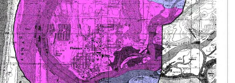


59 Figure 3.4 Relative Amplification Hazard Map


60 Figure 3.5 Relative Liquefaction Hazard Map


61 Figure 3.6 Earthquake Induced Landslides


62 Figure 3.7 Relative Earthquake Hazard Map
63 Risk Analysis DOGAMI has developed two earthquake loss models for Oregon based on the two most likely sources of seismic events: (1) the Cascadia Subduction Zone (CSZ), and (2) combined crustal events (500-year Model). Both models are based on HAZUS, a computerized program, currently used by the Federal Emergency Management Agency (FEMA) as a means of determining potential losses from earthquakes. The CSZ event is based on a potential 8.5 earthquake generated off the Oregon coast. The model does not take into account a tsunami, which probably would develop from the event. The 500-Year crustal model does not look at a single earthquake (as in the CSZ model); it encompasses many faults, each with a 10% chance of producing an earthquake in the next 50 years. The model assumes that each fault will produce a single average earthquake during this time. Neither model takes unreinforced masonry buildings into consideration. DOGAMI has calculated financial, human and operational risks associated with an M8.5 earthquake. Tables 1-4 project the dollar losses, economic losses, human effects and the facilities that would be operational after an M 8.5 event DOGAMI investigators caution that the models contain a high degree of uncertainty and should be used only for general planning purposes. Despite their limitations, the models do provide some approximate estimates of damage. Table 1. Projected dollar losses based on a M8.5 Subduction Event and a 500-year Model County Economic Base in Thousands (1999) Greatest Absolute Loss in Thousands from a M8.5 CSZ Event 1 Greatest Absolute Loss in Thousands from a 500-Year Model Lane $15,418,000 $1,614,000 $3,044,000 Source: DOGAMI Special Paper 29. Earthquake Damage in Oregon Table 2. Estimated losses associated with a M8.5 Subduction Event in Lane County Injuries Deaths Displaced Households Number 1, ,345 Percent of Residents / Households Effected 3% 0% 12% Source: DOGAMI Special Paper 29. Earthquake Damage in Oregon Table 3. Operational facilities in Lane County the day after a M8.5 Subduction Event Fire Stations Police Stations Schools Bridges 49% 42% 46% 76% Source: DOGAMI Special Paper 29. Earthquake Damage in Oregon Table 4. Economic Losses to Lane County after a M8.5 Subduction Event Highways Airports Communications $39 mil $11 mil $11 mil Source: DOGAMI Special Paper 29. Earthquake Damage in Oregon Vol. II; Page Florence Natural Hazards Mitigation Plan October,
64 In 2007, DOGAMI completed a rapid visual screening of public facilities in Oregon. Several public structures within the City scored a high collapse potential, meaning that there is a greater than 10% chance of collapse following a large earthquake. These structures include Peace Harbor Hospital, Siuslaw High School, and the Siuslaw Valley Fire & Rescue Station located on Laurel Street in Old Town Florence. v Community Hazard Issues What is susceptible to damage during a hazard event? Earthquake damage occurs because we have built structures that cannot withstand severe shaking. Buildings, ports, and lifelines (highways, telephone lines, gas, water, etc.) suffer damage in earthquakes. Damage and loss of life can be very severe if structures are not designed to withstand shaking, are on ground that amplifies shaking, or ground which liquefies due to shaking. Unreinforced masonry buildings are known to be the most susceptible to damage. While it is not impossible to design structures to withstand earthquakes, it can be prohibitively expensive to design for significant events. Most buildings are designed with life-safety integrity for the occupants to safely survive the event and evacuate, but not necessarily to protect the building from damage. The advantage of improved seismic design requirements is that they can protect lives, and maintain the functionality of the structure in lesser magnitude events. Buildings that were not built to an adequate seismic standard often can be retrofitted and strengthened to help withstand earthquakes and provide life safety. Earthquake damage to roads and bridges can be particularly serious by hampering or cutting off the movement of people and goods and disrupting the provision of emergency response services. Such effects in turn can produce serious impacts on the local and regional economy by disconnecting people from work, home, food, school and needed commercial, medical and social services. A major earthquake can separate businesses and other employers from their employees, customers, and suppliers thereby further hurting the economy. Finally, following an earthquake event, the cleanup of debris can be a huge challenge for the community. Florence is also vulnerable because of the age of the homes. Figure 3.8 shows the age of homes in Florence. Generally the older the home is, the greater the risk of damage from natural disasters. This is because stricter building codes have been developed following improved scientific understanding of plate tectonics and earthquake risk. For example, structures built after the late 1960s in the Northwest use earthquake resistant designs and construction techniques. Those built before 1960 are not likely to be earthquake resistant. Figure 3.8 Housing Year Built Pre % 34.5% 55.8% Source: 2000 US Census Vol. II; Page Florence Natural Hazards Mitigation Plan October,
65 Existing Hazard Mitigation Activities The City of Florence adheres to the International Code Council Building Codes and Oregon State Codes for building within the identified seismic risk areas. Hazard Mitigation Action Items EQ 1: Develop a comprehensive outreach program to educate businesses and residents about Florence s vulnerability to earthquakes and non-structural and structural retrofits they can implement to reduce the impact of a future earthquake event. EQ 2: Develop an inventory of public (city buildings, LCC, etc.) and large commercial buildings/employers that may be particularly vulnerable to earthquake damage. EQ 3: Retrofit public buildings and critical facilities to meet or exceed current standards for earthquake resistance. EQ 4: Seismically retrofit the historic Siuslaw River Bridge. EQ 6:Earthquake Resilient Siuslaw Bridge. EQ 5: Improve local capabilities to perform earthquake building safety evaluations. MH 2: Encourage the public to have supplies, emergency kits and plans in place. Information on developing family emergency plans and kits should be disseminated through several different channels - television, radio, mail, web, etc MH4: Develop a data repository for all existing GIS hazard data, and a GIS clearinghouse for sharing risk assessment data layers and risk models. MH 6: Expand existing special needs population data to include detailed inventory of all at risk communities (elderly, homeless, disabled, etc.) that are without access to transportation and communication. Determine effective means of alert, warning and evacuation. MH 8: Provide mitigation awareness training to the city planning, public works, and GIS staff. MH 9: Establish an annual Natural hazard Preparedness Expo. MH 10: Develop a hazard awareness plan specifically targeted at tourists and visitors. MH 11: Map alternative routes that could provide access across the Coast Range in the event that a natural hazard causes isolation. MH 12: Acquire funding to upgrade the Florence Municipal Airport facilities to allow for larger aircraft to land with supplies. MH 13: Develop a food distribution plan in the wake of an extended isolation period due to natural hazard. Vol. II; Page Florence Natural Hazards Mitigation Plan October,
66 MH 15: Establish mutual aid agreements between governmental agencies and commercial businesses in the event of an emergency (e.g. fuel, heavy equipment, food, etc.). i USGS, Earthquake History: Oregon, ii Geologic Hazards on the Oregon Coast. Oregon Department of Geology and Mineral Industries. iii DOGAMI, < iv DOGAMI. Spring Geologic Hazards on the Oregon Coast: Earthquakes and tsunamis documented at southern Oregon coast. v Statewide Seismic Needs Assessment Using Rapid Visual Screening. DOGAMI, Vol. II; Page Florence Natural Hazards Mitigation Plan October,
67 Volume II: Hazard Annex Flood Causes and Characteristics of the Hazard Oregon has a detailed history of flooding with flood records dating back to the 1860s. The principal types of flood that can occur in Florence include: (1) riverine flooding along the Siuslaw River and Munsel Creek; (2) surface water flooding due to an inundated water table and (3) ocean flooding from high tides and wind-driven waves or a tsunami event. Flooding is most likely to occur during the winter or spring time. The most serious flooding occurs during December, January, and February. Riverine Floods Riverine floods occur when water levels in rivers and streams overflow their banks. Florence, as with most communities located along such water bodies, has the potential to experience this type of flooding after spring rains, heavy thunderstorms or rapid runoff from snow melt. Riverine floods can be slow or fast-rising, but typically develop over a period of days. The danger of riverine flooding occurs mainly during the winter months, with the onset of persistent, heavy rainfall, and during the spring, with melting of snow in the Coast Range. Surface Water Floods The soil content in Florence is almost entirely sand, meaning the infiltration capacity of the soil is elastic and extensive. In most areas of the city, infiltration is utilized as the primary technique for managing storm water, and with the notable exception of Old Town, drain and pipe collection is not used. During periods of high rainfall the area s ground table rises, allowing the aquifer to recharge. It can also result in standing water in certain areas of the city, historically along 9 th Street west of Highway 101 and along Munsel Creek. The depths and velocities of flooding from poor drainage are not life threatening, but there are risks with driving, electrocution, pollution, and exposure to disease. Ocean Flooding / Wave Action Flooding from wind-driven waves is a common event on the Oregon coast. This is particularly true during the winter storm season, during El Niño events, and when spring and perigean tides occur. The Federal Emergency Management Agency has identified and mapped coastal areas subject to direct wave action (V zones) and sand dune overtopping (AH and AO zones). Direct wave action was especially severe during the winter storm events of 1972 (Siletz Spit), 1978 (Nestucca Spit), and the El Niño events of and Beach and cliff erosion were significant during these periods and a number of homes were destroyed. The following lessons were learned (and oftentimes forgotten between damaging events): Vol. II; Page 4-1 Florence Natural Hazards Mitigation Plan October, 2008
68 Oregon coastal processes are complex and dynamic, sometimes eroding, sometimes aggrading; Some sections of the Oregon coast are rising in relation to ocean levels, others remain fairly constant or are becoming lower; i Primary frontal dunes provide protection from ocean storms; Sand spits are not permanent features; Erosion rates vary and are dependent on several factors including storm duration and intensity, composition of sea cliff, time of year, and impact of human activities (e.g., altering the base of sea cliffs, interfering with the natural movement of beach sand). History of the Hazard in Your Community During the February 1996 flood communities throughout the northwest were cut off from assistance and many citizens had to be evacuated from their homes by boat and helicopter. The entire town of Mapleton, 16 miles east of Florence, had to be evacuated by boat during the worst of the flooding. In Florence, entire housing developments were inundated by floodwaters for several weeks. At the same time Oregon s rivers and streams were overflowing their banks, and landslides created by the torrential rainfall washed out major roads and highways. Highway 126 had multiple areas of washouts and mudslides which blocked the road, as did Highway 101 south. In recent years, landslides have closed Highway 101 North for several months, which creates havoc for travelers and businesses using Highway 101. The following table describes significant floods that have occurred in the region. Vol. II; Page 4-2 Florence Natural Hazards Mitigation Plan October, 2008
69 TABLE 1. SIGNIFICANT FLOODS DATE LOCATION DESCRIPTION TYPE OF FLOOD 1813 NW Oregon Said to exceed Great Flood of 1861 (Source: Native Americans) unknown 12/1861 Coastal rivers The Great Flood ; largest flood of known magnitude on the Rogue 02/1890 Coastal rivers Widespread flooding; Siuslaw River dammed by a large debris flow Rain on snow Rain on snow 01/1923 Lower Columbia Mild temperatures; large amount of rain. Flooded roads / railroads Rain on snow 03/1931 Western Oregon Extremely wet and mild; saturated ground Rain on snow 12/1933 Northern Oregon Intense warm rains; Clatskanie River set record Rain on snow 12/1937 Western Oregon Heavy coastal rain; large number of debris flows Rain on snow 10/1950 SW Oregon coast Heavy October rain Rain on snow 12/1953 Western Oregon Heavy rain accompanied major windstorm; serious log hazards on Columbia 12/1955 Columbia & coastal streams Series of storms; heavy, wet snow; many homes and roads damaged Rain on snow Rain on snow 12/1962 SW Oregon Severe flooding, especially the Rogue River Rain on snow 03/1964 Coast & Columbia River estuary Ocean flooding Tsunami 12/1964 Entire state Two storms; intense rain on frozen ground Rain on snow 01/1972 Northern coast Severe flooding and mudslides; 104 evacuated from Tillamook Rain on snow 01/1974 Western Oregon Series of storms with mild temperatures; large snowmelt; rapid runoff 12/1978 Coastal streams Intense warm rain; two fatalities on Yaquina River; widespread flooding Rain on snow Rain on snow 02/1986 Entire state Warm rain and melting snow; numerous homes evacuated Rain on snow 02/1987 Western Oregon Heavy rain; mudslides; flooded highways; damaged homes Rain on snow 12/1989 Clatsop, Tillamook & Lincoln Warm Pacific storm system. High winds. Fatalities. Mudslides Rain on snow 01/1990 W. Oregon Significant damage in Tillamook Co. Many streams had all-time records 04/1991 Tillamook County 48-hour rainstorm. Wilson River 5 ft. above flood stage. Businesses closed Rain on snow Rain on snow 02/1996 NW Oregon Deep snow pack. Warm temperatures. Record-breaking rains. Rain on snow 11/1996 W. Oregon Record-breaking precipitation. Flooding. Landslides. (FEMA DR-OR) Rain on snow 12/2005 Coos, Curry, and Douglas Counties $2,840, in property damage *figure also includes Jackson and Josephine Counties Source: Taylor and Hannon, 1999, The Oregon Weather Book, pp Vol. II; Page 4-3 Florence Natural Hazards Mitigation Plan October, 2008
70 Risk Assessment How are Hazard Areas Identified? FEMA Flood Insurance Rate Maps (FIRMs) are the most comprehensive resource for identifying flood hazards in Florence. FIRMs depict flood locations and extent; however, many old maps are inaccurate. Florence s most recent FIRM was developed on June 16, 1999, and can be referenced at City Hall on 250 Hwy 101 N. V (wave velocity) zones, depicted on FEMA s Flood Insurance Rate Maps, are areas subject to 100-year events (i.e., 1% chance in any given year). The Flood Insurance Rate Maps show areas vulnerable to wave action (V zones), pounding and sheet-flow from waves over-topping dunes (AO and AH zones). After the 1996 floods, the City of Florence completed a comprehensive Storm Water Management Plan in 2000 evaluating drainage concerns throughout the City s urban growth boundary. The plan identifies likely flooding locations and established a capital improvement plan to alleviate flooding concerns. Principle riverine flood sources in Florence include the Siuslaw River and Munsel Creek. ii Florence is a participant in the National Flood Insurance Program (NFIP). The City has 158 policies in effect; 24 of those policies are located in the A Zone. Zero properties are located in the V Zone. There have been 4 claims since 1978, with $99 in total payments. There have been no repetitive loss claims in the City of Florence. Probability of Future Occurrence The City of Florence estimates a high probability that flooding will occur in the future. A high ranking indicates that one incident is likely within a 10 to 35 year period. Ocean storms can be expected every year. El Niño effects, which tend to raise ocean levels, occur about every three to five years (Taylor and Hannan, 1999). FEMA Flood Insurance Rate Maps (FIRMs) depict areas in Florence likely to experience high water during a 100-year (1%) flood or a 500-year (0.2%) flood event, and more detailed information is available in the Florence Storm Water Management Plan, adopted in Vulnerability Assessment The City of Florence estimates a high vulnerability to flood events, meaning more than 10% of the population or regional assets are likely to be affected by a major flooding event. Low-lying coastal areas are particularly vulnerable to flood hazards that can be exacerbated by high tides, specifically in the northwest quadrant of Florence. The portions of the City that are most susceptible to riverine floods include the south banks of the Siuslaw River, the east side of Florence along Munsel Creek, Old Town and the Green Trees retirement community. In general, economic activities at- risk from a 1% flood include: Motel / hotel operations Old Town historic district, a major tourist draw Food outlets (e.g., grocery stores) Vol. II; Page 4-4 Florence Natural Hazards Mitigation Plan October, 2008
71 Other special considerations to include: Special populations (e.g., elderly, handicapped, non-english speaking) Institutions / incarceration facilities Schools / Day-Care Hazardous materials sites The majority of the corporate limits of Florence are within Zone X, according to the most recent FIRM. Exceptions are Zones A iii and AE iv along the Pacific Ocean, Siuslaw River, and Munsel Creek. The City s comprehensive storm water management plan, adopted in 2000, generally provides a much more detailed outlook on potential flooding areas within the City as well a capital improvements plan to address areas of concern. Although the Old Town district is the economic facet most at risk to flooding, floods typically occur in the off-season, thus reducing the risk of immediate economic impact of property damage. Risk Analysis A detailed risk analysis, which clearly identifies areas of concern within the City and the urban growth boundary, can be found in the Florence Storm Water Management Plan. Monetary damage estimates do not exist at this time. Community Hazard Issues What is susceptible to damage during a hazard event? The extent of the damage and risk to people caused by flood events is primarily dependent on the depth and velocity of floodwaters. Fast moving floodwaters can wash buildings off their foundations and sweep vehicles downstream. Roads, bridges, other infrastructure and lifelines (pipelines, utility, water, sewer, communications systems, etc.) can be seriously damaged when high water combines with flood debris, mud and ice. Extensive flood damage to residences and other structures also results from basement flooding and landslide damage related to soil saturation. Surface water entering into crawlspaces, basements and daylight basements is common during flood events not only in or near flooded areas but also on hillsides and other areas far removed from floodplains. Most damage is caused by water saturating materials susceptible to loss (e.g., wood, insulation, wallboard, fabric, furnishings, floor coverings and appliances.) Homes in frequently flooded areas can also experience blocked sewer lines and damage to septic systems and drain fields. This is particularly the case of residences in rural flood prone areas who commonly utilize private individual sewage treatment systems. Inundation of these systems can result in the leakage of wastewater into surrounding areas creating the risk of serious water pollution and public health threats. This kind damage can render homes unlivable. As was seen in Oregon s 1996 floods, many housing units that were damaged or lost were mobile homes and trailers. Many older manufactured home parks are located in floodplain areas. Manufactured homes have a lower level of structural stability than stick-built (standard wood frame construction) homes. Manufactured homes in Vol. II; Page 4-5 Florence Natural Hazards Mitigation Plan October, 2008
72 floodplain zones must be anchored to provide additional structural stability during flood events. Lack of community enforcement of manufactured home construction and anchoring standards in floodplains can contribute to severe damages from flood events. Flood events impact businesses by damaging property and interrupting commerce. Flood events can cut off customer access and close businesses for repairs. A quick response to the needs of businesses affected by flood events can help a community maintain economic viability in the face of flood damage. Bridges are a major concern during flood events as they provide critical links in road networks by crossing water courses and other significant natural features. However bridges and their supporting structures can also be obstructions in flood-swollen watercourses and can inhibit the rapid flow of water during flood events. Although the Siuslaw Bridge elevation is high enough that it would likely not be disrupted except in the worst case scenario, three bridges to the north on Highway 101, Big Creek, Ten Mile, and Cape Creek are all susceptible to flooding, thus limiting ingress and egress to the City. Existing Hazard Mitigation Activities The Florence Storm Water Management Plan identifies several key projects to alleviate flooding in the City. Thus far, conveyance improvements have been made to Maple Street from 9th to 6th, along 35th Street, and from the intersection of Spruce Street and Munsel Lake Road to Hwy 101 and south along Hwy 101 to 42nd Street. The next scheduled project will continue from Hwy 101 and 42nd street to a drainage way behind Pacific Pines RV Park south to 40th street, then into a storm water pipe from 40th street to 38th Street and finally to a new outfall into Munsel Creek. Hazard Mitigation Action Items FL 1: Reevaluate the projects outlined in the Florence Storm Water Management Plan and reprioritize and add projects as necessary. FL 2: Continue compliance with the NFIP and explore the potential for participation in the NFIP's Community Rating System. FL 3: Promote mitigation efforts to homes identified in the Florence Storm Water Management Plan as prone to flooding. FL 4: Implement the Spruce Street LID storm water improvement system, phase 3, which consists of storm water conveyance upgrades from Hwy 101 and 42nd street to a drainage way behind Pacific Pines RV Park south to 40th street, then into a storm water pipe from 40th street to 38th Street and finally to a new outfall into Munsel Creek. FL 5: Continue compliance with the National Flood Insurance Program (NFIP). MH 2: Encourage the public to have supplies, emergency kits and plans in place. Information on developing family emergency plans and kits should be disseminated through several different channels - television, radio, mail, web, etc MH 3: Digitize existing maps and data concerning hazardous areas within Western Lane County. Vol. II; Page 4-6 Florence Natural Hazards Mitigation Plan October, 2008
73 MH4: Develop a data repository for all existing GIS hazard data, and a GIS clearinghouse for sharing risk assessment data layers and risk models. MH 6: Expand existing special needs population data to include detailed inventory of all at risk communities (elderly, homeless, disabled, etc.) that are without access to transportation and communication. Determine effective means of alert, warning and evacuation. MH 8: Provide mitigation awareness training to the city planning, public works, and GIS staff. MH 9: Establish an annual Natural hazard Preparedness Expo. MH 10: Develop a hazard awareness plan specifically targeted at tourists and visitors. MH 11: Map alternative routes that could provide access across the Coast Range in the event that a natural hazard causes isolation. MH 12: Acquire funding to upgrade the Florence Municipal Airport facilities to allow for larger aircraft to land with supplies. MH 13: Develop a food distribution plan in the wake of an extended isolation period due to natural hazard. MH 15: Establish mutual aid agreements between governmental agencies and commercial businesses in the event of an emergency (e.g. fuel, heavy equipment, food, etc.). i Beach Processes and Sedimentation. Komar, P.D. 1992, ii Lane County Flood Insurance Study, June 2, Federal Emergency Management Agency. iii Zone A is the flood insurance rate zone that corresponds to the 100-year floodplains that are determined in the Flood Insurance Study by approximate methods. Because detailed hydraulic analyses are not performed for such areas, no Base Flood Elevations or depths are shown within this zone. Mandatory flood insurance purchase requirements apply. iv Zone AE is the flood insurance rate zone that corresponds to the 100-year floodplains that are determined in the Flood Insurance Study by detailed hydraulic analyses, establishing Base Flood Elevations or depths that are shown within this zone. Mandatory flood insurance purchase requirements apply. Vol. II; Page 4-7 Florence Natural Hazards Mitigation Plan October, 2008
74 Volume II: Hazard Annex Landslide Causes and Characteristics of the Hazard Landslides are a major geologic threat in almost every state in the United States. In Oregon, a significant number of locations are at risk from dangerous landslides and debris flows. While not all landslides result in property damage, many landslides do pose serious risk to people and property. Increasing population in Oregon and the resultant growth in home ownership has caused the siting of more development in or near landslide areas. Often these areas are highly desirable owing to their location along the coast, rivers and on hillsides. Landslides are fairly common, naturally occurring events in various parts of Oregon. In simplest terms, a landslide is any detached mass of soil, rock, or debris that falls, slides or flows down a slope or a stream channel. Landslides are classified according to the type and rate of movement and the type of materials that are transported. In understanding a landslide, two forces are at work: 1) the driving forces that cause the material to move down slope, and 2) the friction forces and strength of materials that act to retard the movement and stabilize the slope. When the driving forces exceed the resisting forces, a landslide occurs. Landslides can be grouped as on-site and off-site hazards. An on-site slide is one that occurs on or near a development site and is slow moving. It is slow moving slides that cause the most property damage in urban areas. On-site landslide hazards include features called slumps, earthflows and block slides. Off-site slides typically are rapid moving and begin on steep slopes at a distance from homes and development. A 1996 off-site slide in southern Oregon began a long distance away from homes and road, traveled at high velocity and killed five people and injured a number of others. Landslides are classified based on causal factors and conditions and exist in three basic categories. Falls This type of landslide involves the movement of rock and soil which detaches from a steep slope or cliff and falls through the air and/or bounces or rolls down slope. This type of slide is termed a rock fall and is very common along highways where they have been cut through bedrock in steep canyons and along the coast. Slides This kind of landslide exists where the slide material moves in contact with the underlying surface. Here the slide moves along a plane and either slumps by moving along a curved surface (called a rotational slide) or along a flat surface (called a translational slide). While slow-moving slides can occur on relatively gentle slopes Vol. II; Page 5-1 Florence Natural Hazards Mitigation Plan October 2008
75 and are less likely to cause serious injuries or fatalities, they can result in very significant property damage. Flows In this case the landslide is characterized as plastic or liquid in nature in which the slide material breaks up and flows during movement. This type of landslide occurs when a landslide moves down slope as a semi-fluid mass scouring or partially scouring rock and soils from the slope along its path. A flow landslide is typically rapid moving and tends to increase in volume as it moves down slope and scours out its channel. Rapidly moving flow landslides are often referred to as a debris flow. Other terms given to debris flows are mudslides, mudflows, or debris avalanches. Debris flows frequently take place during or following an intense rainfall on previously saturated soil. Debris flows usually start on steep hillsides as slumps or slides that liquefy, accelerate to speeds as high as 35 miles per hour or more, and travel down slopes and channels onto gentle sloping or flat ground. Most slopes steeper than 70 percent are at risk from debris flows. The consistency of a debris flow ranges from watery mud to thick, rocky, mud-like, wet cement which is dense enough to carry boulders, trees and cars. Separate debris flows from different starting points sometimes combine in canyons and channels where their destructive energy is greatly increased. Debris flows are difficult for people to outrun or escape from and present the greatest risk to human life. Debris flows have caused most of their damage in rural areas and were responsible from most of landslide-related deaths and injuries during the 1996 storm in Oregon. Conditions Affecting Landslides Natural conditions and human activities can both play a role in causing landslides. Certain geologic formations are more susceptible to landslides than others. Locations with steep slopes are at the greatest risk of slides. However, the incidence of landslides and their impact on people and property can be accelerated by development. Developers who are uninformed about geologic conditions and processes may create conditions that can increase the risk of or even trigger landslides. There are four principal factors that affect or increase the likelihood of landslides: Natural conditions and processes including the geology of the site, rainfall, wave and water action, seismic tremors and earthquakes and volcanic activity. Excavation and grading on sloping ground for homes, roads and other structures. Drainage and groundwater alterations that are natural or human-caused can trigger landslides. Human activities that may cause slides include broken or leaking water or sewer lines, water retention facilities, irrigation and stream alterations, ineffective storm water management and excess runoff due to increased impervious surfaces. Vol. II; Page 5-2 Florence Natural Hazards Mitigation Plan October 2008
76 Change or removal of vegetation on very steep slopes due to timber harvesting, land clearing and wildfire. History of the Hazard in Your Community Landslides typically accompany every major storm system that impacts western Oregon. In recent events, particularly noteworthy landslides accompanied storms in 1964, 1982, 1996, 1999, and Two major landslide-producing winter storms occurred in Oregon during November Intense rainfall on recently and past logged land as well as previously un-logged areas triggered over 9,500 landslides and debris flows that resulted directly or indirectly in eight fatalities throughout the state. Highways were closed and a number of homes were lost. The fatalities and losses resulting from the 1996 landslide events brought about the passage of Oregon Senate Bill 12, which set site development standards, authorized the mapping of areas subject to rapidly moving landslides and the development of model landslide (steep slope) ordinances. In February 1999, two timber workers were killed in a mud and rockslide south of Florence. Additionally, a January 2000 landslide north of Florence closed Highway 101 for three months, resulting in major social and economic disruption to nearby communities. 1 Risk Assessment How are Hazard Areas Identified? DOGAMI has identified the following areas (Figure 5.1 below) as prone to landslides in the aftermath of an earthquake. It can be assumed that these same areas may be prone to landslides due to other causes such as rain storms. Due to the relatively flat topography within the city limits, Florence is not prone to landslides. As noted in the City of Florence s Comprehensive Plan, only one area in the City s Urban Growth boundary is subject to non-coastal landslides. This is an area of about 80 acres located east of Munsel Lake Road primarily in Bohannon-Preacher-Slickrock soils. Slopes in some areas approach 70% and minor landslides have occurred in the past. Forty acres of the site are developed as a residential PUD. Sections of the internal street system have grades in excess of 10%, making emergency and service vehicle access difficult. Engineering studies have been required for each phase of the development, and engineering foundations have been required for many of the dwellings. A Site Investigation Report may be required if the Hazards Maps or Natural Resources Conservation Services Soils maps show potential for landslide or coastal erosion/sloughing. The Hazards Map from the 1988 Comprehensive Plan is the indicator of need for a Site Investigation Report. 2 Vol. II; Page 5-3 Florence Natural Hazards Mitigation Plan October 2008


77 Figure 5.1 Relative Hazard Map of Earthquake-Induced Landslides 3 Vol. II; Page 5-4 Florence Natural Hazards Mitigation Plan October 2008
78 Probability of Future Occurrence The probability of rapidly moving landslides occurring depends on a number of factors; these include steepness of slope, slope materials, local geology, vegetative cover, human activity, and water. There is a strong correlation between intensive winter rainstorms and the occurrence of rapidly moving landslides (debris flows). Given the correlation between precipitation/snow melt and rapidly moving landslides, it would be feasible to construct a probability curve. The installation of slope indicators or the use of more advanced measuring techniques could provide information on slower moving slides. Due to the relative lack of steep slopes within Florence s city limits, the West Lane Emergency Operations Group determined that there is a low probability of a landslide event, meaning one incident is unlikely to occur more once in a year period. It should be noted that there is a high probability of landslide events occurring in surrounding areas along the major thoroughfares connecting Florence to nearby communities. Vulnerability Assessment Because there are relatively few areas susceptible to landslides within City limits, the West Lane Emergency Operations Group estimates that Florence has a low vulnerability to landslides. A low ranking indicates that less than 1% of the population or City assets are likely to be affected by a landslide. Florence has greater vulnerabilities, however, to landslides that can occur beyond City limits. Rain-induced landslides and debris flows can potentially occur during any winter in Western Lane County. The potential exists for landslides to occur along thoroughfares beyond the City. As such, Florence is vulnerable to isolation for an extended period of time. The slope of the land increases dramatically on the south side of the Siuslaw River, and is identified by DOGAMI as being prone to landslides (see Figure 5.1 above). Additionally, major tunnels control access to Florence from the north and east. Tunnels are drilled through basaltic rock, as are many areas along Highways 126 and 101; areas carved from rock cliffs are particularly susceptible to landslides from seismic activity and/or excessive rainfall. 4 The Heceta Head tunnel 13 miles north of Florence was constructed during the 1930 s at the same time as the coastal bridges. The Highway 126 tunnel 20 miles east of Florence was constructed in the early 1960 s. Both tunnels could be susceptible to damage and/or blockage caused by landslides. The implications of extended isolation would be great. Florence relies on ground transportation for almost all resources and goods. With transportation routes blocked, the City would have to rely on air and sea transport. Landslides in western Lane County typically occur during the winter months when bad weather is common. Often times during these months it is difficult for boats to cross the bar at the mouth of the Siuslaw River or for pilots to land at the airport. Vol. II; Page 5-5 Florence Natural Hazards Mitigation Plan October 2008
79 Risk Analysis At this time, data does not allow for estimates of potential landslide damages. Community Hazard Issues What is susceptible to damage during a hazard event? Depending upon the type, location, severity and area affected, severe property damage, injuries and loss of life can be caused by landslide hazards. Landslides can damage or temporarily disrupt utility services, roads and other transportation systems and critical lifeline services such as police, fire, medical, utility and communication systems, and emergency response. In additional to the immediate damage and loss of services, serious disruption of roads, infrastructure and critical facilities and services may also have longer term impacts on the economy of the community and surrounding area. Increasing the risk to people and property from the effects of landslides are the following three factors: Improper excavation practices, sometimes aggravated by drainage issues, can reduce the stability of otherwise stable slopes. Allowing development on or adjacent to existing landslides or known landslide-prone areas raises the risk of future slides regardless of excavation and drainage practices. Homeowners and developers should understand that in many potential landslide settings that there are no development practices that can completely assure slope stability from future slide events Building on fairly gentle slopes can still be subject to landslides that begin a long distance away from the development. Sites at greatest risk are those situated against the base of very steep slopes, in confined stream channels (small canyons), and on fans (rises) at the mouth of these confined channels. Home siting practices do not cause these landslides, but rather put residents and property at risk of landslide impacts. In these cases, the simplest way to avoid such potential effects is to locate development out of the impact area, or construct debris flow diversions for the structures that are at risk. For more information on the landslide hazard, please visit the state plan s Landslide chapter or the Oregon Technical Resource Guide. Existing Hazard Mitigation Activities FCC Title 10; Chapter 7, Section 3 - Special Development Standards. The following subsections govern development in areas prone to landslides within Florence. G. Slopes Greater than Twelve (12) Percent: For development on steep slopes, a foundation design and grading with provision for retaining walls or excavated banks shall be carried out according to plans by a registered engineer and approved by the City. Vol. II; Page 5-6 Florence Natural Hazards Mitigation Plan October 2008
80 Hazard Mitigation Action Items - Landslides LS 1: Enter into an agreement with DOGAMI s Oregon LIDAR Consortium to map the geomorphology (the study of landforms and the processes that shape them) of Western Lane County. LS 2: Commission a study to determine the slope of "Jake Mann's Hill" and if any properties or city infrastructure (i.e. elevated storage tank) is at risk to landslide. LS 3: Enter into a contract with DOGAMI or private geologist consultant to map and review active dunes within Florence and to produce a report recommending development standards. MH 1: Develop education programs aimed at mitigating risk posed by hazards. MH 2: Encourage the public to have supplies, emergency kits and plans in place. Information on developing family emergency plans and kits should be disseminated through several different channels - television, radio, mail, web, etc MH 3: Digitize existing maps and data concerning hazardous areas within Western Lane County. MH 5: Review FCC 10-7 Special Development Standards and develop new regulations for developments within areas identified as at risk to hazards (tsunami inundation, steep slope, flood, erosion, etc ). MH 6: Expand existing special needs population data to include detailed inventory of all at risk communities (elderly, homeless, disabled, etc.) that are without access to transportation and communication. Determine effective means of alert, warning and evacuation. MH 8: Provide mitigation awareness training to the city planning, public works, and GIS staff. MH 9: Establish an annual Natural hazard Preparedness Expo. MH 11: Map alternative routes that could provide access across the Coast Range in the event that a natural hazard causes isolation. MH 12: Acquire funding to upgrade the Florence Municipal Airport facilities to allow for larger aircraft to land with supplies. MH 13: Develop a food distribution plan in the wake of an extended isolation period due to natural hazard. MH 15: Establish mutual aid agreements between governmental agencies and commercial businesses in the event of an emergency (e.g. fuel, heavy equipment, food, etc.). Vol. II; Page 5-7 Florence Natural Hazards Mitigation Plan October 2008
81 1 Taylor and Hatton, The Oregon Weather Book; and FEMA After-Action Report; 1996 events; and interviews, Oregon Department of Transportation representatives. 2 Realization 2020 Comprehensive Plan for the City of Florence, Oregon. January, Department of Geology and Mineral Industries, Relative earthquake hazard maps for selected urban areas in western Oregon, by I. P. Madin and Z. Wang, 1999, 4 p., 1:24, "Emergency Plan." City of Florence and the Siuslaw Vally Fire & Rescue Department Vol. II; Page 5-8 Florence Natural Hazards Mitigation Plan October 2008
82 Volume II: Hazard Annex Tsunami Causes and Characteristics of the Hazard Tsunamis are induced hazards created by events occurring under the ocean. A tsunami, often incorrectly referred to a tidal wave, is a series of waves that can travel great distances from the earthquake s origin and can cause serious flooding and damage to coastal communities. A tsunami usually begins as a single ocean wave but quickly becomes a series of waves, initiated by earthquakes, underwater volcanic eruptions, or landslides (including landslides that begin below the water surface or enter a deep body of water from above the water surface). It is also possible that a tsunami can be generated by a meteoroid, asteroid, or comet impacts that can be catastrophic to an entire ocean basin. The wavelength of a tsunami may be 100 miles or more in the ocean, with a surface wave height of only a few feet or more. These waves have the potential to travel up to 500 mph. As tsunamis approach shallow water, the speed of the tsunami will slow, but wave heights may increase to as much as 100 feet. Tsunamis can be divided geographically into two categories: those of distant origin and those locally caused. The distant tsunami is generated by a subduction zone earthquake far out in the Pacific and takes up to 24 hours to reach the coast of Oregon. A local tsunami is generated by a subduction earthquake near the Oregon coastline and would take mere minutes to reach land. In the past, Oregon has experienced both types. i While all types of quakes possess the potential to cause tsunamis, subduction zone earthquakes pose the greatest danger. ii The Pacific Northwest is located at a convergent plate boundary, where the Juan de Fuca and North American tectonic plates meet. The two plates are converging at a rate of about 1-2 inches per year. This boundary is called the Cascadia Subduction Zone. It extends from British Columbia to northern California. Subduction zone earthquakes are caused by the abrupt release of slowly accumulated stress. Subduction zones similar to the Cascadia Subduction Zone have produced earthquakes with magnitudes of 8 or larger. Historic subduction zone earthquakes include the 1960 Chile (magnitude 9.5) and 1964 southern Alaska (magnitude 9.2) earthquakes. These types of earthquakes have been known to produce tsunamis. See Figure 6.1 below for a greater understanding of tsunami produced by a subduction zone earthquake Vol. II; Page 6-1 Florence Natural Hazards Mitigation Plan October 2008

83 Figure 6.1. Tsunami Generation iii The interplate earthquakes on the Cascadia Subduction Zone are the only local earthquakes that would result in tsunamis on the Oregon Coast. Deep intraplate earthquakes are highly unlikely to cause a tsunami and shallow crustal earthquakes within the North American plate cannot cause tsunamis. History of the Hazard in Your Community The Pacific Northwest experienced a subduction zone earthquake estimated at magnitude 9 on January 26, The earthquake generated a tsunami that caused damage as far away as Japan. Subduction zone earthquakes and associated tsunamis have occurred on average every 500 years over the last 3500 years in the Pacific Northwest. The time between events has been as short as 100 to 200 years and as long as 1000 years. Since 1812, Oregon has experienced about a dozen tsunamis with wave heights greater than 3 feet; some of these were destructive. Ten of these were generated by distant earthquakes near Alaska, Chile or Japan. In March 1964, a tsunami struck southeastern Alaska following an earthquake beneath the Prince William Sound. The tsunami arrived along the Alaska coastline between 20 and 30 minutes after the quake, devastating villages. Damages were estimated to be over $100 million. Approximately 120 people drowned. The tsunami spread across the Pacific Ocean and caused damage and fatalities in other coastal areas as well. Four children drowned at Beverly Beach and significant property damaged was incurred, including $5,000 in Depoe Bay. Along the entire Oregon Coast damage was estimated to be between $750,000 and $1 million. Tsunamis of lesser magnitude occurred along the Oregon Coast in 1946, 1960, and iv Risk Assessment How are Hazard Areas Identified? The Oregon Department of Geology and Mineral Industries (DOGAMI) has collaborated with the Oregon Graduate Institute and NOAA to create tsunami inundation maps for several areas along the Oregon Coast using regional tsunami simulations and professional judgment. The maps depict the expected inundation for Vol. II; Page 6-2 Florence Natural Hazards Mitigation Plan October 2008
84 tsunamis produced by a magnitude 8.8 to 8.9 undersea earthquake. The tsunami hazard maps were produced to help implement Senate Bill 379 (SB 379), which was passed by the 1995 regular session of the Oregon Legislature. SB 379, implemented as Oregon Revised Statutes (ORS) and , and Oregon Administrative Rules (OAR) , limits construction of new essential facilities and special occupancy structures in tsunami flooding zones. Florence s tsunami inundation zone is depicted in Figure 6.2 below. Additionally, Florence s tsunami evacuation zone map is shown in Figure 6.3 below. The entire immediate coastal area of Florence is subject to tsunamis. The inundation area extends upstream along the Siuslaw River as far inland as Mapleton and several miles inland along the North Fork of the Siuslaw River as well (see Figure 6.2 below). A Community Emergency Notification System (CENS) has been established in the coastal communities to transmit warnings of potential tsunamis to affected residents. DOGAMI is currently working on using LIDAR, computer technology and computer modeling to map the tsunami inundation zones in Oregon. The tsunami inundation zones can t be mapped by LIDAR, per se but better mapping of coastal lands (i.e., surface, shape, height, etc.) can produce more accurate inundation maps. Cannon Beach is serving as the pilot project for this effort. This mapping method is scenariobased and attempts to express what could be expected from a tsunami in the event of a Cascadia subduction zone earthquake or another distant earthquake. v Vol. II; Page 6-3 Florence Natural Hazards Mitigation Plan October 2008

 RD LAW RD IU S MA RT IN OR KS NO RT HF HWY 101 REDWOOD ST")
 44 0'0\"N 35TH ST 20TH ST ST High risk zone")


85 OF GEO LOGY A N D M IN E T AL G O N D E PA R ER TM N S O IE RE INDUSTR STATE OF OREGON DEPARTMENT OF GEOLOGY AND MINERAL INDUSTRIES VICKI S. McCONNELL, STATE GEOLOGIST Tsunami Hazard Map of the Florence-Siuslaw River Area, Lane County, Oregon IMS Tsunami Hazard Map of the Florence-Siuslaw River Area, Lane County, Oregon By George R. Priest, Arun Chawla, and Jonathan C. Allan 124 5'0"W VIE W 2 FS 58 4 LA AB ET EA Y E WA HAZARD ZONES CH RD Low to negligible risk zone for tsunami flooding ( year events) RD LAW RD IU S MA RT IN OR KS NO RT HF HWY 101 REDWOOD ST WESTE RN WA Y 8TH ST NE CT ONADOO 6TH ST 2ND PA C IFIC OCE AN RD LAW S IU S FORK NORT H MARTIN ST VINE ST 10TH ST RD MAPLE ST SPRUCE ST OAK ST OAK ST KINGWOOD ST 18TH ST ILL 12TH ST Florence EH KINGWOOD ST 21ST ST W 15TH ST ST S RO 17TH ST 31ST 24TH ST ST DRIFTWOOD ST D RHODODENDRON DR Extreme risk zone for tsunami flooding ( year events) 44 0'0"N 35TH ST 20TH ST ST High risk zone for tsunami flooding ( year events) ER ST O XYL 1S T AK LL N DR 6TH ST Moderate risk zone for tsunami flooding ( year events) 37TH ST 35T H 27TH ST 9TH ST RD E NS MU ENDRO 42ND ST 40TH S T SIANO LP ETTY RD EL L AKE MANZAN ITA DR HWY 101 D RHODO MUN S BLOCK RD RD SALTAIRE ST 44 0'0"N RD S J When planning evacuation routes and destinations, check with local officials for guidance. In general, one should go to the least hazardous site on the map (a noncolored area or the coolest color) by the shortest route after making sure that the route is not compromised by other earthquake hazards such as liquefaction or earthquake-induced landslides. Bridges may fail in the event of an earthquake. See accompanying text report for explanation of hazard zones, mapping methods, and results. LIMPIT L N S JETTY DISCUSSION C HE I KELS TY OCEANA DR SEAPINE DR 58 4 DARR RD LOST LN RD FS CH RD AVE T JE TY LP CO L EA LEEWARD DR ET AB 3RD N JE T NOTICE This map cannot serve as a substitute for site-specific investigations by qualified practitioners. Site-specific data may give results that differ from those shown on the maps. The views and conclusions contained in this document are those of the authors and should not be interpreted as necessarily representing the official policies, either expressed or implied, of the U.S. government. RD RD 4TH AVE HE C 1ST AV E 1ST AVE JOSHUA LN N Production of this map was supported by National Oceanic and Atmospheric Administration requisition number NRMAH Regional extent of tsunami inundation to eastern limit of the numerical simulation. Boxed area is the mapped area. ST Software used: ESRI ArcMap 9.2 and MapInfo Professional 8 T BAY S Source File \\Rocks\ArcGIS\ProjectMXDs\IMS25.mxd Map sheet reviewed by Ian P. Madin, Oregon Department of Geology and Mineral Industries. Cartography by Rudie Watzig. Acknowledgments: Vasily Titov, Hal Mofjeld, and Frank Gonzalez of the NOAA Tsunami Inundation Mapping Effort (TIME) reviewed the map for technical sufficiency. The map was field checked for accurate representation of topographic control of inundation by George Priest, DOGAMI; Ron Miller, Public Works Director, City of Florence; John Buchannon, Fire Chief, Siuslaw Valley Fire and Rescue; and Tom Kartrude, Port Manager, Port of Siuslaw. GLENADA RD FI SK ST PRIVATE ROAD 124 5'0"W Base Photo: 2005 National Agriculture Imagery Program (NAIP) 1 meter resolution Scale: 1:20,000 Projection: Oregon Lambert International Feet, NAD Miles Kilometers OREGON LOCATION OF STUDY Prepared by George R. Priest, Oregon Department of Geology and Mineral Industries, from numerical simulations of Arun Chawla, Oregon Graduate Institute of Science and Technology, Oregon Health Sciences University, with assistance from Jonathan C. Allan, Oregon Department of Geology and Mineral Industries. For copies of this publication contact: Nature of the Northwest Information Center 800 NE Oregon Street, #5, Ste. 177 Portland, Oregon telephone (503)

86 NATIONAL OCEANIC AND ATMOSPHERIC ADMINISTRATION TSUNAMI EVACUATION MAP City of Florence, Oregon MAP LOCATION O R E G O N If you feel the ground shake: Move immediately inland to higher ground Follow evacuation route signs Do not wait for an official warning MAP SYMBOLS EVACUATE FROM THIS AREA OUTSIDE HAZARD AREA EVACUATION ROUTE SCHOOL H HOSPITAL CITY HALL A ASSEMBLY AREA BRIDGE TSUNAMI WARNING SIREN FIRE DEPT. POLICE PACIFIC OCEAN Driftwood Shores Resort N. JETTY RD. Joshua Lane Heceta Beach HECETA BEACH RD. RHODODENDRON DR. OCEANA DR. Heceta Jtn. Lake A 101 Heceta Junction MUNSEL LAKE RD. DOWNTOWN FLORENCE Greentrees West SIUSLAW Collard Lake H Ackerley Lake Florence Municipal Airport A 9TH ST. KINGWOOD ST. Greentrees Clubhouse Clear Lake Florence Justice Center 27TH ST. 20TH ST. 15TH 2ND OAK ST. S T. A 101 SPRUCE ST. A Grocery Outlet/ Florence Cinemas ODOT 126 Florence Events Center U.S. Coast Guard Station SIUSLAW RIVER Greentrees West H Florence Municipal Airport A 9TH ST. KINGWOOD ST. Greentrees Clubhouse Florence Justice Center City Hall Fred Meyer 35TH ST. 27TH ST. 46TH ST. 20TH ST. 15TH OAK ST. A 2ND S T. A Bi-Mart A 42ND ST. ODOT SPRUCE ST. A Grocery Outlet/ Florence Cinemas Florence Events Center Munsel Creek Three Rivers Casino & Hotel A Munsel Lake SIUSLAW RIVER MUNSEL LAKE RD. RIVER 0 SCALE 0.5 mile N km Barrett Lake City Hall SKUNK HOLLOW NORTH FORK SIUSLAW RIVER 126 GLENADA RD. Barrett Lake GLENADA RD. N 0.5 mile 0.5 km SCALE mile km NOTICE The evacuation zone on this map was developed by the Oregon Department of Geology and Mineral Industries (DOGAMI) in consultation with local emergency officials. It is intended to represent a worst-case scenario for a local tsunami from an earthquake near the Oregon coast. The evacuation routes were developed by local emergency officials and reviewed by the Oregon Department of Emergency Management. DOGAMI is publishing this brochure because the information furthers the mission of the Department. The map is intended for emergency response and should not be used for site-specific planning. U.S. DEPARTMENT OF COMMERCE O R E G O N D E PA R T M E N T O F G E O L O G Y 1937 A N D M I N E R A L I N D U S T R I E S RECOVERY RESPONSE PREPAREDNESS MITIGATION oregon emergency management
87 Probability of Future Occurrence The City of Florence has a moderate probability of experiencing a tsunami event. Given the past pattern of tsunami occurrence on the Oregon Coast, geologists predict a percent chance that a Cascadia Subduction Zone earthquake will occur within the next 50 years, causing a tsunami that will affect the Oregon coast. This forecast comes from evidence for large but infrequent earthquakes and tsunamis that have occurred at the Oregon coast, on average, every 500 years. vi Vulnerability Assessment The City of Florence is highly vulnerable to a tsunami event. This score indicates that a minimum of 10% of the population or City assets are likely to be affected by a tsunami emergency or disaster. It is anticipated that Florence will become isolated in the aftermath of an earthquake-tsunami event, and that the entire Oregon coastline will require assistance. As such, Florence cannot assume that outside resources will be immediately available. As shown figures 6.3 and 6.4 below a relatively small portion of Florence s population is located within the tsunami inundation zone. However, the inundation zone includes the areas of Florence, Old Town and the Port of Siuslaw, which hold more cultural and economic value than any other part of the City. Furthermore, during a tsunami event these areas are the most likely to be populated with tourists, who tend to be unaware of evacuation maps and plans. As such, many casualties are expected from a local tsunami event. Figure 6.4 shows the relatively low amount of land that is within the Tsunami Inundation Zone in Florence and Western Lane County. vii Figure 6.4 Developed Land in the Tsunami Inundation Zone. Figure 6.5 shows the relatively low number of permanent residents living within the Tsunami Inundation Zone in Florence and Western Lane County. Figure 6.5. Number of Residents in Tsunami Inundation Zone Vol. II; Page 6-6 Florence Natural Hazards Mitigation Plan October 2008
88 In 2007 the United States Geological Survey released estimates of the potential socioeconomic impact of tsunamis on each Oregon coastal community, including Florence. It can be inferred from the data in the report that Florence would have difficulty recovering from a tsunami event due to its mostly service based economy. viii Risk Analysis Damage estimates [for specific tsunami event scenarios] are not available at this time. Community Hazard Issues What is susceptible to damage during a hazard event? Tsunamis generated by a CSZ event just off the Oregon coast can strike the coast within five to thirty minutes, possibly disrupting power lines and communications and leaving little time for an official warning. The actual ground shaking of the earthquake may be the only warning received. Tsunamis generated by earthquakes occurring thousands of miles away will take several hours to reach the coast. There would be time for an official warning, although no earthquake would be felt, and the only warning may be a sudden unexpected change in sea level. A significant tsunami event can be expected to cause disruption of power, contamination of water supplies, loss of essential communication systems, a large amount of debris, and traffic congestion. Dealing with evacuees would be a major challenge in the first days after the event. The tourist industry would be non-existent for a considerable period of time and damaged public facilities would have to be restored or replaced at considerable cost. Boats and ships in harbor are also at great risk from the sudden changes in sea level. The water level can change so fast that lines holding ships to the pier have the potential to break. Navigating in these conditions would be treacherous as well as unpredictable; dangerous currents can continue for hours while the water in the harbor shifts back and forth. The rapidly increasing sea level caused by the tsunami picks up debris, rocks, logs and other materials that act as projectiles causing additional damage and dangers. Existing Hazard Mitigation Activities The City of Florence has established Tsunami Evacuation Routes, and posted signage within the inundation zone identified by DOGAMI. An ordinance is currently being enacted by to Florence City Council to require hotels to post tsunami evacuation information in all rooms. A tsunami warning system was installed in the aftermath of the 2004 Indian Ocean tsunami, and is tested on the last Friday of every month. Vol. II; Page 6-7 Florence Natural Hazards Mitigation Plan October 2008
89 Hazard Mitigation Action Items T1: Review signage and warnings for Tsunami Evacuation Routes, new siren tone meanings, etc. T2: Examine costs and benefits of installing a tsunami siren in Old Town Florence. MH 1: Develop education programs aimed at mitigating risk posed by hazards. MH 2: Encourage the public to have supplies, emergency kits and plans in place. Information on developing family emergency plans and kits should be disseminated through several different channels - television, radio, mail, web, etc MH 3: Digitize existing maps and data concerning hazardous areas within Western Lane County. MH 5: Review FCC 10-7 Special Development Standards and develop new regulations for developments within areas identified as at risk to hazards (tsunami inundation, steep slope, flood, erosion, etc ). MH 6: Expand existing special needs population data to include detailed inventory of all at risk communities (elderly, homeless, disabled, etc.) that are without access to transportation and communication. Determine effective means of alert, warning and evacuation. MH 8: Provide mitigation awareness training to the city planning, public works, and GIS staff. MH 9: Establish an annual Natural hazard Preparedness Expo. MH 10: Develop a hazard awareness plan specifically targeted at tourists and visitors. MH 11: Map alternative routes that could provide access across the Coast Range in the event that a natural hazard causes isolation. MH 12: Acquire funding to upgrade the Florence Municipal Airport facilities to allow for larger aircraft to land with supplies. MH 13: Develop a food distribution plan in the wake of an extended isolation period due to natural hazard. MH 15: Establish mutual aid agreements between governmental agencies and commercial businesses in the event of an emergency (e.g. fuel, heavy equipment, food, etc.). Vol. II; Page 6-8 Florence Natural Hazards Mitigation Plan October 2008
90 i Partnership for Disaster Resilience, State of Oregon Natural Hazard Mitigation Plan (2002), stateplan /OR-SNHMP_tsunami_chapter.pdf. ii Oregon Department of Geology and Mineral Industries. Geologic Hazards on the Oregon Coast: Prehistoric and historic tsunamis, iii U.S. Geological Survey Circular iv NOAA, Tsunamis affecting the West Coast of the United States: v Oregon Department of Geology and Mineral Industries, Is this meant to reference a particular document on their webpage? vi Oregon Department of Geology and Mineral Industries. Oregon Geology Fact Sheet: Tsunami Hazards in Oregon. vii Wood, Nathan. Variations in City Exposure and Sensitivity to Tsunami Hazards in Oregon. U.S. Department of the Interior, U.S. Geological Survey. Scientific Investigations Report viii Wood, Nathan. Variations in City Exposure and Sensitivity to Tsunami Hazards in Oregon. U.S. Department of the Interior, U.S. Geological Survey. Scientific Investigations Report Vol. II; Page 6-9 Florence Natural Hazards Mitigation Plan October 2008
91 Volume II: Hazard Annex Volcanic Eruption Causes and Characteristics of the Hazard The Cascade Range of the Pacific Northwest has more than a dozen active volcanoes. These familiar snow-clad peaks are part of a 1,000 mile-long chain of mountains which extend from southern British Columbia to northern California. Cascades volcanoes tend to erupt explosively, and have occurred at an average rate of 1-2 per century during the last 4,000 years. Future eruptions are certain. Seven Cascades volcanoes have erupted since the first U.S. Independence Day slightly more than 200 years ago. Four of those eruptions would have caused considerable property damage and loss of life had they occurred today without warning. The most recent events were Mt. St. Helens in Washington ( ) and Lassen Peak in California ( ). The existence, position and recurrent activity of Cascades volcanoes are generally thought to be related to the convergence of shifting crustal plates. As population increases in the Pacific Northwest, areas near volcanoes are being developed and recreational usage is expanding. As a result more and more people and property are at risk from volcanic activity. The effects of a major volcanic event can be widespread and devastating. The Cascade Range in Washington, Oregon and northern California is one of the most volcanically active regions in the United States. Volcanoes produce a wide variety of hazards that can destroy property and kill people. Large explosive eruptions can endanger people and property hundreds of miles away and even affect the global climate. Some volcano hazards such as landslides can occur even when a volcano is not erupting. Although there are no active volcanoes in Western Lane County, it is important to note the potential impacts of nearby volcanoes. Two types of volcanoes exist in the Three Sisters region, approximately 125 miles east of Florence, and both pose distinct hazards to people and property. South Sister, Middle Sister, and Broken Top, major composite volcanoes clustered near the center of the region, have erupted repeatedly over tens of thousands of years and may erupt explosively in the future. In contrast, mafic volcanoes, which range from small cinder cones to large shield volcanoes like North Sister and Belknap Crater, are typically short-lived (weeks to centuries) and erupt less explosively than composite volcanoes. Hundreds of mafic volcanoes scattered through the Three Sisters region are part of a much longer zone along the High Cascades of Oregon in which birth of new mafic volcanoes is possible. i While immediate danger area around a volcano is approximately 20 miles; ash fall problems may occur as much as 100 miles or more from a volcano s location. Figure 7.1 below illustrates the location of volcanoes in the Pacific Northwest. Vol. II; Page 7-1 Florence Natural Hazards Mitigation Plan October 2008

 of volcanic glass, mineral and rock (ash) rise high into the air forming a huge, billowing eruption column.")
92 Figure 7.1 Potentially Active Volcanoes of the Western United States ii Eruption Columns and Clouds An explosive eruption blasts solid and molten rock fragments called tephra and volcanic gases into the air with tremendous force. The largest rock fragments called bombs usually fall back to the ground within two miles of the event. Small fragments (less than 0.1 inch across) of volcanic glass, mineral and rock (ash) rise high into the air forming a huge, billowing eruption column. Eruption columns creating an eruption cloud can grow rapidly and reach more than 12 miles above a volcano in less than 30 minutes. Volcanic ash clouds can pose serious hazards to aviation. Several commercial jets have nearly crashed because of engine failure from inadvertently flying into ash clouds. Large eruption clouds can extend hundreds of miles downwind resulting in ash fall over enormous areas. Ash from the May 18, 1980 Mt. St. Helens eruption fell over an area of 22,000 square miles in the western U.S. Heavy ash fall, particularly when mixed with rain, can collapse buildings and even a minor ash fall can damage crops, electronics and machinery. For more information on the volcanic hazard, please visit the State Plan s Volcano Chapter. History of the Hazard in Your Community According to the Oregon Department of Geology and Mineral Industries (DOGAMI), the closest volcanoes to Florence are in the Three Sisters area approximately 125 miles to the east. Given the right wind conditions, ash fall in Western Lane County could be a concern. Figure 7.2 illustrates the eruptive history of volcanoes in the Cascade Range. Vol. II; Page 7-2 Florence Natural Hazards Mitigation Plan October 2008

93 Figure 7.2 History of Cascade Eruptions iii Mt. St. Helens, a volcano in Washington State, is the most active volcano in the Cascade Range. Its last major eruption occurred on May 18 th, 1980 when a large landslide and powerful explosive eruption created a large crater, and ended 6 years later after more than a dozen extrusions of lava built a dome in the crater. iv Larger, longer lasting eruptions have occurred in the volcano's past and are likely to occur in the future. Some reports indicate that ashfall reached Mapleton after the 1980 eruption, but no supporting documentation has been found. Risk Assessment How are Hazard Areas Identified? To identify the areas that are likely to be affected by future events, pre-historic rock deposits are mapped and studied to learn about the types and frequency of past eruptions at each volcano. This information helps scientists to better anticipate future activity at a volcano, and provides a basis for preparing for the effects of future eruptions through emergency planning. Scientists also use wind direction to predict areas that might be affected by volcanic ash; during an eruption that emits ash, the ashfall deposition is controlled by the prevailing wind direction. The predominant wind pattern over the Cascades originates from the west, and previous eruptions seen in the geologic record have resulted in most ashfall drifting to the east of the volcanoes. Figure 7.3 shows the annual probability of 10 centimeters or more of ash accumulation from Pacific Northwest volcanoes. Figure 7.4 depicts the potential and geographical extent of volcanic ashfall in excess of 10 centimeters from a large eruption of Mt. St. Helens. Vol. II; Page 7-3 Florence Natural Hazards Mitigation Plan October 2008
 or more tephra accumulation in Oregon and")
 vi Map of Washington and Oregon showing the percentage probability of accumulation of ten or more")
94 Figure 7.3 Average Annual Probability of Ashfall v Map showing annual probability of 10 cm (~4 inches) or more tephra accumulation in Oregon and Washington from eruptions throughout the Cascade Range (Florence is circled in red). Figure 7.4 Potential Ashfall from a Mt. St. Helens Eruption (in excess of 10cm) vi Map of Washington and Oregon showing the percentage probability of accumulation of ten or more centimeters (four or more inches) of tephra from a large eruption of Mount St. Helens. Vol. II; Page 7-4 Florence Natural Hazards Mitigation Plan October 2008
95 Probability of Future Occurrence The West Lane Emergency Operations Group (WLEOG) determined the probability of a volcanic event creating a catastrophic effect on Florence to be low, meaning no more than one even is likely to occur within the next 75 to 100 years. Vulnerability Assessment The WLEOG determined that the City of Florence s vulnerability to a volcanic event is low, meaning less than one percent of the community is at risk to volcanic hazards. As noted above, due to Florence's location on the coast there is little risk of ashfall affecting the city. Typical wind patters push eastward, and all volcanoes are located to the east of Florence in the Cascade Range. The community s greatest vulnerability is its water supply. Due to Florence s reliance on a sole source aquifer, any impact on the water system from ashfall would be detrimental. Risk Analysis Because of the distance between the volcanic areas of the Cascade Range and Western Lane County, WLEOG does not believe there is significant volcanic risk to the City of Florence. Furthermore, volcanoes in the Three Sisters Region have been inactive for over 1,000 years. Quantifiable damage and loss estimates are not available at this time due to the low probability of a volcanic eruption affecting the community. Community Hazard Issues What is susceptible to damage during a hazard event? Structural damages can result from the weight of ash, especially if it is wet. Four inches of wet ash may cause buildings to collapse. A half-inch of ash can impede the movement of most vehicles and disrupt transportation, communication, and utility systems, and cause problems for human and animal respiratory systems. It is extremely dangerous for aircraft, particularly jet planes, as the volcanic ash accelerates wear to critical engine components, can coat exposed electrical components, and erodes exposed structures. Ashfall may severely decrease visibility and even cause darkness, which can further disrupt transportation and other systems. Ashfall can severely degrade air quality, triggering health problems. In areas with considerable ashfall, people with breathing problems might need additional services from doctors or emergency rooms. In severe events, an air quality warning, similar to those given on summer problem air quality days, could be issued. This would, for example, warn people with breathing problems not to go outside. On roads and streets, ashfall can create serious traffic problems as well as road damage. Vehicles moving over even a thin coating of ash can cause great clouds of ash to swell. This results in grave visibility problems for other drivers, calling for speed restrictions, and often forcing road closures. It also adds to the potential for health problems for residents of the area. Extremely wet ash creates very slippery and hazardous road conditions. Ash filling roadside ditches and culverts can prevent proper drainage and cause shoulder erosion and road damage. Blocked drainages can also trigger debris flows or lahars if they Vol. II; Page 7-5 Florence Natural Hazards Mitigation Plan October 2008
96 cause water to pool on or above susceptible slopes. Conventional snow removal methods do not work on dry ash, as they only stir it up and cause it to resettle on the roadway. When ash is pushed to the side of travel lanes, wind and vehicle movement continue to cause it to billow. Existing Hazard Mitigation Activities The extremely low vulnerability and probability of a volcanic event in Florence, combined with the low cost-benefit ratio has precluded any mitigation actions. Hazard Mitigation Action Items VE1: Evaluate capability of the Florence wastewater treatment plant to deal with ash fall and upgrade facility as necessary. VE2: Update emergency response planning for ash fall events. MH 1: Develop education programs aimed at mitigating risk posed by hazards. MH 2: Encourage the public to have supplies, emergency kits and plans in place. Information on developing family emergency plans and kits should be disseminated through several different channels - television, radio, mail, web, etc MH 3: Digitize existing maps and data concerning hazardous areas within Western Lane County. MH 6: Expand existing special needs population data to include detailed inventory of all at risk communities (elderly, homeless, disabled, etc.) that are without access to transportation and communication. Determine effective means of alert, warning and evacuation. MH 8: Provide mitigation awareness training to the city planning, public works, and GIS staff. MH 9: Establish an annual Natural hazard Preparedness Expo. MH 11: Map alternative routes that could provide access across the Coast Range in the event that a natural hazard causes isolation. MH 12: Acquire funding to upgrade the Florence Municipal Airport facilities to allow for larger aircraft to land with supplies. MH 13: Develop a food distribution plan in the wake of an extended isolation period due to natural hazard. MH 15: Establish mutual aid agreements between governmental agencies and commercial businesses in the event of an emergency (e.g. fuel, heavy equipment, food, etc.). Vol. II; Page 7-6 Florence Natural Hazards Mitigation Plan October 2008
97 i W.E. Scott, R.M. Iverson, S.P. Schilling, and B.J. Fischer, 2001, Volcano Hazards in the Three Sisters Region, Oregon: U.S. Geological Survey Open-File Report , 14p. ii USGS Cascades Volcano Observatory, Potentially Active Volcanoes of the Western United States. iii Myers, USGS-CVO, 2000, Modified from CVO, 1994, USGS Open-File Report iv USGS Mt. St. Helens Volcano. v USGS Cascades Volcano Observatory, Modified from W.E. Scott et al., 1997, Open File Report vi USGS Cascades Volcano Observatory, Vol. II; Page 7-7 Florence Natural Hazards Mitigation Plan October 2008
98 Volume II: Hazard Annex Wildfire Causes and Characteristics of the Hazard Fire is an essential part of Oregon s ecosystem, but it is also a serious threat to life and property particularly in the state s growing rural communities. Wildfires occur in locations that have large areas of flammable vegetation. Due to the dry, hot climate, Central, Southwest and Northeast Oregon have the highest risk; the Oregon Coast has the least risk due to its cooler, wet climate. The Oregon Department of Forestry has estimated that there are about 200,000 homes in Oregon at serious risk to wildfire. The impact on communities from wildfire can be great. In 1990, Bend s Awbrey Hall Fire destroyed 21 homes, causing $9 million in damage and costing over $2 million to suppress. The 1996 Skeleton fire in Bend burned over 17,000 acres and damaged or destroyed 30 homes and structures. Statewide that same year, 218,000 acres were burned, 600 homes were threatened and 44 homes were lost. The 2002 Biscuit fire in southern Oregon affected over 500,000 acres and cost $150 million to suppress. Interface Fires Essentially an interface fire occurs where wildland and developed areas come together with both vegetation and structural development combining to provide fuel. The wildland/urban interface (sometimes called rural interface in small communities or outlying areas) can be divided into three categories. The classic wildland/urban interface exists where well-defined urban and suburban development presses up against open expanses of wildland areas. The mixed wildland/urban interface is more typical of the problems in areas of exurban or rural development: isolated homes, subdivisions, resorts and small communities situated predominantly in wildland settings. The occluded wildland/urban interface where islands of wildland vegetation exist within a largely urbanized area. Wildland Fires A wildland fire s main fuel source is natural vegetation. Often referred to as forest or rangeland fires, these fires occur in national forests and parks, private timberland, and on public and private rangeland. A wildland fire can become an interface fire if it encroaches on developed areas. Firestorms Firestorms are events of such extreme intensity that effective suppression is virtually impossible. Firestorms often occur during dry, windy weather and generally burn until conditions change or the available fuel is consumed. The disastrous 1991 East Vol. II; Page 8-1 Florence Natural Hazards Mitigation Plan October, 2008
99 Bay Fire in Oakland, California is an example of an interface fire that developed into a firestorm. Conditions Contributing to Wildfires Ignition of a wildfire may occur naturally from lightning or from human causes such as debris burns, arson, careless smoking, and recreational activities or from an industrial accident. Once started, four main conditions affect the fire s behavior: fuel, topography, weather and development. Fuel is the material that feeds a fire. Fuel is classified by volume and type. As a western state, Oregon is prone to wildfires due to its prevalent conifer, brush and rangeland fuel types. Topography influences the movement of air and directs a fire s course. Slope and hillsides are key factors in fire behavior. Unfortunately, hillsides with steep topographic characteristics are also desirable areas for residential development. Weather is the most variable factor affecting wildfire behavior. High risk areas in Oregon share a hot, dry season in late summer and early fall with high temperatures and low humidity. The increase in residential development in interface areas has resulted in greater wildfire risk. Fire has historically been a natural wildland element and can sweep through vegetation that is adjacent to a combustible home. New residents in remote locations are often surprised to learn that in moving away from built-up urban areas, they have also left behind readily available fire services providing structural protection. History of the Hazard in Your Community Florence has not had any significant wildfires in the past, but the possibility does exist due to the immense Siuslaw National Forest immediately to the north and east, and the Oregon Dunes National Recreation Area to the south. The lack of wildfire in the past is mostly due to coastal Oregon s wet climate. Risk Assessment How are Hazard Areas Identified? In December of 2004, the Lane County Board of Commissioners directed County staff to work collaboratively with fire protection districts and federal and state agencies to develop a Community Wildfire Protection Plan. The plan determined that less than one percent of the Florence community is at high risk to wildfire, and that over 75 percent of the population is considered low risk. Risk Assessments throughout the state of Oregon are shown in Figure 8.1; Western Lane County has a moderate to low risk rating. Figure 8.2 shows the wildfire risk for Lane County. Vol. II; Page 8-2 Florence Natural Hazards Mitigation Plan October, 2008

100 Figure 8.1 Wildfire Rating for Oregon (Green-Low Rating; Yellow-Moderate Rating; Red-High Rating; Blue-Water) Source: Oregon Department of Forestry. CWPP_ Vol. II; Page 8-3 Florence Natural Hazards Mitigation Plan October, 2008

101 Figure 8.2 Lane County Wildfire Risk Map Source: Lane County CWPP Vol. II; Page 8-1 Florence Natural Hazards Mitigation Plan October, 2008
102 The Oregon Department of Forestry determines Fire Weather Hazard Values which are related to the number of days per season that forest fuels are capable of producing a significant fire. Hazard Values range from 1 to 12 with 1 being the lowest capacity to sustain a forest fire and 12 being the highest. Lane County is divided into Area 1, which contains Florence, and Area 2; both these areas have very low hazard rankings which indicate they are not in a wildfire hazard zone. i Hazard Value 1 or HV1produces flame lengths up to five feet with little spotting, torching or crowning. HV2 has flame lengths from 5-8 feet with sporadic spotting, torching or crowning. Probability of Future Occurrence The Western Lane Emergency Operations Group estimates a low probability of a wildfire event due to the cool and damp climate. This score indicates that one incident is likely within a 35 to 75 year period. Wildfire results from natural causes (e.g., lightening strikes), a mechanical failure (Oxbow Fire), or human-causes (unattended campfire, debris burning, or arson). Most wildfires can be linked to human carelessness. A wildfire in the Siuslaw National Forest, located to the north and east of Florence, given the right fuel conditions and left unimpeded, could feasibly pose a risk to Florence. The typical prevailing wind along the coast during the summer months, when forest fires are most common, is from the north. Vulnerability Assessment The City of Florence estimates a low vulnerability to wildfire events, meaning less than one percent of the population or region assets are likely to be affected by a major wildfire emergency or disaster. The low vulnerability ranking is due mainly to the cool and damp climate. There are no areas within the City limits that are seen as at risk to wildfire according to WLEOG. It can be assumed that in order for a major wildfire to affect the coast the area would be in the midst of a drought, which would affect the area's water supply. The implications of a drought on Florence are thoroughly described in the drought annex, but one aspect is that there would be a reduced capacity for firefighting within the City. Even with these considerations, WLEOG and the Siuslaw Valley Fire & Rescue Department contend that a fire would have to be left unabated in order to directly impact Florence. According to the Lane County Community Wildfire Protection Plan, the number of days per season that forest fuels are capable of producing a major fire event is significantly lower on the coast than in other parts of Lane County. ii Risk Analysis The Lane County Community Wildfire Protection Plan evaluated fire risk by analyzing four factors: (1) historical occurrences; (2) vegetative fuels, weather, and topographic features that typically contribute to fires; (3) potential social, economic, and infrastructure values at risk in the community; and (4) each community s ability to respond to fire. Based on these factors, the assessment determines the risk (high, medium, or low) that wildfire poses throughout Lane County. WLEOG based their probability and vulnerability scores on the Lane County Community Wildfire Protection Plan findings. Vol. II; Page 8-1 Florence Natural Hazards Mitigation Plan October, 2008
103 Community Hazard Issues What is susceptible to damage during a hazard event? The effects of fire on ecosystem resources can include damages, benefits, or some combination of both. Ultimately, a fire s effects depend largely on the characteristics of the fire site, the severity of the fire, its duration and the value of the resources affected by the fire. The ecosystems of most forests and wildlands depend upon fire to maintain various functions. These benefits can include, depending upon location and other circumstances, reduced fuel load, disposal of slash and thinned tree stands, increased forage plant production, and improved wildlife habitats, hydrological processes and aesthetic environments. Despite these potential benefits, fire has historically been suppressed for years because of its effects on timber harvest, loss of scenic and recreational values and the obvious threat to property and human life. At the same time, the effects of a wildfire on the built environment, particularly in the face of a major wildfire event, can be devastating to people, homes, businesses and communities. As noted above, fuel, topography, weather and the extent of development are the key determinants for wildfires. A number of other factors also have been identified which affect the degree of risk to people and property in identified wildfire interface areas. These include: Combustible roofing material (for example cedar shakes) Wood construction Homes and other structures with no defensible space Roads and streets with substandard width, grades, weight-load and connectivity standards making evacuation and fire response more difficult Subdivisions and homes surrounded by heavy natural fuel types Structures on steep slopes covered with flammable vegetation Limited on-site or community water supply Locations with normal prevailing winds over 30 miles per hour For more information on the wildfire hazard, please visit the State Plan s Wildfire Chapter, Lane County s Community Wildfire Protection Plan, or the Oregon Technical Resource Guide. Existing Hazard Mitigation Activities The Siuslaw Valley Fire & Rescue Department, a member of the West Lane Emergency Operations Group, participated in the planning process for Lane County s Community Wildfire Protection Plan (CWPP). The CWPP includes Western Lane County in its risk assessment. Vol. II; Page 8-2 Florence Natural Hazards Mitigation Plan October, 2008
104 Hazard Mitigation Action Items WF1: Identify evacuation routes and procedures for high risk areas and educate the public. MH 1: Develop education programs aimed at mitigating risk posed by hazards. MH 2: Encourage the public to have supplies, emergency kits and plans in place. Information on developing family emergency plans and kits should be disseminated through several different channels - television, radio, mail, web, etc MH 3: Digitize existing maps and data concerning hazardous areas within Western Lane County. MH 5: Review FCC 10-7 Special Development Standards and develop new regulations for developments within areas identified as at risk to hazards (tsunami inundation, steep slope, flood, erosion, etc ). MH 6: Expand existing special needs population data to include detailed inventory of all at risk communities (elderly, homeless, disabled, etc.) that are without access to transportation and communication. Determine effective means of alert, warning and evacuation. MH 8: Provide mitigation awareness training to the city planning, public works, and GIS staff. MH 9: Establish an annual Natural hazard Preparedness Expo. MH 11: Map alternative routes that could provide access across the Coast Range in the event that a natural hazard causes isolation. MH 12: Acquire funding to upgrade the Florence Municipal Airport facilities to allow for larger aircraft to land with supplies. MH 13: Develop a food distribution plan in the wake of an extended isolation period due to natural hazard. MH 15: Establish mutual aid agreements between governmental agencies and commercial businesses in the event of an emergency (e.g. fuel, heavy equipment, food, etc.). i Oregon Department of Forestry Criteria for Determination of Wildfire Hazard Zones Administration Rules. ii Oregon Natural Hazards Workgroup Lane County Community Wildfire Protection Plan. Vol. II; Page 8-3 Florence Natural Hazards Mitigation Plan October, 2008
105 Volume II: Hazard Annex Windstorms & Winter Storms Causes and Characteristics of the Hazard Destructive wind and winter storms that produce ice, rain, freezing rain, and high winds have a long history in Florence. Severe storms affecting Oregon with snow and ice typically originate in the Gulf of Alaska or in the central Pacific Ocean. These storms are most common from October through March. Ice storms are comprised of cold temperatures and moisture, but subtle changes can result in varying types of ice formation which may include freezing rain, sleet and hail. Of these, freezing rain can be the most damaging of ice formations. Due to Florence s location at sea level and adjacent to the Pacific Ocean, significant snow accumulation is much less than on the east side of the Cascades, although accumulation in excess of 10 inches has been documented in the past. High winds can be expected throughout Western Lane County. Destructive wind storms are less frequent, and their pattern is fairly well known. They form over the North Pacific during the cool months (October through March), move along the coast and swing inland in a northeasterly direction. Wind speeds vary with the storms. Gusts exceeding 100 miles per hour have been recorded at several coastal locations, but lessen as the storm moves inland. These storms can be very destructive as documented in the now infamous Columbus Day Storm of October, Less destructive storms usually topple trees, power lines, and cause building damage. Flooding can be an additional problem. A large percentage of Oregon s annual precipitation comes from these events. i A windstorm is generally a short duration event involving straight-line winds and/or gusts in excess of 50 mph. Although windstorms can affect all of Western Lane County, they are especially dangerous along the coastline in areas with significant tree stands, and in areas with exposed property, major infrastructure, and above ground utility lines. Windstorms can knock down trees and power lines, damage homes, businesses, public facilities, and create tons of disaster related debris. Though tornadoes are not common in Oregon, these events do occasionally occur and sometime produce significant property damage and even injury. Tornadoes are the most concentrated and violent storms produced by earth s atmosphere, and can produce winds in excess of 300 mph. They have been reported in most of the counties throughout the state since 1887, but are relatively rare phenomena in Florence. History of the Hazard in Your Community Winter storms represent a particularly critical problem in the western portions of Lane County, including the area surrounding Florence. The Pacific coastal margin, the area Vol. II; Page 9-1 Florence Natural Hazards Mitigation Plan October, 2008
106 within a few miles of the Pacific coastline, bears the initial brunt of the massive winter storms that strike Oregon at irregular intervals. Documentation of these impacts is difficult due to the very limited number of observing stations in coastal locations. Figure 9.1 shows the track of a major wind storm that came ashore close to Florence. Reports from other coastal observing stations indicated winds of well over 100 miles per hour and, as noted in the official Oregon climate summary, (Coastal) wind speeds can exceed hurricane force. In one case, the observing station at Newport, Oregon (some 50 miles north of Florence on the coast) reported a gust of nearly 130 miles per hour before the recording instrument was destroyed. Periods of high wind speeds along the Oregon coast are not uncommon; coastal highland areas are commonly forecast to have gusts reaching 60 to 70 miles per hour during the winter months. As noted above, much higher wind speeds and gust velocities are observed at less frequent intervals. The extremely steep gradient in wind speeds all along the coast, with by far the strongest winds occurring near the coast and diminishing rapidly as one moves inland, is of critical interest to Florence since some portions of the City and its Urban Grown Boundary are on the coast itself. Much of the City s critical infrastructure is not far inland. Vol. II; Page 9-2 Florence Natural Hazards Mitigation Plan October, 2008
 Vol.")
107 Figure 9.1 Wind Speed Contours for 50 year Recurrence Interval (km/hr) Vol. II; Page 9-3 Florence Natural Hazards Mitigation Plan October, 2008
108 During the Columbus Day Storm of 1962, when the tail of Typhoon Frieda struck the Oregon Coast, gusts estimated at mph hit the Florence area. Damage in the City included: the leveling of a new solarium wing under construction at the hospital, several flipped planes at the Florence Municipal Airport with one completely totaled, the destruction of the Drive-In Theater screen, the collapse of the Siuslaw 97J Bus garage with resulting damage to vehicles, and many lost and damaged signs, roofs, and windows in commercial and residential buildings alike. A storm on December 12, 1995 brought hurricane force winds of mph through Florence. One Florence man was killed when a tree feel on his pickup truck. The greater Florence area lost power for almost twelve hours. Although less frequent, Florence has also occasionally been hit by substantial snow falls. In 1968, 27 inches of snow was recorded and in 1972, 16 inches was recorded. Aside from direct wind damage itself, Western Lane County regularly suffers from the flooding and landslide conditions that accompany major coastal storms. Western Lane County has had the following winter storms and windstorms during its history. Heavy precipitation aspects associated with storms, which sometimes lead to flooding, are covered in the flood annex. Figure 9.2: Recorded Wind and Winter Storms in Western Lane County ii Date Location Type Comments February 2002 South and Central Coast, Windstorm Major disaster declaration FEMA-1405-DR-OR Southern Willamette Valley December 1995 Northwest Oregon Wind / Rain Strongest windstorm since Nov January 1993 North Coast Range Windstorm Inauguration Day Storm; resulted in a major disaster declaration in Washington State November 1981 Oregon Coast and N. Willamette Valley Windstorm Back-to-back storms on the 13 th and15 th of November January 25, 1974 January 21, 1972 February 13, 1971 December 24, 1964 October 1962 Wind / Rain Wind / Rain Wind / Rain Wind / Rain Windstorm Western Oregon, locations east of Cascades Oregon's most famous and most destructive windstorm, the Columbus Day Storm, produced a barometric pressure low of 960 mb (*) Also produced damaging gusts across Idaho, Montana, Wyoming November 1958 Northwest and Northern Oregon Windstorm March 1, 1957 Wind / Rain December 29, 1955 Wind / Rain December 1951 Statewide Barometric pressure low of mb near Astoria (*) January 1921 Oregon coast /Lower Columbia Windstorm Winds 113 mph at mouth of Columbia. Gusts at Astoria, 130mph. Widespread damage January 1880 Western Oregon Windstorm Very high winds mph near Portland Flying debris; fallen trees (*) For the sake of comparison, surface barometric pressures associated with Atlantic hurricanes are often in the range of 910 to 960 mb. The all-time record low sea level barometric pressure recorded was associated with Typhoon Tip in the Northwest Pacific Ocean on October 12, 1979 at 870 mb. Vol. II; Page 9-4 Florence Natural Hazards Mitigation Plan October, 2008
109 Risk Assessment How are Hazard Areas Identified? All of Western Lane County and Florence are at risk for wind and winter storms. Due to the multitude of variables, such as wind speed and direction, temperature, and rain fall the effects of each storm is different and capable of causing significant damage anywhere. Although undocumented, long term Florence Public Works employees contend that the area south of 12 th Street and west of Kingwood experiences the most consistent wind damage during winter months. Damages, however, have been documented throughout the City. Probability of Future Occurrence Snowstorms need two ingredients: cold air and moisture. Rarely do the two ingredients occur at the same time over western Oregon, except in the higher elevations of the Coast Range and especially in the Cascades. iii High windstorms occur yearly. More destructive storms occur once or twice per decade, most recently in December Although most damage was documented north of Florence, extensive damage from wind, flooding, and landsides were noted throughout the North Coast. High wind events on the order of the 1962 Columbus Day storm are thought to have a 100-year recurrence interval. Western Lane County is rated high for windstorm probability, which indicates that at least one major emergency or disaster because of a windstorm is likely within a 10 to 35 year period. iv The West Lane Emergency Operations Group agrees with the Lane County assessment. Vulnerability Assessment The West Lane Emergency Operations Group estimates a high vulnerability to windstorms. A high ranking indicates that more than 10% of the population or regional assets are likely to be affected by a major windstorm emergency or disaster. Buildings, utilities, and transportation systems in Florence are all vulnerable to wind damage. This is especially true in open areas, such as along the Pacific Ocean. It also is true in forested areas, along tree-lined roads and electrical transmission lines, and on residential parcels where trees have been planted or left for aesthetic purposes. Structures most vulnerable to high winds in Florence include insufficiently-anchored manufactured homes and older buildings in need of roof repair. Manufactured and other non-permanent homes make up 31.2% of the housing stock according to the 2000 US Census and require anchoring. Additionally, a majority of Florence s permanent housing structures were built before 1980 (see Figure 9.3 below v ) and would need to replace their original roofs if not already completed. Figure 9.3: Florence Housing By Year Built Pre % 34.5% 55.8% Source: 2000 US Census Vol. II; Page 9-5 Florence Natural Hazards Mitigation Plan October, 2008
110 Division 530 of the Oregon Building Code identifies high wind areas in Western Lane County and sets anchoring standards for manufactured homes located in those areas. vi It is essential that coastal counties ensure that the standards are enforced. The Oregon Department of Administrative Service s inventory of state-owned and operated buildings includes an assessment of roof conditions as well as the overall condition of the structure. Oregon Emergency Management has arranged this information by county. Fallen trees are especially troublesome. They can block roads and rails for long periods, which can affect emergency operations. In addition, uprooted or shattered trees can down power and/or utility lines, effectively bringing local economic activity and other essential activities to a standstill. Much of the problem may be attributed to a shallow or weakened root system in saturated ground. Many roofs have been destroyed by uprooted ancient trees growing next to a house. In some situations, strategic pruning may be the answer. Prudent counties will work with utility companies in identifying problem areas and establishing a tree maintenance / removal program. Tree-lined coastal roads and highways present a special problem in Western Lane County, especially along Highways 126 and 101. This is because much of the traveling public enjoys the beauty of forested corridors and most certainly would be concerned with any sort of tree removal program. In short, any safety program involving tree removal must be convincing, minimal, and involve a variety of stakeholders. Wind-driven waves are common along the Oregon coast and are responsible for road and highway wash-outs and the erosion of beaches and headlands. These problems are addressed under Flood Hazards (i.e., Ocean flooding and wave action) and Coastal Erosion. Risk Analysis At this time, data does not allow for estimates of potential wind and winter storm damages. What is susceptible to damage during a hazard event? The damaging effects of windstorms may extend for distances of 100 to 300 miles from the center of storm activity. Isolated wind phenomena in the mountainous regions have more localized effects. Near-surface winds and associated pressure effects exert loads on walls, doors, windows, and roofs, sometimes causing structural components to fail. Positive wind pressure is a direct and frontal assault on a structure, pushing walls, doors, and windows inward. Negative pressure also affects the sides and roof: passing currents create lift and suction forces that act to pull building components and surfaces outward. The effects of winds are magnified in the upper levels of multi-story structures. As positive and negative forces impact and remove the building protective envelope (doors, windows, and walls), internal pressures rise and result in roof or leeward building component failures and considerable structural damage. Debris carried along by extreme winds can directly contribute to loss of life and indirectly to the failure of protective building envelope components. Upon impact, wind-driven Vol. II; Page 9-6 Florence Natural Hazards Mitigation Plan October, 2008
111 debris can rupture a building, allowing more significant positive and internal pressures. When severe windstorms strike a community, downed trees, power lines, and damaged property are major hindrances to response and recovery. Severe winter weather can be a deceptive killer. Winter storms which bring snow, ice and high winds can cause significant impacts on life and property. Many severe winter storm deaths occur as a result of traffic accidents on icy roads, heart attacks while shoveling snow, and hypothermia from prolonged exposure to the cold. The temporary loss of home heating can be particularly hard on the elderly, young children and other vulnerable individuals. Property is at risk due to flooding and landslides that may result if there is a heavy snowmelt. Additionally, ice, wind and snow can affect the stability of trees, power and telephone lines and TV and radio antennas. Down trees and limbs can become major hazards for houses, cars, utilities and other property. Such damage in turn can become major obstacles to providing critical emergency response, police, fire and other disaster recovery services. Severe winter weather also can cause the temporary closure of key roads and highways, air and train operations, businesses, schools, government offices and other important community services. Below freezing temperatures can also lead to breaks in uninsulated water lines serving schools, businesses, and industry and individual homes. All of these effects if lasting more than several days can create significant economic impacts for the communities affected. Both winter storms and wind storms are particularly damaging to mobile homes and other non-permanent housing structures. According to the 2000 Census, nonpermanent housing accounts for 31.2% of the housing stock in Florence. Special attention should be given to securing these types of structures. vii Existing Hazard Mitigation Activities The City of Florence adheres to the International Code Council Building Codes and Oregon State Codes for building within the coastal wind zone. Hazard Mitigation Action Items WW1: Educate property owners on how to properly maintain trees to prevent power loss on power lines off the right of way. WW2: Perform a city wide tree survey to determine potentially dangerous trees. WW3: Support/encourage electrical utilities to use underground construction methods where possible to reduce power outages from windstorms. WW4: Support/encourage contractors and homeowners to use windstorm resistant construction methods (i.e. hurricane clips) where possible to reduce damage. WW5: Review strategies for debris management and/or removal after windstorm events. Vol. II; Page 9-7 Florence Natural Hazards Mitigation Plan October, 2008
112 MH 1: Develop education programs aimed at mitigating risk posed by hazards. MH 2: Encourage the public to have supplies, emergency kits and plans in place. Information on developing family emergency plans and kits should be disseminated through several different channels - television, radio, mail, web, etc MH 5: Review FCC 10-7 Special Development Standards and develop new regulations for developments within areas identified as at risk to hazards (tsunami inundation, steep slope, flood, erosion, etc ). MH 6: Expand existing special needs population data to include detailed inventory of all at risk communities (elderly, homeless, disabled, etc.) that are without access to transportation and communication. Determine effective means of alert, warning and evacuation. MH 8: Provide mitigation awareness training to the city planning, public works, and GIS staff. MH 9: Establish an annual Natural hazard Preparedness Expo. MH 11: Map alternative routes that could provide access across the Coast Range in the event that a natural hazard causes isolation. MH 12: Acquire funding to upgrade the Florence Municipal Airport facilities to allow for larger aircraft to land with supplies. MH 13: Develop a food distribution plan in the wake of an extended isolation period due to natural hazard. MH 14: Seek funding for generators for critical facilities. MH 15: Establish mutual aid agreements between governmental agencies and commercial businesses in the event of an emergency (e.g. fuel, heavy equipment, food, etc.). Vol. II; Page 9-8 Florence Natural Hazards Mitigation Plan October, 2008
113 i Taylor and Hatton, 1999, The Oregon Weather Book, p. 139; and FEMA-1405-DR-OR, Reducing Windstorm Damage to Property and Electrical Utilities. ii FEMA Taylor and Hatton, 1999, The Oregon Weather Book, pp iii State Natural Hazard Mitigation Plan, Winter Storms Chapter. iv Lane County Natural Hazards Mitigation Plan, October v US Census, 2000 vi Oregon Secretary of State, Department of Consumer and Business Services, Building Codes Division. Division 530: Park Trailer and Cabana Installation Standards, vii US Census Bureau Census Summary File 3, census.gov Vol. II; Page 9-9 Florence Natural Hazards Mitigation Plan October, 2008
114 Appendix A Action Item Forms 1.1
115 Multi-Hazard # 1 Proposed Action Item: Alignment with Plan Goals: Develop education programs aimed 1. Protect Life, Commerce, Property, and Natural Systems; at mitigating risk posed by hazards 2. Enhance Emergency Services. 3. Improve Partnerships for Communication and Coordination. 4. Increase Awareness Through Education. Rationale for Proposed Action Item: The City of Florence is vulnerable to coastal erosion hazards, drought, earthquakes, flood, landslides, tsunamis, volcanic eruptions, wildfires, and wind and winter storms. Hazards of particular concern include earthquakes, tsunamis, and windstorms. Education programs play a pivotal role in reducing risk from coastal hazards. Techniques used for hazard preparedness by an individual are primarily a function of their level of awareness. Realistic perceptions can minimize potential risk by influencing siting and design decisions. An educated community has a greater likelihood of making decisions that will reduce risk in coastal hazard situations. Source: Oregon Technical Resource Guide. July Community Planning Workshop. Eugene, OR: University of Oregon. p "The Disaster Mitigation Act of 2000 requires that communities continue to involve the public beyond the original planning process [201.6(c)(4)(ii)]. Developing public education programs for hazard risk mitigation would be a way to keep the public informed of, and involved in, the City s actions to mitigate hazards." Source: Oregon Natural Hazards Workgroup. Lane County Natural Hazard Mitigation Plan (Draft). October Community Service Center, University of Oregon, Eugene, OR. p. 45. "To increase natural hazard mitigation and emergency preparedness in a community, "residents must be aware of the risk and know what they should do before and after the disaster occurs. Outreach and awareness campaigns need to be carefully organized and developed to ensure that residents receive critical information." Source: Oregon Natural Hazards Workgroup. Lane County Natural Hazard Mitigation Plan (Draft). October Community Service Center, University of Oregon, Eugene, OR. p. 46. Ideas for Implementation: Partner with Citizen Corps to implement a variety of education and outreach programs along the coast. Partner with DOGAMI s Tsunami Advisory Committee to support grassroots education and outreach programs within the community. Conduct door-to-door outreach within the tsunami inundation zone. Conduct tsunami evacuation drills with effective media coverage. Lead Agency: West Lane Emergency Operations Group Internal Partners: External Partners: Citizen Corps Timeline: If available, estimated cost: Short Term (0-2 years) Long Term (2-4 or more years) Ongoing Form Submitted by: West Lane Emergency Operations Group Action Item Status: Pending 1.2
116 Multi-Hazard # 2 Proposed Action Item: Encourage the public to have supplies, emergency kits and plans in place. Information on developing family emergency plans and kits should be disseminated through several different channels - television, radio, mail, web, etc Rationale for Proposed Action Item: Alignment with Plan Goals: 1. Protect Life, Commerce, Property, and Natural Systems. 2. Enhance Emergency Services. "The Disaster Mitigation Act of 2000 requires that communities continue to involve the public beyond the original planning process [201.6(c)(4)(ii)]. Developing public education programs for hazard risk mitigation would be a way to keep the public informed of, and involved in, the County s actions to mitigate hazards." Source: Oregon Natural Hazards Workgroup. Lane County Natural Hazard Mitigation Plan (Draft). October Community Service Center, University of Oregon, Eugene, OR. p. 45. "To increase natural hazard mitigation and emergency preparedness in a community, "residents must be aware of the risk and know what they should do before and after the disaster occurs. Outreach and awareness campaigns need to be carefully organized and developed to ensure that residents receive critical information." Source: Oregon Natural Hazards Workgroup. Lane County Natural Hazard Mitigation Plan (Draft). October Community Service Center, University of Oregon, Eugene, OR. p. 46. Ideas for Implementation: Encourage residents to visit ready.gov for preparedness recommendations. Emergency kits should include water, food, a battery-powered or hand crank radio or NOAA Weather Radio, flashlight and extra batteries, a first aid kit, a whistle, dust masks, moist towelettes, garbage bags, and plastic ties, a wrench or pliers, a can opener, and local maps. Additional recommended items are listed on ready.gov as well. Encourage Citizen Corps to conduct presentations at local elementary schools; teach kids how to develop emergency kits and plans, and provide kids with information to take home. Provide educational material and examples of how to assemble 72 hour kits to residents of the City and employees Partner with Chambers of Commerce to teach local businesses how to develop survival kits for use in a natural disaster. Lead Agency: West Lane Emergency Operations Group Internal Partners: Citizen Corps, Siuslaw School District (SJ9), Chamber of Commerce Timeline: Short Term (0-2 years) Long Term (2-4 or more years) LT (ongoing) External Partners: FEMA If available, estimated cost: Form Submitted by: West Lane Emergency Operations Group Action Item Status: Pending 1.3
117 Multi-Hazard # 3 Proposed Action Item: Digitize existing maps and data concerning hazardous areas within Western Lane County. Alignment with Plan Goals: 2. Enhance Emergency Services. 3. Improve Partnerships for Communication and Coordination. Rationale for Proposed Action Item: Improved data for risk assessments can help the City to better identify ways to reduce its risk to natural hazards. The City of Florence indicates within its Natural Hazards Mitigation Plan that its probability for, and vulnerability to, most hazards addressed by the NHMP as being moderate or high. Improved data for risk assessments can help the County to better identify ways to reduce its risk to natural hazards. The Disaster Mitigation Act of 2000 recommends that communities identify the types and numbers of buildings, infrastructure, and critical facilities in hazard areas [201.6(c)(2)(i)]. The City currently does not have the appropriate dataset to complete this step of the risk assessment process. Better risk assessments can assist communities better direct limited mitigation dollars. Ideas for Implementation: Partner with DOGAMI and DLCD to digitize the FEMA flood insurance rate map. Partner with Lane County; the County has a similar goal within its Natural Hazards Mitigation Plan, and efforts within western Lane County can be coordinated with the County as a whole. Lead Agency: City of Florence - GIS Internal Partners: Lane Council of Governments Timeline: Short Term (0-2 years) Long Term (2-4 or more years) 3-5 years External Partners: Department of Geology and Mineral Industries, Department of Land Conservation and Development If available, estimated cost: Form Submitted by: West Lane Emergency Operations Group Action Item Status: Pending 1.4
118 Multi-Hazard # 4 Proposed Action Item: Develop a data repository for all existing GIS hazard data, and a GIS clearinghouse for sharing risk assessment data layers and risk models. Rationale for Proposed Action Item: Alignment with Plan Goals: 1. Protect Life, Commerce, Property, and Natural Systems. 2. Enhance Emergency Services. 3. Improve Partnerships for Communication and Coordination. The Disaster Mitigation Act of 2000 requires communities to identify mitigation actions that are being considered by the community to reduce the effect that natural hazards will have on the community [201.6(c)(3)(ii)]. A GIS data repository and clearinghouse would allow agencies responsible for hazard mitigation to access the most current information, improving their ability to mitigate for hazards. This will assist the City in reducing its overall risk to hazards. Ideas for Implementation: Explore ways to acquire existing GIS data. Develop method for storing GIS hazard data. Develop methods for informing agencies that would need GIS hazard data that the repository exists. Lead Agency: City of Florence - GIS Internal Partners: Lane Council of Governments, City of Florence Planning Dept. Timeline: Short Term (0-2 years) 1-2 years Long Term (2-4 or more years) External Partners: Department of Geology and Mineral Industries If available, estimated cost: Form Submitted by: West Lane Emergency Operations Group Action Item Status: Pending 1.5
119 Multi-Hazard # 5 Proposed Action Item: Review FCC 10-7 Special Development Standards and develop new regulations for developments within areas identified as at risk to hazards (tsunami inundation, steep slope, flood, erosion, etc ) Rationale for Proposed Action Item: Alignment with Plan Goals: 1. Protect Life, Commerce, Property, and Natural Systems. The Disaster Mitigation Act of 2000 requires communities to identify actions and projects that reduce the effects of hazards on both new and existing buildings [201.6(c)(3)(ii)]. Establishing development standards and new regulations for developments within hazardous areas may reduce the effects of hazards on new and existing buildings. Goal 7 of Oregon's Statewide Land Use Planning Goals requires that local governments "adopt or amend, as necessary, based on the evaluation of risk, plan policies and implementing measures...[that prohibit] the siting of essential facilities, major structures, hazardous facilities and special occupancy structures, as defined in the state building code(ors (1) (a)(b)(c) and (e)), in identified hazard areas..." Incorporating Goal 7 s requirements in FCC 10-7 will fulfill the state s goal of mitigating essential facilities from natural hazard events. Ideas for Implementation: Review similar ordinances for sample regulatory language. Use GIS data to establish boundaries of potential hazards. Conduct at least 1 public meeting (preferably 6) to obtain comments from public. Lead Agency: City of Florence Planning Department Internal Partners: GIS Timeline: Short Term (0-2 years) Long Term (2-4 or more years) 3-5 years External Partners: DOGAMI If available, estimated cost: Form Submitted by: West Lane Emergency Operations Group Action Item Status: Pending 1.6
120 Multi-Hazard # 6 Proposed Action Item: Expand existing special needs population data to include detailed inventory of all at risk communities (elderly, homeless, disabled, etc.) that are without access to transportation and communication. Determine effective means of alert, warning and evacuation. Rationale for Proposed Action Item: Alignment with Plan Goals: 1. Protect Life, Commerce, Property, and Natural Systems. 2. Enhance Emergency Services. 3. Improve Partnerships for Communication and Coordination. Creating an inventory of special needs populations that are without access to transportation and communication will assist emergency personnel in responding to such populations in the event of a natural disaster. The Disaster Mitigation Act of 2000 requires that communities identify their vulnerability to the hazards that affect the community, and how the community will be impacted by them [201.6(c)(2)(ii)(A)]. Creating an inventory of special needs populations will help the city identify the ways in which these populations will be impacted in the event of a natural hazard, assisting the identification of the city s overall vulnerability to natural hazards. Ideas for Implementation: The County s Natural Hazards Mitigation Plan proposes the same action within its Natural Hazards Mitigation Plan. Partner with Lane County Public Health in their effort to accomplish the same task; or, contact Lane County Public Health for information regarding how this action has been (or is planned to be) accomplished. Establish know your neighbor programs within the City. Neighborhoods can inventory their population s resources (i.e., emergency supplies, equipment), as well as their population s vulnerabilities (i.e., who will need help in a tsunami evacuation?) Contact coastal cities CERT and Citizen Corps teams for a greater understanding of how this can happen. Lead Agency: West Lane Emergency Operations Group Internal Partners: Timeline: Short Term (0-2 years) Long Term (2-4 or more years) 3-4 years External Partners: Lane County Public Health, Citizen Corps, Meals on Wheels, Home Health Hospice, etc. If available, estimated cost: Form Submitted by: West Lane Emergency Operations Group Action Item Status: Pending 1.7
121 Multi-Hazard # 7 Proposed Action Item: Amend West Lane Emergency Operations Group IGA to include Hazard Mitigation as a Purpose. Alignment with Plan Goals: 3. Improve Partnerships for Communication and Coordination. Rationale for Proposed Action Item: The West Lane Emergency Operations Group IGA is an agreement entered into by and between some or all of the following: the Cites of Florence and Dunes City, the Port of Siuslaw, Siuslaw Rural Fire Protection District, and the Western Lane Ambulance District, all of which are political subdivisions of the State of Oregon, and the Confederated Tribes of the Coos, Lower Umpqua, and Siuslaw Indians Police Department. The group agrees to carry out a set list of activities and functions, including emergency planning, preparedness, response, and recovery activities. Mitigation is not mentioned. Sustainability means that a locality can tolerate and overcome damage, diminished productivity, and reduced quality of life from an extreme event without significant outside assistance. Disasters by Design, Mileti, D Emergency planning, preparedness, response, and recovery activities will not reduce the effect of natural hazards on the built environment, social and cultural constructs, and people within the community. The sole group responsible for emergency planning activities within Western Lane County should take a more holistic, mature approach toward advancing sustainable principles within the community especially since the coast is particularly vulnerable to earthquakes, tsunamis, windstorms, flooding, and landslides. Ideas for Implementation: Draft a new set of general purpose statements to propose within a future WLEOG meeting. Amend the IGA to include language regarding mitigation activities. Train WLEOG members about the benefits of mitigation, and encourage WLEOG members to think about incorporating mitigation into their everyday decisions, activities, and conversations. Lead Agency: Internal Partners: West Lane Emergency Operations Group External Partners: Timeline: Short Term (0-2 years) 1-2 years Long Term (2-4 or more years) If available, estimated cost: Form Submitted by: West Lane Emergency Operations Group Action Item Status: Pending 1.8
122 Multi-Hazard # 8 Proposed Action Item: Provide mitigation awareness training to the city planning, public works, and GIS staff. Alignment with Plan Goals: 1. Protect Life, Commerce, Property, and Natural Systems. 2. Enhance Emergency Services. 4. Increase Awareness Through Education. Rationale for Proposed Action Item: The Disaster Mitigation Act of 2000 requires communities to identify actions and projects that reduce the effects of hazards on the community [201.6(c)(3)(ii)]. Providing mitigation training for city planning, public works, and GIS staff increases their awareness and understanding of natural hazard mitigation planning. More informed staff can incorporate natural hazard mitigation into their daily work activities, make better decisions regarding natural hazard planning, and can assist the WLEOG in implementing the Plan s identified action items. This can help the county reduce its overall risk to the natural hazards addressed by the NHMP. Ideas for Implementation: Identify desired areas of natural hazard mitigation training for city planning, public works, and GIS staff. Research existing regional, state, and federal natural hazard mitigation training programs, and contact agencies for information on possible training opportunities. Allow staff members to attend natural hazard mitigation trainings, or provide incentives for their attendance. Ensure that this is a continued, city-supported effort. Train WLEOG members about the benefits of mitigation, and encourage WLEOG members to think about incorporating mitigation into their everyday decisions, activities, and conversations. Lead Agency: City of Florence Internal Partners: City Planning, Public Works, GIS Timeline: Short Term (0-2 years) 1-3 years Long Term (2-4 or more years) External Partners: Oregon Emergency Management, FEMA, OPDR, DOGAMI, Insurance Companies If available, estimated cost: Form Submitted by: West Lane Emergency Operations Group Action Item Status: Pending 1.9
123 Multi-Hazard # 9 Proposed Action Item: Establish an annual Natural Hazard Preparedness Expo Rationale for Proposed Action Item: Alignment with Plan Goals: 1. Protect Life, Commerce, Property, and Natural Systems. 2. Enhance Emergency Services. 4. Increase Awareness Through Education. The Oregon Coast is highly susceptible to earthquakes originating along the Cascadia Subduction Zone (CSZ) and the tsunami that will result from the CSZ event. The entire immediate coastal area of Florence is subject to tsunamis. The inundation area extends upstream along the Siuslaw River as far inland as Mapleton and several miles inland along the North Fork of the Siuslaw River as well. The Disaster Mitigation Act of 2000 requires that communities continue to involve the public beyond the original planning process [201.6(c)(4)(iii)]. Developing a public education and outreach strategies to raise awareness of the risk natural hazard pose will help to keep the public informed of, and involved in, awareness of natural hazards and potential mitigation activities the public can implement. Mitigation is a shared responsibility between local, state, and federal government; citizens; businesses; non-profit organizations; and others. Informing the public of their role in a community s preparedness / mitigation efforts not only increases the public s awareness of a community s hazard risks, but also helps a community reduce its risk to the hazards addressed by the Natural Hazard Mitigation Plan. Ideas for Implementation: Prepare materials and brochures for a Natural Hazard Preparedness Expo. Model after expos that may have occurred elsewhere in the country and/or along the pacific coast. Develop a website that advertises and describes the event. List information about natural hazards, and post educational information (and/or links to that information) about preparedness and mitigation. Partner with state agencies and organizations involved in emergency preparedness and mitigation along the Oregon Coast. Work with local news media to advertise, and then publicize/report on the event. Coordinate with neighboring communities along the coast to develop the preparedness expo. Work with the Tsunami Advisory Committee Outreach (TACO) group to develop this expo. Lead Agency: West Lane Emergency Operations Group Internal Partners: Timeline: Short Term (0-2 years) Long Term (2-4 or more years) Ongoing External Partners: Florence Events Center, Senior Boosters, Citizen Corps, Peace Harbor, DOGAMI, Tsunami Advisory Committee, USGS, Oregon Emergency Management, OPDR If available, estimated cost: Form Submitted by: West Lane Emergency Operations Group Action Item Status: Pending 1.10
124 Multi-Hazard # 10 Proposed Action Item: Develop a hazard awareness plan specifically targeted at tourists and visitors. Rationale for Proposed Action Item: Alignment with Plan Goals: 1. Protect Life, Commerce, Property, and Natural Systems. 2. Enhance Emergency Services. 4. Increase Awareness Through Education. A relatively small portion of Florence s population is located within the tsunami inundation zone. However, the inundation zone includes the areas of Florence, Old Town and the Port of Siuslaw, which hold more cultural and economic value than any other part of the City. Furthermore, during a tsunami event these areas are the most likely to be populated with tourists, who tend to be unaware of evacuation maps and plans. As such, many casualties are expected from a local tsunami event. The City of Florence has established Tsunami Evacuation Routes, and posted signage within the inundation zone identified by DOGAMI. An ordinance is currently being enacted by the Florence City Council to require hotels to post tsunami evacuation information in all rooms. Additional outreach to dayvisitors is needed. "To increase natural hazard mitigation and emergency preparedness in a community, "residents [and visitors] must be aware of the risk and know what they should do before and after the disaster occurs. Outreach and awareness campaigns need to be carefully organized and developed to ensure that residents [and visitors] receive critical information." Source: Oregon Natural Hazards Workgroup. Lane County Natural Hazard Mitigation Plan (Draft). October Community Service Center, University of Oregon, Eugene, OR. p. 46. Ideas for Implementation: Work with chambers of commerce and the Oregon Coast Visitor s Association to disseminate natural hazards preparedness information to tourists. Make tsunami evacuation information available at visitor centers and highly populated tourist centers. Encourage restaurants to post tsunami-evacuation maps. Lead Agency: West Lane Emergency Operations Group Internal Partners: Timeline: Short Term (0-2 years) 1-2 years Long Term (2-4 or more years) External Partners: Chamber of Commerce, Oregon Coast Visitor s Association If available, estimated cost: Form Submitted by: West Lane Emergency Operations Group Action Item Status: Pending 1.11
125 Multi-Hazard # 11 Proposed Action Item: Map alternative routes that could provide access across the Coast Range in the event that a natural hazard causes isolation. Alignment with Plan Goals: 2. Enhance Emergency Services. Rationale for Proposed Action Item: Although Florence and surrounding areas have not been the center point of any recorded earthquakes, the proximity of the Cascadia Subduction Zone and a history of earthquakes along the Oregon coast mean that such an event is probable, if not inevitable. The Cascadia Subduction Zone presents the potential for an earthquake of magnitude 9.0 or higher. An event of such magnitude would result in buildings and infrastructure suffering varying amounts of damage. Large portions of Highway 101 and roads across the Coast Range would be impassable. This would for the most part sever travel from the coast to the inland valley. Earthquake damage to roads and bridges can be particularly serious by hampering or cutting off the movement of people and goods and disrupting the provision of emergency response services. Such effects in turn can produce serious impacts on the local and regional economy by disconnecting people from work, home, food, school and needed commercial, medical and social services. A major earthquake can separate businesses and other employers from their employees, customers, and suppliers thereby further hurting the economy. Ideas for Implementation: Identify and evaluate emergency transportation routes and determine which roads and bridges are critical to the transportation network. Map, and/or propose alternative routes. Identify locations at which alternative bridge crossings are required. Identify regional partners to complete this action for the entire Oregon Coast. Partnerships should additionally benefit efforts to identify and/or create alternative systems to connect communities. Map assets and necessary routes of travel. Prioritize routes of highest dependence, and establish partnerships to create redundancy for these routes. Involve the public throughout the mapping (and prioritization) exercise. Lead Agency: Siuslaw Valley Fire & Rescue Internal Partners: City of Florence Public Works, Planning External Partners: Oregon Department of Transportation Timeline: Short Term (0-2 years) 1-3 years Long Term (2-4 or more years) If available, estimated cost: Form Submitted by: West Lane Emergency Operations Group Action Item Status: Ongoing 1.12
126 Multi-Hazard # 12 Proposed Action Item: Acquire funding to upgrade the Florence Municipal Airport facilities to allow for larger aircraft to land with supplies. Alignment with Plan Goals: 2. Enhance Emergency Services. Rationale for Proposed Action Item: The City of Florence owns and operates a municipal airport within the City limits and is considered a critical facility. In the event of a natural hazard Florence is at risk of being isolated due to its location between the Pacific Ocean and the Coast Range. There are only two main thoroughfares through town, and both have been impeded for significant amounts of time during previous natural hazard events, including wind storms, landslides, mudslides, and floods. The Florence Municipal Airport is the only alternative access to Florence should ground transportation be interrupted. Air transport also is the fastest way to deliver emergency supplies, medical personnel and law enforcement. Ideas for Implementation: Evaluate potential funding sources (PDM and HMGP will likely not fund this project); contact regional airports for input / advice. Develop a scope of work and budget for the potential upgrade. Identify a person and/or group to develop a grant application. Lead Agency: Florence Municipal Airport Internal Partners: Florence Planning Department Timeline: Short Term (0-2 years) Long Term (2-4 or more years) 3-5 years External Partners: Federal Aviation Administration, Department of Homeland Security If available, estimated cost: Form Submitted by: West Lane Emergency Operations Group Action Item Status: Pending 1.13
127 Multi-Hazard # 13 Proposed Action Item: Develop a food distribution plan in the wake of an extended isolation period due to natural hazard. Alignment with Plan Goals: 1. Protect Life, Commerce, Property, and Natural Systems. 2. Enhance Emergency Services. Rationale for Proposed Action Item: If a hazard event requires prolonged recovery, feeding Florence City residents & coastal communities that rely upon Florence s services could become difficult. This is especially true if major roadways and bridges are harmed. In the event of a natural hazard Florence is at risk of being isolated due to its location between the Pacific Ocean and the Coast Range. There are only two main thoroughfares through town, and both have been impeded for significant amounts of time during previous natural hazard events, including wind storms, landslides, mudslides, and floods. Ideas for Implementation: Take steps toward increasing the population s food security by boosting self-reliance. Increasing the numbers of community gardens, victory gardens, CSA s, and urban agriculture enterprises are potential options. Create a food distribution contingency plan to distribute perishable food. The plan should focus on: 1) maintaining transportation lines from food production and distribution facilities; 2) support of urban agriculture. The plan should be developed in collaboration with the U.S. Department of Agriculture Natural Resource Conservation Service. Lead Agency: West Lane Emergency Operations Group Internal Partners: Timeline: Short Term (0-2 years) 1-3 years Long Term (2-4 or more years) External Partners: Local grocery stores, Food Share, U.S. Department of Agriculture Natural Resource Conservation Service, OSU Extension If available, estimated cost: Form Submitted by: West Lane Emergency Operations Group Action Item Status: Pending 1.14
128 Multi-Hazard # 14 Proposed Action Item: Seek funding for generators for critical facilities. Alignment with Plan Goals: 1. Protect Life, Commerce, Property, and Natural Systems. 2. Enhance Emergency Services. Rationale for Proposed Action Item: Although generators are typically not funded by the Pre-Disaster Mitigation (PDM) Grant Program or the Hazard Mitigation Grant Program (HMGP), the City of Florence has identified a need for acquiring this equipment. Critical facilities include the Airport, Police Department, Siuslaw Valley Fire & Rescue, the water & wastewater treatment plants, pump stations, lift stations, and the Florence Events Center (FEC). The FEC is a non-profit community and events center funded by the City of Florence and operated by a mostly volunteer workforce. The FEC is slated to serve as a staging area in the aftermath of a severe hazard. It is important that critical facilities function during and after disasters. Ensuring continuous service will assist residents in recovering from a natural disaster as well as make the process easier. Ideas for Implementation: Prioritize the need for generators within each facility. Establish a maintenance program for emergency power generators i.e., once a month, make sure there is a sufficient fuel supply for the generators, and make sure the generators are able to pick up the load required for its purpose. Potential FEMA funding sources include the Emergency Management Performance Grant (EMPG), Emergency Operations Center (EOC) Grant Program, the Homeland Security Grant Program (HSGP), the Interoperable Emergency Communications Grant Program (IECGP), and the Regional Catastrophic Preparedness Grant Program (RCPGP). Review all potential grant programs and determine an appropriate program to pursue. Lead Agency: City of Florence Internal Partners: Timeline: Short Term (0-2 years) 1-3 years Long Term (2-4 or more years) External Partners: WLEOG, FEMA, Oregon Emergency Management If available, estimated cost: Form Submitted by: West Lane Emergency Operations Group Action Item Status: Pending 1.15
129 Multi-Hazard # 15 Proposed Action Item: Establish mutual aid agreements between governmental agencies and commercial businesses in the event of an emergency (e.g. fuel, heavy equipment, food, etc.). Alignment with Plan Goals: 1. Protect Life, Commerce, Property, and Natural Systems. 2. Enhance Emergency Services. Rationale for Proposed Action Item: Mutual Aid Agreements are commonly used in the emergency management field to pre-arrange assistance with other agencies or jurisdictions in case of an event. This concept, under the term Memorandum of Understanding could be applied to pre-disaster mitigation to confirm collaboration on natural hazard mitigation activities. Developing formal agreements with internal and external partners could assist the partners in collaborating and sharing the responsibility of natural hazard mitigation. Such actions to form collaborative partnerships and commitments to mitigation can assist the City in reducing its risk to the natural hazards addressed by the NHMP. If a hazard event requires prolonged recovery, feeding Florence City residents & coastal communities that rely upon Florence s services could become difficult. This is especially true if major roadways and bridges are harmed. Earthquake damage to roads and bridges can be particularly serious by hampering or cutting off the movement of people and goods and disrupting the provision of emergency response services. Such effects in turn can produce serious impacts on the local and regional economy by disconnecting people from work, home, food, school and needed commercial, medical and social services. A major earthquake can separate businesses and other employers from their employees, customers, and suppliers thereby further hurting the economy. Established Mutual Aid Agreements can anticipate and prepare for meeting the needs and vulnerabilities of coastal communities. Ideas for Implementation: Develop formal agreements (such as Memorandums of Understanding, MOUs) with internal (departments) and external partners (e.g. non-profit organizations, cities, and state agencies) to work together on risk reduction efforts in the City and communities along the Oregon Coast. Lead Agency: West Lane Emergency Operations Group Internal Partners: Timeline: Short Term (0-2 years) 1-3 years Long Term (2-4 or more years) External Partners: Chamber of Commerce, coastal communities, Siuslaw Valley Fire & Rescue, Dunes City, Oregon Emergency Management If available, estimated cost: Form Submitted by: West Lane Emergency Operations Group Action Item Status: Pending 1.16
130 Coastal Erosion # 1 Proposed Action Item: Enter into a contract with DOGAMI or private geologist consultant to map oceanfront and riverfront land and produce a report recommending development standards. Alignment with Plan Goals: 1. Protect Life, Commerce, Property, and Natural Systems. Rationale for Proposed Action Item: The City is currently evaluating its development standards along the Siuslaw River, and hopes to propose amendments to the City Council in Coastal erosion processes create special challenges for people living near the ocean, requiring sound planning in order to minimize the potential dangers to life and property. Attempts to stabilize the shoreline or beach are often futile because the forces that shape the coast are persistent and powerful. Inadequate understanding of the complex interaction of coastal land forms and waters and the various types of coastal erosion can result in serious threats to people, communities and infrastructure. Currently, Title 10 of Chapter 7 in Florence s Code limits development within fifty feet (50') of a river cutbank unless the bank has been stabilized. Human intervention has been responsible for altering beach processes and changing patterns of deposition and erosion. Considerable money and effort have been expended to halt coastal erosion, which in places carries away as much as two feet per year. Much of the problem can be attributed to a poor understanding of coastal processes. Sea walls and riprap, as well as housing on sand spits and headlands, quite often result in effects opposite those desired. DOGAMI Increased understanding of coastal processes may benefit the development of future code. Ideas for Implementation: Review coastal communities coastal development standards. Implement additional restrictions to Title 10 of Chapter 7. Consider the implementation of a Beaches and Dunes Overlay, which could prohibit the removal of soil and sand from the overlay area. The Clatsop County Dredged Material Disposal plan identifies specific areas that are appropriate for disposal of materials for beneficial use; such as coastal erosion. Consider developing a similar plan. Determine whether properties within the 50-foot setback should be moved and/or stabilized. Since coastal processes are ongoing, the setback line should expectedly move over time. Lead Agency: City of Florence - Planning Internal Partners: Timeline: Short Term (0-2 years) Long Term (2-4 or more years) 5+ years External Partners: Department of Geology and Mineral Industries If available, estimated cost: Form Submitted by: West Lane Emergency Operations Group Action Item Status: Pending 1.17
131 Coastal Erosion # 2 Proposed Action Item: Establish geologic report content standards and certification requirements for shoreline protective structures. Alignment with Plan Goals: 1. Protect Life, Commerce, Property, and Natural Systems. Rationale for Proposed Action Item: Areas along the Pacific Ocean and Siuslaw are most likely to be damaged during a coastal erosion event. Additional areas at risk include the east side of Rhododendron Drive; homes in Greentrees, Marine Manor, Shelter Cove and Wild Winds; businesses along the riverfront in Florence s Old Town. The City is currently evaluating its development standards along the Siuslaw River, and hopes to propose amendments to the City Council in There are many different types of shoreline protective structures. The most common form in Oregon is the riprap revetment, which consists of large boulders placed on the bluff or dune slope over smaller rock fill and/or filter fabric. Other less common types of shoreline protective structures includes seawalls constructed of formed concrete, concrete blocks, or in a few cases treated wood. Shoreline protective structures are very expensive to install, and can have several effects on a public beach such as beach narrowing, scenic degradation, and requirement for continued maintenance with heavy equipment. In addition, placement of a hardened structure in front of one property may cause adjacent properties to experience increased erosion. Ideas for Implementation: According to Statewide Land Use Planning Goal 18, shoreline protective structures may be considered only where development existed on January 1, The Oregon Coastal Management Program is conducting a project to inventory the 1977 development status of all oceanfront properties. The results of this study are being made available county by county as the analysis is completed. When results are received, develop standards and certification requirements for shoreline protective structures, where allowed. Lead Agency: City of Florence - Planning Internal Partners: Timeline: Short Term (0-2 years) 0-1 year Long Term (2-4 or more years) External Partners: Oregon Coastal Management Program, DLCD If available, estimated cost: Form Submitted by: West Lane Emergency Operations Group Action Item Status: Pending 1.18
132 Drought # 1 Proposed Action Item: Enter into a contract or intergovernmental agreement with water purveyors to provide potable water in the event that the Florence Dunal Aquifer becomes tainted. Rationale for Proposed Action Item: Alignment with Plan Goals: 1. Protect Life, Commerce, Property, and Natural Systems. 2. Enhance Emergency Services. 3. Improve Partnerships for Communication and Coordination. The Florence Drought risk assessment notes that Florence has a low probability of a drought occurring during the next 75 to 100 years. However, Florence has a high vulnerability to drought because it is the only community with a sole-source aquifer in the state of Oregon. Should an extended drought occur in Florence, water resources in the aquifer may desiccate and water would have to be brought in from Reedsport or Eugene. In addition, if the Dunal Aquifer becomes tainted, Florence s primary source of water will also be compromised. Entering into a contract or intergovernmental agreement with water purveyors will prepare Florence in the event the city s water resources are compromised. The Disaster Mitigation Act of 2000 requires communities to identify comprehensive actions and projects that reduce the effects of a hazard on the community [201.6(c)(3)(ii)]. While entering into a contract or intergovernmental agreement to obtain potable water does not necessarily protect water resources, it will reduce the impact of a drought or of water contamination on the community of Florence by improving preparedness. Ideas for Implementation: Coordinate with local communities to identify potential water purveyors and available water resources. Develop strategies for reducing water usage in the event of a drought or contamination of the Dunal Aquifer. Lead Agency: City of Florence Public Works Internal Partners: Timeline: Short Term (0-2 years) Long Term (2-4 or more years) Ongoing External Partners: Heceta Head Water District, Dunes City, Reedsport, Eugene, Lane County, OEM, FEMA, If available, estimated cost: Form Submitted by: West Lane Emergency Operations Group Action Item Status: Pending 1.19
133 Drought # 2 Proposed Action Item: Establish water conservation measures and drought management practices. Alignment with Plan Goals: 1. Protect Life, Commerce, Property, and Natural Systems. 4. Increase Awareness Through Education. Rationale for Proposed Action Item: The drought risk assessment rates Florence a low probability of a drought occurring during the next 75 to 100 years. However, Florence has a high vulnerability to drought because it is the only community with a sole-source aquifer in the state of Oregon. Should an extended drought occur in Florence, water resources in the aquifer may desiccate and water would have to be brought in from Reedsport or Eugene. Establishing water conservation measures and drought management practices will help reduce water usage in the event of an extended drought, and reduce reliance on outside sources of water. The Disaster Mitigation Act of 2000 requires communities to identify comprehensive actions and projects that reduce the effects of a hazard on the community [201.6(c)(3)(ii)], which includes protecting natural resources. Water conservation measures and drought management practices will help in protecting Florence s water resources should an extended drought occur. Ideas for Implementation: Develop a water conservation ordinance to restrict water usage during drought conditions. Develop strategies for reducing water usage. Prepare outreach materials and strategies for informing the public about restricting water usage should a drought occur. Consider implementing water conservation measures during non-drought periods to reduce water usage and prevent low water levels from occurring. Lead Agency: West Lane Emergency Operations Group Internal Partners: Timeline: Short Term (0-2 years) 1-3 years Long Term (2-4 or more years) External Partners: Siuslaw Fire & Rescue, Heceta Head Water District, Lane County, OEM, FEMA, Oregon Parks and Recreation. If available, estimated cost: Form Submitted by: West Lane Emergency Operations Group Action Item Status: Pending 1.20
134 Earthquake # 1 Proposed Action Item: Develop a comprehensive outreach program to educate businesses and residents about Florence s vulnerability to earthquakes and non-structural and structural retrofits they can implement to reduce the impact of a future earthquake event. Rationale for Proposed Action Item: Alignment with Plan Goals: 1. Protect Life, Commerce, Property, and Natural Systems. 4. Increase Awareness Through Education. Florence is especially vulnerable to earthquake hazards due to its proximity to the Cascadia Subduction Zone (CSZ). With very few exceptions, all of the structures located within the city are built on soils that are subject to liquefaction. Although the municipal area of Florence is not prone to earthquake induced landslides, the south side of the Siuslaw River is at high risk as well as areas along Highways 101 and 126. Educating businesses and homeowners about the structural and non-structural retrofitting of vulnerable homes will help reduce their vulnerability to a future earthquake event. In addition, future injuries can be prevented through non-structural retrofit of a business. The Disaster Mitigation Act of 2000 requires communities to identify comprehensive actions that protect new and existing buildings [201.6(c)(3)(ii)]. Educating homeowners about the structural and nonstructural retrofitting of vulnerable homes will encourage them to improve their homes and reduce the impact of a future earthquake event. Ideas for Implementation: Potential outreach materials include: informational brochures about community seismic risks and mitigation techniques, public forums, newspaper articles, training classes, and television advertisements. Seek funding for education and outreach programs. To encourage residents and businesses to implement structural and non-structural retrofits, develop a pilot project that provides financial incentives for structural and non-structural seismic mitigation measures. Lead Agency: City of Florence Internal Partners: Timeline: Short Term (0-2 years) 0-1 year Long Term (2-4 or more years) External Partners: Lane County, Building Department, Public Works Department, FEMA, OEM If available, estimated cost: Form Submitted by: West Lane Emergency Operations Group Action Item Status: Pending 1.21
135 Earthquake # 2 Proposed Action Item: Develop an inventory of public (city buildings, LCC, etc.) and large commercial buildings/employers that may be particularly vulnerable to earthquake damage. Alignment with Plan Goals: 1. Protect Life, Commerce, Property, and Natural Systems. 2. Enhance Emergency Services. Rationale for Proposed Action Item: Florence is especially vulnerable to earthquakes due to its proximity to the Cascadia Subduction Zone (CSZ). With very few exceptions, all of the structures located within the city are built on soils that are subject to liquefaction. Although the municipal area of Florence is not prone to earthquake induced landslides, the south side of the Siuslaw River is at high risk as well as areas along Highways 101 and 126. Developing an inventory of public and large commercial buildings vulnerable to earthquakes can help the city and private individuals focus efforts on appropriate mitigation priorities and measures. The Disaster Mitigation Act of 2000 requires communities to identify the community s vulnerability to natural hazards, and recommends identifying the types and numbers of buildings and infrastructure that could be affected by hazards [201.6(c)(2)(ii)(A)]. Completing an inventory of public and commercial buildings that are vulnerable to earthquakes helps the city assess its overall vulnerability to earthquakes. A more accurate assessment of its earthquake vulnerability can assist the city in identifying and selecting appropriate methods for earthquake risk mitigation. Ideas for Implementation: Use DOGAMI s Statewide seismic needs assessment as an initial inventory list of public buildings to determine vulnerability to earthquake damage. Assess large commercial buildings for vulnerability to earthquakes. Tools to determine a building s vulnerability to earthquake include Rapid Visual Screening techniques, engineering studies, DOGAMI s HAZUS reports for Lane County, and evaluation of local and regional seismic maps. Determine the importance of a building to the local economy and to recovery efforts during an emergency to prioritize importance for mitigation. Lead Agency: West Lane Emergency Operations Group Internal Partners: Florence Building Department, Public Works Department Timeline: Short Term (0-2 years) Long Term (2-4 or more years) Ongoing External Partners: Chamber of Commerce, DOGAMI, FEMA, OEM If available, estimated cost: Form Submitted by: West Lane Emergency Operations Group Action Item Status: Pending 1.22
136 Earthquake # 3 Proposed Action Item: Retrofit public buildings and critical facilities to meet or exceed current standards for earthquake resistance. Rationale for Proposed Action Item: Alignment with Plan Goals: 1. Protect Life, Commerce, Property, and Natural Systems. 2. Enhance Emergency Services. There are several public buildings in Florence with a moderate to high collapse potential should a major earthquake occur. The Statewide Seismic Needs Assessment completed by DOGAMI in 2007 identified two buildings in the Siuslaw 29J school district with a moderate collapse potential, and one building with a high collapse potential in the event of a large earthquake. One Lane County Community College building has been identified as having a high collapse potential. The Statewide Seismic Needs Assessment also identified three critical facilities as having a moderate to high collapse potential. These include the Peace Harbor Hospital and the Siuslaw Valley Fire and Rescue Station No. 8. While not a conclusive assessment about a building s resilience to earthquakes, the Statewide Seismic Needs Assessment does identify buildings that should be considered for seismic retrofit. Florence is especially vulnerable to earthquakes due to its proximity to the Cascadia Subduction Zone (CSZ). With very few exceptions, all of the structures located within the city are built on soils that are subject to liquefaction. Although the municipal area of Florence is not prone to earthquake induced landslides, the south side of the Siuslaw River is at high risk as well as areas along Highways 101 and 126. Retrofitting public buildings and critical facilities will help reduce the impact of a seismic event on the city should an earthquake occur. The Disaster Mitigation Act of 2000 requires communities to identify comprehensive actions that protect new and existing buildings [201.6(c)(3)(ii)]. Retrofitting public buildings and critical facilities to meet or exceed current standards for earthquake resistance can significantly reduce Florence s vulnerability to future earthquakes. Ideas for Implementation: Identify and prioritize public buildings and critical facilities in need of a seismic retrofit. Work with structural engineers and architects to develop techniques for proper seismic retrofit. Coordinate with DOGAMI and OEM to seek funding for retrofitting buildings. Lead Agency: City of Florence Internal Partners: Timeline: Short Term (0-2 years) Long Term (2-4 or more years) 5-7 years External Partners: Peace Health Hospital, Fire Department, Police Department, Lane County, Building dept, Siuslaw School District (SJ9), DOGAMI, FEMA, OEM If available, estimated cost: Form Submitted by: West Lane Emergency Operations Group Action Item Status: Pending 1.23
137 Earthquake # 4 Proposed Action Item: Seismically retrofit the historic Siuslaw River Bridge. Rationale for Proposed Action Item: Alignment with Plan Goals: 1. Protect Life, Commerce, Property, and Natural Systems. 2. Enhance Emergency Services. The Siuslaw River Bridge connects highway 101 over the Siuslaw River, linking smaller rural areas south of Florence to the city. The bridge, built in 1936, was constructed before Oregon s earthquake risk was fully understood, and is not considered seismically stable. The bridge is also listed on the National Register of Historic Places. To ensure a reliable connection along highway 101 in the event of an earthquake, the bridge should be seismically retrofitted, but done in a sensitive manner to preserve the structure s historic and architectural integrity. Florence is especially vulnerable to earthquakes due to its proximity to the Cascadia Subduction Zone (CSZ). With very few exceptions, all of the structures located within the city are built on soils that are subject to liquefaction. Although the municipal area of Florence is not prone to earthquake induced landslides, the south side of the Siuslaw River is at high risk as well as areas along Highways 101 and 126. Seismically retrofitting the historic Siuslaw River Bridge will reduce the impact of an earthquake on the city and maintain an important link over the Siuslaw River. Historic properties and cultural resources are also valuable economic assets that increase property values and attract businesses and tourists. Far from being at odds with economic development, preservation of these assets is often an important catalyst for economic development (e.g., historic downtown revitalization programs leading to growth in heritage tourism). (FEMA How-to Guide: Integrating Historic Property and Cultural Resource Considerations into Hazard Mitigation Planning, May 2005). Seismically retrofitting the historic Siuslaw River Bridge will protect one of Florence s historic landmarks and maintain its tourist-based economy. The Disaster Mitigation Act of 2000 requires communities to identify comprehensive actions that protect new and existing buildings [201.6(c)(3)(ii)]. The Siuslaw is a critical piece of infrastructure that connects both sides of the Siuslaw River, and will significantly reduce Florence s vulnerability to future earthquakes. Ideas for Implementation: Coordinate with ODOT and the Oregon State Historic Preservation Office to develop proper seismic retrofit techniques for the Siuslaw River Bridge. Seek funding from ODOT for retrofit of the bridge. Lead Agency: City of Florence Internal Partners: Public Works Department Timeline: Short Term (0-2 years) Long Term (2-4 or more years) 5-7 years External Partners: Lane County, Oregon Department of Transportation, State Historic Preservation Office (SHPO) If available, estimated cost: Form Submitted by: West Lane Emergency Operations Group Action Item Status: Pending 1.24
138 Earthquake # 5 Proposed Action Item: Improve local capabilities to perform earthquake building safety evaluations. Alignment with Plan Goals: 1. Protect Life, Commerce, Property, and Natural Systems. Rationale for Proposed Action Item: Building safety evaluations are important in determining the seismic strength of a structure. Improving local capacity to perform evaluations will provide a more comprehensive assessment of overall building safety. Improving local capabilities will also help in implementing Earthquake Action # 2 in developing an inventory of buildings in need of a seismic retrofit. The Disaster Mitigation Act of 2000 requires communities to identify the community s vulnerability to natural hazards, and recommends identifying the types and numbers of buildings and infrastructure that could be affected by hazards [201.6(c)(2)(ii)(A)]. Improving local capabilities to perform earthquake building safety evaluations will help in identifying the types and numbers of buildings and infrastructure that could be impacted by an earthquake event. Ideas for Implementation: Coordinate with the Oregon Building Codes Division to conduct training on performing earthquake building safety evaluations. Work with FEMA and DOGAMI to develop trainings for improving building safety. Lead Agency: Florence Building Department Internal Partners: Planning Department Timeline: Short Term (0-2 years) Long Term (2-4 or more years) 1-3 years External Partners: FEMA, DOGAMI, Oregon Building Codes Division If available, estimated cost: Form Submitted by: West Lane Emergency Operations Group Action Item Status: Pending 1.25
139 Flood # 1 Proposed Action Item: Reevaluate the projects outlined in the Florence Storm Water Management Plan and reprioritize and add projects as necessary. Alignment with Plan Goals: 1. Protect Life, Commerce, Property, and Natural Systems. Rationale for Proposed Action Item: After the 1996 floods, the City of Florence completed a comprehensive Storm Water Management Plan in 2000 evaluating drainage concerns throughout the City s urban growth boundary. The plan identifies likely flooding locations and established a capital improvement plan to alleviate flooding concerns. Thus far, conveyance improvements have been made to Maple Street from 9th to 6th, along 35th Street, and from the intersection of Spruce Street and Munsel Lake Road to Hwy 101 and south along Hwy 101 to 42nd Street. As Florence s plan for storm water and flood management, projects outlined in the eight-year old plan need to be reprioritized and new projects should be added where necessary. The Disaster Mitigation Act of 2000 requires that mitigation plans include a process by which local governments incorporate the requirements of the mitigation plan into other planning mechanisms such as comprehensive or capital improvement plans, when appropriate [201.6(c)(4)(ii)]. The Florence Storm Water Management Plan is a local mechanism for reducing the impact of flooding events through storm water management. The plan provides a process for Florence to prioritize and implement flood mitigation projects and incorporates many of the requirements found in the Florence Natural Hazards Mitigation Plan. Ideas for Implementation: Identify unaddressed flooding issues and storm water projects to include in the Florence Storm Water Management Plan. Review the Florence Storm Water Management Plan for outdated information and update the plan as needed. Coordinate a review of the Storm Water Management Plan with the public to gather feedback on flooding and storm water issues in the community. Lead Agency: Internal Partners: Planning Department Timeline: Short Term (0-2 years) City of Florence Public Works Long Term (2-4 or more years) 3-5 years External Partners: WLEOG, ODOT If available, estimated cost: Form Submitted by: West Lane Emergency Operations Group Action Item Status: Pending 1.26
140 Flood # 2 Proposed Action Item: Explore the potential for participation in the NFIP's Community Rating System. Rationale for Proposed Action Item: Alignment with Plan Goals: 1. Protect Life, Commerce, Property, and Natural Systems. 2. Increase Awareness through education. The flood hazard risk assessment for the City of Florence indicates that the city has a high probability and vulnerability to future flooding events. The most recent flood occurred in 1996 where entire housing developments in Florence were inundated. Currently, the city is a participant in the National Flood Insurance Protection Program which covers a total of 158 properties. The community rating system (CRS) provides financial incentives for cities and property owners to improve their flood mitigation efforts above minimum flood management techniques. Joining the CRS will not only improve flood mitigation in Florence, but will also reduce the NFIP premiums for the 158 properties in the NFIP program. The Disaster Mitigation Act of 2000 requires communities to identify comprehensive actions that protect new and existing buildings [201.6(c)(3)(ii)]. Participating in NFIP s Community Rating System will improve flood mitigation efforts in Florence that will protect existing buildings in the NFIP program, but the additional flood mitigation efforts will also reduce the impact of floods on new construction. Ideas for Implementation: Visit the CRS website to find out how Florence can become a member of the CRS. CRS website: Work towards obtaining higher CRS class ratings (1 being the highest rating obtainable; 10 being a nonparticipating community). Activities that reduce flood insurance premiums fall under four categories: Public Information, Mapping and Regulations, Flood Damage Reduction, and Flood Preparedness. Lead Agency: City of Florence - Planning Internal Partners: Florence Public Works External Partners: WLEOG, FEMA Timeline: Short Term (0-2 years) Long Term (2-4 or more years) 2 years If available, estimated cost: Form Submitted by: West Lane Emergency Operations Group Action Item Status: Pending 1.27
141 Flood # 3 Proposed Action Item: Promote mitigation efforts to homes identified in the Florence Storm Water Management Plan as prone to flooding. Rationale for Proposed Action Item: Alignment with Plan Goals: 1. Protect Life, Commerce, Property, and Natural Systems. 4. Increase Awareness Through Education. After the 1996 floods, the City of Florence completed a comprehensive Storm Water Management Plan in 2000 evaluating drainage concerns throughout the City s urban growth boundary. The plan identifies likely flooding locations and established a capital improvement plan to alleviate flooding concerns. The Plan also identifies homes prone to flooding, and mitigation efforts should be focused on these properties to reduce the impact of future flooding events. The Disaster Mitigation Act of 2000 requires communities to identify comprehensive actions that protect new and existing buildings [201.6(c)(3)(ii)]. The Storm Water Management Plan has identified buildings in Florence that are prone to flooding events, and mitigation efforts should be focused on these buildings to reduce future flood losses. Ideas for Implementation: Inform property owners of their risk to flooding events and mitigation actions they can implement to reduce the impact of future floods. Education and outreach materials such as informational brochures, newspaper articles, and presentations are cost-effective methods for promoting mitigation efforts in homes prone to flooding. Lead Agency: City of Florence Internal Partners: Planning Department, Public Works Department Timeline: Short Term (0-2 years) 1-3 years Long Term (2-4 or more years) External Partners: Neighborhood Associations, FEMA If available, estimated cost: Form Submitted by: West Lane Emergency Operations Group Action Item Status: Pending 1.28
142 Flood # 4 Proposed Action Item: Implement the Spruce Street LID storm water improvement system, phase 3, which consists of storm water conveyance upgrades from Hwy 101 and 42nd street to a drainage way behind Pacific Pines RV Park south to 40th street, then into a storm water pipe from 40th street to 38th Street and finally to a new outfall into Munsel Creek. Rationale for Proposed Action Item: Alignment with Plan Goals: 1. Protect Life, Commerce, Property, and Natural Systems. Over the past several years, the city of Florence has worked to provide municipal services to the northernmost extent of the city in the vicinity of Highway 101 and Munsel Lake Road. A high demand for serviced residential land has spurred the development of the Spruce Street Local Improvement District (LID). While developing a storm water system for the LID, it was determined that limited drainage capacity was available for the subject region. Munsel Creek serves as the primary drainage way for northeast Florence. This waterway was determined to have limited capacity for storm water runoff. Therefore, in developing the storm water system for the LID, a drainage strategy for the entire sub-basin was developed to fairly allocate available drainage capacity. The total project has been divided into three phases. Work for phases 1 and 2 have been completed, and the third phase must be completed to finish the project. Completion of this work will reduce future flooding events due to inadequate storm water runoff. The Disaster Mitigation Act of 2000 requires communities to identify comprehensive actions that protect new and existing buildings and infrastructure [201.6(c)(3)(ii)]. Implementing phase 3 of the Spruce Street LID will improve drainage and help in protecting existing and future structures from flooding events. Ideas for Implementation: Coordinate efforts with the Public Works Department to implement the Spruce Street LID storm water improvement system. Conduct a competitive bidding process to identify contractors to completed the work for improving the storm water system. Lead Agency: City of Florence Public Works Internal Partners: Planning Department Timeline: Short Term (0-2 years) 1-3 years Long Term (2-4 or more years) External Partners: FEMA, ODOT, Oregon DEQ If available, estimated cost: Form Submitted by: West Lane Emergency Operations Group Action Item Status: Pending 1.29
143 Flood # 5 Proposed Action Item: Continue compliance with the National Flood Insurance Program (NFIP). Alignment with Plan Goals: 1. Protect Life, Commerce, Property, and Natural Systems. 2. Enhance Emergency Services. Rationale for Proposed Action Item: The National Flood Insurance Program (NFIP) provides communities with federally backed flood insurance, provided that communities develop and enforce adequate floodplain management measures. According to the NFIP, buildings constructed in compliance with NFIP building standards suffer approximately 80 percent less damage annually than those not built in compliance. The Disaster Mitigation Act of 2000 requires that communities identify actions and projects that reduce the impact of a natural hazard on the community, particularly to new and existing buildings and infrastructure [201.6(c)(3)(ii)]. Continued participation in the NFIP will diminish flood damage to new and existing buildings in communities while providing homeowners, renters, and business owners additional flood insurance protection. Ideas for Implementation: Actively participate with DLCD and FEMA during Community Assistance Visits. The Community Assisted Visit (CAV) is a scheduled visit to a community participating in the NFIP for the purpose of: 1) conducting a comprehensive assessment of the community s floodplain management program; 2) assisting the community and its staff in understanding the NFIP and its requirements; and 3) assisting the community in implementing effective flood loss reduction measures when program deficiencies or violations are discovered. Conduct an assessment of Florence s floodplain ordinances to ensure they reflect current flood hazards. Lead Agency: Florence Planning Department Internal Partners: Public Works Department External Partners: FEMA Timeline: Short Term (0-2 years) Long Term (2-4 or more years) Ongoing If available, estimated cost: Form Submitted by: West Lane Emergency Operations Group Action Item Status: Ongoing 1.30
144 Landslide # 1 Proposed Action Item: Enter into an agreement with DOGAMI s Oregon LIDAR Consortium to map the geomorphology (the study of landforms and the processes that shape them) of western Lane County. Rationale for Proposed Action Item: Alignment with Plan Goals: 1. Protect Life, Commerce, Property, and Natural Systems. LIDAR (light detection and ranging) is a mapping tool that can provide very precise, accurate, and highresolution images of the surface of the earth, vegetation, and the built environment. It can be used to study landforms and identify areas, especially landslide areas that may be susceptible to future occurrences. The Oregon Department of Geology and Mineral Industries (DOGAMI) has been working with communities to develop large-scale LIDAR maps of entire regions. In , various local, state, and federal agencies formed the Portland Consortium to gather 2200 square miles of LIDAR data in the Portland Metropolitan region. DOGAMI has formed the Oregon LIDAR Consortium (OLC) to gather data in other Oregon regions, including Western Land County. Entering into an agreement with the OLC will assist in mapping areas of Western Lane County and landforms around Florence, especially those susceptible to landslide events. While the landslide hazard risk assessment for Florence has a low probability and vulnerability, there are areas in Florence that are susceptible to landslide events. These include 80 acres located east of Munsel Lake Road where the road grade can extend more than 10%. In addition, there are areas outside of Florence along Highways 101 and 126 that are vulnerable to landslide events, and if these highways were to be closed down, Florence would be isolated from the rest of the state. Landslides usually occur when rains are heavy, and the implications can be significant since Florence relies on overland transport for daily supplies. Mapping Western Lane County through LIDAR can help in identifying potential hazard areas. The Disaster Mitigation Act of 2000 requires that communities identify actions and projects that reduce the impact of a natural hazard on the community, particularly to new and existing buildings and infrastructure [201.6(c)(3)(ii)]. Entering into an agreement with DOGAMI s OLC will help in understanding areas and landforms susceptible to landslide events to protect new and existing buildings, and infrastructure. Ideas for Implementation: - DOGAMI s LIDAR website provides information about the OLC and LIDAR and is a starting point for entering into an agreement with DOGAMI. - Collaborate with other Lane County communities to develop a partnership to map the geomorphology of western Lane County. - Seek funding opportunities through FEMA, OEM, and DOGAMI. Lead Agency: City of Florence Internal Partners: Planning Department Timeline: Short Term (0-2 years) Long Term (2-4 or more years) Ongoing External Partners: WLEOG, DOGAMI, FEMA, OEM, Lane County, Lane County communities If available, estimated cost: Form Submitted by: West Lane Emergency Operations Group Action Item Status: Pending 1.31
145 Landslide # 2 Proposed Action Item: Commission a study to determine the slope of "Jake Mann's Hill" and if any properties or city infrastructure (i.e. elevated storage tank) is at risk to landslide. Rationale for Proposed Action Item: Alignment with Plan Goals: 1. Protect Life, Commerce, Property, and Natural Systems. Better data provide for better decisions to minimize loss. Incorporating indirect economic loss better depicts the cost from natural hazard events. With continued urban and near-urban development, areas with significant hazard risk will face development pressures. Land use development should provide for mitigating potential losses from landslide hazards. Ideas for Implementation: Seek funding to further study Jake Mann s Hill. Participate in DOGAMI s LIDAR Acquisition project to map the south coast. Utilize improved topographic data from the LIDAR study. Lead Agency: City of Florence Planning Department Internal Partners: Timeline: Short Term (0-2 years) Long Term (2-4 or more years) 2-4 Years External Partners: WLEOG, DOGAMI If available, estimated cost: Form Submitted by: West Lane Emergency Operations Group Action Item Status: Pending 1.32
146 Landslide # 3 Proposed Action Item: Enter into a contract with DOGAMI or private geologist consultant to map and review active dunes within Florence and to produce a report recommending development standards. Rationale for Proposed Action Item: Alignment with Plan Goals: 1. Protect Life, Commerce, Property, and Natural Systems. The continuous sand transfer by tides, waves, and wind created an area of dune development 56 miles long that is built on a terrace of solid marine sandstone known as the Coos Bay Dune Sheet. Sand dunes ranging from 5 feet to over 500 feet above sea level were formed along this area, forming the largest expanse of coastal sand dunes in North America. The unique nature of this area was federally recognized in 1972, when 32,186 acres of dunes, forest, streams, and lakes from the south side of the Siuslaw River in Florence to the north side of Coos Bay were set aside as the Oregon Dunes National Recreation Area. In the early 1900 s, this landscape was forever changed by the intentional introduction of beach grass along the lower Siuslaw. The beach grass was introduced to stabilize encroaching sand, and in doing so, it created ocean front fore-dunes that stopped new sand from building up the active dunes behind them. Without new sand to replenish the area behind the fore-dunes, the wind exposed a wet deflation plain capable of supporting greater vegetative growth. The plant succession changed accordingly, with willows dominating the shrub stage and shore pines accounting for the majority of the forested stage. Better data provide for better decisions to minimize loss. Incorporating indirect economic loss better depicts the cost from natural hazard events. With continued urban and near-urban development, areas with significant hazard risk will face development pressures. Land use development should provide for mitigating potential losses from landslide hazards. Ideas for Implementation: Consult with DOGAMI or private geologist to determine the need for and/or potential outcomes of an active dune study. Determine potential development standard outcomes. Lead Agency: City of Florence - Planning Internal Partners: Building, Parks & Recreation External Partners: WLEOG, DOGAMI Timeline: Short Term (0-2 years) Long Term (2-4 or more years) 2-4 Years If available, estimated cost: Form Submitted by: West Lane Emergency Operations Group Action Item Status: Pending 1.33
147 Tsunami # 1 Proposed Action Item: Review signage and warnings for Tsunami Evacuation Routes, new siren tone meanings, etc. Alignment with Plan Goals: 1. Protect Life, Commerce, Property, and Natural Systems. 2. Enhance Emergency Services. Rationale for Proposed Action Item: The Tsunami risk assessment for Florence indicates that Florence has a moderate probability of a tsunami recurring, but has a high vulnerability should a tsunami occur because many areas of the city lie in the Tsunami inundation zone. Florence has four tsunami sirens located in the city to alert residents about an oncoming tsunami. In addition, DOGAMI has printed tsunami evacuation maps and brochures to inform residents and tourists where they need to evacuate. To ensure that the tsunami warning systems and evacuation plans are current, they should be reviewed and tested to see if they will function properly. Reviewing signage and warnings for Tsunami Evacuation Routes will significantly enhance the safety of Florence residents and tourists who may not understand the tsunami risk in Florence. Ideas for Implementation: Conduct an education and outreach campaign to teach residents of Florence s vulnerability to a tsunami and actions they can take to enhance their safety. Regularly test tsunami warning systems to ensure that equipment is working properly, and review outreach materials to make sure information is current. Conduct a tabletop exercise and/or full-scale exercise to determine whether response and evacuation techniques are effective. Lead Agency: West Lane Emergency Operations Group Internal Partners: Timeline: Short Term (0-2 years) Long Term (2-4 or more years) Ongoing External Partners: Lane County Emergency Management, Lane County, DOGAMI, OEM, FEMA If available, estimated cost: Form Submitted by: West Lane Emergency Operations Group Action Item Status: Pending 1.34
148 Tsunami # 2 Proposed Action Item: Examine costs and benefits of installing a Tsunami Siren in Old Town Florence Alignment with Plan Goals: 1. Protect Life, Commerce, Property, and Natural Systems. 2. Enhance Emergency Services. Rationale for Proposed Action Item: The Pacific Northwest is located at a convergent plate boundary, where the Juan de Fuca and North American tectonic plates meet. The two plates are converging at a rate of about 1-2 inches per year. This boundary is called the Cascadia Subduction Zone. It extends from British Columbia to northern California. Subduction zone earthquakes are caused by the abrupt release of slowly accumulated stress. Subduction zones similar to the Cascadia Subduction Zone have produced earthquakes with magnitudes of 8 or larger. Historic subduction zone earthquakes include the 1960 Chile (magnitude 9.5) and 1964 southern Alaska (magnitude 9.2) earthquakes. These types of earthquakes have been known to produce tsunamis. The entire immediate coastal area of Florence is subject to tsunamis. The inundation area extends upstream along the Siuslaw River as far inland as Mapleton and several miles inland along the North Fork of the Siuslaw River as well (see Figure 6.2 below). A Community Emergency Notification System (CENS) has been established in the coastal communities to transmit warnings of potential tsunamis to affected residents. The community has voiced concerns regarding the audibility of tsunami sirens; there is interest in installing a tsunami siren in Old Town. Sirens can immediately inform residents and tourists of an impending disaster. Tsunami sirens trigger response systems whereby residents are encouraged to evacuate to higher ground. Ideas for Implementation: Determine costs and benefits of installing a tsunami siren in Florence s Old Town. Seek funding options to install a new tsunami. Lead Agency: West Lane Emergency Operations Group Internal Partners: City of Florence Timeline: Short Term (0-2 years) 1-2 Years Long Term (2-4 or more years) External Partners: DOGAMI, OEM, Department of Homeland Security If available, estimated cost: Form Submitted by: West Lane Emergency Operations Group Action Item Status: Pending 1.35
149 Volcanic Eruption # 1 Proposed Action Item: Evaluate capability of the Florence Waste Water Treatment Plant to deal with ash fall and upgrade the facility as necessary. Alignment with Plan Goals: 1. Protect Life, Commerce, Property, and Natural Systems. Rationale for Proposed Action Item: The Florence Waste Water Treatment Plan serves a population of 8,600 and provides an essential service for the city. Should an ash fall disrupt operation of the waste water treatment plant, contamination of water systems could result. As a precaution against failure, the ability of the Florence waste water treatment plant to withstand an ash fall should be evaluated. If it is determined that repairs are necessary, the facility should be upgraded to avoid future problems. The Disaster Mitigation Act of 2000 requires that communities identify actions and projects that reduce the impact of a natural hazard on the community, particularly to new and existing buildings and infrastructure [201.6(c)(3)(ii)]. Evaluating the capability of the Florence waste water treatment plan will help understand the limitations of the plant in regards to ash fall and help reduce the impact of a potential future volcanic event. Ideas for Implementation: Hire structural engineers to conduct an assessment of the Florence waste water treatment plant to determine if it can withstand an ash fall. Seek funding for potential mitigation projects on the waste water treatment plant. Lead Agency: City of Florence Public Works Internal Partners: Planning Department Timeline: Short Term (0-2 years) Long Term (2-4 or more years) 3-5 years External Partners: FEMA, OEM If available, estimated cost: Form Submitted by: West Lane Emergency Operations Group Action Item Status: Pending 1.36
150 Volcanic Eruption # 2 Proposed Action Item: Alignment with Plan Goals: Update emergency response 1. Protect Life, Commerce, Property, and Natural Systems. planning for ash fall events. 2. Enhance Emergency Services. 3. Improve Partnerships for Communication and Coordination. 4. Increase Awareness Through Education. Rationale for Proposed Action Item: While Florence may have a low probability of a future volcanic event occurring, there is still a chance that a volcanic event will occur, which can significantly disrupt transportation services, among others. Volcanic ash has a high silicon content and can disrupt braking and ventilation systems in cars. Updating emergency response planning for an ash fall will prepare Florence to respond effectively and reduce future impacts. The Disaster Mitigation Act of 2000 requires that communities identify actions and projects that reduce the impact of a natural hazard on the community, particularly to new and existing buildings and infrastructure [201.6(c)(3)(ii)]. Updating emergency response planning for ash fall events will allow Florence to respond effectively and prepare the city from a potentially damaging natural hazard. Ideas for Implementation: Coordinate with Lane County Emergency Management to improve response planning efforts to an ash fall. Provide informational brochures to inform the public on the dangers of an ash fall and what they can do to reduce the impact. Incorporate emergency response plans for ash fall events in city and county emergency operations plans. Lead Agency: West Lane Emergency Operations Group Internal Partners: City of Florence Timeline: Short Term (0-2 years) Long Term (2-4 or more years) Ongoing External Partners: Lane County Emergency Management, FEMA, OEM If available, estimated cost: Form Submitted by: West Lane Emergency Operations Group Action Item Status: Pending 1.37
151 Wildfire # 1 Proposed Action Item: Identify evacuation routes and procedures for high risk areas and educate the public about the risk to wildfire events. Rationale for Proposed Action Item: Alignment with Plan Goals: 1. Protect Life, Commerce, Property, and Natural Systems. 2. Enhance Emergency Services. 3. Improve Partnerships for Communication and Coordination. 4. Increase Awareness Through Education. Most of the City of Florence has a low probability and vulnerability to wildfires, however, the city of Florence is potentially vulnerable to wildfires should one occur in the Siuslaw State Forest to the north and the east, or in the Oregon Dunes National Recreational Area to the south. Areas immediately adjacent to these wildland areas are particularly vulnerable. Educating the public about the potential risk to wildfire and identifying evacuation routes and procedures for these high risk areas will improve the safety of residents in Florence and reduce the impact of wildfires on the community. The Disaster Mitigation Act of 2000 requires that communities identify actions and projects that reduce the impact of a natural hazard on the community, particularly to new and existing buildings and infrastructure [201.6(c)(3)(ii)]. Identifying evacuation routes and procedures for high risk areas will reduce the impact of a wildfire event on members of the public. Ideas for Implementation: Coordinate with the US Forest Service and Lane County Emergency Management to identify evacuation routes and procedures for high risk areas. Use the mechanisms outlined in the Lane County CWPP to identify evacuation routes and procedures and education and outreach to the public about the wildfire risk. Lead Agency: Siuslaw Valley Fire & Rescue Internal Partners: Public Works Timeline: Short Term (0-2 years) 1-2 Years Long Term (2-4 or more years) External Partners: Lane County Emergency Management, FEMA, OEM, US Forest Service If available, estimated cost: Form Submitted by: West Lane Emergency Operations Group Action Item Status: Pending 1.38
152 Wind and Winter Storm # 1 Proposed Action Item: Educate property owners on how to properly maintain trees to prevent power loss on power lines off the right of way. Rationale for Proposed Action Item: Alignment with Plan Goals: 1. Protect Life, Commerce, Property, and Natural Systems. 2. Enhance Emergency Services. 4. Increase Awareness Through Education. Educating property owners about how to prevent power outages on their private property can help reduce impacts of windstorm events on these homeowners. Overhead electrical lines are subject to high winds and winter storm damage. The risk is higher on the lines going to a mountaintop or peak. All of Lane County and Florence is at risk for winter storms. Due to the multitude of variables, such as wind speed, direction, and temperature, each storm is capable of causing extensive damage in any part of the city. High winds can topple trees and break limbs which in turn can result in power outages and disrupt telephone, computer, and TV and radio service. Wind storms affect Florence on nearly a yearly basis due to winter and wind storms. During a wind storm access to lines off the right by the utility is difficult. This difficulty delays the time for restoration of power to Florence residents. The Disaster Mitigation Act of 2000 requires communities to develop comprehensive actions to reduce the impacts of natural hazards [201.6(c)(3)(ii)]. Educating property owners on how to properly maintain trees to prevent power loss on power lines off the right of way will reduce the impact of severe weather on Florence. Ideas for Implementation: Coordinate with the City of Florence Public Works Department and the Central Lincoln People s Utility District to gather information about the maintenance and removal of hazardous trees. Work with the community and City of Florence Public Works Department to identify areas that are prone to damage from nearby trees and perform the necessary maintenance or removal of those trees. Use the hazardous tree inventory created in Wind and Winter Storm Action # 2. Lead Agency: Florence Public Works Department Internal Partners: City of Florence Planning Department Timeline: Short Term (0-2 years) Long Term (2-4 or more years) Ongoing External Partners: Central Lincoln People s Utility District, FEMA, Lane County If available, estimated cost: Form Submitted by: West Lane Emergency Operations Group Action Item Status: Pending 1.39
153 Wind and Winter Storm # 2 Proposed Action Item: Perform a city wide tree survey to determine potentially dangerous trees. Alignment with Plan Goals: 1. Protect Life, Commerce, Property, and Natural Systems. Rationale for Proposed Action Item: Trees can be a major source of power outages in Florence, which has a high probability of wind and winter storms recurring. Power outages from falling trees also increase the city s vulnerability to wind and winter storms because emergency services will be delayed or unavailable. Developing an inventory of dangerous trees that may be more vulnerable to damage from winter and wind storms can help a community in better identifying and prioritizing projects that can assist a community in mitigating its overall risk to storms. The Disaster Mitigation Act of 2000 requires communities to develop comprehensive actions to reduce the impacts of natural hazards [201.6(c)(3)(ii)]. Performing a city-wide tree survey to determine potentially dangerous trees will reduce the future damage to power lines from wind and winter storms that frequently occur in Florence. Ideas for Implementation: Coordinate with the Central Lincoln People s Utility District to conduct a city-wide survey of potentially dangerous trees. Identify areas in the city that exhibit frequent problems and develop appropriate mitigation actions. Map potentially dangerous trees using Geographic Information Systems (GIS) maps. Lead Agency: City of Florence Public Works Internal Partners: City of Florence GIS Dept. External Partners: Central Lincoln People s Utility District, FEMA Timeline: Short Term (0-2 years) 1-3 years Long Term (2-4 or more years) If available, estimated cost: Form Submitted by: West Lane Emergency Operations Group Action Item Status: Pending 1.40
154 Wind and Winter Storm # 3 Proposed Action Item: Support/encourage electrical utilities to use underground construction methods where possible to reduce power outages from windstorms. Alignment with Plan Goals: 1. Protect Life, Commerce, Property, and Natural Systems. 2. Enhance Emergency Services. Rationale for Proposed Action Item: One of the major impacts of wind and winter storms are downed power lines from high winds and downed trees. The wind and winter storm hazard risk assessment rates Florence as having a high vulnerability to wind and winter storm and a high probability of a future storm recurring. Supporting and encouraging the Central Lincoln People s Utility District to use underground construction methods to reduce power outages from storms will reduce the impact of future wind and winter storms. The Disaster Mitigation Act of 2000 requires communities to develop comprehensive actions to reduce the impacts of natural hazards.[201.6(c)(3)(ii)]. Supporting and encouraging the Central Lincoln People s Utility District to use underground construction methods to reduce power outages from storms will reduce the impact of future wind and winter storms. Ideas for Implementation: Work with the community and Florence Public Works Department to identify high wind areas from previous outages and apply for grants to underground utilities in those areas. Use the tree inventory created from Wind and Winter Storm Action # 2 to identify potential areas for undergrounding power lines. Lead Agency: Florence Public Works Department Internal Partners: City of Florence GIS Dept. Timeline: Short Term (0-2 years) Long Term (2-4 or more years) 2-3 years External Partners: Lane County, Central Lincoln People s Utility District, FEMA If available, estimated cost: Form Submitted by: West Lane Emergency Operations Group Action Item Status: Pending 1.41
155 Wind and Winter Storm # 4 Proposed Action Item: Support/encourage contractors and homeowner to use windstorm resistant construction methods (i.e. hurricane clips) where possible to reduce damage. Rationale for Proposed Action Item: Alignment with Plan Goals: 1. Protect Life, Commerce, Property, and Natural Systems. 4. Increase Awareness Through Education. Wind and winter storms have the potential to down trees and cause significant damage to buildings and infrastructure. Florence is especially vulnerable due to the prevalence of near hurricane-force winds that can occasionally hit the coast. Florence has a high probability rating of a wind and winter storm recurring, and also has a high vulnerability to wind and winter storms due to the high number of unanchored manufactured homes and homes built before Supporting contractors and homeowners to use windstorm resistant construction methods, such as hurricane clips, can significantly decrease the potential for wind and winter storms to cause damage to buildings. The Disaster Mitigation Act of 2000 requires that communities identify actions and projects that reduce the impact of a natural hazard on the community, particularly to new and existing buildings and infrastructure [201.6(c)(3)(ii)]. Encouraging contractors and homeowners to use windstorm resistant construction methods can significantly reduce damage from windstorm and winter storm events and protect new and existing buildings and infrastructure. Ideas for Implementation: Develop outreach materials to educate homeowners and contractors about Florence s vulnerability to wind and winter storm events and measures they can take, such as installing hurricane clips, to reduce the impact of wind and winter storm events. Consider strengthening local building codes by requiring additional anchoring of buildings. FEMA s website, provides several strategies homeowners and contractors can implement to reduce the impact to wind and winter storm events. Lead Agency: City of Florence-Building Department Internal Partners: Public Works Department, Planning Department Timeline: Short Term (0-2 years) Long Term (2-4 or more years) Ongoing External Partners: Lane County, FEMA, OEM If available, estimated cost: Form Submitted by: West Lane Emergency Operations Group Action Item Status: Pending 1.42
156 Wind and Winter Storm # 5 Proposed Action Item: Review strategies for debris management and/or removal after windstorm events. Rationale for Proposed Action Item: Alignment with Plan Goals: 1. Protect Life, Commerce, Property, and Natural Systems. 2. Enhance Emergency Services. 3. Improve Partnerships for Communication and Coordination. Debris clearance is often traffic clearance as well, to the extent that roadways are blocked by felled trees or flood muck and thus impede other recovery functions. In addition, Ensuring the smooth function of this service also speeds the clearance of debris-ridden sites so that properties may be repaired and rebuilt, and enhances the prospects for economic recovery by eliminating potential eyesores. Source: American Planning Association Planning for Post-Disaster Recovery and Reconstruction. Planning Advisory Service Report Number 483/484. "Debris management needs to be determined prior to a hazard to ensure a coordinated response. Often times, debris management is one of the largest local expenditures following a disaster. Having a plan ahead of time may assist the community in curbing excess spending postdisaster." Source: ONHW. Cannon Beach Case Study Report. July University of Oregon. p Expedient removal of debris is critical to implementing a smooth recovery following a natural disaster in the City of Florence. Ideas for Implementation: Coordinate with Florence Public Works to develop strategies and a plan for debris management after windstorm events. Develop partnerships with private companies with debris removal equipment to create debris removal strategies. Incorporate debris removal in city and county emergency operations plans and continuity of operations plans. Lead Agency: West Lane Emergency Operations Group Internal Partners: City of Florence-Public Works Dept., Planning Dept. Timeline: Short Term (0-2 years) 0-1 year Long Term (2-4 or more years) External Partners: Lane County, FEMA, OEM If available, estimated cost: Form Submitted by: West Lane Emergency Operations Group Action Item Status: Pending 1.43
157 Wind and Winter Storm # 5 Proposed Action Item: Review strategies for debris management and/or removal after windstorm events. Rationale for Proposed Action Item: Alignment with Plan Goals: 1. Protect Life, Commerce, Property, and Natural Systems. 2. Enhance Emergency Services. 3. Improve Partnerships for Communication and Coordination. Debris clearance is often traffic clearance as well, to the extent that roadways are blocked by felled trees or flood muck and thus impede other recovery functions. In addition, Ensuring the smooth function of this service also speeds the clearance of debris-ridden sites so that properties may be repaired and rebuilt, and enhances the prospects for economic recovery by eliminating potential eyesores. Source: American Planning Association Planning for Post-Disaster Recovery and Reconstruction. Planning Advisory Service Report Number 483/484. "Debris management needs to be determined prior to a hazard to ensure a coordinated response. Often times, debris management is one of the largest local expenditures following a disaster. Having a plan ahead of time may assist the community in curbing excess spending postdisaster." Source: ONHW. Cannon Beach Case Study Report. July University of Oregon. p Expedient removal of debris is critical to implementing a smooth recovery following a natural disaster in the City of Florence. Ideas for Implementation: Coordinate with Florence Public Works to develop strategies and a plan for debris management after windstorm events. Develop partnerships with private companies with debris removal equipment to create debris removal strategies. Incorporate debris removal in city and county emergency operations plans and continuity of operations plans. Lead Agency: West Lane Emergency Operations Group Internal Partners: City of Florence-Public Works Dept., Planning Dept. Timeline: Short Term (0-2 years) 0-1 year Long Term (2-4 or more years) External Partners: Lane County, FEMA, OEM If available, estimated cost: Form Submitted by: West Lane Emergency Operations Group Action Item Status: Pending 1.44
158 Appendix B Planning and Public Process August 25, 2004 City Council Chambers; Natural Hazard Mitigation Plan Meeting On Wednesday, August 25 th, 2004, the Hazard Mitigation Planning Task Force held their final meeting to discuss plan implementation and maintenance requirements. The 2004 planning process did not result in a FEMA-approved, locally-adopted natural hazards mitigation plan. This is the only remaining agenda from the 2004 planning process. September 27, 2007 WLEOG Agenda and Minutes Meeting focused on Lane County's hazard analysis and forming a mission statement for the West Lane Emergency Operations Group. October 29, 2007 WLEOG Agenda and Minutes RARE Participant was introduced to the West Lane Emergency Operations Group; WLEOG discussed a group mission statement and goals (related to emergency preparedness, public outreach, funding acquisition, etc.) Sub-committees were developed in an effort to achieve newly-developed goals. December 11, Siuslaw News: Dunes City outlines hazard mitigation plan February 11, 2008 WLEOG Agenda and Minutes The RARE Participant attended the February 11 th WLEOG meeting to describe: 1) the major components of a natural hazard mitigation planning process; 2) the roles, responsibilities and expectations of the groups involved; 3) the overall mission of the project as well as the plan s goals; and 4) a project timeline. March 17, 2008 WLEOG Agenda The RARE Participant led the WLEOG through a risk assessment exercise. In addition to discussing the effects of previous hazard events, the committee identified community assets and potential vulnerabilities within the City. The West Lane Emergency Operations Group identified nine hazards as a potential threat to the City of Florence, and analyzed each one to determine how Florence has been, or could be, impacted. Butler. March 21, 2008 Siuslaw News: City officials assess potential effects of coast natural hazards April 28, 2008 WLEOG Agenda and Minutes The RARE Participant presented the West Lane Emergency Operations Group with the nine hazard annexes for review. May 19, 2008 WLEOG Agenda and Minutes Megan Findley, PDM Program Manager of the Oregon Partnership for Disaster Resilience, provided the West Lane Emergency Operations Group with an overview of the mitigation action item development process. Megan provided the WLEOG with action item worksheets, and gave an overview of the types of mitigation actions that communities could implement to reduce their risks to natural hazards. WLEOG members were asked to think of actions before their next meeting on June 16, June 16, 2008 WLEOG Agenda and Minutes Greg Butler facilitated the creation of a mission statement, goals, and action items for the natural hazard mitigation plan.
159 July 21, 2008 WLEOG Agenda and Minutes Greg Butler presented a draft of the Natural Hazard Mitigation Plan to the West Lane Emergency Operations Group. August 4, 2008 Florence City Council Agenda Greg Butler presented a draft of the Natural Hazard Mitigation Plan to the Florence City Council for review and comment. The meeting was also televised live on the local public information channel. August 18, 2008 WLEOG Agenda Greg Butler presented a final draft of the plan to the West Lane Emergency Operations Group and provided an overview of the Group's responsibilities in maintaining the plan.
 WELCOME & MEETING OVERVIEW (10")
160 Partners for Disaster Resistance & Resilience Oregon Showcase State Program Event: City of Florence Natural Hazard Mitigation Plan Meeting Date: Wednesday August 25 th, 2004 Time: 1:30PM to 4:00PM Location: City Council Chambers AGENDA (1) WELCOME & MEETING OVERVIEW (10 MINUTES) (a) Introductions (b) Overview (2) DISCUSSION OF FEMA/OEM REQUIREMENTS AND FORMAT (10 MINUTES) (a) Draft Outline Distributed (3) DRAFT INTRODUCTION (10 MINUTES) (a) Why undertaking the plan? (b) What is the process? (c) Who s involved? (d) How is plan organized? (e) History of the process room for where the plan goes from here (4) DRAFT PLAN VISION, MISSION, GOALS, AND ACTION ITEMS (55 MINUTES) (a) Discussion of vision-mission-goals-action items (b) Discussion of Draft Goals (c) Action Item Development (i) Action Item/Capability Matrices (d) Setting Prioritization (i) Draft Goal and Method Exercise (ii) Prioritization of Hazards based on County Plan 1. Results can be utilized for: a. Refining implementation strategy b. Prioritizing plan s action items c. Articulating preferred strategies of the group -Break- (5) PLAN MAINTENANCE (5 MINUTES) (6) NEXT STEPS (60 MINUTES) (a) Documentation of this meeting and process (ONHW) (b) Charted path for wrap up plan and implementation (c) Continued communication and tracking on the County s plan (d) Other/Next Steps Oregon Natural Hazards Workgroup Community Service Center 1209 University of Oregon Eugene Oregon Phone: Fax:
Oregon APA Legal Issues Workshop December 7, Tricia Sears, DLCD With information from Bill Burns, DOGAMI
 Oregon APA Legal Issues Workshop December 7, 2018 Tricia Sears, DLCD With information from Bill Burns, DOGAMI How this Topic Arrived WE FREQUENTLY HEAR CONCERNS ABOUT LIABILITY AND TAKINGS. Current federal
On Page 1, following Paragraph 2 of the Planning Participants subsection, insert the following: 2012 Committee members included:
 Appendix 4: City of West Linn Addendum to the Clackamas County Natural Hazards Mitigation Plan 2012 Amendments and Update The Oregon Partnership for Disaster Resilience prepared this Appendix to the City
RISK ASSESSMENT COMMUNITY PROFILE NATURAL HAZARDS COMMUNITY RISK PROFILES. Page 13 of 524
 RISK ASSESSMENT COMMUNITY PROFILE NATURAL HAZARDS COMMUNITY RISK PROFILES Page 13 of 524 Introduction The Risk Assessment identifies and characterizes Tillamook County s natural hazards and describes how
Baldwin County, Alabama
 2015 Baldwin County, Alabama Multi-Hazard Mitigation Plan I. Comprehensive Plan A multi-jurisdiction plan City of Bay Minette City of Daphne Town of Elberta City of Fairhope City of Foley City of Gulf
City of Manitou Springs
 March 2018 City of Manitou Springs Implementing Land Use tools to reduce and mitigate natural hazard risk Context & History Past Present Historic homes Older infrastructure Hillside development Creekside
2014 Russell County Hazard Mitigation Plan Update STAKEHOLDERS AND TECHNICAL ADVISORS MEETING 2/6/14
 2014 Russell County Hazard Mitigation Plan Update STAKEHOLDERS AND TECHNICAL ADVISORS MEETING 2/6/14 Welcome and Introductions We cannot direct the wind, but we can adjust our sails. 44 CFR 201.6; Local
APPLICATIONS OF EARTHQUAKE HAZARD MAPS TO LAND-USE AND EMERGENCY PLANNING EXAMPLES FROM THE PORTLAND AREA
 APPLICATIONS OF EARTHQUAKE HAZARD MAPS TO LAND-USE AND EMERGENCY PLANNING EXAMPLES FROM THE PORTLAND AREA O. Gerald Uba Metro, Portland, Oregon OVERVIEW The extent to which we understand "below ground"
2014 Annual Mitigation Plan Review Meeting
 2014 Annual Mitigation Plan Review Meeting Highland County EMA MEETING OBJECTIVES Understand Your Natural Disaster Risk Review of Previous Plans Current Plan Status Future Activity Plan/Needs of Each Community
Proposed Scope of Work Village of Farmingdale Downtown Farmingdale BOA Step 2 BOA Nomination Study / Draft Generic Environmental Impact Statement
 Proposed Scope of Work Village of Farmingdale Downtown Farmingdale BOA Step 2 BOA Nomination Study / Draft Generic Environmental Impact Statement The scope of work that follows incorporates and covers
West Carroll Parish Hazard Mitigation Plan Update Public Meeting. August 25, 2015 Oak Grove, LA
 West Carroll Parish Hazard Mitigation Plan Update Public Meeting August 25, 2015 Oak Grove, LA Agenda Hazard Mitigation Planning Process SDMI Staff Risk Assessment SDMI Staff Update on Previous/Current
Table G - 6. Mitigation Actions Identified for Implementation by the City of Kent ( ) (From Wilkin County Master Mitigation Action Chart)
 (From Wilkin County Master Mitigation Action Chart)") Table G - 6. Actions Identified by the () (From Master Action Chart) Multi-Hazard Plan, 2017 Action Comments 5 All-Hazards Local Planning & Regulations Update the Operations Plan on an annual basis. Work
Table G - 6. Actions Identified by the () (From Master Action Chart) Multi-Hazard Plan, 2017 Action Comments 5 All-Hazards Local Planning & Regulations Update the Operations Plan on an annual basis. Work
Interpretive Map Series 24
 Oregon Department of Geology and Mineral Industries Interpretive Map Series 24 Geologic Hazards, and Hazard Maps, and Future Damage Estimates for Six Counties in the Mid/Southern Willamette Valley Including
Assumption Parish Hazard Mitigation Plan Update Public Meeting. September 1, 2015 Napoleonville, LA
 Assumption Parish Hazard Mitigation Plan Update Public Meeting September 1, 2015 Napoleonville, LA Agenda Hazard Mitigation Planning Process SDMI Staff Risk Assessment SDMI Staff Update on Previous/Current
EMERGENCY WARNING SYSTEM PROCEDURES FOR DEBRIS FLOWS IN WESTERN OREGON
 EMERGENCY WARNING SYSTEM PROCEDURES FOR DEBRIS FLOWS IN WESTERN OREGON Updated: 12/03/2007 by the Oregon Department of Forestry and the Oregon Department of Geology and Mineral Industries Debris flows
OREGON POPULATION FORECAST PROGRAM
 OREGON POPULATION FORECAST PROGRAM PROGRAM OVERVIEW BACKGROUND Beginning in 1973 with the passage of Senate Bill (SB) 100, Oregon s growth management system has relied on population forecasts as the primary
COMMUNITY SERVICE AREA
 INSTITUTE FOR TRIBAL ENVIRONMENTAL PROFESSIONALS Tribal Waste and Response Assistance Program (TWRAP) Developing and Implementing a Tribal Integrated Solid Waste Management Plan April 12-14, 2016 Palm
Doug Kluck NOAA Kansas City, MO National Center for Environmental Information (NCEI) National Integrated Drought Information System (NIDIS)
 National Integrated Drought Information System (NIDIS)") National Integrated Drought Information System (NIDIS) for the Missouri River Basin Drought Early Warning Information System (DEWS) & Runoff Trends in the Missouri Basin & Latest Flood Outlook Doug Kluck
National Integrated Drought Information System (NIDIS) for the Missouri River Basin Drought Early Warning Information System (DEWS) & Runoff Trends in the Missouri Basin & Latest Flood Outlook Doug Kluck
Section 2. Indiana Geographic Information Council: Strategic Plan
 Section 2. Indiana Geographic Information Council: Strategic Plan Introduction A geographic information system (GIS) is an automated tool that allows the collection, modification, storage, analysis, and
5.2. IDENTIFICATION OF NATURAL HAZARDS OF CONCERN
 5.2. IDENTIFICATION OF NATURAL HAZARDS OF CONCERN To provide a strong foundation for mitigation strategies considered in Sections 6 and 9, County considered a full range of natural hazards that could impact
United States Multi-Hazard Early Warning System
 United States Multi-Hazard Early Warning System Saving Lives Through Partnership Lynn Maximuk National Weather Service Director, Central Region Kansas City, Missouri America s s Weather Enterprise: Protecting
NOAA S2S Planning. Dave DeWitt Fred Toepfer
 NOAA S2S Planning Dave DeWitt Fred Toepfer 1 Agenda 1. Brief synopsis of The Weather Research and Forecasting Act of 2017 2. Report to Congress a. Timeline b. Process c. Document Outline 3. Some Preliminary
DEPARTMENT OF GEOLOGY AND MINERAL INDUSTRIES WAYS & MEANS SUBCOMMITTEE ON NATURAL RESOURCES MARCH 2, 2017
 DEPARTMENT OF GEOLOGY AND MINERAL INDUSTRIES WAYS & MEANS SUBCOMMITTEE ON NATURAL RESOURCES MARCH 2, 2017 1 ABOUT DOGAMI AGENCY MISSION, VISION & GOALS 2 Lidar image of a stream network along the Umpqua
Timeframe. Crow Wing County, Baxter, Brainerd, Breezy Point, Crosby, Crosslake, Cuyuna, Deerwood, Emily, Fifty
 Table G - 13. s Identified for by the () (From Crow Wing County Master Chart) 1 5 9 All- Hazards All- Hazards Winter Work to ensure that all Crow Wing County residents are aware of and sign-up for the
Weather Information for Surface Transportation (WIST): Update on Weather Impacts and WIST Progress
: Update on Weather Impacts and WIST Progress") Weather Information for Surface Transportation (WIST): Update on Weather Impacts and WIST Progress Samuel P. Williamson Office of the Federal Coordinator for Meteorological Services and Supporting Research
Weather Information for Surface Transportation (WIST): Update on Weather Impacts and WIST Progress Samuel P. Williamson Office of the Federal Coordinator for Meteorological Services and Supporting Research
West Baton Rouge Parish Hazard Mitigation Plan Update Public Meeting. September 9, 2015 Port Allen, LA
 West Baton Rouge Parish Hazard Mitigation Plan Update Public Meeting September 9, 2015 Port Allen, LA Agenda Hazard Mitigation Planning Process SDMI Staff Risk Assessment SDMI Staff Update on Previous/Current
5.2 IDENTIFICATION OF HAZARDS OF CONCERN
 5.2 IDENTIFICATION OF HAZARDS OF CONCERN 2016 HMP Update Changes The 2011 HMP hazard identification was presented in Section 3. For the 2016 HMP update, the hazard identification is presented in subsection
What s next for the Port Waterfront?
 What s next for the Port Waterfront? WATERFRONT LAND USE PLAN UPDATE The Port of San Francisco s Waterfront Land Use Plan ( Waterfront Plan ) guides land use and development on the Port s 7 1/2 mile public
Dark Sky Initiative Draft Terms of Reference
 Dark Sky Initiative Draft Terms of Reference July 2008 Table of Contents 1.0 Introduction 2 2.0 Initiative intent 2-3 3.0 Initiative goals 3 4.0 Legislation 3 5.0 Municipal Development Plan 3 6.0 Land
 Red River Flooding June 2015 Caddo and Bossier Parishes Presented by: Flood Technical Committee Where the Rain Falls Matters I-30 versus I-20 I-20 Backwater and Tributary Floods (Localized) 2016 Flood
Mapping Maine s Working Waterfront: for Our Heritage and Economy
 Mapping Maine s Working Waterfront: for Our Heritage and Economy Abstract Mapping Maine s Working Waterfronts is a collaborative project led by the Island Institute that inventories the state s current
Page G Crow Wing County Multi-Hazard Mitigation Plan, 2017
 Table G - 10. s Identified by the () (From Crow Wing County Master Chart) 1 5 All- Hazards All- Hazards Work to ensure that all Crow Wing County residents are aware of and sign-up for the County s Emergency
CLAREMONT MASTER PLAN 2017: LAND USE COMMUNITY INPUT
 Planning and Development Department 14 North Street Claremont, New Hampshire 03743 Ph: (603) 542-7008 Fax: (603) 542-7033 Email: cityplanner@claremontnh.com www.claremontnh.com CLAREMONT MASTER PLAN 2017:
RETA 6422: Mainstreaming Environment for Poverty Reduction Category 2 Subproject
 RETA 6422: Mainstreaming Environment for Poverty Reduction Category 2 Subproject A. Basic Data 1. Subproject Title: Poverty-Environment Mapping to Support Decision Making 2. Country Director: Adrian Ruthenberg
4.1 Hazard Identification: Natural Hazards
 data is provided in an annex, it should be assumed that the risk and potential impacts to the affected jurisdiction are similar to those described here for the entire Sacramento County Planning Area. This
Economic and Social Council
 United Nations Economic and Social Council Distr.: General 18 July 2016 Original: English Committee of Experts on Global Geospatial Information Management Sixth session New York, 3-5 August 2016 Item 2
UN-GGIM: Strengthening Geospatial Capability
 Fifth Plenary Meeting of UN-GGIM: Europe Brussels, 6-7 June 2018 UN-GGIM: Strengthening Geospatial Capability Walking the talk to leave no one behind Greg Scott, UN-GGIM Secretariat Environmental Statistics
Randall W. Parkinson, Ph.D., P.G. Institute of Water and Environment Florida International University
 An Update on Adaptation Action Activities Undertaken Since Completion of the City of Satellite Beach (FL) Vulnerability Assessment to Rising Seas (2010) Randall W. Parkinson, Ph.D., P.G. Institute of Water
HORIZON 2030: Land Use & Transportation November 2005
 PROJECTS Land Use An important component of the Horizon transportation planning process involved reviewing the area s comprehensive land use plans to ensure consistency between them and the longrange transportation
5.2 IDENTIFICATION OF HAZARDS OF CONCERN
 5.2 IDENTIFICATION OF HAZARDS OF CONCERN 2015 HMP Update Changes The 2010 HMP hazard identification was presented in Section 6. For the 2015 HMP update, the hazard identification is presented in subsection
JCOMM-CHy Coastal Inundation Forecasting Demonstration Project (CIFDP)
") WMO World Meteorological Organization Working together in weather, climate and water JCOMM-CHy Coastal Inundation Forecasting Demonstration Project (CIFDP) Coastal Flooding & Vulnerable Populations Coastal
WMO World Meteorological Organization Working together in weather, climate and water JCOMM-CHy Coastal Inundation Forecasting Demonstration Project (CIFDP) Coastal Flooding & Vulnerable Populations Coastal
WESTERN STATES SEISMIC POLICY COUNCIL POLICY RECOMMENDATION Earthquake and Tsunami Planning Scenarios
 WESTERN STATES SEISMIC POLICY COUNCIL POLICY RECOMMENDATION 18-1 Earthquake and Tsunami Planning Scenarios Policy Recommendation 18-1 WSSPC strongly encourages states, provinces, territories, First Nations,
The World Bank Ecuador Risk Mitigation and Emergency Recovery Project (P157324)
") Public Disclosure Authorized LATIN AMERICA AND CARIBBEAN Ecuador Social, Urban, Rural and Resilience Global Practice Global Practice IBRD/IDA Investment Project Financing FY 2016 Seq No: 2 ARCHIVED on
Public Disclosure Authorized LATIN AMERICA AND CARIBBEAN Ecuador Social, Urban, Rural and Resilience Global Practice Global Practice IBRD/IDA Investment Project Financing FY 2016 Seq No: 2 ARCHIVED on
SEISMIC RISK ASSESSMENT IN ARMENIA
 SEISMIC RISK ASSESSMENT IN ARMENIA Hovhannes Khangeldyan Head of National Crisis Management Center Rescue Service Ministry of Emergency Situations of the Republic of Armenia Tokyo, 2016 ARMENIA: GEOGRAPHICAL
Appendix C Fluvial Flood Hazards
 Appendix C Fluvial Flood Hazards Sea Level Rise Vulnerability Assessment and Adaptation Project March 2019 Contents Contents... i Figures... i Tables... i Definitions, Acronyms, & Abbreviations... ii
Progress Report. Flood Hazard Mapping in Thailand
 Progress Report Flood Hazard Mapping in Thailand Prepared By: Mr. PAITOON NAKTAE Chief of Safety Standard sub-beuro Disaster Prevention beuro Department of Disaster Prevention and Mitigation THAILAND E-mail:
Washington State K 12 Facilities Pre-Disaster Mitigation Program Final Mitigation Plan
 Washington State K 12 Facilities Pre-Disaster Mitigation Program Final Mitigation Plan ESD Meeting, January 2015 Office of Superintendent of Public Instruction School Facilities & Organization 1 Mitigating
STEUBEN COUNTY, NEW YORK. Hazard Analysis Report
 STEUBEN COUNTY, NEW YORK Hazard Analysis Report Prepared by: April 1, 2014 Background On April 1, 2014 the Steuben County Office of Emergency Management conducted a hazard analysis using the automated
Application #: TEXT
 TOWN OF FORT MYERS BEACH 2008 PROPOSED COMPREHENSIVE PLAN AMENDMENTS Application #: 2008-13-TEXT Description: Modify the Coastal Management and Future Land Use Elements to reflect the state s new definition
Dr. Steven Koch Director, NOAA National Severe Storms Laboratory Chair, WRN Workshop Executive Committee. Photo Credit: Associated Press
 Dr. Steven Koch Director, NOAA National Severe Storms Laboratory Chair, WRN Workshop Executive Committee 1 Photo Credit: Associated Press 1" 2" Much%Increased%Vulnerability%to% High6Impact%Weather% %even%before%2011!%
Jim Fox. copyright UNC Asheville's NEMAC
 Decisions and System Thinking Jim Fox November, 2012 1 UNC Asheville s s NEMAC National Environmental Modeling and Analysis Center Applied Research and technology development on integration of environmental
Frequently Asked Questions
 What is the Regional Transit Engagement Series? As one of the fastest growing regions in the country, there is recognition that long-term transit planning efforts should be accelerated if we are to remain
Bossier Parish Hazard Mitigation Plan Update Public Meeting. August 10, 2016 Bossier City, LA
 Bossier Parish Hazard Mitigation Plan Update Public Meeting August 10, 2016 Bossier City, LA Agenda Hazard Mitigation Planning Process SDMI Staff Risk Assessment SDMI Staff Update on Previous/Current Mitigation
Statewide Topographic Mapping Program
 Statewide Topographic Mapping Program February 28, 2018 www.dotd.la.gov Outline Purpose of the Statewide Topographic Mapping Program History Breakdown of R.S. 48:36 - Topographic Mapping Statewide Topographic
National Weather Service 1
 National Weather Service 1 National Weather Service Source: FEMA 2 The Need for a Robust/Diverse Severe Weather Plan Presidential Disaster Declarations 2015 Kentucky Disaster Declarations DR-4216 (Feb
President s Day Weekend Storm Community Meeting and Workshop April 17, 2017
 President s Day Weekend Storm Community Meeting and Workshop April 17, 2017 Meeting outline 1. Progress update on the City of San Jose s recovery efforts 2. Water district presentation on: Weather situation
An Internet-Based Integrated Resource Management System (IRMS)
") An Internet-Based Integrated Resource Management System (IRMS) Third Quarter Report, Year II 4/1/2000 6/30/2000 Prepared for Missouri Department of Natural Resources Missouri Department of Conservation
An Internet-Based Integrated Resource Management System (IRMS) Third Quarter Report, Year II 4/1/2000 6/30/2000 Prepared for Missouri Department of Natural Resources Missouri Department of Conservation
Terms of Reference for the Comparative Environmental Review (CER) of. Options for the Mactaquac Project, Mactaquac, New Brunswick
 of. Options for the Mactaquac Project, Mactaquac, New Brunswick") Terms of Reference for the Comparative Environmental Review (CER) of Options for the Mactaquac Project, Mactaquac, New Brunswick Preamble The New Brunswick Power Corporation ( NB Power ) operates the Mactaquac
Terms of Reference for the Comparative Environmental Review (CER) of Options for the Mactaquac Project, Mactaquac, New Brunswick Preamble The New Brunswick Power Corporation ( NB Power ) operates the Mactaquac
Missouri River Basin Water Management
 Missouri River Basin Water Management US Army Corps of Engineers Missouri River Navigator s Meeting February 12, 2014 Bill Doan, P.E. Missouri River Basin Water Management US Army Corps of Engineers BUILDING
City of Florence Hazard Mitigation Reference
 ANNEX 4. CITY OF FLORENCE HAZARD MITIGATION REFERENCE City of Florence Hazard Mitigation Reference Version 2.0 (March 2017) LANE COUNTY OREGON MULTI-JURISDICTION HAZARD MITIGATION PLAN Page 337 Introduction:
B.2 Sources for Hazard Identification, Profiling, and Ranking (Section 3) Overview of Sussex County s History of Hazards
 Overview of Sussex County s History of Hazards") Appendix B Sources B.1 Sources for Planning Process (Section 2) FEMA. Mitigation Planning Guidance (386 Series). Available on the web at: http://www.fema.gov/plan/mitplanning/planning_resources.shtm FEMA
Appendix B Sources B.1 Sources for Planning Process (Section 2) FEMA. Mitigation Planning Guidance (386 Series). Available on the web at: http://www.fema.gov/plan/mitplanning/planning_resources.shtm FEMA
2018/1 The integration of statistical and geospatial information. The Regional Committee of UN-GGIM: Americas:
 The following are the conclusions and recommendations of the Regional Committee of the United Nations on Global Geospatial Information Management for the Americas, during its Fifth Session, Thursday 8
KENTUCKY HAZARD MITIGATION PLAN RISK ASSESSMENT
 KENTUCKY HAZARD MITIGATION PLAN RISK ASSESSMENT Presentation Outline Development of the 2013 State Hazard Mitigation Plan Risk Assessment Determining risk assessment scale Census Data Aggregation Levels
Earthquakes. & Expansive Soils
 Earthquakes & Expansive Soils January 22, 2009 Plan Update Flanagan & Associates, LLC Consultants Tulsa, OK www.rdflanagan.com rdflanagan@rdflanagan.com Plan can be reviewed at: www.rdflanagan.com/.html
The Tampa Bay Catastrophic Plan Presentation to CFGIS Users Group FDOT District 5 Urban Offices - Orlando July 30, 2010
 The Tampa Bay Catastrophic Plan Presentation to CFGIS Users Group FDOT District 5 Urban Offices - Orlando July 30, 2010 Brady Smith Senior Planner Tampa Bay Regional Planning Council Introduction Recent
Pequabuck River Flooding Study and Flood Mitigation Plan The City of Bristol and Towns of Plainville and Plymouth, CT
 Pequabuck River Flooding Study and Flood Mitigation Plan The City of Bristol and Towns of Plainville and Plymouth, CT Raymond Rogozinski and Maged Aboelata The City of Bristol and Towns of Plainville and
5.2 IDENTIFICATION OF HAZARDS OF CONCERN
 5.2 IDENTIFICATION OF HAZARDS OF CONCERN To provide a strong foundation for mitigation actions considered in Sections 6 and 9, County focused on considering a full range of s that could impact area, and
WHAT HAPPENS WHEN A TORNADO STRIKES THE COMMUNITY? Carroll County Sheriff s Office Emergency Management
 WHAT HAPPENS WHEN A TORNADO STRIKES THE COMMUNITY? Carroll County Sheriff s Office Emergency Management WHAT IS EMERGENCY MANAGEMENT? Carroll County Sheriff s Office Emergency Management Agency is responsible
Table-Top Exercise for Emergency Preparedness Evaluation: Little Anse, Isle Madame
 Table-Top Exercise for Emergency Preparedness Evaluation: Little Anse, Isle Madame Alexander Chung, M.Sc. Candidate C-Change Student Research Associate May 2013 The Community of Little Anse Coastal community
MISSOURI LiDAR Stakeholders Meeting
 MISSOURI LiDAR Stakeholders Meeting East-West Gateway June 18, 2010 Tim Haithcoat Missouri GIO Enhanced Elevation Data What s different about it? Business requirements are changing.fast New data collection
2006 & 2007 Pre-Hurricane Scenario Analyses
 2006 & 2007 Pre-Hurricane Scenario Analyses Executive Summary May 2007 Page 1 OF X FOR OFFICIAL USE ONLY 4 Public Availability to be Determined Under 5 U.S.C. 552 NOTE: Limited Distribution. Release of
Recovery Renewal Rebuilding
 Recovery Renewal Rebuilding Federal Reserve Foreclosure Series Washington, D.C. October 20, 2008 Mayor Jay Williams, Youngstown OH The City of Youngstown Youngstown State University Urban Strategies Inc.
Outage Coordination and Business Practices
 Outage Coordination and Business Practices 1 2007 Objectives What drove the need for developing a planning/coordination process. Why outage planning/coordination is crucial and important. Determining what
NOAA s National Weather Service. National Weather Service
 NOAA s National Weather Service Serving the Nation s Environmental Forecasting Needs Lynn Maximuk Regional Director National Weather Service Central Region Headquarters Kansas City, Missouri America s
CITY OF TUSCALOOSA ORGANIZATION OF 2015 FMP FLOODPLAIN MANAGEMENT PLAN
 CITY OF TUSCALOOSA FLOODPLAIN MANAGEMENT PLAN FMPC Meeting #2 July 8, 2015 ORGANIZATION OF 2015 FMP 2015 Floodplain Management Plan Structure Chapter 1 Introduction Chapter 2 Community Profile Chapter
REGIONAL HAZARD MITIGATION PLANNING IN SOUTH CENTRAL CONNECTICUT. Association of State Floodplain Managers Conference June 13, 2013 Hartford, CT
 REGIONAL HAZARD MITIGATION PLANNING IN SOUTH CENTRAL CONNECTICUT Association of State Floodplain Managers Conference June 13, 2013 Hartford, CT MULTI-JURISDICTION MITIGATION PLAN South Central Regional
TRINITY COUNTY. Board Item Request Form Phone
 County Contract No. Department Board of Supervisors TRINITY COUNTY 6.01 Board Item Request Form 2014-08-12 Contact Judy Pflueger Phone 623-1217 Requested Agenda Location County Matters Requested Board
New Zealand s Next Top Model: integrating tsunami modelling into land use planning
 New Zealand s Next Top Model: integrating tsunami modelling into land use planning Wendy Saunders (MZNZPI), Gegar Prasetya, Graham Leonard GNS Science, Lower Hutt, w.saunders@gns.cri.nz In April 2011 a
Social Studies Grade 2 - Building a Society
 Social Studies Grade 2 - Building a Society Description The second grade curriculum provides students with a broad view of the political units around them, specifically their town, state, and country.
The CRP stresses a number of factors that point to both our changing demographics and our future opportunities with recommendations for:
 Plan Overview The CRP represents the first broad planning initiative covering Lake, Porter and LaPorte counties. Unlike previous plans released by NIRPC, which focused primarily on transportation, the
Southington. Challenges
 Southington Southington, similar to its next-door neighbor Berlin, is a suburban community in the southeast part of the region. Originally an agricultural community, Southington has also hosted industry
Economic and Social Council
 United Nation E/C.20/2012/4/Add.1 Economic and Social Council Distr.: General 2 July 2012 Original: English Committee of Experts on Global Geospatial Information Management Second session New York, 13-15
Technical Memorandum #2 Future Conditions
 Technical Memorandum #2 Future Conditions To: Dan Farnsworth Transportation Planner Fargo-Moorhead Metro Council of Governments From: Rick Gunderson, PE Josh Hinds PE, PTOE Houston Engineering, Inc. Subject:
GOVERNMENT MAPPING WORKSHOP RECOVER Edmonton s Urban Wellness Plan Mapping Workshop December 4, 2017
 GOVERNMENT MAPPING WORKSHOP 12.4.17 RECOVER Edmonton s Urban Wellness Plan Mapping Workshop December 4, 2017 In July of 2017, City Council directed administration to develop RECOVER, Edmonton s Urban Wellness
Seismic Hazard Abatement Program
 Seismic Hazard Abatement Program Recommendations To take the first steps toward a seismic mitigation program for older existing buildings To improve our current regulatory system for implementation of
3Chapter Three: Rescue and Response
 17 16 Report Science Title and the Storms: the USGS Response to the Hurricanes of 2005 3Chapter Three: Rescue and Response This chapter documents the U.S. Geological Survey s (USGS) humanitarian rescue
Surviving the Big One: Understanding and Preparing for a Major Earthquake in Western Oregon
 Surviving the Big One: Understanding and Preparing for a Major Earthquake in Western Oregon May 21, 2013 City of Salem Salem Public Library Althea Rizzo, Geological Hazards Program Coordinator Oregon Emergency
JOINT BRIEFING TO THE MEMBERS. El Niño 2018/19 Likelihood and potential impact
 JOINT BRIEFING TO THE MEMBERS El Niño 2018/19 Likelihood and potential impact CURRENT EL NIÑO OUTLOOK (SEPTEMBER 2018) CPC/IRI ENSO Forecast from September. Red bars denote probability of an El Nino developing
The Use of Geographic Information Systems (GIS) by Local Governments. Giving municipal decision-makers the power to make better decisions
 by Local Governments. Giving municipal decision-makers the power to make better decisions") The Use of Geographic Information Systems (GIS) by Local Governments Giving municipal decision-makers the power to make better decisions Case Study: Examples of GIS Usage by Local Governments in North
The Use of Geographic Information Systems (GIS) by Local Governments Giving municipal decision-makers the power to make better decisions Case Study: Examples of GIS Usage by Local Governments in North
Adapting to Climate Change in Black River First Nation
 Adapting to Climate Change in Black River First Nation Dr. Brian G. Kotak, General Manager -Manitoba Model Forest Jack Johnson, Special Projects Black River First Nation Climate Change & Health Adaptation
Population Trends Along the Coastal United States:
 Coastal Trends Report Series Population Trends Along the Coastal United States: 1980-2008 U.S. Department of Commerce National Oceanic and Atmospheric Administration National Ocean Service Assessing the
Report of the Working Group 2 Data Sharing and Integration for Disaster Management *
 UNITED NATIONS E/CONF.104/6 ECONOMIC AND SOCIAL COUNCIL Twentieth United Nations Regional Cartographic Conference for Asia and the Pacific Jeju, 6-9 October 2015 Item 5 of the provisional agenda Report
GEO Geohazards Community of Practice
 GEO Geohazards Community of Practice 1) Co-Chair of GHCP With input from: Stuart Marsh, GHCP Co-Chair Francesco Gaetani, GEO Secretariat and many GHCP contributors 1) Nevada Bureau of Mines and Geology
Local Area Key Issues Paper No. 13: Southern Hinterland townships growth opportunities
 Draft Sunshine Coast Planning Scheme Review of Submissions Local Area Key Issues Paper No. 13: Southern Hinterland townships growth opportunities Key Issue: Growth opportunities for Southern Hinterland
5.2 IDENTIFICATION OF HAZARDS OF CONCERN
 5.2 IDENTIFICATION OF HAZARDS OF CONCERN 2016 HMP Update Changes The 2011 HMP hazard identification was presented in Section 3. For the 2016 HMP update, the hazard identification is presented in subsection
Economic Geography of the Long Island Region
 Geography of Data Economic Geography of the Long Island Region Copyright 2011 AFG 1 The geography of economic activity requires: - the gathering of spatial data - the location of data geographically -
CATEX Hurricane Zachary
 CATEX Hurricane Zachary EXERCISE, EXERCISE,EXERCISE East Coast CATEX Power Restoration Functional Exercise 2013 This document was prepared under a grant from FEMA's Grants Programs Directorate, U.S. Department
VISIT MISSISSIPPI GULF COAST CRISIS COMMUNICATION MANUAL 2016
 VISIT MISSISSIPPI GULF COAST CRISIS COMMUNICATION MANUAL 2016 This manual was prepared for Visit Mississippi Gulf Coast staff in the event of a crisis, and will help to distinguish the appropriate course
Rainfall-River Forecasting: Overview of NOAA s Role, Responsibilities, and Services
 Dr. Thomas Graziano Chief Hydrologic Services Division NWS Headquarters Steve Buan Service Coordination Hydrologist NWS North Central River Forecast Center Rainfall-River Forecasting: Overview of NOAA
Seasonal Hazard Outlook
 Winter 2016-2017 Current as of: October 21 Scheduled Update: December 614-799-6500 emawatch@dps.ohio.gov Overview Executive Summary Seasonal Forecast Heating Fuel Supply Winter Driving Preparedness Scheduled
Public Disclosure Copy
 Public Disclosure Authorized EAST ASIA AND PACIFIC Vanuatu Social, Urban, Rural and Resilience Global Practice Global Practice Recipient Executed Activities Technical Assistance Loan FY 2013 Seq No: 7