Groundwater and Coastal Phenomena Preceding the 1944 Tsunami (Tonankai Earthquake)
|
|
|
- Conrad Ramsey
- 5 years ago
- Views:
Transcription
1 Groundwater and Coastal Phenomena Preceding the 1944 Tsunami (Tonankai Earthquake) Masataka Ando Institute of Earth Sciences, Academia Sinica

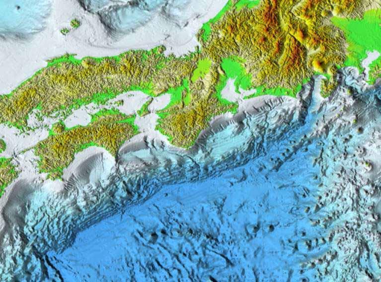
2 Study Area
3

4 Characteristics of large earthquakes along the Nankai trough 1. Strong ground motions in a large region 2. Tsunami damages in a large region 3. Groundwater level changes at hot springs *4. Crustal deformation (not always documented) Well Hot spring Subsidence Uplift Expansion
 Regional strong shaking 2) Regional large tsunami 3) Groundwater level changes")
5 Documented Oldest Nankai Trough Earthquake, 684 A.D. Documented only with about 100 characters in an official document ( Nihon Shoki ), But this information is sufficient to identify the event as a large subduction earthquake along Nankai trough since it describes three following key words: 1) Regional strong shaking 2) Regional large tsunami 3) Groundwater level changes
6 Large Earthquakes along the Nankai Trough
7 1944 and 1946 Events ( Tonankai and Nankai) Tide gage records at San Diego (Tanioka and Satake, 1993) Data from Kenji Satake
8 1854 Two Earthquakes (Ansei) 32 hours time difference Two tsunamis recorded at San Diego West East
9 1944 and 1946 events, 1/2 1/3 of 1854 events Recorded at San Diego, Filtered East West East West (Tanioka and Satake, 1993) (Kenji Satake)
10 1707 Earthquake (Hoei) Casualties 5,049 + (10,000 in Osaka?) Injured 1,430 Lost houses by tsunamis 18,025 Collapsed houses 59,272 Wrecked ships 3,915

11 1605 earthquake (Keicho) Only slight damage by strong ground motions Extensive tsunami damage over West Japan No Groundwater level change at hot springs What is the mechanism of 1605 earthquake? Is this really a Nankai trough earthquake? In 1603 Tokugawa Shogunate was established but the center of culture was still Kyoto.


12 1605 Tsunami Inundation Height (m) 10m m Adapted and modified from Ishibashi, m
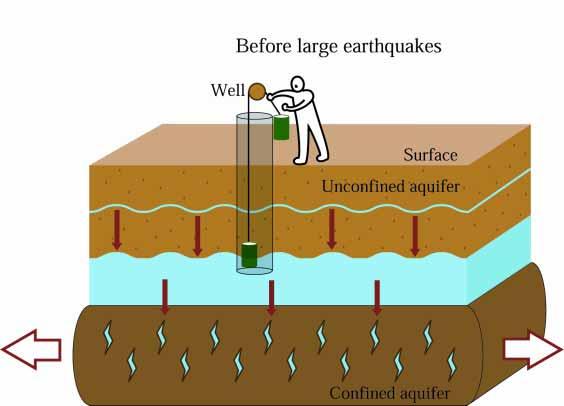
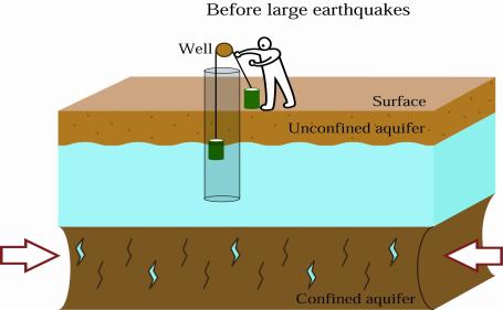
13 Groundwater level changes with 1946 Nankai Earthquake Extensive coseismic well water changes in water level, salinity and muddiness Extensive preseimic well water level changes Nankai earthquake


")
14 m 0 Well water levels at Dogo Spa after 1946 Earthquake From Kawabe (1982) Water Level (m) Dec Jan Feb


15 Summary of Changes in Groundwater after the 1946 Nankai Earthquake


16 Before earthquake After earthquake Fresh water Salty water mixed


17 Preseismic changes in groundwater Changes in groundwater started about a week before the earthquake Transition boundary


18 Legend A millionaire s well Paddy Well If a well is dried, one should store paddy in the well. Tsunami The paddy in the well makes him a millionaire.

19 Fault Model of the 1946 Nankai Earthquake Coseismic fault Preseismic fault

20 Dilatation Contraction Fault Depth 0 km

21 Dilatation Contraction Fault Depth 20 km

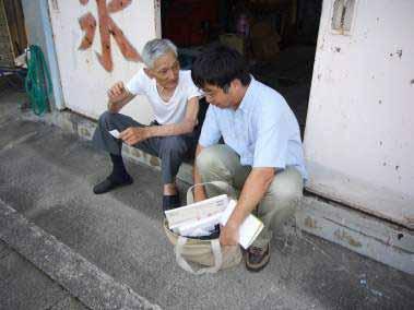
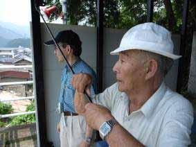
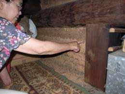
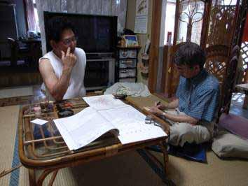
22 a Dilatation Contraction Fault Depth 30 km b
23 b Land Sea a Volumetric Change Dilatation Contraction B A Dislocation (cm) A 300 B 100 Depth B A


24 Coseismic Volumetric Change Water level changes at shallow wells can be noticed by eyes, when Dilatation > 2 x x L W U A: 130km 70km 4m 20 B: 150km 70km 3m 20 Modified from Ando(1981)

25 Preseismic slip Depth=20km, 1m
26 Preseismic Volumetric Change 5 x 10⁻⁶ W=30km, Depth=20km, U=1m

27 Groundwater level changes with 1944 Tonankai Earthquake No data has been systematically collected. Tonaankai earthquake

28 Data of the earthquake not taken properly due to severe censorship Only slight damage caused by the earthquake!, 8 Dec 1944


29 Noticed by world though concealed inside Japan New York Times, December 8, 1944, (the next day)

30 Fault model of 1944 Tonankai earthquake still controversial Kikuchi et al. (2003) Yamanaka (2006)

31 Interviews with local people, more than 60 years after the earthquake

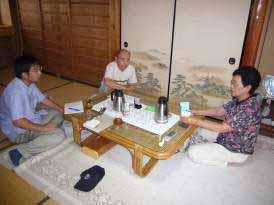
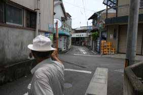
32 Interviews

33 Bubbles generated in the seawater was witnessed before the tsunami struck at Haeda. Gases in the soil squeezed into the seawater due to the surface loading by the tsunami?

34 Tsunami height

35 No well water level change and no retreat of sea water in Owase A man having a prior knowledge of tsunami, the well water level lowering before the tsunami, and the retreat of sea water preceding the tsunami wave, checked for both the wells and seawater levels immediately after the shaking, but could not find either of the phenomena. Thus, he decided to stay. Unfortunately, the tsunami inundated the area and he was killed. Owase city 1000m Kojiroy et al. (2007) Photo taken by a U.S. combat plane 3 days after the earthquake
36 Conclusions Postseismic volumetric changes > 1 x 10⁻⁶ is the lower limit for observable groundwater level changes in the case of The preseismic changes were possibly caused by slow slips on the fault at depths around 20 km in On the contrary, prior to the 1944 event no significant precursory and coseismic ground water change at the eastern part of Kii peninsula was not found, which could be another variety of precursory deformations, associated with subduction events.
Coseismic slip distribution of the 1946 Nankai earthquake and aseismic slips caused by the earthquake
 Earth Planets Space, 53, 235 241, 2001 Coseismic slip distribution of the 1946 Nankai earthquake and aseismic slips caused by the earthquake Yuichiro Tanioka 1 and Kenji Satake 2 1 Meteorological Research
Real time Monitoring System for Earthquakes and Tsunamis (DONET)
") Real time Monitoring System for Earthquakes and Tsunamis (DONET) NankaiTrough Yoshiyuki Kaneda Japan Agency for Marine-Earth Science and Technology (JAMSTEC) POGO@Seoul Presentation 1 Earthquakes in the
Real time Monitoring System for Earthquakes and Tsunamis (DONET) NankaiTrough Yoshiyuki Kaneda Japan Agency for Marine-Earth Science and Technology (JAMSTEC) POGO@Seoul Presentation 1 Earthquakes in the
Earthquakes and Tsunamis
 Earthquakes and Tsunamis Kenji Satake Earthquake Research Institute University of Tokyo 1 Part I 2011 Tohoku earthquake and tsunami 2 Fukushima Dai ichi NPP accident Earthquake ground motion Reactors automatically
Amplification of Tsunami Heights by Delayed Rupture of Great Earthquakes along the Nankai Trough
 Amplification of Tsunami Heights by Delayed Rupture of Great Earthquakes along the Nankai Trough Kentaro Imai 1,2, Kenji Satake 2 and Takashi Furumura 1,2 1 Center for Integrated Disaster Information Research,
Crustal deformation by the Southeast-off Kii Peninsula Earthquake
 Crustal deformation by the Southeast-off Kii Peninsula Earthquake 51 Crustal deformation by the Southeast-off Kii Peninsula Earthquake Tetsuro IMAKIIRE, Shinzaburo OZAWA, Hiroshi YARAI, Takuya NISHIMURA
Groundwater changes related to the 2011 Off the Pacific Coast of Tohoku Earthquake (M9.0)
") Groundwater changes related to the 2011 Off the Pacific Coast of Tohoku Earthquake (M9.0) Yuichi Kitagawa Senior Research Scientist, AIST, GSJ, Active Fault and Earthquake Research Cente Naoji Koizumi
Groundwater changes related to the 2011 Off the Pacific Coast of Tohoku Earthquake (M9.0) Yuichi Kitagawa Senior Research Scientist, AIST, GSJ, Active Fault and Earthquake Research Cente Naoji Koizumi
Slip distributions of the 1944 Tonankai and 1946 Nankai earthquakes including the horizontal movement effect on tsunami generation
 Slip distributions of the 1944 Tonankai and 1946 Nankai earthquakes including the horizontal movement effect on tsunami generation Toshitaka Baba Research Program for Plate Dynamics, Institute for Frontier
I point out two possible paradoxical difficulties in the important target of the IODP in subduction zones, i.e.,
 Drilling the Seismogenic Zone: Some Paradoxes Tetsuzo Seno Earthquake Research Institute, University of Tokyo (Bull. Earthq. Res. Inst., subumitted on January 16, 2003; accepted on July 22, 2003) Abstract
Damage of Sewage Plant by Tsunami
 Damage of Sewage Plant by Tsunami K. Fujima & Y. Shigihara National Defense Acadfemy, Japan SUMMARY: This work describes a damage assessment of a sewage plant in Shizuoka city by next Tokai earthquake
Numerical Tsunami Propagation of 1703 Kanto Earthquake
 Numerical Tsunami Propagation of 1703 Kanto Earthquake Wu Yifei Supervisor: Kenji Satake Introduction Near Tokyo Bay, the 1703 Genroku Kanto Earthquake is known to generate a tsunami which hit the nearby
Dense Ocean floor Network System for Earthquakes and Tsunamis DONET
 Dense Ocean floor Network System for Earthquakes and Tsunamis DONET Yoshiyuki Kaneda Japan Agency for Marine-Earth Science and Technology (JAMSTEC) ION 1 Earthquakes in the Nankai Trough Tokai Nankai Hyuga
RELATION BETWEEN RAYLEIGH WAVES AND UPLIFT OF THE SEABED DUE TO SEISMIC FAULTING
 13 th World Conference on Earthquake Engineering Vancouver, B.C., Canada August 1-6, 24 Paper No. 1359 RELATION BETWEEN RAYLEIGH WAVES AND UPLIFT OF THE SEABED DUE TO SEISMIC FAULTING Shusaku INOUE 1,
Title. Author(s)Heki, Kosuke. CitationScience, 332(6036): Issue Date Doc URL. Type. File Information. A Tale of Two Earthquakes
Heki, Kosuke. CitationScience, 332(6036): Issue Date Doc URL. Type. File Information. A Tale of Two Earthquakes") Title A Tale of Two Earthquakes Author(s)Heki, Kosuke CitationScience, 332(6036): 1390-1391 Issue Date 2011-06-17 Doc URL http://hdl.handle.net/2115/48524 Type article (author version) File Information
Title A Tale of Two Earthquakes Author(s)Heki, Kosuke CitationScience, 332(6036): 1390-1391 Issue Date 2011-06-17 Doc URL http://hdl.handle.net/2115/48524 Type article (author version) File Information
VALIDATION OF TSUNAMI INUNDATION MODELING FOR THE 2004 SUMATRA-ANDAMAN EARTHQUAKE FOR MAKING HAZARD MAPS IN PENANG AND LANGKAWI, MALAYSIA
 Synopses of Master Papers Bulletin of IISEE, 47, 11-16, 013 VALIDATION OF TSUNAMI INUNDATION MODELING FOR THE 004 SUMATRA-ANDAMAN EARTHQUAKE FOR MAKING HAZARD MAPS IN PENANG AND LANGKAWI, MALAYSIA Noor
Blank line 10 pt Keywords: Response Characteristics, Skyscraper, Tohoku-Oki earthquake, Natural operiod
 A Study on the Response Characteristics of a High-Rise Building Built on the Reclaimed Land along the Osaka Bay Yuta Akizuki Graduate School of Engineering, Kyoto University, Kyoto, Japan Blank Line 9
Real Time Monitoring System for Megathrust Earthquakes and Tsunamis - Cabled Network System and Buoy System in Japan -
 Real Time Monitoring System for Megathrust Earthquakes and Tsunamis - Cabled Network System and Buoy System in Japan - 1 Subduction zones around the world Haiti Italy Turkey Tohoku Sichuan Taiwan Sumatra
9.3. Earthquakes. Earthquakes at Divergent Boundaries
 9.3 Earthquakes Preview the headings on these two pages. What can you say about where earthquakes occur? As the plates that make up Earth s crust move, the rough edges lock together. Over time, pressure
Lessons from the 2004 Sumatra earthquake and the Asian tsunami
 Lessons from the 2004 Sumatra earthquake and the Asian tsunami Kenji Satake National Institute of Advanced Industrial Science and Technology Outline 1. The largest earthquake in the last 40 years 2. Tsunami
Source of the July 2006 West Java tsunami estimated from tide gauge records
 GEOPHYSICAL RESEARCH LETTERS, VOL. 33, L24317, doi:10.1029/2006gl028049, 2006 Source of the July 2006 West Java tsunami estimated from tide gauge records Yushiro Fujii 1 and Kenji Satake 2 Received 13
The Cascading Hazards from Cascadia s Earthquakes
 Tsunamis The Cascading Hazards from Cascadia s Earthquakes Earthquakes (Nisqually earthquake, Seattle, WA) Volcanoes (Mt St Helens eruption, WA) Joan Gomberg gomberg@usgs.gov Landslides (Oso landslide,
Chapter 2. Earthquake and Damage
 EDM Report on the Chi-Chi, Taiwan Earthquake of September 21, 1999 2.1 Earthquake Fault 2.1.1 Tectonic Background The island of Taiwan is located in the complex junction where the Eurasian and Philippine
REPORT ON THE TOHOKU AREA PASIFIC OFFSHORE EARTHQUAKE
 REPORT ON THE TOHOKU AREA PASIFIC OFFSHORE EARTHQUAKE GENERAL PERSPECTIVE The Highest Magnitude Ever Recorded The 2011 off the Pacific Coast of Tohoku Earthquake (hereafter, the 2011 Tohoku- Pacific Earthquake
Luca Guerrieri Valerio Comerci Eutizio Vittori
 Earthquake Environmental Effects induced by the 1908 December 28 th Messina earthquake: an in-situ contribute to the Messina supersite (GEO Task DI-09-01a Vulnerability Mapping and Risk Assessment Luca
Mechanism of tsunami generation,propagation and runup -sharing experiences with Japanese
 Mechanism of tsunami generation,propagation and runup -sharing experiences with Japanese Mechanism of tsunami generation Predicting the propagation, runup and inundation of tsunamis Near and far-field
Earthquakes. Building Earth s Surface, Part 2. Science 330 Summer What is an earthquake?
 Earthquakes Building Earth s Surface, Part 2 Science 330 Summer 2005 What is an earthquake? An earthquake is the vibration of Earth produced by the rapid release of energy Energy released radiates in all
Japan Agency for Marine-Earth Science and Technology (JAMSTEC), 2-15 Natsushima-cho, Yokosuka JAPAN
, 2-15 Natsushima-cho, Yokosuka JAPAN") Dense Ocean floor Network System for Mega Thrust Earthquakes & Tsunamis(DONET) -Towards Understanding Mega Thrust Earthquakes, the Geohazard & Disaster Mitigation- Yoshiyuki KANEDA, Katsuyoshi KAWAGUCHI,
Dense Ocean floor Network System for Mega Thrust Earthquakes & Tsunamis(DONET) -Towards Understanding Mega Thrust Earthquakes, the Geohazard & Disaster Mitigation- Yoshiyuki KANEDA, Katsuyoshi KAWAGUCHI,
Recurrence of Kanto Earthquakes Revealed from Tsunami Deposits in Miura peninsula
 Recurrence of Kanto Earthquakes Revealed from Tsunami Deposits in Miura peninsula Kunihiko Shimazaki 1,2, Kenji Satake 1*, Haeng Yoong Kim 1, Takeo Ishibe 1, Takashi Chiba 3 & Toshihiko Sugai 3 1 Earthquake
Before exploring the effects of the 1906 earthquake, watch the video on ground shaking and liquefaction at:
 Seismic Risk: Pre- Work Paper Maps Version Early on the morning of April 16, 1906, a magnitude 7.8 earthquake struck on the San Andreas Fault. The 1906 San Francisco earthquake revolutionized our understanding
Source modeling of hypothetical Tokai-Tonankai-Nankai, Japan, earthquake and strong ground motion simulation using the empirical Green s functions
 Source modeling of hypothetical Tokai-Tonankai-Nankai, Japan, earthquake and strong ground motion simulation using the empirical Green s functions Y. Ishii & K. Dan Ohsaki Research Institute, Inc., Tokyo
Earthquakes Earth, 9th edition, Chapter 11 Key Concepts What is an earthquake? Earthquake focus and epicenter What is an earthquake?
 1 2 3 4 5 6 7 8 9 10 Earthquakes Earth, 9 th edition, Chapter 11 Key Concepts Earthquake basics. "" and locating earthquakes.. Destruction resulting from earthquakes. Predicting earthquakes. Earthquakes
TSUNAMI DAMAGE SURVEY. Yoshinori Shigihara, National Defense Academy, Yokosuka, Japan
 TSUNAMI DAMAGE SURVEY Yoshinori Shigihara, National Defense Academy, Yokosuka, Japan About me Yoshinori Shigihara Assistant Professor Graduate school of Tohoku University (2001-2003) National Defense Academy
Mondo Quake in Pacific Northwest? By Leander Kahney
 Introduction to College Reading D Natural Disasters: Earthquake NAME I. Pre-reading. Discuss the following topics with other students at your table. What countries or regions of the world have earthquakes?
Three Fs of earthquakes: forces, faults, and friction. Slow accumulation and rapid release of elastic energy.
 Earthquake Machine Stick-slip: Elastic Rebound Theory Jerky motions on faults produce EQs Three Fs of earthquakes: forces, faults, and friction. Slow accumulation and rapid release of elastic energy. Three
Earthquakes Chapter 19
 Earthquakes Chapter 19 Does not contain complete lecture notes. What is an earthquake An earthquake is the vibration of Earth produced by the rapid release of energy Energy released radiates in all directions
Inversion of tsunami data. A. Sladen CNRS, Géoazur 1/35
 Inversion of tsunami data A. Sladen CNRS, Géoazur 1/35 DEFINITION Tsunami waves are gravity wave with a long period need a BIG source! 2/35 DEFINITION Krakatoa, 1883 Summer 2015, E.T. pers. comm. Lituya
Earthquakes. Earthquake Magnitudes 10/1/2013. Environmental Geology Chapter 8 Earthquakes and Related Phenomena
 Environmental Geology Chapter 8 Earthquakes and Related Phenomena Fall 2013 Northridge 1994 Kobe 1995 Mexico City 1985 China 2008 Earthquakes Earthquake Magnitudes Earthquake Magnitudes Richter Magnitude
The great earthquakes that have shaped Japan 日本に大きな影響を与えた地震
 The great earthquakes that have shaped Japan 日本に大きな影響を与えた地震 Brian Kennett, Research School of Earth Sciences, ANU Takashi Furumura Earthquake Research Institute, University of Tokyo Japan tectonic plates
Inversion Analysis of Historical Interplate Earthquakes Using Seismic Intensity Data
 Inversion Analysis of Historical Interplate Earthquakes Using Seismic Intensity Data Katsuhisa Kanda and Masayuki Takemura Kobori Research Complex, Kajima Corporation, Tokyo 107-8502, Japan Summary An
Natural Disasters Spring, LECTURE #8: Earthquake Disasters: Monitoring & Mitigation. Date: 1 Feb 2018 (lecturer: Dr.
 GEOL 0820 Ramsey Natural Disasters Spring, 2018 LECTURE #8: Earthquake Disasters: Monitoring & Mitigation Date: 1 Feb 2018 (lecturer: Dr. Shawn Wright) I. Exam I - Reminder Feb 6 th next class details:
Forecasting Future Earthquakes from Tsunami Deposits and Simulation
 Forecasting Future Earthquakes from Tsunami Deposits and Simulation Kenji Satake Earthquake Research Institute The University of Tokyo satake@eri.u-tokyo.ac.jp Contents 1. Earthquake Recurrence and Forecast
Earthquake Source. Kazuki Koketsu. Special Session: Great East Japan (Tohoku) Earthquake. Earthquake Research Institute, University of Tokyo
 Earthquake. Earthquake Research Institute, University of Tokyo") 2012/9/24 17:20-17:35 WCEE SS24.4 Special Session: Great East Japan (Tohoku) Earthquake Earthquake Source Kazuki Koketsu Earthquake Research Institute, University of Tokyo 1 Names and features of the earthquake
2012/9/24 17:20-17:35 WCEE SS24.4 Special Session: Great East Japan (Tohoku) Earthquake Earthquake Source Kazuki Koketsu Earthquake Research Institute, University of Tokyo 1 Names and features of the earthquake
Man-made Earthquakes. 2 June 16. Horst Rademacher HH Lect 4: Earthquakes in the US. Summer Session 2016
 2 June 16 Summer Session 2016 Horst Rademacher HH Lect 4: Earthquakes in the US Man-made Earthquakes http://seismo.berkeley.edu/~horst/summer2016.html Recap from last lecture I: Faults, Earthquakes and
Depth (Km) + u ( ξ,t) u = v pl. η= Pa s. Distance from Nankai Trough (Km) u(ξ,τ) dξdτ. w(x,t) = G L (x,t τ;ξ,0) t + u(ξ,t) u(ξ,t) = v pl
 + u ( ξ,t) u = v pl. η= Pa s. Distance from Nankai Trough (Km) u(ξ,τ) dξdτ. w(x,t) = G L (x,t τ;ξ,0) t + u(ξ,t) u(ξ,t) = v pl") Slip history during one earthquake cycle at the Nankai subduction zone, inferred from the inversion analysis of levelling data with a viscoelastic slip response function Mitsuhiro Matsu'ura, Akira Nishitani
Slip history during one earthquake cycle at the Nankai subduction zone, inferred from the inversion analysis of levelling data with a viscoelastic slip response function Mitsuhiro Matsu'ura, Akira Nishitani
REGIONAL CHARACTERISTICS OF STRESS FIELD AND ITS DYNAMICS IN AND AROUND THE NANKAI TROUGH, JAPAN
 46 4 2003 7 CHINESE JOURNAL OF GEOPHYSICS Vol. 46, No. 4 July, 2003 1 1 2 3 1, 100037 2, 920-1192 3, 237-0061,,, : -. (10 22 ), (60 85km) ; (40 ), (160km)..,. GPS,, -,,.,,,.. 0001-5733(2003) 04-0488 -
The Current Activities of the Headquarters for Earthquake Research Promotion Concerning Tonankai/Nankai Earthquakes
 The Current Activities of the Headquarters for Earthquake Research Promotion Concerning Tonankai/Nankai Earthquakes ISOGAI Keisuke Director of Earthquake Research Division, Research and Development Bureau,
Tsunami Simulation of 2009 Dusky Sound Earthquake in New Zealand
 Tsunami Simulation of 2009 Dusky Sound Earthquake in New Zealand Polina Berezina 1 Institute of Geology, Taras Shevchenko National University of Kyiv, Kyiv, Ukraine Supervisor: Prof. Kenji Satake Earthquake
Tsunami potential and modeling
 Tsunami potential and modeling GEORGE PRIEST OREGON DEPT. OF GEOLOGY AND MINERAL INDUSTRIES NEWPORT COASTAL FIELD OFFICE April 7, 2012 GeoPRISMS Cascadia Workshop, Portland, Oregon What creates most uncertainty
Cascadia Seismic Event Planning for the Maritime Community
 Cascadia Seismic Event Planning for the Maritime Community Jonathan Allan, Oregon Dept. of Geology and Mineral Industries Presentation to Annual Pacific Northwest Waterways Association Meeting (PNWA) October
Lecture Outline Wednesday-Monday April 18 23, 2018
 Lecture Outline Wednesday-Monday April 18 23, 2018 Questions? Lecture Final Exam Lecture Section 1 Friday May 4, 8:00-10:00am Lecture Section 2 Friday May 4, 3:10-5:10 pm Final Exam is 70% new material
Separating Tectonic, Magmatic, Hydrological, and Landslide Signals in GPS Measurements near Lake Tahoe, Nevada-California
 Separating Tectonic, Magmatic, Hydrological, and Landslide Signals in GPS Measurements near Lake Tahoe, Nevada-California Geoffrey Blewitt, Corné Kreemer, William C. Hammond, & Hans-Peter Plag NV Geodetic
Earthquakes and Earthquake Hazards Earth - Chapter 11 Stan Hatfield Southwestern Illinois College
 Earthquakes and Earthquake Hazards Earth - Chapter 11 Stan Hatfield Southwestern Illinois College What Is an Earthquake? An earthquake is the vibration of Earth, produced by the rapid release of energy.
Detection of Kuril subduction-zone earthquakes from remote historic records in Honshu, Japan, between 1656 and 1867
 ANNALS OF GEOPHYSICS, VOL. 47, N. 2/3, April/June 2004 Detection of Kuril subduction-zone earthquakes from remote historic records in Honshu, Japan, between 1656 and 1867 Kenji Satake Active Fault Research
Important Concepts. Earthquake hazards can be categorized as:
 Lecture 1 Page 1 Important Concepts Monday, August 17, 2009 1:05 PM Earthquake Engineering is a branch of Civil Engineering that requires expertise in geology, seismology, civil engineering and risk assessment.
Earthquake Risk in Canada and the National Building Code
 Earthquake Risk in Canada and the National Building Code Tuna Onur, Ph.D. Onur Seemann Consulting, Inc. NICC, Vancouver, BC, 28-30 September 2016 Southwestern Canada: Cascadia Subduction Zone + Crustal
Earthquakes and Earth s Interior
 - What are Earthquakes? Earthquakes and Earth s Interior - The shaking or trembling caused by the sudden release of energy - Usually associated with faulting or breaking of rocks - Continuing adjustment
Tsunami source of the 2004 off the Kii Peninsula earthquakes inferred from offshore tsunami and coastal tide gauges
 LETTER Earth Planets Space, 57, 173 178, 2005 Tsunami source of the 2004 off the Kii Peninsula earthquakes inferred from offshore tsunami and coastal tide gauges Kenji Satake 1, Toshitaka Baba 2, Kenji
Earthquake Hazards. Tsunami
 Earthquake Hazards Tsunami Review: What is an earthquake? Earthquake is the vibration (shaking) and/or displacement of the ground produced by the sudden release of energy. The point inside the Earth where
Read & Learn Earthquakes & Faults
 Read Earthquakes & Faults Read the provided article. Use the information in the reading to answer the questions on the task cards on your answer sheet. Make sure your answers are in the correct spot on
Earthquake hazards. Aims 1. To know how hazards are classified 2. To be able to explain how the hazards occur 3. To be able to rank order hazards
 Earthquake hazards Aims 1. To know how hazards are classified 2. To be able to explain how the hazards occur 3. To be able to rank order hazards Types of hazard Primary A direct result of the earthquake
Chapter 4 Earthquakes and Tsunamis
 Geology of the Hawaiian Islands Class 21 30 March 2004 100 100 100 96 A B C D F Exam Scores 95 94 94 90 85 83 83 83 Mean 72 67 61 59 59 55 54 41 Mean = 78.5 Median = 83 Any Questions? Chapter 4 Earthquakes
Chapter 4 Earthquakes and Tsunamis. Geology of the Hawaiian Islands. Any Questions? Class March Mean = 78.
 Geology of the Hawaiian Islands Class 21 30 March 2004 Any Questions? 100 100 100 96 A B C D F Exam Scores 95 94 94 90 85 83 83 83 Mean 72 67 61 59 59 55 54 41 Mean = 78.5 Median = 83 Chapter 4 Earthquakes
New Seismic Activity Model of Large Earthquakes along Nankai Trough for Probabilistic Seismic Hazard Maps
 New Seismic Activity Model of Large Earthquakes along Nankai Trough for Probabilistic Seismic Hazard Maps Toshihiko Okumura (Shimizu Corp.) Hiroyuki Fujiwara (NIED) Plate Tectonics around Japan Pacific
AVERAGE AND VARIATION OF FOCAL MECHANISM AROUND TOHOKU SUBDUCTION ZONE
 13 th World Conference on Earthquake Engineering Vancouver, B.C., Canada August 1-6, 24 Paper No. 414 AVERAGE AND VARIATION OF FOCAL MECHANISM AROUND TOHOKU SUBDUCTION ZONE Shunroku YAMAMOTO 1 Naohito
Wainui Beach Management Strategy (WBMS) Summary of Existing Documents. GNS Tsunami Reports
 Summary of Existing Documents. GNS Tsunami Reports") Wainui Beach Management Strategy (WBMS) Summary of Existing Documents GNS Tsunami Reports a) Review of Tsunami Hazard and Risk in New Zealand ( National Risk Report ) b) Review of New Zealand s Preparedness
Wainui Beach Management Strategy (WBMS) Summary of Existing Documents GNS Tsunami Reports a) Review of Tsunami Hazard and Risk in New Zealand ( National Risk Report ) b) Review of New Zealand s Preparedness
What Are Disasters? The Rescue Kids Trio!
 The Rescue Kids Trio! What Are Disasters? This manual was made possible through funding by the Council of Local Authorities for International Relations. Disasters and emergency preparedness Emergency preparedness
Electrical Conductivity Structures around Seismically Locked Regions
 Electrical Conductivity Structures around Seismically Locked Regions Tada-nori Goto Program for Deep Sea Research, IFREE, Japan Agency for Marine-Earth Science and Technology 1. Introduction Existence
Earthquakes & Volcanoes
 Earthquakes & Volcanoes Geology - the study of solid Earth, the rocks of which it is composed, and the processes by which they change geo = Earth; ology = study of Earth s Layers Plate Tectonics - the
(Somerville, et al., 1999) 2 (, 2001) Das and Kostrov (1986) (2002) Das and Kostrov (1986) (Fukushima and Tanaka, 1990) (, 1999) (2002) ( ) (1995
 2 (, 2001) Das and Kostrov (1986) (2002) Das and Kostrov (1986) (Fukushima and Tanaka, 1990) (, 1999) (2002) ( ) (1995") ( ) 1995 ( ) (Somerville, et al., 1999) 2 (, 2001) (2001) Das and Kostrov (1986) (2002) Das and Kostrov (1986) GPS ) (Fukushima and Tanaka, 1990) (, 1999) (2002) ( ) (1995 1 (outer fault parameter) (inner
( ) 1995 ( ) (Somerville, et al., 1999) 2 (, 2001) (2001) Das and Kostrov (1986) (2002) Das and Kostrov (1986) GPS ) (Fukushima and Tanaka, 1990) (, 1999) (2002) ( ) (1995 1 (outer fault parameter) (inner
Splay fault and megathrust earthquake slip in the Nankai Trough
 Earth Planets Space, 53, 243 248, 2001 Splay fault and megathrust earthquake slip in the Nankai Trough Phil R. Cummins, Takane Hori, and Yoshiyuki Kaneda Frontier Research Program for Subduction Dynamics,
ANALYSIS OF EVACUATION BEHAVIORS IN DIFFERENT AREAS BEFORE AND AFTER THE GREAT EAST JAPAN EARTHQUAKE
 Fifth International Conference on Geotechnique, Construction Materials and Environment, Osaka, Japan, Nov. 16-18, 2015, ISBN: 978-4-9905958-4-5 C3051 ANALYSIS OF EVACUATION BEHAVIORS IN DIFFERENT AREAS
Differentiating earthquake tsunamis from other sources; how do we tell the difference?
 Differentiating earthquake tsunamis from other sources; how do we tell the difference? David Tappin (1), Stephan Grilli (2), Jeffrey Harris (2), Timothy Masterlark (3), James Kirby (4), Fengyan Shi Shi
Name Date Class. radiate in all directions, carrying some of the. of plate boundaries have different usual patterns of.
 Chapter Outline Earthquakes CHAPTER 6 Lesson 1: Earthquakes and Plate Boundaries A. What is an earthquake? 1. A(n) is the rupture and sudden movement of rocks along a fault. A fault is a fracture surface
with tsunami simulation Author(s) Shishikura, Masanobu; Sawai, Y.; Na Symposium on Backwards Problem in G
 Shishikura, Masanobu; Sawai, Y.; Na Symposium on Backwards Problem in G") Reconstruction of the 869 Jogan Ear Titlethe 2011 Tohoku earthquake, by geol with tsunami simulation Author(s) Shishikura, Masanobu; Sawai, Y.; Na Proceeding of TC302 Symposium Osaka Citation Symposium
Reconstruction of the 869 Jogan Ear Titlethe 2011 Tohoku earthquake, by geol with tsunami simulation Author(s) Shishikura, Masanobu; Sawai, Y.; Na Proceeding of TC302 Symposium Osaka Citation Symposium
Dr. ELIAS A., International Day for Disaster Risk Reduction, AUB - 15 Oct 2012
 3/3/14 Dr. Ata ELIAS, Geology department AUB Outline 1. Tsunami events: 2. The physical and geological tsunami event 3. Global tsunami mitigation efforts Tsunami hazard 1. The tsunami hazard in the Mediterranean
Magnitude 7.0 PAPUA, INDONESIA
 A 7.0 magnitude earthquake struck eastern Indonesia's mountainous West Papua province on Saturday but there were no immediate reports of casualties or damage. The region is sparsely populated. According
Earthquake Hazards. Tsunami
 Earthquake Hazards Tsunami Measuring Earthquakes Two measurements that describe the power or strength of an earthquake are: Intensity a measure of the degree of earthquake shaking at a given locale based
Preparation for Future Earthquake and Tsunami Hazards: Lessons Learned from the 2004 Sumatra-Andaman Earthquake and the Asian Tsunami
 First International Conference of Aceh and Indian Ocean Studies Organized by Asia Research Institute, National University of Singapore & Rehabilitation and Construction Executing Agency for Aceh and Nias
Earthquake Hazards. Tsunami
 Earthquake Hazards Tsunami Review: What is an earthquake? Earthquake is the vibration (shaking) and/or displacement of the ground produced by the sudden release of energy. The point inside the Earth where
Active Faults along Japan Trench and Source Faults of Large Earthquakes
 Proceedings of the International Symposium on Engineering Lessons Learned from the 2011 Great East Japan Earthquake, March 1-4, 2012, Tokyo, Japan Active Faults along Japan Trench and Source Faults of
Depth-dependent slip regime on the plate interface revealed from slow earthquake activities in the Nankai subduction zone
 2010/10/11-14 Earthscope Workshop Depth-dependent slip regime on the plate interface revealed from slow earthquake activities in the Nankai subduction zone Kazushige Obara, ERI, Univ. Tokyo Recurrence
Magnitude 7.5 PALU, INDONESIA
 A magnitude 7.5 earthquake occurred 80.8 km (50.2 mi) north of Palu, Indonesia at a depth of 10 km (6.2 miles). This earthquake triggered a tsunami with wave heights up to 2 m (6.6 ft) that an official
Interviewing insights regarding the high fatality rate inflicted by the
 AIST 2012.2.23 Interviewing insights regarding the high fatality rate inflicted by the 2011 Tohoku earthquake a Masataka Ando, b Mizuho Ishida, c Yoshinari Hayashi d Chiharu Mizuki and e Yuka Nishikawa
ACTIVITIES OF THE HEADQUARTERS FOR EARTHQUAKE RESEARCH PROMOTION
 Journal of Japan Association for Earthquake Engineering, Vol.4, No.3 (Special Issue), 2004 ACTIVITIES OF THE HEADQUARTERS FOR EARTHQUAKE RESEARCH PROMOTION Sadanori HIGASHI 1 1 Member of JAEE, Earthquake
22.5 Earthquakes. The tsunami triggered by the 2004 Sumatra earthquake caused extensive damage to coastal areas in Southeast Asia.
 The tsunami triggered by the 2004 Sumatra earthquake caused extensive damage to coastal areas in Southeast Asia. An earthquake is a movement of Earth s lithosphere that occurs when rocks in the lithosphere
ESTIMATES OF HORIZONTAL DISPLACEMENTS ASSOCIATED WITH THE 1999 TAIWAN EARTHQUAKE
 ESTIMATES OF HORIZONTAL DISPLACEMENTS ASSOCIATED WITH THE 1999 TAIWAN EARTHQUAKE C. C. Chang Department of Surveying and Mapping Engineering Chung Cheng Institute of Technology, Taiwan, ROC ABSTRACT A
A MODEL OF PLATE CONVERGENCE IN SOUTHWEST JAPAN, INFERRED FROM LEVELING DATA ASSOCIATED WITH THE 1946 NANKAIDO EARTHQUAKE
 J. Ph_vs. Earth, 35, 449-467, 1987 A MODEL OF PLATE CONVERGENCE IN SOUTHWEST JAPAN, INFERRED FROM LEVELING DATA ASSOCIATED WITH THE 1946 NANKAIDO EARTHQUAKE Kaoru MIYASHITA Department of Earth Sciences,
NUMERICAL SIMULATION OF TSUNAMI PROPAGATION AND INUNDATION ALONG THE RAKHINE COAST AREAS IN MYANMAR
 NUMERICAL SIMULATION OF TSUNAMI PROPAGATION AND INUNDATION ALONG THE RAKHINE COAST AREAS IN MYANMAR Su Hninn Htwe Supervisor: Bunichiro SHIBAZAKI MEE12619 Yushiro FUJII ABSTRACT This study aimed to assess
SOURCE MODELING OF SUBDUCTION-ZONE EARTHQUAKES AND LONG-PERIOD GROUND MOTION VALIDATION IN THE TOKYO METROPOLITAN AREA
 SOURCE MODELING OF SUBDUCTION-ZONE EARTHQUAKES AND LONG-PERIOD GROUND MOTION VALIDATION IN THE TOKYO METROPOLITAN AREA ABSTRACT : Hiroe Miyake 1, Kazuki Koketsu 2, and Takashi Furumura 3,2 1 Assistant
DEVASTATING DAMAGE DUE TO THE 2004 INDIAN OCEAN TSUNAMI AND ITS LESSONS
 DEVASTATING DAMAGE DUE TO THE 2004 INDIAN OCEAN TSUNAMI AND ITS LESSONS Fumihiko Imamura 1 1 Professor, Tsunami Engineering, Disaster Control Research Center, Tohoku University, Japan Email: imamura@tsunami2.civil.tohoku.ac.jp
1.3 Short Review: Preliminary results and observations of the December 2004 Great Sumatra Earthquake Kenji Hirata
 1.3 Short Review: Preliminary results and observations of the December 2004 Great Sumatra Earthquake Kenji Hirata We give a brief review about observations and preliminary results regarding the 2004 great
FOCAL MECHANISMS OF SUBDUCTION ZONE EARTHQUAKES ALONG THE JAVA TRENCH: PRELIMINARY STUDY FOR THE PSHA FOR YOGYAKARTA REGION, INDONESIA
 FOCAL MECHANISMS OF SUBDUCTION ZONE EARTHQUAKES ALONG THE JAVA TRENCH: PRELIMINARY STUDY FOR THE PSHA FOR YOGYAKARTA REGION, INDONESIA Myo Thant 1, Hiroshi Kawase 2, Subagyo Pramumijoyo 3, Heru Hendrayana
Intermediate-term precursors of great subduction zone earthquakes: An application for predicting the Tokai earthquake
 Earth Planets Space, 56, 621 633, 24 Intermediate-term precursors of great subduction zone earthquakes: An application for predicting the Tokai earthquake Tetsuzo Seno Earthquake Research Institute, University
6. TSUNAMI 6.1 POST TSUNAMI SURVEY
 The June 23, 2001, Atico Earthquake, Peru 6. TSUNAMI One of the most spectacular aspects of this earthquake was damage directly inflicted by a tsunami. This chapter describes the destructions caused by
Seismic vulnerability in Latinamerica Speaker: Rafael Osiris de León Sciences Academy of Dominican Republic.
 Seismic vulnerability in Latinamerica Speaker: Rafael Osiris de León Sciences Academy of Dominican Republic. IANAS GENERAL ASSEMBLY Punta Cana, 16-20 July, 2013 TECTONIC PLATES AND EARTHQUAKES Pacific
Earthquake prediction. Earthquake prediction: animals?
 Earthquake prediction Prediction: specifies that an earthquake of a specific magnitude will occur in a defined region during a particular period: There will be a M 7 or larger earthquake in southern California
Historical Maximum Seismic Intensity Maps in Japan from 1586 to 2004: Construction of Database and Application. Masatoshi MIYAZAWA* and Jim MORI
 Annuals of Disas. Prev. Res. Inst., Kyoto Univ., No. 4C, 25 Historical Maximum Seismic Intensity Maps in Japan from 6 to 24: Construction of Database and Application Masatoshi MIYAZAWA* and Jim MORI *
Abdul Muhari 1, Fumihiko Imamura 2, Taro Arikawa 3, and Bagus Afriyanto 1. Date; 15 October 2018
 Finding of the unexpected tsunami due to the strike-slip fault at central Sulawesi, Indonesia on 28 September 2018, from the preliminary field survey at Palu Abdul Muhari 1, Fumihiko Imamura 2, Taro Arikawa
2.3 Notes: Earthquake Damage Can Be Reduced
 2.3 Notes: Earthquake Damage Can Be Reduced Earthquakes can cause severe damage and loss of life Each year, there is about one earthquake with a magnitude of or higher-this is an extremely earthquake.
Earthquakes Physical Geology 2017 Part 1: Exploring Earthquake distributions. Home butto California Earthquakes: 1) 2) 3) above
 2) 3) above") Earthquakes Physical Geology 2017 Adapted from a lab by Jennifer Wenner This lab is designed to give you experience exploring seismicity associated with different plate boundaries. You will examine seismograms
Earthquakes Physical Geology 2017 Adapted from a lab by Jennifer Wenner This lab is designed to give you experience exploring seismicity associated with different plate boundaries. You will examine seismograms
Active Fault Observation and Research on Earthquake Potential in Taiwan. Chao-Chung Lin Central Geological Survey, Taiwan
 Active Fault Observation and Research on Earthquake Potential in Taiwan Chao-Chung Lin Central Geological Survey, Taiwan Outline Plate tectonic setting and historical earthquake disasters of Taiwan Geologic