Unit 1: Mapping and Astronomy
|
|
|
- Geraldine Norman
- 5 years ago
- Views:
Transcription
1 Unit 1: Mapping and Astronomy 1
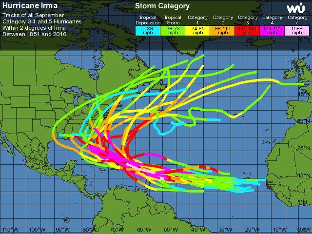
2 Do Now In your notebook, write your thoughts on the following: -What do you know about the beginning location and trajectory of the most recent hurricanes (Harvey or Irma)? -In general, at what point should we be concerned about a hurricane in our area? 2
3 Daily Goal Today we will learn to read coordinate points on a map. Major Questions - What do lines of longitude measure? -What do lines of longitude measure? -How do I find and read a coordinate point on a map? 3
4 What do you know about maps? In your groups, discuss what you know about the following words: Longitude Latitude Hemispheres Equator Prime Meridian 4
5 Latitude These are horizontal lines, along the X-axis. Latitude is the distance in o North or o South of the equator Highlight the Equator: 5
6 Longitude These are vertical lines, along the Y axis. Longitude is the distance in o East or o West of the Prime Meridian Highlight the Prime Meridian: 6
7 Hemispheres The earth is divided into halves, or hemispheres by the equator and Prime Meridian Label the N, S, E, and W hemispheres: 7
8 Absolute Location Where the latitude and longitude lines come together 8
 Longitude: vertical lines on y-axis; oe and ow of Prime Meridian (on PM= 0o) Hemisphere: N, S, E, and W; divided by eq. and P.M.; origin = (0,0) where eq. and P.M. cross Absolute Location: lat and long points 9")
9 Notebook Check How do your notes look? Have you been copying only the most important facts? Don t waste time writing every word! Latitude: horizontal lines on x-axis; on and os of equator (on eq.=0o) Longitude: vertical lines on y-axis; oe and ow of Prime Meridian (on PM= 0o) Hemisphere: N, S, E, and W; divided by eq. and P.M.; origin = (0,0) where eq. and P.M. cross Absolute Location: lat and long points 9
10 How to find Absolute Location 1. First, see if the location is north (N) or south (S) of the equator. 2. Next, count to see how many degrees (lines) the point is from the equator. 3. Then, determine whether it is east (E) or west (W) of the Prime Meridian. 4. Finally, count to see how many lines, or degrees, east or west of the Prime Meridian the point is. 10

11 Where do we want to go? 11
12 o Can we find 20 N? 12
13 o Can we find 50 E? 13
14 o o Can we find 20 N, 50 E? 14
15 o o Can we find 60 S, 100 W? 15
16 o o Can YOU find 35 N 80 W? 16
17 Mapping Latitude and Longitude (Day 2) September 7,

18 Why Do We Care? 18
19 What does the distance between the lines represent? Each degree of latitude or longitude = 69 miles (111 km) That about the distance of a round trip drive to Rock Hill, SC Each degree of latitude and longitude is divided into minutes (') and seconds ("). There are 60 minutes in each degree. For example, Hawthorne Academy is located at : 35 20'11.4"N, 80 47'34.1"W 19
20 Minutes and Seconds 20
21 Absolute Location Investigation With your group complete the Absolute Location Investigation to figure out where the robber went with the maps! The first letter of each place you find will spell out the city where the robber took the maps! 1st Place: 4 bonus pts 2nd Place: 3 bonus pts.. 21
22 Mapping Contour Lines September 8,

23 Do Now Study the map below. What do you think the color codes represent? In other words, what is the difference between a place that is colored red vs a place that is colored blue or green?? 23
24 OBJECTIVE Students will interpret and understand topographic maps. 24
25 What observations can you make about this picture? 25

26 TOPOGRAPHIC MAPS A 2D way of showing 3D image of Earth s elevations 26

27 ELEVATION Elevation is how high something is above sea level. 27
28 CONTOUR LINES Contour Line: a line drawn on a map that connects points of equal elevation - If you physically followed a contour line, elevation would remain constant 28
29 CONTOUR LINES Contour Line 29
30 30
31 CONTOUR INTERVAL Contour Interval: how much the elevation increases To calculate: subtract the lower elevation from the higher elevation. 31
32 CONTOUR INTERVAL What is the Contour Interval? ( ) 32
33 RELIEF Relief: variations (differences) in elevation DIFFERENCE = RELIEF 33
34 RELIEF To calculate Relief: higher elevation lower elevation What is the relief between ? 34
35 35


36 SLOPE Slope: the incline or steepness of a hill. 36


37 Contour lines are closer together Slope is Steep Contour lines are farther apart Slope is gentle 37

38 SLOPE Slope: the incline or steepness of a hill. Contour lines are closer together Contour lines are farther apart

39 SLOPE Slope: the incline or steepness of a hill.
 with the correct depiction")
40 Exit Ticket 1. Match the Topographic Map (1,2,3 ) with the correct depiction (A, B, C ) 2. Which would you rather hike? Why? 40
Name Class Date. For each pair of terms, explain how the meanings of the terms differ.
 Skills Worksheet Chapter Review USING KEY TERMS For each pair of terms, explain how the meanings of the terms differ. 1. true north and magnetic north 2. latitude and longitude 3. equator and prime meridian
Practice Packet Topic 2: Measuring Earth
 Practice Packet Topic 2: Measuring Earth Vocabulary: Lesson 1: Lesson 2: Name: Lesson 3: Mini Lesson: Latitude Longitude Pre-Test 1. To locate exact places on the earth, one must look at a. The intersecting
Laboratory Exercise #2 Introduction to Quadrangle Maps
 page - 1 Laboratory Exercise #2 Introduction to Quadrangle Maps A. Introduction to Quadrangle Maps The United States Geological Survey has developed a nationwide series of quadrangle maps that cover small
Latitude and Longitude
 U n i t 3 M a p p i n g P a g e 1 Latitude and Longitude Note: These coordinates are always expressed LATITUDE/LONGITUDE!!! Coordinate System: Using and to find your position on Earth. LATITUDE LATITUDE
Laboratory Exercise #2 Introduction to Quadrangle Maps
 page - Laboratory Exercise #2 Introduction to Quadrangle Maps A. Introduction to Quadrangle Maps The United States Geological Survey has developed a nationwide series of quadrangle maps that cover small
Mapping Earth. How are Earth s surface features measured and modeled?
 Name Mapping Earth How are Earth s surface features measured and modeled? Before You Read Before you read the chapter, think about what you know about maps Record your thoughts in the first column Pair
Earth Science Unit 1 Test
 Earth Science Unit 1 Test Multiple Choice Identify the choice that best completes the statement or answers the question. 1. The study of meteorology involves the study of a. climate. c. animals. b. outer
MAPPING THE EARTH HOW DO YOU FIND A LOCATION ON THE EARTH?
 MAPPING THE EARTH HOW DO YOU FIND A LOCATION ON THE EARTH? UNIT TOPICS TOPIC 1: LATITUDE & LONGITUDE TOPIC 2: FIELD MAPS TOPIC 3: TOPOGRAPHIC MAPS TOPIC 4: NYS LANDSCAPES TOPIC 1: LATITUDE & LONGITUDE
Regents Earth Science Unit 1 Earth Dimensions
 Regents Earth Science Unit 1 Earth Dimensions www. BarnesWeb.org 2014-15 edition Name: Name: OBJECTIVES Correctly define: isolines, gradient, topographic map, contour interval, hachured lines, profile,
What is a map? A Map is a two or three-dimensional model or representation of the Earth s surface. 2-Dimensional map
 What is a map? A Map is a two or three-dimensional model or representation of the Earth s surface. 2-Dimensional map What is a Map Projection? Planar Projection Projection A Projection is a mathematical
Class Notes: Mapping the Earth
 Name: Date: Period: Mapping the Earth The Physical Setting: Earth Science Class Notes: Mapping the Earth I. Latitude and Longitude Map -! Latitude -! Also called These lines intersect Equator -! The North
Topographic Maps and Profiles
 Name: Date: Period: Earth Science Foundations The Physical Setting: Earth Science CLASS NOTES! Topographic Maps [contour maps] -! Topographic maps show three-dimensional shapes in two dimensions Elevation
Topographic Map Series:
 DEFINITION OF A MAP A MAP IS A GEOGRAPHIC PREPRESENTATION OF A PORTION OF THE EARTH S SURFACE DRAWN TO SCALE, AS SEEN FROM ABOVE. IT S USES COLORS, SYMBOLS AND LABELS TO REPRESENT FEATURES FOUND ON THE
Using Map and Compass Together
 Using Map and Compass Together In situations where you foresee a potential evacuation on foot, where there are no roads, and no indication as to the direction of travel (i.e., road signs), it is recommended
Earth Science Regents Reading Topographic Maps
 Earth Science Regents Reading Topographic Maps Name Period Quick Tutorial on Degrees, Minutes, and Seconds of Latitude and Longitude A degree of latitude on the surface of the earth is about 70 miles long.
Latitude and Longitude Pre Test
 Name Date Latitude and Longitude Pre Test Multiple Choice Directions: For questions, 1 10 circle the answer that letter that best answers the question. Each question is worth 1 point each. 1. To locate
Homework - Topographic Maps and What They Mean - Standard Earth Science
 Name: Mr. Schwartz Earth Science Period: Date: /10 Homework - Topographic Maps and What They Mean - Standard Earth Science Read pages 46-47 and 53-56 in your text. Then, answer the questions. Don t forget
Chapter 3 Models of the Earth. 3.1 Finding Locations on the Earth. 3.1 Objectives
 Chapter 3 Models of the Earth 3.1 Finding Locations on the Earth 3.1 Objectives Explain latitude and longitude. How can latitude and longitude be used to find locations on Earth? How can a magnetic compass
APPENDIX A GLOSSARY. Appendix A.1
 APPENDIX A GLOSSARY Appendix A.1 Appendix A.2 Back Bearing A back bearing is measured from the object to your position. It is the exact opposite of a direct bearing. Base Line An imaginary line on the
Notes and Summary pages:
 Topographic Mapping 8.9C Interpret topographical maps and satellite views to identify land and erosional features and predict how these shapes may be reshaped by weathering ATL Skills: Communication taking
CHAPTER EXIT CHAPTER. Models of Earth. 3.1 Modeling the Planet. 3.2 Mapmaking and Technology. 3.3 Topographic Maps CHAPTER OUTLINE
 EXIT CHAPTER.1 Modeling the Planet.2 Mapmaking and Technology. Topographic Maps CHAPTER OUTLINE CHAPTER.1 Modeling the Planet A flat of Earth is a convenient tool, but it can distort the shape, distance,
Map Skills Lesson 1. Materials: maps, pencils, Lesson 1 Worksheet, strips of paper, grid paper
 Map Skills Lesson 1 Use cardinal directions, map grids, scales, and titles to locate places on a map. Interpret a map using information from its title, compass rose, scale, and legend. Vocabulary: map,
Chapter 3 SECTION 1 OBJECTIVES
 Chapter 3 SECTION 1 OBJECTIVES Distinguish between latitude and longitude and locate coordinates on maps. Explain how latitude and longitude can be used to locate places on Earth s surface. Explain the
Latitude and Longitude. Begin
 Latitude and Longitude Begin The Earth is divided in two halves, the top half is called the northern hemisphere, and the bottom half is called the southern hemisphere. The dividing line between the two
Date: UNI. world. *Dedicated to
 Name: Date: UNI IT THREE 2D and 3D model s of the natural world *Dedicated to Name: Date: ABSTRACT T AND RATIONALE A topographic map is a type of map that depicts the detail and quantitative representation
Mapping Earth Review Note Cards
 Review Note Cards Spheres of Earth Atmosphere- Layer of gases Hydrosphere- All liquid water Lithosphere- Solid surface Biosphere-Living Portion Cryosphere-Ice Portion Evidence that the Earth is Round The
UNIT 1C. USING TOPOGRAPHIC MAPS WHERE IN THE WORLD... ARE YOU?
 UNIT 1C. USING TOPOGRAPHIC MAPS WHERE IN THE WORLD... ARE YOU? TIME 60-90 minutes LEVEL All BENCHMARKS Next Generation Science Standards MS-LS1.D Science & Engineering Practices Developing and Using Models
Meridian Circle through Zenith, North Celestial Pole, Zenith Direction Straight Up from Observer. South Celestial Pole
 Chapter 3 How Earth and Sky Work- Effects of Latitude In chapters 3 and 4we will learn why our view of the heavens depends on our position on the Earth, the time of day, and the day of the year. We will
Introduction to Cartography Part I
 Introduction to Cartography Part I Introduction to Cartography Maps vs. Globes General Types of Maps Standard Map Features Maps versus Globes Map: a representation of the world, or part of it, in two dimensions
Earth and Space: Topographic Maps Satellite Images
 Earth and Space: Topographic Maps Satellite Images Earth and Space: Formative Assessment Activities for Earth and Space Topographic Maps Satellite Images Teacher Pages Purpose The purpose of this station
Do Now. Copy the ques:on below and write down an. Sketch a profile of the books on the front table.
 Do Now Copy the ques:on below and write down an answer Sketch a profile of the books on the front table. Measurements Contour Lines How do we represent Eleva:on on a flat piece of paper? Eleva?on height
Name Date Class. a. High elevation and high relief b. High elevation and level surface c. Flat land and low relief
 Exploring Earth s Surface (pp. 21 27) This section describes factors that determine the shape of Earth s land surface. The section also describes how scientists divide Earth into four spheres. Use Target
AS 410 Land Navigation. Chpt 4-1
 AS 410 Land Navigation Chpt 4-1 Overview Types of Maps Map Legends / Scales Latitude and Longitude Orienteering Why? Why important to learn how to read a compass and map? No cell phone coverage Mountain
EARTH SCIENCE KEY UNIT 2-H
 EARTH SCIENCE KEY UNIT 2-H UNIT 2 MODELS & DIMENSIONS OF EARTH I. Model = ANYTHING THAT REPRESENTS THE PROPERTIES OF AN OBJECT OR SYSTEM A. Types and examples of models: 1. PHYSICAL Provides us with information
Midterm Review #4 -FR
 Base your answers to questions 1 through 3 on the diagram below, which represents a north polar view of Earth on a specific day of the year. Solar times at selected longitude lines are shown. Letter A
Introduction to Geography
 Introduction to Geography ropic of Cancer 3½ N Arctic Circle 90 N Prime Meridian 0 Arctic Ocean Mississippi R. Appalachian Mts. Europe Rocky Mountains N. America Atlantic Gulf of Ocean Mexico Caribbean
Geology 101 Lab Worksheet: Topographic Maps
 Geology 101 Lab Worksheet: Topographic Maps Name: Refer to the Topographic Maps Lab for the information you need to complete this worksheet (http://commons.wvc.edu/rdawes/g101ocl/labs/topomapslab.html).
7a LATITUDE LONGITUDE.notebook. September 19, 2017
 1 PANGEA Add a pangea link to here 2 There are 4 hemispheres Hemispheres are divided using the Equator (north and south) and Prime Meridian (west and east) 3 4 Northern Hemisphere Equator SOUTHERN OCEAN
B. Topographic maps are also called. contour maps
 Topographic Maps Introduction A. Topographic maps are essential tools in geologic and engineering studies because they show the configuration of Earth's surface in remarkable detail and permit one to measure
Topographic Maps Knowledge of Maps What are they? What are they used for? Why are they important?
 Topographic Maps Knowledge of Maps What are they? What are they used for? Why are they important? Topographic Maps Maps that show the change in elevation of land. Elevation is the height of land above
Earth Science: Chapter 2 Assessment
 Earth Science: Chapter 2 Assessment Do not write on this text booklet. Write the letter of the correct answer on your answer sheet. SECTION 1: Multiple Choice (50 points) Choose the letter of the BEST
World Time-Day Calculator Lab
 Background: Time zones around the Earth are bounded by imaginary lines called lines of longitude, or meridians. On a globe or map of the world, they are the lines that are perpendicular to the equator.
MAP STUDY: INTERPRETATION OF SURVEY MAPS
 MAP STUDY: INTERPRETATION OF SURVEY MAPS Types and Elements of Maps Maps are drawn to represent the Earth on a piece of paper. Maps are used widely to represent the Earth. Maps use signs and symbols in
Scientists observe the environment around them using their five senses.
 Earth Science Notes Topics 1: Observation and Measurement Topic 2: The Changing Environment Review book pages 1-38 Scientists observe the environment around them using their five senses. When scientists
Unit I: Earth Dimensions. Review Book pp.19-30
 Unit I: Earth Dimensions Review Book pp.19-30 Objective #1 Describe the actual shape of the Earth and explain 3 pieces of evidence for its actual shape. Earth s Shape The Earth appears to be the shape
Different types of maps and how to read them.
 Different types of maps and how to read them. A map is a picture or representation of the Earth's surface, showing how things are related to each other by distance, direction, and size. Maps have been
Introduction to Geography
 Introduction to Geography What is geography? Geography comes from the Greek word Geographia. Geo means earth and graphia means to describe or chart. Geographers study the earth in relation to space and
Topographic Maps and Landforms Geology Lab
 Topographic Maps and Landforms Geology Lab Ray Rector: Instructor Today s Lab Activities 1) Discussion of Last Week s Lab 2) Lecture on Topo Maps and Elevation Contours 3) Construct Topographic Maps and
EROSIONAL FEATURES. reflect
 reflect Have you ever looked at the land around you and wondered what processes shaped what you see? Perhaps you see mountains, valleys, rivers, or canyons. Do you know how long these geologic features
Geography Can Be Cool. Seriously
 Geography Can Be Cool Seriously Why does geography matter? Geography: the study of looking at every aspect of the Earth s systems, such as human economies, societies, cultures, plants, animals, & climate.
Module 2: Mapping Topic 2 Content: Determining Latitude and Longitude Notes
 Introduction In order to more easily locate points on a globe or map, cartographers designed a system of imaginary vertical lines (also called parallels) and horizontal lines (also called meridians) that
OBJECTIVES. Identify the means by which latitude and longitude were created and the science upon which they are based.
 Name: OBJECTIVES Correctly define: isolines, gradient, topographic map, contour interval, hachured lines, profile, latitude, longitude, hydrosphere, lithosphere, atmosphere, elevation, model EARTH S SPHERES
Erosional Features. What processes shaped this landscape?
 Have you ever looked at the land around you and wondered what processes shaped what you see? Perhaps you see mountains, valleys, rivers, or canyons. Do you know how long these geologic features have been
US History, Ms. Brown Need Help? or Call
 Name Course: US History/Ms. Brown Homeroom: 7th Grade US History Standard #7H102; 7H103 Do Now Day #6 Aims: SWBAT define and use essential geographic vocabulary such as hemisphere, equator, longitude,
Map Skills: Continents and Oceans. Map Skills: Continents and Oceans
 Map Skills: Continents and Oceans Our Earth is made up of continents and oceans. A continent is an enormous mass of land. There are seven continents on our planet. The continents include North America,
Maps. 3. Which altitude of Polaris could be observed in New York State?
 Name: Date: 1. For an observer in New York State, the altitude of Polaris is 43 above the northern horizon. This observer s latitude is closest to the latitude of A. New York City B. Utica 3. Which altitude
1. Identify the Earth motion that provides the basis for our system of local time and time zones.
 Base your answers to questions 1 through 4 on the map below and on your knowledge of Earth science. The map shows the four time zones and some latitude and longitude lines across the continental United
About places and/or important events Landmarks Maps How the land is, hills or flat or mountain range Connected to maps World Different countries
 What do you think you know about geography? About places and/or important events Landmarks Maps How the land is, hills or flat or mountain range Connected to maps World Different countries What do you
Earth s Time Zones. Time Zones In The United States
 Name: Mr. DeLeo Date: Period: Earth s Time Zones Goal: Students will understand why humans have developed time zones on Earth, and how to figure out time at different positions on Earth. Background: One
Geography 101: The Basics
 Geography 101: The Basics What is Geography? Geography is the study of the HUMAN and NON- HUMAN features of the Earth.! Geographers study where things are located why they are located in a specific place.!
King County Explorer Search and Rescue. Course B Map & Compass
 King County Explorer Search and Rescue Course B Map & Compass Disclaimer The intent of this presentation is to provide a basic overview of maps, compasses, and location finding. It is not meant to be a
Orienteering Maps & Map Reading Latitude and Longitude Scale
 Orienteering Maps & Map Reading A map is a two-dimensional representation of the three-dimensional world you'll be hiking in. All maps will have some basic features in common and map reading is all about
Elevations are in meters above mean sea level. Scale 1:2000
 12.001 LAB 7: TOPOGRAPHIC MAPS Due: Monday, April 11 PART I: CONTOURING AND PROFILES (20 PTS) 1. Contour this area map using a 5 meter contour interval. Remember some fundamental rules of contour lines,
FIND PLACES ON GLOBES USING LATITUDE
 GLOBES, MAPS & GRAPHS FIND PLACES ON GLOBES USING LATITUDE AND LONGITUDE LINES FIND PLACES ON MAPS USING A GRID SYSTEM NAME SEVERAL TYPES OF MAP PROJECTIONS AND EXPLAIN THEIR BENEFITS AND SHORTCOMINGS
The Magic School Bus on the Ocean Floor
 A Guide for Using The Magic School Bus on the Ocean Floor in the Classroom Based on the book written by Joanna Cole This guide written by Ruth M. Young, M.S. Ed. Teacher Created Resources, Inc. 6421 Industry
Lab Topographic Maps. Name: Partner: Purpose. Background Information
 Lab Topographic Maps Name: Partner: Purpose The purpose of this lab is to familiarize you with graphic representations of the Earth s surface primarily maps. Simple line maps show the spatial relationship
Latitude and Longitude
 Latitude and Longitude Finding Your Location on a Sphere Coordinate Systems n When you are locating a point on a flat surface you can use Cartesian coordinates of x and y. n The point 2, 3 is plotted on
CHAPTER 2 SKILL SHEET 2: CELESTIAL NAVIGATION
 CHAPTER 2 SKILL SHEET 2: CELESTIAL NAVIGATION Before the invention of GPS technology, how were people on ships far at sea, out of the sight of land, able to tell where they were? For thousands of years
Latitude and Longitude. Finding your location throughout the world!
 Latitude and Longitude Finding your location throughout the world! What is Latitude? Latitude is defined as a measurement of distance in degrees north and south of the equator The word latitude is derived
 Chapter 2 Mapping Our World Picture: Mount Capulin, Raton, NM Cinder Cone Volcano ://3.bp.blogspot.com/_sKz1KwXRzcg/SzFzM52gIoI/AAAAAAAAABk/hguBAT80pk0/s320/capulin.jpg http://www.peteandmelissa.com/images/oklahoma/p1020190.jpg
Complete the following: a. Lines of latitude are parallel to the equator. Name:
 Name: Date: Social Studies Introduction: Basic Geography Period: Latitude Latitude is defined as a measurement of distance in degrees north and south of the equator. The word latitude is derived from the
THE EARTH AND ITS REPRESENTATION
 UNIT 7 THE EARTH AND ITS REPRESENTATION TABLE OF CONTENTS 1 THE EARTH AND THE SOLAR SYSTEM... 2 2 THE EARTH S MOVEMENTS... 2 2.1 Rotation.... 2 2.2 The revolution of the Earth: seasons of the year....
MTH What is a Difference Quotient?
 MTH 111 - What is a Difference Quotient? Another way to think about the difference quotient is that it yields a new function that gives the average rate of change of the original function, for two points
7th Grade US History Standard #7H104 Do Now Day #10. Aims: SWBAT use (read) and/or create a map scale to measure distances on a map DO NOW
 and/or create a map scale to measure distances on a map DO NOW") Course: US History/Ms. Brown Homeroom: 7th Grade US History Standard #7H104 Do Now Day #10 Aims: SWBAT use (read) and/or create a map scale to measure distances on a map DO NOW Directions: Answer the following
Course: US History/Ms. Brown Homeroom: 7th Grade US History Standard #7H104 Do Now Day #10 Aims: SWBAT use (read) and/or create a map scale to measure distances on a map DO NOW Directions: Answer the following
Mapping Our World Chapter 2
 Mapping Our World Chapter 2 Section 2.1: Latitude and Longitude Maps are flat models of threedimensional objects. For thousands of years people have used maps to define borders and to find places. With
Maps: Geography s Basic Tools
 Maps: Geography s Basic Tools What is a map? - A map is a representation of the earth s features drawn on a flat surface. - Maps use points, lines, colours, and symbols to represent the features of an
Maps and Globes. By Kennedy s Korner
 Maps and Globes By Kennedy s Korner Map Key or Symbols Maps use symbols to show places and things on Earth. Symbols are drawings that stand for something real. A map key tells you what each symbol stands
1. Label a few examples of lines of latitude and lines of longitude on the globe above left.
 Oceanography 2 Location, Direction, and Distance on Nautical Charts Please read Appendix III in the textbook for reference. Learning Objectives for the first nautical chart Lab 1. Use the latitude-longitude
Latitude and Longitude, Plus Map Scale
 Name Lab 4 More Date: Latitude and Longitude, Plus Map Scale In the first few labs of the semester, you found that you needed to look at a variety of maps to answer all the questions. One reason you needed
ESS Spring Final Exam Review
 Name Period Date ESS Spring Final Exam Review Geology Vocabulary 1. The study of prehistoric life. 2. The geological theory that great effects require great causes. 3. Earth s history split up into different
Guidance to Instructors on Subject Delivery MAP READING. This is a suggested programme for the delivery of this subject.
 Programme of learning: Guidance to Instructors on Subject Delivery This is a suggested programme for the delivery of this subject. The main headings are the Learning Outcomes (LO1, LO2, etc), with sub
Unit 1 The Basics of Geography. Chapter 1 The Five Themes of Geography Page 5
 Unit 1 The Basics of Geography Chapter 1 The Five Themes of Geography Page 5 Geography comes from the Greek word geographia, which means to describe the earth. Geography is the study of the distribution
REVISION: MAPWORK 18 SEPTEMBER 2014
 REVISION: MAPWORK 18 SEPTEMBER 2014 Lesson Description In this lesson we revise: Various mapwork calculations Summary Relative Position Bearing is the angular (angle) distance between two points True Bearing
Guided Notes Topographic Maps
 Guided Notes Topographic Maps Map scale Straight line distance Curved line distance Rules of Isolines Contour Lines Hachured Lines Possible elevations Slope & Gradient Direction of River Flow Topographic
Lesson 26: Characterization of Parallel Lines
 Student Outcomes Students know that when a system of linear equations has no solution, i.e., no point of intersection of the lines, then the lines are parallel. Lesson Notes The discussion that begins
The. Astronomy is full of cycles. Like the day, the month, & the year In this section we will try to understand these cycles.
 Understanding The Sky Astronomy is full of cycles Like the day, the month, & the year In this section we will try to understand these cycles. For Example Why do we think of stars as nighttime objects?
Name: Date: Period: #: Chapter 1: Outline Notes What Does a Historian Do?
 Name: Date: Period: #: Chapter 1: Outline Notes What Does a Historian Do? Lesson 1.1 What is History? I. Why Study History? A. History is the study of the of the past. History considers both the way things
Compass Basics. Quick Map Basics Review For Compass Use
 Compass Basics Quick Map Basics Review For Compass Use A topographic map tells you where things are and how to get to them, whether you're hiking, biking, hunting, fishing, or just interested in the world
Introduction to Measurement Physics 114 Eyres
 1 Introduction to Measurement Physics 114 Eyres 6/5/2016 Module 1: Measurement 1 2 Significant Figures Count all non-zero digits Count zeros between non-zero digits Count zeros after the decimal if also
Map Reading: Grades 4 & 5
 Map Reading: Grades 4 & 5 Grades: 4,5 Team Size: 1-2 competitors Duration: 25 minutes Supervisors: Sriram Garapati, Rebecca Neill-Totsuka Summary Description Students will solve a mystery using different
What Is a Globe? Hemispheres. Main Idea Globes and maps provide different ways of showing features of the earth. Terms to Know
 r Main Idea Globes and maps provide different ways of showing features of the earth. Terms to Know hemisphere latitude longitude scale bar scale relief elevation contour line What Is a Globe? A globe is
Time, coordinates and how the Sun and Moon move in the sky
 Time, coordinates and how the Sun and Moon move in the sky Using the colors and magnitudes of quasars drawn from the SDSS Catalog Archive Server to distinguish quasars from stars using the light they emit
Chapter 1 Section 2. Land, Water, and Climate
 Chapter 1 Section 2 Land, Water, and Climate Vocabulary 1. Landforms- natural features of the Earth s land surface 2. Elevation- height above sea level 3. Relief- changes in height 4. Core- most inner
Where in the World? Plotting Latitude & Longitude
 Where in the World? Plotting Latitude & Longitude Background Because our planet is a sphere, we need two types of reference lines to locate positions on the Earth and to make accurate maps. These imaginary
LET S GO ON A ROAD TRIP
 Partner School News June 2016 In this issue: Education Children Around the World www.opportunityeducation.org Road Trip Start Writing Right Now Teaching Tip of the Month Focus on Schools LET S GO ON A
2 Mapping Earth Reading Essentials. 2. Contrast What is the difference between a map view and a profile view?
 Mapping Earth Maps What do you think? Read the three statements below and decide whether you agree or disagree with them. Place an A in the Before column if you agree with the statement or a D if you disagree.
The rock probably formed 200million years ago. The mineral sample is purple.
 Midterm Study Guide 1) Intro to Earth Science (Chapters 1& 2) a) Fact (observation) vs. Inference (assumption/hypothesis) Recognize whether a statement is a fact or an inference. For example: The rock
Unit 1 Test. Version A
 For each statement or question, write on your separate answer sheet the number of the word or expression that, of those given, best completes the statement or answers the question. Some questions may require
Cartography the art of making maps
 Cartography the art of making maps A map is a drawing or a picture of the earths surface, showing how things are related to each other by distance, direction and size. Maps are used for: Navigation Distance
Topographic Maps. Take Notes as you view the slides
 Topographic Maps Take Notes as you view the slides Lesson Objectives Define a topographic map and state its uses. Describe how contour lines show the elevations, shape, and slope of the land. Identify