LET S GO ON A ROAD TRIP
|
|
|
- Brendan Dalton
- 6 years ago
- Views:
Transcription

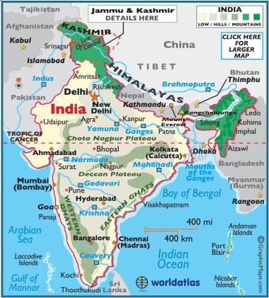
1 Partner School News June 2016 In this issue: Education Children Around the World Road Trip Start Writing Right Now Teaching Tip of the Month Focus on Schools LET S GO ON A ROAD TRIP In many schools it is a holiday break and it may be time for a family adventure! Whether your students and families stay close to home or travel to faraway places, it is fun for students to explore their community, country and world. In the United States, families may visit interesting cities, state and national parks, mountains, beaches and more. In African countries a visit to a national park may be a special trip and in India it may be a trip to a beach by the ocean. Traveling beyond our homes and communities gives us the opportunity to learn about new places, enjoy new experiences and discover our world. If travel is not possible for your students, they can learn about a place they would like to visit and dream of traveling there someday. Share with your students the following books from the OE Supplemental Library, as well as other books you have access to and encourage your students to travel through books. Grade 3 Science: Making a Map Grade 3 Reading: People and Places Children Around the World Different Places, Different Faces Children Just Like Me Grade 4 Science: Earth Secondary Social Studies World Civilizations Grade 6 Science Grasslands Forest Deserts Mountains Creative Arts Grade 5 Dance Around the World

2 Lesson Guide: 1. Review direction vocabulary a. North have students repeat the word and point up b. South have students repeat the word and point down c. East have students repeat the word and point right d. West have students repeat the word and point left e. Remind students of the phrase Never East Soggy Waffles (or another word they would recognize starts with a W) to remember the directions 2. Introduce vocabulary that will come up in the lesson: a. Longitude have students repeat the word and draw a line from their head to their toes emphasize LONG part of the word as they do this b. Latitude have students put their hands in a half circle in front of them as if they had a big, fat belly. Remind them that LAT and FAT rhyme, so they can think of this as Fat-itude c. Equator- have students repeat the word and trace a line around their waste/belt. d. Primer Meridian have students repeat the word and trace a line from their head to their toes e. International Dateline have students repeat the word and trace a line on a friend s back from their head to their feet Start Writing - Right Now What is a favorite place where your students have travelled? Ask them to write to their pen pal about their travel experiences. Ask them to use details to describe their trip and use drawings to illustrate. Where would your students like to visit someday? Ask them to research on this destination and plan a pretend trip. What would they take with them? Ask them to draw these things in a pretend suitcase What do they think they will see and do when they get there? Have them list these things in a daily itinerary. Ask them make a map of their road trip and draw pretend photos to share with their pen pals. Teaching Tip of the Month Let s Learn Social Studies Longitude and Latitude This lesson is planned for 4-7 grade students. In this lesson, students will: Learn vocabulary associated with maps and globes Identify lines of longitude and latitude Locate specific places on a map or globe Materials Needed: Inflatable globes Wipe-off markers
3 3. Tell students these words make up the lines on a globe or a map and help us find exact locations on a map or globe 4. Show the first part of the Gr. 5, Social Studies, Part 4-Longitude and Latitude video a. Make the hand gestures you practiced as the teacher goes through the vocabulary b. You can also pause the video to discuss each vocabulary term and write its definition on the board 5. After the video, have students blow up their mini globes. Then, review the following concepts with students: a. Why do we need lines of latitude and longitude? (to help us identify specific places on a globe or map) b. What are lines of longitude? (horizontal lines that go around the globe) c. What are lines of latitude? (vertical lines that go around the globe) d. What does it mean that lines of latitude are parallel? (they never touch) e. What is a degree? (how far apart each line is on the globe) f. For older students: What is a hemisphere? (a section of the Earth) How are they labeled? (N above the Equator, S below the Equator, E-right of the Prime Meridian, W left of the Prime Meridian) 6. Have students find the Equator a. Ask students if this is a line of longitude or latitude (latitude) b. Have students find and trace with their fingers the other lines of latitude to the north and south of the Equator c. Have students find the line of latitude that is 45º SOUTH of the equator have them think of lines of latitude like a ladder going up and down d. Ask students to identify the continents and oceans that are crossed by this line of latitude (S. America, Atlantic Ocean, Pacific Ocean, Indian Ocean) e. Have students find the line of latitude that is 60º NORTH of the equator. What is there? (Asia, Pacific Ocean, N. America, Atlantic Ocean, Europe) 7. Have students find the Prime Meridian, and International Date Line on their globes trace them with wipe-off markers if available a. Ask students if these are lines of latitude or longitude (longitude) b. Ask students if these lines are parallel why or why not? (no-they touch at the N and S pole) c. Ask students to trace with their fingers the other lines of longitude to the East and West of the Equator d. Have students find the line of longitude that is 20º EAST of the Prime Meridian. What is there? (Arctic Ocean, Europe, Atlantic Ocean, Mediterranean Sea, Africa, Antarctica) e. Have students find the line of longitude that is 60º WEST of the Prime Meridean. What is there? (Arctic Ocean, N. America, Atlantic Ocean, S. America, Antarctica) 8. For older students spend time talking about the 4 hemispheres 9. If time have students find specific placed on the map using a combination of lines of latitude and longitude a. Remind students that you always start your search at the Equator and the Prime Meridian b. Remind students that you then always measure N/S first, then E/W second On the following day, review the vocabulary using a globe to demonstrate the words and their definitions. Then watch Part 2 of the Longitude and Latitude video. For younger students give them specific lines of lat. and long. To find For older students have students work in pairs to find specific locations one student gives the lines of longitude and latitude and the other finds it. Then they switch roles. Some students can work with the map and/or atlas (or worksheets) while others use their globes. You can have the groups switch after some time has passed. For older students, have them identify the hemisphere the spot is located

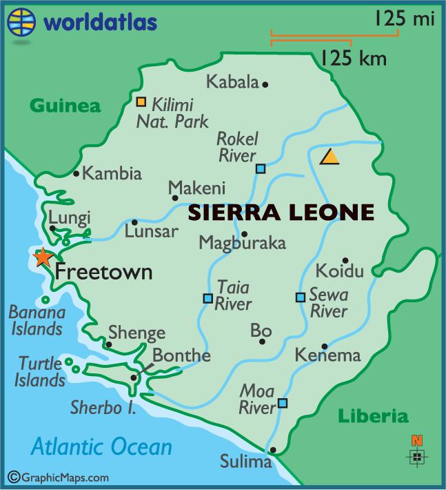
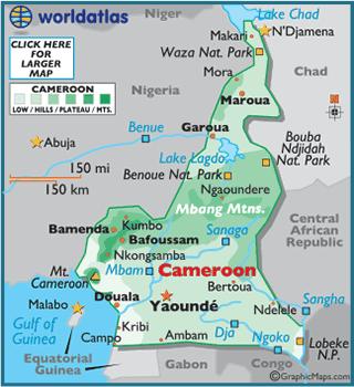
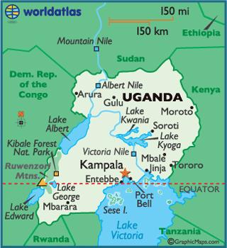
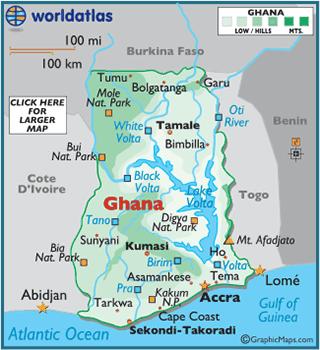
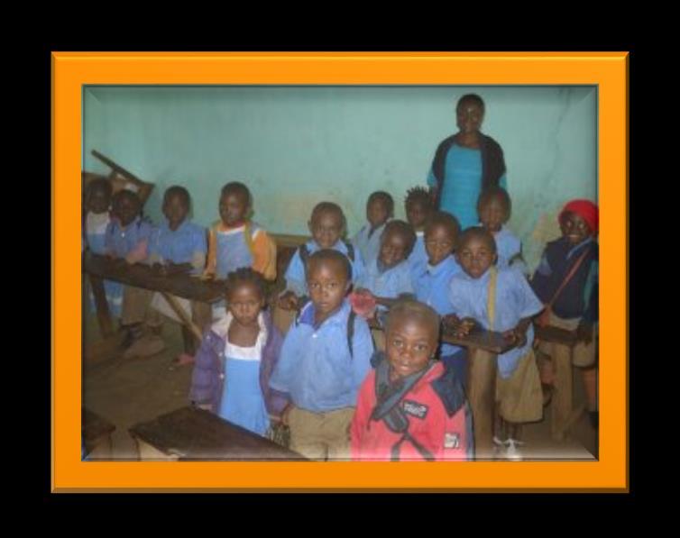
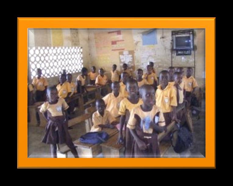
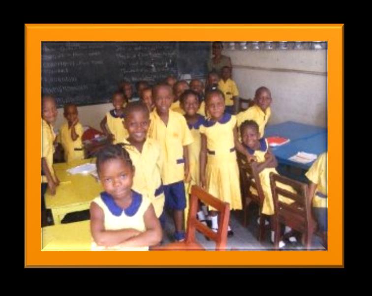
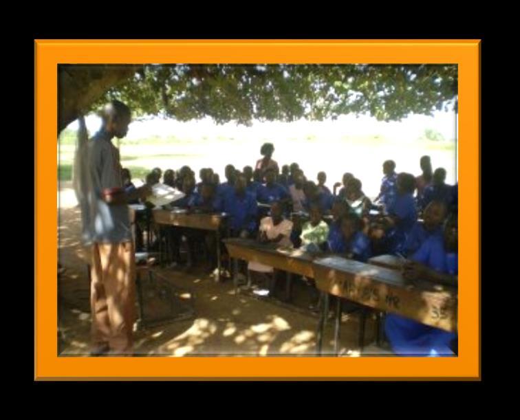
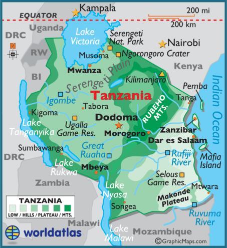
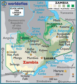
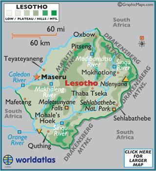
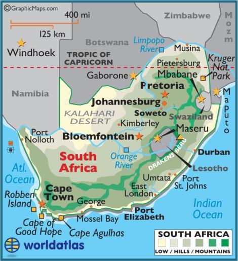
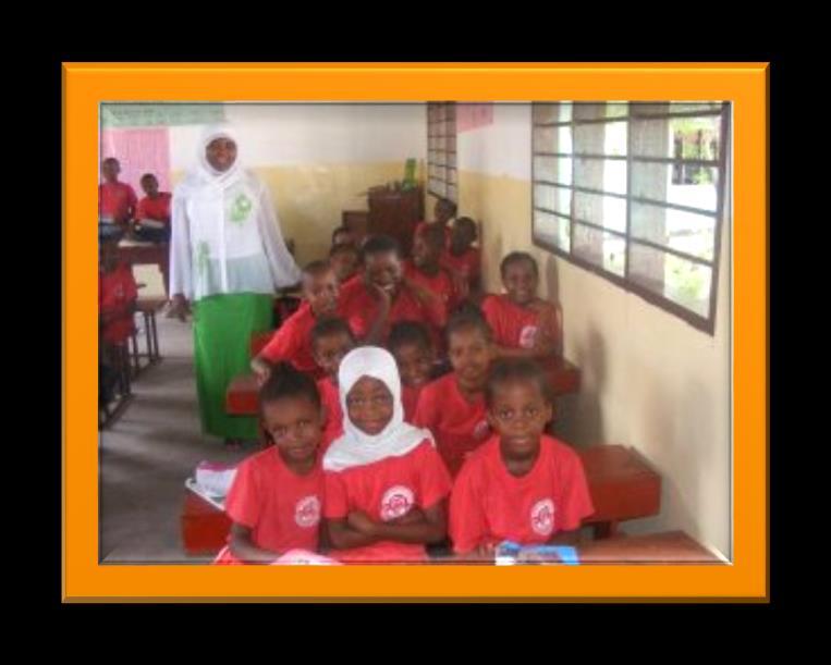
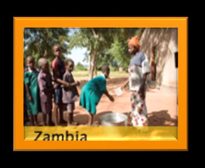
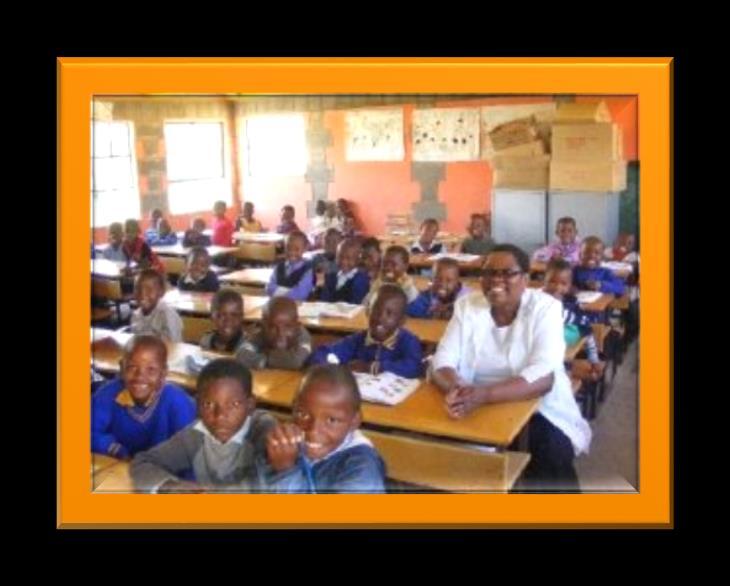
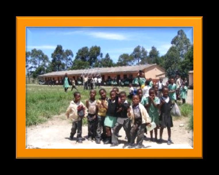
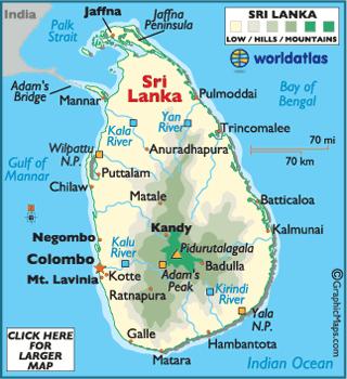
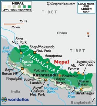
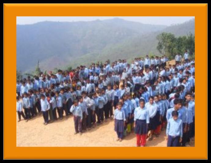
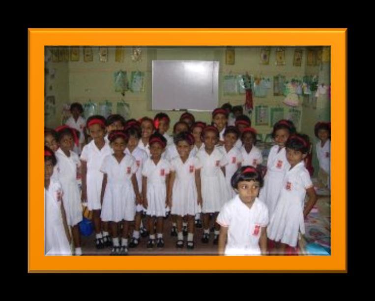
4 Focus on Schools Let s take a road trip to see the countries of the world where schools are supported by Opportunity Education. Each country is a unique and special place, with lovely landscapes, amazing animals, interesting cities and villages, and fascinating culture. But the true beauty of these countries is their people, especially their children. Visit within your own country and perhaps travel to neighboring countries to see for yourself. And until then, enjoy these beautiful faces near the maps of their countries and travel with your heart.
5
6

7
Unit 1: Geography and Social Studies Skills
 Unit 1: Geography and Social Studies Skills Standard(s) of Learning: WHI.1 The student will improve skills in historical research and geographical analysis by a) Identifying, analyzing, and interpreting
Map Skills Lesson 1. Materials: maps, pencils, Lesson 1 Worksheet, strips of paper, grid paper
 Map Skills Lesson 1 Use cardinal directions, map grids, scales, and titles to locate places on a map. Interpret a map using information from its title, compass rose, scale, and legend. Vocabulary: map,
Cardinal and Intermediate Directions:
 Name Period Parent Signature Due Date: (TBA) Geography/Map Skills Study Guide Continents and Oceans of the World: Label the continents (7) and oceans (4) on the lines below the map. 1 11 3 5 4 8 2 9 10
Map Skills: Continents and Oceans. Map Skills: Continents and Oceans
 Map Skills: Continents and Oceans Our Earth is made up of continents and oceans. A continent is an enormous mass of land. There are seven continents on our planet. The continents include North America,
Social Studies Tools (Maps & Sources) Test Study Guide
 Test Study Guide") Social Studies Tools (Maps & Sources) Test Study Guide Name: ANSWER KEY Date: Period: Directions: Complete this study guide as a way to prepare for your test on our Social Studies Tools unit about maps
Social Studies Tools (Maps & Sources) Test Study Guide Name: ANSWER KEY Date: Period: Directions: Complete this study guide as a way to prepare for your test on our Social Studies Tools unit about maps
Sample file. Teacher Guide ... Before You Teach. Our resource has been created for ease of use by both TEACHERS and STUDENTS alike.
 8 7 9 10 12 13 14 11 Introduction T his resource provides ready-to-use information and activities for remedial students in grades five to eight. Written to grade and using simplified language and vocabulary,
St John s Catholic Primary School. Geography Policy. Mission Statement
 St John s Catholic Primary School Geography Policy Mission Statement We at St John s strive for excellence in education by providing a safe, secure and caring family environment where individuals are valued
GEOGRAPHY. Map Skills. Mrs. Pere ~ 2013
 GEOGRAPHY Map Skills Mrs. Pere ~ 2013 WHAT IS A GLOBE? A globe is a model of the Earth. North Pole Equator South Pole WHAT IS A MAP? A map is a flat drawing of a place. THE IMPORTANT PARTS OF A MAP 1.
Essential Questions What are the major physical components of the world, and how are they represented on a map? 3.4
 Third Grade Social Studies Unit One Six Weeks GEOGRAPHY Originally compiled by Russellville In order for students to understand that geography influences the development of a region as well as the interactions
Maps and Globes. By Kennedy s Korner
 Maps and Globes By Kennedy s Korner Map Key or Symbols Maps use symbols to show places and things on Earth. Symbols are drawings that stand for something real. A map key tells you what each symbol stands
... Asia. Based on Bloom s Taxonomy. Human & Movement. Location Place. Regions. Environment. Interactions
 ... Asia Location Place Human & Environment Interactions Movement Regions LEVEL 1 Knowledge Match Show or Label List Information Recall Details (5Ws + H) Find Information LEVEL 2 Comprehension LEVEL 3
Cranford Park CE Primary School. Subject Overview for Geography. Autumn 1 Autumn 2 Spring 1 Spring 2 Summer 1 Summer 2 Title of unit.
 Autumn 1 Autumn 2 Spring 1 Spring 2 Summer 1 Summer 2 Main Objectives /Skills Main Objectives /Skills Main Objectives /Skills Main Objectives /Skills Main Objectives /Skills Main Objectives /Skills Foundation
 Name Period Parent Signature Geography/Map Skills Study Guide *For extra practice with these skills, check out Mr. Kath s website: http://rkath.weebly.com/activities--links.html Continents and Oceans of
... Europe. Based on Bloom s Taxonomy. Environment Interactions Movement. Human & Location. Regions. Place
 ... Europe Location Place Human & Environment Interactions Movement Regions LEVEL 1 Knowledge Match Show or Label List Information Recall Details (5Ws + H) Find Information LEVEL 2 Comprehension Describe
Visit us at...
 Thanks for your purchase. We hope you are pleased. We think you might like the website that we are working on. You will find websites that go along with your unit and word wall cards. We hope you enjoy.
World Geography. Teacher s Guide
 World Geography Teacher s Guide WALCH PUBLISHING Table of Contents To the Teacher.......................................................... vi Classroom Management.................................................
name and locate the world s seven continents and five oceans
 Subject: Geography Activities National Curriculum Objectives One Progression of Skills Name the 7 continents and 5 oceans 3D Jigsaw task to locate continents and seas name and locate the world s seven
Some of these parallels are very important. In the Northern Hemisphere, there is the Tropic of Cancer and the Arctic Circle.
 PDF 2 Geographic coordinates 1 The geographic coordinates system is network of imaginary horizontal and vertical lines that are drawn on globes or maps. These lines are called parallels (lines of latitude)
MEADOWS PRIMARY SCHOOL and NURSERY GEOGRAPHY POLICY
 MEADOWS PRIMARY SCHOOL and NURSERY GEOGRAPHY POLICY Purpose of study The teaching of Geography at Meadows is done by following the 2014 National Curriculum. The planning and teaching of the subject aims
Map Skills Test. 1. What do we call a person who makes maps? a. mapographer b. cartographer c. geologist d. archaeologist
 Map Skills Test 1. What do we call a person who makes maps? a. mapographer b. cartographer c. geologist d. archaeologist 2. What is the name of the 0 latitude line? a. Equator b. Arctic Circle c. First
Latitude and Longitude. Begin
 Latitude and Longitude Begin The Earth is divided in two halves, the top half is called the northern hemisphere, and the bottom half is called the southern hemisphere. The dividing line between the two
Nebraska s Place in the World
 Geographic Educators of Nebraska Advocating geographic education for all Nebraskans Nebraska s Place in the World Students will use lines of latitude and longitude to locate cities within the state and
Unit 1: Basics of Geography Test Review
 Name Date Period Unit 1: Basics of Geography Test Review Directions: Reading the following sections and complete the questions, charts, and diagrams. Types of Maps Maps that have a particular theme are
Map Skills Scavenger Hunt
 Map Skills Scavenger Hunt Introduction to: Continents Cardinal Directions Relative Location Equator and Prime Meridian Hemispheres Reading a Political Map Reading a Physical Map Idea: This product includes
Latitude and Longitude Pre Test
 Name Date Latitude and Longitude Pre Test Multiple Choice Directions: For questions, 1 10 circle the answer that letter that best answers the question. Each question is worth 1 point each. 1. To locate
Why VOCABULARY? clues
 It s GHSGT Time! Why VOCABULARY? Social Studies is all about MAKING CONNECTIONS Key Terms provide relational clues to guide you in answering test questions! The more WORDS you know, the smarter you are
MR. GOFF S WORLD HISTORY UNIT ONE: GEOGRAPHY 5 THEMES OF GEOGRAPHY
 MR. GOFF S WORLD HISTORY UNIT ONE: GEOGRAPHY 5 THEMES OF GEOGRAPHY BYOD BRING YOUR OWN DEVICE IN SMALL GROUPS (3-4), USE YOUR ELECTRONIC DEVICE(S) AND DEFINE THE FOLLOWING VOCAB. WORDS 1. GEOGRAPHY 2.
1 What Is Climate? TAKE A LOOK 2. Explain Why do areas near the equator tend to have high temperatures?
 CHAPTER 17 1 What Is Climate? SECTION Climate BEFORE YOU READ After you read this section, you should be able to answer these questions: What is climate? What factors affect climate? How do climates differ
Section. 1 Our Planet, Earth. Prepare to Read
 1 Section Step-by-Step Instruction Objectives Social Studies 1. Learn about Earth s movement in relation to the sun. 2. Explore seasons and latitude. Reading/Language Arts Use context clues from surrounding
1. Match the words in the first column to the meaning in the second column. [5]
![1. Match the words in the first column to the meaning in the second column. [5]](/thumbs/96/126839765.jpg "1. Match the words in the first column to the meaning in the second column. [5]") Exercise 1: [40 POINTS] 1. Match the words in the first column to the meaning in the second column. [5] Equator Around earth between the Equator and the Poles. Greenwich meridian Half of earth. Longitude
Exercise 1: [40 POINTS] 1. Match the words in the first column to the meaning in the second column. [5] Equator Around earth between the Equator and the Poles. Greenwich meridian Half of earth. Longitude
Use maps, atlases, globes and computer mapping to locate countries and describe features studied
 Roseberry Primary School Curriculum planning Lead Question: What s so amazing about America? National Curriculum driver: Geography Rationale statement: In this study about the amazing Americas, children
locate the world s countries, using maps to focus on Europe (including the location of
 Year 3 and 4 Geography study- Autumn 2 2017 National curriculum: Locational knowledge locate the world s countries, using maps to focus on Europe (including the location of Russia) and North and South
Geography Policy 2014
 Geography Policy 2014 DEFINITION Geography education should inspire in pupils a curiosity and fascination about the world and its people that will remain with them for the rest of their lives. Teaching
St Joseph s R.C. Primary School. Policy for Geography
 St Joseph s R.C. Primary School Policy for Geography 2016-2017 This policy is written with consideration to our school commitment to the Rights of the Child and our achievement of becoming a Rights Respecting
Geography 101: The Basics
 Geography 101: The Basics What is Geography? Geography is the study of the HUMAN and NON- HUMAN features of the Earth.! Geographers study where things are located why they are located in a specific place.!
Understanding Projections
 GEOGRAPHY SKILLS 1 Understanding Projections The earth is a sphere and is best shown as a globe. For books and posters, though, the earth has to be represented as a flat object. To do this, mapmakers create
Witchampton CofE First School Geography Curriculum Map
 2016-2017 Autumn People and : 30-50 Show interest in the lives of people who are familiar to them. Shows interest in different occupations. Remembers and talks significant events in their own experience.
Range of Opportunities
 Geograhy Curriculum Cropwell Bishop Primary School Range of Opportunities Year 1 Year 2 Year 3 Year 4 Year 5 Year 6 All Key Stage 1 Key Stage 2 Investigate the countries and capitals of the United Kingdom.
HOLY CROSS CATHOLIC PRIMARY SCHOOL
 HOLY CROSS CATHOLIC PRIMARY SCHOOL Geography Policy Date Implemented Jan 17 Review Date Jan 22 Mission Statement Holy Cross Primary School is a Catholic School. We seek to provide a broad, balanced Christian
Subject Progression Map
 Subject Progression Map On website Subject Name: Geography Vision-Taken from the National Curriculum A high-quality geography education should inspire in pupils a curiosity and fascination about the world
ST AMBROSE CATHOLIC PRIMARY SCHOOL Geography Policy
 ST AMBROSE CATHOLIC PRIMARY SCHOOL Geography Policy 2017-2018 Our school policy is developed in accordance with the National Curriculum for Geography and Foundation Stage Curriculum for Understanding of
United States of America Geography
 United States of America Geography Part I by Sonja E. Schild LearnSmart Publishing Co. Vancouver, BC, Canada Phone: (604) 433-1347 ISBN 0-9694445-3-9 Notice! All rights reserved. Permission to reproduce
Simple Solutions Social Studies Level 2. Level 2. Social Studies. Help Pages
 Level 2 Social Studies 147 148 adobe houses with bricks made of clay and straw ancestor a family member who lived before us appoint choose; leaders can appoint others barter trading one thing for another
Sample. Contents SECTION 1: PLACE NAMES 6 SECTION 2: CONNECTING TO PLACES 21 SECTION 3: SPACES: NEAR AND FAR 53
 Contents Teachers' Notes 4 National Curriculum Links 5 SECTION 1: PLACE NAMES 6 Teachers' Notes 7-8 Activities Names Of Places 9 Place Names Are Important 1 10 Place Names Are Important 2 11 The Meanings
St. James C of E Primary School
 St. James C of E Primary School Geography Policy St. James C of E Primary School Geography Policy Written by: Lisa Harford Written: April 2016 Reviewed: April 2018 1. Introduction Geography is concerned
Map Of Eastern Hemisphere Labeled
 Map Of Eastern Hemisphere Labeled When somebody should go to the books stores, search instigation by shop, shelf by shelf, it is in reality problematic. This is why we give the book compilations in this
NEWHAM BRIDGE PRIMARY SCHOOL FOUNDATION SUBJECTS CURRICULUM AND ASSESSMENT DOCUMENT GEOGRAPHY
 NEWHAM BRIDGE PRIMARY SCHOOL FOUNDATION SUBJECTS CURRICULUM AND ASSESSMENT DOCUMENT GEOGRAPHY Y1 Geography Curriculum Y1 Geography A.R.E Locational language: hills, beach, forest, town, country, address,
GEOGRAPHY POLICY STATEMENT. The study of geography helps our pupils to make sense of the world around them.
 GEOGRAPHY POLICY STATEMENT We believe that the study of geography is concerned with people, place, space and the environment and explores the relationships between the earth and its peoples. The study
Introduction to Geography
 Introduction to Geography ropic of Cancer 3½ N Arctic Circle 90 N Prime Meridian 0 Arctic Ocean Mississippi R. Appalachian Mts. Europe Rocky Mountains N. America Atlantic Gulf of Ocean Mexico Caribbean
FIRST GRADE 1 WEEK LESSON PLANS AND ACTIVITIES
 FIRST GRADE 1 WEEK LESSON PLANS AND ACTIVITIES UNIVERSE CYCLE OVERVIEW OF FIRST GRADE UNIVERSE WEEK 1. PRE: Describing the Universe. LAB: Comparing and contrasting bodies that reflect light. POST: Exploring
KS1. Geography Progression of Knowledge, Understanding and Skills WIJPS
 Geography Progression of Knowledge, Understanding and Skills WIJPS Geography inspires pupils to delve deeper and with more curiosity and fascination into the world around them and its people. The knowledge
Geography Policy. for Hertsmere Jewish Primary School
 Geography Policy for Hertsmere Jewish Primary School Reviewed by: L Rubin Reviewed on: September 2017 Date of Next Review: September 2018 Policy Review This policy will be reviewed in full by the Governing
The Coordinate System
 5 The Coordinate System Key Words: latitude, degrees, longitude, prime meridian, absolute location You can locate any place on Earth by using a special set of numbers. These numbers are part of a set of
Your web browser (Safari 7) is out of date. For more security, comfort and the best experience on this site: Update your browser Ignore
 is out of date. For more security, comfort and the best experience on this site: Update your browser Ignore") Your web browser (Safari 7) is out of date. For more security, comfort and the best experience on this site: Update your browser Ignore Activityengage MAPPING W O RL D HERITAGE Where are sites of significant
Your web browser (Safari 7) is out of date. For more security, comfort and the best experience on this site: Update your browser Ignore Activityengage MAPPING W O RL D HERITAGE Where are sites of significant
Geography. Programmes of study for Key Stages 1-3
 Geography Programmes of study for Key Stages 1-3 February 2013 Contents Purpose of study 3 Aims 3 Attainment targets 3 Subject content 4 Key Stage 1 4 Key Stage 2 5 Key Stage 3 6 2 Purpose of study A high-quality
Class 4J Autumn Term St. Lucia Adapted from QCA Geography Unit 10 incorporating some elements of Unit 25
 Class 4J Autumn Term 2002 Geography St. Lucia Geography Unit 10 incorporating some elements of Unit 25 ABOUT THE UNIT In this unit children develop ideas about a less economically developed country. When
Unit 1 -Lesson 5. Population Patterns of the Eastern Hemisphere
 Unit 1 -Lesson 5 Population Patterns of the Eastern Hemisphere Population Patterns of the Eastern Hemisphere Population Patterns of the Eastern Hemisphere Big Ideas of the Lesson Population distribution
Lesson Objectives. Core Content Objectives. Language Arts Objectives
 What s the Weather Like? 1 Lesson Objectives Core Content Objectives Students will: Demonstrate understanding of the following units of time and their relationship to one another: day, week, month, year
Geography Long Term Plan 2018
 Geography Long Term Plan 2018 Geography Co-ordinator: Megan Frost A high-quality geography education should inspire in pupils a curiosity and fascination about the world and its people that will remain
Willmar Public Schools Curriculum Map
 Subject Area Grade First Grade Date June 2005, reviewed June 2009 Unit Content Standards Addressed Skills/Benchmarks Essential Questions Assessments Unit 1 Here We Are and Our Class Our School Our Families
Student Handout. Write the map s title in the northwest corner of the map. How many picnic areas does the park have? Write the answer near the legend.
 Student Handout 1F Cards Write the map s title in the northwest corner of the map. How many picnic areas does the park have? Write the answer near the legend. 1 2 Draw a compass rose near the west edge
1 What Is Climate? TAKE A LOOK 2. Explain Why do areas near the equator tend to have high temperatures?
 CHAPTER 17 1 What Is Climate? SECTION Climate BEFORE YOU READ After you read this section, you should be able to answer these questions: What is climate? What factors affect climate? How do climates differ
Crossing the Atlantic: Then and Now
 Your web browser (Safari 7) is out of date. For more security, comfort and Activitydevelop the best experience on this site: Update your browser Ignore Crossing the Atlantic: Then and Now How has the amount
 Name Period Parent Signature Foundational Skills Study Guide *For extra practice with these skills, check out Mr. Kath s website: http://rkath.weebly.com/activities--links.html Continents and Oceans of
N.B Write everything on the paper provided, and the use of good English is recommended.
 St. Francis School, Sliema Specimen Paper Geography Form 1 Time : 1 hour N.B Write everything on the paper provided, and the use of good English is recommended. Name: Class: A. Study about the Continents
Online Integrated Activity. Online Integrated Activity Link. Lindsey Crumley, Brandi Gore, and Angela Ward
 Online Integrated Activity Online Integrated Activity Link Lindsey Crumley, Brandi Gore, and Angela Ward Introduction The content that is covered in our Science Unit is weather and climate. The Science
Subject: Geography Scheme of Work: B1 to B6 Mastery tiles. Term: Autumn/Spring/Summer
 Subject: Geography Scheme of Work: B1 to B6 Mastery tiles Term: Autumn/Spring/Summer Topic / Unit(s) Overview / Context Introduction to geography. An introduction to geography including basic map skills
Unit 9.2 Introduction to Geography
 Unit 9.2 Introduction to Geography Name: Period: This activity has been modified from the Stanford History Education Group from the original found here. 1 What does it mean to think like a geographer?
Many Ways to Name a Place
 Your web browser (Safari 7) is out of date. For more security, comfort and Activityapply the best experience on this site: Update your browser Ignore Many Ways to Name a Place What are the names for the
History EC LE UE MS. Knows the names and order of the Seasons of the Year and science behind it
 History EC LE UE MS Time and Timelines : awareness of how the universe and life came to be and his/her place on the continuum. The child discovers interests, makes connections and draws inferences about
Five Themes of Geography of Ecuador
 LESSON 1 Five Themes of Geography of Ecuador Lesson Objective The students will be able to: find the five themes of geography (location, movement, human/environment interaction, place, and region) of Ecuador
World Geography Name This Country 4 th Grade
 World Geography Name This Country 4 th Grade West Brooke Curriculum By: Susan Adams & Jennifer Westbrook World Geography Name This Country 4 th Grade West Brooke Curriculum 2014 Written by: Susan Adams
2 Mapping Earth Reading Essentials. 2. Contrast What is the difference between a map view and a profile view?
 Mapping Earth Maps What do you think? Read the three statements below and decide whether you agree or disagree with them. Place an A in the Before column if you agree with the statement or a D if you disagree.
Space. Earth. EARTH and EARTH and SPACE SPACE. Earth. William B. Rice
 Space Earth rth EARTH and EARTH and SPACE SPACE SCIENCE Earth is covered with mountains, canyons, and oceans. These landforms change over time. Mountains are made. Valleys may become deeper. Earth s landforms
The World of Geography Pre-Test/Study Guide Chapter 1 Test
 Read each statement or question. On the lines below write the letter of the best answer. 1. Geographers look at the Earth 5. What are the two specific A. by studying cities first. measurements of Earth
Tuition, Medical and Behaviour Support Service
 Tuition, Medical and Behaviour Support Service Curriculum Policy - Primary Geography Reviewed: October 2018 Next Review: October 2019 Responsibility: Andrea Snow AIMS AND PRINCIPLES The national curriculum
Teacher Guide. Our resource has been created for ease of use by both TEACHERS and STUDENTS alike. Sample file NAME: A on Mount Olympus, Greece
 Introduction his resource provides ready-to-use information and activities for remedial students in grades five to eight. Written to grade and using simplified language and vocabulary, geography concepts
Map Making. Chapter 2 Section 1
 Map Making Chapter 2 Section 1 Latitude and Longitude Objectives Compare and contrast latitude and longitude. Describe how time zones vary. Vocabulary cartography equator latitude longitude prime meridian
Learning Target : Describe the purposes and uses of different types of maps.
 Learning Target : Describe the purposes and uses of different types of maps. Directions: 1. Below, place a where you think you are located. 2. In which continent are you located? 3. In which country are
ACTIVITY CLASSROOM. Observe the Moon's Phases. General Information
 CLASSROOM ACTIVITY Observe the Moon's Phases General Information Grade level: All cycles Students per group: Individual or group activities When: After the Planetarium visit Duration: One 50-minute period,
Map Skills Unit. Note taking unit
 Map Skills Unit Note taking unit Introduction To learn about the Earth, we are going to learn about two geographic tools you can use.globes and maps. Globe A globe is a round model of the planet Earth
What Is a Globe? Hemispheres. Main Idea Globes and maps provide different ways of showing features of the earth. Terms to Know
 r Main Idea Globes and maps provide different ways of showing features of the earth. Terms to Know hemisphere latitude longitude scale bar scale relief elevation contour line What Is a Globe? A globe is
Geography Progression
 Geography Progression This document aims to track expectations for History within George Grenville Academy. What the National Curriculum says: KS1: Locational Knowledge: Name and locate the world s 7 continents
Building the next generation of global citizens! Curriculum. International Sports Exchange
 Building the next generation of global citizens! Curriculum International Sports Exchange CURRICULUM Unit TItle: SOUTHERN AFRICA Unit Length: Weeks Guiding Questions: Can students locate the region of
ATheme. Capital Connections. Claudia Crump, Workshop Consultant Indiana University, Southeast
 CAPITAL CONNECTIONS Capital Connections ATheme Claudia Crump, Workshop Consultant Indiana University, Southeast PURPOSE To review basic geographic understandings and skills on location and terminology;
Your web browser (Safari 7) is out of date. For more security, comfort and the best experience on this site: Update your browser Ignore
 is out of date. For more security, comfort and the best experience on this site: Update your browser Ignore") Your web browser (Safari 7) is out of date. For more security, comfort and the best experience on this site: Update your browser Ignore Activitydevelop Educator Version INTRO DUCTIO N TO L ATITU DE AND
Your web browser (Safari 7) is out of date. For more security, comfort and the best experience on this site: Update your browser Ignore Activitydevelop Educator Version INTRO DUCTIO N TO L ATITU DE AND
Barlows Primary School Geography Curriculum Content Key Stage 1 and
 Geography Curriculum Content Key Stage 1 and 2 2017-2018 Curriculum Content Year 1 The content for Year 1 is detailed below: WHAT ARE SEASONS? WHAT SIT LIKE WHERE WE LIVE? WHERE DO DIFFERENT ANIMALS LIVE?
Lesson Overview Activity video available at edu.zspace.com. Objectives
 Gravitational Force Evidence Lesson Overview Activity video available at edu.zspace.com Students will plan and build a structure in Newton's Park to demonstrate the concept of gravity pulling objects "down."
Unit 2 Study Guide: The World in Spatial Terms
 Name Date Hour Unit 2 Study Guide: The World in Spatial Terms TEST is WEDNESDAY, DECEMBER 19 TH This study guide contains all the concepts that will be on your test. Vocabulary words and concepts will
GEOGRAPHY POLICY. Date: March Signed: Review: March 2019
 GEOGRAPHY POLICY Date: March 2018 Signed: Review: March 2019 Aims At Hayton C of E Primary School we believe that Geography is an essential part of the curriculum and teachers ensure that the children
DOWNLOAD OR READ : OER OCEANS AND CONTINENTS WITH THE SETTING SUN PDF EBOOK EPUB MOBI
 DOWNLOAD OR READ : OER OCEANS AND CONTINENTS WITH THE SETTING SUN PDF EBOOK EPUB MOBI Page 1 Page 2 oer oceans and continents with the setting sun oer oceans and continents pdf oer oceans and continents
Geography Policy. Introduction
 Geography Policy Introduction Geography at St. Aloysius Federation School teaches an understanding of places and environments and aims to inspire a curiosity and fascination about the world and its people.
Latitude & Longitude. Worksheets & activities to teach latitude & longitude. Includes notes, activities, review & all answer keys. 11 pages!
 Latitude & Longitude Worksheets & activities to teach latitude & longitude. Includes notes, activities, review & all answer keys. 11 pages! Lines of Latitude & Longitude Name: Lines of latitude and longitude
Downloaded from
 SOCIAL STUDIESCLASS - V LESSON-1 GLOBE ANSWER THE FOLLOWING: 1. Name the continents and oceans on the earth. Ans. The seven continents are: a) Australia b) Europe c) Antarctica d) South America e) North
SECOND GRADE 1 WEEK LESSON PLANS AND ACTIVITIES
 SECOND GRADE 1 WEEK LESSON PLANS AND ACTIVITIES UNIVERSE CYCLE OVERVIEW OF SECOND GRADE UNIVERSE WEEK 1. PRE: Discovering stars. LAB: Analyzing the geometric pattern of constellations. POST: Exploring
Iceland. 1. Warm up. A. Talk about the picture and read the essay. B. Discuss the questions about the essay.
 1. Warm up A. Talk about the picture and read the essay. Iceland My country, Iceland, is one of the most beautiful countries on Earth. It is an island country. It is located in Europe, in the North Atlantic
Module 2 Educator s Guide Overview
 Module 2 Educator s Guide Overview Water, water almost everywhere? Module Overview The presence of water in solid, liquid, and gaseous forms is one of the primary factors that distinguishes Earth from
Display/Resources ideas:
 Year 3/4 Key Skills to be covered, taken from National Curriculum pitching at the correct year group and differentiation within plan for different groups Be specific in the key skills, and make them more
Geography Mile Post 1
 Mile Post 1 Use world maps, atlases and globes to identify the UK and its countries, as well as the countries, continents and oceans studied at this key stage Key Skills IPC learning Goals 1.11 Be able
Nursery. Reception. Year 1
 Nursery Geography Overview Autumn Spring Summer Notices detailed features of objects in their environment. Comments and asks questions about aspects of their familiar world such as the place where they