10/21/2016 Geauga County Auditors Office REALink
|
|
|
- Ginger Shelton
- 5 years ago
- Views:
Transcription
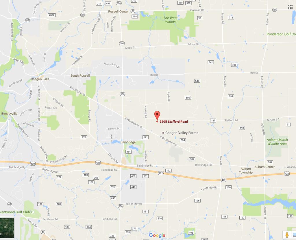
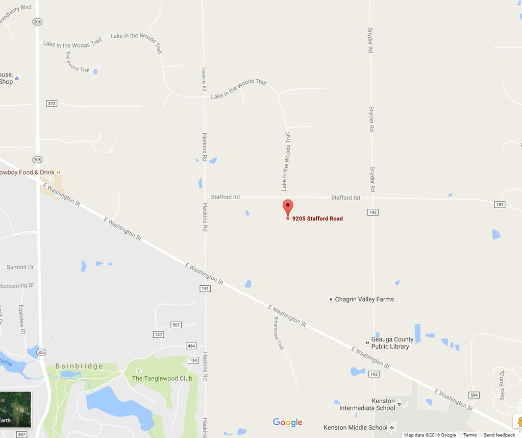
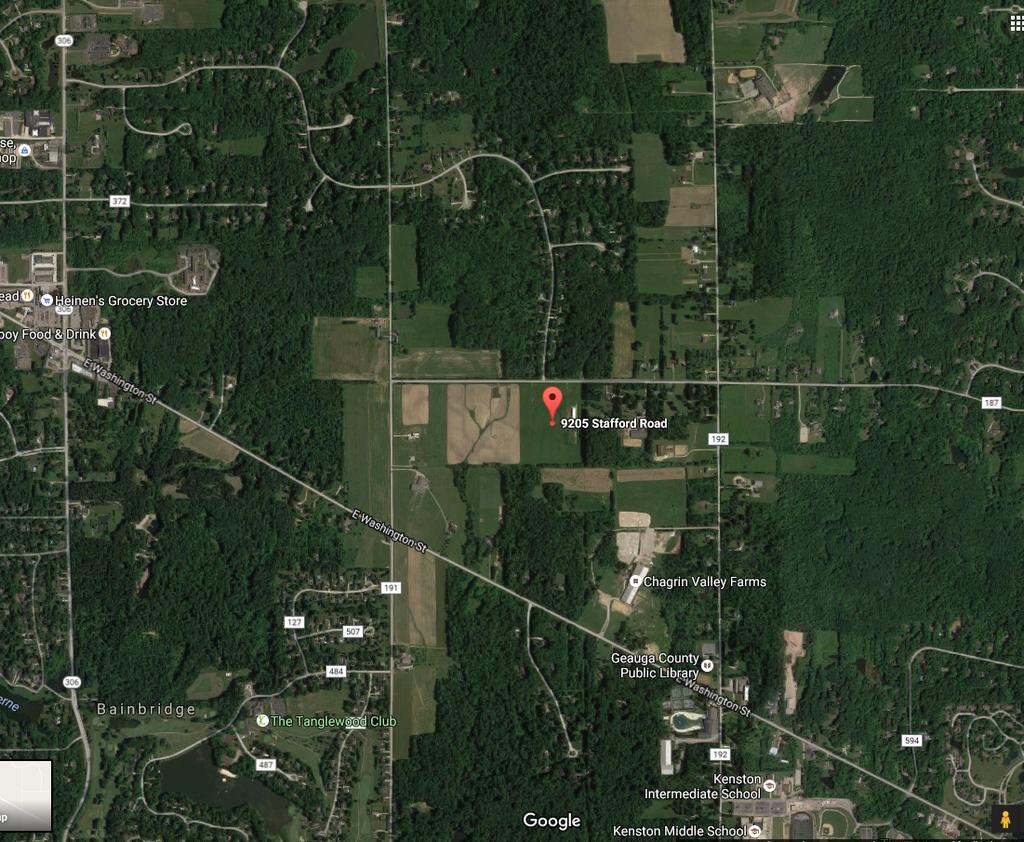
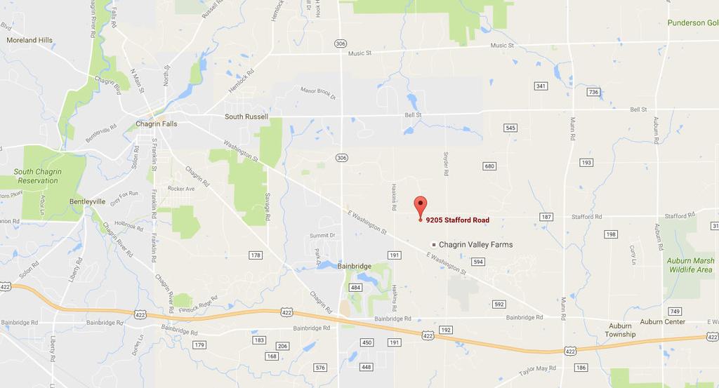
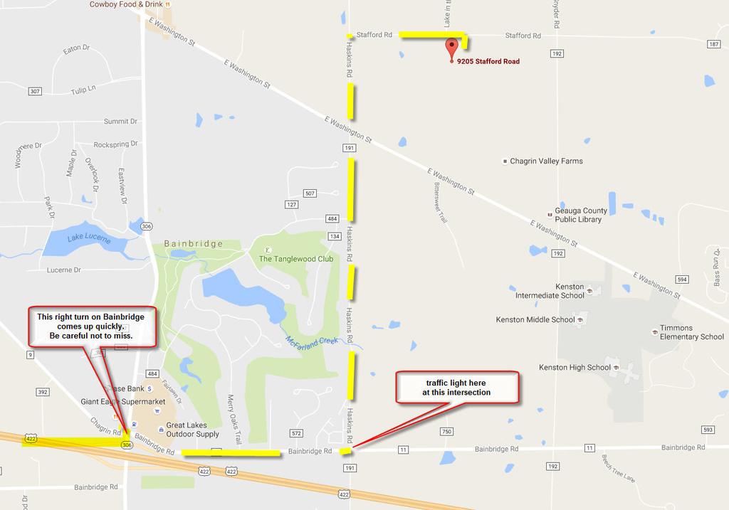
1 10/21/2016 Geauga County Auditors Office REALink New Search Parcel Number Location Address Owner Name Acres STAFFORD RD GOFORTH TRACEY MARIE & WELTLICH SHANNON Main Information Map Tax Details Sales Improvements Permits Sketch Cards Special Assessments Special Assessment Payoff Value History Parcel Number Routing Number Tax District School District Location Address Owner Name Owner Address BAINBRIDGE TWP KENSTON LSD 2804 KENSTON LSD 9205 STAFFORD RD GOFORTH TRACEY MARIE & WELTLICH SHANNON 6484 TANGLEWOOD LN SEVEN HILLS OH Acreage Deed Volume/Page 1985 / 1561 Legal Description LOT 8 TR 1 Property Class 117 Agricult. Use Qualified CAUV Neighborhood Code Dwellings Mailing Name Mailing Address GOFORTH TRECEY MARIE & WELTLICH SHANNON 6484 TANGLEWOOD LN SEVEN HILLS OH Square Footage Grade 0 sq. ft. To view the values used to calculate your current tax bill, please select from the drop down box 2015 (Payable 2016) 2016 (Payable 2017) 2016 Valuation (Payable 2017) Latest Sale (See sales tab for more details) Market Taxable Sale Date Land $120,500 $42,180 Sale Amount $0 Improvement $50,200 $17,570 Valid N Total $170,700 $59,750 CAUV $13,890 $4,860 Conveyance # Exempt # 7197 # Parcels 1 Type LB Copyright 2010 Geauga County /1
2
3
4

5
6 10/4/2016 Geauga County Auditors Office REALink New Search Parcel Number Location Address Owner Name Acres STAFFORD RD GOFORTH TRACEY MARIE & WELTLICH SHANNON Main Information Map Tax Details Sales Improvements Permits Sketch Cards Special Assessments Special Assessment Payoff Value History Improvements Improvement Area Year Built Repl Cost True Value Condition Size Stable $74330 $ AV 36 x 124 Copyright 2010 Geauga County /1
7 10/4/2016 Geauga County Auditors Office REALink New Search Parcel Number Location Address Owner Name Acres STAFFORD RD GOFORTH TRACEY MARIE & WELTLICH SHANNON Main Information Map Tax Details Sales Improvements Permits Sketch Cards Special Assessments Special Assessment Payoff Value History Parcel Number Routing Number Tax District School District Location Address Owner Name Owner Address BAINBRIDGE TWP KENSTON LSD 2804 KENSTON LSD 9205 STAFFORD RD GOFORTH TRACEY MARIE & WELTLICH SHANNON 6484 TANGLEWOOD LN SEVEN HILLS OH Acreage Deed Volume/Page 1985 / 1561 Legal Description LOT 8 TR 1 Property Class 117 Agricult. Use Qualified CAUV Neighborhood Code Dwellings Mailing Name Mailing Address GOFORTH TRECEY MARIE & WELTLICH SHANNON 6484 TANGLEWOOD LN SEVEN HILLS OH Square Footage Grade 0 sq. ft. To view the values used to calculate your current tax bill, please select from the drop down box 2015 (Payable 2016) 2016 (Payable 2017) 2016 Valuation (Payable 2017) Latest Sale (See sales tab for more details) Market Taxable Sale Date Land $120,500 $42,180 Sale Amount $0 Improvement $50,200 $17,570 Valid N Total $170,700 $59,750 CAUV $13,890 $4,860 Conveyance # Exempt # 7197 # Parcels 1 Type LB Copyright 2010 Geauga County /1
8
9
10 11/2/2016 Property Detail Report 9205 Stafford Rd, Chagrin Falls, OH , Geauga County Owner Information Owner Name: Goforth Tracey Marie Tax Billing Zip: Owner Name 2: Weltlich Shannon Tax Billing Zip+4: 3145 Tax Billing Address: 6484 Tanglewood Ln Owner Occupied: No Tax Billing City & State: Seven Hills, OH Location Information School District Name: Kenston Township: Bainbridge Township Kenston Zip Code: Flood Zone Date: 06/16/2009 Carrier Route: R005 Flood Zone Panel: 39055C0212D Census Tract: Flood Zone Code: X Tract Number: 1 Tax Information Formatted PID: Tax Area: 02 Parcel ID: Tax Appraisal Area: 02 % Improved: 36% Lot Number: 8 Legal Description: LOT 8 TR 1 Assessment & Tax Assessment Year 2015 Assessed Value Total $48,270 Assessed Value Land $30,700 Assessed Value Improved $17,570 Market Value Total $137,900 Market Value Land $87,700 Market Value Improved $50,200 Tax Year Total Tax 2015 $1,562 Characteristics Universal Land Use: Farms Lot Acres: Lot Area: 438,649 Features Feature Type Unit Size/Qty Width Depth Year Built Value Stable S 4, $74,330 Listing Information MLS Listing Number: MLS Status Change Date: 10/21/2016 MLS Status: Active Days on Market: 14 MLS Listing Date: 10/20/2016 MLS Listing Agent: C John C. Froelich MLS Current List Price: $200,000 MLS Listing Broker: OHIO REAL ESTATE AUCTIONS LLC MLS Orig. List Price: $200,000 MLS Area: BAINBRIDGE Last Market Sale & Sales History Recording Date 02/13/2015 Settle Date 02/12/2015 Nominal Buyer Name Seller Name Y Goforth Tracey M Goforth Virginia Document Number Document Type Joint Survivorship/Right Of Courtesy of John Froelich, NORTHEASTERN OHIO REAL ESTATE EXCHANGE The data within this report is compiled by CoreLogic from public and private sources. If desired, the accuracy of the data contained herein can be independently verified by the recipient of this report with the applicable county or municipality. Property Detail &addres 1/1
11 10/4/2016 Geauga County Auditors Office REALink New Search Parcel Number Location Address Owner Name Acres STAFFORD RD GOFORTH TRACEY MARIE & WELTLICH SHANNON Main Information Map Tax Details Sales Improvements Permits Sketch Cards Special Assessments Special Assessment Payoff Value History Sale Date Property Class 117 Owner Occupied No Sale Amount $0 Vol / Page 1985/1561 Homestead No Credit Add Remits Information for Tax Year: 2015 (Payable 2016) Cert Delq Year = 2015 Prior Delq Adj Delq December Adj Dec June Adjustments ReCharge HB 920 Credit Subtotal Homestead Non Business Credit Owner Occupied Credit Subtotal Interest/Penalty Real Estate Taxes Owed Real Estate Taxes Paid Special Assessment Owed Special Assessment Paid Total Owed Total Paid Total Owed Delinquent: 0.00 First Half: Full Year: 1, Surplus: 0.00 See where your real estate tax dollar goes See how issues on latest ballot could/will affect your taxes View Your Tax Bill Online Copyright 2010 Geauga County /1
Sales Date Grantor Convey No. Convey Typ # Parcels Sales Price
 Owner Name FINDLEY FRANK A Prop. Class Land Use C - Commercial 471 - DWELLING CONVERTED TO Site Address LegalDescriptions 2584 BRIGGS RD 2584 BRIGGS RD LOT 89 BLK 2 EUREKA PARK Tax District Sch. District
Sales Date Grantor Convey No. Convey Typ # Parcels Sales Price
 Owner Name LOHR DONNA L LOHR DONNA L Prop. Class Land Use R - Residential 550 - CONDOMINIUM UNIT Site Address LegalDescriptions 4714 MERRIFIELD PL BRANFORD VILLAGE CONDOMINIUM BLDG 15 UNIT 70 Tax District
Owner: Sharon Hackett. Property: 2498 SE Mullenix Road Port Orchard, WA Provided Especially For:
 Owner: Sharon Hackett Property: 2498 SE Mullenix Road Port Orchard, WA 98367 242301-4-019-2001 Provided Especially For: Danny Horovitz John L. Scott Real Estate Silverdale, WA We are pleased to provide
I-94 COMMERCIAL LAND ±30.44 ACRES TH ST Eau Galle, WI 54747
 PROPERTY HIGHLIGHTS + + Located off I-94 and Hwy 63 Interchange 2,900 VPD + + Baldwin-Woodville Area School District + + Zoning: Commercial, Rural Residential + + 40 miles to St. Paul + + 25 miles to Menomonie,
VIKING INSPECTION PROPERTY 4921 U.S. Hwy. 85, Williston, ND 58801
 SALE PRICE: $799,000 LOT SIZE: +/-2.49 Acres BUILDING SIZE: +/-3,800 SF DRIVE-IN DOORS 2 CEILING HEIGHT: 16' YEAR BUILT: 2007 ZONING: Commercial PROPERTY OVERVIEW Highly visible, hard-to-find small shop/office/apartment
TRACT 7: ±252 Acres Irrigated Farmland Grassland
 TRACT 7: ±252 Acres Irrigated Farmland Grassland 1880 FM 2013, Friona, Texas 79035 ±252 acres of irrigated farmland and grassland. This farmland is currently being leased and farmed. The lease agreement
BROWN COUNTY FARMLAND AUCTION
 BROWN COUNTY FARMLAND AUCTION CROP - PASTURE - HUNTING - INVESTMENT 62 Acres +/- TUESDAY, NOVEMBER, 1 :30am Auction Location: The DEC (Dakota Event Center) - Lamont St. - Aberdeen, SD 5401 Mercier & Ravina
Lakeland Court MHP Norton Rd Lakeland, FL 33809
 23-space/units - 2 Block Homes - 2 Duplexes 75% Occupied - Annual Leases - Long Term Tenants City Water - Septic Possible 3 additional spaces can be added Seller may consider offering Seller Financing
5 BUILDINGS ON 15 ACRES AVAILABLE
 INDUSTRIAL 5 BUILDINGS ON 15 ACRES AVAILABLE FOR SALE 1717 W. Park Drive, Huntington, IN 46750 Former Carter Lumber Approximately 38,000 sq. ft. in 5 buildings 15.06 acres with industrial zoning Property
Deschutes County Property Information
 Deschutes County Property Information Report Date: 1/25/2015 3:11:23 PM Disclaimer The information and maps presented in this report are provided for your convenience. Every reasonable effort has been
Sunshine City 47-Sp MHP
 Sunshine City 47-Sp MHP 47-sp MHP w/36 POM's Recreation Building used for StorageLaundry Room (Currently not in use) 70% Occupancy - 9-spaces left & 5 MH's left to lease 10 Mobile Homes Newly Rehabbed
Sacramento River Farmland Anderson, California
 AG-LAND INVESTMENT BROKERS 275 Sale Lane / P. O. Box 896 Red Bluff, CA 96080 530.529.4400 office / 530.527.5042 fax Sacramento River Farmland Anderson, California Property: 45 +/- acres of farmland with
Office of the Board of Education Forest Hills Local School District January 3, 2018
 HAMILTON COUNTY, OHIO Office of the Board of Education Forest Hills Local School District January 3, 2018 To the County Auditor: The Board of Education of said School District, hereby submits its' annual
Kitsap County 2016 Comprehensive Plan Update. Appendix A: Growth Estimates
 Kitsap County 2016 Comprehensive Plan Update Appendix A: Growth Estimates Appendix A 1 April 2016 Kitsap County 2016 Comprehensive Plan Update Appendix A: Growth Estimates Land Capacity Land capacity
BUILDING AND SAFETY FEE SCHEDULE (Effective July1, 2013)
") BUILDING AND SAFETY DIVISION TELEPHONE (949) 724-6300 BUILDING AND SAFETY FEE SCHEDULE (Effective July1, 2013) Payment: When a plan is required by the Administrative Authority to be submitted, a plan check
BUILDING AND SAFETY DIVISION TELEPHONE (949) 724-6300 BUILDING AND SAFETY FEE SCHEDULE (Effective July1, 2013) Payment: When a plan is required by the Administrative Authority to be submitted, a plan check
TOWN OF ELLERY RESIDENTIAL VALID SALES RESIDENTIAL SALES FROM JANUARY 1, 2007 TO DECEMBER 30, 2010
 TOWN OF ELLERY RESIDENTIAL VALID SALES RESIDENTIAL SALES FROM JANUARY 1, 2007 TO DECEMBER 30, 2010 The information included in this report was printed as of February 23, 2011 The information contained
Table 6: FY Budget Letter Local Deduction Calculation
 Table 6: FY2017-18 Budget Letter Local Deduction Calculation Tax s (per 15-16 AFR) Local Deduction Property Tax Property (with 10% Cap) Projected Yield of Property Tax age of FY-16 (per 15-16 AFR) Local
Scale 1" = 200' ST 11. This Lot. Road
 TA R8&9 WELS, Maine Scale 1" = 200' 1 This Lot 3 Road ST 11 1 PDF-XChange PROPERY RECORD CARD - TOWNSHIP NAME w w w.docu-track.co m Click to buy NOW! NEW ENGLAND TELEPHONE TA R8 & 9 WELS REMARKS \MSOL\data\MRS\
 https://www.bpofulfillment.com/.aspx?control=findbpo&assetid=&orderid=2005494 1h : 59m : 54s Order : Inspection Date: 11 / 02 / 2013 Information Source: Tax data Property Type: SFD APN (Tax ID number):
GIS SERVICE CENTER MAP ORDER FORM
 Steven V. Stenger County Executive Pam Reitz Director of Administration GIS SERVICE CENTER MAP ORDER FORM 1. Print this form. 2. Fill out the form calculate and include the total cost of your order. 3.
Carrick Road $798,000
 1955-2020 Carrick Road 165.76± acres Fayette/Scott Counties $798,000 Offered Exclusively By: Zach Davis Principal Broker +1.859.576.8195 www.kirkfarms.com zach@kirkfarms.com Measuring an appx. 165+/- acres,
APPLICATION TO AMEND THE FUTURE LAND USE MAP (FLUM) SMALL SCALE
 SMALL SCALE") DEPARTMENT OF DEVELOPMENT & PLANNING 825 Ohio Avenue - Lynn Haven, FL 32444 (850) 265-2961 - (850) 265-3478 APPLICATION TO AMEND THE FUTURE LAND USE MAP (FLUM) SMALL SCALE Deadline to submit is 30 days
DEPARTMENT OF DEVELOPMENT & PLANNING 825 Ohio Avenue - Lynn Haven, FL 32444 (850) 265-2961 - (850) 265-3478 APPLICATION TO AMEND THE FUTURE LAND USE MAP (FLUM) SMALL SCALE Deadline to submit is 30 days
Fully rented multi-unit for sale in convenient Harrisburg location. Good for a savvy or first time investor.
 Fully rented multi-unit for sale in convenient Harrisburg location. Good for a savvy or first time investor. (can be purchased with 2534 Derry St.) Active MLS # 10279887 Class Multi Family Type Semi Detached
Fall River Valley Irrigated Farmland
 AG-LAND Investment Brokers 275 Sale Lane Red Bluff, CA 96080 530-529-4400 Fax 530-527-5042 Fall River Valley Irrigated Farmland Tehama McArthur, County, California 2015 well, 16 inch casing, 150 HP, 2,000
Alamito Creek Preserve Ranches for Sale Marfa, Presidio County, Texas
 Alamito Creek Preserve Ranches for Sale Marfa, Presidio County, Texas James King, Agent Office 432 426.2024 Cell 432 386.2821 James@KingLandWater.com Alamito Creek Preserve Various size Ranch Properties,
INSIDE. Metric Descriptions by Topic Area. Data Sources and Methodology by Topic Area. Technical Appendix
 As part of the Chicago Neighborhoods 2015 (CN2015) project, the Institute for Housing Studies at DePaul University collected data and built metrics to help The Chicago Community Trust and the City of Chicago
Write a report (6-7 pages, double space) on some examples of Internet Applications. You can choose only ONE of the following application areas:
 on some examples of Internet Applications. You can choose only ONE of the following application areas:") UPR 6905 Internet GIS Homework 1 Yong Hong Guo September 9, 2008 Write a report (6-7 pages, double space) on some examples of Internet Applications. You can choose only ONE of the following application
UPR 6905 Internet GIS Homework 1 Yong Hong Guo September 9, 2008 Write a report (6-7 pages, double space) on some examples of Internet Applications. You can choose only ONE of the following application
Engineer's Report. Main Street Business Area. Festoon Lighting and Sidewalk Cleaning Assessment District (Fiscal Year )
") Engineer's Report for the Main Street Business Area Festoon Lighting and Sidewalk Cleaning Assessment District (Fiscal Year 2008-09) Prepared under the provisions of the Benefit Assessment Act of 1982
Engineer's Report for the Main Street Business Area Festoon Lighting and Sidewalk Cleaning Assessment District (Fiscal Year 2008-09) Prepared under the provisions of the Benefit Assessment Act of 1982
FUND LEDGER. 1 of 6 7:34:02 pm 06/06/2012. THURSTON VILLAGE, FAIRFIELD COUNTY From 05/01/2012 to 05/31/2012
 1 of 6 7:34:02 pm Code : 1000 - General Beginning $50,698.47 $0.00 $50,698.47 05/01/2012 Payroll Memo PAYROLL MEMO EXPENDITURE INTO 1000-710-121-0000 5000012 8870DIRECT MEXP 40-2012 $95.22 $0.00 50,603.25
TAX ROLL FOR CITY OF RICHMOND IN THE COUNTY OF, MI FOR THE YEAR 2017 Spec. Population: Ad Valorem+Special Acts
 1/7 Parcel # Valuations Tax Heading Amount Tax Heading Amount --- Totals --- PARCEL #: 7405-006-1001-000 CLASS: 201 SUMMER TAX HEADING AMOUNT WINTER TAX HEADING AMOUNT SUM TAX 4,063.84 SCHOOL: 50180 05
Nanaimo. as at December 31, Cumulative Residential Average Single Family Sale Price
 Nanaimo as at December 31, 2018 Cumulative Residential Average Single Family Sale Price NOTE: Figures are based on a "rolling total" from the past 12 months i.e. 12 months to date instead of the calendar
Digital Tax Mapping Present and Future. Kurt Donaldson
 Digital Tax Mapping Present and Future Kurt Donaldson WV GIS Technical Center Mission - To provide focus, direction and leadership to users of geographic information systems (GIS), digital mapping and
DELAWARE COMPENSATION RATING BUREAU, INC. Internal Rate Of Return Model
 Exhibit 9 As Filed DELAWARE COMPENSATION RATING BUREAU, INC. Internal Rate Of Return Model The attached pages present exhibits and a description of the internal rate of return model used in deriving the
Spatial Relationships in Rural Land Markets with Emphasis on a Flexible. Weights Matrix
 Spatial Relationships in Rural Land Markets with Emphasis on a Flexible Weights Matrix Patricia Soto, Lonnie Vandeveer, and Steve Henning Department of Agricultural Economics and Agribusiness Louisiana
LAKEHAYEN UTILITY DISTRICT King County, Washington. Resolution No
 LAKEHAYEN UTILITY DISTRICT King County, Washington Resolution No. 2014-1242 A Resolution of the Board of Commissioners of the Lakehaven Utility District, King County, Washington, approving the establishment
YELLOW MEDICINE COUNTY FARMS FOR SALE
 YELLOW MEDICINE COUNTY FARMS FOR SALE Owners Rhea Trusts 790+ acres of high quality cropland in western Yellow Medicine County, MN. The land has been owned by the Rhea family for many years. The land includes
TREASURE COAST REGIONAL PLANNING COUNCIL M E M O R A N D U M. To: Council Members AGENDA ITEM 4B10
 TREASURE COAST REGIONAL PLANNING COUNCIL M E M O R A N D U M To: Council Members AGENDA ITEM 4B10 From: Date: Subject: Staff December 14, 2018 Council Meeting Local Government Comprehensive Plan Review
A SPATIAL ANALYSIS OF A RURAL LAND MARKET USING ALTERNATIVE SPATIAL WEIGHT MATRICES
 A Spatial Analysis of a Rural Land Market Using Alternative Spatial Weight Matrices A SPATIAL ANALYSIS OF A RURAL LAND MARKET USING ALTERNATIVE SPATIAL WEIGHT MATRICES Patricia Soto, Louisiana State University
McHenry County Property Search Sources of Information
 Disclaimer: The information in this system may contain inaccuracies or typographical errors. The information in this system is a digital representation of information derived from original documents; as
VILLAGE OF ORLAND PARK
 14700 Ravinia Avenue Orland Park, IL 60462 www.orland-park.il.us Ordinance No: File Number: 2013-0373 AN ORDINANCE ESTABLISHING SPECIAL SERVICE AREA NUMBER 3 STATE OF ILLINOIS, COUNTIES OF COOK AND WILL
Managing Recognized Hazards: Land Use Planning and Zoning, Strategies and Public Education/Notification
 Managing Recognized Hazards: Land Use Planning and Zoning, Strategies and Public Education/Notification Mark Molinari, PG, LEG AECOM Seattle, Washington Introduction Overview of zoning, ordinances, codes
CONGLETON INDUSTRIAL PARK LT 6 EX W 300' & E 350' LT 7 BLK 1, a subdivision of land in the City of Overland Park, Johnson County, Kansas.
 NOTICE OF PUBLIC HEARING CITY PLANNING COMMISSION CITY OF OVERLAND PARK, KANSAS Notice is hereby given that the City Planning Commission of Overland Park, Kansas, will hold a public hearing Monday, July
ArcGIS for Local Government. Local Government. Title Placed Here
 ArcGIS for ArcGIS for Local Government Local Government Title Placed Here ArcGIS for Local Government solutions.arcgis.com/local-government Copyright 2016 Esri. All rights reserved. 151760 G73000 Address
Community Facilities District No. 3 (Seabridge at Mandalay Bay)
") City of Oxnard 2013/14 Annual Report Community Facilities District No. 3 (Seabridge at Mandalay Bay) September 2013 Main Office 32605 Temecula Parkway, Suite 100 Temecula, CA 92592 Toll free: 800.676.7516
City of Oxnard 2013/14 Annual Report Community Facilities District No. 3 (Seabridge at Mandalay Bay) September 2013 Main Office 32605 Temecula Parkway, Suite 100 Temecula, CA 92592 Toll free: 800.676.7516
New Business and Commercial Building Applicants
 New Business and Commercial Building Applicants A Helpful Guide - Z o n i n g P e r m i t A p p l i c a t i o n - B u s i n e s s Q u e s t i o n n a i r e - P r e -Ap p ro va ls f o r C o n s t r u c
Real Estate Investor Calculator Project Workbook. Quick Estimate Factors MAIN DATA ENTRY
 MAIN DATA ENTRY 1 2 Current List / Asking Price: $ 175,000.00 Project Updated: 12/18/17 Original or Current Appraised / Market Value / AsIs: $ 180,000.00 AsIs Date: 12/18/17 Est. Resale Value / Post Renovations
2008 ESRI Business GIS Summit Spatial Analysis for Business 2008 Program
 A GIS Framework F k to t Forecast F t Residential Home Prices By Mak Kaboudan and Avijit Sarkar University of Redlands School of Business 2008 ESRI Business GIS Summit Spatial Analysis for Business 2008
Source: % % FINANCING SHORT TERM HOLDING / RESALE. 30 Maximun Offer to Resell (Fix/Flip): $ 424,000.00
: $ 424,000.00") MAIN DATA ENTRY Current List / Asking Price: $ 499,000.00 Project Updated: 11/15/17 Original or Current Appraised / Market Value / AsIs: $ 520,000.00 AsIs Date: 11/1/17 Est. Resale Value / Post Renovations
MAIN DATA ENTRY Current List / Asking Price: $ 499,000.00 Project Updated: 11/15/17 Original or Current Appraised / Market Value / AsIs: $ 520,000.00 AsIs Date: 11/1/17 Est. Resale Value / Post Renovations
PENNSYLVANIA COMPENSATION RATING BUREAU F CLASS FILING INTERNAL RATE OF RETURN MODEL
 F Class Exhibit 4 Proposed 10/1/16 PENNSYLVANIA COMPENSATION RATING BUREAU F CLASS FILING INTERNAL RATE OF RETURN MODEL The attached pages present exhibits and a description of the internal rate of return
McHenry County Property Search Sources of Information
 Disclaimer: The information in this system may contain inaccuracies or typographical errors. The information in this system is a digital representation of information derived from original documents; as
73% of the units constructed in 2017 were attached or multifamily housing types.
 Montgomery County Data: HOUSING 2017 Housing Units Built Montgomery County, Pennsylvania 73% of the units constructed in 2017 were attached or multifamily housing types. Housing construction in Montgomery
Statistical-geospatial integration - The example of Sweden. Marie Haldorson Director, Statistics Sweden
 Statistical-geospatial integration - The example of Sweden Marie Haldorson Director, Statistics Sweden Spatial data and geospatial applications at Statistics Sweden Long tradition GI integrated in production
ReadyGEN K-2 Alcott College Prep
 ReadyGEN K-2 Alcott College Prep School Information: School/District Name Address City / State / ZIP Phone Number Purchase Summary Description Amount Free Amount Charged ReadyGEN2014 $5444.31 $46466.27
Schuyler County Idle Farmland Analysis. Conducted by Cornell Cooperative Extension of Schuyler County
 Schuyler County Idle Farmland Analysis Conducted by Cornell Cooperative Extension of Schuyler County June 15, 2010 Schuyler County Idle Farmland Analysis Purpose: The purpose of this analysis is to approximate
² 2015 Program Year. Farm Tract McLeod County, Minnesota 1:4, NHEL NHEL
 United States Department of Agriculture McLeod County, Minnesota Farm 5125 #* 2 3.65 NHEL Tract 2762 1 33.19 NHEL ² 2015 Program Year Map Created November 06, 2014 Common Land Unit Cropland Non-cropland
Summary of Legal Descriptions
 Perimeter Descriptions Bounds Descriptions - perimeter descriptions without a direction of travel. Metes Descriptions - perimeter descriptions with a direction of travel described by a series of measurements.
-Newfrom. The American Chemical Society & Oxford University Press
 1 -Newfrom The American Chemical Society & Oxford University Press Order before January 15, 2006 and save $75.00. See order form for details. Special discount available online only. Visit www.oup.com/us/reagent
FOR SALE. Chapel Lane, West Ella, East Yorkshire, HU10 7SE RESIDENTIAL CONVERSION AND NEW BUILD OPPORTUNITY
 Chapel Lane, West Ella, East Yorkshire, HU10 7SE FOR SALE RESIDENTIAL CONVERSION AND NEW BUILD OPPORTUNITY Conversion, extension and adaptation of former chapel to form a detached three bedroom dwelling
Annual TTFO Meeting April 10, 2018 Michael J. Wittman, P.S. Chief Surveyor / GIS Coordinator
 Annual TTFO Meeting April 10, 2018 Michael J. Wittman, P.S. Chief Surveyor / GIS Coordinator Text Book Definition: Layman Terms: An organized collection of hardware, software and geographic data designed
Transactional Real Estate Law: From Contract to Closing
 Nova Southeastern University NSUWorks Law Center Plus Seminar Series Shepard Broad College of Law Fall 9-29-2017 Transactional Real Estate Law: From Contract to Closing Jacqueline A. Revis Ronald Brown
Mule Shoe Bar South Ranch
 Mule Shoe Bar South Ranch All contiguous rangeland with sub irrigated range sites consisting of 11,555 total acres Mike Lashley Owner Broker Mike s Cell: 308-530-0134 Email: mike@lashleyland.com Property
Warner Real Estate Advisors, Inc. Minto West Non -Residential Intensity Analysis
 Warner Real Estate Advisors, Inc. Non -Residential Intensity Analysis 12/16/2013 Warner Real Estate Advisors, Inc. Real Estate Research, Market Studies & GIS December 16, 2013 Ms. Tara W. Duhy, Esq. Lewis,
Allo Fiber City Checklist
 Allo Fiber City Checklist Experience Fiber Internet + TV + Phone Like Never Before. Gigabit Internet speeds have the power to move communities forward by contributing to economic development and heightening
VILLAGE OF ORLAND PARK
 14700 Ravinia Avenue Orland Park, IL 60462 www.orland-park.il.us Ordinance No: File Number: 2013-0239 AN ORDINANCE PROPOSING THE ESTABLISHMENT OF SPECIAL SERVICE AREA NUMBER 2 IN THE, AND PROVIDING FOR
Online Robustness Appendix to Endogenous Gentrification and Housing Price Dynamics
 Online Robustness Appendix to Endogenous Gentrification and Housing Price Dynamics Robustness Appendix to Endogenous Gentrification and Housing Price Dynamics This robustness appendix provides a variety
AGEC 603. Stylized Cited Assumptions. Urban Density. Urban Density and Structures. q = a constant density the same throughout
 AGEC 603 Urban Density and Structures Stylized Cited Assumptions q = a constant density the same throughout c = constant structures the same throughout Reality housing is very heterogeneous Lot size varies
Comptroller GIS and Property Data. Ken Morrell Assessment Systems Manager Division of Property Assessments February 22, 2007
 Comptroller GIS and Property Data Ken Morrell Assessment Systems Manager Division of Property Assessments February 22, 2007 Comptroller Divisions Using and Supporting GIS Office of Local Government Implement
Week 3: The Urban Housing Market, Structures and Density.
 Week 3: The Urban Housing Market, Structures and Density. Hedonic Regression Analysis. Shadow prices versus marginal costs. Land value maximizing FAR. FAR and Urban Redevelopment. Land Use competition:
For Sale on Bids. Open House By Appointment
 For Sale on Bids Written Bid Deadline: Friday, September 7, by 12:00 P.M. Noon 52+/- Acres & Storage Facility Grand Forks, ND Property Location: Conveniently located off Interstate 29 and North Washington
Chittenden Road Prune Orchard Corning, California
 AG-LAND INVESTMENT BROKERS 275 Sale Lane / P. O. Box 896 Red Bluff, CA 96080 530.529.4400 office / 530.527.5042 fax Chittenden Road Prune Orchard Corning, California Property: 40.00 acres planted to producing
Sponsored Financial Services. How We Get Our Funds
 Sponsored Financial Services How We Get Our Funds Types of Payment Methods Letter of Credit Draws Usually Federal Automatic Payments Usually Foundations and Non-Profits Periodic Billings Usually Corporations,
The assessor s office has two main components, that of front office, (tech/support staff) and secondly the appraisal/sales data staff.
 and secondly the appraisal/sales data staff.") Department: Assessor FY 2017 Proposed Budget Department Mission: The Klamath County Assessor s Office provides efficient, courteous and professional service and information to the public while effectively
Department: Assessor FY 2017 Proposed Budget Department Mission: The Klamath County Assessor s Office provides efficient, courteous and professional service and information to the public while effectively
 Boone County GIS has the right to inquire about and investigate the use of any requested products and deny access to anyone based on concerns relating to privacy, security, public health, public safety,
CITY OF PORTLAND, TEXAS SERVICE PLAN FOR ANNEXATION AREA
 CITY OF PORTLAND, TEXAS SERVICE PLAN FOR ANNEXATION AREA Location and Acreage Approximately 1,863 acres of land in San Patricio County, located in the ETJ northwest of the existing City Limits. Metes and
WHITEHEAD 30 (10) (570) (30) (10) & TRACY MILLER.
 (570) (30) (10) & TRACY MILLER.") BEGINNING at a point in the center of Pennsylvania State Highway Route No. 414, said point located on the boundary between the lands herein described and lands now or formerly of Carman Tartaglia; thence
BEGINNING at a point in the center of Pennsylvania State Highway Route No. 414, said point located on the boundary between the lands herein described and lands now or formerly of Carman Tartaglia; thence
160 Acres of Tillable Land, Alfalfa, Pasture, Building Site, and Rec Area in Sun Prairie Township! Thursday, November 1, 2018 at NOON
 160+/- Acres of McCook County land 160 Acres of Tillable Land, Alfalfa, Pasture, Building Site, and Rec Area in Sun Prairie Township! Thursday, November 1, 2018 at NOON Located from Salem, SD on US HWY
For Sale at $437,500.00
 We are pleased to present Carlson Farm 72.43 ± Acres Garden City Township, Blue Earth County For Sale at $437,500.00 Listing Agent: Darrell Hylen, ALC Office: 507-345-LAND (5263) Toll Free: 800-730-LAND
Cincinnati Industrial listing summary
 AERIAL MARCH 2014 L OREAL 75 GSI COMMERCE LOGISTICS BLVD. 71 BUILDING H 631,448 SF CUMMINS BUILDING A 754,800 SF BUILDING B 1,197,000 SF TRANSPORT DRIVE.75 mile DIXIE HWY. 25 2101-2301 E. KEMPER ROAD ::
For the campaign period from (day candidate filed nomination) 2014/09/08 to 2014/10/27
 2014/09/08 to 2014/10/27") Ministry of Municipal Affairs and Housing Financial Statement Auditor s Report Form 4 Municipal Elections Act, 1996 (Section 78) Instructions: All candidates must complete Boxes A and B. Candidates who
Ministry of Municipal Affairs and Housing Financial Statement Auditor s Report Form 4 Municipal Elections Act, 1996 (Section 78) Instructions: All candidates must complete Boxes A and B. Candidates who
Texas Land Survey Maps For Wise County By Gregory A. Boyd READ ONLINE
 Texas Land Survey Maps For Wise County By Gregory A. Boyd READ ONLINE Jul 06, 2015 Genealogy Family Maps Cemetery Wise County Texas Land Survey in Books, Magazines, Texas Land Survey Maps for Wise County
Parcels & Hazard Layers in Emergency Preparedness and Response. John Siegman Brady Foust First American Spatial Solutions
 Parcels & Hazard Layers in Emergency Preparedness and Response John Siegman Brady Foust First American Spatial Solutions What is Parcel Data? Parcel boundary: the legal extents of each taxable U.S. property
Mule Shoe Bar Beck Ranch
 Mule Shoe Bar Beck Ranch All contiguous combination pivot irrigated and rangeland consisting of 7,908 acres Property Highlights List Price $4,927,263 Location The historic Mule Shoe Bar Ranches are located
Kenneth Shelton, Assistant Superintendent, Business Services Los Angeles County Office of Education 9300 Imperial Highway Downey, CA 90242
 April 17, 2009 Kenneth Shelton, Assistant Superintendent, Business Services Los Angeles County Office of Education 9300 Imperial Highway Downey, CA 90242 Dear Assistant Superintendent Shelton: The purpose
A New Approach to Estimating the Production Function for Housing: Appendices
 A New Approach to Estimating the Production Function for Housing: Appendices Dennis Epple Carnegie Mellon University and NBER Brett Gordon Columbia University Holger Sieg Carnegie Mellon University and
CRP HEL CRP Ortho Imagery. Tract Cropland Total: acres
 United States Department of Agriculture Madison County, Iowa 17 4.09 23 1.26 6 10.74 14 2.89 12 1.7 1 18.02 230TH LN T 347 3 34 4.65 13 2.81 2 11.4 ELMWOOD AVE 16 3 6.49 18 6.5 1.59 21 2.35 8.76 24 11
Jernigans Mobile Home Community 103 Spring Street, Grovetown, GA 30813
 EXECUTIVE SUMMARY OFFERING SUMMARY Sale Price: $600,000 Number Of Units: 21 Cap Rate: 9.4% NOI: $66,895 Lot Size: 2.7 Acres Building Size: 23,000 PROPERTY OVERVIEW 21 Space park. All units are park owned
KEY DECISION NOTICE. Exchequer Services
 KEY DECISION NOTICE SERVICE AREA: GOVERNANCE AND PENSIONS Exchequer Services SUBJECT MATTER: COUNCIL TAX BASE 2018-19 DECISION: DECISION TAKER(S): DESIGNATION OF DECISION TAKER(S): That pursuant to the
OAK FOREST SUNSET HEIGHTS SHADY ACRES HOUSTON HEIGHTS LAZYBROOK/ TIMBERGROVE WOODLAND HEIGHTS COTTAGE GROVE. Market Overview M ±3,759 SF OFFICE.
 OFFICE FOR SALE OR LEASE SEC of 11th St. & Heights Blvd. (Heights) ±3, 759 S F B U I L D I G LOC ATE D O ± 7, 500 SF OF LAD 1 0 4 0 BLVD. HOUSTO T X 7 7 0 0 8 146n 105 321 Conroe 336 The Woodlands Splendora
City Council Report 915 I Street, 1 st Floor Sacramento, CA
 City Council Report 915 I Street, 1 st Floor Sacramento, CA 95814 www.cityofsacramento.org File ID: 2017-01321 October 31, 2017 Consent Item 18 Title: Delegation to Vote: Election of Reclamation District
2016 Housing Units Built
 Montgomery County Data: HOUSING 2016 Housing Units Built Montgomery County, Pennsylvania The total number of units built in 2016 increased by 16% Housing construction in Montgomery County continued to
Tri-County Regional Planning Commission Regional Zoning GIS Project Documentation
 Tri-County Regional Planning Commission Regional Zoning GIS Project Documentation 12/13/00 Revised 11/07/2007 Projection Michigan GeoRef: From PDF file on Center for Geographic Information s web site:
Ceu Approved as to form: Barbara Y. hinpoch, Mayor
 CTY OF RENTON, WASHNGTON ORDNANCE NO 4028 AN ORDNANCE OF THE CTY OF RENTON, WASHNGTON, ESTABLSHNG A SPECAL ASSESSMENT DSTRCT FOR SANTARY SEWER SERCE N THE ADAMS STA LD NO 25 SERCE AREA AND ESTABLSHNG THE
Spatial Analysis using Vector GIS THE GOAL: PREPARATION:
 PLAN 512 GIS FOR PLANNERS Department of Urban and Environmental Planning University of Virginia Fall 2006 Prof. David L. Phillips Spatial Analysis using Vector GIS THE GOAL: This tutorial explores some
GIS Lecture 4: Data. GIS Tutorial, Third Edition GIS 1
 GIS Lecture 4: Data GIS 1 Outline Data Types, Tables, and Formats Geodatabase Tabular Joins Spatial Joins Field Calculator ArcCatalog Functions GIS 2 Data Types, Tables, Formats GIS 3 Directly Loadable
Proclaiming Certain Lands as Reservation for the Confederated Tribes of the
 This document is scheduled to be published in the Federal Register on 11/05/2018 and available online at https://federalregister.gov/d/2018-24174, and on govinfo.gov [4337-15] DEPARTMENT OF THE INTERIOR
for sale HOLLYWOOD HILLS CENTURY CITY BEVERLY HILLS WEST HOLLYWOOD MELROSE AVE ROMAINE ST 843 NORTH LA BREA AVE WARING AVE WILLOUGHBY AVE
 CENTURY CITY BEVERLY HILLS HOLLYWOOD HILLS WEST HOLLYWOOD MELROSE AVE WARING AVE 843 NORTH LA BREA AVE WILLOUGHBY AVE ROMAINE ST N LA BREA AVE HOLLYWOOD - OWNER-USER OR REDEVELOPMENT SITE for sale Table
Chapter 1 Homework - Elements of Real Estate Law
 Chapter 1 Homework - Elements of Real Estate Law The following questions are a small example of what you might expect to see on the Real Estate Law portion of the Cadastral Mapping exam. First try answering
Tax Increment Finance Village of Coal Valley Route 6 Redevelopment Plan and Project Area
 Tax Increment Finance Village of Coal Valley Route 6 Redevelopment Plan and Project Area Amendment No. 1 January 2018 Prepared by Original Document (June 2006) prepared by Ehlers & Associates, Inc. Tax
We are pleased to present Spence Farms 145 ± Acres Pleasant Mound Township, Blue Earth County
 We are pleased to present Spence Farms 145 ± Acres Pleasant Mound Township, Blue Earth County PARCEL 1 Minimum maintenance Township road PARCEL 2 PARCEL 3 = PARCELS 1+2 This property to be sold by Sealed
Case 2:13-cv JCM-CWH Document 508 Filed 03/08/19 Page 1 of 10
 Case 2:13-cv-01658-JCM-CWH Document 508 Filed 03/08/19 Page 1 of 10 1 2 3 4 5 6 7 Michael F. Lynch, Esq. Nevada Bar No. 8555 LYNCH LAW PRACTICE, PLLC 3613 S. Eastern Ave. Las Vegas, Nevada 89169 702.684.6000