Väino Tarandi Professor, KTH. Årskonferens Centrum för Byggeffektivitet, Stockholm
|
|
|
- Lambert Richardson
- 6 years ago
- Views:
Transcription


1 Fokusgrupp Informationshantering och Digitalisering Behovet av interoperabilitet och öppna standarder i byggsektorn integration av BIM och GIS ur ett livscykelperspektiv Väino Tarandi Professor, KTH Årskonferens Centrum för Byggeffektivitet, Stockholm
2 Informationshantering och digitalisering» Fokusgruppen Informationshantering och digitalisering vill studera och utveckla det obrutna informationsflödet i byggsektorn över hela processen från planering över projektering och produktion till drift och förvaltning.» Olika digitaliserade flöden och tillämpningar ska kunna hanteras med öppna och standardiserade format, helst på internationell bas.» Grunden för detta är en gemensam nationell informationsplattform. Stora möjligheter finns till en allt effektivare produktion, eftersom mängden digitaliserade processer ökar för att på sikt omfatta det mesta vi bygger och förvaltar.
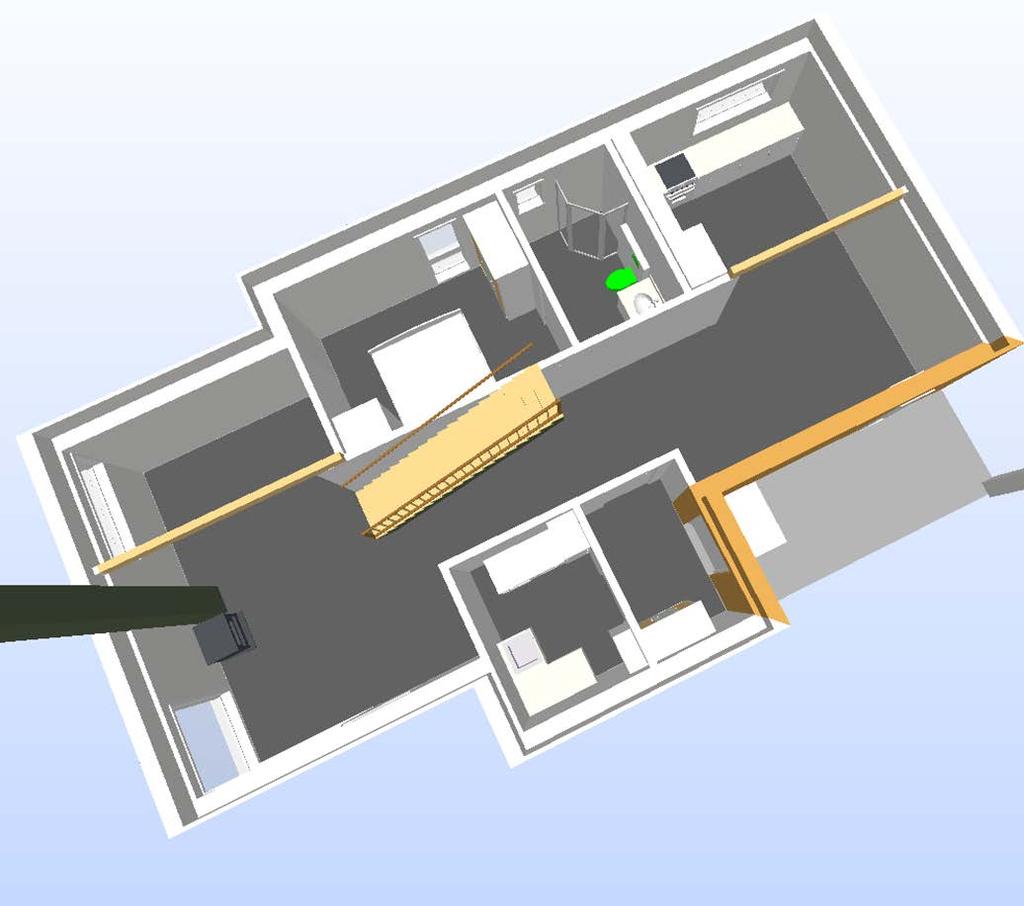
3 Så här ser det ut. (för bygg)» BIM, GIS och infrastruktur inte integrerade» Få modeller för produktion eller förvaltning - trots ambition i designskedet Undervisningshuset på KTH ett exempel Förvaltningen ställer inga krav» Stadsmodeller Inga öppna standarder Stuprör per leverantör av IT och sensorer» Sensorer Inte kopplade till modeller Ingen analys eller styrning
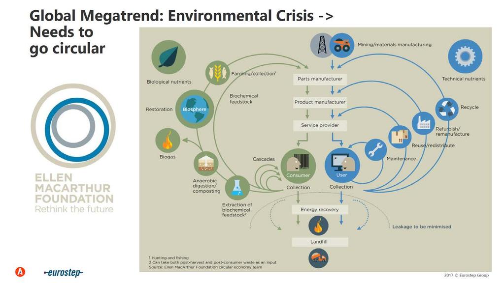
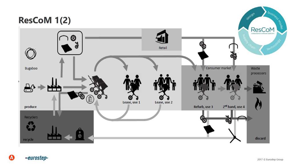
4 Trender» Digitalisering» Cirkulär ekonomi, design & produkt» Digital Twin / Digital Thread Kräver livscykelstöd "typ" PLCS Stödjer LCA, cirkulär design, simulering & analys» ISO/IEC JWG 21 Standardisering av IoT, Smart Manufacturing & Industry(ie) 4.0 Stort svenskt deltagande Ericsson, Sandvik, Siemens, KTH, LTH m fl

5 Digitalisering

6 Cirkulär ekonomi - delningsekonomi
7
8
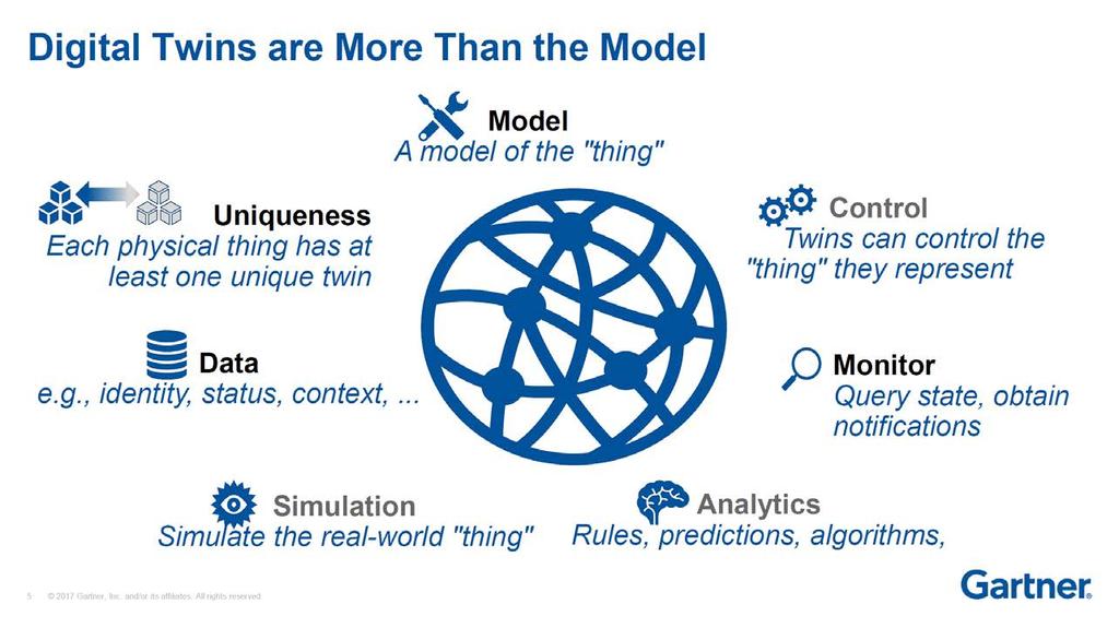
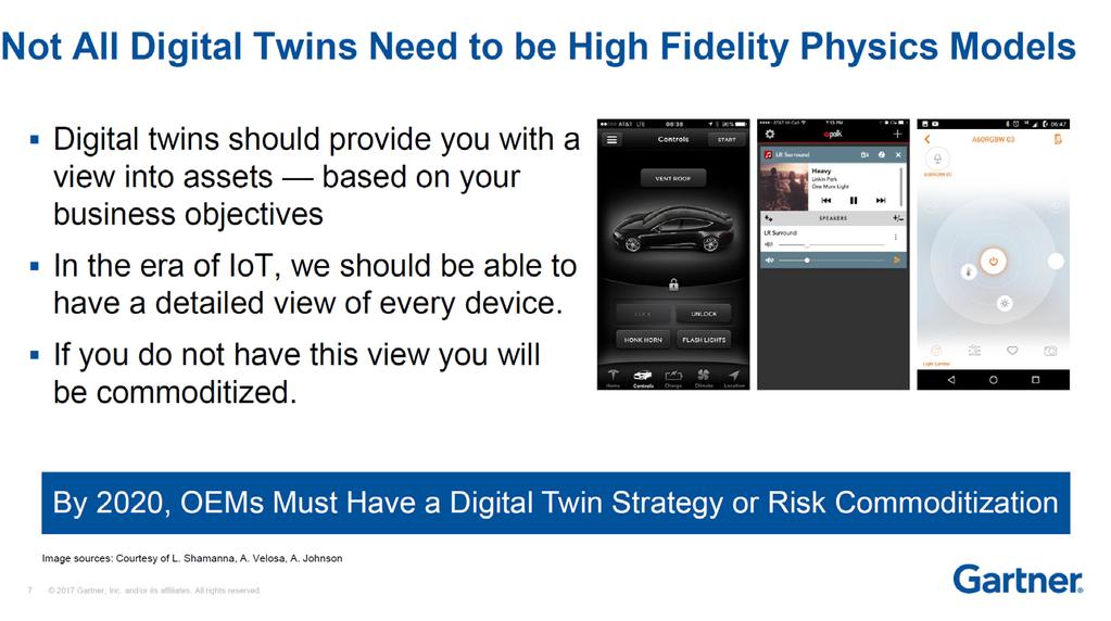
9 Digital Twin & Digital Thread
10

11
12
13
14

15 ISO/IEC JWG 21
16 Vår forskning och utveckling - Testbädden

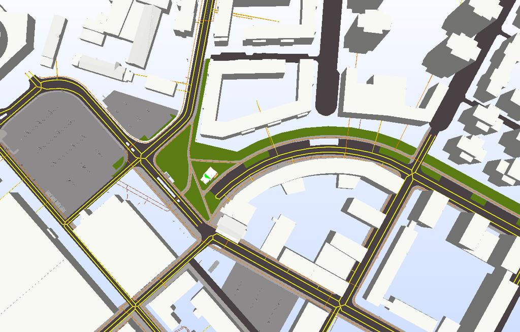
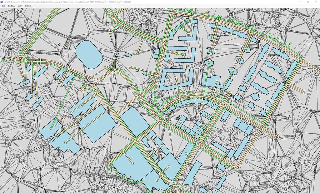
17 Testbed for BIM level 3 Testbed for Interoperability Lifecycle managemetn Common models, Conceptsand processes Processes drawings, documents models files objects data bases integrated BIM hub BIM levels after British Standards Institute (from ARCADIS adapted to Sweden)
18 Smart planning, design, construction, operation and use processes over the whole life cycle APPLICATION CASES Test case 2 Test case 4 Test case 1 Test case 3 Test case n TEST BED SMART INFORMATION PROCESSEs National geo data Municipality geo data Real estate register Etc Export, import, linking Converting, verifying (ETL) Country County City Block Property Geodata (Swedish Geo process) Linked data sources Visualisation Transport network Lifecycle support Building Floor Room Building element BIM (BIM Alliance) Converting, verifyiing (ETL) Export, import, linking National road db BIM Product database Etc.
 Country County City Block Property Geodata (Swedish Geo process) Linked")
19 Smart planning, design, construction, operation and use processes over the whole life cycle APPLICATION CASES Test case 2 Test case 4 Test case 1 Test case 3 Test case n TEST BED SMART INFORMATION PROCESSEs National geo data Municipality geo data Real estate register Etc Export, import, linking Converting, verifyiing (ETL) Country County City Block Property Geodata (Swedish Geo process) Linked data sources Visualisation Transport network Lifecycle support Building Floor Room Building element BIM (BIM Alliance) Converting, verifyiing (ETL) Export, import, linking National road db BIM Product database Etc.

20 Time schedule for the Test bed WP 1: Developmentof the platform, WP leader Torbjörn Holm, Eurostep WP 2: Information exchange construction company - municipality, WP leader Lars Harrie, Lund University WP 3: 3D property formation, WP leader Jenny Paulsson, KTH WP 4: BIM for production management, WP leader Thomas Olofsson, LTU WP 5: Management, information dissemination, WP leader Väino Tarandi, KTH Applied project Trafikverket VERA IFC Alignment tested in the test bed late autumn 2017 OOOOOOOOOOOO Participants KTH, LTU, LU, Chalmers, Högskolan i Gävle, Lantmäteriet, Trafikverket, Boverket, Mölndal stad, Stockholm stad, Malmö stad, Helsingborg stad, Eurostep, Triona, Trimble (Vianova), Agency 9, Logiq/Finfo, NCC, Tyréns, Cementa, Betongindustri, SLL Trafikförvaltningen
21 Project purpose This project proposal aims at creating a Level 3 test bed to be a national resource for testing concepts, ideas and innovations for the smart community. It involves tests of open new and existing standards, methods and processes to make available and use Geo and BIM data in several parts of the community building process throughout the project and city life cycles. The test bed will be used in cooperation between authorities like National Land Survey, National Board of Housing, Building and Planning, Swedish Transport Administration, municipalities, etc. and construction companies to develop and test a digital open, object oriented and standardized information exchange. "

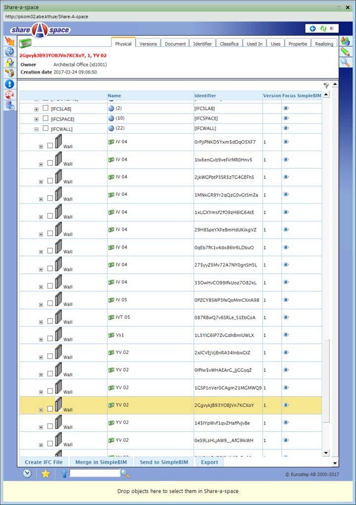
22 Multiple Systems Integration? Collaboration Hub
23 Integration of standards for buildings and infrastructure Through Life Support - PLCS Net-work ISO 191xx based (NVDB, Inspire, etc.) Alignment Ifc, simple ifcxml Common concepts InfraGML Ifc, simple ifcxml, LandXML LandXML XML. XML.
24 Lifecycle + breakdown with topology Objectified topological relation (with effectivity) Life cycle phases Product breakdown [ISO ] Through life support (incl. versioning) [PLCS ISO 10303:239]
25
26 Heterogeneous data models mapped to PLCS Alignment Road, Railway Bridge InfraGML
27 Using PLCS and IFC (& more) PLCS» ISO Change Management Versioning Consolidation Requirement Product as realized Maintenance IFC» ISO 16739:2013 Building element Material Property Geometry Placement Other domain specific stds - LandXML, CityGML, InfraGML C O P Y R I G H T E U R O S T E P G R O U P
 B-rep CSG Geometry (Sweep)")


28 What IFC2x3 can do today Geometry (explicit) B-rep CSG Geometry (Sweep) volume - extrusion, rotation areas - extrusion, rotation Topology element connectivity, schematic design Relations between Building Elements Wall Connections Holes Chases Zones Spaces and Spatial Structure Space Building Storey Building Building Site Building Elements Walls, Openings, Doors Roofs, Stairs, Ramps, etc. Site and Terrain Model Site Site attributes C O P Y R I G H T E U R O S T E P G R O U P

29 The PLCS high level model C O P Y R I G H T E U R O S T E P G R O U P


")


30 Business processes Municipality Contractor Building permit 3D property Production management Information systems Train Train Agency9 Nova Point Minecraft System A System B System C System Mate MateX Standardised interfaces (ETL tools) Information Network TNE BIM / GIS object PLCS Documents Reference db Linked data sets City Block Building Room Road... Property register NVDB NNH Logic/Finfo
31 Architecture to implement 1. Topological & Spatial hierarchies 2. Versions and changes 3. Life cycle 4. Unique identifiers - GUID 5. Classification 6. Units 7. Coordinate systems 8. Reference geometries 9. Types with versions 10. LOD Level of Detail for the Geo process 11. Terrain model - granularity 12. Networks and Road alignments 13. Swedish Geo process
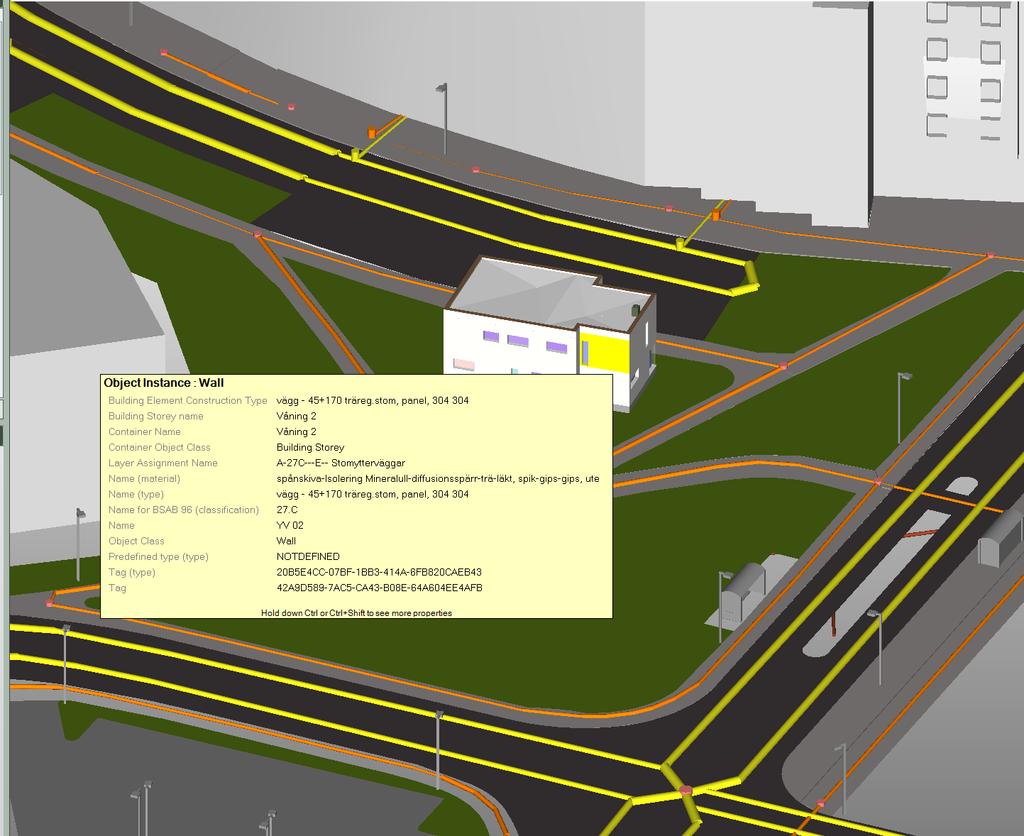
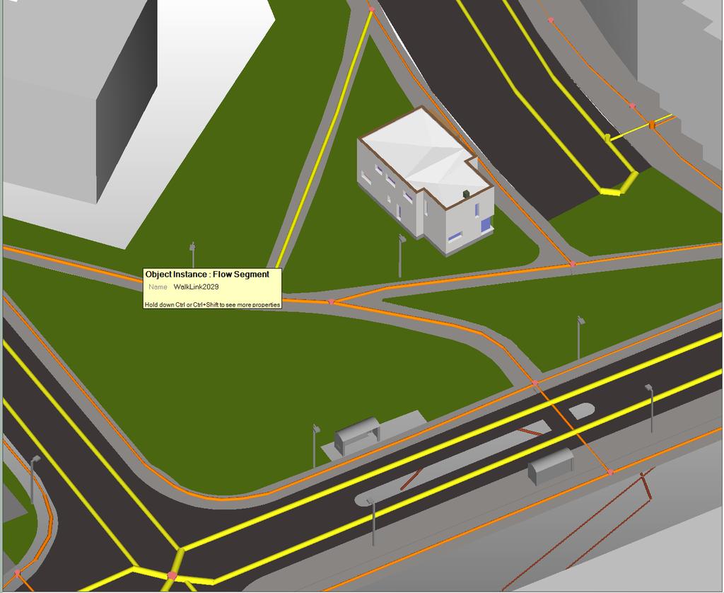
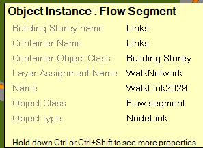
32 Topological & Spatial hierarcies Background In the GIS world, you usually use coordinates to search for information rather than topologis-ka relationship. In the BIM world, the IFC standard has evolved over a long period of time, and the structure of the building, floor, room and building elements has worked well to find and navigate among the different parts. Systems and topologies provide opportunities for analysis and comparisons of different locations in the country with recurring similar degradations. The idea is to have a simple, quick breakdown in a few steps. Suggestions for functionality in the platform Structures from county to city to neighborhood to property are being built up. To these networks, breakdowns in networks for wiring, roads m m from the appropriate level. Similarly, as the stories (spatial structure element) of the building has rooms, the Infra group in buildignsmart has developed traffic places with "spatial segments" - lanes, walkways, etc. For example, a roundabout, station area, sports facility has "spatial segments" - this is lacking in the classification systems...
33
34
35 Life-cycle model From a life-cycle perspective it is important to have an unbroken information flow. The different phases of the life-cycle for a construction project and the construction itself need to be represented by several objects, not just one, over time. The designed physical element, fulfilling requirements through its function, The product as planned realizing the technical solution and finally, The product as realized with its serial number.
36 Livscyle phases Description All stages and types of objects will be handled for detail planning, property development, construction, operation and management processes. Requirements management, design phases, types of items should be handled. It is difficult for the actors to address the requirements on the objects to be built when the requirements are usually presented in text documents instead of attributes associated with geographical or geometrical objects. Requirements are own objects (in PLCS) and they should not be viewed as attributes associated with the objects. In the built society there are existing buildings and facilities - they occur at different stages of determination, production, operation and maintenance. Similarly, there are planning processes in progress covering different parts of the built society. Suggestions for functionality The phases can be handled by giving the objects in information models different phase relations to be able to follow their changes over time. Previous work in EU projects and standardization of PLCS for manufacturing and defense industries, as well as buildings to some extent, supports that PLCS is proposed as a platform for lifecycle management in the platform, see the following pictures:
37
38

39 Type object to design object Physical_element Part Physical_element _version Part_version Physical_element _definition Part_view _definition Breakdown_element_realization
40

41 Type object to planned individual Product_as _individual Part Product_as _planned Part_version Product_as_ individual_view Part_view _definition Breakdown_element_realization Product_as_planned will later be replaced by Product_as_realized

42 Design object to planned individual Physical_element Product_as _individual Physical_element _version Product_design _version_to_individual Product_as _planned Physical_element _definition Product_as_ individual_view Product_as_planned will later be replaced by Product_as_realized
43 Classification Description The new classification system CoClass is now ready for use in Sweden. It covers both buildings and facilities. It has an object division that is extensive and soon also property definitions. CoClass is also intended to be used to identify components in different system structures. Alternative Use CoClass for pure classification of building objects. Watch out for the impact of system structures on identity setting. Other identification applications (designation) are possible as identities can be generated based on the systems and breakdowns that exist in the buildings if they are modeled correctly. Suggestions for functionality in the platform Build parallel structures according to the IFC Standard (Building, Spatial Structure Elements, Spaces and Building elements) also for facilities (and other "building complex" such as railway stations). The figure below shows a sports facility that should be structured in a similar way to a construction work. It should follow the structures of IFC - a breakdown from property to building and land, which is then broken down into a spatial and physical structure.

44 <BV>Track and Field Facility <UT>BDA Sport Area (Soccer field) <BX>Sport Arena <BV>APA Utility room <UT>GDB Green made rest area <UT>GAA Forest Sport arena, utility rooms and sport areas seem to be unstructured and mixed in this example?
45 Coordinate systems Description The question is which coordinate system will we primarily work in when designing? You can think of three alternatives: A national system Sweref 99 TM A municipal system - Local map projections by Sweref 99 Alternative - construction site-specific coordinate system Our proposal is that we should store in geographic coordinates and then convert. The Swedish Transport Administration only has latitude and longitude on its elongated projects - within the BIM area it is included as part of the IFC standard. Swedish geo process requires the Sweref 99 TM to be used (at least in their building model).

46 In IFC 4 the coordinates are definied for the project/site origo using IFC 4 geolocation, which has the following structure:
47 Engineering system the BIM world


48 Linking The BIM world is linked to the ellipsoid by a fixed point and a known orientation Map projections are determined by mathematical formulas, these vary depending on map projection
 in")


49 Reference geometries Description The IFC standard provides reference geometries for the relative locations of the individual objects (building elements) in relation to the site's origin or other building elements. These reference geometries may be insertion points, lines and surfaces for all different building components. They define the origin and rotation of the current object. Similarly, in Swedish geo process according to Measurement Instructions, see examples below.
50 LOD Level of Detail for the Geo process Description The test beds should be able to keep information and geometry for the various objects that form the built environment. Several different representations should be kept for both information and geometry using property sets and 2D / 3D models, respectively. On the GIS side, CityGML has its definition of LOD0, 1, 2, 3 and 4. For the BIM side, for example NIBS (USA) has its values 200, 300 etc. Alternative The LOD geometry on the building level (for Swedish geo process / CityGML) can be generated from BIM models (with appropriate software) or it can be created by using separate tools in the planning process to be independent of the design work. Definitions of building components will be created in the design process and directly linked to the BIM objects. Suggestions for functionality in the platform Generate LOD 0, 1, 2, 3 and 4 from the BIM models when they are imported to the platform. Placeholders are created at the building level for geometries (and properties) classified as respective LOD level. The LOD descriptions for the Swedish geo process are linked to the relevant version of the building as the details are developed. FME is a candidate as a tool. The definitions on the building level are imported via the BIM model and are linked to the respective stage and version.

51 OGCs Level of Definition

52 GIS standards vs BIM standards BIM-model Geodata-model Source: Nagel och Kolbe
53 Network and Road Alignments (IFC 4)
54
55

56 Swedish Geo process Process flows and information deliveries?
57
58
59 Vår forskning och utveckling - Nya testfall för Testbädden» Forskningsfrågor och utvecklingsprojekt inom KTH Undervisningshuset» IoT, sensorer, simuleringar m m» Samverkan Industriell Produktion, Gunilla Sivard» Akademiska Hus
60 Thank you!
Väino Tarandi Professor, KTH, Stockholm. Gothenburg
 The Test Bed The need for interoperability and open standards in the Architecture Engineering Construction (AEC) industry how to integrate BIM and GIS with a life cycle view Väino Tarandi Professor, KTH,
Overview of CityGML. Dave Capstick, Ordnance Survey Research Department
 Overview of CityGML Dave Capstick, Ordnance Survey Research Department Introduction Why is citygml necessary CityGML development who is responsible? Ordnance Surveys interest 3D modelling basic concepts
Investigating the practical relationship between GIS and BIM; then relating that to a 3D cadastre. J. Gabriel van Wyk, Johan Nel
 Investigating the practical relationship between GIS and BIM; then relating that to a 3D cadastre. J. Gabriel van Wyk, Johan Nel Overview So exactly what is BIM? Available BIM offerings in the market Traditional
ISO/TC 211 International seminar Kurt Löwnertz, Smart Built Environment
 ISO/TC 211 International seminar Kurt Löwnertz, Smart Built Environment What is Smart Built Environment? A 12 year strategic R&I programme 2016 2028 One of 17 such programmes aiming at strengthening industrial
GIS-based Smart Campus System using 3D Modeling
 GIS-based Smart Campus System using 3D Modeling Smita Sengupta GISE Advance Research Lab. IIT Bombay, Powai Mumbai 400 076, India smitas@cse.iitb.ac.in Concept of Smart Campus System Overview of IITB Campus
INSPIRE in Sweden.
 INSPIRE in Sweden Swedish National Data Service Established 2008. SND is a service organisation for Swedish research within the Humanities, Social Sciences and Medicine. SND is the Swedish node in an international
The Swedish National Geodata Strategy and the Geodata Project
 The Swedish National Geodata Strategy and the Geodata Project Ewa Rannestig, Head of NSDI Co-ordination Unit, Lantmäteriet, ewa.rannstig@lm.se Ulf Sandgren, Project Manager Geodata Project, Lantmäteriet,
BIM and INSPIRE, for a better integration of built infrastructures in their environment : the MINnD project
 BIM and INSPIRE, for a better integration of built infrastructures in their environment : the MINnD project François ROBIDA Christophe CASTAING Strasbourg, > 1 8 septembre 2017 ABOUT BIM Building Information
SWEDISH SDI DEVELOPMENT & IMPLEMENTATION OF INSPIRE
 SWEDISH SDI DEVELOPMENT & IMPLEMENTATION OF INSPIRE Christina Wasström, Lantmäteriet, 801 82 Gävle, Sweden, christina.wasstrom@lm.se ABSTRACT The Swedish Government and Parliament has given Lantmäteriet
Landreport Sweden
 L A N T M Ä T E R I E T 1 (7) 2016-05-25 v 1.0 Landreport Sweden 2015-2016 1. The Address register current situation The number of addresses is about 3.7 million. The updating runs for good, but there
ArcGIS Urban: An Introduction. Lisa Staehli ArcGIS Urban Team Product Development Brooks Patrick ArcGIS Urban Team Business Development
 ArcGIS Urban: An Introduction Lisa Staehli ArcGIS Urban Team Product Development Brooks Patrick ArcGIS Urban Team Business Development Our Cities Are Facing Massive Challenges Our Cities Are Facing Massive
Compact guides GISCO. Geographic information system of the Commission
 Compact guides GISCO Geographic information system of the Commission What is GISCO? GISCO, the Geographic Information System of the COmmission, is a permanent service of Eurostat that fulfils the requirements
BIM Week October 2013 Munich, GERMANY
 BIM Week October 2013 Munich, GERMANY Paul Scarponcini, PE, PhD Bentley Systems, Inc. COBie (for Buildings) Based on MVD of Building IFCs no geometry extended constraints, attributes, relationships Uses
INSPIRE in Sweden - an Important Part of the National Geodata Strategy
 INSPIRE in Sweden - an Important Part of the National Geodata Strategy Ewa RANNESTIG and Monica LAGERQVIST NILSSON, Sweden Key words: National Geodata Strategy, National Infrastructure for Spatial Information,
3D Urban Information Models in making a smart city the i-scope project case study
 UDC: 007:528.9]:004; 007:912]:004; 004.92 DOI: 10.14438/gn.2014.17 Typology: 1.04 Professional Article 3D Urban Information Models in making a smart city the i-scope project case study Dragutin PROTIĆ
CityGML and the Streets of New York A Proposal for Detailed Street Space Modeling
 LEONHARD OBERMEYER CENTER TUM CENTER OF DIGITAL METHODS FOR THE BUILT ENVIRONMENT CityGML and the Streets of New York A Proposal for Detailed Street Space Modeling Christof Beil & Thomas H. Kolbe Chair
Pushing the Standards Edge: Collaborative Testbeds to Accelerate Standards Development and Implementation
 Pushing the Standards Edge: Collaborative Testbeds to Accelerate Standards Development and Implementation Mark E. Reichardt President mreichardt@opengeospatial.org 31 October 2006 2006 Open Geospatial
IDBE. Common conceptual framework and roadmap of collaboration in Spatial Standards for the Digital Built Environment
 IDBE Common conceptual framework and roadmap of collaboration in Spatial Standards for the Digital Built Environment GeoBIM: 3D GIS in China Mei Xue: In my opinion, what matters most in the integration
BIM Building Information Modelling/Management
 1 BIM Building Information Modelling/Management Outline What is the Industry Foundation Classes? Background Schema Domains What is the Information Delivery Manual? 2 Managing Data Requirements The Information
3D-geodata infrastructure in the city of coburg - Origin process und vision. INGeoForum e.v. Open Geospatial Consortium
 INGeoForum e.v. Open Geospatial Consortium at Fraunhofer Institut for Computer Graphics in Darmstadt 3D-geodata infrastructure in the city of coburg - Origin process und vision 29. September 2009 Requirements
Nordic Address Forum. Cooperation with Municipalities & The Geodata Strategy. Angela Fessé Lantmäteriet Odense, June
 Nordic Address Forum Cooperation with Municipalities & The Geodata Strategy Angela Fessé Lantmäteriet Odense, June 3-4 2010 Why collaborate on national databases? The private market and society have broader
IDEBarcelona: Cooperating for a Smart Region Infrastructure
 IDEBarcelona: Cooperating for a Smart Region Infrastructure Marta Codinachs Serra Diputació de Barcelona Territory and Sustainability Area Territorial Information Systems Department SMART CITY EXPO WORLD
AEC 3 United Kingdom. Industry Foundation Classes. Norwegian IFG project Harmonisation IFC and gml3. Dr. Thomas Liebich, Jeffrey Wix AEC3 Ltd.
 Industry Foundation Classes AEC 3 United Kingdom Thatcham, Berkshire RG18 3ES Tel: +44-1635 86 4590 Fax: +44-1635 86 0673 email: jeffrey.wix@aec3.com Germany D-80636 München Tel: +49-89-1870 3223 Fax:
EXPECTATIONS OF TURKISH ENVIRONMENTAL SECTOR FROM INSPIRE
 EXPECTATIONS OF TURKISH ENVIRONMENTAL SECTOR FROM INSPIRE June, 2010 Ahmet ÇİVİ Tuncay DEMİR INSPIRE in the Eyes of MoEF Handling of Geodata by MoEF Benefits Expected TEIEN First Steps for INSPIRE Final
GEOVEKST A Norwegian Program for Cost Sharing in Production, Updating and Administration of Geographic Data
 GEOVEKST A Norwegian Program for Cost Sharing in Production, Updating and Administration of Dr. Anne Kirsten S. HØSTMARK, Norway Key words: Mapping in large scale, formal co-operation, cost sharing, standarised
Implementing INSPIRE in Sweden
 Implementing INSPIRE in Sweden Christina Wasström NSDI-unit, Lantmäteriet Christina.wasstrom@lm.se Standards Cooperation Metadata Competence Infrastructure for Geodata Legal Framework Portal Services Geodata
Coordinate systems, measured surveys for BIM, total station for BIM, as-built surveys, setting-out
 Coordinate systems, measured surveys for BIM, total station for BIM, as-built surveys, setting-out What is a BIM What does a BIM do Why use a BIM BIM Software BIM and the Surveyor How do they relate to
buildingsmart International and Open Geospatial Consortium Framework for Collaboration on BIM-GIS Interoperability
 buildingsmart International and Open Geospatial Consortium Framework for Collaboration on BIM-GIS Interoperability Jim Plume, Carsten Rönsdorf, and Scott Simmons Copyright 2017 Open Geospatial Consortium
A BASE SYSTEM FOR MICRO TRAFFIC SIMULATION USING THE GEOGRAPHICAL INFORMATION DATABASE
 A BASE SYSTEM FOR MICRO TRAFFIC SIMULATION USING THE GEOGRAPHICAL INFORMATION DATABASE Yan LI Ritsumeikan Asia Pacific University E-mail: yanli@apu.ac.jp 1 INTRODUCTION In the recent years, with the rapid
SMART CITIES NEED LOCATION DATA
 SMART CITIES NEED LOCATION DATA Carsten Rönsdorf 27 May 2015 Lisbon Future Cities need Location Data Geospatial World Forum 27 May 2015 Carsten Rönsdorf, Head of Advisory Services, OS International OFFICIAL
INSPIREd solutions for Air Quality problems Alexander Kotsev
 INSPIREd solutions for Air Quality problems Alexander Kotsev www.jrc.ec.europa.eu Serving society Stimulating innovation Supporting legislation The European data puzzle The European data puzzle 24 official
Development of a tool for proximity applications
 Page 1 of 8 Development of a tool for proximity applications Anders Dahlgren 1 and Lars Harrie 2 1 The National Rural Development Agency, Östersund, Sweden, anders.dahlgren@glesbygdsverket.se 2 GIS Centre,
Bentley Map Advancing GIS for the World s Infrastructure
 Bentley Map Advancing GIS for the World s Infrastructure Presentation Overview Why would you need Bentley Map? What is Bentley Map? Where is Bentley Map Used? Why would you need Bentley Map? Because your
CityGML XFM Application Template Documentation. Bentley Map V8i (SELECTseries 2)
") CityGML XFM Application Template Documentation Bentley Map V8i (SELECTseries 2) Table of Contents Introduction to CityGML 1 CityGML XFM Application Template 2 Requirements 2 Finding Documentation 2 To
CityGML XFM Application Template Documentation Bentley Map V8i (SELECTseries 2) Table of Contents Introduction to CityGML 1 CityGML XFM Application Template 2 Requirements 2 Finding Documentation 2 To
Open spatial data infrastructure
 Open spatial data infrastructure a backbone for digital government Thorben Hansen Geomatikkdagene 2018 Stavanger 13.-15. mars Spatial Data Infrastructure definition the technology, policies, standards,
Improving Business Decisions for Existing Buildings with BIM and GIS
 Improving Business Decisions for Existing Buildings with BIM and GIS Ken Bragg European Services Manager, Safe Software @kenatsafe GeoBIM Europe Dec. 11 th 2015 FME FME Technology Capabilities Translate
Important note To cite this publication, please use the final published version (if applicable). Please check the document version above.
. Please check the document version above.") Delft University of Technology Building Information Modelling: essentials and issues The need to Integrate BIM and Geoinformation Zlatanova, Sisi; Isikdag, Umit Publication date 2016 Document Version Early
Delft University of Technology Building Information Modelling: essentials and issues The need to Integrate BIM and Geoinformation Zlatanova, Sisi; Isikdag, Umit Publication date 2016 Document Version Early
Appropriation Directions for 2007
 INSPIRE in Sweden An Important Part of the National Geodata Strategy Monica Lagerqvist Nilsson Appropriation Directions for 2007 A commission to investigate the necessity to adjust the Swedish legislation
Think Local - Act Global a Nordic Perspective
 Think Local - Act Global a Nordic Perspective OGC Nordic Forum Jari Reini 20-21.5.2014 OGC Nordic Forum? OGC Nordic Forum addresses OGC outreach and education needs of government, academic, research and
Paper UC1351. Conference: User Conference Date: 08/10/2006 Time: 8:30am-9:45am Room: Room 23-B (SDCC)
") Conference: User Conference Date: 08/10/2006 Time: 8:30am-9:45am Room: Room 23-B (SDCC) Title of Paper: Increasing the Use of GIS in the Federal Government Author Name: Miss Abstract This presentation
Conference: User Conference Date: 08/10/2006 Time: 8:30am-9:45am Room: Room 23-B (SDCC) Title of Paper: Increasing the Use of GIS in the Federal Government Author Name: Miss Abstract This presentation
Smart Cities: Data Representation Model
 Smart Cities: Data Representation Model ISO/IEC JTC 1/SC24 Meetings 19-24 January 2019 Seoul, Korea Peter Ryan 1 and Myeong Won Lee 2 1 Defence Science & Technology Group, Australia 2 University of Suwon,
CityGML in Detail Part 2
 CityGML in Detail Part 2 Prof. Dr. Thomas H. Kolbe Institute for Geodesy and Geoinformation Science Berlin University of Technology kolbe@igg.tu-berlin.de May 2008 EduServ6 Course on CityGML Copyright
Data Origin. Ron van Lammeren CGI-GIRS 0910
 Data Origin Ron van Lammeren CGI-GIRS 0910 How to obtain geodata? Geo data initiative Executive Order 12906, "Coordinating Geographic Data Acquisition and Access: The National Spatial Data Infrastructure,"
K. Zainuddin et al. / Procedia Engineering 20 (2011)
") Available online at www.sciencedirect.com Procedia Engineering 20 (2011) 154 158 The 2 nd International Building Control Conference 2011 Developing a UiTM (Perlis) Web-Based of Building Space Management
Available online at www.sciencedirect.com Procedia Engineering 20 (2011) 154 158 The 2 nd International Building Control Conference 2011 Developing a UiTM (Perlis) Web-Based of Building Space Management
Building a national spatial data infrastructure. Thorben Hansen, Head of Division Danish Agency for Data Supply and Efficiency
 Building a national spatial data infrastructure Thorben Hansen, Head of Division Danish Agency for Data Supply and Efficiency About Spatial Data Infrastructure Spatial data come from many sources and is
Testing of Geoportals: INSPIRE demands and challenges
 Testing of Geoportals: INSPIRE demands and challenges Imad Abugessaisa & Solgerd Tanzilli Lantmäteriet - Swedish Mapping, Cadastre and Land Registration Authority / Future Position X, Gävle INSPIRE 2010
Data Origin. How to obtain geodata? Ron van Lammeren CGI-GIRS 0910
 Data Origin How to obtain geodata? Ron van Lammeren CGI-GIRS 0910 Spatial Data interest Improvement of policy making. ± 90% of all information used by government has spatial characteristics SPATIAL INFORMATION
The Role of Mapping, GPS, and GIS in Trail Design and Construction
 The Role of Mapping, GPS, and GIS in Trail Design and Construction How do we normally think about MAPS and TRAILS? Idea of map as final product Trail maps Kiosk / trailhead maps Survey plat Map as Product
Japan Construction Information Center
 Japan Construction Information Center A Framework for Data Coordination Method of Maintenance Data and 3D Conceptual Model on CIM Based Database July 2016 Japan Construction Information Center Foundation
UBGI and Address Standards
 Workshop on address standards UBGI and Address Standards 2008. 5.25 Copenhagen, Denmark Sang-Ki Hong Convenor, WG 10 1 Evolution of Geographic Information Visualization Feature (Contents) Context Accessibility
Exploit your geodata to enable smart cities and countries
 Exploit your geodata to enable smart cities and countries Carsten Rönsdorf, Head of Advisory Services Middle East Practice Manager Future Cities, standards and 3D 24 November 2014 Importance of Standards
4D information management system for road maintenance using GIS
 icccbe 2010 Nottingham University Press Proceedings of the International Conference on Computing in Civil and Building Engineering W Tizani (Editor) 4D information management system for road maintenance
Innovation in Land Management: Integrated Solutions For National Cadastre Projects
 Success With GIS Innovation in Land Management: Integrated Solutions For National Cadastre Projects XXIII International FIG Congress Munich These documents are only complete, when used in connection with
3D City Models. Lars Harrie, Per-Ola Olsson. Images borrowed from Hanna Stigmar, Viktoria Strömberg, Bo Mao and Ara Toomanian
 3D City Models Lars Harrie, Per-Ola Olsson Images borrowed from Hanna Stigmar, Viktoria Strömberg, Bo Mao and Ara Toomanian 1. Collection of 3D-data Photogrammetry http://www.gpsi-corp.com Overlapping
Open geodata. GISS-conference at Esri Berlin
 Open geodata GISS-conference at Esri Berlin 2017-09-29 Eva Nord, regional spatial data coordinator at the national mapping, cadastral and landregistration authority Uwe Stephan, GIS coordinator at the
Programme Study Plan
 Faculty of Social and Life Sciences Programme Study Plan Geographic Information Systems Programme Code: Programme Title: TGLIT Engineering: Surveying Technology and Geographical IT Credits: 180 Programme
Integrating Building Information Models with Open Geospatial Web Services
 Open Geospatial Consortium Interoperability Testbed 4 for CAD/GIS/BIM Integrating Building Information Models with Open Geospatial Web Services Prepared by: Paul Cote Harvard Graduate School of Design
International 3D Developments. Jantien Stoter Professor 3D GeoInformation
 International 3D Developments Jantien Stoter Professor 3D GeoInformation European Spatial Data Research EuroSDR 3D Special Interest Group Active participants: Swisstopo, Ordnance Survey UK, Ordnance Survey
Application of GIS in Public Transportation Case-study: Almada, Portugal
 Case-study: Almada, Portugal Doutor Jorge Ferreira 1 FSCH/UNL Av Berna 26 C 1069-061 Lisboa, Portugal +351 21 7908300 jr.ferreira@fcsh.unl.pt 2 FSCH/UNL Dra. FCSH/UNL +351 914693843, leite.ines@gmail.com
Virtual 3D Models as a Basis for Property Formation
 Virtual 3D Models as a Basis for Property Formation Martin ANDRÈE,Goran MILUTINOVIC and Stefan SEIPEL, Sweden Key words: LIDAR, 3D, Cadastre, Survey, e-government, process development SUMMARY Property
Smart Cities: Visualization
 Smart Cities: Visualization ISO/IEC JTC 1/SC24 Meetings 20-25 January 2019 Seoul, Korea Peter Ryan 1 and Myeong Won Lee 2 1 Defence Science & Technology Group, Australia 2 University of Suwon, Korea Presentation
GIS Capability Maturity Assessment: How is Your Organization Doing?
 GIS Capability Maturity Assessment: How is Your Organization Doing? Presented by: Bill Johnstone Principal Consultant Spatial Vision Group November 8, 2018 1. Motivation for Capability Maturity Models
GENERATING INSPIRE PLU DATA ON BASE OF THE GERMAN NATIONAL STANDARD XPLANUNG. Dr. Joachim Benner Dr. Kai-Uwe Krause September
 GENERATING INSPIRE PLU DATA ON BASE OF THE GERMAN NATIONAL STANDARD XPLANUNG Dr. Joachim Benner Dr. Kai-Uwe Krause September Introduction city state Hamburg North Sea Hamburg Hamburg as a city state is
Analys av GIS-användning inom offentlig sektor i Norden
 Analys av GIS-användning inom offentlig sektor i Norden Henning Sten Hansen, Line Hvingel and Lise Schrøder Aalborg Universitet Jönköping, Sweden 30 March 2011 Overview The Danish and Swedish approaches
Data Conversion to I3S for 3D Modeling from CityGML. Christian Dahmen (con terra GmbH) Satish Sankaran (Esri)
 Satish Sankaran (Esri)") Data Conversion to I3S for 3D Modeling from CityGML Christian Dahmen (con terra GmbH) Satish Sankaran (Esri) 3D Across the ArcGIS Platform Manage Multiscale 3D Models 3D Geodesign ArcGIS for 3D Cities
Data Conversion to I3S for 3D Modeling from CityGML Christian Dahmen (con terra GmbH) Satish Sankaran (Esri) 3D Across the ArcGIS Platform Manage Multiscale 3D Models 3D Geodesign ArcGIS for 3D Cities
GEOGRAPHY (GE) Courses of Instruction
 Courses of Instruction") GEOGRAPHY (GE) GE 102. (3) World Regional Geography. The geographic method of inquiry is used to examine, describe, explain, and analyze the human and physical environments of the major regions of the
GEOGRAPHY (GE) GE 102. (3) World Regional Geography. The geographic method of inquiry is used to examine, describe, explain, and analyze the human and physical environments of the major regions of the
Spatial Data Infrastructure Concepts and Components. Douglas Nebert U.S. Federal Geographic Data Committee Secretariat
 Spatial Data Infrastructure Concepts and Components Douglas Nebert U.S. Federal Geographic Data Committee Secretariat August 2009 What is a Spatial Data Infrastructure (SDI)? The SDI provides a basis for
Using OGC standards to improve the common
 Using OGC standards to improve the common operational picture Abstract A "Common Operational Picture", or a, is a single identical display of relevant operational information shared by many users. The
GIS-based Smart Campus System using 3D Modeling
 GIS-based Smart Campus System using 3D Modeling Hardik Panchal & Rizwan Khan, Smita Sengupta, GISE Advance Lab, Indian Institute of Technology, Bombay, India N.L. Sarda, Dept. Of Computer Science, Indian
TRAITS to put you on the map
 TRAITS to put you on the map Know what s where See the big picture Connect the dots Get it right Use where to say WOW Look around Spread the word Make it yours Finding your way Location is associated with
Model Setup IDM Vol 2: Process Model
 Model Setup IDM Vol 2: Process Model Gateway to Melbourne, Australia. Source: Fender Katsalidis, Architects Version 1.4 27 June 2017 Contents Model Setup Exchange Scenarios... 1 Overview... 1 Project Roles...
EuroSDR (European Spatial Data Research)
") EuroSDR (European Spatial Data Research) ROLLING RESEARCH PLAN 2015-2018 EuroSDR Secretariat Public Governance Institute KU Leuven Parkstraat 45 bus 3609 3000 Leuven Belgium Tel.: +32 16 32 31 80 Fax:
EuroSDR (European Spatial Data Research) ROLLING RESEARCH PLAN 2015-2018 EuroSDR Secretariat Public Governance Institute KU Leuven Parkstraat 45 bus 3609 3000 Leuven Belgium Tel.: +32 16 32 31 80 Fax:
Sova3D - Pilot Case: Hyvinkää Architectural Competition. Internet of Spaces
 Sova3D - Pilot Case: Hyvinkää Architectural Competition SOVA3D SOVA3D offers Internet Based Services for Building Environment 3D Digitalisation. - 3D-VIRTUALMODELS - City Model - Geometry Models - BIM
STRICT AND AUTOMATIC MAPPING OF IFC-BIM MODELS INTO SEMANTICALLY ENRICHED 3D CITYGML BUILDING MODELS (EXTERIOR AND INTERIOR)
") STRICT AND AUTOMATIC MAPPING OF IFC-BIM MODELS INTO SEMANTICALLY ENRICHED 3D CITYGML BUILDING MODELS (EXTERIOR AND INTERIOR) 1ST INTERNATIONAL IAG WORKSHOP ON BIM AND GIS INTEGRATION 25 OCTOBER 2017 Rudi
STRICT AND AUTOMATIC MAPPING OF IFC-BIM MODELS INTO SEMANTICALLY ENRICHED 3D CITYGML BUILDING MODELS (EXTERIOR AND INTERIOR) 1ST INTERNATIONAL IAG WORKSHOP ON BIM AND GIS INTEGRATION 25 OCTOBER 2017 Rudi
Sustainable and Harmonised Development for Smart Cities The Role of Geospatial Reference Data. Peter Creuzer
 Sustainable and Harmonised Development for Smart Cities The Role of Geospatial Reference Data Peter Creuzer 1. Introduction - Smart Cities and Geodata 2. Geodata in Germany 3. Examples 4. Data and Service
Bentley Map Advancing GIS for the World s Infrastructure
 Bentley Map Advancing GIS for the World s Infrastructure Presentation Overview Why would you need Bentley Map? What is Bentley Map? Where is Bentley Map Used? Red text signifies new things in Bentley Map
Estonian Place Names in the National Information System and the Place Names Register *
 UNITED NATIONS Working Paper GROUP OF EXPERTS ON No. 62 GEOGRAPHICAL NAMES Twenty-fifth session Nairobi, 5 12 May 2009 Item 10 of the provisional agenda Activities relating to the Working Group on Toponymic
"Our Profession: Today and the Next Ten FiveYears" Jack Verouden Outgoing Chairman OGP Surveying & Positioning Committee
 "Our Profession: Today and the Next Ten FiveYears" Jack Verouden Outgoing Chairman OGP Surveying & Positioning Committee and Shell Chief Surveyor Greenwich Meridian 112 m No error in Google Earth: Different
SITMUN: Cooperating to Build Local SDIs in the Barcelona Region
 SITMUN: Cooperating to Build Local SDIs in the Barcelona Region Diputació de Barcelona Territory and Sustainability Area Territorial Information Systems Department INSPIRE CONFERENCE Barcelona, September
The production and use of a hydrographic flow-direction network of surface waters. Rickard HALLENGREN, Håkan OLSSON and Erik SISELL, Sweden
 The production and use of a hydrographic flow-direction network of surface waters Rickard HALLENGREN, Håkan OLSSON and Erik SISELL, Sweden Key words: hydrographic, flow-direction network, surface waters
GIS FOR MAZOWSZE REGION - GENERAL OUTLINE
 GIS FOR MAZOWSZE REGION - GENERAL OUTLINE S. Bialousz 1), K Mączewski 2), E. Janczar 2), K. Osinska-Skotak 1) 1) Warsaw University of Technology, Warsaw, Poland 2) Office of the Surveyor of the Mazowieckie
Ready for INSPIRE.... connecting worlds. European SDI Service Center
 Ready for INSPIRE Consultancy SOFTWARE T r a i n i n g Solutions... connecting worlds European SDI Service Center Increasing Added Value with INSPIRE and SDI Components INSPIRE In 2007, the European Commission
Spatial data interoperability and INSPIRE compliance the platform approach BAGIS
 Spatial data interoperability and INSPIRE compliance the platform approach BAGIS BAGIS Voluntary, independent, public, non-profit organization; Organization with main mission to promote the growth of the
What is GIS? Introduction to data. Introduction to data modeling
 What is GIS? Introduction to data Introduction to data modeling 2 A GIS is similar, layering mapped information in a computer to help us view our world as a system A Geographic Information System is a
7 11 August 2011, Vancouver. Don Brutzman, Benjamin Hagedorn. The OGC: Making Location Count
 OGC 3D Portrayal Interoperability Experiment, OGC 3D Summit 2011 SIGGRAPH 2011 7 11 August 2011, Vancouver Don Brutzman, Benjamin Hagedorn The OGC: Making Location Count What is the Open Geospatial Consortium?
Integrating geology in reality mesh? François ROBIDA BRGM (French Geological Survey)
") Integrating geology in reality mesh? François ROBIDA BRGM (French Geological Survey) > 1 UNDERSTANDING geological phenomena and associated risks. THE FRENCH GEOLOGICAL SURVEY THE BRGM IS FRANCE S LEADING
Integrating geology in reality mesh? François ROBIDA BRGM (French Geological Survey) > 1 UNDERSTANDING geological phenomena and associated risks. THE FRENCH GEOLOGICAL SURVEY THE BRGM IS FRANCE S LEADING
start of Swedish national maps.
 1809 - start of Swedish national maps. Corps of military field measurement Triangulation network Spheroid: Bessel 1841 Semimajor axis: : 6377397.155 Semiminor axis: : 6356078.963 Inverse flattening: :
THIS IS NOT A PRESENTATION
 THIS IS NOT A PRESENTATION IT IS AN INVITATION Background Objectives Project Profile Distributed Geodata Management Current Status Remarks Gunnar Misund Associate Professor Head of Environmental Computing
Swedish Spatial Data Infrastructure and the National Geodata Strategy
 Submitted to the United Nations Committee of Experts on Global Geospatial Information Management Seventh Session New York, August 2018 Registration number 519-2018/4327 Country Report, Sweden Swedish Spatial
Introduction to GIS I
 Introduction to GIS Introduction How to answer geographical questions such as follows: What is the population of a particular city? What are the characteristics of the soils in a particular land parcel?
Research on the Architecture of Urban Emergency System Based on GIS Zhe Li1,a, Xiang Teng2,b
 3rd International Conference on Materials Engineering, Manufacturing Technology and Control (ICMEMTC 2016) Research on the Architecture of Urban Emergency System Based on GIS Zhe Li1,a, Xiang Teng2,b 1
ESRI Survey Summit August Clint Brown Director of ESRI Software Products
 ESRI Survey Summit August 2006 Clint Brown Director of ESRI Software Products Cadastral Fabric How does Cadastral fit with Survey? Surveyors process raw field observations Survey measurements define high-order
Technical Specifications. Form of the standard
 Used by popular acceptance Voluntary Implementation Mandatory Legally enforced Technical Specifications Conventions Guidelines Form of the standard Restrictive Information System Structures Contents Values
The INSPIRE Building Model for Energy Applications
 The INSPIRE Building Model for Energy Applications 1 Gerhard Gröger Institute for Geodesy and Geoinformation University of Bonn, Germany 2nd Joint SIG 3D and OGC Workshop - CityGML EnergyADE for building
ISO Series Standards in a Model Driven Architecture for Landmanagement. Jürgen Ebbinghaus, AED-SICAD
 ISO 19100 Series Standards in a Model Driven Architecture for Landmanagement Jürgen Ebbinghaus, AED-SICAD 29.10.2003 The Company 100% SIEMENS PTD SIEMENS Business Services Shareholder & Strategic Business
Global Geospatial Information Management Country Report Finland. Submitted by Director General Jarmo Ratia, National Land Survey
 Global Geospatial Information Management Country Report Finland Submitted by Director General Jarmo Ratia, National Land Survey Global Geospatial Information Management Country Report Finland Background
Building a National Data Repository
 Building a National Data Repository Mladen Stojic, Vice President - Geospatial 1/30/2013 2012 Intergraph Corporation 1 Information has meaning and gives power only when shared and distributed. Information,
Strategies for Integrating CAD and BIM in ArcGIS. Don Kuehne Esri 3D Product Manager: CAD/BIM/AEC
 Strategies for Integrating CAD and BIM in ArcGIS Don Kuehne Esri 3D Product Manager: CAD/BIM/AEC CAD Digital Drawing CAD in ArcGIS Desktop CAD in Desktop CAD as Data CAD as a Map EXPORT TO CAD Create and
BIM Interoperability Limitations: Australian and Malaysian Rail Projects
 BIM Interoperability Limitations: Australian and Malaysian Rail Projects Russell Kenley 1, a, Toby Harfield 2 and Ali Behnam 3 1, 2, 3 Swinburne University of Technology, PO Box 218, Hawthorn, Victoria,
OpenGeospatial Consortium Working Group Reports 3DIM, Urban planning, Land & Infrastructure
 OpenGeospatial Consortium Working Group Reports 3DIM, Urban planning, Land & Infrastructure Leif Granholm BIM Ambassador, Trimble October 30, 2014 Toronto 3DIM Charter The 3D Information Management (3DIM)