BIM and INSPIRE, for a better integration of built infrastructures in their environment : the MINnD project
|
|
|
- Shon Blankenship
- 6 years ago
- Views:
Transcription


1 BIM and INSPIRE, for a better integration of built infrastructures in their environment : the MINnD project François ROBIDA Christophe CASTAING Strasbourg, > 1 8 septembre 2017

2 ABOUT BIM Building Information Modelling (BIM) is a digital representation of physical and functional characteristics of a facility. A building information model is a shared knowledge resource for information about a facility forming a reliable basis for decisions during its lifecycle; defined as existing from earliest conception to demolition. Originally used for building, now largely used for large infrastructures (highway, metro, airport ) (over 50% of BIM projects in France) Standards developed by BSI consortium date
3 date

4 EU SUPPORT

 http://www.")
5 THE MINND PROJECT A French collaborative research project Interoperable Information Model for Sustainable Infrastructures A French consortium of 60 partners 1 goal : enhancing BIM capabilities for infrastructure modeling and management (complete lifecycle of infrastructures)
6 MINND OBJECTIVES Progress in the modeling of different forms of representation and evolution of objects in their spatial and social environment Control and share information about infrastructures Improve productivity and competitiveness Control risks Implement projects in the context of sustainable development date

7 WHY ARE WE (BRGM) HERE? UNDERSTANDING geological phenomena and associated risks. DEVELOPING new methodologies and techniques. THE FRENCH GEOLOGICAL SURVEY THE BRGM IS FRANCE S LEADING PUBLIC INSTITUTION WORKING IN EARTH SCIENCE APPLICATIONS FOR THE MANAGEMENT OF SURFACE AND SUBSURFACE RESOURCES AND RISKS. ITS ACTIVITIES ARE GEARED TO SCIENTIFIC RESEARCH, SUPPORT TO PUBLIC POLICY DEVELOPMENT AND INTERNATIONAL COOPERATION. PRODUCING and disseminating data to support the management of soils, subsoils and their resources. DELIVERING the necessary tools for managing soils, subsoils and their resources, preventing risks and pollution and developing climate change policies. Over 1000 staff including more than 700 engineers and researchers
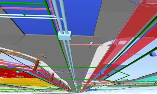
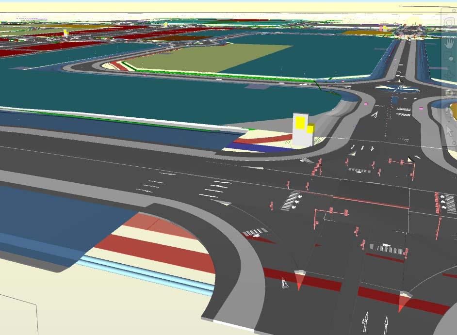
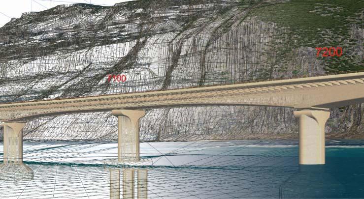
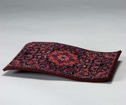
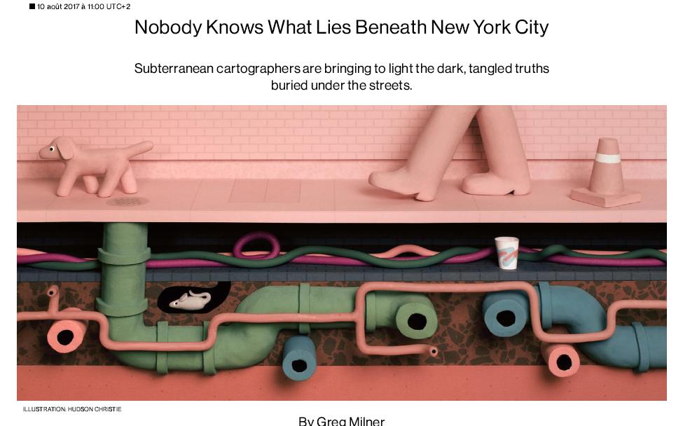
8 Our infrastructures and cities are not laying on a flying carpet
9


10
11

12 KEY CHALLENGES FOR SMART / SUSTAINABLE / RESILIENT CITIES AND INFRASTRUCTURES DEPENDENT OF SUBSURFACE KNOWLEDGE Geo-Hazards : ground stability, subsidence, earthquake, flooding Resources / services : water, geothermal energy, energy storage, building materials Remediation of polluted soils, urban wastelands In the context of climate change and energy transition and of increasing conflict of usage of the underground We need an holistic modelling of cities that integrates the subsurface (and the other components of the natural environment as air, water, biodiversity) Geological surveys, environmental agencies are information providers and data custodians Inspire is supposed to provide this type of information about environment from public organisations


13 HOWEVER, THERE ARE ALREADY EXAMPLES / EXPERIMENTS But without shared best practices, common standards and real integration in current urban models


14 HOWEVER, THERE ARE ALREADY EXAMPLES / EXPERIMENTS City of Lyon City of Toulouse Paris Basin
15 WHY IS IT DIFFICULT TO MERGE MODELLING OF BUILT ENVIRONMENT AND GEOLOGY? Built environment Geology Modelling process Complete design by human Progressive exploration, and understanding (increasing complexity) Data acquisition Relatively cheap (Lidar ) Expensive and indirect Modelling tools CAD engineering software geomodellers (interpolation algorithms) Standards BIM CityGML Accuracy / uncertainty Usualy well known (design construction) For 2d : GeoSciML Not for 3D (still software dependent) Difficult to estimate, communicate, and represent Visualisation VR tools for general public for experts only People Engineers Natural scientists
16 MINND : 8 USES CASES Standardised uses cases extended to infrastructure Roadway lifecycles Project review Cost control through modeling 7 8 Infrastructure lifecycle and exploitation Underground infrastructures Bridges Environment
 description Relationship with its natural environment Actions planned Identify exchange requirements (ER) Process description (IDM) Study of digital")
17 MINND - UC8: UNDERGROUND INFRASTRUCTURE Scope: standardizing underground infrastructure description process One main sponsor Importance of building and environment relationship Two main topics and working groups Built environement (tunnels ) description Relationship with its natural environment Actions planned Identify exchange requirements (ER) Process description (IDM) Study of digital workflows (services + profiles) Enabling data structure (OGC + BSI standards)
18 PERSPECTIVE FOR GEOLOGICAL DATA BIM project DB BIM project DB BIM project DB Geological model DB Services to query geological models Services to feed geological models

19 COLLABORATION BETWEEN OGC AND BSI Memorandum of understanding Work on joint standards Relevant working groups in OGC (similar to bsi rooms) CityGML, IndoorGML, LandInfra, LandAdministration, Smart Cities Geoscience / GeoSciML A GROWING PARTICIPATION OF COMMUNITIES / USERS IN THE PROCESS (domain focus)


20 PROPOSED UNDERGROUND INFRASTRUCTURE PILOT PRESENTED TO NYC MAYOR S OFFICE, MAY D integration of underground critical infrastructure with secure online services for multiple applications Routine operations, emergency response with cascading failures, withstand cyber attacks Foster coordination of local, state, federal governments and utilities Suitable to any urban environment, e.g., New York Underground Infrastructure Data Model City p y Existing Municipal Data Sets Pipe Long-Distance Heat citygml:track citygml:road citygml:track Secured Online Access Pipe - Gas Pipe - coolingenergy Pipe - WasteWater Pipe - FreshWater Copyright 2016 Open Geospatial Consortium

21 (UPCOMING) GEOSCIENCE DOMAIN WORKING GROUP Initiated by Following adoption of GeoSciML, proposal to create a Geoscience Domain Working Group under the umbrella of the Earth Systems Science DWG With primary focus on Borehole standards / best practices 3D geological modelling Seismology Meeting of DWG in Southampton on 14 th September
 standards for 3D geology (new OGC group!")
22 FINAL REMARKS We must address the needs of smart cities and large infrastructures Deliver data / information / products for shallow subsurface Derived from our INSPIRE data infrastructure In partnership with municipalities / engineering and utilities companies / PPP Platform business model? Through agreed (new) standards for 3D geology (new OGC group!) interoperable with BIM standards (Building Information Modelling) Which makes possible the integration of geology with city models Land planners / infrastructure owners and operators must not ignore anymore the hidden / unknown part of reality that is part of our natural environment
23 THANK YOU FOR YOUR ATTENTION FRANÇOIS ROBIDA
Integrating geology in reality mesh? François ROBIDA BRGM (French Geological Survey)
") Integrating geology in reality mesh? François ROBIDA BRGM (French Geological Survey) > 1 UNDERSTANDING geological phenomena and associated risks. THE FRENCH GEOLOGICAL SURVEY THE BRGM IS FRANCE S LEADING
Integrating geology in reality mesh? François ROBIDA BRGM (French Geological Survey) > 1 UNDERSTANDING geological phenomena and associated risks. THE FRENCH GEOLOGICAL SURVEY THE BRGM IS FRANCE S LEADING
a national geological survey perspective François ROBIDA BRGM (French Geological Survey)
") a national geological survey perspective François ROBIDA BRGM (French Geological Survey) Pre-Conference Seminar on Socio-Economic Value of Geospatial for National and Regional Development 21 August 2017,
a national geological survey perspective François ROBIDA BRGM (French Geological Survey) Pre-Conference Seminar on Socio-Economic Value of Geospatial for National and Regional Development 21 August 2017,
Oman NSDI Business Values and Future Directions. Hassan Alawi Alghazali Acting Director General National Spatial Data Infrastructure
 Oman NSDI Business Values and Future Directions Hassan Alawi Alghazali Acting Director General National Spatial Data Infrastructure Presentation Outline Geospatial Maturity Current Challenges NCSI s Role
SMART CITIES NEED LOCATION DATA
 SMART CITIES NEED LOCATION DATA Carsten Rönsdorf 27 May 2015 Lisbon Future Cities need Location Data Geospatial World Forum 27 May 2015 Carsten Rönsdorf, Head of Advisory Services, OS International OFFICIAL
IDBE. Common conceptual framework and roadmap of collaboration in Spatial Standards for the Digital Built Environment
 IDBE Common conceptual framework and roadmap of collaboration in Spatial Standards for the Digital Built Environment GeoBIM: 3D GIS in China Mei Xue: In my opinion, what matters most in the integration
KUNMING FORUM ON UNITED NATIONS GLOBAL GEOSPATIAL INFORMATION MANAGEMENT CITIES OF THE FUTURE: SMART, RESILIENT
 KUNMING FORUM ON UNITED NATIONS GLOBAL GEOSPATIAL INFORMATION MANAGEMENT CITIES OF THE FUTURE: SMART, RESILIENT and SUSTAINABLE Yunnan Zhenzhuang Guest House, Kunming, China 10 12 May 2017 BACKGROUND CONCEPT
THE ROLE OF GEOSPATIAL AT THE WORLD BANK
 THE ROLE OF GEOSPATIAL AT THE WORLD BANK INSPIRE Conference Barcelona, Spain September 26, 2016 Kathrine Kelm Senior Land Administration Specialist Global Land and Geospatial Unit The World Bank Group
Pushing the Standards Edge: Collaborative Testbeds to Accelerate Standards Development and Implementation
 Pushing the Standards Edge: Collaborative Testbeds to Accelerate Standards Development and Implementation Mark E. Reichardt President mreichardt@opengeospatial.org 31 October 2006 2006 Open Geospatial
Plan4all (econtentplus project)
") Plan4all (econtentplus project) Karel CHARVAT 1, Tomáš MILDORF 2 1 Help service remote sensing, Ltd., Černoleská 1600, 256 01 Benešov u Prahy, Czech Republic charvat@bnhelp.cz 2 Department of Mathematics
Plan4all (econtentplus project) Karel CHARVAT 1, Tomáš MILDORF 2 1 Help service remote sensing, Ltd., Černoleská 1600, 256 01 Benešov u Prahy, Czech Republic charvat@bnhelp.cz 2 Department of Mathematics
Geological information for Europe : Towards a pan-european Geological Data Infrastructure
 Geological information for Europe : Towards a pan-european Geological Data Infrastructure Integrating geoscientific information for EU competitiveness Co-funded by the European Union European societal
Advancing Geoscientific Capability. Geological Survey of Finland
 Advancing Geoscientific Capability Geological Survey of Finland GTK in brief The Geological Survey of Finland (GTK) is one of the largest European centres of excellence in assessment, research and the
Health DWG ad-hoc. May 31 st, 2013 OGC-TC
 Health DWG ad-hoc May 31 st, 2013 OGC-TC AGENDA 1. Welcome / Roundtable Introductions 2. Background of OGC and proposal of Health DWG 3. Toward an OGC Health DWG 4. Draft Health DWG Charter 5. Potential
Presentation of the gicases case studies Carlo Cipolloni ISPRA Giorgio Saio GISIG Dirk Frigne GEOSPARC Elena Krikigianni EPSGR
 Presentation of the gicases case studies Carlo Cipolloni ISPRA Giorgio Saio GISIG Dirk Frigne GEOSPARC Elena Krikigianni EPSGR 1 Which are the gicases Case study? CS1 - Use of indoor GIS in healthcare
The UN-GGIM: Europe core data initiative to encourage Geographic information supporting Sustainable Development Goals Dominique Laurent, France
 INSPIRE conference Strasbourg 6 September 2017 The UN-GGIM: Europe core data initiative to encourage Geographic information supporting Sustainable Development Goals Dominique Laurent, France Introduction
Compact guides GISCO. Geographic information system of the Commission
 Compact guides GISCO Geographic information system of the Commission What is GISCO? GISCO, the Geographic Information System of the COmmission, is a permanent service of Eurostat that fulfils the requirements
Land Use in the context of sustainable, smart and inclusive growth
 Land Use in the context of sustainable, smart and inclusive growth François Salgé Ministry of sustainable development France facilitator EUROGI vice president AFIGéO board member 1 Introduction e-content+
US National Spatial Data Infrastructure A Spatial Framework for Governance and Policy Development to Enable a Location-Based Digital Ecosystem
 GeoPlatform Workshop 7 Dec 2016, Department of the Interior Washington, D.C. US National Spatial Infrastructure A Spatial Framework for Governance and Policy Development to Enable a Location-Based Digital
Adding value to Copernicus services with member states reference data
 www.eurogeographics.org Adding value to Copernicus services with member states reference data Neil Sutherland neil.sutherland@os.uk GIS in the EU 10 November 2016 Copyright 2016 EuroGeographics 61 member
June 19 Huntsville, Alabama 1
 June 19 Huntsville, Alabama 1 Real-Time Geospatial Data: The Fusion of PI and ArcGIS Enabling Smarter Facilities Management OSIsoft and Esri Mapping and Location Analytics Platform Supporting Your Use
Investigating the practical relationship between GIS and BIM; then relating that to a 3D cadastre. J. Gabriel van Wyk, Johan Nel
 Investigating the practical relationship between GIS and BIM; then relating that to a 3D cadastre. J. Gabriel van Wyk, Johan Nel Overview So exactly what is BIM? Available BIM offerings in the market Traditional
Exploit your geodata to enable smart cities and countries
 Exploit your geodata to enable smart cities and countries Carsten Rönsdorf, Head of Advisory Services Middle East Practice Manager Future Cities, standards and 3D 24 November 2014 Importance of Standards
EXPECTATIONS OF TURKISH ENVIRONMENTAL SECTOR FROM INSPIRE
 EXPECTATIONS OF TURKISH ENVIRONMENTAL SECTOR FROM INSPIRE June, 2010 Ahmet ÇİVİ Tuncay DEMİR INSPIRE in the Eyes of MoEF Handling of Geodata by MoEF Benefits Expected TEIEN First Steps for INSPIRE Final
We recommend you cite the published version. The publisher s URL is:
 Ludlow, D. and Khan, Z. (2011) GMES and INSPIRE: Harmonising cross-thematic environmental data for integrated intelligence. In: 2nd GMES Operational Workshop, Sofia, Bulgaria, 17th - 18th March 2011. Available
EuroSDR (European Spatial Data Research)
") EuroSDR (European Spatial Data Research) ROLLING RESEARCH PLAN 2015-2018 EuroSDR Secretariat Public Governance Institute KU Leuven Parkstraat 45 bus 3609 3000 Leuven Belgium Tel.: +32 16 32 31 80 Fax:
EuroSDR (European Spatial Data Research) ROLLING RESEARCH PLAN 2015-2018 EuroSDR Secretariat Public Governance Institute KU Leuven Parkstraat 45 bus 3609 3000 Leuven Belgium Tel.: +32 16 32 31 80 Fax:
Arctic Spatial Data Infrastructure Enabling Access to Arctic Location-Based Information
 Arctic Spatial Data Infrastructure Enabling Access to Arctic Location-Based Information Arctic SDI Side Event Co-Chairs: Arvo Kokkonen Arctic SDI Board Chair & Director General, National Land Survey of
DEPARTMENT OF GEOLOGY AND MINERAL INDUSTRIES WAYS & MEANS SUBCOMMITTEE ON NATURAL RESOURCES MARCH 2, 2017
 DEPARTMENT OF GEOLOGY AND MINERAL INDUSTRIES WAYS & MEANS SUBCOMMITTEE ON NATURAL RESOURCES MARCH 2, 2017 1 ABOUT DOGAMI AGENCY MISSION, VISION & GOALS 2 Lidar image of a stream network along the Umpqua
INSPIREd solutions for Air Quality problems Alexander Kotsev
 INSPIREd solutions for Air Quality problems Alexander Kotsev www.jrc.ec.europa.eu Serving society Stimulating innovation Supporting legislation The European data puzzle The European data puzzle 24 official
Geographic Information Infrastructure and Policy Framework for Sustainable Mountain Development in the Hindu Kush-Himalayas
 Geo SMART ASIA 2017 22-24 August, Kualalampur Geographic Information Infrastructure and Policy Framework for Sustainable Mountain Development in the Hindu Kush-Himalayas Basanta Shrestha, Director Strategic
GIS Building Communities beyond National Borders (Building Successful Spatial Data Infrastructures) Nick Land, ESRI Europe
 Nick Land, ESRI Europe") GIS Building Communities beyond National Borders (Building Successful Spatial Data Infrastructures) Nick Land, ESRI Europe UK worst flooding in the last 60 years 350,000 households without drinking water
GIS Building Communities beyond National Borders (Building Successful Spatial Data Infrastructures) Nick Land, ESRI Europe UK worst flooding in the last 60 years 350,000 households without drinking water
VISUALIZING THE SMART CITY 3D SPATIAL INFRASTRUCTURE GEOSMART ASIA- 30 SEP, 2015
 www.aamgroup.com VISUALIZING THE SMART CITY 3D SPATIAL INFRASTRUCTURE GEOSMART ASIA- 30 SEP, 2015 Agenda AAM What is a Smart City? Data Acquisition 3D Modelling Benefits Questions AAM AAM is a Geospatial
Norwegian spatial data infrastructure supporting disaster risk management Norwegian Mapping Authority
 Norwegian spatial data infrastructure supporting disaster risk management Norwegian Mapping Authority Arvid Lillethun, Norwegian Mapping Authority Land and Poverty 2018 Conference, World Bank 19.-23. March
E-Government and SDI in Bavaria, Germany
 135 E-Government and SDI in Bavaria, Germany Wolfgang STOESSEL, Germany Key words: GDI-BY, Bavaria, Spatial Data Infrastructure SUMMARY Spatial Data Infrastructure (SDI) is an important part of the e-government
On the convergence of 3D-GIS, CAD and 3D Simulation
 On the convergence of 3D-GIS, CAD and 3D Simulation V. Coors, Stuttgart University of Applied Science, Volker.Coors@hft-stuttgart.de Urban information space Due to improved tools for the design and acquisition
Geological Survey of Canada Lands and Minerals Sector Natural Resources Canada OneGeology, June 2018
 Geological Survey of Canada Lands and Minerals Sector Natural Resources Canada OneGeology, June 2018 Geological Survey of Canada Mission The Geological Survey of Canada provides public geoscience knowledge
Spatial decision making in Armenia based on multidisciplinary environmental research
 EU FP7 EcoArm2ERA Integration into ERA Integration of spatial decision support systems and evidence based modeling in National/Regional Policy applications and regulatory systems: scientific and policy
GIS at UCAR. The evolution of NCAR s GIS Initiative. Olga Wilhelmi ESIG-NCAR Unidata Workshop 24 June, 2003
 GIS at UCAR The evolution of NCAR s GIS Initiative Olga Wilhelmi ESIG-NCAR Unidata Workshop 24 June, 2003 Why GIS? z z z z More questions about various climatological, meteorological, hydrological and
BIM Week October 2013 Munich, GERMANY
 BIM Week October 2013 Munich, GERMANY Paul Scarponcini, PE, PhD Bentley Systems, Inc. COBie (for Buildings) Based on MVD of Building IFCs no geometry extended constraints, attributes, relationships Uses
INDONESIA S S UPDATE: GEOSPATIAL INFORMATION FOR SUSTAINABLE DEVELOPMENT RELATED TO INA SDI Dr. Asep Karsidi, M.Sc
 INDONESIA S S UPDATE: GEOSPATIAL INFORMATION FOR SUSTAINABLE DEVELOPMENT RELATED TO INA SDI Dr. Asep Karsidi, M.Sc GEOSPATIAL INFORMATION AGENCY 08 August, 2012 OUTLINE 1. Transformation Bakosurtanal into
RETA 6422: Mainstreaming Environment for Poverty Reduction Category 2 Subproject
 RETA 6422: Mainstreaming Environment for Poverty Reduction Category 2 Subproject A. Basic Data 1. Subproject Title: Poverty-Environment Mapping to Support Decision Making 2. Country Director: Adrian Ruthenberg
Enabling Access to Arctic Location Based Information - the Arctic SDI
 Enabling Access to Arctic Location Based Information - the Arctic SDI Jani Kylmäaho Head of Arctic SDI Geoportal WG National Land Survey of Finland SAO Chair, WG Chairs and Executive Secretaries meeting
Roadmap to interoperability of geoinformation
 Roadmap to interoperability of geoinformation and services in Europe Paul Smits, Alessandro Annoni European Commission Joint Research Centre Institute for Environment and Sustainability paul.smits@jrc.it
GEOMATICS. Shaping our world. A company of
 GEOMATICS Shaping our world A company of OUR EXPERTISE Geomatics Geomatics plays a mayor role in hydropower, land and water resources, urban development, transport & mobility, renewable energy, and infrastructure
International Union of Geodesy and Geophysics. Resolutions
 International Union of Geodesy and Geophysics Resolutions ADOPTED BY THE COUNCIL AT THE XXVI GENERAL ASSEMBLY PRAGUE, CZECH REPUBLIC (22 JUNE 2 JULY 2015) 0 Page Resolution 1: Role of Ocean in Climate
IDEBarcelona: Cooperating for a Smart Region Infrastructure
 IDEBarcelona: Cooperating for a Smart Region Infrastructure Marta Codinachs Serra Diputació de Barcelona Territory and Sustainability Area Territorial Information Systems Department SMART CITY EXPO WORLD
Enabling Access to Arctic Location Based Information
 Enabling Access to Arctic Location Based Information Kevin Gallagher Arctic SDI Board Chair, United States Geological Survey Alaska Surveying and Mapping Conference, GeoJam 15 February 2017 What is Arctic
3D Urban Information Models in making a smart city the i-scope project case study
 UDC: 007:528.9]:004; 007:912]:004; 004.92 DOI: 10.14438/gn.2014.17 Typology: 1.04 Professional Article 3D Urban Information Models in making a smart city the i-scope project case study Dragutin PROTIĆ
Building Institutional Capacity for Multi-Hazard Early Warning in Asia and the Pacific Subtitle
 Building Institutional Capacity for Multi-Hazard Early Warning in Asia and the Pacific Subtitle Title Keran Wang Chief, Space Applications Section ICT and Disaster Risk Reduction Division 22 May 2018 Pillar
ArcGIS. for Server. Understanding our World
 ArcGIS for Server Understanding our World ArcGIS for Server Create, Distribute, and Manage GIS Services You can use ArcGIS for Server to create services from your mapping and geographic information system
8 th Arctic Regional Hydrographic Commission Meeting September 2018, Longyearbyen, Svalbard Norway
 8 th Arctic Regional Hydrographic Commission Meeting 11-13 September 2018, Longyearbyen, Svalbard Norway Status Report of the Arctic Regional Marine Spatial Data Infrastructures Working Group (ARMSDIWG)
Integrating information, HPC and organisations for Earth Science innovation
 Integrating information, HPC and organisations for Earth Science innovation Dr Robert Woodcock Exploration and Mining Lesley Wyborn Geoscience Australia The Components of Auscope AuScope Infrastructure
APPLICATIONS OF EARTHQUAKE HAZARD MAPS TO LAND-USE AND EMERGENCY PLANNING EXAMPLES FROM THE PORTLAND AREA
 APPLICATIONS OF EARTHQUAKE HAZARD MAPS TO LAND-USE AND EMERGENCY PLANNING EXAMPLES FROM THE PORTLAND AREA O. Gerald Uba Metro, Portland, Oregon OVERVIEW The extent to which we understand "below ground"
Key Points Sharing fosters participation and collaboration Metadata has a big role in sharing Sharing is not always easy
 Sharing Resources Geoff Mortson esri, Inc. SDI Solutions Team Key Points Sharing fosters participation and collaboration Metadata has a big role in sharing Sharing is not always easy Data Sharing is Good
3D-geodata infrastructure in the city of coburg - Origin process und vision. INGeoForum e.v. Open Geospatial Consortium
 INGeoForum e.v. Open Geospatial Consortium at Fraunhofer Institut for Computer Graphics in Darmstadt 3D-geodata infrastructure in the city of coburg - Origin process und vision 29. September 2009 Requirements
Spatially enabling e-government through geo-services
 Spatially enabling e-government through geo-services Mauro Salvemini EUROGI PRESIDENT Professor at Sapienza Università di Roma (IT) 1 About the presentation Few information about Eurogi ; Some essential
Oak Ridge Urban Dynamics Institute
 Oak Ridge Urban Dynamics Institute Presented to ORNL NEED Workshop Budhendra Bhaduri, Director Corporate Research Fellow July 30, 2014 Oak Ridge, TN Our societal challenges and solutions are often local
The Canadian Ceoscience Knowledge Network. - A Collaborative Effort for Unified Access to Ceoscience Data
 The Canadian Ceoscience Knowledge Network - A Collaborative Effort for Unified Access to Ceoscience Data The Canadian Geoscience Knowledge Network A Collaborative Effort for Unified Access to Geoscience
INSPIRE Basics. Vlado Cetl European Commission Joint Research Centre. https://ec.europa.eu/jrc/
 INSPIRE Basics Vlado Cetl European Commission Joint Research Centre https://ec.europa.eu/jrc/ Serving society Stimulating innovation Supporting legislation Outline SDI? Why European SDI? INSPIRE Policy
Chapter 10: BIM for Facilitation of Land Administration Systems in Australia
 Chapter 10: BIM for Facilitation of Land Administration Systems in Australia Sam Amirebrahimi Introduction With the introduction of the concept of 3D Cadastre and extensive efforts in this area, currently
Foundation Geospatial Information to serve National and Global Priorities
 Foundation Geospatial Information to serve National and Global Priorities Greg Scott Inter-Regional Advisor Global Geospatial Information Management United Nations Statistics Division UN-GGIM: A global
A Preliminary Model of Community-based Integrated Information System for Urban Spatial Development
 A Preliminary Model of Community-based Integrated Information System for Urban Spatial Development Bauni HAMID 1, Devin DEFRIZA 2 1 2 CAITAD (Center of Applied Information Technology in Planning and Design),
Harmonizing spatial databases and services at local and regional level
 Harmonizing spatial databases and services at local and regional level A. Ionita 1, M. Caian 2, V. Vassilev 3, V. Craciunescu 2, I. Nedelcu 4 1 Research Institute for Artificial Intelligence, Bucuresti,
Exploring GIS Potential for Northwestern Ontario Land Information Ontario
 Exploring GIS Potential for Northwestern Ontario Land Information Ontario May 13, 2015 The LIO Vision LIO Vision: That all geographic information about Ontario is fully integrated and accessible LIO Goal:
INTEGRATED HEAVY RAIN RISK MANAGEMENT
 INTEGRATED HEAVY RAIN RISK MANAGEMENT Newsletter #1 June 2017 November 2017 RAINMAN finally started 2 What do we plan to do 3 Kick-off meeting in Vienna 5 Scoping workshop on risk assessment and mapping
Applying Hazard Maps to Urban Planning
 Applying Hazard Maps to Urban Planning September 10th, 2014 SAKAI Yuko Disaster Management Expert JICA Study Team for the Metro Cebu Roadmap Study on the Sustainable Urban Development 1 Contents 1. Outline
National Geographic Institute (IGN)
") (IGN) National Centre of Geographic Information (CNIG) Tenth United Nations Regional Cartographic Conference of the Americas New York, 19-23 August 2013 Spanish National Land Observation Program (PNOT)
(IGN) National Centre of Geographic Information (CNIG) Tenth United Nations Regional Cartographic Conference of the Americas New York, 19-23 August 2013 Spanish National Land Observation Program (PNOT)
ADVANTAGES OF GIS-INTEGRATED MARITIME DATA IN THE BLACK SEA REGION FOR MULTIPURPOSE USE
 INTERAGENCY INTERACTION IN CRISIS MANAGEMENT AND DISASTER RESPONSE 2017 ADVANTAGES OF GIS-INTEGRATED MARITIME DATA IN THE BLACK SEA REGION FOR MULTIPURPOSE USE Lyubka Pashova 1, Anna Kortcheva 2, Vasko
Proposal for a DIRECTIVE OF THE EUROPEAN PARLIAMENT AND OF THE COUNCIL. establishing an infrastructure for spatial information in the Community
 Proposal for a DIRECTIVE OF THE EUROPEAN PARLIAMENT AND OF THE COUNCIL establishing an infrastructure for spatial information in the Community INSPIRE http://inspire.jrc.it/ Alessandro Annoni 1 EU Commission
Economic and Social Council
 United Nations Economic and Social Council Distr.: General 2 July 2012 E/C.20/2012/10/Add.1 Original: English Committee of Experts on Global Geospatial Information Management Second session New York, 13-15
Chapter 2 Land Use Management and Risk Communication
 Chapter 2 Land Use Management and Risk Communication Michiko Banba Abstract Land use represents a relationship between natural and urban environment. Land use management is the way of managing land use
Introduction of the Asia-Oceania Global Earth Observation System of Systems (AOGEOSS) GEO Initiative(GI-22 )
 GEO Initiative(GI-22 )") Introduction of the Asia-Oceania Global Earth Observation System of Systems (AOGEOSS) GEO Initiative(GI-22 ) Prof. Xiang ZHOU Institute of Remote Sensing and Digital Earth, CAS 11 May 2017 Kunming, China
Introduction of the Asia-Oceania Global Earth Observation System of Systems (AOGEOSS) GEO Initiative(GI-22 ) Prof. Xiang ZHOU Institute of Remote Sensing and Digital Earth, CAS 11 May 2017 Kunming, China
Open Data meets Big Data
 Open Data meets Big Data Max Craglia, Sven Schade, Anders Friis European Commission Joint Research Centre www.jrc.ec.europa.eu Serving society Stimulating innovation Supporting legislation JRC is Technical
GIS-based Smart Campus System using 3D Modeling
 GIS-based Smart Campus System using 3D Modeling Smita Sengupta GISE Advance Research Lab. IIT Bombay, Powai Mumbai 400 076, India smitas@cse.iitb.ac.in Concept of Smart Campus System Overview of IITB Campus
Sustainable and Harmonised Development for Smart Cities The Role of Geospatial Reference Data. Peter Creuzer
 Sustainable and Harmonised Development for Smart Cities The Role of Geospatial Reference Data Peter Creuzer 1. Introduction - Smart Cities and Geodata 2. Geodata in Germany 3. Examples 4. Data and Service
Statistical-geospatial integration - The example of Sweden. Marie Haldorson Director, Statistics Sweden
 Statistical-geospatial integration - The example of Sweden Marie Haldorson Director, Statistics Sweden Spatial data and geospatial applications at Statistics Sweden Long tradition GI integrated in production
Report on the establishment of UN GGIM: Europe Item 14. 4th session of the Committee of Experts on UN-GGIM
 Report on the establishment of UN GGIM: Europe Item 14 1 Why regional European committees of UN GGIM? In the ECOSOC resolution 2011/24 on the UN GGIM: Emphasizes the importance of promoting national, regional
Climate Risk Visualization for Adaptation Planning and Emergency Response
 Climate Risk Visualization for Adaptation Planning and Emergency Response NCR Flood Fact Finding Workshop Ricardo Saavedra ricardo@vizonomy.com Social Media, Mobile, and Big Data St. Peter s Basilica,
Coastal Mapping Follow on? Bruno Frachon Corine Lochet Gaël Morvan
 Coastal Mapping Follow on? Bruno Frachon Corine Lochet Gaël Morvan Shared objectives; IHO DG MARE CPMR Development of a Joint European Coastal Mapping Programme (JECMaP) within the IHO EU network with
7 11 August 2011, Vancouver. Don Brutzman, Benjamin Hagedorn. The OGC: Making Location Count
 OGC 3D Portrayal Interoperability Experiment, OGC 3D Summit 2011 SIGGRAPH 2011 7 11 August 2011, Vancouver Don Brutzman, Benjamin Hagedorn The OGC: Making Location Count What is the Open Geospatial Consortium?
IGOS Geohazards: toward an improved use of Earth Observations for Geohazards mitigation
 IGOS Geohazards: toward an improved use of Earth Observations for Geohazards mitigation Scientific and Technical Subcommittee session Vienna, 15th February 2007 Gonéri Le Cozannet IGOS Geohazards Bureau
OGC Pilot Future Cities. 3D Stadt modelle, 9/11 Bonn
 Pilot Future Cities 3D Stadt modelle, 9/11 Bonn Bart De Lathouwer / Athina Trakas Open Geospatial Consortium Setting the stage Geo and BIM, how do they relate? Identify the issues How we pilot the solutions
Oman NSDI Supporting Economic Development. Saud Al-Nofli Director of Spatial Data Directorate General of NSDI, NCSI
 Oman NSDI Supporting Economic Development 2017 Saud Al-Nofli Director of Spatial Data Directorate General of NSDI, NCSI "It s critical to make correct decisions the first time to optimize the Investments
Community Discovery Data Questionnaire
 Region III Community Discovery Data Questionnaire Thank you for taking the time to complete this questionnaire. It will provide important information to help FEMA understand flood risk issues in the Conococheague-Opequon
STEREO ANALYST FOR ERDAS IMAGINE Stereo Feature Collection for the GIS Professional
 STEREO ANALYST FOR ERDAS IMAGINE Stereo Feature Collection for the GIS Professional STEREO ANALYST FOR ERDAS IMAGINE Has Your GIS Gone Flat? Hexagon Geospatial takes three-dimensional geographic imaging
UN GGIM and National SDI Strategy
 MSDI Open Forum on 26 th January 2016 Contributing to the successful delivery of MSDI UN GGIM and National SDI Strategy Hiroshi Murakami Deputy Administrator Geospatial Information Authority of Japan Geospatial
Institute of Statistical and Geographical Information of Jalisco State Subnational Statistical and Geographical System India.
 Institute of Statistical and Geographical Information of Jalisco State Subnational Statistical and Geographical System India. January 2017 Subnational Statistical and Geographical System National Statistical
Open Geospatial Consortium activities in the Maritime domain
 Open Geospatial Consortium activities in the Maritime domain Scott Simmons Executive Director, Standards Program General Maritime efforts participants Alliance partners IHO ISO / TC 211 Members Danish
Land Administration and Cadastre
 Geomatics play a major role in hydropower, land and water resources and other infrastructure projects. Lahmeyer International s (LI) worldwide projects require a wide range of approaches to the integration
Weather Climate Science to Service Partnership South Africa
 PROJECTS UNDERWAY Title of the Weather Climate Science to Service Partnership South Africa Together, building on an existing strong partnership, South African Weather Service and the Met Office will build
Spatial information for urban planning and management case study Zagreb Darko ŠIŠKO, Vlado CETL, Tomislav CICELI. Strasbourg, September 7th, 2017
 Spatial information for urban planning and management case study Zagreb Darko ŠIŠKO, Vlado CETL, Tomislav CICELI Strasbourg, September 7th, 2017 Contents: Cities & INSPIRE Cities in Croatian NSDI City
Colin Bray, OSi CEO. Collaboration to develop a data platform for geospatial and statistical information in Ireland
 Colin Bray, OSi CEO Collaboration to develop a data platform for geospatial and statistical information in Ireland Organisations Ireland s National Mapping Agency Established in 1824 Operates under the
Earth Observation and GEOSS in Horizon Copernicus for Raw Material Workshop 5 th September 2016
 Earth Observation and GEOSS in Horizon 2020 Copernicus for Raw Material Workshop 5 th September 2016 Gilles OLLIER Head of Sector -Earth observation Directorate Environment Unit I.4 Climate Actions and
Plenary Session 2, part 2 A European shared information system
 3 rd GMES Forum 5 6 June 2003 Athens Plenary Session 2, part 2 A European shared information system Gordon McInnes Deputy Director European Environment Agency 1 I keep six honest serving men. They taught
EuroGeographics & INSPIRE. Nick Land, Executive Director of EuroGeographics
 EuroGeographics & INSPIRE Nick Land, Executive Director of EuroGeographics EuroGeographics A growing association 49 Members, 42 countries Topographic mapping, cadastre, land registry + Networked organisation
INSPIRing Geospatial Framework For Local Administrations
 This project is financed by the European Union and the Republic of Turkey Presented at the FIG Congress 2018, May 6-11, 2018 in Istanbul, Turkey National Programme for Turkey 2010 Instrument for Pre-Accession
EuroGEOSS Protected Areas Pilot
 EuroGEOSS Protected Areas Pilot Max Craglia European Commission Joint Research Centre Part 1: the present MyNatura2000 Mobile app. Awareness raising & volunteered data collection. Natura2000 covers 18%
Spatially Enabled Society
 International Seminar on Land Administration Trends and Issues in Asia and the Pacific Region Spatially Enabled Society Abbas Rajabifard Vice Chair PCGIAP-WG3 Vice-President (President Elect), GSDI Association
National workshop on sustainable urban and industry development in Mongolia objective, expected outcomes and schedule
 GEO-REF Information Eco-Efficient Urban Infrastructure, and Platform Green for & Disaster Livable Management Cities National workshop on sustainable urban and industry development in Mongolia objective,
Conceptual Modelling within The OGC MetOcean Domain Working Group
 Conceptual Modelling within The OGC MetOcean Domain Working Group 21 st EGOWS Mtg, 1 st -4 th June 2010, ECMWF Dominic Lowe, dominiclowe@stfc.ac.uk British Atmospheric Data Centre, http://badc.nerc.ac.uk
Smart Cities and Urban Governance. The urbanapi Project: Bologna Case Study David C. Ludlow, Maria Paola Mauri, Chiara Caranti
 1 ABSTRACT Smart Cities and Urban Governance. The urbanapi Project: Bologna Case Study David C. Ludlow, Maria Paola Mauri, Chiara Caranti (David C. Ludlow, UWE University of the West of England, Bristol-
GEOMATICS SURVEYING AND MAPPING EXPERTS FOR OVER 35 YEARS
 GEOMATICS SURVEYING AND MAPPING EXPERTS FOR OVER 35 YEARS 2 GEOMATICS AND SURVEYING SOLUTIONS SPANNING THE ENTIRE PROJECT LIFECYCLE 1,000+ 250+ 24 Surveying professionals Active field crews Geomatics offices