Spatial Analysis in CyberGIS
|
|
|
- Janel Osborne
- 6 years ago
- Views:
Transcription
1 Spatial Analysis in CyberGIS towards a spatial econometrics workbench Luc Anselin, Sergio Rey and Myunghwa Hwang GeoDa Center School of Geographical Sciences and Urban Planning Arizona State University
2 Acknowledgment NSF Award OCI : CyberGIS Software Integration for Sustained Geospatial Innovation
3 Team Luc Anselin Sergio J. Rey Robert Pahle Myunghwa Hwang Philip Stephens Xing Kang
4 Goals
5 towards cyberinfrastructure in support of spatial analysis (Goodchild, 2010)
6 Some Specific Project Goals Integrate and sustain a core set of composable, interoperable, manageable, and reusable CyberGIS software elements based on community-driven and open source strategies
7 Some Specific Project Goals (2) Empower high-performance and scalable CyberGIS by exploiting spatial characteristics of data and analytical operations for achieving unprecedented capabilities for geospatial knowledge discovery
8 Challenge most current spatial analysis/spatial econometrics software written for single CPU rethink and rewrite analytical, algorithmic and processing facilities to integrate into a cyberinfrastructure lack of interoperability
9 Spatial Econometrics Workbench framework for supporting spatial econometric research in a cyberscience era (Anselin and Rey, IJGIS 2012) support for scientific workflow leverages PySAL
10 Leveraging PySAL
11 PySAL open source library of Python routines for spatial analysis: geocomputation, spatial weights, spatial autocorrelation, spatial econometrics hosted on google code
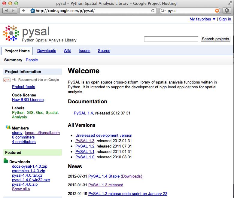
12

13
14 PySAL Functions for CyberGIS (selected examples) spatial weights global/local spatial autocorrelation simulation estimators
15 Migrating to CyberGIS provide functionality as web services performance = need for parallelization + refined algorithms interoperability = need for metadata and provenance tracking
16 Web Services
17 PySAL Web Services wrapping PySAL code as services providing access through portal infrastructure = link between UIUC and ASU Decision Theater Cluster prototype: spatial weights operations
18 Service Implementation Client Tier Server Tier Web Application Command Line Shell Apache2 modwsgi Python django PySAL DT Cluster Desktop GIS Extensions Other Clients
19 Integration with Token Service Token Service (UIUC Cluster) 1. Get a token 2. Token 5. Token Verification 4. Verify a token User 3. Request a service with token, domain & remote_addr 7. Results PySAL Web Services (DT Cluster) 6. Process the request

20 Web 2.0 Interface to PySAL Services
21 Command-Line Access open to cybergis gateway users authentication: gateway token Examples:
22 Parallelization
23 Why? real-time analysis in a decision support environment 8 second rule spatial econometric methods: spatial weights manipulations, simulation estimators
24 Approach focused on PySAL and use of Python parallelization modules multicore and GPU, clusters (ongoing) available Python libraries: pyopencl, multiprocessing, parallel python not all spatial analysis methods suitable for parallelization
25 Initial Results embarrassingly parallel: permutation inference (simulations), local statistics, simulation estimators not so straightforward: sequential analysis combined with parallel experimentation needed: results not always as expected no obvious general results
26 Some Examples implementing parallel Lisa (Local Moran) Fisher-Jencks map classification regionalization (contiguity-constrained clustering)
27 Example: Fisher-Jencks Map Classification
28 Provenance and Standards
29 Scientific Workflow data provenance model provenance lineage of data sources, manipulation and analytical operations (DAG) enable replication
30 Specialized Needs spatial operations combine data with processing requires metadata for attribute data requires metadata for operations
31 Example: Spatial Weights provenance = lineage includes spatial data source, type of weights (e.g., contiguity, distance), any standardization or manipulation (e.g., higher order)
32 Example: PySAL spgreg what do we know about south_k6.gwt and south_ep_k20.kwt

33 Early Attempts header line in gal and gwt files standard initially in SpaceStat and later adopted by R, GeoDa, PySAL, etc. insufficient

34 Taxonomy of Weights Formats in PySAL
35 Conceptual Framework separate data source from operations data source: polygon or coordinate files with standard metadata (projection, origin, etc.) operations: no metadata yet (initial work in OGC WPS etc. but not for analysis)
36 Operations creating the network structure 0-1 connectivity graph computing the weights values
37 Prototype Weights Metadata content model = vocabularies to describe spatial weights provenance and operations representation = XML Schema
38 Core Operations
39 Extract of XML Schema
40
41 Moving Forward automatic generation of provenance information automatic retrieval semantic interoperability
42 Roadmap
43 Methodological Refinements parallelizing spatial methods and algorithm improvement spatial probit/tobit space-time methods (space-time scan statistic)
44 Operationalization web services / portal weights metadata automatic provenance generation spatial econometrics workbench
45 Community Building demonstrate usefulness demonstrate added value training and documentation facilitate participation
Introduction to PySAL and Web Based Spatial Statistics
 1 Introduction to PySAL and Web Based Spatial Statistics Myung-Hwa Hwang GeoDa Center for Geospatial Analysis and Computation School of Geographical Sciences and Urban Planning Arizona State University
Working Paper
 Working Paper 2008-12 Dynamic Manipulation of Spatial Weights Using Web Services Sergio J. Rey, Luc Anselin, and Myunghwa Hwang Dynamic Manipulation of Spatial Weights Using Web Services Sergio J. Rey
To link to this article:
 This article was downloaded by: [Arizona State University] On: 12 November 2014, At: 16:24 Publisher: Taylor & Francis Informa Ltd Registered in England and Wales Registered Number: 1072954 Registered
Open Geospatial Analytics with PySAL
 Open Geospatial Analytics with PySAL Sergio J. Rey 1, *, Luc Anselin 2,, Xun Li 3,, Robert Pahle 4,, Jason Laura 5,, Wenwen Li 6, and Julia Koschinsky 7, 1 2 3 4 5 6 7 GeoDa Center for Geospatial Analysis
Manipulation of Spatial Weights Using Web Services
 Manipulation of Spatial Weights Using Web Services Sergio J. Rey GeoDa Center School of Geographical Sciences & Urban Planning Arizona State University Sergio.Rey@asu.edu Luc Anselin GeoDa Center School
Cyberinfrastructure and CyberGIS: Recent Advances and Key Themes
 Cyberinfrastructure and CyberGIS: Recent Advances and Key Themes Shaowen Wang CyberInfrastructure and Geospatial Information Laboratory (CIGI) Department of Geography Department of Computer Science National
Integrating Open-Source Statistical Packages with ArcGIS
 Esri International User Conference San Diego, California Technical Workshops 7-25-12 Integrating Open-Source Statistical Packages with ArcGIS Mark V. Janikas, Ph. D. Xing Kang Outline Introduction to Spatial
Bentley Map Advancing GIS for the World s Infrastructure
 Bentley Map Advancing GIS for the World s Infrastructure Presentation Overview Why would you need Bentley Map? What is Bentley Map? Where is Bentley Map Used? Why would you need Bentley Map? Because your
EXPECTATIONS OF TURKISH ENVIRONMENTAL SECTOR FROM INSPIRE
 EXPECTATIONS OF TURKISH ENVIRONMENTAL SECTOR FROM INSPIRE June, 2010 Ahmet ÇİVİ Tuncay DEMİR INSPIRE in the Eyes of MoEF Handling of Geodata by MoEF Benefits Expected TEIEN First Steps for INSPIRE Final
Reducing Consumer Uncertainty
 Spatial Analytics Reducing Consumer Uncertainty Eliciting User and Producer Views on Geospatial Data Quality Introduction Cooperative Research Centre for Spatial Information (CRCSI) in Australia Communicate
Practical teaching of GIS at University of Liège
 Practical teaching of GIS at University of Liège Jean-Paul Kasprzyk, assistant Lessons Pr. Jean-Paul Donnay: For non-geographers (geologists, urban planners, engineers ) GIS users Master: Introduction
Ready for INSPIRE.... connecting worlds. European SDI Service Center
 Ready for INSPIRE Consultancy SOFTWARE T r a i n i n g Solutions... connecting worlds European SDI Service Center Increasing Added Value with INSPIRE and SDI Components INSPIRE In 2007, the European Commission
The Time is Right to Commit to Use International Standards. Empowering Australia with Spatial Information
 The Time is Right to Commit to Use International Standards Empowering Australia with Spatial Information OUTLINE Energy Industry Metadata Standards Initiative ISO 19115 Revision Australian initiatives
Innovation. The Push and Pull at ESRI. September Kevin Daugherty Cadastral/Land Records Industry Solutions Manager
 Innovation The Push and Pull at ESRI September 2004 Kevin Daugherty Cadastral/Land Records Industry Solutions Manager The Push and The Pull The Push is the information technology that drives research and
Visualize and interactively design weight matrices
 Visualize and interactively design weight matrices Angelos Mimis *1 1 Department of Economic and Regional Development, Panteion University of Athens, Greece Tel.: +30 6936670414 October 29, 2014 Summary
Geog 469 GIS Workshop. Managing Enterprise GIS Geodatabases
 Geog 469 GIS Workshop Managing Enterprise GIS Geodatabases Outline 1. Why is a geodatabase important for GIS? 2. What is the architecture of a geodatabase? 3. How can we compare and contrast three types
GEOSPATIAL WEB SERVICE INTEGRATION AND MASHUPS FOR WATER RESOURCE APPLICATIONS
 GEOSPATIAL WEB SERVICE INTEGRATION AND MASHUPS FOR WATER RESOURCE APPLICATIONS C. Granell a, *, L. Díaz a, M. Gould a a Center for Interactive Visualization, Department of Information Systems, Universitat
Introduction to Portal for ArcGIS. Hao LEE November 12, 2015
 Introduction to Portal for ArcGIS Hao LEE November 12, 2015 Agenda Web GIS pattern Product overview Installation and deployment Security and groups Configuration options Portal for ArcGIS + ArcGIS for
ArcGIS Enterprise: What s New. Philip Heede Shannon Kalisky Melanie Summers Sam Williamson
 ArcGIS Enterprise: What s New Philip Heede Shannon Kalisky Melanie Summers Sam Williamson ArcGIS Enterprise is the new name for ArcGIS for Server What is ArcGIS Enterprise ArcGIS Enterprise is powerful
Portals: Standards in Action
 Portals: Standards in Action David Danko ISO TC 211 Metadata Project Leader GIS Standards Consultant-ESRI. Metadata Portals Portal gateway, place of entry Producers Advertise, expose products Share information
Introduction to Portal for ArcGIS
 Introduction to Portal for ArcGIS Derek Law Product Management March 10 th, 2015 Esri Developer Summit 2015 Agenda Web GIS pattern Product overview Installation and deployment Security and groups Configuration
Spatial Tools for Econometric and Exploratory Analysis
 Spatial Tools for Econometric and Exploratory Analysis Michael F. Goodchild University of California, Santa Barbara Luc Anselin University of Illinois at Urbana-Champaign http://csiss.org Outline A Quick
Ontologies and Spatial Decision Support
 Ontologies and Spatial Decision Support Naicong Li, Philip Murphy, The Redlands Institute, University of Redlands Krzysztof Janowicz, University of California, Santa Barbara Earth Science-Ontolog mini
CyberGIS: What Still Needs to Be Done? Michael F. Goodchild University of California Santa Barbara
 CyberGIS: What Still Needs to Be Done? Michael F. Goodchild University of California Santa Barbara Progress to date Interoperable location referencing coordinate transformations geocoding addresses point-of-interest
Exploratory Spatial Data Analysis and GeoDa
 Exploratory Spatial Data Analysis and GeoDa Luc Anselin Spatial Analysis Laboratory Dept. Agricultural and Consumer Economics University of Illinois, Urbana-Champaign http://sal.agecon.uiuc.edu Outline
Innovation in Land Management: Integrated Solutions For National Cadastre Projects
 Success With GIS Innovation in Land Management: Integrated Solutions For National Cadastre Projects XXIII International FIG Congress Munich These documents are only complete, when used in connection with
Data Aggregation with InfraWorks and ArcGIS for Visualization, Analysis, and Planning
 Data Aggregation with InfraWorks and ArcGIS for Visualization, Analysis, and Planning Stephen Brockwell President, Brockwell IT Consulting, Inc. Join the conversation #AU2017 KEYWORD Class Summary Silos
Spatial Data, Spatial Analysis and Spatial Data Science
 Spatial Data, Spatial Analysis and Spatial Data Science Luc Anselin http://spatial.uchicago.edu 1 spatial thinking in the social sciences spatial analysis spatial data science spatial data types and research
Paper UC1351. Conference: User Conference Date: 08/10/2006 Time: 8:30am-9:45am Room: Room 23-B (SDCC)
") Conference: User Conference Date: 08/10/2006 Time: 8:30am-9:45am Room: Room 23-B (SDCC) Title of Paper: Increasing the Use of GIS in the Federal Government Author Name: Miss Abstract This presentation
Conference: User Conference Date: 08/10/2006 Time: 8:30am-9:45am Room: Room 23-B (SDCC) Title of Paper: Increasing the Use of GIS in the Federal Government Author Name: Miss Abstract This presentation
ArcGIS for INSPIRE. Marten Hogeweg Satish Sankaran
 ArcGIS for INSPIRE Marten Hogeweg Satish Sankaran Outline What is ArcGIS ArcGIS for INSPIRE Web GIS Case Studies Roadmap Q&A What is INSPIRE? INSPIRE is the legal framework for a European Spatial Data
Bentley Geospatial update
 Bentley Geospatial update Tallinna, 01.11.2007 Timo Tuukkanen, Bentley Systems Issues today Bentley Map available now detailed introduction to Bentley Map Bentley Geo Web Publisher Bentley Web GIS update,
Technical Specifications. Form of the standard
 Used by popular acceptance Voluntary Implementation Mandatory Legally enforced Technical Specifications Conventions Guidelines Form of the standard Restrictive Information System Structures Contents Values
WEB MAP SERVICE (WMS) FOR GEOLOGICAL DATA GEORGE TUDOR
 FOR GEOLOGICAL DATA GEORGE TUDOR") WEB MAP SERVICE (WMS) FOR GEOLOGICAL DATA GEORGE TUDOR WEB MAP SERVICE (WMS) - GENERALITIES Projects with data from different sources Geological data are in different GIS software format Large amount of
WEB MAP SERVICE (WMS) FOR GEOLOGICAL DATA GEORGE TUDOR WEB MAP SERVICE (WMS) - GENERALITIES Projects with data from different sources Geological data are in different GIS software format Large amount of
Portal for ArcGIS: An Introduction
 Portal for ArcGIS: An Introduction Derek Law Esri Product Management Esri UC 2014 Technical Workshop Agenda Web GIS pattern Product overview Installation and deployment Security and groups Configuration
A Model of GIS Interoperability Based on JavaRMI
 A Model of GIS Interoperability Based on Java Gao Gang-yi 1 Chen Hai-bo 2 1 Zhejiang University of Finance & Economics, Hangzhou 310018, China 2 College of Computer Science and Technology, Zhejiang UniversityHangzhou
ArcGIS Enterprise: What s New. Philip Heede Shannon Kalisky Melanie Summers Shreyas Shinde
 ArcGIS Enterprise: What s New Philip Heede Shannon Kalisky Melanie Summers Shreyas Shinde ArcGIS Enterprise is the new name for ArcGIS for Server ArcGIS Enterprise Software Components ArcGIS Server Portal
GIS-based Smart Campus System using 3D Modeling
 GIS-based Smart Campus System using 3D Modeling Smita Sengupta GISE Advance Research Lab. IIT Bombay, Powai Mumbai 400 076, India smitas@cse.iitb.ac.in Concept of Smart Campus System Overview of IITB Campus
OGC GEOPACKAGE AND HOW OPEN SOURCE IS CHANGING THE WAY GOVERNMENTS THINK ABOUT STANDARDS. Nathan Frantz Geospatial Research Lab
 OGC GEOPACKAGE AND HOW OPEN SOURCE IS CHANGING THE WAY GOVERNMENTS THINK ABOUT STANDARDS Nathan Frantz Geospatial Research Lab Dr. Ben Tuttle National Geospatial-Intelligence Agency FOSS4G 2015 Geospatial
Implementing INSPIRE Geoportal in Turkey
 Implementing INSPIRE Geoportal in Turkey Gencay SERTER City and Regional Planner 1 Presentation Plan Introduction INSPIRE and Turkey Importance of al Spatial Planning Portal Logical&Legal Hierarchy GeoPortal
Rick Ebert & Joseph Mazzarella For the NED Team. Big Data Task Force NASA, Ames Research Center 2016 September 28-30
 NED Mission: Provide a comprehensive, reliable and easy-to-use synthesis of multi-wavelength data from NASA missions, published catalogs, and the refereed literature, to enhance and enable astrophysical
Spatial data interoperability and INSPIRE compliance the platform approach BAGIS
 Spatial data interoperability and INSPIRE compliance the platform approach BAGIS BAGIS Voluntary, independent, public, non-profit organization; Organization with main mission to promote the growth of the
Imagery and the Location-enabled Platform in State and Local Government
 Imagery and the Location-enabled Platform in State and Local Government Fred Limp, Director, CAST Jim Farley, Vice President, Leica Geosystems Oracle Spatial Users Group Denver, March 10, 2005 TM TM Discussion
Key Points Sharing fosters participation and collaboration Metadata has a big role in sharing Sharing is not always easy
 Sharing Resources Geoff Mortson esri, Inc. SDI Solutions Team Key Points Sharing fosters participation and collaboration Metadata has a big role in sharing Sharing is not always easy Data Sharing is Good
WEB-BASED SPATIAL DECISION SUPPORT: TECHNICAL FOUNDATIONS AND APPLICATIONS
 WEB-BASED SPATIAL DECISION SUPPORT: TECHNICAL FOUNDATIONS AND APPLICATIONS Claus Rinner University of Muenster, Germany Piotr Jankowski San Diego State University, USA Keywords: geographic information
ArcGIS for INSPIRE. Marten Hogeweg
 ArcGIS for INSPIRE Marten Hogeweg Please Take Our Survey on the App Download the Esri Events app and find your event Select the session you attended Scroll down to find the feedback section Complete answers
The Pace of Change Is Accelerating Creating Many Challenges
 VISION The Pace of Change Is Accelerating Creating Many Challenges Evidence Threatening Our Natural World and Our Future as Humans Social Conflict Mass Migration Ocean Acidification Food Population Urbanization
Enabling ENVI. ArcGIS for Server
 Enabling ENVI throughh ArcGIS for Server 1 Imagery: A Unique and Valuable Source of Data Imagery is not just a base map, but a layer of rich information that can address problems faced by GIS users. >
UNIPD RESEARCH UNIT Progress Report Francesca FISSORE, Marco PIRAGNOLO, Francesco PIROTTI
 UNIPD RESEARCH UNIT Progress Report Francesca FISSORE, Marco PIRAGNOLO, Francesco PIROTTI PRIN PROJECT: URBAN GEOmatics for Bulk Information Generation, Data Assessment and Technology Awareness UR UniPD
CHAPTER 22 GEOGRAPHIC INFORMATION SYSTEMS
 CHAPTER 22 GEOGRAPHIC INFORMATION SYSTEMS PURPOSE: This chapter establishes the administration and use of to improve the quality and accessibility of Department s spatial information and support graphical
Launch of Data Collection or Production Centre for World Weather Information Service
 Launch of Data Collection or Production Centre for World Weather Information Service The Hong Kong Observatory (HKO) announces that the Data Collection or Production Centre (DCPC) for the World Weather
Building a 4-D Weather Data Cube for the NextGen Initial Operating Capability (IOC)
") Building a 4-D Weather Data Cube for the NextGen Initial Operating Capability (IOC) Friends/Partners in Aviation Weather Vision Forum July 15, 2008 Bruce Lambert - DoD Tom Ryan FAA Jason Tuell NWS 1 Overview
Building a 4-D Weather Data Cube for the NextGen Initial Operating Capability (IOC) Friends/Partners in Aviation Weather Vision Forum July 15, 2008 Bruce Lambert - DoD Tom Ryan FAA Jason Tuell NWS 1 Overview
Pushing the Standards Edge: Collaborative Testbeds to Accelerate Standards Development and Implementation
 Pushing the Standards Edge: Collaborative Testbeds to Accelerate Standards Development and Implementation Mark E. Reichardt President mreichardt@opengeospatial.org 31 October 2006 2006 Open Geospatial
Visualizing Uncertainty In Environmental Work-flows And Sensor Streams
 Visualizing Uncertainty In Environmental Work-flows And Sensor Streams Karthikeyan Bollu Ganesh and Patrick Maué Institute for Geoinformatics (IFGI), University of Muenster, D-48151 Muenster, Germany {karthikeyan,pajoma}@uni-muenster.de
ISO Series Standards in a Model Driven Architecture for Landmanagement. Jürgen Ebbinghaus, AED-SICAD
 ISO 19100 Series Standards in a Model Driven Architecture for Landmanagement Jürgen Ebbinghaus, AED-SICAD 29.10.2003 The Company 100% SIEMENS PTD SIEMENS Business Services Shareholder & Strategic Business
Methodological Chain for Hydrological Management with Web-GIS Applications
 Advances in Geosciences Konstantinos Perakis & Athanasios Moysiadis, Editors EARSeL, 2012 Methodological Chain for Hydrological Management with Web-GIS Applications Alexandros Konstantinidis 1, Eleni Tzanou
econtentplus GS Soil
 econtentplus GS Soil General aims Assessment and strategic development of INSPIRE compliant Geodata-Services for European Soil Data BPN on basis of the EU 2007/2/EC (INSPIRE) Directive for Annex III theme
RESEARCG ON THE MDA-BASED GIS INTEROPERABILITY Qi,LI *, Lingling,GUO *, Yuqi,BAI **
 RESEARCG ON THE MDA-BASED GIS INTEROPERABILITY Qi,LI *, Lingling,GUO *, Yuqi,BAI ** * Digital Earth Studio, Peking University, Beijing, 100871 liqi@pku.edu.cn, guolingling@cybergis.org.cn ** Network Department,
The Architecture of the Georgia Basin Digital Library: Using geoscientific knowledge in sustainable development
 GEOLOGIJA 46/2, 343 348, Ljubljana 2003 The Architecture of the Georgia Basin Digital Library: Using geoscientific knowledge in sustainable development B. BRODARIC 1, M. JOURNEAY 2, S. TALWAR 2,3, R. HARRAP
Lecture 3: Exploratory Spatial Data Analysis (ESDA) Prof. Eduardo A. Haddad
 Prof. Eduardo A. Haddad") Lecture 3: Exploratory Spatial Data Analysis (ESDA) Prof. Eduardo A. Haddad Key message Spatial dependence First Law of Geography (Waldo Tobler): Everything is related to everything else, but near things
Lecture 3: Exploratory Spatial Data Analysis (ESDA) Prof. Eduardo A. Haddad Key message Spatial dependence First Law of Geography (Waldo Tobler): Everything is related to everything else, but near things
The INSPIRE Community Geoportal
 Infrastructure for Spatial Information in the European Community The INSPIRE Community Geoportal Gianluca Luraschi EC INSPIRE GEOPORTAL TEAM European Commission Joint Research Centre Institute for Environment
Regionalizing and Understanding Commuter Flows: An Open Source Geospatial Approach
 Regionalizing and Understanding Commuter Flows: An Open Source Geospatial Approach Lorraine Barry School of Natural and Built Environment, Queen's University Belfast l.barry@qub.ac.uk January 2017 Summary
SERVICE-BASED APPROACH TO GEOPORTALS ARCHITECTURE
 SERVICE-BASED APPROACH TO GEOPORTALS ARCHITECTURE Evgeny Panidi Saint-Petersburg State University Saint-Petersburg, Russia, panidi@yandex.ru Abstract. This paper describes the author s view on service-based
Spatial Data Availability Energizes Florida s Citizens
 NASCIO 2016 Recognition Awards Nomination Spatial Data Availability Energizes Florida s Citizens State of Florida Agency for State Technology & Department of Environmental Protection Category: ICT Innovations
A Technique for Importing Shapefile to Mobile Device in a Distributed System Environment.
 A Technique for Importing Shapefile to Mobile Device in a Distributed System Environment. 1 Manish Srivastava, 2 Atul Verma, 3 Kanika Gupta 1 Academy of Business Engineering and Sciences,Ghaziabad, 201001,India
A decade of geoinformation sharing at ETH Zurich
 A decade of geoinformation sharing at ETH Zurich Ionuț Iosifescu-Enescu, Cristina Iosifescu-Enescu, Nadia H. Panchaud, Angeliki Tsorlini, Lorenz Hurni {iosifescu,ciosifescu,nadia.panchaud,atsorlini,lhurni}@ethz.ch
The Canadian Ceoscience Knowledge Network. - A Collaborative Effort for Unified Access to Ceoscience Data
 The Canadian Ceoscience Knowledge Network - A Collaborative Effort for Unified Access to Ceoscience Data The Canadian Geoscience Knowledge Network A Collaborative Effort for Unified Access to Geoscience
E14- Integrating Civil Design, Mapping and Geospatial Data
 www.bentley.com E14- Integrating Civil Design, Mapping and Geospatial Data Lisa Whitson, Transportation and Local Infrastructure Professional Services, Bentley Systems USA GIS and Engineering Data Integration
Introduction to geoprocessing services using SEXTANTE. Víctor Olaya SEXTANTE Geospatial Services
 Introduction to geoprocessing services using SEXTANTE. Víctor Olaya SEXTANTE Geospatial Services Overview Quick introduction to SEXTANTE Client/Server fundamentals Standards for web-based geoservices SEXTANTE
Solving the European Data Puzzle Simplifying INSPIRE Challenges and Usage. con terra GmbH Dipl.-Ing. Mark Döring
 Solving the European Data Puzzle Simplifying INSPIRE Challenges and Usage con terra GmbH Dipl.-Ing. Mark Döring INSPIRE Reference Projects GeoBAK 2.0 Project // INSPIRE Data & Services The Project Evolution
Demystifying ArcGIS Online. Karen Lizcano Esri
 Demystifying ArcGIS Online Karen Lizcano Esri An Integrated Web GIS Platform Desktop Web Device Powered by Services Managed via Portal Access from any Device Portal Server Online Content and Services ArcGIS
CSISS Resources for Research and Teaching
 CSISS Resources for Research and Teaching Donald G. Janelle Center for Spatially Integrated Social Science University of California, Santa Barbara Montreal 26 July 2003 Workshop on Spatial Analysis for
Ontology Summit Framing the Conversation: Ontologies within Semantic Interoperability Ecosystems
 Ontology Summit 2016 Framing the Conversation: Ontologies within Semantic Interoperability Ecosystems GeoSciences Track: Semantic Interoperability in the GeoSciences Gary Berg-Cross and Ken Baclawski Co-Champions
Using OGC standards to improve the common
 Using OGC standards to improve the common operational picture Abstract A "Common Operational Picture", or a, is a single identical display of relevant operational information shared by many users. The
Big Data and Geospatial Cyberinfrastructure for Advancing Applications
 Big Data and Geospatial Cyberinfrastructure for Advancing Applications Presented at GIScience 2012 Big Data and CyberGIS Panel Budhendra Bhaduri September 20, 2012 Columbus, OH Geospatial Cyberinfrastructure
INSPIRE - A Legal framework for environmental and land administration data in Europe
 INSPIRE - A Legal framework for environmental and land administration data in Europe Dr. Markus Seifert Bavarian Administration for Surveying and Cadastre Head of the SDI Office Bavaria Delegate of Germany
Joint MISTRAL/CESI lunch workshop 15 th November 2017
 MISTRAL@Newcastle Joint MISTRAL/CESI lunch workshop 15 th November 2017 ITRC at Newcastle ITRC at Newcastle MISTRAL at Newcastle New approach to infrastructure data management to open-up analytics, modelling
INSPIRing Geospatial Framework For Local Administrations
 This project is financed by the European Union and the Republic of Turkey Presented at the FIG Congress 2018, May 6-11, 2018 in Istanbul, Turkey National Programme for Turkey 2010 Instrument for Pre-Accession
Production Line Tool Sets
 Production Line Tool Sets Tools for high-quality database production and cartographic output Production Line Tool Sets Production Line Tool Sets (PLTS) by ESRI are a collection of software applications
ESTABLISHMENT OF KARNATAKA GEOPORTAL AND ITS ROLE IN PLANNING
 ESTABLISHMENT OF KARNATAKA GEOPORTAL AND ITS ROLE IN PLANNING By H. Hemanth Kumar Karnataka State Council for Science & Technology (KSCST), Indian Institute of Science, Bangalore, India Abstract Natural
ArcGIS Deployment Pattern. Azlina Mahad
 ArcGIS Deployment Pattern Azlina Mahad Agenda Deployment Options Cloud Portal ArcGIS Server Data Publication Mobile System Management Desktop Web Device ArcGIS An Integrated Web GIS Platform Portal Providing
Open Contextual Cartographic Visualization
 J. Kozel 223 Open Contextual Cartographic Visualization Jiří Kozel Laboratory on Geoinformatics and Cartography, Insitute of Geography, Faculty of Science, Masaryk University, Czech Republic jirikozel@centrum.cz
Geotechnology for Agriculture: A view from regulations and free software.
 Geotechnology for Agriculture: A view from regulations and free software. 11 de noviembre del 2015 C O N T E N T S Agriculture, two aspects: data and software Common problems with data and information
Portal for ArcGIS: An Introduction. Catherine Hynes and Derek Law
 Portal for ArcGIS: An Introduction Catherine Hynes and Derek Law Agenda Web GIS pattern Product overview Installation and deployment Configuration options Security options and groups Portal for ArcGIS
Australian Earth Science Research Spatial Information Infrastructure
 AN ORGANISATION FOR A NATIONAL EARTH SCIENCE INFRASTRUCTURE PROGRAM Australian Earth Science Research Spatial Information Infrastructure Dr Robert Woodcock AuScope Grid - Director Outline Why build an
SYNERGY OF SATELLITE REMOTE SENSING AND SENSOR NETWORKS ON GEO GRID
 SYNERGY OF SATELLITE REMOTE SENSING AND SENSOR NETWORKS ON GEO GRID National Institute of Advanced Industrial Science and Technology, Japan Yoshio Tanaka (on behalf of AIST GEO Grid team) Contents Brief
Perform. Xcel. Lead. Presenter. Raghavendran S. GM Technical (GIS)
") Perform. Xcel. Lead. Presenter Raghavendran S GM Technical (GIS) Perform. Xcel. Lead. The Trademarks/Logos belong to the respective companies 2015 PIXEL SOFTEK PVT. LTD. 1 Incorporated in 1996 HQ in Bangalore,
Perform. Xcel. Lead. Presenter Raghavendran S GM Technical (GIS) Perform. Xcel. Lead. The Trademarks/Logos belong to the respective companies 2015 PIXEL SOFTEK PVT. LTD. 1 Incorporated in 1996 HQ in Bangalore,
Spatial Data Infrastructure Concepts and Components. Douglas Nebert U.S. Federal Geographic Data Committee Secretariat
 Spatial Data Infrastructure Concepts and Components Douglas Nebert U.S. Federal Geographic Data Committee Secretariat August 2009 What is a Spatial Data Infrastructure (SDI)? The SDI provides a basis for
Lecture 3: Exploratory Spatial Data Analysis (ESDA) Prof. Eduardo A. Haddad
 Prof. Eduardo A. Haddad") Lecture 3: Exploratory Spatial Data Analysis (ESDA) Prof. Eduardo A. Haddad Key message Spatial dependence First Law of Geography (Waldo Tobler): Everything is related to everything else, but near things
Lecture 3: Exploratory Spatial Data Analysis (ESDA) Prof. Eduardo A. Haddad Key message Spatial dependence First Law of Geography (Waldo Tobler): Everything is related to everything else, but near things
Roadmap to interoperability of geoinformation
 Roadmap to interoperability of geoinformation and services in Europe Paul Smits, Alessandro Annoni European Commission Joint Research Centre Institute for Environment and Sustainability paul.smits@jrc.it
INSPIRE Directive. Status June 2007
 INSPIRE Directive INfrastructure for SPatial InfoRmation in Europe Status June 2007 European Commission Directorate-General Environment Research, Science and Innovation Unit Rue de la Loi, 200 1049 Brussels
Resources for Spatial Thinking and Analysis
 Resources for Spatial Thinking and Analysis Donald G. Janelle Center for Spatially Integrated Social Science University of California, Santa Barbara New Orleans, 21 November 2002 Workshop on Spatial Analysis
An Introduction to the Community Maps Information Model
 Esri International User Conference July 23 27 San Diego Convention Center An Introduction to the Community Maps Information Model Seth Sarakaitis Agenda Overview of Community Maps Program Information Models
From the Venice Lagoon Atlas towards a collaborative federated system
 From the Venice Lagoon Atlas towards a collaborative federated system City of Venice Alessandro Mulazzani CORILA Consortium for Coordination of Research Activities Concerning the Venice Lagoon System ISMAR-CNR
NOKIS - Information Infrastructure for the North and Baltic Sea
 NOKIS - Information Infrastructure for the North and Baltic Sea Carsten Heidmann 1 and Jörn Kohlus 2 Abstract 1. General The initial motivation for the project NOKIS (German title: Nord- und Ostsee-Küsteninformationssystem)
Geospatial SDI Portal for effective Governance of Pune METROPOLIS region
 Geospatial SDI Portal for effective Governance of Pune METROPOLIS region Mr. Praveen Gautam Senior Manager 19 th January 2018 PMRDA Overview Provide a Spatial Framework for the entire region with various
Hosted by Esri Official Distributor
 Hosted by Esri Official Distributor Esri European User Conference October 15-17, 2012 Oslo, Norway Hosted by Esri Official Distributor Interoperability and Standards Support in ArcGIS 10.1 Roberto Lucchi
Central and Federal Government SolutionS
 Central and Federal Government Solutions 2 Intergraph s Advanced Geospatial Solutions for Central and Federal Government Operations Central and federal governments are continually asked to do more with
GeoSpace for Singapore s Whole-of-Government Data Sharing
 GeoSpace for Singapore s Whole-of-Government Data Sharing Ng Siau Yong, Lim Ming Khai, Lo Jing Lu & Anupam Mukherjee ABSTRACT Sharing of land information among government agencies is not new to Singapore.
The PREVIEW Global Risk Data Platform: a geoportal to serve and share global data on risk to natural hazards
 The PREVIEW Global Risk Data Platform: a geoportal to serve and share global data on risk to natural hazards Gregory Giuliani (UNEP/GRID-Geneva & University of Geneva/enviroSPACE ) http://www.grid.unep.ch
G EOSPAT I A L ERDAS IMAGINE. The world s most widely-used software package for creating information from geospatial data
 G EOSPAT I A L ERDAS IMAGINE The world s most widely-used software package for creating information from geospatial data ERDAS IMAGINE Geographic imaging professionals need to process vast amounts of