G EOSPAT I A L ERDAS IMAGINE. The world s most widely-used software package for creating information from geospatial data
|
|
|
- Bertha Leonard
- 5 years ago
- Views:
Transcription

1 G EOSPAT I A L ERDAS IMAGINE The world s most widely-used software package for creating information from geospatial data
2
3 ERDAS IMAGINE Geographic imaging professionals need to process vast amounts of geospatial data every day often relying on software designed for other purposes and add-on applications that create almost as many problems as they solve. Is it possible to save both time and money, leverage existing data investments, and improve your image analysis capabilities, with just one software application? Yes, it is 3
4 ARE YOU MAKING THE MOST OF YOUR geospatial data? Imagery and LiDAR are the primary sources of data for mapping and managing features or resources. Whether you are studying changes in urban growth, sensitive environments, mapping resources or assessing damage from natural disasters, a geospatial data archive enables you to reference and measure the amount of change that has taken place in a geographic area. Accurate and up-to-date leads to quicker, more informed decisions. ERDAS IMAGINE unites users from different departments within your organization, saving training time and increasing productivity. Your co-workers, business partners and clients can now work on a project and product consistent results through a single intuitive interface. You can also customize ERDAS IMAGINE to simplify your workflows. Image analysis, remote sensing, and GIS Support for optical panchromatic, multispectral and hyperspectral imagery, radar and LiDAR data User-friendly ribbon interface Multi-core and distributed processing Spatial modeling with raster and vector operators, as well as real-time results preview High-performance terrain preparation and mosaicking A variety of change detection tools ERDAS ER Mapper algorithm support Ability to convert more than 190 image formats into all major file formats, including GeoTIFF, NITF, CADRG, JPEG, JPEG2000, ECW, and MrSID Comprehensive OGC Web Services, including Web Processing Service (WPS), Web Coverage Service (WCS), Web Mapping Service (WMS), and Catalog Services for the Web (CS-W) ERDAS IMAGINE provides true value, consolidating remote sensing, photogrammetry, LiDAR analysis, and radar processing into a single product. We offer many solutions in one, incorporating the following standards, enterprise capabilities and products: 4

5 IMAGINE VirtualGIS was the first, and is still the best, at 3D visualization of all geospatial data types. VERSATILE For organizations with extensive collections of geospatial data, ERDAS IMAGINE supports enterprise-enabled geospatial image processing that utilizes a centralized relational database to store geospatial information. This provides enormous benefit to an institution, making data visible and accessible to end-users through data management solutions such as ERDAS APOLLO. Existing and future investments in image and feature geospatial information are exploitable by the greatest number of decision-makers. As users upgrade their hardware and operating systems, ERDAS IMAGINE takes advantage of these new technologies through threading, parallel processing and minimizing the number of times we touch the pixel on the hard disk. Batch tools in IMAGINE Advantage enable multi-core and distributed processing jobs, allowing large projects to fully leverage system and network resources. With more than 30 years of experience pioneering geospatial analysis, you will see the fusion and culmination of innovation in ERDAS IMAGINE. 5

6 SEAMLESS How do you maximize the investment of your goespatial data? ERDAS IMAGINE simplifies classification, orthorectification, mosaicking, reprojection, and image interpretation while maintaining the integrity of the geospatial data you need for updating your GIS in multiple formats. COMPLETE ERDAS IMAGINE is easy-to-use, raster-based software designed specifically to extract information from images. Perfect for beginners and experts alike, easy-to-learn ERDAS IMAGINE enables you to process imagery like a seasoned professional, regardless of your experience in geographic imaging. The intuitive ERDAS IMAGINE interface streamlines your workflow and saves time. Powerful algorithms and data processing functions work behind the scenes so you can concentrate on your analyses. The quick display and ability to work with multiple datasets in geographically-linked viewers in ERDAS IMAGINE dramatically reduces the time you would otherwise spend trying to manually relate information from various sources. ERDAS IMAGINE is the most powerful package for derived information (data production), supporting multiple workflows, including: Data conversion Orthorectification Color balancing, mosaicking and compression Land cover mapping and terrain categorization LiDAR editing and classification Map and report generation and printing through the map composer, PowerPoint, Word, or GeoPDF Feature capture and update Spatial modeling and analysis Terrain creation, editing, and analysis Send Map Reports directly to Microsoft Word. 6


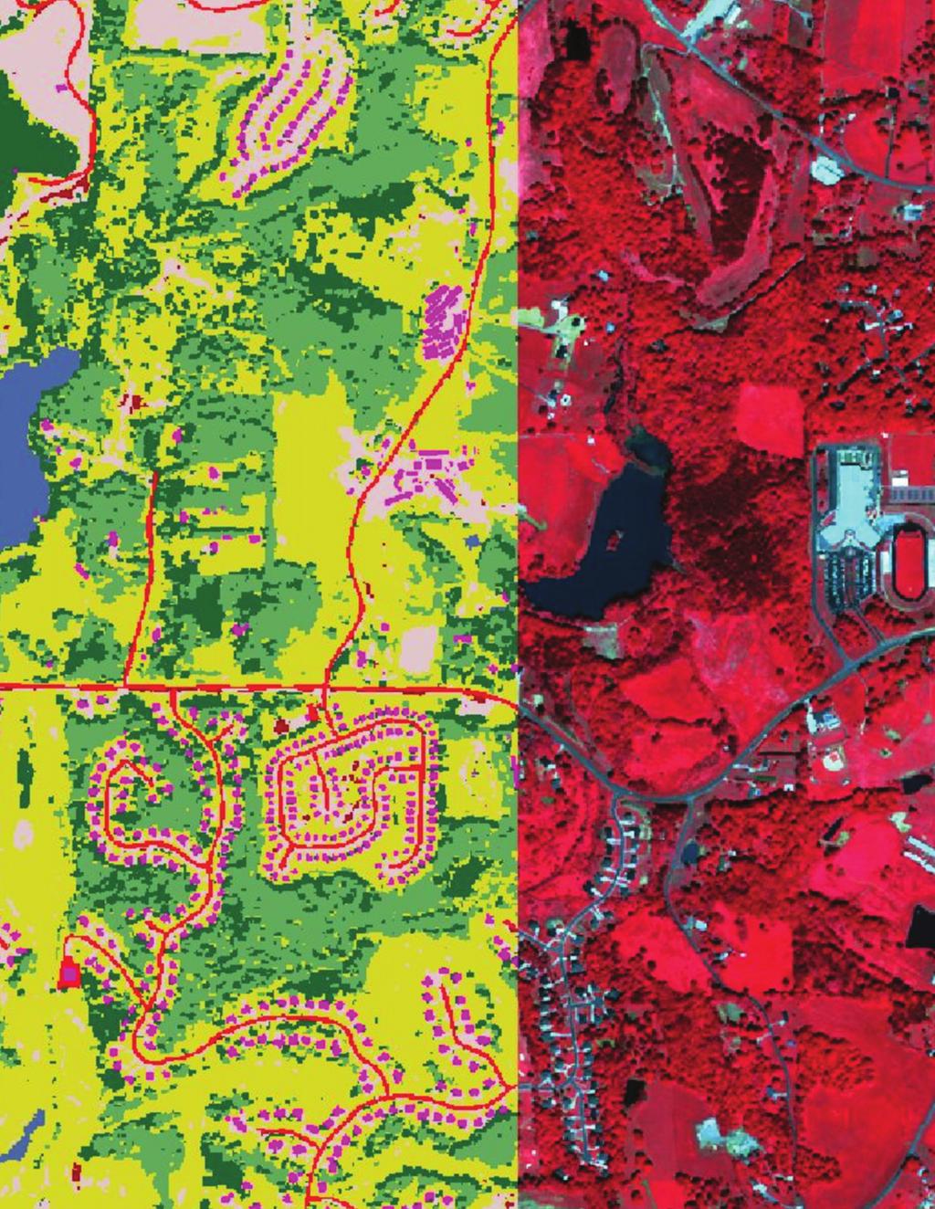
7 ERDAS IMAGINE provides more classification solutions than any other product on the market. Whether mapping change using the Feature Counting tool, or by automatic change detection algorithms, ERDAS IMAGINE is your change mapping solution. 7
8 Selected Functionality Options FUNCTIONALITY ESSENTIALS ADVANTAGE PROFESSIONAL Geographically connect files across viewers Compress into MrSID, ECW and JPEG2000 formats Use more than 190 different image and GIS data format Rapidly display and roam through imagery vectors and LiDAR Create and edit Arc coverages and shapefiles Create and print maps in more than 1000 different projected coordinate systems Display and analyze Esri Geodatabases Mosaic images Polynomial-rectify images Batch processing Parallel batch processing Ortho-rectify images RGB Encode, edit, filter, merge and split point cloud data Interpolate surfaces Perform spatial, radiometric, and spectral enhancement Analyze radar images Perform advanced multispectral image classification and point cloud classification Perform graphical spatial modeling Extract information from hyperspectral imagery With a wide array of tools enabling you to analyze data from virtually any source and present in formats ranging from printed maps to 3D models, ERDAS IMAGINE offers you one comprehensive solution for all of your geographic imaging and image processing needs. It simplifies and streamlines your production workflow, saving you time, money, and resources without sacrificing accuracy. 8

9 From mosaicking a few images to tens of thousands of images, from megabytes to terabytes, IMAGINE MosaicPro can do it all, all while scaling to your hardware investment. THE ERDAS IMAGINE PRODUCT SUITE IMAGINE Advantage includes a complete IMAGINE Essentials : A powerful, low-cost set of tools to analyze data from imagery via image and LiDAR mapping and visualization mosaicking, surface interpolation, advanced tool that allows different types of geospatial image interpretation and orthorectification. data to be combined and quickly organized for projects. IMAGINE Essentials provides IMAGINE Professional : The most a robust set of tools for geocorrection, image sophisticated software for geographic analysis, visualization and map output. imaging, IMAGINE Professional includes complex Hyperspectral image analysis, IMAGINE Advantage : A geographic radar analysis and advanced classification imaging toolset that extends the capabilities tools. It also includes graphical spatial data of IMAGINE Essentials by adding more modeling, which is a unique capability for precise mapping and geospatial data analyzing geographic data. processing functions. ERDAS IMAGINE is a scalable solution that will grow with you. With three tiers and a multitude of add-on modules, you can tailor the system to meet your specific requirements. 9


10 Scalability helps you achieve an immediate return on your hardware investment (ROI). Multi-core and distributed processing of massive data projects enable you to take full advantage of hardware resources. DISCOVER THE POTENTIAL OF YOUR IMAGERY Additionally, Intergraph provides an array of add-ons that expand the core functionality of ERDAS IMAGINE so you can tailor it to your organization s individual geospatial and business needs. These innovative products include the IMAGINE Radar Mapping Suite, IMAGINE Objective, Stereo Analyst for ERDAS IMAGINE, IMAGINE AutoSync, IMAGINE VirtualGIS, IMAGINE Easytrace and many others. For more information about these add-ons, please contact your Intergraph sales representative. Increase your accuracy using the flexible and comprehensive toolset of the standard in imaging software ERDAS IMAGINE, from the inventors of commercial remote sensing software. 10

11 About intergraph Intergraph is the leading global provider of engineering and geospatial software that enables customers to visualize complex data. Businesses and governments in more than 60 countries rely on Intergraph s industry-specific software to organize vast amounts of data to make processes and infrastructure better, safer and smarter. The company s software and services empower customers to build and operate more efficient plants and ships, create intelligent maps, and protect critical infrastructure and millions of people around the world. Intergraph operates through two divisions: Process, Power & Marine (PP&M) and Security, Government & Infrastructure (SG&I). Intergraph PP&M provides enterprise engineering software for the design, construction, operation and data management of plants, ships and offshore facilities. Intergraph SG&I provides geospatially powered solutions, including ERDAS technologies, to the public safety and security, defence and intelligence, government, transportation, photogrammetry, and utilities and communications industries. Intergraph Government Solutions (IGS) is a wholly owned subsidiary of Intergraph Corporation responsible for the SG&I U.S. federal business. Intergraph is part of Hexagon (Nordic exchange: HEXA B; a leading global provider of design, measurement and visualisation technologies that enable customers to design, measure and position objects, and process and present data. For more information, visit and 11
12 geospatial.intergraph.com 2012 Intergraph Corporation. All rights reserved. Intergraph is part of Hexagon. Intergraph, the Intergraph logo, Stereo Analyst, ERDAS IMAGINE, IMAGINE Essentials, IMAGINE Advantage,and IMAGINE Professional are registered trademarks of Intergraph Corporation or its subsidiaries in the United States and in other countries. IMAGINE AutoSync, and IMAGINE Easytrace are trademarks of Intergraph Corporation or its subsidiaries in the United States and in other countries. Other products and brand names are trademarks of their respective owners. GEO-US-0011D-ENG 12/12
STEREO ANALYST FOR ERDAS IMAGINE Stereo Feature Collection for the GIS Professional
 STEREO ANALYST FOR ERDAS IMAGINE Stereo Feature Collection for the GIS Professional STEREO ANALYST FOR ERDAS IMAGINE Has Your GIS Gone Flat? Hexagon Geospatial takes three-dimensional geographic imaging
Geospatial natural disaster management
 Geospatial natural disaster management disasters happen. are you ready? Natural disasters can strike almost anywhere at any time, with no regard to a municipality s financial resources. These extraordinarily
ArcGIS. for Server. Understanding our World
 ArcGIS for Server Understanding our World ArcGIS for Server Create, Distribute, and Manage GIS Services You can use ArcGIS for Server to create services from your mapping and geographic information system
PRODUCT BROCHURE IMAGINE OBJECTIVE THE FUTURE OF FEATURE EXTRACTION, UPDATE, & CHANGE MAPPING
 PRODUCT BROCHURE IMAGINE OBJECTIVE THE FUTURE OF FEATURE EXTRACTION, UPDATE, & CHANGE MAPPING IMAGINE OBJECTIVE ADDRESSING BUSINESS PROBLEMS Globally, GIS departments and mapping institutions invest considerable
Data Aggregation with InfraWorks and ArcGIS for Visualization, Analysis, and Planning
 Data Aggregation with InfraWorks and ArcGIS for Visualization, Analysis, and Planning Stephen Brockwell President, Brockwell IT Consulting, Inc. Join the conversation #AU2017 KEYWORD Class Summary Silos
Features and Benefits
 Autodesk LandXplorer Features and Benefits Use the Autodesk LandXplorer software family to help improve decision making, lower costs, view and share changes, and avoid the expense of creating physical
When Map Quality Matters
 When Map Quality Matters 50% 25% Powerful geospatial mapping tools for Adobe Creative Cloud and offline map solutions for mobile devices 20% When Map Quality Matters 10% We re focused on creating powerful
Central and Federal Government SolutionS
 Central and Federal Government Solutions 2 Intergraph s Advanced Geospatial Solutions for Central and Federal Government Operations Central and federal governments are continually asked to do more with
June 19 Huntsville, Alabama 1
 June 19 Huntsville, Alabama 1 Real-Time Geospatial Data: The Fusion of PI and ArcGIS Enabling Smarter Facilities Management OSIsoft and Esri Mapping and Location Analytics Platform Supporting Your Use
ArcGIS for Desktop. ArcGIS for Desktop is the primary authoring tool for the ArcGIS platform.
 ArcGIS for Desktop ArcGIS for Desktop ArcGIS for Desktop is the primary authoring tool for the ArcGIS platform. Beyond showing your data as points on a map, ArcGIS for Desktop gives you the power to manage
W H I T E P A P E R. The New Paradigm. Leveraging the Information Cloud with the Dynamic GIS
 W H I T E P A P E R The New Paradigm Leveraging the Information Cloud with the Dynamic GIS Image indicates nuclear power plant in Fukushima, Japan. One-meter resolution image provided by GeoEye IKONOS,
SOLUTIONS ADVANCED GIS. TekMindz are developing innovative solutions that integrate geographic information with niche business applications.
 ADVANCED GIS SOLUTIONS TekMindz are developing innovative solutions that integrate geographic information with niche business applications. TEK INDZ TM GIS Services Overview At the leading edge of geospatial
Questions and Answers
 AUTODESK LANDXPLORER SOFTWARE FAMILY Questions and Answers The Autodesk LandXplorer 3D city model software family can help you create, analyze, and visualize digital city models. Contents Autodesk Landxplorer
ASSESSMENT. Industry Solutions Harness the Power of GIS for Property Assessment
 ASSESSMENT Industry Solutions Harness the Power of GIS for Property Assessment Esri Canada has thousands of customers worldwide who are using the transforming power of GIS technology to collect, maintain,
An easy-to-use application that lets end users prepare and deploy background maps to your Carmenta based applications.
 Introducing Carmenta Map Builder An easy-to-use application that lets end users prepare and deploy background maps to your Carmenta based applications. Carmenta s geospatial technology is known for its
Exelis and Esri Technologies for Defense and National Security. Cherie Muleh
 Exelis and Esri Technologies for Defense and National Security Cherie Muleh Cherie.Muleh@exelisinc.com ENVI IMAGERY AND DATA BECOME KNOWLEDGE > Add information from imagery to your GIS > Automated workflows
ENVI for ArcGIS TURN GEOSPATIAL IMAGERY INTO USEFUL INFORMATION FOR YOUR GIS ON THE DESKTOP, FOR MOBILE DEVICES, AND IN THE CLOUD HarrisGeospatial.
 ENVI for ArcGIS TURN GEOSPATIAL IMAGERY INTO USEFUL INFORMATION FOR YOUR GIS ON THE DESKTOP, FOR MOBILE DEVICES, AND IN THE CLOUD HarrisGeospatial.com ENVI FOR ArcGIS BENEFITS Use the full power of ENVI
Humanitarian Assistance and Disaster Relief (HADR)
") Humanitarian Assistance and Disaster Relief (HADR) Remote sensing, GIS & Server Technology for Planning, Response & Mitigation Jonathan Lee Hon Yip Senior Technical Sales, Intergraph Security, Government
Humanitarian Assistance and Disaster Relief (HADR) Remote sensing, GIS & Server Technology for Planning, Response & Mitigation Jonathan Lee Hon Yip Senior Technical Sales, Intergraph Security, Government
Imagery and the Location-enabled Platform in State and Local Government
 Imagery and the Location-enabled Platform in State and Local Government Fred Limp, Director, CAST Jim Farley, Vice President, Leica Geosystems Oracle Spatial Users Group Denver, March 10, 2005 TM TM Discussion
Discovery and Access of Geospatial Resources using the Geoportal Extension. Marten Hogeweg Geoportal Extension Product Manager
 Discovery and Access of Geospatial Resources using the Geoportal Extension Marten Hogeweg Geoportal Extension Product Manager DISCOVERY AND ACCESS USING THE GEOPORTAL EXTENSION Geospatial Data Is Very
Industry. Local and Regional. Government Solutions
 Industry Local and Regional Government Solutions Advanced Geospatial Solutions for Local and Regional Goverment Operations The public is increasingly demanding that local governments provide services
Leveraging Web GIS: An Introduction to the ArcGIS portal
 Leveraging Web GIS: An Introduction to the ArcGIS portal Derek Law Product Management DLaw@esri.com Agenda Web GIS pattern Product overview Installation and deployment Configuration options Security options
Bentley Map Advancing GIS for the World s Infrastructure
 Bentley Map Advancing GIS for the World s Infrastructure Presentation Overview Why would you need Bentley Map? What is Bentley Map? Where is Bentley Map Used? Why would you need Bentley Map? Because your
Lecture 6 - Raster Data Model & GIS File Organization
 Lecture 6 - Raster Data Model & GIS File Organization I. Overview of Raster Data Model Raster data models define objects in a fixed manner see Figure 1. Each grid cell has fixed size (resolution). The
Map your way to deeper insights
 Map your way to deeper insights Target, forecast and plan by geographic region Highlights Apply your data to pre-installed map templates and customize to meet your needs. Select from included map files
U.S. Army Topographic Engineering Center (TEC) Alexandria, VA. Army Geo-Referenced PDF (GeoPDF) Project
 Alexandria, VA. Army Geo-Referenced PDF (GeoPDF) Project") U.S. Army Topographic Engineering Center (TEC) Alexandria, VA Army Geo-Referenced PDF (GeoPDF) Project June 2006 Ray Caputo Geospatial Information and Imagery Requirements Branch Operations Division The
U.S. Army Topographic Engineering Center (TEC) Alexandria, VA Army Geo-Referenced PDF (GeoPDF) Project June 2006 Ray Caputo Geospatial Information and Imagery Requirements Branch Operations Division The
Better Topographic Map Production Using ArcGIS. A Comprehensive Solution for Mapping Organizations
 Better Topographic Map Production Using ArcGIS A Comprehensive Solution for Mapping Organizations The World Is Always Changing As a member of a national mapping organization, you know this is true. You
Managing Imagery and Raster Data Using Mosaic Datasets
 Esri International User Conference San Diego, California Technical Workshops July 25, 2012 Managing Imagery and Raster Data Using Mosaic Datasets Hong Xu, Prashant Mangtani Presentation Overview Introduction
These modules are covered with a brief information and practical in ArcGIS Software and open source software also like QGIS, ILWIS.
 Online GIS Training and training modules covered are: 1. ArcGIS, Analysis, Fundamentals and Implementation 2. ArcGIS Web Data Sharing 3. ArcGIS for Desktop 4. ArcGIS for Server These modules are covered
Production Line Tool Sets
 Production Line Tool Sets Tools for high-quality database production and cartographic output Production Line Tool Sets Production Line Tool Sets (PLTS) by ESRI are a collection of software applications
Enabling the Image Analyst (IA) to use the geodatabase
 to use the geodatabase") Enabling the Image Analyst (IA) to use the geodatabase Rick Racine, BAE Systems, Reston, VA Stewart Walker, BAE Systems, San Diego, CA 2008 ESRI Federal User Conference, Washington, D.C., 21 February 2610020508
Enabling the Image Analyst (IA) to use the geodatabase Rick Racine, BAE Systems, Reston, VA Stewart Walker, BAE Systems, San Diego, CA 2008 ESRI Federal User Conference, Washington, D.C., 21 February 2610020508
Enabling ENVI. ArcGIS for Server
 Enabling ENVI throughh ArcGIS for Server 1 Imagery: A Unique and Valuable Source of Data Imagery is not just a base map, but a layer of rich information that can address problems faced by GIS users. >
Time Series Analysis with SAR & Optical Satellite Data
 Time Series Analysis with SAR & Optical Satellite Data Thomas Bahr ESRI European User Conference Thursday October 2015 harris.com Motivation Changes in land surface characteristics mirror a multitude of
DP Project Development Pvt. Ltd.
 Dear Sir/Madam, Greetings!!! Thanks for contacting DP Project Development for your training requirement. DP Project Development is leading professional training provider in GIS technologies and GIS application
Building a National Data Repository
 Building a National Data Repository Mladen Stojic, Vice President - Geospatial 1/30/2013 2012 Intergraph Corporation 1 Information has meaning and gives power only when shared and distributed. Information,
Using OGC standards to improve the common
 Using OGC standards to improve the common operational picture Abstract A "Common Operational Picture", or a, is a single identical display of relevant operational information shared by many users. The
Portal for ArcGIS: An Introduction. Catherine Hynes and Derek Law
 Portal for ArcGIS: An Introduction Catherine Hynes and Derek Law Agenda Web GIS pattern Product overview Installation and deployment Configuration options Security options and groups Portal for ArcGIS
Spatial Data Availability Energizes Florida s Citizens
 NASCIO 2016 Recognition Awards Nomination Spatial Data Availability Energizes Florida s Citizens State of Florida Agency for State Technology & Department of Environmental Protection Category: ICT Innovations
Geospatial capabilities, spatial data and services provided by Military Geographic Service
 Geospatial capabilities, spatial data and services provided by Military Geographic Service LtC Mariyan Markov PhD CONTENTS 1. INTRODUCTION - Workflow - Data sources remote sensing, direct field observation.
Esri Training by Microcenter Prepare to Innovate. Microcenter Course Catalog
 Esri Training by Microcenter Prepare to Innovate 2015 Instructor-Led Courses Microcenter Course Catalog ArcGIS Foundational Courses Designed to meet the learning needs of professionals whose GIS experience
GIS-T 2010 Building a Successful Geospatial Data Sharing Framework: A Ohio DOT Success Story
 GIS-T 2010 Building a Successful Geospatial Data Sharing Framework: A Ohio DOT Success Story ODOT District 2 GIS John Puente District 1 GIS Coordinator\ Planning Administrator 2 Interoperability 3 District
EnvSci 360 Computer and Analytical Cartography
 EnvSci 360 Computer and Analytical Cartography Lecture 7 Mapping Images, Surfaces, and 3-D Data Brief Overview of Imagery What is Imagery? A spatial data model that defines space as an array of equally
Geomatica GeoCapacity Information Systems
 Geomatica GeoCapacity Information Systems A PCI Geomatics White Paper October 2006 Table of Contents 1. Introduction...2 2. How a GCIS reduces the cost of creating geo-information products...3 3. Characteristics
ArcGIS is Advancing. Both Contributing and Integrating many new Innovations. IoT. Smart Mapping. Smart Devices Advanced Analytics
 ArcGIS is Advancing IoT Smart Devices Advanced Analytics Smart Mapping Real-Time Faster Computing Web Services Crowdsourcing Sensor Networks Both Contributing and Integrating many new Innovations ArcGIS
ENV208/ENV508 Applied GIS. Week 1: What is GIS?
 ENV208/ENV508 Applied GIS Week 1: What is GIS? 1 WHAT IS GIS? A GIS integrates hardware, software, and data for capturing, managing, analyzing, and displaying all forms of geographically referenced information.
ArcGIS Data Models: Raster Data Models. Jason Willison, Simon Woo, Qian Liu (Team Raster, ESRI Software Products)
") ArcGIS Data Models: Raster Data Models Jason Willison, Simon Woo, Qian Liu (Team Raster, ESRI Software Products) Overview of Session Raster Data Model Context Example Raster Data Models Important Raster
ArcGIS Data Models: Raster Data Models Jason Willison, Simon Woo, Qian Liu (Team Raster, ESRI Software Products) Overview of Session Raster Data Model Context Example Raster Data Models Important Raster
Geodatabase An Overview
 Federal GIS Conference February 9 10, 2015 Washington, DC Geodatabase An Overview Ralph Denkenberger - esri Session Path The Geodatabase - What is it? - Why use it? - What types are there? Inside the Geodatabase
Spatial Analysis with Web GIS. Rachel Weeden
 Spatial Analysis with Web GIS Rachel Weeden Agenda Subhead goes here Introducing ArcGIS Online Spatial Analysis Workflows Scenarios Other Options Resources ArcGIS is a Platform Making mapping and analytics
Overview. Everywhere. Over everything.
 Cadenza Desktop Cadenza Web Cadenza Mobile Cadenza Overview. Everywhere. Over everything. The ultimate GIS and reporting suite. Provide, analyze and report data efficiently. For desktop, web and mobile.
One platform for desktop, web and mobile
 One platform for desktop, web and mobile Search and filter Get access to all data thematically filter data in context factually and spatially as well as display it dynamically. Export a selection or send
Geo Business Gis In The Digital Organization
 We have made it easy for you to find a PDF Ebooks without any digging. And by having access to our ebooks online or by storing it on your computer, you have convenient answers with geo business gis in
Bentley Map V8i (SELECTseries 3)
") Bentley Map V8i (SELECTseries 3) A quick overview Why Bentley Map Viewing and editing of geospatial data from file based GIS formats, spatial databases and raster Assembling geospatial/non-geospatial data
Bentley Map V8i (SELECTseries 3) A quick overview Why Bentley Map Viewing and editing of geospatial data from file based GIS formats, spatial databases and raster Assembling geospatial/non-geospatial data
You are Building Your Organization s Geographic Knowledge
 You are Building Your Organization s Geographic Knowledge And Increasingly Making it Available Sharing Data Publishing Maps and Geo-Apps Developing Collaborative Approaches Citizens Knowledge Workers Analysts
ESRI Survey Summit August Clint Brown Director of ESRI Software Products
 ESRI Survey Summit August 2006 Clint Brown Director of ESRI Software Products Cadastral Fabric How does Cadastral fit with Survey? Surveyors process raw field observations Survey measurements define high-order
ArcGIS 10.1 An Overview of the System
 ArcGIS 10.1 An Overview of the System ArcGIS 10.1 An Overview of the System Damian Spangrud Director of Solutions, Esri Redlands, CA USA ArcGIS 10.1 Web Cloud Online Mobile Enterprise Desktop ArcGIS 10.1
ArcGIS Earth for Enterprises DARRON PUSTAM ARCGIS EARTH CHRIS ANDREWS 3D
 ArcGIS Earth for Enterprises DARRON PUSTAM ARCGIS EARTH CHRIS ANDREWS 3D ArcGIS Earth is ArcGIS Earth is a lightweight globe desktop application that helps you explore any part of the world and investigate
CONFERENCE AGENDA Southern Africa User Conference th March, The Wanderers Club, Illovo, Johannesburg, South Africa
 CONFERENCE AGENDA Southern Africa User Conference 2012 28th March, The Wanderers Club, Illovo, Johannesburg, South Africa an Intergraph brand The Wanderers Club, 21 North Street, Illovo, Johannesburg Conference
Geodatabase An Introduction
 Federal GIS Conference 2014 February 10 11, 2014 Washington DC Geodatabase An Introduction Ralph Denkenberger esri Session Path The Geodatabase - What is it? - Why use it? - What types are there? Inside
ArcGIS 10.0 Imagery. Joseph B. Bowles
 ArcGIS 10.0 Imagery Joseph B. Bowles Presentation Overview Imagery and raster data What is a mosaic dataset Use of mosaic datasets Build a mosaic dataset Migrate to mosaic datasets Q&A Characteristics
Trimble s ecognition Product Suite
 Trimble s ecognition Product Suite Dr. Waldemar Krebs October 2010 Trimble Geospatial in the Image Processing Chain Data Acquisition Pre-processing Manual/Pixel-based Object-/contextbased Interpretation
Careers in downstream satellite applications. Michael Lawrence Business Development Director. Deimos Space UK
 Careers in downstream satellite applications Michael Lawrence Business Development Director Deimos Space UK 1 Agenda 1. What is the downstream sector? 2. What kinds of jobs are available? 3. What do you
Bentley Geospatial update
 Bentley Geospatial update Tallinna, 01.11.2007 Timo Tuukkanen, Bentley Systems Issues today Bentley Map available now detailed introduction to Bentley Map Bentley Geo Web Publisher Bentley Web GIS update,
OFWIM 2017 Annual Conference What Does Web GIS Really Mean for Fish and Wildlife Agencies?
 Content Open Mapping OFWIM 2017 Annual Conference What Does Web GIS Really Mean for Fish and Wildlife Agencies? Imagery Spatial Analysis Mike Bialousz, Esri 3D Data Exploration Real-Time Apps Visualization
Innovation. The Push and Pull at ESRI. September Kevin Daugherty Cadastral/Land Records Industry Solutions Manager
 Innovation The Push and Pull at ESRI September 2004 Kevin Daugherty Cadastral/Land Records Industry Solutions Manager The Push and The Pull The Push is the information technology that drives research and
UNIT 4: USING ArcGIS. Instructor: Emmanuel K. Appiah-Adjei (PhD) Department of Geological Engineering KNUST, Kumasi
 Department of Geological Engineering KNUST, Kumasi") UNIT 4: USING ArcGIS Instructor: Emmanuel K. Appiah-Adjei (PhD) Department of Geological Engineering KNUST, Kumasi Getting to Know ArcGIS ArcGIS is an integrated collection of GIS software products ArcGIS
UNIT 4: USING ArcGIS Instructor: Emmanuel K. Appiah-Adjei (PhD) Department of Geological Engineering KNUST, Kumasi Getting to Know ArcGIS ArcGIS is an integrated collection of GIS software products ArcGIS
NR402 GIS Applications in Natural Resources
 NR402 GIS Applications in Natural Resources Lesson 1 Introduction to GIS Eva Strand, University of Idaho Map of the Pacific Northwest from http://www.or.blm.gov/gis/ Welcome to NR402 GIS Applications in
Creation of an Internet Based Indiana Water Quality Atlas (IWQA)
") Department of Environmental Management Creation of an Internet Based Water Quality Atlas (IWQA) May 4, 2005 IUPUI 1200 Waterway Blvd., Suite 100 polis, 46202-5140 Water Quality Atlas John Buechler, Neil
Department of Environmental Management Creation of an Internet Based Water Quality Atlas (IWQA) May 4, 2005 IUPUI 1200 Waterway Blvd., Suite 100 polis, 46202-5140 Water Quality Atlas John Buechler, Neil
Demystifying ArcGIS Online. Karen Lizcano Esri
 Demystifying ArcGIS Online Karen Lizcano Esri An Integrated Web GIS Platform Desktop Web Device Powered by Services Managed via Portal Access from any Device Portal Server Online Content and Services ArcGIS
<Insert Picture Here> Oracle Spatial 11g. Dr. Siva Ravada
 Oracle Spatial 11g Dr. Siva Ravada New in Oracle Spatial 11g 3D Support Spatial Web Services Network Data Model GeoRaster Performance Improvements 3D Applications Location-based services
Display data in a map-like format so that geographic patterns and interrelationships are visible
 Vilmaliz Rodríguez Guzmán M.S. Student, Department of Geology University of Puerto Rico at Mayagüez Remote Sensing and Geographic Information Systems (GIS) Reference: James B. Campbell. Introduction to
Web GIS Deployment for Administrators. Vanessa Ramirez Solution Engineer, Natural Resources, Esri
 Web GIS Deployment for Administrators Vanessa Ramirez Solution Engineer, Natural Resources, Esri Agenda Web GIS Concepts Web GIS Deployment Patterns Components of an On-Premises Web GIS Federation of Server
for XPS surface analysis
 Thermo Scientific Avantage XPS Software Powerful instrument operation and data processing for XPS surface analysis Avantage Software Atomic Concentration (%) 100 The premier software for surface analysis
Incorporating ArcGIS Pro in your Curriculum
 AAG, Boston 2017 April 5, 2017 Incorporating ArcGIS Pro in your Curriculum Geri Miller Agenda Concerns Acknowledged Learning curve ArcGIS Pro does not have all the tools (perception) Licensing and offline
Oakland County Parks and Recreation GIS Implementation Plan
 Oakland County Parks and Recreation GIS Implementation Plan TABLE OF CONTENTS 1.0 Introduction... 3 1.1 What is GIS? 1.2 Purpose 1.3 Background 2.0 Software... 4 2.1 ArcGIS Desktop 2.2 ArcGIS Explorer
UTAH S STATEWIDE GEOGRAPHIC INFORMATION DATABASE
 UTAH S STATEWIDE GEOGRAPHIC INFORMATION DATABASE Data Information and Knowledge Management NASCIO Awards 2009 STATE GEOGRAPHIC INFORMATION DATABASE B. EXECUTIVE SUMMARY Utah has developed one of the most
Overview of Geospatial Open Source Software which is Robust, Feature Rich and Standards Compliant
 Overview of Geospatial Open Source Software which is Robust, Feature Rich and Standards Compliant Cameron SHORTER, Australia Key words: Open Source Geospatial Foundation, OSGeo, Open Standards, Open Geospatial
Integrated Electricity Demand and Price Forecasting
 Integrated Electricity Demand and Price Forecasting Create and Evaluate Forecasting Models The many interrelated factors which influence demand for electricity cannot be directly modeled by closed-form
Geodatabase An Introduction
 2013 Esri International User Conference July 8 12, 2013 San Diego, California Technical Workshop Geodatabase An Introduction David Crawford and Jonathan Murphy Session Path The Geodatabase What is it?
Introduction to Portal for ArcGIS
 Introduction to Portal for ArcGIS Derek Law Product Management March 10 th, 2015 Esri Developer Summit 2015 Agenda Web GIS pattern Product overview Installation and deployment Security and groups Configuration
Data Aggregation with InfraWorks and ArcGIS for Visualization, Analysis, and Planning
 CI125230 Data Aggregation with InfraWorks and ArcGIS for Visualization, Analysis, and Planning Stephen Brockwell Brockwell IT Consulting Inc. Sean Kinahan Brockwell IT Consulting Inc. Learning Objectives
The Vaisala AUTOSONDE AS41 OPERATIONAL EFFICIENCY AND RELIABILITY TO A TOTALLY NEW LEVEL.
 The Vaisala AUTOSONDE AS41 OPERATIONAL EFFICIENCY AND RELIABILITY TO A TOTALLY NEW LEVEL. Weather Data Benefit For Society The four most important things about weather prediction are quality, reliability,
Write a report (6-7 pages, double space) on some examples of Internet Applications. You can choose only ONE of the following application areas:
 on some examples of Internet Applications. You can choose only ONE of the following application areas:") UPR 6905 Internet GIS Homework 1 Yong Hong Guo September 9, 2008 Write a report (6-7 pages, double space) on some examples of Internet Applications. You can choose only ONE of the following application
UPR 6905 Internet GIS Homework 1 Yong Hong Guo September 9, 2008 Write a report (6-7 pages, double space) on some examples of Internet Applications. You can choose only ONE of the following application
Mapping Coastal Change Using LiDAR and Multispectral Imagery
 Mapping Coastal Change Using LiDAR and Multispectral Imagery Contributor: Patrick Collins, Technical Solutions Engineer Presented by TABLE OF CONTENTS Introduction... 1 Coastal Change... 1 Mapping Coastal
TRAITS to put you on the map
 TRAITS to put you on the map Know what s where See the big picture Connect the dots Get it right Use where to say WOW Look around Spread the word Make it yours Finding your way Location is associated with
What are the Spatial Data Standards?
 What is SDSFIE? 1992 Army, Navy, Air Force and Marine Corps established the Tri- Service CADD/GIS Technology Center at the US Army Engineer Waterways Experiment Station in Vicksburg, Miss. 1999 name was
Geog 469 GIS Workshop. Managing Enterprise GIS Geodatabases
 Geog 469 GIS Workshop Managing Enterprise GIS Geodatabases Outline 1. Why is a geodatabase important for GIS? 2. What is the architecture of a geodatabase? 3. How can we compare and contrast three types
What is GIS and How Can It Help Me?
 esri European User Conference Madrid 2011 What is GIS and How Can It Help Me? Jaime Nieves Ignacio Vázquez esri spain «Knowing where things are, and why, is essential to rational decision making.» Jack
Web GIS: Architectural Patterns and Practices. Shannon Kalisky Philip Heede
 Web GIS: Architectural Patterns and Practices Shannon Kalisky Philip Heede Web GIS Transformation of the ArcGIS Platform Desktop Apps Server GIS Web Maps Web Scenes Layers Web GIS Transformation of the
Introduction to Portal for ArcGIS. Hao LEE November 12, 2015
 Introduction to Portal for ArcGIS Hao LEE November 12, 2015 Agenda Web GIS pattern Product overview Installation and deployment Security and groups Configuration options Portal for ArcGIS + ArcGIS for
SUPPORTS SUSTAINABLE GROWTH
 DDSS BBUUN NDDLLEE G E O S P AT I A L G O V E R N A N C E P A C K A G E SUPPORTS SUSTAINABLE GROWTH www.digitalglobe.com BRISBANE, AUSTRALIA WORLDVIEW-3 30 CM International Civil Government Programs US
GIS Software. Evolution of GIS Software
 GIS Software The geoprocessing engines of GIS Major functions Collect, store, mange, query, analyze and present Key terms Program collections of instructions to manipulate data Package integrated collection
ArcGIS Enterprise: What s New. Philip Heede Shannon Kalisky Melanie Summers Sam Williamson
 ArcGIS Enterprise: What s New Philip Heede Shannon Kalisky Melanie Summers Sam Williamson ArcGIS Enterprise is the new name for ArcGIS for Server What is ArcGIS Enterprise ArcGIS Enterprise is powerful
for Effective Land Administration
 Role of Geospatial Technology in Land Information System(LIS) for Effective Land Administration Dr. Deb Jyoti Pal Sections Role of GIS in Land Records Proposed Work Flow Case Studies Role of GIS Creating
ISO Series Standards in a Model Driven Architecture for Landmanagement. Jürgen Ebbinghaus, AED-SICAD
 ISO 19100 Series Standards in a Model Driven Architecture for Landmanagement Jürgen Ebbinghaus, AED-SICAD 29.10.2003 The Company 100% SIEMENS PTD SIEMENS Business Services Shareholder & Strategic Business
3D BUILDING MODELS IN GIS ENVIRONMENTS
 A. N. Visan 3D Building models in GIS environments 3D BUILDING MODELS IN GIS ENVIRONMENTS Alexandru-Nicolae VISAN, PhD. student Faculty of Geodesy, TUCEB, alexvsn@yahoo.com Abstract: It is up to us to
Innovation in mapping and photogrammetry at the Survey of Israel
 16, October, 2017 Innovation in mapping and photogrammetry at the Survey of Israel Yaron Felus and Ronen Regev Contents Why HD mapping? Government requirements Mapping regulations o Quality requirements
FROM WATER LEAKS TO WINE GRAPES: A NEW OUTLOOK FOR IMAGERY ANALYSIS
 Place image here (10 x 3.5 ) FROM WATER LEAKS TO WINE GRAPES: A NEW OUTLOOK FOR IMAGERY ANALYSIS ENVI AS A FRAMEWORK FOR CLOUD SERVICES & DEEP LEARNING Presented By Gordon Sumerling on Behalf of Cherie
Kentucky Collaborates in GeoMAPP Project: The Advantages and Challenges of Archiving in a State with a Centralized GIS
 Kentucky Collaborates in GeoMAPP Project: The Advantages and Challenges of Archiving in a State with a Centralized GIS Geospatial Multistate Archive and Preservation Partnership By Glen McAninch Best Practices
ArcGIS Pro: Essential Workflows STUDENT EDITION
 ArcGIS Pro: Essential Workflows STUDENT EDITION Copyright 2018 Esri All rights reserved. Course version 6.0. Version release date August 2018. Printed in the United States of America. The information contained
How to Pick a GIS. GIS Software Chapter 8 in Longley, Goodchild, Maguire, and Rhind,, 2001
 How to Pick a GIS GIS Software Chapter 8 in Longley, Goodchild, Maguire, and Rhind,, 2001 How to Pick a GIS Evolution of GIS software Architecture of GIS software Types of software Example products The