Florida Natural Areas Inventory. Tracking Florida s Biodiversity
|
|
|
- Bruno Ray
- 5 years ago
- Views:
Transcription

1 Florida Natural Areas Inventory Tracking Florida s Biodiversity


2 Mission Collect, interpret, and disseminate ecological information critical to the conservation of Florida s biological diversity

3 Program Background established in 1981 as part of TNC now part of Florida State University, FREAC entirely contract-funded long term relationship with Florida DEP and FWC part of a nationwide network of Natural Heritage Programs Lake Wales Ridge WEA


4 Staff FNAI Staff Special expertise: botany herpetology ornithology entomology coastal ecology community ecology computer data bases and GIS conservation and environmental land use planning

5 Rare Species Records Scientific and common names Global and state rarity ranks Federal and state legal status Location information Description of the site Specific information about the plant or animal Date of observation Surveyor


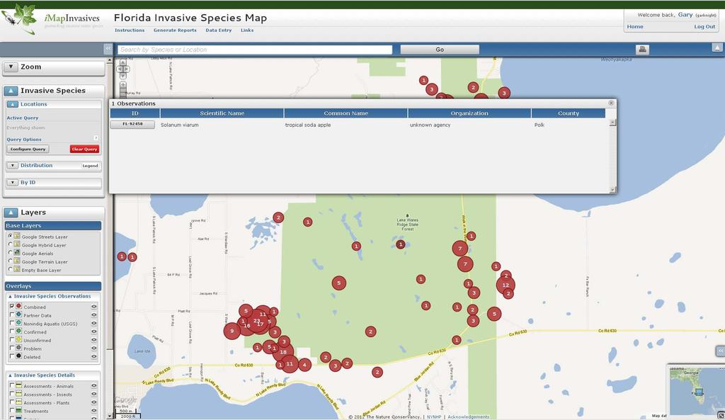
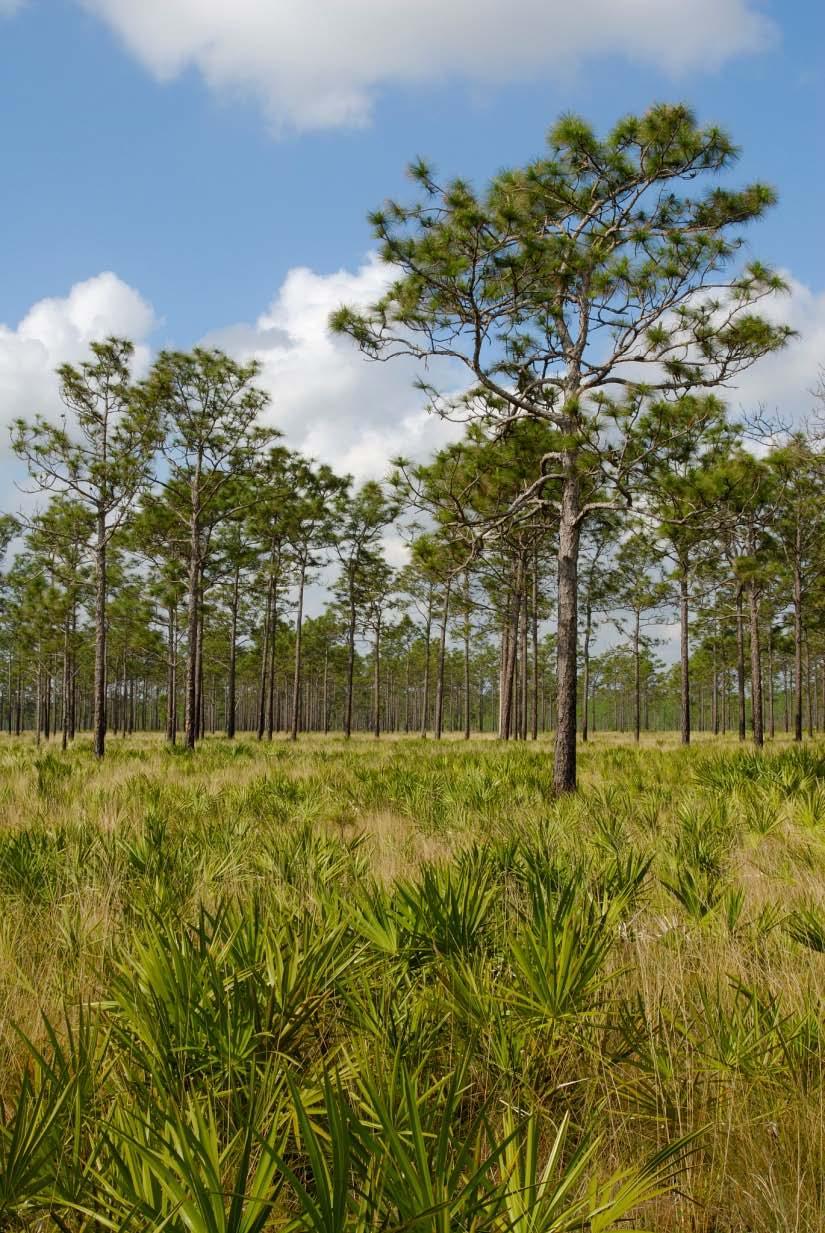
6 FNAI and Invasive plants Started building a database in 2003 Primarily funded by FWC s Invasive Plant Section more than 209,000 observation records on more than 2000 managed areas On-line data forms Downloadable data Apalachicola National Forest
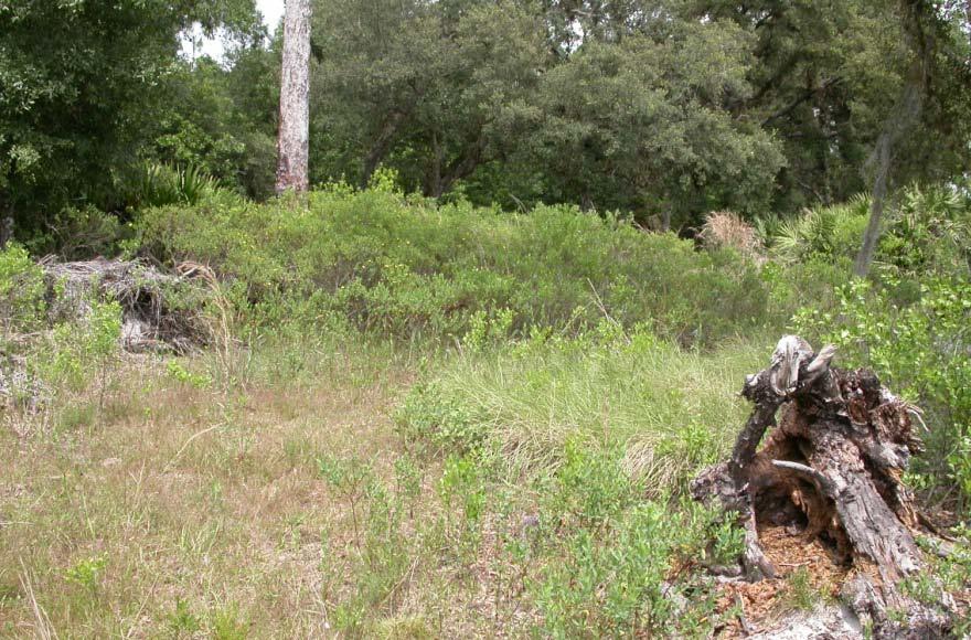
7 Apalachicola National Forest
8 Apalachicola National Forest
9 Apalachicola National Forest

10 Apalachicola National Forest

11 Apalachicola National Forest

12 Apalachicola National Forest

13 Apalachicola National Forest

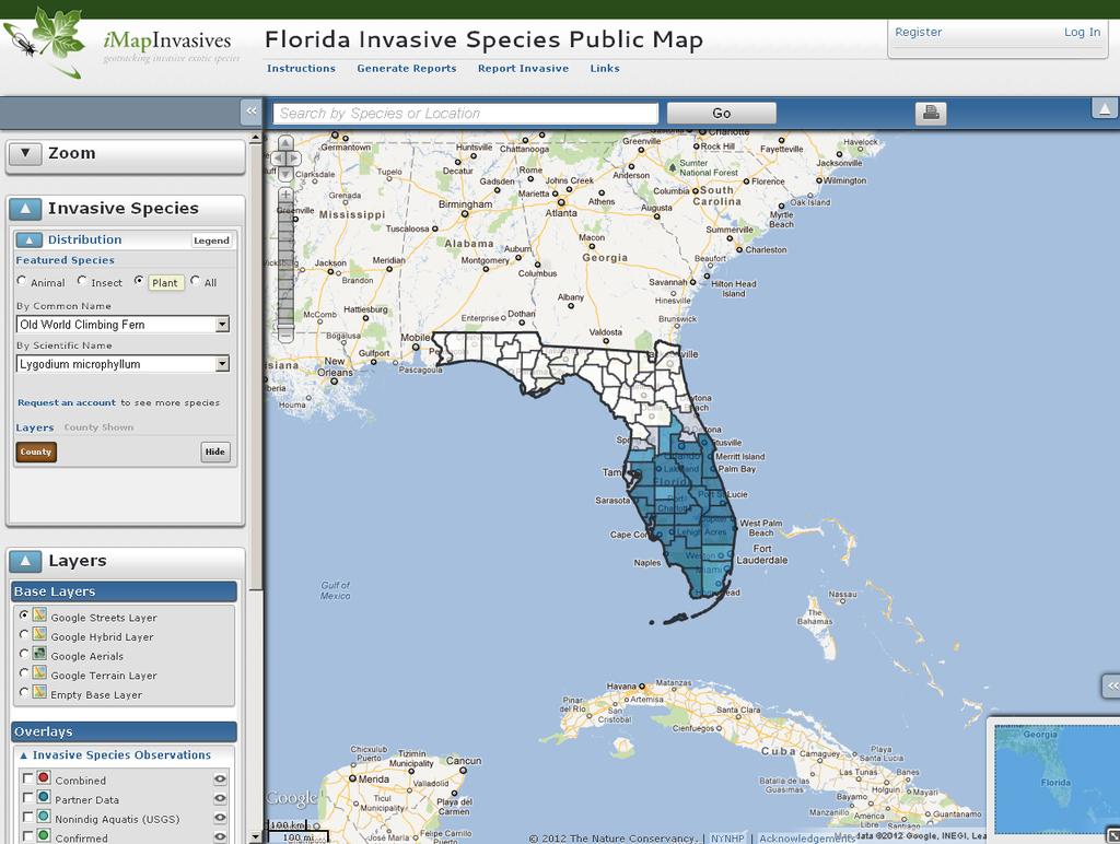
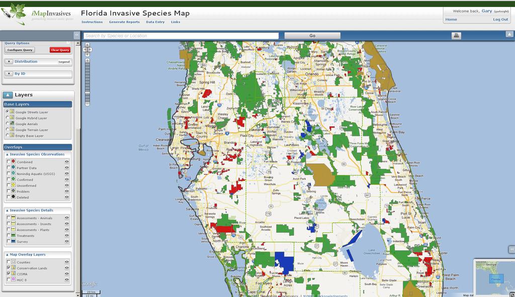
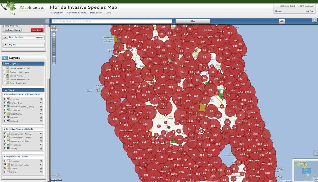
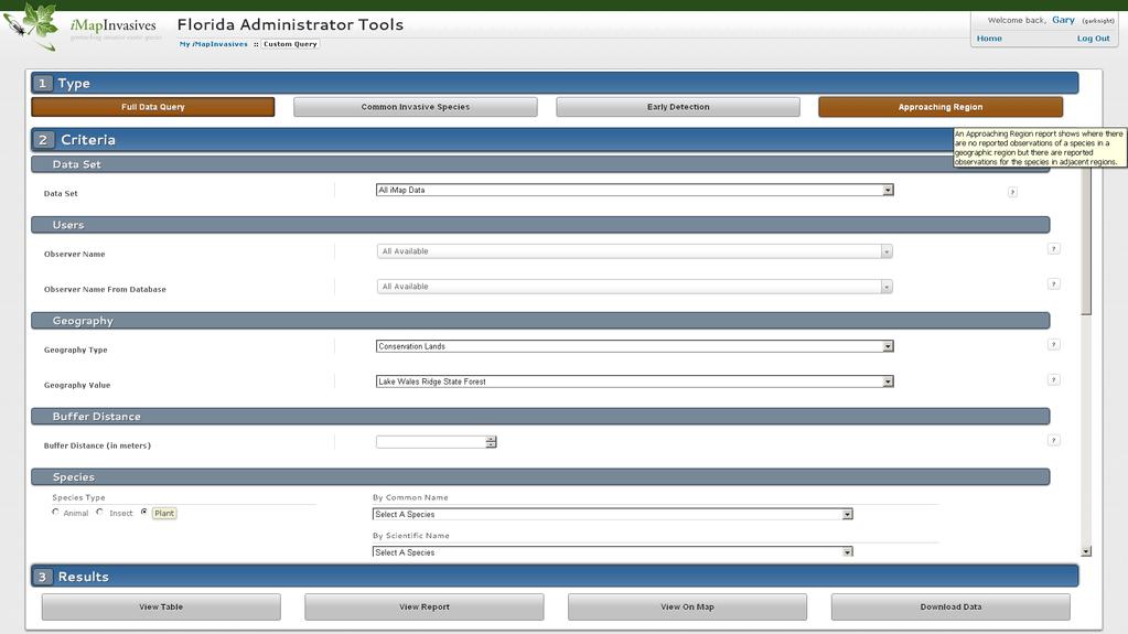
14 Introduction to imapinvasives A collaborative web-based solution for invasive species data aggregation, mapping, and analysis

15
16 imapinvasives is an online, GIS-based, all-taxa mapping tool allowing natural resources mangers and other professionals with invasive species responsibilities the ability to collect, manage, and analyze invasive species data. Designed specifically for land managers Manage observation / assessment information Manage survey information (including absence data) Manage treatment data Sophisticated GIS and spatial analysis capabilities Wide array of on-demand reports Batch uploading for partner organizations Early detection watch lists and e- mail alerts Mobile web site for any webcapable mobile device
17
18

19
20

21
22
23

24
25
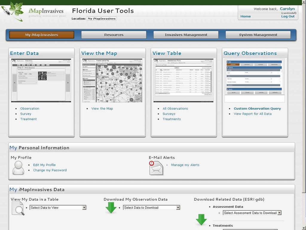
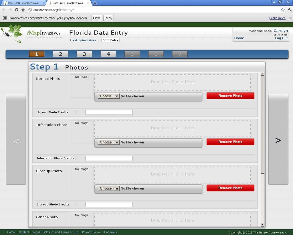
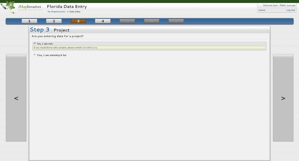
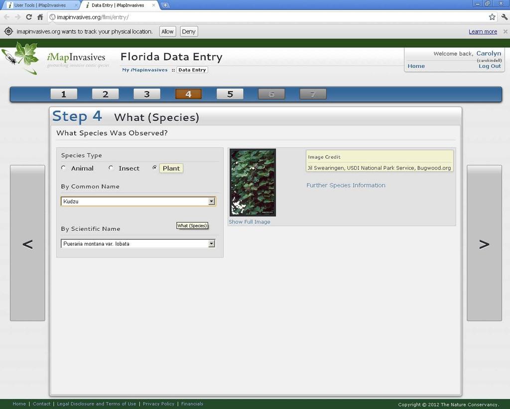
26 Data Entry
27
28
29
30
31

32
33

34

35

36

37
38
39

40
41
42
43

44
45


46
47
48
49
50

51
52

53

54

55

56

57
58
59
60
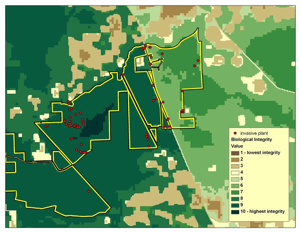
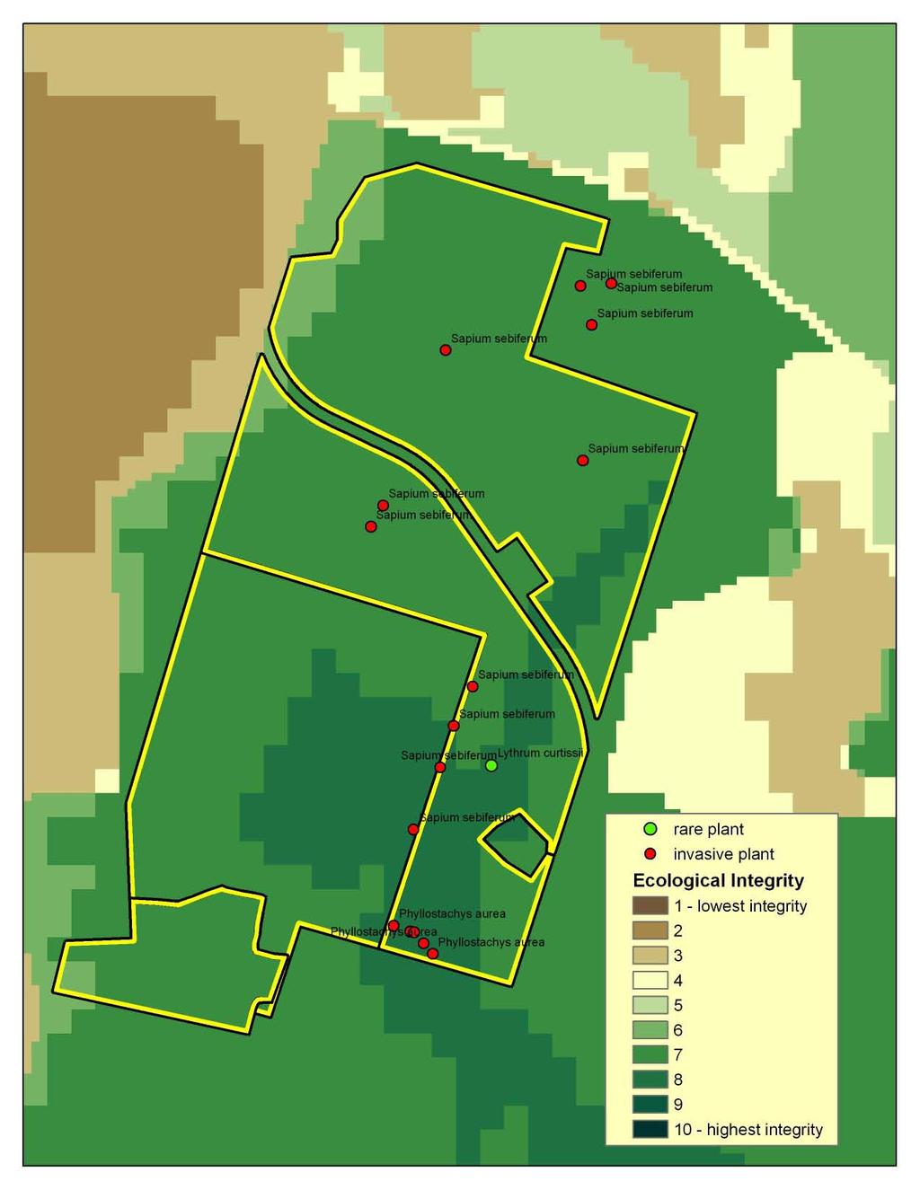
61

62
63 Advantages of imapinvasives GIS foundation allows complex spatial analysis Many helpful on-demand reports already developed Easy to learn and use Ability to manage survey and treatment data No cost to partners Support provided by FNAI Tools are being continually improved based on user feedback


64 Prioritizing Invasive Exotic Plant Treatments
65 Invasive Plant Threats to Rare Plants in the First Coast CISMA Total Rare Plant Occurrences 260 Total Invasive Occurrences 7,776 Rare Plant Occurrences (with 200m buffer) intersecting Invasive Occurrences 35 Invasive Occurrences intersecting Rare Plant Occurrences (with 200m buffer) 180 Total Intersections Rare Plant Occurrences (with 200m buffer) and Invasive Occurrences 262
66 Top Ten Rare Plants Threatened by Proximity (200 m) to Invasive Plants* Rare Plant Scientific Name Rare Plant Common Name No. Occurrences Intersected Hartwrightia floridana Hartwrightia 66 Baptisia calycosa var. calycosa Canby's Wild Indigo 43 Calydorea coelestina Bartram's Ixia 41 Forestiera godfreyi Godfrey's Swampprivet 19 Monotropsis reynoldsiae Pygmy Pipes 15 Peperomia humilis Terrestrial Peperomia 14 Ctenium floridanum Florida Toothache Grass 10 Spiranthes polyantha Green Ladies'-tresses 10 Balduina atropurpurea Purple Honeycomb-head 9 Pteroglossaspis ecristata Giant Orchid 6 *Data for First Coast CISMA boundaries
67 Top Ten Invasive Plants within 200 m of Rare Plant Occurrence* Invasive Plant Scientific Name Invasive Plant Common Name No. Rare Plant Occurrences Intersected Lygodium japonicum Japanese climbing fern 41 Panicum repens torpedo grass 37 Melia azedarach Chinaberry 27 Albizia julibrissin mimosa 24 Sapium sebiferum Chinese tallow 22 Dioscorea bulbifera air-potato 18 Cinnamomum camphora camphor tree 14 Lantana camara lantana 14 Colocasia esculenta taro 8 Sesbania punicea purple sesban 8 *Data for First Coast CISMA boundaries
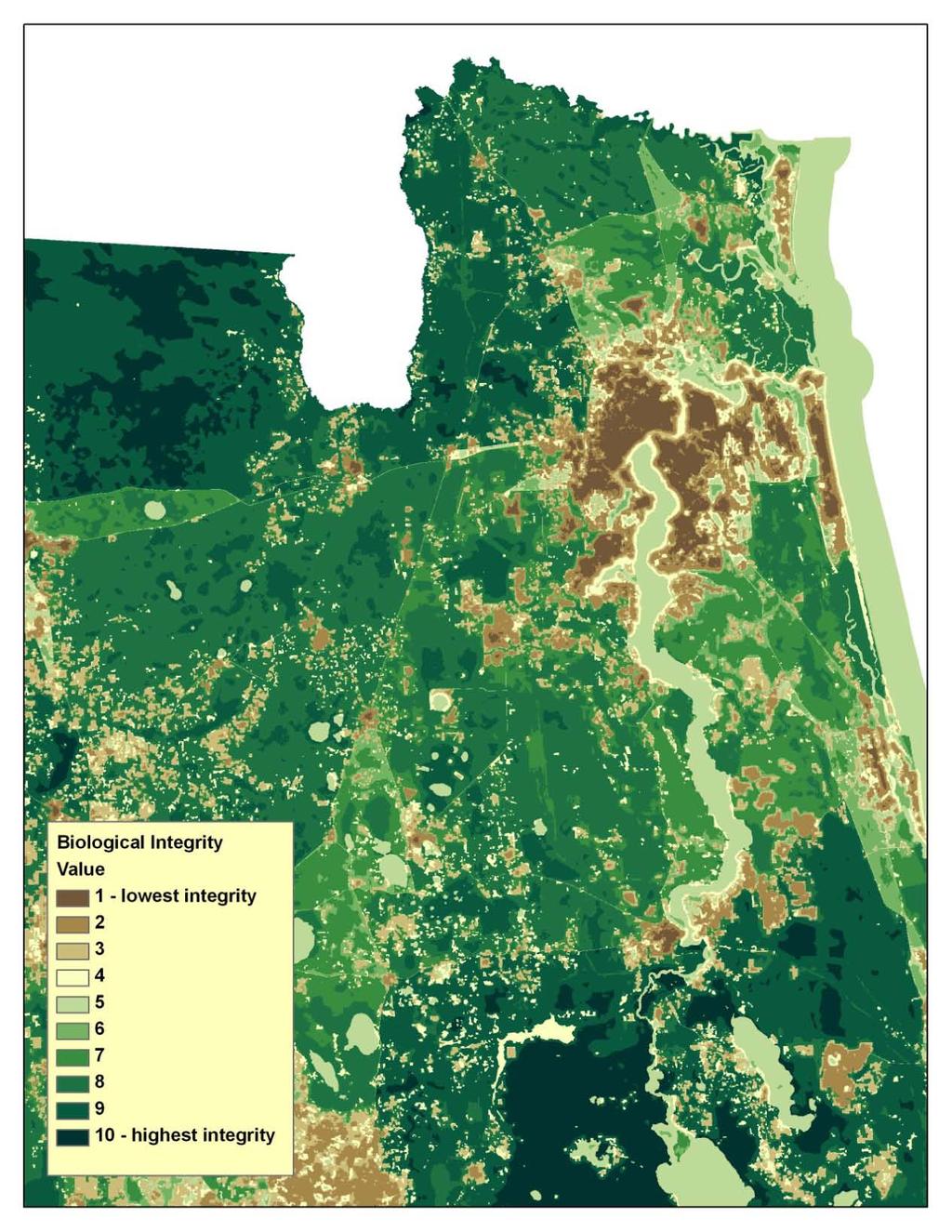

68 Ecological Integrity
69 Ecological Integrity


70

71
72 Technical Assistance Frank Price, FNAI Data Manager x 210
The FNAI Invasive Plants Program
 The FNAI Invasive Plants Program What we do and how we can help the Northwest FL CISMA Frank Price Invasive Plants Program Manager Staff of 32 Part of FUS and the NatureServe network 100% contract funded
Assessing Michigan s Biological diversity. Michigan Natural Features Inventory MSU Extension
 Assessing Michigan s Biological diversity John Paskus,, Amy Derosier,, Edward Schools, and Helen Enander Michigan Natural Features Inventory MSU Extension Goal Provide scientifically based information
Data Dictionary for Observation Data Transcription Reports from the Colorado Natural Heritage Program
 Data Dictionary for Observation Data Transcription Reports from the Colorado Natural Heritage Program This Data Dictionary defines terms used in Observation Data Reports exported by the Colorado Natural
An Introduction to NatureServe Linking Conservation and Transportation Planning Phoenix, Arizona November 8 & 9, 2006
 An Introduction to NatureServe Linking Conservation and Transportation Planning Phoenix, Arizona November 8 & 9, 2006 1 NatureServe in Brief An independent, non-profit conservation organization Provides
An Introduction to Day Two. Linking Conservation and Transportation Planning Lakewood, Colorado August 15-16, 16, 2006
 An Introduction to Day Two Linking Conservation and Transportation Planning Lakewood, Colorado August 15-16, 16, 2006 1 Agenda Day One Transportation Planning Heritage Program State Wildlife Action Plan
HABITAT SUITABILITY MODELS: RESEARCH AND MANAGEMENT
 HABITAT SUITABILITY MODELS: RESEARCH AND MANAGEMENT Mark Barrett, Ph.D. Florida Fish and Wildlife Conservation Commission Fish and Wildlife Research Institute Center for Spatial Analysis George Box (1976)
Invasive Species Geodatabase Presentation Central Florida Invasive Species Working Group (CFISWG)
") Invasive Species Geodatabase Presentation Central Florida Invasive Species Working Group (CFISWG) Information provided by: Orange County Environmental Protection Division Green PLACE Program HomeBud 27
Invasive Species Geodatabase Presentation Central Florida Invasive Species Working Group (CFISWG) Information provided by: Orange County Environmental Protection Division Green PLACE Program HomeBud 27
National Survey on the Natural Environment of Japan. Hajime Hirosawa Biodiversity Center of Japan Ministry of the Environment (MOE)
") National Survey on the Natural Environment of Japan Hajime Hirosawa Biodiversity Center of Japan Ministry of the Environment (MOE) Biodiversity Center of Japan, MOE Establishment: 1998 Purpose: to encourage
National Survey on the Natural Environment of Japan Hajime Hirosawa Biodiversity Center of Japan Ministry of the Environment (MOE) Biodiversity Center of Japan, MOE Establishment: 1998 Purpose: to encourage
Previously Used Scientific Names: Habenaria quinqueseta var. quinqueseta, Orchis habenaria Linnaeus, O. quinqueseta Michaux
 Common Name: MICHAUX S ORCHID Scientific Name: Habenaria quinqueseta (Michaux) A. Eaton Other Commonly Used Names: Michaux s orchis, long-horned habenaria, long-horned false rein-orchid Previously Used
Previously Used Scientific Names: Calopogon barbatus (Walter) Ames var. multiflorus (Lindley) Correll
 Ames var. multiflorus (Lindley) Correll") Common Name: MANY-FLOWERED GRASS PINK Scientific Name: Calopogon multiflorus Lindley Other Commonly Used Names: none Previously Used Scientific Names: Calopogon barbatus (Walter) Ames var. multiflorus
Common Name: MANY-FLOWERED GRASS PINK Scientific Name: Calopogon multiflorus Lindley Other Commonly Used Names: none Previously Used Scientific Names: Calopogon barbatus (Walter) Ames var. multiflorus
Using Technology to Report Invasive Species in Indiana via EDDMapS and the GLEDN Smartphone/Tablet App
 Using Technology to Report Invasive Species in Indiana via EDDMapS and the GLEDN Smartphone/Tablet App Rebekah D. Wallace, Charles T. Bargeron, and Karan A. Rawlins Background University of Georgia BS
United States Department of the Interior NATIONAL PARK SERVICE Northeast Region
 United States Department of the Interior NATIONAL PARK SERVICE Northeast Region June 17, 2017 REQUEST FOR STATEMENTS OF INTEREST and QUALIFICATIONS Project Title: ASSESSMENT OF NATURAL RESOURCE CONDITION
Common Name: FLORIDA LADIES-TRESSES. Scientific Name: Spiranthes floridana (Wherry) Cory. Other Commonly Used Names: none
 Cory. Other Commonly Used Names: none") Common Name: FLORIDA LADIES-TRESSES Scientific Name: Spiranthes floridana (Wherry) Cory Other Commonly Used Names: none Previously Used Scientific Names: Spiranthes brevilabris var. floridana (Wherry)
Common Name: FLORIDA LADIES-TRESSES Scientific Name: Spiranthes floridana (Wherry) Cory Other Commonly Used Names: none Previously Used Scientific Names: Spiranthes brevilabris var. floridana (Wherry)
Nebraska Conservation and Environmental Review Tool (CERT): Terminology used in the Tables of the CERT Report
: Terminology used in the Tables of the CERT Report") Nebraska Conservation and Environmental Review Tool (CERT): Terminology used in the Tables of the CERT Report Nebraska Natural Heritage Program Nebraska Game and Parks Commission February 8, 2018 Contents
Nebraska Conservation and Environmental Review Tool (CERT): Terminology used in the Tables of the CERT Report Nebraska Natural Heritage Program Nebraska Game and Parks Commission February 8, 2018 Contents
Data Dictionary for Network of Conservation Areas Transcription Reports from the Colorado Natural Heritage Program
 Data Dictionary for Network of Conservation Areas Transcription Reports from the Colorado Natural Heritage Program This Data Dictionary defines terms used in Network of Conservation Areas (NCA) Reports
Doing Things Differently: Tracking Invasive Exotic Plants in the Florida Park Service
 Florida Park Service Doing Things Differently: Tracking Invasive Exotic Plants in the Florida Park Service 21 May 2013 The Big Picture 171 State Parks and Trails across 5 Districts ~785,000 Acres Almost
Coastal Response Research Center. Nancy Kinner University of New Hampshire (UNH) Michele Jacobi NOAA ORR. September 27, 2007
 Michele Jacobi NOAA ORR. September 27, 2007") Coastal Response Research Center Nancy Kinner University of New Hampshire (UNH) Michele Jacobi NOAA ORR September 27, 2007 1 Coastal Response Research Center (CRRC) CRRC is partnership between NOAA s Office
Coastal Response Research Center Nancy Kinner University of New Hampshire (UNH) Michele Jacobi NOAA ORR September 27, 2007 1 Coastal Response Research Center (CRRC) CRRC is partnership between NOAA s Office
Kyoto and Carbon Initiative - the Ramsar / Wetlands International perspective
 Kyoto and Carbon Initiative - the Ramsar / Wetlands International perspective (the thoughts of Max Finlayson, as interpreted by John Lowry) Broad Requirements Guideline(s) for delineating wetlands (specifically,
Figure 1: Mapping occurrences on USGS topographic maps. Needs Figure 2: Comparison of buffered points and digitized occurrence boundaries
 Using Geographic Information Systems to Prepare Sensitive Species Information for Land Use Master Planning Ed Schools, Helen Enander, and John Paskus MSU Extension, Michigan Natural Features Inventory
Measuring ecosystems and biodiversity and related goods and services
 Measuring ecosystems and biodiversity and related goods and services World Bank, WAVES Partnership Meeting Michael Bordt, EASD Statistics Canada March 30, 2011 Outline What exists already in Canada and
Spatial Data Availability Energizes Florida s Citizens
 NASCIO 2016 Recognition Awards Nomination Spatial Data Availability Energizes Florida s Citizens State of Florida Agency for State Technology & Department of Environmental Protection Category: ICT Innovations
Data Dictionary for Potential Conservation Area Transcription Reports from the Colorado Natural Heritage Program
 Data Dictionary for Potential Conservation Area Transcription Reports from the Colorado Natural Heritage Program This Data Dictionary defines terms used in Potential Conservation Area (PCA) Reports exported
OCEANOGRAPHIC DATA MANAGEMENT
 OCEANOGRAPHIC DATA MANAGEMENT Presented to: Environmental Disaster Data Management Meeting Russ Beard Director, National Coastal Data Development Center Interim Science Coordinator, Gulf Restoration Council
Summary Description Municipality of Anchorage. Anchorage Coastal Resource Atlas Project
 Summary Description Municipality of Anchorage Anchorage Coastal Resource Atlas Project By: Thede Tobish, MOA Planner; and Charlie Barnwell, MOA GIS Manager Introduction Local governments often struggle
The Catalogue of Life: towards an integrative taxonomic backbone for biodiversity. Frank A. Bisby, Yuri R. Roskov
 Nimis P. L., Vignes Lebbe R. (eds.) ù Biodiversity: Progress and Problems pp. 37-42. ISBN 978-88-8303-295-0. EUT, 2010. The Catalogue of Life: towards an integrative taxonomic backbone for biodiversity
Sustainability Adaptation Transparency Accountability. $400 FBC of fuel.
 Sustainability Adaptation Transparency Accountability $400 FBC of fuel. We need a sustainability platform Tools for organization, collaboration, policy, data collection, storage, analysis, understanding,
USGS National Geospatial Program Understanding User Needs. Dick Vraga National Map Liaison for Federal Agencies July 2015
 + USGS National Geospatial Program Understanding User Needs Dick Vraga National Map Liaison for Federal Agencies July 2015 + Topics 2 Background Communities of Use User Surveys National Map Liaisons Partnerships
Common Name: GLADE WINDFLOWER. Scientific Name: Anemone berlandieri Pritzel. Other Commonly Used Names: southern thimble-weed
 Common Name: GLADE WINDFLOWER Scientific Name: Anemone berlandieri Pritzel Other Commonly Used Names: southern thimble-weed Previously Used Scientific Names: Anemone caroliniana Walter var. heterophylla
Middle School. Teacher s Guide MICROPLANTS MAJOR SPONSOR:
 Middle School Teacher s Guide MICROPLANTS MAJOR SPONSOR: Introduction As technology continues to rapidly evolve, scientists are able to collect and store more data. Some scientists find themselves with
Chesapeake Bay Remote Sensing Pilot Executive Briefing
 Chesapeake Bay Remote Sensing Pilot Executive Briefing Introduction In his Executive Order 13506 in May 2009, President Obama stated The Chesapeake Bay is a national treasure constituting the largest estuary
THE NATURESERVE NETWORK
 THE NATURESERVE NETWORK Access to NatureServe's best available data on the locations of endangered species September 1, 2011 A Network Connecting Science with Conservation Mexico Guatemala El Salvador
Continental Divide National Scenic Trail GIS Program
 CDNST Vision Statement: Provide the most accurate geospatial locational information of the Continental Divide Trail and nearby resources to the public as well as help provide internal management information
Harvesting and harnessing data for biogeographical research
 How do we know what grows where? Harvesting and harnessing data for biogeographical research A. Geography Tree B. Species Tree inventories and surveys natural areas, preserves, state forests, private properties
Geography for the 2020 Round of Census
 Boundaries Key Census Data EA Id Population Male Female EA Id Area EA Id Num HH Avg HH size Geography for the 2020 Round of Census Linda Peters, Esri lpeters@esri.com Integration of Statistical and Geospatial
11 major glaciations occurred during the Pleistocene. As glaciers advanced and receded the sea level globally decreased and rose accordingly.
 11 major glaciations occurred during the Pleistocene. As glaciers advanced and receded the sea level globally decreased and rose accordingly. This rising of sea levels caused plants and animals to move
Accounting for Ecosystem and Biodiversity Related Themes in Uganda
 Introduction Accounting for Ecosystem and Biodiversity Related Themes in Uganda Calls for more evidence-based approaches to policy have increased the need for integrated environmental-economic information
SIF_7.1_v2. Indicator. Measurement. What should the measurement tell us?
 Indicator 7 Area of natural and semi-natural habitat Measurement 7.1 Area of natural and semi-natural habitat What should the measurement tell us? Natural habitats are considered the land and water areas
Common Name: FLORIDA ADDER S-MOUTH ORCHID. Scientific Name: Malaxis spicata Swartz. Other Commonly Used Names: none
 Common Name: FLORIDA ADDER S-MOUTH ORCHID Scientific Name: Malaxis spicata Swartz Other Commonly Used Names: none Previously Used Scientific Names: Malaxis floridana (Chapman) Kuntze, Microstylis floridana
Environmental Management 123 West Indiana Ave., Room 202 DeLand, FL (386) Environmental Management Outdoor Education
 Environmental Management Outdoor Education") Environmental Management 123 West Indiana Ave., Room 202 DeLand, FL 32720 (386) 736-5927 Environmental Management Outdoor Education 2015-2016 Environmental Management Education Offerings Botany Botany,
Environmental Management 123 West Indiana Ave., Room 202 DeLand, FL 32720 (386) 736-5927 Environmental Management Outdoor Education 2015-2016 Environmental Management Education Offerings Botany Botany,
Resolution XIII.23. Wetlands in the Arctic and sub-arctic
 13th Meeting of the Conference of the Contracting Parties to the Ramsar Convention on Wetlands Wetlands for a Sustainable Urban Future Dubai, United Arab Emirates, 21-29 October 2018 Resolution XIII.23
Assessment and valuation of Ecosystem Services for decision-makers
 Assessment and valuation of Ecosystem Services for decision-makers An introduction to the ARIES approach Ferdinando Villa *, Ken Bagstad Gary Johnson, Marta Ceroni *Basque Center for Climate Change, Bilbao,
Ecological Valuation for Land Use Planning Decision Support in South Florida: The Ecosystem Portfolio Model
 Ecological Valuation for Land Use Planning Decision Support in South Florida: The Ecosystem Portfolio Model Bill Labiosa, Rich Bernknopf, Paul Hearn, Dianna Hogan, Dave Strong, Leonard Pearlstine, Amy
3/29/11. Why bother with tools? Incorporating Decision Support Tools into Climate Adaptation Planning. A Simplified Planning Process
 Incorporating Decision Support Tools into Climate Adaptation Planning Why bother with tools? Tools don t eliminate complexity but they can help deal with it" Tools can:"! Help incorporate science into
Annex I. Common criteria for the choice of Protected Marine and Coastal Areas that could be included in SPAMI list
 Annex I Common criteria for the choice of Protected Marine and Coastal Areas that could be included in SPAMI list PROTOCOL CONCERNING SPECIALLY PROTECTED AREAS AND BIOLOGICAL DIVERSITY IN THE MEDITERRANEAN
Environmental Response Management Application
 Environmental Response Management Application Coastal Response Research Center Nancy Kinner, Michele Jacobi, Rob Braswell, Kurt Schwehr & Amy Merten RRT III May 14, 2008 1 Talk Outline Overview of Center
Creating an e-flora for South Africa
 SANBI POLICY DOCUMENT DIVISION: Biosystematics Research and Biodiversity Collections EFFECTIVE DATE: 1 April 2014 Compiler: Marianne le Roux & Janine Victor POLICY NUMBER: LAST AMENDED: Creating an e-flora
Developing EU-BON's site-specific portal
 General meeting- Cambridge, 2-4 June, 2015 Developing EU-BON's site-specific portal Yoni Gavish University of Leeds gavishyoni@gmail.com 1 Before we start... I have no expertise in data management + web
NatureServe s Federally Listed Species Location Data Play an Important Role in EPA s FIFRA Risk Assessments
 NatureServe s Federally Listed Species Location Data Play an Important Role in EPA s FIFRA Risk Assessments 1 ASHLEA FRANK COMPLIANCE SERVICES INTERNATIONAL FIFRA ENDANGERED SPECIES TASK FORCE BIODIVERSITY
Floristic Quality Index: Current Methods and Development. Nia Wellendorf Russ Frydenborg DEP Bureau of Labs
 Floristic Quality Index: Current Methods and Development Nia Wellendorf Russ Frydenborg DEP Bureau of Labs Outline History and definition of FQI Methods developed for Florida lakes Ongoing index development
The Midwest Invasive Species Information Network: Today and Tomorrow
 The Midwest Invasive Species Information Network: Today and Tomorrow Amos H. Ziegler Applied Spatial Ecology and Technical Services Laboratory Department of Entomology, Michigan State University RRIP IT
the map Redrawing Donald Hobern takes a look at the challenges of managing biodiversity data [ Feature ]
![the map Redrawing Donald Hobern takes a look at the challenges of managing biodiversity data [ Feature ]](/thumbs/82/86628837.jpg "the map Redrawing Donald Hobern takes a look at the challenges of managing biodiversity data [ Feature ]") Redrawing the map Donald Hobern takes a look at the challenges of managing biodiversity data 46 Volume 12 > Number 9 > 2008 www.asiabiotech.com Cicadetta sp., Canberra, Australia, December 2007 Photograph
Redrawing the map Donald Hobern takes a look at the challenges of managing biodiversity data 46 Volume 12 > Number 9 > 2008 www.asiabiotech.com Cicadetta sp., Canberra, Australia, December 2007 Photograph
Resilient Landscapes Fund
 Resilient Landscapes Fund Definitions and Map Guide 2017 This document includes definitions of key terms and instructions for developing maps for application to OSI s Resilient Landscapes Fund. INTRODUCTION
Botany 401 Vascular Flora of Wisconsin
 Botany 401 Vascular Flora of Wisconsin Pick up syllabus from one of the instructors http://courses.botany.wisc.edu/botany_401/class/lecture.html Botany 401 Vascular Flora of Wisconsin Objectives for the
ACRONYMS AREAS COUNTRIES MARINE TERMS
 Natura 2000 ACRONYMS AREAS COUNTRIES MARINE TERMS DEFINITION A European network of protected sites under the European Habitats and Birds Directives, aiming to protect the most valuable and threatened European
X All databased and barcoded
 Botany 401 Vascular Flora of Wisconsin Pick up syllabus from one of the instructors http://courses.botany.wisc.edu/botany_401/class/lecture.html Botany 401 Vascular Flora of Wisconsin Objectives for the
13th Queensland Weed Symposium 2015
 13th Queensland Weed Symposium 2015 JG1 Lower Beechmont Conservation Area Restoration of Lower Beechmont Conservation Area 13 th Queensland Weed Symposium 15 th September 2015 (www.googlemaps.com) JG14
Assessing state-wide biodiversity in the Florida Gap analysis project
 University of Nebraska - Lincoln DigitalCommons@University of Nebraska - Lincoln Nebraska Cooperative Fish & Wildlife Research Unit -- Staff Publications Nebraska Cooperative Fish & Wildlife Research Unit
Management Planning & Implementation of Communication Measures for Terrestrial Natura 2000 Sites in the Maltese Islands Epsilon-Adi Consortium
 Management Planning & Implementation of Communication Measures for Terrestrial Natura 2000 Sites in the Maltese Islands Epsilon-Adi Consortium Briefing Meetings, February 2013 CT3101/2011, MEPA, Malta
GIS Options RELU Upland Moorland Scoping Study Project CCG/SoG Working Paper, February 2005 Andy Turner
 GIS Options RELU Upland Moorland Scoping Study Project CCG/SoG Working Paper, February 2005 Andy Turner 1. Introduction This working paper outlines some Geographical Information System (GIS) options for
Partnering with LANDFIRE, NatureServe, and Heritage Programs. Utilizing Legacy Data for Ecological Site Concept Development and Descriptions
 Partnering with LANDFIRE, NatureServe, and Heritage Programs Utilizing Legacy Data for Ecological Site Concept Development and Descriptions Content LANDFIRE: BpS vs. EVT LANDFIRE: Disturbance Models NatureServe:
Integrating ArcGIS Server and Flex: Highlighting the Trees in Washington, DC. Holli Howard and Mike Alonzo Casey Trees Washington, DC
 Integrating ArcGIS Server and Flex: Highlighting the Trees in Washington, DC Holli Howard and Mike Alonzo Casey Trees Washington, DC Presentation overview Casey Trees Our ESRI partnership: The Casey Trees
Strategies for Control of Giant Salvinia and Other Invasive Species
 Strategies for Control of Giant Salvinia and Other Invasive Species Projects under consideration for a Caddo Lake Institute grant proposal to the National Fish & Wildlife Foundation Initial Focus is on
Getting Biodiversity Data
 Getting Biodiversity Data NatureServe Canada Douglas Hyde Executive Director Value of biodiversity data to business? Reasons vary depending on the business Reduce development uncertainty Integrated views
EBA Engineering Consultants Ltd. Creating and Delivering Better Solutions
 EBA Engineering Consultants Ltd. Creating and Delivering Better Solutions ENHANCING THE CAPABILITY OF ECOSYSTEM MAPPING TO SUPPORT ADAPTIVE FOREST MANAGEMENT Prepared by: EBA ENGINEERING CONSULTANTS LTD.
FOURTEEN YEARS OF SPATIAL DATA FROM PLANTS OF CONCERN: WHAT ARE WE LEARNING?
 FOURTEEN YEARS OF SPATIAL DATA FROM PLANTS OF CONCERN: WHAT ARE WE LEARNING? Rachel Goad, Manager, Plants of Concern Shannon Still, Postdoctoral Researcher, Chicago Botanic Garden Jeremie Fant, Conservation
Issues in bryophyte conservation and research
 Issues in bryophyte conservation and research Paula Warren Head Office Wellington Craig Miller West Coast Conservancy Hokitika Published by Head Office, PO Box 10-420 Wellington, New Zealand This report
Data Dictionary for Element Occurrence Transcription Reports from the Colorado Natural Heritage Program
 Data Dictionary for Element Occurrence Transcription Reports from the Colorado Natural Heritage Program This Data Dictionary defines terms used in Element Occurrence (EO) Reports exported by the Colorado
Virginia Shoreline Mapping Tools
 Virginia Shoreline Mapping Tools December 15, 2017 Karen Duhring Center for Coastal Resources Management Virginia Institute of Marine Science College of William & Mary Virginia Shoreline Mapping Tools
A national islands database and assessment of conservation value
 A national islands database and assessment of conservation value Julie Quinn and Karl Bossard Spotted-Tailed Quoll (D.Watts) Feral pig (B. Salau) Glossodia orchid (S.Bourne) Tracking and Tasman Island
Section 2. Indiana Geographic Information Council: Strategic Plan
 Section 2. Indiana Geographic Information Council: Strategic Plan Introduction A geographic information system (GIS) is an automated tool that allows the collection, modification, storage, analysis, and
Document Title. Estimating the Value of Partner Contributions to Flood Mapping Projects. Blue Book
 Document Title Estimating the Value of Partner Contributions to Flood Mapping Projects Blue Book Version 1.1 November 2006 Table of Contents 1. Background...1 2. Purpose...1 3. Overview of Approach...2
Global Environment Facility - Integrating Watershed & Coastal Areas Management (GEF-IWCAM): Andros Demonstration Site
: Andros Demonstration Site") Global Environment Facility - Integrating Watershed & Coastal Areas Management (GEF-IWCAM): Andros Demonstration Site Coastal Aquifer Management in Small Island Developing States of the Caribbean: Challenges
Global Environment Facility - Integrating Watershed & Coastal Areas Management (GEF-IWCAM): Andros Demonstration Site Coastal Aquifer Management in Small Island Developing States of the Caribbean: Challenges
Common Name: PINK LADY S-SLIPPER
 Common Name: PINK LADY S-SLIPPER Scientific Name: Cypripedium acaule Aiton Other Commonly Used Names: pink moccasin flower, stemless lady-slipper, slipper orchid Previously Used Scientific Names: Fissipes
Oregon Department of Transportation. Geographic Information Systems Strategic Plan
 Oregon Department of Transportation Geographic Information Systems Strategic Plan Adopted May, 2000 By the GIS Steering Committee Last printed 10/2/2012 4:20:00 PM Page Geographic Information Systems Strategic
RESPONSE FORM Infraspecific Taxon Protocol. Infraspecific Taxon: Resident Species: Requestor Name and Affiliation: ITP Completed by:
 Infraspecific Taxon: Lantana camara UF-1013A-2A Resident Species: Lantana camara Requestor Name and Affiliation: Zhanao Deng, Environ Hort., GCREC, UF ITP Completed by: Deah Lieurance Date ITP started:
Georgia Performance Standards for Urban Watch Restoration Field Trips
 Georgia Performance Standards for Field Trips 6 th grade S6E3. Students will recognize the significant role of water in earth processes. a. Explain that a large portion of the Earth s surface is water,
Application of WebGIS and VGI for Community Based Resources Inventory. Jihn-Fa Jan Department of Land Economics National Chengchi University
 Application of WebGIS and VGI for Community Based Resources Inventory Jihn-Fa Jan Department of Land Economics National Chengchi University OUTLINE Introduction Methodology Results Conclusions 2 MOTIVATION
Remote Sensing and Spatial Analysis (RSSA)
") MESM Track Remote Sensing and Spatial Analysis (RSSA) Dr. Y.Q. Wang (Track Chair) http://nrs.uri.edu/people/faculty/wang.html Remote Sensing and Spatial Analysis Remote sensing, GIS, GPS and their applications
MESM Track Remote Sensing and Spatial Analysis (RSSA) Dr. Y.Q. Wang (Track Chair) http://nrs.uri.edu/people/faculty/wang.html Remote Sensing and Spatial Analysis Remote sensing, GIS, GPS and their applications
Mapping Water Resources and Reservoirs for Climate Resilience in Zambezi River Basin
 Mapping Water Resources and Reservoirs for Climate Resilience in Zambezi River Basin Corné van der Sande, NEO BV Senior Advisor Earth Observation Services for Monitoring Drought and Water Resources in
An introduction to thee Urban Oases Site Selection Tool:
 An introduction to thee Urban Oases Site Selection Tool: Created by Audubon Connecticut with assistance from a GIS Consultant/Research Assistant at the Harvard Forest Essential input provided by the New
Transportation and Logistics Planning and Development Mapping Tool
 Transportation and Logistics Planning and Development Mapping Tool Doreen Gonzales-Gaboyan Business Development and Outreach Center for Innovation through Visualization and Simulation (CIVS) Purdue University
Habitat destruction by IAS Flora. Siril Wijesundara Research Professor National Institute of Fundamental Studies Kandy, Sri Lanka
 Habitat destruction by IAS Flora Siril Wijesundara Research Professor National Institute of Fundamental Studies Kandy, Sri Lanka Invasive species can cause significant changes to ecosystems, upset the
Landscape Planning and Habitat Metrics
 Landscape Planning and Habitat Metrics Frank W. Davis National Center for Ecological Analysis and Synthesis UC Santa Barbara (Tools for Landscape Biodiversity Planning) Jimmy Kagan Institute for Natural
Empowered lives. Resilient nations. Data for People and Planet. powered by
 Empowered lives. Resilient nations. Data for People and Planet powered by Overview As we enter the fourth industrial revolution, technology is revolutionizing our ability to map nature. Satellite data
Vanishing Species 5.1. Before You Read. Read to Learn. Biological Diversity. Section. What do biodiversity studies tell us?
 Vanishing Species Before You Read Dinosaurs are probably the most familiar organisms that are extinct, or no longer exist. Many plants and animals that are alive today are in danger of dying out. Think
Ecosystem Indicators. Age Poom. Environmental Management Master Course CAU Ecology Centre SS 2006
 Ecosystem Indicators Age Poom Environmental Management Master Course CAU Ecology Centre SS 2006 Indicator definitions Purpose of development and use of indicators Characteristics and requirements of indicators
The Atlas Aspect of the Atlas of Living Australia
 The Atlas Aspect of the Atlas of Living Australia Lee Belbin lee@blatantfabrications.com Melbourne Museum, July 28, 2010 The Atlas is funded by the Australian Government under the National Collaborative
Sea Level Space Watch: Service Offering
 Space for Smarter Government Programme Sea Level Space Watch: Service Offering General Sea Level Space Watch : Operational service developed to support national flood defence planning. Systematically updated
Courtesy of Tomi Petr
 Lake Dal, rich in submerged aquatic plants, is threatened by pollution, Kashmir, India Lakes, reservoirs, rivers and streams are important habitats for inland fisheries, but they are threatened by human
NOAA s OCM: Services, tools and collaboration opportunities & Puerto Rico s NE Marine Corridor as a case study
 NOAA s OCM: Services, tools and collaboration opportunities & Puerto Rico s NE Marine Corridor as a case study Dr. Antares Ramos Álvarez NOAA s Office of Coastal Management September 15 th, 2016 Conservation
EcoServ-GIS. EcoServ GIS Stage I. Why EcoServ GIS? 17/12/2012
 EcoServ-GIS Ecosystem Services Mapping: A Wildlife Trust GIS Toolkit to map ecosystem services at a county scale Dr Jonathan Winn Living Landscape Coordinator Durham Wildlife Trust Dr Chloe Bellamy Ecosystem
IH 35 at Blanco River May 2015
 IH 35 at Blanco River May 2015 Presentation Objectives Background of historical damage assessment processes Introduction to Collector App ( Mat Peck) Collector App and Flood Damage Assessment (Katie Steele)
The Web of Life arxiv:submit/ [q-bio.pe] 11 Mar 2014
![The Web of Life arxiv:submit/ [q-bio.pe] 11 Mar 2014](/thumbs/93/113869982.jpg "The Web of Life arxiv:submit/ [q-bio.pe] 11 Mar 2014") The Web of Life arxiv:submit/0930921 [q-bio.pe] 11 Mar 2014 Miguel A. Fortuna, Raúl Ortega, and Jordi Bascompte Integrative Ecology Group Estación Biológica de Doñana (EBD-CSIC) Seville, Spain To whom
The Web of Life arxiv:submit/0930921 [q-bio.pe] 11 Mar 2014 Miguel A. Fortuna, Raúl Ortega, and Jordi Bascompte Integrative Ecology Group Estación Biológica de Doñana (EBD-CSIC) Seville, Spain To whom
Ecology 312 SI STEVEN F. Last Session: Aquatic Biomes, Review This Session: Plate Tectonics, Lecture Quiz 2
 Ecology 312 SI STEVEN F. Last Session: Aquatic Biomes, Review This Session: Plate Tectonics, Lecture Quiz 2 Questions? Warm up: KWL KNOW: On a piece of paper, write down things that you know well enough
Wisconsin s Invasive Species Classification Assessment and Rule
 Wisconsin s Invasive Species Classification Assessment and Rule The Process Legislature gave WIDNR authority to create an invasive species classification system. Legislature also created Wis. Council on
HELSINKI COMMISSION Baltic Marine Environment Protection Commission
 HELSINKI COMMISSION Baltic Marine Environment Protection Commission HELCOM RECOMMENDATION 24/10 Adopted 25 June 2003, having regard to Article 20, Paragraph 1 b) of the 1992 Helsinki Convention IMPLEMENTATION
Law Enforcement Solutions and Applications
 ArcGIS for Solutions and Applications Solutions and Applications ArcGIS for Platform ArcGIS for Collection of solutions and applications for law enforcement. Built on the ArcGIS platform. For any named
Building capacity to support decisionmaking for protection and management of marine areas
 Credit_Deep Atlantic Stepping Stones Science Team_IFE_URI_NOAA_no3 Credit: John Weller, john@lastocean.com Credit: John Weller, john@lastocean.com Credit: John Weller, john@lastocean.com Credit: Sarah
Rainfall-River Forecasting: Overview of NOAA s Role, Responsibilities, and Services
 Dr. Thomas Graziano Chief Hydrologic Services Division NWS Headquarters Steve Buan Service Coordination Hydrologist NWS North Central River Forecast Center Rainfall-River Forecasting: Overview of NOAA
The effect of Climate Change on Invasive Alien Plants in South Africa
 The effect of Climate Change on Invasive Alien Plants in South Africa Dr Roger Price Agricultural Research Council: Plant Protection Research Institute The threat of invasive alien plants The International