Using Technology to Report Invasive Species in Indiana via EDDMapS and the GLEDN Smartphone/Tablet App
|
|
|
- Clifford Powers
- 6 years ago
- Views:
Transcription

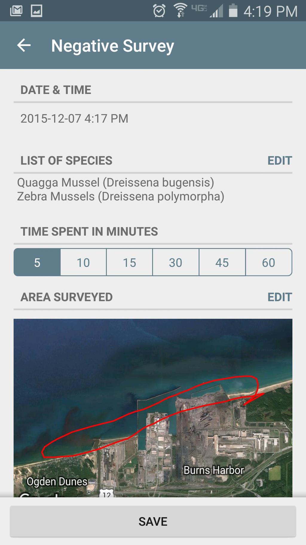
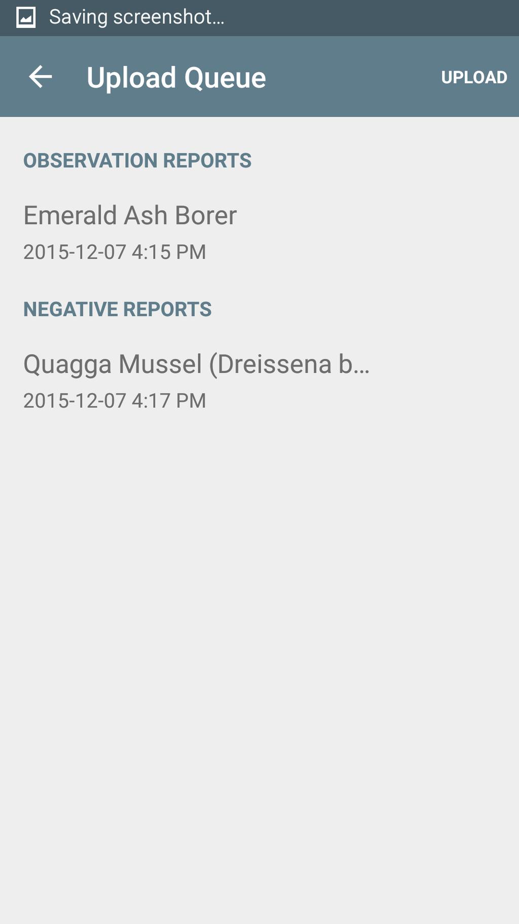
1 Using Technology to Report Invasive Species in Indiana via EDDMapS and the GLEDN Smartphone/Tablet App Rebekah D. Wallace, Charles T. Bargeron, and Karan A. Rawlins
2 Background University of Georgia BS Agriscience and Environmental Systems MS Crop and Soil Sciences (Weed Science) AmeriCorps Florida State Parks Invasive species mapping and control, Endangered species mapping EDDMapS Data Coordinator Manage and format large dataset/database contributions Point-of-contact for individuals, programs, and agencies with data and verification questions Handle complex queries for individuals with specific questions/needs
3 Center for Invasive Species and Ecosystem Health Center for Invasive Species and Ecosystem Health Bugwood Network Renamed Feb 2008 Began as an image database Now: Aggregate distribution data (Invasive species, Crop pests, and Biocontrol Agents) BugwoodWiki Provide web hosting and build tools to make data, images, videos, and information available Community of Practice for extension
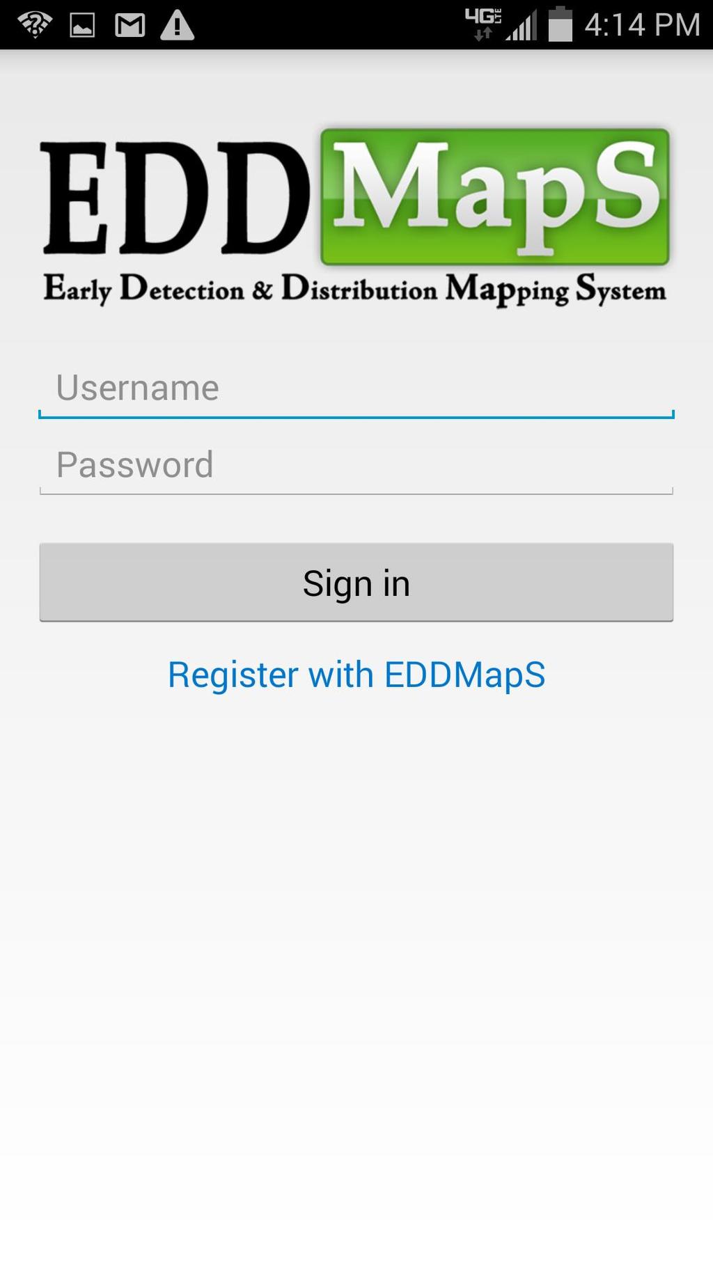
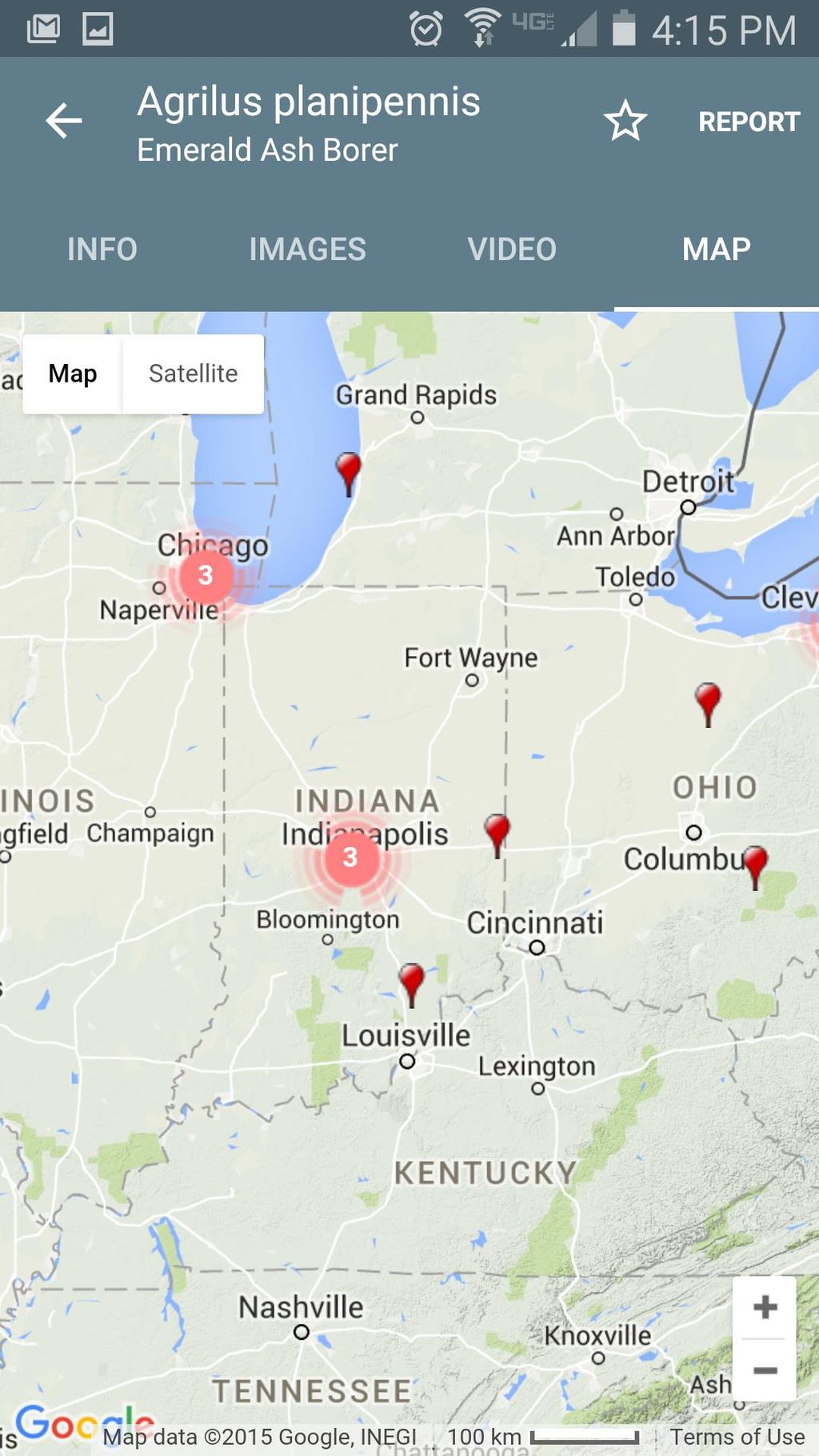
4 EDDMapS Early Detection and Distribution Mapping System Web Based Electronic Reporting and Distribution Mapping Invasive species mapping Biological control agent release mapping Plant disease resistance mapping Mapping Nationwide, including some Canadian provinces Host Websites for Regional Mapping Projects Florida Invasive Species Partnership (IveGot1) EDDMapS West Mid-Atlantic Early Detection Network


5 EDDMapS Purpose Electronic Early Detection Tool Aggregate Data Homeowners Trained citizen scientists Federal and State Agencies Herbariums/Academic Institutions Existing regional/topical databases Identify Existing Range, Gaps, and Leading Edge in Maps
6


7
8
9 apps.bugwood.org
10 Data Sharing, Aggregating, and Collaboration Sharing/Aggregating Data Standardization from the beginning leads to shorter integration times Duplication of effort decreased Increased awareness of species ranges and issues Broader audience to evaluate validity of data Collaborating/Partnerships Combining resources to achieve shared goals Addressing individual needs - Different programs focus on different goals
11 EDDMapS Data Recruiting Contributors USDA NRCS Plants Database Biota of North America Program USFS Forest Inventory Analysis Indiana DNR SEWISC Statistics Records Total 2,797,469 Point 1,747,615 Users 29,397 Reporters 8,957 Alaska Natural Heritage Program Minnesota Department of Natural Resources Perdue University Mirror of Global Invasive Species Information Network (GISIN)


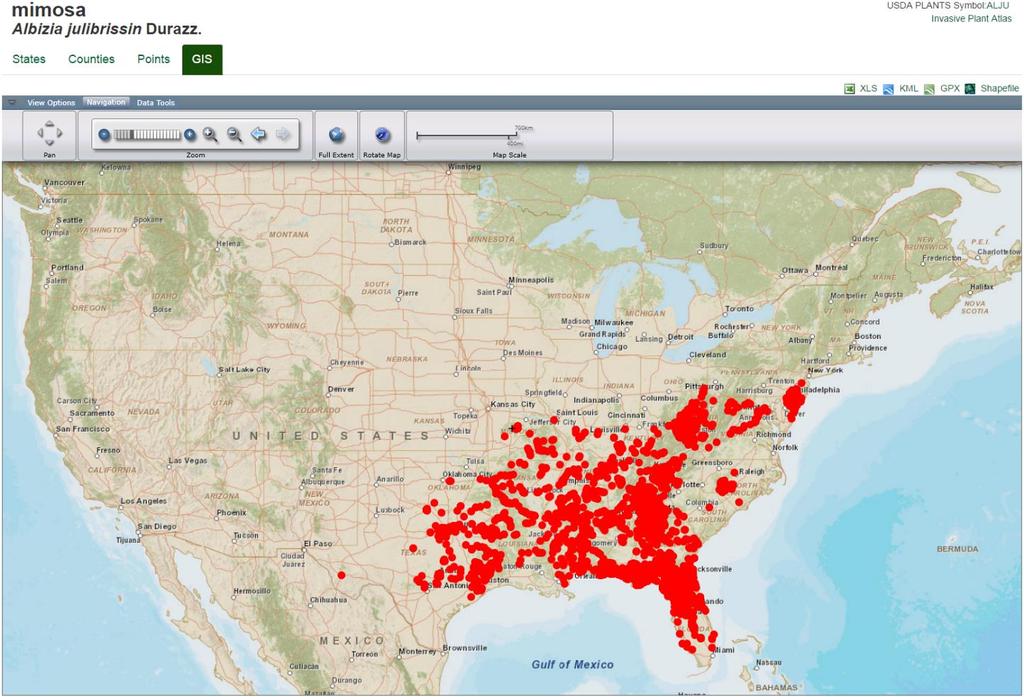
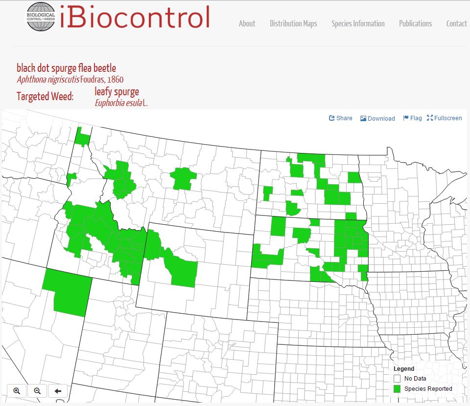
12 EDDMapS Tools Local and National Distribution Maps Identification and Management Nationwide Invasive Species Mapping Biocontrol Release Maps
13
14

15
16
17
18


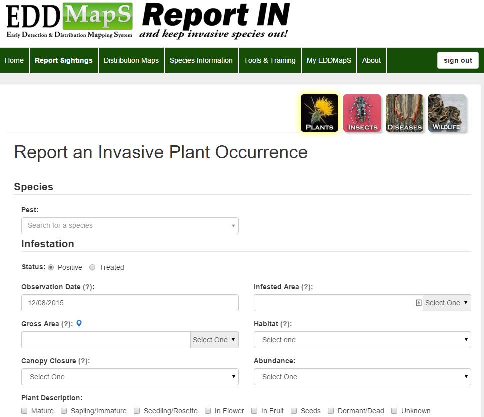
19 Thus The Ultimate Invasive Species Reporting Tool Is Always With You


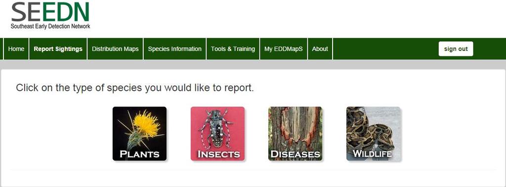
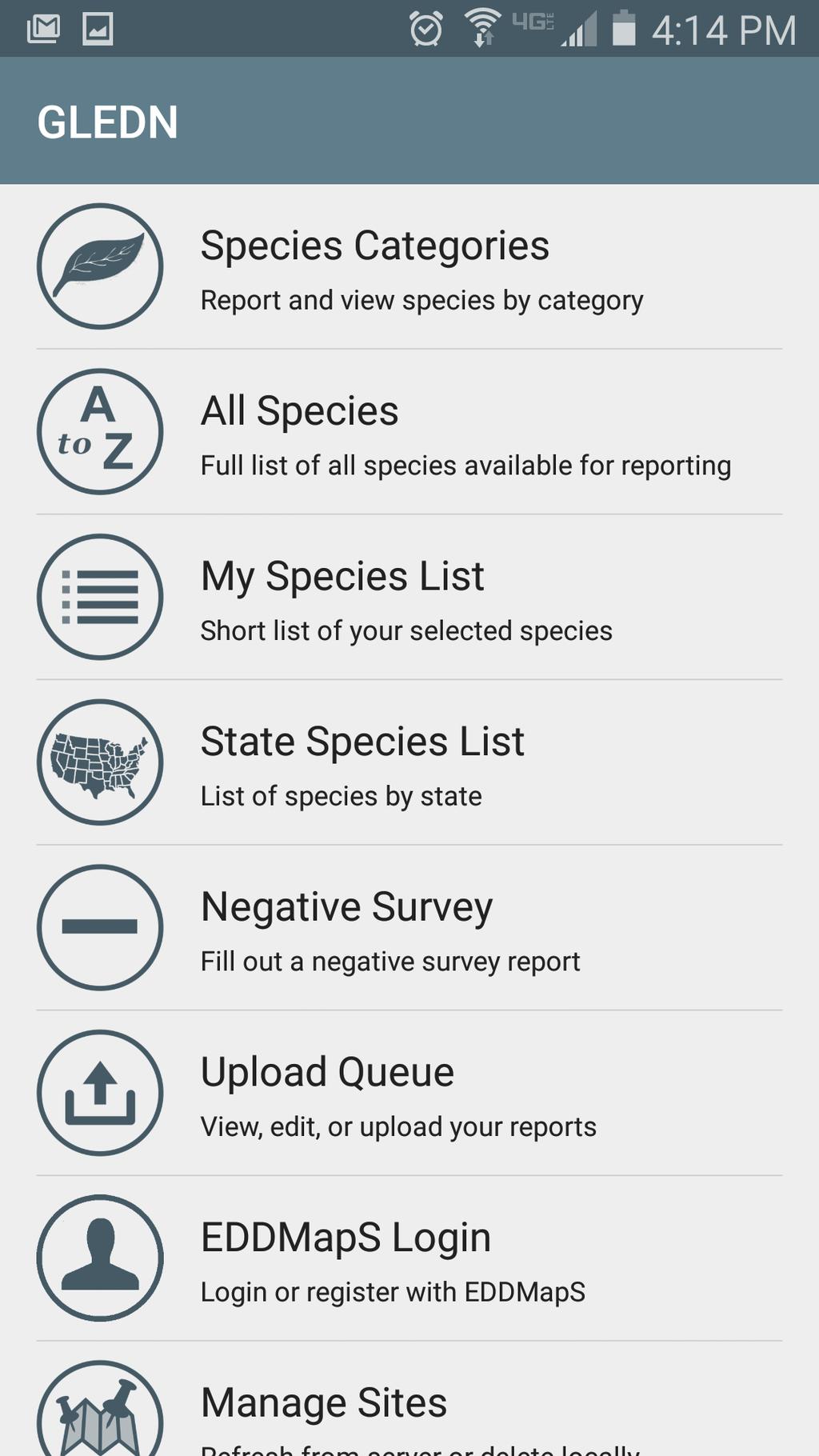
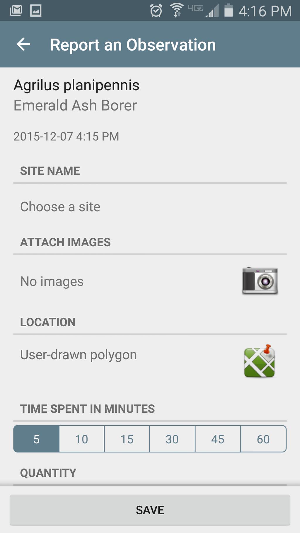
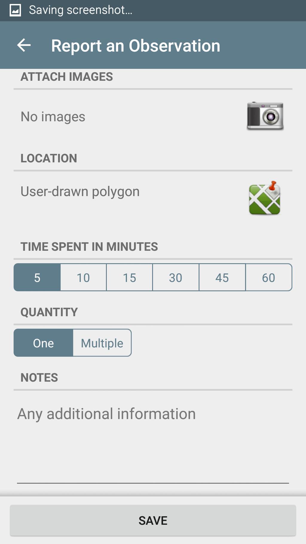
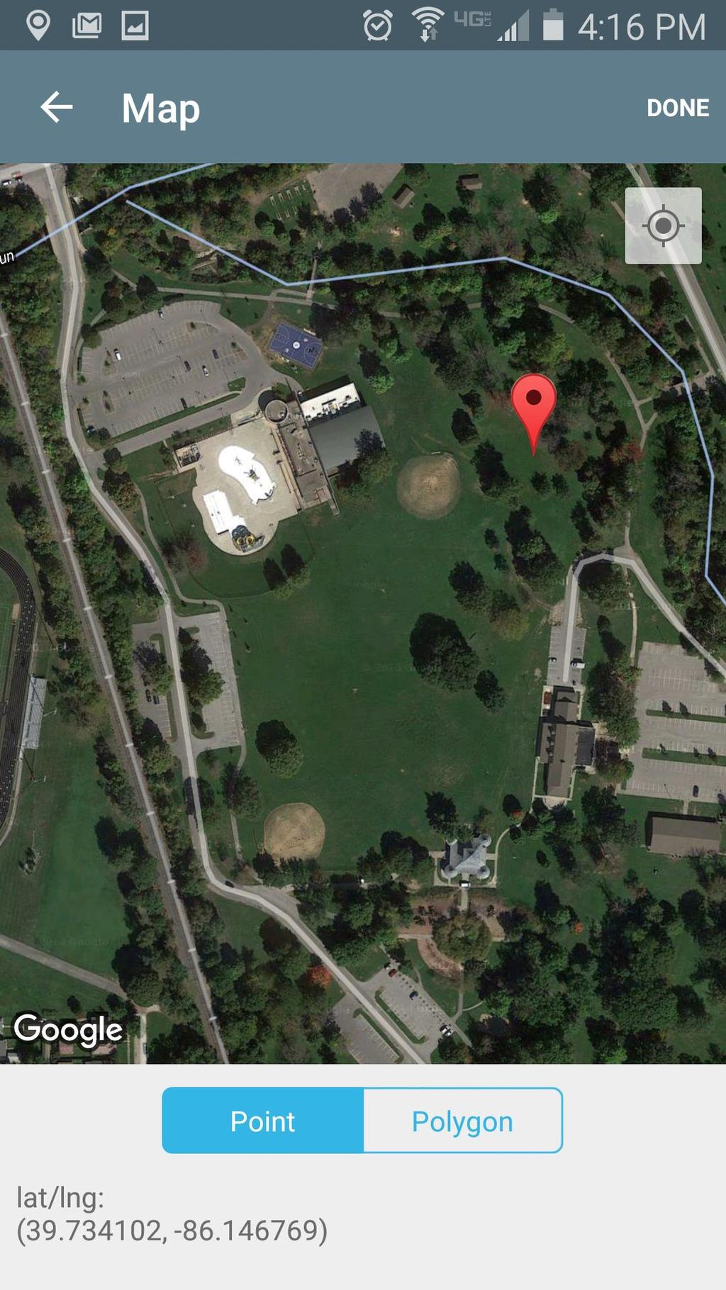
20 Reporting Tools OR No Smartphone Existing Data Multiple Data Uses Report in the field Saves reports when no wireless access Regional Apps

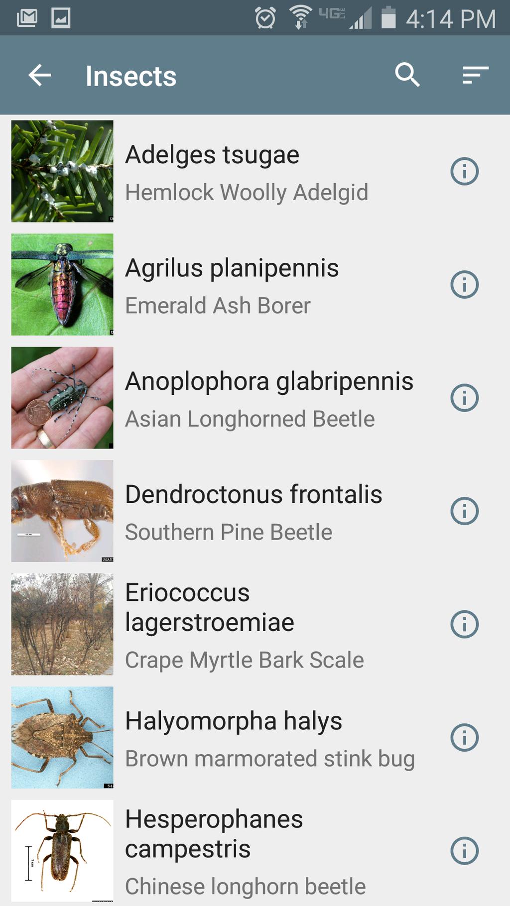
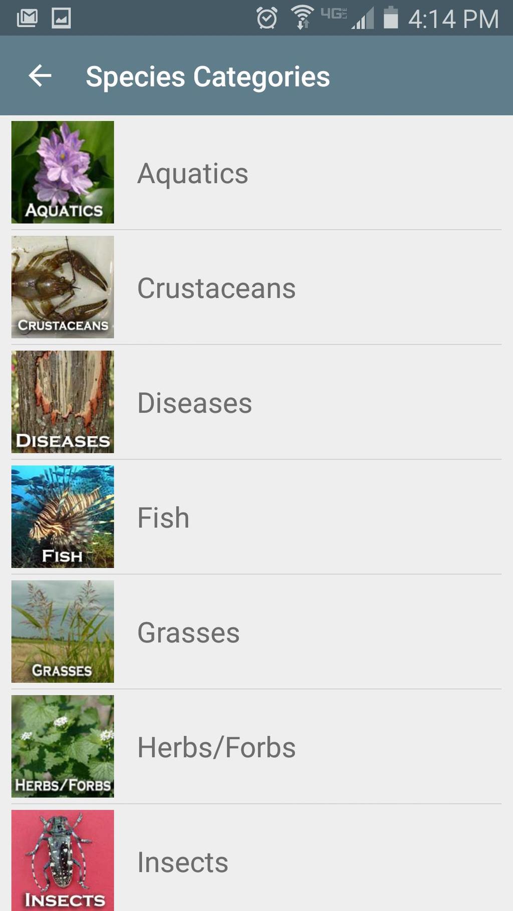
21 Terrestrial Plants Aquatic Plants Insects Plant Pathogens Aquatic Invertebrates Fish Animals

22
23
24

25
26

27
28
29

30
31
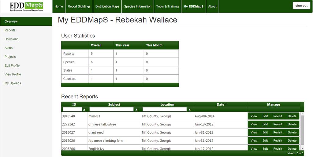
32 Where are my reports? Why aren t my records showing up?
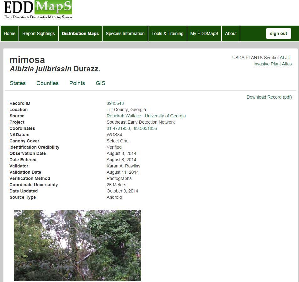
33 Record Verification - Process Record Entered Alert Sent to Verifier Record Evaluated Sample vs. Images vs. Expertise vs. No Supporting Documentation Contact Reporter for additional information/images Site visit Record Status Changed (Identification Credibility) Possible, Credible, Verified, Incorrect, Delete If identification is correct, report is released for public availability
34 Data Verification State Verifiers Training and Education in Identification of Invasive Species Specific to a Location (state or region) and/or Type of Invasive (aquatic plants, aquatic invertebrates, diseases, insects, wildlife, etc.) Active in the Invasive Species/Environmental Community Time Availability (Volunteer)


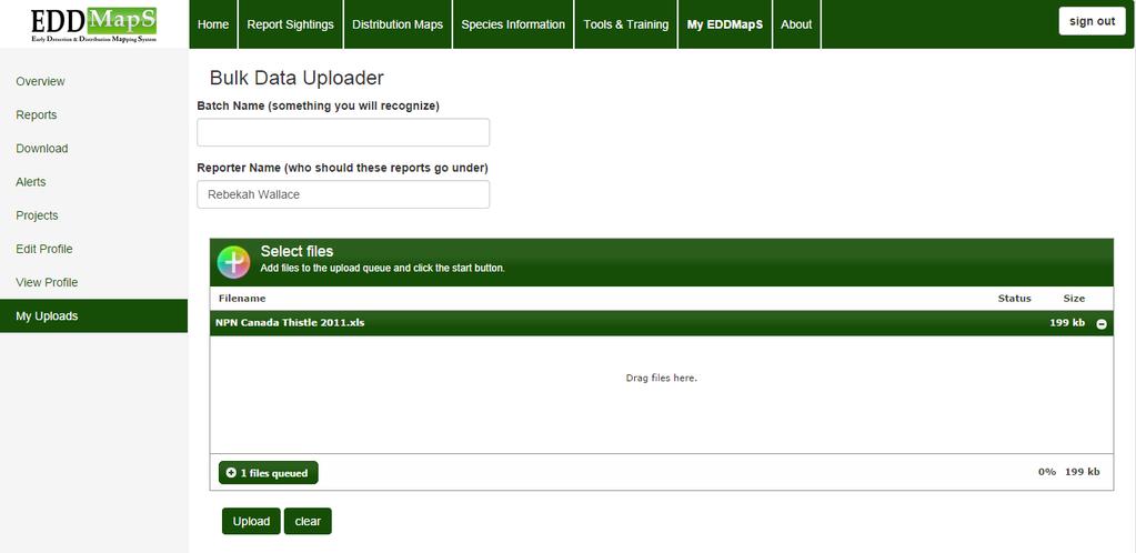
35 EDDMapS Downloading Data Options for Data Download XLS, KML, GPX, and Shapefile Where to Download Data Species Maps Advanced Query Tools Access/Download Point Data XLS and KML only


36 ReportIN Successes Black swallowwort known from only two sites in Indiana now reported in two new counties (LaGrange and Elkhart) First known infestation of Japanese stiltgrass at McCormick s Creek SP First population of Japanese chaff flower north of the Ohio River counties (Lawrence) First population of plumeless thistle in Indiana (Steuben)
37 EDDMapS for Minnesota DNR - Key Deliverables Recording observation data made by DNR field and office Recording observation data made by public Reviewing, editing, confirming, and rejecting observation data Batch processing observations originally recorded in other systems Designating basins & water courses Reporting certain observation data on public website Reporting observation data on internal website Deriving standard geographic information for consumption by other systems Exposing observation data for consumption by other systems Reporting observation and listing data in traditional list and summary reports

38 Rebekah D. Wallace EDDMapS Data Coordinator Questions?
A Regional Database Tracking Fire Footprint Each Year within the South Atlantic Region: Current Database Description and Future Directions
 A Regional Database Tracking Fire Footprint Each Year within the South Atlantic Region: Current Database Description and Future Directions Last Updated on September 30, 2018 Contributors: NatureServe,
An Introduction to Day Two. Linking Conservation and Transportation Planning Lakewood, Colorado August 15-16, 16, 2006
 An Introduction to Day Two Linking Conservation and Transportation Planning Lakewood, Colorado August 15-16, 16, 2006 1 Agenda Day One Transportation Planning Heritage Program State Wildlife Action Plan
Citizen Science at the. U.S. Geological Survey
 Citizen Science at the U.S. Geological Survey David Applegate USGS Associate Director for Natural Hazards NRC Board on Earth Science & Resources December 5, 2014 U.S. Department of the Interior U.S. Geological
Strategies for Control of Giant Salvinia and Other Invasive Species
 Strategies for Control of Giant Salvinia and Other Invasive Species Projects under consideration for a Caddo Lake Institute grant proposal to the National Fish & Wildlife Foundation Initial Focus is on
The Midwest Invasive Species Information Network: Today and Tomorrow
 The Midwest Invasive Species Information Network: Today and Tomorrow Amos H. Ziegler Applied Spatial Ecology and Technical Services Laboratory Department of Entomology, Michigan State University RRIP IT
United States Department of the Interior NATIONAL PARK SERVICE Northeast Region
 United States Department of the Interior NATIONAL PARK SERVICE Northeast Region June 17, 2017 REQUEST FOR STATEMENTS OF INTEREST and QUALIFICATIONS Project Title: ASSESSMENT OF NATURAL RESOURCE CONDITION
Chesapeake Bay Remote Sensing Pilot Executive Briefing
 Chesapeake Bay Remote Sensing Pilot Executive Briefing Introduction In his Executive Order 13506 in May 2009, President Obama stated The Chesapeake Bay is a national treasure constituting the largest estuary
SoilView: Development of a Custom GIS Application for Publishing Soil Surveys
 SoilView: Development of a Custom GIS Application for Publishing Soil Surveys Allan Johnson and Mike Wigginton Abstract Currently, digital soils information can be obtained from many sources. Numerous
Puakea, Hawaiÿi. Puakea, Hawaiÿi WATERSHED FEATURES
 Puakea, Hawaiÿi DAR Watershed Code: 85046 Puakea, Hawaiÿi WATERSHED FEATURES Puakea watershed occurs on the island of Hawaiÿi. The Hawaiian meaning of the name is white blossom. The area of the watershed
National Survey on the Natural Environment of Japan. Hajime Hirosawa Biodiversity Center of Japan Ministry of the Environment (MOE)
") National Survey on the Natural Environment of Japan Hajime Hirosawa Biodiversity Center of Japan Ministry of the Environment (MOE) Biodiversity Center of Japan, MOE Establishment: 1998 Purpose: to encourage
National Survey on the Natural Environment of Japan Hajime Hirosawa Biodiversity Center of Japan Ministry of the Environment (MOE) Biodiversity Center of Japan, MOE Establishment: 1998 Purpose: to encourage
Keanahalululu Gulch, Hawaiÿi
 DAR Watershed Code: 85021 WATERSHED FEATURES Keanahalululu Gulch watershed occurs on the island of Hawaiÿi. The Hawaiian meaning of the name is unknown. The area of the watershed is 4.1 square mi (10.6
The FNAI Invasive Plants Program
 The FNAI Invasive Plants Program What we do and how we can help the Northwest FL CISMA Frank Price Invasive Plants Program Manager Staff of 32 Part of FUS and the NatureServe network 100% contract funded
CHAPTER 7 PRODUCT USE AND AVAILABILITY
 CHAPTER 7 PRODUCT USE AND AVAILABILITY Julie Prior-Magee Photo from SWReGAP Training Site Image Library Recommended Citation Prior-Magee, J.S. 2007. Product use and availability. Chapter 7 in J.S. Prior-Magee,
Protecting Pollinators in Home Lawns and Landscapes
 POL-1 PROTECTING POLLINATORS Bumble bee on a thistle flower. Protecting Pollinators in Home Lawns and Landscapes Doug Richmond and Cliff Sadof Purdue Entomology Extension Specialists Why Are Pollinators
GIS for Integrated Pest Management. Christina Hailey. Abstract:
 GIS for Integrated Pest Management Christina Hailey Abstract: At its formation in 1965, Harris County Mosquito Control (Houston, Texas) (HCMC) was primarily involved in the prevention and control of mosquito-borne
What Can Citizen Scientists Tell Us about Drought?
 What Can Citizen Scientists Tell Us about Drought? Using CoCoRaHS to Improve the Monitoring and Reporting of Drought Impacts Amanda Farris, Kirsten Lackstrom Carolinas Integrated Sciences & Assessments
NatureServe s Federally Listed Species Location Data Play an Important Role in EPA s FIFRA Risk Assessments
 NatureServe s Federally Listed Species Location Data Play an Important Role in EPA s FIFRA Risk Assessments 1 ASHLEA FRANK COMPLIANCE SERVICES INTERNATIONAL FIFRA ENDANGERED SPECIES TASK FORCE BIODIVERSITY
The Kentucky Mesonet: Entering a New Phase
 The Kentucky Mesonet: Entering a New Phase Stuart A. Foster State Climatologist Kentucky Climate Center Western Kentucky University KCJEA Winter Conference Lexington, Kentucky February 9, 2017 Kentucky
Spatial Data Availability Energizes Florida s Citizens
 NASCIO 2016 Recognition Awards Nomination Spatial Data Availability Energizes Florida s Citizens State of Florida Agency for State Technology & Department of Environmental Protection Category: ICT Innovations
An Introduction to NatureServe Linking Conservation and Transportation Planning Phoenix, Arizona November 8 & 9, 2006
 An Introduction to NatureServe Linking Conservation and Transportation Planning Phoenix, Arizona November 8 & 9, 2006 1 NatureServe in Brief An independent, non-profit conservation organization Provides
Section 2. Indiana Geographic Information Council: Strategic Plan
 Section 2. Indiana Geographic Information Council: Strategic Plan Introduction A geographic information system (GIS) is an automated tool that allows the collection, modification, storage, analysis, and
Mapping for Successful Management. Kayla Malone Chaffee County Noxious Weed Department Supervisor
 Mapping for Successful Management Kayla Malone Chaffee County Noxious Weed Department Supervisor Outline Mapping and CDA guidelines EDDMapS Point, line, or polygon? Plant life cycles Examples of implementation
Wisconsin s Invasive Species Classification Assessment and Rule
 Wisconsin s Invasive Species Classification Assessment and Rule The Process Legislature gave WIDNR authority to create an invasive species classification system. Legislature also created Wis. Council on
Continental Divide National Scenic Trail GIS Program
 CDNST Vision Statement: Provide the most accurate geospatial locational information of the Continental Divide Trail and nearby resources to the public as well as help provide internal management information
Role of GIS in Tracking and Controlling Spread of Disease
 Role of GIS in Tracking and Controlling Spread of Disease For Dr. Baqer Al-Ramadan By Syed Imran Quadri CRP 514: Introduction to GIS Introduction Problem Statement Objectives Methodology of Study Literature
Florida Natural Areas Inventory. Tracking Florida s Biodiversity
 Florida Natural Areas Inventory Tracking Florida s Biodiversity Mission Collect, interpret, and disseminate ecological information critical to the conservation of Florida s biological diversity Program
Living in a Watershed
 Living in a Watershed Department of Ecosystem Science and Ma... http://ecosystems.psu.edu/youth/sftrc/lesson-plans/water/k-5/watershed Department of Ecosystem Science and Management Youth Living in a Watershed
Advanced network for the distribution of endangered species
 Advanced network for the distribution of endangered species Cristián Bonacic & Andrea Vásquez PONTIFICIA UNIVERSIDAD CATOLICA DE CHILE Sao Paulo May 2013 The problem: Wildlife Data Challenges in Latin
Spatial Optimization of CoCoRAHS Network in Tennessee. Joanne Logan Department of Biosystems Engineering and Soil Science University of Tennessee
 Spatial Optimization of CoCoRAHS Network in Tennessee Joanne Logan Department of Biosystems Engineering and Soil Science University of Tennessee Abstract CoCoRaHS (Community Collaborative Rain, Hail and
Colorado State University: NAISN Hub
 Colorado State University: NAISN Hub Researchers Colorado State University Tom Stohlgren Jim Graham Paul Evangelista Sunil Kumar Greg Newman Alycia Crall Sara Simonson Nick Young USGS Fort Collins Science
Inter State Large Navigable Rivers of the United States
 Inter State Large Navigable Rivers of the United States REVIEW OF NORTH AMERICAN BASINS: GREAT LAKES AND MISSISSIPPI RIVER HELEN A. BROHL, EXECUTIVE DIRECTOR US COMMITTEE ON THE MARINE TRANSPORTATION SYSTEM
Avoiding Nutrient Applications During Critical Periods with a Real-time Decision Support Tool: Wisconsin s Runoff Risk Advisory Forecast (RRAF)
") Avoiding Nutrient Applications During Critical Periods with a Real-time Decision Support Tool: Wisconsin s Runoff Risk Advisory Forecast (RRAF) Dustin Goering National Weather Service 27 Feb 2015 Overview
Avoiding Nutrient Applications During Critical Periods with a Real-time Decision Support Tool: Wisconsin s Runoff Risk Advisory Forecast (RRAF) Dustin Goering National Weather Service 27 Feb 2015 Overview
National Fish Habitat Action Plan Data Viewer Application
 Jeff Smith Andrea Ostroff USGS NBII National Fish Habitat Action Plan Data Viewer Application Outline Overview of the NFHAP habitat assessment project. The NFHAP spatial framework. The habitat assessment
Water Atlas Overview. Myakka River Management Coordinating Council June 22, 2012 Englewood, Florida
 Water Atlas Overview Myakka River Management Coordinating Council June 22, 2012 Englewood, Florida What is the Water Atlas? A data warehouse A set of interactive maps A collection of tools for viewing/analyzing
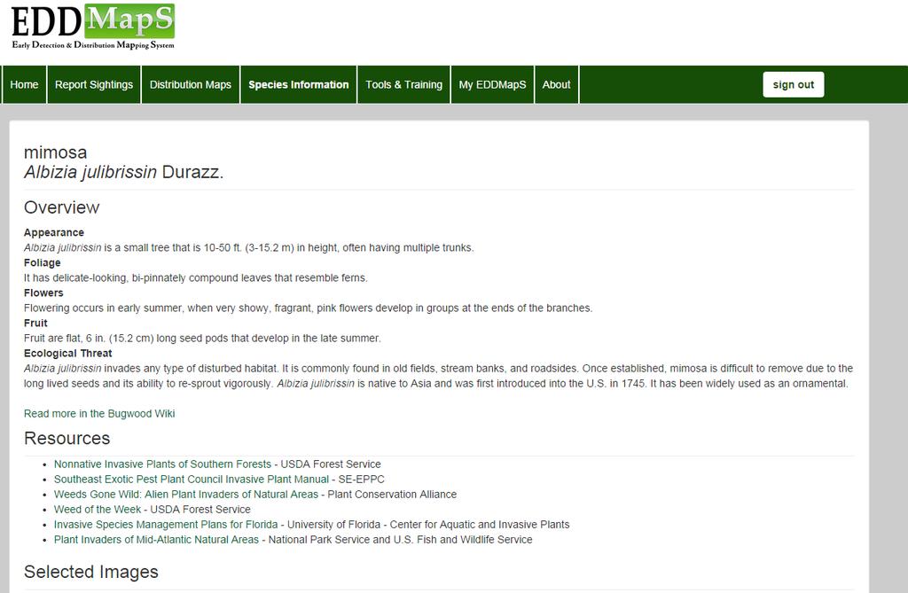
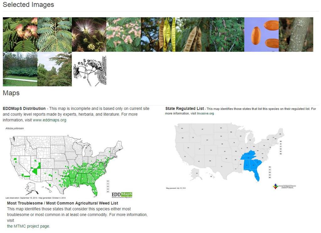
Invasive Species Management Plans for Florida
 Invasive Species Management Plans for Florida Air Potato Dioscorea bulbifera (L.) Dioscoreaceae INTRODUCTION A native to tropical Asia, air potato, Dioscorea bulbifera, was first introduced to the Americas
BIOAG'L SCI + PEST MGMT- BSPM (BSPM)
") Bioag'l Sci + Pest Mgmt-BSPM (BSPM) 1 BIOAG'L SCI + PEST MGMT- BSPM (BSPM) Courses BSPM 102 Insects, Science, and Society (GT-SC2) Credits: 3 (3-0-0) How insects develop, behave, and affect human activity.
Bioag'l Sci + Pest Mgmt-BSPM (BSPM) 1 BIOAG'L SCI + PEST MGMT- BSPM (BSPM) Courses BSPM 102 Insects, Science, and Society (GT-SC2) Credits: 3 (3-0-0) How insects develop, behave, and affect human activity.
CalWeedMapper. Mapping the Spread of Invasive Plant Species. Karsten Vennemann. Seattle
 CalWeedMapper Mapping the Spread of Invasive Plant Species Karsten Vennemann Seattle Talk Overview The CalWeedMapper Project this presentation is about the expert online editing tool (part of larger project)
Creating a Staff Development Plan with Esri
 Creating a Staff Development Plan with Esri Michael Green David Schneider Guest Presenter: Shane Feirer, University of California Esri UC 2014 Technical Workshop Agenda What is a Staff Development Plan?
The Atlas Aspect of the Atlas of Living Australia
 The Atlas Aspect of the Atlas of Living Australia Lee Belbin lee@blatantfabrications.com Melbourne Museum, July 28, 2010 The Atlas is funded by the Australian Government under the National Collaborative
Viburnum lantana 'Mohican' -- Minnesota
 Plant Risk Evaluator -- PRE Evaluation Report Viburnum lantana 'Mohican' -- Minnesota 2017 Farm Bill PRE Project PRE Score: 10 -- Accept (low risk of invasiveness) Confidence: 70 / 100 Questions answered:
GIS Resources for Local Governments
 ISSUE PAPER SERIES GIS Resources for Local Governments February 2018 NEW YORK STATE TUG HILL COMMISSION DULLES STATE OFFICE BUILDING 317 WASHINGTON STREET WATERTOWN, NY 13601 (315) 785-2380 WWW.TUGHILL.ORG
Bombing for Biodiversity in the United States: Response to Zentelis & Lindenmayer 2015
 CORRESPONDENCE Bombing for Biodiversity in the United States: Response to Zentelis & Lindenmayer 2015 Jocelyn L. Aycrigg 1, R. Travis Belote 2, Matthew S. Dietz 3, Gregory H. Aplet 4, & Richard A. Fischer
CHAPTER 12: TERRESTRIAL LAYERS
 CHAPTER 12: TERRESTRIAL LAYERS Coordinator: Shannon McElvaney Hawai`i Natural Heritage Program mcelvane@hawaii.edu Theme Description: Land use corresponds to the socio-economic description (or functional
Environment and Natural Resources Trust Fund 2010 Request for Proposals (RFP)
") LCCMR ID: 141-E2 Project Title: Environment and Natural Resources Trust Fund 2010 Request for Proposals (RFP) Monitoring and Modeling Minnesota Landscapes and Ecosystem Services LCCMR 2010 Funding Priority:
LCCMR ID: 141-E2 Project Title: Environment and Natural Resources Trust Fund 2010 Request for Proposals (RFP) Monitoring and Modeling Minnesota Landscapes and Ecosystem Services LCCMR 2010 Funding Priority:
Atlas of Living Scotland New data infrastructure for research and citizen science
 Atlas of Living Scotland New data infrastructure for research and citizen science John Sawyer and Rachel Stroud CEO NBN Trust, j.sawyer@nbn.org.uk Who is the National Biodiversty Network? The National
Lonicera fragrantissima -- Georgia
 Plant Risk Evaluator -- PRE Evaluation Report Lonicera fragrantissima -- Georgia 2017 Farm Bill PRE Project PRE Score: 15 -- Evaluate this plant further Confidence: 65 / 100 Questions answered: 19 of 20
Mobrand to Jones and Stokes. Sustainable Fisheries Management Use of EDT
 Sustainable Fisheries Management Use of EDT Ecosystem Diagnosis and Treatment EDT EDT designed to provide a practical, science-based approach for developing and implementing watershed plans. Provides decision
Boundary and Annexation Survey (BAS)
") Boundary and Annexation Survey (BAS) New Mexico SDC Meeting Chris Wingate Geography Division U.S. Census Bureau 1 Agenda Boundary and Annexation Survey (BAS) BAS Overview American Community Survey (ACS)
Boundary and Annexation Survey (BAS) New Mexico SDC Meeting Chris Wingate Geography Division U.S. Census Bureau 1 Agenda Boundary and Annexation Survey (BAS) BAS Overview American Community Survey (ACS)
Cloud Computing Technology for Precision Nitrogen Management in Corn
 Cornell Adapt-N Training Webinar: Cloud Computing Technology for Precision Nitrogen Management in Corn 4/3/2014 Presenters: Bianca Moebius-Clune, Greg Levow, & Harold van Es 10:30-11:00am ET/ 9:30-10:00CT:
Ecological Land Cover Classification For a Natural Resources Inventory in the Kansas City Region, USA
 Ecological Land Cover Classification For a Natural Resources Inventory in the Kansas City Region, USA by Applied Ecological Services, Inc. In cooperation with the Mid-America Regional Council 600 Broadway,
Doing Things Differently: Tracking Invasive Exotic Plants in the Florida Park Service
 Florida Park Service Doing Things Differently: Tracking Invasive Exotic Plants in the Florida Park Service 21 May 2013 The Big Picture 171 State Parks and Trails across 5 Districts ~785,000 Acres Almost
UPDATING THE MINNESOTA NATIONAL WETLAND INVENTORY
 UPDATING THE MINNESOTA NATIONAL WETLAND INVENTORY An Integrated Approach Using Object-Oriented Image Analysis, Human Air-Photo Interpretation and Machine Learning AARON SMITH EQUINOX ANALYTICS INC. FUNDING
The Weed Battle. Sage Fitch, Salt Lake County Weed Specialist
 The Weed Battle Noxious and Invasive Weed Management by The Salt Lake County Weed Program and The Bonneville CWMA Sage Fitch, Salt Lake County Weed Specialist Our program & our partners Who are we and
Survey of Eurasian Watermilfoil (Myriophyllum spicatum) in Gloucester Pool, Port Severn, ON, Canada
 in Gloucester Pool, Port Severn, ON, Canada") Survey of Eurasian Watermilfoil (Myriophyllum spicatum) in Gloucester Pool, Port Severn, ON, Canada Prepared for: Gloucester Pool Cottagers Association Prepared by: Milfoil Solution, Inc. A Canadian Subsidiary
Survey of Eurasian Watermilfoil (Myriophyllum spicatum) in Gloucester Pool, Port Severn, ON, Canada Prepared for: Gloucester Pool Cottagers Association Prepared by: Milfoil Solution, Inc. A Canadian Subsidiary
Geography for the 2020 Round of Census
 Boundaries Key Census Data EA Id Population Male Female EA Id Area EA Id Num HH Avg HH size Geography for the 2020 Round of Census Linda Peters, Esri lpeters@esri.com Integration of Statistical and Geospatial
Wailupe, Oÿahu. Wailupe, Oÿahu WATERSHED FEATURES
 DAR Watershed Code: 33005 WATERSHED FEATURES Wailupe watershed occurs on the island of Oÿahu. The Hawaiian meaning of the name is kite water. The area of the watershed is 3.4 square mi (8.8 square km),
Pilea nummulariifolia (creeping Charlie)
") Australia/New Zealand Weed Risk Assessment adapted for Florida. Data used for analysis published in: Gordon, D.R., D.A. Onderdonk, A.M. Fox, R.K. Stocker, and C. Gantz. 28. Predicting Invasive Plants in
Australia/New Zealand Weed Risk Assessment adapted for Florida. Data used for analysis published in: Gordon, D.R., D.A. Onderdonk, A.M. Fox, R.K. Stocker, and C. Gantz. 28. Predicting Invasive Plants in
NWSEO CALLS FOR NATIONAL CLIMATE SERVICE TO BE MADE PART OF THE NATIONAL WEATHER SERVICE
 APRIL 2009 NWSEO CALLS FOR NATIONAL CLIMATE SERVICE TO BE MADE PART OF THE NATIONAL WEATHER SERVICE At its recent winter meeting, the NWSEO National Council decided to urge the Administration and Congress
2018 NASCIO Award Submission Category: Cross-Boundary Collaboration and Partnerships. Project Title: Tennessee Wildfires: A Coordinated GIS Response
 2018 NASCIO Award Submission Category: Cross-Boundary Collaboration and Partnerships Project Title: Tennessee Wildfires: A Coordinated GIS Response Sevier County, Tennessee State of Tennessee, Emergency
Weeds, Exotics or Invasives?
 Invasive Species Geography 444 Adopted from Dr. Deborah Kennard Weeds, Exotics or Invasives? What is a weed? Invasive species? 1 Weeds, Exotics or Invasives? Exotic or non-native: Non-native invasive pest
Native Species? In US prior to European settlement
 INVASIVE SPECIES Native Species? An organism that is a part of the balance of nature that has developed over hundreds or thousands of years in a particular region or ecosystem. In US prior to European
GIS and Community Health. GIS and Community Health. Institutional Context and Interests in GIS Development. GIS and Community Health
 GIS and Community Health GIS and Community Health Some critiques of GIS emphasize the potentially harmful social consequences of the diffusion of GIS technology, including reinforcing the power of state
An Internet-Based Integrated Resource Management System (IRMS)
") An Internet-Based Integrated Resource Management System (IRMS) Third Quarter Report, Year II 4/1/2000 6/30/2000 Prepared for Missouri Department of Natural Resources Missouri Department of Conservation
An Internet-Based Integrated Resource Management System (IRMS) Third Quarter Report, Year II 4/1/2000 6/30/2000 Prepared for Missouri Department of Natural Resources Missouri Department of Conservation
Wailua, Maui WATERSHED FEATURES
 Wailua, Maui DAR Watershed Code: 65007 Wailua, Maui WATERSHED FEATURES Wailua watershed occurs on the island of Maui. The Hawaiian meaning of the name is two waters. The area of the watershed is 1.9 square
Application of Remote Sensing and Global Positioning Technology for Survey and Monitoring of Plant Pests
 Application of Remote Sensing and Global Positioning Technology for Survey and Monitoring of Plant Pests David Bartels, Ph.D. USDA APHIS PPQ CPHST Mission Texas Laboratory Spatial Technology and Plant
Fig 1. Steps in the EcoValue Project
 Assessing the Social and Economic Value of Ecosystem Services in the Northern Forest Region: A Geographic Information System (GIS) Approach to Landscape Valuation Principal Investigator(s): Dr. Matthew
Acer pseudosieboldianum x palmatum 'IslAJ' Arctic Jade -- Minnesota
 Plant Risk Evaluator -- PRE Evaluation Report Acer pseudosieboldianum x palmatum 'IslAJ' Arctic Jade -- Minnesota 2017 Farm Bill PRE Project PRE Score: 2 -- Accept (low risk of invasiveness) Confidence:
Distribution of Hydrilla and Giant Salvinia in Mississippi in 2005
 An Annual Report to the Mississippi Bureau of Plant Industry for 2005 John D. Madsen, Ryan M. Wersal, and Wilfredo Robles GeoResources Institute and Department of Plant and Soil Science Mississippi State
Ficus pumila (climbing fig)
") Australia/New Zealand Weed Risk Assessment adapted for Florida. Data used for analysis published in: Gordon, D.R., D.A. Onderdonk, A.M. Fox, R.K. Stocker, and C. Gantz. 28. Predicting Invasive Plants in
Australia/New Zealand Weed Risk Assessment adapted for Florida. Data used for analysis published in: Gordon, D.R., D.A. Onderdonk, A.M. Fox, R.K. Stocker, and C. Gantz. 28. Predicting Invasive Plants in
Biophysical Interactions
 1 River Ecology Senior Geography Biophysical Interactions Checking the Pulse of the Hawkesbury River Name 2 River Ecology Senior Geography Senior Geography Outcomes PRELIMINARY COURSE OUTCOMES P2 describes
Your web browser (Safari 7) is out of date. For more security, comfort and the best experience on this site: Update your browser Ignore
 is out of date. For more security, comfort and the best experience on this site: Update your browser Ignore") Your web browser (Safari 7) is out of date. For more security, comfort and the best experience on this site: Update your browser Ignore U NLO CKING THE EDUCATIO NAL PO TENTIAL O F CITIZEN SCIENCE Essays
Your web browser (Safari 7) is out of date. For more security, comfort and the best experience on this site: Update your browser Ignore U NLO CKING THE EDUCATIO NAL PO TENTIAL O F CITIZEN SCIENCE Essays
1. PURPOSE 2. PERIOD OF PERFORMANCE
 Statement of Work Herbarium Voucher Collection Land Management Section, Environmental Security Department Marine Corps Installations West Marine Corps Base Camp Pendleton, California 1. PURPOSE The purpose
Leymus arenarius 'Blue Dune' -- Minnesota
 Plant Risk Evaluator -- PRE Evaluation Report Leymus arenarius 'Blue Dune' -- Minnesota 2017 Farm Bill PRE Project PRE Score: 17 -- Reject (high risk of invasiveness) Confidence: 77 / 100 Questions answered:
Indiana University Maps
 Indiana University 9.28.09 Maps Maps Mission Action Cause related cartography at National Geographic Networks and Complex Systems This talk series is open to all Indiana University faculty and students
Integrating ArcGIS Server and Flex: Highlighting the Trees in Washington, DC. Holli Howard and Mike Alonzo Casey Trees Washington, DC
 Integrating ArcGIS Server and Flex: Highlighting the Trees in Washington, DC Holli Howard and Mike Alonzo Casey Trees Washington, DC Presentation overview Casey Trees Our ESRI partnership: The Casey Trees
Creation of an Internet Based Indiana Water Quality Atlas (IWQA)
") Department of Environmental Management Creation of an Internet Based Water Quality Atlas (IWQA) May 4, 2005 IUPUI 1200 Waterway Blvd., Suite 100 polis, 46202-5140 Water Quality Atlas John Buechler, Neil
Department of Environmental Management Creation of an Internet Based Water Quality Atlas (IWQA) May 4, 2005 IUPUI 1200 Waterway Blvd., Suite 100 polis, 46202-5140 Water Quality Atlas John Buechler, Neil
Information. Information Technology. Geographic. Services (GIS) 119 W Indiana Ave Deland, FL 32720
 119 W Indiana Ave Deland, FL 32720") Information Technology Geographic Information Services (GIS) 119 W Indiana Ave Deland, FL 32720 A GIS consists of 5 primary components: Hardware Software People Data Methods or Business Processes --- Hardware
Information Technology Geographic Information Services (GIS) 119 W Indiana Ave Deland, FL 32720 A GIS consists of 5 primary components: Hardware Software People Data Methods or Business Processes --- Hardware
Working with ArcGIS Online
 Esri International User Conference San Diego, CA Technical Workshops July 12, 2011 Working with ArcGIS Online Bern Szukalski, Deane Kensok Topics for this Session ArcGIS Online Overview ArcGIS Online Content
Pollinators. Pam Brown University of Florida/IFAS Extension, Retired
 Pollinators Pam Brown University of Florida/IFAS Extension, Retired What is Pollination Pollination is the transfer of pollen from male anther to female stigma resulting in fertilization. Pollination results
The Invasion of False Brome in Western Oregon
 The Invasion of False Brome in Western Oregon GIS II Presentation Winter 2006 Will Fellers Kurt Hellerman Kathy Strope Statia Cupit False Brome (Brachypodium sylvaticum) Perennial bunchgrass native to
GIS Changing the World GIS Day November 15, 2017
 + GIS Changing the World GIS Day November 15, 2017 + Growing Up On The Farm 3 Geographic Information in DNR A 75 year history of mapping and GIS. Forest type map from 1944. State of Washington - Division
Leo Donovall PISC Coordinator/Survey Entomologist
 Leo Donovall PISC Coordinator/Survey Entomologist Executive Order 2004-1 Recognized the Commonwealth would benefit from the advice and counsel of an official body of natural resource managers, policy makers,
DNA Barcoding: A New Tool for Identifying Biological Specimens and Managing Species Diversity
 DNA Barcoding: A New Tool for Identifying Biological Specimens and Managing Species Diversity DNA barcoding has inspired a global initiative dedicated to: Creating a library of new knowledge about species
THREAT CATEGORIES Level 1 Level 1 Level 2 Level 2 Level 3 Level Residential development. Commercial and.
 NJ's 2015 SWAP Update THREAT CATEGORIES Level 1 Level 1 Focal Threat Assessment: MAMMALS 1. Residential commercial development 1.1 Housing urban areas 1.1.1 L conversion from nat'l habitat to urban & other
Citizen Science and Arctic Observing: Using the Internet and Simple Technologies to Improve Understanding of Arctic Ecosystem Change
 Citizen Science and Arctic Observing: Using the Internet and Simple Technologies to Improve Understanding of Arctic Ecosystem Change Maribeth S. Murray 1, Phillip A. Loring 2, Howard Ferren 3 and Rebekka
You are Building Your Organization s Geographic Knowledge
 You are Building Your Organization s Geographic Knowledge And Increasingly Making it Available Sharing Data Publishing Maps and Geo-Apps Developing Collaborative Approaches Citizens Knowledge Workers Analysts
Empowered lives. Resilient nations. Data for People and Planet. powered by
 Empowered lives. Resilient nations. Data for People and Planet powered by Overview As we enter the fourth industrial revolution, technology is revolutionizing our ability to map nature. Satellite data
Data-Sharing Agreement
 Data-Sharing Agreement Contributions to LandMark: The Global Platform of Indigenous and Community Lands This Data-Sharing Agreement provides the standards for contributing data to the LandMark: The Global
Condition Monitoring: A New System for Drought Impacts Reporting through CoCoRaHS
 Condition Monitoring: A New System for Drought Impacts Reporting through CoCoRaHS Amanda Farris Carolinas Integrated Sciences & Assessments (CISA) University of South Carolina WERA 1012 Annual Conference
Presenting Tree Inventory. Tomislav Sapic GIS Technologist Faculty of Natural Resources Management Lakehead University
 Presenting Tree Inventory Tomislav Sapic GIS Technologist Faculty of Natural Resources Management Lakehead University Suggested Options 1. Print out a Google Maps satellite image of the inventoried block
ZOOLOGY UNDERGRADUATE MAJOR (BS, HBS)
") Zoology Undergraduate Maj (BS, HBS) ZOOLOGY UNDERGRADUATE MAJOR (BS, HBS) Administered by the Department of Integrative Biology under the School of Life Sciences. The Zoology maj offers scientific training
Zoology Undergraduate Maj (BS, HBS) ZOOLOGY UNDERGRADUATE MAJOR (BS, HBS) Administered by the Department of Integrative Biology under the School of Life Sciences. The Zoology maj offers scientific training
Development of Webbased. Tool for Tennessee
 Development of Webbased Farm Mapping Tool for Tennessee Southern Region Water Quality Conference, Oct. 24 2005 Forbes Walker and Alan Jolly Biosystems Engineering and SOIL SCIENCE Nutrient Management Planning
THE NATURESERVE NETWORK
 THE NATURESERVE NETWORK Access to NatureServe's best available data on the locations of endangered species September 1, 2011 A Network Connecting Science with Conservation Mexico Guatemala El Salvador
Improving Understanding of Drought Impacts through Citizen Science
 Improving Understanding of Drought Impacts through Citizen Science Amanda Brennan, Janae Davis, Kirstin Dow, Kirsten Lackstrom, Sumi Selvaraj North Carolina Water Resources Research Institute Annual Meeting
N ew York State Agricultural Experiment S tation vnrfx* NYSAES I Publications I Latest Press Releases
 N ew York State Agricultural Experiment S tation vnrfx* NYSAES I Publications I Latest Press Releases CORNELL U N I V E R S I T Y GENEVA NEW YORK. 100 Years of New York Weather August 16th, 2000 CONTACT:
Geospatial Decision Support Tools for Planning of Marine Protected Areas in California
 Geospatial Decision Support Tools for Planning of Marine Protected Areas in California WILL MCCLINTOCK (UNIVERSITY OF CALIFORNIA SANTA BARBARA), MATT MERRIFIELD (THE NATURE CONSERVANCY), SOPHIE DE BEUKELAER
Your web browser (Safari 7) is out of date. For more security, comfort and. the best experience on this site: Update your browser Ignore
 is out of date. For more security, comfort and. the best experience on this site: Update your browser Ignore") Your web browser (Safari 7) is out of date. For more security, comfort and Activityengage the best experience on this site: Update your browser Ignore Introduction to GIS What is a geographic information
Your web browser (Safari 7) is out of date. For more security, comfort and Activityengage the best experience on this site: Update your browser Ignore Introduction to GIS What is a geographic information
Biodiversity Blueprint Overview
 Biodiversity Blueprint Overview Climate Variability Climate projections for the Glenelg Hopkins Regions suggest that the weather will be hotter and drier in the coming years which will impact on land use,
Fickeisen Plains Cactus (Pediocactus peeblesianus ssp. fickeiseniae)
") Fickeisen Plains Cactus (Pediocactus peeblesianus ssp. fickeiseniae) Monitoring Report Salt Trail Canyon Monitoring Site 2006-2008 Daniela Roth Navajo Natural Heritage Program Department of Fish & Wildlife
Fickeisen Plains Cactus (Pediocactus peeblesianus ssp. fickeiseniae) Monitoring Report Salt Trail Canyon Monitoring Site 2006-2008 Daniela Roth Navajo Natural Heritage Program Department of Fish & Wildlife
Texas A&M AgriLife Extension Service Texas Water Resources Institute
 Texas A&M AgriLife Extension Service Texas Water Resources Institute Quarterly Progress Report Water Quality at Caddo Lake Center for Invasive Species Eradication: Caddo Lake Giant Salvinia Eradication