Empowered lives. Resilient nations. Data for People and Planet. powered by
|
|
|
- Ernest Burke
- 5 years ago
- Views:
Transcription


1 Empowered lives. Resilient nations. Data for People and Planet powered by

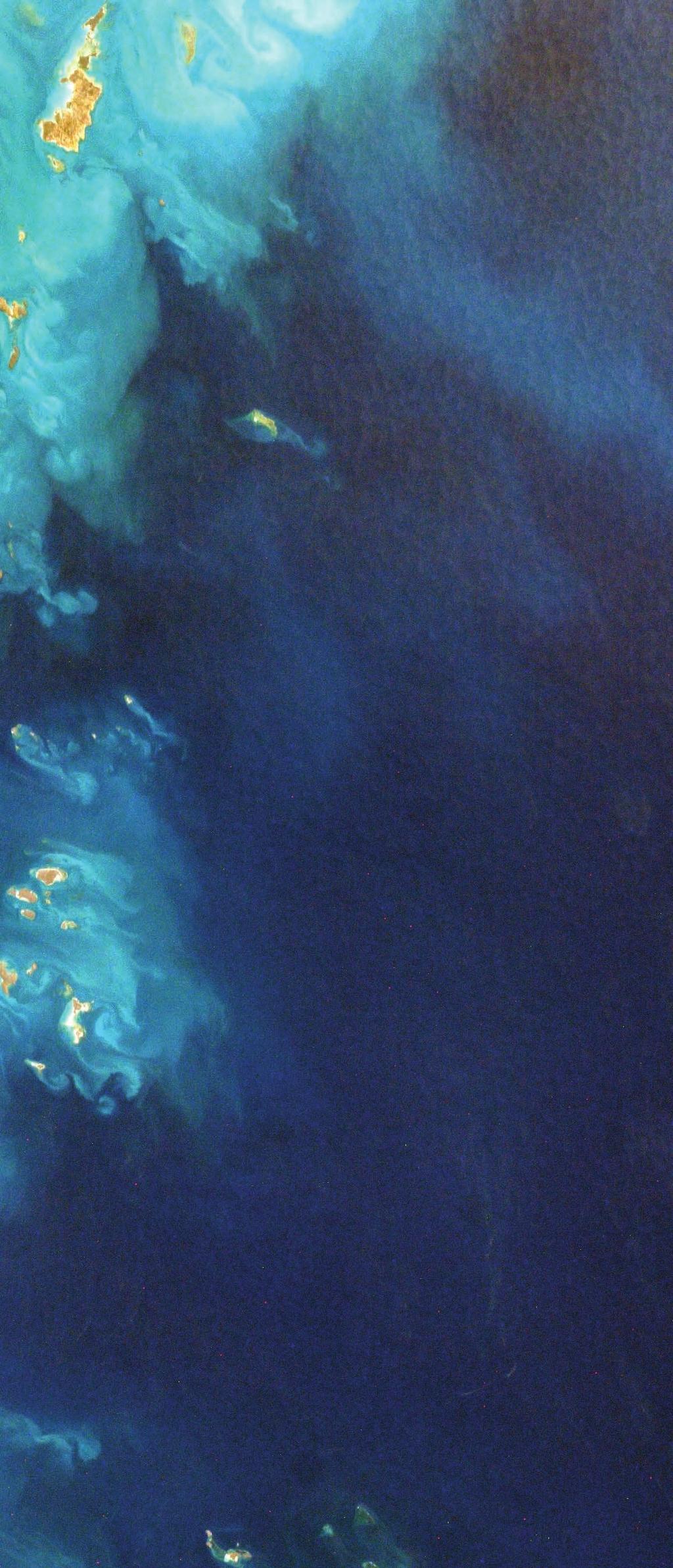
2 Overview As we enter the fourth industrial revolution, technology is revolutionizing our ability to map nature. Satellite data provide a bird s eye view of the Earth s surface in real-time, while drones and mobile apps enable local communities and indigenous peoples to map their knowledge of local ecosystems. Spatial data empowers governments to make well-informed decisions to ensure that nature is not left behind in the information age. The UN Biodiversity Lab helps countries achieve the Convention on Biological Diversity s (CBD) Aichi Biodiversity Targets (ABTs) and the Sustainable Development Goals (SDGs). It provides a customized spatial analysis platform to support conservation and development decision-making around the globe. A partnership between the UNDP and UN Environment powered by MapX, the Lab will work closely with national governments to provide every country with the best available spatial data to make informed conservation decisions. The Challenge Unequal use of spatial data to meet conservation and development challenges Geospatial data have the potential to play a transformative role in meeting conservation and development needs by identifying priority zones for conservation, mixed land-use, and development. However, many countries are not accessing geospatial data due to limitations in data availability, access, and technical capacity. A recent UN report shows that geospatial data will enable policy-makers to accelerate implementation of the ABTs and SDGs, but there are striking gaps between the potential for data to be used, and the actual capacity of countries to use data for effective decision-making.
3 The Opportunity Mobilizing spatial data to achieve biodiversity and sustainable development targets As we work to deliver on the Aichi Biodiversity Targets and Sustainable Development Goals, democratizing and accelerating access to spatial data will be an essential component of national planning and implementation. UN Conventions provide a global framework, however the translation of international agreements to local level action can often take years. We thus must work to ensure that spatial data is made available and used by innovative new partners including the private sector, indigenous peoples and local communities, and non-governmental organiza-tions. This project provides one of our best opportunities to share and develop spatial data layers as a public good, ensure they are utilized, and address existing capacity gaps. The Platform The UN Biodiversity Lab is an online platform that allows policymakers and other partners to access global data layers, upload and manipulate their own datasets, and query multiple datasets to provide key information on the Aichi Biodiversity Targets and nature-based Sustainable Development Goals. The core mission of the UN Biodiversity Lab is three-fold: to build spatial literacy to enable better decisions, to use spatial data as a vehicle for improved transparency and accountability, and to apply insights from spatial data across sectors to deliver on the Convention on Biological Diversity and the 2030 Agenda for Sustainable Development. By creating a collaborative, open-source environment, the UN Biodiversity Lab is an inclusive and scalable data platform. Key services of the UN Biodiversity Lab include: Access to global spatial data layers for conservation and development planning Facilitated access to high-quality spatial data on forest cover developed by NASA Ability for countries to upload national data sets and manage the level of user access Ability for queries to answer essential questions for conservation and development Ability for users to export maps, data layers, and datasets for reporting and further analysis. Supported export formats include pdf, shapefile, GeoJSON, DXF, SQLite, and KML. Assessments of data layer integrity by the UN, including data reliability, technical accessibility, data openness, and data sustainability.

4 Ten key questions essential to achieving the ABTs and SDGs The UN Biodiversity Lab can help policymakers to address these questions to accelerate action for conservation and sustainable development Where are the most important areas to promote sustainable use of biodiversity to reduce poverty? ABT 2; SDG 1.1; 1.2; 1.5 Where is natural resource management in danger of exceeding safe limits? ABT 4; SDG 6.4, 15.1, 15.2 Where are the highest rates of loss of natural habitats occurring? ABT 5, SDG 15.1, 15.2; 15.5 Where are the most important areas for promoting sustainable agriculture, forestry and aquaculture? ABT 7; SDG 15.2, 15.3 Where are the most dangerous sources of pollution, including agricultural runoff? ABT 8; SDG 3.9; 6.3; 14.1 Where can we have the biggest impact in controlling, eradicating, and preventing invasive species? ABT 9; SDG 15.8 Where are the areas of coral reefs that are most vulnerable to climate change or ocean acidification? ABT 10; SDG 14.3 Where are most important areas to create new protected areas and improve existing ones? ABT 11; SDG 14.5, 15.1, 15.4, 15.7, 15.9 Where are the most important areas to protect ecosystems to avoid species extinctions? ABT 12, SDG 14.2; 14.5; 15.1; 15.4; 15.7; 15.9 Where are the most important areas to protect ecosystems in order to sustain essential ecosystem services, including water, health, livelihoods and well-being? ABT 14; SDG 1.1; 1.2; 1.5; 2.1; 2.4; 6.1; 6.5; 6.6 Average Mammal Species Density Map created in UN Biodiversity Lab

5 The Future Out of 180 5th National Report submissions to the Convention on Biological Diversity, 33% either contained no maps or maps without actionable data. The UN Biodiversity Lab launches a new challenge to countries creating their 6th National Reports: double the amount of spatial data in their reporting. To support this challenge, UNDP and UN Environment will support communication and trainings on the use of the data in addition to monitoring its use, gathering best practices, and sharing these widely on the NBSAP Forum. Building a Global Partnership to Provide Data for People and Planet At the center of the UN Biodiversity Lab is a robust partnership between UNDP and UN Environment to provide highquality data for government representatives. UNDP and UN Environment s direct engagement with over 140 governments allows for dynamic updates to the platform based on actual user needs. Likewise, engagement with diverse technical partners and data providers ensures the provision of cuttingedge data to take action for sustainable development. The UN Biodiversity Lab is not just another website; it is a platform for building partnerships among data providers and data users to ensure that governments have access and capacity to use cutting-edge spatial data to make key conservation and development decisions.
6
Disaster Management & Recovery Framework: The Surveyors Response
 Disaster Management & Recovery Framework: The Surveyors Response Greg Scott Inter-Regional Advisor Global Geospatial Information Management United Nations Statistics Division Department of Economic and
Implementing the Sustainable Development Goals: The Role of Geospatial Technology and Innovation
 Fifth High Level Forum on UN Global Geospatial Information Management Implementing the Sustainable Development Goals: The Role of Geospatial Technology and Innovation 28-30 November 2017 Sheraton Maria
2018/1 The integration of statistical and geospatial information. The Regional Committee of UN-GGIM: Americas:
 The following are the conclusions and recommendations of the Regional Committee of the United Nations on Global Geospatial Information Management for the Americas, during its Fifth Session, Thursday 8
TOWARDS CLIMATE-RESILIENT COASTAL MANAGEMENT: OPPORTUNITIES FOR IMPROVED ICZM IN BELIZE
 TOWARDS CLIMATE-RESILIENT COASTAL MANAGEMENT: OPPORTUNITIES FOR IMPROVED ICZM IN BELIZE CHANTALLE SAMUELS Coastal Zone Management Authority and Institute The Caribbean Community Climate Change Centre VULNERABILITY
THE ROLE OF GEOSPATIAL AT THE WORLD BANK
 THE ROLE OF GEOSPATIAL AT THE WORLD BANK INSPIRE Conference Barcelona, Spain September 26, 2016 Kathrine Kelm Senior Land Administration Specialist Global Land and Geospatial Unit The World Bank Group
Challenges and Successes in Sharing Geospatial Data in Africa
 Challenges and Successes in Sharing Geospatial Data in Africa 2018 GeoNode Summit Torino, Italy March 26-28, 2018 Bernard Justus Muhwezi Manager, Geo-Information Services Uganda Bureau of Statistics, Kampala,
Concept note. High-Level Seminar: Accelerating Sustainable Energy for All in Landlocked Developing Countries through Innovative Partnerships
 Concept note High-Level Seminar: Accelerating Sustainable Energy for All in Landlocked Developing Countries through Innovative Partnerships Date: 24 and 25 October 2016 Venue: Conference Room C3, Vienna
Dr. Biliana Cicin-Sain President, Global Ocean Forum 1
 Towards a Sustainable Development Goal on Oceans and Seas: Healthy, Productive and Resilient Oceans and Seas- Prosperous and Resilient Peoples and Communities Dr. Biliana Cicin-Sain President, Global Ocean
Foundation Geospatial Information to serve National and Global Priorities
 Foundation Geospatial Information to serve National and Global Priorities Greg Scott Inter-Regional Advisor Global Geospatial Information Management United Nations Statistics Division UN-GGIM: A global
KENYA NATIONAL BUREAU OF STATISTICS Workshop on
 KENYA NATIONAL BUREAU OF STATISTICS Workshop on Capacity Building in Environment Statistics: the Framework for the Development of Environment Statistics (FDES 2013) Coordination with Sector Ministries
Accounting for Ecosystem and Biodiversity Related Themes in Uganda
 Introduction Accounting for Ecosystem and Biodiversity Related Themes in Uganda Calls for more evidence-based approaches to policy have increased the need for integrated environmental-economic information
KUNMING FORUM ON UNITED NATIONS GLOBAL GEOSPATIAL INFORMATION MANAGEMENT CITIES OF THE FUTURE: SMART, RESILIENT
 KUNMING FORUM ON UNITED NATIONS GLOBAL GEOSPATIAL INFORMATION MANAGEMENT CITIES OF THE FUTURE: SMART, RESILIENT and SUSTAINABLE Yunnan Zhenzhuang Guest House, Kunming, China 10 12 May 2017 BACKGROUND CONCEPT
Urban Climate Resilience
 Urban Climate Resilience in Southeast Asia Partnership Project Introduction Planning for climate change is a daunting challenge for governments in the Mekong Region. Limited capacity at the municipal level,
Geographic Information Infrastructure and Policy Framework for Sustainable Mountain Development in the Hindu Kush-Himalayas
 Geo SMART ASIA 2017 22-24 August, Kualalampur Geographic Information Infrastructure and Policy Framework for Sustainable Mountain Development in the Hindu Kush-Himalayas Basanta Shrestha, Director Strategic
Realizing benefits of Spatial Data Infrastructure A user s perspective from Environment Agency - Abu Dhabi
 Realizing benefits of Spatial Data Infrastructure A user s perspective from Environment Agency - Abu Dhabi Anil Kumar Director, Environment Information Management 26 April 2012 Geospatial World Forum,
EuroGEOSS Protected Areas Pilot
 EuroGEOSS Protected Areas Pilot Max Craglia European Commission Joint Research Centre Part 1: the present MyNatura2000 Mobile app. Awareness raising & volunteered data collection. Natura2000 covers 18%
UN-GGIM: Strengthening Geospatial Capability
 Fifth Plenary Meeting of UN-GGIM: Europe Brussels, 6-7 June 2018 UN-GGIM: Strengthening Geospatial Capability Walking the talk to leave no one behind Greg Scott, UN-GGIM Secretariat Environmental Statistics
The Integrated Ge spatial Information Framework to the strengthening of NSDI, Mongolia
 Young Geospatial Professionals Summit 21 NOV 2018 The Integrated Ge spatial Information Framework to the strengthening of NSDI, Mongolia BAYARMAA ENKHTUR Geospatial information and technology department
Working Group on Geospatial Information
 GEO-XIV Plenary Summary Working Group on Geospatial Information 4 th Meeting Lawrence Friedl Argyro Kavvada Group on Earth Observations NASA Earth Science Dec. 6-8, 2017 An intergovernmental organization
Building Stronger Data Ecosystems to Address SDGs Data Needs
 Building Stronger Data Ecosystems to Address SDGs Data Needs Data Science in Africa Workshop @ the African University of Science and Technology, Abuja Nov. 15, 2018 The Global Sustainable Development Goals
Making the SDGs work for the Lake Chad Basin
 Making the SDGs work for the Lake Chad Basin SIDE EVENT ON THE MARGINS OF THE 2018 HIGH LEVEL POLITICAL FORUM 16 JULY 2018, 18.30 20.00 CONFERENCE ROOM 11, UN CONFERENCE BUILDING, UNITED NATIONS HEADQUARTERS,
Building Institutional Capacity for Multi-Hazard Early Warning in Asia and the Pacific Subtitle
 Building Institutional Capacity for Multi-Hazard Early Warning in Asia and the Pacific Subtitle Title Keran Wang Chief, Space Applications Section ICT and Disaster Risk Reduction Division 22 May 2018 Pillar
NCAVES - Global initiative and national pilots
 NCAVES - Global initiative and national pilots Kavita Sharma UN Environment Pretoria, March 2018 Outline 1. Global initiative > Introduction > Objectives and deliverables >Activities in 2017 and 2018 2.
IHP-WINS will make water-related information available online, allowing countries and stakeholders to access reliable data on an open source platform.
 United Nations Educational, Scientific and Cultural Organization International Hydrological Programme International Hydrological Programme Water Information Network System INTERNATIONAL HYDROLOGICAL PROGRAMME
PROGRAM OF THE RUSSIAN FEDERATION CHAIRMANSHIP OF THE ARCTIC COUNCIL IN
 PROGRAM OF THE RUSSIAN FEDERATION CHAIRMANSHIP OF THE ARCTIC COUNCIL IN 2004-2006 The Arctic Council is a unique forum for interaction between the governments of the Arctic States, the Permanent Participants
Geospatial Information Management in the Americas: Lessons for the Post-2015 development agenda
 Geospatial Information Management in the Americas: Lessons for the Post-2015 development agenda Rolando Ocampo President, UN-GGIM: Americas October 2014 The integration of statistical and geographical
Climate Risk Visualization for Adaptation Planning and Emergency Response
 Climate Risk Visualization for Adaptation Planning and Emergency Response NCR Flood Fact Finding Workshop Ricardo Saavedra ricardo@vizonomy.com Social Media, Mobile, and Big Data St. Peter s Basilica,
Economic and Social Council
 United Nations Economic and Social Council Distr.: General 2 July 2012 E/C.20/2012/10/Add.1 Original: English Committee of Experts on Global Geospatial Information Management Second session New York, 13-15
UN GGIM and National SDI Strategy
 MSDI Open Forum on 26 th January 2016 Contributing to the successful delivery of MSDI UN GGIM and National SDI Strategy Hiroshi Murakami Deputy Administrator Geospatial Information Authority of Japan Geospatial
Building capacity to support decisionmaking for protection and management of marine areas
 Credit_Deep Atlantic Stepping Stones Science Team_IFE_URI_NOAA_no3 Credit: John Weller, john@lastocean.com Credit: John Weller, john@lastocean.com Credit: John Weller, john@lastocean.com Credit: Sarah
Seabed knowledge In support of UN SDGs
 Seabed knowledge In support of UN SDGs Evert Flier Fiskerifaglig forum 2. november 2017 Hydrography & small scale fishing Hydrography in Transition Serving the Maritime Community Hydrography in Transition
Arctic ecosystem services: TEEB Arctic Scoping study. Alexander Shestakov WWF Global Arctic Programme 3 December Arctic Biodiversity Congress
 Arctic ecosystem services: TEEB Arctic Scoping study Alexander Shestakov WWF Global Arctic Programme 3 December 20143 Arctic Biodiversity Congress Content 1. Project design 2. Approach 3. Challenges and
Presentation by Thangavel Palanivel Senior Strategic Advisor and Chief Economist UNDP Regional Bureau for Asia-Pacific
 Presentation by Thangavel Palanivel Senior Strategic Advisor and Chief Economist UNDP Regional Bureau for Asia-Pacific The High-Level Euro-Asia Regional Meeting on Improving Cooperation on Transit, Trade
Key Indicators for Territorial Cohesion & Spatial Planning Stakeholder Workshop - Project Update. 13 th December 2012 San Sebastián, Basque Country
 Key Indicators for Territorial Cohesion & Spatial Planning Stakeholder Workshop - Project Update 13 th December 2012 San Sebastián, Basque Country Key Aims Explore the use of territorial data in developing
Integrated approaches to the implementation of the Convention on Biological Diversity
 Integrated approaches to the implementation of the Convention on Biological Diversity Actions on ABS in the context of UNESCO Biosphere Reserves Vibeke Jensen, Director UNESCO Liaison Office in New York
Essential Cold Region Variables to reach societal benefits
 - Where the Poles come together Essential Cold Region Variables to reach societal benefits Yubao Qiu, Massimo Menenti and ECRV Task Team (ongoing) 2018.6 @ Davos - Switzerland /GEO Cold Regions Initiative
Geospatial framework for monitoring SDGs/Sendai targets By Shimonti Paul Sr. Assistant Editor Geospatial Media & Communications
 Geospatial framework for monitoring SDGs/Sendai targets By Shimonti Paul Sr. Assistant Editor Geospatial Media & Communications Outline 1. Introduction to Geospatial Media and Communications 2. Geospatial
Together towards a Sustainable Urban Agenda
 Together towards a Sustainable Urban Agenda The City We (Youth) Want Preliminary findings from youth consultations Areas Issue Papers Policy Units 1.Social Cohesion and Equity - Livable Cities 2.Urban
REPUBLIC OF ZAMBIA STATEMENT THE HONOURABLE LUCKY MULUSA, M.P., MINISTER OF NATIONAL DEVELOPMENT PLANNING,
 REPUBLIC OF ZAMBIA Permanent Mi$sion of Zambia to the United Nations, 237 East 52nd Street, New York, NY 10022 Tex: (212) 888-5770 Fax: (212) 888-5213 E-mail: zambia@un.int Please check against delivery
The UN-GGIM: Europe core data initiative to encourage Geographic information supporting Sustainable Development Goals Dominique Laurent, France
 INSPIRE conference Strasbourg 6 September 2017 The UN-GGIM: Europe core data initiative to encourage Geographic information supporting Sustainable Development Goals Dominique Laurent, France Introduction
PACIFIC ISLANDS REGIONAL OCEAN POLICY. A healthy Ocean that sustains the livelihoods and aspirations of Pacific Island communities.
 PACIFIC ISLANDS REGIONAL OCEAN POLICY VISION A healthy Ocean that sustains the livelihoods and aspirations of Pacific Island communities. THIS IS OUR OCEAN 1. The care of the ocean is the responsibility
Ministry of Health and Long-Term Care Geographic Information System (GIS) Strategy An Overview of the Strategy Implementation Plan November 2009
 Strategy An Overview of the Strategy Implementation Plan November 2009") Ministry of Health and Long-Term Care Geographic Information System (GIS) Strategy An Overview of the Strategy Implementation Plan November 2009 John Hill, Health Analytics Branch Health System Information
Ministry of Health and Long-Term Care Geographic Information System (GIS) Strategy An Overview of the Strategy Implementation Plan November 2009 John Hill, Health Analytics Branch Health System Information
CONFERENCE STATEMENT
 CONFERENCE STATEMENT We, the elected representatives from Canada, Denmark/Greenland, Finland, Iceland, Norway, Russia, Sweden and the United States of America; In collaboration with the indigenous peoples
INDONESIA S S UPDATE: GEOSPATIAL INFORMATION FOR SUSTAINABLE DEVELOPMENT RELATED TO INA SDI Dr. Asep Karsidi, M.Sc
 INDONESIA S S UPDATE: GEOSPATIAL INFORMATION FOR SUSTAINABLE DEVELOPMENT RELATED TO INA SDI Dr. Asep Karsidi, M.Sc GEOSPATIAL INFORMATION AGENCY 08 August, 2012 OUTLINE 1. Transformation Bakosurtanal into
A Call for Mountains
 A Call for Mountains From the participants of the World Mountain Forum in Bishkek, October 23-26, 2018 ACKNOWLEDGING that mountain regions provide essential global goods and services for both highland
Liana Talaue McManus. Division of Marine Affairs and Policy Rosenstiel School of Marine & Atmospheric Science University of Miami
 Liana Talaue McManus Division of Marine Affairs and Policy Rosenstiel School of Marine & Atmospheric Science University of Miami Outline 1. Coasts as vulnerable & resilient social ecological systems 2.
Biodiversity and Ecosystem services Thinking globally, acting locally
 Biodiversity and Ecosystem services Thinking globally, acting locally Anne-Gaelle Ausseil - Manaaki Whenua Landcare Research Geoff Hicks National Commission for UNESCO 1 8 / 1 0 / 2 0 1 8 M A N A A K I
Statement of Mr. Sandagdorj Erdenebileg, Chief, Policy Development, Coordination, Monitoring and Reporting Service, UN-OHRLLS.
 Statement of Mr. Sandagdorj Erdenebileg, Chief, Policy Development, Coordination, Monitoring and Reporting Service, UN-OHRLLS at the Botswana National Workshop on the Vienna Programme of Action 27 th October
Building Institutional Capacity for Multi-Hazard Early Warning in Pacific Countries Subtitle
 Building Institutional Capacity for Multi-Hazard Early Warning in Pacific Countries Subtitle Title Keran Wang Chief, Space Applications Section ICT and Disaster Risk Reduction Division 30 March 2018 Slide
The Global Statistical Geospatial Framework and the Global Fundamental Geospatial Themes
 The Global Statistical Geospatial Framework and the Global Fundamental Geospatial Themes Sub-regional workshop on integration of administrative data, big data and geospatial information for the compilation
LLDCS IN THE GLOBAL AGENDA: CHALLENGES AND INTERNATIONAL RESPONSES CHAIR OF THE GROUP OF LLDCS IN GENEVA
 LLDCS IN THE GLOBAL AGENDA: CHALLENGES AND INTERNATIONAL RESPONSES CHAIR OF THE GROUP OF LLDCS IN GENEVA E X P E R T G R O U P M E E T I N G O N T H E M I D T E R M R E V I E W O F T H E V P O A F O R
Weather Climate Science to Service Partnership South Africa
 PROJECTS UNDERWAY Title of the Weather Climate Science to Service Partnership South Africa Together, building on an existing strong partnership, South African Weather Service and the Met Office will build
THE SEVILLE STRATEGY ON BIOSPHERE RESERVES
 THE SEVILLE STRATEGY ON BIOSPHERE RESERVES 1 VISION FOR BIOSPHERE RESERVES IN THE 21 ST CENTURY The international Seville Conference on Biosphere Reserves, organised by UNESCO, adopted a two-pronged approach,
Using Big Interagency Databases to Identify Climate Refugia for Idaho s Species of Concern
 Using Big Interagency Databases to Identify Climate Refugia for Idaho s Species of Concern What is a Climate Refugia? habitat that supports a locally reproducing population [or key life history stage]
Open Cities Project. The World Bank, South Asia Region. Background
 Open Cities Project The World Bank, South Asia Region Opencitiesproject.com Background The World Bank s South Asia Region (SAR) is proud to announce its new Open Cities Project. The goal of this project
Prof Chryssy Potsiou, FIG President
 THE VALUE OF GEOSPATIAL DATA AND ROLE OF SURVEYORS IN SUSTAINABLE DEVELOPMENT Prof Chryssy Potsiou, FIG President National Technical University of Athens School of Rural and Surveying Engineering, Greece
Towards a Statistical Framework for Measuring Sustainable Tourism (MST)
") Towards a Statistical Framework for Measuring Sustainable Tourism (MST) 11th UNWTO/PATA Forum Guilin, China Clara van der Pol, UNWTO How do we work? the process of UN official statistics Engage, Research
Towards a Statistical Framework for Measuring Sustainable Tourism (MST) 11th UNWTO/PATA Forum Guilin, China Clara van der Pol, UNWTO How do we work? the process of UN official statistics Engage, Research
Northrop Grumman Concept Paper
 Northrop Grumman Concept Paper A Comprehensive Geospatial Web-based Solution for NWS Impact-based Decision Support Services Glenn Higgins April 10, 2014 Northrop Grumman Corporation Information Systems
Baltic 2030: Bumps on the Road
 Sven Beyersdorff June 14th 2018 Baltic 2030: Bumps on the Road - How the Baltic Sea States are performing on the SDGs Aims of report Why did we do this? Understand performance of 11 countries in the Baltic
NOAA Surface Weather Program
 NOAA Surface Weather Program Maintenance Decision Support System Stakeholder Meeting #9 Jim O Sullivan NOAA Surface Weather Program Manager NWS Office of Climate, Water, and Weather Services September
National Survey on the Natural Environment of Japan. Hajime Hirosawa Biodiversity Center of Japan Ministry of the Environment (MOE)
") National Survey on the Natural Environment of Japan Hajime Hirosawa Biodiversity Center of Japan Ministry of the Environment (MOE) Biodiversity Center of Japan, MOE Establishment: 1998 Purpose: to encourage
National Survey on the Natural Environment of Japan Hajime Hirosawa Biodiversity Center of Japan Ministry of the Environment (MOE) Biodiversity Center of Japan, MOE Establishment: 1998 Purpose: to encourage
The importance of international university and project cooperation in science
 The importance of international university and project cooperation in science The Role of Science in Arctic Social and Business Development Arctic Frontiers Science January 25, 2017 Dr. Marina Kalinina
WORLD COUNCIL ON CITY DATA
 WORLD COUNCIL ON CITY DATA WCCD ISO 37120 STANDARDIZED CITY DATA TO MEET UN SDG TARGETS UN WORLD DATA FORUM Presented by: James Patava www.dataforcities.org @wccitydata PUBLICATION OF THE FIRST ISO STANDARD
FINDINGS OF THE ARCTIC METEOROLOGY SUMMIT
 FINDINGS OF THE ARCTIC METEOROLOGY SUMMIT 2018 WWW.FMI.FI CHAIR S SUMMARY: 1 2 3 We need to be curious to explore the known unknowns. Meteorology is an elemental part of international collaboration in
Spatial Data Availability Energizes Florida s Citizens
 NASCIO 2016 Recognition Awards Nomination Spatial Data Availability Energizes Florida s Citizens State of Florida Agency for State Technology & Department of Environmental Protection Category: ICT Innovations
PUBLIC HEALTH ASSOCIATION OF AUSTRALIA Strategic Plan
 PUBLIC HEALTH ASSOCIATION OF AUSTRALIA Strategic Plan March 2017 20 Napier Close Deakin ACT Australia 2600 PO Box 319 Curtin ACT Australia 2605 Table of Contents Introduction... 2 Vision for a healthy
Millennium Ecosystem Assessment
 Millennium Ecosystem Assessment Global Data Challenges from an MA perspective Global Spatial Data and Information User Workshop 21-23 September 2004! What is the MA?! How and what kinds of data does it
SAHEL AND. Club WEST AFRICA
 SAHEL AND Club WEST AFRICA Informing policies for Africa s urban future Africa is projected to have the fastest urban growth rate in the world by 2050, Africa s cities will be home to an additional 950
CONSERVATIONISTS COLLABORATE TO SAVE GIANT PANDAS
 CASE STUDY CONSERVATIONISTS COLLABORATE TO SAVE GIANT PANDAS SMITHSONIAN NATIONAL ZOOLOGICAL PARK In July 2005, many Americans were delighted by new reports about the birth and early development of Tai
Norwegian spatial data infrastructure supporting disaster risk management Norwegian Mapping Authority
 Norwegian spatial data infrastructure supporting disaster risk management Norwegian Mapping Authority Arvid Lillethun, Norwegian Mapping Authority Land and Poverty 2018 Conference, World Bank 19.-23. March
US National Spatial Data Infrastructure A Spatial Framework for Governance and Policy Development to Enable a Location-Based Digital Ecosystem
 GeoPlatform Workshop 7 Dec 2016, Department of the Interior Washington, D.C. US National Spatial Infrastructure A Spatial Framework for Governance and Policy Development to Enable a Location-Based Digital
ACTION PLAN FOR WORLD HERITAGE IN LATIN AMERICA AND THE CARIBBEAN ( )
") Annex ACTION PLAN FOR WORLD HERITAGE IN LATIN AMERICA AND THE CARIBBEAN (2014-2024) The current Regional Action Plan for Latin America and the Caribbean for 2014-2024 has been elaborated by the State Parties
Annex ACTION PLAN FOR WORLD HERITAGE IN LATIN AMERICA AND THE CARIBBEAN (2014-2024) The current Regional Action Plan for Latin America and the Caribbean for 2014-2024 has been elaborated by the State Parties
Louis-François Guerre, Planet Action Coordinator Copenhagen, December Spot Image 2007
 Louis-François Guerre, Planet Action Coordinator Copenhagen, December 2009 1 Spot Image 2007 Spot Image, Earth Observation and geo-information services Satellite operator, imagery distributor SPOT4 SPOT5
Zambia: A financial landscape ripe with opportunity May 11, 2016
 Zambia: A financial landscape ripe with opportunity May 11, 2016 www.themix.org 1 An ecosystem to develop the Digital Finance sector and to support all stakeholders Policy and regulation Customer Adoption
Introduction: The Gulf of Mexico Alliance. The Gulf GAME project MERMAid and PHINS Results & Conclusions What s next? Examples
 AAG Las Vegas March 25, 2009 Introduction: Ocean governance and Ecosystem-Based Management The Gulf of Mexico Alliance Habitat Identification and Characterization The Gulf GAME project MERMAid and PHINS
SDG s and the role of Earth Observation
 SDG s and the role of Earth Observation Christian Heipke IPI - Institute for Photogrammetry and GeoInformation Leibniz Universität Hannover Germany Secretary General, ISPRS 1. No Poverty 2. Zero Hunger
Observation (EO) & Geomatics in Canada
 & Geomatics in Canada") Innovating to Increase the Impact of Earth Observation (EO) & Geomatics in Canada Natural Resources Canada February 25, 2014 Prashant Shukle, Director General Canada Centre for Mapping and Earth Observation
Innovating to Increase the Impact of Earth Observation (EO) & Geomatics in Canada Natural Resources Canada February 25, 2014 Prashant Shukle, Director General Canada Centre for Mapping and Earth Observation
Welcome. C o n n e c t i n g
 Welcome C o n n e c t i n g YOU D i s c i p l i n e s Why is This Meeting......So Important Now? OUR WORLD Is Increasingly Challenged The Evidence Is Clear We Need Better Understanding and More Collaboration
Arctic Spatial Data Infrastructure Enabling Access to Arctic Location-Based Information
 Arctic Spatial Data Infrastructure Enabling Access to Arctic Location-Based Information Arctic SDI Side Event Co-Chairs: Arvo Kokkonen Arctic SDI Board Chair & Director General, National Land Survey of
GIS (GEOGRAPHICAL INFORMATION SYSTEMS) AS A FACILITATION TOOL FOR SUSTAINABLE DEVELOPMENT IN AFRICA
 AS A FACILITATION TOOL FOR SUSTAINABLE DEVELOPMENT IN AFRICA") GIS (GEOGRAPHICAL INFORMATION SYSTEMS) AS A FACILITATION TOOL FOR SUSTAINABLE DEVELOPMENT IN AFRICA a presentation by Elizabeth Hicken GDEST Conference on Geospatial Sciences for Sustainable Development
GIS (GEOGRAPHICAL INFORMATION SYSTEMS) AS A FACILITATION TOOL FOR SUSTAINABLE DEVELOPMENT IN AFRICA a presentation by Elizabeth Hicken GDEST Conference on Geospatial Sciences for Sustainable Development
Sustainability Science: The State of the Field
 Sustainability Science: The State of the Field Presented to The Sustainability Science Fellows Seminar Harvard University Sept. 17, 2012 by William C. Clark Sustainable Development Sustainable Development:
Urbanization and Sustainable Development of Cities: A Ready Engine to Promote Economic Growth and Cooperation
 Urbanization and Sustainable Development of Cities: A Ready Engine to Promote Economic Growth and Cooperation Wan Portia Hamzah Institute of Strategic and International Studies (ISIS) Malaysia 10 September
Briefing. H.E. Mr. Gyan Chandra Acharya
 Briefing by H.E. Mr. Gyan Chandra Acharya Under-Secretary-General and High Representative for the Least Developed Countries, Landlocked Developing Countries and Small Island Developing States Briefing
CONCEPT NOTE. UNESCO s International Science School 29 May - 1 June 2018, Havana, Cuba
 CONCEPT NOTE UNESCO s International Science School 29 May - 1 June 2018, Havana, Cuba Building resilient societies through the links between research, disaster risk reduction and climate change adaptation
Land Use in the context of sustainable, smart and inclusive growth
 Land Use in the context of sustainable, smart and inclusive growth François Salgé Ministry of sustainable development France facilitator EUROGI vice president AFIGéO board member 1 Introduction e-content+
STATEMENT THE HONOURABLE JOSHUA SETIPA (SENATOR) MINISTER OF TRADE AND INDUSTRY OF THE KINGDOM OF LESOTHO AT THE
 MINISTER OF TRADE AND INDUSTRY OF THE KINGDOM OF LESOTHO AT THE") STATEMENT BY THE HONOURABLE JOSHUA SETIPA (SENATOR) MINISTER OF TRADE AND INDUSTRY OF THE KINGDOM OF LESOTHO AT THE FIFTH MEETING OF TRADE MINISTERS OF LANDLOCKED DEVELOPING COUNTRIES 23 JUNE, 2016, GENEVA
STATEMENT BY THE HONOURABLE JOSHUA SETIPA (SENATOR) MINISTER OF TRADE AND INDUSTRY OF THE KINGDOM OF LESOTHO AT THE FIFTH MEETING OF TRADE MINISTERS OF LANDLOCKED DEVELOPING COUNTRIES 23 JUNE, 2016, GENEVA
16540/14 EE/cm 1 DG E 1A
 Council of the European Union Brussels, 5 December 2014 (OR. en) 16540/14 ENV 965 CULT 139 NOTE From: To: Subject: General Secretariat of the Council Delegations Charter of Rome on Natural and Cultural
Swedish Spatial Data Infrastructure and the National Geodata Strategy
 Submitted to the United Nations Committee of Experts on Global Geospatial Information Management Seventh Session New York, August 2018 Registration number 519-2018/4327 Country Report, Sweden Swedish Spatial
Marine Spatial Management Tool
 Marine Spatial Management Tool Marine Spatial Management Tool Support the marine spatial planning process with updated and reliable geospatial information Marine management is important to Norway with
Asia Protected Areas Charter
 資料 3-1 Asia Protected Areas Charter The Asia Challenge Asia is the world s most rapidly growing region as well as one of the most bio-diverse. This dynamic development has led to unprecedented growth,
The Thresholds working Group.
 A Report for the CEESP on the Key Biodiversity Areas (KBA) Delineation Workshop organized by the IUCN during 10-15 March 2013, Front Royal, Virginia, USA. The joint task force of the World Commission of
Esri and GIS Education
 Esri and GIS Education Organizations Esri Users 1,200 National Government Agencies 11,500 States & Regional Agencies 30,800 Cities & Local Governments 32,000 Businesses 8,500 Utilities 12,600 NGOs 11,000
Advancing Geoscientific Capability. Geological Survey of Finland
 Advancing Geoscientific Capability Geological Survey of Finland GTK in brief The Geological Survey of Finland (GTK) is one of the largest European centres of excellence in assessment, research and the
ADDRESSING THE DATA AND INFORMATION NEEDS FOR GOOD GOVERNANCE, SHARING EXPERIENCES FROM COTE D IVOIRE. 20 April 2016 to 22 April 2016 ADDIS ABABA
 20 April 2016 to 22 April 2016 ADDIS ABABA ADDRESSING THE DATA AND INFORMATION NEEDS FOR GOOD GOVERNANCE, SHARING EXPERIENCES FROM COTE D IVOIRE Dr. Edouard FONH-GBEI Director General of CNTIG, General
Discovery and Access of Geospatial Resources using the Geoportal Extension. Marten Hogeweg Geoportal Extension Product Manager
 Discovery and Access of Geospatial Resources using the Geoportal Extension Marten Hogeweg Geoportal Extension Product Manager DISCOVERY AND ACCESS USING THE GEOPORTAL EXTENSION Geospatial Data Is Very
Key Points Sharing fosters participation and collaboration Metadata has a big role in sharing Sharing is not always easy
 Sharing Resources Geoff Mortson esri, Inc. SDI Solutions Team Key Points Sharing fosters participation and collaboration Metadata has a big role in sharing Sharing is not always easy Data Sharing is Good
CONFERENCE STATEMENT
 Final draft CONFERENCE STATEMENT We, the elected representatives of Canada, Denmark/Greenland, the European Parliament, Finland, Iceland, Norway, Russia, Sweden and the United States of America; In collaboration
Framework on reducing diffuse pollution from agriculture perspectives from catchment managers
 Framework on reducing diffuse pollution from agriculture perspectives from catchment managers Photo: River Eden catchment, Sim Reaney, Durham University Introduction This framework has arisen from a series
Designing smart & Resilient cities:
 Designing smart & Resilient cities: How can Egyptian cities learn from an emerging global practice On the Cuspof Change Professor Samer Bagaeen FRICS MRTPI FRSA AoU 1. GLOBAL CHALLENGES POPULATION GROWTH,
Geospatial Decision Support Tools for Planning of Marine Protected Areas in California
 Geospatial Decision Support Tools for Planning of Marine Protected Areas in California WILL MCCLINTOCK (UNIVERSITY OF CALIFORNIA SANTA BARBARA), MATT MERRIFIELD (THE NATURE CONSERVANCY), SOPHIE DE BEUKELAER