GEOGRAPHY OF THE UNITED STATES & CANADA. By Brett Lucas
|
|
|
- Phyllis Simmons
- 5 years ago
- Views:
Transcription


1 GEOGRAPHY OF THE UNITED STATES & CANADA By Brett Lucas
2 THE INTERMONTANE WEST

3
4 Setting the Boundaries What states and provinces are part of the region? Parts of WA, OR, ID, CA, UT, NM. All of NV and AZ. What regions does it border? N. Pacific Coast, Rocky Mountains, Great Plains, California, Mexico

5
6 Overview Rugged and topographically diverse Population growing rapidly Las Vegas, Phoenix (Sunbelt) Inadequate water resources
7 Physical Geography
8 Physical Setting Area between Sierra Nevada and Cascade Mountains and the Rockies Tapers to the north Three regions Basin and Range Colorado Plateau Columbia Plateau

9


10 Basin & Range Parallel narrow mountains with flat valleys in between Pulled apart over time Drain into themselves
11 Basin & Range The region was up-arched in the Mesozoic Era. Subsidence occurred along normal faults beginning in the Miocene. Up-faulted crustal blocks formed linear mountains that shed sediment into the adjacent down-dropped basins. Faults opened conduits for igneous rock, producing lava flows and volcanism. Sediments eroded from the mountains filled the downfaulted basins, clogged rivers, and caused closed-basin (no outlet) lakes to form. Evaporite minerals (gypsum and salt) were deposited as the lakes evaporated.

12

13 Great Salt Lake The lake is the largest remnant of Lake Bonneville, a pluvial lake which covered much of western Utah in prehistoric times. Great Salt Lake is endorheic (has no outlet besides evaporation) and has very high salinity

14


15 Colorado Plateau Much of the land is greater than 5,000 feet in elevation Narrow permanent streams carved into uplifted land Much of the land is flat mesa s

16

17 Columbia Plateau Covered with ancient lava flows Surface considerably transformed over time

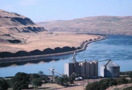
18 Columbia Plateau

19 Hells Canyon The canyon was carved by the Snake River It plunges more than a mile below the canyon's west rim on the Oregon side and 8,000 feet below the peaks of the Seven Devils Mountains range to the east
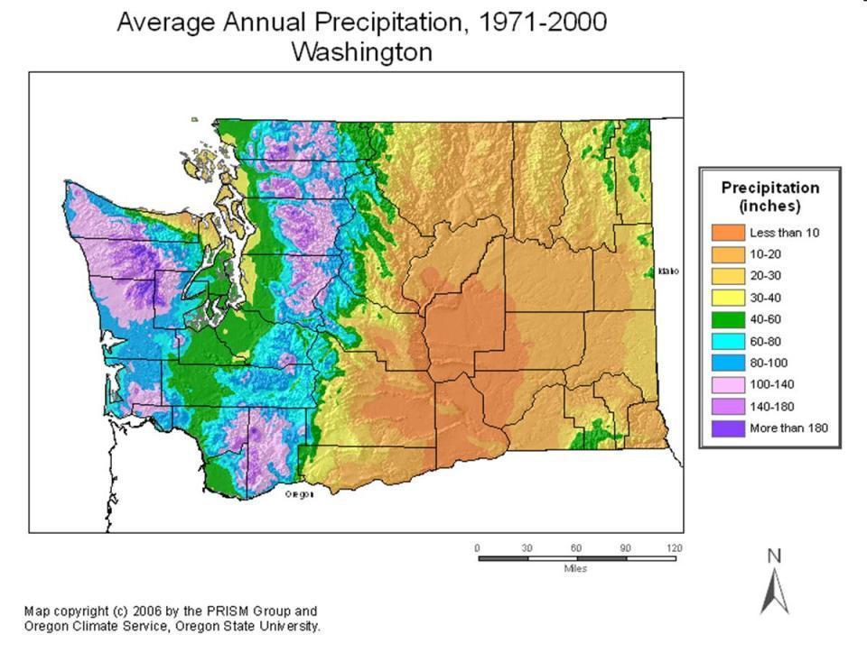
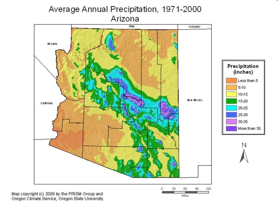
20 Climate Driest climates here Somewhat more humid, and wet as you go further north Vertical zonation Very hot low basins, especially south Cooler plateaus, mesas
21
22 Climograph Spokane, WA
23 Climograph Yakima, WA

24

25
26 Climograph Moscow, ID
27 Climograph Boise, ID
28 Climograph Pocatello, ID

29
30 Climograph Salt Lake City, UT

31
32 Climograph Ely, NV
33 Climograph Las Vegas, NV

34
35
36 Climograph Flagstaff, AZ
37 Climograph Phoenix, AZ

38
39 Climograph Albuquerque, NM
40
41 Climograph El Paso, TX
42 Climate Comparison Spokane WA Boise ID Top of GC 8,000 Bottom of GC 2,000 Jan Temp (F) 33 / / / / 36 Jul Temp (F) 82 / / / / 78 Rainfall 16.5 in. 12 in. 24 in. 8 in. Snowfall 49 in. 21 in. 80 in. <5 in. GC = Grand Canyon

43 Death Valley Hottest spot in North America 134 o record high 116 o average high in July Lowest spot in North America -282 feet Driest spot in North America 2 of precipitation annually


44 Natural Vegetation: Forest & Grasslands Forests found in wetter, cooler areas Washington Oregon Mountains Grasslands found in drier areas


45 Natural Vegetation: Desert
46 Population & Settlement

47 Native Settlement Sparse & Varied Some of the best preserved native ruins Flourished in wetter climate in the past Cave Kiva

48 Spanish Settlement Settled along the upper Rio Grande in the 1500 s and 1600 s Santa Fe Albuquerque San Xavier del Bac
49 British/American Settlement Lewis and Clark (northern region) Trappers only semi-permanent population Some populations passing through to the West Coast Gold Rush (California) Silver Rush (Nevada) Transcontinental railroad finished in 1869 Eventually, miners settled the region
50 Mormon Settlement 1847: Mormons settle in Great Salt Lake valley Utah is the only state to have been colonized systematically Still dominant area for Mormons
51 Present Population Very rapidly growing, especially southern parts Las Vegas (+83% fastest in the US) Boise (+46%) Phoenix (+45%) Reno (+33%) Mostly Caucasian, significant Mexican population in borderlands Very transient population

52 Mexican Population Dominant in borderlands New Mexico is 42% Hispanic, the largest percentage of any state Many cities with greater percentages El Paso 76% Laredo 94%

53 Native American Population
54 Population Numbers State/Metro area 2000 (1,000 s) 1990 (1,000 s) Change Nevada 1,998 1, % Arizona 5,130 3, % Utah 2,232 1, % Idaho 1,293 1, % New Mexico 1,819 1, % Spokane, WA % US & Canada 312, , %

55 Population Density WA

56 Population Density OR

57 Population Density ID

58 Population Density UT

59 Population Density NV

60 Population Density CA

61 Population Density AZ

62 Population Density NM

63 Population Density NM
64 Human & Economic Geography

65 Mining Copper Mines AZ #1, UT #2, NM #3 Gold Nevada Coal Navajo Generating Station Uranium


66 Irrigated Farming Small geographic extent Important commercially Idaho potatoes Imperial Valley dates Washington State apples
67 Livestock Similar to Rocky Mountains Sheep and cattle Many graze on federal land Move higher up into mountains in summer, back to lower ground in winter


68 Water Resources: Colorado MAFY = Million Acre Feet per Year Based on 1929 accord


69 Water Resources: Colorado Lake Mead Hoover Dam
70 Water Resources: Colorado State Battles The Colorado River Compact is a 1922 agreement among seven U.S. states in the basin of the Colorado River in the American Southwest governing the allocation of the river's water among the parties of the interstate compact The compact divides the river basin into two areas, the Upper Basin (comprising CO, NM, UT and WY) and the Lower Basin (NV, AZ and CA) The compact requires the Upper Basin states to deliver water at a rate of 7.5 million acre feet per year (293 m³/s), averaged over a moving ten-year average
71 Water Resources: Colorado The compact requires the Upper Basin states to deliver water at a rate of 7.5 million acre feet per year (293 m³/s), averaged over a moving ten-year average In December, 2007, a set of interim guidelines on how to allocate Colorado River water in the event of shortages was signed by the Secretary of the Interior Battles within States Imperial Valley vs. San Diego
72 Water Resources: Columbia Mostly dammed Grand Coulee, largest hydroelectric dam in the United States Much of the Pacific Northwest hinges on the Columbia for power supply Columbia is also used for navigation/barge traffic and irrigation water Significant environmental concerns

73

74

75 Tourism National Parks Monument Valley, Arches, Canyonlands, Bryce, Zion, Grand Canyon, Big Bend Old mining towns and cliff dwellings Oatman Nevada: Gambling

76
 as El Paso (700k) Symbiotic economy, maquiladoras in Mexico Very")
77 El Paso Twice as many people in Ciudad Juarez, Mexico (1.4 M) as El Paso (700k) Symbiotic economy, maquiladoras in Mexico Very high poverty rate

78

79


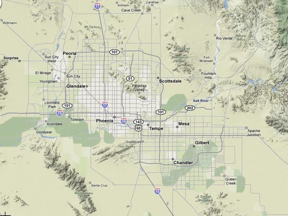
80 Phoenix Incredible growth Over 500 square miles Diverse economy Large retirement population In the sun belt
81

82


83 Sun City Founded in 1960 Community for people over 55, and no one under 18 38,000 people in 2000 Popularity has led to other planned cities Sun City West, Sun City Grand, Carefree, etc.

84

85


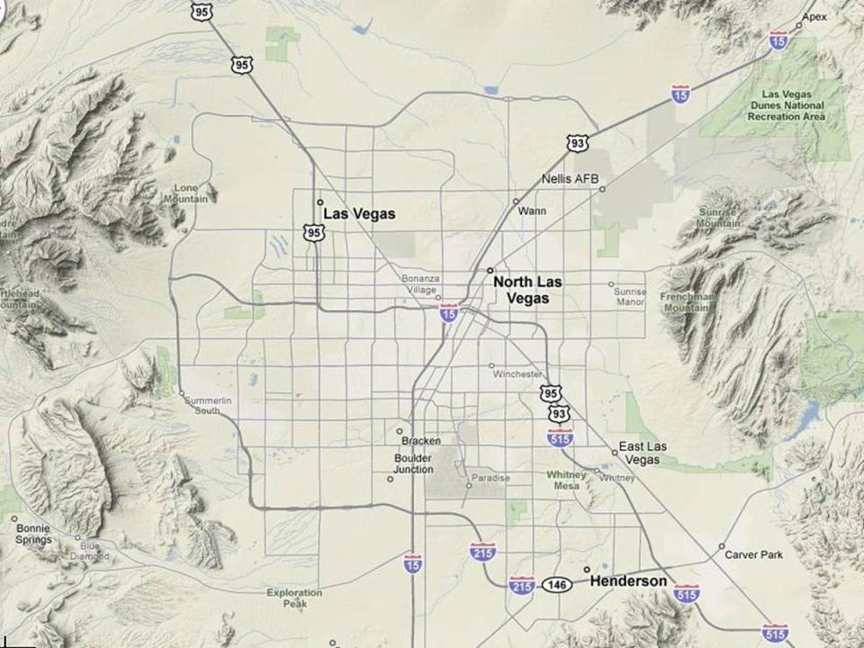
86 Las Vegas Built as gambling town Transformed into a city 1/3 of the population employed by the casinos or related industry Rapid growth to decline with casinos elsewhere and water shortage

87
88

89

90 Reno 3rd largest city in NV Reno, known as "The Biggest Little City in the World", is the birthplace of the gaming corporation Harrah's Entertainment. Gambling industry on hard times.

91

92


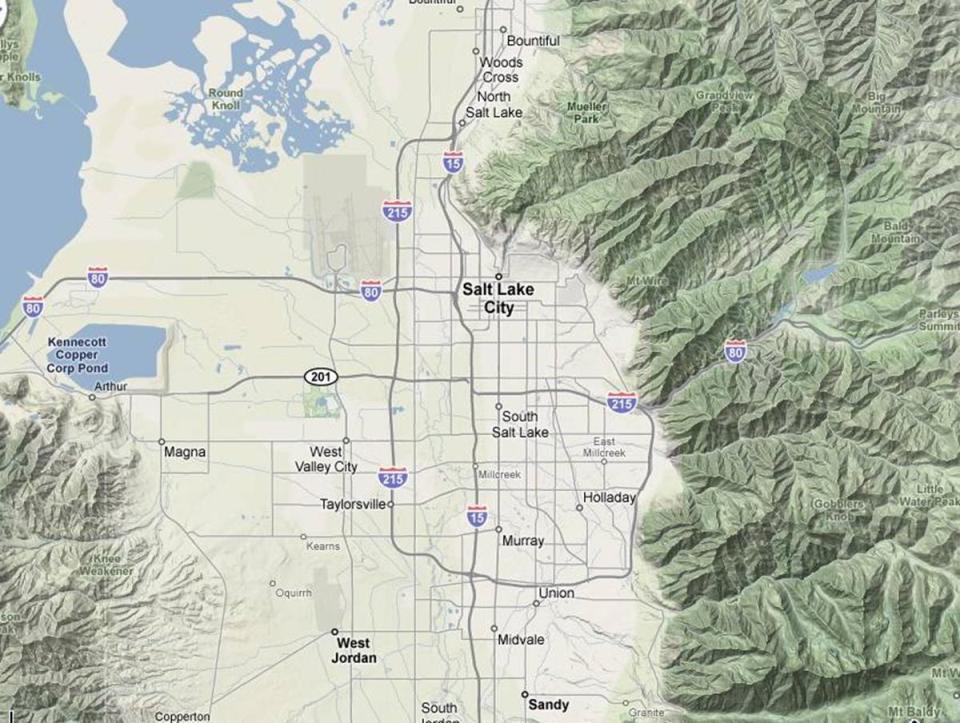
93 Salt Lake City 1.5 million people Mormon capital Diversifying economy Increasing prominence Ski tourism (Park City) 2002 Olympics
94

95


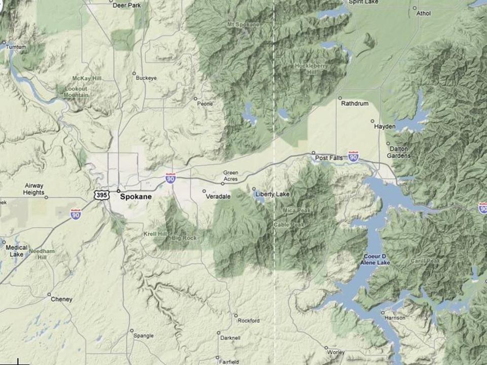
96 Spokane The metropolitan center of the Inland Northwest 2 nd largest city in Washington Great Northern railroad reached Spokane in 1892 and made the region a transportation hub Expo 74
97

98
99 Outlook Incredible growth Populations both young and old Severe water problems
The United States & Canada. A Regional Study of Anglo America
 A Regional Study of Anglo America Landform Regions of the United States & Canada world leaders in agricultural and industrial production because of... VAST LANDS stretch from the Atlantic Ocean on the
Unit 1: Geography. For additional information, refer to this website: 1 G e o g r a p h y
 Unit 1: Geography For additional information, refer to this website: http://mryoungtms.weebly.com/ 1 G e o g r a p h y Continents and Oceans SOL USI. 2a Essential Understanding: Continents are large land
6/25/2018. Upcoming Classes After Today. Our Only Presentation Day: Monday, July 2
 Upcoming Classes After Today Tuesday (June 26): Pacific Northwest and the Northlands Wednesday (June 27): Geographic Literacy in America; Take-Home Midterm Exam #2 distributed and discussed Thursday (June
Basin & Range / Mojave Desert
 Basin & Range / Mojave Desert Basin & Range vs. Great Basin 1 2/20/2016 An overview of the last horst Basin and Range / Mojave Desert Summary: Granitic, volcanic, marine sedimentary, non marine sedimentary,
11/14/2017. Key City Focus: Phoenix
 Semester Project Reminder Semester Project presentations begin on Monday, November 20 (and continue on Monday, November 27 and Wednesday, November 27). See the presentation schedule posted online for your
GEOGRAPHY OF THE UNITED STATES & CANADA. By Brett Lucas
 GEOGRAPHY OF THE UNITED STATES & CANADA By Brett Lucas THE APPALACHIANS & THE OZARKS Setting the Boundaries What states and provinces are part of the region? Eastern TN, western NC, eastern KY, western
Guided Reading Activity
 Guided Reading Activity Lesson 1 Physical Features Essential Question: How does geography influence the way people live? A Vast Land Directions: Read the lesson and use your text to decide whether each
discussion of North America s physical features, including its landforms and bodies of
 Chapter 7 Natural Environments of North America Chapter 7 focuses on the natural environments of North America. The chapter opens with a discussion of North America s physical features, including its landforms
GEOGRAPHY OF THE WEST
 GEOGRAPHY OF THE WEST ROCKIES TO THE PACIFIC The Rocky Mountains run through North America from north to south. They mark the end of the Midwest and the beginning of the West. MOUNTAINS AND MORE The Rocky
Grade 7 History Mr. Norton
 Grade 7 History Mr. Norton Section 1: Thinking Geographically Section 2: Land and Climates of the United States Section 3: The Tools of History Section 4: Economics and Other Social Sciences Grade 7 History
Physical Geography of the United States and Canada Chapter 5 A Land of Contrasts
 Physical Geography of the United States and Canada Chapter 5 A Land of Contrasts Land Area Together the U.S. and Canada cover more than 7 million square miles. In total area, Canada ranks 2 nd and the
Natural Texas. Regions and Climates
 Natural Texas Regions and Climates Two Kinds: Physical geography Climate, vegetation, rivers, lakes, oceans, plateaus, plains, and mountain ranges Human geography Economic activities How we earn a living
Chapter 6, Part Colonizers arriving in North America found extremely landscapes. It looked different to region showing great.
 Social Studies 9 Unit 1 Worksheet Chapter 6, Part 1. 1. Colonizers arriving in North America found extremely landscapes. It looked different to region showing great. 2. The Earth is years old and is composed
!! The Rio Grande River starts at the Rocky Mountains in Colorado. This River is 1,885 miles long!
 The Southwest Region By Taylor Noble and Kaiya Leismer Land and water The southwest region covers a lot of land but the Southwest region has lowest amount of states in any other region. In the Southwest
COOLING DRYING 19 4 CT WT CT AR. mean global temperature levels of aridity latitudinal stratification have all changed appreciably
 as we have seen. BIOMES are the biota's adaptive response to earth's climate zones but climate too has a history - - it has evolved through time mean global temperature levels of aridity latitudinal stratification
Arizona Climate Summary February 2012
 Arizona Climate Summary February 2012 Summary of conditions for January 2012 January 2012 Temperature and Precipitation Summary January 1 st 20 th : The New Year has started on a very dry note. The La
California: Land and People Lesson 1: Locating California
 California: Land and People Lesson 1: Locating California Hemisphere One half of the earth or another sphere Video on Hemispheres click here Relative location Where a place is compared to one or more other
Map directions are broken down into 2 main types; Cardinal Directions and Intermediate Directions SW S
 ELEMENTS OF MAPS COMPASS ROSE AND DIRECTIONS When reading a map it s always important to know your directions. The Compass Rose is the tool to help you do that. Map directions are broken down into 2 main
Topography of the conterminous United States
 Topography of the conterminous United States Potential Natural Vegetation Geology Coastal Ranges physiographic province Cascade-Sierra Mountains Cascades Mount Hood California central valley Sierra-Nevada
Movement of the Earth s Crust: Formation of: Mountain s Plateau's and Dome s
 Movement of the Earth s Crust: Formation of: Mountain s Plateau's and Dome s References Information taken from several places including Prentice Hall Earth Science: @ http://www.eram.k12.ny.us/education/components/docmgr/default.php?sectiondetaili
Unit 2. United States Physical Geography
 Unit 2 United States Physical Geography Physical Geography U.S. extends from the Atlantic to Pacific U.S. is the 3rd largest country U.S. has fertile soils, vast forests, and variety of minerals All major
LATITUDE. Latitude lines run to, but are measured & The 0 of latitude that circles the earth is called the?
 LATITUDE Latitude lines run to, but are measured & The 0 of latitude that circles the earth is called the? LATITUDE 0 0 Latitude lines run east to west, but are measured north & south The 0 of latitude
Arizona Climate Summary February 2016 Summary of conditions for January 2016
 January 2016 Temperature and Precipitation Summary Arizona Climate Summary February 2016 Summary of conditions for January 2016 January 1 st 14 th : The new year began with high pressure over the southwest
a) Piedmont: e) Monument: f) Plateau: g) Mesa: h) Butte: i) Playa: j) Perennial Stream:
 Piedmont: e) Monument: f) Plateau: g) Mesa: h) Butte: i) Playa: j) Perennial Stream:") Name: Lab day: Tuesday Wednesday CEEES/SC 10110L-20110L Planet Earth Laboratory Laboratory #11: Arid Environments & Landforms Readings: See handout at http://www.nd.edu/~cneal/physicalgeo/lab-deserts/index.html.
Name: Lab day: Tuesday Wednesday CEEES/SC 10110L-20110L Planet Earth Laboratory Laboratory #11: Arid Environments & Landforms Readings: See handout at http://www.nd.edu/~cneal/physicalgeo/lab-deserts/index.html.
[ 1.2 ] Texas Geography
![[ 1.2 ] Texas Geography](/thumbs/78/78091378.jpg "[ 1.2 ] Texas Geography") [ 1.2 ] Texas Geography [ 1.2 ] Texas Geography Learning Objectives Identify how geography helps people understand and organize information about a place. Compare the physical and human characteristics
[ 1.2 ] Texas Geography [ 1.2 ] Texas Geography Learning Objectives Identify how geography helps people understand and organize information about a place. Compare the physical and human characteristics
Variability Across Space
 Variability and Vulnerability of Western US Snowpack Potential impacts of Climactic Change Mark Losleben, Kurt Chowanski Mountain Research Station, University of Colorado Introduction The Western United
Chapter 1: America s Land Lesson 1: Land and Climate
 Chapter 1: America s Land Lesson 1: Land and Climate Geography: Describe landforms and other physical features of the United States. Geography: Explain how and why climate varies throughout the United
Upper Owyhee Watershed Assessment
 * Owyhee Watershed Council and Scientific Ecological Services The upper Owyhee subbasin is located in parts of three states: the southeastern corner of Oregon, the southwestern corner of Idaho, and north
Elementary Social Studies Content Area Assessment Task. Winter 2010 EDUC 203
 1 Elementary Social Studies Content Area Assessment Task Winter 2010 EDUC 203 Students: Fourth grade class in Watsonville, CA. Approximately 90% Latino, primarily of Mexicandescent. About 80% participate
Instructor: Joe Mason 207 Science Hall Office Hours: 1-2PM, Wednesday; 11:00AM-12 Noon, Thursday; or by appointment.
 Geography 344. The American West. Spring 2015. Instructor: Joe Mason 207 Science Hall mason@geography.wisc.edu Office Hours: 1-2PM, Wednesday; 11:00AM-12 Noon, Thursday; or by appointment. Introduction
Arizona Climate Summary October 2012
 Arizona Climate Summary October 2012 Summary of conditions for September 2012 September 2012 Temperature and Precipitation Summary September 1 st 14 th : September began with an upper level low pressure
ELEMENTS OF BASIC WORLD GEOGRAPHY TABLE OF CONTENTS UNIT 1 THE BASICS OF GEOGRAPHY AND NORTH AMERICA
 TABLE OF CONTENTS UNIT 1 THE BASICS OF GEOGRAPHY AND NORTH AMERICA IMPORTANT WORDS TO KNOW... 1 CHAPTER 1 THE BASICS OF GEOGRAPHY GEOGRAPHY... 2 TOOLS OF GEOGRAPHY... 3 EARTH...4 SEASONS, CLIMATE, AND
Laboratory Exercise #4 Geologic Surface Processes in Dry Lands
 Page - 1 Laboratory Exercise #4 Geologic Surface Processes in Dry Lands Section A Overview of Lands with Dry Climates The definition of a dry climate is tied to an understanding of the hydrologic cycle
Weather and Climate Summary and Forecast Winter
 Weather and Climate Summary and Forecast Winter 2016-17 Gregory V. Jones Southern Oregon University February 7, 2017 What a difference from last year at this time. Temperatures in January and February
Unit 1: Geography CLASS WEBSITE: QUIZLET GAMES: ONLINE RESOURCES
 Unit 1: Geography ONLINE RESOURCES CLASS WEBSITE: HTTPS://MRYOUNGTMS.WEEBLY.COM/GEOGRAPHY.HTML QUIZLET GAMES: HTTPS://QUIZLET.COM/JOIN/MSFYY94T5 1 G e o g r a p h y Continents and Oceans The Seven Continents
TOPOGRAPHIC RELIEF MAP of NYS. LANDFORMS of NYS. Landforms. Creation of NYS Landforms 9/22/2011
 TOPOGRAPHIC RELIEF MAP of NYS LANDFORMS of NYS Prof. Anthony Grande AFG 2011 Landforms The basis of present-day landforms (surface features) is the bedrock geology that has been worked on by the forces
Weather and Climate Summary and Forecast March 2018 Report
 Weather and Climate Summary and Forecast March 2018 Report Gregory V. Jones Linfield College March 7, 2018 Summary: The ridge pattern that brought drier and warmer conditions from December through most
5th social studies geography (5thsocstud_geography)
") Name: Date: 1. Many of the Native Americans who lived on the Great Plains were nomadic people. Why did they move from place to place? A. They were finding new areas to mine. B. They were looking for fertile
Name: Date: 1. Many of the Native Americans who lived on the Great Plains were nomadic people. Why did they move from place to place? A. They were finding new areas to mine. B. They were looking for fertile
Meteorology. Circle the letter that corresponds to the correct answer
 Chapter 3 Worksheet 1 Meteorology Name: Circle the letter that corresponds to the correct answer 1) If the maximum temperature for a particular day is 26 C and the minimum temperature is 14 C, the daily
CANADA S LANDFORM REGIONS
 CANADA S LANDFORM REGIONS Canada s Regions Canada is divided into Eight major regions. A Region is an area that is defined on the basis of the presence or absence of certain characteristics: Age of rock
Weather and Climate of the Rogue Valley By Gregory V. Jones, Ph.D., Southern Oregon University
 Weather and Climate of the Rogue Valley By Gregory V. Jones, Ph.D., Southern Oregon University The Rogue Valley region is one of many intermountain valley areas along the west coast of the United States.
2. PHYSICAL SETTING FINAL GROUNDWATER MANAGEMENT PLAN. 2.1 Topography. 2.2 Climate
 FINAL GROUNDWATER MANAGEMENT PLAN 2. PHYSICAL SETTING Lassen County is a topographically diverse area at the confluence of the Cascade Range, Modoc Plateau, Sierra Nevada and Basin and Range geologic provinces.
What is the largest country in the world? Russia
 What is the largest country in the world? #1 Russia CSCOPE 2007 2 Russia Dimensions #2-3 Spans 11 Time Zones From East to West: Gulf of Finland to Alaska From North to South: Above the Arctic Circle to
TYPES OF GOVERNMENTS
 While the terms country, state, and nation are often used interchangeably, there is a difference. A State (note the capital "S") is a self-governing political entity. The term State can be used interchangeably
ACCUMULATED PRECIPITATION IN INCHES
 4 3 CUMULATIVE PRECIPITATION WATER YEAR 7 COLUMBIA BASIN ABOVE GRAND COULEE 18% of Normal 1971- Average ACCUMULATED PRECIPITATION IN INCHES 1 3 1 4 3 1 8 6 4 94% of Normal 17% of Normal 118% of Normal
ACCUMULATED PRECIPITATION IN INCHES
 CUMULATIVE PRECIPITATION WATER YEAR COLUMBIA BASIN ABOVE GRAND COULEE 84% of Normal 1971- Average ACCUMULATED PRECIPITATION IN INCHES 8 6 82% of Normal 85% of Normal 82% of Normal SNAKE RIVER BASIN ABOVE
Monthly Long Range Weather Commentary Issued: February 15, 2015 Steven A. Root, CCM, President/CEO
 Monthly Long Range Weather Commentary Issued: February 15, 2015 Steven A. Root, CCM, President/CEO sroot@weatherbank.com JANUARY 2015 Climate Highlights The Month in Review During January, the average
Lecture Outlines PowerPoint. Chapter 12 Earth Science 11e Tarbuck/Lutgens
 Lecture Outlines PowerPoint Chapter 12 Earth Science 11e Tarbuck/Lutgens 2006 Pearson Prentice Hall This work is protected by United States copyright laws and is provided solely for the use of instructors
Monthly Long Range Weather Commentary Issued: APRIL 18, 2017 Steven A. Root, CCM, Chief Analytics Officer, Sr. VP,
 Monthly Long Range Weather Commentary Issued: APRIL 18, 2017 Steven A. Root, CCM, Chief Analytics Officer, Sr. VP, sroot@weatherbank.com MARCH 2017 Climate Highlights The Month in Review The average contiguous
Arizona Climate Summary May 2012
 Arizona Climate Summary May 2012 Summary of conditions for April 2012 April 2012 Temperature and Precipitation Summary April 1 st 16 th : Although April began with another low pressure system sweeping
Section Reference: Defining The North American Realm and Its Population Clusters Population Clusters
 Package Title: Testbank Course Title: The World Today 7e Chapter Number: Chapter 01 Question type: Multiple-Choice 1) The two leading languages spoken in Canada are: a) English and Spanish b) English and
The Mississippi, Missouri, and Ohio Rivers
 The Mississippi, Missouri, and Ohio Rivers Mississippi River Mississippi River begins at Lake Itasca in northwest Minnesota and runs 2,320 miles to the Gulf of Mexico approx. 90 days for a drop of rain
Terrain Units PALEOGEOGRAPHY: LANDFORM CREATION. Present Geology of NYS. Detailed Geologic Map of NYS
 NYS TOPOGRAPHY Why so? PALEOGEOGRAPHY: LANDFORM CREATION Prof. Anthony Grande AFG 014 Present Geology of NYS Detailed Geologic Map of NYS Generalized Geology Detailed Geology Hot links to the fold out
PHYSIOGRAPHIC REGIONS OF THE LOWER 48 UNITED STATES
 PHYSIOGRAPHIC REGIONS OF THE LOWER 48 UNITED STATES LAURENTIAN UPLAND 1. Superior Upland ATLANTIC PLAIN 2. Continental Shelf (not on map) 3. Coastal Plain a. Embayed section b. Sea Island section c. Floridian
Earth s Layers. Earth s Surface
 CHAPTER 1 LESSON 3 Earth s Layers Earth s Surface Key Concepts What are Earth s major landforms and how do they compare? What are the major landform regions of the United States? What do you think? Read
Kiwanis International
 Page 1 of 7 Southwest 02 Division 2 K0003A Albuquerque NM 86 87 1.16 +1 K04781 Aztec NM 4 4 0.00 K14177 Bloomfield NM 4 4 0.00 K08906 Coronado, Albuquerque NM 11 11 0.00 K17384 Corrales NM 39 40 2.56 +1
Weather and Climate Summary and Forecast February 2018 Report
 Weather and Climate Summary and Forecast February 2018 Report Gregory V. Jones Linfield College February 5, 2018 Summary: For the majority of the month of January the persistent ridge of high pressure
High School World History Cycle 2 Week 2 Lifework
 Name: Advisory: Period: High School World History Cycle 2 Week 2 Lifework This packet is due Monday, November 7 Complete and turn in on Friday for 10 points of EXTRA CREDIT! Lifework Assignment Complete
Integrated Science I: Locating earthquake epicenters. Name Per Date
 Integrated Science I: Locating earthquake epicenters. Name Per Date Whenever a significant earthquake occurs somewhere in the world, news media present reports about two issues; the size or magnitude of
4th Grade Social Studies First Nine Weeks
 4th Grade Social Studies First Nine Weeks Multiple Choice Identify the choice that best completes the statement or answers the question. 1 Name the mountains that are located in the eastern United States.
Arizona Climate Summary November 2015 Summary of conditions for October 2015
 October 2015 Temperature and Precipitation Summary Arizona Climate Summary November 2015 Summary of conditions for October 2015 October 1 st 14 th : October began with high pressure over the southwest,
Weather and Climate Summary and Forecast Winter
 Weather and Climate Summary and Forecast Winter 2016-17 Gregory V. Jones Southern Oregon University December 5, 2016 Well after an October that felt more like November, we just finished a November that
Regional Geography C. LANGDON WHITE. Professor Emeritus Stanford University EDWIN J. FOSCUE TOM L. MCKNIGHT
 Regional Geography of Anglo-America Sixth Edition C. LANGDON WHITE Professor Emeritus Stanford University EDWIN J. FOSCUE Late of Southern Methodist University TOM L. MCKNIGHT Professor of Geography University
Arizona Climate Summary February 2018 Summary of conditions for January 2018
 Arizona Climate Summary February 2018 Summary of conditions for January 2018 January 2018 Temperature and Precipitation Summary January 1 st 19 th : The new year began with a ridge of high pressure over
Groundwater Resources of the Las Cruces/Doña Ana County Region
 Groundwater Resources of the Las Cruces/Doña Ana County Region Presentation to Lower Rio Grande Water Users Organization Water Symposium June 6, 2007 Las Cruces, NM by Bobby J. Creel, PhD New Mexico Water
Arizona Climate Summary January 2017 Summary of conditions for December 2016
 Arizona Climate Summary January 2017 Summary of conditions for December 2016 December 2016 Temperature and Precipitation Summary December 1 st 15 th : Similar to November, December began with a dry trough
Vocabulary. geography. landform. plateau. climate. equator. Lesson Main Ideas What do they think about? What questions do they ask?
 Grade 5 U.S. History Chapter 1: America's Land Lesson 1: Land and Climate Objectives 1. Geography: Describe landforms and other physical features of the United States. 2. Geography: Explain how and why
What is a landform? These shapes (except for bodies of water) on the earth s surface are all examples of landforms.
 on the earth s surface are all examples of landforms.") Landforms What is a landform? These shapes (except for bodies of water) on the earth s surface are all examples of landforms. archipelago a large group of many islands. The Hawaiian Islands Lighthouse
Landforms What is a landform? These shapes (except for bodies of water) on the earth s surface are all examples of landforms. archipelago a large group of many islands. The Hawaiian Islands Lighthouse
National Wildland Significant Fire Potential Outlook
 National Wildland Significant Fire Potential Outlook National Interagency Fire Center Predictive Services Issued: April 1, 2008 Next Issue: May 1, 2008 Wildland Fire Outlook April 2008 through July 2008
Late Tertiary Volcanism. North Washington. Other Andesite Volcanoes. Southern Washington. High Cascades. High Cascades. Mid-Miocene Miocene to present
 Miocene to Present Late Tertiary Volcanism Mid-Miocene Miocene to present Reading: DNAG volume G3, Ch. 7 High Cascade Range Columbia River Snake River Plain Basin and Range Southwestern California Sierra
Arizona Climate Summary
 April 2016 Temperature and Precipitation Summary Arizona Climate Summary May 2016 Summary of conditions for April 2016 April 1 st 15 th : April 1 st saw the tail end of a low pressure system move out of
Arizona Climate Summary May 2018 Summary of conditions for April 2018
 April 2018 Temperature and Precipitation Summary Arizona Climate Summary May 2018 Summary of conditions for April 2018 April 1 st 16 th : April was a very dry month across Arizona. Several low pressure
Continental Landscapes
 Continental Landscapes Landscape influenced by tectonics, climate & differential weathering Most landforms developed within the last 2 million years System moves toward an equilibrium Continental Landscapes
LANDFORMS of NYS. Landforms. Exercise 4 9/13/2012. TOPOGRAPHIC RELIEF MAP of NYS. Physiographic map of NYS and vicinity showing Surface Features
 TOPOGRAPHIC RELIEF MAP of NYS LANDFORMS of NYS Prof. Anthony Grande AFG 2012 Landforms REMINDER: The basis of present-day landforms (surface features) is the bedrock geology that has been worked on by
March 1, 2003 Western Snowpack Conditions and Water Supply Forecasts
 Natural Resources Conservation Service National Water and Climate Center 101 SW Main Street, Suite 1600 Portland, OR 97204-3224 Date: March 17, 2003 Subject: March 1, 2003 Western Snowpack Conditions and
HI SUMMER WORK
 HI-201 2018-2019 SUMMER WORK This packet belongs to: Dear Dual Enrollment Student, May 7 th, 2018 Dual Enrollment United States History is a challenging adventure. Though the year holds countless hours
Objectives. Understand the different physical & human characteristics of each region
 TEXAS REGIONS Objectives Know the 4 regions of Texas Understand the different physical & human characteristics of each region Understand how physical differences affect human characteristics (way of life)
The Climate of Oregon Climate Zone 3 Southwest Interior
 .k) 105 Unbound issue " " 1 4oes not circulate C4P. Special Report 915 May 1993 The Climate of Oregon Climate Zone 3 Southwest Interior Property of OREGON STATE UNIVERSITY Library Serials Corvallis, OR
State Geography Due: Tuesday, October 24, 2017
 State Geography Due: Tuesday, October 24, 2017 Step 1: You will first go online to http://www.timeanddate.com/worldclock/distance.html. Click on calculators and from the drop down menu, click on distance
The Little Colorado River
 The Little Colorado River The Little Colorado River Junction of the Little Colorado River and the Colorado Grand Falls of the Little Colorado River The relief/topo map at the right shows the junction of
Landforms in Canada. Canada is made up of three dis;nct types of landforms: Canadian Shield Highlands Lowlands
 Canada s Landforms What is a Landform? A landform is any physical feature of the Earth s surface having a characteris;c, recognizable shape, produced by natural causes. Landforms include major features
Physiographic Provinces (West, Ch. 13)
") Geology 229 Engineering Geology Lecture 13 Physiographic Provinces (West, Ch. 13) The definition of the term Physiography Physiography (n.) The science which treats of the earth's exterior physical features,
Geology 229 Engineering Geology Lecture 13 Physiographic Provinces (West, Ch. 13) The definition of the term Physiography Physiography (n.) The science which treats of the earth's exterior physical features,
Changes in Texas Ecoregions
 Comment On Lesson Changes in Texas Ecoregions The state of Texas can be divided into 10 distinct areas based on unique combinations of vegetation, topography, landforms, wildlife, soil, rock, climate,
Directed Reading. Section: How Mountains Form MOUNTAIN RANGES AND SYSTEMS. Skills Worksheet
 Skills Worksheet Directed Reading Section: How Mountains Form 1. How high is Mount Everest? a. about 1980 km above sea level b. more than 8 km below sea level c. more than 8 km above sea level d. more
Colorado CoCoRaHS. Colorado CoCoRaHS. Because Every Drop Counts! November 2014 Volume 2, Issue 11
 U.S. PRECIPITATION (% OF AVERAGE) LOOKING BACK AT OCTOBER 2014 October was a fairly dry month for much of the nation with the exception of the Pacific Northwest, portions of New England and the Tennessee
Arizona Climate Summary
 May 2015 Temperature and Precipitation Summary Arizona Climate Summary June 2015 Summary of conditions for May 2015 May 1 st 14 th : May began with high pressure in the west, and May 1 st was dry statewide,
Social Studies. Chapter 2 Canada s Physical Landscape
 Social Studies Chapter 2 Canada s Physical Landscape Introduction Canada s geography its landforms and climate - has a great impact on Canadians sense of identity. Planet Earth The earth is divided into
Tropical Moist Rainforest
 Tropical or Lowlatitude Climates: Controlled by equatorial tropical air masses Tropical Moist Rainforest Rainfall is heavy in all months - more than 250 cm. (100 in.). Common temperatures of 27 C (80 F)
Sierra Weather and Climate Update
 Sierra Weather and Climate Update 2014-15 Kelly Redmond Western Regional Climate Center Desert Research Institute Reno Nevada Yosemite Hydroclimate Workshop Yosemite Valley, 2015 October 8-9 Percent of
Office of the Washington State Climatologist
 Office of the Washington State Climatologist May 3, 2013 April Event Summary Average April temperatures were below normal for a majority of the state. Total precipitation was above normal for western and
MARS AREA SCHOOL DISTRICT CURRICULUM GRADE: Grade 4
 MARS AREA SCHOOL DISTRICT CURRICULUM GRADE: Grade 4 Course Title: Social Studies Brief Description Overview: Students will explore the history, geography, government, and economy of the United States with
MET Lecture 20 Mountain Snowstorms (CH16)
") MET 4300 Lecture 20 Mountain Snowstorms (CH16) Learning Objectives Provide an overview of the importance and impacts of mountain snowstorms in the western US Describe how topography influence precipitation
MET 4300 Lecture 20 Mountain Snowstorms (CH16) Learning Objectives Provide an overview of the importance and impacts of mountain snowstorms in the western US Describe how topography influence precipitation
Changes to Land 5.7B. landforms: features on the surface of Earth such as mountains, hills, dunes, oceans and rivers
 All the landforms on Earth have changed over time and continue to change. Many of the changes were caused by wind, moving water, and moving ice. Mountains have grown and shrunk. Rivers have cut away land
Explain the impact of location, climate, natural resources, and population distribution on Europe. a. Compare how the location, climate, and natural
 SS6G10 Explain the impact of location, climate, natural resources, and population distribution on Europe. a. Compare how the location, climate, and natural resources of Germany, the United Kingdom and
Weather and Climate Summary and Forecast October 2018 Report
 Weather and Climate Summary and Forecast October 2018 Report Gregory V. Jones Linfield College October 4, 2018 Summary: Much of Washington, Oregon, coastal California and the Bay Area and delta region
How does erosion happen?
 How does erosion happen? By National Geographic, adapted by Newsela staff on 10.03.17 Word Count 682 Level 830L These rock formations, in Bryce Canyon National Park, Utah, are called hoodoos. Although
Grade Five Social Studies Assessment Regions/Native Americans
 Name Grade Five Social Studies Assessment Regions/Native Americans Use the map below to answer questions 1 and 2 1. (Geo 1) For this location give the name of the city found there. 38 N, 100 W a. Scottsbluff
Passwords. Social Studies Vocabulary. Texas: Grade 7
 Passwords Social Studies Vocabulary Texas: Grade 7 To the Student What is federalism? How are independence and interdependence different? What does an anthropologist do? Passwords: Social Studies Vocabulary
Gravel Transport Can Determine Late Flood Tectonics
 Chapter 23 Gravel Transport Can Determine Late Flood Tectonics The locations of all the quartzite gravel in the northwest states and adjacent Canada provide more information about the Flood than just reinforcing
(version 3) I. HumAN -Environment Interaction
 I. HumAN -Environment Interaction") (version 3) I. HumAN -Environment Interaction A. Landforms 1. Earth s topography is made up of many different types of landforms. 2. While the planet is covered primarily with water, the four major types
(version 3) I. HumAN -Environment Interaction A. Landforms 1. Earth s topography is made up of many different types of landforms. 2. While the planet is covered primarily with water, the four major types