California: Land and People Lesson 1: Locating California
|
|
|
- Rebecca Alexandra Stevenson
- 5 years ago
- Views:
Transcription

1 California: Land and People Lesson 1: Locating California

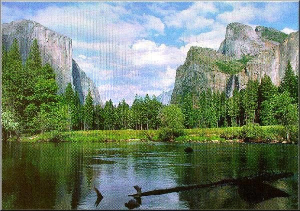
2 Hemisphere One half of the earth or another sphere
3 Video on Hemispheres click here


4 Relative location Where a place is compared to one or more other places on earth.

5 Region An area with common features that set it apart from other areas.


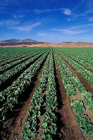
6 Geographers People who study geography
7 Environment The surroundings in which people, plants or animals live.


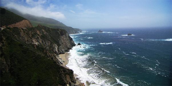
8 Coast The land next to an ocean
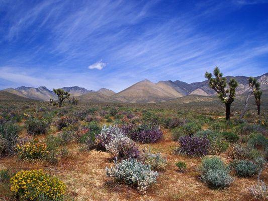
9 Mountain Range A chain of mountains. Mt. Shasta (Cascade Range) Sierra Nevada Mountain Range


10 Plain A large area of nearly flat land

11 What is the global address of California? California, United States, North America, Western Hemisphere, (Earth, Solar System, Universe) Click here to see our place in the universe!

12 How many states are in the Western region of the United States? Six. California, Oregon, Washington, Nevada, Alaska, and Hawaii. Which states border the state of California? Oregon, Nevada, and Arizona.


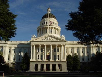
13 What are some of the geographic features of the West? Snowy mountains, green valleys, hot deserts, and the Pacific Coast.


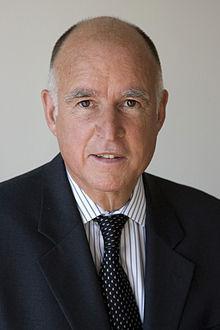
14 List two mountain ranges in California. The Cascade Range and Sierra Nevada Sierra Nevada Mountain Range Mt. Shasta (Cascade Range)

15 What do lines of latitude measure? Lines of latitude measure how far north or south a place is from the equator. What is another name for lines of latitude? Parallels.

16 What do lines of longitude measure? Lines of longitude measure how far east or west a place is from the Prime Meridian. What is another name for lines of longitude? Meridians Prime Meridian Click here to hear a song about latitude and longitude!


17 What is California s: State Flower: California Poppy State Bird: California Quail State Tree: California Redwood State Nickname: The Golden State State Motto: Eureka! (I have found it!) I have found it!

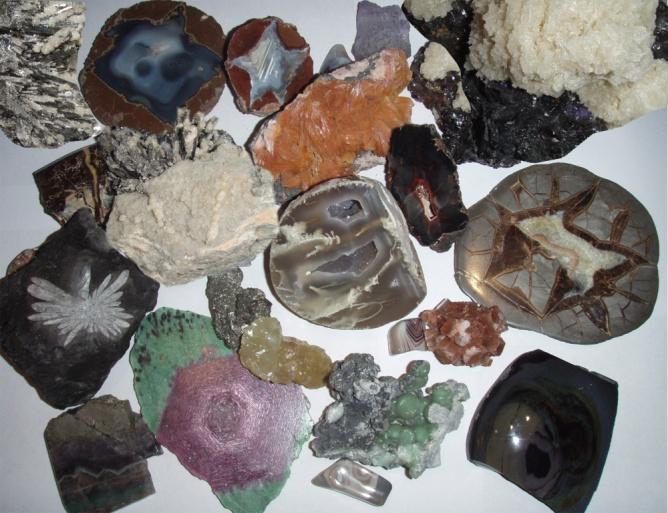
18 What animal is on California s state flag? The California Grizzly Bear

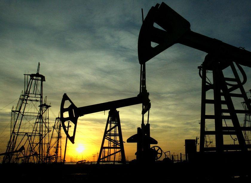
19 What ocean is California next to? The Pacific Ocean


20 What is the capital of California? Sacramento


21 Who is the Governor of California? Jerry Brown

22 California: Land and People Lesson 2: California's Resources


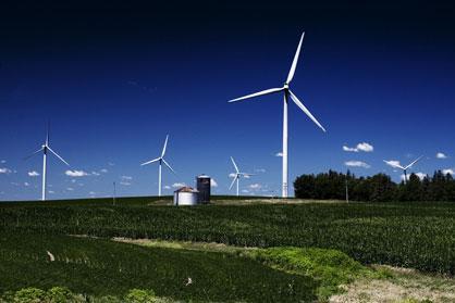
23 Natural Resource Something found in the environment that people can use.


24 Nonrenewable resource Something that cannot be replaced, such as a fuel or mineral.


25 Mineral Something found in the earth that is not a plant or an animal.


26 Petroleum Commonly called oil, it is formed into gasoline, kerosene, or oil for heating buildings.


27 Renewable resource Something that can be replaced.


28 Conservation The protection and wise use of forests, rivers, and other natural resources.


29 Recycle To use something over again, instead of throwing it away.


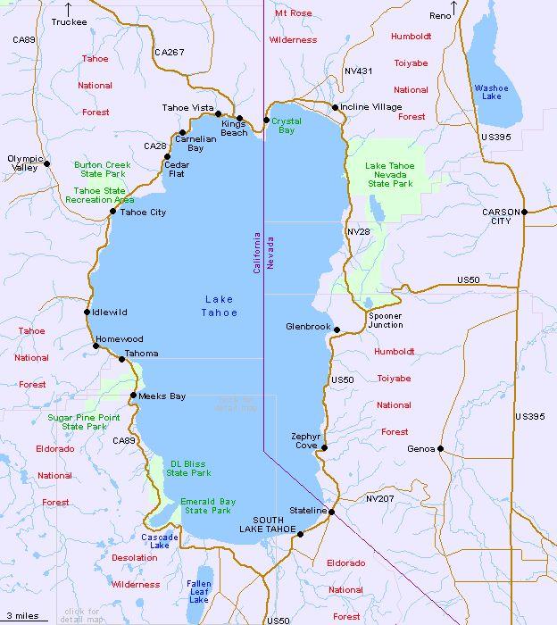
30 Alternative energy Energy, from sources other than coal, gas, or oil, that does not pollute.
31 Brainpop! On Natural Resources Username: 73.5 Pass: 8300


32 Where does geothermal power come from? Hot water or steam from underground.

33 Why is it important to recycle? To protect natural resources! Name three ways energy is produced in California. Oil power plants Natural gas power plants Geothermal power plants Wind farms What are three ways you can help protect our environment? Reduce Reuse Recycle!

34 Which National Parks are located in the Sierra Nevada mountains? *Yosemite National Park Kings Canyon National Park Sequoia National Park

35 Name the largest earthquake fault in California The San Andreas Fault

36 How many people live in California? Over 38 million people!

37 Name a large lake that is on the California-Nevada border Lake Tahoe

38 Name a California dairy product that is often advertised on TV Milk (cheese, yogurt, ice cream )

39 What are piers in California made from? Piers in California are generally made from wood and concrete. What pier is the longest in the state? Santa Cruz Municipal Wharf. 2,745 feet in length. Built in Wooden - Longest wooden pier in CA

40 What famous amusement park is located in Anaheim? In what year did it open? Disneyland is located in Anaheim. It opened in 1955.

41 California: Land and People Lesson 3: California's Climate


42 Elevation How high a place is above the ocean, or the earth s surface.

43 Sea Level The level of the surface of the sea, an elevation of zero.
44 Climate The pattern of weather of a certain place over many years.

45 Precipitation The moisture that falls to the ground as rain, snow, sleet, or hail.

46 Rain Shadow The side of a mountain that is usually dry because precipitation falls on the other side.
47 What causes temperatures to vary in California? Elevation and distances from the equator cause temperatures to vary in California. Why do the clouds lose their moisture as they travel over the Sierra Nevada Mountains? The moisture turns to snow or ice and drops from the clouds.

48 What is a drought? A long period with very little rain. What part of California has the wettest climate? The northern coast and parts of the Sierra Nevada.
49 What causes low precipitation in Death Valley? Death Valley is in the rain shadow. By the time clouds reach Death Valley, they have lost most of their moisture. How does the Pacific Ocean affect climate in California? The ocean warms the air in the winter and cools it in the summer.

50 California: Land and People Lesson 4: One Land, Many People

51 Culture A way of life a group of people share. Diverse Great difference, variety Immigrant A person who comes to a new country to live.
52 Refugee Someone who flees unsafe conditions in his or her homeland Ethnic Group A group of people whose ancestors come from the same country or area and/or who share the same culture. Heritage Something handed down from earlier generations or from the past; tradition.
53 What are some reasons people come to California? People come to California: Seeking freedom and a better way of life To find work As refugees Why is it important to celebrate a culture s heritage? To learn more about people s traditions and to keep their history alive. How can we learn about the cultures of California? You can attend the cultural festivals held throughout the year.

54 What makes California so rich in different cultures? Many people have come here from other lands and brought their cultural traditions with them. For example: Latin Music BrainPOP Which city in California has the most people? Los Angeles
Elementary Social Studies Content Area Assessment Task. Winter 2010 EDUC 203
 1 Elementary Social Studies Content Area Assessment Task Winter 2010 EDUC 203 Students: Fourth grade class in Watsonville, CA. Approximately 90% Latino, primarily of Mexicandescent. About 80% participate
4th Grade Social Studies First Nine Weeks
 4th Grade Social Studies First Nine Weeks Multiple Choice Identify the choice that best completes the statement or answers the question. 1 Name the mountains that are located in the eastern United States.
Five Themes of Geography Project Ms. Kiesel, Per 5. The United States of America
 Five Themes of Geography Project Ms. Kiesel, Per 5 The United States of America Location Absolute Location : The USA is located in the continent of North America in the northern and western hemispheres.
About places and/or important events Landmarks Maps How the land is, hills or flat or mountain range Connected to maps World Different countries
 What do you think you know about geography? About places and/or important events Landmarks Maps How the land is, hills or flat or mountain range Connected to maps World Different countries What do you
Chapter 1: America s Land Lesson 1: Land and Climate
 Chapter 1: America s Land Lesson 1: Land and Climate Geography: Describe landforms and other physical features of the United States. Geography: Explain how and why climate varies throughout the United
Unit 2. United States Physical Geography
 Unit 2 United States Physical Geography Physical Geography U.S. extends from the Atlantic to Pacific U.S. is the 3rd largest country U.S. has fertile soils, vast forests, and variety of minerals All major
Guided Reading Activity
 Guided Reading Activity Lesson 1 Physical Features Essential Question: How does geography influence the way people live? A Vast Land Directions: Read the lesson and use your text to decide whether each
4th Grade US Regional Geography First Nine Weeks
 4th Grade US Regional Geography First Nine Weeks 2014-2015 Identify the choice that best completes the statement or answers the question. 1 The line identified as 0 runs west and east on the globe and
Fig Major air masses of the world
 Fig. 9.3 Major air masses of the world CLASSIFICATION FOUR BASIC CATEGORIES OF AIR MASSES: POLAR - P ARCTIC - A TROPICAL - T EQUATORIAL - E TWO DESIGNATIONS OF SURFACE IN SOURCE REGION MARITIME - m. CONTINENTAL
Unit 1: Basics of Geography Test Review
 Name Date Period Unit 1: Basics of Geography Test Review Directions: Reading the following sections and complete the questions, charts, and diagrams. Types of Maps Maps that have a particular theme are
Physical Geography of the United States and Canada Chapter 5 A Land of Contrasts
 Physical Geography of the United States and Canada Chapter 5 A Land of Contrasts Land Area Together the U.S. and Canada cover more than 7 million square miles. In total area, Canada ranks 2 nd and the
Extreme Weather. Extreme weather has always been a part of Utah
 Climate Notes Extreme Weather Extreme weather has always been a part of Utah Floods Severe storms Wind 1920 Lehi hail storm killed birds and chickens 1971 Farmington wind storm Climate vs. Weather Climate:
Chapter 1 Section 2. Land, Water, and Climate
 Chapter 1 Section 2 Land, Water, and Climate Vocabulary 1. Landforms- natural features of the Earth s land surface 2. Elevation- height above sea level 3. Relief- changes in height 4. Core- most inner
5th social studies geography (5thsocstud_geography)
") Name: Date: 1. Many of the Native Americans who lived on the Great Plains were nomadic people. Why did they move from place to place? A. They were finding new areas to mine. B. They were looking for fertile
Name: Date: 1. Many of the Native Americans who lived on the Great Plains were nomadic people. Why did they move from place to place? A. They were finding new areas to mine. B. They were looking for fertile
Chapter 3 Packet. and causes seasons Earth tilted at 23.5 / 365 1/4 days = one year or revolution
 Name Chapter 3 Packet Sequence Section 1 Seasons and Weather : and causes seasons Earth tilted at 23.5 / 365 1/4 days = one year or revolution solstice - begins summer in N. hemisphere, longest day winter
Grade 7 History Mr. Norton
 Grade 7 History Mr. Norton Section 1: Thinking Geographically Section 2: Land and Climates of the United States Section 3: The Tools of History Section 4: Economics and Other Social Sciences Grade 7 History
discussion of North America s physical features, including its landforms and bodies of
 Chapter 7 Natural Environments of North America Chapter 7 focuses on the natural environments of North America. The chapter opens with a discussion of North America s physical features, including its landforms
Contents. Section 1: Climate Factors. Section 2: Climate Types. Section 3: Climate Effects
 Contents Section 1: Climate Factors 1. Weather or Climate?.... 2 2. Elements of Climate.... 4 3. Factors Affecting Climate.... 10 4. Comparing Climates.... 15 5. Quiz 1.... 20 Section 2: Climate Types
Chapter 2 Planet Earth
 Chapter 2 Planet Earth Section Notes Earth and the Sun s Energy Water on Earth The Land Close-up The Water Cycle World Almanac Major Eruptions in the Ring of Fire Quick Facts Chapter 2 Visual Summary Video
1 What Is Climate? TAKE A LOOK 2. Explain Why do areas near the equator tend to have high temperatures?
 CHAPTER 17 1 What Is Climate? SECTION Climate BEFORE YOU READ After you read this section, you should be able to answer these questions: What is climate? What factors affect climate? How do climates differ
Bellringer. A Wonderful Home. Our Planet Earth
 A Wonderful Home Earth is a wonderful home for living organisms. A great variety of organisms live here. They benefit from abundant water, a thick atmosphere, and Earth s suitable distance from the Sun.
(version 3) I. HumAN -Environment Interaction
 I. HumAN -Environment Interaction") (version 3) I. HumAN -Environment Interaction A. Landforms 1. Earth s topography is made up of many different types of landforms. 2. While the planet is covered primarily with water, the four major types
(version 3) I. HumAN -Environment Interaction A. Landforms 1. Earth s topography is made up of many different types of landforms. 2. While the planet is covered primarily with water, the four major types
State Geography Due: Tuesday, October 24, 2017
 State Geography Due: Tuesday, October 24, 2017 Step 1: You will first go online to http://www.timeanddate.com/worldclock/distance.html. Click on calculators and from the drop down menu, click on distance
Why Geography Matters
 Why Geography Matters Vocabulary words geography relative location absolute location physical feature human feature region modify adapt cause effect geography: The study of the Earth s physical and human
ANSWERS TO EXAMPLE ASSIGNMENT (For illustration only)
") ANSWERS TO EXAMPLE ASSIGNMENT (For illustration only) In the following answer to the Example Assignment, it should be emphasized that often there may be no right answer to a given question. Data are usually
ANSWERS TO EXAMPLE ASSIGNMENT (For illustration only) In the following answer to the Example Assignment, it should be emphasized that often there may be no right answer to a given question. Data are usually
Vocabulary. geography. landform. plateau. climate. equator. Lesson Main Ideas What do they think about? What questions do they ask?
 Grade 5 U.S. History Chapter 1: America's Land Lesson 1: Land and Climate Objectives 1. Geography: Describe landforms and other physical features of the United States. 2. Geography: Explain how and why
The United States & Canada. A Regional Study of Anglo America
 A Regional Study of Anglo America Landform Regions of the United States & Canada world leaders in agricultural and industrial production because of... VAST LANDS stretch from the Atlantic Ocean on the
INTERNATIONAL INDIAN SCHOOL, RIYADH HALF YEARLY
 INTERNATIONAL INDIAN SCHOOL, RIYADH HALF YEARLY 2018-19 STD V Fill in the blanks: WORKSHEET LESSON - 1 KNOW YOUR PLANET SOCIAL STUDIES 1 A book containing maps is called an _ 2 A Flemish map maker, collection
World Geography Chapter 3
 World Geography Chapter 3 Section 1 A. Introduction a. Weather b. Climate c. Both weather and climate are influenced by i. direct sunlight. ii. iii. iv. the features of the earth s surface. B. The Greenhouse
Name Date Class. a. High elevation and high relief b. High elevation and level surface c. Flat land and low relief
 Exploring Earth s Surface (pp. 21 27) This section describes factors that determine the shape of Earth s land surface. The section also describes how scientists divide Earth into four spheres. Use Target
[ 1.2 ] Texas Geography
![[ 1.2 ] Texas Geography](/thumbs/78/78091378.jpg "[ 1.2 ] Texas Geography") [ 1.2 ] Texas Geography [ 1.2 ] Texas Geography Learning Objectives Identify how geography helps people understand and organize information about a place. Compare the physical and human characteristics
[ 1.2 ] Texas Geography [ 1.2 ] Texas Geography Learning Objectives Identify how geography helps people understand and organize information about a place. Compare the physical and human characteristics
The Five Themes of Geography
 The Five Themes of Geography The Five Themes of Geography Main Idea: Geographers use the Five Themes of Geography to help them study the Earth. The Five Themes of Geography Geography and You: Suppose a
Name Class Date. 2. What is the average weather condition in an area over a long period of time called? a. winter b. temperature c. climate d.
 Skills Worksheet Directed Reading B Section: What Is Climate? CLIMATE VS. WEATHER 1. What kind of conditions vary from day to day? a. climate b. weather c. latitude d. biome 2. What is the average weather
Unit 1: Geography. For additional information, refer to this website: 1 G e o g r a p h y
 Unit 1: Geography For additional information, refer to this website: http://mryoungtms.weebly.com/ 1 G e o g r a p h y Continents and Oceans SOL USI. 2a Essential Understanding: Continents are large land
Lesson- 6 WEATHER AND CLIMATE
 Lesson- 6 WEATHER AND CLIMATE New Words 1. Heat Zones:- the division of the earth according to the climate. 2. Frigid:- the zone that is the coldest 3. Temperate:- the zone that is neither too hot nor
The Geography Curriculum at Coston Primary
 The Geography Curriculum at Coston Primary Years Year 1 Year 2 Summer We are learning about where food is farmed and in The physical features of farms. The human features of farms. The characteristics
netw rks Guided Reading Activity Essential Question: How does geography influence the way people live? Earth's Physical Geography
 Guided Reading Activity Lesson 1 Earth and the Sun Essential Question: How does geography influence the way people live? Looking at Earth Directions: What are the layers that make up Earth? Use your textbook
Chapter 2: Physical Geography
 Chapter 2: Physical Geography Pg. 39-68 Learning Goals for Chp2: q q q q q Explain how the Earth moves in space and why seasons change. Outline the factors that influence climate and recognize different
Grade Five Social Studies Assessment Regions/Native Americans
 Name Grade Five Social Studies Assessment Regions/Native Americans Use the map below to answer questions 1 and 2 1. (Geo 1) For this location give the name of the city found there. 38 N, 100 W a. Scottsbluff
1 What Is Climate? TAKE A LOOK 2. Explain Why do areas near the equator tend to have high temperatures?
 CHAPTER 17 1 What Is Climate? SECTION Climate BEFORE YOU READ After you read this section, you should be able to answer these questions: What is climate? What factors affect climate? How do climates differ
Chapter 2 Geography Study Guide
 Chapter 2 Geography Study Guide Multiple Choice Identify the letter of the choice that best completes the statement or answers the question. 1. What is the largest and deepest ocean? a. the Indian Ocean
The Variety of Maps By ReadWorks
 The Variety of Maps By ReadWorks Maps are known for helping us figure out how to get to a certain location: which road do I take to the ice-cream parlor? How do I get from my house to my best friend s?
HOW GEOGRAPHY AND GEOLOGY AFFECT BIOLOGICAL DIVERSITY
 HOW GEOGRAPHY AND GEOLOGY AFFECT BIOLOGICAL DIVERSITY Factors Affecting Extinction Rates Natural Factors Climate change Cataclysmic event (volcano, earthquake) Human Activities Habitat Loss/Fragmentation
GEOGRAPHY OF THE WEST
 GEOGRAPHY OF THE WEST ROCKIES TO THE PACIFIC The Rocky Mountains run through North America from north to south. They mark the end of the Midwest and the beginning of the West. MOUNTAINS AND MORE The Rocky
How Geographers View the World: Human Geography. ESSENTIAL QUESTION: How does geography influence the way people live?
 How Geographers View the World: Human Geography ESSENTIAL QUESTION: How does geography influence the way people live? Geographers Think Spatially Gefffffdgfhfjgjp Guiding Question: What does it mean to
Five Themes of Geography. By PresenterMed
 Five Themes of Geography By PresenterMed Geography Geography: the study of the Earth Where are things located? Why are they there? Location Location: where a place is Cardinal Directions: North, South,
Module 11: Meteorology Topic 3 Content: Climate Zones Notes
 Introduction Latitude is such an important climate factor that you can make generalizations about a location's climate based on its latitude. Areas near the equator or the low latitudes are generally hot
student pretest Stewardship Project middle school (Grades 7-8)
") student pretest Stewardship Project middle school (Grades 7-8) 1. True or False. Solar energy is radiant energy carried through the sun s heat and light. 2. Yes or No. Does solar energy dissipate as it
student pretest Stewardship Project middle school (Grades 7-8) 1. True or False. Solar energy is radiant energy carried through the sun s heat and light. 2. Yes or No. Does solar energy dissipate as it
APPENDIX V VALLEYWIDE REPORT
 APPENDIX V VALLEYWIDE REPORT Page Intentionally Left Blank 1.2 San Joaquin Valley Profile Geography The San Joaquin Valley is the southern portion of the Great Central Valley of California (Exhibit 1-1).
Weather and Climate Summary and Forecast March 2018 Report
 Weather and Climate Summary and Forecast March 2018 Report Gregory V. Jones Linfield College March 7, 2018 Summary: The ridge pattern that brought drier and warmer conditions from December through most
Earth Science Review.notebook. April 12, Landforms or Not. Wind, Water, Ice Erosion
 Landforms or Not Wind, Water, Ice Erosion 1 Wave Erosion Wave Deposition Landform Questions 2 Sort the resources Nonrenewable Resources Renewable Resources Alternative Energy Resources natural plants air
8th Geography Pre-Test
 Quiz Preview Go back Student's Name appears here Course Name appears here QuizStar 8th Geography Pre-Test Quiz Directions Choose the BEST answer for each question. Directions: 1. Answer the questions below
Multiple Choice Identify the choice that best completes the statement or answers the question.
 CH.15 practice TEST Multiple Choice Identify the choice that best completes the statement or answers the question. 1) The short-term state of the atmosphere is called a) climate. c) water cycle. b) weather.
Exploring Geography. Chapter 1
 Exploring Geography Chapter 1 The Study of Geography Geography is the study of where people, places, and things are located and how they relate to each other. Greek meaning writing about or describing
Natural Disasters and Storms in Philadelphia. What is a storm? When cold, dry air meets warm, moist (wet) air, there is a storm.
 air, there is a storm.") Natural Disasters and Storms in Philadelphia 1. What is a natural disaster? 2. Does Philadelphia have many natural disasters? o Nature (noun) everything in the world not made No. Philadelphia does not
Natural Disasters and Storms in Philadelphia 1. What is a natural disaster? 2. Does Philadelphia have many natural disasters? o Nature (noun) everything in the world not made No. Philadelphia does not
Over the course of this unit, you have learned about different
 70 People and Weather TA L K I N G I T O V E R Over the course of this unit, you have learned about different aspects of earth s weather and atmosphere. Atmospheric scientists, climatologists, hydrologists,
Unit 1 Basic Geographical Concepts and Themes of Geography
 Unit 1 Basic Geographical Concepts and Themes of Geography Physical: Mount Everest Political: Nepalese Sherpa What is Geography? -Geography, simply put, is the study of the Earth s surface. This includes
3) What is the difference between latitude and longitude and what is their affect on local and world weather and climate?
 What is the difference between latitude and longitude and what is their affect on local and world weather and climate?") www.discoveryeducation.com 1) Describe the difference between climate and weather citing an example of each. Describe how water (ocean, lake, river) has a local effect on weather and climate and provide
www.discoveryeducation.com 1) Describe the difference between climate and weather citing an example of each. Describe how water (ocean, lake, river) has a local effect on weather and climate and provide
Chapter 21 Southwest Asia: Harsh & Arid Lands
 Name Hour Chapter 21 Southwest Asia: Harsh & Arid Lands Essential Question: How has the physical geography of Asia influenced the development of these regions (i.e. history, population distribution, &
Weather: Air Patterns
 Weather: Air Patterns Weather: Air Patterns Weather results from global patterns in the atmosphere interacting with local conditions. You have probably experienced seasonal shifts, such as winter in New
CH. 3: Climate and Vegetation
 CH. 3: Climate and Vegetation GROUP WORK RUBRIC Score of 50 (5): Superior - 100% A 5 is superior work, and has completed all requirements of the assignments, it is in order and its presentation is almost
Name Date Class. well as the inland, found near the Tropics. 4. In the, or the regions near the Equator, you may find a lush
 WATER, CLIMATE, AND VEGETATION Vocabulary Activity DIRECTIONS: Fill in the Blanks Select a term from below to complete each of the following sentences. CHAPTER 1. The constant movement of water, a process
GUIDED READING CHAPTER 1: THE LAY OF THE LAND (Page 1)
") CHAPTER 1: THE LAY OF THE LAND (Page 1) Section 1 The Tidewater Region Directions: Use the information from pages 6-11 to complete the following statements. 1. In the southern part of the coast, the Tidewater
CHAPTER 1: THE LAY OF THE LAND (Page 1) Section 1 The Tidewater Region Directions: Use the information from pages 6-11 to complete the following statements. 1. In the southern part of the coast, the Tidewater
The Variety of Maps By ReadWorks
 The Variety of Maps By ReadWorks Maps are known for helping us figure out how to get to a certain location: which road do I take to the ice-cream parlor? How do I get from my house to my best friend s?
2 Georgia: Its Heritage and Its Promise
 TERMS region, erosion, fault, elevation, Fall Line, aquifer, marsh, climate, weather, precipitation, drought, tornado, hurricane, wetland, estuary, barrier island, swamp PLACES Appalachian Mountains, Appalachian
2 Mapping Earth Reading Essentials. 2. Contrast What is the difference between a map view and a profile view?
 Mapping Earth Maps What do you think? Read the three statements below and decide whether you agree or disagree with them. Place an A in the Before column if you agree with the statement or a D if you disagree.
forest tropical jungle swamp marsh prairie savanna pampas Different Ecosystems (rainforest)
") Different Ecosystems forest A region of land that is covered with many trees and shrubs. tropical jungle (rainforest) swamp A region with dense trees and a variety of plant life. It has a tropical climate.
Different Ecosystems forest A region of land that is covered with many trees and shrubs. tropical jungle (rainforest) swamp A region with dense trees and a variety of plant life. It has a tropical climate.
Barlows Primary School Geography Curriculum Content Key Stage 1 and
 Geography Curriculum Content Key Stage 1 and 2 2017-2018 Curriculum Content Year 1 The content for Year 1 is detailed below: WHAT ARE SEASONS? WHAT SIT LIKE WHERE WE LIVE? WHERE DO DIFFERENT ANIMALS LIVE?
Chapter 6, Part Colonizers arriving in North America found extremely landscapes. It looked different to region showing great.
 Social Studies 9 Unit 1 Worksheet Chapter 6, Part 1. 1. Colonizers arriving in North America found extremely landscapes. It looked different to region showing great. 2. The Earth is years old and is composed
MARS AREA SCHOOL DISTRICT CURRICULUM GRADE: Grade 4
 MARS AREA SCHOOL DISTRICT CURRICULUM GRADE: Grade 4 Course Title: Social Studies Brief Description Overview: Students will explore the history, geography, government, and economy of the United States with
God Gives Us Spring and Rain
 Lesson 8 God Gives Us Spring and Rain Vocabulary equator: an imaginary circle around the center of the earth halfway between the North Pole and South Pole water cycle: the cycle that occurs when water
Bell Work. REVIEW: Our Planet Earth Page 29 Document A & B Questions
 9.12.16 Bell Work REVIEW: Our Planet Earth Page 29 Document A & B Questions Intro to Climate & Weather https://www.youtube.com/watch?v=vhgyoa70q7y Weather vs. Climate Video Climate & Weather 3.1 Weather
Climate Classification Chapter 7
 Climate Classification Chapter 7 Climate Systems Earth is extremely diverse No two places exactly the same Similarities between places allow grouping into regions Climates influence ecosystems Why do we
Iceland. 1. Warm up. A. Talk about the picture and read the essay. B. Discuss the questions about the essay.
 1. Warm up A. Talk about the picture and read the essay. Iceland My country, Iceland, is one of the most beautiful countries on Earth. It is an island country. It is located in Europe, in the North Atlantic
Weather and Climate Summary and Forecast November 2017 Report
 Weather and Climate Summary and Forecast November 2017 Report Gregory V. Jones Linfield College November 7, 2017 Summary: October was relatively cool and wet north, while warm and very dry south. Dry conditions
Weather and Climate in Canada. October 2 nd, 2017
 Weather and Climate in Canada October 2 nd, 2017 Big Ideas How are climate and weather in Canada influenced by geography? How do weather and climate affect the lives of Canadians? Weather and Climate
New National Curriculum Geography Skills Planning KS1
 New National Curriculum Geography Skills Planning KS1 Enquiry Question Objective-essential knowledge skills or understanding Locational Knowledge Standards /Success Criteria Lesson progression over half
EQ: Discuss main geographic landforms of the U.S. & Canada and examine varied landforms in relation to their lifestyles.
 EQ: Discuss main geographic landforms of the U.S. & Canada and examine varied landforms in relation to their lifestyles. Places & Terms for Discussion Appalachian Mountains Great Plains Canadian Shield
Social Studies. Chapter 2 Canada s Physical Landscape
 Social Studies Chapter 2 Canada s Physical Landscape Introduction Canada s geography its landforms and climate - has a great impact on Canadians sense of identity. Planet Earth The earth is divided into
What is the largest country in the world? Russia
 What is the largest country in the world? #1 Russia CSCOPE 2007 2 Russia Dimensions #2-3 Spans 11 Time Zones From East to West: Gulf of Finland to Alaska From North to South: Above the Arctic Circle to
Natural Texas. Regions and Climates
 Natural Texas Regions and Climates Two Kinds: Physical geography Climate, vegetation, rivers, lakes, oceans, plateaus, plains, and mountain ranges Human geography Economic activities How we earn a living
CHAPTER 1: EXPLORING GEOGRAPHY
 CHAPTER 1: EXPLORING GEOGRAPHY Please Do Now: In your PDN section of your binder answer the following with one or two sentences: What is Geography? What is Geography? The study of where people, places,
V Q \ = 5a?WZTL 156 Unit 6
 156 Unit 6 It is large and almost round. The colors are blue and brown. There are also swirls of white. It even glows at night. What a wonderful sight! What is it? I will learn to talk about physical features
Word Cards. 2 map. 1 geographic representation. a description or portrayal of the Earth or parts of the Earth. a visual representation of an area
 Name: Date: Hour: Word Cards 1 geographic representation a description or portrayal of the Earth or parts of the Earth Example: A map is a representation of an actual location or place. 2 map a visual
Read Across America. Listen as I read for facts about Volcanoes. In the Shadow of the Volcano
 Read Across America Listen as I read for facts about Volcanoes. In the Shadow of the Volcano Constructive & Destructive Processes Earth s surface is always changing. Blowing wind and flowing water causes
Explain the impact of location, climate, natural resources, and population distribution on Europe. a. Compare how the location, climate, and natural
 SS6G10 Explain the impact of location, climate, natural resources, and population distribution on Europe. a. Compare how the location, climate, and natural resources of Germany, the United Kingdom and
Adopt a Drifter Lesson Plan by Mary Cook, Middle School Science Teacher, Ahlf Jr. High School, Searcy, Arkansas
 Adopt a Drifter Lesson Plan by Mary Cook, Middle School Science Teacher, Ahlf Jr. High School, Searcy, Arkansas Do Ocean Surface Currents Influence Climate? Objectives Students will construct climographs
DEPARTMENT OF GEOSCIENCES SAN FRANCISCO STATE UNIVERSITY. Metr Fall 2012 Test #1 200 pts. Part I. Surface Chart Interpretation.
 DEPARTMENT OF GEOSCIENCES SAN FRANCISCO STATE UNIVERSITY NAME Metr 356.01 Fall 2012 Test #1 200 pts Part I. Surface Chart Interpretation. Figure 1. Surface Chart for 1500Z 7 September 2007 1 1. Pressure
2nd Grade. Earth's Water. Slide 1 / 111 Slide 2 / 111. Slide 3 / 111. Slide 4 / 111. Slide 5 (Answer) / 111. Slide 5 / 111. Role of Water on Earth
 / 111. Slide 5 / 111. Role of Water on Earth") Slide 1 / 111 Slide 2 / 111 2nd Grade Role of Water on Earth 2015-11-20 www.njctl.org Slide 3 / 111 Slide 4 / 111 Table of Contents: The Role of Water on Earth Earth's Water The Use of Maps Click on the
Slide 1 / 111 Slide 2 / 111 2nd Grade Role of Water on Earth 2015-11-20 www.njctl.org Slide 3 / 111 Slide 4 / 111 Table of Contents: The Role of Water on Earth Earth's Water The Use of Maps Click on the
Weather and Climate Summary and Forecast Winter
 Weather and Climate Summary and Forecast Winter 2016-17 Gregory V. Jones Southern Oregon University February 7, 2017 What a difference from last year at this time. Temperatures in January and February
The map shows ocean currents in the northern Atlantic Ocean. Which location most likely has the warmest climate?
 6 th Grade Final Exam Study Guide 1. Use the map below to answer this question. The map shows ocean currents in the northern Atlantic Ocean. Which location most likely has the warmest climate? 2. Daylight
A. Spatial Sense (Working with Maps, Globes, and Other Geographic Tools)
") A. Spatial Sense (Working with Maps, Globes, and Other Geographic Tools) Measuring Distance Using Map Scale All maps are drawn to scale; that is, they are smaller than the things they represent. Scale
A. Spatial Sense (Working with Maps, Globes, and Other Geographic Tools) Measuring Distance Using Map Scale All maps are drawn to scale; that is, they are smaller than the things they represent. Scale
LAB 19. Lab 19. Differences in Regional Climate: Why Do Two Cities Located at the Same Latitude and Near a Body of Water Have Such Different Climates?
 Lab Handout Lab 19. Differences in Regional Climate: Why Do Two Cities Located at the Same Latitude and Near a Body of Water Have Such Different Climates? Introduction Weather describes the current atmospheric
Unit 1: Geography GeoTrekkers in the Western Hemisphere. Illustrated Glossary
 Unit 1: Geography GeoTrekkers in the Western Hemisphere Illustrated Glossary adapt to change in order to fit new condi/ons archipelago a group or chain of islands clustered together in a sea or ocean bodies
Global Weather Trade Winds etc.notebook February 17, 2017
 Global Weather 1 north pole northern hemisphere equator southern hemisphere south pole 2 We have seasons because of the Earth's tilt The seasons are opposite in the northern and southern hemispheres winter
Tropical Moist Rainforest
 Tropical or Lowlatitude Climates: Controlled by equatorial tropical air masses Tropical Moist Rainforest Rainfall is heavy in all months - more than 250 cm. (100 in.). Common temperatures of 27 C (80 F)
Ta b l e o f C o n t e n t s
 Ta b l e o f C o n t e n t s Introduction..................................................................3 How to Use This Book.........................................................4 Standards Information.........................................................6
Thursday, April 27, 17
 Thursday, April 27, 17 Geography of Southeast Asia Objec-ve: Understand the geographical differences between the mainland region and the insular region of Southeast Asia. Do Now: What is the capital of
TO GO TO ANY OF THE PAGES LISTED BELOW, CLICK ON ITS TITLE
 TO GO TO ANY OF THE PAGES LISTED BELOW, CLICK ON ITS TITLE CHAPTER 6 Plate Tectonics 1 6-1 What is continental drift? 2 6-2 Why is the seafloor spreading? 3 6-3 What evidence supports seafloor spreading?
Biosphere. All living things, plants, animals, (even you!) are part of the zone of the earth called the biosphere.
 are part of the zone of the earth called the biosphere.") Unit 1 Study Guide Earth s Spheres Biosphere All living things, plants, animals, (even you!) are part of the zone of the earth called the biosphere. Hydrosphere Water covers ¾ of the earth, made up mostly
Unit 1 Study Guide Earth s Spheres Biosphere All living things, plants, animals, (even you!) are part of the zone of the earth called the biosphere. Hydrosphere Water covers ¾ of the earth, made up mostly