Karst found mostly in limestone (rock with at least 50% carbonate minerals), depends on 1) permeability & porosity
|
|
|
- Valentine Farmer
- 5 years ago
- Views:
Transcription
1 KARST LANDFORMS produced by weathering & erosion in regions of carbonate rocks and evaporites processes called karstification mainly below ground surface predominantly underground drainage poorly-developed surface network of streams occurs everywhere, but most common in temperate & tropical climates; in US, occurs in PA, MD, central Florida, east-central Missouri, belt from south-central Indiana to east-central Kentucky, Edwards Plateau in Texas, NM (karst terms listed in text)
2 Karst found mostly in limestone (rock with at least 50% carbonate minerals), depends on 1) permeability & porosity increase permeability & porosity = increase solution = increase karst 2) secondary porosity along fractures, joints, faults, etc 3) bedding thickness: massive-bedded limestone is better for karst than thin-bedded limestone, where insoluble materials concentrate along bedding planes & restrict water flow 4) available relief: height above baselevel should be enough to permit free circulation of water in system Warm, wet = ideal for karst because chemical reactions occur faster at higher temperatures, & lush vegetation & microbe activity give tropical soil water a high partial pressure of CO 2 [P CO2 ]
3 Solution process: CO 2 dissolved in water reacts to form weak carbonic acid (H 2 CO 3 ): CO 2 + H 2 O H 2 CO 3 amount of CO 2 dissolved in water is function of P CO2 & water temperature CO 2 increases as P CO2 increases & T water decreases CaCO 3 + H 2 O + CO 2 Ca HCO 3 - Karst is related to groundwater
4 GROUNDWATER PROFILE zone of aeration: pore spaces occupied by air & water capillary fringe: all pore spaces are occupied by water held in tension, so the water won t drain freely phreatic zone: water drains freely because hydrostatic pressure exceeds atmospheric pressure water table: hydrostatic pressure = atmospheric pressure The movement of groundwater is controlled by the amount of potential energy, which is a function of pressure & elevation above datum, and porosity (% of rock s volume taken up by void spaces measure of rock s ability to hold water) / permeability (measure of capability of rocks to transmit fluid size and connectedness of voids)
5 Groundwater profile zone of soil moisture zone of aeration (vadose water) water table capillary fringe phreatic zone
6 Groundwater flows from higher to lower potential zones, & perpendicular to equipotential surfaces v, Q are proportional to loss of potential occurring as water moves from one point to another aquifers: lithologic bodies that store & transmit water unconfined: open to atmosphere, & hydrostatic level (level at which water stands in an open hole) is within the waterbearing unit itself confined: water rises above aquifer when aquifer is penetrated; rises to piezometric surface determined by difference in potential at point where precipitation enters aquifer (recharge zone) & position of hole artesian flow: where piezometric level is above ground aquitard: impermeable layer
7 As a well is pumped, a cone of depression develops as the hydrostatic level around the well is lowered With respect to karst, carbonate aquifers are a) diffuse flow: cavities limited in size & number, caves rare, well-defined water table present b) free flow: water moves through integrated conduits under influence of gravity; flow can transport sediment; discharge through springs c) confined flow: water moves in response to pressure Springs in karst areas are 1) exsurgences: from flow in diffuse aquifers; fed by seepage 2) resurgences: fed by groundwater moving through distinct conduits Springs are generally controlled by large structural or stratigraphic features, & in turn control surface topography (eg. n vs s Grand Canyon)

8 regional dip of bedrock


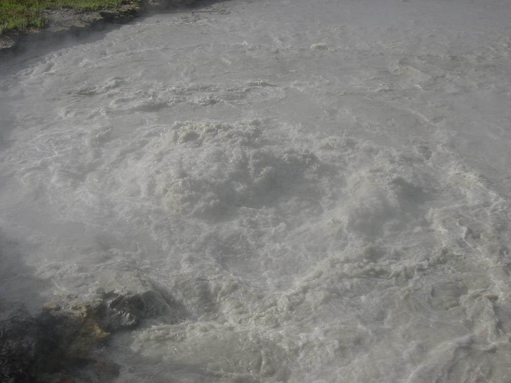
9 karst spring, Glenwood Canyon, CO karst spring, Vasey s Paradise, Grand Canyon, AZ


10 travertine dam, Jemez Creek, New Mexico hot springs travertine, Jemez Creek close-up of travertine along Ribbon Falls, Grand Canyon, AZ


11 tufa formations, Mono Lake, CA travertine dam, Hanging Lake, CO travertine terraces, Havasu Creek, AZ
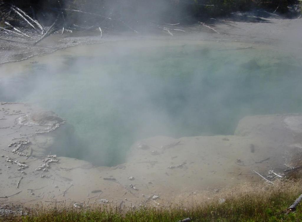
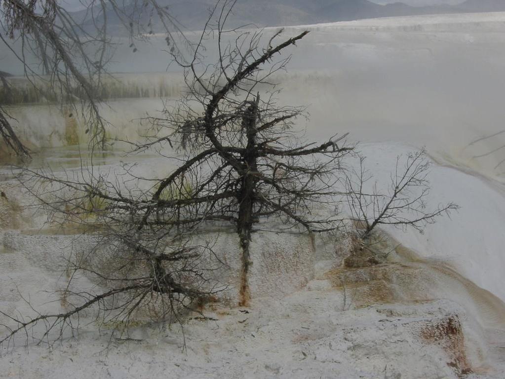
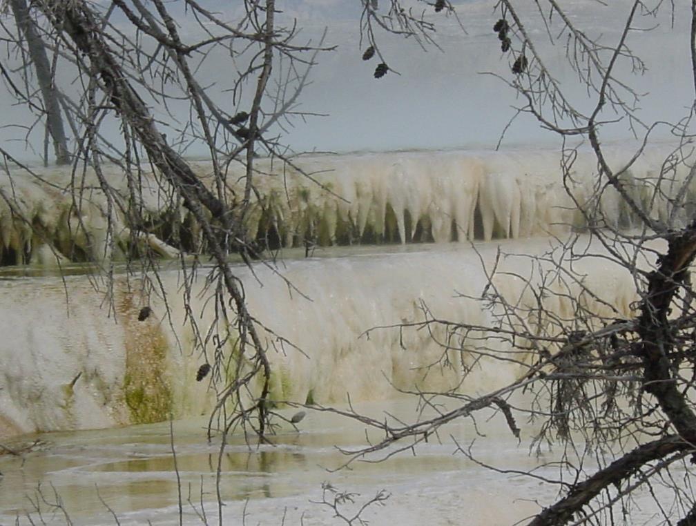
12 travertine formation & hot springs, Yellowstone
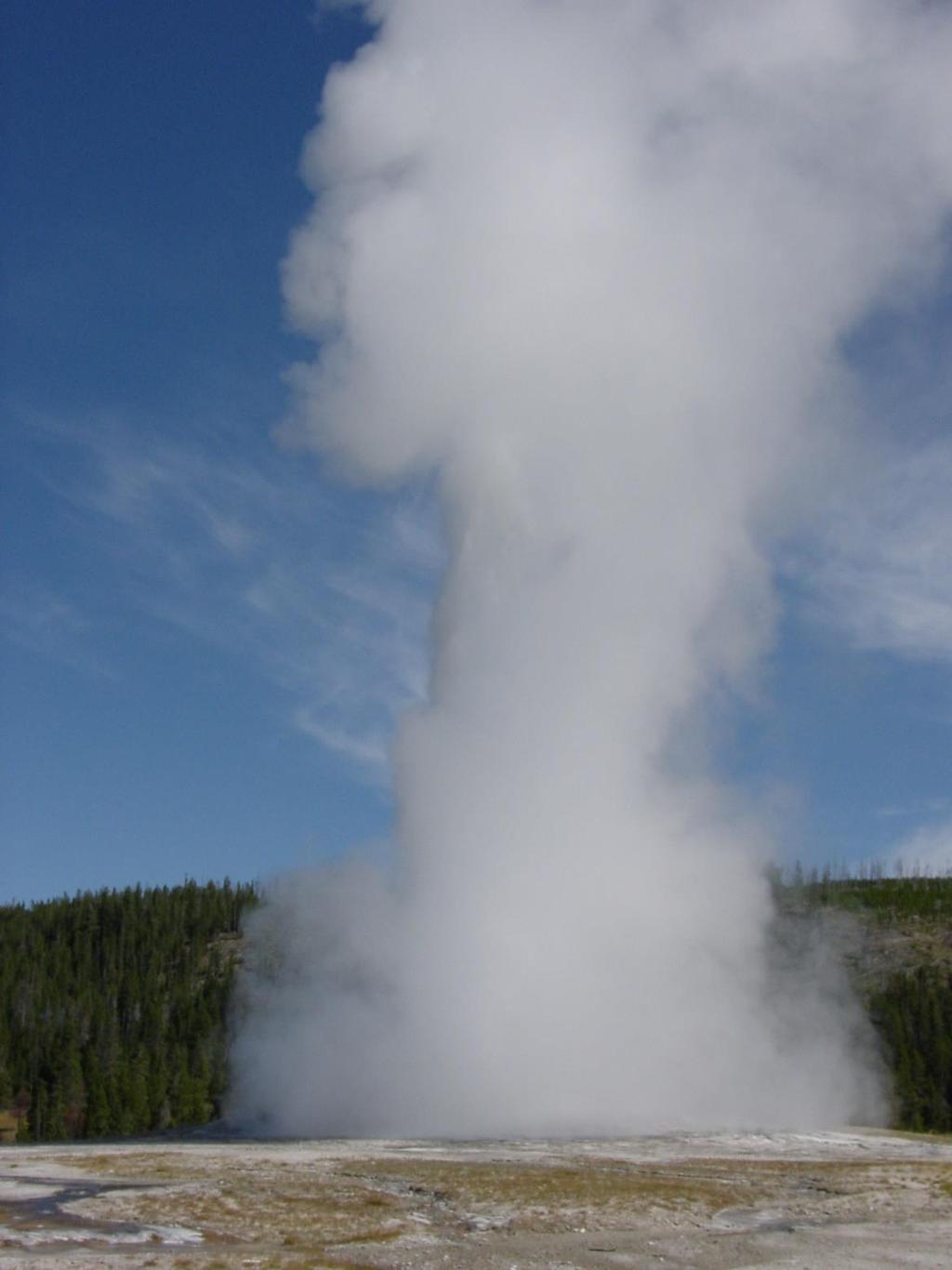
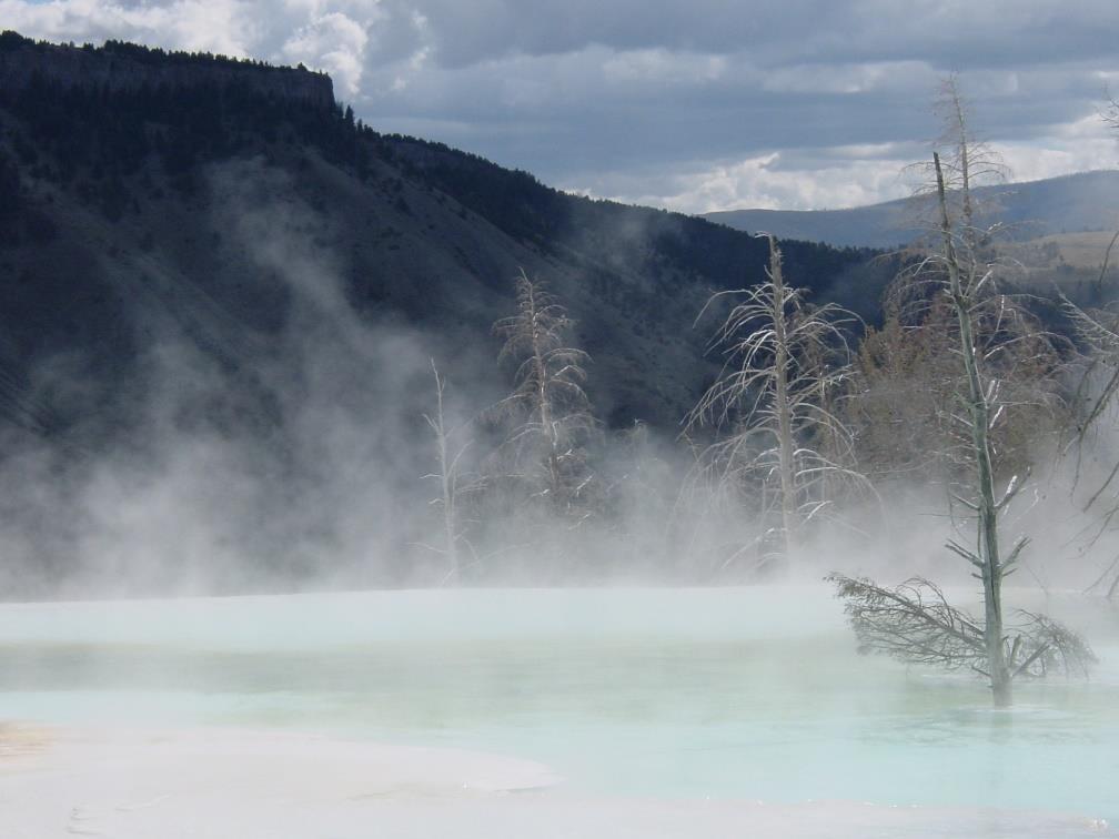
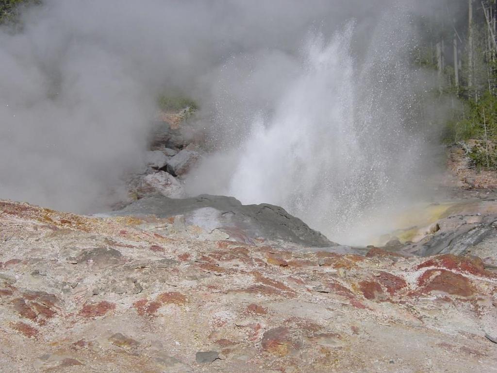
13 travertine formation & geysers, Yellowstone
14 Surficial Landforms 1) Closed depressions dolines/sinks/sinkholes: closed hollow of small or moderate size, wider ( m) than deep (2-100 m), circular or elliptical, usually in groups solutional: water infiltrating into joints & fissures enlarges cracks by solution; function of slope (low is best), lithology & structure (dense, well-jointed limestone is best), & vegetation & soil cover (increase solution) collapse: depressions initiated by solution occurring beneath surface uvalas & poljes: larger than dolines; as dolines enlarge, they coalesce into hollows with undulating floors 2) Karst valleys allogenic valleys: head in impermeable rocks adjacent to karstic area blind valley: valley terminates at cliff face due to sink


15 Chichen Itza, Yucatan cenote (sinkhole) uvala, West Virginia Florida sinkhole
16

17 karst collapse terrain, Yellowstone
 Minor solution features (karren) grooves, pits, flutes, pinnacles, etc of cm to a few m in size dry valley, West")
18 2) Karst valleys (continued) pocket valley: begins where groundwater resurges as springs dry valleys: don t have well-defined water courses, or carry only ephemeral flow when flooding 3) Minor solution features (karren) grooves, pits, flutes, pinnacles, etc of cm to a few m in size dry valley, West Virginia


19 arid-region carbonate weathering patterns, southern AZ

20 Establishment of plants in solutional weathering pits, Big Bend National Park, Texas


21 humid-region carbonate weathering patterns, Niagara Escarpment, Ontario


22 seasonal tropics carbonate weathering patterns (rillenkarren), northwestern Australia
23 Tropical Karst all temperate landforms are present, but the landscape is dominated by residual hills rather than the closed depressions of temperate karst higher temperature, total precipitation, & precipitation intensity produce rapid & prolonged corrosion rapid plant growth & decay combine with extreme microbial activity to supercharge infiltrating water with CO2 and intensify the solution process examples are cone karst, cockpits (depressions around cones), towers, phytokarst (type of karren that develop into spongelike pinnacles under biochemical action of blue-green algae)

24 cockpit & tower karst, Goundong Province, China
25 Jamaica


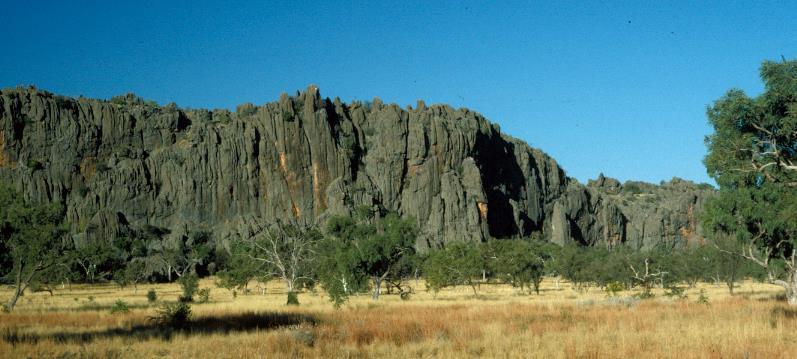
26 small towers, western Australia
 at water table or in shallow phreatic zone, associated with fluctuations of water table Plan view & cross section shapes of cave")
27 Caves: natural underground cavities that include entrances, passages, & rooms Caves form 1) above water table by corrosive action of vadose water 2) beneath water table by deep circulation of phreatic water 3) at water table or in shallow phreatic zone, associated with fluctuations of water table Plan view & cross section shapes of cave passages


28 cave, southern Australia Wind Cave National Park, South Dakota

29 cave, southern Australia
Essentials of Geology, 11e
 Essentials of Geology, 11e Groundwater Chapter 10 Instructor Jennifer Barson Spokane Falls Community College Geology 101 Stanley Hatfield Southwestern Illinois Co Jennifer Cole Northeastern University
6.1 Water. The Water Cycle
 6.1 Water The Water Cycle Water constantly moves among the oceans, the atmosphere, the solid Earth, and the biosphere. This unending circulation of Earth s water supply is the water cycle. The Water Cycle
Prentice Hall EARTH SCIENCE
 Prentice Hall EARTH SCIENCE Tarbuck Lutgens Running Water and Groundwater Running Water The Water Cycle Water constantly moves among the oceans, the atmosphere, the solid Earth, and the biosphere. This
 12 10 8 6 4 2 0 40-50 50-60 60-70 70-80 80-90 90-100 Fresh Water What we will cover The Hydrologic Cycle River systems Floods Groundwater Caves and Karst Topography Hot springs Distribution of water in
Chapter 13. Groundwater
 Chapter 13 Groundwater Introduction Groundwater is all subsurface water that completely fills the pores and other open spaces in rocks, sediments, and soil. Groundwater is responsible for forming beautiful
Lecture Outlines PowerPoint. Chapter 5 Earth Science 11e Tarbuck/Lutgens
 Lecture Outlines PowerPoint Chapter 5 Earth Science 11e Tarbuck/Lutgens 2006 Pearson Prentice Hall This work is protected by United States copyright laws and is provided solely for the use of instructors
WATER ON AND UNDER GROUND. Objectives. The Hydrologic Cycle
 WATER ON AND UNDER GROUND Objectives Define and describe the hydrologic cycle. Identify the basic characteristics of streams. Define drainage basin. Describe how floods occur and what factors may make
Chapter 14: Groundwater. Fig 14.5b
 Chapter 14: Groundwater Fig 14.5b OBJECTIVES Recognize that groundwater is a vital source of accessible freshwater. Describe how groundwater forms below the water table. Explain the origin of aquifers,
STUDY GUIDE FOR CONTENT MASTERY. Movement and Storage of Groundwater
 Groundwater SECTION 10.1 Movement and Storage of Groundwater In your textbook, read about the hydrosphere, precipitation and groundwater, and groundwater storage. Use the following terms to complete the
Chapter 14. Groundwater
 Chapter 14 Groundwater Importance of groundwater! Groundwater is water found in the pores of soil and sediment, plus narrow fractures in bedrock! Groundwater is the largest reservoir of fresh water that
Prof. Stephen A. Nelson EENS 111. Groundwater
 Page 1 of 8 Prof. Stephen A. Nelson EENS 111 Tulane University Physical Geology This page last updated on 20-Oct-2003 is water that exists in the pore spaces and fractures in rock and sediment beneath
What is a water table? What is an aquifer? What is the difference between a spring and a well?
 CHAPTER 11 3 Water Underground SECTION The Flow of Fresh Water BEFORE YOU READ After you read this section, you should be able to answer these questions: What is a water table? What is an aquifer? What
Ground-Water Flow through Porous Medium. GEO 321 Lecture 14 Dr. J. S. Kite. Groundwater, Karst, and Caves
 GEO 321 Lecture 14 Dr. J. S. Kite The Rock Organ Organ Cave, Greenbrier Co., WV Groundwater, Karst, and Caves Soil & Ground Water Distribution Eastern USA Soil Moisture Belt Unsaturated (Aeration) Zone
Groundwater. Earth Chapter 17
 Groundwater Earth Chapter 17 Chapter 17 Groundwater Importance of Groundwater Groundwater is water found in the pores of soil and sediment, plus narrow fractures in bedrock Groundwater and the Hydrosphere
Why Study Groundwater?
 Groundwater Water filling open spaces in rock, sediment, and soil beneath the surface is called groundwater. This natural resource is as important to human endeavors as surface water. Groundwater is an
It usually refers to limestone terrain characteristically. possessing a patchy and thin soil cover, containing many enclosed depressions, and
 Karst Landform karst is terrain in which soluble rocks are altered above and below ground by the dissolving action of water and that bears distinctive characteristics of relief and drainage (Jennings 1971,)
Groundwater. (x 1000 km 3 /y) Oceans Cover >70% of Surface. Groundwater and the. Hydrologic Cycle
 Oceans Cover >70% of Surface. Groundwater and the. Hydrologic Cycle") Chapter 17 Oceans Cover >70% of Surface Groundwater and the Hydrologic Cycle Vasey s Paradise, GCNP Oceans are only 0.025% of Mass Groundwater Groundwater is liquid water that lies in the subsurface in
Chapter 17 Oceans Cover >70% of Surface Groundwater and the Hydrologic Cycle Vasey s Paradise, GCNP Oceans are only 0.025% of Mass Groundwater Groundwater is liquid water that lies in the subsurface in
Karst Landforms. Caverns Sinkholes Disappearing Streams Springs Towers
 Karst Landforms Karst is a term used to describe landscapes that are formed by chemical weathering process controlled by groundwater activity. Karst landscapes are predominantly composed of limestone rock
Groundwater. (x 1000 km 3 /y) Reservoirs. Oceans Cover >70% of Surface. Groundwater and the. Hydrologic Cycle
 Reservoirs. Oceans Cover >70% of Surface. Groundwater and the. Hydrologic Cycle") Chapter 13 Oceans Cover >70% of Surface Groundwater and the Hydrologic Cycle Oceans are only 0.025% of Mass Groundwater Groundwater is liquid water that lies in the subsurface in fractures in rocks and
Chapter 13 Oceans Cover >70% of Surface Groundwater and the Hydrologic Cycle Oceans are only 0.025% of Mass Groundwater Groundwater is liquid water that lies in the subsurface in fractures in rocks and
HID 362 MESLEKİ İNGİLİZCE 2
 HID 362 MESLEKİ İNGİLİZCE 2 Hafta 5 Prof. Dr. N. Nur ÖZYURT 2017-2018 Bahar Dönemi http://www.philippe-crochet.com/galerie/karst/details/18/lapiaz-et-sites-ruiniformes/236104/rr-14-0032-pic-saint-loupherault-figures-de-karstification-sur-la-crete-ouest
Ground-Water Flow through Porous Medium
 Soil & Ground Water Distribution Eastern USA Soil Moisture Belt Unsaturated (Vadose( = Aeration) Zone Capillary Fringe Water Table Saturated (Phreatic)) Zone Ground-Water Flow through Porous Medium Water
Karst Topography In order to understand karst topography we must first have a basic understanding of the water cycle, the formation of limestone (carb
 Karst Topography The formation of caves and other associated features in limestone bedrock is called karst topography. Limestone, a sedimentary rock made mostly of the mineral calcite and small amounts
What we will cover. The Hydrologic Cycle. River systems. Floods. Groundwater. Caves and Karst Topography. Hot springs
 Fresh Water What we will cover The Hydrologic Cycle River systems Floods Groundwater Caves and Karst Topography Hot springs On a piece of paper, put these reservoirs of water in to order from largest to
River Processes. Drainage Basin Morphometry
 Drainage Basin Morphometry River Processes Morphometry - the measurement and mathematical analysis of the configuration of the earth s surface and of the shape and dimensions of its landforms. Horton (1945)
Solution Processes and. Karst Topography
 Solution Processes & Karst Topography Come forth into the light of things, Let Nature be your teacher. William Wordsworth 1 Solution Processes and Karst Topography The Impact of Solution Processes on the
EARTH SCIENCE 11 CHAPTER 9 NOTES WATER MOVING UNDERGROUND
 EARTH SCIENCE 11 CHAPTER 9 NOTES WATER MOVING UNDERGROUND KEY A. ALL THE WORLD S WATER 1. The world has an estimated one and one third thousand million cubic kilometers of water. 2. The earth s water is
RIVERS, GROUNDWATER, AND GLACIERS
 RIVERS, GROUNDWATER, AND GLACIERS Delta A fan-shaped deposit that forms when a river flows into a quiet or large body of water, such as a lake, an ocean, or an inland sea. Alluvial Fan A sloping triangle
Test is over no later than 9:40 p.m. There are 43 questions. Each is worth points, for a total of 100 points.
 Student name NOTE: Test 2 - Form B 3370:133 Section 001 SAMPLE Caves Count pages to make sure that you have all of them. Turn in this question sheet when done. Fill in all information requested on the
Surface Processes Focus on Mass Wasting (Chapter 10)
") Surface Processes Focus on Mass Wasting (Chapter 10) 1. What is the distinction between weathering, mass wasting, and erosion? 2. What is the controlling force in mass wasting? What force provides resistance?
Surface Processes Focus on Mass Wasting (Chapter 10) 1. What is the distinction between weathering, mass wasting, and erosion? 2. What is the controlling force in mass wasting? What force provides resistance?
Earth Science Chapter 9. Day 6 - Finish Capillary Action Lab - Quiz over Notes - Review Worksheets over Sections 9.2 and 9.3
 Earth Science Chapter 9 Day 1 Day 2 Day 3 Read Section 9.1 Surface Water Chapter 9 Term Sheet Notes over Section 9.1 Surface Water Section 9.1 Review Worksheets Quiz over Section 9.1 Notes Virtual Lab
1 Water Beneath the Surface
 CHAPTER 16 1 Water Beneath the Surface SECTION Groundwater KEY IDEAS As you read this section, keep these questions in mind: What are two properties of aquifers? How is the water table related to the land
Section I: Multiple Choice Select the best answer to each question. Mark your final answer on the answer sheet. (1 pt each)
") Sedimentary Rocks & Surface Processes Quest Name: Earth Science 2013 Block: Date: Section I: Multiple Choice Select the best answer to each question. Mark your final answer on the answer sheet. (1 pt each)
Sedimentary Rocks & Surface Processes Quest Name: Earth Science 2013 Block: Date: Section I: Multiple Choice Select the best answer to each question. Mark your final answer on the answer sheet. (1 pt each)
Land Subsidence. Land subsidence is defined as the lowering of the land surface.
 Land Subsidence Land subsidence is defined as the lowering of the land surface. Many different factors can cause the land surface to subside. Subsidence can occur rapidly due to: a sinkhole or under ground
Mammoth Cave National Park, Kentucky
 Mammoth Cave National Park, Kentucky Objectives of Today s Lecture Refresher on Sedimentary Depositional Systems and Rock Classifications Transgressive and Regressive Marine Environments Carbonate Depositional
LBJWC - Sinkhole Lesson
 LBJWC - Sinkhole Lesson Concept Caves and sinkholes are major openings in the ground that recharge water to the Edwards Aquifer. Objective - Students will: 1) identify a sinkhole, cave, fracture, fault,
Subsidence is the sinking or collapse of a portion of the land surface. The movement involved in subsidence is essentially vertical; little or no
 1 Subsidence is the sinking or collapse of a portion of the land surface. The movement involved in subsidence is essentially vertical; little or no horizontal motion is involved. It may take the form of
Weathering, Mass Wasting and Karst
 Weathering, Mass Wasting and Karst Capable of wearing down anything that the internal processes can build. Gravity, water, wind and ice Denudation - the overall effect of disintegration, wearing away and
Florida s Karst Geology
 Florida s Karst Geology Orange Creek Basin Interagency Working Group Public Workshop, November 5 th, 2015 Harley Means, P.G. Assistant State Geologist Florida Geological Survey Karst Karst a type of topography
Soils, Hydrogeology, and Aquifer Properties. Philip B. Bedient 2006 Rice University
 Soils, Hydrogeology, and Aquifer Properties Philip B. Bedient 2006 Rice University Charbeneau, 2000. Basin Hydrologic Cycle Global Water Supply Distribution 3% of earth s water is fresh - 97% oceans 1%
Chapter 8 Fetter, Applied Hydrology 4 th Edition, Geology of Groundwater Occurrence
 Chapter 8 Fetter, Applied Hydrology 4 th Edition, 2001 Geology of Groundwater Occurrence Figure 8.42. Alluvial Valleys ground-water region. Fetter, Applied Hydrology 4 th Edition, 2001 Fetter, Applied
EMERGENCY INVESTIGATION OF EXTREMELY LARGE SINKHOLES, MAOHE, GUANGXI, CHINA
 EMERGENCY INVESTIGATION OF EXTREMELY LARGE SINKHOLES, MAOHE, GUANGXI, CHINA Mingtang Lei, Xiaozhen Jiang, Zhende Guan Institute of Karst Geology, CAGS, Guilin, China, mingtanglei@hotmail.com Yongli Gao
DATA ACQUISITION METHODS FOR GROUNDWATER INVESTIGATION AND THE SITING OF WATER SUPPLY WELLS
 DATA ACQUISITION METHODS FOR GROUNDWATER INVESTIGATION AND THE SITING OF WATER SUPPLY WELLS M.B.J. Foster Tetra Tech EM Inc., San Francisco, CA, USA Keywords: Groundwater, water wells, drilled wells, geophysical
Geology 103 Planet Earth (QR II), Laboratory Exercises 1. Groundwater
, Laboratory Exercises 1. Groundwater") Geology 103 Planet Earth (QR II), Laboratory Exercises 1 Student Name: Section: Karst Landform: Groundwater Anyone who has viewed Chinese landscape scroll paintings will recognize that the mountains are
Geology 103 Planet Earth (QR II), Laboratory Exercises 1 Student Name: Section: Karst Landform: Groundwater Anyone who has viewed Chinese landscape scroll paintings will recognize that the mountains are
Wisconsin s Hydrogeology: an overview
 2012 Soil and Water Conservation Society Conference Stevens Point, WI Feb 9, 2012 Wisconsin s Hydrogeology: an overview Ken Bradbury Wisconsin Geological and Natural History Survey University of Wisconsin-Extension
Karst: multiple concepts for a unique geological object Dr Michel Bakalowicz
 Karst: multiple concepts for a unique geological object Dr Michel Bakalowicz Michel.Bakalowicz@gmail.com By way of an introduction The project of exploiting a lignite deposit in a limestone environment
The Effect of Weather, Erosion, and Deposition in Texas Ecoregions
 The Effect of Weather, Erosion, and Deposition in Texas Ecoregions 7.8B: I can analyze the effects of weathering, erosion, and deposition on the environment in ecoregions of Texas Weathering The breakdown
Each basin is surrounded & defined by a drainage divide (high point from which water flows away) Channel initiation
 Channel initiation") DRAINAGE BASINS A drainage basin or watershed is defined from a downstream point, working upstream, to include all of the hillslope & channel areas which drain to that point Each basin is surrounded &
DRAINAGE BASINS A drainage basin or watershed is defined from a downstream point, working upstream, to include all of the hillslope & channel areas which drain to that point Each basin is surrounded &
Unit 3 Review - Surface Processes
 Unit 3 Review - Surface Processes 1. Why is the surface of Mercury covered with meteor impact craters, while Earth s surface has relatively few craters? A) Mercury is larger than Earth, so it gets hit
' International Institute for Land Reclamation and Improvement. 2 Groundwater Investigations. N.A. de Ridder'? 2.1 Introduction. 2.
 2 Groundwater Investigations N.A. de Ridder'? 2.1 Introduction Successful drainage depends largely on a proper diagnosis of the causes of the excess water. For this diagnosis, one must consider: climate,
Earth Science. STREAM DRAINAGE PATTERNS (start by reading the first page of these notes!)
") Name _ Earth Science STREAM DRAINAGE PATTERNS (start by reading the first page of these notes!) WHAT IS A DRAINAGE PATTERN? Streams seek the lowest path as they move downhill, and they tend to erode their
Name _ Earth Science STREAM DRAINAGE PATTERNS (start by reading the first page of these notes!) WHAT IS A DRAINAGE PATTERN? Streams seek the lowest path as they move downhill, and they tend to erode their
Section 11.1 pp Where Mountains Form
 Section 11.1 pp. 236 237 Where Mountains Form Chapter 11 Set a Purpose: TE, p. 236 Reading Study Guide, p. 36 Discussion: TE, p. 236 Differentiating ion Reading Support: TE, p. 236 Visual Teaching Interpret
Groundwater Quality. Landform Development by Subsurface Water. Karst Landscapes and Landforms
 LANDFORM DEVELOPMENT BY SUBSURFACE WATER 447 320 kilometers (200 mi) away (see again Fig. 16.8). Other wellknown artesian systems are found in Olympia, Washington; the western Sahara; and eastern Australia
GEOL 407- Geomorphology Fall '10
 1. Definitions- define any 8 of the following (3 pts each) A. Karst- A term derived from the type section area of the former Yugoslavia which describes a landscape created by dissolution of the underlying
HYDROGEOLOGICAL PROPERTIES OF THE UG2 PYROXENITE AQUIFERS OF THE BUSHVELD COMPLEX
 R. Gebrekristos, P.Cheshire HYDROGEOLOGICAL PROPERTIES OF THE UG2 PYROXENITE AQUIFERS OF THE BUSHVELD COMPLEX R. Gebrekristos Digby Wells Environmental P. Cheshire Groundwater Monitoring Services Abstract
Which map shows the stream drainage pattern that most likely formed on the surface of this volcano? A) B)
 B)") 1. When snow cover on the land melts, the water will most likely become surface runoff if the land surface is A) frozen B) porous C) grass covered D) unconsolidated gravel Base your answers to questions
1. When snow cover on the land melts, the water will most likely become surface runoff if the land surface is A) frozen B) porous C) grass covered D) unconsolidated gravel Base your answers to questions
Hydrogeology of Karst NE Wisconsin. Dr. Maureen A. Muldoon UW-Oshkosh Geology Department
 Hydrogeology of Karst NE Wisconsin Dr. Maureen A. Muldoon UW-Oshkosh Geology Department WI Bedrock Outline Karst Landscapes Existing WQ Data Flow in Karst Aquifers Overview of Silurian Aquifer Water Level
Surface Water and Stream Development
 Surface Water and Stream Development Surface Water The moment a raindrop falls to earth it begins its return to the sea. Once water reaches Earth s surface it may evaporate back into the atmosphere, soak
UNIT 12: THE HYDROLOGIC CYCLE
 UNIT 12: THE HYDROLOGIC CYCLE After Unit 12 you should be able to: o Effectively use the charts Average Chemical Composition of Earth s Crust, Hydrosphere and Troposphere, Selected Properties of Earth
PHYSICAL GEOGRAPHY. By Brett Lucas
 PHYSICAL GEOGRAPHY By Brett Lucas WEATHERING & MASS WASTING Denudation Disintegration, wearing away, and removal of rock material Involves three activities: Weathering is the break down of rocks into smaller
Soil Formation. Lesson Plan: NRES B2-4
 Soil Formation Lesson Plan: NRES B2-4 1 Anticipated Problems 1. What are five different factors that affect soil formation? 2. What are some different types of parent material that affect soils? 3. What
What is weathering and how does it change Earth s surface? Answer the question using
 7 th Grade Lesson What is weathering and how does it change Earth s surface? Answer the question using the sentence frame. You have 4 minutes. Weathering is. This changes the Earth s surface because. 1
Weathering and Erosion
 Weathering and Erosion OBJECTIVE: Explain how erosion and deposition shape Earth s surface by matching and using models How do erosion and deposition shape Earth s surface? Deposition Formation Transported
Sustainable Energy Science and Engineering Center GEOTHERMAL ENERGY. Sustainable Energy Sources. Source:
 Sustainable Energy Sources GEOTHERMAL ENERGY Earth s Temperature Profile GEOTHERMAL ENERGY Plate Tectonics Earth's crust is broken into huge plates that move apart or push together at about the rate our
Weathering Erosion and Deposition. Presented by Kesler Science
 Weathering Erosion and Deposition Presented by Kesler Science Essential Questions: 1. What effects do weathering, erosion, and deposition have on the environment in ecoregions? Weathering Chemical and
11/22/2010. Groundwater in Unconsolidated Deposits. Alluvial (fluvial) deposits. - consist of gravel, sand, silt and clay
 deposits. - consist of gravel, sand, silt and clay") Groundwater in Unconsolidated Deposits Alluvial (fluvial) deposits - consist of gravel, sand, silt and clay - laid down by physical processes in rivers and flood plains - major sources for water supplies
Groundwater in Unconsolidated Deposits Alluvial (fluvial) deposits - consist of gravel, sand, silt and clay - laid down by physical processes in rivers and flood plains - major sources for water supplies
Weathering and Soil Formation. Chapter 10
 Weathering and Soil Formation Chapter 10 Old and New Mountains The Appalachian Mountains appear very different from the Sierra Mountains. The Appalachians are smaller, rounded, gently sloping, and covered
WEATHERING, EROSION & DEPOSITION STUDY GUIDE
 WEATHERING, EROSION & DEPOSITION STUDY GUIDE Weathering: The difference between mechanical & chemical weathering is: Sort terms as being mechanical/physical or chemical weathering: acid rain, root splitting
Glaciers. 1. The photograph below shows the results of a landslide.
 Name: Date: 1. The photograph below shows the results of a landslide. This landslide is an example of A) wind abrasion B) glacial deposition C) wave action D) mass movement 2. Which agent of erosion is
PHYSICAL GEOGRAPHY: An overview. Definitions. Faulting. Folding GEOLOGIC PROCESSES 9/17/2013 TOPOGRAPHIC RELIEF
 TOPOGRAPHIC RELIEF PHYSICAL GEOGRAPHY: An overview Prof. Anthony Grande AFG 0913 2 Definitions GEOLOGIC PROCESSES Geography: Study of people living on the surface of the earth. Geology: the study of the
Name: KEY OBJECTIVES HYDROLOGY:
 Name: KEY OBJECTIVES Correctly define: abrasion, capillarity, deposition, discharge, erosion, evapotranspiration, hydrology, impermeable, infiltration, meander, permeable, porosity, water table, weathering,
Monday, October 15 th Grab a textbook! Objective: We will explain the formation of different soils and classify soils according to particle size.
 Soil Mr. Gilmore Monday, October 15 th Grab a textbook! Objective: We will explain the formation of different soils and classify soils according to particle size. Review: 1. The four limestone samples
Unit 4: Landscapes Practice Problems
 Name: Date: 1. Soil with the greatest porosity has particles that are A. poorly sorted and densely packed B. poorly sorted and loosely packed C. well sorted and densely packed D. well sorted and loosely
Ecoregions Glossary. 7.8B: Changes To Texas Land Earth and Space
 Ecoregions Glossary Ecoregions The term ecoregions was developed by combining the terms ecology and region. Ecology is the study of the interrelationship of organisms and their environments. The term,
KARST LANDSCAPES Geology & Hydrology. Dr. Gerald E. Weber
 KARST LANDSCAPES Geology & Hydrology Dr. Gerald E. Weber Aerial Oblique Photograph of the UCSC Campus looking northwest Karst A type of topography that is formed on limestone, gypsum, and other soluble
Changes in Texas Ecoregions
 Comment On Lesson Changes in Texas Ecoregions The state of Texas can be divided into 10 distinct areas based on unique combinations of vegetation, topography, landforms, wildlife, soil, rock, climate,
8UNIT. External dynamics of the Earth. What do you remember? Key language. Content objectives
 8UNIT External dynamics of the Earth What do you remember? Can you name the solids in the photograph? nd the liquid? Is the liquid moving? How does it move? What is the name of this formation of water?
GEOL 110. Sedimentary Layering. Geologic Structures (faults, joints, folds), Unconformities, Karst. Sedimentary Layering 9/23/17. Geologic Structures
, Unconformities, Karst. Sedimentary Layering 9/23/17. Geologic Structures") GEOL 110 Sedimentary Layering Geologic Structures (faults, joints, folds), Unconformities, Karst Layering = horizontal, continuous banding produced during sediment deposition Sedimentary Layering Geologic
GEOL 110 Sedimentary Layering Geologic Structures (faults, joints, folds), Unconformities, Karst Layering = horizontal, continuous banding produced during sediment deposition Sedimentary Layering Geologic
Water Erosion (pages )
") Water Erosion (pages 272 281) Runoff and Erosion (pages 273 274) Key Concept: Moving water is the major agent of the erosion that has shaped Earth s land surface. Falling raindrops can loosen and pick
Water Erosion (pages 272 281) Runoff and Erosion (pages 273 274) Key Concept: Moving water is the major agent of the erosion that has shaped Earth s land surface. Falling raindrops can loosen and pick
WEATHERING. Weathering breakdown of rock materials Erosion transport of broken-down materials
 WEATHERING the interacting physical, chemical & biological processes that progressively alter the original lithologic character of rocks to produce secondary minerals (e.g. clays) & unconsolidated regolith
Conceptual models for karstic aquifers
 Speleogenesis and Evolution of Karst Aquifers The Virtual Scientific Journal www.speleogenesis.info Conceptual models for karstic aquifers William B. White Department of Geosciences and Materials Research
UNIT 4: Earth Science Chapter 21: Earth s Changing Surface (pages )
") CORNELL NOTES Directions: You must create a minimum of 5 questions in this column per page (average). Use these to study your notes and prepare for tests and quizzes. Notes will be turned in to your teacher
CORNELL NOTES Directions: You must create a minimum of 5 questions in this column per page (average). Use these to study your notes and prepare for tests and quizzes. Notes will be turned in to your teacher
Physical Geography A Living Planet
 Physical Geography A Living Planet The geography and structure of the earth are continually being changed by internal forces, like plate tectonics, and external forces, like the weather. Iguaçu Falls at
NEW YORK S NATURAL WONDERS
 Landscapes and Drainage Patterns NEW YORK S NATURAL WONDERS New York is not one of the largest states of the United States, nor does it have any large national parks to rival Yosemite or the Grand Canyon.
Weathering, Erosion, Deposition
 Weathering, Erosion, Deposition The breakdown of rocks at or near the Earth s Surface. Physical Chemical - The breakdown of rock into smaller pieces without chemical change. - Dominant in moist /cold conditions
Biosphere. All living things, plants, animals, (even you!) are part of the zone of the earth called the biosphere.
 are part of the zone of the earth called the biosphere.") Unit 1 Study Guide Earth s Spheres Biosphere All living things, plants, animals, (even you!) are part of the zone of the earth called the biosphere. Hydrosphere Water covers ¾ of the earth, made up mostly
Unit 1 Study Guide Earth s Spheres Biosphere All living things, plants, animals, (even you!) are part of the zone of the earth called the biosphere. Hydrosphere Water covers ¾ of the earth, made up mostly
Environmental Geology Lab 5 - Mass Wasting Hazards
 Environmental Geology Lab 5 - Mass Wasting Hazards page - 1 Many landslides, slope failures or sinkholes (collapse structures formed in terrain underlain by limestone rocks) occur during or immediately
EARTH S CHANGING SURFACE
 EARTH S CHANGING SURFACE Weathering Together, weathering and erosion work continuously to wear down the material on Earth s surface. weathering process that breaks down rock and other substances of Earth
Surface Processes. Water Cycle. Evaporation Transpiration Condenstation Precipitation Infiltration Runoff
 s e s s roce S P e c urfa s e s s e c o r P e s c d r a a f C r Su iew Note v e R Water Cycle Evaporation Transpiration Condenstation Precipitation Infiltration Runoff Runoff The moving of water along
Thermal / Solar. When air is warmed it... Rises. Solar Energy. Evaporation. Condensation Forms Clouds
 Thermal / Solar Light from the Sun is transformed into what type of energy when it hits Earth's surface? Rises When air is warmed it... Solar Energy Water moves through the water cycle using what type
STUDY GUIDE FOR CONTENT MASTERY. Surface Water Movement
 Surface Water SECTION 9.1 Surface Water Movement In your textbook, read about surface water and the way in which it moves sediment. Complete each statement. 1. An excessive amount of water flowing downslope
Topic 6: Weathering, Erosion and Erosional-Deposition Systems (workbook p ) Workbook Chapter 4, 5 WEATHERING
 Workbook Chapter 4, 5 WEATHERING") Topic 6: Weathering, Erosion and Erosional-Deposition Systems (workbook p. 95-125) Workbook Chapter 4, 5 THE BIG PICTURE: Weathering, erosion and deposition are processes that cause changes to rock material
Topic 6: Weathering, Erosion and Erosional-Deposition Systems (workbook p. 95-125) Workbook Chapter 4, 5 THE BIG PICTURE: Weathering, erosion and deposition are processes that cause changes to rock material
Groundwater Hydrology
 EXERCISE 12 Groundwater Hydrology INTRODUCTION Groundwater is an important component of the hydrologic cycle. It feeds lakes, rivers, wetlands, and reservoirs; it supplies water for domestic, municipal,
The Nature of Sedimentary Rocks
 The Nature of Sedimentary Rocks Sedimentary rocks are composed of: Fragments of other rocks Chemical precipitates Organic matter or biochemically produced materials The Nature of Sedimentary Rocks Sedimentary
mountain rivers fixed channel boundaries (bedrock banks and bed) high transport capacity low storage input output
 high transport capacity low storage input output") mountain rivers fixed channel boundaries (bedrock banks and bed) high transport capacity low storage input output strong interaction between streams & hillslopes Sediment Budgets for Mountain Rivers Little
mountain rivers fixed channel boundaries (bedrock banks and bed) high transport capacity low storage input output strong interaction between streams & hillslopes Sediment Budgets for Mountain Rivers Little
Unit 7.2 W.E.D. & Topography Test
 Name: Score: Unit 7.2 W.E.D. & Topography Test 1. 2. 3. 4. 5. 6. 7. 8. 9. 10. 11. 12. 13. 14. 15. 16. 17. 18. 19. 20. 21. 22. 23. 24. 25. 1. The formation of mountains is due mainly to while the destruction
the Quarrying Industry Dewatering and the Quarrying Industry the Quarrying Industry
 Dewatering and the Quarrying Industry Dewatering and Dewatering and the Quarrying Industry the Quarrying Industry Les Brown Eugene P. Daly John Kelly Objectives 1) To present a summary of water management
Continental Landscapes
 Continental Landscapes Landscape influenced by tectonics, climate & differential weathering Most landforms developed within the last 2 million years System moves toward an equilibrium Continental Landscapes
Page 1. Weathering & Erosion by Mass Wasting Pre-Test. Name:
 Weathering & Erosion by Mass Wasting Pre-Test 3048-1 - Page 1 Name: 1) As a particle of sediment in a stream breaks into several smaller pieces, the rate of weathering of the sediment will A) increase
Which process is represented by letter F? A) capillarity B) infiltration C) condensation D) vaporization
 capillarity B) infiltration C) condensation D) vaporization") 1. Water's covalent bond is due to A) water's ability to stick to stick to other materials B) a slight negative charge of O and positive charge of H C) an uneven sharing of electrons D) both B and C 2.
1. Water's covalent bond is due to A) water's ability to stick to stick to other materials B) a slight negative charge of O and positive charge of H C) an uneven sharing of electrons D) both B and C 2.
Chapter 13 Unsafe Ground: Landslides and Other Mass Movements
 Chapter 13 Unsafe Ground: Landslides and Other Mass Movements What is the controlling force for mass wasting? What factors influence mass wasting? Classification of Mass Wasting Mass wasting events are