Using 10 Be to constrain erosion rates of bedrock outcrops, globally and in the Appalachian Mountains. Eric W. Portenga Paul Bierman, Advisor
|
|
|
- Vivian Melton
- 5 years ago
- Views:
Transcription

1 Using 10 Be to constrain erosion rates of bedrock outcrops, globally and in the Appalachian Mountains Eric W. Portenga Paul Bierman, Advisor
2 Outline Why bedrock? Work completed Field work Lab work Global 10 Be erosion rate dataset compilation Initial results Statistical analyses of global compilation Work to be done Global compilation Appalachian Sample lab work
3 Bedrock Erosion Rates Little is known about erosion rates Slow difficult to constrain Focal point of few studies (focus on basinaveraged erosion rates) Ubiquitous features of landscapes, globally Sets the pace of landscape change

4
 Susquehanna (n=26; Reuter) Samples from 30 sites Multiple")
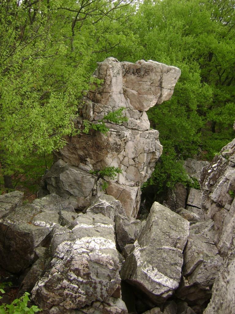
5 Field Work River basins in central Appalachian Mtns. studied with 10 Be on basin-scale Potomac (n=48; Trodick/Duxbury) Susquehanna (n=26; Reuter) Samples from 30 sites Multiple samples per site to study variance Unglaciated ridges outside glacial margin

6


7


8


9
10 Work Completed: Lab Work Rock Room produce monomineralic grains Crush/Grind Sieve (<250µm, µm, >850µm) µm fraction magnetically separated Mineral Separation Lab remove non-quartz minerals 24hr etch in 6N HCl (2x or 3x if needed) 24hr etch in 1% HF/HNO 3 (3x) Heavy-liquid density separation 36hr etch in 0.5% HF/HNO 3 Week-long etch in 0.5% HF/HNO 3 Meteoric Beryllium Lab test quartz purity 0.250g aliquot of each sample digested in HF/H 2 SO 4 HF evaporates overnight Bring up H 2 SO 4 to 1% Run on ICP-OES
11 Work to be Done: Appalachian Sample Laboratory Work 66 samples have passed quartz purity tests 6 samples in week-long 0.5% HF/HNO 3 etch Will be tested once more In-situ Laboratory Sample Digestion Cation/Anion exchange columns Overall, 66 samples will be prepared for AMS at Lawrence Livermore National Laboratory
12 Work Completed Global 10 Be erosion rate compilation Data from 31 sources Raw 10 Be concentrations Lithology Global datasets Variable Dataset Elevation Gtopo_30: provided by ESRI Software at University of Vermont Local Relief Same as Elevation Peak Ground Acceleration Global Seismic Hazard Assessment Program (Giardini et al., 1999)* Climate Zone Köppen-Geiger Climate System (Peel et al., 2007) Mean Annual Precipitation WorldClim Climate Model (Hijmans et al., 2005) Mean Annual Temperature Same as Mean Annual Precipitation

13
14 Initial Results: Latitude Erosion rates peak between Sampling gap between Glacial complications in the north Presence of Southern Ocean in the south

15 Gtopo_30 elevation dataset
16 Initial Results: Elevation & Relief Elevation yields the weakest correlation with erosion rate Local relief (r=5km) yields a weak correlation (R 2 =0.001; p=0.6176) (R 2 =0.150; p<0.0001)

17 Peak Ground Acceleration (Giardini et al., 1999)
18 Initial Results: Seismicity (R 2 =0.021; p=0.007) Active (n=69): 19.6±3.0 m My -1 Inactive (n=309): 8.4±1.2 m My -1
19 Initial Results: Lithology Specific lithologies generalized to four categories Weaknesses along bedding and foliation planes Note: sample populations vary Igneous (n=255): 8.0±1.2 m My -1 Metamorphic (n=52): 12.9±1.9 m My -1 Quartz (n=5): 2.2±0.3 m My -1 Sedimentary (n=66): 18.5±2.8 m My -1

20 Köppen-Geiger Climate Classification (Peel et al., 2007)
21 Initial Results: Climate Zone Utilize five generalized zones Note: sample populations vary Climates with temperature fluctuations see highest erosion rates Arid (n=277): 5.9±0.9 m My -1 Cold (n=32): 15.8±2.4 m My -1 Polar (n=27): 1.2±0.2 m My -1 Temperate (n=78): 25.5±3.7 m My -1 Tropical (n=14): 5.3±0.3 m My -1
 WorldClim model (Hijmans et al.")
22 Individual Climate Components Mean Annual Precipitation (mm/yr) Mean Annual Temperature ( C) WorldClim model (Hijmans et al., 2005)
23 Initial Results: MAP MAP shows a weak correlation with erosion rates Freeze-thaw cycling (Cold & Temperate)? Chemical weathering (Temperate & Tropical)? (R 2 =0.133; p<0.0001)
24 Initial Results: MAT Erosion rates spike between 0-25 C Where Cold and Temperate climates are dominant Extremely high and low temperatures are not favorable for retaining moisture
25 Initial Results: Multivariate Regression Forward Step-wise Regression Categorical data Lithology Climate Zone Seismic Activity Global Scale 1. p-values are ranked 2. If p<probability to Enter variable is entered into regression 3. Variables entered one at a time 4. New p-values generated 5. If p>probability to Leave variable is removed

26
27 Initial Results: Multivariate Regression Stratification of global erosion rates by categorical data improves the regression Important parameters stand out Relief, MAP, Latitude also best-fit one-way parameters Six variables used do well explaining variation in some categories but not others
28 Biases Inherent to the Data Glaciation limits 10 Be interpretive power Limited data for regions of political unrest and weak economies Quartz-bearing lithologies limits distribution of potential sampling sites Climate Zones and Lithologies are underrepresented Joint spacing and fracture density information is not provided
29 Work to be Done: Global Erosion Publication Update database with few missed publications providing more bedrock samples Update basin-averaged 10 Be erosion rate summary compiled by Joanna Reuter (2005) Synthesize two global compilations as basis of first publication
30 Timeline December 2009 Finish bedrock and basin-averaged data compilation and begin writing manuscript Continue quartz purity tests January 2010 Begin in situ laboratory methods Submit global summary manuscript (journal TBA) February 2009 Finish in situ laboratory work March 2010 Run samples using AMS at Lawrence Livermore National Laboratory Receive data April 2010 Data Analysis Summer 2010 Write thesis Write manuscript for Appalachian bedrock paper Fall 2010 Defend thesis in early Fall Submit Appalachian bedrock manuscript Prepare for/give talk at GSA


31 Thank You
GLOBALLY AND IN THE APPALACHIAN MOUNTIANS. A Thesis Progress Report Presented. Eric W. Portenga. The Faculty of the Geology Department
 USING 10 Be TO CONSTRAIN EROSION RATES OF BEDROCK OUTCROPS, GLOBALLY AND IN THE APPALACHIAN MOUNTIANS A Thesis Progress Report Presented by Eric W. Portenga to The Faculty of the Geology Department of
Basin-scale analysis of long-term sediment-generation rates derived from 10 Be in river sediment:
 Basin-scale analysis of long-term sediment-generation rates derived from 10 Be in river sediment: The Susquehanna River basin and beyond Joanna M. Reuter M.S. Proposal April 30, 2003 Paul Bierman, advisor
Low rates of bedrock outcrop erosion in the central Appalachian Mountains inferred from in situ 10 Be
 DR2013023 Low rates of bedrock outcrop erosion in the central Appalachian Mountains inferred from in situ 10 Be Eric W. Portenga Department of Geology University of Vermont Burlington, VT 05405 Paul R.
Sediment Generation Rates in the Potomac River Basin. A Thesis Progress Report Presented. Charles David Trodick Jr.
 Sediment Generation Rates in the Potomac River Basin A Thesis Progress Report Presented by Charles David Trodick Jr. to The Faculty of the Geology Department of The University of Vermont Accepted by the
Veronica Sosa-Gonzalez Defense Presentation
 Veronica Sosa-Gonzalez Defense Presentation Background Introduction Methods Results and Interpretations Conclusion Final remarks Photo credits: K. Nichols Determine long-term erosion rates in Panama, using
Page 1. Weathering & Erosion by Mass Wasting Pre-Test. Name:
 Weathering & Erosion by Mass Wasting Pre-Test 3048-1 - Page 1 Name: 1) As a particle of sediment in a stream breaks into several smaller pieces, the rate of weathering of the sediment will A) increase
COSMOGENIC 10 BE EROSION HISTORY OF THE BLUE RIDGE ESCARPMENT A LONG-LIVED FEATURE OF THE SOUTHERN APPALACHAINS
 COSMOGENIC 10 BE EROSION HISTORY OF THE BLUE RIDGE ESCARPMENT A LONG-LIVED FEATURE OF THE SOUTHERN APPALACHAINS A Thesis Progress Report Presented by Colleen L. Sullivan to The Faculty of the Geology Department
Tuckahoe Union Free School District Earth Science Curriculum Map/Scope and Sequence. Compiled by: Mark Dineen
 Tuckahoe Union Free School District Earth Science Curriculum Map/Scope and Sequence Compiled by: Mark Dineen SEPTEMBER Tuckahoe Union Free School District Curriculum Map- Earth Science Mr. Dineen Texts:
Climate Dataset: Aitik Closure Project. November 28 th & 29 th, 2018
 1 Climate Dataset: Aitik Closure Project November 28 th & 29 th, 2018 Climate Dataset: Aitik Closure Project 2 Early in the Closure Project, consensus was reached to assemble a long-term daily climate
GLOBALLY AND IN THE CENTRAL APPALACHIAN MOUNTAINS. A Thesis Presented. Eric William Portenga. The Faculty of the Graduate College
 USING 10 BE TO CONSTRAIN EROSION RATES OF BEDROCK OUTCROPS GLOBALLY AND IN THE CENTRAL APPALACHIAN MOUNTAINS A Thesis Presented by Eric William Portenga to The Faculty of the Graduate College of The University
Circle the best answer for each question. There are a total of 50 questions.
 Winter Packet 2013 Name Period ircle the best answer for each question. There are a total of 50 questions. 1. What occurs when ions from the Sun hit air molecules and cause them to emit vivid colors of
Pre-mid Year Review Please Don't write on the review packet
 1. Base your answer to the following question on the diagrams below, which represent two different solid, uniform materials cut into cubes A and B. 5. The data table below shows the mass and volume of
DATA REPOSITORY TABLES
 GSA Data Repository Item 2016354 Portenga, E.W., Bierman P.R., Trodick, C.D., Jr., Greene, S.E., DeJong, B.D., Rood, D.H., and Pavich, M.J., 2016, Background rates of erosion and sediment generation in
Lab 7: Sedimentary Structures
 Name: Lab 7: Sedimentary Structures Sedimentary rocks account for a negligibly small fraction of Earth s mass, yet they are commonly encountered because the processes that form them are ubiquitous in the
Bill Nye: Rocks and Soil
 Bell Ringer 1.What kind of rock is formed by applying heat and pressure to existing rock? 2.What would be required to turn a sedimentary rock into an igneous rock? 3.How are sedimentary rocks classified?
CLIMATE. UNIT TWO March 2019
 CLIMATE UNIT TWO March 2019 OUTCOME 9.2.1Demonstrate an understanding of the basic features of Canada s landscape and climate. identify and locate major climatic regions of Canada explain the characteristics
Surface Processes on the Earth. Rocks, Weathering, Erosion and Soil
 Surface Processes on the Earth Rocks, Weathering, Erosion and Soil ROCKS AND ROCK CYCLE Rock types Three main types of rock Igneous Metamorphic Sedimentary Igneous Form when magma or lava cools and hardens
Weather and Climate Summary and Forecast Winter
 Weather and Climate Summary and Forecast Winter 2016-17 Gregory V. Jones Southern Oregon University February 7, 2017 What a difference from last year at this time. Temperatures in January and February
CONTENTS CHAPTER 1: PROLOGUE The Local Environment... 1 Observation, Inference, Classification Properties of the Environment...
 CONTENTS CHAPTER 1: PROLOGUE The Local Environment... 1 Observation, Inference, Classification Properties of the Environment... 3 Measurement, Percent Deviation From Accepted Value Density... 6 Density
B) color B) Sediment must be compacted and cemented before it can change to sedimentary rock. D) igneous, metamorphic, and sedimentary rocks
 color B) Sediment must be compacted and cemented before it can change to sedimentary rock. D) igneous, metamorphic, and sedimentary rocks") 1. Which characteristic of nonsedimentary rocks would provide the least evidence about the environment in which the rocks were formed? A) structure B) color C) crystal size D) mineral composition 2. Which
1. Which characteristic of nonsedimentary rocks would provide the least evidence about the environment in which the rocks were formed? A) structure B) color C) crystal size D) mineral composition 2. Which
Low rates of bedrock outcrop erosion in the central Appalachian Mountains inferred from in situ 10 Be
 Low rates of bedrock outcrop erosion in the central Appalachian Mountains inferred from in situ Be Eric W. Portenga 1,,, Paul R. Bierman 2, Donna M. Rizzo 3, and Dylan H. Rood 4,# 1 Department of Geology,
Landscape. Review Note Cards
 Landscape Review Note Cards Last Ice Age Pleistocene Epoch that occurred about 22,000 Years ago Glacier A large, long lasting mass of ice which forms on land and moves downhill because of gravity. Continental
Weather Review. What is the relative humidity when the temperature equals the dew point?
 Weather Review A measures dew point and relative humidity. What is another name for the DRY BULB? Why is the wet bulb NEVER higher than the dry bulb? What is the dew point? What is the relative humidity?
ESC102. Sedimentary Rocks. Our keys to the past. Monday, February 11, 13
 ESC102 Sedimentary Rocks Our keys to the past Sedimentary Rocks Sedimentary rocks are rocks that form through the accumulation of sediment and the process of lithification. Lithification occurs after deposition
Rocks and the Rock Cycle. Banded Iron Formation
 Rocks and the Rock Cycle Banded Iron Formation Rocks Big rocks into pebbles, Pebbles into sand. I really hold a million, million Rocks here in my hand. Florence Parry Heide How do rocks change? How are
Continental Landscapes
 Continental Landscapes Landscape influenced by tectonics, climate & differential weathering Most landforms developed within the last 2 million years System moves toward an equilibrium Continental Landscapes
Figure 1 The map shows the top view of a meandering stream as it enters a lake. At which points along the stream are erosion and deposition dominant?
 1. In which type of climate does chemical weathering usually occur most rapidly? 1. hot and dry 3. cold and dry 2. hot and wet 4. cold and wet 2. Figure 1 The map shows the top view of a meandering stream
Follow this and additional works at: https://scholarsarchive.byu.edu/iemssconference
 International Congress on Environmental Modelling and Software Brigham Young University BYU ScholarsArchive 3rd International Congress on Environmental Modelling and Software - Burlington, Vermont, USA
Page One. GEOL 1030 Pre test S15. Please enter your rst and last name.
 GEOL 1030 Pre test S15 Page One Please enter your rst and last name. First Name: Last Name: 1. The most common elements in the Earth's crust, in order of decreasing abundance, are: a. feldspar, quartz,
Energy Systems, Structures and Processes Essential Standard: Analyze patterns of global climate change over time Learning Objective: Differentiate
 Energy Systems, Structures and Processes Essential Standard: Analyze patterns of global climate change over time Learning Objective: Differentiate between weather and climate Global Climate Focus Question
TAKE HOME EXAM 8R - Geology
 Name Period Date TAKE HOME EXAM 8R - Geology PART 1 - Multiple Choice 1. A volcanic cone made up of alternating layers of lava and rock particles is a cone. a. cinder b. lava c. shield d. composite 2.
Our Planet Earth. I nteractions of Earth Systems
 CHAPTER 3 LESSON 2 Our Planet Earth I nteractions of Earth Systems Key Concepts How does the water cycle show interactions of Earth systems? How does weather show interactions of Earth systems? How does
What factors affect the angle of a slope?
 Climate Rock type and Structure What factors affect the angle of a slope? Aspect Fast mass movements Slides: Slides are movements along the SLIP PLANE, i.e. a line of weakness in the rock or soil structure.
Happy Tuesday. Pull out a ½ sheet of paper
 Happy Tuesday Pull out a ½ sheet of paper 1. Physical properties of a mineral are predominantly related to 1. the external conditions of temperature, pressure, and amount of space available for growth.
Physical Geography Lab Activity #16
 Physical Geography Lab Activity #16 Due date Name California Climate Classification COR Objective 6, SLO 3 16.1. Introduction One of the most important factors in the physical geography of a place is its
RISK ASSESSMENT COMMUNITY PROFILE NATURAL HAZARDS COMMUNITY RISK PROFILES. Page 13 of 524
 RISK ASSESSMENT COMMUNITY PROFILE NATURAL HAZARDS COMMUNITY RISK PROFILES Page 13 of 524 Introduction The Risk Assessment identifies and characterizes Tillamook County s natural hazards and describes how
Amazing Ice: Glaciers and Ice Ages
 Amazing Ice: Glaciers and Ice Ages Updated by: Rick Oches, Professor of Geology & Environmental Sciences Bentley University Waltham, Massachusetts Based on slides prepared by: Ronald L. Parker, Senior
Weathering, Erosion, Deposition, and Landscape Development
 Weathering, Erosion, Deposition, and Landscape Development I. Weathering - the breakdown of rocks into smaller particles, also called sediments, by natural processes. Weathering is further divided into
Chapter 2. Wearing Down Landforms: Rivers and Ice. Physical Weathering
 Chapter 2 Wearing Down Landforms: Rivers and Ice Physical Weathering Weathering vs. Erosion Weathering is the breakdown of rock and minerals. Erosion is a two fold process that starts with 1) breakdown
A Report on a Statistical Model to Forecast Seasonal Inflows to Cowichan Lake
 A Report on a Statistical Model to Forecast Seasonal Inflows to Cowichan Lake Prepared by: Allan Chapman, MSc, PGeo Hydrologist, Chapman Geoscience Ltd., and Former Head, BC River Forecast Centre Victoria
GEOCHEMISTRY UNIFORM SYLLABUS
 GEOCHEMISTRY UNIFORM SYLLABUS The Association of Professional Engineers and Geoscientists of the Province of British Columbia Note: 1. This Syllabus May Be Subject To Change 2. These Courses Are Required
Preliminaries to Erosion: Weathering and Mass Wasting
 Preliminaries to Erosion: Weathering & Mass Wasting All things deteriorate in time. Virgil 1 Preliminaries to Erosion: Weathering and Mass Wasting Denudation The Impact of Weathering and Mass Wasting on
Required Materials Plummer, C., Physical geology. Columbus, OH: McGraw Hill Higher Education
 Butler Community College Science, Technology, Engineering, and Math Division Robert Carlson Revised Fall 2017 Implemented Spring 2018 Textbook Update Spring 2018 COURSE OUTLINE Physical Geology Course
UNIT 5: ECOLOGY Chapter 15: The Biosphere
 CORNELL NOTES Directions: You must create a minimum of 5 questions in this column per page (average). Use these to study your notes and prepare for tests and quizzes. Notes will be stamped after each assigned
Unit 3 Review - Surface Processes
 Unit 3 Review - Surface Processes 1. Why is the surface of Mercury covered with meteor impact craters, while Earth s surface has relatively few craters? A) Mercury is larger than Earth, so it gets hit
The Cycling of Matter. Day 1
 The Cycling of Matter Day 1 Objective I will learn the rock cycle is the series of processes in which rock changes from one form to another. I will learn in the water cycle, water condenses, precipitates
Storm and Storm Systems Related Vocabulary and Definitions. Magnitudes are measured differently for different hazard types:
 Storm and Storm Systems Related Vocabulary and Definitions Magnitude: this is an indication of the scale of an event, often synonymous with intensity or size. In natural systems, magnitude is also related
Climate Change or Climate Variability?
 Climate Change or Climate Variability? Key Concepts: Greenhouse Gas Climate Climate change Climate variability Climate zones Precipitation Temperature Water cycle Weather WHAT YOU WILL LEARN 1. You will
NAME: GEL 109 Final Study Guide - Winter 2008 Questions 6-24 WILL be on the final exactly as written here; this is 60% of the test.
 GEL 109 Final Study Guide - Winter 2008 Questions 6-24 WILL be on the final exactly as written here; this is 60% of the test. 1. Sketch a map view of three types of deltas showing the differences in river,
IMPACT OF CLIMATE CHANGE OVER THE ARABIAN PENINSULA
 IMPACT OF CLIMATE CHANGE OVER THE ARABIAN PENINSULA By: Talal Alharbi June, 29 2017 1 Motivation: In arid and semi-arid regions of the world the demand for fresh water resources is increasing due to: increasing
Mining minerals from sand
 Mining minerals from sand Learning objectives By completing this activity, you will: Use ilmenite (a mineral which contains the element titanium), which is mined by DuPont to use as a white pigment, as
What does mastering the course content look like?
 COURSE DESCRIPTION Earth science is a laboratory course that serves as an introduction survey of geology, mineralogy, mapping, astronomy as well as topics in meteorology, oceanography and paleontology.
PHYSICAL GEOLOGY Geology 110 Spring Semester, 2018 Syllabus
 James Madison University Dept of Geology & Environmental Science PHYSICAL GEOLOGY Geology 110 Spring Semester, 2018 Syllabus Instructor: Dr. L. Scott Eaton Office: Memorial Hall 7305E E-mail: eatonls@jmu.edu
Great Lakes Update. Volume 199: 2017 Annual Summary. Background
 Great Lakes Update Volume 199: 2017 Annual Summary Background The U.S. Army Corps of Engineers (USACE) tracks and forecasts the water levels of each of the Great Lakes. This report is primarily focused
Social Studies. Chapter 2 Canada s Physical Landscape
 Social Studies Chapter 2 Canada s Physical Landscape Introduction Canada s geography its landforms and climate - has a great impact on Canadians sense of identity. Planet Earth The earth is divided into
Unit 7.2 W.E.D. & Topography Test
 Name: Score: Unit 7.2 W.E.D. & Topography Test 1. 2. 3. 4. 5. 6. 7. 8. 9. 10. 11. 12. 13. 14. 15. 16. 17. 18. 19. 20. 21. 22. 23. 24. 25. 1. The formation of mountains is due mainly to while the destruction
Section 7.1. Weathering. SES3a. Objectives
 SES3a. Objectives Distinguish between mechanical and chemical weathering. Describe the different factors that affect mechanical and chemical weathering. Identify variables that affect the rate of weathering.
Paper 1 Physical Core UNIT 3 Rocks and weathering
 Paper 1 Physical Core UNIT 3 Rocks and Recommended Prior Knowledge The fundamental principles of tectonics and may have been introduced at IGSCE. However no previous knowledge is essential to this unit.
SYLLABUS FORM WESTCHESTER COMMUNITY COLLEGE Valhalla, NY lo CURRENT DATE: Please indicate whether this is a NEW COURSE or a REVISION:
 SYLLABUS FORM WESTCHESTER COMMUNITY COLLEGE Valhalla, NY lo595 l. Course #: 2. NAME OF ORIGINATOR /REVISOR: PHYSC 143 Laurel Senft, Rob Applebaum, Eryn Klosko NAME OF COURSE Earth Science 3. CURRENT DATE:
Which map shows the stream drainage pattern that most likely formed on the surface of this volcano? A) B)
 B)") 1. When snow cover on the land melts, the water will most likely become surface runoff if the land surface is A) frozen B) porous C) grass covered D) unconsolidated gravel Base your answers to questions
1. When snow cover on the land melts, the water will most likely become surface runoff if the land surface is A) frozen B) porous C) grass covered D) unconsolidated gravel Base your answers to questions
As compaction and cementation of these sediments eventually occur, which area will become siltstone? A) A B) B C) C D) D
 A B) B C) C D) D") 1. A student obtains a cup of quartz sand from a beach. A saltwater solution is poured into the sand and allowed to evaporate. The mineral residue from the saltwater solution cements the sand grains together,
1. A student obtains a cup of quartz sand from a beach. A saltwater solution is poured into the sand and allowed to evaporate. The mineral residue from the saltwater solution cements the sand grains together,
Chapter outline. Reference 12/13/2016
 Chapter 2. observation CC EST 5103 Climate Change Science Rezaul Karim Environmental Science & Technology Jessore University of science & Technology Chapter outline Temperature in the instrumental record
The performance expectation above was developed using the following elements from the NRC document A Framework for K-12 Science Education:
 MS-ESS2-1 Earth's Systems Students who demonstrate understanding can: MS-ESS2-1. Develop a model to describe the cycling of Earth's materials and the flow of energy that drives this process. [Clarification
1. Any process that causes rock to crack or break into pieces is called physical weathering. Initial product = final product
 Weathering 1. Any process that causes rock to crack or break into pieces is called physical weathering. Initial product = final product End Result of physical weathering is increased surface area. 2. Physical
2013 GEOLOGICAL ASSESSMENT REPORT SHERIDAN HILL PROPERTY
 2013 GEOLOGICAL ASSESSMENT REPORT ON THE SHERIDAN HILL PROPERTY NEW WESTMINSTER MINING DIVISION BRITISH COLUMBIA NTS 092G07 49 16 31 NORTH LATITUDE, 122 39 48 WEST LONGITUDE PREPARED FOR Sheridan Hill
Practice 3rd Quarter Exam Page 1
 Name 1. Which characteristic would most likely remain constant when a limestone cobble is subjected to extensive abrasion? A) shape B) mass C) volume D) composition 2. Which activity demonstrates chemical
Which rock is shown? A) slate B) dunite C) gneiss D) quartzite
 slate B) dunite C) gneiss D) quartzite") 1. Which metamorphic rock will have visible mica crystals and a foliated texture? A) marble B) quartzite C) schist D) slate 2. The recrystallization of unmelted material under high temperature and pressure
1. Which metamorphic rock will have visible mica crystals and a foliated texture? A) marble B) quartzite C) schist D) slate 2. The recrystallization of unmelted material under high temperature and pressure
2 Rates of Weathering
 Name CHAPTER 10 Class Date Weathering and Soil Formation SECTION 2 Rates of Weathering National Science Education Standards BEFORE YOU READ After you read this section, you should be able to answer these
Changing Landscapes: Glaciated Landscapes. How do glaciers move?
 Changing Landscapes: Glaciated Landscapes How do glaciers move? What you need to know Differences between cold-and warm-based glaciers, their locations and rates of movement Glacier ice movement including
PH YSIC A L PROPERT IE S TERC.UCDAVIS.EDU
 PH YSIC A L PROPERT IE S 8 Lake surface level Daily since 1900 Lake surface level varies throughout the year. Lake level rises due to high stream inflow, groundwater inflow and precipitation directly onto
Match up the pictures and key terms
 Match up the pictures and key terms 1 Plucking Striations 3 Roche Mountonnees 2 Chatter Marks 4 What is the difference between plucking and abrasion? Glacial Processes Erosion, Weathering and Deposition
Earth systems the big idea guiding questions Chapter 1 & 2 Earth and Earth Systems review notes are in purple
 Earth systems the big idea guiding questions Chapter 1 & 2 Earth and Earth Systems review notes are in purple How can you describe Earth? What are the composition and the structure of the atmosphere? How
THE CHANGING SURFACE OF THE EARTH
 THE CHANGING SURFACE OF THE EARTH Key words Drain geological agent weathering erosion Sediment deposition transport The landscape is a consequence of the action of two types of geological processes; internal
Michigan s Geology and Groundwater
 Michigan s Geology and Groundwater Ralph J. Haefner Deputy Director U.S. Geological Survey Michigan-Ohio Water Science Center Lansing, Michigan Outline About the USGS Geology 101 Michigan s geology Bedrock
Chapter 1 Section 2. Land, Water, and Climate
 Chapter 1 Section 2 Land, Water, and Climate Vocabulary 1. Landforms- natural features of the Earth s land surface 2. Elevation- height above sea level 3. Relief- changes in height 4. Core- most inner
Weathering, Erosion & Soils Quiz
 Weathering, Erosion & Soils Quiz Multiple Choice Identify the choice that best completes the statement or answers the question. 1. The diagram below shows a cross-section of a rock layer. Erosion is the
1. Which type of climate has the greatest amount of rock weathering caused by frost action? A) a wet climate in which temperatures remain below
 a wet climate in which temperatures remain below") 1. Which type of climate has the greatest amount of rock weathering caused by frost action? A) a wet climate in which temperatures remain below freezing B) a wet climate in which temperatures alternate
1. Which type of climate has the greatest amount of rock weathering caused by frost action? A) a wet climate in which temperatures remain below freezing B) a wet climate in which temperatures alternate
LANDFORM REGIONS IN CANADA. Classroom Notes and Descriptions
 LANDFORM REGIONS IN CANADA Classroom Notes and Descriptions Landform Regions in Canada There are eight distinct landforms in Canada: Western Cordillera Region Interior Plains Canadian Shield Hudson Bay
Flood Risk Assessment
 Flood Risk Assessment February 14, 2008 Larry Schick Army Corps of Engineers Seattle District Meteorologist General Assessment As promised, La Nina caused an active winter with above to much above normal
Stewards Pooi Kei College TEACHING SCHEDULE ( ) Form: S4 Subject : Geography No. of periods per cycle: 9 Teacher: Mr. Eric Chau Year/Month
 Form: S4 Subject : Geography No. of periods per cycle: 9 Teacher: Mr. Eric Chau Year/Month") Form: S4 Subject : Geography No. of periods per cycle: 9 Teacher: Mr. Eric Chau Year/Month 2009 September October November Topics / Subjects to be covered skills (if any) Remarks Cycle 1 What is tropical
Form: S4 Subject : Geography No. of periods per cycle: 9 Teacher: Mr. Eric Chau Year/Month 2009 September October November Topics / Subjects to be covered skills (if any) Remarks Cycle 1 What is tropical
Stable Isotopes OUTLINE
 Stable Isotopes OUTLINE Reading: White Ch 9.1 to 9.7.1 (or digital p370-400) Exercise answer? What does the salt do? Today 1. 2 leftovers 2. Stable Isotopes for hydrologic and climate applications 1 CaCO
Earth/Space Honors EOC Pacing Guide
 Lesson Vocabulary NGSSS Minerals Understand the physical and chemical properties that define and identify a mineral. Chemical formula Luster Cleavage Fracture Hardness Streak Specific gravity Solid Inorganic
Chapter 3 Sedimentation of clay minerals
 Chapter 3 Sedimentation of clay minerals 3.1 Clay sedimentation on land 3.2 From land to sea 3.3 Clay sedimentation in the sea 1 3.1 Clay sedimentation on land Deserts Glaciers Rivers Lacustrine 2 University
Occurs in Nature SOLID Inorganic (not from a plant or animal) Crystalline (forms crystals) Atoms / Molecules bond in a regular pattern
 Crystalline (forms crystals) Atoms / Molecules bond in a regular pattern") #12: Mineral Occurs in Nature SOLID Inorganic (not from a plant or animal) Crystalline (forms crystals) Atoms / Molecules bond in a regular pattern Regular Composition EX- Halite (salt) is always NaCl
#12: Mineral Occurs in Nature SOLID Inorganic (not from a plant or animal) Crystalline (forms crystals) Atoms / Molecules bond in a regular pattern Regular Composition EX- Halite (salt) is always NaCl
1/31/2013. Weathering Includes Physical, Chemical, Biological processes. Weathering Mechanisms. Wind abrasion forming Ventifacts
 Monument Valley, Utah. What weathering processes contributed to the development of these remarkable rock formations? Weathering Includes Physical, Chemical, Biological processes Weathering Mechanisms Physical
Detecting landscape response to perturbations by climate and base level in central Pennsylvania using in-situ 10 Be and 26 Al
 Detecting landscape response to perturbations by climate and base level in central Pennsylvania using in-situ 10 Be and 26 Al A Thesis Progress Report Presented by Alison Regina Denn to The Faculty of
School Program Name: Name of Sanctuary: Grade Level: Grades 6 8 Location Options: Time:
 School Program Name: Name of Sanctuary: Grade Level: Grades 6 8 Location Options: Time: For more info: Landforms of New England Moose Hill Wildlife Sanctuary At the sanctuary 2 hours or combine with another
Name: Mid-Year Review #2 SAR
 Name: Mid-Year Review #2 SAR Base your answers to questions 1 through 3 on on the diagram below, which shows laboratory materials used for an investigation of the effects of sediment size on permeability,
Name HW - Landscapes
 Name HW - Landscapes 1. New York s Tug Hill landscape region is classified as a plateau because this region has a A) high elevation with distorted bedrock B) high elevation with nearly horizontal layers
Supplement of Vegetation greenness and land carbon-flux anomalies associated with climate variations: a focus on the year 2015
 Supplement of Atmos. Chem. Phys., 17, 13903 13919, 2017 https://doi.org/10.5194/acp-17-13903-2017-supplement Author(s) 2017. This work is distributed under the Creative Commons Attribution 3.0 License.
Name Date Class. Earth, Our Planet
 Name Date Class Chapter 1 PAGE KEELEY SCIENCE PROBES Earth, Our Planet Benchmark Practice Chapter Review Study Guide Inquiry Lab Note-taking When we talk about our planet Earth, what parts are we describing?
The elevations on the interior plateau generally vary between 300 and 650 meters with
 11 2. HYDROLOGICAL SETTING 2.1 Physical Features and Relief Labrador is bounded in the east by the Labrador Sea (Atlantic Ocean), in the west by the watershed divide, and in the south, for the most part,
Earth Science. Explain how Earth's biogeochemical cycles create a balance of materials. Examine the importance of biogeochemical cycles.
 Unit 1: DYNAMIC STRUCTURE OF EARTH Introduction to Understand that earth science is based upon the four sciences of astronomy, geology, meteorology, and oceanography. Identify topics studied within the
Wednesday, October 10 th
 Wednesday, October 10 th Page 13a (left side) / Place Lab on table Objective: We will describe the different types of weathering and erosion and identify evidence of each type. Warm-up: 1. What is weathering?
Monday, May 24, Things to Know...
 117 Things to Know... 117 Things to Know... The same substance always has the same density. 2As pressure increases, density increases 3As temperature increases, density decreases 4Water expands when it
Glacial Erosion II: Processes, Rates & Landforms. Bernard Hallet ESS
 Glacial Erosion II: Processes, Rates & Landforms Bernard Hallet ESS 685-2409 hallet@u.washington.edu Housekeeping for the day Friday Discussion Section Holiday Friday no discussion session Monday Discussion
Ecogeographic Analysis A Guide to the Ecological Division of Land for Planning and Management
 Slide 1 Ecogeographic Analysis A Guide to the Ecological Division of Land for Planning and Management Robert G. Bailey USDA Forest Service Ecoregions, Ecosystem Geography and Sustainability rgbailey@fs.fed.us
Chapter 15 Millennial Oscillations in Climate
 Chapter 15 Millennial Oscillations in Climate This chapter includes millennial oscillations during glaciations, millennial oscillations during the last 8000 years, causes of millennial-scale oscillations,
Geology 229 Engineering Geology. Lecture 7. Rocks and Concrete as Engineering Material (West, Ch. 6)
") Geology 229 Engineering Geology Lecture 7 Rocks and Concrete as Engineering Material (West, Ch. 6) Outline of this Lecture 1. Rock mass properties Weakness planes control rock mass strength; Rock textures;
Geology 229 Engineering Geology Lecture 7 Rocks and Concrete as Engineering Material (West, Ch. 6) Outline of this Lecture 1. Rock mass properties Weakness planes control rock mass strength; Rock textures;
Climates of Earth. Lesson Outline LESSON 1. A. What is climate? 1. is the long-term average weather conditions that occur in a particular region.
 Lesson Outline LESSON 1 A. What is climate? 1. is the long-term average weather conditions that occur in a particular region. 2. Climate depends on how average weather conditions throughout the year. B.