Navigation and Communication UNIS Winter Safety Course January Sara Cohen Staff Engineer, Arctic Geology
|
|
|
- Allison Parsons
- 6 years ago
- Views:
Transcription


1 Navigation and Communication UNIS Winter Safety Course January 2018 Sara Cohen Staff Engineer, Arctic Geology

2 Course Objectives Navigation Maps, GPS, TopoSvalbard, Weather Communication VHF Radio, Satellite Phone, Cell phones, Emergency Beacon, InReach

3 Key Map Terms Scale Grid Orientation Legend Contour Lines Coordinate System Geodetic Datum Projection Maps What is a map? What do we find on a map?

4 Maps Continuted (UTM System) -Why use UTM? Constant distance relationship anywhere on the map LAT LONG differs as you move towards poles We use metric units, only meters, no degrees, minutes, seconds. You can measure it Locations can be identified by three numbers: Zone, Easting & Northing -The UTM system divdes the Earth between 80 S & 84 N latitude into 60 zones, each with 6 of longitude in width -Each latitude band is 8 degrees high, and is lettered starting from "C" at 80 S, increasing up the alphabet until "X The last latitude band, "X", is extended an extra 4 degrees, so it ends at 84 N latitude, thus covering the northernmost land on Earth.

5

6


7 Locating a UTM position A position is given by the UTM zone number and the easting & northing coordinate pair in that zone UTM grid coordinates are expressed as a distance in meters to the east & north UTM has grid lines spaced every 1km Eastings range from approx meters close to the poles, to m near the equator. Northings range from 0 at the equator to approximately 9,300,000 meters at 84 N

8 UNIS is at 33x The two first small digits refer to the 100 km route The two next large digits are called principal digits and refer to the 1 km route The last three digits represent the distance in meters east/north into the route.

9 4.6cm=460m 7.0cm=700m Short UTM: UTM coordinates: 33x
10 Map Exercise If the scale is 1:100000, what does 1cm =? What are the UTM coordinates/elevation of Innerhytta? Find the location from the UTM coordinates: 33x

11 What is important to know about Svalbard Maps? You should be familiar with both the UTM and Longitude, Latitude Reference System! UTM is more common for land, while Longitude and Latitude are common for the sea We are in UTM Zone 33 X The Geodetic Datum we use is WGS84 Our magnetic declination is 7 20 East


 Svalbard 1:250.")
12 Svalbard Maps In Svalbard the Norwegian Polar Institute provides a map service Maps are available in different scales which are published in several series Svalbard 1: (S500) Svalbard 1: (S250) Svalbard 1: (S100)

13 Svalbard Maps continued Overview of Svalbard topographic maps: Every map will contain: Name Scale Code Inset Maps Contour Lines/Data Map Data Legend

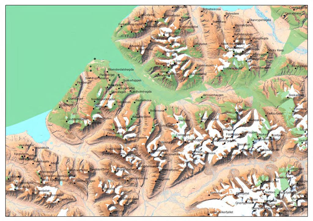
14 Svalbard Maps Continued TOPO Svalbard digital maps for Svalbard toposvalbard.npolar.no geodata.npolar.no (for downloading arcgis) Topographic Maps 3D Maps Aerial photos Satellite Imagery Let s look at Svalbard


15 GPS Instrument which utilizes the Global Positioning System by connecting to satellites -Track your position and movement -Trackback -Make Waypoints and routes -Navigate towards waypoints -Moving map -MAP datum, WGS 84 or ED 50 -Position ref, UTM or LAT/LONG -Transfer GPS data into PC map system (OZI Explorer)
16 Set up a track... Get a Montana GPS Open up ozi explorer on your computer


17 VHF Field Communication (Group to Group) Emergency Communication (Group to Vessel, Group to Group) BATTERIES! LOCK! Channels: CH 1 Skolten and Scheteligmountain repeater CH 3 Nordenskiöld and Zeppelinermt repeater CH 5 Radio to radio CH 6 Radio to radio CH 7 Såta and Ishetta telephone link MA 6 Maritime channel SHIP to SHIP MA 16 Maritime channel 16 (emergency Bodø Radio) SNSK Store Norske Spitsbergen Kullkompani
18 Letter Code Letter Code A Alpha N November B Bravo O Oscar C Charlie P Papa D Delta Q Quebec E Echo R Romeo F Foxtrot S Sierra G Golf T Tango H Hotel U Uniform I India V Victor J Juliett W Whiskey K Kilo X X-Ray L Lima Y Yankee M Mike Z Zulu
19 Radio Procedures Sara Sara this is Group A, Group A, Over Group A, this is Sara, Over Sara, this is Group A, we are now at position 1, moving towards position 2, Over Group A this is Sara, roger Sara, this is group A, out
 Turning on procedures UNIS daytime +47 79 02 33 00")

20 Satellite Phones Field Communication (Group to UNIS) Emergency Communication (Group to UNIS, Group to Sysselmannen) Turning on procedures UNIS daytime UNIS Duty 24/ Governor emergency 24/ Hospital It is NOT possible to call Norwegian emergency numbers 110, 112 and 113
21 Satellite Phone Procedures in an emergency: Present yourself Position What kind of accident/injury Who is injured, state of injury Situation for rest of the group What kind of assistance do you need Agree on next time of contact
 Transmit on 406 MHz for")

22 Emergency Beacon Emergency use ONLY 24 hrs signal in all conditions (not under water) Transmit on 406 MHz for world wide satellite coverage Local homing on 121,5 MHz for sysellmannen GPS unit gives accurate position information


23 Automatic GPS Tracking SMS Capabilities Emergency Function Iridium Satellite inreach
24
25 Communication Exercise Leave UNIS, turn on all devices (Sat phone, GPS and VHF radio). Wait until phone will be registered in a network and call to number: (explain who you are and where you are). When you exit UNIS main building activate your GPS and use the GOTO function to navigate your route When you are halfway through report to UNIS Ops on your VHF Channel 5 When you get back to UNIS we will upload your GPS track onto the computer
26 Resources
Navigation and Communication UNIS Winter Safety Course. Sara Cohen Staff Engineer, Arctic Geology
 Navigation and Communication UNIS Winter Safety Course Sara Cohen Staff Engineer, Arctic Geology Course Objectives Use a Compass, Map & GPS for Navigation Use a VHF Radio, Satellite Phone & Emergency Beacon
Navigation and Communication AS January Sara Mollie Cohen Head Engineer, Department of Arctic Geology
 Navigation and Communication AS101 07-11 January 2019 Sara Mollie Cohen Head Engineer, Department of Arctic Geology Course Objectives Navigation Maps, Coordinate Sysems GPS, TopoSvalbard, Weather Communication
Welcome to Aerospace Engineering DESIGN-CENTERED INTRODUCTION TO AEROSPACE ENGINEERING
 Welcome to Aerospace Engineering DESIGN-CENTERED INTRODUCTION TO AEROSPACE ENGINEERING Topics 1. Course Organization 2. Today's Dreams in Various Speed Ranges 3. Designing a Flight Vehicle: Route Map of
Which page are each of these images from?
 Which page are each of these images from? A B C D Operated by Victoria Airport Authority We need your help to find 11 differences between these two fire rescue vehicles! start Help the cyclists find their
King County Explorer Search and Rescue. Course B Map & Compass
 King County Explorer Search and Rescue Course B Map & Compass Disclaimer The intent of this presentation is to provide a basic overview of maps, compasses, and location finding. It is not meant to be a
Butte County Fire Department
 Butte County Fire Department Basic Land Navigation Verification Sheet I verify that Print Supervisor s name has completed the Print Employee s name Basic Land Navigation self study guide on. Date Attached
Trail Life USA High Adventure Training Land Navigation Module. Dennis Conte
 Trail Life USA High Adventure Training Land Navigation Module Dennis Conte Navigating With GPS and a MAP Let s Talk about your GPS Hand Held Tool. Is a GPS Hand Held the magic bullet? Can it solve all
Land Navigation Table of Contents
 Land Navigation Table of Contents Preparatory Notes to Instructor... 1 Session Notes... 5 Learning Activity: Grid Reference Four Figure... 7 Learning Activity: Grid Reference Six Figure... 8 Learning Activity:
GPS Mapping. Teacher Instructions. Overview: Objectives: Materials: Answers to Student Worksheets:
 Overview: Scientists use Global Positioning System (GPS) receivers to map lava flows. GPS data are compiled by computer Geographic Information System (GIS) software into a digital map. Digital maps can
Chapter 3 Models of the Earth. 3.1 Finding Locations on the Earth. 3.1 Objectives
 Chapter 3 Models of the Earth 3.1 Finding Locations on the Earth 3.1 Objectives Explain latitude and longitude. How can latitude and longitude be used to find locations on Earth? How can a magnetic compass
Butte County Fire Department
 Butte County Fire Department Basic Land Navigation Verification Sheet I verify that Print Supervisor's name Print Employee's name has completed the Basic Land Navigation self study guide on Date Attached
Geog Lecture 29 Mapping and GIS Continued
 Geog 1000 - Lecture 29 Mapping and GIS Continued http://scholar.ulethbridge.ca/chasmer/classes/ Today s Lecture (Pgs 13-25, 28-29) 1. Hand back Assignment 3 2. Review of Dr. Peddle s lecture last week
Navigating with Map & Compass. Nevada County Sheriff s Search & Rescue
 Navigating with Map & Compass Nevada County Sheriff s Search & Rescue Objectives Very Practical Teach you how to go from point A to point B Go from the wilderness (real world) to a map and visa versa Agenda
Test Bank Chapter 2: Representations of Earth
 Multiple Choice Test Bank Chapter 2: Representations of Earth 1. A rhumb line on a Mercator projection is a line of. a. true size b. true shape c. true compass bearing d. true location 2. Maximum longitude
GCSAR Navigation -- Maps
 GCSAR Navigation -- Maps From the GCSAR Certification Standards Identify and explain all the border information on a topographic map. Identify and explain the following aspects of maps: index and intermediate
12/26/2012. Geographic Information Systems * * * * GIS (... yrezaei
 ( - Geographic Information Systems ( ( 1 2 3 Information System Data base DB IS IS DB (Knowledge ( ( (System (Information System - (Georefrence Analysis Data + Knowledge ======== Information 4 5 ( < 10%
Akuni Adventures GPS Navigation Course. Welcome
 Akuni Adventures GPS Navigation Course Welcome 1 GPS Navigation Course Instructor: Joe Bourgeois joe@akuni.com 2 Waiver Please take a moment to read and sign your waiver. Thank You 3 Maps: Agenda Margin
What you learned. Lecture 27: Class Summary. Maps and geodesy. How you learned it
 What you learned Geography 12: Maps and Spatial Reasoning Lecture 27: Class Summary Professor Keith Clarke Map geometry, construction and content Practical map use, reading and navigation Map representation
Chapter 1 Overview of Maps
 Chapter 1 Overview of Maps In this chapter you will learn about: Key points when working with maps General types of maps Incident specific maps Map legend and symbols Map sources A map is a navigational
Georeferencing. Place names Postal addresses Postal codes Coordinate systems (lat/long, UTM, etc.)
") Georeferencing Georeferencing Used to describe the act of assigning locations to data or information Certain requirements include that they are: unique, have shared meaning, and are persistent through
Georeferencing Georeferencing Used to describe the act of assigning locations to data or information Certain requirements include that they are: unique, have shared meaning, and are persistent through
What Do You See? FOR 274: Forest Measurements and Inventory. Area Determination: Frequency and Cover
 What Do You See? Message of the Day: Many options exist to determine the size, area, or extent of a feature on a landscape FOR 274: Forest Measurements and Inventory Lecture 7: Measures of Land Area Frequency
ANNEX 23 RESOLUTION MSC.231(82) ADOPTION OF AMENDMENTS TO THE EXISTING MANDATORY SHIP REPORTING SYSTEM IN THE GULF OF FINLAND
 ADOPTION OF AMENDMENTS TO THE EXISTING MANDATORY SHIP REPORTING SYSTEM IN THE GULF OF FINLAND") RESOLUTION MSC.231(82) (adopted on 5 December 2006) ADOPTION OF AMENDMENTS TO THE EXISTING MANDATORY SHIP REPORTING SYSTEM IN THE GULF OF FINLAND THE MARITIME SAFETY COMMITTEE, RECALLING Article 28(b)
RESOLUTION MSC.231(82) (adopted on 5 December 2006) ADOPTION OF AMENDMENTS TO THE EXISTING MANDATORY SHIP REPORTING SYSTEM IN THE GULF OF FINLAND THE MARITIME SAFETY COMMITTEE, RECALLING Article 28(b)
Intro to GIS Fall 2010 Georeferencing & Map Projections
 Intro to GIS Fall 2010 Georeferencing & Map Projections SHAPE OF THE EARTH Earth's Shape Geoid: shape of earth minus topographic features (irregular due to local variations in gravity) Ellipsoid: elongated
GPS Measurement Protocol
 GPS Measurement Protocol Purpose To determine the latitude, longitude, and elevation of your school and of all your GLOBE sites Overview The GPS receiver will be used to determine the latitude, longitude
Shape e o f f the e Earth
 1 Coordinate Systems & Projections Coordinate Systems Two map layers are not going to register spatially unless they are based on the same coordinate system. 2 Contents Shape of the earth Datum Projections
Chapter 3 Geographic Location Systems
 Chapter 3 Geographic Location Systems In this chapter you will learn about: Latitude and longitude Universal Transverse Mercator (UTM) U.S. Public Land Survey Other geographic location systems Geographic
Georeferencing, Map Projections, Cartographic Concepts. -Coordinate Systems -Datum
 Georeferencing, Map Projections, Cartographic Concepts -Map Projections -Coordinate Systems -Datum Map projection is "the process of systematically transforming positions on the Earth's spherical surface
Introduction to GIS - 2
 Introduction to GIS - 2 Outline Using GIS Representation of spatial objects in GIS Prof. D. Nagesh Kumar Department of Civil Engineering Indian Institute of Science Bangalore 560 012, India http://www.civil.iisc.ernet.in/~nagesh
Allen County SKYWARN Net Operations Manual
 Allen County SKYWARN Net Operations Manual This page is intentionally blank Allen County SKYWARN Net Ops. Manual Page 2 of 11 24 January 2017 Table of Contents Table of Contents... 3 Purpose... 5 About
Topographic Maps and Landforms Geology Lab
 Topographic Maps and Landforms Geology Lab Ray Rector: Instructor Today s Lab Activities 1) Discussion of Last Week s Lab 2) Lecture on Topo Maps and Elevation Contours 3) Construct Topographic Maps and
Basic Land Navigation. Clark County Sheriff Core Comp Rev. # Land Navigation
 Basic Land Navigation Clark County Sheriff Core Comp Rev. # 2018 1 Land Navigation Requirement Through written evaluation the applicant will demonstrate knowledge of land navigation involved in Search
Lecture 9: Reference Maps & Aerial Photography
 Lecture 9: Reference Maps & Aerial Photography I. Overview of Reference and Topographic Maps There are two basic types of maps? Reference Maps - General purpose maps & Thematic Maps - maps made for a specific
AS 410 Land Navigation. Chpt 4-1
 AS 410 Land Navigation Chpt 4-1 Overview Types of Maps Map Legends / Scales Latitude and Longitude Orienteering Why? Why important to learn how to read a compass and map? No cell phone coverage Mountain
Mapping coordinate systems
 Mapping coordinate systems 1. The Earth's Graticule Latitude and Longitude The graticule is the imaginary grid of lines running east-west (lines of latitude = parallels) and north-south lines of longitude
This week s topics. Week 6. FE 257. GIS and Forest Engineering Applications. Week 6
 FE 257. GIS and Forest Engineering Applications Week 6 Week 6 Last week Chapter 8 Combining and splitting landscape features and merging GIS databases Chapter 11 Overlay processes Questions? Next week
UNIT 1C. USING TOPOGRAPHIC MAPS WHERE IN THE WORLD... ARE YOU?
 UNIT 1C. USING TOPOGRAPHIC MAPS WHERE IN THE WORLD... ARE YOU? TIME 60-90 minutes LEVEL All BENCHMARKS Next Generation Science Standards MS-LS1.D Science & Engineering Practices Developing and Using Models
Dr. ABOLGHASEM AKBARI Faculty of Civil Engineering & Earth Resources, University Malaysia Pahang (UMP)
") Workshop on : Dr. ABOLGHASEM AKBARI Faculty of Civil Engineering & Earth Resources, University Malaysia Pahang (UMP) 14-15 April 2016 Venue: Tehran, Iran GIS definitions GIS: A simplified view of the real
Workshop on : Dr. ABOLGHASEM AKBARI Faculty of Civil Engineering & Earth Resources, University Malaysia Pahang (UMP) 14-15 April 2016 Venue: Tehran, Iran GIS definitions GIS: A simplified view of the real
Road Scholar. Coaches Clinic
 Coaches Clinic Test Format Review of Individual Test Elements Items to Bring Tips Links General Test Format: Storyline Test Navigation Elements Identification of Landmarks, features, etc. Aerial/Satellite
Tippecanoe County ARES Net Formats NET 1-4. Net Formats
 1. Introduction Net Formats To provide a basis for carrying out the mission of the Tippecanoe County, Indiana, Amateur Radio Emergency Service (ARES ), guidelines must be in place to meet the communications
Marine Navigation Pt. 1. Marine Navigation Pt. 2
 Marine Navigation Marine Navigation Pt. 1 Introduction to Navigation Coordinate Systems Nautical Charts Aids to Navigation Tides Marine Navigation Pt. 2 The Magnetic Compass Obtaining a Fix Dead Reckoning
Mapping Our World Chapter 2
 Mapping Our World Chapter 2 Section 2.1: Latitude and Longitude Maps are flat models of threedimensional objects. For thousands of years people have used maps to define borders and to find places. With
Basic Map Skills for the Outdoors
 Geography 80-20 80% of what there is to know, for 20% of the sweat Basic Map Skills for the Outdoors Map Scale Map source: US Geological Survey Four ways to indicate map scale: Representative fraction
Introduction to Geographic Information Science. Updates/News. Last Lecture. Geography 4103 / Map Projections and Coordinate Systems
 Geography 4103 / 5103 Introduction to Geographic Information Science Map Projections and Coordinate Systems Updates/News Thursday s lecture Reading discussion 1 find the readings online open questions,
WHERE ARE YOU? Maps & Geospatial Concepts Fall 2012
 WHERE ARE YOU? Maps & Geospatial Concepts Fall 2012 Where are you? Relative location I m at school Absolute Location 45 26 18.07 122 43 50.78 Datums Datums A reference surface of the Earth Used as the
Earth Science: Chapter 2 Assessment
 Earth Science: Chapter 2 Assessment Do not write on this text booklet. Write the letter of the correct answer on your answer sheet. SECTION 1: Multiple Choice (50 points) Choose the letter of the BEST
OCN 201 LAB FALL 2003 POLYNESIAN AND WESTERN NAVIGATION
 Name: OCN 201 LAB FALL 2003 POLYNESIAN AND WESTERN NAVIGATION INTRODUCTION People have been sailing the seas for thousands of years, during most of which time they relied on the sun and the stars to navigate
Digital Topographic Mapping With Two Different Scales Using GPS And GIS On Adindan (Sudan) Datum
 Datum") INTERNATIONAL JOURNAL OF TECHNOLOGY ENHANCEMENTS AND EMERGING ENGINEERING RESEARCH, VOL 1, ISSUE 1 42 Digital Topographic Mapping With Two Different Scales Using GPS And GIS On Adindan (Sudan) Datum Abd
INTERNATIONAL JOURNAL OF TECHNOLOGY ENHANCEMENTS AND EMERGING ENGINEERING RESEARCH, VOL 1, ISSUE 1 42 Digital Topographic Mapping With Two Different Scales Using GPS And GIS On Adindan (Sudan) Datum Abd
ch02.pdf chap2.pdf chap02.pdf
 Introduction to Geographic Information Systems 8th Edition Karl Solutions Manual Full Download: http://testbanklive.com/download/introduction-to-geographic-information-systems-8th-edition-karl-solutions-manu
Understanding and Implementing the US National Grid
 Understanding and Implementing the US National Grid A training course designed to provide geospatial professionals the understanding and skills to support emergency responders and decision makers with
Create A Watershed Profile
 Name Date Follow the steps below with Chesapeake Bay FieldScope to create a watershed profile for your location. Part 1. Take a trip down your tributaries. Create A Watershed Profile 1. Find your field
Appendix B Calculating Pipe Length and Mean Slope from GPS Data
 Appendix B Calculating Pipe Length and Mean Slope from GPS Data B.1 THE BASICS: NORTHING AND EASTING Dimensions of the potential site for a water network can be measured with landbased surveying equipment,
GEOGRAPHIC COORDINATE SYSTEMS
 GEOGRAPHIC COORDINATE SYSTEMS Introduction to GIS Winter 2015 What is Georeferencing? Used to establish a location on the Earth s surface 1 st order polynomial transformation Georeferencing toolbar What
Spatial locations. Spatial locations. Spatial locations. Spatial locations
 Where am I? sounds simple, but definitely not huge amount of picky detail Cartographers make a career from the details focus on the minimum you need to know c Philip M. Dixon (Iowa State Univ.) Spatial
Positional Accuracy of the Google Earth Imagery In The Gaza Strip
 Positional Accuracy of the Google Earth Imagery In The Gaza Strip Maher A. El-Hallaq Associate Professor of Surveying Civil Engineering Department The Islamic University of Gaza, Palestine mhallaq@iugaza.edu.ps
Chapter S1 Celestial Timekeeping and Navigation. How do we define the day, month, year, and planetary time periods?
 Chapter S1 Celestial Timekeeping and Navigation S1.1 Astronomical Time Periods Our goals for learning:! How do we define the day, month, year, and planetary time periods?! How do we tell the time of day?!
Topographic Map Series:
 DEFINITION OF A MAP A MAP IS A GEOGRAPHIC PREPRESENTATION OF A PORTION OF THE EARTH S SURFACE DRAWN TO SCALE, AS SEEN FROM ABOVE. IT S USES COLORS, SYMBOLS AND LABELS TO REPRESENT FEATURES FOUND ON THE
BUILDING AN ACCURATE GIS
 BUILDING AN ACCURATE GIS 2006 GIS in the Rockies Denver, Colorado September 13, 2006 William E. Linzey United States Department of Commerce National Oceanic and Atmospheric Administration National Geodetic
Mapping Earth. How are Earth s surface features measured and modeled?
 Name Mapping Earth How are Earth s surface features measured and modeled? Before You Read Before you read the chapter, think about what you know about maps Record your thoughts in the first column Pair
Red Star Navigation. Bearings:
 Red Star Navigation Bearings: The main focus in Red Star Navigation is how to use a compass and in particular compass bearings. It is important for cadets to describe bearings as this will assist them
Fri. Jan. 26, Demonstration of QGIS with GPS tracks. Types of data, simple vector (shapefile) formats
 formats") Fri. Jan. 26, 2018 Demonstration of QGIS with GPS tracks Types of data, simple vector (shapefile) formats Map projections, Coordinate Reference Systems Demonstration of QGIS with geologic map 1 Raster
Fri. Jan. 26, 2018 Demonstration of QGIS with GPS tracks Types of data, simple vector (shapefile) formats Map projections, Coordinate Reference Systems Demonstration of QGIS with geologic map 1 Raster
Using Map and Compass Together
 Using Map and Compass Together In situations where you foresee a potential evacuation on foot, where there are no roads, and no indication as to the direction of travel (i.e., road signs), it is recommended
10/13/2011. Introduction. Introduction to GPS and GIS Workshop. Schedule. What We Will Cover
 Introduction Introduction to GPS and GIS Workshop Institute for Social and Environmental Research Nepal October 13 October 15, 2011 Alex Zvoleff azvoleff@mail.sdsu.edu http://rohan.sdsu.edu/~zvoleff Instructor:
GIS Workshop Data Collection Techniques
 GIS Workshop Data Collection Techniques NOFNEC Conference 2016 Presented by: Matawa First Nations Management Jennifer Duncan and Charlene Wagenaar, Geomatics Technicians, Four Rivers Department QA #: FRG
Classroom Outing
 Classroom Outing Government Of Canada Government Of BC, Printed by Gotrekkers: http://www.gotrekkers.com/bc-topo-20k-britishcolumbia-topographic-map/ Gemtrek Mark Klassen et al John Baldwin Chrismar
Relative and Absolute Directions
 Relative and Absolute Directions Purpose Learning about latitude and longitude Developing math skills Overview Students begin by asking the simple question: Where Am I? Then they learn about the magnetic
COURSE SCHEDULE, GRADING, and READINGS
 COURSE SCHEDULE, GRADING, and READINGS Note: All academic classes will be held in the GIS lab at Royal Thimphu College. These dates are listed here. Other days will involve travel or days off, and the
USING THE MILITARY LENSATIC COMPASS
 USING THE MILITARY LENSATIC COMPASS WARNING This presentation is intended as a quick summary, and not a comprehensive resource. If you want to learn Land Navigation in detail, either buy a book; or get
Contour Line Overlays in Google Earth
 Overview: Students download a section of a topographic map of their community from the ATEP website. This file will overlay the Google Earth satellite imagery. Students use the path tool to trace a contour
2. Which geometric model has been used at some time to describe the earth? a. Sphere b. Oblate ellipsoid c. Flat disk. d. Geoid e.
 01 02 03 04 05 06 07 08 09 10 11 12 13 14 15 16 17 18 19 20 21 22 23 24 25 26 27 28 29 30 31 32 33 34 35 36 37 38 39 40 41 42 43 44 45 46 47 48 49 50 Geography 12 Sample Mid-Term Examination Before you
N J S A 40a Salaries Wages Or Compensation
 We have made it easy for you to find a PDF Ebooks without any digging. And by having access to our ebooks online or by storing it on your computer, you have convenient answers with n j s a 40a 9 165 salaries
1/28/16. EGM101 Skills Toolbox. Oblate spheroid. The shape of the earth Co-ordinate systems Map projections. Geoid
 EGM101 Skills Toolbox Oblate spheroid The shape of the earth Co-ordinate systems Map projections The geoid is the shape that the surface of the oceans would take under the influence of Earth's gravitation
The future activity level in the High North and the risk patterns in different sea regions
 The 5 th MARPART workshop. MV Polarlys at the Hurtigruten The future activity level in the High North and the risk patterns in different sea regions Dr. Nataliya Marchenko The University Centre in Svalbard,
Referencing map features: Coordinate systems and map projections
 Referencing map features: Coordinate systems and map projections Coordinate systems and map projections if we want to integrate geographic data from many different sources, we need to use a consistent
Lab 1: Importing Data, Rectification, Datums, Projections, and Coordinate Systems
 Lab 1: Importing Data, Rectification, Datums, Projections, and Coordinate Systems Topics covered in this lab: i. Importing spatial data to TAS ii. Rectification iii. Conversion from latitude/longitude
Map projections. Rüdiger Gens
 Rüdiger Gens Coordinate systems Geographic coordinates f a: semi-major axis b: semi-minor axis Geographic latitude b Geodetic latitude a f: flattening = (a-b)/a Expresses as a fraction 1/f = about 300
Introduction to GPS and Orienteering
 Introduction to GPS and Orienteering There are a wide variety of GPS units available. Most GPS units are fairly similar though not exactly the same. This tutorial is specific to the Garmin emap GPS. If
Different types of maps and how to read them.
 Different types of maps and how to read them. A map is a picture or representation of the Earth's surface, showing how things are related to each other by distance, direction, and size. Maps have been
Evaluation of GPS in Orthometric Heights Determination in Khartoum State (Sudan)
") Evaluation of GPS in Orthometric Heights Determination in Khartoum State (Sudan) Dr. Nagi Zomrawi Mohammed 1, Dr. Abd Elrahim Elgizouli Mohammed 2 and Engineer Osman Bakry 3 1 Sudan University of Science
Evaluation of GPS in Orthometric Heights Determination in Khartoum State (Sudan) Dr. Nagi Zomrawi Mohammed 1, Dr. Abd Elrahim Elgizouli Mohammed 2 and Engineer Osman Bakry 3 1 Sudan University of Science
CHAIRMAN OF THE JOINT CHIEFS OF STAFF INSTRUCTION
 CHAIRMAN OF THE JOINT CHIEFS OF STAFF INSTRUCTION J-3 CJCSI 3900.01C DISTRIBUTION: A, B, C, J POSITION (POINT AND AREA) REFERENCE PROCEDURES Reference: DODD 5105.60, 11 October 1996, National Imagery and
REFERENCING COORDINATE SYSTEMS MAP PROJECTIONS GEOREFERENCING
 GIS in Ecology SPATIAL REFERENCING COORDINATE SYSTEMS MAP PROJECTIONS GEOREFERENCING : :1 Where on earth? Early mapmakers recognized the need for a system that could locate features on the earth's surface.
Shape of the Earth. Data Output by the Receiver
 It is quite common for confusion to arise about the process used during a hydrographic survey when GPS-derived water surface elevation is incorporated into the data as an RTK Tide correction. This article
DATA APPLIANCE FOR ARCGIS
 DATA APPLIANCE FOR ARCGIS Data Appliance for ArcGIS Provides Access to Multi-Scale Basemaps Down to Medium Scale Levels Worldwide And Large Scale for Most of the World The Data Appliance includes Several
Wed. Apr. 25, 2018 GIS DEMO. Reading: Ch Comparing Image Types (Death Valley) Treat as review of techniques already studied
 Treat as review of techniques already studied") Wed. Apr. 25, 2018 GIS DEMO Reading: Ch. 14 -- Comparing Image Types (Death Valley) Treat as review of techniques already studied 1 GIS: Geographic Information Systems Way to organize data obtained by
Wed. Apr. 25, 2018 GIS DEMO Reading: Ch. 14 -- Comparing Image Types (Death Valley) Treat as review of techniques already studied 1 GIS: Geographic Information Systems Way to organize data obtained by
GE 11 Overview of Geodetic Engineering. Florence A. Galeon Assistant Professor U.P. College of Engineering
 GE 11 Overview of Geodetic Engineering Florence A. Galeon Assistant Professor U.P. College of Engineering 1 Outline I. Five Major Fields of Geodetic Engineering II. Overview of Surveying III. Overview
NR402 GIS Applications in Natural Resources Lesson 4 Map Projections
 NR402 GIS Applications in Natural Resources Lesson 4 Map Projections From http://www.or.blm.gov/gis/ 1 Geographic coordinates Coordinates are expressed as Latitude and Longitude in Degrees, Minutes, Seconds
Chapter 1: The World of Geography
 Chapter 1: The World of Geography Chapter 1: What is Geography? *It is the study of our earth; our home. OR *Anything that can be mapped! *Geography mixes up the physical and human aspects of our world
Routeing. Voyage preparation, -planning and -implementation
 Routeing Voyage preparation, -planning and -implementation Routeing possibilities Weather routeing By own information By external party Climatologic Routeing By charts and books Weather Routeing Basis
Charts and Chart Work with Poole Sailing
 with Poole Sailing Nautical charts are a mine of information but they need to be up to date. Corrections to charts are published by the Hydrographic Office monthly as Notices to Mariners both in print
Name Class Date. For each pair of terms, explain how the meanings of the terms differ.
 Skills Worksheet Chapter Review USING KEY TERMS For each pair of terms, explain how the meanings of the terms differ. 1. true north and magnetic north 2. latitude and longitude 3. equator and prime meridian
Projections and Coordinate Systems
 Projections and Coordinate Systems Overview Projections Examples of different projections Coordinate systems Datums Projections Overview Projections and Coordinate Systems GIS must accurately represent
Annex 1 to Recommendation 9 (JCOMM-III)
") Annex 1 to Recommendation 9 (JCOMM-III) AMENDMENTS TO THE MANUAL ON MARINE METEOROLOGICAL SERVICES (WMO-No. 558) AND GUIDE TO MARINE METEOROLOGICAL SERVICES (WMO-No. 471) LAYOUT FOR THE INNATIONAL MARITIME
Annex 1 to Recommendation 9 (JCOMM-III) AMENDMENTS TO THE MANUAL ON MARINE METEOROLOGICAL SERVICES (WMO-No. 558) AND GUIDE TO MARINE METEOROLOGICAL SERVICES (WMO-No. 471) LAYOUT FOR THE INNATIONAL MARITIME
Coordinate Systems. Location on earth is defined by coordinates
 Coordinate Systems We think of the earth as a sphere It is actually a spheroid (ellipsoid), slightly larger in radius at the equator than at the poles Shape of the Earth Location on earth is defined by
Lesson 5: Map Scale and Projections
 Organizing Data and Information Lesson 5: Map Scale and Projections Map Scales Projections Information can be organized as lists, numbers, tables, text, pictures, maps, or indexes. Clusters of information
Earth Science Regents Reading Topographic Maps
 Earth Science Regents Reading Topographic Maps Name Period Quick Tutorial on Degrees, Minutes, and Seconds of Latitude and Longitude A degree of latitude on the surface of the earth is about 70 miles long.
SECTION 1: Identification Information
 Page 1 of 5 Home Data Catalog Download Data Data Status Web Services About FAQ Contact Us SECTION 1: Identification Information Originator: University of Minnesota-Duluth Geology Department; MN Geological
Global Positioning System (G.P.S.)
") Title: Global Positioning System (G.P.S.) (Navigation) Grade(s): 6-8 Introduction: The Global Positioning System (G.P.S.) Is a worldwide radio-navigation system formed from a constellation of 24 satellites
Title: Global Positioning System (G.P.S.) (Navigation) Grade(s): 6-8 Introduction: The Global Positioning System (G.P.S.) Is a worldwide radio-navigation system formed from a constellation of 24 satellites
Topographic Maps Self-Instruction Lab (2016 edition) Geology 100 David Harbor s Section. 12 inches x 1 mile
 Geology 100 David Harbor s Section. 12 inches x 1 mile") Topographic Maps Name Self-Instruction Lab (2016 edition) Geology 100 David Harbor s Section Topographic maps are an important aid for a geologist, but maps are also useful for hikers, bicyclists, and
Topographic Maps Name Self-Instruction Lab (2016 edition) Geology 100 David Harbor s Section Topographic maps are an important aid for a geologist, but maps are also useful for hikers, bicyclists, and
When the Earth Was Flat. Measurements were made using a plumb bob, a spirit level, and a stick. Also, the Stars.
 ABSTRACT Defining the shape of the Earth geoid. Mathematical models spheroid or ellipsoid Mathematical projection of geodetic systems GIS/GPS technology The need for a unified projection systems World
Contribution of Norwegian partners (Aanderaa Data Instruments and NIVA) to Safeport project ( ). Final report
 to Safeport project ( ). Final report") Contribution of Norwegian partners (Aanderaa Data Instruments and NIVA) to Safeport project (2010-2012). Final report NFR-196866 Entry and Berthing Ship and Port Advising System as an Element of Port ITS.
Contribution of Norwegian partners (Aanderaa Data Instruments and NIVA) to Safeport project (2010-2012). Final report NFR-196866 Entry and Berthing Ship and Port Advising System as an Element of Port ITS.
Lab 1: Importing Data, Rectification, Datums, Projections, and Output (Mapping)
") Lab 1: Importing Data, Rectification, Datums, Projections, and Output (Mapping) Topics covered in this lab: i. Importing spatial data to TAS ii. Rectification iii. Conversion from latitude/longitude to
Lab 1: Importing Data, Rectification, Datums, Projections, and Output (Mapping) Topics covered in this lab: i. Importing spatial data to TAS ii. Rectification iii. Conversion from latitude/longitude to