#FakeWeather, Cape Fear Hurricanes, and the 2018 Hurricane Season Outlook. Building a Weather-Ready Nation
|
|
|
- Alban McLaughlin
- 5 years ago
- Views:
Transcription

1 #FakeWeather, Cape Fear Hurricanes, and the 2018 Hurricane Season Outlook


2 The #FakeWeather Epidemic


3 #FakeWeather Expect it Before, During, & After an Event Before an event the spread of highly uncertain long range models may degrade the public trust in the more accurate short term forecasts and warnings During an event an increase in old repurposed pictures from past event are shared as if they were current events After an event doctored pics are used to show a false interpretation of impacts from a storm Purportedly a pic of the after effects of Hurricane Harvey in Houston


4 #FakeWeather Types Malicious Informers -they purposefully create false information to cause confusion & panic Meme Makers - typically create memes to make light of a situation, but they often mimic news outlets Hijackers -make information appear as if it is coming from a credible source, they hijack news station logos and put them on images

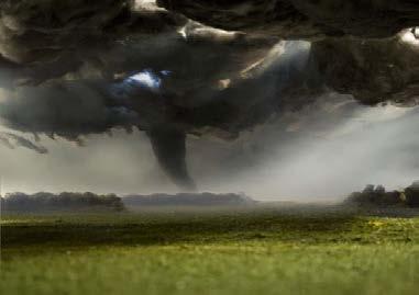
 Image taken from web showing tornado in OK in")


5 #FakeWeather Types Continued Prankers -regurgitate pictures from past weather events and share them, (not always passed along by the original person posting the image) Image taken from web showing tornado in OK in 2016 Wannabees weather enthusiasts who only share the worst case scenario & it goes viral IE. Billy Bob s Weather Page, etc Modifiers -take actual pictures of an event and photoshop/modify them It s unfortunate, but people will share weather info without confirming the source! In essence, false information can ultimately impede our unified messaging.

6 #FakeWeather How to spot them Tips from the Capital Weather Gang at the Washington Post include: Is the time of day correct, shadows, sun location? Is it the correct season? ie. green leaves on tree in picture for a winter tornado Is the image correct geographically? I.E. mountains in the background of a Carolina Beach waterspout Does the image match the type of weather expected? I.E. supercell or shelf cloud being reported as the approach of Hurricane x Did the social media account just pop-up
7 #FakeWeather What can you do to help! Beware before you share! - Only share information that originates from an original/credible source, if you are not sure, then take the extra moment to verify the source s social media account Prepare for the fake shares - Make sure that your staff and constituents are aware of the potential spread of #FakeWeather before, during, and after, especially large impact events watch when the hype begins and be able to direct people to credible sources. Do your best to re-direct Consider posting a credible link directly into a #FakeWeather thread to provide clarification Just because you can doesn t mean you should! - Resist posting and sharing computer model graphics and other information that is hype, especially without providing meaningful context. Bottomline - We all need to work together to share a consistent/unified message.


8 Let s get back to reality Hurricane Season is here and the core of hurricane season is only a few months away. Southeast NC has experienced explosive growth more and more of the population has not experienced a major hurricane. Last year we were lucky, others were not (Texas, Florida, Puerto Rico) Hurricane Harvey NBC5 Hurricane Irma WeatherNation Hurricane Maria CNBC Are we ready if this is the year a Hazel-like storm returns?


9 Brunswick County: All Hurricanes (since 1850 passing within 75 nm of St. James)

10 Hurricane Hazel Cat. 4 Hazel (135 mph) makes landfall at Calabash, NC. Wind gust of 98 mph recorded at ILM. Pressure of 938 mb measured in Hazel s eye by the fishing vessel Judy Ninda 1600 UTC Oct 15


 to Southport -20 ft grassy dunes were leveled")
11 Hurricane Hazel Population shift: I.e. Brunswick County 19k people in 1950, as of 2010 census 107k people in the county Hurricane Ike 2008 (15-20 storm surge) Brunswick County Impacts -352 out of 357 homes on Long Beach were destroyed -All 200 houses on Holden Beach were destroyed -$5 million in damage (1954 dollars) to Southport -20 ft grassy dunes were leveled to flat areas of sand -No houses remained in Ocean Isle Beach

12 St. James Plantation: Hazel inundation Areas

13 Hurricane Return Period Last Direct Impact Hurricane Matthew 2016 Source: NHC
14 Major Hurricane Return Period (Cat 3 or Higher) Hurricanes Last Direct Cat 3 or greater Impact Hurricane Fran 1996 (22 years ago!) Source: NHC


15 Hurricane Fran ( 96) Category 3 landfall with 115 mph winds at Cape Fear. Gusts measured at 105 mph in Southport, 100 mph in Greenville, 86 mph in Wilmington, 79 mph in Raleigh. Responsible for 26 deaths and over 4 billion dollars in damage. Both piers on Wrightsville Beach destroyed. Storm tide reached 12 feet on Topsail Island with hundreds of homes destroyed. Second lowest pressure on record in Wilmington with millibars


16 Atlantic Ocean water temperatures Roughly 30 years of warm water, followed by roughly 30 years of cold water Graphic originally from hockeyschtick.blogspot.com
17 1880s/90s: Hurricanes 1950s: Heat, Hurricanes 90s/2000s: Heat, Hurricanes 1900s/10s: Cold, Snow 1970s/80s: Cold, Snow Atlantic Ocean water temperatures Roughly 30 years of warm water, followed by roughly 30 years of cold water Graphic originally from hockeyschtick.blogspot.com
18 Why are we at risk??: 3 Main Tracks L H H
19 Why are we at risk??: 3 Main Tracks L H

20 Why are we at risk??: 3 Main Tracks L H H

 La")
21 El Nino Southern Oscillation (ENSO) El Nino La Nina Anomaly


22 ENSO and Atlantic Hurricanes Last 6 El Nino Years (2015, 2009, 2006, 2004, 2002, 1997) 65 named storms 28 became hurricanes 15 became major hurricanes (Cat. 3 or >) Last 6 La Nina Years (2016, 2011, 2010, 2007, 2000, 1999) 95 named storms 48 became hurricanes 23 became major hurricanes (Cat. 3 or >) Last 6 Neutral Years (2017, 2014, 2013, 2012, 2008, 2005) 102 named storms 51 became hurricanes 22 became major hurricanes (Cat. 3 or >)
23 Hurricane Outlook Performance 30 NOAA Atlantic Hurricane Outlook Performance 25 # of Named Storms ENSO EN N EN N EN LN N EN LN LN N = NOAA Forecast Range N N EN LN N


24 What is ENSO Projected to be this Hurricane Season? El Nino Neutral La Nina


25 The Outlook
26 National Weather Service Wilmington NC Some common myths or misperceptions I m not evacuating unless it s a Category 3 or higher I don t have to worry about storm surge since it is only a beach thing It s only a Category 1 storm! I saw on Facebook <insert whatever nightmare scenario you can think of> I ve been through a Category 4 before We are okay, the new forecast has us out of the cone! They say it s not going to be a bad year


27 Increased Frequency of Catastrophic Weather Events in Carolinas Hurricane Matthew was the fourth in a series of devastating flood events in the Carolinas since 1999 Hurricane Floyd (1999) September Tropical Fire Hose (2010) Historic SC Floods October (2015) Hurricane Matthew (2016)
28 St. James Plantation: Hazel inundation Areas
2017 Hurricane Season and Beyond
 2017 Hurricane Season and Beyond Ken Graham National Hurricane Center Building a Weather-Ready Nation Much of U.S. Coast Saw Tropical Wind Watches or Warnings 2017 Hurricane Season Facts and Figures 7th
Are You Ready For Hurricane Season? 2018 Hurricane Talk B Y : S T O R M T E A M 8 M E T E O R O L O G I S T J U L I E P H I L L I P S
 Are You Ready For Hurricane Season? 2018 Hurricane Talk B Y : S T O R M T E A M 8 M E T E O R O L O G I S T J U L I E P H I L L I P S About Me I am Currently a Weekday Meteorologist at WFLA Channel 8.
Welcome Jeff Orrock Warning Coordination Meteorologist National Weather Service Raleigh
 Welcome Jeff Orrock Warning Coordination Meteorologist National Weather Service Raleigh Jeff.orrock@noaa.gov Sources: Operational Significant Event Imagery and the Environmental Applications Team (EAT)
2015 Hurricane Season BY: STORM TEAM 8 METEOROLOGIST JULIE PHILLIPS
 2015 Hurricane Season BY: STORM TEAM 8 METEOROLOGIST JULIE PHILLIPS FORECAST COLORADO STATE UNIVERSITY FORECAST IS CALLING FOR ONE OF THE LEAST ACTIVE SEASONS SINCE THE MID 20 TH CENTURY! THE OFFICIAL
Major Hurricane Matthew Briefing Situation Overview
 Major Hurricane Matthew Briefing Situation Overview THIS IS NOW A WORST CASE STORM SURGE SCENARIO Catastrophic Damage is Anticipated for Coastal Areas. Major Hurricane Matthew is still expected to move
El Niño Update Impacts on Florida
 Current Issues in Emergency Management (CIEM) Sessions 1 &2 October 12 th and 26 th, 2006 Florida Division of Emergency Management Tallahassee, Florida El Niño Update Impacts on Florida Bart Hagemeyer
Frank Revitte National Weather Service. Weather Forecast Office New Orleans/Baton Rouge
 Frank Revitte National Weather Service Weather Forecast Office New Orleans/Baton Rouge Above normal activity 17 Total Named Storms 7 Tropical Storms 4 Hurricanes 6 Major Hurricanes Not the most active,
Hurricane Matthew. Life Threatening Flash Flooding Likely. National Weather Service Wilmington NC. Josh Weiss, Meteorologist
 Hurricane Matthew Life Threatening Flash Flooding Likely Threat Assessment for northeast South Carolina & southeast North Carolina National Weather Service Wilmington NC 630 PM EDT Friday October 7, 2016
Hurricane Matthew Life Threatening Flash Flooding Likely
 Hurricane Matthew Life Threatening Flash Flooding Likely Threat Assessment for northeast South Carolina & southeast North Carolina National Weather Service Wilmington NC 12 AM EDT Saturday October 8, 2016
2008 Hurricane Caravan. Daniel Noah Meteorologist National Weather Service x1 May 22, 2008
 2008 Hurricane Caravan Daniel Noah Meteorologist National Weather Service daniel.noah@noaa.gov, 813-645-2323 x1 May 22, 2008 National Weather Service We never close! Open 24 hours a day 365 days per year
LECTURE #18: Hurricane Damage, Monitoring & Case Study
 GEOL 0820 Ramsey Natural Disasters Spring, 2018 LECTURE #18: Hurricane Damage, Monitoring & Case Study Date: 27 March 2018 I. Exam II grades now posted online o high: 98, low: 46, average: 80 (~3 points
HURRICANE SURVIVAL KIT
 HURRICANE SURVIVAL KIT DEFINITION-A hurricane is a very vast and powerful storm that originates in the tropics of the Atlantic Ocean. They become hurricanes when the sustained winds associated with it
Hurricane Season 2018
 Hurricane Season 2018 Mission Protect LIFE and Property (Save Lives and Livelihoods) NOAA/ National Weather Service We are NOT a 9-to-5 agency. We operate 24/7/365 serving communities. We are available
Tropical Storm Ana. Created 615 AM Sat May 9, 2015 Reid Hawkins, Science Officer
 Tropical Storm Ana Threat Assessment for northeast South Carolina & southeast North Carolina Created 615 AM Sat May 9, 2015 Reid Hawkins, Science Officer National Weather Service Wilmington, NC 1 New Information
2015 Hurricane Season Outlook and Preparedness. Amy Godsey State Meteorologist State Emergency Response Team Florida Division of Emergency Management
 2015 Hurricane Season Outlook and Preparedness Amy Godsey State Meteorologist State Emergency Response Team Florida Division of Emergency Management 2015 Hurricane Season Last Hurricane Landfall: Kate
The Wind Hazard: Messaging the Wind Threat & Corresponding Potential Impacts
 The Wind Hazard: Messaging the Wind Threat & Corresponding Potential Impacts Scott Spratt Warning Coordination Meteorologist NWS Melbourne, FL David Sharp Science & Operations Officer NWS Melbourne, FL
GC Briefing. Weather Sentinel Tropical Storm Michael. Status at 8 AM EDT (12 UTC) Today (NHC) Discussion. October 11, 2018
 Today (NHC) Discussion. October 11, 2018") GC Briefing Weather Sentinel Tropical Storm Michael October 11, 2018 After making landfall as a high-end category-4 hurricane on the Florida Panhandle, Michael weakened to tropical storm status early this
GC Briefing Weather Sentinel Tropical Storm Michael October 11, 2018 After making landfall as a high-end category-4 hurricane on the Florida Panhandle, Michael weakened to tropical storm status early this
Communications and Lessons Learned from
 Weather Forecast Office Charleston, SC Communications and Lessons Learned from Southeast and Caribbean and Climate Community of Practice - April, 2017 Public Information and Communications During Extremes
Subtropical Storm Ana
 Subtropical Storm Ana Threat Assessment for northeast South Carolina & southeast North Carolina Created 745 AM Fri May 8, 2015 Reid Hawkins, Science Officer National Weather Service Wilmington, NC 1 New
Hurricane Harvey and What is to come. Eric Berger, Space City Weather
 Hurricane Harvey and What is to come Eric Berger, Space City Weather Today s talk A word about Space City Weather Social media-rology A look back at Hurricane Harvey Why does Houston get these storms Rainfall
NWS HURRICANES June 3, 2015
 NWS HURRICANES June 3, 2015 Hurricane Season June 1 November 30 2 What s the concern? All tropical systems passing within 125nm of central Maryland since 1950 Mid-Atlantic Hurricanes Greatest Risk: August
Storm Surge Forecast with Shifting Forecast Tracks
 Storm Surge Forecast with Shifting Forecast Tracks Storm Surge Findings in the Florida Keys Jon Rizzo Warning Coordination Meteorologist National Weather Service Florida Keys Florida Keys Life History
Ch. 11: Hurricanes. Be able to. Define what hurricane is. Identify the life and death of a hurricane. Identify the ways we track hurricanes.
 Ch. 11: Hurricanes Be able to Define what hurricane is. Identify the life and death of a hurricane. Identify the ways we track hurricanes. What are Hurricanes? Smaller than mid-latitude cyclones. Don t
The Saffir-Simpson Hurricane Wind Scale
 The Saffir-Simpson Hurricane Wind Scale The Saffir-Simpson Hurricane Wind Scale is a one to five categorization based on the hurricane's intensity at the indicated time. The scale provides examples of
Hurricane Matthew. National Weather Service Wilmington NC. Steven Pfaff, WCM.
 Hurricane Matthew Threat Assessment for northeast South Carolina & southeast North Carolina National Weather Service Wilmington NC 730 AM EDT Tuesday October 4, 2016 Steven Pfaff, WCM Steven.Pfaff@noaa.gov
2006 ATLANTIC HURRICANE SUMMARY. Weather Research Center Houston, Texas
 2006 ATLANTIC HURRICANE SUMMARY Weather Research Center Houston, Texas Weather Research Center 5104 Caroline Houston, Texas 77004 Phone: 713-529-3076 Fax: 713-528-3538 E-mail: wrc@wxresearch.org 2006 Atlantic
Major Hurricane Earl
 Major Hurricane Earl Advisory 32 North Carolina Threat Assessment Prepared at: 8 AM Thursday September 2, 2010 Hurricane and Tropical Storm Warnings in effect for the North Carolina Coast and Sounds. NWS
Hurricane Wilma Post Storm Data Acquisition Estimated Peak Wind Analysis and Storm Tide Data. December 27, 2005
 Hurricane Wilma Post Storm Data Acquisition Estimated Peak Wind Analysis and Storm Tide Data December 27, 2005 Hurricane Wilma was the sixth major hurricane of the record-breaking 2005 Atlantic hurricane
Major Hurricane Earl
 Major Hurricane Earl Advisory 33 North Carolina Threat Assessment Prepared at: 11 AM Thursday September 2, 2010 Hurricane and Tropical Storm Warnings in effect for the North Carolina Coast and Sounds NWS
Lessons Learned from Hurricane Harvey and Irma
 EOL Visit to NSF 3 March 2016 Lessons Learned from Hurricane Harvey and Irma Wen-Chau Lee National Center for Atmospheric Research 23 November 2017 Outline: Meteorological elements of the active 2017 Atlantic
Severe Weather: Tornadoes and Hurricanes
 Severe Weather: Tornadoes and Hurricanes Tornadoes Grab Toto!! TORNADOES Are a low pressure storm that usually forms over land in an average year, 800 tornadoes are reported in the U.S. a tornado is defined
Agricultural Outlook Forum Presented: February 17, 2006 THE SCIENCE BEHIND THE ATLANTIC HURRICANES AND SEASONAL PREDICTIONS
 Agricultural Outlook Forum Presented: February 17, 2006 THE SCIENCE BEHIND THE ATLANTIC HURRICANES AND SEASONAL PREDICTIONS Gerald Bell Meteorologist, National Centers for Environmental Prediction NOAA,
Hurricane Tracking Lab
 Hurricane Tracking Lab Background: Hurricanes are one of nature s most powerful disasters. To equal the power of a hurricane, one would have to set off about a thousand nuclear devices per second for as
HURRICANES. The History, Structure, Development, and Destruction. Source:
 HURRICANES The History, Structure, Development, and Destruction Source: http://www.dc.peachnet.edu/~pgore/students/w97/matheson/hpage.htm Hurricane Sandy was the deadliest and most destructive tropical
WEDNESDAY 30 TH AUGUST, :57 p.m. Tropical Storm Irma forms in the Atlantic. Don t let your guard down, always #Be Ready.
 Chapter 1 - The Set Up In the days leading up to Irma a series of composed and sobering text messages, presented in truncated form below, from Department of Disaster Management warned us of the pending
HURRICANES. Source:
 HURRICANES Source: http://www.dc.peachnet.edu/~pgore/students/w97/matheson/hpage.htm What is a hurricane? Violent cyclonic storm that develops in the tropical region Wind speeds are > 74 mph Source: http://www.google.com/imgres?hl=en&sa=x&biw=1920&bih=955&tbm=
TROPICAL DEPRESSION HARVEY BRIEFING
 TROPICAL DEPRESSION HARVEY BRIEFING 10:15 PM CDT Wednesday, August 23, 2017 Prepared by: Lara Beal NWSCorpus www.weather.gov/corpuschristi Situation Overview No changes to Watches. Hurricane Watch remains
11/17/2017. Memorable Hurricanes of 2004 MET 4532
 MET 4532 2004 Hurricane Season Lecture 31 & 32 2004, 2005, and After 17-20 November 2017 1 2 Memorable Hurricanes of 2004 Hurricane Dates Damage (US) Deaths (US) Charlie (4) 9-14 AUG $14B 10 Ivan (4) 2-24
Your Task: Read each slide then use the underlined red or underlined information to fill in your organizer.
 Severe Weather: Tornadoes and Hurricanes Thunderstorms and Lightning S6E4 d. Construct an explanation of the relationship between air pressure, weather fronts, and air masses and meteorological events
Tropical Storm Ana. Created 6:00 AM Sun May 10, 2015 John Cole Warning Coordination Meteorologist
 Tropical Storm Ana Threat Assessment for Eastern North Carolina Created 6:00 AM Sun May 10, 2015 John Cole Warning Coordination Meteorologist John.cole@noaa.gov National Weather Service Newport/Morehead
ARUBA CLIMATOLOGICAL SUMMARY 2017 PRECIPITATION
 ARUBA CLIMATOLOGICAL SUMMARY 2017 PRECIPITATION The total amount of rainfall recorded at Reina Beatrix International Airport for the year 2017 was 391.0 mm. This is 17.1 % below normal ( Figure 1 ). During
At the Midpoint of the 2008
 At the Midpoint of the 2008 Atlantic Hurricane Season Editor s note: It has been an anxious couple of weeks for those with financial interests in either on- or offshore assets in the Gulf of Mexico and
Hurricane Matthew Page 1 Location Forecast Analysis Summary Report - Advanced Wind Estimation On
 Page 1 Current NHC Forecast Predictions Maximum Sustained Winds / Storm Category: 138 MPH / Category 4 Forward motion: 9 mph towards the North Hurricane Force winds extend from the center: 46 miles Tropical
GC Briefing. Weather Sentinel Hurricane Florence. Status at 5 PM EDT (21 UTC) Today (NHC) Discussion. September 13, 2018
 Today (NHC) Discussion. September 13, 2018") GC Briefing September 13, 2018 Weather Sentinel Hurricane Florence Tropical storm conditions have been reported for areas of North Carolina and will continue to spread inland to the west and south. Hurricane
GC Briefing September 13, 2018 Weather Sentinel Hurricane Florence Tropical storm conditions have been reported for areas of North Carolina and will continue to spread inland to the west and south. Hurricane
Hurricane Matthew Threats and Impacts Briefing for Eastern NC
 Hurricane Matthew Threats and Impacts Briefing for Eastern NC October 6 th, 2016 Date/Time Created: 10/6/2016, Noon EDT National Weather Service Newport/Morehead City, NC Hurricane Matthew Key Points Changes
Appendix B Lesson 1: What Is Weather Exit Ticket
 Appendix B Lesson 1: What Is Weather Exit Ticket Name Date Period What is Weather? Exit Ticket List 3 things that you learned during the demonstrations today. What are two questions that you still have?
A HURRICANE IS COMING. Presented by Atiba Upchurch Broward Emergency Management Division
 A HURRICANE IS COMING Presented by Atiba Upchurch Broward Emergency Management Division Mission Statement To safeguard the lives and property of the people of Broward County from major hazards and emergencies
Outlook 2008 Atlantic Hurricane Season. Kevin Lipton, Ingrid Amberger National Weather Service Albany, New York
 Outlook 2008 Atlantic Hurricane Season Kevin Lipton, Ingrid Amberger National Weather Service Albany, New York Summary 2007 Hurricane Season Two hurricanes made landfall in the Atlantic Basin at category-5
Fire Weather Drivers, Seasonal Outlook and Climate Change. Steven McGibbony, Severe Weather Manager Victoria Region Friday 9 October 2015
 Fire Weather Drivers, Seasonal Outlook and Climate Change Steven McGibbony, Severe Weather Manager Victoria Region Friday 9 October 2015 Outline Weather and Fire Risk Environmental conditions leading to
A Hurricane Outlook for the 21st Century.
 A Hurricane Outlook for the 21st Century. Hugh Willoughby Florida International University Cat Winds Effects One 74-95 mph No real damage to building structures. Two Three Four Five 96-110 mph 111-130
NOAA Storm Surge Modeling Gaps and Priorities
 NOAA Storm Surge Modeling Gaps and Priorities HFIP Meeting November 9 th, 2017 Laura Paulik Alaka NHC Storm Surge Unit Introduction to Probabilistic Storm Surge P-Surge is based on an ensemble of Sea,
3/5/2013 UNCERTAINTY IN HURRICANE FREQUENCY: HOW MODELERS APPROACH THE PROBLEM PROBLEM STATEMENT
 UNCERTAINTY IN HURRICANE FREQUENCY: HOW MODELERS APPROACH THE PROBLEM Matthew Nielsen Director, Product Management PROBLEM STATEMENT Hurricane Frequency Isn t Stable Over Time Are historical average frequencies
2011 Year in Review TORNADOES
 2011 Year in Review The year 2011 had weather events that will be remembered for a long time. Two significant tornado outbreaks in April, widespread damage and power outages from Hurricane Irene in August
A Look Back at the 2012 Hurricane Season and a Look Ahead to 2013 & Beyond. Daniel Brown National Hurricane Center Miami, Florida 24 April 2013
 A Look Back at the 2012 Hurricane Season and a Look Ahead to 2013 & Beyond Daniel Brown National Hurricane Center Miami, Florida 24 April 2013 2012 Atlantic Verification Good News- Lots of Accuracy Records
Hurricane Matthew. National Weather Service Wilmington NC. Steven Pfaff, WCM.
 Hurricane Matthew Threat Assessment for northeast South Carolina & southeast North Carolina National Weather Service Wilmington NC 515 PM EDT Monday October 3, 2016 Steven Pfaff, WCM Steven.Pfaff@noaa.gov
Climate Outlook through 2100 South Florida Ecological Services Office Vero Beach, FL September 9, 2014
 Climate Outlook through 2100 South Florida Ecological Services Office Vero Beach, FL September 9, 2014 Short Term Drought Map: Short-term (
Winter. Here s what a weak La Nina usually brings to the nation with tempseraures:
 2017-2018 Winter Time again for my annual Winter Weather Outlook. Here's just a small part of the items I considered this year and how I think they will play out with our winter of 2017-2018. El Nino /
Hurricanes. Hurricanes are large, tropical storm systems that form and develop over the warm waters near the equator.
 Hurricanes Hurricanes are large, tropical storm systems that form and develop over the warm waters near the equator. They are responsible for weather that can devastate entire communities: Heavy rain --
1.2 DEVELOPMENT OF THE NWS PROBABILISTIC EXTRA-TROPICAL STORM SURGE MODEL AND POST PROCESSING METHODOLOGY
 1.2 DEVELOPMENT OF THE NWS PROBABILISTIC EXTRA-TROPICAL STORM SURGE MODEL AND POST PROCESSING METHODOLOGY Huiqing Liu 1 and Arthur Taylor 2* 1. Ace Info Solutions, Reston, VA 2. NOAA / NWS / Science and
PRMS WHITE PAPER 2014 NORTH ATLANTIC HURRICANE SEASON OUTLOOK. June RMS Event Response
 PRMS WHITE PAPER 2014 NORTH ATLANTIC HURRICANE SEASON OUTLOOK June 2014 - RMS Event Response 2014 SEASON OUTLOOK The 2013 North Atlantic hurricane season saw the fewest hurricanes in the Atlantic Basin
Weather Research Center
 Weather Research Center 3227 Audley Houston, Texas 77098 Phone: 713-529-3076 Fax: 713-528-3538 E-mail: wrc@wxresearch.org Press Release For Immediate Release November 29, 2005 For Information Contact:
Disaster Risk Management in India. Kamal Kishore New Delhi, 27 October 2016
 Disaster Risk Management in India Kamal Kishore New Delhi, 27 October 2016 Hazard, Exposure and Vulnerability Disaster Prevention Mitigation Hurricane Matthew: Cuba & Haiti Emergency Response Coordination
MIAMI-SOUTH FLORIDA National Weather Service Forecast Office
 MIAMI-SOUTH FLORIDA National Weather Service Forecast Office http://www.weather.gov/miami June 2015 South Florida Weather Summary Dry East, Wet West...Drought Remains SE Florida July 3, 2015: Depending
Planning for the Threat Preparing for the Impacts The Role of the Local Forecast
 Planning for the Threat Preparing for the Impacts The Role of the Local Forecast 2014 Florida Governor Hurricane Conference Pablo Santos NOAA/NWS WFO Miami, FL 2014 - FLGHC 2014 - FLGHC Decision Support
Homework Assignment IV. Weather Exercises
 Page 1 of 5 EENS 3050/6050 Tulane University Natural Disasters Prof. Stephen A. Nelson Homework Assignment IV. Weather Exercises This document last updated on 16-Nov-2016 1. Go to the following link to
Ensuring the Building of Community Resiliency through Effective Partnership December 4, 2017 Melia Nassau Beach Valentino A. Hanna
 Ensuring the Building of Community Resiliency through Effective Partnership December 4, 2017 Melia Nassau Beach Valentino A. Hanna Sol Caribbean Presence What Occurred Mega Storms 2017 Cat 5 Hurricane
Storms. Tropical Cyclone?
 Storms Tropical Cyclone? Tropical Cyclone: low pressure storm forming in the tropics (Start as Thunder Storms). They form around a center, producing heavy winds and rains. Storms What strengthens a Tropical
Chapter 16, Part Hurricane Paths. 2. Hurricane Paths. Hurricane Paths and Damage
 Chapter 16, Part 2 Hurricane Paths and Damage 1. Hurricane Paths Start over tropical water except South Atlantic and eastern South Atlantic, where water is too cold. Initially steered by easterly winds
Current Details from the National Hurricane Center (NHC)
") Current Watches and Warnings A Warning is in effect from Anclote River to the Okaloosa/Walton County Line; north of the Volusia/Brevard County line to the South Santee River A Surge Warning is in effect
Current Watches and Warnings A Warning is in effect from Anclote River to the Okaloosa/Walton County Line; north of the Volusia/Brevard County line to the South Santee River A Surge Warning is in effect
Preliminary Assessment of 2017 Atlantic Hurricane Season. Phil Klotzbach. Department of Atmospheric Science. Phil Klotzbach
 Atlantic Basin Basin Tropical Seasonal Cyclone Hurricane Climatology Prediction and Preliminary Assessment of 2017 Atlantic Hurricane Season Phil Klotzbach Department of Atmospheric Science Colorado Phil
Climate Variability and El Niño
 Climate Variability and El Niño David F. Zierden Florida State Climatologist Center for Ocean Atmospheric Prediction Studies The Florida State University UF IFAS Extenstion IST January 17, 2017 The El
Here s what a weak El Nino usually brings to the nation with temperatures:
 Time again for my annual Winter Weather Outlook. Here's just a small part of the items I considered this year and how I think they will play out with our winter of 2018-2019. El Nino / La Nina: When looking
Module 11: Meteorology Topic 6 Content: Severe Weather Notes
 Severe weather can pose a risk to you and your property. Meteorologists monitor extreme weather to inform the public about dangerous atmospheric conditions. Thunderstorms, hurricanes, and tornadoes are
Tropical Update. 12 PM EDT Friday, October 7, 2016 Hurricane Matthew & Tropical Storm Nicole
 Tropical Update 12 PM EDT Friday, October 7, 2016 Hurricane Matthew & Tropical Storm Nicole This update is intended for government and emergency response officials, and is provided for informational and
Hurricanes. Environmental Geology Mr. Paul Lowrey. Stacey Singleton, Cassandra Combs, Dwight Stephenson, Matt Smithyman
 Environmental Geology Mr. Paul Lowrey Stacey Singleton, Cassandra Combs, Dwight Stephenson, Matt Smithyman Hurricanes EMPACTS Project, Spring 2017 Northwest Arkansas Community College, Bentonville, AR
Tropical Update. 5 AM EDT Wednesday, September 6, 2017 Hurricane Irma, Tropical Storm Jose, and Tropical Storm Katia
 Tropical Update 5 AM EDT Wednesday, September 6, 2017 Hurricane Irma, Tropical Storm Jose, and Tropical Storm Katia This update is intended for government and emergency response officials, and is provided
Homework 8: Hurricane Damage (adapted from Pipkin et al.)
") 1 Homework 8: Hurricane Damage (adapted from Pipkin et al.) Tropical cyclones have a significant impact on coastal areas of the world. In the Atlantic and Eastern Pacific Oceans they are called hurricanes
1 Homework 8: Hurricane Damage (adapted from Pipkin et al.) Tropical cyclones have a significant impact on coastal areas of the world. In the Atlantic and Eastern Pacific Oceans they are called hurricanes
COLORING & ACTIVITY BOOK
 COLORING & ACTIVITY BOOK Here are some important tips for hurricane season. Broward County wants you and your family to be during hurricane season June 1st through November 30th. Let s get started! 2 Hurricane
Hurricane Harvey: SE Texas Impacts. 10 PM CDT UPDATE Friday, August 25, 2017 Prepared by: Lance Wood
 Hurricane Harvey: SE Texas Impacts 10 PM CDT UPDATE Friday, August 25, 2017 Prepared by: Lance Wood Latest Observations Hurricane Harvey making landfall this evening near Rockport as a category 4 hurricane.
An Analysis of Past River Flooding at Select National Weather Service River Forecast Locations in South Carolina
 An Analysis of Past River Flooding at Select National Weather Service River Forecast Locations in South Carolina Jeff C. Dobur AUTHOR: Sr. Hydrologist. National Oceanic and Atmospheric Administration,
National Hurricane Program. FEMA Region IV
 National Hurricane Program FEMA Region IV Percent NHP A quick background Hurricane Program major buckets (Toolboxes) Hurricane Evacuation Study HURREVAC Post Storm Assessments Training Hurricane Liaison
Table 1. August average temperatures and departures from normal ( F) for selected cities.
 for selected cities.") Climate Summary for Florida August 2016 Prepared by Lydia Stefanova and David Zierden Florida Climate Center, The Florida State University, Tallahassee, Florida Online at: http://climatecenter.fsu.edu/products-services/summaries
Climate Summary for Florida August 2016 Prepared by Lydia Stefanova and David Zierden Florida Climate Center, The Florida State University, Tallahassee, Florida Online at: http://climatecenter.fsu.edu/products-services/summaries
The 2014 Atlantic Hurricane Season. What is New and What to Expect. Mark Chambers President & CEO ImpactWeather, Inc.
 The 2014 Atlantic Hurricane Season What is New and What to Expect Mark Chambers President & CEO ImpactWeather, Inc. Hurricane Climatology for the Gulf of Mexico A Look back at 2013 The outlook for this
Tropical Update. 5 PM EDT Thursday, September 7, 2017 Hurricane Irma, Hurricane Jose, and Hurricane Katia
 Tropical Update 5 PM EDT Thursday, September 7, 2017 Hurricane Irma, Hurricane Jose, and Hurricane Katia This update is intended for government and emergency response officials, and is provided for informational
Donna J. Kain, PhD and Catherine F. Smith, PhD East Carolina University
 Risk Perceptions and Emergency Communication Effectiveness in Coastal Zones Preliminary Findings on Interpretations of Weather Related Messages and Maps Donna J. Kain, PhD (kaind@ecu.edu), and Catherine
ovember 2008 Antigua and Barbuda Meteorological Service
 ovember 2008 Antigua and Barbuda Meteorological Service The Atlantic Hurricane Season Summary 2008 Special Focus on Antigua and Barbuda The Season in Brief Sixteen (16) named storms formed in the Atlantic
The 2015 NWS Spring and Summer Weather Update
 http://weather.gov The 2015 NWS Spring and Summer Weather Update Western North Carolina severe weather climatology Tony Sturey, WCM Greenville/Spartanburg, SC North Carolina Spring and Summer Outlooks
El Niño & Expected Florida Severe Weather
 El Niño & Expected Florida Severe Weather Brady Smith, AICP, CFM Tampa Bay Regional Planning Council brady@tbrpc.org ONE BAY Resilient Communities Working Group Meeting February 5, 2016 El Niño & Expected
Hurricanes, Sea Level Rise, and South Florida s Challenging Future
 Hurricanes, Sea Level Rise, and South Florida s Challenging Future Brian McNoldy Senior Research Associate University of Miami Tropical Weather Expert Washington Post Scientific Advisor Coastal Risk Consulting
Hurricane Season 2010 & NOAA s Deepwater Response
 Hurricane Season 2010 & NOAA s Deepwater Response What s Happened? What Will 2010 Bring? Possible Shoreline Effects Darin Figurskey Meteorologist-in-Charge NOAA s NWS Raleigh, NC NOAA s National Weather
2013 ATLANTIC HURRICANE SEASON OUTLOOK. June RMS Cat Response
 2013 ATLANTIC HURRICANE SEASON OUTLOOK June 2013 - RMS Cat Response Season Outlook At the start of the 2013 Atlantic hurricane season, which officially runs from June 1 to November 30, seasonal forecasts
SLOSH New Orleans Basin 2012 Update
 SLOSH New Orleans Basin 2012 Update Michael Koziara Science and Operations Officer National Weather Service Slidell, LA The Basics What is storm surge? What is SLOSH? Details Assumptions Inundation = Storm
Compare and Contrast
 Read the two passages about hurricanes. Think about similarities and differences between the two passages. How and Where Hurricanes Form Hurricanes are very powerful storms that are capable of causing
Hurricane Irma. City of Cocoa Beach September 8 12, 2017
 Hurricane Irma City of Cocoa Beach September 8 12, 2017 Monitoring prior to landfall Expected effects What happened What went well What didn t go well Changes and improvements After Action Outline Storm
Hurricane Charley: A Retrospective 2014 Florida Governor s Hurricane Conference
 Hurricane Charley: A Retrospective 2014 Florida Governor s Hurricane Conference 2004 Hurricane Season: Storm Tracks Satellite Images of 2004 Hurricanes Charley Frances Ivan Jeanne Three Hurricanes in Polk
Name Earth Science Pd. Hurricanes. Directions: Read the information, view diagrams and answer the questions in the worksheet.
 Hurricanes Directions: Read the information, view diagrams and answer the questions in the worksheet. Hurricane Basics The ingredients for a hurricane include a pre-existing weather disturbance, warm tropical
A Perfect Storm: The Collision of Tropical Cyclones, Climate Change and Coastal Population Growth. Jeff Donnelly Woods Hole Oceanographic Institution
 A Perfect Storm: The Collision of Tropical Cyclones, Climate Change and Coastal Population Growth Jeff Donnelly Woods Hole Oceanographic Institution Recent Hurricane Trends What Might the Future Hold?
Key Takeaways: - Rain: Coastal NC: ; isolated totals to 40 Central, Western, & Northeastern NC: 5-10 ; isolated totals to 20
 Key Takeaways: - Life-Threatening Impacts Will Extend Far From The Storm s Center: Despite the southward shift in track, widespread and extreme impacts from heavy rain, storm surge, and wind are still
Issue Overview: El Nino and La Nina
 Issue Overview: El Nino and La Nina By Bloomberg, adapted by Newsela staff on 09.28.16 Word Count 748 TOP: A Category 5 typhoon in the Pacific Ocean. BOTTOM: Graphics courtesy of the U.S. National Oceanic
Tropical Update. 5 AM EDT Thursday, September 7, 2017 Hurricane Irma, Hurricane Jose, and Hurricane Katia
 Tropical Update 5 AM EDT Thursday, September 7, 2017 Hurricane Irma, Hurricane Jose, and Hurricane Katia This update is intended for government and emergency response officials, and is provided for informational