Measuring and GIS Referencing of Network Level Pavement Deterioration in Post-Katrina Louisiana March 19, 2008
|
|
|
- Marilynn Allison
- 6 years ago
- Views:
Transcription

1 Infrastructure Data Collection Solutions Measuring and GIS Referencing of Network Level Pavement Deterioration in Post-Katrina Louisiana March 19, 2008

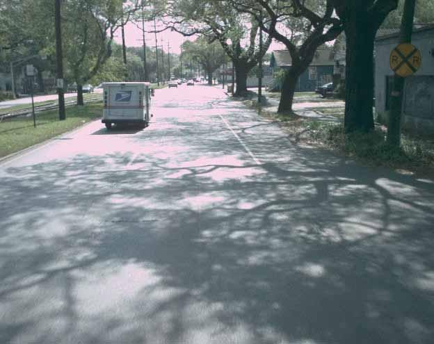
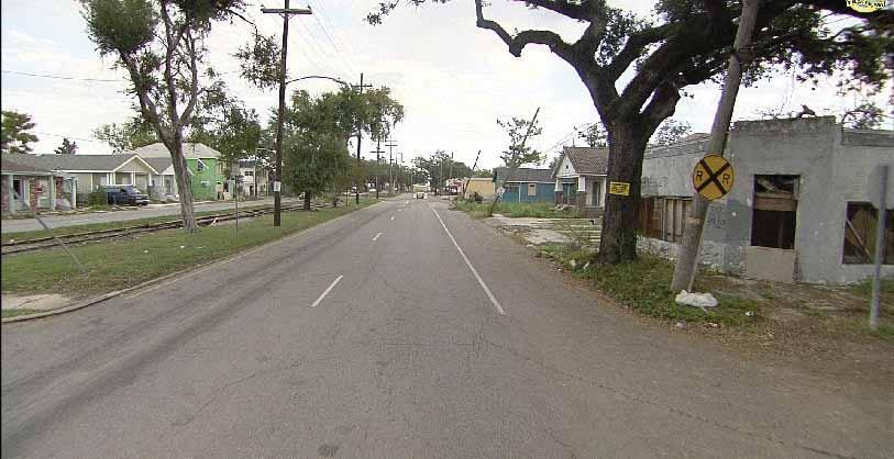
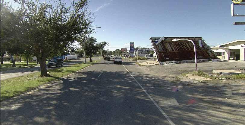
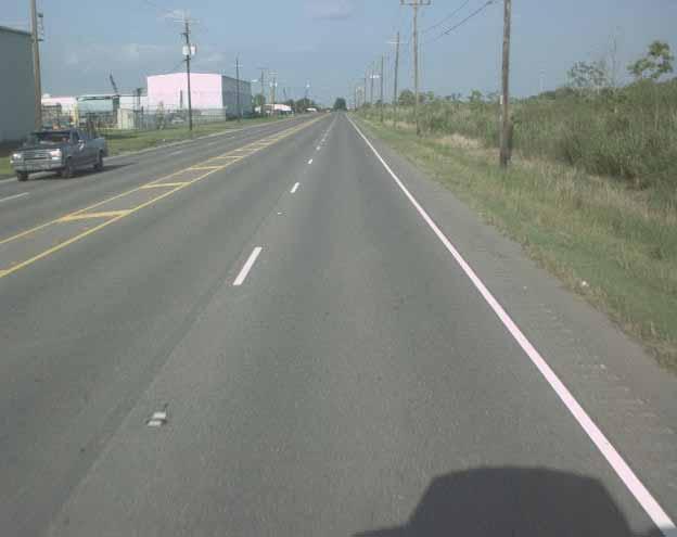
2 Hurricane Katrina August 2005 I-10 I-610 West End Blvd. Interchange source:
3 Hurricane Katrina August 2005 Touched land August Directly hit District 02 including the City of New Orleans Over 1,800 people died as a result of the storm Property damage estimated at $81 Billion The DOTD and The Federal Emergency Management Agency (FEMA) were in discussions with regards to assigning funding appropriate to the damage done by the hurricane The DOTD contracted FWD testing for the district to assess the condition of the roads FEMA was not prepared to accept this data as proof of damage caused by Katrina, as there was no historical comparison Pavement distress data had been collectedonatwoyearcyclesince1994 Right Of Way imagery collected concurrently with the pavement data
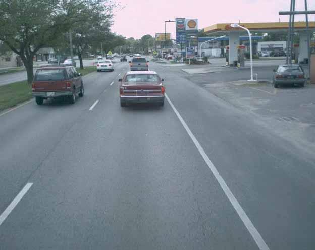
4 Louisiana DOTD Statewide data collection had been collected on a two year cycle for over 10 years Collected Data Includes: Digital Videolog Pavement Imagery Distress Data Roughness Rutting Faulting All Collected data and imagery are associated to the Linear Referencing System as well as GPS
5 Fugro-Roadware Roadware Group is a division of Fugro World Wide Established in 1969 Largest automated collector of road data in North America Design, build, support & operate the ARAN Data elements collected GPS Data Pavement Images Rutting depths International Roughness Index (IRI) Right of Way Images

6 Pavement Condition Data Rear downward facing cameras Continuous pavement images of full lane width Distresses 2mm (0.08 inches) in size

7 Pavement Distress

8 Rutting Pair of INO Lasers Measure full transverse profile of the road surface Profile is evaluated to determine the depths of ruts

9 International Roughness Index (IRI) Laser SDP System 16 khz laser in each wheelpath Measures continuous profile of the roadway

10 GPS Data Trimble System Applanix POS (Position and Orientation System) Collected every 10 millimiles (52.8 feet) Two antennas to give vehicle heading

11 Right Of Way Images Wide angle High Definition images A single image every 5 millimiles (26.4 feet)

12 End Result Multi dimensional set of accurate condition data Data is linear referenced, but also accurately georeferenced Linear referencing is the typical way to view condition data GPS data typically used to verify road section segmentation We now have the ability to sort and analyze data spatially
13
14

15
16
17

18
19

20 Geo-Referenced Distress Data Pavement Distress rated according to LADOT specific rating protocol. Random (Miscellaneous) Cracking chosen for the purpose of this presentation

21 Segment Level Data

22 Segment Level Data

23 Station Level Data
24 Deterioration Curves COMPOSITE INTERSTATE DETERIORATION CURVE ROUGHNESS INDEX AGE COMPOSITE CURVE Possible Modified Curve Post Katrina Single Year Curve
25 Deterioration Curves JOINTED INTERSTATE DETERIORATION CURVE ROUGHNESS INDEX AGE CONCRETE CURVE Possible Modified Curve Post Katrina Single Year Curve
26 Summary TheDOTDwillbecomparingthedatafromthe3 consecutive cycles. Loaded into the PMS for analysis Planned treatments, life cycle costing, and deterioration curves will be reviewed Having had a comprehensive and integrated data collection, PMS, and GIS program will allow the DOTD to: Compare year over year data and imagery Analyze the impact of any major changes within District 02 Have a factual foundation for a discussion around the economic impact
27 Thank you!
City of Phoenix Pavement Management System. Ryan Stevens Civil Engineer III Street Transportation Department November 15, 2017
 City of Phoenix Pavement Management System Ryan Stevens Civil Engineer III Street Transportation Department November 15, 2017 Outline City of Phoenix Street Network Automated data collection Distresses
HPMS Rule on Collecting Pavement Condition Data. Roger Smith Sui Tan
 HPMS Rule on Collecting Pavement Condition Data Roger Smith Sui Tan Final Rule Issued January Affects Local agencies that have non-state NHS roads/ street For which you report HPMS data to Caltrans 2 Final
Implementing (Bleeding) Standards for Pavement Data Collection. RICK MILLER, Pavement Management Engineer, Kansas Dept.
 Standards for Pavement Data Collection. RICK MILLER, Pavement Management Engineer, Kansas Dept.") Implementing (Bleeding) Standards for Pavement Data Collection RICK MILLER, Pavement Management Engineer, Kansas Dept. of Transportation About the Presenter Rick Miller Kansas Department of Transportation
Implementing (Bleeding) Standards for Pavement Data Collection RICK MILLER, Pavement Management Engineer, Kansas Dept. of Transportation About the Presenter Rick Miller Kansas Department of Transportation
Non-Destructive Pavement Evaluation to Assess Flood Damage in The City of Calgary
 Non-Destructive Pavement Evaluation to Assess Flood Damage in The City of Calgary Venkat Lakkavalli P. Eng., M. Sc. The City of Calgary Alberta, Canada Presented at TAC 2014, Montreal (Karim, M et al.
3Chapter Three: Rescue and Response
 17 16 Report Science Title and the Storms: the USGS Response to the Hurricanes of 2005 3Chapter Three: Rescue and Response This chapter documents the U.S. Geological Survey s (USGS) humanitarian rescue
The Tampa Bay Catastrophic Plan Presentation to CFGIS Users Group FDOT District 5 Urban Offices - Orlando July 30, 2010
 The Tampa Bay Catastrophic Plan Presentation to CFGIS Users Group FDOT District 5 Urban Offices - Orlando July 30, 2010 Brady Smith Senior Planner Tampa Bay Regional Planning Council Introduction Recent
The State of Michigan Transportation Asset Management Council 2006 PASER Survey Of Shiawassee County
 The State of Michigan Transportation Asset Management Council 2006 PASER Survey Of Shiawassee County Prepared by the Genesee County Metropolitan Planning Commission Staff 1 The State of Michigan Transportation
Mary Sharp 1, CFM, GIS Manager. Nicholas Wissler 2, GIS Manager. James Stevenson 1, GISP, GIS Specialist. Matt Batina 1, GIS Specialist
 Mapping Infrastructure Damages from FEMA Field Notes in Support of the City of New Orleans Hurricane Katrina Disaster Recovery Efforts Mary Sharp 1, CFM, GIS Manager Nicholas Wissler 2, GIS Manager James
A STUDY OF MANUAL VS AUTOMATED PAVEMENT CONDITION SURVEYS. Dr. David H. Timm. Jason M. McQueen
 A STUDY OF MANUAL VS AUTOMATED PAVEMENT CONDITION SURVEYS Dr. David H. Timm Jason M. McQueen Highway Research Center Auburn University Auburn, Alabama May 2004 ABSTRACT A STUDY OF MANUAL VS AUTOMATED PAVEMENT
New Jersey Department of Transportation Extreme Weather Asset Management Pilot Study
 New Jersey Department of Transportation Extreme Weather Asset Management Pilot Study Overview Prepared for: June 26, 2018 Introduction Overview of Pilot Study New Jersey s Climate New Jersey s Transportation
Lesson: Don t Wait For the Storm
 Lesson: Don t Wait For the Storm Developing a GIS for Plaquemines Parish, Louisiana Presented by: Daniel Mellott, GISP Burk Kleinpeter, Inc. Where is Plaquemines Parish? 1998 GIS Feasibility Study User
Title Model For Pavement Asset Manageme.
 Kochi University of Technology Aca A Study On Structural Performance Title Model For Pavement Asset Manageme Shimeno, Shigeru, Kamiya, Keizo, Author(s), Eguchi, Masayuki Society for Social Management Sys
DETERMINE JOINTED PLAIN CONCRETE PAVEMENT (JPCP) SLAB REPLACEMENT TREATMENT USING SENSING TECHNOLOGY
 SLAB REPLACEMENT TREATMENT USING SENSING TECHNOLOGY") DETERMINE JOINTED PLAIN CONCRETE PAVEMENT (JPCP) SLAB REPLACEMENT TREATMENT USING SENSING TECHNOLOGY Presented by Yi-Ching Wu Georgia Institute of Technology Pavement Evaluation 2014 September 15-18, 2014
DETERMINE JOINTED PLAIN CONCRETE PAVEMENT (JPCP) SLAB REPLACEMENT TREATMENT USING SENSING TECHNOLOGY Presented by Yi-Ching Wu Georgia Institute of Technology Pavement Evaluation 2014 September 15-18, 2014
LTPP Automated Faulting Measurement
 LTPP Automated Faulting Measurement MAHESH AGURLA mahesh.agurla.ctr@dot.gov SEAN LIN sean.lin.ctr@dot.gov Presentation Overview Introduction Research objectives Profile data processing Analysis & comparison
Hari Priya Pemmaraju Venkata NRS 509 November, 28th 2005
 Hari Priya Pemmaraju Venkata NRS 509 November, 28th 2005 Geographic Information System for Pavement Management Pavements are one of the critical elements of the highway transportation infrastructure in
Adaptability of AASHTO Provisional Standards for Condition Surveys for Roughness and Faulting in Kansas
 Adaptability of AASHTO Provisional Standards for Condition Surveys for Roughness and Faulting in Kansas Kamesh Vedula Department of Civil Engineering Kansas State University Manhattan, KS 66506 kamesh@ksu.edu
Geospatial Information Management in the Americas: Lessons for the Post-2015 development agenda
 Geospatial Information Management in the Americas: Lessons for the Post-2015 development agenda Rolando Ocampo President, UN-GGIM: Americas October 2014 The integration of statistical and geographical
ROAD INFORMATION SYSTEM FOR MAINTENANCE MANAGEMENT OF ROAD INFRASTRUCTURE PROJECTS
 ROAD INFORMATION SYSTEM FOR MAINTENANCE MANAGEMENT OF ROAD INFRASTRUCTURE PROJECTS Need for GIS Voluminous/ Manual Data Vs Digital Need for GIS CE - C&B (North) KPWD Secretary Office CE - C&B (South) Dispersed
Calhoun County, Texas Under 5 Meter Sea Level Rise
 Kyle Kacal GEO 327G Calhoun County, Texas Under 5 Meter Sea Level Rise PROBLEM AND PURPOSE: Sea level rise is threat to all coastal areas. Although natural sea level rise happens at a very slow rate, hurricanes
Greater New Orleans Hurricane and Storm Damage Risk Reduction System 101
 Greater New Orleans Hurricane and Storm Damage Risk Reduction System 101 René Poché New Orleans District U.S. Army Corps of Engineers US Army Corps of Engineers BUILDING STRONG 1878 Gentilly Ridge Metairie
GEOGRAPHIC INFORMATION SYSTEMS
 GEOGRAPHIC INFORMATION SYSTEMS 4-H Round-Up Community Transitions Workshop Daniel Hanselka June 14, 2011 Goals of the Workshop Answer the question: What is GIS? Uses of GIS. Some of the Common Terminology
Innovated Technological Trends in Highways. Flood Modelling & Evaluation of Impacts on Infrastructure
 Innovated Technological Trends in Highways Flood Modelling & Evaluation of Impacts on Infrastructure Dr. Waheed Uddin Professor and Director CAIT University of Mississippi Contributions from: CAIT and
Construction complete on all HSDRRS projects across storm evacuation routes
 Task Force Hope Status Report August 29, 2013 Construction complete on all HSDRRS projects across storm evacuation routes Eastern Tie-In Swing Gates positioned across Hwy. 23 By Susan Spaht If a tropical
The sensitivity of repeated profile measurements to pavement unevenness and surface conditions
 CONTROL ENGINEERING The sensitivity of repeated profile measurements to pavement unevenness and surface conditions ENEA SOGNO and MICHELE MORI Prague, 20.10.2016 Summary The company Business sectors Accreditation
Frequently Asked Questions about MnDOT s Railroad Map Conversion Project
 Frequently Asked Questions about MnDOT s Railroad Map Conversion Project What were the main objectives of the project? What are the results and end products? What can these railroad maps be used for? Who
Pavement Distress Categories
 Pavement Distress Identification Jointed Concrete Pavements Raymond Ong, Purdue University William Flora, INDOT Planning Joyce Stone, INDOT Pavement Engineering Samy Noureldin, INDOT Research Pavement
Linear Referencing Systems (LRS) Support for Municipal Asset Management Systems
 Support for Municipal Asset Management Systems") Linear Referencing Systems (LRS) Support for Municipal Asset Management Systems Esri Canada Infrastructure Asset Management Leadership Forum November 1, 2017 Toronto, ON David Loukes, P. Eng., FEC Andy
Linear Referencing Systems (LRS) Support for Municipal Asset Management Systems Esri Canada Infrastructure Asset Management Leadership Forum November 1, 2017 Toronto, ON David Loukes, P. Eng., FEC Andy
Hurricane Katrina Tracking Lab
 Hurricane Katrina Tracking Lab Introduction: The 2005 hurricane season was the most active season on record resulting in 28 named storms. Hurricane Katrina was the eleventh named storm and would end up
2006 & 2007 Pre-Hurricane Scenario Analyses
 2006 & 2007 Pre-Hurricane Scenario Analyses Executive Summary May 2007 Page 1 OF X FOR OFFICIAL USE ONLY 4 Public Availability to be Determined Under 5 U.S.C. 552 NOTE: Limited Distribution. Release of
2015 North Dakota Asphalt Conference
 2015 North Dakota Asphalt Conference NDDOT Implementation of AASHTO Flexible Pavement Design Part I ADT & ESALs Nickie Reis, P&AM Part II Structural Numbers Tom Bold, M&R March 31 - April 1, 2015 Part
JALBTCX AND THE USACE NATIONAL COASTAL MAPPING PROGRAM
 JALBTCX AND THE USACE NATIONAL COASTAL MAPPING PROGRAM 237 237 237 217 217 217 200 200 200 80 119 27 252 174.59 1 255 255 255 0 0 0 163 163 163 131 132 122 239 65 53 110 135 120 112 92 56 62 102 130 102
Advanced Image Analysis in Disaster Response
 Advanced Image Analysis in Disaster Response Creating Geographic Knowledge Thomas Harris ITT The information contained in this document pertains to software products and services that are subject to the
DMS-UAV Accuracy Assessment: AP20 with Nikon D800E
 DMS-UAV Accuracy Assessment: AP20 with Nikon D800E Joe Hutton, Greg Lipa, James Lutes, Omer Mian Applanix, William Chan - GeoPixel Air Introduction The Direct Mapping Solution for Unmanned Aerial Vehicles
Determine the flooded area based on elevation information and the current water level
 Identifying Data Needs Identifying Data Needs Purpose Before looking for data, the methodology needs to be analyzed to establish what data is needed The most important question that needs to be answered
Mapping a Nation in 3D Singapore s Journey. Bryan Chew Registrar of Titles Assistant Chief Executive Singapore Land Authority
 Mapping a Nation in 3D Singapore s Journey Bryan Chew Registrar of Titles Assistant Chief Executive Singapore Land Authority Singapore Size - 719 sq km Population - 5.5 million Density 7,600/sq km Singapore
ESTIMATION OF REMAINING SERVICE LIFE OF FLEXIBLE PAVEMENTS FROM SURFACE DEFLECTIONS DABA SHABARA GEDAFA
 ESTIMATION OF REMAINING SERVICE LIFE OF FLEXIBLE PAVEMENTS FROM SURFACE DEFLECTIONS by DABA SHABARA GEDAFA B.S., Addis Ababa University, Ethiopia, M.Tech., Indian Institute of Technology Bombay, India,
Technical Memorandum #2 Future Conditions
 Technical Memorandum #2 Future Conditions To: Dan Farnsworth Transportation Planner Fargo-Moorhead Metro Council of Governments From: Rick Gunderson, PE Josh Hinds PE, PTOE Houston Engineering, Inc. Subject:
Aerial Photograph-Based Pavement Surface Distress Detection and Evaluation
 Aerial Photograph-Based Pavement Surface Distress Detection and Evaluation César Hernández Gracia Antonio Sahuquillo Piñero AF2913-Road Construction and Maintenance Table of Contents 1. Introduction 2.
Phases of Disaster Response. John Yeaw, Gavin Vanstone, Haochen Wu, Jordan Tyler
 Phases of Disaster Response John Yeaw, Gavin Vanstone, Haochen Wu, Jordan Tyler BP Oil Spill One of the worst man made disasters in human history The BP oil spill occurred in April of 2010 when the Deepwater
HAZUS-MH: A Predictable Hurricane Risk Assessment Tool for the City of Houston and Harris County
 HAZUS-MH: A Predictable Hurricane Risk Assessment Tool for the City of Houston and Harris County Presented by Melvin G. Spinks, P.E., President Annie Ding, PhD, GISP October 29, 2008 Rice University Contents
What s New in the World of Winter Maintenance Technology. Laser Road Surface Sensor (LRSS) Functional Description
 Functional Description") What s New in the World of Winter Maintenance Technology Dennis Burkheimer Winter Operations Administrator Iowa Department of Transportation John Scharffbillig Fleet Manager Minnesota Department of Transportation
What s New in the World of Winter Maintenance Technology Dennis Burkheimer Winter Operations Administrator Iowa Department of Transportation John Scharffbillig Fleet Manager Minnesota Department of Transportation
MECHANISTIC-EMPIRICAL LOAD EQUIVALENCIES USING WEIGH IN MOTION
 MECHANISTIC-EMPIRICAL LOAD EQUIVALENCIES USING WEIGH IN MOTION Prepared By: Curtis Berthelot Ph.D., P.Eng. Dept. of Civil Engineering University of Saskatchewan Tanya Loewen Dept. of Civil Engineering
Where Are We and Where Do We Need to Go? A Summary of the Interstate Condition Project
 Pavement Condition Reporting and Target Setting in the TAMP Where Are We and Where Do We Need to Go? A Summary of the Interstate Condition Project July 11, 2016 Jonathan Groeger, MBA Gonzalo R. Rada, Ph.D.,
Puerto Rico Transportation Asset Management Plan
 Puerto Rico Transportation Asset Management Plan PR-TAMP April 12, 2018 April 12, 2018 The Project Team Gordon Proctor Shobna Varma Jose Carro, P.E. Zaida Rico, P.E., Ph.D. gordon@proctorassociates.com
Analysis of Rutting and Roughness Distresses in PCC Pavements Overlaid with Asphalt Concrete
 Analysis of Rutting and Roughness Distresses in PCC Pavements Overlaid with Asphalt Concrete Kavussi, A. Associate Professor, Tarbiat Modares University, Tehran, Iran SYNOPSIS Concrete slab pavements overlaid
Modulus of Rubblized Concrete from Surface Wave Testing
 from Surface Wave Testing Nenad Gucunski Center for Advanced Infrastructure and Transportation (CAIT) Infrastructure Condition Monitoring Program (ICMP) 84 th Annual NESMEA Conference October 8, 2008 Route
Positioning the Pacific: NOAA s Geospatial Activities. Juliana Blackwell, Director NOAA s National Geodetic Survey March 6, 2012
 Positioning the Pacific: NOAA s Geospatial Activities Juliana Blackwell, Director NOAA s National Geodetic Survey March 6, 2012 A Common Problem of the Early 19 th Century 1807 President Thomas Jefferson
Rebuilding after Hurricane Katrina: Neighborhood Planning with a GIS Template
 Rebuilding after Hurricane Katrina: Neighborhood Planning with a GIS Template URPL 969 Applied GIS Workshop: Rethinking New Orleans After Hurricane Katrina Prof. David Hart University of Wisconsin-Madison
LTPP InfoPave TM Extracting Information out of LTPP Data
 LTPP InfoPave TM Extracting Information out of LTPP Data Jane Jiang PE, LTPP Database Manager, FHWA Riaz Ahmad, President, iengineering Jerome Daleiden PE, Director Pavement Engineering, Fugro Jonathan
Applications of GIS in Electrical Power System. Dr. Baqer AL-Ramadan Abdulrahman Al-Sakkaf
 Applications of GIS in Electrical Power System Dr. Baqer AL-Ramadan Abdulrahman Al-Sakkaf OUTLINES: Objective Importance of GIS GIS data development Application of GIS Findings Conclusions and Recommendations
MODELLING CATASTROPHIC COASTAL FLOOD RISKS AROUND THE WORLD
 MODELLING CATASTROPHIC COASTAL FLOOD RISKS AROUND THE WORLD Nicola Howe Christopher Thomas Copyright 2016 Risk Management Solutions, Inc. All Rights Reserved. June 27, 2016 1 OUTLINE MOTIVATION What we
Comparative Analysis of Hurricane Vulnerability in New Orleans and Baton Rouge. Dr. Marc Levitan LSU Hurricane Center. April 2003
 Comparative Analysis of Hurricane Vulnerability in New Orleans and Baton Rouge Dr. Marc Levitan LSU Hurricane Center April 2003 In order to compare hurricane vulnerability of facilities located in different
Deploying the Winter Maintenance Support System (MDSS) in Iowa
 in Iowa") Deploying the Winter Maintenance Support System (MDSS) in Iowa Dennis A. Kroeger Center for Transportation Research and Education Iowa State University Ames, IA 50010-8632 kroeger@iastate.edu Dennis Burkheimer
Deploying the Winter Maintenance Support System (MDSS) in Iowa Dennis A. Kroeger Center for Transportation Research and Education Iowa State University Ames, IA 50010-8632 kroeger@iastate.edu Dennis Burkheimer
Information. Information Technology. Geographic. Services (GIS) 119 W Indiana Ave Deland, FL 32720
 119 W Indiana Ave Deland, FL 32720") Information Technology Geographic Information Services (GIS) 119 W Indiana Ave Deland, FL 32720 A GIS consists of 5 primary components: Hardware Software People Data Methods or Business Processes --- Hardware
Information Technology Geographic Information Services (GIS) 119 W Indiana Ave Deland, FL 32720 A GIS consists of 5 primary components: Hardware Software People Data Methods or Business Processes --- Hardware
CITY OF NEW LONDON WINTER ROAD & SIDEWALK MAINTENANCE POLICY
 CITY OF NEW LONDON WINTER ROAD & SIDEWALK MAINTENANCE POLICY GENERAL The purpose of this policy is to set up acceptable procedures and policies for the winter maintenance of public areas in the City of
Hurricane Katrina. Learning Objective: -Analyse the causes, effects and responses of a tropical storm
 Hurricane Katrina Learning Objective: -Analyse the causes, effects and responses of a tropical storm Learning Outcomes: -Classify the impacts of Hurricane Katrina -Apply understanding to an exam question
GIS and Remote Sensing Support for Evacuation Analysis
 GIS and Remote Sensing Support for Evacuation Analysis Presented to GIS for Transportation Symposium Rapid City, South Dakota March 28-31, 2004 Demin Xiong Oak Ridge National Laboratory 2360 Cherahala
Risk Analysis for Assessment of Vegetation Impact on Outages in Electric Power Systems. T. DOKIC, P.-C. CHEN, M. KEZUNOVIC Texas A&M University USA
 21, rue d Artois, F-75008 PARIS CIGRE US National Committee http : //www.cigre.org 2016 Grid of the Future Symposium Risk Analysis for Assessment of Vegetation Impact on Outages in Electric Power Systems
Snow and Ice Control POLICY NO. P-01/2015. CITY OF AIRDRIE Snow and Ice Control Policy
 Page 1 CITY OF AIRDRIE Snow and Ice Control Effective Date: Approved By: Approved On: March 17, 2015 City Council March 16, 2015 Revision Date: Resolution #: ------ PURPOSE: The City of Airdrie is responsible
Florida Flood Risks. Heavy Rainfall. Groundwater. Tidal Flooding. Storm Surge. King Tides. Runoff/Riverine
 Florida Flood Risks Heavy Rainfall Storm Surge Groundwater Tidal Flooding Runoff/Riverine King Tides Sawgrass Mills Mall Sunrise, Florida 15 of rain in 3 days, with most in 24 hours. Mall closed for 3
Pavement Quality Indicators Study. Five Year Report
 Five Year Report By Construction Management Department University of Nebraska Lincoln, NE 68588-0500 Researcher: Cody Kluver Advisor: Wayne Jensen 1. Report No SPR - 1 P563 4. Title and Subtitle Pavement
Storm Surge Analysis Update Meeting Cross City, Florida June 17, 2014
 Big Bend Coastal Storm Surge Study Storm Surge Analysis Update Meeting Cross City, Florida June 17, 2014 Introductions Risk MAP Project Team FEMA Region IV Florida Division of Emergency Management (FDEM)
MnDOT Research Update BCOA Performance and UBOL Design
 MnDOT Research Update BCOA Performance and UBOL Design Tom Burnham, P.E. Senior Road Research Engineer CPAM Annual Concrete Paving Workshop, Brainerd, MN Outline BCOA (Whitetopping) Study Objectives Field
Statewide Topographic Mapping Program
 Statewide Topographic Mapping Program February 28, 2018 www.dotd.la.gov Outline Purpose of the Statewide Topographic Mapping Program History Breakdown of R.S. 48:36 - Topographic Mapping Statewide Topographic
Regional GIS Initiatives Geospatial Technology Center
 Regional GIS Initiatives Geospatial Technology Center Mr. Bobby Lear GIS Coordinator St. James Parish & Dr. Balaji Ramachandran Contractors Educational Trust Fund Endowed Professor Geomatics Program, Department
Hurricane KATRINA Lessons Learned for Managing Risk
 Hurricane KATRINA Lessons Learned for Managing Risk Steven L. Stockton, P.E. Deputy Director of Civil Works U.S. Army Corps of Engineers What Happened? Storm Path from August 23 to 31, 2005 Mon. August
Impact of Existing Pavement on Jointed Plain Concrete Overlay Design and Performance
 Impact of Existing Pavement on Jointed Plain Concrete Overlay Design and Performance Michael I. Darter, Jag Mallela, and Leslie Titus-Glover 1 ABSTRACT Concrete overlays are increasingly being constructed
LECTURE #18: Hurricane Damage, Monitoring & Case Study
 GEOL 0820 Ramsey Natural Disasters Spring, 2018 LECTURE #18: Hurricane Damage, Monitoring & Case Study Date: 27 March 2018 I. Exam II grades now posted online o high: 98, low: 46, average: 80 (~3 points
Use of Geospatial data for disaster managements
 Use of Geospatial data for disaster managements Source: http://alertsystemsgroup.com Instructor : Professor Dr. Yuji Murayama Teaching Assistant : Manjula Ranagalage What is GIS? A powerful set of tools
APPENDIX B DISTRESSES
 144 APPENDIX B DISTRESSES 145 INTRODUCTION The purpose of this appendix is not to provide a detailed discussion of the various descriptions and causes of distresses that may occur in any given pavement
Modeling Coastal Change Using GIS Technology
 Emily Scott NRS 509 Final Report December 5, 2013 Modeling Coastal Change Using GIS Technology In the past few decades, coastal communities around the world are being threatened by accelerating rates of
Development of the Kingdom of Tonga Cyclone Emergency Recovery and Management System using Geospatial Tools
 Development of the Kingdom of Tonga Cyclone Emergency Recovery and Management System using Geospatial Tools Case Studies from Small Island States FIG Commissions 3, 7 and 8 Malcolm Archbold General Manager
MAST ACADEMY OUTREACH. WOW (Weather on Wheels)
") MAST ACADEMY OUTREACH ELEMENTARY PROGRAM Adventures Aboard WOW (Weather on Wheels) Teacher Instructions / Answer Keys MAST Academy Maritime and Science Technology High School Miami-Dade County Public Schools
MAST ACADEMY OUTREACH ELEMENTARY PROGRAM Adventures Aboard WOW (Weather on Wheels) Teacher Instructions / Answer Keys MAST Academy Maritime and Science Technology High School Miami-Dade County Public Schools
Using GIS Data and GPS Mapping to Expedite Area Recovery from Natural Disasters
 Using GIS Data and GPS Mapping to Expedite Area Recovery from Natural Disasters Who is this guy? Thomas B Toby Sanford GIS Manager for GTPDD 13 years Bachelors Degree from Mississippi State University
BUILDING AN ASSET MANAGEMENT GEODATABASE FOR RANCHING. Matt Crawford, GISP
 BUILDING AN ASSET MANAGEMENT GEODATABASE FOR RANCHING Matt Crawford, GISP Introduction East Foundation Formed in 2007 Mission Research Education Outreach Properties Six ranches ~ 215,000 acres San Antonio
The Role of the Louisiana Geographic Information Center in the Response to Hurricane Katrina
 The Role of the Louisiana Geographic Information Center in the Response to Hurricane Katrina By: Jared Chapiewsky & Laura Brown For: URPL 969- GIS Applications in Response to Hurricane Katrina Date: March
Information for File MVP RMM
 Information for File MVP-2013-03320-RMM Applicant: City of St. Cloud Corps Contact: Ryan Malterud Address: 180 Fifth Street East, Suite 700, St. Paul, MN 55101 E-Mail: Ryan.M.Malterud@usace.army.mil Phone:
WEATHER ON WHEELS Elementary School Program
 WEATHER ON WHEELS Elementary School Program MAST ACADEMY OUTREACH On-Site Packet Miami-Dade County Public Schools Miami, Florida MAST ACADEMY OUTREACH WEATHER ON WHEELS ELEMENTARY ON-SITE HIGHLIGHTS PACKET
The Use of Geographic Information Systems (GIS) by Local Governments. Giving municipal decision-makers the power to make better decisions
 by Local Governments. Giving municipal decision-makers the power to make better decisions") The Use of Geographic Information Systems (GIS) by Local Governments Giving municipal decision-makers the power to make better decisions Case Study: Examples of GIS Usage by Local Governments in North
The Use of Geographic Information Systems (GIS) by Local Governments Giving municipal decision-makers the power to make better decisions Case Study: Examples of GIS Usage by Local Governments in North
A Summary of State DOT GIS Activities. Presented at the 2000 AASHTO GIS-T Symposium Minneapolis, MN
 A Summary of State DOT GIS Activities Presented at the 2000 AASHTO GIS-T Symposium Minneapolis, MN Information Sources E-mail survey of state DOT GIS managers 49 State DOTs responded in 2000 Results compared
Retrofit Dowel Bars In Jointed Concrete Pavement - Long Term Performance and Best Practices
 Retrofit Dowel Bars In Jointed Concrete Pavement - Long Term Performance and Best Practices Tom Burnham, P.E. Bernard Izevbekhai, P.E. Office of Materials and Road Research Minnesota Department of Transportation
Federal Maintenance Decision Support System (MDSS) Prototype Update
 Prototype Update") Federal Maintenance Decision Support System (MDSS) Prototype Update Kevin R. Petty, Ph.D. National Center for Atmospheric Research Boulder, Colorado, USA MDSS Meeting 6 August 2008 Reno, Nevada Historical
Federal Maintenance Decision Support System (MDSS) Prototype Update Kevin R. Petty, Ph.D. National Center for Atmospheric Research Boulder, Colorado, USA MDSS Meeting 6 August 2008 Reno, Nevada Historical
2016 APWA Snow Conference. Web-based GIS for Municipal Snow Operations
 2016 APWA Snow Conference Web-based GIS for Municipal Snow Operations Christopher M. Cignoli, P.E. - Director of Public Works, Springfield, MA Bob Houldson - Director IT Services for the Department of
GIS Changing the World GIS Day November 15, 2017
 + GIS Changing the World GIS Day November 15, 2017 + Growing Up On The Farm 3 Geographic Information in DNR A 75 year history of mapping and GIS. Forest type map from 1944. State of Washington - Division
Technical Report Documentation Page 2. Government 3. Recipient s Catalog No.
 1. Report No. FHWA/TX-12/0-6663-1 Technical Report Documentation Page 2. Government 3. Recipient s Catalog No. Accession No. 4. Title and Subtitle Field Evaluation of Automated Rutting Measuring Equipment
THE USE OF GEOMATICS IN CULTURAL HERITAGE AND ARCHAEOLOGY FOR VARIOUS PURPOSES
 THE USE OF GEOMATICS IN CULTURAL HERITAGE AND ARCHAEOLOGY FOR VARIOUS PURPOSES FEBRUARY 2013 AL BEIDA GEOPLAN CONTENT Company Profile Concept Objectives and Strategies Data Production Methods Data Samples
Kentucky Collaborates in GeoMAPP Project: The Advantages and Challenges of Archiving in a State with a Centralized GIS
 Kentucky Collaborates in GeoMAPP Project: The Advantages and Challenges of Archiving in a State with a Centralized GIS Geospatial Multistate Archive and Preservation Partnership By Glen McAninch Best Practices
DOWNLOAD OR READ : MONROE LA STREET MAP PDF EBOOK EPUB MOBI
 DOWNLOAD OR READ : MONROE LA STREET MAP PDF EBOOK EPUB MOBI Page 1 Page 2 monroe la street map monroe la street map pdf monroe la street map monroe la street map monroe la street map pdf monroe la street
US Army Corps of Engineers BUILDING STRONG
 Greater New Orleans Hurricane and Storm Damage Risk Reduction System Robert Rowlette Senior Senior Program Manager Task Force Hope U.S. Army Corps of Engineers April 19, 2012 US Army Corps of Engineers
INDOT Office of Traffic Safety
 Intro to GIS Spatial Analysis INDOT Office of Traffic Safety Intro to GIS Spatial Analysis INDOT Office of Traffic Safety Kevin Knoke Section 130 Program Manager Highway Engineer II Registered Professional
Hurricane Katrina August 29 th, 2005 Costliest Disaster/One of the 5 deadliest Hurricanes in US History. Total Cost: Approx. $100 Billion in damages O
 Eddie Katz Hurricane Katrina August 29 th, 2005 Costliest Disaster/One of the 5 deadliest Hurricanes in US History. Total Cost: Approx. $100 Billion in damages Over 15 million affected by Katrina whether
TOOLS FOR RISK MANAGEMENT Related to climate change
 TOOLS FOR RISK MANAGEMENT Related to climate change copyright CONTENT 1 CLIMATE CHANGE AND ENVIRONMENTAL STUDIES 2 METHODS AND TOOLS DEVELOPED BY EGIS For infrastructures For urban areas For crisis management
CHAPTER SEVEN: THE NEW ORLEANS EAST PROTECTED AREA
 7.1 Introduction CHAPTER SEVEN: THE NEW ORLEANS EAST PROTECTED AREA The New Orleans East (NEO) protected area includes some of the lowest ground in the metropolitan region. Therefore, it is not surprising
User perceptions of highway roughness. Kevan Shafizadeh and Fred Mannering
 User perceptions of highway roughness Kevan Shafizadeh and Fred Mannering Background States invest millions of dollars annually measuring the physical condition of their highways Such measurements are
Title: Storm of the Century: Documenting the 1993 Superstorm
 A. PAIIF 2011 Cover Page Title: Storm of the Century: Documenting the 1993 Superstorm Point of Contact: Name: Alex Granger Email: alex.granger@noaa.gov Phone Number: 571-555-9278 Mailing Address: Research
Using Remote Sensing Technologies to Improve Resilience
 4 Using Remote Sensing Technologies to Improve Resilience Ronald T. Eguchi CEO, ImageCat, Inc. 6 years ago The world had just survived the Y2K bug with no major incidents Nations around the world commit
Running Head: HAZARD MITIGATION PLAN OUTLINE FOR MISSISSIPPI 1
 Running Head: HAZARD MITIGATION PLAN OUTLINE FOR MISSISSIPPI 1 Hazard Mitigation Plan Outline for Mississippi Name: Institution: HAZARD MITIGATION PLAN OUTLINE FOR MISSISSIPPI 2 Hazard Mitigation Plan
IMPERIAL COUNTY PLANNING AND DEVELOPMENT
 IMPERIAL COUNTY PLANNING AND DEVELOPMENT GEODATABASE USER MANUAL FOR COUNTY BUSINESS DEVELOPMENT GIS June 2010 Prepared for: Prepared by: County of Imperial Planning and Development 801 Main Street El
The last three sections of the main body of this report consist of:
 Threatened and Endangered Species Geological Hazards Floodplains Cultural Resources Hazardous Materials A Cost Analysis section that provides comparative conceptual-level costs follows the Environmental
Structural Design of Pavements
 CAIRO UNIVERSITY FACULTY OF ENGINEERING PUBLIC WORKS DEPARTMENT 4 th Year Civil Engineering Highway Engineering Course 2008-2009 Structural Design of Pavements Lecturer Dr. Eng. Omar Osman Asst. Professor