Real-time Global Satellite Mapping of Precipitation (GSMaP) product
|
|
|
- Alexina Hardy
- 6 years ago
- Views:
Transcription


1 Real-time Global Satellite Mapping of Precipitation (GSMaP) product Riko Oki Earth Observation Research Center (EORC) Japan Aerospace Exploration Agency (JAXA)


2 JAXA s Current and Future Satellite/Sensor Activities GPM/DPR (JFY2013) ALOS-2 SAR (JFY2014) GCOM-C (JFY2016) Earth CARE/CPR (JFY2017) GOSAT-2 (JFY2017) DAICHI (ALOS) (JFY2005) High Resolution Wide Swath (Optical) (JFY2017 (TBD)) Aqua/AMSR-E (JFY2002) SHIZUKU (GCOM-W) (2011) ADEOS-Ⅱ (JFY2002) IBUKI (GOSAT) (2009) TRMM/PR (JFY1997) JERS-1 ( J F MOS (JFY1986)
 2015 2020 2025 2030 2034 情報収集衛星光学")
3 内閣府戦略室宇宙基本計画工程表より抜粋 3 内閣府戦略室宇宙基本計画 工程表 ( 情報収集関係 ) 情報収集衛星光学 情報収集衛星レーダ
 陸域海域 気象 温室効果ガス いぶき (Ibuki) だいち (Daichi) ひまわり")
4 内閣府戦略室宇宙基本計画工程表より抜粋 i.pdf 内閣府戦略室宇宙基本計画 工程表 ( だいち / ひまわり / いぶき ) 陸域海域 気象 温室効果ガス いぶき (Ibuki) だいち (Daichi) ひまわり (Himawari) その他??? (Others???)

5 内閣府戦略室宇宙基本計画工程表より抜粋 5 今後の宇宙からの 地球観測計画 その他の明日は?? 2020( 平成 32) 年度以降地球観測衛星計画が空白


6 Precipitation observation from Space Precipitation affects most everyone's life & work, but is one of hardest meteorological parameters to measure; because of its high spatial and temporal variability; and most of ground observations are performed at urban area, and few observation over the ocean, deserts and mountainous areas Distribution of rain gauge in GPCC Monitoring Product Provided by Global Precipitation Climatology Centre (GPCC ) Satellite Merits of Satellite Global observation with the same time interval with the same accuracy
 Core Observatory by NASA-JAXA GPM Core Observatory")
 Constellation Satellites by international partners")


 developed by JAXA and NICT DPR is")
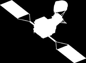
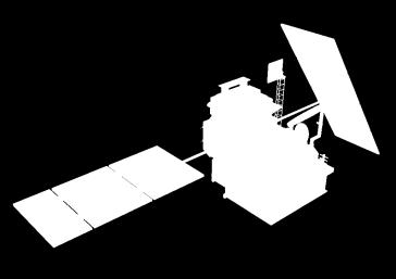
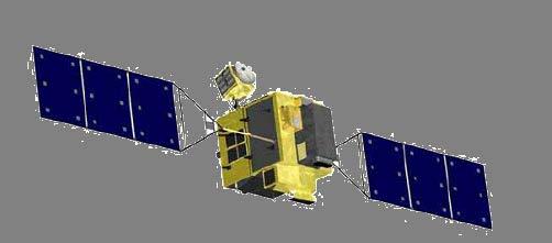
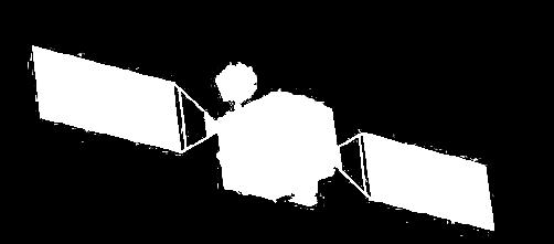
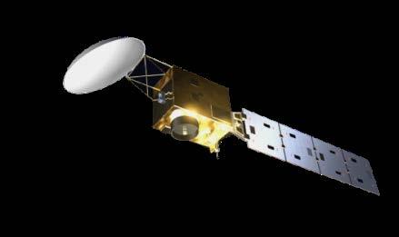
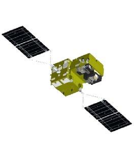
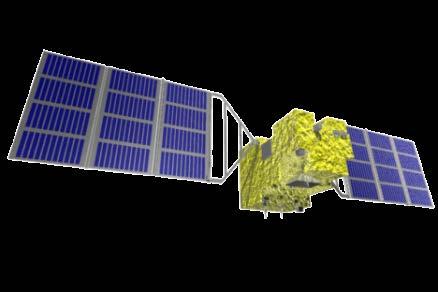
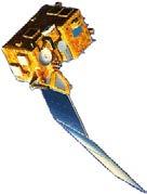
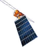
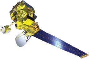
7 Global Precipitation Measurement (GPM) KaPR: 35.5GHz radar (phased array) Core Observatory by NASA-JAXA GPM Core Observatory GMI (Microwav e Imager) KuPR: 13.6GHz radar (phased array) Constellation Satellites by international partners GPM is an international mission consisting of the GPM Core Observatory and Constellation Satellites for high accurate and frequent global precipitation observation. Core Observatory: developed under NASA and JAXA equal partnership. Constellation satellites: provided by international partners (includes GCOM-W1). Dual-frequency Precipitation Radar (DPR) developed by JAXA and NICT DPR is composed of two radars: KuPR & KaPR GPM Core Observatory was successfully launched on 28 Feb (JST). All GPM standard products were released on September 2014.
 GSMaP is a blended Microwave-IR product and has been developed in Japan for the GPM mission.")
8 Global Satellite Mapping of Precipitation (GSMaP) A figure on 7th November, 2013 (Typhoon Haiyan case) GSMaP is a blended Microwave-IR product and has been developed in Japan for the GPM mission. Processing and distributing global rainfall data in near real time basis (about 4-hour after observations) by merging multi-satellite data. Hourly product in 0.1x0.1deg. lat/lon grid. Proto-type version has been in operation in JAXA since GPM-GSMaP data were released on Sep

 Bad: cannot measure")
 Precipitation Radars GSMaP Microwave Radiometer Retrieval")


9 Overview of GSMaP Algorithm GPM-Core GMI Microwave Imagers & Sounders GCOM-W AMSR2 DMSP SSM/I, SSMIS NOAA/MetOp AMSU Good: high-frequent (wide swath, multisatellites) Bad: cannot measure vertical structure (need info. from radar) Precipitation Radars GSMaP Microwave Radiometer Retrieval Algorithm IR Imagers TRMM PR GPM-Core DPR Data Base Rainfall Data from each Microwave Radiometer Merged Microwave Rainfall Data (Okamoto et al. 2005, Kubota et al, 2007, Aonashi et al. 2009, Ushio et al. 2009, Shige et al. 2009, Kachi et al. 2011) Geostationary Satellites Microwave-IR Merged Algorithm (CMV, K/F) Global Rainfall Map + Gauge-calibrated Rainfall Map (0.1 degree grid, Hourly)
10 GPM-GSMaP Product list Product name L3 GSMaP Hourly Variables Hourly Precip Rate (GSMaP_MVK) Standard product (Latency: 3 days) Horizontal resolution deg.lat/lon Temporal resolution Latency Correction 1 hour 3 days None Gauge-corrected Hourly Precip Rate corrected by gauge (GSMaP_Gauge) Corrected by daily rain gauges (NOAA CPC Gauge-Based Analysis, Chen et al. 2008) Product name L3R GSMaP Hourly Variables Near-real-time product (Latency: 4 hours) Hourly Precip Rate (GSMaP_NRT) Horizontal resolution deg.lat/lon Temporal resolution Latency Correction 1 hour 4 hours None Gauge-corrected Hourly Precip Rate corrected by gauge (GSMaP_Gauge_NRT) Correction by empirical coefficients GPM-GSMaP data is now available from JAXA G-portal ( as well as current GSMaP web site (


11 Evaluation of GPM-GSMaP Daily averaged rainfall around Japan in 0.25 degree grid was compared with JMA s Radar-AMeDAS (gauge-calibrated radar analysis rainfall). An example on Apr. 12, 2014 GSMaP_MVK GSMaP_Gauge Gauge-Radar Analysis JMA radar coverage RMSE=0.35mm/h Corr.=0.825 RMSE=0.16mm/h Corr.=0.871 GSMaP_Gauge shows better correlation with less Root Mean Square Error (RMSE) on Apr. 12, 2014.


, Australia (E.")
, Europe (C.")
12 IPWG Validation collaboration The GSMaP joins the International Precipitation Working Group (IPWG) validation activities. Within IPWG Validation collaboration framework, our GSMaP products are validated also in U.S.(J.-J.Wang/J. Janowiak), Australia (E. Ebert ), South America (D. Vila), Europe (C. Kidd), and South Africa (E. Becker).
 to produce GSMaP at 1-hr before (observation). Applying 0.")
13 Development of GSMaP just now version (GSMaP_NOW) To reduce latency from 4-hr to now Using data that is available within 0.5-hour (GMI, AMSR2 direct receiving data, AMSU direct receiving data and Himawari-IR) to produce GSMaP at 1-hr before (observation). Applying 0.5-hour forward extrapolation (future direction) by cloud motion vector to produce GSMaP at current hour (just now). Web site and data (GEO- Himawari region) are now open to the public on Nov. 2 nd, GSMaP_NOW/index_j.htm
 Global Rainfall Watch (GSMaP_NRT/MVK) Realtime Rainfall Watch (GSMaP_NOW) Cham pi Olaf Patric ia GSMaP (Global)")
 Core : http://sharaku.eorc.jaxa.")
14 14 GSMaP_NOW over Himawari-8 area started! Global Satellite Mapping of Precipitation (GSMaP) Global Rainfall Watch (GSMaP_NRT/MVK) Realtime Rainfall Watch (GSMaP_NOW) Cham pi Olaf Patric ia GSMaP (Global) observed Hurricane Patricia and Olaf, and Typhoon Champi: Oct. 2015, hourly animation Rapidly changing precipitation phenomena need frequent observations. Global JAXA Global rainfall Rainfall map Watch merging (4-hr GPM delay) Core : Observatory, polar orbiting microwave JAXA radiometer/sounders, Realtime Rainfall Watch and (Himawari-area): geostationary infrared radiometers.

 RMS Error (mm/h) Correlation Coefficient NRT NOW NRT NOW")
15 Early Evaluation of GSMaP_NOW GSMaP_NRT GSMaP_NOW Gauge-Radar Analysis (Radar-AMeDAS) MAE=0.28mm/h RMSE=0.47mm/h Corr.=0.822 MAE=0.29mm/h RMSE=0.50mm/h Corr.=0.792 Daily averaged rainfall on Jul. 1, 2015 Period Jun. 11 Jul. 3, 2015 Mean ABS Error (mm/h) RMS Error (mm/h) Correlation Coefficient NRT NOW NRT NOW NRT NOW
月 800 Sep. 2008 Aug.")
, Infrastructure Development Institute (IDI) : Global Flood Alert System (GFAS)")
16 者 ( ( GSMaP Applications 毎登録 50 国内海外月毎合計累計 GSMaP registered users 人) 登録日 About 1600 registered users as of 31 Aug About 67% users are originated from foreign countries 登 1200 録者累 1000 計人)月 800 Sep Aug Registration number Weather forecast/monitoring Japan Weather Association (JWA) : Mobile phone, weather information Meteorological agencies in Asian country: Rainfall monitoring, typhoon monitoring, flood prediction Flood warning/prediction International Flood Network (IFNet), Infrastructure Development Institute (IDI) : Global Flood Alert System (GFAS) International Centre for Water Hazard and Risk Management (ICHARM) : Integrated Flood Analysis System (IFAS) Japan Water Association : flood potential monitoring UNESCO-IHP: flood warning system using IFAS Asia Development Bank (ADB): River management including flood risk Japan International Cooperation Agency (JICA): Water resource management in river-basin, flood monitoring Agriculture/Industry/Education Crop forecast, food security, weather index insurance Providing precipitation and flood information to factories abroad Using global rainfall map in educational materials


 Before Flood Discharge of main river is normal (green)")
17 GSMaP in Flood Analysis with ICHARM Under UNESCO-IHP project, JAXA and ICHARM is developing with Pakistan Meteorological Department (PMD) to develop operational flood analysis system. After calibration of GSMaP product with ground-based stations in Pakistan, correlation coefficients are increased from 0.5 to 0.7, and can be used in the Indus Integrated Flood Analysis System (Indus-IFAS) developed by ICHARM. The system will be in operation in 2015 by PMD, and plan to extend the system to larger regions is underway. Similar system is in operation in Bangladesh and Philippines under ADB project. River discharge output using GSMaP Rainfall by GSMaP (increasing as rainfall in upper stream increased) Before Flood Discharge of main river is normal (green) before flood INPUT During Flood (Area within red line is Indus river basin) Discharge of main river is largely increased (red) during flood Example of Indus-IFAS in Pakistan (Image provided by ICHARM) 17

18 GSMaP in Agricultural Insurance Japanese insurance company has developed Weather Index Insurance in Myanmar using GSMaP rainfall data, and plans to sell it in 2015 In Myanmar, agriculture makes up 40% of GDP, but natural disasters such as droughts happens often recently. Overview of the insurance Assured persons: farm houses in the assured regions Assured crops: rice, sesame Assured regions: Arid regions in the central Myanmar Assured risks: drought (risk of less rainfall in rainy season) Plan to expand the insurance to other disaster risks (cyclone, heavy rainfall) in Myanmar, and to other countries in South-East Asia GSMaP Rainfal data Planning insurance Insurance payment to farm houses Set the criteria of accumulated rainfall during certain period, calculated from past data When estimated rainfall by GSMaP is less than the criteria, insurance will be paid. (from press release from Sompo Japan Nipponkoa & RESTEC in Dec. 2014) 18

19 A Food Security Package research using GSMaP by a fund of the MEXT By Higuchi (Chiba Univ.)
20 Summary Global Satellite Mapping of Precipitation (GSMaP) Japanese product of the GPM mission Processing and distributing global rainfall data in near real time basis (about 4-hour after observations) by merging multisatellite data. Hourly product in 0.1x0.1deg. lat/lon grid. GPM-GSMaP data is now available from JAXA G-portal ( as well as current GSMaP web site ( GSMaP_NOW is now available at GSMaP application About 1600 registered users as of 31 Aug About 67% users are originated from foreign countries. Flood Analysis with ICHARM Food Security Package research under a fund of the MEXT.
Rainfall Observation from Space: A overview of GPM and GSMaP
 Rainfall Observation from Space: A overview of GPM and GSMaP (July 2016 version) Earth Observation Research Center (EORC) Japan Aerospace Exploration Agency (JAXA) Rainfall Measurement and our life Rain
GPM-GSMaP data is now available from JAXA G-portal (https://www.gportal.jaxa.jp) as well as current GSMaP web site (http://sharaku.eorc.jaxa.
 as well as current GSMaP web site (http://sharaku.eorc.jaxa.") GPM-GSMaP data is now available from JAXA G-portal (https://www.gportal.jaxa.jp) as well as current GSMaP web site (http://sharaku.eorc.jaxa.jp/ GSMaP/). GPM Core GMI TRMM PR GPM era Precipitation Radar
GPM-GSMaP data is now available from JAXA G-portal (https://www.gportal.jaxa.jp) as well as current GSMaP web site (http://sharaku.eorc.jaxa.jp/ GSMaP/). GPM Core GMI TRMM PR GPM era Precipitation Radar
Welcome and Introduction
 Welcome and Introduction Riko Oki Earth Observation Research Center (EORC) Japan Aerospace Exploration Agency (JAXA) 7th Workshop of International Precipitation Working Group 17 November 2014 Tsukuba International
GSMaP - Integrated application with developer and user collaboration -
 WIGOS WORKSHOP 2019 Session 2.2 GSMaP - Integrated application with developer and user collaboration - Takuji Kubota and Moeka Yamaji Earth Observation Research Center (EORC) Japan Aerospace Exploration
Global Flood Alert System based on satellite derived rainfall data -Targeting the era of Global Precipitation Measurement (GPM)-
-") Global Flood Alert System based on satellite derived rainfall data -Targeting the era of Global Precipitation Measurement (GPM)- Riko Oki, Misako Kachi (JAXA/EORC) Kazuhiko Fukami (PWRI) and Kazuo Umeda
Global Flood Alert System based on satellite derived rainfall data -Targeting the era of Global Precipitation Measurement (GPM)- Riko Oki, Misako Kachi (JAXA/EORC) Kazuhiko Fukami (PWRI) and Kazuo Umeda
Teruyuki Nakajima Director, Earth Observation Research Center (EORC) Japan Aerospace Exploration Agency (JAXA)
 Japan Aerospace Exploration Agency (JAXA)") Tokyo Inter. Conference on the Forest Governance Initiative - Improving Forest Governance using Forest Early Warning Systems and Satellite Technologies - October 24-26, 2017 Teruyuki Nakajima Director,
Tokyo Inter. Conference on the Forest Governance Initiative - Improving Forest Governance using Forest Early Warning Systems and Satellite Technologies - October 24-26, 2017 Teruyuki Nakajima Director,
JAXA s satellites for Disaster Risk Reduction
 JAXA s satellites for Disaster Risk Reduction October 9, 2017 Masanobu TSUJI Japan Aerospace Exploration Agency (JAXA) Panel on Space Technology and Applications in Support of theregional Roadmap for Implementing
Japanese Programs on Space and Water Applications
 Japanese Programs on Space and Water Applications Tamotsu IGARASHI Remote Sensing Technology Center of Japan June 2006 COPUOS 2006 Vienna International Centre Water-related hazards/disasters may occur
JAXA s satellites for Disaster Management and Climate Change
 JAXA s satellites for Disaster Management and Climate Change August 24, 2017 Masanobu TSUJI Japan Aerospace Exploration Agency (JAXA) JAXA Activities Space Transportation Human Space Activities Satellite
JAXA Status Report. JAXA Status Report. 4-6 April 2017 WMO ET-SAT
 JAXA Status Report JAXA Status Report 4-6 April 2017 WMO ET-SAT JAXA s Past, Current and Future Satellite/Sensor Activities ALOS-2 (CY 2014) GCOM-C (JFY 2017) GOSAT-2 (JFY 2018) Earth CARE/CPR (JFY 2019(TBC))
New Concept of Regional Cooperation in Asia for Water Disaster Management Applying Satellite Precipitation Measurement
 New Concept of Regional Cooperation in Asia for Water Disaster Management Applying Satellite Precipitation Measurement Yusuke Muraki Japan Aerospace Exploration Agency (JAXA) Mission Planning Department
高分解能 GSMaP アルゴリズムの 構造と考え方 牛尾知雄 ( 大阪大 )
") 高分解能 GSMaP アルゴリズムの 構造と考え方 牛尾知雄 ( 大阪大 ) Curret GSMaP products GSMaP_MWR Microwave radiometer product GSMaP_MVK Global precipitatio mappig from microwave ad ifrared radiometric data GSMaP_Gauge Gauge adjusted
高分解能 GSMaP アルゴリズムの 構造と考え方 牛尾知雄 ( 大阪大 ) Curret GSMaP products GSMaP_MWR Microwave radiometer product GSMaP_MVK Global precipitatio mappig from microwave ad ifrared radiometric data GSMaP_Gauge Gauge adjusted
APPENDIX 2 OVERVIEW OF THE GLOBAL PRECIPITATION MEASUREMENT (GPM) AND THE TROPICAL RAINFALL MEASURING MISSION (TRMM) 2-1
 AND THE TROPICAL RAINFALL MEASURING MISSION (TRMM) 2-1") APPENDIX 2 OVERVIEW OF THE GLOBAL PRECIPITATION MEASUREMENT (GPM) AND THE TROPICAL RAINFALL MEASURING MISSION (TRMM) 2-1 1. Introduction Precipitation is one of most important environmental parameters.
APPENDIX 2 OVERVIEW OF THE GLOBAL PRECIPITATION MEASUREMENT (GPM) AND THE TROPICAL RAINFALL MEASURING MISSION (TRMM) 2-1 1. Introduction Precipitation is one of most important environmental parameters.
Satellite-based applications for water resources management in Asia and Pacific region
 Satellite-based applications for water resources management in Asia and Pacific region Ko Hamamoto Japan Aerospace Exploration Agency The views expressed in this paper/presentation are the views of the
Global Rainfall Map Realtime version (GSMaP_NOW) Data Format Description
 Data Format Description") updated 01 November 2018 2 November 2015 Global Rainfall Map Realtime version (GSMaP_NOW) Data Format Description This document describes data format and information of Global Rainfall Map Realtime version
updated 01 November 2018 2 November 2015 Global Rainfall Map Realtime version (GSMaP_NOW) Data Format Description This document describes data format and information of Global Rainfall Map Realtime version
Value of Satellite Observation Sensitive to Humidity and Precipitation in JMA s Operational Numerical Weather Prediction
 地球観測衛星 30 周年記念シンポジウム JAXA Symposium for earth observing satellites 気象庁の現業数値気象予報における衛星観測データの水蒸気及び降水の解析予測精度への貢献 Value of Satellite Observation Sensitive to Humidity and Precipitation in JMA s Operational
ALOS-2 Project Manager. Shin-ichi Sobue
 ALOS-2 Project Manager Shin-ichi Sobue JAXA Earth Observation Satellites Targets (JFY) 2014 2015 2016 2017 2018 2019 2020 2021 2022 2023 2024 [Land and disaster monitoring] Disasters & Resources Climate
GLOBAL SATELLITE MAPPING OF PRECIPITATION (GSMAP) PROJECT
 PROJECT") GLOBAL SATELLITE MAPPING OF PRECIPITATION (GSMAP) PROJECT Tomoo Ushio 1, Kazumasa Aonashi 2, Takuji Kubota 3, Shoichi Shige 4, Misako Kachi 3, Riko Oki 3, Ken ichi Okamoto 5, Satoru Yoshida 1, Zen-Ichiro
GLOBAL SATELLITE MAPPING OF PRECIPITATION (GSMAP) PROJECT Tomoo Ushio 1, Kazumasa Aonashi 2, Takuji Kubota 3, Shoichi Shige 4, Misako Kachi 3, Riko Oki 3, Ken ichi Okamoto 5, Satoru Yoshida 1, Zen-Ichiro
GSMaP RIKEN Nowcast (GSMaP_RNC) Data Format Description
 Data Format Description") GSMaP RIKEN Nowcast (GSMaP_RNC) Data Format Description 4 August 2017 This document describes data format and information of Global Satellite Mapping of Precipitation (GSMaP) RIKEN Nowcast provided by
GSMaP RIKEN Nowcast (GSMaP_RNC) Data Format Description 4 August 2017 This document describes data format and information of Global Satellite Mapping of Precipitation (GSMaP) RIKEN Nowcast provided by
Ⅴ.. Global Flood Alert System
 Ⅴ.. Global Flood Alert System 1. Project Concept - An attempt to make the best use of Satellite Rainfall in FEW - Support for existing FEW activities where necessary 2. Collaboration between: i) Space
JAXA s Contributions to the Climate Change Monitoring
 0 JAXA s Contributions to the Climate Change Monitoring June 7, 2011 Takao Akutsu Planning Manager Japan Aerospace Exploration Agency (JAXA) Japanese Main Activities of Earth Observation 1 GEOSS 10 years
Contribution to global Earth observation from satellites
 Contribution to global Earth observation from satellites - JAXA s Earth Observation strategy - April 16, 2008 Makoto Kajii Japan Aerospace Exploration Agency Earth Observation Summits and GEOSS 1 st EO
Overview of Long- term Observa3ons of the Global Water Cycle by the Advanced Microwave Scanning Radiometer (AMSR) Series
 Series") Overview of Long- term Observa3ons of the Global Water Cycle by the Advanced Microwave Scanning Radiometer (AMSR) Series M. Kachi 1), T. Maeda 1), N. Ono 1), M. Kasahara 1), N. Ebuchi 1),2), and H. Shimoda
Overview of Long- term Observa3ons of the Global Water Cycle by the Advanced Microwave Scanning Radiometer (AMSR) Series M. Kachi 1), T. Maeda 1), N. Ono 1), M. Kasahara 1), N. Ebuchi 1),2), and H. Shimoda
Related missions and programs for Snowfall and Snow Hydrology of JAXA
 Related missions and programs for Snowfall and Snow Hydrology of JAXA ALOS AVNIR-2 2006/11/05 Shuji Shimizu Japan Aerospace Exploration Agency (JAXA) Earth Observation Research Center (EORC) JAXA Earth
Global Rainfall Map in Near Real Time (GSMaP_NRT) and Gauge-calibrated Rainfall Product (GSMaP_Gauge) Data Format Description
 and Gauge-calibrated Rainfall Product (GSMaP_Gauge) Data Format Description") Global Rainfall Map in Near Real Time (GSMaP_NRT) and Gauge-calibrated Rainfall Product (GSMaP_Gauge) Data Format Description updated 25 July 2017 10 October 2008 This document describes data format and
Global Rainfall Map in Near Real Time (GSMaP_NRT) and Gauge-calibrated Rainfall Product (GSMaP_Gauge) Data Format Description updated 25 July 2017 10 October 2008 This document describes data format and
JAXA agency report. Masumi MATSUNAGA Satellite Applications and Operations Center(SAOC), JAXA
, JAXA") JAXA agency report Masumi MATSUNAGA Satellite Applications and Operations Center(SAOC), JAXA JAXA Activities Space Transportation Human Space Activities Satellite Programs Lunar & Planetary Exploration
JAXA agency report Masumi MATSUNAGA Satellite Applications and Operations Center(SAOC), JAXA JAXA Activities Space Transportation Human Space Activities Satellite Programs Lunar & Planetary Exploration
Global Precipitation Data Sets
 Global Precipitation Data Sets Rick Lawford (with thanks to Phil Arkin, Scott Curtis, Kit Szeto, Ron Stewart, etc) April 30, 2009 Toronto Roles of global precipitation products in drought studies: 1.Understanding
Agency Status Reports: JMA and JAXA
 Agency Status Reports: JMA and JAXA Kozo Okamoto (JMA : Japan Meteorological Agency) Misako Kachi, Tamotsu Igarashi (JAXA : Japan Aerospace Exploration Agency) JMA Status and plan of MTSAT (Himawari-6
JAXA s Ocean Environment Monitoring Activities and Himawari Monitor
 JAXA s Ocean Environment Monitoring Activities and Himawari Monitor Misako Kachi, Yukio Kurihara, Hiroshi Murakami, Norimasa Ito (JAXA) Yasumasa Miyazawa (JAMSTEC) IOVWST@Sapporo, 17-19 May, 2016 Research
Global Precipitation Measurement (GPM) for Science and Society
 for Science and Society") Global Precipitation Measurement (GPM) for Science and Society Gail Skofronick-Jackson GPM Project Scientist NASA Goddard Space Flight Center Radar Observation of Rain from Space Tokyo, Japan 29 November
Global Precipitation Measurement (GPM) for Science and Society Gail Skofronick-Jackson GPM Project Scientist NASA Goddard Space Flight Center Radar Observation of Rain from Space Tokyo, Japan 29 November
OVERVIEW OF THE FIRST SATELLITE OF THE GLOBAL CHANGE OBSERVATION MISSION - WATER (GCOM-W1)
") OVERVIEW OF THE FIRST SATELLITE OF THE GLOBAL CHANGE OBSERVATION MISSION - WATER (GCOM-W1) Misako Kachi, Keiji Imaoka, Hideyuki Fujii, Daisaku Uesawa, Kazuhiro Naoki, Akira Shibata, Tamotsu Igarashi, Earth
OVERVIEW OF THE FIRST SATELLITE OF THE GLOBAL CHANGE OBSERVATION MISSION - WATER (GCOM-W1) Misako Kachi, Keiji Imaoka, Hideyuki Fujii, Daisaku Uesawa, Kazuhiro Naoki, Akira Shibata, Tamotsu Igarashi, Earth
JAXA S FUTURE EARTH OBSERVATION MISSIONS FOR METEOROLOGICAL AND CLIMATOLOGICAL APPLICATIONS
 JAXA S FUTURE EARTH OBSERVATION MISSIONS FOR METEOROLOGICAL AND CLIMATOLOGICAL APPLICATIONS Misako Kachi, Keiji Imaoka, Hiroshi Murakami, Masahiro Hori, Shuichiro Katagiri, Shuji Shimizu, Riko Oki, and
Overview and Access to GPCP, TRMM, and GPM Precipitation Data Products
 National Aeronautics and Space Administration ARSET Applied Remote Sensing Training http://arset.gsfc.nasa.gov @NASAARSET Overview and Access to GPCP, TRMM, and GPM Precipitation Data Products www.nasa.gov
Utilization of satellite precipitation data for flood management
 Utilization of satellite precipitation data for flood management Tetsuya IKEDA Infrastructure Development Institute (IDI) Japan Typhoon Committee Integrated Workshop November 7, 2011 Nha Trang, Vietnam,
JAXA Remote Sensing Satellite Missions Utilization for Earth and Environment Observation
 JAXA Remote Sensing Satellite Missions Utilization for Earth and Environment Observation 27 th June 2013 Toshiyoshi Kimura EORC/JAXA Inventory, Modeling and Climate Impacts of Greenhouse Gas emissions
CEOS Overview and JAXA Plans for Water Cycle Observation
 CEOS Overview and JAXA Plans for Water Cycle Observation Asian Water Cycle Symposium November 2-4, 2005 Tokyo, Japan Chu Ishida Japan Aerospace Exploration Agency (JAXA) Contents 1. CEOS overview 2. CEOS
Remote sensing of precipitation extremes
 The panel is about: Understanding and predicting weather and climate extreme Remote sensing of precipitation extremes Climate extreme : (JSC meeting, June 30 2014) IPCC SREX report (2012): Climate Ali
STATUS OF THE FIRST SATELLITE OF THE GLOBAL CHANGE OBSERVATION MISSION - WATER (GCOM-W1)
") STATUS OF THE FIRST SATELLITE OF THE GLOBAL CHANGE OBSERVATION MISSION - WATER (GCOM-W1) Misako Kachi 1, Keiji Imaoka 1, Masahiro Hori 1, Kazuhiro Naoki 1, Takashi Maeda 1, Arata Okuyama 1, Marehiro Kasahara
STATUS OF THE FIRST SATELLITE OF THE GLOBAL CHANGE OBSERVATION MISSION - WATER (GCOM-W1) Misako Kachi 1, Keiji Imaoka 1, Masahiro Hori 1, Kazuhiro Naoki 1, Takashi Maeda 1, Arata Okuyama 1, Marehiro Kasahara
The use and impacts of sea surface temperature from passive microwave measurements
 The use and impacts of sea surface temperature from passive microwave measurements Anne O Carroll 6/12/2017 ECMWF workshop on using low frequency passive microwave measurements in research and operational
Development of Spaceborne Dualfrequency. and Its Role for the Global Precipitation Measurement
 Development of Spaceborne Dualfrequency Precipitation Radar and Its Role for the Global Precipitation Measurement Shinsuke Satoh (1), Riko Oki (1), Nobuhiro Takahashi (2), and Toshio Iguchi (2) (1) National
Eighteenth International Water Technology Conference, IWTC18 Sharm ElSheikh, March 2015
 SPATIOTEMPORAL EVALUATION OF GLOBAL PRECIPITATION MAPPING -GSMAP AT BASIN SCALE IN SAGAMI RIVER, JAPAN S. Takegawa 1, K. Takido 2, ando. Saavedra 3 1 Tokyo Institute of Technology, Tokyo,koizumi.s.ae@m.titech.ac.jp
Trial Running of GFAS
 Trial Running of GFAS International Flood Network Please access to: http://www.internationalfloodnetwork.org/index.html What is GFAS? Global Flood Alert System (GFAS) provides with global rainfall information
NASA Flood Monitoring and Mapping Tools
 National Aeronautics and Space Administration ARSET Applied Remote Sensing Training http://arset.gsfc.nasa.gov @NASAARSET NASA Flood Monitoring and Mapping Tools www.nasa.gov Outline Overview of Flood
Assimilation of GPM/DPR at JMA
 Assimilation of GPM/DPR at JMA Yasutaka Ikuta Numerical Prediction Division Japan Meteorological Agency Data Assimilation Seminar in RIKEN/AICS, Kobe, Japan, 13 Jun, 2016 1 OUTLINE 1. Introduction 2. Operational
10 emergency observation requests were successfully processed during the period
 ISRO s Inputs for the Sentinel Asia DPN and JPT meeting being held during 13-16, 16, November 2012 November 2012 Sentinel Asia Activity Spectrum - A dedicated Sentinel Asia server established at NRSC,
Evaluation of Satellite Precipitation Measurements Considering Physical Conditions of Atmosphere
 平成 28 年度 JAXA/EORC 水循環ワークショップ @ Tokyo.JP 2016.07.28 Evaluation of Satellite Precipitation Measurements Considering Physical Conditions of Atmosphere 1 Hyungjun Kim and 1 Nobuyuki Utsumi 1 Institute of
Long-term Water Cycle Observation by the Advanced Microwave Scanning Radiometer (AMSR) Series: AMSR-E, AMSR2 and Follow-on
 Series: AMSR-E, AMSR2 and Follow-on") Long-term Water Cycle Observation by the Advanced Microwave Scanning Radiometer (AMSR) Series: AMSR-E, AMSR2 and Follow-on M. Kachi 1), H. Fujii 1), T. Kubota 1), T. Maeda 1), N. Ono 1), M. Kasahara 1),
Long-term Water Cycle Observation by the Advanced Microwave Scanning Radiometer (AMSR) Series: AMSR-E, AMSR2 and Follow-on M. Kachi 1), H. Fujii 1), T. Kubota 1), T. Maeda 1), N. Ono 1), M. Kasahara 1),
International Flood Network - IFNet
 International Flood Network - IFNet - Akira Sasaki Deputy Director General IFNet Secretariat Today s s Contents 1. IFNet (International Flood Network) 2. GFAS (Global Flood Alert System) Increasing Flood
Global Precipitation Measurement Mission Overview & NASA Status
 Global Precipitation Measurement Mission Overview & NASA Status Gail Skofronick Jackson GPM Project Scientist (appointed 14 January 2014) Replacing Dr. Arthur Hou (1947-2013) NASA Goddard Space Flight
Ensuring Water in a Changing World
 Ensuring Water in a Changing World Evaluation and application of satellite-based precipitation measurements for hydro-climate studies over mountainous regions: case studies from the Tibetan Plateau Soroosh
School on Modelling Tools and Capacity Building in Climate and Public Health April Rainfall Estimation
 2453-6 School on Modelling Tools and Capacity Building in Climate and Public Health 15-26 April 2013 Rainfall Estimation CECCATO Pietro International Research Institute for Climate and Society, IRI The
CLOUD AND PRECIPITATION OBSERVATION BY SPACEBORNE RADAR IN JAPAN: CURRENT AND FUTURE MISSIONS
 CLOUD AND PRECIPITATION OBSERVATION BY SPACEBORNE RADAR IN JAPAN: CURRENT AND FUTURE MISSIONS R. Oki a, T. Kubota a *, S. Katagiri a, M. Kachi a, S. Shimizu a, M. Kojima b, K. Kimura c a Earth Observation
JAXA Earth Observation Satellites and the Validation
 JAXA Earth Observation Satellites and the Validation Keiji Imaoka + many colleagues Earth Observation Research Center (EORC) Japan Aerospace Exploration Agency (JAXA) March 9, 2012 4 th GRUAN ICM Meeting
Shiro Ochi JAXA
 SESSION 4: Sharing Knowledge and Good Practices by Regional Experts Our Experiences from Japan, Asia and International community Shiro Ochi GIC@AIT, JAXA International Disaster Charter Framework Sentinel
Utilization of Satellite Precipitation Data for Flood Management
 Utilization of Satellite Precipitation Data for Flood Management Toshiro SUZUKI Director, Water and Environment Research Department Infrastructure Development Institute (IDI) Japan 1 Contents 1. Global
Introduction to Multi-hazard Risk-based Early Warning System in Japan
 Introduction to Multi-hazard Risk-based Early Warning System in Japan Yasuo SEKITA (Mr) Director-General, Forecast Department Japan Meteorological Agency (JMA) Natural Disasters in Asia Source: Disasters
Status of GCOM and expectation for microwave scatterometer
 Status of GCOM and expectation for microwave scatterometer Keiji Imaoka 1, Misako Kachi 1, Tamotsu Igarashi 1, Keizo Nakagawa 1, Naoto Ebuchi 2, Taikan Oki 1,3, and Haruhisa Shimoda 1,4 1 Japan Aerospace
The Global Precipitation Measurement (GPM) Mission: Arthur Hou. NASA Goddard Space Flight Center
 Mission: Arthur Hou. NASA Goddard Space Flight Center") The Global Precipitation Measurement (GPM) Mission: Overview and U.S. Status Arthur Hou NASA Goddard Space Flight Center 5 th IPWG Workshop 11-15 October 2010 GPM Mission Concept An international ti satellite
The Global Precipitation Measurement (GPM) Mission: Overview and U.S. Status Arthur Hou NASA Goddard Space Flight Center 5 th IPWG Workshop 11-15 October 2010 GPM Mission Concept An international ti satellite
Interpretation of Polar-orbiting Satellite Observations. Atmospheric Instrumentation
 Interpretation of Polar-orbiting Satellite Observations Outline Polar-Orbiting Observations: Review of Polar-Orbiting Satellite Systems Overview of Currently Active Satellites / Sensors Overview of Sensor
Determination of risk-based warning criteria
 Determination of risk-based warning criteria Risk-based Warning Provide Risk-based Information Users are interested in what the weather might do rather than what the weather might be, no matter how scientifically
Satellite Remote Sensing for Ocean
 Satellite Remote Sensing for Ocean August 17, 2017 Masatoshi Kamei RESTEC All rights reserved RESTEC 2015 Contents 1. About RESTEC and Remote Sensing 2. Example of Remote Sensing Technology 3. Remote Sensing
Keiji Imaoka + many contributors. Earth Observation Research Center (EORC) Japan Aerospace Exploration Agency (JAXA)
 Japan Aerospace Exploration Agency (JAXA)") Keiji Imaoka + many contributors Earth Observation Research Center (EORC) Japan Aerospace Exploration Agency (JAXA) Mini-Workshop on A-Train Science Tokyo, Japan March 8, 2013 2 Late 1990s 2000s 2003 (JAXA
Keiji Imaoka + many contributors Earth Observation Research Center (EORC) Japan Aerospace Exploration Agency (JAXA) Mini-Workshop on A-Train Science Tokyo, Japan March 8, 2013 2 Late 1990s 2000s 2003 (JAXA
Passive and Active Microwave Sensors for Precipitation Research
 Passive and Active Microwave Sensors for Precipitation Research Joe Turk Jet Propulsion Laboratory California Institute of Technology Pasadena, CA jturk@jpl.nasa.gov Characteristics of Precipitation Wide
Effective Utilization of Synthetic Aperture Radar (SAR) Imagery in Rapid Damage Assessment
 Imagery in Rapid Damage Assessment") Effective Utilization of Synthetic Aperture Radar (SAR) Imagery in Rapid Damage Assessment Case Study Pakistan Floods SUPARCO M. Maisam Raza, Ahmad H. Rabbani SEQUENCE Flood Monitoring using Satellite
Effective Utilization of Synthetic Aperture Radar (SAR) Imagery in Rapid Damage Assessment Case Study Pakistan Floods SUPARCO M. Maisam Raza, Ahmad H. Rabbani SEQUENCE Flood Monitoring using Satellite
Outline of Sediment Disaster Early Warning in Japan
 JICA training(disaster Management for Landslide and Sediment-related Disaster) Outline of Sediment Disaster Early Warning in Japan December 2, 2014 Masaru KUNITOMO National Institute for Land and Infrastructure
COUNTRY PRESENTATION ON MR JAYNAL ABEDIN JOINT SECRETARY ( WORKS & DEVELOPMENT ) MINISTRY OF DEFENCE
 MINISTRY OF DEFENCE") COUNTRY PRESENTATION ON By MR JAYNAL ABEDIN JOINT SECRETARY ( WORKS & DEVELOPMENT ) MINISTRY OF DEFENCE Bangladesh Geographical Location of Bangladesh Bangladesh Country at a Glance Physical Features 1,230
COUNTRY PRESENTATION ON By MR JAYNAL ABEDIN JOINT SECRETARY ( WORKS & DEVELOPMENT ) MINISTRY OF DEFENCE Bangladesh Geographical Location of Bangladesh Bangladesh Country at a Glance Physical Features 1,230
TRMM, Hydrologic Science, and Societal Benefit: The Role of Satellite Measurements
 TRMM, Hydrologic Science, and Societal Benefit: The Role of Satellite Measurements Michael H. Freilich TRMM 15 th Anniversary Symposium 12 November 2012 KEY TRMM ATTRIBUTES Long on-orbit lifetime 15 years
GLOBAL PRECIPITATION MEASUREMENT UPDATE
 GLOBAL PRECIPITATION MEASUREMENT UPDATE Gilbert Mark Flaming National Aeronautics and Space Administration Goddard Space Flight Center Code 420.2 Greenbelt, Maryland 20771 USA Email: gilbert.m.flaming@nasa.gov
GCOM-W1 now on the A-Train
 GCOM-W1 now on the A-Train GCOM-W1 Global Change Observation Mission-Water Taikan Oki, K. Imaoka, and M. Kachi JAXA/EORC (& IIS/The University of Tokyo) Mini-Workshop on A-Train Science, March 8 th, 2013
Influence of MJO on Asian Climate and its Performance of JMA Monthly Forecast Model
 Influence of MJO on Asian Climate and its Performance of JMA Monthly Forecast Model Satoko Matsueda, Yuhei Takaya and Kengo Miyaoka Climate Prediction Division, Japan Meteorological Agency Madden-Julian
H-SAF future developments on Convective Precipitation Retrieval
 H-SAF future developments on Convective Precipitation Retrieval Francesco Zauli 1, Daniele Biron 1, Davide Melfi 1, Antonio Vocino 1, Massimiliano Sist 2, Michele De Rosa 2, Matteo Picchiani 2, De Leonibus
Development of Tropical Storm Falcon (Meari) over the Philippines
 over the Philippines") Development of Tropical Storm Falcon (Meari) over the Philippines June 20-27, 2011 At the end of June, 2011, the Philippines were struck again by Tropical storm Falcon (Meari). After gaining strength over
Development of Tropical Storm Falcon (Meari) over the Philippines June 20-27, 2011 At the end of June, 2011, the Philippines were struck again by Tropical storm Falcon (Meari). After gaining strength over
Current and Upcoming NASA Hurricane Measurement Missions National Hurricane Conference
 NASA Science Mission Directorate Earth Science Division Applied Sciences Program Current and Upcoming NASA Hurricane Measurement Missions National Hurricane Conference April 18, 2017 Formulation Implementation
Outline of 4 Lectures
 Outline of 4 Lectures 1. Sept. 17, 2008: TC best track definition and datasets, global distribution of TCs; Review of history of meteorological satellites, introducing different orbits, scanning patterns,
Applications of yield monitoring systems and agricultural statistics in agricultural (re)insurance
insurance") Image: used under license from shutterstock.com Applications of yield monitoring systems and agricultural statistics in agricultural (re)insurance 18 October 2018 Ernst Bedacht Agenda Introduction 1. Munich
Image: used under license from shutterstock.com Applications of yield monitoring systems and agricultural statistics in agricultural (re)insurance 18 October 2018 Ernst Bedacht Agenda Introduction 1. Munich
Lecture 4b: Meteorological Satellites and Instruments. Acknowledgement: Dr. S. Kidder at Colorado State Univ.
 Lecture 4b: Meteorological Satellites and Instruments Acknowledgement: Dr. S. Kidder at Colorado State Univ. US Geostationary satellites - GOES (Geostationary Operational Environmental Satellites) US
Country Presentation-Nepal
 Country Presentation-Nepal Mt.Everest, Shiva Pd. Nepal, DHM South Asia Drought Monitor Workshop Dhaka Bangladesh 2 th April 215 Overview Brief Climatology Climate activities- DHM PPCR (Pilot Program for
"Cloud and Rainfall Observations using Microwave Radiometer Data and A-priori Constraints" Christian Kummerow and Fang Wang Colorado State University
 "Cloud and Rainfall Observations using Microwave Radiometer Data and A-priori Constraints" Christian Kummerow and Fang Wang Colorado State University ECMWF-JCSDA Workshop Reading, England June 16-18, 2010
Analyzing and Visualizing Precipitation and Soil Moisture in ArcGIS
 Analyzing and Visualizing Precipitation and Soil Moisture in ArcGIS Wenli Yang, Pham Long, Peisheng Zhao, Steve Kempler, and Jennifer Wei * NASA Goddard Earth Science Data and Information Services Center
Operational Monsoon Monitoring at NCEP
 Operational Monsoon Monitoring at NCEP Wassila M. Thiaw Climate Prediction Center National Centers for Environmental Predictions Operational Monsoon Monitoring at NCEP Wassila M. Thiaw Climate Prediction
Monitoring Air Pollution from Space
 Monitoring Air Pollution from Space Media Regional Training Workshop 16 th Nov 20 th Nov 2015 Shreta Ghimire International Centre for Integrated Mountain Development Kathmandu, Nepal Why do we study air
TRANSBOUNDARY FLOOD FORECASTING THROUGH DOWNSCALING OF GLOBAL WEATHER FORECASTING AND RRI MODEL SIMULATION
 TRANSBOUNDARY FLOOD FORECASTING THROUGH DOWNSCALING OF GLOBAL WEATHER FORECASTING AND RRI MODEL SIMULATION Rashid Bilal 1 Supervisor: Tomoki Ushiyama 2 MEE15624 ABSTRACT The study comprise of a transboundary
Numerical Simulation System for Environmental Studies: SPEEDI-MP
 System for Prediction of Environmental Emergency Dose Information Multi-model Package 1/18 Numerical Simulation System for Environmental Studies: SPEEDI-MP Research Group for Environmental Science, Japan
Satellite derived precipitation estimates over Indian region during southwest monsoons
 J. Ind. Geophys. Union ( January 2013 ) Vol.17, No.1, pp. 65-74 Satellite derived precipitation estimates over Indian region during southwest monsoons Harvir Singh 1,* and O.P. Singh 2 1 National Centre
Haiti and Dominican Republic Flash Flood Initial Planning Meeting
 Dr Rochelle Graham Climate Scientist Haiti and Dominican Republic Flash Flood Initial Planning Meeting September 7 th to 9 th, 2016 Hydrologic Research Center http://www.hrcwater.org Haiti and Dominican
Exploring the role of new technologies in quantifying precipitation levels and urban flooding
 Exploring the role of new technologies in quantifying precipitation levels and urban flooding Jörg Rieckermann Urban Water Management Eawag, Swiss Federal Institute of Aquatic Science and Technology Motivation
New NASA Ocean Observations and Coastal Applications
 New NASA Ocean Observations and Coastal Applications Duane Armstrong Chief, Applied Science & Technology Project Office August 20, 2014 1 Outline NASA s new Earth Science Ocean Science Missions for 2014
Recent Developments in Climate Information Services at JMA. Koichi Kurihara Climate Prediction Division, Japan Meteorological Agency
 Recent Developments in Climate Information Services at JMA Koichi Kurihara Climate Prediction Division, Japan Meteorological Agency 1 Topics 1. Diagnosis of the Northern Hemispheric circulation in December
JMA s Cooperation with
 JMA s Cooperation with the Pacific Island Countries (PICs) Tomoyuki KITAMURA Japan Meteorological Agency Bali, Indonesia, 7 March 2018 Contents Background Steps to issue weather forecast/warning JMA s
for the Global Precipitation Mission
 A Physically based Rainfall Rate Algorithm for the Global Precipitation Mission Kevin Garrett 1, Leslie Moy 1, Flavio Iturbide Sanchez 1, and Sid Ahmed Boukabara 2 5 th IPWG Workshop Hamburg, Germany October
MAIN ATTRIBUTES OF THE PRECIPITATION PRODUCTS DEVELOPED BY THE HYDROLOGY SAF PROJECT RESULTS OF THE VALIDATION IN HUNGARY
 MAIN ATTRIBUTES OF THE PRECIPITATION PRODUCTS DEVELOPED BY THE HYDROLOGY SAF PROJECT RESULTS OF THE VALIDATION IN HUNGARY Eszter Lábó OMSZ-Hungarian Meteorological Service, Budapest, Hungary labo.e@met.hu
CHAPTER VII COMPARISON OF SATELLITE (TRMM) PRECIPITATION DATA WITH GROUND-BASED DATA
 PRECIPITATION DATA WITH GROUND-BASED DATA") CHAPTER VII COMPARISON OF SATELLITE () PRECIPITATION DATA WITH GROUND-BASED DATA CHAPTER VII COMPARISON OF SATELLITE () PRECIPITATION DATA WITH GROUND-BASED DATA 7.1. INTRODUCTION Most of the earth s rain
CHAPTER VII COMPARISON OF SATELLITE () PRECIPITATION DATA WITH GROUND-BASED DATA CHAPTER VII COMPARISON OF SATELLITE () PRECIPITATION DATA WITH GROUND-BASED DATA 7.1. INTRODUCTION Most of the earth s rain
Intercomparison of Satellite Precipitation Products for Different Cloud Types
 8 th IPWG & 5 th IWSSM Joint Workshop Bologna, 3-7 October, 2016 Intercomparison of Satellite Precipitation Products for Different Cloud Types Nobuyuki UTSUMI Hyungjun Kim, Taikan OKI (IIS, The University
School on Modelling Tools and Capacity Building in Climate and Public Health April Remote Sensing
 2453-5 School on Modelling Tools and Capacity Building in Climate and Public Health 15-26 April 2013 Remote Sensing CECCATO Pietro International Research Institute for Climate and Society, IRI The Earth
H SAF SATELLITE APPLICATION FACILITY ON SUPPORT TO OPERATIONAL HYDROLOGY AND WATER MANAGEMENT EUMETSAT NETWORK OF SATELLITE APPLICATION FACILITIES
 H SAF SATELLITE APPLICATION FACILITY ON SUPPORT TO OPERATIONAL HYDROLOGY AND WATER MANAGEMENT EUMETSAT NETWORK OF SATELLITE APPLICATION FACILITIES H-SAF: SATELLITE PRODUCTS FOR OPERATIONAL HYDROLOGY H-SAF
P4.4 THE COMBINATION OF A PASSIVE MICROWAVE BASED SATELLITE RAINFALL ESTIMATION ALGORITHM WITH AN IR BASED ALGORITHM
 P4.4 THE COMBINATION OF A PASSIVE MICROWAVE BASED SATELLITE RAINFALL ESTIMATION ALGORITHM WITH AN IR BASED ALGORITHM Robert Joyce 1), John E. Janowiak 2), and Phillip A. Arkin 3, Pingping Xie 2) 1) RS
New Era of Global Monitoring by ALOS-2: Advanced Land Observing Satellite-2 DAICHI-2 Yuko Suzuki
 New Era of Global Monitoring by ALOS-2: Advanced Land Observing Satellite-2 DAICHI-2 Yuko Suzuki International Relations and Research Department Japan Aerospace Exploration Agency (JAXA) 1 Dawning Era
Judit Kerényi. OMSZ - Hungarian Meteorological Service, Budapest, Hungary. H-1525 Budapest, P.O.Box 38, Hungary.
 SATELLITE-DERIVED PRECIPITATION ESTIMATIONS DEVELOPED BY THE HYDROLOGY SAF PROJECT CASE STUDIES FOR THE INVESTIGATION OF THEIR ACCURACY AND FEATURES IN HUNGARY Judit Kerényi OMSZ - Hungarian Meteorological
JOINT BRIEFING TO THE MEMBERS. El Niño 2018/19 Likelihood and potential impact
 JOINT BRIEFING TO THE MEMBERS El Niño 2018/19 Likelihood and potential impact CURRENT EL NIÑO OUTLOOK (SEPTEMBER 2018) CPC/IRI ENSO Forecast from September. Red bars denote probability of an El Nino developing
Lecture 19: Operational Remote Sensing in Visible, IR, and Microwave Channels
 MET 4994 Remote Sensing: Radar and Satellite Meteorology MET 5994 Remote Sensing in Meteorology Lecture 19: Operational Remote Sensing in Visible, IR, and Microwave Channels Before you use data from any