Passive and Active Microwave Sensors for Precipitation Research
|
|
|
- Myles Poole
- 5 years ago
- Views:
Transcription


1 Passive and Active Microwave Sensors for Precipitation Research Joe Turk Jet Propulsion Laboratory California Institute of Technology Pasadena, CA


, synoptic (fronts)")

 More challenging")

2 Characteristics of Precipitation Wide variability in space, time, and intensity Discontinuous; wide range of extremes; intermittent Controlled across scales from microscale (microphysics), mesoscale (sea breezes), synoptic (fronts) Spaceborne measurement of precipitation: Constrained by observing system limitations (revisit, resolution, frequency, swath, noise) More challenging over land than over ocean Used by an increasingly broad and diverse user community Not straightforward to validate
3 Topics that I will discuss Satellite Platforms with Precipitation-Relevant Capabilities General issues with current datasets and products Focus on GPM and what it will do differently from TRMM A few unique proposed mission concepts

4 Local Time of Satellite Observations TRMM TMI+PR 28-day repeat (equator)? TRMM launch Nov 1997 F19 launch: As soon as Oct 2013 F14 only direct-broadcast since 24 Aug 2008 F13 only direct-broadcast since 9 Nov 2009 F15 RADCAL beacon activated 14 Aug 2006 FY-3A launch: May 2008 Megha-Tropiques launch: Oct 2012


5

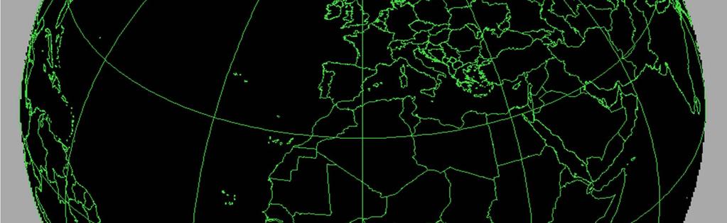
6 Why is Observation Time So Important? Technical Aspects Solar panels in the dark Solar intrusions into detectors or calibration references Example from EOS-Terra morning overpass on January 1, Solar zenith is indicated by the white shades and the red stripe indicates the daynight terminator. Note how Terra passes over at nearly the same local time each orbit. Terminator Orbit First-light (spy satellites) Limit Sun s influence on passive measurements Scene Conditions Precipitation changes very rapidly and often has a predominant daily cycle
, there will be a systematic underestimate")
 But it s only raining")
7 The Satellite Beamfilling Problem We don t know the spatial pattern of the underlying rainfall at the time that the satellite flies over Satellite movement Therefore, when one interprets the satellite signal (radiances), there will be a systematic underestimate of the rainfall (e.g, 10 mm/hour) But it s only raining in this fraction of the sensor s field of view (e.g., 25 mm/hour) Satellite sensor receives a signal for all Earth scenes that fall within this cone ( field of view ) Earth s surface 50-km (not drawn to scale)
8 Two Types of Satellite Measurements Sun T=6000 Kelvin Satellite Solar Reflection Sunlight that is reflected off the top of the cloud and then into the satellite field of view. Daytime-only. Does not directly measure rainfall, only cloud top properties Cloud T=300 K Earth s surface (70% ocean, 30% land) Thermal Emission Thermal emission that originates near the top of the cloud (infrared to near infrared) or within the cloud (microwave) and into the satellite field of view. Day and night. (not drawn to scale)
 Maximum thermal emission from the Earth (T=300 K) is in the infrared (IR) wavelengths near 11 microns Passive microwave (PMW) emission is much weaker, but able")
9 Electromagnetic Spectrum Utilized For Satellite-Based Remote Sensing of Precipitation Maximum emission from the sun (T=6000 K) is from microns wavelength (Visible spectrum) Maximum thermal emission from the Earth (T=300 K) is in the infrared (IR) wavelengths near 11 microns Passive microwave (PMW) emission is much weaker, but able to penetrate clouds and more directly sense rainfall. 10, 19, 37, 85 GHz are commonly used window channels


10 Different Satellite Instrument Scanning Patterns Across-Track Scanning Conically Scanning AMSU Sensors on NOAA/METOP TRMM Precipitation Radar Pixels expand across track Viewing angle changes across scan SSMI Sensor on DMSP AMSR-E Sensor on EOS-Aqua Pixels maintain size across track Viewing angle constant across scan click on image to animate
11 Concept of Atmospheric Transmittance Any signal received by a satellite sensor is affected by atmospheric constituents such as water vapor and oxygen molecules However there are windows in the spectra where the atmosphere is more transparent and hence the signal received by the satellite better represents the feature that you want to observe (clouds, rainfall, terrain, sea surface) TRANSPARENT SEMI-TRANSPARENT OPAQUE

 Mississippi alluvial plains Small inland lakes and")
12 8 May Z Aqua Overpass Clear-Air Flight Date During MC3E 85H Precipitation across south-central Minnesota Open water lakes Partially frozen lakes River channels Antecedent precipitation effects Lower and Upper Mississippi floods Upper Midwest floods (Red River) Mississippi alluvial plains Small inland lakes and reservoirs
13 8 May Z Aqua Overpass Clear-Air Flight Date During MC3E 37H Precipitation across south-central Minnesota Open water lakes Partially frozen lakes River channels Antecedent precipitation effects Lower and Upper Mississippi floods Upper Midwest floods (Red River) Mississippi alluvial plains Small inland lakes and reservoirs
 Mississippi alluvial plains Small inland lakes and")
14 8 May Z Aqua Overpass Clear-Air Flight Date During MC3E 19H Precipitation across south-central Minnesota Open water lakes Partially frozen lakes River channels Antecedent precipitation effects Lower and Upper Mississippi floods Upper Midwest floods (Red River) Mississippi alluvial plains Small inland lakes and reservoirs

 Mississippi alluvial plains Small inland lakes and")
15 8 May Z Aqua Overpass Clear-Air Flight Date During MC3E 10H Precipitation across south-central Minnesota Open water lakes Partially frozen lakes River channels Antecedent precipitation effects Lower and Upper Mississippi floods Upper Midwest floods (Red River) Mississippi alluvial plains Small inland lakes and reservoirs


16 MC3E AMSR-E Afternoon Overpasses 10H 19H 37H 89H 8 May May May May May 2011

 30 samples/scan (upper")
17 SSMIS Scan Geometry Main Reflector Cold Calibration Reflector Warm Load Feedhorns 1707-km SSMIS 1400-km SSMI 180 samples/scan (91, 150, 183 GHz) 90 samples/scan (19-37 GHz) 60 samples/scan (lower sounding) 30 samples/scan (upper sounding) 17
 unclear at this")
18 SSMIS Orbit Times Satellites fly in a near terminator orbit to capture first-light F19 launch as soon as October 2013 Future of this satellite system (after F-20) unclear at this time

19 Global Precipitation Measurement (GPM) core satellite Orbit will provide sampling of considerably more high latitude scenes Use combined GMI+DPR retrievals over narrow inner swath for radiometer only retrievals
 GMI (TMI + 157/183")

20 TRMM and GPM TRMM GPM Orbit 38-deg NSS 1, 405-km 65-deg NSS, 410-km Launch H-2 (JAXA) HY-2 (JAXA) Radar Single frequency, ±17 o scan Dual frequency/interlaced Radiometer TMI (SSMI + 10 GHz) GMI (TMI + 157/183 GHz) Revisit Data System Sufficient sampling to study tropical climate TSDIS (now PPS) Realtime was afterthought and best effort Aggregate 3-hr revisit with partner satellites PPS Realtime essential role 1 Non Sun Synchronous
 window channels (10.7H/V, 19.35 H/V, 37.1H/V, 89.0H/V, 166H GHz) sounding channels (23.")
21 GPM Microwave Radiometer (GMI) atmospheric transmittance TRMM (9 channels, GHz) GPM (11 channels, GHz) window channels (10.7H/V, H/V, 37.1H/V, 89.0H/V, 166H GHz) sounding channels (23.8, 190 GHz)
22 Main Characteristics of DPR Item KuPR KaPR TRMM PR Antenna Type Active Phased Array (128) Active Phased Array (128) Active Phased Array (128) Frequency & GHz & GHz & GHz Swath Width 245 km 120 km 215 km Horizontal Reso 5 km (at nadir) 5 km (at nadir) 4.3 km (at nadir) Tx Pulse Width 1.6 us (x2) 1.6/3.2 us (x2) 1.6 us (x2) Range Reso 250 m (1.67 s) 250 m/500 m (1.67/3.34 s) 250m Observation Range 18 km to -5 km (mirror image around nadir) 18 km to -3 km (mirror image around nadir) 15km to -5km (mirror image at nadir) PRF VPRF (4206 Hz±170 Hz) VPRF (4275 Hz±100 Hz) Fixed PRF (2776Hz) Sampling Num 104~ ~ Tx Peak Power > 1013 W > 146 W > 500 W Min Detect Ze (Rainfall Rate) < 18 dbz ( < 0.5 mm/hr ) < 12 dbz (500m res) ( < 0.2 mm/hr ) Courtesy T. Iguchi, NICT < 18 dbz ( < 0.7 mm/hr ) Measure Accuracy within ±1 db within ±1 db within ±1 db Data Rate < 112 Kbps < 78 Kbps < 93.5 Kbps Mass < 365 kg < 300 kg < 465 kg Power Consumption < 383 W < 297 W < 250 W Size m m m * Minimum detectable rainfall rate is defined by Ze=200 R 1.6 (TRMM/PR: Ze=372.4 R 1.54 )
23 Dual Frequency Precipitation Radar (DPR) 14GHz radar beam 35GHz radar beam Detection limit in 35GHz channel Detection limit in 14GHz channel Higher sensitivity at higher frequency Ice Snow Height 14GHz Discrimination between snow and rain by attenuation difference Melting layer Rain 35GHz Accurate rain estimation based on attenuation difference Radar Reflectivity Factor Roles of DPR Accurate 3D measurements of precipitation as TRMM, but with better sensitivity Improvement of estimation accuracy Identification of hydrometer type, phase state Improvement of MWR algorithms Simultaneous measurements with GPM Microwave Imager (GMI) Courtesy T. Iguchi, NICT
24 Concept of the DPR antenna scan Courtesy T. Iguchi, NICT KuPR footprint : Δz = 250 m KaPR footprint (Matched-beam with KuPR) : Δz = 250 m KaPR footprint (High-sensitivity beam) : Δz = 500 m KaPR: 120 km (24 beams) KuPR: 245 km (49 beams) In the interlacing scan area ( ), the KaPR can measure snow and light rain in a high-sensitivity mode with a double pulse width. The synchronized matched beam ( ) is necessary for the dualfrequency algorithm.


25 GPM Two-Frequency Radar
26 Retrieval of Near-Surface Rainrate Examine Specific Attenuation Adjacent gates are analyzed and the Z is analyzed Specific Attenuation (db km -1 ) A = (Z 1 Z 2 ) / z then A= ar b where a,b are constants that relate A to reflectivity Z z= 250m for PR/DPR Z at gate 1 Z at gate 2 etc etc Errors gradually build up in topdown and bottom-up approaches Natural variability of the raindrop size distribution (DSD) and A-Z relations Single frequency radar does not directly provide information about hydrometeor phase Ka-band (35 GHz) and higher: More impact from clouds/vapor, multiple scattering
 As a Constraint Knowledge of clear-sky PIA is used as a constraint")
27 Retrieval of Near-Surface Rainrate Examine Specific Attenuation Adjacent gates are analyzed and the Z is analyzed Specific Attenuation (db km -1 ) A = (Z 1 Z 2 ) / z then A= ar b where a,b are constants that relate A to reflectivity Z z= 250m for PR/DPR Z at gate 1 Z at gate 2 etc etc Use Path Integrated Attenuation (PIA) As a Constraint Knowledge of clear-sky PIA is used as a constraint to partition per-gate attenuation and derive rainrate Nearby clear-sky scene is used as a reference Clear-sky scene 30 db is measured from the gate that hits the surface Rainy scene 20 db measured= 10 db PIA (2-way) Strongly reflecting ocean surface (easier) or Highly variable land surface (difficult)


28 TRMM TMI/PR 15 Sep UTC Over-Ocean TMI can t delineate fine-scale structure PR-estimated precip is displaced from the TMIestimated precip due to parallax satellite motion


 that the")
29 TRMM TMI/PR 17 Sep UTC Over-Land TMI can t capture the heavy isolated rain events (the tail of the rainfall histogram, i.e. the few big events ) that the PR picks up satellite motion


30
31 Tropical Rainfall convective clouds with ice region above rain, warm ocean background Higher Latitude Drizzle Lower altitude clouds, mainly non-convective, cold ocean background Using Microwave Imaging and Sounding Channels GHz imaging channels are the most useful 183 GHz sounding channels less useful water vapor and temperature variations less significant Significant surface contribution between GHz Surface is usually opaque at 150 and 183 GHz signals due to snow and drizzle 150 ±1 ±3 ± shading denotes water vapor thermal emission 19 GHz 19 GHz 37 85


32 Hurricane Katrina 29 August UTC SSMIS 19V GHz ~ 50-km resolution Over Water V > H Over Land V ~ H Hurricane eye 280K Cold ocean due to lower surface emissivity Gulf 220K Great Lakes 200K Coarse sensor resolution effects near coastlines Warm land due to high surface emissivity 280K
 (Over Land V ~ H)")

33 Hurricane Katrina 29 August UTC (Morning Overpass) Lakes and Irrigated Lands Apparent SSMIS 91H GHz (Over Water V > H) (Over Land V ~ H) Surface Depolarizes for Increasingly Moist Atmospheres Cloud-Free Land-Ocean TB Difference ~ 60K Great Lakes ~ 20K Gulf of Mexico Heaviest Convection in southern Mississippi


34 Hurricane Katrina 29 August UTC GOES-12 IR image SSMIS 91V GHz ~15-km resolution Cloud-Free LandOcean TB Difference ~ 15K Gulf of Mexico ~ 30K Great Lakes Land/water differences are almost completely masked by atmospheric emission Surface precipitation shows up at 91 GHz
 SSMIS 150 GHz Cloud-Free Land- Ocean T B")

35 Hurricane Katrina 29 August UTC (Morning Overpass) SSMIS 150 GHz Cloud-Free Land- Ocean T B Difference Disappears over Gulf of Mexico ~ 10K over Great Lakes Masks Nearly All But the Most Convective Precipitation
 Lower Level")
 Strongest Regions of Convection Precip")
36 Hurricane Katrina 29 August UTC (Morning Overpass) SSMIS 183.3±7 GHz (Outer Skirt of Strong Water Absorption) Lower Level Moisture (700 hpa) Patterns Revealed (Similar to a 6.2 µm MSG Water Vapor Image) Strongest Regions of Convection Precip Embedded in Upper-Level WV
37 Hurricane Katrina 29 August UTC (Morning Overpass) SSMIS 183.3±3 GHz (Mid-Skirt of Strong Water Absorption) Mid-Level Moisture (500 hpa) Patterns Revealed Strongest Regions of Convection Contrast but are Weaker
 Upper Level Moisture (350 hpa) Patterns Revealed Strongest Regions of Convection")
38 Hurricane Katrina 29 August UTC (Morning Overpass) SSMIS 183.3±1 GHz (Inner-Skirt of Strong Water Absorption) Upper Level Moisture (350 hpa) Patterns Revealed Strongest Regions of Convection Contrast Primarily Upper-Level WV with the very strongest convection

 Satellite Merging + +")
 Characteristics Only a")


39 Increasing Refresh and Coverage with Multi-Dataset Merging Techniques Multiple LEO (Microwave) Satellite Merging DMSP orbits Aqua (AMSR) TRMM (TMI+PR) Characteristics Only a few obs per point per day Intermittently spaced in time Inter-sensor differences (resolution, calibration, algorithm) Open issues: high latitudes, snow, cold/variable surfaces, drizzle 3-hour 6-hour 12-hour 24-hour etc.
 Conically")
 CMORPH TRMM 3B42")

40 Multi-Sensor & Techniques = DMSP orbits Aqua (AMSR) TRMM (TMI+PR) geostationary Across-track scanning microwave sounders (15-50 km) Conically scanning microwave imagers (5-70 km) Space Radars (5 km) TRMM 2A12 Instantaneous swath-level precipitation product (L2) CMORPH TRMM 3B42 Blend/tracking with geostationary VIS/IR (25 km, 3-hourly) High resolution precipitation products HRPP GPCP CMAP HOAPS etc Raingauge analyses (1-deg, daily) (2.5-deg, monthly
41 Merging Procedures Geostationary imagers 4-km IR Microwave imagers km resolution min refresh intermittent refresh time 0000 UTC 6-hour time window 0600 UTC

42 IR and microwave rain estimation Infrared Microwave GHz

43 Additional precipitation estimates for climate monitoring Product Source Resolution Data record GPCP NOAA 2.5º, pentad & monthly, global CMAP NOAA 2.5º, pentad & monthly, global 1979-present 1979-present TRMM 3B42 NASA 0.25º, 3 hr, 50ºS-50ºN 1998-present

44 Near-real time ~global precipitation Product Source Resolution TMPA NASA 0.25º, 3 hr NRLblend NRL 0.10º, 1 hr PERSIANN UC Irvine 0.25º, 1 hr CMORPH NOAA 8 km, 30 min HYDRO NOAA 5 km, 1 hr MIRS NOAA 0.25º, daily GSMaP JAXA 0.10º, 1 hr


45 Tools GSMaP nearreal time data viewer


46 Geostationary Earth-Orbiting Satellites Need at least 5 to image the entire Earth at any one time Don t see above (below) 70N (70S) degrees latitude Very rapid time updating: New images transmitted as fast as every 15 minutes Subpoint pixel resolution near 1-km during day, 3-km at night Composite IR from GOES-11, GOES-12, Meteo-8, Meteo-5, GMS-6 between +/-60 degrees
APPENDIX 2 OVERVIEW OF THE GLOBAL PRECIPITATION MEASUREMENT (GPM) AND THE TROPICAL RAINFALL MEASURING MISSION (TRMM) 2-1
 AND THE TROPICAL RAINFALL MEASURING MISSION (TRMM) 2-1") APPENDIX 2 OVERVIEW OF THE GLOBAL PRECIPITATION MEASUREMENT (GPM) AND THE TROPICAL RAINFALL MEASURING MISSION (TRMM) 2-1 1. Introduction Precipitation is one of most important environmental parameters.
APPENDIX 2 OVERVIEW OF THE GLOBAL PRECIPITATION MEASUREMENT (GPM) AND THE TROPICAL RAINFALL MEASURING MISSION (TRMM) 2-1 1. Introduction Precipitation is one of most important environmental parameters.
Development of Spaceborne Dualfrequency. and Its Role for the Global Precipitation Measurement
 Development of Spaceborne Dualfrequency Precipitation Radar and Its Role for the Global Precipitation Measurement Shinsuke Satoh (1), Riko Oki (1), Nobuhiro Takahashi (2), and Toshio Iguchi (2) (1) National
Remote sensing of precipitation extremes
 The panel is about: Understanding and predicting weather and climate extreme Remote sensing of precipitation extremes Climate extreme : (JSC meeting, June 30 2014) IPCC SREX report (2012): Climate Ali
Lecture 19: Operational Remote Sensing in Visible, IR, and Microwave Channels
 MET 4994 Remote Sensing: Radar and Satellite Meteorology MET 5994 Remote Sensing in Meteorology Lecture 19: Operational Remote Sensing in Visible, IR, and Microwave Channels Before you use data from any
Interpretation of Polar-orbiting Satellite Observations. Atmospheric Instrumentation
 Interpretation of Polar-orbiting Satellite Observations Outline Polar-Orbiting Observations: Review of Polar-Orbiting Satellite Systems Overview of Currently Active Satellites / Sensors Overview of Sensor
Welcome and Introduction
 Welcome and Introduction Riko Oki Earth Observation Research Center (EORC) Japan Aerospace Exploration Agency (JAXA) 7th Workshop of International Precipitation Working Group 17 November 2014 Tsukuba International
Evaluation of GPM Precipitation Estimates for Land Data Assimilation Applications
 Evaluation of GPM Precipitation Estimates for Land Data Assimilation Applications PI: Prof. Lori Bruce, Ph.D Mississippi State University GeoResources Institute RPC Review (04/14/08) 1 GPM Evaluation Team
"Cloud and Rainfall Observations using Microwave Radiometer Data and A-priori Constraints" Christian Kummerow and Fang Wang Colorado State University
 "Cloud and Rainfall Observations using Microwave Radiometer Data and A-priori Constraints" Christian Kummerow and Fang Wang Colorado State University ECMWF-JCSDA Workshop Reading, England June 16-18, 2010
Global Precipitation Data Sets
 Global Precipitation Data Sets Rick Lawford (with thanks to Phil Arkin, Scott Curtis, Kit Szeto, Ron Stewart, etc) April 30, 2009 Toronto Roles of global precipitation products in drought studies: 1.Understanding
Overview and Access to GPCP, TRMM, and GPM Precipitation Data Products
 National Aeronautics and Space Administration ARSET Applied Remote Sensing Training http://arset.gsfc.nasa.gov @NASAARSET Overview and Access to GPCP, TRMM, and GPM Precipitation Data Products www.nasa.gov
H-SAF future developments on Convective Precipitation Retrieval
 H-SAF future developments on Convective Precipitation Retrieval Francesco Zauli 1, Daniele Biron 1, Davide Melfi 1, Antonio Vocino 1, Massimiliano Sist 2, Michele De Rosa 2, Matteo Picchiani 2, De Leonibus
Remote Sensing in Meteorology: Satellites and Radar. AT 351 Lab 10 April 2, Remote Sensing
 Remote Sensing in Meteorology: Satellites and Radar AT 351 Lab 10 April 2, 2008 Remote Sensing Remote sensing is gathering information about something without being in physical contact with it typically
NOAA/NESDIS Tropical Web Page with LEO Satellite Products and Applications for Forecasters
 NOAA/NESDIS Tropical Web Page with LEO Satellite Products and Applications for Forecasters Sheldon Kusselson National Oceanic and Atmospheric Administration (NOAA) National Environmental Satellite Data
F O U N D A T I O N A L C O U R S E
 F O U N D A T I O N A L C O U R S E December 6, 2018 Satellite Foundational Course for JPSS (SatFC-J) F O U N D A T I O N A L C O U R S E Introduction to Microwave Remote Sensing (with a focus on passive
GPM-GSMaP data is now available from JAXA G-portal (https://www.gportal.jaxa.jp) as well as current GSMaP web site (http://sharaku.eorc.jaxa.
 as well as current GSMaP web site (http://sharaku.eorc.jaxa.") GPM-GSMaP data is now available from JAXA G-portal (https://www.gportal.jaxa.jp) as well as current GSMaP web site (http://sharaku.eorc.jaxa.jp/ GSMaP/). GPM Core GMI TRMM PR GPM era Precipitation Radar
GPM-GSMaP data is now available from JAXA G-portal (https://www.gportal.jaxa.jp) as well as current GSMaP web site (http://sharaku.eorc.jaxa.jp/ GSMaP/). GPM Core GMI TRMM PR GPM era Precipitation Radar
Orbit and Transmit Characteristics of the CloudSat Cloud Profiling Radar (CPR) JPL Document No. D-29695
 JPL Document No. D-29695") Orbit and Transmit Characteristics of the CloudSat Cloud Profiling Radar (CPR) JPL Document No. D-29695 Jet Propulsion Laboratory California Institute of Technology Pasadena, CA 91109 26 July 2004 Revised
Orbit and Transmit Characteristics of the CloudSat Cloud Profiling Radar (CPR) JPL Document No. D-29695 Jet Propulsion Laboratory California Institute of Technology Pasadena, CA 91109 26 July 2004 Revised
GLOBAL PRECIPITATION MEASUREMENT UPDATE
 GLOBAL PRECIPITATION MEASUREMENT UPDATE Gilbert Mark Flaming National Aeronautics and Space Administration Goddard Space Flight Center Code 420.2 Greenbelt, Maryland 20771 USA Email: gilbert.m.flaming@nasa.gov
Remote Sensing of Precipitation
 Lecture Notes Prepared by Prof. J. Francis Spring 2003 Remote Sensing of Precipitation Primary reference: Chapter 9 of KVH I. Motivation -- why do we need to measure precipitation with remote sensing instruments?
Related missions and programs for Snowfall and Snow Hydrology of JAXA
 Related missions and programs for Snowfall and Snow Hydrology of JAXA ALOS AVNIR-2 2006/11/05 Shuji Shimizu Japan Aerospace Exploration Agency (JAXA) Earth Observation Research Center (EORC) JAXA Earth
Satellite and Aircraft Observations of Snowfall Signature at Microwave Frequencies. Yoo-Jeong Noh and Guosheng Liu
 Satellite and Aircraft Observations of Snowfall Signature at Microwave Frequencies Yoo-Jeong Noh and Guosheng Liu Department of Meteorology, Florida State University Tallahassee, Florida, USA Corresponding
School on Modelling Tools and Capacity Building in Climate and Public Health April Remote Sensing
 2453-5 School on Modelling Tools and Capacity Building in Climate and Public Health 15-26 April 2013 Remote Sensing CECCATO Pietro International Research Institute for Climate and Society, IRI The Earth
Atmospheric Lidar The Atmospheric Lidar (ATLID) is a high-spectral resolution lidar and will be the first of its type to be flown in space.
 is a high-spectral resolution lidar and will be the first of its type to be flown in space.") www.esa.int EarthCARE mission instruments ESA s EarthCARE satellite payload comprises four instruments: the Atmospheric Lidar, the Cloud Profiling Radar, the Multi-Spectral Imager and the Broad-Band Radiometer.
www.esa.int EarthCARE mission instruments ESA s EarthCARE satellite payload comprises four instruments: the Atmospheric Lidar, the Cloud Profiling Radar, the Multi-Spectral Imager and the Broad-Band Radiometer.
Lectures 7 and 8: 14, 16 Oct Sea Surface Temperature
 Lectures 7 and 8: 14, 16 Oct 2008 Sea Surface Temperature References: Martin, S., 2004, An Introduction to Ocean Remote Sensing, Cambridge University Press, 454 pp. Chapter 7. Robinson, I. S., 2004, Measuring
TRMM Multi-satellite Precipitation Analysis (TMPA)
") TRMM Multi-satellite Precipitation Analysis (TMPA) (sometimes known as 3B42/43, TRMM product numbers) R. Adler, G. Huffman, D. Bolvin, E. Nelkin, D. Wolff NASA/Goddard Laboratory for Atmospheres with key
TRMM Multi-satellite Precipitation Analysis (TMPA) (sometimes known as 3B42/43, TRMM product numbers) R. Adler, G. Huffman, D. Bolvin, E. Nelkin, D. Wolff NASA/Goddard Laboratory for Atmospheres with key
Recent improvements in the all-sky assimilation of microwave radiances at the ECMWF
 Recent improvements in the all-sky assimilation of microwave radiances at the ECMWF Katrin Lonitz, Alan Geer and many more katrin.lonitz@ecmwf.int ECMWF January 30, 2018 clear sky assimilation all-sky
School on Modelling Tools and Capacity Building in Climate and Public Health April Rainfall Estimation
 2453-6 School on Modelling Tools and Capacity Building in Climate and Public Health 15-26 April 2013 Rainfall Estimation CECCATO Pietro International Research Institute for Climate and Society, IRI The
July 1987 December 2002
 16 October 2006 GLOBAL PRECIPITATION DATA SETS George J. Huffman 1 Table 1. Summary of publicly available, quasi-operational, quasi-global precipitation estimates from a single sensor type. Where appropriate,
Assimilation of precipitation-related observations into global NWP models
 Assimilation of precipitation-related observations into global NWP models Alan Geer, Katrin Lonitz, Philippe Lopez, Fabrizio Baordo, Niels Bormann, Peter Lean, Stephen English Slide 1 H-SAF workshop 4
The Global Precipitation Measurement (GPM) Mission: Arthur Hou. NASA Goddard Space Flight Center
 Mission: Arthur Hou. NASA Goddard Space Flight Center") The Global Precipitation Measurement (GPM) Mission: Overview and U.S. Status Arthur Hou NASA Goddard Space Flight Center 5 th IPWG Workshop 11-15 October 2010 GPM Mission Concept An international ti satellite
The Global Precipitation Measurement (GPM) Mission: Overview and U.S. Status Arthur Hou NASA Goddard Space Flight Center 5 th IPWG Workshop 11-15 October 2010 GPM Mission Concept An international ti satellite
The EarthCARE mission: An active view on aerosols, clouds and radiation
 The EarthCARE mission: An active view on aerosols, clouds and radiation T. Wehr, P. Ingmann, T. Fehr Heraklion, Crete, Greece 08/06/2015 EarthCARE is ESA s sixths Earth Explorer Mission and will be implemented
P6.13 GLOBAL AND MONTHLY DIURNAL PRECIPITATION STATISTICS BASED ON PASSIVE MICROWAVE OBSERVATIONS FROM AMSU
 P6.13 GLOBAL AND MONTHLY DIURNAL PRECIPITATION STATISTICS BASED ON PASSIVE MICROWAVE OBSERVATIONS FROM AMSU Frederick W. Chen*, David H. Staelin, and Chinnawat Surussavadee Massachusetts Institute of Technology,
GPM/DPR V5 algorithm. Toshio Iguchi NICT JPST teleference 13 April 2017
 GPM/DPR V5 algorithm Toshio Iguchi NICT JPST teleference 13 April 2017 Major changes that affect R estimates in V5 Calibration change in L1 (Positive effect) Zm increases from V4 by KuPR: +1.3 db, KaPR(MS):
ASSIMILATION EXPERIMENTS WITH DATA FROM THREE CONICALLY SCANNING MICROWAVE INSTRUMENTS (SSMIS, AMSR-E, TMI) IN THE ECMWF SYSTEM
 IN THE ECMWF SYSTEM") ASSIMILATION EXPERIMENTS WITH DATA FROM THREE CONICALLY SCANNING MICROWAVE INSTRUMENTS (SSMIS, AMSR-E, TMI) IN THE ECMWF SYSTEM Niels Bormann 1, Graeme Kelly 1, Peter Bauer 1, and Bill Bell 2 1 ECMWF,
ASSIMILATION EXPERIMENTS WITH DATA FROM THREE CONICALLY SCANNING MICROWAVE INSTRUMENTS (SSMIS, AMSR-E, TMI) IN THE ECMWF SYSTEM Niels Bormann 1, Graeme Kelly 1, Peter Bauer 1, and Bill Bell 2 1 ECMWF,
NESDIS Polar (Region) Products and Plans. Jeff Key NOAA/NESDIS Madison, Wisconsin USA
 Products and Plans. Jeff Key NOAA/NESDIS Madison, Wisconsin USA") NESDIS Polar (Region) Products and Plans Jeff Key NOAA/NESDIS Madison, Wisconsin USA WMO Polar Space Task Group, 2 nd meeting, Geneva, 12 14 June 2012 Relevant Missions and Products GOES R ABI Fractional
NESDIS Polar (Region) Products and Plans Jeff Key NOAA/NESDIS Madison, Wisconsin USA WMO Polar Space Task Group, 2 nd meeting, Geneva, 12 14 June 2012 Relevant Missions and Products GOES R ABI Fractional
Application of Himawari-8 AHI Data to the GOES-R Rainfall Rate Algorithm
 Application of Himawari-8 AHI Data to the GOES-R Rainfall Rate Algorithm Yaping Li 1, Robert Kuligowski 2 and Yan Hao 1 1. IMSG at NOAA/NESDIS/STAR 2. NOAA/NESDIS/STAR, College Park, MD 1 GOES-R Baseline
Direct assimilation of all-sky microwave radiances at ECMWF
 Direct assimilation of all-sky microwave radiances at ECMWF Peter Bauer, Alan Geer, Philippe Lopez, Deborah Salmond European Centre for Medium-Range Weather Forecasts Reading, Berkshire, UK Slide 1 17
Division, 7 Grace Hopper Ave., Monterey, CA 93943, Tel: (831) ,
 ,") P6.20 PRECIPITATION SIGNATURES IN SSMIS IMAGERY F.J. Turk 1 T.F. Lee 1, S.D. Miller 1, R. Ferraro 2, F. Weng 2 1 Naval Research Laboratory, Marine Meteorology Division, Monterey, CA USA 2 NOAA-NESDIS,
P6.20 PRECIPITATION SIGNATURES IN SSMIS IMAGERY F.J. Turk 1 T.F. Lee 1, S.D. Miller 1, R. Ferraro 2, F. Weng 2 1 Naval Research Laboratory, Marine Meteorology Division, Monterey, CA USA 2 NOAA-NESDIS,
Earth Exploration-Satellite Service (EESS)- Active Spaceborne Remote Sensing and Operations
- Active Spaceborne Remote Sensing and Operations") Earth Exploration-Satellite Service (EESS)- Active Spaceborne Remote Sensing and Operations SRTM Radarsat JASON Seawinds TRMM Cloudsat Bryan Huneycutt (USA) Charles Wende (USA) WMO, Geneva, Switzerland
Earth Exploration-Satellite Service (EESS)- Active Spaceborne Remote Sensing and Operations SRTM Radarsat JASON Seawinds TRMM Cloudsat Bryan Huneycutt (USA) Charles Wende (USA) WMO, Geneva, Switzerland
Global Precipitation Measurement (GPM) for Science and Society
 for Science and Society") Global Precipitation Measurement (GPM) for Science and Society Gail Skofronick-Jackson GPM Project Scientist NASA Goddard Space Flight Center Radar Observation of Rain from Space Tokyo, Japan 29 November
Global Precipitation Measurement (GPM) for Science and Society Gail Skofronick-Jackson GPM Project Scientist NASA Goddard Space Flight Center Radar Observation of Rain from Space Tokyo, Japan 29 November
Meteorological Satellite Image Interpretations, Part III. Acknowledgement: Dr. S. Kidder at Colorado State Univ.
 Meteorological Satellite Image Interpretations, Part III Acknowledgement: Dr. S. Kidder at Colorado State Univ. Dates EAS417 Topics Jan 30 Introduction & Matlab tutorial Feb 1 Satellite orbits & navigation
EUMETSAT STATUS AND PLANS
 1 EUM/TSS/VWG/15/826793 07/10/2015 EUMETSAT STATUS AND PLANS François Montagner, Marine Applications Manager, EUMETSAT WMO Polar Space Task Group 5 5-7 October 2015, DLR, Oberpfaffenhofen PSTG Strategic
TRMM, Hydrologic Science, and Societal Benefit: The Role of Satellite Measurements
 TRMM, Hydrologic Science, and Societal Benefit: The Role of Satellite Measurements Michael H. Freilich TRMM 15 th Anniversary Symposium 12 November 2012 KEY TRMM ATTRIBUTES Long on-orbit lifetime 15 years
ON COMBINING AMSU AND POLAR MM5 OUTPUTS TO DETECT PRECIPITATING CLOUDS OVER ANTARCTICA
 ON COMBINING AMSU AND POLAR MM5 OUTPUTS TO DETECT PRECIPITATING CLOUDS OVER ANTARCTICA Stefano Dietrich, Francesco Di Paola, Elena Santorelli (CNR-ISAC, Roma, Italy) 2nd Antarctic Meteorological Observation,
Lecture 4b: Meteorological Satellites and Instruments. Acknowledgement: Dr. S. Kidder at Colorado State Univ.
 Lecture 4b: Meteorological Satellites and Instruments Acknowledgement: Dr. S. Kidder at Colorado State Univ. US Geostationary satellites - GOES (Geostationary Operational Environmental Satellites) US
Remote Sensing I: Basics
 Remote Sensing I: Basics Kelly M. Brunt Earth System Science Interdisciplinary Center, University of Maryland Cryospheric Science Laboratory, Goddard Space Flight Center kelly.m.brunt@nasa.gov (Based on
CHAPTER VII COMPARISON OF SATELLITE (TRMM) PRECIPITATION DATA WITH GROUND-BASED DATA
 PRECIPITATION DATA WITH GROUND-BASED DATA") CHAPTER VII COMPARISON OF SATELLITE () PRECIPITATION DATA WITH GROUND-BASED DATA CHAPTER VII COMPARISON OF SATELLITE () PRECIPITATION DATA WITH GROUND-BASED DATA 7.1. INTRODUCTION Most of the earth s rain
CHAPTER VII COMPARISON OF SATELLITE () PRECIPITATION DATA WITH GROUND-BASED DATA CHAPTER VII COMPARISON OF SATELLITE () PRECIPITATION DATA WITH GROUND-BASED DATA 7.1. INTRODUCTION Most of the earth s rain
Japanese Programs on Space and Water Applications
 Japanese Programs on Space and Water Applications Tamotsu IGARASHI Remote Sensing Technology Center of Japan June 2006 COPUOS 2006 Vienna International Centre Water-related hazards/disasters may occur
Future Opportunities of Using Microwave Data from Small Satellites for Monitoring and Predicting Severe Storms
 Future Opportunities of Using Microwave Data from Small Satellites for Monitoring and Predicting Severe Storms Fuzhong Weng Environmental Model and Data Optima Inc., Laurel, MD 21 st International TOV
Applications of the SEVIRI window channels in the infrared.
 Applications of the SEVIRI window channels in the infrared jose.prieto@eumetsat.int SEVIRI CHANNELS Properties Channel Cloud Gases Application HRV 0.7 Absorption Scattering
JAXA s Contributions to the Climate Change Monitoring
 0 JAXA s Contributions to the Climate Change Monitoring June 7, 2011 Takao Akutsu Planning Manager Japan Aerospace Exploration Agency (JAXA) Japanese Main Activities of Earth Observation 1 GEOSS 10 years
Outline of 4 Lectures
 Outline of 4 Lectures 1. Sept. 17, 2008: TC best track definition and datasets, global distribution of TCs; Review of history of meteorological satellites, introducing different orbits, scanning patterns,
Masahiro Kazumori, Takashi Kadowaki Numerical Prediction Division Japan Meteorological Agency
 Development of an all-sky assimilation of microwave imager and sounder radiances for the Japan Meteorological Agency global numerical weather prediction system Masahiro Kazumori, Takashi Kadowaki Numerical
The Status of NOAA/NESDIS Precipitation Algorithms and Products
 The Status of NOAA/NESDIS Precipitation Algorithms and Products Ralph Ferraro NOAA/NESDIS College Park, MD USA S. Boukabara, E. Ebert, K. Gopalan, J. Janowiak, S. Kidder, R. Kuligowski, H. Meng, M. Sapiano,
Global Flood Alert System based on satellite derived rainfall data -Targeting the era of Global Precipitation Measurement (GPM)-
-") Global Flood Alert System based on satellite derived rainfall data -Targeting the era of Global Precipitation Measurement (GPM)- Riko Oki, Misako Kachi (JAXA/EORC) Kazuhiko Fukami (PWRI) and Kazuo Umeda
Global Flood Alert System based on satellite derived rainfall data -Targeting the era of Global Precipitation Measurement (GPM)- Riko Oki, Misako Kachi (JAXA/EORC) Kazuhiko Fukami (PWRI) and Kazuo Umeda
Satellite data assimilation for Numerical Weather Prediction II
 Satellite data assimilation for Numerical Weather Prediction II Niels Bormann European Centre for Medium-range Weather Forecasts (ECMWF) (with contributions from Tony McNally, Jean-Noël Thépaut, Slide
Next generation of EUMETSAT microwave imagers and sounders: new opportunities for cloud and precipitation retrieval
 Next generation of EUMETSAT microwave imagers and sounders: new opportunities for cloud and precipitation retrieval Christophe Accadia, Sabatino Di Michele, Vinia Mattioli, Jörg Ackermann, Sreerekha Thonipparambil,
Status of the GeoKompsat-2A AMI rainfall rate algorithm
 Status of the GeoKompsat-2A AMI rainfall rate algorithm Dong-Bin Shin, Damwon So, Hyo-Jin Park Department of Atmospheric Sciences, Yonsei University Algorithm Strategy Well-known assumption in IR-based
Spaceborne and Ground-based Global and Regional Precipitation Estimation: Multi-Sensor Synergy
 Hydrometeorology and Remote Sensing Lab (hydro.ou.edu) at The University of Oklahoma Spaceborne and Ground-based Global and Regional Precipitation Estimation: Multi-Sensor Synergy Presented by: 温逸馨 (Berry)
Quantitative Precipitation Estimation using Satellite and Ground Measurements
 Quantitative Precipitation Estimation using Satellite and Ground Measurements Kuolin Hsu Center for Hydrometeorology and Remote Sensing University of California Irvine XVII Congress of the Spanish Association
Corrections to Scatterometer Wind Vectors For Precipitation Effects: Using High Resolution NEXRAD and AMSR With Intercomparisons
 Corrections to Scatterometer Wind Vectors For Precipitation Effects: Using High Resolution NEXRAD and AMSR With Intercomparisons David E. Weissman Hofstra University Hempstead, New York 11549 Svetla Hristova-Veleva
HY-2A Satellite User s Guide
 National Satellite Ocean Application Service 2013-5-16 Document Change Record Revision Date Changed Pages/Paragraphs Edit Description i Contents 1 Introduction to HY-2 Satellite... 1 2 HY-2 satellite data
Climate & Earth System Science. Introduction to Meteorology & Climate. Chapter 05 SOME OBSERVING INSTRUMENTS. Instrument Enclosure.
 Climate & Earth System Science Introduction to Meteorology & Climate MAPH 10050 Peter Lynch Peter Lynch Meteorology & Climate Centre School of Mathematical Sciences University College Dublin Meteorology
Global Precipitation Measurement Mission Overview & NASA Status
 Global Precipitation Measurement Mission Overview & NASA Status Gail Skofronick Jackson GPM Project Scientist (appointed 14 January 2014) Replacing Dr. Arthur Hou (1947-2013) NASA Goddard Space Flight
On the Satellite Determination of Multilayered Multiphase Cloud Properties. Science Systems and Applications, Inc., Hampton, Virginia 2
 JP1.10 On the Satellite Determination of Multilayered Multiphase Cloud Properties Fu-Lung Chang 1 *, Patrick Minnis 2, Sunny Sun-Mack 1, Louis Nguyen 1, Yan Chen 2 1 Science Systems and Applications, Inc.,
P3.4 POSSIBLE IMPROVEMENTS IN THE STANDARD ALGORITHMS FOR TRMM/PR
 P3.4 POSSIBLE IMPROVEMENTS IN THE STANDARD ALGORITHMS FOR TRMM/PR Nobuhiro Takahashi* and Toshio Iguchi National Institute of Information and Communications Technology 1. INTRODUCTION The latest version
A Time Lag Model to Estimate Rainfall Rate Based on GOES Data
 A Time Lag Model to Estimate Rainfall Rate Based on GOES Data Nazario D. Ramirez, Robert J. Kuligowski, and Joan M. Castro Octava Reunión Nacional de Percepción Remota y Sistemas Geográficos de Información
The Global Precipitation Climatology Project (GPCP) CDR AT NOAA: Research to Real-time Climate Monitoring
 CDR AT NOAA: Research to Real-time Climate Monitoring") The Global Precipitation Climatology Project (GPCP) CDR AT NOAA: Research to Real-time Climate Monitoring Robert Adler, Matt Sapiano, Guojun Gu University of Maryland Pingping Xie (NCEP/CPC), George Huffman
The Global Precipitation Climatology Project (GPCP) CDR AT NOAA: Research to Real-time Climate Monitoring Robert Adler, Matt Sapiano, Guojun Gu University of Maryland Pingping Xie (NCEP/CPC), George Huffman
A Time-varying Radiometric Bias Correction for the TRMM Microwave Imager. Kaushik Gopalan Thesis defense : Oct 29, 2008
 A Time-varying Radiometric Bias Correction for the TRMM Microwave Imager Kaushik Gopalan Thesis defense : Oct 29, 2008 Outline Dissertation Objective Initial research Introduction to GPM and ICWG Inter-satellite
Land Surface Temperature Measurements From the Split Window Channels of the NOAA 7 Advanced Very High Resolution Radiometer John C.
 Land Surface Temperature Measurements From the Split Window Channels of the NOAA 7 Advanced Very High Resolution Radiometer John C. Price Published in the Journal of Geophysical Research, 1984 Presented
THE EVALUATION OF A PASSIVE MICROWAVE-BASED SATELLITE RAINFALL ESTIMATION ALGORITHM WITH AN IR BASED ALGORITHM AT SHORT TIME SCALES
 THE EVALUATION OF A PASSIVE MICROWAVE-BASED SATELLITE RAINFALL ESTIMATION ALGORITHM WITH AN IR BASED ALGORITHM AT SHORT TIME SCALES Robert Joyce 1, John E. Janowiak 2, Phillip A. Arkin 3, Pingping Xie
2009 Progress Report To The National Aeronautics and Space Administration NASA Energy and Water Cycle Study (NEWS) Program
 Program") 2009 Progress Report To The National Aeronautics and Space Administration NASA Energy and Water Cycle Study (NEWS) Program Proposal Title: Grant Number: PI: The Challenges of Utilizing Satellite Precipitation
2009 Progress Report To The National Aeronautics and Space Administration NASA Energy and Water Cycle Study (NEWS) Program Proposal Title: Grant Number: PI: The Challenges of Utilizing Satellite Precipitation
TRMM and Other Data Precipitation Data Set Documentation. George J. Huffman David T. Bolvin
 TRMM and Other Data Precipitation Data Set Documentation George J. Huffman David T. Bolvin Laboratory for Atmospheres, NASA Goddard Space Flight Center and Science Systems and Applications, Inc. 28 April
Snowfall Detection and Rate Retrieval from ATMS
 Snowfall Detection and Rate Retrieval from ATMS Jun Dong 1, Huan Meng 2, Cezar Kongoli 1, Ralph Ferraro 2, Banghua Yan 2, Nai-Yu Wang 1, Bradley Zavodsky 3 1 University of Maryland/ESSIC/Cooperative Institute
Astronaut Ellison Shoji Onizuka Memorial Downtown Los Angeles, CA. Los Angeles City Hall
 Astronaut Ellison Shoji Onizuka Memorial Downtown Los Angeles, CA Los Angeles City Hall Passive Microwave Radiometric Observations over Land The performance of physically based precipitation retrievals
Observations Team: Satellite Observation Update. John Knaff NOAA/NESDIS Regional and Mesoscale Meteorology Branch
 Observations Team: Satellite Observation Update John Knaff NOAA/NESDIS Regional and Mesoscale Meteorology Branch 1 FY12 Satellite Milestones: i. CIRA/RAMMB continue maintaining and populating real-time
New NASA Ocean Observations and Coastal Applications
 New NASA Ocean Observations and Coastal Applications Duane Armstrong Chief, Applied Science & Technology Project Office August 20, 2014 1 Outline NASA s new Earth Science Ocean Science Missions for 2014
The assimilation of AMSU and SSM/I brightness temperatures in clear skies at the Meteorological Service of Canada
 The assimilation of AMSU and SSM/I brightness temperatures in clear skies at the Meteorological Service of Canada Abstract David Anselmo and Godelieve Deblonde Meteorological Service of Canada, Dorval,
PUBLICATIONS. Journal of Geophysical Research: Atmospheres. Rain detection and measurement from Megha-Tropiques microwave sounder SAPHIR
 PUBLICATIONS Journal of Geophysical Research: Atmospheres RESEARCH ARTICLE Key Points: Rain retrieval from Megha-Tropiques SAPHIR microwave sounder Separate algorithms are developed for identification
Lectures 7 and 8: 13, 18 Feb Sea Surface Temperature
 Lectures 7 and 8: 13, 18 Feb 2008 Sea Surface Temperature References: Martin, S., 2004, An Introduction to Ocean Remote Sensing, Cambridge University Press, 454 pp. Chapter 7. Robinson, I. S., 2004, Measuring
REVISION OF THE STATEMENT OF GUIDANCE FOR GLOBAL NUMERICAL WEATHER PREDICTION. (Submitted by Dr. J. Eyre)
") WORLD METEOROLOGICAL ORGANIZATION Distr.: RESTRICTED CBS/OPAG-IOS (ODRRGOS-5)/Doc.5, Add.5 (11.VI.2002) COMMISSION FOR BASIC SYSTEMS OPEN PROGRAMME AREA GROUP ON INTEGRATED OBSERVING SYSTEMS ITEM: 4 EXPERT
WORLD METEOROLOGICAL ORGANIZATION Distr.: RESTRICTED CBS/OPAG-IOS (ODRRGOS-5)/Doc.5, Add.5 (11.VI.2002) COMMISSION FOR BASIC SYSTEMS OPEN PROGRAMME AREA GROUP ON INTEGRATED OBSERVING SYSTEMS ITEM: 4 EXPERT
GLOBAL PRECIPITATION MEASUREMENT (GPM) MISSION. Algorithm Theoretical Basis Document. GPROF2017 Version 1 (used in GPM V5 processing) June 1 st, 2017
 MISSION. Algorithm Theoretical Basis Document. GPROF2017 Version 1 (used in GPM V5 processing) June 1 st, 2017") GLOBAL PRECIPITATION MEASUREMENT (GPM) MISSION Algorithm Theoretical Basis Document GPROF2017 Version 1 (used in GPM V5 processing) June 1 st, 2017 Passive Microwave Algorithm Team Facility TABLE OF CONTENTS
GLOBAL PRECIPITATION MEASUREMENT (GPM) MISSION Algorithm Theoretical Basis Document GPROF2017 Version 1 (used in GPM V5 processing) June 1 st, 2017 Passive Microwave Algorithm Team Facility TABLE OF CONTENTS
Snowfall Detection and Retrieval from Passive Microwave Satellite Observations. Guosheng Liu Florida State University
 Snowfall Detection and Retrieval from Passive Microwave Satellite Observations Guosheng Liu Florida State University Collaborators: Eun Kyoung Seo, Yalei You Snowfall Retrieval: Active vs. Passive CloudSat
P1.6 Simulation of the impact of new aircraft and satellite-based ocean surface wind measurements on H*Wind analyses
 P1.6 Simulation of the impact of new aircraft and satellite-based ocean surface wind measurements on H*Wind analyses Timothy L. Miller 1, R. Atlas 2, P. G. Black 3, J. L. Case 4, S. S. Chen 5, R. E. Hood
Megha-Tropiques Mission Status. N. Viltard and the MT science team
 Megha-Tropiques Mission Status N. Viltard and the MT science team The Megha-Tropiques mission SCARAB BROADBAND VIRS MADRAS PMR IMAGER SAPHIR 183 GHz WV Sounder + GPS-ROSA Courtesy CNES Mission status update
Rain rate retrieval using the 183-WSL algorithm
 Rain rate retrieval using the 183-WSL algorithm S. Laviola, and V. Levizzani Institute of Atmospheric Sciences and Climate, National Research Council Bologna, Italy (s.laviola@isac.cnr.it) ABSTRACT High
The Megha-Tropiques Mission
 The Megha-Tropiques Mission May 8,, 2010 0600Z courtesy www.satmos.meteo.fr Rémy Roca and the French MT science team Overview Indo-french mission realized by The Indian Space Research Organisation et the
Lecture 4: Meteorological Satellites and Instruments. Acknowledgement: Dr. S. Kidder at Colorado State Univ.
 Lecture 4: Meteorological Satellites and Instruments Acknowledgement: Dr. S. Kidder at Colorado State Univ. Homework for the Spring Break: get some tangible, preliminary results for your final project.
Severe storms over the Mediterranean Sea: A satellite and model analysis
 National Research Council of Italy Severe storms over the Mediterranean Sea: A satellite and model analysis V. Levizzani, S. Laviola, A. Malvaldi, M. M. Miglietta, and E. Cattani 6 th International Precipitation
P4.4 THE COMBINATION OF A PASSIVE MICROWAVE BASED SATELLITE RAINFALL ESTIMATION ALGORITHM WITH AN IR BASED ALGORITHM
 P4.4 THE COMBINATION OF A PASSIVE MICROWAVE BASED SATELLITE RAINFALL ESTIMATION ALGORITHM WITH AN IR BASED ALGORITHM Robert Joyce 1), John E. Janowiak 2), and Phillip A. Arkin 3, Pingping Xie 2) 1) RS
Lecture 13. Applications of passive remote sensing: Remote sensing of precipitation and clouds.
 Lecture 13. Applications of passive remote sensing: Remote sensing of precipitation and clouds. 1. Classification of remote sensing techniques to measure precipitation. 2. Visible and infrared remote sensing
MAIN ATTRIBUTES OF THE PRECIPITATION PRODUCTS DEVELOPED BY THE HYDROLOGY SAF PROJECT RESULTS OF THE VALIDATION IN HUNGARY
 MAIN ATTRIBUTES OF THE PRECIPITATION PRODUCTS DEVELOPED BY THE HYDROLOGY SAF PROJECT RESULTS OF THE VALIDATION IN HUNGARY Eszter Lábó OMSZ-Hungarian Meteorological Service, Budapest, Hungary labo.e@met.hu
Estimating Non-Raining Surface Parameters to Assist GPM Constellation Radiometer Precipitation Products
 Estimating Non-Raining Surface Parameters to Assist GPM Constellation Radiometer Precipitation Products a dozen brightness temperatures, not independent orien taton tals crys cloud shallow terrain deep
Radio Frequency Earth Science
 Radio Frequency Earth Science Overview for Committee On Radio Frequency (CORF) National Academy of Science National Research Council April 27, 2005 Bill.Watson@NASA.Gov Program Executive for Ground Networks
URSI-F Microwave Signatures Meeting 2010, Florence, Italy, October 4 8, Thomas Meissner Lucrezia Ricciardulli Frank Wentz
 URSI-F Microwave Signatures Meeting 2010, Florence, Italy, October 4 8, 2010 Wind Measurements from Active and Passive Microwave Sensors High Winds and Winds in Rain Thomas Meissner Lucrezia Ricciardulli
THE FEASIBILITY OF EXTRACTING LOWLEVEL WIND BY TRACING LOW LEVEL MOISTURE OBSERVED IN IR IMAGERY OVER CLOUD FREE OCEAN AREA IN THE TROPICS
 THE FEASIBILITY OF EXTRACTING LOWLEVEL WIND BY TRACING LOW LEVEL MOISTURE OBSERVED IN IR IMAGERY OVER CLOUD FREE OCEAN AREA IN THE TROPICS Toshiro Ihoue and Tetsuo Nakazawa Meteorological Research Institute
Hyperspectral Microwave Atmospheric Sounding
 Hyperspectral Microwave Atmospheric Sounding W. J. Blackwell, L. J. Bickmeier, R. V. Leslie, M. L. Pieper, J. E. Samra, and C. Surussavadee 1 April 14, 2010 ITSC-17 This work is sponsored by the Department
EVALUATION OF GPM-ERA CONSTELLATION PRECIPITATION ESTIMATES FOR LAND SURFACE MODELING APPLICATIONS
 EVALUATION OF GPM-ERA CONSTELLATION PRECIPITATION ESTIMATES FOR LAND SURFACE MODELING APPLICATIONS F.Joseph Turk 1, G. Mostovoy 2, V. Anantharaj 2, P. Houser 3, QiQi Lu 4, Y. Ling 2 1 Naval Research Laboratory,
THE STATUS OF THE NOAA/NESDIS OPERATIONAL AMSU PRECIPITATION ALGORITHM
 THE STATUS OF THE NOAA/NESDIS OPERATIONAL AMSU PRECIPITATION ALGORITHM R.R. Ferraro NOAA/NESDIS Cooperative Institute for Climate Studies (CICS)/ESSIC 2207 Computer and Space Sciences Building Univerisity
COMPARISON OF SIMULATED RADIANCE FIELDS USING RTTOV AND CRTM AT MICROWAVE FREQUENCIES IN KOPS FRAMEWORK
 COMPARISON OF SIMULATED RADIANCE FIELDS USING RTTOV AND CRTM AT MICROWAVE FREQUENCIES IN KOPS FRAMEWORK Ju-Hye Kim 1, Jeon-Ho Kang 1, Hyoung-Wook Chun 1, and Sihye Lee 1 (1) Korea Institute of Atmospheric
The use and impacts of sea surface temperature from passive microwave measurements
 The use and impacts of sea surface temperature from passive microwave measurements Anne O Carroll 6/12/2017 ECMWF workshop on using low frequency passive microwave measurements in research and operational