Sciences Research and Development. 805 Sherbrooke Street West Frankfurter Str Working group:
|
|
|
- Imogen Lane
- 6 years ago
- Views:
Transcription
1 Advances in Understanding Extratropical John R. Gyakum Transition (ET) IWTC-VIII Topic 4.2 Julia Keller Department of Atmospheric and Oceanic Deutscher Wetterdienst Sciences Research and Development McGill University Numerical Models 805 Sherbrooke Street West Frankfurter Str. 135 Montreal, QC H3A 0B Offenbach Canada Germany Working group: Sim Aberson, Heather Archambault, Lance F. Bosart, Chris Davis, Fermin Elizaga, Clark Evans, Jenni Evans, Chris Fogarty, Christian Grams, Kyle Griffin, Pat Harr, Bob Hart, Naoko Kitabatake, Matthew Kucas, Shawn Milrad, Ron McTaggart-Cowan, Florian Pantillon, João Rafael Dias Pinto, Elizabeth Ritchie, Kimberly Wood
2 Outline of presentation Introduction/Motivation Classification of extratropical transition Climatology Downstream impacts Forecasting of extratropical transition Processes during extratropical transition Hybrid systems Summary and recommendations for future research directions 2
3 Introduction/Motivation Since IWTC-VII, there has been increasing research on the complex interactions of the transitioning TC (tropical cyclone) and the extratropical westerlies ETs are often associated with explosive reintensification and/or copious rains ET modification of mid-latitude flow may trigger high-impact weather systems downstream Such a modification often coincides with reduced predictability in precisely those regions impacted by these high-impact weather systems 3

4 Introduction/Motiva tion (from Jones et al. 2003): Tracks of all tropical cyclones that underwent extratropical transition during (a) Western North Pacific. Tracks of tropical cyclones defined to be extratropical in JTWC best-track data. (b) Southwest Pacific [data as in (a)] and southeast Indian Ocean [tracks of tropical cyclones that accelerated toward the southeast under the influence of a midlatitude frontal system and maintained gales into midlatitudes, the socalled captured cyclones in Foley and Hanstrum (1994); best-track data taken from s/history.htm]. (c) North Atlantic. Tracks of tropical cyclones defined to be extratropical in National Hurricane Center best-track data. 4

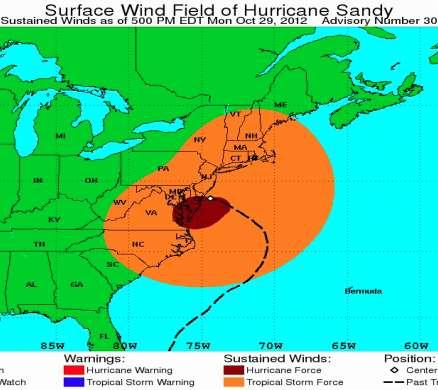
5 Introduction/Motivation Hurricane Sandy and its ET 5
 and wind (dark barbs, kt convention) and 300 200-hPa PV (shaded in warm colors every 2 PVU starting at 2 PVU) and wind (white barbs, kt convention) from Eta initialization for (a) 0000 UTC 16")
6 Classification of extratropical transition (from Atallah and Bosart 2003): The hPa PV (shaded in cool colors every 0.2 PVU starting at 0.8 PVU) and wind (dark barbs, kt convention) and hPa PV (shaded in warm colors every 2 PVU starting at 2 PVU) and wind (white barbs, kt convention) from Eta initialization for (a) 0000 UTC 16 Sep, (b) 1200 UTC 16 Sep, (c) 0000 UTC 17 Sep, and (d) 1200 UTC 17 Sep (Floyd 1999) 6
7 Classification of extratropical transition (Floyd 1999) (from Jones et al. 2003): Cyclone phase space diagrams for (a), (b) the extratropical transition of Hurricane Floyd in [(a), (b) Taken from Hart (2003) du/cyclonephase.] 7
 pathway (Kofron et al.")
8 Classification of extratropical transition Based on environment Based on Cyclone Phase Space (CPS) pathway (Kofron et al. 2010b) 8
 ENP (150 TCs) and (b) ATL (174")
9 Climatology Eastern North Pacific and North Atlantic Ocean (Wood and Ritchie 2014) Average CPS frequency per TC during in the (a) ENP (150 TCs) and (b) ATL (174 TCs). 9
. Eady growth rate(hoskins and Valdes 1990; a parameter indicating baroclinic development of disturbance): 0.")
10 Climatology Western North Pacific Ocean (Kitabatake 2011) June August October 26-year monthly mean field of Eady growth rate (contour, day -1 Kitabatake (2011) ), SST (Color, deg C), and the ET completion location (circle). Eady growth rate(hoskins and Valdes 1990; a parameter indicating baroclinic development of disturbance): 0.31 f N du dz In August, TCs tend to move to higher latitude in a weakly baroclinic environment above cooler sea surface before ET completion In October, TCs tend to complete ET in lower latitude in a strongly baroclinic environment above warmer sea surface 10
 portion of bar represent the number of TCs undergoing ET. In (a), year on chart refers to year season ended.")
11 Climatology Southwest Indian Ocean (Griffin and Bosart 2014) Summary of TC and ET events in the SWIO west of 90 E by (a) TC season and (b) month, Full height of bar represents TC events, with lower (blue) portion of bar represent the number of TCs undergoing ET. In (a), year on chart refers to year season ended. In (b), crossmonth events sorted by which month contained the end of TC life. Lower (blue) portion of bar represents the number of TCs beginning ET that month. 11
 TC location. b) Extratropical cyclone location (as defined by 500mb closed center).")
12 Climatology North Atlantic Ocean (Hart) Frequency of occurrence from of TC XC proximity within 1500km. a) TC location. b) Extratropical cyclone location (as defined by 500mb closed center). 12
 was the only documented cyclone to undergo ET.")
13 Climatology South Atlantic Ocean (Pinto) Simplified life cycle of two South Atlantic tropical storms. Anita (2010) was the only documented cyclone to undergo ET. Images based on infrared GOES-12 satellite imagery. 13
 Average rainfall swath (mm) for the two recurving TC groups identified in Ritchie et al.")
14 Downstream impacts Precipitation (Ritchie et al. 2011) Average rainfall swath (mm) for the two recurving TC groups identified in Ritchie et al. (2011) and their representative members. 14
 For Frances (2004), (c) NARR ageostrophic frontogenesis as in panel (a), but total from t = -3 h to t = +3 h, and (d) CaPA total precipitation (mm, shaded) for t = - 6 h to t = + 6 h and NARR")
15 Downstream impacts Precipitation (Milrad et al. 2013) For Frances (2004), (c) NARR ageostrophic frontogenesis as in panel (a), but total from t = -3 h to t = +3 h, and (d) CaPA total precipitation (mm, shaded) for t = - 6 h to t = + 6 h and NARR SLP (hpa, solid black) at t = 0 h. The black ovals denote the area of enhanced precipitation in the SLRV. In both (c) and (d), Montreal s Trudeau International Airport (CYUL) is marked with a blue star and Quebec s Jean-Lesage International Airport (CYQB) is marked with a black star. Bottom: Also for Frances (2004), (e) cross-section of ageostrophic frontogenesis (shaded) and equivalent potential temperature (K, red contours), at t = 0 h. The cross-sectional area is denoted by the black line in panel (c) and the black star indicates the center of the SLRV. (f) NARR sounding at t = 0 h at the location of the black star in panel (e). Plotted are temperature ( C, red), dew point ( C, blue), and winds (kts, black barbs). 15

16 Downstream impacts Precipitation (Milrad et al. 2013) Schematic showing the processes involved in producing enhanced precipitation during ET cases in the SLRV. The red circles and dotted lines indicate two common storm locations and tracks. The blue and purple arrows represent the geostrophic and pressure driven channeled surface wind, respectively. The black lines approximate isobars, with the identified pressure gradient threshold for pressure-driven channeling written in purple. The yellow ellipses are typical regions of ageostrophic frontogenesis and precipitation enhancement within the SLRV. 16
 Composite analyses showing (a) strong (N = 54) and (b) weak (N = 54) TC extratropical flow interactions at the time of maximum interaction.")
17 Downstream impacts Rossby wave trains (Archambault et al. 2014a) Composite analyses showing (a) strong (N = 54) and (b) weak (N = 54) TC extratropical flow interactions at the time of maximum interaction. Analyses show 500-hPa ascent (dashed green, every 2 x 10⁻³ hpa/s, negative values only), precipitable water (shaded according to gray scale, mm), and 200-hPa PV (blue, every 1 PVU), irrotational wind (vectors, >2 m/s; purple vectors, >8 m/s), negative PV advection by the irrotational wind (dashed red, every 2 PVU/day starting at 2 PVU/day), and wind speed (shaded according to color bar, m /s)). The star denotes the point of maximum interaction. The TC symbol denotes the composite TC position. 17
![Downstream impacts Rossby wave trains (Quinting and Jones, 2014) Anomaly of RWP occurrence frequency [%] (a) and RWP amplitude [m/s] (b) from June to November climatology for western North Pacific](/docs-images/74/69715353/images/18-0.jpg "TCs. Values that are statistically significant at the 95% confidence level are hatched. Black horizontal bar marks the range of longitudes of TCs at ET-time.")
18 Downstream impacts Rossby wave trains (Quinting and Jones, 2014) Anomaly of RWP occurrence frequency [%] (a) and RWP amplitude [m/s] (b) from June to November climatology for western North Pacific TCs. Values that are statistically significant at the 95% confidence level are hatched. Black horizontal bar marks the range of longitudes of TCs at ET-time. White circle marks the mean longitude of all TCs at ETtime. 280 cases were used. 18
 vertically averaged from 100 to 300 hpa and associated troughrelative non-divergent wind vectors (scale for wind speed in m/s below the colour bar).")
19 Downstream impacts Critical bifurcation point in the upper-level extratropical flow that governs the downstream impact of an ET (Grams et al. 2013) Trough-relative stream function (shaded every 0.5x10 6 m 2 /s) vertically averaged from 100 to 300 hpa and associated troughrelative non-divergent wind vectors (scale for wind speed in m/s below the colour bar). Contours: ur + vr = 0, 10 m/s (white solid). Time shown is 0600 UTC 1 October Tracks are shown relative to the estimated zonal trough propagation speed of 0.5 /h and centred on the TC position (open square) at the time shown. A geographical coordinate system centred on the bifurcation point is used. 19
 Tracks of Hurricane Earl in 5-day integrations starting at 1200 UTC 1 September (left panel, colour-coded for jet wind speeds as shown in the right panel legend).")
20 Downstream impacts Importance of upstream middle-latitude flow (McTaggart- Cowan et al. 2001; Corboseiro et al. 2012) Tracks of Hurricane Earl in 5-day integrations starting at 1200 UTC 1 September (left panel, colour-coded for jet wind speeds as shown in the right panel legend). The potential temperature on the dynamic tropopause (2 PVU surface) at 1200 UTC 6 September are shaded according to the color bar. Initial wind speeds in the jet and their relation to Earl's final intensity are shown in the right panel. 20
 Example for new warning product during ET")
21 Forecasting of extratropical transition Communication and outreach (Fogarty) Example for new warning product during ET 21
 Composites of Airborne Doppler")

22 Processes during extratropical transition Inner core structure and intensity change (Aberson) Composites of Airborne Doppler wind analyses and dropwind sonde data at 7 and 0.5 km altitude from NOAA aircraft for Hurricane Arthur. Best track for Arthur from NHC. 22
 and 12 UTC 01 Oct Sep 2008 (right). 1.5 PVU PV surface (blue shading),320 K surface of Θe (transparent grey shading), representing 3-D baroclinic zone.")
23 Processes during extratropical transition Interaction with middle latitudes (Grams et al. 2013) Figure 5 from Grams et al. (2013a). 3-D view of ET Jangmi at 00 UTC 30 Sep 2008 (left) and 12 UTC 01 Oct Sep 2008 (right). 1.5 PVU PV surface (blue shading),320 K surface of Θe (transparent grey shading), representing 3-D baroclinic zone. v = 60m s -1 (green shading), highlighting upper-level midlatitude jet. Θ at 990 hpa (shading at bottom, brown colours >300 K, green 290 K,blue <280 K) and geopotential at 990 hpa (black contours, every 250 gpm). Paths of representative trajectories (every 100th, starting 28/12UTC ending 30/12UTC (left) and 30/12UTC 02/12UTC (right)) coloured by PV of air parcel moving along trajectory. Low-PV air (PV<0.6 PVU) grey shades, higher PV values (PV>0.6 PVU) in red shades (legend bottom right). 23
, 500 hpa upward vertical motion (purple contours every 5 μb s -1 ), and mean sea level pressure (black contours every 4 hpa) for (a) 1200 UTC 8 March, (b) 0000")
24 Processes during extratropical transition Interaction with middle latitudes (Griffin and Bosart 2013) Plot of 250 hpa isotachs (shaded per color bar; m s -1 ), hpa thickness (dashed contours; dam; 540 and below in blue), 500 hpa upward vertical motion (purple contours every 5 μb s -1 ), and mean sea level pressure (black contours every 4 hpa) for (a) 1200 UTC 8 March, (b) 0000 UTC 9 March, and (c) 1200 UTC 9 March
 (a) and (b) Relative vorticity (10-5 /s) and streamlines and 850 hpa.")
25 Processes during extratropical transition ET processes that occur without a predecessor TC (Davis et al. 2013) (a) and (b) Relative vorticity (10-5 /s) and streamlines and 850 hpa. C1 refers to cyclone 1, TCS025 refers to the remnants of TCS025; (c) Temperature (K) at 850 hpa. Arrows denote orientation of strongest flow. 25
. (Pantillon et al.")
26 Processes during extratropical transition The correct phasing of Helene with the Rossby wavetrain was crucial to both its correct track, and for the enhanced probability of developing the Mediterranean cyclone (Medicane). (Pantillon et al. 2013) Link between Hurricane Helene (2006) and a Mediterranean tropical-like cyclone (Medicane) in the operational ECMWF ensemble forecast, partitioned in 2 clusters. Tracks of Helene until 1200 UTC 26 September 2006 and tracks of the Medicane on 26 September 2006; tracks in the ECMWF analysis (solid black line), deterministic forecasts (dashed black lines), and ensemble forecasts (shading) initialized at 0000 UTC from 20 to 23 September Ensemble members that predict the Medicane are in color (red and blue of 22 and 23 September 2006, respectively). Dots indicate the position of Helene at 0000 UTC. 26


27 Hybrid systems Mediterranean Sea (Elizaga) MODIS image of the tropical-like Mediterranean cyclone on 19 th November 2013 at 15:30 UTC. The centre of the cyclone is just off the Sardinia coast. Cyclone phase space diagram from UKMET model. It shows the evolution of the Mediterranean storm between 18th November 00UTC and 21st November 00UTC. Source: Florida State University 27
28 Summary New methods of classification 1. Differences in ET environments 2. The CPS pathway and the isentropic PV Climatologies 1. Southwestern Pacific Ocean 2. Eastern North Pacific Ocean 3. Improved understanding of South Atlantic ET 4. North Atlantic interactions with extratropical cyclones. 28
29 Downstream impacts 1. Precipitation structures Summary 2. Amplification of middle-latitude Rossby wave trains 3. Sensitivity to phasing between the transitioning TC and the pre-existing middle-latitude wave train Forecasting 1. Assimilation of aircraft reconnaissance data have been shown to improve forecasts of ET s inner-core structure 29
30 Processes Summary 1. Advection of potential vorticity (PV) by the nondivergent wind 2. Diabatic PV modifications 3. Warm conveyor belt (WCB) ascent in a baroclinic zone Hybrid systems 1. Mediterranean cyclone with tropical characteristics 30
31 Recommendations for future research directions 1. The need to develop an objective classifier of ET, so that climatological studies and intensity estimations may be standardized. 2. The need to conduct more systematic studies of physical processes to determine the relative position of the ET and mid-latitude bifurcation points, and how well these are represented in NWP models. 31
32 Recommendations for future research directions 3.Additional insight is needed on how a TC may alter the midlatitude environment in a manner that facilitates its own reintensification, and the TC s role in diminishing predictability. 4.Future field campaigns are needed to document the role of condensational heating and its representation in numerical models during ET. 32
33 Discussion questions * Should we achieve a unification in how ET is defined, operationally and in climatological studies? Is the CPS the way to go, or do we need an additional classifier that captures the environmental factors and the midlatitude impact? * How do we achieve a better understanding the role of diabatic processes and the occurrence of bifurcation points during ET? How do these processes affect the synoptic situation and predictability in downstream midlatitudes? 33
34 Thank you! 34
Subtropical and Hybrid Systems IWTC VII Topic 1.6
 Subtropical and Hybrid Systems IWTC VII Topic 1.6 John R. Gyakum Department of Atmospheric and Oceanic Sciences McGill University, Montreal Canada Working group: John L. Beven II, Lance F. Bosart, Fermin
The Impact of air-sea interaction on the extratropical transition of tropical cyclones
 The Impact of air-sea interaction on the extratropical transition of tropical cyclones Sarah Jones Institut für Meteorologie und Klimaforschung Universität Karlsruhe / Forschungszentrum Karlsruhe 1. Introduction
Shawn M. Milrad Atmospheric Science Program Department of Geography University of Kansas Lawrence, Kansas
 Shawn M. Milrad Atmospheric Science Program Department of Geography University of Kansas Lawrence, Kansas Eyad H. Atallah and John R. Gyakum Department of Atmospheric and Oceanic Sciences McGill University
Multiscale Analyses of Inland Tropical Cyclone Midlatitude Jet Interactions: Camille (1969) and Danny (1997)
 and Danny (1997)") Multiscale Analyses of Inland Tropical Cyclone Midlatitude Jet Interactions: Camille (1969) and Danny (1997) Matthew Potter, Lance Bosart, and Daniel Keyser Department of Atmospheric and Environmental
Multiscale Analyses of Inland Tropical Cyclone Midlatitude Jet Interactions: Camille (1969) and Danny (1997) Matthew Potter, Lance Bosart, and Daniel Keyser Department of Atmospheric and Environmental
What does a cloud-resolving model bring during an extratropical transition?
 What does a cloud-resolving model bring during an extratropical transition? Florian Pantillon (1) Jean-Pierre Chaboureau (1) Christine Lac (2) Patrick Mascart (1) (1) Laboratoire d'aérologie, Toulouse,
2D.1 DETERMINATION OF A CONSISTENT TIME FOR THE EXTRATROPICAL TRANSITION OF TROPICAL CYCLONES
 2D.1 DETERMINATION OF A CONSISTENT TIME FOR THE EXTRATROPICAL TRANSITION OF TROPICAL CYCLONES David E. Kofron*, Elizabeth A. Ritchie, and J. Scott Tyo University of Arizona, Tucson, Arizona 1. INTRODUCTION
Impact of air-sea interaction on extratropical transition of tropical cyclones. Sarah Jones
 Impact of air-sea interaction on extratropical transition of tropical cyclones Sarah Jones 12.Juli 2007 15.Juli 2007 16.Juli 2007 Direct Impact of ET Ex-Hurricane Philippe: a storm or not a storm? 6 day
The Impact of the Extratropical Transition of Typhoon Dale (1996) on the Early Wintertime Stratospheric Circulation
 on the Early Wintertime Stratospheric Circulation") The Impact of the Extratropical Transition of Typhoon Dale (1996) on the Early 1996-97 Wintertime Stratospheric Circulation Andrea L. Lang 1, Jason M. Cordeira 2, Lance F. Bosart 1 and Daniel Keyser 1
The Impact of the Extratropical Transition of Typhoon Dale (1996) on the Early 1996-97 Wintertime Stratospheric Circulation Andrea L. Lang 1, Jason M. Cordeira 2, Lance F. Bosart 1 and Daniel Keyser 1
A 40-year climatology of extratropical transition in the eastern North Pacific continued (and some other stuff)
") GOES-EAST image of Hurricane Dora, 1445 UTC 21 July 2011 A 40-year climatology of extratropical transition in the eastern North Pacific continued (and some other stuff) Elizabeth A. Ritchie and Kimberly
GOES-EAST image of Hurricane Dora, 1445 UTC 21 July 2011 A 40-year climatology of extratropical transition in the eastern North Pacific continued (and some other stuff) Elizabeth A. Ritchie and Kimberly
1. INTRODUCTION: 2. DATA AND METHODOLOGY:
 27th Conference on Hurricanes and Tropical Meteorology, 24-28 April 2006, Monterey, CA 3A.4 SUPERTYPHOON DALE (1996): A REMARKABLE STORM FROM BIRTH THROUGH EXTRATROPICAL TRANSITION TO EXPLOSIVE REINTENSIFICATION
Diabatic processes and the structure of extratropical cyclones
 Geophysical and Nonlinear Fluid Dynamics Seminar AOPP, Oxford, 23 October 2012 Diabatic processes and the structure of extratropical cyclones Oscar Martínez-Alvarado R. Plant, J. Chagnon, S. Gray, J. Methven
1. INTRODUCTION. designed. The primary focus of this strategy was the extratropical transition (ET) of tropical cyclones based on the poleward
 of tropical cyclones based on the poleward") P1.98 THE THORPEX PACIFIC ASIAN REGIONAL CAMPAIGN (T-PARC) OBJECTIVE ON THE EXTRATROPICAL TRANSITION OF TROPICAL CYCLONES: OBSERVED CASES, THEIR STRUCTURE AND DOWNSTREAM IMPACTS P. A. Harr 1, S. C. Jones
P1.98 THE THORPEX PACIFIC ASIAN REGIONAL CAMPAIGN (T-PARC) OBJECTIVE ON THE EXTRATROPICAL TRANSITION OF TROPICAL CYCLONES: OBSERVED CASES, THEIR STRUCTURE AND DOWNSTREAM IMPACTS P. A. Harr 1, S. C. Jones
Julia H. Keller¹, Sarah C. Jones¹ and Patrick A. Harr²
 The Eddy Kinetic Energy Budget for Several Forecast Scenarios of the Extratropical Transition of two Tropical Cyclones Julia H. Keller¹, Sarah C. Jones¹ and Patrick A. Harr² ¹ Karlsruhe Institute of Technology
A Climatology of the Extratropical Transition of Tropical Cyclones in the Western North Pacific
 A Climatology of the Extratropical Transition of Tropical Cyclones in the Western North Pacific Naoko KITABATAKE (Meteorological Research Institute / Japan Meteorological Agency) 1 Outline 1. Topic 1:
A Preliminary Climatology of Extratropical Transitions in the Southwest Indian Ocean
 A Preliminary Climatology of Extratropical Transitions in the Southwest Indian Ocean Kyle S. Griffin Department of Atmospheric and Environmental Sciences, University at Albany, State University of New
THE EXTRATROPICAL TRANSITION OF TYPHOON WINNIE (1997): SELF-AMPLIFICATION AFTER LANDFALL
: SELF-AMPLIFICATION AFTER LANDFALL") THE EXTRATROPICAL TRANSITION OF TYPHOON WINNIE (1997): SELF-AMPLIFICATION AFTER LANDFALL Chih-Shin Liu *1,2 and George Tai-Jen Chen 2 1 Weather Forecast Center, Central Weather Bureau, 2 Department of
THE EXTRATROPICAL TRANSITION OF TYPHOON WINNIE (1997): SELF-AMPLIFICATION AFTER LANDFALL Chih-Shin Liu *1,2 and George Tai-Jen Chen 2 1 Weather Forecast Center, Central Weather Bureau, 2 Department of
Predecessor Rain Events: A Literature Review. By: Tony Viramontez
 Predecessor Rain Events: A Literature Review By: Tony Viramontez Introduction Predecessor Rain Event (PRE): meso- and subsynopticscale regions of high-impact heavy rainfall that occur well in advance of
Tropical Cyclone Formation/Structure/Motion Studies
 Tropical Cyclone Formation/Structure/Motion Studies Patrick A. Harr Department of Meteorology Naval Postgraduate School Monterey, CA 93943-5114 phone: (831) 656-3787 fax: (831) 656-3061 email: paharr@nps.edu
Diabatic processes and the structure of the warm conveyor belt
 2 nd European Windstorm Workshop Leeds, 3-4 September 2012 Diabatic processes and the structure of the warm conveyor belt Oscar Martínez-Alvarado J. Chagnon, S. Gray, R. Plant, J. Methven Department of
High-Impact Weather Events Associated with Interacting Tropical Cyclones over the Western Pacific in August 2016
 High-Impact Weather Events Associated with Interacting Tropical Cyclones over the Western Pacific in August 2016 Lance F. Bosart, Philippe P. Papin, and Alicia M. Bentley, and Tomer Burg GEWEX-2018 Open
David E. Kofron*, Miguel F. Piñeros, Elizabeth A. Ritchie, and J. Scott Tyo University of Arizona, Tucson, Arizona 1. INTRODUCTION
 15.4 DEFINING THE LIFECYCLE OF THE EXTRATROPICAL TRANSITION OF TROPICAL CYCLONES USING THE DEVIATION ANGLE VARIANCE TECHNIQUE FOR REMOTELY-SENSED IMAGERY David E. Kofron*, Miguel F. Piñeros, Elizabeth
Synoptic Meteorology II: Frontogenesis Examples Figure 1
 Synoptic Meteorology II: Frontogenesis Examples The below images, taken from the 1200 UTC 17 January 2019 GFS forecast run, provide examples of the contributions of deformation and divergence to frontogenesis.
Extratropical transition of tropical cyclones: Operational forecasting challenges. Matthew Kucas Joint Typhoon Warning Center Pearl Harbor, HI, USA
 Extratropical transition of tropical cyclones: Operational forecasting challenges Matthew Kucas Joint Typhoon Warning Center Pearl Harbor, HI, USA Outline Motivation for discussion Brief overview of tropical
SUPPLEMENTARY INFORMATION
 Figure S1. Summary of the climatic responses to the Gulf Stream. On the offshore flank of the SST front (black dashed curve) of the Gulf Stream (green long arrow), surface wind convergence associated with
Final Examination, MEA 443 Fall 2008, Lackmann
 Place an X here to count it double! Name: Final Examination, MEA 443 Fall 2008, Lackmann If you wish to have the final exam count double and replace your midterm score, place an X in the box above. As
DYNAMICAL STRUCTURES AND PRECIPITATION DISTRIBUTIONS OF TRANSITIONING TROPICAL CYCLONES IN EASTERN CANADA,
 6B.1 DYNAMICAL STRUCTURES AND PRECIPITATION DISTRIBUTIONS OF TRANSITIONING TROPICAL CYCLONES IN EASTERN CANADA, 1979-2004 SHAWN MILRAD 1, EYAD ATALLAH and JOHN GYAKUM Department of Atmospheric and Oceanic
Synoptic Meteorology II: Petterssen-Sutcliffe Development Theory Application March 2015
 Synoptic Meteorology II: Petterssen-Sutcliffe Development Theory Application 10-12 March 2015 In our lecture on Petterssen-Sutcliffe Development Theory, we outlined the principle of selfdevelopment in
Extratropical and Polar Cloud Systems
 Extratropical and Polar Cloud Systems Gunilla Svensson Department of Meteorology & Bolin Centre for Climate Research George Tselioudis Extratropical and Polar Cloud Systems Lecture 1 Extratropical cyclones
and 24 mm, hPa lapse rates between 3 and 4 K km 1, lifted index values
 3.2 Composite analysis 3.2.1 Pure gradient composites The composite initial NE report in the pure gradient northwest composite (N = 32) occurs where the mean sea level pressure (MSLP) gradient is strongest
Recurving Western North Pacific Tropical Cyclones and Mid-Latitude Predictability
 GEOPHYSICAL RESEARCH LETTERS, VOL.???, XXXX, DOI:10.1002/, 1 2 Recurving Western North Pacific Tropical Cyclones and Mid-Latitude Predictability A. Aiyyer, 1 Corresponding author: A. Aiyyer, Department
Extratropical processes and forecast errors
 Extratropical processes and forecast errors Heini Wernli With contributions from: Andreas Dörnbrack, Sarah Jones, George Craig Maxi Böttcher, Hanna Joos, Andreas Schäfler, Matthias Zimmer, Florian Meier,
Tropical Storm List
 Tropical Storm Email List http://tstorms.org/ tropical-storms@tstorms.org Tropical-Storms is a mailing list only for those who are professionally active in either the research or forecasting of tropical
Mid-Latitude Dynamics and Atmospheric Rivers
 Mid-Latitude Dynamics and Atmospheric Rivers Session: Theory, Structure, Processes 1 Wednesday, 10 August 2016 Contribution from: Heini Werni Peter Knippertz Harold Sodemann Andreas Stohl Francina Dominguez
Report from the PDP working group
 Report from the PDP working group Craig Bishop, Pat Harr, Shuhei Maeda, John Methven, Mark Rodwell, Istvan Szunyogh, Olivier Talagrand, Heini Wernli ICSC11 Meeting July 2013 PDP mission Main task of the
Ensemble Prediction Systems
 Ensemble Prediction Systems Eric Blake National Hurricane Center 7 March 2017 Acknowledgements to Michael Brennan 1 Question 1 What are some current advantages of using single-model ensembles? A. Estimates
Characterizing the role of diabatic processes for the modification of mid-latitude Rossby waves and Jetstream winds
 Characterizing the role of diabatic processes for the modification of mid-latitude Rossby waves and Jetstream winds Andreas Schäfler 1, George Craig 2, Andreas Dörnbrack 1, Florian Harnisch 4, Uwe Marksteiner
3. Midlatitude Storm Tracks and the North Atlantic Oscillation
 3. Midlatitude Storm Tracks and the North Atlantic Oscillation Copyright 2006 Emily Shuckburgh, University of Cambridge. Not to be quoted or reproduced without permission. EFS 3/1 Review of key results
Vertical structure. To conclude, we will review the critical factors invloved in the development of extratropical storms.
 Vertical structure Now we will examine the vertical structure of the intense baroclinic wave using three visualization tools: Upper level charts at selected pressure levels Vertical soundings for selected
Tropical-Extratropical Transition
 Tropical-Extratropical Transition Extratropical Transition A significant number of tropical cyclones move into the midlatitudes and transform into extratropical cyclones. This process is generally referred
TOWARDS A BETTER UNDERSTANDING OF AND ABILITY TO FORECAST THE WIND FIELD EXPANSION DURING THE EXTRATROPICAL TRANSITION PROCESS
 P1.17 TOWARDS A BETTER UNDERSTANDING OF AND ABILITY TO FORECAST THE WIND FIELD EXPANSION DURING THE EXTRATROPICAL TRANSITION PROCESS Clark Evans* and Robert E. Hart Florida State University Department
2D.4 THE STRUCTURE AND SENSITIVITY OF SINGULAR VECTORS ASSOCIATED WITH EXTRATROPICAL TRANSITION OF TROPICAL CYCLONES
 2D.4 THE STRUCTURE AND SENSITIVITY OF SINGULAR VECTORS ASSOCIATED WITH EXTRATROPICAL TRANSITION OF TROPICAL CYCLONES Simon T. Lang Karlsruhe Institute of Technology. INTRODUCTION During the extratropical
Lower-Tropospheric Height Tendencies Associated with the Shearwise and Transverse Components of Quasigeostrophic Vertical Motion
 JULY 2007 N O T E S A N D C O R R E S P O N D E N C E 2803 Lower-Tropospheric Height Tendencies Associated with the Shearwise and Transverse Components of Quasigeostrophic Vertical Motion JONATHAN E. MARTIN
Simulations of the Extratropical Transition of Tropical Cyclones: Contributions by the Midlatitude Upper-Level Trough to Reintensification
 2112 MONTHLY WEATHER REVIEW Simulations of the Extratropical Transition of Tropical Cyclones: Contributions by the Midlatitude Upper-Level Trough to Reintensification ELIZABETH A. RITCHIE Department of
Dynamics of the Atmosphere. Large-scale flow with rotation and stratification
 12.810 Dynamics of the Atmosphere Large-scale flow with rotation and stratification Visualization of meandering jet stream Upper level winds from June 10th to July 8th 1988 from MERRA Red shows faster
Synoptic Meteorology
 M.Sc. in Meteorology Synoptic Meteorology [MAPH P312] Prof Peter Lynch Second Semester, 2004 2005 Seminar Room Dept. of Maths. Physics, UCD, Belfield. Part 9 Extratropical Weather Systems These lectures
Tropical Waves. John Cangialosi and Lixion Avila National Hurricane Center. WMO Region IV Tropical Cyclone Workshop
 Tropical Waves John Cangialosi and Lixion Avila National Hurricane Center WMO Region IV Tropical Cyclone Workshop Outline Basic definition Schematic diagrams/interactions Operational products/forecasts
13.3 CHARACTERIZATION OF EXTRATROPICAL TRANSITION USING CLUSTER ANALYSIS
 13.3 CHARACTERIZATION OF EXTRATROPICA TRANSITION USING CUSTER ANAYSIS Justin M. Arnott* and Jenni. Evans The Pennsylvania State University, Department of Meteorology, University Park, Pennsylvania 1. INTRODUCTION
ADJONT-BASED ANALYSIS OF OBSERVATION IMPACT ON TROPICAL CYCLONE INTENSITY FORECASTS
 7A.3 ADJONT-BASED ANALYSIS OF OBSERVATION IMPACT ON TROPICAL CYCLONE INTENSITY FORECASTS Brett T. Hoover* and Chris S. Velden Cooperative Institute for Meteorological Satellite Studies, Space Science and
Katherine E. Lukens and E. Hugo Berbery. Acknowledgements: Kevin I. Hodges 1 and Matthew Hawcroft 2. University of Reading, Reading, Berkshire, UK
 Boreal Winter Storm Tracks and Related Precipitation in North America: A Potential Vorticity Perspective Katherine E. Lukens and E. Hugo Berbery Acknowledgements: Kevin I. Hodges 1 and Matthew Hawcroft
Satellites, Weather and Climate Module??: Polar Vortex
 Satellites, Weather and Climate Module??: Polar Vortex SWAC Jan 2014 AKA Circumpolar Vortex Science or Hype? Will there be one this year? Today s objectives Pre and Post exams What is the Polar Vortex
Comparison of Wave Packets associated with Extratropical. Transition and Winter Cyclones. Ryan D. Torn. Gregory J. Hakim
 Generated using version 3.1.2 of the official AMS L A TEX template 1 Comparison of Wave Packets associated with Extratropical 2 Transition and Winter Cyclones 3 Ryan D. Torn Department of Atmospheric and
THE SYNOPTIC ENVIRONMENT OF THE 11 APRIL 2001 CENTRAL PLAINS TORNADO OUTBREAK VIEWED IN THREE DIMENSIONS
 P1.1 THE SYNOPTIC ENVIRONMENT OF THE 11 APRIL 2001 CENTRAL PLAINS TORNADO OUTBREAK VIEWED IN THREE DIMENSIONS Daniel D. Nietfeld * NOAA/NWS/WFO Omaha/Valley, NE 1. INTRODUCTION A powerful low pressure
P1.35 EVALUATING THE IMPACTS OF EXTRATROPICAL TRANSITIONING ON TYPHOON LOSSES VIA SYNOPTIC CASE STUDIES
 P1.35 EVALUATING THE IMPACTS OF EXTRATROPICAL TRANSITIONING ON TYPHOON LOSSES VIA SYNOPTIC CASE STUDIES Peter J. Sousounis* and Mélicie Desflots AIR Worldwide Corporation, Boston, MA 1. MOTIVATION FOR
The 2009 Hurricane Season Overview
 The 2009 Hurricane Season Overview Jae-Kyung Schemm Gerry Bell Climate Prediction Center NOAA/ NWS/ NCEP 1 Overview outline 1. Current status for the Atlantic, Eastern Pacific and Western Pacific basins
Simulations of the Extratropical Transition of Tropical Cyclones: Phasing between the Upper-Level Trough and Tropical Cyclones
 862 M O N T H L Y W E A T H E R R E V I E W VOLUME 135 Simulations of the Extratropical Transition of Tropical Cyclones: Phasing between the Upper-Level Trough and Tropical Cyclones ELIZABETH A. RITCHIE
Lectures on Tropical Cyclones
 Lectures on Tropical Cyclones Chapter 1 Observations of Tropical Cyclones Outline of course Introduction, Observed Structure Dynamics of Mature Tropical Cyclones Equations of motion Primary circulation
Shawn M. Milrad and John R. Gyakum Department of Atmospheric and Oceanic Sciences McGill University Montreal, QC, Canada
 Shawn M. Milrad and John R. Gyakum Department of Atmospheric and Oceanic Sciences McGill University Montreal, QC, Canada Motivation Outline 6-8 December 2010 surprise snow Meteorological Issues Case overview
10B.2 THE ROLE OF THE OCCLUSION PROCESS IN THE EXTRATROPICAL-TO-TROPICAL TRANSITION OF ATLANTIC HURRICANE KAREN
 10B.2 THE ROLE OF THE OCCLUSION PROCESS IN THE EXTRATROPICAL-TO-TROPICAL TRANSITION OF ATLANTIC HURRICANE KAREN Andrew L. Hulme* and Jonathan E. Martin University of Wisconsin-Madison, Madison, Wisconsin
Introduction of products for Climate System Monitoring
 Introduction of products for Climate System Monitoring 1 Typical flow of making one month forecast Textbook P.66 Observed data Atmospheric and Oceanic conditions Analysis Numerical model Ensemble forecast
5D.6 EASTERLY WAVE STRUCTURAL EVOLUTION OVER WEST AFRICA AND THE EAST ATLANTIC 1. INTRODUCTION 2. COMPOSITE GENERATION
 5D.6 EASTERLY WAVE STRUCTURAL EVOLUTION OVER WEST AFRICA AND THE EAST ATLANTIC Matthew A. Janiga* University at Albany, Albany, NY 1. INTRODUCTION African easterly waves (AEWs) are synoptic-scale disturbances
Summary of High Wind Event of 7 March 2004
 Summary of High Wind Event of 7 March 2004 This event was characterized by a very strong jet streak that developed over North Carolina by 00 UTC 8 March, as seen in the Eta model analysis at 300 mb, with
Climatology of dry air intrusions and their relation to strong surface winds in extratropical cyclones
 Climatology of dry air intrusions and their relation to strong surface winds in extratropical cyclones...and intro to synoptic and meso-scale cyclone dynamics Shira Raveh-Rubin and Heini Wernli Institute
The Impacts on Extended-Range Predictability of Midlatitude Weather Patterns due to Recurving Tropical Cyclones
 The Impacts on Extended-Range Predictability of Midlatitude Weather Patterns due to Recurving Tropical Cyclones Patrick A. Harr and Heather M. Archambault Naval Postgraduate School, Monterey, CA Hurricane
KUALA LUMPUR MONSOON ACTIVITY CENT
 T KUALA LUMPUR MONSOON ACTIVITY CENT 2 ALAYSIAN METEOROLOGICAL http://www.met.gov.my DEPARTMENT MINISTRY OF SCIENCE. TECHNOLOGY AND INNOVATIO Introduction Atmospheric and oceanic conditions over the tropical
Remote impact of North Atlantic hurricanes on the Mediterranean during episodes of intense rainfall in autumn 2012
 QuarterlyJournalof theroyalmeteorologicalsociety Q. J. R. Meteorol. Soc. 141: 967 978, April 2015 A DOI:10.1002/qj.2419 Remote impact of North Atlantic hurricanes on the Mediterranean during episodes of
1. COLD FRONT - CLOUD STRUCTURE IN SATELLITE IMAGES
 1. COLD FRONT - CLOUD STRUCTURE IN SATELLITE IMAGES The satellite image shows a cyclonically curved synoptic scale cloud band usually a few hundred kilometres wide; in the VIS image the cloud band mostly
The Extratropical Transition of Tropical Cyclone Lili (1996) and Its Crucial Contribution to a Moderate Extratropical Development
 and Its Crucial Contribution to a Moderate Extratropical Development") 1562 M O N T H L Y W E A T H E R R E V I E W VOLUME 133 The Extratropical Transition of Tropical Cyclone Lili (1996) and Its Crucial Contribution to a Moderate Extratropical Development ANNA AGUSTÍ-PANAREDA
1562 M O N T H L Y W E A T H E R R E V I E W VOLUME 133 The Extratropical Transition of Tropical Cyclone Lili (1996) and Its Crucial Contribution to a Moderate Extratropical Development ANNA AGUSTÍ-PANAREDA
Extratropical transition of North Atlantic tropical cyclones in variable-resolution CAM5
 Extratropical transition of North Atlantic tropical cyclones in variable-resolution CAM5 Diana Thatcher, Christiane Jablonowski University of Michigan Colin Zarzycki National Center for Atmospheric Research
AMERICAN METEOROLOGICAL SOCIETY
 AMERICAN METEOROLOGICAL SOCIETY Monthly Weather Review EARLY ONLINE RELEASE This is a preliminary PDF of the author-produced manuscript that has been peer-reviewed and accepted for publication. Since it
John Gyakum, Ron McTaggart-Cowan, Eyad Atallah, and Lance Bosart
 Hurricane Juan (2003): Forecasting and numerical simulation John Gyakum, Ron McTaggart-Cowan, Eyad Atallah, and Lance Bosart Outline Case Background Operational Forecasts and NWP Improved NWP Guidance
Boundary layer controls on extratropical cyclone development
 Boundary layer controls on extratropical cyclone development R. S. Plant (With thanks to: I. A. Boutle and S. E. Belcher) 28th May 2010 University of East Anglia Outline Introduction and background Baroclinic
C
 C 0.8 0.4 0.2 0.0-0.2-0.6 Fig. 1. SST-wind relation in the North Pacific and Atlantic Oceans. Left panel: COADS SST (color shade), surface wind vectors, and SLP regressed upon the Pacific Decadal Oscillation
PATRICK A. HARR. Department of Meteorology, Naval Postgraduate School, Monterey, California
 VOLUME 136 M O N T H L Y W E A T H E R R E V I E W SEPTEMBER 2008 Predictability Associated with the Downstream Impacts of the Extratropical Transition of Tropical Cyclones: Methodology and a Case Study
Chapter 12 Fronts & Air Masses
 Chapter overview: Anticyclones or highs Air Masses o Classification o Source regions o Air masses of North America Fronts o Stationary fronts o Cold fronts o Warm fronts o Fronts and the jet stream o Frontogenesis
the 2 past three decades
 SUPPLEMENTARY INFORMATION DOI: 10.1038/NCLIMATE2840 Atlantic-induced 1 pan-tropical climate change over the 2 past three decades 3 4 5 6 7 8 9 10 POP simulation forced by the Atlantic-induced atmospheric
Occlusion Cyclogenesis
 Occlusion Cyclogenesis Part I: Occlusion cloud bands in comparison to CF and WFs Concepts for cyclogenesis Different types of cyclogenesis and examples Numerical parameters on isobaric and isentropic surfaces
Vertical Structure of Atmosphere
 ATMOS 3110 Introduction to Atmospheric Sciences Distribution of atmospheric mass and gaseous constituents Because of the earth s gravitational field, the atmosphere exerts a downward forces on the earth
A Tropical Cyclone with a Very Large Eye
 JANUARY 1999 PICTURES OF THE MONTH 137 A Tropical Cyclone with a Very Large Eye MARK A. LANDER University of Guam, Mangilao, Guam 9 September 1997 and 2 March 1998 1. Introduction The well-defined eye
General Circulation. Nili Harnik DEES, Lamont-Doherty Earth Observatory
 General Circulation Nili Harnik DEES, Lamont-Doherty Earth Observatory nili@ldeo.columbia.edu Latitudinal Radiation Imbalance The annual mean, averaged around latitude circles, of the balance between the
Radiative contribution to the North-American cold air outbreaks in a Lagrangian perspective
 Radiative contribution to the North-American cold air outbreaks in a Lagrangian perspective Natalia Bliankinshtein, Y. Huang, J. R. Gyakum and E. Atallah Department of Atmospheric and Oceanic Sciences
TC Danny formed as a tropical depression in the northern Gulf of Mexico at 1200
 4. TC Danny Multiscale Analysis 4.1. Introduction 4.1.1. TC Track TC Danny formed as a tropical depression in the northern Gulf of Mexico at 1200 UTC 16 July 1997 and then slowly moved toward the northeast
Mesoscale Atmospheric Systems. Surface fronts and frontogenesis. 06 March 2018 Heini Wernli. 06 March 2018 H. Wernli 1
 Mesoscale Atmospheric Systems Surface fronts and frontogenesis 06 March 2018 Heini Wernli 06 March 2018 H. Wernli 1 Temperature (degc) Frontal passage in Mainz on 26 March 2010 06 March 2018 H. Wernli
Fronts in November 1998 Storm
 Fronts in November 1998 Storm Much of the significant weather observed in association with extratropical storms tends to be concentrated within narrow bands called frontal zones. Fronts in November 1998
General Circulation of the Atmosphere. René Garreaud
 General Circulation of the Atmosphere René Garreaud www.dgf.uchile.cl/rene General circulation of the Atmosphere Low latitude areas receive more solar energy than high latitudes (because of earth sphericity).
Comparison of Wave Packets associated with Extratropical. Transition and Winter Cyclones. Ryan D. Torn. Gregory J. Hakim
 Generated using version 3.1.2 of the official AMS L A TEX template 1 Comparison of Wave Packets associated with Extratropical 2 Transition and Winter Cyclones 3 Ryan D. Torn Department of Atmospheric and
Occlusion cyclogenesis II
 Occlusion cyclogenesis II Upper level influences on cyclogenesis Vorticity Advection (CVA) and the 4-quadrant jet streak model (Uccellini) Potential Vorticity (PV) (Hoskins Theory) Rapid cyclogenesis 14
Accuracy of GFS Forecasts: An Examination of High-Impact Cold Season Weather Events
 Accuracy of GFS Forecasts: An Examination of High-Impact 2011 2012 Cold Season Weather Events DANIEL F. DIAZ 1, 2, STEVEN M. CAVALLO 3, and BRIAN H. FIEDLER 3 1 National Weather Center Research Experiences
2. Outline of the MRI-EPS
 2. Outline of the MRI-EPS The MRI-EPS includes BGM cycle system running on the MRI supercomputer system, which is developed by using the operational one-month forecasting system by the Climate Prediction
Chapter 5. Summary and Conclusions
 Chapter 5. Summary and Conclusions Two cases of heavy rainfall were analyzed using observational data sets and model simulations. The first case was the landfall of Hurricane Floyd in North Carolina in
Isentropic Analysis. Much of this presentation is due to Jim Moore, SLU
 Isentropic Analysis Much of this presentation is due to Jim Moore, SLU Utility of Isentropic Analysis Diagnose and visualize vertical motion - through advection of pressure and system-relative flow Depict
Doris Anwender, Nadia Fourrie, Florence Rabier, Philippe Arbogast Karlsruher Institut für Technologie
 P1.102 DATA IMPACT EXPERIMENTS USING IASI OBSERVATIONS DURING THE LIFE CYCLE OF HURRICANES GUSTAV, HANNA AND IKE (2008) Doris Anwender, Nadia Fourrie, Florence Rabier, Philippe Arbogast Karlsruher Institut
Pacific Storm Track at Different Horizontal Resolutions Snap-shot of Column Liquid Water Content
 Color Plates Pacific Storm Track at Different Horizontal Resolutions Snap-shot of Column Liquid Water Content Fig. 2.8 A snapshot of the cyclone frontal-system by a nonhydrostatic model run with two very
AN EXTRATROPICAL CYCLONE ATLAS
 AN EXTRATROPICAL CYCLONE ATLAS A tool for illustrating cyclone structure and evolution characteristics BY H. F. DACRE, M. K. HAWCROFT, M. A. STRINGER AND K. I. HODGES Authors Affiliations H.F.Dacre, Department
P2.4 THE IMPACT OF TROPICAL CYCLONE REMNANTS ON THE RAINFALL OF THE NORTH AMERICAN SOUTHWEST REGION
 P2.4 THE IMPACT OF TROPICAL CYCLONE REMNANTS ON THE RAINFALL OF THE NORTH AMERICAN SOUTHWEST REGION by Elizabeth A. Ritchie 1 and David Szenasi University of New Mexico 1. INTRODUCTION New Mexico has a
Introduction to tropical meteorology and deep convection
 Introduction to tropical meteorology and deep convection TMD Lecture 1 Roger K. Smith University of Munich A satpix tour of the tropics The zonal mean circulation (Hadley circulation), Inter- Tropical
 http://www.ssec.wisc.edu/data/composites.html Red curve: Incoming solar radiation Blue curve: Outgoing infrared radiation. Three-cell model of general circulation Mid-latitudes: 30 to 60 latitude MID-LATITUDES
Air Masses of North America cp and ca air masses Air mass characterized by very cold and dry conditions
 Chapter 8: Air Masses, Fronts, and Middle-Latitude Cyclones Air masses Fronts Middle-latitude cyclones Air Masses Air mass an extremely large body of air whose properties of temperature and humidity are
The purpose of this thesis is to present two multiscale analyses of inland tropical
 I. Introduction 1.1 General Purpose The purpose of this thesis is to present two multiscale analyses of inland tropical cyclone (TC) midlatitude jet interactions. More specifically, the main focus will
QUALITY OF MPEF DIVERGENCE PRODUCT AS A TOOL FOR VERY SHORT RANGE FORECASTING OF CONVECTION
 QUALITY OF MPEF DIVERGENCE PRODUCT AS A TOOL FOR VERY SHORT RANGE FORECASTING OF CONVECTION C.G. Georgiev 1, P. Santurette 2 1 National Institute of Meteorology and Hydrology, Bulgarian Academy of Sciences
Polar Lows and other High Latitude Weather Systems. John Turner and Tom Bracegirdle British Antarctic Survey Cambridge, UK
 Polar Lows and other High Latitude Weather Systems John Turner and Tom Bracegirdle British Antarctic Survey Cambridge, UK A mosaic of infra-red satellite imagery of the Antarctic and Southern Ocean on