Welcome to PolarConnect. With Kelly McCarthy and NASA s Operation IceBridge
|
|
|
- Dustin Hudson
- 5 years ago
- Views:
Transcription


1 Welcome to PolarConnect With Kelly McCarthy and NASA s Operation IceBridge 5 May 2016

2 If you are joining by phone, please mute your phone. Press *6 to mute and *6 to unmute.
3 Participant Introductions In the chat box please introduce yourself by typing your: üname üschool / Institution üthe number of students and adults participating with you in the same location
4 What is PolarTREC? PolarTREC is a professional development experience in which K-12 teachers are paired with researchers for 2-6 week research experiences in the polar regions. From , nearly 50 teachers from around the United States will join scientists in the Arctic and Antarctica to learn about science, the polar regions, and to share what they have learned with their students and communities.
5 During the Presentation: Type your question in the text chat box At the End of the Presentation: Raise your hand with the hand button. Questions PolarTREC staff will call on you and activate your microphone. Speak loud and clear and directly into the microphone or phone to ask your question.


6 Welcome to our PolarCONNECT Event from Thule, Greenland! Ê PolarTREC Teacher Kelly McCarthy Our Lady of Lourdes Regional School in Coal Township, PA Ê Researcher: John Woods and NASA s Operation IceBridge (Arctic 2016 Campaign)


7 Operation IceBridge Mission Overview Ê Largest airborne survey of polar ice ever conducted! Ê 10 year campaign to measure ice over the Arctic and Antarctica Ê Uses remote sensing methods to collect data supporting a 3 dimensional model of polar sea and land ice surfaces as well as the bedrock beneath the ice sheets Ê Bridges gap in data between ICESat 1 which stopped collecting data in 2009 and ICESat 2 which is set for launch in 2017


8 Role of Airborne Science in the Polar Regions Ê Field research can provide localized measurements to understand what is happening to our Earth at different points of interest Ê Satellite imagery and data can provide a wide scale observation over a large region based on remote instruments orbiting our Earth Ê Airborne Science completes the profile. By mapping a large region of earth with instruments attached to a suborbital aircraft we gain key information about our dynamic planet that we don t get from ground studies or satellite data.
9 Science Goals of Operation IceBridge Ê Maintain continuous data flow of land and sea ice surface topography, thickness, and underlying bedrock Ê Focus on priority sea and land ice paths chosen by a panel of scientists called the Operation IceBridge Science Team. Ê Ê Ê Satellite underflights Paths covering a broad scope of sea and land ice Critically changing land glaciers or ice shelves Ê Improve current models of land and sea ice at the poles.
 Ê Hurricane Hunter Ê Based out of Tampa,")
 Ê")

10 NASA OIB s 2016 Arctic Campaign Ê Aircraft: NOAA P-3 (Miss Piggy) Ê Hurricane Hunter Ê Based out of Tampa, FL Ê Instruments: Ê Airborne Topographic Mapper (ATM) Ê FLIR Infrared Camera Ê Digital Mapping System (DMS) Ê CReSIS Snow Radar Ê MCoRDS Ê Locations: Ê Thule Air Base, Greenland Ê Kangerlussuaq, Greenland Photo credit: NASA/ATM

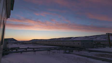
11 LIFE IN THE FIELD Working from the ground and in the air, living on the edge of an ice sheet, experiencing the culture of the north.

12 Life in the Field: GPS Ground Station Fixed GPS Antenna A GPS ground station is used to support data collected during an OIB airborne campaign: Antenna fixed at precise, known location receives position data from satellites starting one hour pre-flight to one hour post-flight Receivers located inside the ground station collect position data, which is downloaded at the end of each day GPS Receiver The data collected at the ground station is compared to the airborne GPS data collected in a method called differential GPS correction


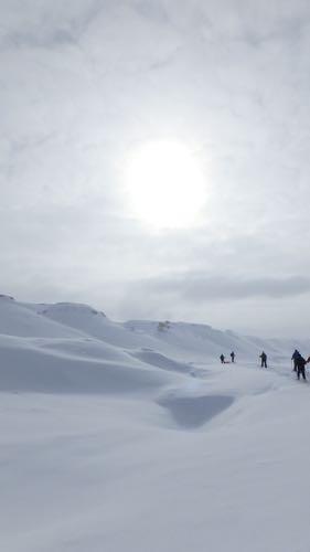
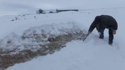
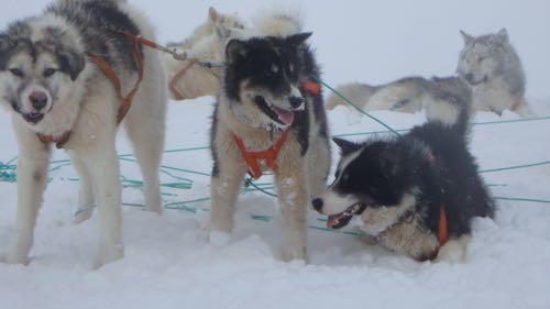
13 Life in the field: Culture of the North


14 A Special Guest: Dr. Piers Sellers Ê Director of NASA s Earth Sciences Division at NASA Goddard Space Flight Center, Astronaut Dr. Piers Sellers spent a week in Thule to see first hand the region out of which the largest airborne polar science campaign is based. Ê Visit NASA.gov to view a video short about his stay.

15 First Flight: The North Pole Transect! Black line: Selected North Pole Transect flight plan Red lines: Satellite tracks from CryoSat 2, a European Space Agency satellite also used to measure polar ice that align to our time in flight. Successful, clear flight with >90% useful data!


16 THE NORTH POLE TRANSECT PRELIMINARY DATA Ê DMS Mosaic of images captured over the North Pole Ê ATM plot of latitude, longitude, and height with respect to the ellipsoid of the earth over the pole. Ê FLIR Infrared camera image captured near the pole showing a warmer line of open water called a lead


17 The North Pole Transect From the P-3 Land Ice (Ridges along Northern coast of Greenland And Peterman s Glacier in Northern Greenland) Sea Ice: Open water Leads (linear fracture in sea ice revealing open water) Pressure Ridges Ridges created by moving ice masses over arctic ocean


18 Life On the NOAA P-3 SAFETY DRILLS ARE KEY IN A SMOOTH SCIENCE FLIGHT, ESPECIALLY OVER COLD OPEN WATER OIB TEAMS RUN DATA THROUGHOUT THE FLIGHT, MONITORING DATA COLLECTION USING RADAR, LIDAR, AND IMAGING INSTRUMENTS


19 LOOKING FORWARD (ARCTIC 2016) Ê Ê Ê COMPLETE PRIORITY SEA AND LAND ICE MISSIONS IN THULE, GREENLAND TRANSIT TO KANGERLUSSUAQ, GREENLAND TO COMPLETE LAND ICE MISSIONS BASED THROUGHOUT THE GREENLAND INTERIOR STAY CONNECTED TO US THROUGHOUT THE REST OF THE EXPEDITION! ARCTIC
20 Questions At the End of the Presentation: Raise your hand with the hand button. PolarTREC staff will call on you and activate your microphone. Speak loud and clear and directly into the microphone or phone to ask your question.
21 Teachers: Join PolarTREC! Every teacher can participate in different ways: Following Expeditions Participate in PolarConnect Events Join the Polar Education List Take Online Professional Development Courses Become a PolarTREC Teacher!

22 Upcoming Events Date: 9 May 2016 Time: 10:00 am Alaska Daylight Time (AKST) Duration: 1 hour Topic: Event with teacher Alex Eilers and the research team studying Weddell Seals in Antarctica. Age Group: Open to all ages.


23 Thank You! An archive of the event will be available shortly.
TEACHER PAGE Trial Version
 TEACHER PAGE Trial Version * After completion of the lesson, please take a moment to fill out the feedback form on our web site (https://www.cresis.ku.edu/education/k-12/online-data-portal)* Lesson Title:
Product Validation Report Polar Ocean
 Product Validation Report Polar Ocean Lars Stenseng PVR, Version 1.0 July 24, 2014 Product Validation Report - Polar Ocean Lars Stenseng National Space Institute PVR, Version 1.0, Kgs. Lyngby, July 24,
Sinéad Louise Farrell1,2,3 Thomas Newman1,2,, Alek Petty 1,2, Jackie Richter-Menge4, Dave McAdoo1,2, Larry Connor2
 Sinéad Louise Farrell1,2,3 Thomas Newman1,2,, Alek Petty 1,2, Jackie Richter-Menge4, Dave McAdoo1,2, Larry Connor2 1 Earth System Science Interdisciplinary Center, University of Maryland, USA 2 NOAA Laboratory
Optimizing Observations of Sea Ice Thickness and Snow Depth in the Arctic
 DISTRIBUTION STATEMENT A. Approved for public release; distribution is unlimited. Optimizing Observations of Sea Ice Thickness and Snow Depth in the Arctic Jacqueline A. Richter-Menge CRREL, 72 Lyme Road,
Optimizing Observations of Sea Ice Thickness and Snow Depth in the Arctic
 DISTRIBUTION STATEMENT A. Approved for public release; distribution is unlimited. Optimizing Observations of Sea Ice Thickness and Snow Depth in the Arctic Sinead L. Farrell University of Maryland, ESSIC
Determining the Impact of Sea Ice Thickness on the
 US NAVAL RESEARCH LABORATORY FIVE YEAR RESEARCH OPTION Determining the Impact of Sea Ice Thickness on the Arctic s Naturally Changing Environment (DISTANCE) Co-PI s for NRL John Brozena, Joan Gardner (Marine
Evidence of Current Climate Change in the Polar Regions
 Evidence of Current Climate Change in the Polar Regions Dr. Mary Albert Cold Regions Research and Engineering Laboratory Thayer School of Engineering, Dartmouth College Hanover, NH Overview How do we detect
Welcome to PolarConnect
 Welcome to PolarConnect Upwelling and Ecology In The Beaufort Sea! With PolarTREC Teacher Lisa Seff Chief Scientist Dr. Carin Ashjian and the entire team of research scientists! September 14, 2017 Getting
Overview: Key Concepts: Time: 2, minute class periods. Materials:
 Text and Activities Adapted from: Teachers Domain, Texas A&M University: Ocean Drilling Distance Learning Program, The New York Times, Center for Remote Sensing of Ice Sheets (CReSIS), the Natural Resources
Is Greenland Really That Big?
 Details Learning Resources Completion Time: About one period Permission: Download, Share, and Remix Is Greenland Really That Big? Overview NASA s Operation IceBridge images Earth s polar ice in unprecedented
Observations of Arctic snow and sea ice thickness from satellite and airborne surveys. Nathan Kurtz NASA Goddard Space Flight Center
 Observations of Arctic snow and sea ice thickness from satellite and airborne surveys Nathan Kurtz NASA Goddard Space Flight Center Decline in Arctic sea ice thickness and volume Kwok et al. (2009) Submarine
SEA LIFE Sydney Aquarium. Penguin Expedition Self-Guided Resource Kit. Secondary 7-10
 SEA LIFE Sydney Aquarium Penguin Expedition Self-Guided Resource Kit Secondary 7-10 Introduction The following material has been developed by the SEA LIFE Sydney Aquarium Education Team to support our
Activity 4 It s a Cool Color
 Activity 4 It s a Cool Color Forces of Change >> Arctic >> Activity 4 >> Page 1 ACTIVITY 4 IT S A COOL COLOR THE ALBEDO EFFECT AND CLIMATE OVERVIEW SUGGESTED GRADE LEVEL ALIGNMENT WITH NATIONAL STANDARDS
Sea Ice and Satellites
 Sea Ice and Satellites Overview: Students explore satellites: what they are, how they work, how they are used, and how to interpret satellite images of sea ice using Google Earth. (NOTE: This lesson may
Global Climate Change
 Global Climate Change Overview: Students will learn about global climate change, what causes global warming, and scientific projections about climate change in the near future. Levels V-VI Grades 9-12
Geomorphologic Mapping by Airborne Laser Scanning in Southern Victoria Land
 Geomorphologic Mapping by Airborne Laser Scanning in Southern Victoria Land Bea Csatho, Terry Wilson, Tony Schenk, Garry McKenzie, Byrd Polar Research Center, The Ohio State University, Columbus, OH William
SEA ICE AND GLOBAL WARMING
 jkjk SEA ICE AND GLOBAL WARMING Lesson plan for grades K- 3 By: Laura Sanders, Environmental Science Institute, March 2011 Length of lesson: two 30- minute class periods SOURCES AND RESOURCES: Atmospheric
C1: From Weather to Climate Looking at Air Temperature Data
 C1: From Weather to Climate Looking at Air Temperature Data Purpose Students will work with short- and longterm air temperature data in order to better understand the differences between weather and climate.
CryoSat: ESA s Ice Mission:
 CryoSat: ESA s Ice Mission: 6 years in operations: status and achievements T. Parrinello CryoSat Mission Manager M. Drinkwater Mission Scientist CryoSat March 2016 sea-ice thickness CryoSat: A bit of history
TECH NOTE. New Mean Sea Surface for the CryoSat-2 L2 SAR Chain. Andy Ridout, CPOM, University College London
 TECH NOTE Subject : From : To : New Mean Sea Surface for the CryoSat-2 L2 SAR Chain Andy Ridout, CPOM, University College London Tommaso Parrinello, CryoSat Mission Manager, ESRIN Date : 30 th June 2014
Create a Topographic Profile of Beacon Valley
 Details Create a Topographic Profile of Beacon Valley Completion Time: About a week Permission: Download, Share, and Remix Overview Beacon Valley is recognized by scientists as one of the most Mars-like
Loan 867. Calibration and validation of the CryoSat radar altimeter: field studies on the Greenland Ice Sheet.
 Loan 867. Calibration and validation of the CryoSat radar altimeter: field studies on the Greenland Ice Sheet. Elizabeth M. MORRIS Scott Polar Research Institute, Lensfield Road, Cambridge CB2 1ER, UK.
Image 1: Earth from space
 Image 1: Earth from space Credit: NASA Spacecraft: Apollo 17 Sensor: camera using visible light Image date: December 7, 1972 This image is a photograph of Earth taken by Harrison "Jack" Schmitt, an astronaut
90 N. exploring the arctic and the perspectives on climate change
 . 90 N POLE TRACK exploring the arctic and the perspectives on climate change 2 0 0 5 The drive to return to the North Pole once more for a scientific expedition is fueled by my desire to contribute to
World Meterological Organization Polar Space Task Group
 World Meterological Organization Polar Space Task Group Jerry L. Mullins Coordinator, USGS Antarctic, Arctic and Canadian Programs Reston, VA, USA 30 September 2011 1. USGS Landsat Program 11/06 7/07 4/08
Effects of Global Warming on Coastal Cities: A Katrina Case Study
 Effects of Global Warming on Coastal Cities: A Katrina Case Study Introduction This lesson was created to discuss the possible effects of temperatures increasing worldwide, with a focus on the events that
NASA/UCAR: Effects of Climate Change: Oceans and Ice
 LIVE INTERACTIVE LEARNING @ YOUR DESKTOP NASA/UCAR: Effects of Climate Change: Oceans and Ice Presented by: Becca Hatheway Thursday, October 14, 2010 6:30 p.m. - 8:00 p.m. Eastern time Effects of Climate
Measuring Ice Like NASA Does!
 Details Arctic / Antarctic About 1 Period Download, share, and remix Middle School and Up Measuring Ice Like NASA Does! Overview One of the most important indicators of our warming climate is the extent
LVIS OIB 2012 Antarctica Grid Mapping and Flights
 LVIS OIB 2012 Antarctica Grid Mapping and Flights The following document presents LVIS flight lines and sample plans to be considered for the Fall 2012 Antarctica G- V OIB deployment. LVIS Planning Team:
CDR Phil Hall Office of Oceanic and Atmospheric Research
 CDR Phil Hall Office of Oceanic and Atmospheric Research 23 June 2011 Tools for Building UAS Capacity Requirements Documentation and Trade Studies Observing System Simulation Experiments and Information
On Thin Ice. Takedown At the end of the day place the instruments and hula hoops away as directed by your steward.
 On Thin Ice Activity Overview Elementary students will learn about climate change and how it is changing the environment. Students will participate in a game of musical chairs using hula-hoops to represent
1 What Is Climate? TAKE A LOOK 2. Explain Why do areas near the equator tend to have high temperatures?
 CHAPTER 17 1 What Is Climate? SECTION Climate BEFORE YOU READ After you read this section, you should be able to answer these questions: What is climate? What factors affect climate? How do climates differ
How Will Melting Ice Sheets Affect Us?
 PASSAGE 4 How Will Melting Ice Sheets Affect Us? Variation is normal. During the last ice age, for example, ice sheets also covered much of North America and Scandinavia. Why is what s happening now different
Use of Geophysical Software for Interpretation of Ice-Penetrating Radar Data and Mapping of Polar Ice Sheets
 Use of Geophysical Software for Interpretation of Ice-Penetrating Radar Data and Mapping of Polar Ice Sheets Alex O. Martinez University of Kansas 2335 Irving Hill Road Lawrence, KS 66045-7612 http://cresis.ku.edu
Developing Cross-cultural Education Programs
 Developing Cross-cultural Education Programs Kathy Bertram Director, Education Outreach Office Geophysical Institute University of Alaska Fairbanks Communicating Science in Native Cultures Alaska Native
Floating Ice: Progress in Addressing Science Goals
 Polar Floating Ice: Progress in Addressing Science Goals Stephen Howell 1, Leif Toudal Pedersen 2 and Roberto Saldo 3 1 Environment Canada, Climate Research Division, Toronto, Canada 2 Danish Meteorological
Activity 3 Arctic Heat Wave?
 Activity 3 Arctic Heat Wave? Forces of Change >> Arctic >> Activity 3 >> Page 1 ACTIVITY 3 ARCTIC HEAT WAVE? THE RATE OF CLIMATE CHANGE Are Ice Caps Melting Faster? From 1979 to 2002, seasonal melting
Activity 6 Ride the Arctic Climate Rollercoaster
 Activity 6 Ride the Arctic Climate Rollercoaster Forces of Change >> Arctic >> Activity 6 >> Page 1 ACTIVITY 6 RIDE THE ARCTIC CLIMATE ROLLERCOASTER CLIMATE CHANGE IN THE ARCTIC SINCE THE ICE AGE Graphic
GPS Measurement Protocol
 GPS Measurement Protocol Purpose To determine the latitude, longitude, and elevation of your school and of all your GLOBE sites Overview The GPS receiver will be used to determine the latitude, longitude
Activity 2 Changes Close to Home
 Activity 2 Changes Close to Home Forces of Change >> Arctic >> Activity 2 >> Page 1 ACTIVITY 2 CHANGES CLOSE TO HOME ORAL CLIMATE HISTORY PROJECT Documenting Cultural Knowledge, Savoonga, Alaska Smithsonian
Where is Earth s Water?
 PASSAGE 1 Where is Earth s Water? Our planet contains a limited amount of water that is always in motion. The water that comes out of your faucet moved through the atmosphere, flowed across Earth s surface,
POLAR I.C.E. (Interactive Climate Education) REMOTE SENSING: USING RADAR TO LOOK THROUGH ICE
 REMOTE SENSING: USING RADAR TO LOOK THROUGH ICE") POLAR I.C.E. (Interactive Climate Education) REMOTE SENSING: USING RADAR TO LOOK THROUGH ICE BUILD A 3D MODEL OF THE LANDSCAPE THAT LIES UNDER THE ICE! INTRODUCTION: It is hard to believe that melting
POLAR I.C.E. (Interactive Climate Education) REMOTE SENSING: USING RADAR TO LOOK THROUGH ICE BUILD A 3D MODEL OF THE LANDSCAPE THAT LIES UNDER THE ICE! INTRODUCTION: It is hard to believe that melting
POLAR WEEKEND SHRINKING ICE SHEETS AND RISING SEA LEVEL
 POLAR WEEKEND SHRINKING ICE SHEETS AND RISING SEA LEVEL TOPIC: Shrinking Ice Sheets and Rising Sea Levels PROJECT PERSONNEL: Dr. Robert Bindschadler, Glaciologist, NASA Scientists provide information on
St. James C of E Primary School
 St. James C of E Primary School Geography Policy St. James C of E Primary School Geography Policy Written by: Lisa Harford Written: April 2016 Reviewed: April 2018 1. Introduction Geography is concerned
Spring 2012 IceBridge P-3 Flight Plans 26 January 2012 Draft
 Spring 2012 IceBridge P-3 Flight Plans 26 January 2012 Draft compiled by John Sonntag Introduction to Flight Plans ***note this section not yet updated*** This document is a translation of the NASA Operation
Exam II: Water, Winds, Deserts, Oceans
 Montclair State University, College of Science and Mathematics Department of Earth and Environmental Studies EAES101 Planet Earth Semester: SAMPLE Dr. Mark Chopping Exam II: Water, Winds, Deserts, Oceans
WEATHER ON WHEELS Middle School Program
 WEATHER ON WHEELS Middle School Program MAST ACADEMY OUTREACH Post-Site Activities Miami-Dade County Public Schools Miami, Florida MAST ACADEMY OUTREACH WEATHER ON WHEELS POST-SITE PACKAGE TABLE OF CONTENTS
Exploring The Polar Connection to Sea Level Rise NGSS Disciplinary Core Ideas Science & Engineering Crosscutting Concepts
 Exploring The Polar Connection to Sea Level Rise NGSS Disciplinary Core Ideas Science & Engineering Crosscutting Concepts Practices MS - ESS: Earth & Space Science 1. Ask questions 2. Developing and using
4 Forecasting Weather
 CHAPTER 16 4 Forecasting Weather SECTION Understanding Weather BEFORE YOU READ After you read this section, you should be able to answer these questions: What instruments are used to forecast weather?
Write five things (key words only) onto the word wheel that you think of when you read the words space station. Space station
 onto the word wheel that you think of when you read the words space station. Space station") 1 Warmer Write five things (key words only) onto the word wheel that you think of when you read the words space station. Space station 2 Share your ideas in class. Key words ill the gaps in the sentences
1 Warmer Write five things (key words only) onto the word wheel that you think of when you read the words space station. Space station 2 Share your ideas in class. Key words ill the gaps in the sentences
Mass balance of sea ice in both hemispheres Airborne validation and the AWI CryoSat-2 sea ice data product
 Mass balance of sea ice in both hemispheres Airborne validation and the AWI CryoSat-2 sea ice data product Stefan Hendricks Robert Ricker Veit Helm Sandra Schwegmann Christian Haas Andreas Herber Airborne
Using Ice Thickness and Bed Topography to Pick Field Sites Near Swiss Camp, Greenland
 Lauren Andrews 6 May 2010 GEO 386G: GIS final project Using Ice Thickness and Bed Topography to Pick Field Sites Near Swiss Camp, Greenland Problem Formulation My primary goal for this project is to map
Glaciology Exchange (Glacio-Ex) Norwegian/Canadian/US Partnership Program
 Norwegian/Canadian/US Partnership Program") Glaciology Exchange (Glacio-Ex) Norwegian/Canadian/US Partnership Program Luke Copland University of Ottawa, Canada Jon Ove Hagen University of Oslo, Norway Kronebreeen, Svalbard. Photo: Monica Sund The
Glaciology Exchange (Glacio-Ex) Norwegian/Canadian/US Partnership Program Luke Copland University of Ottawa, Canada Jon Ove Hagen University of Oslo, Norway Kronebreeen, Svalbard. Photo: Monica Sund The
Geodetics measurements within the scope of current and future perspectives of GNSS-Reflectometry and GNSS-Radio Occultation
 Geodetics measurements within the scope of current and future perspectives of GNSS-Reflectometry and GNSS-Radio Occultation Introduction The aim of this presentation is to provide an overview of the GNSS-R
Ian Turnbull, Ryan Crawford, and Erik Veitch
 Ian Turnbull, Ryan Crawford, and Erik Veitch Ian Turnbull, PhD: Ice Researcher at C-CORE and Adjunct Professor, Department of Geography, Memorial University of Newfoundland (MUN), St. John s, Newfoundland
Spectral Albedos. a: dry snow. b: wet new snow. c: melting old snow. a: cold MY ice. b: melting MY ice. d: frozen pond. c: melting FY white ice
 Spectral Albedos a: dry snow b: wet new snow a: cold MY ice c: melting old snow b: melting MY ice d: frozen pond c: melting FY white ice d: melting FY blue ice e: early MY pond e: ageing ponds Extinction
Prof. Dr. Anders Levermann Junior Professor for climate modelling on long timescales, Potsdam Institute for Climate Impact Research, Potsdam, Germany
 Prof. Dr. Anders Levermann Junior Professor for climate modelling on long timescales, Potsdam Institute for Climate Impact Research, Potsdam, Germany Points for discussion: The state of global climate;
, ε TAWS TAWS, TS TAWS TAWS TB/TAWS AWS TAWS TAWS TAWS
 West Antarctic Ice Sheet Firn Temperature Record Continuity and Seasonal Trends: Implications for Determining Emissivity Trends from SSM/I Brightness Temperatures Jamika Baltrop, Brian Campbell, TreAsia
The Amazing Antarctic Trek
 Details Learning Resources Completion Time: Less than a week Permission: Download, Share, and Remix The Amazing Antarctic Trek Overview This versatile activity was inspired by my own Antarctic voyage (Lollie
Ice on Land! Who: Dr. Waleed Abdalati University of Colorado. Where: Greenland Ice Sheet and glaciers around the world.
 Ice on Land! Who: Dr. Waleed Abdalati University of Colorado What: Studies how, why, and how fast ice sheets and glaciers are changing to understand how they will affect global ocean levels. Where: Greenland
Earth Science: Chapter 2 Assessment
 Earth Science: Chapter 2 Assessment Do not write on this text booklet. Write the letter of the correct answer on your answer sheet. SECTION 1: Multiple Choice (50 points) Choose the letter of the BEST
Land Navigation Table of Contents
 Land Navigation Table of Contents Preparatory Notes to Instructor... 1 Session Notes... 5 Learning Activity: Grid Reference Four Figure... 7 Learning Activity: Grid Reference Six Figure... 8 Learning Activity:
The Mystery of the Destroyed Weather Station
 Details Learning Resources Completion Time: Less than a week Permission: Download and Share The Mystery of the Destroyed Weather Station Overview: Students use data and pictures of a destroyed wind sensor,
NASA: BACK TO THE MOON
 NASA: BACK TO THE MOON Don Campbell Cornell University "I believe that this nation should commit itself to achieving the goal, before this decade is out, of landing a man on the moon and returning him
Lesson 9 Overview. DRIVING QUESTION: What is the greenhouse effect and how does it affect Earth s surface temperature?
 Lesson 9 Overview DRIVING QUESTION: What is the greenhouse effect and how does it affect Earth s surface temperature? LEARNING GOAL: Students develop and use models of the greenhouse effect to construct
The ICESat 2 Mission Laser altimetry of ice, clouds and land elevation
 OSTM SWT San Diego October 2011 The ICESat 2 Mission Laser altimetry of ice, clouds and land elevation and also ocean, coastal, and continental waters Charon Birkett, ESSIC/UMD on behalf of T. Markus,
History & Scope of Remote Sensing FOUNDATIONS
 History & Scope of Remote Sensing FOUNDATIONS Lecture Overview Introduction Overview of visual information Power of imagery Definition What is remote sensing? Definition standard for class History of Remote
GSC 107 Lab # 3 Calculating sea level changes
 GSC 107 Lab # 3 Calculating sea level changes Student name Student ID Background Glacial-Interglacial Cycles Climate-related sea-level changes of the last century are very minor compared with the large
APPLICATION OF AIRCRAFT LASER ALTIMETRY TO GLACIER AND ICE CAP MASS BALANCE STUDIES
 APPLICATION OF AIRCRAFT LASER ALTIMETRY TO GLACIER AND ICE CAP MASS BALANCE STUDIES W. Abdalati and W.B. Krabill Laboratory for Hydrospheric Processes NASA Goddard Space Flight Center U.S.A. waleed.abdalati@gsfc.nasa.gov
Activity 2.2: Expert Group B Worksheet
 Name Teacher Date Activity 2.2: Expert Group B Worksheet In your expert group, complete each task answer the questions related to each task. In the next activity, you will explain your phenomenon to your
CryoSat-2: A new perspective on Antarctica
 CryoSat-2: A new perspective on Antarctica K. Briggs 1, R. Cullen 2, L. Foresta 3, R. Francis 2, A. Hogg 1, M. McMillan 1, A. Muir 4, N. Galin 4, L. Gilbert 4, N. Gourmelen 3, A. Ridout 4, A. Shepherd
An Introduction to Earth s Climate
 LIVE INTERACTIVE LEARNING @ YOUR DESKTOP An Introduction to Earth s Climate Presented by: Dr. Lisa Gardiner Thursday, March 25, 2010 An Introduction to Earth s Climate A web seminar for the NSTA community
Beginning the Search for Life on the Outer Planets
 # 57 Beginning the Search for Life on the Outer Planets Dr. Donald Blankenship November 14, 2008 Produced by and for Hot Science - Cool Talks by the Environmental Science Institute. We request that the
Arctic Impacts. Details. Materials. Learning Resources
 Details Learning Resources Completion Time: About one period Permission: Download, Share, and Remix Arctic Impacts Overview Lake El gygytgyn (67. o N, 17 o E) is one of the best preserved large asteroid
Airborne Measurement of Snow Thickness Over Sea Ice
 Airborne Measurement of Snow Thickness Over Sea Ice Uniquiea B. Wade Elizabeth City State University Elizabeth City, North Carolina 27909 Abstract Snow cover on sea ice plays an important role in the climate
Name Per Date Earth Science Climate & Insolation Test
 Name Per Date Earth Science Climate & Insolation Test 1) Which graph best represents the general relationship between latitude and average surface temperature? 2) The diagram below shows the apparent path
Using Remote-sensed Sea Ice Thickness, Extent and Speed Observations to Optimise a Sea Ice Model
 Using Remote-sensed Sea Ice Thickness, Extent and Speed Observations to Optimise a Sea Ice Model Paul Miller, Seymour Laxon, Daniel Feltham, Douglas Cresswell Centre for Polar Observation and Modelling
Opening. Monster Guard. Grades 1-3. Teacher s Guide
 Teacher s Guide PLEASE NOTE: Students must complete the Initiation section of the Monster Guard app before they begin this activity, in order to gain access to the Earthquake training mission. Opening
Satellites, Weather and Climate Module 1: Introduction to the Electromagnetic Spectrum
 Satellites, Weather and Climate Module 1: Introduction to the Electromagnetic Spectrum What is remote sensing? = science & art of obtaining information through data analysis, such that the device is not
ESC 3704 Spring 2012 In-Class Exercise #1 KEY
 ESC 3704 Spring 2012 In-Class Exercise #1 KEY The video On Thin Ice, narrated by Martin Atkin, will be shown in class. Answer the questions as the movie progresses, then write answers to the discussion
Remote Sensing I: Basics
 Remote Sensing I: Basics Kelly M. Brunt Earth System Science Interdisciplinary Center, University of Maryland Cryospheric Science Laboratory, Goddard Space Flight Center kelly.m.brunt@nasa.gov (Based on
The Importance of Cultural Contexts in Climate Education
 The Importance of Cultural Contexts in Climate Education Kathryn Berry Bertram, Ph.D., University of Alaska Fairbanks Geophysical Institute Education Director Climate education for indigenous students
S3-A Land and Sea Ice Cyclic Performance Report. Cycle No Start date: 21/04/2017. End date: 18/05/2017
 PREPARATION AND OPERATIONS OF THE MISSION PERFORMANCE CENTRE (MPC) FOR THE COPERNICUS SENTINEL-3 MISSION Cycle No. 017 Start date: 21/04/2017 End date: 18/05/2017 Ref. S3MPC.UCL.PR.08-017 Contract: 4000111836/14/I-LG
Pan-Arctic Digital Elevation Map (Pan-Arctic DEM)
") Memorandum to CAFF Board 07/28/2017 BACKGROUND: Pan-Arctic Digital Elevation Map (Pan-Arctic DEM) ArcticDEM is a National Geospatial-Intelligence Agency (NGA)-National Science Foundation (NSF) publicprivate
Memorandum to CAFF Board 07/28/2017 BACKGROUND: Pan-Arctic Digital Elevation Map (Pan-Arctic DEM) ArcticDEM is a National Geospatial-Intelligence Agency (NGA)-National Science Foundation (NSF) publicprivate
Climate Change: How it impacts Canadians and what we can do to slow it down.
 Climate Change: How it impacts Canadians and what we can do to slow it down. Lesson Overview This lesson takes stock of how climate change has already affected Canadians in geographic, economic, and cultural
Validation of the Antarctic Snow Accumulation and Ice Discharge Basal Stress Boundary of the Southeastern Region of the Ross Ice Shelf, Antarctica
 Validation of the Antarctic Snow Accumulation and Ice Discharge Basal Stress Boundary of the Southeastern Region of the Ross Ice Shelf, Antarctica TEAM MEMBERS Ayanna Overton, junior Charlie Nelson, senior
Studying the Ocean Using Live Data
 Studying the Ocean Using Live Data Overview The Argo buoy project is a major oceanographic study that harnesses the power of automated unmanned buoys traveling the world s oceans (http://www.argo.ucsd.edu/).
The Earth Explorer Missions - Current Status
 EOQ N 66 July 2000 meteorology earthnet remote sensing solid earth future programmes Earth Observation Quarterly The Earth Explorer Missions - Current Status G. Mégie (1) and C.J. Readings (2) (1) Institut
ESS Glaciers and Global Change
 ESS 203 - Glaciers and Global Change Wednesday January 10, 2018. Turn in writing assignment (Frozen Earth, Chapter 1) Turn in any more Day-1 Questionnaires. Today s highlights on Friday 60-second highlights
Major NASA activities in the Arctic
 Major NASA activities in the Arctic Arctic sea ice extent and thickness is declining The last four years have seen the lowest four minimum extents ever recorded for Arctic sea ice. NASA s researchers and
The Cryosphere. Beyond the Book. FOCUS Book
 FOCUS Book Make a model to find out how melting ice and snow cover affect Earth s temperature. Use white paint to cover a round fruit such as an orange or grapefruit. The fruit represents Earth, while
SAMPLE PAGE. pulses. The Ice Age By: Sue Peterson
 Page 61 Objective sight words (pulses, intermittent, isotopes, chronicle, methane, tectonic plates, volcanism, configurations, land-locked, erratic); concepts (geological evidence and specific terminology
Remote Sensing/Reflectance Spectrometer
 Remote Sensing/Reflectance Spectrometer REMOTE SENSING / REFLECTANCE SPECTROMETER TEACHER NOTES The remote sensing experiment is designed to take a full hour to complete, and can be undertaken using just
Observing Snow: Conventional Measurements, Satellite and Airborne Remote Sensing. Chris Derksen Climate Research Division, ECCC
 Observing Snow: Conventional Measurements, Satellite and Airborne Remote Sensing Chris Derksen Climate Research Division, ECCC Outline Three Snow Lectures: 1. Why you should care about snow 2. How we measure
Curiosity Overview Nasa
 Curiosity Overview Nasa 1 / 6 2 / 6 3 / 6 Curiosity Overview Nasa NASA.gov brings you the latest images, videos and news from America's space agency. Get the latest updates on NASA missions, watch NASA
National Center for Atmospheric Research: Climate Discovery Teacher s Guide
 Lesson Summary Students use a photo of the Bhutan glaciers in order to investigate the different effects albedo has on solar absorption. Prior Knowledge & Skills Graphing skills Data collection skills
Some NOAA Products that Address PSTG Satellite Observing Requirements. Jeff Key NOAA/NESDIS Madison, Wisconsin USA
 Some NOAA Products that Address PSTG Satellite Observing Requirements Jeff Key NOAA/NESDIS Madison, Wisconsin USA WMO Polar Space Task Group, 4 th meeting, Greenbelt, 30 September 2014 Relevant Missions
1 What Is Climate? TAKE A LOOK 2. Explain Why do areas near the equator tend to have high temperatures?
 CHAPTER 17 1 What Is Climate? SECTION Climate BEFORE YOU READ After you read this section, you should be able to answer these questions: What is climate? What factors affect climate? How do climates differ
Precipitation, snow accumulation and sea ice thickness over the Arctic Ocean
 Precipitation, snow accumulation and sea ice thickness over the Arctic Ocean Alek Petty, Linette Boisvert, Melinda Webster, Thorsten Markus, Nathan Kurtz, Jeremy Harbeck www.alekpetty.com / @alekpetty
How we know the world has warmed
 How we know the world has warmed A comprehensive review of key climate indicators confirms the world is warming and the past decade was the warmest on record. More than 3 scientists from 48 countries analyzed