Summary Report on the International Clouds Working Group (ICWG)
|
|
|
- Frank Sherman Burke
- 5 years ago
- Views:
Transcription
1 Summary Report on the International Clouds Working Group (ICWG) Presented to CGMS-44 WGII/E.5.4 Rapporteur: Co-Chairs: Dong Wu (NASA/GSFC) Rob Roebeling (EUMETSAT) Bryan Baum (U. Wisc, SSEC)
2 Outline 1. Thanks to Bryan Baum and Rob Roebelingfor their leadership and excellent cooperation 2. Recalling actions and recommendations from CGMS Report from ICWG-1 (Thanks to the host, Prof.Jerome Riedi, for endurance in preparation) 2. Topics for discussion =>


3 Recalling Actions and Recommendations from CGMS-43 (May 2015)

4
5 High-Level Priorities from CGMS Develop best practices for retrieving cloud properties, using the converging capabilities of next-generation geostationary imagers ICWG ICWG Topical Groups selected August 19, 2015 as the golden day for inter-comparison and evaluations of cloud products. The results are presented at ICWG-1. GOES-R ABI and polar orbiting data will be included for intercomparison before ICWG-2. ICWG attempts to establish references from these comparisons that can be used as benchmarks to track the cloud product accuracies from CGMS agencies Using current and future geostationary imagers and ICWG sounders, generate and disseminate consistent basic nowcasting products, initially in pilot areas, as identified in SCOPE-Nowcasting. ICWG Severe Weather Topical Group had active discussions on nowcastingproducts as well as data collection and effective information generation. A scan strategy is recommended to include full disk imaging at least every 10 minutes when satellite and ground station capabilities allow. The group identified a need for intercomparison studies from various satellite derived thunderstorm properties over the life cycle of several thunderstorms.
6 ICWG Biennial workshop The 1 st biennial workshop of the ICWG, or ICWG-1, was held in Lille, France from 17 to 20 May 2016, with ~85 attendees. The workshop covered a wide range of topics concerning cloud parameter retrievals, its applications and related issues. Key issues of the ICWG-1 are: Cloud Modelling Cloud Parameter Retrievals from Combined Sensors Aggregation Methods for Climate Applications Assessment of Cloud Parameter Retrievals and their Uncertainty Estimates Cloud Parameters in Weather and Climate Applications ICWG May 2016, Lille, France, Europe Organized by Université de Lille 1 - Sciences & Technologies, France Financially supported by EUMETSAT Website:
7 ICWG Topical Groups (Lead) Cloud masks (Karl-Göran Karlsson) Calibration of passive imagers (Dave Doelling) Use of combined sensors for cloud retrievals (Bryan Baum) Cloud modelling for remote sensing (Phil Watts) Cloud height for wind applications (Andy Heidinger) Cloud retrievals over snow and ice surfaces (AndiWalther and Adam Dybbroe) Severe weather applications (Mike Pavolonis) Validation sources and strategies (Pat Minnis) Assessment of level-2 passive imager cloud parameter retrievals (Yong- Sang Choi) Assessment of retrieval uncertainties (Caroline Poulsen) Aggregation methods for climate applications (Nadia Smith) Assessment of cloud parameter data records for climate studies (Martin Stengel, Mike Foster) Red: Convened in ICWG-1
8 R43.14: ICWG investigations on new-generation instruments (e.g., Himawari-8, GOES-R) for cloud parameters August 19, 2015 was selected as the golden day for inter-comparison and evaluations of cloud products. Participants included CMA, EUMETSAT, JMA, KMA, NASA-GSFC, NASA-LaRCand NOAA at the ICWG-1 meeting. ICARE has been hosting and will continue to host the inter-comparison data sets. Data will be made available to other groups interested in testing operational cloud products for specific applications. GOES-R ABI inter-comparison will also be considered before ICWG-2 meeting. Polar orbiting data will be collected for this golden day for future analysis. Will consider a polar orbiting inter-comparison for the same golden day used for AHI. Will attempt to establish references from these comparisons that can be used as benchmarks to track the cloud product accuracies from CGMS agencies. For example, Taylor Plots using CALIPSO as the reference will be used as one benchmark result for cloud height comparisons. Should expand to include basic measures of uncertainty for each product as recommended by the ICWG Uncertainty Group. For example, inclusion of cloudtop pressure errors would foster collaboration with the IWWG.

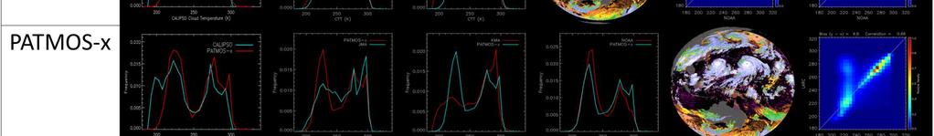

9 ICWG intercomparisons of cloud fraction for Golden Day August 19, 2015 (Heidinger et al.)
10 Suggested Action Items to GCMS (From Cloud Inter-Comparison Group) CGMS members to submit their data to the ICWG intercomparison. Fulldisk data at 10 minute temporal resolution, 2 km spatial resolution in the native AHI projection is preferred. The data should be submitted by September 1, Recommendation to CGMS CGMS members to budget a baseline funding for the intercomparison study, given its importance and impacts on global cloud products. Currently, ICWG helps to facilitate to collect the data (e.g., level-3 climate data record in TG Climate Product, level-2 retrieval assessment in TG Intercomparison), but many teams carried out the efforts on a volunteer basis. Lack of funding limited the scope and prohibited a definitive analysis of the new HIMAWARI-8 data set.
11 Severe Weather Topical Discussion Summary of European CWG activities Satellite data collection recommendations for CGMS agencies Recommended steps towards global harmonization of derived products for severe weather applications Coordination with other ICWG topical groups (e.g. cloud property needs for severe weather applications) Outside CGMS coordination Initialprimary focus is mid-latitude convective nowcasting applications over land
12 Summary for CGMS (From Severe Weather Topical Group) Recommendation to CGMS: To ensure that rapidly evolving weather outside of rapid scan areas is sufficiently sampled, CGMS geostationary satellite operators should adopt a scan strategy that includes full disk imaging at least every 10 minutes when satellite and ground station capabilities allow. Recommendation to CGMS:Since satellite products that directly address severe weather nowcasting applications (0 to 6 hour forecasts) have not been standardized, it is recommended that CGMS agencies provide a list of operational Level-2 products that utilize meteorological satellites for severe weather (thunderstorm) applications. ICWG Action:Inter-compare various satellite derived thunderstorm properties over the life cycle of several thunderstorms identified as worthy of study by the European Convective Working Group. This activity is a natural extension of the satellite-derived cloud property inter-comparisons performed by the members of the ICWG over the last 10 years, but endorsement by CGMS agencies is critical to ensure that the work is prioritized and completed.


13 Best Scientific Practice for Severe WX High-resolution NWP Data Geostationary Satellite Data Precipitation Radar Data Lightning Data Storm Environment Evolution of Cumulus to Cumulonimbus Storm Tracking and Hydrometeor Properties Storm Electrification Encourage algorithm developers to utilize satellite data, in tandem with non-satellite data, to develop improved applications for short-term severe weather forecasting
14 Recommendations to CGMS (From Severe Weather Topical Group) Ensure that convective weather outside of rapid scan areas is sufficiently sampled, geostationary satellite operators from CGMS members should adopt a scan strategy that includes full disk imaging at least every 10 minutes when satellite and ground station capabilities allow. When only a subset of spectral channels on a geostationary sensor can be disseminated during rapid scan operations, the channel selection should include at least two infrared window channels (3 where possible) in addition to standard visible (0.65 um) and near-infrared (3.9 um) measurements to allow convective cloud properties to be estimated for nowcasting applications regardless of solar zenith angle. In coordination with users, CGMS members to work towards standardizing satellite products (requirements and terminology) that identify rapid developing cumulus clouds and mature cumulonimbus with strong updrafts. Initiate coordination with IWWG, ITWG, and IPWG on convective weather. Use satellite cloud products in tandem with non-satellite data, specifically ground-based radar and lightning products.
15 Cloud Models (CMo) for Remote Sensing Aim: Obtain a collective view on current cloud modelling issues and solutions (both employed and proposed), document to provide a group resource and an encouragement for collaborative endeavour. Baseline to define a modelling issue: Single layer, plane parallel, homogeneous microphysics and temperature ICWG CMoIssue 1 Multi-Layer Cloud ICWG CMo Issue 2 Horizontal Inhomogeneity ICWG CMo Issue 3 Vertical Inhomogeneity ICWG CMo Issue 4 Ice scattering parameters ICWG CMoIssue 5 Aerosol (with cloud, over, in or below) ICWG CMoIssue 6 Fractional Cover (n<1) ICWG CMoIssue 7 index of refraction ICWG CMo Issue 8 Effective variance
16 GEWEX Cloud Assessment (From Climate Product Topical Group) The Climate Product Topical Group discussed the value of the GEWEX Cloud Assessment as an archive for level3 cloud climatologies in a shared format. To this end six of the participants present agreed to either add or extend their data holdings in the GEWEX archive (climserv.ipsl.polytechnique.fr/gewexca/): SATCorps, PATMOS-x, CLARA-A2, HIRS CMSAT, Cloud_CCI, CALIPSO Questions raised regarding the current GEWEX format included whether: The current level3 spatial resolution (1 x1 ) would be sufficient for current and future model needs (perhaps add 0.5 x0.5 when possible) We need to add or change included variables (CDNC, radiative properties) Given the increase in AVHRR-and HIRS-derived records a method to address satellite drift should be included; Averaging standards should be developed to account for visible saturation for optical retrievals Uncertainty estimates should be integrated into the averaging process. Recommendation to ICWG and GEWEX DAP The Climate Product Topical Group expressed interest in extending and expanding GEWEX Cloud Assessment activities in the ICWG framework.
17 HIRS observations since 1979 for cloudiness over ocean (0-30S and 70W- 135W) Three El Nino events: , , and Occurrence of monthly high clouds: 75% in (not shown here) and The event: highlevel cloudiness lower by ~30% in general. The 2016 March spike is still 15% lower than March High-Level Cloudiness During El Nino: vs Credit: R. Frey and P. Menzel (U Wisc)
18 Uncertainty of Climate Data Records (From Climate Product Topical Group) Discussed prominent issues facing those groups developing climate data records (CDRs) from heritage sensors like HIRS and AVHRR, as the number of cloud climate records developed from these sensors has steadily grown in recent years. Issues identified as being priorities include: Calibration Reliance on reanalysis products as ancillary data Aliasing effects caused by orbital drift These are issues that specifically affect stability of these records over time, limiting their usefulness for certain climate applications such as trend detection. Recommendation to CGMS CDR developers We recommend CDR development groups that use heritage sensors collaborate to better characterize error associated with calibration, dependence on ancillary data, and satellite drift, with the goal of developing robust methods for minimizing uncertainty paying specific attention to improving the long-term stability of the recordvia addressing biases on season, annual and multi-decadal timescales.
19 Reprocessing (From Climate Product Topical Group) The Climate Product Topical Group discussed the challenges of re-processing modern satellites for CDR purposes as the amount of data produced by these satellites rapidly increases. The amount of data produced by Suomi NPP, Himawariand others and future launches (e.g. GOES-R series) is large enough to make it difficult to re-process. Recommendation to Satellite Data Processors We recommend Satellite data processors develop subsampled versions (perhaps ~5km) of level1b files including statistical information (i.estandard deviation) to reduce the size of satellite data and facilitate re-processing for CDR development.
20 Suggested Action items to CGMS (From Climate Product Topical Group) CDR developers submit their records to the GEWEX Cloud Assessment archive CDR developers produce diurnally corrected products based on intended local overpass time of the satellite series at launch (e.g. afternoon or morning). Recommendations to CGMS Satellite Data Providers generate subsampled versions of level1b products for recent and future launches to facilitate CDR reprocessing, for example, MODIS MYD02SSH data.
21 Active Cloud Sensors ICWG TGs recognize importance of CALIPSO, ISS/CATS, and the upcoming EarthCAREmission for validation of the cloud properties retrieved from passive sensors. The absence of space cloud lidars will severely impact our ability to evaluate cloud products from new sensors, and product uncertainty from advanced cloud retrievals. The availability of future spaceborne lidar cloud measurements is essential for validation of long-term cloud records. Lack of plans for space cloud lidars beyond EarthCARE has raised ICWG s concern. Recommendation to Space Lidar Providers Long-term lidar measurements from space are important for validation of atmospheric retrievals from passive sensors. The Climate Product Topical Group encourages satellite providers to provide sufficient funding for future lidar missions.
22 ICWG Changes and Updates Andy Heidinger(NOAA/NESDIS) to replace Bryan Baum as ICWG Co-Chair Information Exchange The ICWG members are encouraged to exchange data and code with the aim to foster development of cloud retrieval algorithms and the generation data records for meteorological and climatologic applications. ICWG-1 discussion to consider open source community validation software Suitable for GEO and Polar orbiters (even high resolution ) Python based library -> Pytroll( Cost sharing and possible partial funding? Website The ICWG website hosts information on the workshops, access to common data records and tools, and information on the Topical Groups. Please visit: Thanks to ICARE, Université de Lille 1 - Sciences & Technologies
Second Announcement. 2 nd Workshop CGMS International Cloud Working Group. 29 October - 2 November 2018, Madison, Wisconsin, USA
 Second Announcement 2 nd Workshop CGMS International Cloud Working Group 29 October - 2 November 2018, Madison, Wisconsin, USA Organized by the Space Science and Engineering Center of the University of
REPORT FROM THE INTERNATIONAL CLOUDS WORKING GROUP (ICWG)
") Proceedings for the 13 th International Winds Workshop 27 June - 1 July 2016, Monterey, California, USA REPORT FROM THE INTERNATIONAL CLOUDS WORKING GROUP (ICWG) Dong Wu 1, Bryan Baum 2, Andrew Heidinger
Proceedings for the 13 th International Winds Workshop 27 June - 1 July 2016, Monterey, California, USA REPORT FROM THE INTERNATIONAL CLOUDS WORKING GROUP (ICWG) Dong Wu 1, Bryan Baum 2, Andrew Heidinger
CGMS Baseline In response to CGMS action/recommendation A45.01 HLPP reference: 1.1.8
 Prepared by WGIII Agenda Item: 7.1 Discussed in WGIII CGMS Baseline In response to CGMS action/recommendation A45.01 HLPP reference: 1.1.8 In CGMS-45, Working Group III agreed to hold a review of the CGMS
Ice clouds observed by passive remote sensing :
 Ice clouds observed by passive remote sensing : What did we learn from the GEWEX Cloud Assessment? Claudia Stubenrauch Laboratoire de Météorologie Dynamique, IPSL/CNRS, France Clouds are extended objects
CLAVR-x is the Clouds from AVHRR Extended Processing System. Responsible for AVHRR cloud products and other products at various times.
 CLAVR-x in CSPP Andrew Heidinger, NOAA/NESDIS/STAR, Madison WI Nick Bearson, SSEC, Madison, WI Denis Botambekov, CIMSS, Madison, WI Andi Walther, CIMSS, Madison, WI William Straka III, CIMSS, Madison,
CGMS Baseline. Sustained contributions to the Global Observing System. Endorsed by CGMS-46 in Bengaluru, June 2018
 CGMS Baseline Sustained contributions to the Global Observing System Best Practices for Achieving User Readiness for New Meteorological Satellites Endorsed by CGMS-46 in Bengaluru, June 2018 CGMS/DOC/18/1028862,
COMPARISON OF THE OPTIMAL CLOUD ANALYSIS PRODUCT (OCA) AND THE GOES-R ABI CLOUD HEIGHT ALGORITHM (ACHA) CLOUD TOP PRESSURES FOR AMVS
 AND THE GOES-R ABI CLOUD HEIGHT ALGORITHM (ACHA) CLOUD TOP PRESSURES FOR AMVS") Proceedings for the 13 th International Winds Workshop 27 June - 1 July 2016, Monterey, California, USA COMPARISON OF THE OPTIMAL CLOUD ANALYSIS PRODUCT (OCA) AND THE GOES-R ABI CLOUD HEIGHT ALGORITHM
Proceedings for the 13 th International Winds Workshop 27 June - 1 July 2016, Monterey, California, USA COMPARISON OF THE OPTIMAL CLOUD ANALYSIS PRODUCT (OCA) AND THE GOES-R ABI CLOUD HEIGHT ALGORITHM
NOWCASTING PRODUCTS BASED ON MTSAT-1R RAPID SCAN OBSERVATION. In response to CGMS Action 38.33
 CGMS-39, JMA-WP-08 Prepared by JMA Agenda Item: G.II/8 Discussed in WG II NOWCASTING PRODUCTS BASED ON MTSAT-1R RAPID SCAN OBSERVATION In response to CGMS Action 38.33 This document reports on JMA s MTSAT-1R
Satellite observation of atmospheric dust
 Satellite observation of atmospheric dust Taichu Y. Tanaka Meteorological Research Institute, Japan Meteorological Agency 11 April 2017, SDS WAS: Dust observation and modeling @WMO, Geneva Dust observations
FUTURE PLAN AND RECENT ACTIVITIES FOR THE JAPANESE FOLLOW-ON GEOSTATIONARY METEOROLOGICAL SATELLITE HIMAWARI-8/9
 FUTURE PLAN AND RECENT ACTIVITIES FOR THE JAPANESE FOLLOW-ON GEOSTATIONARY METEOROLOGICAL SATELLITE HIMAWARI-8/9 Toshiyuki Kurino Japan Meteorological Agency, 1-3-4 Otemachi Chiyodaku, Tokyo 100-8122,
IPWG s Potential Role in a Snow Hydrology Mission
 IPWG s Potential Role in a Snow Hydrology Mission Chris Kidd The University of Birmingham Birmingham, United Kingdom International Precipitation Working Group Ralph Ferraro NOAA/NESDIS College Park, MD
Introducing Actions/Recommendations from CGMS to the 14th International Winds Workshop
 Introducing Actions/Recommendations from CGMS to the 14th International Winds Workshop Jaime Daniels (NOAA) CGMS Rapporteur for IWWG with IWWG co-chairs Regis Borde (EUMETSAT) Steve Wanzong (UW/CIMSS)
A HIGH RESOLUTION EUROPEAN CLOUD CLIMATOLOGY FROM 15 YEARS OF NOAA/AVHRR DATA
 A HIGH RESOLUTION EUROPEAN CLOUD CLIMATOLOGY FROM 15 YEARS OF NOAA/AVHRR DATA R. Meerkötter 1, G. Gesell 2, V. Grewe 1, C. König 1, S. Lohmann 1, H. Mannstein 1 Deutsches Zentrum für Luft- und Raumfahrt
Status report on current and future satellite systems by EUMETSAT Presented to CGMS-44, Plenary session, agenda item D.1
 Status report on current and future satellite systems by EUMETSAT Presented to CGMS-44, Plenary session, agenda item D.1 CGMS-44-EUMETSAT-WP-19.ppt, version 1 (# 859110), 8 June 2016 MISSION PLANNING YEAR...
APPENDIX 2 OVERVIEW OF THE GLOBAL PRECIPITATION MEASUREMENT (GPM) AND THE TROPICAL RAINFALL MEASURING MISSION (TRMM) 2-1
 AND THE TROPICAL RAINFALL MEASURING MISSION (TRMM) 2-1") APPENDIX 2 OVERVIEW OF THE GLOBAL PRECIPITATION MEASUREMENT (GPM) AND THE TROPICAL RAINFALL MEASURING MISSION (TRMM) 2-1 1. Introduction Precipitation is one of most important environmental parameters.
APPENDIX 2 OVERVIEW OF THE GLOBAL PRECIPITATION MEASUREMENT (GPM) AND THE TROPICAL RAINFALL MEASURING MISSION (TRMM) 2-1 1. Introduction Precipitation is one of most important environmental parameters.
Lecture 4b: Meteorological Satellites and Instruments. Acknowledgement: Dr. S. Kidder at Colorado State Univ.
 Lecture 4b: Meteorological Satellites and Instruments Acknowledgement: Dr. S. Kidder at Colorado State Univ. US Geostationary satellites - GOES (Geostationary Operational Environmental Satellites) US
International Cooperation in Operational Environmental Satellites: The U.S. Experience
 Committee on the Peaceful Uses of Outer Space Science and Technology Sub committee Forty seventh session February 17, 2010 Vienna, Austria International Cooperation in Operational Environmental Satellites:
ESA Cloud-CCI Phase 1 Results Climate Research Perspective
 ESA Cloud-CCI Phase 1 Results Climate Research Perspective Claudia Stubenrauch Laboratoire de Météorologie Dynamique, France and Cloud-CCI Team Outline Ø Challenges to retrieve cloud properties Ø What
Meteosat Third Generation (MTG): Lightning Imager and its products Jochen Grandell
: Lightning Imager and its products Jochen Grandell") 1 Go to View menu and click on Slide Master to update this footer. Include DM reference, version number and date Meteosat Third Generation (MTG): Lightning Imager and its products Jochen Grandell Topics
1 Go to View menu and click on Slide Master to update this footer. Include DM reference, version number and date Meteosat Third Generation (MTG): Lightning Imager and its products Jochen Grandell Topics
WMO OSCAR. Observing Systems Capability Analysis and Review Tool A building block of Rolling Requirements Review
 WMO OSCAR Observing Systems Capability Analysis and Review Tool A building block of Rolling Requirements Review Quantitative user-defined requirements for observation of physical variables in application
Country Report - Singapore
 Country Report - Singapore The 5th Meeting of the Coordinating Group Vladivostok city, Russky Island, Russia Far Eastern Federal University of the RA II WIGOS Satellite Project 21 October 2017 Outline
A 2016 CEOS Chair Initiative. Non-meteorological Applications for Next Generation Geostationary Satellites
 A 2016 CEOS Chair Initiative Committee on Earth Observation Satellites Non-meteorological Applications for Next Generation Geostationary Satellites Co-chaired by EUMETSAT (Holmlund), CSIRO (Schroeder),
Assessment of Global Cloud Climatologies from Satellite Observations
 Assessment of Global Cloud Climatologies from Satellite Observations Claudia Stubenrauch IPSL - Laboratoire de Météorologie Dynamique, France + input from participants of GEWEX Cloud Assessment October
EUMETSAT products and services for monitoring storms - New missions, more data and more meteorological products
 EUMETSAT products and services for monitoring storms - New missions, more data and more meteorological products Jochen Grandell 1 EUM/RSP/VWG/17/921460 Outline Overview of EUMETSAT missions Current...and
EUMETSAT Activities Related to Climate
 EUMETSAT Activities Related to Climate Jörg Schulz joerg.schulz@eumetsat.int Slide: 1 What we do USER REQUIREMENTS European National Meteorological Services Operating Agency! European Space Industry Private
An Overview of the UW Hyperspectral Retrieval System for AIRS, IASI and CrIS
 An Overview of the UW Hyperspectral Retrieval System for AIRS, IASI and CrIS Nadia Smith a, Elisabeth Weisz b and William L. Smith Cooperative Institute for Meteorological Satellite Studies (CIMSS) Space
NEW CGMS BASELINE FOR THE SPACE-BASED GOS. (Submitted by the WMO Secretariat) Summary and Purpose of Document
 Summary and Purpose of Document") WORLD METEOROLOGICAL ORGANIZATION COMMISSION FOR BASIC SYSTEMS OPEN PROGRAMME AREA GROUP ON INTEGRATED OBSERVING SYSTEMS EXPERT TEAM ON SATELLITE SYSTEMS ET-SAT-7/Inf. 2 (12.III.2012) ITEM: 8.1 SEVENTH
WORLD METEOROLOGICAL ORGANIZATION COMMISSION FOR BASIC SYSTEMS OPEN PROGRAMME AREA GROUP ON INTEGRATED OBSERVING SYSTEMS EXPERT TEAM ON SATELLITE SYSTEMS ET-SAT-7/Inf. 2 (12.III.2012) ITEM: 8.1 SEVENTH
CORRELATION BETWEEN ATMOSPHERIC COMPOSITION AND VERTICAL STRUCTURE AS MEASURED BY THREE GENERATIONS OF HYPERSPECTRAL SOUNDERS IN SPACE
 CORRELATION BETWEEN ATMOSPHERIC COMPOSITION AND VERTICAL STRUCTURE AS MEASURED BY THREE GENERATIONS OF HYPERSPECTRAL SOUNDERS IN SPACE Nadia Smith 1, Elisabeth Weisz 1, and Allen Huang 1 1 Space Science
Non-meteorological Applications for Next Generation Geostationary Satellites: A 2016 CEOS Chair Initiative
 Committee on Earth Observation Satellites Non-meteorological Applications for Next Generation Geostationary Satellites: A 2016 CEOS Chair Initiative Ian Grant, Australian Bureau of Meteorology (Adapted
On the Satellite Determination of Multilayered Multiphase Cloud Properties. Science Systems and Applications, Inc., Hampton, Virginia 2
 JP1.10 On the Satellite Determination of Multilayered Multiphase Cloud Properties Fu-Lung Chang 1 *, Patrick Minnis 2, Sunny Sun-Mack 1, Louis Nguyen 1, Yan Chen 2 1 Science Systems and Applications, Inc.,
JMA s ATMOSPHERIC MOTION VECTORS In response to Action 40.22
 5 July 2013 Prepared by JMA Agenda Item: II/6 Discussed in WG II JMA s ATMOSPHERIC MOTION VECTORS In response to Action 40.22 This paper reports on the recent status of JMA's AMVs from MTSAT-2 and MTSAT-1R,
MONITORING WEATHER AND CLIMATE FROM SPACE
 MONITORING WEATHER AND CLIMATE FROM SPACE EUMETSAT Report on New Services Anders Meier Soerensen New X/L-band antenna, Greenland Athens: New 3.0 m L/X-band antenna New 2.4 m L/Xband antenna Installations
SAFNWC/MSG SEVIRI CLOUD PRODUCTS
 SAFNWC/MSG SEVIRI CLOUD PRODUCTS M. Derrien and H. Le Gléau Météo-France / DP / Centre de Météorologie Spatiale BP 147 22302 Lannion. France ABSTRACT Within the SAF in support to Nowcasting and Very Short
BMKG UPDATES ON SATELLITE-RELATED ACTIVITIES IN RA V
 UPDATES ON SATELLITE-RELATED ACTIVITIES IN RA V Riris Adriyanto (BMKG Indonesia / Member RA V TT-SU) With inputs from : Agnes Lane (Australian BoM / Leader RA V TT-SU) 1 Introduction Throughout these years,
THE LAND-SAF SURFACE ALBEDO AND DOWNWELLING SHORTWAVE RADIATION FLUX PRODUCTS
 THE LAND-SAF SURFACE ALBEDO AND DOWNWELLING SHORTWAVE RADIATION FLUX PRODUCTS Bernhard Geiger, Dulce Lajas, Laurent Franchistéguy, Dominique Carrer, Jean-Louis Roujean, Siham Lanjeri, and Catherine Meurey
Fifty Years of Operational Environmental Satellites: The U.S. Experience
 United Nations Committee on the Peaceful Uses of Outer Space Vienna, Austria June 15, 2010 Fifty Years of Operational Environmental Satellites: The U.S. Experience Mr. Charles Baker Deputy Assistant Administrator
NWC-SAF Satellite Application Facility in Support to Nowcasting and Very Short Range Forecasting
 NWC-SAF Satellite Application Facility in Support to Nowcasting and Very Short Range Forecasting Marianne König Slide 1 Satellite Application Facilities (SAFs) in Europe Member State Cooperating State
Arctic Weather Every 10 Minutes: Design & Operation of ABI for PCW
 Arctic Weather Every 10 Minutes: Design and Operation of ABI for PCW Dr. Paul C. Griffith and Sue Wirth 31st Space Symposium, Technical Track, Colorado Springs, Colorado This document is not subject to
Title: The Impact of Convection on the Transport and Redistribution of Dust Aerosols
 Authors: Kathryn Sauter, Tristan L'Ecuyer Title: The Impact of Convection on the Transport and Redistribution of Dust Aerosols Type of Presentation: Oral Short Abstract: The distribution of mineral dust
GSICS UV Sub-Group Activities
 GSICS UV Sub-Group Activities Rosemary Munro with contributions from NOAA, NASA and GRWG UV Subgroup Participants, in particular L. Flynn 1 CEOS Atmospheric Composition Virtual Constellation Meeting (AC-VC)
ALGORITHM MAINTENANCE AND VALIDATION OF MODIS CLOUD MASK, CLOUD TOP-PRESSURE, CLOUD PHASE AND ATMOSPHERIC SOUNDING ALGORITHMS
 ALGORITHM MAINTENANCE AND VALIDATION OF MODIS CLOUD MASK, CLOUD TOP-PRESSURE, CLOUD PHASE AND ATMOSPHERIC SOUNDING ALGORITHMS CIMSS Investigators: S. A. Ackerman (PI) W. P. Menzel E. Borbas R. Frey B.
REVISION OF THE STATEMENT OF GUIDANCE FOR GLOBAL NUMERICAL WEATHER PREDICTION. (Submitted by Dr. J. Eyre)
") WORLD METEOROLOGICAL ORGANIZATION Distr.: RESTRICTED CBS/OPAG-IOS (ODRRGOS-5)/Doc.5, Add.5 (11.VI.2002) COMMISSION FOR BASIC SYSTEMS OPEN PROGRAMME AREA GROUP ON INTEGRATED OBSERVING SYSTEMS ITEM: 4 EXPERT
WORLD METEOROLOGICAL ORGANIZATION Distr.: RESTRICTED CBS/OPAG-IOS (ODRRGOS-5)/Doc.5, Add.5 (11.VI.2002) COMMISSION FOR BASIC SYSTEMS OPEN PROGRAMME AREA GROUP ON INTEGRATED OBSERVING SYSTEMS ITEM: 4 EXPERT
EUMETSAT SAF NETWORK. Lothar Schüller, EUMETSAT SAF Network Manager
 1 EUMETSAT SAF NETWORK Lothar Schüller, EUMETSAT SAF Network Manager EUMETSAT ground segment overview METEOSAT JASON-2 INITIAL JOINT POLAR SYSTEM METOP NOAA SATELLITES CONTROL AND DATA ACQUISITION FLIGHT
Climate working group
 Climate working group Peter Thorne (Co-Chair), Jörg Schulz (Co- Chair), Hartmut Aumann, Denis Blumstein, Laure Chaumat, Cyril Crevoisier, Viju John, Anton Kaifel, Dieter Klaes, Steve Mango, Marc Schröder,
REPORT ON THE ACTIVITIES OF THE EUMETSAT-ESSL CONVECTION WORKING GROUP
 REPORT ON THE ACTIVITIES OF THE EUMETSAT-ESSL CONVECTION WORKING GROUP Marianne König EUMETSAT, Eumetsat Allee 1, 64295 Darmstadt, Germany Abstract The focus of the Convection Working Group is to have
MSG system over view
 MSG system over view 1 Introduction METEOSAT SECOND GENERATION Overview 2 MSG Missions and Services 3 The SEVIRI Instrument 4 The MSG Ground Segment 5 SAF Network 6 Conclusions METEOSAT SECOND GENERATION
APPLICATIONS WITH METEOROLOGICAL SATELLITES. W. Paul Menzel. Office of Research and Applications NOAA/NESDIS University of Wisconsin Madison, WI
 APPLICATIONS WITH METEOROLOGICAL SATELLITES by W. Paul Menzel Office of Research and Applications NOAA/NESDIS University of Wisconsin Madison, WI July 2004 Unpublished Work Copyright Pending TABLE OF CONTENTS
EUMETSAT AGENCY REPORT 2014/15 INSTRUMENT CAL/VAL ACTIVITIES
 1 WGCV Plenary #39, Berlin, May 2015 EUMETSAT AGENCY REPORT 2014/15 INSTRUMENT CAL/VAL ACTIVITIES J. Ackermann, S. Elliott, T. Hewison, K. Holmlund, V. John, R. Munro, P. Miu, A. O Carroll, R. Roebeling,
Sustained, Co-Ordinated Processing of Environmental Satellite Data for Climate Monitoring (SCOPE-CM)
") Sustained Coordinated Processing of Environmental Satellite Data for Climate Monitoring Sustained, Co-Ordinated Processing of Environmental Satellite Data for Climate Monitoring (SCOPE-CM) Joerg Schulz,
Sustained Coordinated Processing of Environmental Satellite Data for Climate Monitoring Sustained, Co-Ordinated Processing of Environmental Satellite Data for Climate Monitoring (SCOPE-CM) Joerg Schulz,
Cloud properties & bulk microphysical properties of semi-transparent cirrus from AIRS & IASI
 Cloud properties & bulk microphysical properties of semi-transparent cirrus from AIRS & Claudia Stubenrauch A. Feofilov, R. Armante, A. Guignard* ABC(t) ARA team Laboratoire de Météorologie Dynamique /
Preparation for Himawari 8
 Preparation for Himawari 8 Japan Meteorological Agency Meteorological Satellite Center Hidehiko MURATA ET SUP 8, WMO HQ, Geneva, 14 17 April 2014 1/18 Introduction Background The Japan Meteorological Agency
McIDAS Activities Within The NASA Langley Research Center Clouds And Radiation Group
 McIDAS Activities Within The NASA Langley Research Center Clouds And Radiation Group Kristopher Bedka Science Systems and Applications Inc @ NASA LaRC In Collaboration With (in alphabetical order) J. K.
IPWG recent accomplishments and future directions
 IPWG recent accomplishments and future directions Paul Kucera (NCAR, Boulder, USA) And Bozena Lapeta (IMWM Krakow, Poland) with additions by Volker Gärtner (EUMETSAT, IPWG Rapporteur) IPWG Objectives IPWG
Maryland Space. Business Roundtable. Satellite and Information Service. Stephen Volz, Ph.D., Assistant Administrator. January 2018
 Maryland Space Satellite and Information Service Business Roundtable Stephen Volz, Ph.D., Assistant Administrator January 2018 Delivering on the Commitment JPSS-1 Launch Nov 18, 2017 GOES-R Launch Nov
Cloud masking as cross-cutting issue
 Cloud masking as cross-cutting issue Presentation to CEOS/WGCV activity project planning meeting Rainer Hollmann, Cornelia Schlundt, Satellite based Climate Monitoring Deutscher Wetterdienst Outline Need
RGB Experts and Developers Workshop - Introduction Tokyo, Japan 7-9 Nov 2017
 RGB Experts and Developers Workshop - Introduction Tokyo, Japan 7-9 Nov 2017 Workshop Objectives Review of existing RGB standards Reconfirm and extend existing standards (new multi-spectral imagers) Stimulate
Global Space-based Inter-Calibration System (GSICS) Infrared Reference Sensor Traceability and Uncertainty
 Infrared Reference Sensor Traceability and Uncertainty") Global Space-based Inter-Calibration System (GSICS) Infrared Reference Sensor Traceability and Uncertainty Tim Hewison (EUMETSAT) Thomas Pagano (NASA/JPL) Dave Tobin (NOAA/CIMSS) Masaya Takahashi (JMA)
Global Space-based Inter-Calibration System (GSICS) Infrared Reference Sensor Traceability and Uncertainty Tim Hewison (EUMETSAT) Thomas Pagano (NASA/JPL) Dave Tobin (NOAA/CIMSS) Masaya Takahashi (JMA)
EUMETSAT SAF NETWORK. Lothar Schüller, EUMETSAT SAF Network Manager
 1 EUMETSAT SAF NETWORK Lothar Schüller, EUMETSAT SAF Network Manager EUMETSAT ground segment overview METEOSAT JASON-2 INITIAL JOINT POLAR SYSTEM METOP NOAA SATELLITES CONTROL AND DATA ACQUISITION FLIGHT
CURRENT STATUS OF OPERATIONAL WIND PRODUCT IN JMA/MSC
 Proceedings for the 13 th International Winds Workshop 27 June - 1 July 2016, Monterey, California, USA CURRENT STATUS OF OPERATIONAL WIND PRODUCT IN JMA/MSC Kazuki Shimoji and Kenichi Nonaka JMA/MSC,
GENERATION OF HIMAWARI-8 AMVs USING THE FUTURE MTG AMV PROCESSOR
 GENERATION OF HIMAWARI-8 AMVs USING THE FUTURE MTG AMV PROCESSOR Manuel Carranza 1, Régis Borde 2, Masahiro Hayashi 3 1 GMV Aerospace and Defence S.A. at EUMETSAT, Eumetsat Allee 1, D-64295 Darmstadt,
Long-Term Time Series of Water Vapour Total Columns from GOME, SCIAMACHY and GOME-2
 Graphics: ESA Graphics: ESA Graphics: ESA Long-Term Time Series of Water Vapour Total Columns from GOME, SCIAMACHY and GOME-2 S. Noël, S. Mieruch, H. Bovensmann, J. P. Burrows Institute of Environmental
Instrumentation planned for MetOp-SG
 Instrumentation planned for MetOp-SG Bill Bell Satellite Radiance Assimilation Group Met Office Crown copyright Met Office Outline Background - the MetOp-SG programme The MetOp-SG instruments Summary Acknowledgements:
OPAG on Integrated Observing Systems. Workshop to Improve the Usefulness of Operational Radiosonde Data. (Submitted by the Secretariat)
") WORLD METEOROLOGICAL ORGANIZATION COMMISSION FOR BASIC SYSTEMS CBS MANAGEMENT GROUP Fourth session Langen, Germany, 13-16 October 2003 Distr.: RESTRICTED CBS/MG-IV/Doc. 3.1(5) (24.IX.2003) ITEM: 3.1 ENGLISH
WORLD METEOROLOGICAL ORGANIZATION COMMISSION FOR BASIC SYSTEMS CBS MANAGEMENT GROUP Fourth session Langen, Germany, 13-16 October 2003 Distr.: RESTRICTED CBS/MG-IV/Doc. 3.1(5) (24.IX.2003) ITEM: 3.1 ENGLISH
MODIS and VIIRS Reflective Solar Calibration Update
 MODIS and VIIRS Reflective Solar Calibration Update X. Xiong 1, C. Cao 2, A. Angal 3, S. Blonski 4, N. Lei 3, W. Wang 4, Z. Wang 3, and A. Wu 3 1 NASA GSFC, MD 20771, USA; 2 NOAA NESDIS, MD 20740, USA
Interpretation of Polar-orbiting Satellite Observations. Atmospheric Instrumentation
 Interpretation of Polar-orbiting Satellite Observations Outline Polar-Orbiting Observations: Review of Polar-Orbiting Satellite Systems Overview of Currently Active Satellites / Sensors Overview of Sensor
30 Years of HIRS Cloud Observations
 30 Years of HIRS Cloud Observations W. Paul Menzel a, Erik Olson a, Utkan Kolat a, Robert Holz a, Bryan Baum a, Andrew Heidinger b, Michael Pavolonis b, Don Wylie a, Darren Jackson c, Brent Maddux a, and
Research Working Group Recommendations and Action Items
 Research Working Group Recommendations and Action Items IPWG 2016, Bologna, Italy, Oct. 6 th 2016. Chair: Ali Behrangi Rapporteur: Yeji Choi Participants 2016: R. Adler, M. Buiat., C. Funk, C. Guilloteau,
Joint Polar Satellite System. 3 rd Post-EPS User Consultation Workshop Mike Haas
 3 rd Post-EPS User Consultation Workshop Mike Haas Overview Introduction - Policy Drivers - Management System Description - Space Segment - Ground Segment Partnerships Status Benefits 2 Introduction (Policy
ERA-CLIM2-WP3: Satellite data reprocessing and inter-calibration
 ERA-CLIM2-WP3: Satellite data reprocessing and inter-calibration Rob Roebeling, Jörg Schulz, Marie Doutriaux- Boucher, Alessio Lattanzio, Viju John, and Andrey Bogdanov Thanks to: Christian Marquardt and
Assimilation of precipitation-related observations into global NWP models
 Assimilation of precipitation-related observations into global NWP models Alan Geer, Katrin Lonitz, Philippe Lopez, Fabrizio Baordo, Niels Bormann, Peter Lean, Stephen English Slide 1 H-SAF workshop 4
WEATHER AND CLIMATE EXTREMES MONITORING BASED ON SATELLITE OBSERVATION : INDONESIA PERSPECTIVE RIRIS ADRIYANTO
 WEATHER AND CLIMATE EXTREMES MONITORING BASED ON SATELLITE OBSERVATION : INDONESIA PERSPECTIVE RIRIS ADRIYANTO INDONESIA AGENCY FOR METEOROLOGY, CLIMATOLOGY AND GEOPHYSICS (BM KG) 1. INTRODUCTION - BMKG
McIDAS support of Suomi-NPP /JPSS and GOES-R L2
 McIDAS support of Suomi-NPP /JPSS and GOES-R L2 William Straka III 1 Tommy Jasmin 1, Bob Carp 1 1 Cooperative Institute for Meteorological Satellite Studies, Space Science and Engineering Center, University
Next generation of EUMETSAT microwave imagers and sounders: new opportunities for cloud and precipitation retrieval
 Next generation of EUMETSAT microwave imagers and sounders: new opportunities for cloud and precipitation retrieval Christophe Accadia, Sabatino Di Michele, Vinia Mattioli, Jörg Ackermann, Sreerekha Thonipparambil,
Cross-calibration of Geostationary Satellite Visible-channel Imagers Using the Moon as a Common Reference
 Cross-calibration of Geostationary Satellite Visible-channel Imagers Using the Moon as a Common Reference Thomas C. Stone U.S. Geological Survey, Flagstaff AZ, USA 27 30 August, 2012 Motivation The archives
Ground-based Validation of spaceborne lidar measurements
 Ground-based Validation of spaceborne lidar measurements Ground-based Validation of spaceborne lidar measurements to make something officially acceptable or approved, to prove that something is correct
Update on SCOPE-Nowcasting Pilot Project Real Time Ocean Products Suman Goyal Scientist-E
 Update on SCOPE-Nowcasting Pilot Project Real Time Ocean Products Suman Goyal Scientist-E 19-22 Nov 2013 SCOPE-Nowcasting-1 Agenda Item 5 Pilot Projects Overview Users /Clients User requirements Product
CMA Consideration on early-morning orbit satellite
 CMA Consideration on early-morning orbit satellite National Satellite Meteorological Center,CMA Yang Jun CGMS 40 in Lugano, 5-9 Nov., 2012 Outline Background Gap analysis on the sounding data coverage
Data Short description Parameters to be used for analysis SYNOP. Surface observations by ships, oil rigs and moored buoys
 3.2 Observational Data 3.2.1 Data used in the analysis Data Short description Parameters to be used for analysis SYNOP Surface observations at fixed stations over land P,, T, Rh SHIP BUOY TEMP PILOT Aircraft
Feature-tracked 3D Winds from Satellite Sounders: Derivation and Impact in Global Models
 Feature-tracked 3D Winds from Satellite Sounders: Derivation and Impact in Global Models David Santek 1, A.-S. Daloz 1, S. Tushaus 1, M. Rogal 1, W. McCarty 2 1 Space Science and Engineering Center/University
Outcome of the GSICS/CEOS-IVOS Lunar Calibration Workshop
 Outcome of the GSICS/CEOS-IVOS Lunar Calibration Workshop S. Wagner a, T. Hewison a, T. Stone b, S. Lachérade c, B. Fougnie c, X. Xiong d With the support of M. Takahashi JMA (1-year visiting scientist
onboard of Metop-A COSMIC Workshop 2009 Boulder, USA
 GRAS Radio Occultation Measurements onboard of Metop-A A. von Engeln 1, Y. Andres 1, C. Cardinali 2, S. Healy 2,3, K. Lauritsen 3, C. Marquardt 1, F. Sancho 1, S. Syndergaard 3 1 2 3 EUMETSAT, ECMWF, GRAS
The MODIS Cloud Data Record
 The MODIS Cloud Data Record Brent C. Maddux 1,2 Steve Platnick 3, Steven A. Ackerman 1 Paul Menzel 1, Kathy Strabala 1, Richard Frey 1, 1 Cooperative Institute for Meteorological Satellite Studies, 2 Department
Himawari-8 BUFR Development for Winds Processing and Radiances Cloud Mask, Cloud Phase, Cloud Height
 Sandy Supplemental Grant Recipient Quarterly Progress Report Himawari-8 BUFR Development for Winds Processing and Radiances Award Number: NA14NES4830006 The National Oceanic and Atmospheric Administration
Status Report from the International (A)TOVS Working Group (ITWG) Allen Huang & Steve English, Co-chairs Iguacu, Brazil 5 August 2008
TOVS Working Group (ITWG) Allen Huang & Steve English, Co-chairs Iguacu, Brazil 5 August 2008") Status Report from the International (A)TOVS Working Group (ITWG) Allen Huang & Steve English, Co-chairs Iguacu, Brazil 5 August 2008 Working Groups: Advanced Infrared Sounders ATOVS/TOVS data in NWP ATOVS/TOVS
Status Report from the International (A)TOVS Working Group (ITWG) Allen Huang & Steve English, Co-chairs Iguacu, Brazil 5 August 2008 Working Groups: Advanced Infrared Sounders ATOVS/TOVS data in NWP ATOVS/TOVS
GLOBAL ATMOSPHERIC MOTION VECTOR INTER-COMPARISON STUDY
 GLOBAL ATMOSPHERIC MOTION VECTOR INTER-COMPARISON STUDY Iliana Genkova (1), Regis Borde (2), Johannes Schmetz (2), Chris Velden (3), Ken Holmlund (2), Mary Forsythe (4), Jamie Daniels (5), Niels Bormann
Non-meteorological Applications for Next Generation Geostationary Meteorological Satellites
 Non-meteorological Applications for Next Generation Geostationary Meteorological Satellites Toshiyuki KURINO Satellite Program Division Japan Meteorological Agency Topics Advanced GEO for Earth Observation
STATUS OF JAPANESE METEOROLOGICAL SATELLITES AND RECENT ACTIVITIES OF MSC
 STATUS OF JAPANESE METEOROLOGICAL SATELLITES AND RECENT ACTIVITIES OF MSC Daisaku Uesawa Meteorological Satellite Center, Japan Meteorological Agency Abstract MTSAT-1R is the current operational Japanese
Future Opportunities of Using Microwave Data from Small Satellites for Monitoring and Predicting Severe Storms
 Future Opportunities of Using Microwave Data from Small Satellites for Monitoring and Predicting Severe Storms Fuzhong Weng Environmental Model and Data Optima Inc., Laurel, MD 21 st International TOV
METEOSAT THIRD GENERATION
 METEOSAT THIRD GENERATION FACTS AND FIGURES MONITORING WEATHER AND CLIMATE FROM SPACE A HIGHLY INNOVATIVE GEOSTATIONARY SATELLITE SYSTEM FOR EUROPE AND AFRICA The Meteosat Third Generation (MTG) system
AIRS observations of Dome Concordia in Antarctica and comparison with Automated Weather Stations during 2005
 AIRS observations of Dome Concordia in Antarctica and comparison with Automated Weather Stations during 2005, Dave Gregorich and Steve Broberg Jet Propulsion Laboratory California Institute of Technology
4.1 New Generation Satellite Data and Nowcasting Products: Himawari
 4.1 New Generation Satellite Data and Nowcasting Products: Himawari SCOPE-Nowcasting-EP 18-20 September 2017 Koji Yamashita kobo.yamashita@met.kishou.go.jp Meteorological Satellite Center (MSC) Japan Meteorological
Himawari 8/9 data distribution/dissemination plan
 Himawari 8/9 data distribution/dissemination plan Japan Meteorological Agency (JMA) Hidehiko MURATA Himawari is the name of this flower in Japanese ET SUP 8, WMO HQ, Geneva, 14 17 April 2014 1 Outline
Polar Multi-Sensor Aerosol Product: User Requirements
 Polar Multi-Sensor Aerosol Product: User Requirements Doc.No. Issue : : EUM/TSS/REQ/13/688040 v2 EUMETSAT EUMETSAT Allee 1, D-64295 Darmstadt, Germany Tel: +49 6151 807-7 Fax: +49 6151 807 555 Telex: 419
Earth Science Flight Mission Overview
 Earth Science Flight Mission Overview Nand Topiwala Science Mission Directorate NASA Headquarters April 25, 2007 Earth Science Missions Afternoon Constellation, or A-Train, Multi-Satellite Observatory
COORDINATION GROUP FOR METEOROLOGICAL SATELLITES AND GOFC-GOLD
 Coordination Group for Meteorological Satellites - CGMS COORDINATION GROUP FOR METEOROLOGICAL SATELLITES AND GOFC-GOLD Mitch Goldberg, CGMS co-liaison to CGMS Working group 2 satellite data and products
Combining Polar Hyper-spectral and Geostationary Multi-spectral Sounding Data A Method to Optimize Sounding Spatial and Temporal Resolution
 Combining Polar Hyper-spectral and Geostationary Multi-spectral Sounding Data A Method to Optimize Sounding Spatial and Temporal Resolution W. L. Smith 1,2, E. Weisz 1, and J. McNabb 2 1 University of
RGB Experts and Developers Workshop 2017 Tokyo, Japan
 "Application of the Sandwich Product and variations to this as used by Australian Forecasters and as presented during training at the Australian VLab Centre of Excellence". RGB Experts and Developers Workshop
VALIDATION OF DUAL-MODE METOP AMVS
 VALIDATION OF DUAL-MODE METOP AMVS Ákos Horváth 1, Régis Borde 2, and Hartwig Deneke 1 1 Leibniz Institute for Tropospheric Research, Permoserstrasse 15, Leipzig, Germany 2 EUMETSAT, Eumetsat Allee 1,
A statistical approach for rainfall confidence estimation using MSG-SEVIRI observations
 A statistical approach for rainfall confidence estimation using MSG-SEVIRI observations Elisabetta Ricciardelli*, Filomena Romano*, Nico Cimini*, Frank Silvio Marzano, Vincenzo Cuomo* *Institute of Methodologies
Judit Kerényi. OMSZ - Hungarian Meteorological Service, Budapest, Hungary. H-1525 Budapest, P.O.Box 38, Hungary.
 SATELLITE-DERIVED PRECIPITATION ESTIMATIONS DEVELOPED BY THE HYDROLOGY SAF PROJECT CASE STUDIES FOR THE INVESTIGATION OF THEIR ACCURACY AND FEATURES IN HUNGARY Judit Kerényi OMSZ - Hungarian Meteorological