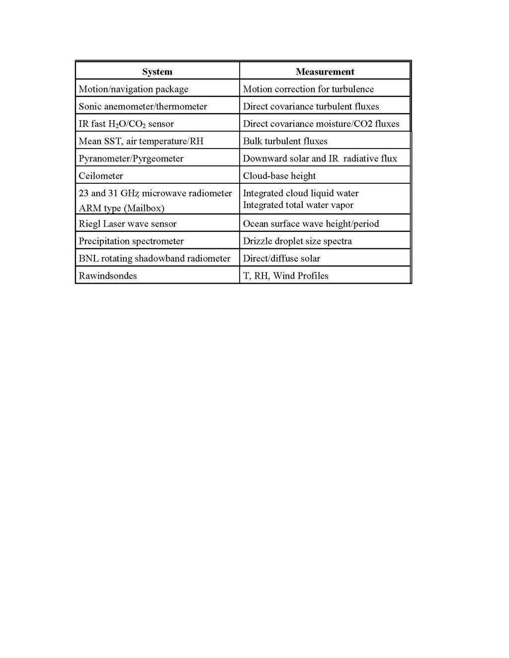
Ship-Based Measurements of Cloud Microphysics and PBL Properties in Precipitating Trade Cumuli During RICO
|
|
|
- Sydney Walker
- 5 years ago
- Views:
Transcription
1
; J. Hare and A. White (CU); C. Fairall, G. Feingold, and R.")
2 Ship-Based Measurements of Cloud Microphysics and PBL Properties in Precipitating Trade Cumuli During RICO Institutions: University of Miami; University of Colorado; NOAA ETL Investigators: P. Kollias (UM); J. Hare and A. White (CU); C. Fairall, G. Feingold, and R. Hill (ETL)
3 Ship-Based Radars 915-MHz wind profiler--pbl 3-D winds, inversion height, cloud and precipitation structure 9.4 GHz Doppler Radar (upward pointing) Reference reflectivity; Doppler spectra ; Cloud dynamics and precipitation physics 35 GHz Scanning Doppler cloud radar Reflectivity and Doppler moments; Cloud mapping and microphysical properties; precipitation mapping 94-GHz Doppler radar (stabilized/scanning)--high resolution Doppler spectra; cloud and precipitation microphysics
4 Scanning Doppler Lidar (NOAA ETL) Range resolved radial wind speed and intensity measurement once a second Resolution/Range: ~20 cm s-1 ; 5 km Scanning: Motion compensated hemispheric scanner Measurements: Aerosol distributions and wind motions around and below clouds
5 Ship-Board Instrumentation
6 R/V Seward Johnson General Specifications Length Overall feet. Length between Perpendiculars feet. Beam Overall - 36 feet. Fuel Capacity - 60,000 Gal. Fuel Consumption - 70 gal./hr., normal cruise. Potable Water - 15,000 gal. with RO Unit (120 gal. hr.). Accommodations - 40 (including crew). Speed - 13 knots. Year Built/Converted /1994.

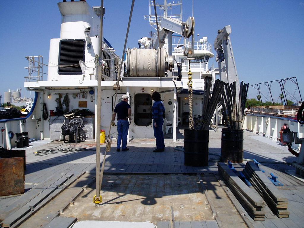
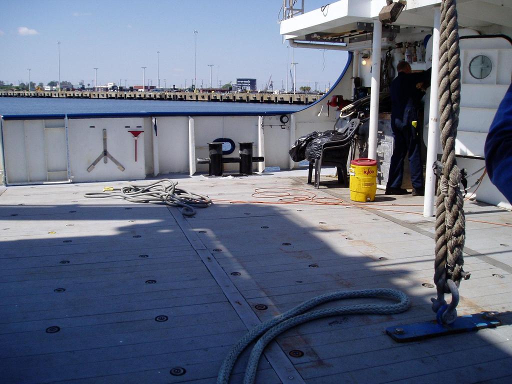
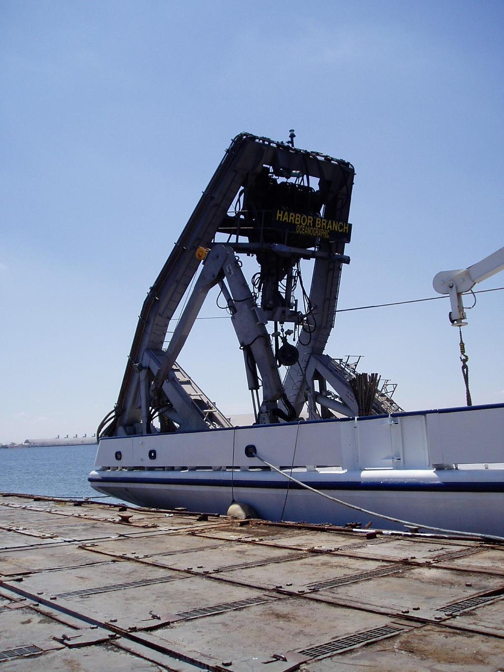
7 R/V Seward Johnson

8
9 Ship Operations Remote Sensing and In Situ -- Continuous Rawindsondes 6/day Coordination with Island-ased Radars Approx 20 km off shore (daily (?) repositioning) Scanning for Ka-Band Radar and Doppler Lidar
10 Statistical Properties of precipitating trade wind cumuli from cloud scale to mesoscale UM (W/X) o NOAA/K cloud entity swath NOAA 915-MHz 500m NOAA/K meso-scale swath 30 km
11 Coordination with Other RICO Operations Operations Center Needs: Ship info for mission planning; Ship positioning and operations Mode: Internent; Telephone; Radio (?) Schedule: Before and after planning meetings; regular 6 per day soundings; on-demand Surface-Based Radars Needs: Positioning of ship; Ship operations; Met Input for islandbased radar operations Mode: Radio, Internet, Telephone Schedule: On demand; scheduled times) Aircraft Needs: Ship operations and positioning; Observational input for in-flight operations Mode: Radio Schedule: On demand
12 Scientific Questions to be Addressed 5. Can we find evidence for cloud processing of aerosol in the aerosol size distributions? 6. Can we detect changes in cloud microphysics under different aerosol loadings?
13 UM Cloud and Precipitation Mobile Observatory UM W-band Doppler radar Frequency: 94.2 GHz (wavelength = 3.19 mm) Antenna: 0.91 m, Cassengrain 0.24o beamwidth (8-10 m at 1 km range) Vertical resolution: 30 m, Temporal Resolution: sec PRF: 5-10 khz (4-8 ms-1) Nyquist Doppler spectra, raw I/Q Sensitivity: km UM X-band Doppler radar Frequency: 9.4 GHz (wavelength = 3.2 cm) Antenna: 2 m, Cassengrain Vertical resolution: 60 m, Temporal Resolution: sec PRF: khz (8-20 ms-1) Nyquist Doppler spectra, raw I/Q Sensitivity: km Ceilometer Broadband radiometers IRT Surface Met. Rain gauge ** NOAA/ETL 2 channel Microwave Radiometer
14 Scientific Questions to Be Addressed 1. What is the range of the dynamical and microphysical structures in trade-wind cumuli, and how do these structures affect the lifecycle of clouds under varying wind shear, stability, and aerosol conditions? 2. What microphysical / dynamical factors and time scales are involved in the production of largedrop concentrations in fair-weather cumulus clouds? 3. How do the raindrop size distributions evolve from the initial to mature precipitating stages of shallow cumuli?
15 Scientific Questions to be Addressed 4. How is the marine boundary layer altered by precipitation from trade-wind cumuli? 5. What are the statistical properties of precipitating trade-wind cumuli from the cloud to mesoscale scale?
16 Approaches Coordination with Surface-Based Radars and Aircraft and Integration of Observations Continuous Monitoring for Cloud Statistics
Ship-Based Measurements of Cloud Microphysics and PBL Properties in Precipitating Trade Cumuli During RICO
 Ship-Based Measurements of Cloud Microphysics and PBL Properties in Precipitating Trade Cumuli During RICO Institutions: University of Miami; University of Colorado; NOAA ETL Investigators: P. Kollias
Ship-based measurements of cloud microphysics and PBL properties in precipitating trade cumulus clouds during RICO
 Ship-based measurements of cloud microphysics and PBL properties in precipitating trade cumulus clouds during RICO Allen White and Jeff Hare, University of Colorado/CIRES Bruce Albrecht and Pavlos Kolias,
Boundary Layer Structure, Turbulence and Shallow Cumulus Observations During RICO 2005
 Boundary Layer Structure, Turbulence and Shallow Cumulus Observations During RICO 2005 A Thesis Defense By Shaunna Donaher University of Miami, RSMAS April 9 th, 2007 Introduction/ Motivation Previous
Aircraft Observations for ONR DRI and DYNAMO. Coupled Air-sea processes: Q. Wang, D. Khelif, L. Mahrt, S. Chen
 Aircraft Observations for ONR DRI and DYNAMO (NOAA/ONR/NSF) Coupled Air-sea processes: Q. Wang, D. Khelif, L. Mahrt, S. Chen Deep convection/mjo initiation: Dave Jorgensen, S. Chen, R. Houze Aerosol/Cloud
On Trade-Wind Cumulus Cold Pools
 On Trade-Wind Cumulus Cold Pools Paquita Zuidema & Zhujun Li U of Miami Reg Hill, Ludovic Bariteau, Bob Rilling, Chris Fairall, Alan Brewer, Bruce Albrecht, Jeff Hare AGU Dec 2011 key finding from RICO:
P1.17 SENSITIVITY OF THE RETRIEVAL OF STRATOCUMULUS CLOUD LIQUID WATER AND PRECIPITATION FLUX TO DOPPLER RADAR PARAMETERS
 P1.17 SENSITIVITY OF THE RETRIEVAL OF STRATOCUMULUS CLOUD LIQUID WATER AND PRECIPITATION FLUX TO DOPPLER RADAR PARAMETERS Yefim L. Kogan*, Zena N. Kogan, and David B. Mechem Cooperative Institute for Mesoscale
Lecture 11: Doppler wind lidar
 Lecture 11: Doppler wind lidar Why do we study winds? v Winds are the most important variable studying dynamics and transport in the atmosphere. v Wind measurements are critical to improvement of numerical
NOAA Research Vessel Ronald H. Brown Participation and Operations During NAME
 NOAA Research Vessel Ronald H. Brown Participation and Operations During NAME Draft: 4 March 2002 Walter A. Petersen 1, Robert Cifelli 1, Steven A. Rutledge 1 and Christopher W. Fairall 2 1 Department
On Trade-Wind Cumulus Cold Pools
 On Trade-Wind Cumulus Cold Pools Paquita Zuidema & Zhujun Li Reg Hill, Ludovic Bariteau, Bob Rilling, Chris Fairall, Alan Brewer, Bruce Albrecht, Jeff Hare key finding from RICO: nearly all cloud producing
APPENDIX 2 OVERVIEW OF THE GLOBAL PRECIPITATION MEASUREMENT (GPM) AND THE TROPICAL RAINFALL MEASURING MISSION (TRMM) 2-1
 AND THE TROPICAL RAINFALL MEASURING MISSION (TRMM) 2-1") APPENDIX 2 OVERVIEW OF THE GLOBAL PRECIPITATION MEASUREMENT (GPM) AND THE TROPICAL RAINFALL MEASURING MISSION (TRMM) 2-1 1. Introduction Precipitation is one of most important environmental parameters.
APPENDIX 2 OVERVIEW OF THE GLOBAL PRECIPITATION MEASUREMENT (GPM) AND THE TROPICAL RAINFALL MEASURING MISSION (TRMM) 2-1 1. Introduction Precipitation is one of most important environmental parameters.
In Situ Comparisons with the Cloud Radar Retrievals of Stratus Cloud Effective Radius
 In Situ Comparisons with the Cloud Radar Retrievals of Stratus Cloud Effective Radius A. S. Frisch and G. Feingold Cooperative Institute for Research in the Atmosphere National Oceanic and Atmospheric
On Trade-Wind Cumulus Cold Pools
 On Trade-Wind Cumulus Cold Pools Paquita Zuidema & Zhujun Li contributions from Reg Hill, Ludovic Bariteau, Bob Rilling, Chris Fairall, Alan Brewer, Bruce Albrecht, Jeff Hare if you can t explain something
NARVAL. North Atlantic Rainfall Validation. Christian Klepp, Stephan Bakan, Gerhard Peters, Bjorn Stevens, Lutz Hirsch, Johannes Quaas
 NARVAL North Atlantic Rainfall Validation Christian Klepp, Stephan Bakan, Gerhard Peters, Bjorn Stevens, Lutz Hirsch, Johannes Quaas Klima Campus Meteorologisches Institut, Universität Hamburg Max-Planck-Institut
Novel Product Line FMCW Cloud Radars
 Novel Product Line RPG Dual Polarization Dual Frequency Scanning Cloud Radar Systems: Configurations and Applications Edited by Dr. Alexander Myagkov and Dr. Thomas Rose 1 2 Benefit from high operation
Radar Observations of Updrafts, Downdrafts, and Turbulence in Fair-Weather Cumuli
 1750 JOURNAL OF THE ATMOSPHERIC SCIENCES Radar Observations of Updrafts, Downdrafts, and Turbulence in Fair-Weather Cumuli P. KOLLIAS, B.A.ALBRECHT, R.LHERMITTE, AND A. SAVTCHENKO Division of Meteorology
P1.6 Simulation of the impact of new aircraft and satellite-based ocean surface wind measurements on H*Wind analyses
 P1.6 Simulation of the impact of new aircraft and satellite-based ocean surface wind measurements on H*Wind analyses Timothy L. Miller 1, R. Atlas 2, P. G. Black 3, J. L. Case 4, S. S. Chen 5, R. E. Hood
Remote Sensing in Meteorology: Satellites and Radar. AT 351 Lab 10 April 2, Remote Sensing
 Remote Sensing in Meteorology: Satellites and Radar AT 351 Lab 10 April 2, 2008 Remote Sensing Remote sensing is gathering information about something without being in physical contact with it typically
(Preliminary) Observations of Tropical Storm Fay Dustin W Phillips Kevin Knupp, & Tim Coleman. 34th Conference on Radar Meteorology October 8, 2009
 Observations of Tropical Storm Fay Dustin W Phillips Kevin Knupp, & Tim Coleman. 34th Conference on Radar Meteorology October 8, 2009") (Preliminary) Observations of Tropical Storm Fay Dustin W Phillips Kevin Knupp, & Tim Coleman 34th Conference on Radar Meteorology October 8, 2009 Outline I. Research Equipment MIPS, MAX, KJAX (WSR-88D)
(Preliminary) Observations of Tropical Storm Fay Dustin W Phillips Kevin Knupp, & Tim Coleman 34th Conference on Radar Meteorology October 8, 2009 Outline I. Research Equipment MIPS, MAX, KJAX (WSR-88D)
WELCOME TO THE FIRST RICO PLANNING WORKSHOP. RICO NOVEMBER 24, 2004 JANUARY 24, 2005 Antigua and Barbuda
 WELCOME TO THE FIRST RICO PLANNING WORKSHOP RICO NOVEMBER 24, 2004 JANUARY 24, 2005 Antigua and Barbuda AGENDA TODAY: Wednesday February 25 1. Introduction and welcome 1:00-1:15 pm (Ochs and Rauber) 2.
SANDRINE BONY AND BJORN STEVENS
 EUREC 4 A, THE FIELD STUDY: A DRAFT WHITE PAPER SANDRINE BONY AND BJORN STEVENS This draft white paper is meant to sketch out developing plans for the 2019-2020 EUREC 4 A field study. A more complete document
REVISION OF THE STATEMENT OF GUIDANCE FOR GLOBAL NUMERICAL WEATHER PREDICTION. (Submitted by Dr. J. Eyre)
") WORLD METEOROLOGICAL ORGANIZATION Distr.: RESTRICTED CBS/OPAG-IOS (ODRRGOS-5)/Doc.5, Add.5 (11.VI.2002) COMMISSION FOR BASIC SYSTEMS OPEN PROGRAMME AREA GROUP ON INTEGRATED OBSERVING SYSTEMS ITEM: 4 EXPERT
WORLD METEOROLOGICAL ORGANIZATION Distr.: RESTRICTED CBS/OPAG-IOS (ODRRGOS-5)/Doc.5, Add.5 (11.VI.2002) COMMISSION FOR BASIC SYSTEMS OPEN PROGRAMME AREA GROUP ON INTEGRATED OBSERVING SYSTEMS ITEM: 4 EXPERT
Robert Houze University of Washington (with contributions from B. Smull)
") Robert Houze University of Washington (with contributions from B. Smull) Winter MONEX Summer MONEX Presented at: International Conference on MONEX and its Legacy, 3-7 Feb 2005, New Delhi Johnson & Houze
Robert Houze University of Washington (with contributions from B. Smull) Winter MONEX Summer MONEX Presented at: International Conference on MONEX and its Legacy, 3-7 Feb 2005, New Delhi Johnson & Houze
Measurements are infrequent in this region due to difficulty in making both ship- and air-based measurements Natural pristine region far removed from
 PLANNED OBSERVATIONAL CAMPAIGNS OVER THE SOUTHERN OCEANS FOR DETERMINING THE ROLES OF CLOUDS, AEROSOLS AND RADIATION IN THE CLIMATE SYSTEM: SOCRATES, MARCUS & MICRE G. McFarquhar, U. Illinois C. Bretherton,
C-130 and instrumentation for RICO
 C-130 and instrumentation for RICO Flight schedule and staff limitations Hardpoint allocation and cabin layout Time synchronization Flight issues expectation around convection Sensor groups and expected
Status-quo of COPS Scientific Preparation, Candidate Instrumentation, Workshop Overview
 Status-quo of COPS Scientific Preparation, Candidate Instrumentation, Workshop Overview Andreas Behrendt, Volker Wulfmeyer Institut für Physik und Meteorologie (IPM), Universität Hohenheim, Stuttgart Christoph
EPIC2001 was conceived as an intensive process study along and near 95 o W during September and October 2001 used to make measurements of the atmosphe
 EPIC2001 was conceived as an intensive process study along and near 95 o W during September and October 2001 used to make measurements of the atmosphere and ocean in this region. Two aircraft, the National
The HIAPER Cloud Radar Performance and Observations During Winter Storm Observations of a Nor easter
 The HIAPER Cloud Radar Performance and Observations During Winter Storm Observations of a Nor easter S. Ellis 1*, R. Rauber 2, P. Tsai 1, J. Emmett 1, E. Loew 1, C. Burghart 1, M. Dixon 1, J. Vivekanandan
Interpretation of Polar-orbiting Satellite Observations. Atmospheric Instrumentation
 Interpretation of Polar-orbiting Satellite Observations Outline Polar-Orbiting Observations: Review of Polar-Orbiting Satellite Systems Overview of Currently Active Satellites / Sensors Overview of Sensor
Convective Structures in Clear-Air Echoes seen by a Weather Radar
 Convective Structures in Clear-Air Echoes seen by a Weather Radar Martin Hagen Deutsches Zentrum für Luft- und Raumfahrt Oberpfaffenhofen, Germany Weather Radar Weather radar are normally used to locate
Snow Microphysical Retrieval Based on Ground Radar Measurements
 Snow Microphysical Retrieval Based on Ground Radar Measurements V. Chandrasekar Colorado State University June 27, 2007 1 Outline Role of inter comparing ground and space borne radar Class of measurements
OWLeS (Ontario Winter Lake-effect Systems)
") Request for LOAF Facility Support Wyoming King Air with Cloud Radar & Cloud Lidar Two Dual-Pol DOWs + One Rapid-scan DOW Field Catalog & Data Archive support OWLeS (Ontario Winter Lake-effect Systems)
Request for LOAF Facility Support Wyoming King Air with Cloud Radar & Cloud Lidar Two Dual-Pol DOWs + One Rapid-scan DOW Field Catalog & Data Archive support OWLeS (Ontario Winter Lake-effect Systems)
HY-2A Satellite User s Guide
 National Satellite Ocean Application Service 2013-5-16 Document Change Record Revision Date Changed Pages/Paragraphs Edit Description i Contents 1 Introduction to HY-2 Satellite... 1 2 HY-2 satellite data
Meteorology 311. RADAR Fall 2016
 Meteorology 311 RADAR Fall 2016 What is it? RADAR RAdio Detection And Ranging Transmits electromagnetic pulses toward target. Tranmission rate is around 100 s pulses per second (318-1304 Hz). Short silent
Steven Greco* and George D. Emmitt Simpson Weather Associates, Charlottesville, VA. 2. Experiments
 3.3 INVESTIGATION OF FLOWS WITHIN COMPLEX TERRAIN AND ALONG COASTLINES USING AN AIRBORNE DOPPLER WIND LIDAR: OBSERVATIONS AND MODEL COMPARISONS Steven Greco* and George D. Emmitt Simpson Weather Associates,
LAUNCH Concept. Lindenberg Observatory
 Concept Lindenberg Observatory LAUNCH-2005 International Lindenberg Campaign for Assessment of Humidity- and Cloud- Profiling Systems and its Impact on High-Resolution Modelling Objectives Basic Techniques
Turbulence Measurements. Turbulence Measurements In Low Signal-to-Noise. Larry Cornman National Center For Atmospheric Research
 Turbulence Measurements In Low Signal-to-Noise Larry Cornman National Center For Atmospheric Research Turbulence Measurements Turbulence is a stochastic process, and hence must be studied via the statistics
RPG Dual Polarization Dual Frequency Scanning Cloud Radar Systems: Configurations and Applications
 RPG Dual Polarization Dual Frequency Scanning Cloud Radar Systems: Configurations and Applications Edited by Dr. Alexander Myagkov and Dr. Thomas Rose RPG Radiometer Physics GmbH Werner-von-Siemens-Str.
Zhongxun LIU (ISAE/NUDT), Nicolas JEANNIN(ONERA), François VINCENT (ISAE), Xuesong WANG(NUDT)
, Nicolas JEANNIN(ONERA), François VINCENT (ISAE), Xuesong WANG(NUDT)") Institut Supérieur de l Aéronautique et de l Espace Radar Monitoring of Wake Turbulence in Rainy Weather: Modelling and Simulation Zhongxun LIU (ISAE/NUDT), Nicolas JEANNIN(ONERA), François VINCENT (ISAE),
Institut Supérieur de l Aéronautique et de l Espace Radar Monitoring of Wake Turbulence in Rainy Weather: Modelling and Simulation Zhongxun LIU (ISAE/NUDT), Nicolas JEANNIN(ONERA), François VINCENT (ISAE),
Tr a n s r e g i o n a l C o l l a b o r a t i v e Re s e a r c h C e n t r e TR 172
 Tr a n s r e g i o n a l C o l l a b o r a t i v e Re s e a r c h C e n t r e TR 172 ArctiC Amplification: Climate Relevant Atmospheric and SurfaCe Processes, and Feedback Mechanisms (AC) 3 Towards a better
EUREC 4 A. A proposal for a HALO deployment out of Barbados to measure the winter North Atlantic Trades in February 2020
 EUREC 4 A A proposal for a HALO deployment out of Barbados to measure the winter North Atlantic Trades in February 2020 Felix Ament, Sandrine Bony, Susanne Crewell, Bernhard Mayer, Markus Rapp, Bjorn Stevens,
AN ANALYSIS OF A SHALLOW COLD FRONT AND WAVE INTERACTIONS FROM THE PLOWS FIELD CAMPAIGN
 AN ANALYSIS OF A SHALLOW COLD FRONT AND WAVE INTERACTIONS FROM THE PLOWS FIELD CAMPAIGN P.105 Carter Hulsey and Kevin Knupp Severe Weather Institute and Radar & Lightning Laboratories, University of Alabama
Cloud Observations at UFS Schneefernerhaus Towards the Evaluation of Satellite Observations and Numerical Weather Prediction
 Cloud Observations at UFS Schneefernerhaus Towards the Evaluation of Satellite Observations and Numerical Weather Prediction Martin Hagen 1, Tobias Zinner 2, Bernhard Mayer 2, Axel Häring 1,2 1 Institut
The EarthCARE mission: An active view on aerosols, clouds and radiation
 The EarthCARE mission: An active view on aerosols, clouds and radiation T. Wehr, P. Ingmann, T. Fehr Heraklion, Crete, Greece 08/06/2015 EarthCARE is ESA s sixths Earth Explorer Mission and will be implemented
WIND PROFILER NETWORK OF JAPAN METEOROLOGICAL AGENCY
 WIND PROFILER NETWORK OF JAPAN METEOROLOGICAL AGENCY Masahito Ishihara Japan Meteorological Agency CIMO Expert Team on Remote Sensing Upper-Air Technology and Techniques 14-17 March, 2005 Geneva, Switzerland
The Next Generation Polarimetric Airborne Doppler Radar
 The Next Generation Polarimetric Airborne Doppler Radar Wen Chau Lee, James Moore, J. Vivekanandan, Eric Loew, J. Salazar Peisang Tsai, and Vanda Grubišić National Center for Atmospheric Research* Boulder,
LAUNCH Concept. Lindenberg Observatory
 Concept Lindenberg Observatory LAUNCH-2005 International Lindenberg Campaign for Assessment of Humidity- and Cloud- Profiling Systems and its Impact on High-Resolution Modelling Objectives Basic Techniques
WP11 PHYSICAL ACCESS TO RIs
 WP11 PHYSICAL ACCESS TO RIs ENVRIplus multi-disciplinary test platforms SMEAR II-Hyytiälä, Univ of Helsinki, Finland Boreal landscape, rural site: mixed/conifer forest, peatlands and lakes Co-located activities
The Retrieval of Stratus Cloud Droplet Effective Radius with Cloud Radars
 JUNE 00 FRISCH ET AL. 835 The Retrieval of Stratus Cloud Droplet Effective Radius with Cloud Radars SHELBY FRISCH NOAA/Environmental Technology Laboratory, Boulder, Colorado, and Colorado State University,
The difficult art of evaluation clouds and convection representation in GCM s
 The difficult art of evaluation clouds and convection representation in GCM s Motivation Configuration Results Roel Neggers Pier Siebesma thanks to many others at KNMI Evaluation Strategy Large Eddy Simulation
A HIGH RESOLUTION HYDROMETEOR PHASE CLASSIFIER BASED ON ANALYSIS OF CLOUD RADAR DOPLLER SPECTRA. Edward Luke 1 and Pavlos Kollias 2
 6A.2 A HIGH RESOLUTION HYDROMETEOR PHASE CLASSIFIER BASED ON ANALYSIS OF CLOUD RADAR DOPLLER SPECTRA Edward Luke 1 and Pavlos Kollias 2 1. Brookhaven National Laboratory 2. McGill University 1. INTRODUCTION
Lower Troposphere Remote Sensing Activities at UMBC
 Lower Troposphere Remote Sensing Activities at UMBC Ruben Delgado, Belay Demoz Atmospheric Lidar Group Joint Center for Earth Systems Technology University of Maryland, Baltimore County Ad-Hoc Mixing Layer
Summary of ABL group discussions: IHOP Planning meeting National Center for Atmospheric Research Boulder, CO April, 2001
 Summary of ABL group discussions: IHOP Planning meeting National Center for Atmospheric Research Boulder, CO 24-25 April, 2001 Scientific objectives: Summary list: It was agreed that the majority of the
Evolution of NOAA s Observing System Integrated Analysis (NOSIA)
") Evolution of NOAA s Observing System Integrated Analysis (NOSIA) Presented to the 13th Symposium on Societal Applications: Policy, Research and Practice (paper 9.1) Louis Cantrell Jr., and D. Helms, R.
Evolution of NOAA s Observing System Integrated Analysis (NOSIA) Presented to the 13th Symposium on Societal Applications: Policy, Research and Practice (paper 9.1) Louis Cantrell Jr., and D. Helms, R.
Airborne Studies of High Wind and Rain Effects Using IWRAP
 Airborne Studies of High Wind and Rain Effects Using IWRAP Robert F. Contreras, Stephen J. Frasier, and Tao Chu OVWST Meeting July 5-7, 2006 Salt Lake City, Utah Department of Electrical & Computer Engineering
UFO Database. UFO Dissemination Workshop 23/04/2015. NLR, Amsterdam. Oleg A. Krasnov and the UFO team
 UFO Database UFO Dissemination Workshop 23/0/2015 NLR, Amsterdam Oleg A. Krasnov (o.a.krasnov@tudelft.nl) and the UFO team 2 / Outline UFO Database in Internet Database content Data collections UFO Toulouse
Working Group Initiation of Convection
 Working Group Initiation of Convection Ulrich Corsmeier Institut für Meteorologie und Klimaforschung (IMK) Forschungszentrum Karlsruhe/Universität Karlsruhe 2 nd COPS Workshop June 27 June 28, 2005 University
Rapid Environmental Changes observed by Remote Sensing Systems in the local vicinity of an unusual Colorado Tornado
 Rapid Environmental Changes observed by Remote Sensing Systems in the local vicinity of an unusual Colorado Tornado 27th Conference on Severe Local Storms 3 7 November 2014, Madison, Wisconsin Steven E.
Contents. 3. Flying strategies Needs for turbulence measurements Vertical structure Horizontal spatial variability Thin interfaces Clouds
 Contents 1. Planetary Boundary Layer and clouds - Definition - PBL vertical structure - BL Clouds Shallow convection clouds Deep convective clouds Marine Stratocumulus - PBL in complex terrain 2. Probing
A NEW METHOD OF RETRIEVAL OF WIND VELOCITY OVER THE SEA SURFACE IN TROPICAL CYCLONES OVER THE DATA OF MICROWAVE MEASUREMENTS. A.F.
 A NEW METHOD OF RETRIEVAL OF WIND VELOCITY OVER THE SEA SURFACE IN TROPICAL CYCLONES OVER THE DATA OF MICROWAVE MEASUREMENTS A.F. Nerushev Institute of Experimental Meteorology. 82 Lenin Ave., Obninsk,
Development of Spaceborne Dualfrequency. and Its Role for the Global Precipitation Measurement
 Development of Spaceborne Dualfrequency Precipitation Radar and Its Role for the Global Precipitation Measurement Shinsuke Satoh (1), Riko Oki (1), Nobuhiro Takahashi (2), and Toshio Iguchi (2) (1) National
Projects in the Remote Sensing of Aerosols with focus on Air Quality
 Projects in the Remote Sensing of Aerosols with focus on Air Quality Faculty Leads Barry Gross (Satellite Remote Sensing), Fred Moshary (Lidar) Direct Supervision Post-Doc Yonghua Wu (Lidar) PhD Student
UK Contribution to YMC Observational Field Campaign
 UK Contribution to YMC Observational Field Campaign Land, air and sea, operational modelling YMC 3 rd Workshop, Malaysia 2017 Paul Barrett paul.barrett@metoffice.gov.uk UK Involvement in YMC HotHouse TerraMaris
Weather Compass Webquest: Lab/Activity Edition
 Weather Compass Webquest: Lab/Activity Edition www.weathercompass.webs.com 1 Name: Date: Welcome to the Weather Compass Webquest: Activity/Lab Edition. This webquest was created by the National Oceanic
Clouds, Precipitation and their Remote Sensing
 Clouds, Precipitation and their Remote Sensing Prof. Susanne Crewell AG Integrated Remote Sensing Institute for Geophysics and Meteorology University of Cologne Susanne Crewell, Kompaktkurs, Jülich 24.
Objectives of CPEA Project
 Observation System for Equatorial Convective Activities at Koto Tabang, Sumatra Coupling Processes in the Equatorial Atmosphere: CPEA T. Kozu*1, T. Shimomai*1, Y. Fujiyoshi*3, Y. Shibagaki*4, H. Hashiguchi*5,
Myung-Sook Park, Russell L. Elsberry and Michael M. Bell. Department of Meteorology, Naval Postgraduate School, Monterey, California, USA
 Latent heating rate profiles at different tropical cyclone stages during 2008 Tropical Cyclone Structure experiment: Comparison of ELDORA and TRMM PR retrievals Myung-Sook Park, Russell L. Elsberry and
SURF Progresses Contents
 SURF Progresses Contents 1 5th Workshop: June 21-23, 2017 2 SURF-2016 Summer Experiment 3 Preliminary results 4 Future plan (1) 5 th Workshop: June 21-23, 2017 SURF WS-5: Structure I. New Science Reports
ARM Climate Research Facility: Goals and Objectives
 ARM Climate Research Facility: Goals and Objectives Provide the national and international scientific community with the infrastructure needed for scientific research on global change Global change research
Lab 6 Radar Imagery Interpretation
 Lab 6 Radar Imagery Interpretation Background Weather radar (radio detection and ranging) is another very useful remote sensing tool used in meteorological forecasting. Microwave radar was developed in
Enhancing information transfer from observations to unobserved state variables for mesoscale radar data assimilation
 Enhancing information transfer from observations to unobserved state variables for mesoscale radar data assimilation Weiguang Chang and Isztar Zawadzki Department of Atmospheric and Oceanic Sciences Faculty
Validation experiments of GPM/DPR on the pure oceanic precipitating clouds by instruments on board R/V Mirai
 Validation experiments of GPM/DPR on the pure oceanic precipitating clouds by instruments on board R/V Mirai PI: Masaki KATSUMATA (JAMSTEC) CI: Katsuhiro NAKAGAWA (NICT) Jun INOUE (NIPR / JAMSTEC) Takashi
Lecture 4b: Meteorological Satellites and Instruments. Acknowledgement: Dr. S. Kidder at Colorado State Univ.
 Lecture 4b: Meteorological Satellites and Instruments Acknowledgement: Dr. S. Kidder at Colorado State Univ. US Geostationary satellites - GOES (Geostationary Operational Environmental Satellites) US
F O U N D A T I O N A L C O U R S E
 F O U N D A T I O N A L C O U R S E December 6, 2018 Satellite Foundational Course for JPSS (SatFC-J) F O U N D A T I O N A L C O U R S E Introduction to Microwave Remote Sensing (with a focus on passive
Improved Microwave Radiometric Imaging of Surface Wind Speed Dynamics in the Hurricane Eye-Wall
 Improved Microwave Radiometric Imaging of Surface Wind Speed Dynamics in the Hurricane -Wall Ruba Amarin, W. Linwood Jones Christopher Ruf Shuyi Chen Central Florida Remote Sensing Lab. Space Physics Research
Large-Eddy Simulations of Tropical Convective Systems, the Boundary Layer, and Upper Ocean Coupling
 DISTRIBUTION STATEMENT A. Approved for public release; distribution is unlimited. Large-Eddy Simulations of Tropical Convective Systems, the Boundary Layer, and Upper Ocean Coupling Eric D. Skyllingstad
Some comments on weather modification and its science base
 Some comments on weather modification and its science base Woods Hole -- July 31, 2002 Gabor Vali University of Wyoming Collaborators: R.D. Kelly, D. Leon, S. Haimov, S. Gill 1 BASC - WxMod Jul 31, 2002
Projeto Temático FAPESP 2013/ Climate Ecosystems Atmospheric Composition
 Projeto Temático FAPESP 2013/05014-0 Climate Ecosystems Atmospheric Composition GoAmazon2014/15 Experiment Manaus is a city of 2 million people surrounded by just forest in a radius of 1.500 Km. UNIQUE
Recent Improvement of Integrated Observation Systems in JMA
 Recent Improvement of Integrated Observation Systems in JMA Mr Osamu Suzuki and Mr Yoshihiko Tahara Japan Meteorological Agency 1-3-4 Otemachi, Chiyoda-ku, Tokyo 100-8122, Japan Tel: +81-3-3212-8341, Fax:
Susceptibility of trade wind cumulus clouds to precipitation. Katrin Lonitz. Berichte zur Erdsystemforschung. Reports on Earth System Science
 Susceptibility of trade wind cumulus clouds to precipitation Katrin Lonitz Berichte zur Erdsystemforschung Reports on Earth System Science 147 2014 Berichte zur Erdsystemforschung 147 2014 Susceptibility
Reprint 850. Within the Eye of Typhoon Nuri in Hong Kong in C.P. Wong & P.W. Chan
 Reprint 850 Remote Sensing Observations of the Subsidence Zone Within the Eye of Typhoon Nuri in Hong Kong in 2008 C.P. Wong & P.W. Chan 8 th International Symposium on Tropospheric Profiling: Integration
On Surface fluxes and Clouds/Precipitation in the Tropical Eastern Atlantic
 On Surface fluxes and Clouds/Precipitation in the Tropical Eastern Atlantic Chris Fairall, NOAA/ESRL Paquita Zuidema, RSMAS/U Miami with contributions from Peter Minnett & Erica Key AMMA Team Meeting Leeds,
2D Wind Field Estimation with Higher Spatial Resolution Using Dual Compact X-Band Weather Radars
 2D Wind Field Estimation with Higher Spatial Resolution Using Dual Compact X-Band Weather Radars 95th AMS Annual Meeting, Phoenix, Arizona By FURUNO ELECTRIC CO.,LTD January 5th, 2015 Contents 1. Introduction
Introduction. Suita. Kobe. Okinawa. Tsukuba. Tokyo? in in in in 2017 See Poster #16 2. in 2015
 1 Introduction We developed the X band Phased Array Weather Radar (PAWR) to watch and predict severe weather disasters caused by localized heavy rainfalls or tornadoes. The PAWR measures 3 dimentional
Accident Prevention Program
 Thunderstorm Accident Prevention Program Thunderstorms - Don't Flirt...Skirt'Em Pilot's Beware! Within the route you intend to fly may lie a summer hazard in wait for the unwary--the Thunderstorm. The
Lecture 4: Meteorological Satellites and Instruments. Acknowledgement: Dr. S. Kidder at Colorado State Univ.
 Lecture 4: Meteorological Satellites and Instruments Acknowledgement: Dr. S. Kidder at Colorado State Univ. Homework for the Spring Break: get some tangible, preliminary results for your final project.
Aerosol-Cloud-Drizzle-Turbulence Interactions in Boundary Layer Clouds
 DISTRIBUTION STATEMENT A. Approved for public release; distribution is unlimited. Aerosol-Cloud-Drizzle-Turbulence Interactions in Boundary Layer Clouds Bruce Albrecht University of Miami Rosenstiel School
Aerosol-Cloud-Drizzle-Turbulence Interactions in Boundary layer Clouds
 DISTRIBUTION STATEMENT A. Approved for public release; distribution is unlimited. Aerosol-Cloud-Drizzle-Turbulence Interactions in Boundary layer Clouds Bruce Albrecht University of Miami Rosenstiel School
University of Notre Dame 2. University of Utah 3. US Army Dugway Proving Grounds 4. University of Virginia 5. Oregon State University 6
 The Mountain Terrain Atmospheric Modeling and Observations (MATERHORN) Program: The First Field Experiment (MATERHORN-X1) H.J.S. Fernando 1, E. Pardyjak 2, D. Zajic 3, S. De Wekker 4 and J. Pace 3 S. Hoch
The 5th Meeting of the Coordinating Group of the RA II WIGOS Satellite Project
 The 5th Meeting of the Coordinating Group of the RA II WIGOS Satellite Project 21 October, Vladivostok city, Russky Island, Russia Far Eastern Federal University Hong Kong, China Mr. C.K.So, Scientific
Airborne Remote Sensing for Ocean and Coastal Applications
 Airborne Remote Sensing for Ocean and Coastal Applications Ben Reineman, Luc Lenain, Nick Statom, David Castel, Ken Melville Scripps Institution of Oceanography 17 October, 2011 Address for correspondence:
Threshold radar reflectivity for drizzling clouds
 Click Here for Full Article GEOPHYSICAL RESEARCH LETTERS, VOL. 35, L03807, doi:10.1029/2007gl031201, 2008 Threshold radar reflectivity for drizzling clouds Yangang Liu, 1 Bart Geerts, 2 Mark Miller, 2
Validation of MÉRA total precipitation at Stornoway (Scotland) with a 24 GHz micro rain radar: A Preliminary Investigation
 with a 24 GHz micro rain radar: A Preliminary Investigation") Validation of MÉRA total precipitation at Stornoway (Scotland) with a 24 GHz micro rain radar: A Preliminary Investigation Dr. Edward Graham 1 and Dr. Chris Kidd 2 1 University of the Highlands and Islands,
Validation of MÉRA total precipitation at Stornoway (Scotland) with a 24 GHz micro rain radar: A Preliminary Investigation Dr. Edward Graham 1 and Dr. Chris Kidd 2 1 University of the Highlands and Islands,
NOAA ESRL Physical Science Division Arc7c Cruises and Science
 NOAA ESRL Physical Science Division Arc7c Cruises and Science Presented by Taneil U?al On Behalf of Ma?hew Shupe, Ola Persson, Byron Blomquist, Chris Fairall and Janet Intrieri Cloud and Radia7on Feedbacks
Flight Report Sunday September 21, 2014 Summary
 Flight Report Sunday September 21, 2014 Summary 1 Flight Report: G1 Flight#10 & HALO AC14 1.1 Flight Strategy 2 1.2 Weather Conditions Before the Flight...3 1.3 Weather Conditions During the Flight...6
RELAMPAGO (working closely with CACTI) is an international project...
 is an international project...") RELAMPAGO Remote sensing of Electrification, Lightning, And Meso-scale/micro-scale Processes with Adaptive Ground Observations (translates to lightning flash in Spanish and Portuguese) June 2014 South
RELAMPAGO Remote sensing of Electrification, Lightning, And Meso-scale/micro-scale Processes with Adaptive Ground Observations (translates to lightning flash in Spanish and Portuguese) June 2014 South
A new mesoscale NWP system for Australia
 A new mesoscale NWP system for Australia www.cawcr.gov.au Peter Steinle on behalf of : Earth System Modelling (ESM) and Weather&Environmental Prediction (WEP) Research Programs, CAWCR Data Assimilation
Exploring the Atmosphere with Lidars
 Exploring the Atmosphere with Lidars 2. Types of Lidars S Veerabuthiran S Veerabuthiran is working as a research fellow in Space Physics Laboratory, Vikram Sarabhai Space Centre, Trivandrum. His research
Vertical structure and precipitation properties in typhoon rainbands
 The 4 th THORPEX-Asia Science workshop, Kunming, China on 31 Oct.-2 Nov. 2012 Vertical structure and precipitation properties in typhoon rainbands Dong-Kyun Kim, Yeon-Hee Kim, Kwan-Young Chung Forecast
Ultra clean layers and low albedo ( grey ) clouds in CSET
 clouds in CSET") CSET RF11, near Hawaii Ultra clean layers and low albedo ( grey ) clouds in CSET Robert Wood, University of Washington Paquita Zuidema, Chris Bretherton, Kuan Ting (Andy) O, Hans Mohrmann, Isabel McCoy,
CSET RF11, near Hawaii Ultra clean layers and low albedo ( grey ) clouds in CSET Robert Wood, University of Washington Paquita Zuidema, Chris Bretherton, Kuan Ting (Andy) O, Hans Mohrmann, Isabel McCoy,
A synthesis of published VOCALS studies on marine boundary layer and cloud structure along 20S
 A synthesis of published VOCALS studies on marine boundary layer and cloud structure along 20S Chris Bretherton Department of Atmospheric Sciences University of Washington VOCALS RF05, 72W 20S Work summarized