National report of Slovakia 2017
|
|
|
- Donald Morton
- 5 years ago
- Views:
Transcription
1 National report of Slovakia 2017 Branislav Droščák, Karol Smolík, Pavol Ceizel, Ján Bublavý, Miroslav Steinhubel, et al. 1) Juraj Papčo, Ľubomíra Gerhátová, Marcel Mojzeš, Martin Imrišek, et al. 2) Katarína Leitmannová 3) Peter Vajda, Pavol Záhorec 4) 1) Geodetic and Cartographic Institute Bratislava 2) Slovak University of Technology in Bratislava, Faculty of Civil Engineering, Department of Theoretical Geodesy 3) Geodesy, Cartography and Cadastre Authority of Slovak Republic, Department of Geodesy and Foreign affairs 4) Slovak Academy of Sciences, Earth study institute EUREF 2017, annual symposium May 2017, Wroclaw, Poland
2 Outline Slovakian activities towards to EPN News from: SKPOS (Slovak real time determination system) national levelling network national gravimetric network Research and development Geodetic and Cartographic Institute activities Slovak University of Technology activities Slovak Academy of Sciences activities Other news

")

3 Slovakian EPN Operational and Local analysis centers Geodetic and Cartographic Institute Bratislava (GKÚ) EPN OC Slovak University of Technology in Bratislava (SUT) EPN LAC


4 SUT - EPN Local analysis center activity used since GPS week 1883 EPN subnetwork computation: 56 EPN permanent stations, 8 EPN permanent stations added to SUT network solution (GPS week 1908: CASE, 1910: AUBG, DILL, GOR2, LEIJ, 1936: ADAR, SCIL, SNEO). New reference frame (IGS14) and an updated set of antenna calibrations (igs14.atx) are used: GPS week CEPER network computation: 55 permanent stations in region of Central Europe, GPS/GLONASS and GLONASS only solutions: GPS week 1774.


5 Slovakian EPN permanent stations Slovakian EPN Real-time service permanent stations MOPI GANP MOP2 BBYS
6 Slovakian contribution to EPN Densification (31 permanent stations)
7 Slovak real-time determination system - SKPOS

8 SKPOS Reference stations infrastructure (May 2017) 34 Slovakian reference stations (14 individual calibrated) 29/34 stations observe GPS+GLONASS+Galileo Network density: average distance is 44,6 km 20 foreign reference stations (APOS, gnssnet.hu, CZEPOS, ASG-EUPOS, ZAKPOS)
9 SKPOS Number of users SKPOS non-geodetic users SKPOS geodetic users May 2017


10 SKPOS Type of users Surveying fields (cadastre, surveying, mapping, GIS) - 78% Other fields (precise agriculture, machine guarding) - 22%
11 SKPOS Packages - data formats - charges Package Content Duration Format Flat rate SKPOS_mm RINEX 1000 h year RINEX 2.x, 3.x 50 SKPOS_cm (year) RTK unlimited + 50 h RINEX year RTCM 2.3, 3.1, RTCM 3.2 MSM CMRx, CMR+ 50 SKPOS_cm (month) RTK unlimited month RTCM 2.3, 3.1 RTCM 3.2 MSM CMRx, CMR+ 19 SKPOS_dm DGNSS unlimited year RTCM
12 SKPOS 10 years anniversary ( ) User seminary - SKPOS 2016 Dates: and in Bratislava Partners: ÚGKK SR and Geotronics Slovakia s.r.o Number of participants: over 150 Feedback: well appreciate
 New SKPOS promo brochure")
13 SKPOS 10 years anniversary ( ) New book: 10 years of SKPOS (in Slovak) New SKPOS promo brochure


14 SKPOS New guideline for users Name of the guideline: Usage of Slovak real-time determination system for surveying Aim: to define unified procedure of SKPOS usage for surveying in Slovakia to improve the quality and the level of professionalism of surveying using SKPOS
15 National levelling network
16 National levelling network 585 km of the new levelling lines measured in 2016 work done by 3 levelling groups Target for 2020 year: The new national vertical reference system realization
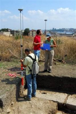
17 National gravimetric network

 Lomnický štít Skalnaté Pleso Štart Tatr.")
18 National gravimetric network New vertical gravimetric baseline Locality: Tatra mountains 5 points Gravity difference: 4406,6 μgal Height difference: 1935 m Highest point: Lomnicky peak 2634 m measurements done by FG5X-251 (GOP, CZE) Lomnický štít Skalnaté Pleso Štart Tatr. Lomnica Stará Lesná Gánovce
19 Geodetic and Cartographic Institute Bratislava Research and development activities

20 Projects supported by data from SKPOS
21 EPN, IGS and SKPOS permanent station GANP (Gánovce) analysis east component differences MP2 parameter differences
22 Slovak University of Technology Research and development activities
23 National center for diagnosing the Earth surface deformations in Slovakia ITMS research project 9 absolute gravity / GNSS permanent stations Activity in 2016: FG5 gravitimeter comparison in Luxembourg


24 Code multipath experiment Two measurement epochs were performed with aim to show contribution of material reflection properties. Code multipath statistics MP1, MP2 for GPS signals shows increase up to 60% at point situated in 3 m distance from the wall.
25 GNSS meteorology - ZTD and PWV computation SUT own solution Near real time GNSS processing in Bernese SW 5.2 Latency min Meteorological data from SHMU (Slovak meteorological service) 36 GNSS reference stations

26 Multi-sensor InSAR deformation monitoring: Geohazards - landslides, PRIEVIDZA, SENTINEL-1 ( )
 COMPARISON WITH")
27 Geohazards Landslides undermined area Koš comparison with levelling GEOHAZARDS UNDERMINED AREA, KOŠ, SENTINEL-1 ( ) COMPARISON WITH LEVELLING
28 Slovak Academy of Science Research and development activities


 Applications in geodesy,")
29 PREDICTION OF VERTICAL GRADIENTS OF GRAVITY (VGG) Prediction of VGGs based on modelling the topographic gradient effect with use of high resolution high accuracy DTMs (Zahorec, Papčo, Vajda) Verification by in situ observations (Tenerife, June 2016) Applications in geodesy, geophysics and geodynamics
30 Other news Geodesy, Cartography and Cadastre Authority of Slovak Republic
31 Orthophotos of Slovakia Present state Plan cooperation between GCCA and Ministry of agriculture

32 Digital elevation model
33 Thank you for your attention
National report for Slovakia
 National report for Slovakia Branislav Droščák, Karol Smolík, Ján Bublavý, Martin Ferianc, Miroslav Roháček, et al. 1) Juraj Papčo, Branislav Hábel, Martin Imrišek, Martina Mináriková, Peter Špánik, Richard
National report of Slovakia 2016
 National report of Slovakia 2016 Branislav Droščák, Ivan Horváth, Karol Smolík 1), Marcel Mojzeš, Juraj Papčo, Ľubomíra Gerhátová, Martina Minariková 2) 1) Geodetic and Cartographic Institute Bratislava
NATIONAL REPORT OF POLAND TO EUREF 2011
 NATIONAL REPORT OF POLAND TO EUREF 2011 Jan Krynski Institute of Geodesy and Cartography, Warsaw Jerzy B. Rogowski Warsaw University of Technology, Warsaw Outline Main geodetic activities at the national
HMK Swedish handbook in surveying and mapping
 HMK Swedish handbook in surveying and mapping A Alfredsson, J Sunna, C-G Persson TS07B - Standards and Recommended Practices for Positioning and Measurement, Paper no 7072 FIG Congress 2014 Engaging the
CEGRN Consortium. A first campaign took place in Since 1997, each two years, a weekly campaign has been observed, normally in June.
 CEGRN 2015 Campaign A. Caporali (1), J. Zurutuza (1), O. Khoda (2), G. Stangl (3), M. Becker (4), M. Bertocco (1), L. Gerhatova (5), M. Mojzes (5), M. Mulic (6), Yu. Stopkhay (7), C. Nagorneac (8), A.
Densification of the GGOS infrastructure in Poland in the framework of EPOS-PL
 EPOS European Plate Observing System Densification of the GGOS infrastructure in Poland in the framework of EPOS-PL K. Sośnica 1, J. Bosy 1, J. Kapłon 1, W. Rohm 1, T. Hadaś 1, J. Sierny 1, I. Kudłacik
GGSP: Realisation of the Galileo Terrestrial Reference Frame
 Galileo Geodetic Service Provider Prototype GGSP: Realisation of the Galileo Terrestrial Reference Frame Wolfgang Söhne, Johannes Ihde Federal Agency for Cartography and Geodesy Gerd Gendt, Markus Rothacher
Operational Aspects of GNSS CORS What is a GNSS CORS system used for?
 Please insert a picture (Insert, Picture, from file). Size according to grey field (10 cm x 25.4 cm). Scale picture: highlight, pull corner point Cut picture: highlight, choose the cutting icon from the
Development of the Czech National Geodetic Control
 252 National Reports Development of the Czech National Geodetic Control J. KOSTELECKÝ 1,2, J. IMEK 1, F. BENEš 3, J. PROVŠZEK 3 1. Densification of EUREF in the Czech Republic, DGPS method In the years
Brussels, BELGIUM. Bojan Stopar. Faculty of Civil and Geodetic Engineering
 EUREF 2008 Symposium Brussels, BELGIUM June 18-20, 2008 NATIONAL REPORT OF SLOVENIA Bojan Stopar University of Ljubljana University of Ljubljana Faculty of Civil and Geodetic Engineering ADOPTION OF THE
DEPARTMENT OF THEORETICAL GEODESY
 DEPARTMENT OF THEORETICAL GEODESY Head of the Department: Assoc. Prof. Marcel Mojzeš, PhD. Tel.: + 421 2 52494 401 Fax: + 421 2 52925 476 E-mail: mojzes@cvt.stuba.sk I. STAFF Professors Ján Melicher, PhD.
Contributions to Geophysics and Geodesy Vol. 46/3, 2016 ( )
") Contributions to Geophysics and Geodesy Vol. 46/3, 2016 (179 202) An analysis of methods for gravity determination and their utilization for the calculation of geopotential numbers in the Slovak national
Contributions to Geophysics and Geodesy Vol. 46/3, 2016 (179 202) An analysis of methods for gravity determination and their utilization for the calculation of geopotential numbers in the Slovak national
A Strategic Plan for Geodesy in Sweden. Mikael Lilje Lars E. Engberg Geodesy Department Lantmäteriet Sweden
 A Strategic Plan for Geodesy in Sweden Mikael Lilje Lars E. Engberg Geodesy Department Lantmäteriet Sweden Our vision is to be able to meet Swedish society s needs for a homogeneous, sustainable geodetic
THREE SEASONAL BEHAVIOUR OF THE BALKAN PENINSULA GNSS PERMANENT STATIONS FROM GPS SOLUTIONS
 Доклади на Българската академия на науките Comptes rendus de l Académie bulgare des Sciences Tome 66, No 1, 2013 GEOPHYSIQUE Sismologie THREE SEASONAL BEHAVIOUR OF THE BALKAN PENINSULA GNSS PERMANENT STATIONS
Reference Systems Realization for the Territory of Bulgaria - Status and Perspectives
 Conference and plenary meeting of the Permanent Committee on Cadastre in the European Union 13-15 March 2018, Sofia Reference Systems Realization for the Territory of Bulgaria - Status and Perspectives
A Study on Precise Local Gravity Field Modelling
 A Study on Precise Local Gravity Field Modelling R. Čunderlík 1, J. Papčo 2, P. Záhorec 3 cunderli@svf.stuba.sk, juraj.papco@stuba.sk, zahorec@savbb.sk 1 Dept. of Mathematics and Descriptive Geometry,
MODELS OF VERTICAL MOVEMENTS OF THE EARTH CRUST SURFACE IN THE AREA OF POLAND DERIVED FROM LEVELING AND GNSS DATA
 Acta Geodyn. Geomater., Vol. 9, No. 3 (167), 331 337, 2012 MODELS OF VERTICAL MOVEMENTS OF THE EARTH CRUST SURFACE IN THE AREA OF POLAND DERIVED FROM LEVELING AND GNSS DATA Bernard KONTNY 1) * and Janusz
Tectonic deformations in Greece and the operation of HEPOS network
 Tectonic deformations in Greece and the operation of HEPOS network M. Gianniou KTIMATOLOGIO S.A. (Hellenic Cadastre) Abstract Today, networks of permanent reference stations are broadly used for the realization
Monitoring and Analysis
 Monitoring and Analysis of the Italian Permanent Network RDN of GNSS stations G. Farolfi Symposium EUREF 2010 Gävle, Sweden 2th - 5th june 1 Outlook Data and features of the RDN network Processing Strategy
Status. EUREF TWG Meeting November 8 9, 2004, Praha
 ECGN was initiated by IAG Sub-Commission for Europe EUREF (SC1.3a) and IAG Sub-Commission for Europe of the International Gravity and Geoid Commission (IGGC) with relationship to Joint Research Centre
National Report of Sweden to the EUREF 2004 Symposium
 1 National Report of Sweden to the EUREF 2004 Symposium - geodetic activities at Lantmäteriet, the National Land Survey of Sweden Edited by Dan Norin Lantmäteriet, SE-801 82 Gävle, Sweden, dan.norin@lm.se
COST Action ES1206 Advanced Global Navigation Satellite Systems tropospheric products for monitoring severe weather events and climate (GNSS4SWEC)
") COST Action ES1206 Advanced Global Navigation Satellite Systems tropospheric products for monitoring severe weather events and climate (GNSS4SWEC) R. Pacione, J. Jones, G. Guerova, J. Dousa, G. Dick, S.
COST Action ES1206 Advanced Global Navigation Satellite Systems tropospheric products for monitoring severe weather events and climate (GNSS4SWEC) R. Pacione, J. Jones, G. Guerova, J. Dousa, G. Dick, S.
ZB GIS new electronic services
 ZB GIS new electronic services ITAPA, november 2010 Ľuboslav Michalík TVORÍME VEDOMOSTNÚ SPOLOČNOSŤ Európsky fond regionálneho rozvoja Objectives ZB GIS as database of reference spatial data on national
The BIFROST Project: 21 years of search for the true crustal deformation in Fennoscandia
 The BIFROST Project: 21 years of search for the true crustal deformation in Fennoscandia Martin Lidberg and Holger Steffen Lantmäteriet, Sweden Jan Johansson Chalmers University of Technology Halfdan Kierulf
REGIONAL REFERENCE FRAMES: THE IAG PERSPECTIVE
 REGIONAL REFERENCE FRAMES: THE IAG PERSPECTIVE João Agria Torres SPUIAGG IAG Sub-commission 1.3: Regional Reference Frames jatorres@iol.pt 1. About the IAG CONTENT 2. Objectives and organization of SC
GNSS-specific local effects at the Geodetic Observatory Wettzell
 GNSS-specific local effects at the Geodetic Observatory Wettzell Peter Steigenberger, Urs Hugentobler, Ralf Schmid Technische Universität München (TUM) Uwe Hessels, Thomas Klügel Bundesamt für Kartographie
GEODETIC NETWORK OF SAUDI ARABIA AND FIDUCIAL STATIONS. GFN OF Saudi Arabia in Based on ITRF2000 Datum
 STUDIES OF TECTONIC MOVEMENTS IN SAUDI ARABIA USING CORS M. Al Rajhi, Ali Al Omar, R. Yanar, F. Kartal, K. Eren, SUBJECT TO TALKS BACKGROUND GEODETIC NETWORK OF SAUDI ARABIA AND FIDUCIAL STATIONS GFN OF
CHILEAN PART OF SIRGAS REFERENCE FRAME, REALIZATION, ADOPTION, MAINTENANCE AND ACTUAL STATUS. Geodesy for Planet Earth IAG 2009, Buenos Aires
 CHILEAN PART OF SIRGAS REFERENCE FRAME, REALIZATION, ADOPTION, MAINTENANCE AND ACTUAL STATUS Geodesy for Planet Earth IAG 2009, Buenos Aires Ing. Héctor Parra hparra@igm.cl, IGM Chile Dr. Juan Báez jbaez@udec.cl,
DETERMINATION OF THE DEFORMATION OF THE EARTH S CRUST IN POLAND
 DETERMINATION OF THE DEFORMATION OF THE EARTH S CRUST IN POLAND J. Bogusz 1), L. Kujawa 1), T. Liwosz 1), J. B. Rogowski 1), M. Jarosiński 2), M. Kłęk 3), 1) Department of Geodesy and Geodetic Astronomy,
GGOS, ECGN and NGOS: Global and regional geodetic observing systems. Markku Poutanen Finish Geodetic Institute
 GGOS, ECGN and NGOS: Global and regional geodetic observing systems Markku Poutanen Finish Geodetic Institute Contents GGOS, ECGN, NGOS Why? How? Future? (geodesy) GGOS Structure GGOS Structure European
IGS-related multi-gnss activities at CODE
 IGS-related multi-gnss activities at CODE Lars Prange (1), Rolf Dach (1) Simon Lutz (1), Stefan Schaer (2), Adrian Jäggi (1) (1) Astronomical Institute, University of Bern, Switzerland source: http://boris.unibe.ch/57698/
GNSS METEOROLOGY AND WATER VAPOUR ESTIMATION IN TURKEY
 GNSS METEOROLOGY AND WATER VAPOUR ESTIMATION IN TURKEY DR. CETIN MEKIK ASSOC. PROF., THE DEPT. OF GEOMATICS ENGINEERING BULENT ECEVIT UNIVERSITY, ZONGULDAK/TURKEY GNSS4SWEC MC&WG Meeting, Varna, Bulgaria,
Publ. Astron. Obs. Belgrade No. 91 (2012), REALIZATION OF ETRF2000 AS A NEW TERRESTRIAL REFERENCE FRAME IN REPUBLIC OF SERBIA
, REALIZATION OF ETRF2000 AS A NEW TERRESTRIAL REFERENCE FRAME IN REPUBLIC OF SERBIA") Publ. Astron. Obs. Belgrade No. 91 (2012), 199-206 Contributed paper REALIZATION OF ETRF2000 AS A NEW TERRESTRIAL REFERENCE FRAME IN REPUBLIC OF SERBIA D. BLAGOJEVIĆ and V. VASILIĆ Faculty of Civil Engineering,
Publ. Astron. Obs. Belgrade No. 91 (2012), 199-206 Contributed paper REALIZATION OF ETRF2000 AS A NEW TERRESTRIAL REFERENCE FRAME IN REPUBLIC OF SERBIA D. BLAGOJEVIĆ and V. VASILIĆ Faculty of Civil Engineering,
MEMORANDUM OF UNDERSTANDING
 MEMORANDUM OF UNDERSTANDING between A: EUREF, the Reference Frame Sub-Commission for Europe of the International Association of Geodesy (IAG) and B: EUMETNET, the Network of European Meteorological Services.
ECGN - Development of the European Combined Geodetic Network in Austria
 ECGN - Development of the European Combined Geodetic Network in Austria Diethard Ruess 1, Gelöscht: BEV Dept. Control Survey Abstract Austria takes part in the European Combined Geodetic Network - Project
Report for 15th PCGIAP Meeting at 18th UNRCC-AP Working Group 1 Regional Geodesy
 Report for 15th PCGIAP Meeting at 18th UNRCC-AP Working Group 1 Regional Geodesy Chairman Shigeru Matsuzaka, Japan - shigeru@gsi.go.jp Vice Chairman Prof. Pengfei Cheng, China - chengpf@casm.ac.cn John
2 Sofia University, Sofia, Bulgaria. C Hackman 1, Guergana Guerova 2, S Byram 1, J Dousa 3 and U Hugentobler 4
 International GNSS Service (IGS) Troposphere Products and Working Group Activities C Hackman 1, Guergana Guerova 2, S Byram 1, J Dousa 3 and U Hugentobler 4 1 United States Naval Observatory, Washington,
SDI Development in the Russian Federation
 , the Russian Federation Key words: SDI development, the Russian Federation SUMMARY A reform in the field of spatial data is gathering headway in Russia. Creation of a single agency, which united state
Recent GNSS Developments and Reference Frame Issues in Turkey. Onur LENK and Bahadir AKTUĞ
 Recent GNSS Developments and Reference Frame Issues in Turkey Onur LENK and Bahadir AKTUĞ General Command of Mapping onur.lenk lenk@hgk.mil.tr 1/31 GPS STUDIES İN TURKEY date back to early 1990s geodynamics-oriented
Geodetic Department KTIMATOLOGIO S.A. (Hellenic Cadastre) K. Katsampalos, C. Kotsakis Department of Geodesy and Surveying
 K. Katsampalos, C. Kotsakis Department of Geodesy and Surveying") Realization of ETRS89 in Greece by the HEPOS network M. Gianniou i Geodetic Department KTIMATOLOGIO S.A. (Hellenic Cadastre) mgianniu@ktimatologio.gr K. Katsampalos, C. Kotsakis Department of Geodesy and
Realization of ETRS89 in Greece by the HEPOS network M. Gianniou i Geodetic Department KTIMATOLOGIO S.A. (Hellenic Cadastre) mgianniu@ktimatologio.gr K. Katsampalos, C. Kotsakis Department of Geodesy and
APPLICATION OF SATELLITE NAVIGATION SYSTEMS IN GEODETIC AND GEODYNAMIC PROGRAMMES OF THE CEI (Central European Initiative)
") APPLICATION OF SATELLITE NAVIGATION SYSTEMS IN GEODETIC AND GEODYNAMIC PROGRAMMES OF THE CEI (Central European Initiative) Janusz Sledzinski International Coordinator of the CEI WG&ST Section C Geodesy
APPLICATION OF SATELLITE NAVIGATION SYSTEMS IN GEODETIC AND GEODYNAMIC PROGRAMMES OF THE CEI (Central European Initiative) Janusz Sledzinski International Coordinator of the CEI WG&ST Section C Geodesy
GEODETIC AND GEODYNAMIC STUDIES AT DEPARTMENT OF GEODESY AND GEODETIC ASTRONOMY WUT
 Reports on Geodesy and Geoinformatics vol. 100/2016; pp. 165-200 DOI:10.1515/rgg-2016-0013 Review article GEODETIC AND GEODYNAMIC STUDIES AT DEPARTMENT OF GEODESY AND GEODETIC ASTRONOMY WUT Aleksander
Realizing a geodetic reference frame using GNSS in the presence of crustal deformations: The case of Greece
 Realizing a geodetic reference frame using GNSS in the presence of crustal deformations: The case of Greece M. Gianniou National Cadastre and Mapping Agency S.A. Outline 1. Introduction 2. Deformation
Realization of the vertical datum and height system of Lithuania
 Realization of the vertical datum and height system of Lithuania B. Krikstaponis, E. Parseliunas, P. Petroskevicius, R. Putrimas, A. Zakarevicius Vilnius Gediminas Technical University, Sauletekio al.
Verification of the meteorological observations on the EPN stations
 Institute of Geodesy and Geoinformatics Wroclaw University of Environmental and Life Sciences Verification of the meteorological observations on the EPN stations Jarosław aw Bosy Witold Rohm bosy@kgf.ar.wroc.pl;
Status of spatial information in the Republic of Moldova
 AGENCY FOR LAND RELATIONS AND CADASTRE OF MOLDOVA Status of spatial information in the Republic of Moldova Vasile GRAMA, Maria OVDII, Agency for Land Relations and Cadastre ovdii@agency.cadastre.md CONTENTS
Dealing with significant differential tectonic plate velocities within an RTK-network: The case of HEPOS
 Dealing with significant differential tectonic plate velocities within an RTK-network: The case of HEPOS M. Gianniou, E. Mitropoulou, I. Stavropoulou National Cadastre and Mapping Agency S.A. Mesogion
Péter Braunmüller: The evaluation of troposphere models applied in the Hungarian Active GNSS Network
 Péter Braunmüller: The evaluation of troposphere models applied in the Hungarian Active GNSS Network Abridged version of my MSc degree thesis at the Budapest University of Technology and Economics written
DEPARTMENT OF MAPPING AND LAND CONSOLIDATION
 DEPARTMENT OF MAPPING AND LAND CONSOLIDATION Head of the Department: Assoc. Prof. Jozef Čižmár, PhD. Tel.: + 42-2-52494 330 E-mail: cizmar@svf.stuba.sk I. STAFF Associate Professors Čižmár Jozef, PhD.
On the use of meteo data. How to raise the value of EPN s
 On the use of meteo data or How to raise the value of EPN s ZTD product? Jan Dousa & Wolfgang Söhne 50th EUREF TWG, Florence, 2009-05-26 Introduction Last TWG (Jan Dousa's presentation): ti Towards more
SIRGAS: Basis for Geosciences, Geodata, and Navigation in Latin America
 SIRGAS: Basis for Geosciences, Geodata, and Navigation in Latin America Claudio Brunini President of SIRGAS Universidad Nacional de La Plata, Argentina María Virginia Mackern President of SIRGAS/WG-I:
GRUAN GNSS Precipitable Water (GNSS-PW) Task Team: Accomplishment, Progress and Plan
 Task Team: Accomplishment, Progress and Plan") GRUAN GNSS Precipitable Water (GNSS-PW) Task Team: Accomplishment, Progress and Plan Co-chairs: Junhong (June) Wang and Kalev Rannat Members: John Braun, UCAR, USA Galina Dick, GeoForschungsZentrum Potsdam,
GRUAN GNSS Precipitable Water (GNSS-PW) Task Team: Accomplishment, Progress and Plan Co-chairs: Junhong (June) Wang and Kalev Rannat Members: John Braun, UCAR, USA Galina Dick, GeoForschungsZentrum Potsdam,
Reference frames and positioning
 The APREF Project: an Improved Geodetic Infrastructure for Asia and the Pacific (4861) John Dawson (Australia), Graeme Blick (New Zealand), Manoj Deo, Guorong Hu and Gary Johnston (Australia) Reference
On Integrated Geodetic Monitoring for Sinkhole-Induced Surface Deformation and Mass Dislocation
 On Integrated Geodetic Monitoring for Sinkhole-Induced Surface Deformation and Mass Dislocation - JISDM2016 - Joint International Symposium on Deformation Monitoring - Session - Multi-Sensor-Systems for
Exploitation of ground based GPS for Climate and Numerical Weather Prediction applications COST action 716
 Exploitation of ground based GPS for Climate and Numerical Weather Prediction applications COST action 716 COST Objectives and status of COST 716 Overview of work packages / projects Near real-time demonstration
UN Resolution on GGRF ( and its implementation in Europe)
") Presented at the FIG Working Week 2017, UN Resolution on GGRF ( and its implementation in Europe) May 29 - June 2, 2017 in Helsinki, Finland Markku Poutanen, FGI Contents Global Geodetic Reference Frame
Presented at the FIG Working Week 2017, UN Resolution on GGRF ( and its implementation in Europe) May 29 - June 2, 2017 in Helsinki, Finland Markku Poutanen, FGI Contents Global Geodetic Reference Frame
Emerging GNSS based tropospheric products
 Emerging GNSS based tropospheric products Jaroslaw Bosy, Witold Rohm, Jan Kaplon, Tomasz Hadas, Karina Wilgan, Pawel Hordyniec, Krzysztof Sosnica, Kamil Kazmierski, Jan Sierny The 7th China Satellite Navigation
Establishment of a Global Absolute Gravity Network
 Establishment of a Global Absolute Gravity Network H. Wilmes 1), H. Wziontek 1), R. Falk 1), J. Ihde 1), S. Bonvalot 2), R. Forsberg 3), S. Kenyon 4), L. Vitushkin 5) 1) Federal Agency for Cartography
CENTIMETRE LEVEL OF ACCURACY OF QUASIGEOID MODEL IN POLAND
 CENTIMETRE LEVEL OF ACCURACY OF QUASIGEOID MODEL IN POLAND Jan Krynski Institute of Geodesy and Cartography, Poland krynski@igik.edu.pl Adam Lyszkowicz University of Warmia and Mazury in Olsztyn, Poland
The Global Geodetic Observing System (GGOS) of the International Association of Geodesy (IAG)
 of the International Association of Geodesy (IAG)") The Global Geodetic Observing System (GGOS) of the International Association of Geodesy (IAG) Hermann Drewes Representative of the International Union of Geodesy and Geophysics (IUGG) to the Cartographic
The Global Geodetic Observing System (GGOS) of the International Association of Geodesy (IAG) Hermann Drewes Representative of the International Union of Geodesy and Geophysics (IUGG) to the Cartographic
The estimation of errors in calculated terrain corrections in the Tatra Mountains
 Contributions to Geophysics and Geodesy Vol. 40/4, 2010 (323 350) The estimation of errors in calculated terrain corrections in the Tatra Mountains Pavol ZAHOREC 1,RomanPAŠTEKA 2,JurajPAPČO 3 1 Geophysical
Co-location of VLBI with other techniques in space: a simulation study
 Co-location of VLBI with other techniques in space: a simulation study B. Männel, M. Rothacher ETH Zürich, Geodesy and Geodynamics Lab 7 th IGS General Meeting, Madrid 212 1 Reference frame and local ties
This presentation covers the following areas
 Geodetic Datums and Coordinate Systems for Surveying and Mapping in Hong Kong FIG Working Week 2012 Rome, Italy 6-10 May Simon KWOK Hong Kong, China 1 This presentation covers the following areas Explains
FYROM A BRIEF HISTORICAL OVERVIEW ON EARTH OBSERVATION ACTIVITIES
 A BRIEF HISTORICAL OVERVIEW ON EARTH OBSERVATION ACTIVITIES The analog publication of the spatial data contents in the former Yugoslavian Republic of Macedonia dated from the end of the 19th century and
2013 Cartographic Country Report Uruguay **
 ADVANCE UNEDITED VERSION UNITED NATIONS _ STATISTICS DIVISION E/CONF.103/IP.5 Tenth United Nations Regional Cartographic Conference for the Americas New York, 19-23, August 2013 Item 6(b) of the provisional
EUREF 2014 Resolutions. Z. Altamimi, C. Bruyninx, R. Dach, M. Lidberg, M. Poutanen, W. Sohne, J. Torres, M. Greaves
 EUREF 2014 Resolutions Z. Altamimi, C. Bruyninx, R. Dach, M. Lidberg, M. Poutanen, W. Sohne, J. Torres, M. Greaves Resolution 1 considering the United Nations Committee of Experts on Global Geospatial
GRAVITY MEASUREMENTS IN THE GEODYNAMIC NETWORK SUDETY
 Acta Geodyn. Geomater., Vol. 3, No. 3 (143), 117-123, 2006 GRAVITY MEASUREMENTS IN THE GEODYNAMIC NETWORK SUDETY Petr LUKAVEC 1) 2) * and Martin LEDERER 2) 1) CEDR (Center of Earth Dynamic Research) -
Case study of Japan: Reference Frames in Practice
 Case study of Japan: Reference Frames in Practice Basara Miyahara and Koji Matsuo Sponsors: 1 Outline Introduction - Geodetic reference frame of Japan - GEONET : continuous GNSS observation system Geometric
CARTOGRAPHIC SOCIETY OF THE SLOVAK REPUBLIC ACTIVITIES National Report for the 14 th General Assembly of the ICA
 CARTOGRAPHIC SOCIETY OF THE SLOVAK REPUBLIC ACTIVITIES 2003-2006 National Report for the 14 th General Assembly of the ICA Bratislava 2007 CARTOGRAPHIC SOCIETY OF THE SLOVAK REPUBLIC CARTOGRAPHIC SOCIETY
National Cartographic Center
 National Cartographic Center NCC activities and accomplishments Activities of national organizations, institutions and universities in field of geomatics Large scale maps Medium scale maps Small scale
THE SITUATION IN EASTERN EUROPE ABOUT GEOID / QUASIGEOID MODELS DETERMINATION
 THE SITUATION IN EASTERN EUROPE ABOUT GEOID / QUASIGEOID MODELS DETERMINATION Petre Iuliu DRAGOMIR, Professor, PhD Technical University of Civil Engineering Bucharest, Faculty of Geodesy, pdragomir@rdslink.ro
The European Surveying Plot A surveying map of land property: A proposal and it s perspectives
 The European Surveying Plot A surveying map of land property: A proposal and it s perspectives Nikolaos KALAMAKIS, Greece Key words: INSPIRE, Interoperability, National Geographic Organizations, technical
CIVIL ENGINEERING AND BUILDING SERVICE TOPOGRAPHIC PERMANENT LANDMARKS NETWORK. SPATIAL COORDINATE OPTIMIZATION
 DOI 10.1515/pesd-2016-0015 PESD, VOL. 10, no. 1, 2016 CIVIL ENGINEERING AND BUILDING SERVICE TOPOGRAPHIC PERMANENT LANDMARKS NETWORK. SPATIAL COORDINATE OPTIMIZATION Daniel Lepadatu 1, Loredana Judele
WMO/WWRP FDP: INCA CE
 WMO/WWRP FDP: INCA CE Yong Wang ZAMG, Austria This project is implemented through the CENTRAL EUROPE Programme co-financed by the ERDF INCA CE: implementation over Central Europe A Nowcasting Initiative
TOWARDS ROBUST LOCALIZATION OF RTK-GPS TOPOGRAPHIC SURVEYS 23
 TOWARDS ROBUST LOCALIZATION OF RTK-GPS TOPOGRAPHIC SURVEYS Jerry W. Nave, North Carolina A&T University; Tarig A. Ali, American University of Sharjah Abstract Localization is performed to fit the observed
Fundamental Station Wettzell - geodetic observatory -
 Fundamental Station Wettzell - geodetic observatory - Wolfgang Schlüter Bundesamt für Kartographie und Geodäsie, Fundamental Station Wettzell Germany Radiometer Workshop, Wettzell, 10.10.06 Evolvement
Evolution and development of National Spatial Data Infrastructure in Republic of Moldova
 Agency for Land Relations and Cadastre of the Republic of Moldova Evolution and development of National Spatial Data Infrastructure in Republic of Moldova Alexandru Morcov Deputy general director ALRC
The Global Geodetic Observing System (GGOS) of the International Association of Geodesy, IAG
 of the International Association of Geodesy, IAG") The Global Geodetic Observing System (GGOS) of the International Association of Geodesy, IAG Hans-Peter Plag (1), Markus Rothacher (2), Richard Gross (3), Srinivas Bettadpur (4) (1) Nevada Bureau of Mines
The Global Geodetic Observing System (GGOS) of the International Association of Geodesy, IAG Hans-Peter Plag (1), Markus Rothacher (2), Richard Gross (3), Srinivas Bettadpur (4) (1) Nevada Bureau of Mines
National Report of Greece to EUREF 2016
 National Report of Greece to EUREF 2016 M.Gianniou, E. Mitropoulou, D. Mastoris National Cadastre and Mapping Agency S.A. Mesogion Ave. 288, 15562 Athens, Greece 1. Introduction During the last months
POPULATION ATLAS OF SLOVAKIA
 POPULATION ATLAS OF SLOVAKIA Jozef Mládek Department of Human Geography and Demogeography Faculty of Nature Sciences Comenius University Bratislava mladek@fns.uniba.sk Jana Marenčáková University of Central
Updating and Re-establishment of Cadastral Control Points in Korea by Using GPS Observations
 Updating and Re-establishment of Cadastral Control Points in Korea by Using GPS Observations YANG Chul-Soo, Korea Key words: GPS, cadastral control point, datum transformation, network adjustment SUMMARY
Country Report On Sdi Activities In Singapore ( )
") UNITED NATIONS E/CONF.102/IP.4 ECONOMIC AND SOCIAL COUNCIL Nineteenth United Nations Regional Cartographic Conference for Asia and the Pacific Bangkok, 29 October 1 November 2012 Item 6(b) of the provisional
UNITED NATIONS E/CONF.102/IP.4 ECONOMIC AND SOCIAL COUNCIL Nineteenth United Nations Regional Cartographic Conference for Asia and the Pacific Bangkok, 29 October 1 November 2012 Item 6(b) of the provisional
ABSTRACT The first chapter Chapter two Chapter three Chapter four
 ABSTRACT The researches regarding this doctoral dissertation have been focused on the use of modern techniques and technologies of topography for the inventory and record keeping of land reclamation. The
UN-GGIM: Europe GRF-Europe. Markku Poutanen
 UN-GGIM: Europe GRF-Europe Markku Poutanen Global Geodetic Reference Frame GGRF The UN Committee of Experts on Global Geospatial Information Management (UN-GGIM) decided in July 2013 to formulate and facilitate
Positioning in the Pacific Islands
 Positioning in the Pacific Islands Andrick Lal United Nations/Nepal Workshop on the Applications of Global Navigation Satellite Systems Kathmandu - Nepal 15 th December 2016 Presentation Outline Introduction
Developments towards GNSS real-time service in GFZ
 1 Developments towards GNSS real-time service in GFZ Dousa, J., Ge, M., Chen J., Gendt, G. Helmholtz-Zentrum Potsdam, Deutsches GeoForschungsZentrum Geng, J. University Institute of Engineering Surveying
EUREF National Report of the Republic of Moldova
 EUREF 2011 National Report of the Republic of Moldova Dr. Ing. Maria OVDII, Ing. Alexandr CEBANU, Ing. Ion EREMIA EUREF 2011, Chisinau, Moldova, May 25-28 28 CONTENTS Geodetic Datum in the Republic of
National Report about geodetic work in Latvia
 National Report about geodetic work in Latvia EUREF 2007 London, 6th to 9th June 2007 J. Kaminskis, Department of Geodesy Latvian Geospatial Information Agency, Latvia E-mail: janis.kaminskis@lgia.gov.lv
State of Israel Ministry of Housing and Construction Survey of Israel. The Hydrological project case
 State of Israel Ministry of Housing and Construction Survey of Israel The Hydrological project case Survey of Israel Content Introduction To the Survey of Israel The operation assumptions The main responsibilities
New gravimetric quasigeoid of Slovakia
 BOLLETTINO DI GEOFISICA TEORICA ED APPLICATA VOL. 40, N. 3-4, pp. 211-217; SEP.-DEC. 1999 New gravimetric quasigeoid of Slovakia M. MOJZEŠ and J. JANÁK Departament of Theoretical Geodesy, Slovak University
The APREF Project. The Asia-Pacific regional geodetic
 The GEODESY APREF Project The Asia-Pacifi c Reference Frame (APREF) is an initiative that recognizes the importance of improving the regional geodetic framework in the Asia-Pacifi c region Lennard Huisman
Sustainable and Harmonised Development for Smart Cities The Role of Geospatial Reference Data. Peter Creuzer
 Sustainable and Harmonised Development for Smart Cities The Role of Geospatial Reference Data Peter Creuzer 1. Introduction - Smart Cities and Geodata 2. Geodata in Germany 3. Examples 4. Data and Service
Monitoring of Precipitable Water Vapor Over the Czech Republic by GPS
 Monitoring of Precipitable Water Vapor Over the Czech Republic by GPS Ing. Michal Kačmařík Institute of Geoinformatics, Faculty of Mining and Geology, VŠB Technical Univerzity of Ostrava, 17. listopadu
The GOP analysis center: a global near real-time solution
 391 The GOP analysis center: a global near real-time solution J. DOUSA 1 1. Motivation The activities of the Geodetic Observatory Pecny (GOP) analysis center in the field of the NRT processing has started
VYKONÁVANIE VYBRANÝCH GEODETICKÝCH A KARTOGRAFICKÝCH ČINNOSTÍ NA ÚZEMÍ SLOVENSKEJ REPUBLIKY
 VYKONÁVANIE VYBRANÝCH GEODETICKÝCH A KARTOGRAFICKÝCH ČINNOSTÍ NA ÚZEMÍ SLOVENSKEJ REPUBLIKY REALIZATION OF SELECTED GEODETIC AND CARTOGRAPHIC ACTIVITIES IN SLOVAKIA 1 Dipl. Ing. Peter Repáň Komora geodetov
Impact of the SRP model on CODE's 5- system orbit and clock solution for the MGEX
 Impact of the SRP model on CODE's 5- system orbit and clock solution for the MGEX L. Prange, E. Orliac, R. Dach, D. Arnold, G. Beutler, S. Schaer, A. Jäggi Astronomical Institute, University of Bern, Switzerland
The Impact of the 2010 Darfield (Canterbury) Earthquake on the Geodetic Infrastructure in New Zealand 1
 Earthquake on the Geodetic Infrastructure in New Zealand 1") The Impact of the 2010 Darfield (Canterbury) Earthquake on the Geodetic Infrastructure in New Zealand 1 Graeme BLICK, John BEAVAN, Chris CROOK, Nic DONNELLY Keywords: Darfield Earthquake, control, survey,
The Impact of the 2010 Darfield (Canterbury) Earthquake on the Geodetic Infrastructure in New Zealand 1 Graeme BLICK, John BEAVAN, Chris CROOK, Nic DONNELLY Keywords: Darfield Earthquake, control, survey,
Strategy for the Realization of the International Height Reference System (IHRS)
") Deutsches Geodätisches Forschungsinstitut (DGFI-TUM) Technische Universität München Strategy for the Realization of the International Height Reference System (IHRS) Laura Sánchez 1, Johannes Ihde 2, Roland
Deutsches Geodätisches Forschungsinstitut (DGFI-TUM) Technische Universität München Strategy for the Realization of the International Height Reference System (IHRS) Laura Sánchez 1, Johannes Ihde 2, Roland
Case Study of Japan: Crustal deformation monitoring with GNSS and InSAR
 Technical Seminar Reference Frame in Practice, Case Study of Japan: Crustal deformation monitoring with GNSS and InSAR Basara Miyahara miyahara-b96ip@milt.go.jp Geospatial Information Authority of Japan
Increasing GI awareness in local authorities in Poland experiences from the INSPIRE Academy training programme
 Increasing GI awareness in local authorities in Poland experiences from the INSPIRE Academy training programme http://www.akademiainspire.pl Maria Andrzejewska, Monika Rusztecka UNEP/GRID-Warsaw Centre,