Status of spatial information in the Republic of Moldova
|
|
|
- Laurence Snow
- 6 years ago
- Views:
Transcription
1 AGENCY FOR LAND RELATIONS AND CADASTRE OF MOLDOVA Status of spatial information in the Republic of Moldova Vasile GRAMA, Maria OVDII, Agency for Land Relations and Cadastre
2 CONTENTS 1. Introduction and general data about Moldova 2. Historical review 3. Geodetic Datum and System s condition 4. Existing situation of spatial data in Moldova 6. Integration in European Spatial Data Infrastructure 7. Conclusion


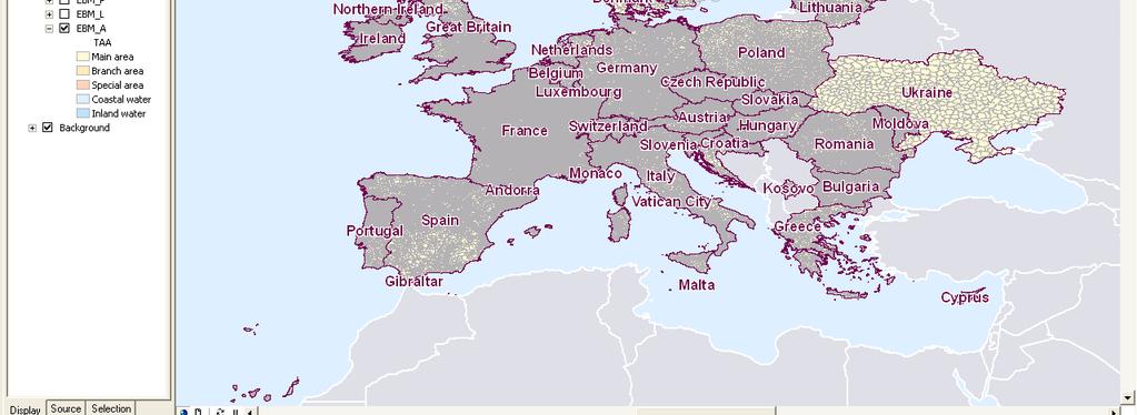
3 GENERAL DATA ABOUT MOLDOVA Moldova is one of Eastern Partnership Countries fully implementing ETRS89 and actively participating in EuroGeographics, EUREF and EUPOS activities Total area km² Capital Chisinau Population 4,3 mln Properties 5,7 mln Territory division 32 regions 65 cities settlements
4 GENERAL DATA ABOUT THE AGENCY FOR LAND RELATIONS AND CADASTRE
5 HISTORICAL REVIEW Declaration of Independence of the Republic of Moldova Mass distribution of national property Foundation of the Agency for Land Relations and Cadastre Law of Real Estate Signing of an agreement concerning the credit for further development between Republic of Moldova and Agency for International Development (AID) Law of Land Code Law of geodesy and mapping Guvernment Decision on establishment of Steering Committee for creation c NSDI Guvernment Decision concerning the improvement the NSDI Concept Implementation of the First Cadastral Project in Moldova. The World Bank and donors Agencies contribution are highly appreciated and support the development of the First Cadastre Project in Moldova.
6 GEODETIC DATUM AND ACTUAL SISTEM S CONDITION The rectangular coordinate reference system for Moldova is called MOLDREF99. The geodetic datum for MOLDREF99 is ETRS89 and GRS80 ellipsoid; OTACI There are totally 495 points available based on MOLDREF99. These are divided into 3 classes/orders: i) 5 points of 0 class/order ii) 72 points of 1st class/order iii) 418 points of 2nd class/order; The coordinate system is UTM system for small scale mapping (1: : ) and the local Transverse Mercator Moldova (TMM) for large scale mapping (1:500 1:10000). The vertical datum is Baltic Sea Level based on Kronstadt zero point; UNGHENI RGN-0 (EUREF sites 5) First order sites 78 Second order sites 400 CHELTUITORUL NOU PALANCA Connection of the National Geodetic Network with the European Geodetic Frame EUREF was done. GIURGIULESTI
7 EXISTING SITUATION About 70% of real estate objects are registered. Legal environment is created and new system of real estate evaluation is being implemented; Real estate market is assured by the information about the owner, real estate and right on real estate. The necessary conditions for private sector development (notaries, cadastral engineers, valuators) in domains connected with registration are created. Real estate market is assured by the information about the owner, real estate and right on real estate.
8 International Development Moldova throw ARFC is the active member of EuroGeographics Moldova throw ARFC is a LMO (Legally Manadated Organization) in INSPIRE gis.org/inspire. Agreements of cooperation with neighboring countries: i) Belarusi, ii) Romania, iii) Russian Federation, iv) Ucraina.
9 Integration in European and Global Spatial Data Infrastructure i) GSDI Global Mapping 1: ii) EuroGeographics EuroGlobal Map 1: EuroRegional Map 1: EuroDem; EuroBoundary Map. iii) National (NSDI) Line Maps 1: Line Maps 1: 5 000
 www.eurogeographics.")
10 Existing situation EuroGlobalMap 1: (EuroGeographics)

11 Existing situation EuroRegionalMap 1: (EuroGeographics)


12 EXISTING SITUATION IN SPATIAL INFORMATION Euro Boundary Map 1: The digital map 1: of administrative and territorial division of the Republic of Moldova
 - 1: 10 000 (92%) - 1: 5 000 (47%) Existing vector map 1: 200 000 (100%); 1:50 000")
13 EXISTING SITUATION IN SPATIAL INFORMATION Existing raster map: - 1: (100%) - 1: (100%) - 1: (100%) - 1: (92%) - 1: (47%) Existing vector map 1: (100%); 1: (12%);


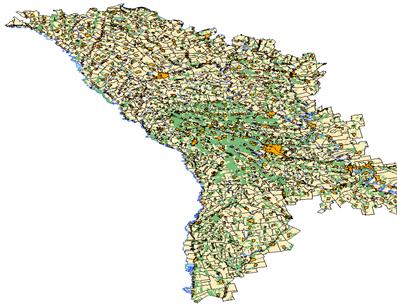
14 EXISTING SITUATION OF SPATIAL INFORMATION Map of administrative and territorial division of the Republic of Moldova, Scale 1: : scale digital map of the Republic of Moldova
15 EXISTING SITUATION OF SPATIAL INFORMATION Moldova Orthophoto Project Project supported by the Norwegian Government in the period Statens Kartverk administrated the Project. The Moldova Orthophoto Project consists of: i) production of digital orthophotos with resolution 40 cm of the entire territory excluding Transdnistrian ii) iii) production of orthophotos with resolution 20 cm for urban areas. DTM of the territory of Moldova
 line maps for 10% of the territory of Moldova; ii) establish 7 permanent reference stations and GPS Control Centre -")
16 EXISTING SITUATION OF SPATIAL INFORMATION Geodetic Network Modernisation Moldova Line Maps for Development: New project ( ) -new grant from the Norwegian Government -to be implemented over 2 years -based on the delivered orthophoto and DTM data -2 main components: i) line maps for 10% of the territory of Moldova; ii) establish 7 permanent reference stations and GPS Control Centre - adherence to the EU INSPIRE Directive - will be accompanied with knowledge transfer and on-the-job training
 BRICENI RGS-2 (relative second order sites - 112) RGS-3 (relative third order sites -1702) CHISINAU")
17 EXISTING SITUATION OF SPATIAL INFORMATION Gravity Network MOLDGRAV 06 Absolute gravity sites (3) RGS-1 (relative gravity first order sites -17) BRICENI RGS-2 (relative second order sites - 112) RGS-3 (relative third order sites -1702) CHISINAU GIURGIULESTI


18 NEW GEODATA LEGISLATION UNDER DEVELOPMENT NSDI Act is being developed Inspire - transposition into national law National needs detailed data, broader and deeper content 2. INSPIRE requirements simplified data
19 THE FUTURE AGENDA Make data from existing maps available as parts of the NSDI, in vector or/and in raster form, and the relevant geographic data available for public use through the Geoportal; Complete cadastre and land registry database; Make cadastral parcels and identifiers available as part of the NSDI through the Geoportal; Make geographic names and administrative units available as part of the NSDI; Geospatial standardization; Digital Base Map development 1: , 1: 5 000; Guide and assist other Government institutions in using approved geographic and geodetic standards in making their data available in the NSDI.
20 LINKS ARFC SOLUTIONS i) ii) iii)
21 CONCLUSIONS Moldova has recently started the establishment of the National Spatial Data Infrastructure. The project aims at supporting development of e-governance, providing access to reliable and up-to-date geographical information for governmental institutions at all levels, professional users in private sector, and for the public in general. NSDI will facilitate Moldova s integration in the European geographic information service for environmental protection, response to hazards and natural disasters, etc., in compliance with the EU INSPIRE Directives and Regulations. The Norwegian contribution is highly appreciated and support the development of the country.
22 THANKS FOR YOUR ATTENTION
EUREF National Report of the Republic of Moldova
 EUREF 2011 National Report of the Republic of Moldova Dr. Ing. Maria OVDII, Ing. Alexandr CEBANU, Ing. Ion EREMIA EUREF 2011, Chisinau, Moldova, May 25-28 28 CONTENTS Geodetic Datum in the Republic of
Evolution and development of National Spatial Data Infrastructure in Republic of Moldova
 Agency for Land Relations and Cadastre of the Republic of Moldova Evolution and development of National Spatial Data Infrastructure in Republic of Moldova Alexandru Morcov Deputy general director ALRC
Demonstration of a local SDI solution with several stakeholders in pilot areas in line with EU best practices
 EU Twinning project for the Agency of Land Relations and Cadaster (ALRC)- Organization, Streamlining and Computerization Process in Mapping in the Republic of Moldova. Demonstration of a local SDI solution
Development of NSDI in Moldova with donor funding
 Development of NSDI in Moldova with donor funding Maria OVDII, Ph. D Agency for Land Relations and Cadastre of Moldova E mail maria.ovdii@arfc.gov.md JRC WORKSHOP Financing the Evolution of Spatial Data
SDI Development in Georgia. Mari Khardziani Head of International Relations Unit National Agency of Public Registry
 SDI Development in Georgia Mari Khardziani Head of International Relations Unit National Agency of Public Registry Kehl, Germany September 5, 2017 2 National Agency of Public Registry Legal Entity of Public
EuroGeographics & INSPIRE. Nick Land, Executive Director of EuroGeographics
 EuroGeographics & INSPIRE Nick Land, Executive Director of EuroGeographics EuroGeographics A growing association 49 Members, 42 countries Topographic mapping, cadastre, land registry + Networked organisation
Influence of INSPIRE on European/national data specifications
 www.eurogeographics.org Influence of INSPIRE on European/national data specifications Saulius Urbanas, EuroGeographics 20 th June 2017 Copyright 2013 EuroGeographics EuroGeographics 46 European countries
EuroBoundaries. The project of EuroGeographics for up-dating the European Boundaries Network.
 EuroBoundaries The project of EuroGeographics for up-dating the European Boundaries Network heinz.koenig@bev.gv.at Situation and Facts Topographic aspects EuroRegionalMap Neighbouring topographic maps
Report on the establishment of UN GGIM: Europe Item 14. 4th session of the Committee of Experts on UN-GGIM
 Report on the establishment of UN GGIM: Europe Item 14 1 Why regional European committees of UN GGIM? In the ECOSOC resolution 2011/24 on the UN GGIM: Emphasizes the importance of promoting national, regional
Norwegian spatial data infrastructure supporting disaster risk management Norwegian Mapping Authority
 Norwegian spatial data infrastructure supporting disaster risk management Norwegian Mapping Authority Arvid Lillethun, Norwegian Mapping Authority Land and Poverty 2018 Conference, World Bank 19.-23. March
Sustainable and Harmonised Development for Smart Cities The Role of Geospatial Reference Data. Peter Creuzer
 Sustainable and Harmonised Development for Smart Cities The Role of Geospatial Reference Data Peter Creuzer 1. Introduction - Smart Cities and Geodata 2. Geodata in Germany 3. Examples 4. Data and Service
The Integrated Ge spatial Information Framework to the strengthening of NSDI, Mongolia
 Young Geospatial Professionals Summit 21 NOV 2018 The Integrated Ge spatial Information Framework to the strengthening of NSDI, Mongolia BAYARMAA ENKHTUR Geospatial information and technology department
The European Surveying Plot A surveying map of land property: A proposal and it s perspectives
 The European Surveying Plot A surveying map of land property: A proposal and it s perspectives Nikolaos KALAMAKIS, Greece Key words: INSPIRE, Interoperability, National Geographic Organizations, technical
Emerging Trends in Institutional Arrangements Europe - Finland
 Emerging Trends in Institutional Arrangements Europe - Finland Arvo Kokkonen Deputy Director General National Land Survey of Finland 1 Contents Facts about Finland National Land Survey of Finland European
Ministry of ICT of I.R.IRAN
 The ECO 8/6 mill km 2 10 Slamic countries ~330 mill people Oil, Gas, Industries,Tourism 2 Issue transformation in last decade Problem solving needs more integrated approach More interaction &complexity
QUALITY CONTROL ROLE IN PROCESS OF ESTABLISHMENT OF NSDI
 QUALITY CONTROL ROLE IN PROCESS OF ESTABLISHMENT OF NSDI S. Lemajić a,lj. Rašić b a Croatian Geodetic Institute, Savska 41/XVI, Zagreb, Croatia slavko.lemajic@cgi.hr b State Geodetic Administration, Lastovska
Challenges and Potentials of Place Based Information Management in Nepal"
 Nineteenth United Nations Regional Cartographic Conference for Asia and the Pacific, Bangkok, Thailand, 29 October 1 November 2012 Challenges and Potentials of Place Based Information Management in Nepal"
Adding value to Copernicus services with member states reference data
 www.eurogeographics.org Adding value to Copernicus services with member states reference data Neil Sutherland neil.sutherland@os.uk GIS in the EU 10 November 2016 Copyright 2016 EuroGeographics 61 member
Disaster Management in Mongolia
 The Third UN-GGIM-AP Plenary Meeting Disaster Management in Mongolia ~Coordination among NGIA & Other Related Organizations and Recommendations~ Bali Indonesia 10 November 2014 Khurelshagai Ayurzana, Director
Indsæt billede her. Location an INSPIRED gateway to E-government
 Location an INSPIRED gateway to E-government Indsæt billede her Ulla Kronborg Mazzoli INSPIRE contact point Deputy Chief Spatial Data Infrastructure Danish National Survey and Cadastre Outline A short
FYROM A BRIEF HISTORICAL OVERVIEW ON EARTH OBSERVATION ACTIVITIES
 A BRIEF HISTORICAL OVERVIEW ON EARTH OBSERVATION ACTIVITIES The analog publication of the spatial data contents in the former Yugoslavian Republic of Macedonia dated from the end of the 19th century and
INSPIRE Basics. Vlado Cetl European Commission Joint Research Centre. https://ec.europa.eu/jrc/
 INSPIRE Basics Vlado Cetl European Commission Joint Research Centre https://ec.europa.eu/jrc/ Serving society Stimulating innovation Supporting legislation Outline SDI? Why European SDI? INSPIRE Policy
Turkey National Report
 UNITED NATIONS Working Paper GROUP OF EXPERTS ON No. 26 GEOGRAPHICAL NAMES Twenty-third Session Vienna, 28 March 4 April 2006 Item 5 of the Provisional Agenda: Reports of the division Turkey National Report
INSPIRATION results and benefits for the Agency for Real Estate Cadastre
 JOINT RESEARCH CENTER - E&I WORKSHOP INSPIRATION results and benefits for the Agency for Real Estate Cadastre Sonja Dimova, state advisor AGENCY FOR REAL ESTATE CADASTRE REPUBLIC OF MACEDONIA Wednesday,
Project based approach developing National Spatial Data Infrastructure in Lithuania
 Project based approach developing National Spatial Data Infrastructure in Lithuania National Land Service under the Ministry of Agriculture of The Republic of Lithuania Cadastres & Geodesy Department Director
INSPIRATION RESULTS AND BENEFITS ALBANIA
 INSPIRATION RESULTS AND BENEFITS ALBANIA By Eng. Besnik Çomo Paper prepared for E&I Workshop: Support to INSPIRE Implementation in enlargement and EWP Countries JRC ISPRA Central Office of Immovable Property
The contribution of EUREF to Inspire
 EUREF2010 SYMPOSIUM The contribution of EUREF to Inspire J. Torres, V. Bitenc, A. Caporali, P. Cruddace, L. Engberg, B. Garayt and H. Habrich (members of TWG-RS) June 2-4, 2010 Gävle 1 EUREF2010 SYMPOSIUM
GIS Building Communities beyond National Borders (Building Successful Spatial Data Infrastructures) Nick Land, ESRI Europe
 Nick Land, ESRI Europe") GIS Building Communities beyond National Borders (Building Successful Spatial Data Infrastructures) Nick Land, ESRI Europe UK worst flooding in the last 60 years 350,000 households without drinking water
GIS Building Communities beyond National Borders (Building Successful Spatial Data Infrastructures) Nick Land, ESRI Europe UK worst flooding in the last 60 years 350,000 households without drinking water
OPEN GOVERNMENT - BENEFITS OF INSPIRE IN THE PUBLIC SECTOR
 Brussels, 04th March 2013 - Daniela Hogrebe and André Caffier from GDI-DE 1 OPEN GOVERNMENT - BENEFITS OF INSPIRE IN THE PUBLIC SECTOR Powered by INSPIRE Open Government 2 SDI is a fundament of transparent
INSPIRE - A Legal framework for environmental and land administration data in Europe
 INSPIRE - A Legal framework for environmental and land administration data in Europe Dr. Markus Seifert Bavarian Administration for Surveying and Cadastre Head of the SDI Office Bavaria Delegate of Germany
Compact guides GISCO. Geographic information system of the Commission
 Compact guides GISCO Geographic information system of the Commission What is GISCO? GISCO, the Geographic Information System of the COmmission, is a permanent service of Eurostat that fulfils the requirements
SERBIA A BRIEF HISTORICAL OVERVIEW ON EARTH OBSERVATION ACTIVITIES
 A BRIEF HISTORICAL OVERVIEW ON EARTH OBSERVATION ACTIVITIES The first documents registering data on land on the territory of Serbia date back from the period of Medieval Serbian state. These documents
US National Spatial Data Infrastructure A Spatial Framework for Governance and Policy Development to Enable a Location-Based Digital Ecosystem
 GeoPlatform Workshop 7 Dec 2016, Department of the Interior Washington, D.C. US National Spatial Infrastructure A Spatial Framework for Governance and Policy Development to Enable a Location-Based Digital
Geospatial Information and Sustainable Development (Rio+20) A Belgian perspective
 A Belgian perspective") Geospatial Information and Sustainable Development (Rio+20) A Belgian perspective In the resolution adopted by the General Assembly, The future we want World leaders acknowledged the need to further mainstream
Geospatial Information and Sustainable Development (Rio+20) A Belgian perspective In the resolution adopted by the General Assembly, The future we want World leaders acknowledged the need to further mainstream
Status of implementation of the INSPIRE Directive 2016 Country Fiches. COUNTRY FICHE Czech Republic
 Status of implementation of the INSPIRE Directive 2016 Country Fiches COUNTRY FICHE Czech Republic Introduction... 1 1. State of Play... 2 1.1 Coordination... 2 1.2 Functioning and coordination of the
Country Case Studies Norway- The Norwegian national spatial data infrastructure improve risk management and of disaster resilience
 Country Case Studies Norway- The Norwegian national spatial data infrastructure improve risk management and of disaster resilience Arvid Lillethun Norwegian Mapping Authority Land Mapping Division arvid.lillethun@kartverket.no
Brussels, BELGIUM. Bojan Stopar. Faculty of Civil and Geodetic Engineering
 EUREF 2008 Symposium Brussels, BELGIUM June 18-20, 2008 NATIONAL REPORT OF SLOVENIA Bojan Stopar University of Ljubljana University of Ljubljana Faculty of Civil and Geodetic Engineering ADOPTION OF THE
LAND INFORMATION SYSTEM A TOOL TO KEEP THE REGISTRY OF PLANNING PERMISSION. CASE STUDY OF THE SZCZUTOWO COMMUNE
 INFRASTRUKTURA I EKOLOGIA TERENÓW WIEJSKICH INFRASTRUCTURE AND ECOLOGY OF RURAL AREAS Nr 2/IV/2013, POLSKA AKADEMIA NAUK, Oddział w Krakowie, s. 15 27 Komisja Technicznej Infrastruktury Wsi LAND INFORMATION
NATIONAL BENEFITS OF INSPIRE IMPLEMENTATION THE REAL LIFE USE CASES
 NATIONAL BENEFITS OF INSPIRE IMPLEMENTATION THE REAL LIFE USE CASES Andrius Balciunas, SE GIS Centras, a.balciunas@gis centras.lt Evaldas Rozanskas, SE GIS Centras, e.rozanskas@gis centras.lt INSPIRE conference
UN GGIM and National SDI Strategy
 MSDI Open Forum on 26 th January 2016 Contributing to the successful delivery of MSDI UN GGIM and National SDI Strategy Hiroshi Murakami Deputy Administrator Geospatial Information Authority of Japan Geospatial
Technical Framework Methodology as a core of building up the NSDI NSDI Implementation Specifics in Serbia
 Technical Framework Methodology as a core of building up the NSDI NSDI Implementation Specifics in Serbia Luka Jovičić SDI Consultant@ Gramont Ltd. Aleksandar Dedić RGA NSDI department Dragica Pajić RGA
HARMONIZING AND INTEGRATING OF THREE LEVELS OF SPATIAL PLANNING DATABASES FOR THE MUNICIPALITY OF VITI IN KOSOVA
 Bashkim IDRIZI, Valbone SULEJMANI HARMONIZING AND INTEGRATING OF THREE LEVELS OF SPATIAL PLANNING DATABASES FOR THE MUNICIPALITY OF VITI IN KOSOVA 4-8 September 2017; Kehl and Strasbourg Overview: Preface
National Spatial Data Infrastructure International workshop 9 th June, 2015 Terelj Hotel, Mongolia
 1 st session: NSDI policy, planning and the legal framework Formation of NSDI policy and legal framework in Mongolia Khurelshagai Ayurzana, Director General, Administration of Land Affairs, Geodesy and
UN-GGIM: Europe GRF-Europe. Markku Poutanen
 UN-GGIM: Europe GRF-Europe Markku Poutanen Global Geodetic Reference Frame GGRF The UN Committee of Experts on Global Geospatial Information Management (UN-GGIM) decided in July 2013 to formulate and facilitate
SWEDISH SDI DEVELOPMENT & IMPLEMENTATION OF INSPIRE
 SWEDISH SDI DEVELOPMENT & IMPLEMENTATION OF INSPIRE Christina Wasström, Lantmäteriet, 801 82 Gävle, Sweden, christina.wasstrom@lm.se ABSTRACT The Swedish Government and Parliament has given Lantmäteriet
Building a national spatial data infrastructure. Thorben Hansen, Head of Division Danish Agency for Data Supply and Efficiency
 Building a national spatial data infrastructure Thorben Hansen, Head of Division Danish Agency for Data Supply and Efficiency About Spatial Data Infrastructure Spatial data come from many sources and is
Proposal for a DIRECTIVE OF THE EUROPEAN PARLIAMENT AND OF THE COUNCIL. establishing an infrastructure for spatial information in the Community
 Proposal for a DIRECTIVE OF THE EUROPEAN PARLIAMENT AND OF THE COUNCIL establishing an infrastructure for spatial information in the Community INSPIRE http://inspire.jrc.it/ Alessandro Annoni 1 EU Commission
SDI-Challenges European perspective
 THE HIGH LEVEL FORUM ON GLOBAL GEOSPATIAL INFORMATION MANAGEMENT Seoul, Republic of Korea, 24-26 October 2011 Session 1: Challenges in geospatial policy formation and institutional arrangements SDI-Challenges
SDI Development in the Russian Federation
 , the Russian Federation Key words: SDI development, the Russian Federation SUMMARY A reform in the field of spatial data is gathering headway in Russia. Creation of a single agency, which united state
Country Report on SDI Activities in Singapore *
 UNITED NATIONS E/CONF.100/CRP.9 ECONOMIC AND SOCIAL COUNCIL Eighteenth United Nations Regional Cartographic Conference for Asia and the Pacific Bangkok, 26-29 October 2009 Item 7(a) of the provisional
Maria Andrzejewska UNEP/GRID Warsaw Centre
 Maria Andrzejewska UNEP/GRID Warsaw Centre Agenda 1. Environment matters! 2. Spatial data to benefit environment 3. Environment management with cadastral data 4. Cadaster in spatial planning 5. Conclusions
Efficient procedures for quality assurance of data and services. Anders Östman & Jan Zakariasson Swedesurvey AB
 Efficient procedures for quality assurance of data and services Anders Östman & Jan Zakariasson Swedesurvey AB Swedesurvey AB An International Consultant company, owned by the Swedish Government Provides
Land Use in the context of sustainable, smart and inclusive growth
 Land Use in the context of sustainable, smart and inclusive growth François Salgé Ministry of sustainable development France facilitator EUROGI vice president AFIGéO board member 1 Introduction e-content+
Towards National Geographic Information System in Nepal
 2 nd High Level Forum on Global Geospatial Information Management, Qatar National Convention Centre, Doha, Qatar, 4 6 February, 2013 Towards National Geographic Information System in Nepal Krishna Raj
The Swedish National Geodata Strategy and the Geodata Project
 The Swedish National Geodata Strategy and the Geodata Project Ewa Rannestig, Head of NSDI Co-ordination Unit, Lantmäteriet, ewa.rannstig@lm.se Ulf Sandgren, Project Manager Geodata Project, Lantmäteriet,
GSDI Global Spatial Data Infrastructure. Convergences between Geo Spatial Communities: key decision for decision making
 GSDI Global Spatial Data Infrastructure Convergences between Geo Spatial Communities: key decision for decision making April 14 th 2010 Bas Kok GSDI Past-President Director of International Affairs, Dutch
The Process of Spatial Data Harmonization in Italy. Geom. Paola Ronzino
 The Process of Spatial Data Harmonization in Italy Geom. Paola Ronzino ISSUES Geospatial Information in Europe: lack of data harmonization the lack of data duplication of data CHALLENGES Challenge of INSPIRE:
Cooperation is the key, FIG can facilitate
 Cooperation is the key, FIG can facilitate Mikael Lilje Vice President 2017-2020 Head, Geodetic infrastructure, Swedish mapping, cadastral and land registration authority Presented at the GIS/RS Conference
Study Visit University of Applied Sciences Utrecht Netherlands
 Study Visit University of Applied Sciences Utrecht Netherlands Directorate-General for Territorial Development Lisbon 1 April 2014 1 Agenda Presentation Cadastre Department Surveying / Geodesy Department
MALDIVES. Regional Expert Workshop On Land Accounting For SDG Monitoring & Reporting (25-27 th Sept 2017) - Fathimath Shanna, Aishath Aniya -
 - Fathimath Shanna, Aishath Aniya -") MALDIVES Regional Expert Workshop On Land Accounting For SDG Monitoring & Reporting (25-27 th Sept 2017) - Fathimath Shanna, Aishath Aniya - ABOUT MALDIVES Approximately 860 km long and 120 km wide Consists
MALDIVES Regional Expert Workshop On Land Accounting For SDG Monitoring & Reporting (25-27 th Sept 2017) - Fathimath Shanna, Aishath Aniya - ABOUT MALDIVES Approximately 860 km long and 120 km wide Consists
Marine Spatial Planning, a Norwegian user case NSHC33
 Marine Spatial Planning, a Norwegian user case NSHC33 Marine Spatial Management Tool Support the marine spatial planning process with updated and reliable geospatial information Marine management is important
2018/1 The integration of statistical and geospatial information. The Regional Committee of UN-GGIM: Americas:
 The following are the conclusions and recommendations of the Regional Committee of the United Nations on Global Geospatial Information Management for the Americas, during its Fifth Session, Thursday 8
Reference Systems Realization for the Territory of Bulgaria - Status and Perspectives
 Conference and plenary meeting of the Permanent Committee on Cadastre in the European Union 13-15 March 2018, Sofia Reference Systems Realization for the Territory of Bulgaria - Status and Perspectives
ALBANIA IN THE GLOBAL MAP. Milot LUBISHTANI, Bashkim IDRIZI
 ALBANIA IN THE GLOBAL MAP Milot LUBISHTANI, Bashkim IDRIZI Overview: Introduction GSDI Global Mapping Introduction Standards Participating Utilization Data structure Albanian Global Map Dataset Process
Disaster Management & Recovery Framework: The Surveyors Response
 Disaster Management & Recovery Framework: The Surveyors Response Greg Scott Inter-Regional Advisor Global Geospatial Information Management United Nations Statistics Division Department of Economic and
PAN AMERICAN INSTITUTE OF GEOGRAPHY AND HISTORY Specialized Organization of the OAS
 PAN AMERICAN INSTITUTE OF GEOGRAPHY AND HISTORY Specialized Organization of the OAS 10 th UNRCC Americas United Nations, New York, 20 August 2013 PAIGH, SIRGAS, PC-IDEA and GeoSUR 2013-2015 Joint Action
Upgrade the Datasets in NSDI for Smarter Services with the Cases of China
 Upgrade the Datasets in NSDI for Smarter Services with the Cases of China By Dr. JIANG Jie Dept of GeoInformaiton Service Platform National Geomatics Center of China October 7, 2015 Jeju, Republic of Korea
The European Location Framework (ELF) Project One Source for Reference Geo-Information for Europe
 Project One Source for Reference Geo-Information for Europe") The European Location Framework (ELF) Project One Source for Reference Geo-Information for Europe Presentation to: By: Date: INSPIRE Conference Antti Jakobsson, Technical Coordinator 25 th June 2013 25
The European Location Framework (ELF) Project One Source for Reference Geo-Information for Europe Presentation to: By: Date: INSPIRE Conference Antti Jakobsson, Technical Coordinator 25 th June 2013 25
Brazil Paper for the. Second Preparatory Meeting of the Proposed United Nations Committee of Experts on Global Geographic Information Management
 Brazil Paper for the Second Preparatory Meeting of the Proposed United Nations Committee of Experts on Global Geographic Information Management on Data Integration Introduction The quick development of
INSPIRE Monitoring and Reporting Implementing Rule Draft v2.1
 INSPIRE Infrastructure for Spatial Information in Europe INSPIRE Monitoring and Reporting Implementing Rule Draft v2.1 Title INSPIRE Monitoring and Reporting Implementing Rule v2.1 Creator DT Monitoring
UN Resolution on GGRF ( and its implementation in Europe)
") Presented at the FIG Working Week 2017, UN Resolution on GGRF ( and its implementation in Europe) May 29 - June 2, 2017 in Helsinki, Finland Markku Poutanen, FGI Contents Global Geodetic Reference Frame
Presented at the FIG Working Week 2017, UN Resolution on GGRF ( and its implementation in Europe) May 29 - June 2, 2017 in Helsinki, Finland Markku Poutanen, FGI Contents Global Geodetic Reference Frame
Prof Chryssy Potsiou, FIG President
 THE VALUE OF GEOSPATIAL DATA AND ROLE OF SURVEYORS IN SUSTAINABLE DEVELOPMENT Prof Chryssy Potsiou, FIG President National Technical University of Athens School of Rural and Surveying Engineering, Greece
Appropriation Directions for 2007
 INSPIRE in Sweden An Important Part of the National Geodata Strategy Monica Lagerqvist Nilsson Appropriation Directions for 2007 A commission to investigate the necessity to adjust the Swedish legislation
A donor partner view. Olaf Magnus Østensen. 'Modernization of spatial data infrastructure to reduce risks and impacts of floods'
 A donor partner view Olaf Magnus Østensen 'Modernization of spatial data infrastructure to reduce risks and impacts of floods' About the EEA Grants programme http://eeagrants.org/ Beneficiary country Donor
VERY HIGH RESOLUTION SATELLITE DATA FOR CADASTRAL MAPPING
 132 Romuald Kaczynski, Michal Kedzierski Military University of Technology, Warsaw, Poland VERY HIGH RESOLUTION SATELLITE DATA FOR CADASTRAL MAPPING Kaczynski Romuald, Kedzierski Michal, 2013 В статье
Global Geospatial Information Management Country Report Finland. Submitted by Director General Jarmo Ratia, National Land Survey
 Global Geospatial Information Management Country Report Finland Submitted by Director General Jarmo Ratia, National Land Survey Global Geospatial Information Management Country Report Finland Background
Infrastructure for Spatial Information in Europe (INSPIRE)
") Infrastructure for Spatial Information in Europe (INSPIRE) 2011 GISCO Working Party 8-9.3.2012 INSPIRE is about improving access to spatial information: the environment doesn t stop at borders EU Geoportal
Infrastructure for Spatial Information in Europe (INSPIRE) 2011 GISCO Working Party 8-9.3.2012 INSPIRE is about improving access to spatial information: the environment doesn t stop at borders EU Geoportal
Zagreb Spatial Data Infrastructure. Sanja Batić, APIS IT Split, 14. rujna 2011.
 Zagreb Spatial Data Infrastructure Sanja Batić, APIS IT Split, 14. rujna 2011. Agenda Zagreb Spatial Data Infrastructure - ZIPP Guidelines for further ZIPP Geoportal development Conclusion 1964 The Centre
GEOVEKST A Norwegian Program for Cost Sharing in Production, Updating and Administration of Geographic Data
 GEOVEKST A Norwegian Program for Cost Sharing in Production, Updating and Administration of Dr. Anne Kirsten S. HØSTMARK, Norway Key words: Mapping in large scale, formal co-operation, cost sharing, standarised
Country Report On Sdi Activities In Singapore ( )
") UNITED NATIONS E/CONF.102/IP.4 ECONOMIC AND SOCIAL COUNCIL Nineteenth United Nations Regional Cartographic Conference for Asia and the Pacific Bangkok, 29 October 1 November 2012 Item 6(b) of the provisional
UNITED NATIONS E/CONF.102/IP.4 ECONOMIC AND SOCIAL COUNCIL Nineteenth United Nations Regional Cartographic Conference for Asia and the Pacific Bangkok, 29 October 1 November 2012 Item 6(b) of the provisional
GEOGRAPHICAL NAMES AS PART OF THE GLOBAL, REGIONAL AND NATIONAL SPATIAL DATA INFRASTRUCTURES
 GEOGRAPHICAL NAMES AS PART OF THE GLOBAL, REGIONAL AND NATIONAL SPATIAL DATA INFRASTRUCTURES Željko HEĆIMOVIĆ, Željka JAKIR, Zvonko ŠTEFAN, Danijela KUKIĆ zeljko.hecimovic@cgi.hr, zeljka.jakir@cgi.hr,
EARTH OBSERVATION SERVICES IN REPUBLIC OF MOLDOVA
 EARTH OBSERVATION SERVICES IN REPUBLIC OF MOLDOVA Vasile ALCAZ 1 Ion APOSTOL 2 1 Institute of Geology and Seismology Moldavian Academy of Sciences 2 Ministry of Environment and Natural Resources Republic
Quality information for the Digital Agenda EuroGeographics contribution to the Digital Agenda for Europe
 Quality information for the Digital Agenda EuroGeographics contribution to the Digital Agenda for Europe Ingrid Vanden Berghe, EuroGeographics President high performance infrastructure quality contentinformation
NATIONAL SPATIAL DATA INFRASTRUCTURE IN REPUBLIC OF MOLDOVA
 I. Danii, V. Mocreac, M. Ovdii, P. Ivancenco, D. Cotovici National Spatial Data Infrastructure in Republic of Moldova NATIONAL SPATIAL DATA INFRASTRUCTURE IN REPUBLIC OF MOLDOVA Ivan DANII, Agency for
Spatial information for urban planning and management case study Zagreb Darko ŠIŠKO, Vlado CETL, Tomislav CICELI. Strasbourg, September 7th, 2017
 Spatial information for urban planning and management case study Zagreb Darko ŠIŠKO, Vlado CETL, Tomislav CICELI Strasbourg, September 7th, 2017 Contents: Cities & INSPIRE Cities in Croatian NSDI City
Common geographies for dissemination of SDG Indicators
 5 th High Level Forum on United Nations GGIM, Mexico 2017 Common geographies for dissemination of SDG Indicators Understanding statistical and geodetic division of territory Janusz Dygaszewicz Central
Report on the impact of open geographical data - Danish effect studies -
 Presented at the FIG Congress 2018, May 6-11, 2018 in Istanbul, Turkey Report on the impact of open geographical data - Danish effect studies - (Paper no 9603) Agenda 1. Intro teaser 2. Basic digital infrastructure
8th FIG Regional Conference November 2012 Montevideo, Uruguay
 8th FIG Regional Conference 26 29 November 2012 Montevideo, Uruguay Platinum Sponsors: Member Associations; Affiliate Members; Academic Members; Corporate Members & Correspondents 120 Countries 1 FIG Foundation
Nordic Address Forum. Cooperation with Municipalities & The Geodata Strategy. Angela Fessé Lantmäteriet Odense, June
 Nordic Address Forum Cooperation with Municipalities & The Geodata Strategy Angela Fessé Lantmäteriet Odense, June 3-4 2010 Why collaborate on national databases? The private market and society have broader
Qatar s Nation-Wide GIS Cooperation on Local and Regional Levels
 Qatar s Nation-Wide GIS Cooperation on Local and Regional Levels Dr. Mohammad Abd El-Wahab Hamouda GIS Consultant & Chairman of GIS Coordinators Group The Center for GIS State of Qatar Second High Level
Application of GIS Technologies in maintenance and development of a Gas Transmission System
 Application of GIS Technologies in maintenance and development of a Gas Transmission System by Iva Juretić and Vanja Skopljak Štulić The main role of GIS, in addition to providing spatial data, is to create
Basic Act on the Advancement of Utilizing Geospatial Information
 Basic Act on the Advancement of Utilizing Geospatial Information (Act No. 63 of May 30, 2007) Table of Contents Chapter I General Provisions (Articles 1 to 8) Chapter II Basic Plan for the Advancement
ECONOMIC AND SOCIAL COUNCIL
 UNITED NATIONS E/CONF.102/3 ECONOMIC AND SOCIAL COUNCIL Nineteenth United Nations Regional Cartographic Conference for Asia and the Pacific Bangkok, 29 October 1 November 2012 Item 4 of the provisional
Economic and Social Council
 United Nations Economic and Social Council Distr.: General 18 July 2016 Original: English Committee of Experts on Global Geospatial Information Management Sixth session New York, 3-5 August 2016 Item 2
SWITZERLAND LAUNCHES MOST EXTENSIVE AND ACCURATE LANDSCAPE MODEL KEY CONTRIBUTIONS 2014: DEVELOPING A COMMON VISION FOR PAN-EUROPEAN GEOINFORMATION
 CONTENTS 4 5 6 8 10 12 13 14 16 18 19 20 ABOUT EUROGEOGRAPHICS STRATEGIC PARTNERS PRESIDENT S REPORT KEY CONTRIBUTIONS 2014: PROVIDING THE VOICE OF OUR MEMBERS IN EUROPE AND ACROSS THE WORLD THE EYES,
Geospatial and Statistical Data Integration
 Geospatial and Statistical Data Integration Dr. Emmanuel Nkurunziza Director General Outline I. About RCMRD II. Evolution of Rwanda s geospatial and statistics systems III. Statistics in Rwanda IV. Geospatial
The state-of-the-art of the Finnish SDI. Arctic SDI WG Meeting
 The state-of-the-art of the Finnish SDI Arctic SDI WG Meeting Moscow 8.9.2011 Esa Tiainen Development Centre 1 NATIONAL LAND SURVEY DOWN TO EARTH Contents Legal framework Coordination structure Network
EuroSDR (European Spatial Data Research)
") EuroSDR (European Spatial Data Research) ROLLING RESEARCH PLAN 2015-2018 EuroSDR Secretariat Public Governance Institute KU Leuven Parkstraat 45 bus 3609 3000 Leuven Belgium Tel.: +32 16 32 31 80 Fax:
EuroSDR (European Spatial Data Research) ROLLING RESEARCH PLAN 2015-2018 EuroSDR Secretariat Public Governance Institute KU Leuven Parkstraat 45 bus 3609 3000 Leuven Belgium Tel.: +32 16 32 31 80 Fax:
Maanmittauspäivät 2018 Helsinki Maanmittauspäivät 2018 The Danish initiatives regarding open and free basic data including effect studies
 Maanmittauspäivät 2018 The Danish initiatives regarding open and free basic data including effect studies 22.03.2018 Agenda 1. Intro overall frame / selfie 2. Data Infrastructure 3. The Danish Digital
Geospatial Policy Development and Institutional Arrangements *
 HIGH LEVEL FORUM ON GLOBAL GEOSPATIAL MANAGEMENT INFORMATION WORKING PAPER No. 13 First Forum Seoul, Republic of Korea, 24-26 October 2011 Geospatial Policy Development and Institutional Arrangements *