Indsæt billede her. Location an INSPIRED gateway to E-government
|
|
|
- Clyde Daniels
- 5 years ago
- Views:
Transcription

1 Location an INSPIRED gateway to E-government Indsæt billede her Ulla Kronborg Mazzoli INSPIRE contact point Deputy Chief Spatial Data Infrastructure Danish National Survey and Cadastre
2 Outline A short presentation About the NSDI status and strategy What role does INSPIRE play Danish egov strategy and where we are heading Challenges and up coming tasks

3 National Survey and Cadastre = KMS As coordinator: The Minister of the Environment has assigned most of her (INSPIRE) authority to KMS Represent Denmark in the INSPIRE Committee National contact Point Responsible for the Infrastructure for Spatial Information Act and thereby implementation of the INSPIRE directive Manage infrastructure for spatial information in Denmark Hence KMS has a legal obligation to ensure a cohesive cross agency SDI that supports public administration and public sector activities.


4 Overall objective: Spatial information becomes an everyday resource Clear agreement on central principles Work to ensure that spatial information contributes to improving the efficiency of public sector activities
5 Focal points of the NSDI Stronger coordination and governance Coordination Committee on Infrastructure for Spatial Information Directly linked to the Steering Committee for Joint Government Cooperation egov), Serves as the domain manager for spatial information. A national geoportal Geodata-info.dk comply with the INSPIRE requirements (metadata) free and open for all serving NSDI joint nordic cooperation on open source Common components Reducing costs, favors sharing and encreases useability common accesss point to the SDI Agreements in the public sector 3 sets of agreements regulates all use of KMS s data and services (central government, municipalities and regions) aim that a cross-sector, shared agreement model for the SDI covering the entire public sector is developed.


6
 gives KMS overall responsibility for filling out the framework and objectives for the national SDI Reinforces the consensus based creation of")
7 Where is INSPIRE? Legislation (Infrastructure for Spatial Information Act) gives KMS overall responsibility for filling out the framework and objectives for the national SDI Reinforces the consensus based creation of a cohesive SDI Matters on the political agenda Increased awareness of SDI What is needed in order to effectively share data, metadata through standardized services Re-use, common components and shared access points Spatial information is on the political agenda Timeframe Consensus is strong but takes time.the Directive has put some speed into decision making But most important THE INFRASTRUCTURE PRINCIPLES INSPIRE principles used as a guiding element in the development of a new Danish e- Government Strategy


8 Indsæt billede her
9 THE danish egovenment STRATEGY Vision: "Digitalisation will create a smarter public sector that is simple, effective and coherent Action: Cross-cutting themes of reuse of data, infrastructure, citizen service, governance... Focus: Authoritative basic data and a common public data distributor


10 Indsæt billede her
11 Architecture basic data distribution Users Public, private Distribution of data The Data distributor high capacity and performance Basic data Replication in near real time Authorities with responsability - collection, reporting and maintenance of data
12 Challenges and future focal points We cannot afford to do the same thing several times -> common public solutions Common components (solutions, services, etc.) must be part of a shared public infrastructure Applications use - must be in focus Reinforced cooperation with the private sector More knowlegde and more dedicated communication INSPIRE helps but will not be the answer to all our challenges ;-)


13 Indsæt billede her


14 Thank you for your attention! www. Inspire-danmark.dk www. Geodata-info.dk
Implementation of Inspire in Denmark - How we get it flying! Olav Eggers National Survey & Cadastre -Denmark
 Implementation of Inspire in Denmark - How we get it flying! Olav Eggers oe@kms.dk National Survey & Cadastre -Denmark Introduction Overview Infrastructure for Spatial Information Act National Survey and
Between legislation and consensus how do we INSPIRE Denmark?
 Between legislation and consensus how do we INSPIRE Denmark? Olav Eggers Spatial Data Infrastructure Division Danish Ministry of the Environment National Survey and Cadastre (KMS), Denmark INSPIRE Contact
Maanmittauspäivät 2018 Helsinki Maanmittauspäivät 2018 The Danish initiatives regarding open and free basic data including effect studies
 Maanmittauspäivät 2018 The Danish initiatives regarding open and free basic data including effect studies 22.03.2018 Agenda 1. Intro overall frame / selfie 2. Data Infrastructure 3. The Danish Digital
Status of implementation of the INSPIRE Directive 2016 Country Fiches. COUNTRY FICHE Denmark
 Status of implementation of the INSPIRE Directive 2016 Country Fiches COUNTRY FICHE Denmark Introduction... 1 1. State of Play... 2 1.1 Coordination... 2 1.2 Functioning and coordination of the infrastructure...
Report on the impact of open geographical data - Danish effect studies -
 Presented at the FIG Congress 2018, May 6-11, 2018 in Istanbul, Turkey Report on the impact of open geographical data - Danish effect studies - (Paper no 9603) Agenda 1. Intro teaser 2. Basic digital infrastructure
Building a national spatial data infrastructure. Thorben Hansen, Head of Division Danish Agency for Data Supply and Efficiency
 Building a national spatial data infrastructure Thorben Hansen, Head of Division Danish Agency for Data Supply and Efficiency About Spatial Data Infrastructure Spatial data come from many sources and is
INSPIRE implementation in the Danish Ministry of the Environment. Environmental data - from onsite collection to compliant INSPIRE distribution
 INSPIRE implementation in the Danish Ministry of the Environment Environmental data - from onsite collection to compliant INSPIRE distribution Welcome to workshop! Danish Ministry of the Environment and
The Swedish National Geodata Strategy and the Geodata Project
 The Swedish National Geodata Strategy and the Geodata Project Ewa Rannestig, Head of NSDI Co-ordination Unit, Lantmäteriet, ewa.rannstig@lm.se Ulf Sandgren, Project Manager Geodata Project, Lantmäteriet,
Global Geospatial Information Management Country Report Finland. Submitted by Director General Jarmo Ratia, National Land Survey
 Global Geospatial Information Management Country Report Finland Submitted by Director General Jarmo Ratia, National Land Survey Global Geospatial Information Management Country Report Finland Background
Status of implementation of the INSPIRE Directive 2016 Country Fiches. COUNTRY FICHE Czech Republic
 Status of implementation of the INSPIRE Directive 2016 Country Fiches COUNTRY FICHE Czech Republic Introduction... 1 1. State of Play... 2 1.1 Coordination... 2 1.2 Functioning and coordination of the
Spatial information for urban planning and management case study Zagreb Darko ŠIŠKO, Vlado CETL, Tomislav CICELI. Strasbourg, September 7th, 2017
 Spatial information for urban planning and management case study Zagreb Darko ŠIŠKO, Vlado CETL, Tomislav CICELI Strasbourg, September 7th, 2017 Contents: Cities & INSPIRE Cities in Croatian NSDI City
Strategic basis The National Survey and Cadastre LOCATION A GATEWAY TO egovernment
 Strategic basis The National Survey and Cadastre 2011-2015 LOCATION A GATEWAY TO egovernment Strategic BASIS The National Survey and Cadastre 2011-2015 Title: Location - a gateway to egovernment Published
INSPIRATION results and benefits for the Agency for Real Estate Cadastre
 JOINT RESEARCH CENTER - E&I WORKSHOP INSPIRATION results and benefits for the Agency for Real Estate Cadastre Sonja Dimova, state advisor AGENCY FOR REAL ESTATE CADASTRE REPUBLIC OF MACEDONIA Wednesday,
SWEDISH SDI DEVELOPMENT & IMPLEMENTATION OF INSPIRE
 SWEDISH SDI DEVELOPMENT & IMPLEMENTATION OF INSPIRE Christina Wasström, Lantmäteriet, 801 82 Gävle, Sweden, christina.wasstrom@lm.se ABSTRACT The Swedish Government and Parliament has given Lantmäteriet
Demonstration of a local SDI solution with several stakeholders in pilot areas in line with EU best practices
 EU Twinning project for the Agency of Land Relations and Cadaster (ALRC)- Organization, Streamlining and Computerization Process in Mapping in the Republic of Moldova. Demonstration of a local SDI solution
Member State Report: Denmark
 INSPIRE Infrastructure for Spatial Information in Europe Member State Report: Denmark 2010-2012 Title Member State Report: Denmark 2010-2012 Creator Lars Erik Storgaard (national reporter) and Marie Holm
Appropriation Directions for 2007
 INSPIRE in Sweden An Important Part of the National Geodata Strategy Monica Lagerqvist Nilsson Appropriation Directions for 2007 A commission to investigate the necessity to adjust the Swedish legislation
OPEN GOVERNMENT - BENEFITS OF INSPIRE IN THE PUBLIC SECTOR
 Brussels, 04th March 2013 - Daniela Hogrebe and André Caffier from GDI-DE 1 OPEN GOVERNMENT - BENEFITS OF INSPIRE IN THE PUBLIC SECTOR Powered by INSPIRE Open Government 2 SDI is a fundament of transparent
INSPIRE in Sweden - an Important Part of the National Geodata Strategy
 INSPIRE in Sweden - an Important Part of the National Geodata Strategy Ewa RANNESTIG and Monica LAGERQVIST NILSSON, Sweden Key words: National Geodata Strategy, National Infrastructure for Spatial Information,
GSDI Global Spatial Data Infrastructure. Convergences between Geo Spatial Communities: key decision for decision making
 GSDI Global Spatial Data Infrastructure Convergences between Geo Spatial Communities: key decision for decision making April 14 th 2010 Bas Kok GSDI Past-President Director of International Affairs, Dutch
Analys av GIS-användning inom offentlig sektor i Norden
 Analys av GIS-användning inom offentlig sektor i Norden Henning Sten Hansen, Line Hvingel and Lise Schrøder Aalborg Universitet Jönköping, Sweden 30 March 2011 Overview The Danish and Swedish approaches
Status of implementation of the INSPIRE Directive 2016 Country Fiches. COUNTRY FICHE Finland
 Status of implementation of the INSPIRE Directive 2016 Country Fiches COUNTRY FICHE Finland Introduction... 1 1. State of Play... 2 1.1 Coordination... 2 1.2 Functioning and coordination of the infrastructure...
Marine Spatial Management Tool
 Marine Spatial Management Tool Marine Spatial Management Tool Support the marine spatial planning process with updated and reliable geospatial information Marine management is important to Norway with
Norwegian spatial data infrastructure supporting disaster risk management Norwegian Mapping Authority
 Norwegian spatial data infrastructure supporting disaster risk management Norwegian Mapping Authority Arvid Lillethun, Norwegian Mapping Authority Land and Poverty 2018 Conference, World Bank 19.-23. March
Status of implementation of the INSPIRE Directive 2016 Country Fiches. COUNTRY FICHE France
 Status of implementation of the INSPIRE Directive 2016 Country Fiches COUNTRY FICHE France Introduction... 1 1. State of Play... 2 1.1 Coordination... 2 1.2 Functioning and coordination of the infrastructure...
Emerging Trends in Institutional Arrangements Europe - Finland
 Emerging Trends in Institutional Arrangements Europe - Finland Arvo Kokkonen Deputy Director General National Land Survey of Finland 1 Contents Facts about Finland National Land Survey of Finland European
Zagreb Spatial Data Infrastructure. Sanja Batić, APIS IT Split, 14. rujna 2011.
 Zagreb Spatial Data Infrastructure Sanja Batić, APIS IT Split, 14. rujna 2011. Agenda Zagreb Spatial Data Infrastructure - ZIPP Guidelines for further ZIPP Geoportal development Conclusion 1964 The Centre
SDI Development in Georgia. Mari Khardziani Head of International Relations Unit National Agency of Public Registry
 SDI Development in Georgia Mari Khardziani Head of International Relations Unit National Agency of Public Registry Kehl, Germany September 5, 2017 2 National Agency of Public Registry Legal Entity of Public
INSPIRE - A Legal framework for environmental and land administration data in Europe
 INSPIRE - A Legal framework for environmental and land administration data in Europe Dr. Markus Seifert Bavarian Administration for Surveying and Cadastre Head of the SDI Office Bavaria Delegate of Germany
Status of implementation of the INSPIRE Directive 2016 Country Fiches. COUNTRY FICHE Malta
 Status of implementation of the INSPIRE Directive 2016 Country Fiches COUNTRY FICHE Malta Introduction... 1 1. State of Play... 2 1.1 Coordination... 2 1.2 Functioning and coordination of the infrastructure...
INSPIRE Basics. Vlado Cetl European Commission Joint Research Centre. https://ec.europa.eu/jrc/
 INSPIRE Basics Vlado Cetl European Commission Joint Research Centre https://ec.europa.eu/jrc/ Serving society Stimulating innovation Supporting legislation Outline SDI? Why European SDI? INSPIRE Policy
UN GGIM and National SDI Strategy
 MSDI Open Forum on 26 th January 2016 Contributing to the successful delivery of MSDI UN GGIM and National SDI Strategy Hiroshi Murakami Deputy Administrator Geospatial Information Authority of Japan Geospatial
Technical Framework Methodology as a core of building up the NSDI NSDI Implementation Specifics in Serbia
 Technical Framework Methodology as a core of building up the NSDI NSDI Implementation Specifics in Serbia Luka Jovičić SDI Consultant@ Gramont Ltd. Aleksandar Dedić RGA NSDI department Dragica Pajić RGA
Status of implementation of the INSPIRE Directive 2016 Country Fiches. COUNTRY FICHE Netherlands
 Status of implementation of the INSPIRE Directive 2016 Country Fiches COUNTRY FICHE Netherlands Introduction... 1 1. State of Play... 2 1.1 Coordination... 2 1.2 Functioning and coordination of the infrastructure...
Status of implementation of the INSPIRE Directive 2016 Country Fiches. COUNTRY FICHE Portugal
 Status of implementation of the INSPIRE Directive 2016 Country Fiches COUNTRY FICHE Portugal Introduction... 1 1. State of Play... 2 1.1 Coordination... 2 1.2 Functioning and coordination of the infrastructure...
IDEBarcelona: Cooperating for a Smart Region Infrastructure
 IDEBarcelona: Cooperating for a Smart Region Infrastructure Marta Codinachs Serra Diputació de Barcelona Territory and Sustainability Area Territorial Information Systems Department SMART CITY EXPO WORLD
Status of spatial information in the Republic of Moldova
 AGENCY FOR LAND RELATIONS AND CADASTRE OF MOLDOVA Status of spatial information in the Republic of Moldova Vasile GRAMA, Maria OVDII, Agency for Land Relations and Cadastre ovdii@agency.cadastre.md CONTENTS
the evolution of GIS/SDI line hvingel, lise schrøder and henning sten hansen
 the evolution of GIS/SDI line hvingel, lise schrøder and henning sten hansen the agenda of this presentation 1990 2005 the agenda of this presentation 1. the scope of this research 2. the frame of the
Status of implementation of the INSPIRE Directive 2016 Country Fiches. COUNTRY FICHE Estonia
 Status of implementation of the INSPIRE Directive 2016 Country Fiches COUNTRY FICHE Estonia Introduction... 1 1. State of Play... 2 1.1 Coordination... 2 1.2 Functioning and coordination of the infrastructure...
Open spatial data infrastructure
 Open spatial data infrastructure a backbone for digital government Thorben Hansen Geomatikkdagene 2018 Stavanger 13.-15. mars Spatial Data Infrastructure definition the technology, policies, standards,
Development of a Dainish infrastructure for spatial information (DAISI) Brande-Lavridsen, Hanne; Jensen, Bent Hulegaard
 Brande-Lavridsen, Hanne; Jensen, Bent Hulegaard") Aalborg Universitet Development of a Dainish infrastructure for spatial information (DAISI) Brande-Lavridsen, Hanne; Jensen, Bent Hulegaard Published in: NORDGI : Nordic Geographic Information Publication
Aalborg Universitet Development of a Dainish infrastructure for spatial information (DAISI) Brande-Lavridsen, Hanne; Jensen, Bent Hulegaard Published in: NORDGI : Nordic Geographic Information Publication
Ministry of ICT of I.R.IRAN
 The ECO 8/6 mill km 2 10 Slamic countries ~330 mill people Oil, Gas, Industries,Tourism 2 Issue transformation in last decade Problem solving needs more integrated approach More interaction &complexity
National Spatial Data Infrastructure International workshop 9 th June, 2015 Terelj Hotel, Mongolia
 1 st session: NSDI policy, planning and the legal framework Formation of NSDI policy and legal framework in Mongolia Khurelshagai Ayurzana, Director General, Administration of Land Affairs, Geodesy and
Upgrade the Datasets in NSDI for Smarter Services with the Cases of China
 Upgrade the Datasets in NSDI for Smarter Services with the Cases of China By Dr. JIANG Jie Dept of GeoInformaiton Service Platform National Geomatics Center of China October 7, 2015 Jeju, Republic of Korea
The German GDI a public-private cooperation project. Heinz BRÜGGEMANN Surveying and Mapping Agency NRW, Germany
 The German GDI a public-private cooperation project Heinz BRÜGGEMANN Surveying and Mapping Agency NRW, Germany Definition of Grimm Public tasks are all action lines..., which are handled by public actors,
Welcome to GST. Visit from Bhutan June 3rd Pia Dahl Højgaard, Manager, Maintenance-Properties
 Welcome to GST Visit from Bhutan June 3rd 2013 Pia Dahl Højgaard, Manager, Maintenance-Properties About the Danish Geodata Agency The Danish Geodata Agency (Geodatastyrelsen) ensures that geographical
Status of implementation of the INSPIRE Directive 2016 Country Fiches. COUNTRY FICHE Ireland
 Status of implementation of the INSPIRE Directive 2016 Country Fiches COUNTRY FICHE Ireland Introduction... 1 1. State of Play... 2 1.1 Coordination... 2 1.2 Functioning and coordination of the infrastructure...
Land Board, NW Services and SDI Tambet Tiits, FRICS
 Land Board, NW Services and SDI Tambet Tiits, FRICS 07.09.2016 200th anniversary of the Struve Geodetic Arc Friedrich Georg Wilhelm Struve and Carl Friedrich Tenner Struve Geodetic Arc The Struve Geodetic
SDI-Challenges European perspective
 THE HIGH LEVEL FORUM ON GLOBAL GEOSPATIAL INFORMATION MANAGEMENT Seoul, Republic of Korea, 24-26 October 2011 Session 1: Challenges in geospatial policy formation and institutional arrangements SDI-Challenges
GIS Building Communities beyond National Borders (Building Successful Spatial Data Infrastructures) Nick Land, ESRI Europe
 Nick Land, ESRI Europe") GIS Building Communities beyond National Borders (Building Successful Spatial Data Infrastructures) Nick Land, ESRI Europe UK worst flooding in the last 60 years 350,000 households without drinking water
GIS Building Communities beyond National Borders (Building Successful Spatial Data Infrastructures) Nick Land, ESRI Europe UK worst flooding in the last 60 years 350,000 households without drinking water
Turkey s National SDI Implementation
 Onur PAŞAOĞULLARI Head of Department Turkey s National SDI Implementation Presentation Plan NSDI Background General Directorate of Geographic Information Systems NSDI Project INSPIRE Directive Urban Information
Governance and performance of open spatial data policies in the context of INSPIRE
 Governance and performance of open spatial data policies in the context of INSPIRE Dr. Glenn Vancauwenberghe Delft University of Technology Dr. ir. Bastiaan van Loenen Delft University of Technology 1
QUALITY CONTROL ROLE IN PROCESS OF ESTABLISHMENT OF NSDI
 QUALITY CONTROL ROLE IN PROCESS OF ESTABLISHMENT OF NSDI S. Lemajić a,lj. Rašić b a Croatian Geodetic Institute, Savska 41/XVI, Zagreb, Croatia slavko.lemajic@cgi.hr b State Geodetic Administration, Lastovska
Spatial Data Infrastructures in Greece: State of play Spring 2003
 Spatial Data Infrastructures in : State of play Spring 2003 Country report on SDI elaborated in the context of a study commissioned by the EC (EUROSTAT & DGENV) in the framework of the INSPIRE initiative
Marine Spatial Planning, a Norwegian user case NSHC33
 Marine Spatial Planning, a Norwegian user case NSHC33 Marine Spatial Management Tool Support the marine spatial planning process with updated and reliable geospatial information Marine management is important
INSPIRing effort. Peter Parslow Ordnance Survey December Various European approaches to managing an SDI
 INSPIRing effort Peter Parslow Ordnance Survey December 2015 Various European approaches to managing an SDI WHAT IS INSPIRE? A European Union Directive A community effort: http://inspire.ec.europa.eu/
Status of implementation of the INSPIRE Directive 2016 Country Fiches. COUNTRY FICHE Italy
 Status of implementation of the INSPIRE Directive 2016 Country Fiches COUNTRY FICHE Italy Introduction... 1 1. State of Play... 2 1.1 Coordination... 2 1.2 Functioning and coordination of the infrastructure...
Proposal for a DIRECTIVE OF THE EUROPEAN PARLIAMENT AND OF THE COUNCIL. establishing an infrastructure for spatial information in the Community
 Proposal for a DIRECTIVE OF THE EUROPEAN PARLIAMENT AND OF THE COUNCIL establishing an infrastructure for spatial information in the Community INSPIRE http://inspire.jrc.it/ Alessandro Annoni 1 EU Commission
Ready for INSPIRE.... connecting worlds. European SDI Service Center
 Ready for INSPIRE Consultancy SOFTWARE T r a i n i n g Solutions... connecting worlds European SDI Service Center Increasing Added Value with INSPIRE and SDI Components INSPIRE In 2007, the European Commission
Status of implementation of the INSPIRE Directive 2016 Country Fiches. COUNTRY FICHE Croatia
 Status of implementation of the INSPIRE Directive 2016 Country Fiches COUNTRY FICHE Croatia Introduction... 1 1. State of Play... 2 1.1 Coordination... 2 1.2 Functioning and coordination of the infrastructure...
INSPIRATION RESULTS AND BENEFITS ALBANIA
 INSPIRATION RESULTS AND BENEFITS ALBANIA By Eng. Besnik Çomo Paper prepared for E&I Workshop: Support to INSPIRE Implementation in enlargement and EWP Countries JRC ISPRA Central Office of Immovable Property
INSPIRE Coordination in Germany
 Inter-ministerial Committee for Geo Information INSPIRE Coordination in Germany The federal administrative level Pier-Giorgio Zaccheddu Head of Administration Office Inter-ministerial Committee for Geo
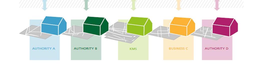
Addresses, administrative units and place names
 Addresses, administrative units and place names Hello! Hello! integration of three Inspire themes for E-government and private sector benefits Hi Hi there! there! Morten Lind, Ministry for Housing Urban
The state-of-the-art of the Finnish SDI. Arctic SDI WG Meeting
 The state-of-the-art of the Finnish SDI Arctic SDI WG Meeting Moscow 8.9.2011 Esa Tiainen Development Centre 1 NATIONAL LAND SURVEY DOWN TO EARTH Contents Legal framework Coordination structure Network
Nordic Address Forum. Cooperation with Municipalities & The Geodata Strategy. Angela Fessé Lantmäteriet Odense, June
 Nordic Address Forum Cooperation with Municipalities & The Geodata Strategy Angela Fessé Lantmäteriet Odense, June 3-4 2010 Why collaborate on national databases? The private market and society have broader
Implementing INSPIRE in Sweden
 Implementing INSPIRE in Sweden Christina Wasström NSDI-unit, Lantmäteriet Christina.wasstrom@lm.se Standards Cooperation Metadata Competence Infrastructure for Geodata Legal Framework Portal Services Geodata
ATLAS OF INSPIRE IMPLEMENTATION. An Inventory of Experiences, Successes And Headaches of European National Mapping Agencies
 ATLAS OF INSPIRE IMPLEMENTATION An Inventory of Experiences, Successes And Headaches of European National Mapping Agencies Walter T. de Vries (Joep Crompvoets, Jantien Stoter, Ingrid Vanden Berghe) 23
Report on the establishment of UN GGIM: Europe Item 14. 4th session of the Committee of Experts on UN-GGIM
 Report on the establishment of UN GGIM: Europe Item 14 1 Why regional European committees of UN GGIM? In the ECOSOC resolution 2011/24 on the UN GGIM: Emphasizes the importance of promoting national, regional
Realizing benefits of Spatial Data Infrastructure A user s perspective from Environment Agency - Abu Dhabi
 Realizing benefits of Spatial Data Infrastructure A user s perspective from Environment Agency - Abu Dhabi Anil Kumar Director, Environment Information Management 26 April 2012 Geospatial World Forum,
INSPIRE implementation in Portugal: the operational approach
 INSPIRE implementation in Portugal: the operational approach REIS, Rui; SANTOS, Ana Sofia; FONSECA, Alexandra; SILVA, Henrique; GOMES, Ana Luisa; FURTADO, Danilo; GEIRINHAS, João rui.reis@igeo.pt AGENDA
Project based approach developing National Spatial Data Infrastructure in Lithuania
 Project based approach developing National Spatial Data Infrastructure in Lithuania National Land Service under the Ministry of Agriculture of The Republic of Lithuania Cadastres & Geodesy Department Director
Danmarks Miljøportal The Danish Natural Environment Portal
 Danmarks Miljøportal The Danish Natural Environment Portal 2 Agenda What s The Danish Natural Environment Portal. Short live demo of Danmarks Arealinformation, with special focus on the inspire layers,
Disaster Management in Mongolia
 The Third UN-GGIM-AP Plenary Meeting Disaster Management in Mongolia ~Coordination among NGIA & Other Related Organizations and Recommendations~ Bali Indonesia 10 November 2014 Khurelshagai Ayurzana, Director
US National Spatial Data Infrastructure A Spatial Framework for Governance and Policy Development to Enable a Location-Based Digital Ecosystem
 GeoPlatform Workshop 7 Dec 2016, Department of the Interior Washington, D.C. US National Spatial Infrastructure A Spatial Framework for Governance and Policy Development to Enable a Location-Based Digital
Country Case Studies Norway- The Norwegian national spatial data infrastructure improve risk management and of disaster resilience
 Country Case Studies Norway- The Norwegian national spatial data infrastructure improve risk management and of disaster resilience Arvid Lillethun Norwegian Mapping Authority Land Mapping Division arvid.lillethun@kartverket.no
Country Report on SDI Activities in Singapore *
 UNITED NATIONS E/CONF.100/CRP.9 ECONOMIC AND SOCIAL COUNCIL Eighteenth United Nations Regional Cartographic Conference for Asia and the Pacific Bangkok, 26-29 October 2009 Item 7(a) of the provisional
The Danish Maritime Spatial Data Infrastructure (MSDI) Geodata of the Sea
 Geodata of the Sea") MSDI/MSP The Danish Maritime Spatial Data Infrastructure (MSDI) Geodata of the Sea Components of an infrastructure: DATA - metadata, datasets FUNCTIONALITY - spatial data services, web services and other
MSDI/MSP The Danish Maritime Spatial Data Infrastructure (MSDI) Geodata of the Sea Components of an infrastructure: DATA - metadata, datasets FUNCTIONALITY - spatial data services, web services and other
Establishing the National Spatial Data Infrastructure (NSDI) for Norway a joint effort by many stakeholders SPATIAL DATA FOR BENEFIT OF THE SOCIETY
 for Norway a joint effort by many stakeholders SPATIAL DATA FOR BENEFIT OF THE SOCIETY") Establishing the National Spatial Data Infrastructure (NSDI) for Norway a joint effort by many stakeholders SPATIAL DATA FOR THE BENEFIT OF SOCIETY OUTLINE Political background Norway digital - The Norwegian
Establishing the National Spatial Data Infrastructure (NSDI) for Norway a joint effort by many stakeholders SPATIAL DATA FOR THE BENEFIT OF SOCIETY OUTLINE Political background Norway digital - The Norwegian
CLICK HERE TO KNOW MORE
 CLICK HERE TO KNOW MORE GeoSpace for Singapore s Whole-of-Government Data Sharing Asia GeoSpatial Forum 17 19 Oct 2011 Lee Kim Haw Singapore Land Authority Introducing Singapore Land Authority Limited
INSPIRE Monitoring and Reporting Implementing Rule Draft v2.1
 INSPIRE Infrastructure for Spatial Information in Europe INSPIRE Monitoring and Reporting Implementing Rule Draft v2.1 Title INSPIRE Monitoring and Reporting Implementing Rule v2.1 Creator DT Monitoring
Challenges and Potentials of Place Based Information Management in Nepal"
 Nineteenth United Nations Regional Cartographic Conference for Asia and the Pacific, Bangkok, Thailand, 29 October 1 November 2012 Challenges and Potentials of Place Based Information Management in Nepal"
The FIG - Questionnaire on NSDI
 The FIG - Questionnaire on NSDI Bernd Teichert University of Applied Sciences Dresden, Germany Contents NSDI - Definition Com. 3 - Brainstorming in Prague Canberra Implications and Conclusions The SDI
Swedish Spatial Data Infrastructure and the National Geodata Strategy
 Submitted to United Nations Committee of Experts on Global Geospatial Information Management Seventh Session New York, August 2017 Country Report of Sweden Swedish Spatial Data Infrastructure and the National
INSPIRE General Introduction & Service Architecture
 INSPIRATION Spatial Data Infrastructure in the Western Balkans INSPIRE General Introduction & Service Architecture 1st National INSPIRATION Workshop Croatia November 21-22, 2012 A multi-countryprojectfunded
EuroSDR (European Spatial Data Research)
") EuroSDR (European Spatial Data Research) ROLLING RESEARCH PLAN 2015-2018 EuroSDR Secretariat Public Governance Institute KU Leuven Parkstraat 45 bus 3609 3000 Leuven Belgium Tel.: +32 16 32 31 80 Fax:
EuroSDR (European Spatial Data Research) ROLLING RESEARCH PLAN 2015-2018 EuroSDR Secretariat Public Governance Institute KU Leuven Parkstraat 45 bus 3609 3000 Leuven Belgium Tel.: +32 16 32 31 80 Fax:
NGO potential as a stakeholder within processes of developing the NSDI
 and 7th Cartography and Geoinformation Conference NGO potential as a stakeholder within processes of developing the NSDI Luka Jovičić, MSc. Industrial Engineering representative market NGO status needs
Spatial Data Infrastructure Concepts and Components. Douglas Nebert U.S. Federal Geographic Data Committee Secretariat
 Spatial Data Infrastructure Concepts and Components Douglas Nebert U.S. Federal Geographic Data Committee Secretariat August 2009 What is a Spatial Data Infrastructure (SDI)? The SDI provides a basis for
The impact of the open geographical data follow up study Agency for Data Supply and Efficiency
 www.pwc.dk The impact of the open geographical data follow up study Agency for Data Supply and Efficiency March 17th 2017 Management summary In recent years, interest in releasing public-sector data has
Concept Formulation of Geospatial Infrastructure. Hidenori FUJIMURA*
 Concept Formulation of Geospatial Infrastructure 1 Concept Formulation of Geospatial Infrastructure Hidenori FUJIMURA* (Published online: 28 December 2016) Abstract Technical trends in the field of surveying
E-Government and SDI in Bavaria, Germany
 135 E-Government and SDI in Bavaria, Germany Wolfgang STOESSEL, Germany Key words: GDI-BY, Bavaria, Spatial Data Infrastructure SUMMARY Spatial Data Infrastructure (SDI) is an important part of the e-government
AMS E-GOS Local governance and performance of open data policies at municipal level
 AMS E-GOS Local governance and performance of open data policies at municipal level Frederika Welle Donker Knowledge Centre Open Data TU Delft f.m.welledonker@tudelft.nl 1 Knowledge Centre Open Data Research
EXPECTATIONS OF TURKISH ENVIRONMENTAL SECTOR FROM INSPIRE
 EXPECTATIONS OF TURKISH ENVIRONMENTAL SECTOR FROM INSPIRE June, 2010 Ahmet ÇİVİ Tuncay DEMİR INSPIRE in the Eyes of MoEF Handling of Geodata by MoEF Benefits Expected TEIEN First Steps for INSPIRE Final
Implementing free basic data for river administration and climate adaption across the public sector using the INSPIRE principle and data model
 Implementing free basic data for river administration and climate adaption across the public sector using the INSPIRE principle and data model The basic data program Partial agreement 3 (PA3) Basic data
Think Local - Act Global a Nordic Perspective
 Think Local - Act Global a Nordic Perspective OGC Nordic Forum Jari Reini 20-21.5.2014 OGC Nordic Forum? OGC Nordic Forum addresses OGC outreach and education needs of government, academic, research and
The Process of Spatial Data Harmonization in Italy. Geom. Paola Ronzino
 The Process of Spatial Data Harmonization in Italy Geom. Paola Ronzino ISSUES Geospatial Information in Europe: lack of data harmonization the lack of data duplication of data CHALLENGES Challenge of INSPIRE:
Biodiversity and Protected Areas Management Project
 Biodiversity and Protected Areas Management Project Technical Advisor ESA region: Selwyn Willoughby Coordinator ESA region: Christine Mentzel FlexiCadastre EMEA Regional User Conference, Cape Town, South
Implementation of INSPIRE Principles: Sardinia Region SDI State of the Art and Further Developments
 REGION OF SARDINIA (ITALY) LOCAL AUTHORITY FOR MUNICIPALITIES, FINANCES AND URBAN PLANNING DEPT. FOR THE REGIONAL SPATIAL DATA INFRASTRUCTURE Implementation of INSPIRE Principles: Sardinia Region SDI State
ICA/EuroSDR NMA workshop Amsterdam 3-4 dec Anders Færch-Jensen Hanne Mortensen Esben Taudorf
 ICA/EuroSDR NMA workshop Amsterdam 3-4 dec. 2015 Anders Færch-Jensen Hanne Mortensen Esben Taudorf Agenda About the Agency Basic data SDI and workflows Current workflow for map production Pick nuse Demo
a national geological survey perspective François ROBIDA BRGM (French Geological Survey)
") a national geological survey perspective François ROBIDA BRGM (French Geological Survey) Pre-Conference Seminar on Socio-Economic Value of Geospatial for National and Regional Development 21 August 2017,
a national geological survey perspective François ROBIDA BRGM (French Geological Survey) Pre-Conference Seminar on Socio-Economic Value of Geospatial for National and Regional Development 21 August 2017,
Evolving Spatial Data Infrastructures (SDIs) and the importance of SDI governance
 and the importance of SDI governance") Evolving Spatial Data Infrastructures (SDIs) and the importance of SDI governance INSPIRE Conference 2017 7-9-2017, Jaap-Willem Sjoukema Who am I? Jaap-Willem Sjoukema Jaap-willem.sjoukema@wur.nl PhD-Candidate
Evolving Spatial Data Infrastructures (SDIs) and the importance of SDI governance INSPIRE Conference 2017 7-9-2017, Jaap-Willem Sjoukema Who am I? Jaap-Willem Sjoukema Jaap-willem.sjoukema@wur.nl PhD-Candidate