Development of NSDI in Moldova with donor funding
|
|
|
- Diana Johnson
- 5 years ago
- Views:
Transcription


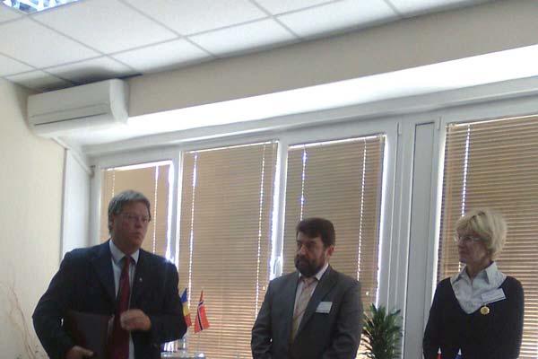
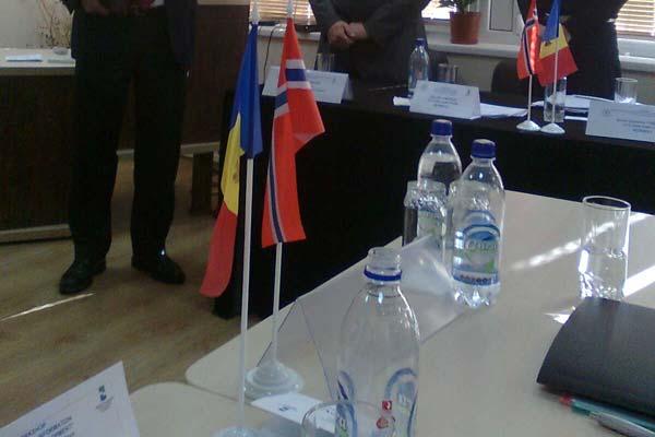
1 Development of NSDI in Moldova with donor funding Maria OVDII, Ph. D Agency for Land Relations and Cadastre of Moldova E mail maria.ovdii@arfc.gov.md JRC WORKSHOP Financing the Evolution of Spatial Data Infrastructures, Barselona, Spaine, 26 October 2016
2 Contents Introduction Development of NSDI in Moldova with donor funding i) EU Twining Project for ALRC Organization, Streamlining and Computerization Process in Mapping in the Republic of Moldova, ii) EU Danube Reference Data and Services Infrastrcture Data Harmonisation Pilot in Moldova iii) Norwegian technical support : Feasibility Study 2007: Development of Orthophoto and Digital Terrain Model 2008: Technical support for efficient use of Orthophoto 2010: Establishment of MoldPOS Net, a continuously operation Reference Stations Network for Moldova 2011: Mapping and Laser Scanning for flood risk area of Moldova/Pilot 2012 today: Development if IT System for Cadastre MoldLIS 2015 today: Aerial photography, production of Digital Terrain Model and Orthophoto for Cadastre 2016: Pilot Project for use of Drones (UAV/UAS) for production of Orthophoto data 2016: Geoportal for NSDI 2016: Digital Maps for NSDI based on Orthophoto 2016 Lessons learned Conclusions
3 Introduction Moldova is now engaged in a far reaching economic reform programme, both in terms of domestic policy and international relations, more particularly with the EU. In line with the Partnership and Cooperation Agreement (PCA) between the Republic of Moldova and the EU, the mapping system appears to be an indispensable tool for implementing and enforcing at least four groups of policy issues: fighting the deterioration of the environment, transport, regional development, and tourism (art. 61, 62, 67 and 69 of the PCA). In line with these provisions, the country has built since 2006 a track record of intense activity to harmonize its laws and regulation with the EU Acquis. Although the Republic of Moldova is not EU member country, the INSPIRE mechanism is considered as an appealing instrument for ensuring cost efficient conditions for the management and dissemination of geographic data nationwide and, potentially, across borders.
4 EU Twining Project Organization, Streamlining and Computerization Process in Mapping in the Republic of Moldova The goal of EU assistance provided through the Twinning Project "Twinning Project for the Agency for Land Relations and Cadastre (ALRC) Organization, Streamlining and Computerization Process in Mapping in the Republic of Moldova" was to accelerate the development of the Information Society services in Moldova. This initiative was in direct relation with the E Governance programme and in this respect European funds in the amount of EUR 1.2 million were provided for ensuring the implementation of the Project Action Plan. The EU Twinning partners are SWEDESURVEY and State Geodetic Administration of the Republic of Croatia.
5 EU Twining Project Organization, Streamlining and Computerization Process in Mapping in the Republic of Moldova The EU Twinning project focused on 4 components: i) Draft Geographic data umbrella law in line with the EU INSPIRE requirements; ii) Demonstration of an effective regional SDI solution with several stakeholders in line with EU best practices; iii) Demonstration of a local SDI solution with several stakeholders in pilot areas in line with EU best practices; iv) Demonstration of Networks services in the field of data sharing under the responsibility of ALRC. The implementation of this project has contributed to achieve an improved mapping system in line with EU standards and best international practices of management of geographical data.

6 EU Danube Reference Data and Services Infrastructure (DRDSI) Data Harmonisation Pilot in Moldova The Data Harmonization Pilot in Moldova aims access to data sources for the benefits of Danube Reference Data and Service Infrastructure and cross border countries as Ukraine in the scope of EU Strategy of Danube Region. After the evaluation of the data, it was selected the folloowing data sets as: Administrative units Hydrography Transport networks Land cover Soil Land use Vegetation Cadastre data Population In frame of the Pilot project was developed Metadata for discovery and use of data in compliance with the INSPIRE Directive. The resulting metadata repository will be accessible using View and Download services compliant with the INSPIRE Directive on DRDSI platform
7 Norwegian technical support In February 2006 the Government of Moldova throw Agency for Land Relations and Cadastre (ALRC) has approached the Norwegian Ministry of Foreign Affairs (NMFA) with a project proposal and application for financial support of Orthophoto Production in Moldova. Considering the application, NMFA has requested Norwegian Mapping Authority Kartverket (SK) to make its technical assessment. Towards the end of 2006, a partnership between the two organizations SK and ALRC was established with strategic goals. One major goal of this cooperation is to support Moldova with basic geographic information urgently needed to solve problems connected to property registration, security of tenure, land conflicts resolution, decision making at all levels, etc. Several components of the NSDI are in place as Orthophoto, Digital Terrain Model, Line Maps, MoldPos GNSS Net, IT in Cadastre MoldLis (in development).
8 2006: Feasibility Study In June 2006, a delegation from Kartverket (Norwegian Mapping Authority) visited ALRC of Moldova. The facts finding mission was carried out on by Helge Onsrud and Elena Busch, became the nucleus of cooperation between SK and ALRC. The main conclusion of the Feasibility Study was that the Republic of Moldova necessitates the basic geographic information Orthophoto and updated Topographic Digital Maps, and reliable cadastral information updated property maps. The collaboration was supported in different ways; one was through S.E. Cadastru, S.E. INGEOCAD, S.E. IPOT and S.E. PSIF. Numerous changes occurred as the partnership matured over the years. The results transferred this partnership into a model of excellence in terms of public cooperation.

9 2007: Development of Orthophoto and Digital Terrain Model Project Partners and Contractors Norway: Norwegian Ministry of Foreign Affairs Norwegian Mapping Authority Statens kartverk Moldova: Agency for Land Relations and Cadastre of Moldova State Institute INGEOCAD State Enterprise CADASTRU State Institute for Land Use and Territory Planning IPOT Association for Soil Protection Contractors: BlomInfo A/S, Denmark aerial photography, orthophoto and DTM production Norconsult, Norway consulting, knowledge transfer and hosting study visits Project Mapping and Management, Norway consulting, preparation of technical specifications Asplan Viak Internet AS, Norway technical solution for external and internal use of orthophoto data, orthophoto web portal Master Systems SRL, Moldova equipment and software DAAC System Integrator SRL, Moldova equipment and software


10 2007: Development of Orthophoto and Digital Terrain Model Delivered in kind to ALRC: Orthophoto 40 cm km 2 the whole of Moldova Orthophoto 20 cm km 2 45 settlements Digital Terrain Model for the whole country and 45 settlements Equipment and software for efficient use of the data Study visits to Norway: For top managers March 2007 Training on the quality control execution May 2007 Representatives of ALRC s institutes October 2008 Workshop in Chisinau on the delivery of orthophoto June 2008


11 2008: Technical support for efficient use of Orthophoto

12 2008: Closing Workshop

13 2009: Pilot Project Line Maps for development The scoop of the project is to provide access to reliable and up to date line maps for governmental institutions at all levels, professional users in private sector, and for the public in general. Component 1: Preparing line maps for parts of the Moldavian territory along with establishing capacity at ARLC for subsequent full coverage of the entire territory of Moldova, as well as establishing capacity for quality control of produced maps. Component 2: Establishment of a system for cost effective utilisation of satellite based (GPS) surveying for ownership registration and other field activities
14 2009: Pilot Project Line Maps for development Component 1: Preparing line maps for parts of the Moldavian territory along with establishing capacity at ARLC for subsequent full coverage of the entire territory of Moldova, as well as establishing capacity for quality control of produced maps. The main objectives of the Pilot: Development of standards and specifications determining the requirements to content and accuracy of maps, being needed for contracting production to private sector as well as for in house production; Development of procedures and methods for quality control of maps produced; On the job training and test production of line maps at the Agency's institute of geodesy "INGEOCAD", for a pilot area of about 10% 500 sq. km., of the planned project area, to build in house capacity for map production and for checking standards and quality control routines before the larger production is outsourced to private sector; line map production 20 % territory.

 via aerial laser scanning for")


15 2011: Line Maps for risk areas of Moldova Taking care of the recent floods in 2010, ALRC has asked Norway for modification of the Project in order to create elevation model (10 cm accuracy) via aerial laser scanning for flooded territories. The main components: Aerial photography for 20% of the territory Laser scanning Digital Terrain Model Vector line mapping Area overview including planed flight lines Coverage of the area with laser scanning and processed DTM

 S.E.")

16 Quality Control of the Orthophoto Projects and Line Maps was done simultaneous by i) S.E. INGEOCD/Moldova and SK/Norway Quality Control


17 2009: MoldPOS net General layout of the MoldPOS Network The Control Centre is operated by S.E. INGEOCAD Architecture of the MoldPOS Network

18 Final Workshop: MoldPOS net
, Legal Data regarding rights and facts registered at cadastre, maintenance records for related Persons (physical and legal) and Real Estate")
19 2012 today: Development of IT System in Cadastre MoldLIS The System covers the following cadastre Registers: Physical Objects (a map data of cadastre), Legal Data regarding rights and facts registered at cadastre, maintenance records for related Persons (physical and legal) and Real Estate Evaluation.
20 2015 today: Orthophoto for Real Estate Cadastre The project goal is to prepare up to date photomaps for the entire territory of Moldova, to support efficient, secure and transparent real estate registration and to provide access to geographic information throughout Moldova. The main objectives of the Project: Aerial photography with Ground sampling Distance (GDS) of 20 cm for territory of Moldova resulting resulting in oriented images ca sq.km, Production of Digital Terrain Model and contour lines for ca sq.km, Production of Orthophoto for ca sq.km
21 2015 today: Orthophoto for Real Estate Cadastre Project Partners and Contractors Norway: Norwegian Ministry of Foreign Affairs Norwegian Mapping Authority Kartverket Moldova: Agency for Land Relations and Cadastre State Institute INGEOCAD/Qualyty Control Contractors: SC Primul Meridian S.R.L/Romania The Project it is in progress.
22 2015: Real Estate Registration System for Moldova Maps The Norwegian Ministry of Foreign Affairs, on behalf of the Norwegian Government, has an 16 June 2015 allocated a grant of up to NOK towards the Project: Real Estate Registration System for Moldova Maps, that shall be implemented during the planned period from June 2015 to June The Project goal is to prepare a new nationwide electronic map to facilitate good governance and economic growth. The Project consists of three main activities: Activity 1: Technical assistance from SK to provide project supervision and preparation of technical specifications for procurement and quality control in the deliveries. Activity 2: Verification and upgrading of technical specifications and database model for maps. Activity 3: Production of maps in scale 1: 2000 for urban areas (up to 1000 sq.km) and 1:5000 for rural areas (up to sq.km).
23 2016: Pilot Project for use of Drones (UAV/UAS for production of Orthophoto Scoop of the works: Aerial photography and Orthophoto production of three selected areas, On the job training of the professional staff at ALRCS.E. INGEOCAD, Technical advisory of ALRC/S.E. INGEOCAD on planning, data acquisition, data processing and quality control Compilation of the Project completion report with recommendations to ALRC/S.E. INGEOCAD on use of different types of UAV/UAS for various photogrammetric and mapping application.

24 Next step 2016: National Geoportal The results of the Moldova Orthophoto Projects in the frame of Norwegian technical support supposed to be share to a National Geoportal of the Republic of Moldova. Since at the present there is no such a Geoportal, in accordance with the principles of INSPIRE Directive 2007/2, the Agency for Land Relations and Cadastre has asked the Norwegian Government to support it. One of the main purposes of the Project is to support the Republic of Moldova in establishment of National Spatial Data Infrastructure in accordance with the principles of the EU INSPIRE Directive 2007/2. A study of current stay of play in R. Moldova has been done. The ToR for National Geoportal was developed and discussed in frame of ALRC WG. The project it is in progress.
25 Lessons learned Lessons learned The establishment and maintenance of NSDI is an important early step in supporting data sharing. Through the EU Twinning project for the Agency for Land Relations and Cadastre Organization, Streamling and Computerization Process in Mapping in the Republic of Moldova the ALRC initiated the further development of the NSDI of Moldova together with its Twinning partner SWEDESURVEY and State Geodetic Administration of the Republic of Croatia. Way forward Put in place Umbrella Law and Strategy and Implementation plan for the NSDI. Demonstrate of an effective regional SDI solution with several stakeholders in line with EU best practices. Demonstrate of an effective local SDI solution with several stakeholders in line with EU best practices. Demonstrate of Networks services in the field of data sharing under the responsibility of ALRC.
26 Lessons learned Lessons learned The EU and Norway technical assistance as EU Twinning Project DRDSI Data Harmonization Pilot Orthophoto project Digital Terrain Model Line Maps MoldPos GNSS Net IT in Cadastre MoldLis Geoportal are the indispensable part of National Spatial Data Infrastructure of Moldova Way forward The National Geoportal is a key element for sharing the data and provides the ability to search, view and download spatial data from different sources. It is necessary to develop data pricing policy and use of data in public and private sector.
27 Public geospatial data Lessons learned The existing registers and databases are dispersed, being held by different institutions, while data exchange is limited. Databases are different formats, and there is no interoperability between them. Data are not available to the public; only some aggregated data are posted on the websites of the institutions that conduct the monitoring. Some databases exist only on hard copies. Lack of data exchange system. Lack of trained staff in data exchange in all monitored fields. Way forward Strengthen the capacities of the Agency for Land Relations and Cadastre. ALRC should be encouraged to facilitate discussions between public authorities regarding the data collection process. Identify experts responsible for data collection and data transfer in the established format. Install the software necessary for data exchange. Legalize the use of software. Train the experts responsible for data transfer in using the software. Develop the integrated SDI monitoring.

28 Standards Lessons learned Compliance with data development standards is critical. Training in the use and application of standards is critical. Way forward Greater effort needs to be placed on the development of standards for data themes and framework layers. Provide greater access to data development standards training using all available partnerships.
29 Cooperation Lessons learned Partnership between central, local, academia and private sectors are critical to ensure the success of NSDI Way forward Ensure all data is compliant and interoperable. Clearly define the role of private sector participants an future partnership. The Agency for Land Relations and Cadastre will be able to act as the national body to co ordinate the supply of data and services from public bodies to Community institutions and bodies. The Agency for Land Relations and Cadastre will be able to: make agreements on behalf of the public authorities manage access on behalf of the public authorities deliver data and services on behalf of the public authorities.
30 Conclusions Even National Spatial Data Infrastructure does not exist in the Republic of Moldova at this moment, some components, can be found, and some other does not exist at all. One of the tools that ensure e Government openness is the open data portal where all government institutions, constantly post data sets. Currently status of cooperation between institutions regarding sharing the spatial data is usually defined through bilateral agreements. There are around 20 potential stakeholder organisations that have ability and established cooperation in sharing the data. Stakeholders using Agency for Land Relations and Cadastre s geoportal S.E. INGEOCAD portal map.md and S.E. Cadastre portal
31 Conclusions The EU Twinning Project, DRDSI Pilot Project and the Projects in frame of Norwegian technical support demonstrate the importance and utility of geospatial data for community decision making and highlighted the importance of Mapping and Cadastre Authority role in ensuring coordination and guaranteeing access to data. Participating communities as public authorities, state enterprises, privat sector and academia recognized significant benefits of the application of geospatial data and information and the integration of this information with the other relevant data. Moldova NSDI has to be harmonized with the development of spatial data infrastructures on the European (INSPIRE) and global (GSDI, UN GGIM) levels.
32 Conclusions The EU Twinning Project, DRDSI Data Harmonization Pilot and Norwegian technical assistance has been implemented in partnership, with strong participation of the Moldavian partner. The Agency for Land Relations and Cadastre recognise and highly appreciate the technical assistance and knowledge transfer provided by EU and Norwegian Mapping and Cadastre Authority Kartverket, professional competence, experiences and good practices. The experiences and challenges encountered by DRDSI Team, Sweden, Croatian, Norway Mapping and Cadastre Authorities and Agency for Land Relations and Cadastre of Moldova in establishing their partnership can serve as an example and guide for other public authorities in developed EU countries as Sweden, Norway, Croatia and countries in development as Moldova.
33 Thank you for your attention
Demonstration of a local SDI solution with several stakeholders in pilot areas in line with EU best practices
 EU Twinning project for the Agency of Land Relations and Cadaster (ALRC)- Organization, Streamlining and Computerization Process in Mapping in the Republic of Moldova. Demonstration of a local SDI solution
Evolution and development of National Spatial Data Infrastructure in Republic of Moldova
 Agency for Land Relations and Cadastre of the Republic of Moldova Evolution and development of National Spatial Data Infrastructure in Republic of Moldova Alexandru Morcov Deputy general director ALRC
Status of spatial information in the Republic of Moldova
 AGENCY FOR LAND RELATIONS AND CADASTRE OF MOLDOVA Status of spatial information in the Republic of Moldova Vasile GRAMA, Maria OVDII, Agency for Land Relations and Cadastre ovdii@agency.cadastre.md CONTENTS
SDI Development in Georgia. Mari Khardziani Head of International Relations Unit National Agency of Public Registry
 SDI Development in Georgia Mari Khardziani Head of International Relations Unit National Agency of Public Registry Kehl, Germany September 5, 2017 2 National Agency of Public Registry Legal Entity of Public
The Swedish National Geodata Strategy and the Geodata Project
 The Swedish National Geodata Strategy and the Geodata Project Ewa Rannestig, Head of NSDI Co-ordination Unit, Lantmäteriet, ewa.rannstig@lm.se Ulf Sandgren, Project Manager Geodata Project, Lantmäteriet,
Establishing the National Spatial Data Infrastructure (NSDI) for Norway a joint effort by many stakeholders SPATIAL DATA FOR BENEFIT OF THE SOCIETY
 for Norway a joint effort by many stakeholders SPATIAL DATA FOR BENEFIT OF THE SOCIETY") Establishing the National Spatial Data Infrastructure (NSDI) for Norway a joint effort by many stakeholders SPATIAL DATA FOR THE BENEFIT OF SOCIETY OUTLINE Political background Norway digital - The Norwegian
Establishing the National Spatial Data Infrastructure (NSDI) for Norway a joint effort by many stakeholders SPATIAL DATA FOR THE BENEFIT OF SOCIETY OUTLINE Political background Norway digital - The Norwegian
INSPIRE - A Legal framework for environmental and land administration data in Europe
 INSPIRE - A Legal framework for environmental and land administration data in Europe Dr. Markus Seifert Bavarian Administration for Surveying and Cadastre Head of the SDI Office Bavaria Delegate of Germany
GIS Building Communities beyond National Borders (Building Successful Spatial Data Infrastructures) Nick Land, ESRI Europe
 Nick Land, ESRI Europe") GIS Building Communities beyond National Borders (Building Successful Spatial Data Infrastructures) Nick Land, ESRI Europe UK worst flooding in the last 60 years 350,000 households without drinking water
GIS Building Communities beyond National Borders (Building Successful Spatial Data Infrastructures) Nick Land, ESRI Europe UK worst flooding in the last 60 years 350,000 households without drinking water
SWEDISH SDI DEVELOPMENT & IMPLEMENTATION OF INSPIRE
 SWEDISH SDI DEVELOPMENT & IMPLEMENTATION OF INSPIRE Christina Wasström, Lantmäteriet, 801 82 Gävle, Sweden, christina.wasstrom@lm.se ABSTRACT The Swedish Government and Parliament has given Lantmäteriet
INSPIRE Basics. Vlado Cetl European Commission Joint Research Centre. https://ec.europa.eu/jrc/
 INSPIRE Basics Vlado Cetl European Commission Joint Research Centre https://ec.europa.eu/jrc/ Serving society Stimulating innovation Supporting legislation Outline SDI? Why European SDI? INSPIRE Policy
EUREF National Report of the Republic of Moldova
 EUREF 2011 National Report of the Republic of Moldova Dr. Ing. Maria OVDII, Ing. Alexandr CEBANU, Ing. Ion EREMIA EUREF 2011, Chisinau, Moldova, May 25-28 28 CONTENTS Geodetic Datum in the Republic of
Proposal for a DIRECTIVE OF THE EUROPEAN PARLIAMENT AND OF THE COUNCIL. establishing an infrastructure for spatial information in the Community
 Proposal for a DIRECTIVE OF THE EUROPEAN PARLIAMENT AND OF THE COUNCIL establishing an infrastructure for spatial information in the Community INSPIRE http://inspire.jrc.it/ Alessandro Annoni 1 EU Commission
Status of implementation of the INSPIRE Directive 2016 Country Fiches. COUNTRY FICHE Croatia
 Status of implementation of the INSPIRE Directive 2016 Country Fiches COUNTRY FICHE Croatia Introduction... 1 1. State of Play... 2 1.1 Coordination... 2 1.2 Functioning and coordination of the infrastructure...
National Spatial Data Infrastructure International workshop 9 th June, 2015 Terelj Hotel, Mongolia
 1 st session: NSDI policy, planning and the legal framework Formation of NSDI policy and legal framework in Mongolia Khurelshagai Ayurzana, Director General, Administration of Land Affairs, Geodesy and
Disaster Management in Mongolia
 The Third UN-GGIM-AP Plenary Meeting Disaster Management in Mongolia ~Coordination among NGIA & Other Related Organizations and Recommendations~ Bali Indonesia 10 November 2014 Khurelshagai Ayurzana, Director
QUALITY CONTROL ROLE IN PROCESS OF ESTABLISHMENT OF NSDI
 QUALITY CONTROL ROLE IN PROCESS OF ESTABLISHMENT OF NSDI S. Lemajić a,lj. Rašić b a Croatian Geodetic Institute, Savska 41/XVI, Zagreb, Croatia slavko.lemajic@cgi.hr b State Geodetic Administration, Lastovska
UN GGIM and National SDI Strategy
 MSDI Open Forum on 26 th January 2016 Contributing to the successful delivery of MSDI UN GGIM and National SDI Strategy Hiroshi Murakami Deputy Administrator Geospatial Information Authority of Japan Geospatial
GEOMATICS. Shaping our world. A company of
 GEOMATICS Shaping our world A company of OUR EXPERTISE Geomatics Geomatics plays a mayor role in hydropower, land and water resources, urban development, transport & mobility, renewable energy, and infrastructure
NATIONAL SPATIAL DATA INFRASTRUCTURE IN REPUBLIC OF MOLDOVA
 I. Danii, V. Mocreac, M. Ovdii, P. Ivancenco, D. Cotovici National Spatial Data Infrastructure in Republic of Moldova NATIONAL SPATIAL DATA INFRASTRUCTURE IN REPUBLIC OF MOLDOVA Ivan DANII, Agency for
Global Geospatial Information Management Country Report Finland. Submitted by Director General Jarmo Ratia, National Land Survey
 Global Geospatial Information Management Country Report Finland Submitted by Director General Jarmo Ratia, National Land Survey Global Geospatial Information Management Country Report Finland Background
Land Board, NW Services and SDI Tambet Tiits, FRICS
 Land Board, NW Services and SDI Tambet Tiits, FRICS 07.09.2016 200th anniversary of the Struve Geodetic Arc Friedrich Georg Wilhelm Struve and Carl Friedrich Tenner Struve Geodetic Arc The Struve Geodetic
2018/1 The integration of statistical and geospatial information. The Regional Committee of UN-GGIM: Americas:
 The following are the conclusions and recommendations of the Regional Committee of the United Nations on Global Geospatial Information Management for the Americas, during its Fifth Session, Thursday 8
Adding value to Copernicus services with member states reference data
 www.eurogeographics.org Adding value to Copernicus services with member states reference data Neil Sutherland neil.sutherland@os.uk GIS in the EU 10 November 2016 Copyright 2016 EuroGeographics 61 member
Ministry of ICT of I.R.IRAN
 The ECO 8/6 mill km 2 10 Slamic countries ~330 mill people Oil, Gas, Industries,Tourism 2 Issue transformation in last decade Problem solving needs more integrated approach More interaction &complexity
Status of implementation of the INSPIRE Directive 2016 Country Fiches. COUNTRY FICHE Czech Republic
 Status of implementation of the INSPIRE Directive 2016 Country Fiches COUNTRY FICHE Czech Republic Introduction... 1 1. State of Play... 2 1.1 Coordination... 2 1.2 Functioning and coordination of the
INSPIRE in Sweden - an Important Part of the National Geodata Strategy
 INSPIRE in Sweden - an Important Part of the National Geodata Strategy Ewa RANNESTIG and Monica LAGERQVIST NILSSON, Sweden Key words: National Geodata Strategy, National Infrastructure for Spatial Information,
Status of implementation of the INSPIRE Directive 2016 Country Fiches. COUNTRY FICHE Malta
 Status of implementation of the INSPIRE Directive 2016 Country Fiches COUNTRY FICHE Malta Introduction... 1 1. State of Play... 2 1.1 Coordination... 2 1.2 Functioning and coordination of the infrastructure...
A donor partner view. Olaf Magnus Østensen. 'Modernization of spatial data infrastructure to reduce risks and impacts of floods'
 A donor partner view Olaf Magnus Østensen 'Modernization of spatial data infrastructure to reduce risks and impacts of floods' About the EEA Grants programme http://eeagrants.org/ Beneficiary country Donor
a national geological survey perspective François ROBIDA BRGM (French Geological Survey)
") a national geological survey perspective François ROBIDA BRGM (French Geological Survey) Pre-Conference Seminar on Socio-Economic Value of Geospatial for National and Regional Development 21 August 2017,
a national geological survey perspective François ROBIDA BRGM (French Geological Survey) Pre-Conference Seminar on Socio-Economic Value of Geospatial for National and Regional Development 21 August 2017,
Brazil Paper for the. Second Preparatory Meeting of the Proposed United Nations Committee of Experts on Global Geographic Information Management
 Brazil Paper for the Second Preparatory Meeting of the Proposed United Nations Committee of Experts on Global Geographic Information Management on Data Integration Introduction The quick development of
GEOVEKST A Norwegian Program for Cost Sharing in Production, Updating and Administration of Geographic Data
 GEOVEKST A Norwegian Program for Cost Sharing in Production, Updating and Administration of Dr. Anne Kirsten S. HØSTMARK, Norway Key words: Mapping in large scale, formal co-operation, cost sharing, standarised
INSPIREd solutions for Air Quality problems Alexander Kotsev
 INSPIREd solutions for Air Quality problems Alexander Kotsev www.jrc.ec.europa.eu Serving society Stimulating innovation Supporting legislation The European data puzzle The European data puzzle 24 official
Economic and Social Council
 United Nations Economic and Social Council Distr.: General 18 July 2016 Original: English Committee of Experts on Global Geospatial Information Management Sixth session New York, 3-5 August 2016 Item 2
US National Spatial Data Infrastructure A Spatial Framework for Governance and Policy Development to Enable a Location-Based Digital Ecosystem
 GeoPlatform Workshop 7 Dec 2016, Department of the Interior Washington, D.C. US National Spatial Infrastructure A Spatial Framework for Governance and Policy Development to Enable a Location-Based Digital
GIS Geographical Information Systems. GIS Management
 GIS Geographical Information Systems GIS Management Difficulties on establishing a GIS Funding GIS Determining Project Standards Data Gathering Map Development Recruiting GIS Professionals Educating Staff
SDI in Lombardia (Italy(
 SDI in Lombardia (Italy( Italy) Andrea Piccin European SDI Best Practice Awards 2009 - Learning from Best Practices Turin, 26th and 27th November 2009 Lombardia, in Italy, is 4 th Region for territorial
INSPIRATION results and benefits for the Agency for Real Estate Cadastre
 JOINT RESEARCH CENTER - E&I WORKSHOP INSPIRATION results and benefits for the Agency for Real Estate Cadastre Sonja Dimova, state advisor AGENCY FOR REAL ESTATE CADASTRE REPUBLIC OF MACEDONIA Wednesday,
INSPIRing Geospatial Framework For Local Administrations
 This project is financed by the European Union and the Republic of Turkey Presented at the FIG Congress 2018, May 6-11, 2018 in Istanbul, Turkey National Programme for Turkey 2010 Instrument for Pre-Accession
Land Use in the context of sustainable, smart and inclusive growth
 Land Use in the context of sustainable, smart and inclusive growth François Salgé Ministry of sustainable development France facilitator EUROGI vice president AFIGéO board member 1 Introduction e-content+
Norwegian spatial data infrastructure supporting disaster risk management Norwegian Mapping Authority
 Norwegian spatial data infrastructure supporting disaster risk management Norwegian Mapping Authority Arvid Lillethun, Norwegian Mapping Authority Land and Poverty 2018 Conference, World Bank 19.-23. March
Report on the establishment of UN GGIM: Europe Item 14. 4th session of the Committee of Experts on UN-GGIM
 Report on the establishment of UN GGIM: Europe Item 14 1 Why regional European committees of UN GGIM? In the ECOSOC resolution 2011/24 on the UN GGIM: Emphasizes the importance of promoting national, regional
Background Document: Report of the Regional Committee of United Nations Global Geospatial Information Management for Asia and the Pacific
 Background Document: Report of the Regional Committee of United Nations Global Geospatial Information Management for Asia and the Pacific 1. Summary 1. This report highlights the activities carried out
Status of implementation of the INSPIRE Directive 2016 Country Fiches. COUNTRY FICHE Estonia
 Status of implementation of the INSPIRE Directive 2016 Country Fiches COUNTRY FICHE Estonia Introduction... 1 1. State of Play... 2 1.1 Coordination... 2 1.2 Functioning and coordination of the infrastructure...
NSDI as a tool for Secure land tenure
 NSDI as a tool for Secure land tenure General Overview To look at the progress in SDI development and its application in policy formulation and impact on land tenure. INTEGRATION OF INFORMATION POLICIES
PART A Project summary
 PART A Project summary A.1 Project identification Project title Project acronym Name of the lead partner organisation in English Specific objective Demonstrattion AF DAF Partner 1.1. Improving innovation
Infrastructure for Spatial Information in Europe (INSPIRE)
") Infrastructure for Spatial Information in Europe (INSPIRE) 2011 GISCO Working Party 8-9.3.2012 INSPIRE is about improving access to spatial information: the environment doesn t stop at borders EU Geoportal
Infrastructure for Spatial Information in Europe (INSPIRE) 2011 GISCO Working Party 8-9.3.2012 INSPIRE is about improving access to spatial information: the environment doesn t stop at borders EU Geoportal
Challenges and Potentials of Place Based Information Management in Nepal"
 Nineteenth United Nations Regional Cartographic Conference for Asia and the Pacific, Bangkok, Thailand, 29 October 1 November 2012 Challenges and Potentials of Place Based Information Management in Nepal"
QUESTIONNAIRE THE CURRENT STATUS OF MAPPING IN THE WORLD
 QUESTIONNAIRE ON THE CURRENT STATUS OF MAPPING IN THE WORLD The questionnaire is intended to take stock of the current status of mapping in the world. The information collected will eventually be used
INSPIRE Directive. Status June 2007
 INSPIRE Directive INfrastructure for SPatial InfoRmation in Europe Status June 2007 European Commission Directorate-General Environment Research, Science and Innovation Unit Rue de la Loi, 200 1049 Brussels
Arctic Spatial Data Infrastructure Enabling Access to Arctic Location-Based Information
 Arctic Spatial Data Infrastructure Enabling Access to Arctic Location-Based Information Arctic SDI Side Event Co-Chairs: Arvo Kokkonen Arctic SDI Board Chair & Director General, National Land Survey of
Technical Framework Methodology as a core of building up the NSDI NSDI Implementation Specifics in Serbia
 Technical Framework Methodology as a core of building up the NSDI NSDI Implementation Specifics in Serbia Luka Jovičić SDI Consultant@ Gramont Ltd. Aleksandar Dedić RGA NSDI department Dragica Pajić RGA
Plan4all (econtentplus project)
") Plan4all (econtentplus project) Karel CHARVAT 1, Tomáš MILDORF 2 1 Help service remote sensing, Ltd., Černoleská 1600, 256 01 Benešov u Prahy, Czech Republic charvat@bnhelp.cz 2 Department of Mathematics
Plan4all (econtentplus project) Karel CHARVAT 1, Tomáš MILDORF 2 1 Help service remote sensing, Ltd., Černoleská 1600, 256 01 Benešov u Prahy, Czech Republic charvat@bnhelp.cz 2 Department of Mathematics
INSPIRE Monitoring and Reporting Implementing Rule Draft v2.1
 INSPIRE Infrastructure for Spatial Information in Europe INSPIRE Monitoring and Reporting Implementing Rule Draft v2.1 Title INSPIRE Monitoring and Reporting Implementing Rule v2.1 Creator DT Monitoring
Major Opportunities in Spatial Data Infrastructure Communities
 Major Opportunities in Spatial Data Infrastructure Communities Bas Kok President GSDI June 17 th 2008 FIG Working Week: Integrating Generations 14-19 June 2008 Stockholm, Sweden http://www.gsdi.org 1 GSDI
Implementation of Inspire in Denmark - How we get it flying! Olav Eggers National Survey & Cadastre -Denmark
 Implementation of Inspire in Denmark - How we get it flying! Olav Eggers oe@kms.dk National Survey & Cadastre -Denmark Introduction Overview Infrastructure for Spatial Information Act National Survey and
Status of implementation of the INSPIRE Directive 2016 Country Fiches. COUNTRY FICHE Netherlands
 Status of implementation of the INSPIRE Directive 2016 Country Fiches COUNTRY FICHE Netherlands Introduction... 1 1. State of Play... 2 1.1 Coordination... 2 1.2 Functioning and coordination of the infrastructure...
ESBN. Working Group on INSPIRE
 ESBN Working Group on INSPIRE by Marc Van Liedekerke, Endre Dobos and Paul Smits behalf of the WG members WG participants Marc Van Liedekerke Panos Panagos Borut Vrščaj Ivana Kovacikova Erik Obersteiner
Upgrade the Datasets in NSDI for Smarter Services with the Cases of China
 Upgrade the Datasets in NSDI for Smarter Services with the Cases of China By Dr. JIANG Jie Dept of GeoInformaiton Service Platform National Geomatics Center of China October 7, 2015 Jeju, Republic of Korea
Sustainable and Harmonised Development for Smart Cities The Role of Geospatial Reference Data. Peter Creuzer
 Sustainable and Harmonised Development for Smart Cities The Role of Geospatial Reference Data Peter Creuzer 1. Introduction - Smart Cities and Geodata 2. Geodata in Germany 3. Examples 4. Data and Service
Project based approach developing National Spatial Data Infrastructure in Lithuania
 Project based approach developing National Spatial Data Infrastructure in Lithuania National Land Service under the Ministry of Agriculture of The Republic of Lithuania Cadastres & Geodesy Department Director
Country Report On Sdi Activities In Singapore ( )
") UNITED NATIONS E/CONF.102/IP.4 ECONOMIC AND SOCIAL COUNCIL Nineteenth United Nations Regional Cartographic Conference for Asia and the Pacific Bangkok, 29 October 1 November 2012 Item 6(b) of the provisional
UNITED NATIONS E/CONF.102/IP.4 ECONOMIC AND SOCIAL COUNCIL Nineteenth United Nations Regional Cartographic Conference for Asia and the Pacific Bangkok, 29 October 1 November 2012 Item 6(b) of the provisional
RETA 6422: Mainstreaming Environment for Poverty Reduction Category 2 Subproject
 RETA 6422: Mainstreaming Environment for Poverty Reduction Category 2 Subproject A. Basic Data 1. Subproject Title: Poverty-Environment Mapping to Support Decision Making 2. Country Director: Adrian Ruthenberg
The state-of-the-art of the Finnish SDI. Arctic SDI WG Meeting
 The state-of-the-art of the Finnish SDI Arctic SDI WG Meeting Moscow 8.9.2011 Esa Tiainen Development Centre 1 NATIONAL LAND SURVEY DOWN TO EARTH Contents Legal framework Coordination structure Network
Non-Governmental Organizations for Spatial Data Infrastructure. Environmental Democracy Case
 Non-Governmental Organizations for Spatial Data Infrastructure Environmental Democracy Case L.Jovičić, S.Vrečar, V.Cetl, K.Ristovski GSDI Small Grant Program Award 2011-2012 Non-Governmental Organisations
THE ROLE OF GEOSPATIAL AT THE WORLD BANK
 THE ROLE OF GEOSPATIAL AT THE WORLD BANK INSPIRE Conference Barcelona, Spain September 26, 2016 Kathrine Kelm Senior Land Administration Specialist Global Land and Geospatial Unit The World Bank Group
INSPIRATION RESULTS AND BENEFITS ALBANIA
 INSPIRATION RESULTS AND BENEFITS ALBANIA By Eng. Besnik Çomo Paper prepared for E&I Workshop: Support to INSPIRE Implementation in enlargement and EWP Countries JRC ISPRA Central Office of Immovable Property
Country Report on SDI Activities in Singapore *
 UNITED NATIONS E/CONF.100/CRP.9 ECONOMIC AND SOCIAL COUNCIL Eighteenth United Nations Regional Cartographic Conference for Asia and the Pacific Bangkok, 26-29 October 2009 Item 7(a) of the provisional
The Process of Spatial Data Harmonization in Italy. Geom. Paola Ronzino
 The Process of Spatial Data Harmonization in Italy Geom. Paola Ronzino ISSUES Geospatial Information in Europe: lack of data harmonization the lack of data duplication of data CHALLENGES Challenge of INSPIRE:
The National Spatial Data Infrastructure of Zambia Shlomi SIVAN, Israel. Key words: National Land Audit, GIS, LIS, Common Spatial Data
 The National Spatial Data Infrastructure of Zambia Shlomi SIVAN, Israel Key words: National Land Audit, GIS, LIS, Common Spatial Data SUMMARY One of Zambia's important challenges is to recognize the title
Oman NSDI Business Values and Future Directions. Hassan Alawi Alghazali Acting Director General National Spatial Data Infrastructure
 Oman NSDI Business Values and Future Directions Hassan Alawi Alghazali Acting Director General National Spatial Data Infrastructure Presentation Outline Geospatial Maturity Current Challenges NCSI s Role
Spatial Data Infrastructure Concepts and Components. Douglas Nebert U.S. Federal Geographic Data Committee Secretariat
 Spatial Data Infrastructure Concepts and Components Douglas Nebert U.S. Federal Geographic Data Committee Secretariat August 2009 What is a Spatial Data Infrastructure (SDI)? The SDI provides a basis for
Realizing benefits of Spatial Data Infrastructure A user s perspective from Environment Agency - Abu Dhabi
 Realizing benefits of Spatial Data Infrastructure A user s perspective from Environment Agency - Abu Dhabi Anil Kumar Director, Environment Information Management 26 April 2012 Geospatial World Forum,
Status of implementation of the INSPIRE Directive 2016 Country Fiches. COUNTRY FICHE Portugal
 Status of implementation of the INSPIRE Directive 2016 Country Fiches COUNTRY FICHE Portugal Introduction... 1 1. State of Play... 2 1.1 Coordination... 2 1.2 Functioning and coordination of the infrastructure...
Faatasi Malologa (PGSC Chair) Director Department of Lands & Survey, Tuvalu
 Director Department of Lands & Survey, Tuvalu") Seventh Session of the United Nations Committee of Experts on Global Geospatial Information Management (UN-GGIM) - 31 July -4 August 2017 Faatasi Malologa (PGSC Chair) Director Department of Lands & Survey,
Seventh Session of the United Nations Committee of Experts on Global Geospatial Information Management (UN-GGIM) - 31 July -4 August 2017 Faatasi Malologa (PGSC Chair) Director Department of Lands & Survey,
Economic and Social Council
 United Nations Economic and Social Council Distr.: General 2 July 2012 E/C.20/2012/10/Add.1 Original: English Committee of Experts on Global Geospatial Information Management Second session New York, 13-15
Spatially enabling e-government through geo-services
 Spatially enabling e-government through geo-services Mauro Salvemini EUROGI PRESIDENT Professor at Sapienza Università di Roma (IT) 1 About the presentation Few information about Eurogi ; Some essential
EuroSDR (European Spatial Data Research)
") EuroSDR (European Spatial Data Research) ROLLING RESEARCH PLAN 2015-2018 EuroSDR Secretariat Public Governance Institute KU Leuven Parkstraat 45 bus 3609 3000 Leuven Belgium Tel.: +32 16 32 31 80 Fax:
EuroSDR (European Spatial Data Research) ROLLING RESEARCH PLAN 2015-2018 EuroSDR Secretariat Public Governance Institute KU Leuven Parkstraat 45 bus 3609 3000 Leuven Belgium Tel.: +32 16 32 31 80 Fax:
Natura 2000 and spatial planning. Executive summary
 Natura 2000 and spatial planning Executive summary DISCLAIMER The information and views set out in this study are those of the author(s) and do not necessarily reflect the official opinion of the Commission.
SDI-Challenges European perspective
 THE HIGH LEVEL FORUM ON GLOBAL GEOSPATIAL INFORMATION MANAGEMENT Seoul, Republic of Korea, 24-26 October 2011 Session 1: Challenges in geospatial policy formation and institutional arrangements SDI-Challenges
Large Scale Mapping Policy for the Province of Nova Scotia
 Large Scale Mapping Policy for the Province of Nova Scotia December, 2005 Version 1.0 TABLE OF CONTENTS PAGE BACKGROUND...3 POLICY...5 Policy 1.0 Large Scale Mapping Program...5 Policy 2.0 Service Offering...5
Compact guides GISCO. Geographic information system of the Commission
 Compact guides GISCO Geographic information system of the Commission What is GISCO? GISCO, the Geographic Information System of the COmmission, is a permanent service of Eurostat that fulfils the requirements
Status of implementation of the INSPIRE Directive 2016 Country Fiches. COUNTRY FICHE Finland
 Status of implementation of the INSPIRE Directive 2016 Country Fiches COUNTRY FICHE Finland Introduction... 1 1. State of Play... 2 1.1 Coordination... 2 1.2 Functioning and coordination of the infrastructure...
Status of implementation of the INSPIRE Directive 2016 Country Fiches. COUNTRY FICHE Denmark
 Status of implementation of the INSPIRE Directive 2016 Country Fiches COUNTRY FICHE Denmark Introduction... 1 1. State of Play... 2 1.1 Coordination... 2 1.2 Functioning and coordination of the infrastructure...
Emerging Trends in Institutional Arrangements Europe - Finland
 Emerging Trends in Institutional Arrangements Europe - Finland Arvo Kokkonen Deputy Director General National Land Survey of Finland 1 Contents Facts about Finland National Land Survey of Finland European
Appropriation Directions for 2007
 INSPIRE in Sweden An Important Part of the National Geodata Strategy Monica Lagerqvist Nilsson Appropriation Directions for 2007 A commission to investigate the necessity to adjust the Swedish legislation
Swedish Spatial Data Infrastructure and the National Geodata Strategy
 Submitted to the United Nations Committee of Experts on Global Geospatial Information Management Seventh Session New York, August 2018 Registration number 519-2018/4327 Country Report, Sweden Swedish Spatial
COEX CONVENTION AND EXHIBITION CENTRE SEOUL REPUBLIC OF KOREA
 REPUBLIC OF NAMIBIA SPEECH BY ALPHEUS G.!NARUSEB, (MP) MINISTER OF LANDS AND RESETTLEMENT IN THE REPUBLIC OF NAMIBIA AT THE HIGH LEVEL GLOBAL GEOSPATIAL INFORMATION MANAGEMENT FORUM ORGANISED BY THE UNITED
Economic and Social Council 2 July 2015
 ADVANCE UNEDITED VERSION UNITED NATIONS E/C.20/2015/11/Add.1 Economic and Social Council 2 July 2015 Committee of Experts on Global Geospatial Information Management Fifth session New York, 5-7 August
Status of implementation of the INSPIRE Directive 2016 Country Fiches. COUNTRY FICHE France
 Status of implementation of the INSPIRE Directive 2016 Country Fiches COUNTRY FICHE France Introduction... 1 1. State of Play... 2 1.1 Coordination... 2 1.2 Functioning and coordination of the infrastructure...
SDI Development in the Russian Federation
 , the Russian Federation Key words: SDI development, the Russian Federation SUMMARY A reform in the field of spatial data is gathering headway in Russia. Creation of a single agency, which united state
National Geospatial Platforms Solution to interoperability challenge in Europe. Antti Jakobsson Programme manager National Land Survey of Finland
 National Geospatial Platforms Solution to interoperability challenge in Europe Antti Jakobsson Programme manager National Land Survey of Finland 1 Questionnaire made in 2017: Google search: Public Geospatial
FYROM A BRIEF HISTORICAL OVERVIEW ON EARTH OBSERVATION ACTIVITIES
 A BRIEF HISTORICAL OVERVIEW ON EARTH OBSERVATION ACTIVITIES The analog publication of the spatial data contents in the former Yugoslavian Republic of Macedonia dated from the end of the 19th century and
Spatial Statistical Information Services in KOSTAT
 Distr. GENERAL WP.30 12 April 2010 ENGLISH ONLY UNITED NATIONS ECONOMIC COMMISSION FOR EUROPE (UNECE) CONFERENCE OF EUROPEAN STATISTICIANS EUROPEAN COMMISSION STATISTICAL OFFICE OF THE EUROPEAN UNION (EUROSTAT)
The Danish Maritime Spatial Data Infrastructure (MSDI) Geodata of the Sea
 Geodata of the Sea") MSDI/MSP The Danish Maritime Spatial Data Infrastructure (MSDI) Geodata of the Sea Components of an infrastructure: DATA - metadata, datasets FUNCTIONALITY - spatial data services, web services and other
MSDI/MSP The Danish Maritime Spatial Data Infrastructure (MSDI) Geodata of the Sea Components of an infrastructure: DATA - metadata, datasets FUNCTIONALITY - spatial data services, web services and other
Spatial information for urban planning and management case study Zagreb Darko ŠIŠKO, Vlado CETL, Tomislav CICELI. Strasbourg, September 7th, 2017
 Spatial information for urban planning and management case study Zagreb Darko ŠIŠKO, Vlado CETL, Tomislav CICELI Strasbourg, September 7th, 2017 Contents: Cities & INSPIRE Cities in Croatian NSDI City
GIS FOR MAZOWSZE REGION - GENERAL OUTLINE
 GIS FOR MAZOWSZE REGION - GENERAL OUTLINE S. Bialousz 1), K Mączewski 2), E. Janczar 2), K. Osinska-Skotak 1) 1) Warsaw University of Technology, Warsaw, Poland 2) Office of the Surveyor of the Mazowieckie
Stay of play in the Serbian geo-sector
 Stay of play in the Serbian geo-sector Republic Geodetic Authority, Serbia IGN France International, France INSPIRE Conference Florence, 27 th June 2013 Outline NSDI status Institutional framework Technical
BOTSWANA-TOWARDS A NATIONAL GEO-SPATIAL DATA INFRASTRUCTURE
 BOTSWANA-TOWARDS A NATIONAL GEO-SPATIAL DATA INFRASTRUCTURE Bryson B. H. MOREBODI, Botswana Key words: ABSTRACT The paper will review geo-spatially-related work over the last ten years with particular
Challenges and Successes in Sharing Geospatial Data in Africa
 Challenges and Successes in Sharing Geospatial Data in Africa 2018 GeoNode Summit Torino, Italy March 26-28, 2018 Bernard Justus Muhwezi Manager, Geo-Information Services Uganda Bureau of Statistics, Kampala,
Use of the ISO Quality standards at the NMCAs Results from questionnaires taken in 2004 and 2011
 Use of the ISO 19100 Quality standards at the NMCAs Results from questionnaires taken in 2004 and 2011 Eurogeographics Quality Knowledge Exchange Network Reference: History Version Author Date Comments