EarthQuakes. When the. 20 April 2012 Professional Surveyor Magazine
|
|
|
- Kenneth Ross
- 5 years ago
- Views:
Transcription
1


2 When the EarthQuakes Background: A UNAVCO team installs a GNSS monitoring station in Alaska. Stations operate unattended and send data to regional connection points via radio datalinks courtesy of Michael Jackson, Trimble. Inset: UNAVCO field engineer Peter Gray installs an EarthScope PBO reference station on Mt. St. Helens in Washington; Mt. Rainier is in the background courtesy of Mike Jackson. 20 April 2012 Professional Surveyor Magazine


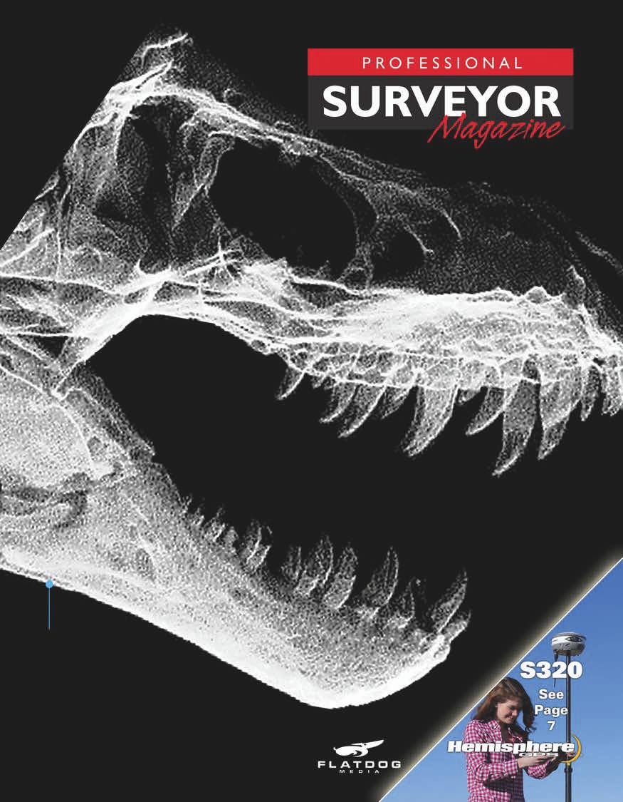
3 Background: This digital point-cloud reconstruction of a tyrannosaurus rex ( Stan ) at the Manchester Museum of the University of Manchester, United Kingdom was created in LFM software. For more than two decades, GNSS has played a central role in understanding the movement of the Earth s surface. Today, GNSS helps plan, manage, and respond to seismic emergencies. By John Stenmark, LS The U.S. Geological Survey (USGS) reported that in 2011 we experienced more than 2,420 earthquakes of magnitude 5.0 or larger worldwide. That s 10% more than in 2010 and more than 30% higher than the average over the previous 10-year period. At the same time, global population has increasingly concentrated in urban centers, many of which are located in known hazard zones. Aging infrastructure in many urban centers increases the potential impact of any hazardous event. To mitigate the risk, scientists are using GNSS to develop an increased understanding of the motion of Earth s tectonic plates. This knowledge enables emergency managers to reduce damage and improve emergency response. Measuring Tectonic Motion Geophysicists describe three types of seismic motion related to the Earth s plates. Interseismic motion is the ongoing slow, elastic movement of plates that occurs between large earthquakes, without movement on the fault itself. Coseismic motion, caused by excessive stress from this movement, is visible in the shaking and rapid displacement of the surface during an earthquake and its aftershocks. Following an earthquake event, the fault experiences postseismic motion, in which the stresses around the fault are redistributed or released as a result of the changes caused by the quake. In some cases, postseismic surface motion can be more than 1 cm (0.03 ft) per day as the fault settles into its new normal state. Then the interseismic motion resumes, and the cycle repeats. A young Chilean views the damage from a 2010 earthquake to Route P-22 west of Arauco courtesy of Leonardo Perez (IGM). For decades, researchers have used seismic sensors to detect the Earth s surface motion. In concept, a seismometer consists of a housing attached to the earth. Inside the housing, a mass is suspended on a spring. When the earth moves, the housing moves with it. But the mass, isolated by the spring, tends not to move. This enables the seismometer to measure the velocity of the ground relative to the stationary mass. Different seismometers are calibrated to detect different types of motion and are especially useful at higher frequencies where the earth is shaking at 1 Hz or faster. While seismometers excel at measuring the magnitude and frequency of even tiny movements, they can t determine the overall direction or distance moved, and they tend to stop working or saturate during very large displacements. Professional Surveyor Magazine April

4 That s where GNSS comes in. GNSS can measure the long, slow interseismic motion with high precision. It can also capture the rapid changes that occur during the coseismic earthquake event. According to USGS geophysicist Ken Hudnut, these GNSS capabilities make it a valuable tool in seismic studies. The biggest things we ve learned from GNSS are in the areas where there is really no other suitable sensor technology, Hudnut said. For plate tectonic movements, and for the buildup of strain before an earthquake and the postseismic movement after an earthquake occurs, GNSS is unique. Geophysicists measure with GNSS in two ways. They use campaign GNSS to periodically measure designated points over long periods. For example, a team will visit a point once per year to collect hours (or days) of static GNSS observations. With this approach, it is possible to measure interseismic motion at a relatively large number of points in a given area over a number of years. This provides a detailed picture of the surface motion near a known fault and helps scientists estimate the stresses accumulating deep underground. Immediately after an earthquake, teams attempt to recover and remeasure as many campaign points as possible. The data lets them develop an accurate picture of the coseismic motion. Timely measurement is important, as postseismic motion provides important clues about the behavior of the fault. Following an earthquake, scientists want to measure as many campaign points as possible before the coseismic motion is masked by postseismic movement. To facilitate this rapid response, UNAVCO (Boulder, Colorado), the University of Hawaii, The Ohio State University, and others have developed GNSS campaign kits designed for rapid deployment to earthquake zones. (In response to the 2010 Maule earthquake in Chile, UNAVCO supplied 25 campaign kits to research teams, and Trimble donated nine Trimble NetRS reference stations.) The campaign kits contain dual-frequency, survey-grade GNSS receivers with geodetic antennas as well as power supplies and communications equipment to support continuous, unattended operation. These systems were coupled with rapidly deployable monuments and power and communications systems developed at the University of Hawaii and Ohio State. The equipment allowed researchers from these organizations to respond to the earthquake within days. The second method used by geophysicists employs continuously operating reference stations (CORS) that capture and record GNSS data. A CORS site includes a permanently installed GNSS receiver together with power and communications equipment. Data from multiple CORS can be collected and processed to provide precise information on the continuous motion of the GNSS sensors. In some regions, scientific organizations have established CORS networks for research in geophysical, atmospheric, or other sciences. In other locales, governments or private firms install CORS to provide reference frames for positioning needs in surveying, construction, agriculture, and other commercial applications. In many areas, multiple CORS are connected into a real-time network (RTN) that receives a continuous stream of data from the individual CORS. The RTN combines the information from the multiple CORS to compute relative positions of each CORS, updating the positions as often as several times each second. This rapid update allows the RTN to capture coseismic shaking in real time. The RTN also distributes reference information that enables individual GNSS rovers to compute their own positions with high precision. The CORS stations serve two functions. For the geophysicists, they can measure all three types of seismic motion, thus providing a detailed picture of movement before, during, and after an earthquake. The second function of CORS is to provide geodetic reference points that can be used by scientists, surveyors, and emergency responders following a disaster. While these three groups have different functions and goals, they all require an accurate reference frame for their positioning operations. Complementary Approaches In New Zealand, John Beavan is a crustal dynamics geophysicist at GNS Science, a Crown Research Institute. Beavan, who has used GNSS for decades, says that the campaign and CORS approaches are complementary. In areas of low strain, campaign GNSS is sufficient to take measurements over periods of years. It s an accurate and cost-effective way to provide precise data on the 22 April 2012 Professional Surveyor Magazine

5 slow surface motion. Seismically active or densely populated areas benefit from CORS observations. Beavan said that Japan stands out in its GNSS monitoring; Japan s Geospatial Information Authority is considered one of the best GNSS monitoring networks in the world. Taiwan and western North America have well-developed networks as well. In China, the Crustal Movement Observation Network of China (CMONOC) has more than 260 monitoring stations in place using Trimble NetR8 GNSS reference receivers. When the magnitude 9.0 earthquake struck eastern Japan in March 2011, CMONOC receivers, as far as 600 mi (1,000 km) from the epicenter, revealed local coseismic displacements of 0.02 to 0.12 ft (5 to 36 mm). Other regions, including Indonesia and parts of South America, have nascent networks in place, including some real-time networks. But to better protect their populations and economic infrastructures, these areas need to increase the number of permanent GNSS stations. Science and the Surveyor CORS networks are often integrated with scientific and commercial applications. In Washington, the Washington State Reference Network (WSRN) Above: Kirby MacCleod of GNS Science operates a GNSS receiver during a measurement campaign in Fiordland; the data was used for measuring the coseismic deformation of the Mw 7.8 Dusky Sound earthquake in July Opposite: Vectors indicate horizontal coseismic displacements in China and Japan from the March 2011 M9.0 earthquake data for green vectors courtesy of GSI, solutions courtesy of the ARIA team at Caltech and JPL, graph courtesy of CMONOC. is a statewide cooperative made up of more than 100 GPS and GNSS reference stations. WSRN uses Trimble VRS technology to provide real-time positioning services for surveying and other highprecision positioning users. The WSRN receivers also form part of the Pacific Northwest Geodetic Array (PANGA), a network of approximately 350 CORS in the Pacific Northwest managed by the Geodesy Lab at Central Washington University. PANGA data is available to surveyors and other commercial users. Similarly, UNAVCO s Plate Boundary Observatory (PBO) operates more than 1,100 GNSS reference stations in a network concentrating on 11 western states plus Alaska and Puerto Rico. PBO provides free access to PBO data products. Back in New Zealand, John Beavan explained how GNS Science and New Zealand s Earthquake Commission established the GeoNet project to provide a modern geological hazard monitoring system. GeoNet is a network of geophysical instruments (including GNSS, seismometers, and other geophysical instruments) and specialized software to detect, analyze, and respond to seismic activity. The GNSS network is made up of more than 180 Trimble NetR9 and NetRS GNSS reference receivers. GNS Science operates GeoNet in collaboration with Land Information New Zealand (LINZ), the national department for geodetic and cadastral surveys. LINZ uses GNSS data from roughly 40 Geo- Net CORS as part of its PositioNZ control network, making the data available for post-processed and real-time positioning. Additionally, ibase, a privatelyoperated RTN, uses data from PositioNZ and Trimble VRS 3 Net App to provide real-time, centimeter-level positioning in 16 regions throughout the country. GeoNet, LINZ, and ibase cooperate to address scientific, engineering, and humanitarian needs, and GeoNet played a key role in emergency response to the 2010 and 2011 quakes. The GNSS network also helped determine the extent of horizontal ground movement, uplift, and subsidence resulting from the quakes. (For more on the New Zealand quakes, see PSM s March 2012 feature.) Professional Surveyor Magazine April


6 Ken Hudnut takes photos of the fault scarp in Baja California in Aug following the El Mayor - Cucapah earthquake courtesy of Prof. John Fletcher, CICESE. Earthquakes in California Over the past decade, the increasingly dense GNSS networks have enabled deeper understanding of seismic activity on the faults and plate boundaries. Researchers combine GNSS data with historical reports of past earthquakes to make calculations on stresses accumulating on the faults. From there, it s possible to develop estimates on the strength of future quakes. These estimates, often presented as seismic hazard maps, indicate the amount of surface shaking from an earthquake at various probability levels. But there is no way to predict when or where an earthquake will occur with any useful certainty. The best we can do is to understand the risk and be prepared for the unexpected. An agency in California is doing just that. The California Emergency Management Agency (Cal EMA) is tasked to enhance safety and preparedness against natural disasters. California faces threats from multiple natural sources including earthquakes, wildfires, landslides, and tsunamis. Cal EMA works closely with emergency managers, scientists, and engineers to understand risks and plan for emergency response. With hundreds of CORS providing real-time data, California is one of the most closely monitored locations on the planet. Cal EMA program deputy Kate Long said that the seismic research helps reduce casualties and damage from earthquakes. It s no accident that Cal EMA s Earthquake and Tsunami (ET) program office is housed at the California Institute of Technology (Caltech), alongside the USGS and other seismic experts. We need the information for planning, Long said. If the scientists are seeing areas of significant displacement, we are interested in that. Jim Goltz, who recently retired as ET program manager and still works at the Caltech facility, described how a group of nine scientists, called the California Earthquake Prediction Evaluation Council (CEPEC), uses the information. Any time there is anomalous seismic activity in the state, Cal EMA can consult with CEPEC to look at the data and consider the risks. When an earthquake does strike, Cal EMA increases its reliance on GNSS data. Long and Goltz are part of the emergency mobilization center at Caltech where they see the seismic and GNSS information as soon as it is available. Their job is to translate the science into actionable data for decision makers. The response from the geodetic network has its greatest value in the first few minutes and hours after an event, Goltz said. During an earthquake, the largest motion may not occur along the fault. Landslides, subsidence, and liquefaction can produce larger displacements than those observed along a fault line. Real-time GNSS networks can indentify the motion and deliver the data to emergency teams. That information is used to make decisions on deployment of emergency resources. For example, Cal EMA can direct reconnaissance teams to specific locations to check for damage to lifelines such as water and gas mains, roadways, and communications facilities. In the first few hours, we need to cut through the confusion, Long said. We need to establish ground truth in the affected areas. Then we can pinpoint and deploy resources to the most acute problems. A Stable Future Both Goltz and Beavan look to an increased role of GNSS in earthquake studies and mitigation. One promising application uses GNSS to issue early warnings for tsunamis. A series of GNSS sensors along a coastline can detect an earthquake offshore, even it if isn t felt by local residents. The GNSS data can let officials issue alerts quickly after a tsunami-generating quake, giving residents valuable time to move to higher ground. While the knowledge base of plate tectonics and seismic activity continues to grow, it remains impossible to predict when or where an earthquake will strike. There is no certainty, Beavan said. The best we can do is to say there is an x percent probability that a magnitude y quake will occur in a certain geographic region in the next n years. While this seems quite nebulous, it is a big improvement over years past. We can t predict earthquakes, but we can certainly be better prepared for them. See our website for a more detailed version of this article that includes information on the history of earthquake measurement and specific efforts around the globe to respond to earthquakes and other disasters using mapping and monitoring technology. JOHN STENMARK, LS, is a writer and consultant working in the AEC and technical industries. He has over 20 years experience in applying advanced technology to surveying and related disciplines. 24 April 2012 Professional Surveyor Magazine
The Impact of the 2010 Darfield (Canterbury) Earthquake on the Geodetic Infrastructure in New Zealand 1
 Earthquake on the Geodetic Infrastructure in New Zealand 1") The Impact of the 2010 Darfield (Canterbury) Earthquake on the Geodetic Infrastructure in New Zealand 1 Graeme BLICK, John BEAVAN, Chris CROOK, Nic DONNELLY Keywords: Darfield Earthquake, control, survey,
The Impact of the 2010 Darfield (Canterbury) Earthquake on the Geodetic Infrastructure in New Zealand 1 Graeme BLICK, John BEAVAN, Chris CROOK, Nic DONNELLY Keywords: Darfield Earthquake, control, survey,
NGIAs' roles in successful disaster response
 The Second UN-GGIM-AP Plenary Meeting NGIAs' roles in successful disaster response Japan Teheran Iran 28 October 2013 Shin-ichi SAKABE, Director of International Affairs Division Geospatial Information
Case Study of Japan: Crustal deformation monitoring with GNSS and InSAR
 Technical Seminar Reference Frame in Practice, Case Study of Japan: Crustal deformation monitoring with GNSS and InSAR Basara Miyahara miyahara-b96ip@milt.go.jp Geospatial Information Authority of Japan
How to communicate Cascadia Subduction Zone earthquake hazards
 How to communicate Cascadia Subduction Zone earthquake hazards Tom Brocher Research Geophysicist Earthquake Science Center U.S. Geological Survey Menlo Park, California Seattle Post-Intelligencer Lessons
How GNSS CORS in Japan works for geodetic control and disaster mitigations
 ICG Working Group D Reference Frames, Timing and Applications How GNSS CORS in Japan works for geodetic control and disaster mitigations ICG11, Nov. 7-11, 2016, Sochi, Russia Hiromichi TSUJI Geodetic Observation
Earthquakes and Faulting
 Earthquakes and Faulting Crustal Strength Profile Quakes happen in the strong, brittle layers Great San Francisco Earthquake April 18, 1906, 5:12 AM Quake lasted about 60 seconds San Francisco was devastated
GEO-VIII November Geohazard Supersites and Natural Laboratories Progress Report. Document 9
 GEO-VIII 16-17 November 2011 Geohazard Supersites and Natural Laboratories Progress Report Document 9 This document is submitted to GEO-VIII for information. Geohazard Supersites and Natural Laboratories
What are the social, technical, environmental and economic benefits and opportunities of accessing and sharing geodetic data?
 What are the social, technical, environmental and economic benefits and opportunities of accessing and sharing geodetic data? Graeme Blick Group Manager Positioning and Resilience Land Information New
SCIGN science report & GPS fault slip sensors
 SCIGN science report & GPS fault slip sensors Kenneth W. Hudnut USGS, Pasadena, CA UJNR Earthquake Research Panel Meeting Morioka, Japan Nov. 6-7, 2002 GPS is now vital to earthquake monitoring (array
Earthquake Hazards. Tsunami
 Earthquake Hazards Tsunami Review: What is an earthquake? Earthquake is the vibration (shaking) and/or displacement of the ground produced by the sudden release of energy. The point inside the Earth where
Three Fs of earthquakes: forces, faults, and friction. Slow accumulation and rapid release of elastic energy.
 Earthquake Machine Stick-slip: Elastic Rebound Theory Jerky motions on faults produce EQs Three Fs of earthquakes: forces, faults, and friction. Slow accumulation and rapid release of elastic energy. Three
Report for 15th PCGIAP Meeting at 18th UNRCC-AP Working Group 1 Regional Geodesy
 Report for 15th PCGIAP Meeting at 18th UNRCC-AP Working Group 1 Regional Geodesy Chairman Shigeru Matsuzaka, Japan - shigeru@gsi.go.jp Vice Chairman Prof. Pengfei Cheng, China - chengpf@casm.ac.cn John
Seismic Activity and Crustal Deformation after the 2011 Off the Pacific Coast of Tohoku Earthquake
 J-RAPID Symposium March 6-7, 2013 Seismic Activity and Crustal Deformation after the 2011 Off the Pacific Coast of Tohoku Earthquake Y. Honkura Tokyo Institute of Technology Japan Science and Technology
ESTIMATES OF HORIZONTAL DISPLACEMENTS ASSOCIATED WITH THE 1999 TAIWAN EARTHQUAKE
 ESTIMATES OF HORIZONTAL DISPLACEMENTS ASSOCIATED WITH THE 1999 TAIWAN EARTHQUAKE C. C. Chang Department of Surveying and Mapping Engineering Chung Cheng Institute of Technology, Taiwan, ROC ABSTRACT A
Earthquake Hazards. Tsunami
 Earthquake Hazards Tsunami Review: What is an earthquake? Earthquake is the vibration (shaking) and/or displacement of the ground produced by the sudden release of energy. The point inside the Earth where
I. Locations of Earthquakes. Announcements. Earthquakes Ch. 5. video Northridge, California earthquake, lecture on Chapter 5 Earthquakes!
 51-100-21 Environmental Geology Summer 2006 Tuesday & Thursday 6-9:20 p.m. Dr. Beyer Earthquakes Ch. 5 I. Locations of Earthquakes II. Earthquake Processes III. Effects of Earthquakes IV. Earthquake Risk
Earthquake Hazards. Tsunami
 Earthquake Hazards Tsunami Measuring Earthquakes Two measurements that describe the power or strength of an earthquake are: Intensity a measure of the degree of earthquake shaking at a given locale based
Geodesy. orientation. shape. gravity field
 Geodesy noun Science of measuring the shape, orientation and gravity field of the Earth and how it changes over time. shape orientation gravity field Positioning has always been important Downstream applications
Low-Latency Earthquake Displacement Fields for Tsunami Early Warning and Rapid Response Support
 Low-Latency Earthquake Displacement Fields for Tsunami Early Warning and Rapid Response Support Hans-Peter Plag, Geoffrey Blewitt Nevada Bureau of Mines and Geology and Seismological Laboratory University
Earthquakes. Building Earth s Surface, Part 2. Science 330 Summer What is an earthquake?
 Earthquakes Building Earth s Surface, Part 2 Science 330 Summer 2005 What is an earthquake? An earthquake is the vibration of Earth produced by the rapid release of energy Energy released radiates in all
Section 19.1: Forces Within Earth Section 19.2: Seismic Waves and Earth s Interior Section 19.3: Measuring and Locating.
 CH Earthquakes Section 19.1: Forces Within Earth Section 19.2: Seismic Waves and Earth s Interior Section 19.3: Measuring and Locating Earthquakes Section 19.4: Earthquakes and Society Section 19.1 Forces
Earthquakes and Earthquake Hazards Earth - Chapter 11 Stan Hatfield Southwestern Illinois College
 Earthquakes and Earthquake Hazards Earth - Chapter 11 Stan Hatfield Southwestern Illinois College What Is an Earthquake? An earthquake is the vibration of Earth, produced by the rapid release of energy.
Lab 9: Satellite Geodesy (35 points)
") Lab 9: Satellite Geodesy (35 points) Here you will work with GPS Time Series data to explore plate motion and deformation in California. This lab modifies an exercise found here: http://www.unavco.org:8080/cws/pbonucleus/draftresources/sanandreas/
Lab 9: Satellite Geodesy (35 points) Here you will work with GPS Time Series data to explore plate motion and deformation in California. This lab modifies an exercise found here: http://www.unavco.org:8080/cws/pbonucleus/draftresources/sanandreas/
Case study of Japan: Reference Frames in Practice
 Case study of Japan: Reference Frames in Practice Basara Miyahara and Koji Matsuo Sponsors: 1 Outline Introduction - Geodetic reference frame of Japan - GEONET : continuous GNSS observation system Geometric
Lecture Outline Wednesday-Monday April 18 23, 2018
 Lecture Outline Wednesday-Monday April 18 23, 2018 Questions? Lecture Final Exam Lecture Section 1 Friday May 4, 8:00-10:00am Lecture Section 2 Friday May 4, 3:10-5:10 pm Final Exam is 70% new material
Seismogeodesy for rapid earthquake and tsunami characterization
 Seismogeodesy for rapid earthquake and tsunami characterization Yehuda Bock Scripps Orbit and Permanent Array Center Scripps Institution of Oceanography READI & NOAA-NASA Tsunami Early Warning Projects
A Broad View of Geospatial Technology & Systems
 A Broad View of Geospatial Technology & Systems Pete Large Vice President, Trimble On the shoulders of giants 1 Since their time, our ability to generate geospatial information has grown exponentially
CORS Network and Datum Harmonisation in the Asia-Pacific Region. Richard Stanaway and Craig Roberts
 CORS Network and Datum Harmonisation in the Asia-Pacific Region Richard Stanaway and Craig Roberts School of Surveying and Spatial Information Systems University of New South Wales CORS Networks in the
Earthquakes Earth, 9th edition, Chapter 11 Key Concepts What is an earthquake? Earthquake focus and epicenter What is an earthquake?
 1 2 3 4 5 6 7 8 9 10 Earthquakes Earth, 9 th edition, Chapter 11 Key Concepts Earthquake basics. "" and locating earthquakes.. Destruction resulting from earthquakes. Predicting earthquakes. Earthquakes
Earthquake Investigation
 Exploration A Earthquake Investigation 1. Obtain a piece of plastic putty and knead it into a rectangular shape. 2. Push the ends of the putty toward the middle. Draw and describe what it looks like below.
Section Forces Within Earth. 8 th Grade Earth & Space Science - Class Notes
 Section 19.1 - Forces Within Earth 8 th Grade Earth & Space Science - Class Notes Stress and Strain Stress - is the total force acting on crustal rocks per unit of area (cause) Strain deformation of materials
Operational Aspects of GNSS CORS What is a GNSS CORS system used for?
 Please insert a picture (Insert, Picture, from file). Size according to grey field (10 cm x 25.4 cm). Scale picture: highlight, pull corner point Cut picture: highlight, choose the cutting icon from the
Earthquakes. Earthquake Magnitudes 10/1/2013. Environmental Geology Chapter 8 Earthquakes and Related Phenomena
 Environmental Geology Chapter 8 Earthquakes and Related Phenomena Fall 2013 Northridge 1994 Kobe 1995 Mexico City 1985 China 2008 Earthquakes Earthquake Magnitudes Earthquake Magnitudes Richter Magnitude
LOCAL TSUNAMIS: CHALLENGES FOR PREPAREDNESS AND EARLY WARNING
 LOCAL TSUNAMIS: CHALLENGES FOR PREPAREDNESS AND EARLY WARNING HARALD SPAHN 1 1 German Technical Cooperation International Services, Jakarta, Indonesia ABSTRACT: Due to the threat of local tsunamis warning
Earthquakes Chapter 19
 Earthquakes Chapter 19 Does not contain complete lecture notes. What is an earthquake An earthquake is the vibration of Earth produced by the rapid release of energy Energy released radiates in all directions
Military Geographic Institute
 New Chilean Reference Frame, 3 years after Maule Earthquake 90 YEARS SUPORTING THE NATIONAL DEVELOPMENT Major Julio Neira Gutierrez (MSc) Head of Geodetic Department & GDB Military Geographic Institute
Magnitude 6.5 OFFSHORE NORTHERN CALIFORNIA
 A powerful offshore earthquake that struck near the Northern California coast left a hodgepodge of debris for communities to sort through Sunday but spared residents any serious injury. After 25,000 people
Magnitude 7.9 SE of KODIAK, ALASKA
 A magnitude 7.9 earthquake occurred at 12:31 am local time 181 miles southeast of Kodiak at a depth of 25 km (15.5 miles). There are no immediate reports of damage or fatalities. Light shaking from this
Title. Author(s)Heki, Kosuke. CitationScience, 332(6036): Issue Date Doc URL. Type. File Information. A Tale of Two Earthquakes
Heki, Kosuke. CitationScience, 332(6036): Issue Date Doc URL. Type. File Information. A Tale of Two Earthquakes") Title A Tale of Two Earthquakes Author(s)Heki, Kosuke CitationScience, 332(6036): 1390-1391 Issue Date 2011-06-17 Doc URL http://hdl.handle.net/2115/48524 Type article (author version) File Information
Title A Tale of Two Earthquakes Author(s)Heki, Kosuke CitationScience, 332(6036): 1390-1391 Issue Date 2011-06-17 Doc URL http://hdl.handle.net/2115/48524 Type article (author version) File Information
The Earthquake Cycle Chapter :: n/a
 The Earthquake Cycle Chapter :: n/a A German seismogram of the 1906 SF EQ Image courtesy of San Francisco Public Library Stages of the Earthquake Cycle The Earthquake cycle is split into several distinct
12/07/2013. Apparent sea level rise and earthquakes
 Main collaborations: - P. Simeoni - M. N. Bouin - S. Calmant Valérie Ballu Valerie.ballu@univ-lr.fr Apparent sea level rise and earthquakes possibly the world s first community to be formally moved out
TEGAM s Connection to the EarthScope Project
 TEGAM s Connection to the EarthScope Project Introduction The EarthScope Project is an undertaking funded by the National Science Foundation in partnership with the United States Geological Survey and
Tsunami Physics and Preparedness. March 6, 2005 ICTP Public Information Office 1
 Tsunami Physics and Preparedness March 6, 2005 ICTP Public Information Office 1 What we do Provide world-class research facilities for scientists from developing world Foster advanced scientific research,
CEETEP Related Digital Resources
 CEETEP Related Digital Resources The resources on the CEETEP DVD and USB drive include many items developed by or in collaboration with other organizations. Here we overview some of the partner and related
Lessons Learned from Past Tsunamis Warning and Emergency Response
 UNESCO IOC CTIC US NOAA ITIC Regional Training Workshop on Strengthening Tsunami Warning and Emergency Response Standard Operating Procedures and the Development of the ICG/CARIBE-EWS PTWC New Enhanced
Magnitude 6.9 GULF OF CALIFORNIA
 A pair of strong earthquakes struck off the coast of Mexico early Thursday only minutes apart. The magnitude 6.9 and 6.2 were centered about 85 miles northeast of Guerrero Negro in the Mexican state of
GPS Strain & Earthquakes Unit 5: 2014 South Napa earthquake GPS strain analysis student exercise
 GPS Strain & Earthquakes Unit 5: 2014 South Napa earthquake GPS strain analysis student exercise Strain Analysis Introduction Name: The earthquake cycle can be viewed as a process of slow strain accumulation
Tsunami Research and Its Practical Use for Hazard Mitigation. Hiroo Kanamori Seismological Laboratory, California Institute of Technology
 Tsunami Research and Its Practical Use for Hazard Mitigation Hiroo Kanamori Seismological Laboratory, California Institute of Technology Cause of Tsunami Earthquakes Landslides Volcanic origin Impact (Dr.
CHILEAN PART OF SIRGAS REFERENCE FRAME, REALIZATION, ADOPTION, MAINTENANCE AND ACTUAL STATUS. Geodesy for Planet Earth IAG 2009, Buenos Aires
 CHILEAN PART OF SIRGAS REFERENCE FRAME, REALIZATION, ADOPTION, MAINTENANCE AND ACTUAL STATUS Geodesy for Planet Earth IAG 2009, Buenos Aires Ing. Héctor Parra hparra@igm.cl, IGM Chile Dr. Juan Báez jbaez@udec.cl,
What is an Earthquake?
 Earthquakes What is an Earthquake? Earthquake - sometimes violent shaking of ground caused by movement of Earth s tectonic plates; creates seismic waves Often followed by smaller earthquakes (aftershocks);
Report of the Working Group 2 Data Sharing and Integration for Disaster Management *
 UNITED NATIONS E/CONF.104/6 ECONOMIC AND SOCIAL COUNCIL Twentieth United Nations Regional Cartographic Conference for Asia and the Pacific Jeju, 6-9 October 2015 Item 5 of the provisional agenda Report
Earthquakes. Photo credit: USGS
 Earthquakes Earthquakes Photo credit: USGS Pancaked Building - 1985 Mexico City Earthquakes don t kill people - buildings do! An earthquake is the motion or trembling of the ground produced by sudden displacement
The Science and Policy of Natural Hazards
 Image courtesy of USGS. 12.103 Image courtesy of NOAA. The Science and Policy of Natural Hazards Image courtesy of USGS. Image courtesy of NOAA. Topics Four categories of hazards will be investigated in
Earthquake Source. Kazuki Koketsu. Special Session: Great East Japan (Tohoku) Earthquake. Earthquake Research Institute, University of Tokyo
 Earthquake. Earthquake Research Institute, University of Tokyo") 2012/9/24 17:20-17:35 WCEE SS24.4 Special Session: Great East Japan (Tohoku) Earthquake Earthquake Source Kazuki Koketsu Earthquake Research Institute, University of Tokyo 1 Names and features of the earthquake
2012/9/24 17:20-17:35 WCEE SS24.4 Special Session: Great East Japan (Tohoku) Earthquake Earthquake Source Kazuki Koketsu Earthquake Research Institute, University of Tokyo 1 Names and features of the earthquake
Report of PCGIAP to the 18 th United Nations Regional Cartographic Conference for Asia and the Pacific (UNRCC-AP) for the period
 for the period") Permanent Committee on GIS Infrastructure for Asia and the Pacific (PCGIAP) Established in 1995 by a United Nations Resolution Report of PCGIAP to the 18 th United Nations Regional Cartographic Conference
Permanent Committee on GIS Infrastructure for Asia and the Pacific (PCGIAP) Established in 1995 by a United Nations Resolution Report of PCGIAP to the 18 th United Nations Regional Cartographic Conference
Usually, only a couple of centuries of earthquake data is available, much shorter than the complete seismic cycle for most plate motions.
 Earthquake Hazard Analysis estimate the hazard presented by earthquakes in a given region Hazard analysis is related to long term prediction and provides a basis to expressed hazard in probabilistic terms.
Module 1, Investigation 3: Predicting Eruptions
 Module 1, Investigation 3: Predicting Eruptions Introduction Welcome! Volcanoes are either "active" or "extinct". Active means that the volcano has erupted during the past 10,000 years. It can also mean
Downtown Anchorage Seismic Risk Assessment & Land Use Regulations to Mitigate Seismic Risk
 Prepared for: The Municipality of Anchorage Planning Department and the Geotechnical Advisory Commission Downtown Anchorage Seismic Risk Assessment & Land Use Regulations to Mitigate Seismic Risk Prepared
International Union of Geodesy and Geophysics. Resolutions
 International Union of Geodesy and Geophysics Resolutions ADOPTED BY THE COUNCIL AT THE XXVI GENERAL ASSEMBLY PRAGUE, CZECH REPUBLIC (22 JUNE 2 JULY 2015) 0 Page Resolution 1: Role of Ocean in Climate
Country Report On Sdi Activities In Singapore ( )
") UNITED NATIONS E/CONF.102/IP.4 ECONOMIC AND SOCIAL COUNCIL Nineteenth United Nations Regional Cartographic Conference for Asia and the Pacific Bangkok, 29 October 1 November 2012 Item 6(b) of the provisional
UNITED NATIONS E/CONF.102/IP.4 ECONOMIC AND SOCIAL COUNCIL Nineteenth United Nations Regional Cartographic Conference for Asia and the Pacific Bangkok, 29 October 1 November 2012 Item 6(b) of the provisional
Overview. Tools of the Trade. USGS Decision-Making Tools for Pre-Earthquake Mitigation and Post-Earthquake Response
 USGS Decision-Making Tools for Pre-Earthquake Mitigation and Post-Earthquake Response Tools of the Trade DAVID WALD United States Geological Survey NEHRP Workshop: Developing Earthquake Scenarios Sept
Sendai Earthquake NE Japan March 11, Some explanatory slides Bob Stern, Dave Scholl, others updated March
 Sendai Earthquake NE Japan March 11, 2011 Some explanatory slides Bob Stern, Dave Scholl, others updated March 14 2011 Earth has 11 large plates and many more smaller ones. Plates are 100-200 km thick
Magnitude 7.0 N of ANCHORAGE, ALASKA
 A magnitude 7.0 earthquake occurred just before 8:30 am local time 8 miles north of Anchorage at a depth of 40.9 km (25.4 miles). There are reports of major infrastructure damage and damage to many homes
Lessons from the 2004 Sumatra earthquake and the Asian tsunami
 Lessons from the 2004 Sumatra earthquake and the Asian tsunami Kenji Satake National Institute of Advanced Industrial Science and Technology Outline 1. The largest earthquake in the last 40 years 2. Tsunami
Chapt pt 15 er EARTHQUAKES! BFRB P 215 ages -226
 Chapter 15 EARTHQUAKES! BFRB Pages 215-226226 Earthquake causes An earthquake is the shaking of the Earth s crust caused by a release of energy The movement of the Earth s plates causes most earthquakes
Agency Vision and Decision- Maker Needs: A USGS Perspective
 Agency Vision and Decision- Maker Needs: A USGS Perspective Connecting Grassroots to Government for Disaster Management David Applegate USGS Associate Director for Natural Hazards September 13, 2012 U.S.
GEORED Project: GNSS Geodesy Network for Geodynamics Research in Colombia, South America. Héctor Mora-Páez
 GEORED Project: GNSS Geodesy Network for Geodynamics Research in Colombia, South America. Héctor Mora-Páez Colombian Geological Survey UNAVCO SCIENCE MEETING Feb 27 March 1, 2012 Boulder, CO, TECTONIC
Wainui Beach Management Strategy (WBMS) Summary of Existing Documents. GNS Tsunami Reports
 Summary of Existing Documents. GNS Tsunami Reports") Wainui Beach Management Strategy (WBMS) Summary of Existing Documents GNS Tsunami Reports a) Review of Tsunami Hazard and Risk in New Zealand ( National Risk Report ) b) Review of New Zealand s Preparedness
Wainui Beach Management Strategy (WBMS) Summary of Existing Documents GNS Tsunami Reports a) Review of Tsunami Hazard and Risk in New Zealand ( National Risk Report ) b) Review of New Zealand s Preparedness
Indian Ocean Tsunami Warning System: Example from the 12 th September 2007 Tsunami
 Indian Ocean Tsunami Warning System: Example from the 12 th September 2007 Tsunami Charitha Pattiaratchi 1 Professor of Coastal Oceanography, The University of Western Australia Email: chari.pattiaratchi@uwa.edu.au
ADDITIONAL RESOURCES. Duration of resource: 30 Minutes. Year of Production: Stock code: VEA Resource written by: Andrew Clarke BA Dip Tchg
 ADDITIONAL RESOURCES The destructive and unexpected nature of earthquakes has remained a constant threat since civilisation began. Suitable for all secondary audiences, this two-part program firstly examines
Cascadia megathrust earthquakes: reducing risk through science, engineering, and planning
 Cascadia megathrust earthquakes: reducing risk through science, engineering, and planning NSF Hazards SEES EAR-1331412 Urban Science and Engineering Workshop 21 July 2014 Everything to do with M9 Cascadia
GEODETIC NETWORK OF SAUDI ARABIA AND FIDUCIAL STATIONS. GFN OF Saudi Arabia in Based on ITRF2000 Datum
 STUDIES OF TECTONIC MOVEMENTS IN SAUDI ARABIA USING CORS M. Al Rajhi, Ali Al Omar, R. Yanar, F. Kartal, K. Eren, SUBJECT TO TALKS BACKGROUND GEODETIC NETWORK OF SAUDI ARABIA AND FIDUCIAL STATIONS GFN OF
Students will be able, using GIS, to locate the largest and most destructive earthquakes;
 Exploring Earthquake Hazards with GIS Laboratory for Introduction to Geophysics, Spring 2007 Prof. Constantin Cranganu Brooklyn College of the City University of New York Learning Objectives: Students
Earthquakes and Tsunamis
 Earthquakes and Tsunamis Kenji Satake Earthquake Research Institute University of Tokyo 1 Part I 2011 Tohoku earthquake and tsunami 2 Fukushima Dai ichi NPP accident Earthquake ground motion Reactors automatically
New USGS Maps Identify Potential Ground- Shaking Hazards in 2017
 New USGS Maps Identify Potential Ground- Shaking Hazards in 2017 New USGS Maps Identify Potential Ground-Shaking Hazards in 2017 The central U.S. faces continued hazards from human-induced earthquakes
Running Head: JAPANESE TSUNAMI 1. Geological Perspective of the Japanese Tsunami
 Running Head: JAPANESE TSUNAMI 1 Geological Perspective of the Japanese Tsunami JAPANESE TSUNAMI 2 JAPANESE TSUNAMI 3 Abstract Humanity is characterized with flaws, so is planet earth. Earthquakes shake
Building earthquake early warning for the west coast. Ken Creager Professor of Earth and Space Sciences University of Washington
 Building earthquake early warning for the west coast Ken Creager Professor of Earth and Space Sciences University of Washington How Earthquake Early Warning works: P-waves S-waves 3-fold way of Earthquake
This article is provided courtesy of the American Museum of Natural History.
 Avoiding Earthquake Surprises in the Pacific Northwest This article is provided courtesy of the American Museum of Natural History. How Vulnerable Is the Pacific Northwest? Cascadia is a region in the
Wireless Networks in Geophysical Monitoring
 Workshop on New Frontiers in Internet of Things 7-18 March 2016 Trieste, Italy Wireless Networks in Geophysical Monitoring Hairo Villalobos Vulcanological and Seismological Observatory of Costa Rica, National
the IRIS Consortium Collaborative, Multi-user Facilities for Research and Education Briefing NSF Business Systems Review September 9, 2008
 the IRIS Consortium Collaborative, Multi-user Facilities for Research and Education Briefing NSF Business Systems Review September 9, 2008 A facilities program for collection and distribution of seismological
Real time Monitoring System for Earthquakes and Tsunamis (DONET)
") Real time Monitoring System for Earthquakes and Tsunamis (DONET) NankaiTrough Yoshiyuki Kaneda Japan Agency for Marine-Earth Science and Technology (JAMSTEC) POGO@Seoul Presentation 1 Earthquakes in the
Real time Monitoring System for Earthquakes and Tsunamis (DONET) NankaiTrough Yoshiyuki Kaneda Japan Agency for Marine-Earth Science and Technology (JAMSTEC) POGO@Seoul Presentation 1 Earthquakes in the
STRESS IN THE SYSTEM? INSIGHTS INTO MODELLING IN THE WAKE OF TOHOKU
 STRESS IN THE SYSTEM? INSIGHTS INTO MODELLING IN THE WAKE OF TOHOKU Aspen Re June 13, 2012 James Few President, Aspen Re Aspen Insurance Holdings Limited AGENDA Do we need near-term quake rates? Lessons
Warkworth geodetic station as a potential GGOS core site in New Zealand
 "Launching the Next-Generation IVS Network Session 2: Correlators, Stations and Operations Centers. 7th IVS General Meeting March 5, 2012 Madrid, Spain Warkworth geodetic station as a potential GGOS core
Country Report on SDI Activities in Singapore *
 UNITED NATIONS E/CONF.100/CRP.9 ECONOMIC AND SOCIAL COUNCIL Eighteenth United Nations Regional Cartographic Conference for Asia and the Pacific Bangkok, 26-29 October 2009 Item 7(a) of the provisional
Complete Weather Intelligence for Public Safety from DTN
 Complete Weather Intelligence for Public Safety from DTN September 2017 White Paper www.dtn.com / 1.800.610.0777 From flooding to tornados to severe winter storms, the threats to public safety from weather-related
Interpretive Map Series 24
 Oregon Department of Geology and Mineral Industries Interpretive Map Series 24 Geologic Hazards, and Hazard Maps, and Future Damage Estimates for Six Counties in the Mid/Southern Willamette Valley Including
Guidelines for Site-Specific Seismic Hazard Reports for Essential and Hazardous Facilities and Major and Special-Occupancy Structures in Oregon
 Guidelines for Site-Specific Seismic Hazard Reports for Essential and Hazardous Facilities and Major and Special-Occupancy Structures in Oregon By the Oregon Board of Geologist Examiners and the Oregon
Magnitude 7.6 SOUTH OF IQUIQUE, CHILE
 A powerful aftershock struck off northern Chile prompting an evacuation of the coastal area and raising fears of a tsunami. This magnitude 7.6 earthquake is the largest of a series of aftershocks following
Real Time Monitoring System for Megathrust Earthquakes and Tsunamis - Cabled Network System and Buoy System in Japan -
 Real Time Monitoring System for Megathrust Earthquakes and Tsunamis - Cabled Network System and Buoy System in Japan - 1 Subduction zones around the world Haiti Italy Turkey Tohoku Sichuan Taiwan Sumatra
Deformation cycles of great subduction earthquakes in a viscoelastic Earth
 Deformation cycles of great subduction earthquakes in a viscoelastic Earth Kelin Wang Pacific Geoscience Centre, Geological Survey of Canada School of Earth and Ocean Science, University of Victoria????
San Andreas Movie Can It Happen?
 San Andreas Movie Can It Happen? Learning Objectives (LO) Lecture 14: Faults and Quakes Read: Chapter 10 and 11 Homework #12 due Thursday 12pm What we ll learn today:! 1. Compare strike-slip to dip-slip
CSU Student Research Competition Summary Submission
 Name: CSU Student Research Competition Summary Submission Shawn Morrish Title: Coseismic Uplift and Geomorphic Response to the September 5, 2012 Mw7.6 Nicoya Earthquake, Costa Rica Abstract: The Nicoya
Strategic Framework on Geospatial Information and Services for Disasters Relevance for the Americas Region
 Strategic Framework on Geospatial Information and Services for Disasters Relevance for the Americas Region Seventh Session of the Committee of Experts on UN-GGIM Side Event --- UN Headquarters, New York
Earthquakes. Pt Reyes Station 1906
 Earthquakes Pt Reyes Station 1906 Earthquakes Ground shaking caused by the sudden release of accumulated strain by an abrupt shift of rock along a fracture in the earth. You Live in Earthquake Country
Reference frames and positioning
 The APREF Project: an Improved Geodetic Infrastructure for Asia and the Pacific (4861) John Dawson (Australia), Graeme Blick (New Zealand), Manoj Deo, Guorong Hu and Gary Johnston (Australia) Reference
Establishment and Operation of a Regional Tsunami Warning Centre
 Establishment and Operation of a Regional Tsunami Warning Centre Dr. Charles McCreery, Director NOAA Richard H. Hagemeyer Pacific Tsunami Warning Center Ewa Beach, Hawaii USA Why A Regional Tsunami Warning
Magnitude 7.7 QUEEN CHARLOTTE ISLANDS REGION
 A major 7.7 magnitude earthquake struck at 8:04 PM local time in western British Columbia, Canada. The epicenter is located on Moresby Island, the southern large island in the Queen Charlotte Islands region.
J M MIRANDA UNIVERSITY OF LISBON THE USE OF REMOTE SENSING FOR EARTHQUAKE RISK ASSESSMENT AND MITIGATION
 1 THE USE OF REMOTE SENSING FOR EARTHQUAKE RISK ASSESSMENT AND MITIGATION 2 the observation of strong ground motion and aftershock sequences as well as the investigation of the destruction from these earthquakes
Taiwan, (Sathiyam.tv)
") Taiwan, 1999. (Sathiyam.tv) This document was modified and supplemented by BYU-Idaho faculty. All illustrations are from USGS unless otherwise noted. Learning Objectives Your goals in studying this chapter
Taiwan, 1999. (Sathiyam.tv) This document was modified and supplemented by BYU-Idaho faculty. All illustrations are from USGS unless otherwise noted. Learning Objectives Your goals in studying this chapter
crustal structure experiment beneath Wairarapa - Wellington area: results from SAHKE
 crustal structure experiment beneath Wairarapa - Wellington area: results from SAHKE Tim Stern and SAHKE team* * VUW, GNS, University of Southern California, University of Tokyo(Japan) SAHKE = Seismic