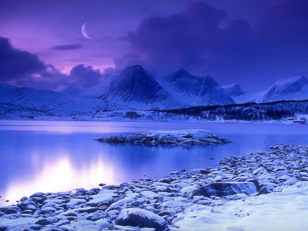
Permafrost Engineering in Alaska. By Don Reid, Adam Price, Sabine Eisma, Casey Wagner and Logan Wallace
|
|
|
- Malcolm Phillips
- 5 years ago
- Views:
Transcription


1 Permafrost Engineering in Alaska By Don Reid, Adam Price, Sabine Eisma, Casey Wagner and Logan Wallace
2 Permafrost Engineering in Alaska Basic Alaskan Geography and Geology Permafrost features and distribution Permafrost Engineering Attributes Foundations in Permafrost Water Prospecting in Frozen Soils
3 Alaskan Geology Formation of Alaska Ice Age Seismic Activity Ice Fields Mountains and Minerals Aleutian Mountain Chain
4 Formation Alaska formed ~125 million years ago Two hypotheses on formation Merging of 7 plates Formed From Merger of Pacific and N. American Plates
5 Cold Past Pleistocene Ice Age 2.5 mya 9 kya Alaska connected to Asia by landbridge due to lowered sea level (el feet)
6 Seismic Activity ~4% of all energy released by earthquakes has Alaskan origin. Caused by the Pacific Oceanic plate slipping under the North American Continental plate Mostly focused around south central Alaska ttp://geology.com/novarupta/

7 Ring of Fire

8 Alaskan Tectonics Eastern Segment Central Segment

9 Ice Fields Land areas completely covered in ice, year round. Cover 28,80 square miles 4.9% of Alaska ttp://
10 Mountains and Islands 20% of Alaska s land area is over 4,500 feet above sea level Mountain ranges split Alaska into 5 sections: The Interior The Arctic The Aleutian Islands Southeast Alaska South-central Alaska Alaska is rich in minerals Some of the many minerals deposits found in Alaska: Gold, copper, silver, mercury, platinum, tin, coal.
11 Aleutian Islands In the Ring of Fire Highly active - 26 of the 57 Volcanoes have erupted since 1970 Volcanic arc is fed from the subduction of the Pacific plate sinking beneath the North American plate No trees and little to no vegetation
12 Permafrost Definition: Ground that has been continuously below the freezing point of water for two successive winters and the intervening summer Below layer of active sporadically frozen soil.


13
14 Permafrost Formation Earth has a fairly constant temperature gradient (approximately 3 degrees Celsius per 100 meters). As surface temperatures go below freezing, permafrost can form to varying depths.

15

16 Distribution of Permafrost Generally continuous north of Fairbanks and discontinuous in southern portions of Alaska.

17 Surface Formations Patterned Ground - A phenomenon on the active layer caused by freeze/thaw cycles. Freeze cycles churn and sort finer grain soils to the surface.
18 Surface Formations Pingos Frozen subsurface lake surrounded by permafrost. The density of the permafrost does not give way, forcing the expanding ice up, creating a blister like formation beneath the active layer.


19 Pingo


20 Mechanical Properties of Permafrost

21 Characterization of Permafrost Use soil grain characteristics, crystalline structure of ice, temperature ratio of interstitial ice to soil grains to determine mechanical properties Source: Nelson et al, Cold Regions Engineering. U. of Wash. 2008
22 Elastic Modulus Vary Widely, but higher in frozen soils Brittle, stiff, rocklike. Wave speed is greater (stress waves and seismic waves) Source: Smith, D.W. Ed Cold Regions Utilities Monograph ASCE, 1996.
23 Strength Ice Poor Soils Dominated by coarse grained or dense fine-grained soils Generally, strength is about the same as un-frozen soils (Can be slightly lower): τ = c f + σ n tanϕ Ice Rich Soils Dominated by loose fine-grained soils Bulk Density under 1000 kg/m 3 Strength dominated by cohesion of interstitial ice τ = c f + σ n tanϕ f Source: Smith, D.W. Ed Cold Regions Utilities Monograph ASCE, 1996.
24 Basic Effect Source: Nelson et al, Cold Regions Engineering. U. of Wash. 2008
25 Creep Slow progressive movement of a loaded frozen soil without volume change. (Smith, p 3-33) Slow liquid movement Short term (Primary) Creep: Strain Rate starts high, decreases. Secondary Creep: Long term, low. Constant strain rate. Tertiary Creep: Accelerating Strain Rate. Can be short. Soil is considered to have failed. Source: Smith, D.W. Ed Cold Regions Utilities Monograph ASCE, 1996.
26 Sample Issues with Permafrost Frost Heaving The freeze cycle of the active layer presses against the permafrost layer, forcing the freezing soil to expand upward. Thawing Building constructed on permafrost can offset the thermal balance causing thawing of the permafrost layer. Permafrost thawing results in settling, undermining foundations and structures. Excavation Difficulties Source: Smith, D.W. Ed Cold Regions Utilities Monograph ASCE, 1996.
27 Excavation Difficulties Permafrost excavation is similar to that of intact rock masses. Typical soil excavation techniques are inadequate Some permafrost excavation options Heated water bladders thaw the soil before excavation Steam jets Explosives Jackhammers Source: Smith, D.W. Ed Cold Regions Utilities Monograph ASCE, 1996.

28

29 Permafrost and Foundations Rice, Building in the North, 4 th Edition, Anchorage: Alaska Science & Technology Foundation
30 Frequent Foundation Problems Up-heave caused by cyclic thawing and refreezing of soils. Thawing of soils around foundation is caused by either heat leaking from the foundation or by seasonally varying temperatures. Frost-Jacking: Poles/piles become unstable when bottom few feet is not placed in permanently frozen soil. Andersland and Ladanyi (1994), Frozen Ground Engineering, 2 nd Edition, John Wiley and Sons, Inc. for ASCE Coduto, Foundation Design, 2 nd Edition, New Jersey: Prentice Hall 2001

31 Solutions Excavation and backfill - used to change unsuitable soils (Fine-grained or poorly drained) into suitable soils, like coarse sand and gravel. Wooden Piles - anchored or not anchored, depended on the size of the active layer. -Should be placed well into the permanently frozen layer and should have a elevation of about 5 feet above ground level. -Should be wrapped in a low friction plastic sleeve covering the depth of the active layer to prevent frost jacking Rice, Building in the North, 4 th Edition, Anchorage: Alaska Science & Technology Foundation


32 Foundation Temperature Control To prevent thaw/freeze problems, soils around foundation are kept cold by Ventilation Mechanical Refrigeration Insulation Rice, Building in the North, 4 th Edition, Anchorage: Alaska Science & Technology Foundation

33 More Solutions Post and Pad Footing - mostly used by people who build their own homes. Easy to build, cheap and easy adjustable. Rice, Building in the North, 4 th Edition, Anchorage: Alaska Science & Technology Foundation
34 Permafrost and Water Supply in Alaska's North Alaska has an abundance of surface water sources such as lakes and rivers. The run- off rates are very high along the Pacific coast, dropping off significantly in the central and northern parts of the state. In the north, rivers and lakes freeze to their full depth in winter so are not practical water sources. 83% of Anchorage public water supply is from surface water. 100% of Fairbanks public water supply is from ground water. (USGS Alaska Annual Data Report 2005) Source: Smith, D.W. Ed Cold Regions Utilities Monograph ASCE, 1996.
35 Groundwater in Permafrost A. Suprapermafrost - Water above the permafrost (in the active layer). In the Arctic region, the active layer is 1~6 feet. Very little water accumulates in this layer, and what does is often contaminated and is frozen in winter. B. Intrapermafrost- Water within the permafrost layer- In order to stay in the liquid phase, water within permafrost layers must have high concentrations of dissolved solids. The water pockets are constantly changing and there is, as yet, no economically feasible way to access this source. C. Subpermafrost- Water below the permafrost layer. This is the most dependable place to find high quality water in large quantities. In general, the deeper the source, the warmer the water will be and therefore the least likely to freeze during extraction. Source: Smith, D.W. Ed Cold Regions Utilities Monograph ASCE, 1996.

36 Groundwater in Permafrost
37 Subpermafrost Water Alluvial- below very thick alluvial deposits where the permafrost layer is not too thick. Layered- Stratified bedrock may have water filled layers (aquifers) that have considerable yield. Wells should be situated along the axis of a syncline and the deepest, warmest one is likely to be the most productive. Fissured- Subpermafrost water in joints caused by tectonic forces or weathering. Joints caused by tectonics are quite deep and are rare in Northern Alaska. Those caused by weathering are much more common and can contain significant quantities of water. They are generally a lot shallower and therefore may be frozen in winter in areas where the permafrost is thin. Solution Channels- Found in areas of high limestone content. Also known as Karst water, it is found in the cavities in eroded carbonate bedrock In Northern Alaska, karst landscapes exist in the Brooks Mountains and the White Mountains. Source: Muller, Siemon W.,"Frozen in Time ASCE 2008
38 Other Water Sources Very deep lakes are plumbed in winter and the water stored in heated tanks. In small, remote settlements in the far north, such as Arctic islands, glacier and river ice is used as the only source of water. Source: Smith, D.W. Ed Cold Regions Utilities Monograph ASCE, 1996.
39 End
Periglacial Geomorphology
 Periglacial Geomorphology Periglacial Geomorphology Periglacial: literally means around glacial - term introduced in 1909 to describe landforms and processes around glaciated areas. Periglacial environments:
Forces That Shape Earth. How do continents move? What forces can change rocks? How does plate motion affect the rock cycle?
 Forces That Shape Earth How do continents move? What forces can change rocks? How does plate motion affect the rock cycle? Plate Motion Mountain ranges are produced by plate tectonics. The theory of plate
Exploring Geography. Chapter 1. Chapter 1, Section
 Chapter 1, Section World Geography Chapter 1 Exploring Geography Copyright 2003 by Pearson Education, Inc., publishing as Prentice Hall, Upper Saddle River, NJ. All rights reserved. Chapter 1, Section
Chapter 1 Section 2. Land, Water, and Climate
 Chapter 1 Section 2 Land, Water, and Climate Vocabulary 1. Landforms- natural features of the Earth s land surface 2. Elevation- height above sea level 3. Relief- changes in height 4. Core- most inner
Shape Earth. Plate Boundaries. Building. Building
 Chapter Introduction Lesson 1 Lesson 2 Lesson 3 Lesson 4 Chapter Wrap-Up Forces That Shape Earth Landforms at Plate Boundaries Mountain Building Continent Building How is Earth s surface shaped by plate
water erosion lithosphere Describe the process of erosion and deposition. chemical weathering Dissolving limestone is an example of.
 At one time, there was one large island off the coast of Mississippi and now it is two separate islands. What caused the island to be split into two? water erosion The crust and the top part of the upper
Chapter 2 Planet Earth
 Chapter 2 Planet Earth Section Notes Earth and the Sun s Energy Water on Earth The Land Close-up The Water Cycle World Almanac Major Eruptions in the Ring of Fire Quick Facts Chapter 2 Visual Summary Video
Social Studies 9 UNIT 2 GEOGRAPHIC INFLUENCES ON IDENTITY: PLACE AND PEOPLE
 Social Studies 9 UNIT 2 GEOGRAPHIC INFLUENCES ON IDENTITY: PLACE AND PEOPLE The Structure of the Earth To understand the forces that create Canada's physical landscape we must understand the structure
Mass Wasting: The Work of Gravity
 Chapter 15 Lecture Earth: An Introduction to Physical Geology Twelfth Edition Mass Wasting: The Work of Gravity Tarbuck and Lutgens Chapter 15 Mass Wasting The Importance of Mass Wasting Slopes are the
1 Earth s Oceans. TAKE A LOOK 2. Identify What are the five main oceans?
 CHAPTER 13 1 Earth s Oceans SECTION Exploring the Oceans BEFORE YOU READ After you read this section, you should be able to answer these questions: What affects the salinity of ocean water? What affects
deep within the planet. They are also shaped by conditions on the planet s surface. In
 Chapter 4 Landforms, Water, and Natural Resources Earth is home to many different types of landforms. These landforms are shaped by forces deep within the planet. They are also shaped by conditions on
Extent of Periglacial = Global Permafrost Permafrost: Soil and/or rock where temperatures remain below 0 degrees C for 2 or more years.
 Geog 1000 - Lecture 34 Periglacial Environments and Paleoclimatology http://scholar.ulethbridge.ca/chasmer/classes/ Today s Lecture (Pgs 422-434) 1. Exam questions from last week, and today 2. Extent of
How do glaciers form?
 Glaciers What is a Glacier? A large mass of moving ice that exists year round is called a glacier. Glaciers are formed when snowfall exceeds snow melt year after year Snow and ice remain on the ground
Earth s Structure and Natural Processes Practice Test
 Name: Earth s Structure and Natural Processes Practice Test Section: Directions: For each of the questions or incomplete statements below, choose the best of the answer choices given and write your answer
A physical feature of the Earth s surface
 Earth s Landforms A physical feature of the Earth s surface A physical feature of the Earth s surface LANDFORM Highest of Earth s physical features Highest of Earth s physical features MOUNTAIN Low area
Plates & Boundaries The earth's continents are constantly moving due to the motions of the tectonic plates.
 Plates & Boundaries The earth's continents are constantly moving due to the motions of the tectonic plates. As you can see, some of the plates contain continents and others are mostly under the ocean.
GEOG 1010A. Come to the PASS workshop with your mock exam complete. During the workshop you can work with other students to review your work.
 It is most beneficial to you to write this mock midterm UNDER EXAM CONDITIONS. This means: Complete the midterm in 1.5 hours. Work on your own. Keep your notes and textbook closed. Attempt every question.
Evidence for Permafrost on Long Island
 Evidence for Permafrost on Long Island By Vesna Kundic and Gilbert N. Hanson Department of Geosciences Stony Brook University Permafrost or permanently frozen ground is soil or rock that remains below
Social Studies. Chapter 2 Canada s Physical Landscape
 Social Studies Chapter 2 Canada s Physical Landscape Introduction Canada s geography its landforms and climate - has a great impact on Canadians sense of identity. Planet Earth The earth is divided into
TAKE HOME EXAM 8R - Geology
 Name Period Date TAKE HOME EXAM 8R - Geology PART 1 - Multiple Choice 1. A volcanic cone made up of alternating layers of lava and rock particles is a cone. a. cinder b. lava c. shield d. composite 2.
Page 1. Name:
 Name: 1) Which property would best distinguish sediment deposited by a river from sediment deposited by a glacier? thickness of sediment layers age of fossils found in the sediment mineral composition
Chapter 2 Geography. Getting to know Earth
 Chapter 2 Geography Getting to know Earth Our Solar System Sun is at the center of our solar system Contains a lot of Mass» Mass gives the Sun gravitational pull» This keeps the planets in our solar system
24. Ocean Basins p
 24. Ocean Basins p. 350-372 Background The majority of the planet is covered by ocean- about %. So the majority of the Earth s crust is. This crust is hidden from view beneath the water so it is not as
4 Deforming the Earth s Crust
 CHAPTER 7 4 Deforming the Earth s Crust SECTION Plate Tectonics BEFORE YOU READ After you read this section, you should be able to answer these questions: What happens when rock is placed under stress?
Lab 7: Sedimentary Structures
 Name: Lab 7: Sedimentary Structures Sedimentary rocks account for a negligibly small fraction of Earth s mass, yet they are commonly encountered because the processes that form them are ubiquitous in the
Science 10 PROVINCIAL EXAM STUDY BOOKLET. Unit 4. Earth Science
 Science 10 PROVNCAL EXAM STUDY BOOKLET Unit 4 Earth Science Student nstructions 1. Ensure that you have blank paper and a Data Booklet. 2. Record all answers on a separate piece of paper. 3. Answer keys
Beneath our Feet: The 4 Layers of the Earty by Kelly Hashway
 Beneath our Feet: The 4 Layers of the Earty by Kelly Hashway The Earth is more than a giant ball made up of dirt, rocks, and minerals. The Earth may look like a giant ball from when looking at it from
Section 1: Earth s Interior and Plate Tectonics Section 2: Earthquakes and Volcanoes Section 3: Minerals and Rocks Section 4: Weathering and Erosion
 Section 1: Earth s Interior and Plate Tectonics Section 2: Earthquakes and Volcanoes Section 3: Minerals and Rocks Section 4: Weathering and Erosion Key Terms Crust Mantle Core Lithosphere Plate Tectonics
The structure of the Earth and how its motion creates the seasons. The landforms of the earth and the forces that shape the land.
 The structure of the Earth and how its motion creates the seasons. The landforms of the earth and the forces that shape the land. The role of wind and water in creating climate. The different climate and
Learning Objectives (LO)! Lecture 11: Plate Tectonics II! No Homework!! ** Chapter 3 **! What we ll learn today:!
! Lecture 11: Plate Tectonics II! No Homework!! ** Chapter 3 **! What we ll learn today:!") Learning Objectives (LO)! Lecture 11: Plate Tectonics II! No Homework!! ** Chapter 3 **! What we ll learn today:! 1. List the three types of tectonic plate boundaries! 2. Describe the processes occurring
Learning Objectives (LO)! Lecture 11: Plate Tectonics II! No Homework!! ** Chapter 3 **! What we ll learn today:! 1. List the three types of tectonic plate boundaries! 2. Describe the processes occurring
Plate Tectonics Tutoiral. Questions. Teacher: Mrs. Zimmerman. Plate Tectonics and Mountains Practice Test
 Teacher: Mrs. Zimmerman Print Close Plate Tectonics and Mountains Practice Test Plate Tectonics Tutoiral URL: http://www.hartrao.ac.za/geodesy/tectonics.html Questions 1. Fossils of organisms that lived
Chapter 2: Physical Geography
 Chapter 2: Physical Geography Pg. 39-68 Learning Goals for Chp2: q q q q q Explain how the Earth moves in space and why seasons change. Outline the factors that influence climate and recognize different
Climate Regulation. - What stabilizes the climate - Greenhouse effect
 Climate Regulation - What stabilizes the climate - Greenhouse effect Last time! Processes that shaped Earth: Volcanism, tectonics! How we retain atmospheric molecules ( escape speed )! A magnetic field
ARE YOU READY TO THINK? Look at the first slide THINK PAIR SHARE!
 ARE YOU READY TO THINK? Look at the first slide THINK PAIR SHARE! WHAT PROMINENT FEATURE CAN YOU IDENTIFY IN THIS PICTURE? What do you think the different colors represent? Who might find such a picture
EQ: Discuss main geographic landforms of the U.S. & Canada and examine varied landforms in relation to their lifestyles.
 EQ: Discuss main geographic landforms of the U.S. & Canada and examine varied landforms in relation to their lifestyles. Places & Terms for Discussion Appalachian Mountains Great Plains Canadian Shield
Name. 4. The diagram below shows a soil profile formed in an area of granite bedrock. Four different soil horizons, A, B, C, and D, are shown.
 Name 1. In the cross section of the hill shown below, which rock units are probably most resistant to weathering? 4. The diagram below shows a soil profile formed in an area of granite bedrock. Four different
Foundations of Earth Science, 6e Lutgens, Tarbuck, & Tasa
 Foundations of Earth Science, 6e Lutgens, Tarbuck, & Tasa Oceans: The Last Frontier Foundations, 6e - Chapter 9 Stan Hatfield Southwestern Illinois College The vast world ocean Earth is often referred
Cattaraugus Creek: A Story of Flowing Water and the Geology of the Channel It Flows Through Presentation to West Valley Citizen Task Force 4/27/16
 Cattaraugus Creek: A Story of Flowing Water and the Geology of the Channel It Flows Through Presentation to West Valley Citizen Task Force 4/27/16 Raymond C. Vaughan, Ph.D. What happens if you drop a
Exploring Geography. Chapter 1
 Exploring Geography Chapter 1 The Study of Geography Geography is the study of where people, places, and things are located and how they relate to each other. Greek meaning writing about or describing
Directed Reading. Section: Volcanoes and Plate Tectonics
 Skills Worksheet Directed Reading Section: Volcanoes and Plate Tectonics 1. What can cause some of the most dramatic changes to Earth s surface? a. solar activity b. tides c. geysers d. volcanic eruptions
Name: Answer Key Date: Period:
 Name: Answer Key Date: Period: Earth Science Final Exam Study Guide Ch 1: Mapping 1. On the global grid, the equator is at 0 degrees. Is the equator a line of longitude or latitude? Latitude 2. What type
LANDFORMS CREATED AND CHANGED?
 HOW ARE LANDFORMS CREATED AND CHANGED? Landforms are created by different natural forces. Some are within Earth, and some are on the surface of Earth. Landforms can also be changed by humans. These changes
Directed Reading. Section: Volcanoes and Plate Tectonics
 Skills Worksheet Directed Reading Section: Volcanoes and Plate Tectonics 1. Some volcanic eruptions can be more powerful than a(n) a. hand grenade. b. earthquake. c. geyser. d. atomic bomb. 2. The cause
Figure 1 The map shows the top view of a meandering stream as it enters a lake. At which points along the stream are erosion and deposition dominant?
 1. In which type of climate does chemical weathering usually occur most rapidly? 1. hot and dry 3. cold and dry 2. hot and wet 4. cold and wet 2. Figure 1 The map shows the top view of a meandering stream
Answers: Internal Processes and Structures (Isostasy)
") Answers: Internal Processes and Structures (Isostasy) 1. Analyse the adjustment of the crust to changes in loads associated with volcanism, mountain building, erosion, and glaciation by using the concept
Answers: Internal Processes and Structures (Isostasy) 1. Analyse the adjustment of the crust to changes in loads associated with volcanism, mountain building, erosion, and glaciation by using the concept
Erosion and Deposition
 Erosion and Deposition Erosion Sediment natural forces move rock/soil from one place to another. gravity, water, wind, glaciers, waves are causes material moved by erosion Deposition when erosion lays
Question #1: What are some ways that you think the climate may have changed in the area where you live over the past million years?
 Reading 5.2 Environmental Change Think about the area where you live. You may see changes in the landscape in that area over a year. Some of those changes are weather related. Others are due to how the
Topic 6: Weathering, Erosion and Erosional-Deposition Systems (workbook p ) Workbook Chapter 4, 5 WEATHERING
 Workbook Chapter 4, 5 WEATHERING") Topic 6: Weathering, Erosion and Erosional-Deposition Systems (workbook p. 95-125) Workbook Chapter 4, 5 THE BIG PICTURE: Weathering, erosion and deposition are processes that cause changes to rock material
Topic 6: Weathering, Erosion and Erosional-Deposition Systems (workbook p. 95-125) Workbook Chapter 4, 5 THE BIG PICTURE: Weathering, erosion and deposition are processes that cause changes to rock material
Bell Ringer. Are soil and dirt the same material? In your explanation be sure to talk about plants.
 Bell Ringer Are soil and dirt the same material? In your explanation be sure to talk about plants. 5.3 Mass Movements Triggers of Mass Movements The transfer of rock and soil downslope due to gravity is
Biosphere. All living things, plants, animals, (even you!) are part of the zone of the earth called the biosphere.
 are part of the zone of the earth called the biosphere.") Unit 1 Study Guide Earth s Spheres Biosphere All living things, plants, animals, (even you!) are part of the zone of the earth called the biosphere. Hydrosphere Water covers ¾ of the earth, made up mostly
Unit 1 Study Guide Earth s Spheres Biosphere All living things, plants, animals, (even you!) are part of the zone of the earth called the biosphere. Hydrosphere Water covers ¾ of the earth, made up mostly
4 th Grade Science Unit C: Earth Sciences Chapter 6: Minerals and Rocks Lesson 1: What are minerals?
 4 th Grade Science Unit C: Earth Sciences Chapter 6: Minerals and Rocks Lesson 1: What are minerals? mineral A mineral is a natural, nonliving, solid crystal that makes up rocks. All over the world, each
I. Earth s Layers a. Crust: Earth s outside layer. Made of mostly rock. i. Continental: er; made of mostly granite, forms the continents and shallow
 I. Earth s Layers a. Crust: Earth s outside layer. Made of mostly rock. i. Continental: er; made of mostly granite, forms the continents and shallow sea beds, floats! ii. Oceanic: er; dense rock such as
4 Deforming the Earth s Crust
 CHAPTER 7 4 Deforming the Earth s Crust SECTION Plate Tectonics BEFORE YOU READ After you read this section, you should be able to answer these questions: What happens when rock is placed under stress?
Plate Tectonics. By Destiny, Jarrek, Kaidence, and Autumn
 Plate Tectonics By Destiny, Jarrek, Kaidence, and Autumn .The Denali Fault and San Andreas Fault - The San Andreas Fault is a continental transform fault that extends roughly 1300 km (810 miles) through
1. In the block diagram shown here, which is the oldest rock unit?
 Pre/Post GCI Name (print) 1. In the block diagram shown here, which is the oldest rock unit? 2. Referring to the same diagram as the previous question, which of the labeled rock units is the youngest?
Weathering, Erosion, Deposition, and Landscape Development
 Weathering, Erosion, Deposition, and Landscape Development I. Weathering - the breakdown of rocks into smaller particles, also called sediments, by natural processes. Weathering is further divided into
Tuesday, September 05, 2017 Planet Earth
 Tuesday, September 05, 2017 Planet Earth Objective: Describe the solar system and Earth s location in it. Identify Earth s shape. Discuss Earth s structure. List Earth s landforms Do Now: What is a compass
Sediment and Sedimentary rock
 Sediment and Sedimentary rock Sediment: An accumulation of loose mineral grains, such as boulders, pebbles, sand, silt or mud, which are not cemented together. Mechanical and chemical weathering produces
Chapter 7 Plate Tectonics. Plate tectonics accounts for important features of Earth s surface and major geologic events.
 Chapter 7 Plate Tectonics Plate tectonics accounts for important features of Earth s surface and major geologic events. 7-2 Alfred Wegener s Hypothesis of Continental Drift (1915) He noticed that the continents
Full file at
 Chapter 2 PLATE TECTONICS AND PHYSICAL HAZARDS MULTIPLE-CHOICE QUESTIONS 1. What direction is the Pacific Plate currently moving, based on the chain of Hawaiian Islands with only the easternmost island
Elastic Rebound Theory
 Earthquakes Elastic Rebound Theory Earthquakes occur when strain exceeds the strength of the rock and the rock fractures. The arrival of earthquakes waves is recorded by a seismograph. The amplitude of
Which landscape best represents the shape of the valleys occupied by glaciers? A) B) C) D)
 B) C) D)") 1. Glaciers often form parallel scratches and grooves in bedrock because glaciers A) deposit sediment in unsorted piles B) deposit rounded sand in V-shaped valleys C) continually melt and refreeze D) drag
1. Glaciers often form parallel scratches and grooves in bedrock because glaciers A) deposit sediment in unsorted piles B) deposit rounded sand in V-shaped valleys C) continually melt and refreeze D) drag
Glaciers form wherever snow and ice can accumulate High latitudes High mountains at low latitudes Ice temperatures vary among glaciers Warm
 The Cryosphere Glaciers form wherever snow and ice can accumulate High latitudes High mountains at low latitudes Ice temperatures vary among glaciers Warm (temperate) glaciers: at pressure melting point,
Chapter 02 The Sea Floor
 Chapter 02 The Sea Floor Multiple Choice Questions 1. One of the following is not one of the world's major ocean basins: A. Atlantic Ocean B. Arctic Ocean C. Indian Ocean D. Antarctic Ocean E. Pacific
Chapter 6, Part Colonizers arriving in North America found extremely landscapes. It looked different to region showing great.
 Social Studies 9 Unit 1 Worksheet Chapter 6, Part 1. 1. Colonizers arriving in North America found extremely landscapes. It looked different to region showing great. 2. The Earth is years old and is composed
Chapter Introduction Lesson 1 Earthquakes Lesson 2 Volcanoes Chapter Wrap-Up
 Chapter Introduction Lesson 1 Earthquakes Lesson 2 Volcanoes Chapter Wrap-Up What causes earthquakes and volcanic eruptions? What do you think? Before you begin, decide if you agree or disagree with each
MARINE GEOLOGY & GEOGRAPHY
 MARINE GEOLOGY MARINE GEOLOGY & GEOGRAPHY Marine Geology 4 LAYERS OF THE EARTH CRUST THICKNESS: VARIES BETWEEN OCEAN & CONTINENTS 5-40 KM STATE: SOLID ELEMENTS: SILICON, ALUMINUM, CALCIUM, SODIUM, POTASSIUM
Read Across America. Listen as I read for facts about Volcanoes. In the Shadow of the Volcano
 Read Across America Listen as I read for facts about Volcanoes. In the Shadow of the Volcano Constructive & Destructive Processes Earth s surface is always changing. Blowing wind and flowing water causes
Assessment Schedule 2015 Earth and Space Science: Demonstrate understanding of the causes of extreme Earth events in New Zealand (91191)
") NCEA Level 2 Earth and Space Science (91191) 2015 page 1 of 6 Assessment Schedule 2015 Earth and Space Science: Demonstrate understanding of the causes of extreme Earth events in New Zealand (91191) Evidence
NCEA Level 2 Earth and Space Science (91191) 2015 page 1 of 6 Assessment Schedule 2015 Earth and Space Science: Demonstrate understanding of the causes of extreme Earth events in New Zealand (91191) Evidence
12/3/2014. Plate Tectonics: A Scientific Revolution Unfolds Earth Science, 13e Chapter 7. Continental drift: an idea before its time
 Plate Tectonics: A Scientific Revolution Unfolds Earth Science, 13e Chapter 7 Stanley C. Hatfield Southwestern Illinois College Continental drift: an idea before its time Alfred Wegener First proposed
Course Syllabus (Contents Part 8) Geothermal Energy
 Geothermal Energy") Course Syllabus (Contents Part 8) PART 8 GEOTHERMAL ENERGY Geothermal energy Typical geothermal gradient Global geothermal resource Plate boundaries & hot spots Major geothermal regions US geothermal resources
Course Syllabus (Contents Part 8) PART 8 GEOTHERMAL ENERGY Geothermal energy Typical geothermal gradient Global geothermal resource Plate boundaries & hot spots Major geothermal regions US geothermal resources
The Sea Floor. Chapter 2
 The Sea Floor Chapter 2 Geography of the Ocean Basins World ocean is the predominant feature on the Earth in total area Northern Hemisphere = 61% of the total area is ocean. Southern Hemisphere = about
Lithosphere. Solid shell of the Earth, consists of crust and upper mantle The lithosphere includes things like:
 Lithosphere Lithosphere Solid shell of the Earth, consists of crust and upper mantle The lithosphere includes things like: Rocks, minerals, soil Mountains Plains Volcanoes Essential to Life The lithosphere
Grade 9 Social Studies Canadian Identity. Chapter 2 Review Canada s Physical Landscape
 Grade 9 Social Studies Canadian Identity Chapter 2 Review Canada s Physical Landscape Name: Unit 1: Empowerment Terms (notes or textbook) 1. Core 2. Crust 3. Mantle 4. Magma 5. Continental drift 6. Plate
Mass Wasting and Landscape Evolution
 Mass Wasting and Landscape Evolution 11-8-06 Uplift is a tectonic process Three types of uplift: 1. Collisional uplift 2. isostatic uplift 3. Extensional uplif. A physical experiment in isostasy: [crust
Weathering, Erosion & Soils Quiz
 Weathering, Erosion & Soils Quiz Multiple Choice Identify the choice that best completes the statement or answers the question. 1. The diagram below shows a cross-section of a rock layer. Erosion is the
FROST HEAVE. GROUND FREEZING and FROST HEAVE
 FROST HEAVE The temperature of soils near the ground surface reflects the recent air temperatures. Thus, when the air temperature falls below 0 C (32 F) for extended periods, the soil temperature drops
Name Date Class. How have geologists learned about Earth s inner structure? What are the characteristics of Earth s crust, mantle, and core?
 Chapter 4 Plate Tectonics Section 1 Summary Earth s Interior How have geologists learned about Earth s inner structure? What are the characteristics of Earth s crust, mantle, and core? Earth s surface
1. I can describe evidence for continental drift theory (e.g., fossil evidence, mountain belts, paleoglaciation)
") Science 10 Review Earth Science Vocabulary asthenosphere continental drift theory converging plates diverging plates earthquakes epicentre fault hot spot inner core lithosphere mantle mantle convection
Science 10 Review Earth Science Vocabulary asthenosphere continental drift theory converging plates diverging plates earthquakes epicentre fault hot spot inner core lithosphere mantle mantle convection
Lecture Outlines PowerPoint. Chapter 13 Earth Science 11e Tarbuck/Lutgens
 Lecture Outlines PowerPoint Chapter 13 Earth Science 11e Tarbuck/Lutgens 2006 Pearson Prentice Hall This work is protected by United States copyright laws and is provided solely for the use of instructors
Physical Geography of the United States and Canada Chapter 5 A Land of Contrasts
 Physical Geography of the United States and Canada Chapter 5 A Land of Contrasts Land Area Together the U.S. and Canada cover more than 7 million square miles. In total area, Canada ranks 2 nd and the
Occurs in Nature SOLID Inorganic (not from a plant or animal) Crystalline (forms crystals) Atoms / Molecules bond in a regular pattern
 Crystalline (forms crystals) Atoms / Molecules bond in a regular pattern") #12: Mineral Occurs in Nature SOLID Inorganic (not from a plant or animal) Crystalline (forms crystals) Atoms / Molecules bond in a regular pattern Regular Composition EX- Halite (salt) is always NaCl
#12: Mineral Occurs in Nature SOLID Inorganic (not from a plant or animal) Crystalline (forms crystals) Atoms / Molecules bond in a regular pattern Regular Composition EX- Halite (salt) is always NaCl
Unit Study Guide: Earth s Changing Surface
 Name Date Per Unit 8.3.2 Study Guide: Earth s Changing Surface I Can Statements I Can Statements are the learning targets for each unit. By the time you take the test for this unit, you should be able
What Are Tectonic Plates?
 Plate Tectonics The theory that the Earth s outermost layer is fragmented into a dozen or more large and small plates that move relative to one another as they ride on top of hotter, more mobile material.
Mass Wasting. Revisit: Erosion, Transportation, and Deposition
 Mass Wasting Revisit: Erosion, Transportation, and Deposition While landslides are a normal part of erosion and surface processes, they can be very destructive to life and property! - Mass wasting: downslope
Name: Geology Study Guide Date:
 Name: Geology Study Guide Date: Vocabulary You must know the following terms and definitions: 1. bedrock- a solid rock mass that is undisturbed by environmental conditions on the Earth s crust 2. Continental
STUDY GUIDE FOR CONTENT MASTERY. Surface Water Movement
 Surface Water SECTION 9.1 Surface Water Movement In your textbook, read about surface water and the way in which it moves sediment. Complete each statement. 1. An excessive amount of water flowing downslope
Explain the impact of location, climate, natural resources, and population distribution on Europe. a. Compare how the location, climate, and natural
 SS6G10 Explain the impact of location, climate, natural resources, and population distribution on Europe. a. Compare how the location, climate, and natural resources of Germany, the United Kingdom and
What is the largest country in the world? Russia
 What is the largest country in the world? #1 Russia CSCOPE 2007 2 Russia Dimensions #2-3 Spans 11 Time Zones From East to West: Gulf of Finland to Alaska From North to South: Above the Arctic Circle to
Question #1 Assume that the diagram below shows a cross section of part of the lithosphere.
 Name: Class: Date: Question #1 Assume that the diagram below shows a cross section of part of the lithosphere. Which diagram correctly shows what will happen to the lithosphere when pushed by tectonic
Errata for Earth Science: God s World, Our Home
 Errata for Earth Science: God s World, Our Home Page 1 Updated December 21, 2017 Chapter 1, Learning Check 1.5 2. The answer key on the Resource CD repeats question 1 but gives the correct answer for question
Convergent plate boundaries. Objective to be able to explain the formation and key features of these zones.
 Convergent plate boundaries Objective to be able to explain the formation and key features of these zones. Destructive plate margins When plates collide due to convection currents/slab pull in the asthenosphere
Earth systems the big idea guiding questions Chapter 1 & 2 Earth and Earth Systems review notes are in purple
 Earth systems the big idea guiding questions Chapter 1 & 2 Earth and Earth Systems review notes are in purple How can you describe Earth? What are the composition and the structure of the atmosphere? How
Section 11.1 pp Where Mountains Form
 Section 11.1 pp. 236 237 Where Mountains Form Chapter 11 Set a Purpose: TE, p. 236 Reading Study Guide, p. 36 Discussion: TE, p. 236 Differentiating ion Reading Support: TE, p. 236 Visual Teaching Interpret
A Living Planet. Chapter PHYSICAL GEOGRAPHY. What you will learn in this chapter. Summary of the chapter
 QUIT Main Ideas What you will learn in this chapter Summary Summary of the chapter Test your geographic knowledge by playing the. Main Ideas Section 1: The Earth Inside and Out The earth is the only habitable
Dynamic Crust Practice
 1. Base your answer to the following question on the cross section below and on your knowledge of Earth science. The cross section represents the distance and age of ocean-floor bedrock found on both sides
Weathering, Erosion, Deposition
 Weathering, Erosion, Deposition The breakdown of rocks at or near the Earth s Surface. Physical Chemical - The breakdown of rock into smaller pieces without chemical change. - Dominant in moist /cold conditions
ANOTHER MEXICAN EARTHQUAKE! Magnitude 7.1, Tuesday Sept. 19, 2017
 ANOTHER MEXICAN EARTHQUAKE! Magnitude 7.1, Tuesday Sept. 19, 2017 Why is there no oceanic crust older than 200 million years? SUBDUCTION If new oceanic crust is being continuously created along the earth
GLY July Ms. Nelda Breedt. Plates move slowly and eventually.
 GLY 162 Tectonic Processes: Volcanism Ms. Nelda Breedt GLY 162 Environmental Geology Plate Tectonics Plates move slowly and eventually. 2 Spread apart (divergent plates) Dive beneath one another (converging
Sediment and sedimentary rocks Sediment
 Sediment and sedimentary rocks Sediment From sediments to sedimentary rocks (transportation, deposition, preservation and lithification) Types of sedimentary rocks (clastic, chemical and organic) Sedimentary