Evaluating Geological Formations and Managing Ground-Water Resources: Can We Afford the Effort?
|
|
|
- Jayson Skinner
- 6 years ago
- Views:
Transcription


1 Evaluating Geological Formations and Managing Ground-Water Resources: Can We Afford the Effort? Stanley T. Paxton & Todd Halihan Oklahoma State University GSA Annual Meeting Salt Lake City, Utah October, 2005


2 Acknowledgements US EPA, Ada, Oklahoma United States Geological Survey Oklahoma Water Resource Board ExxonMobil Corporation American Association of Petroleum Geologists Oklahoma State University

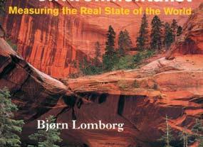
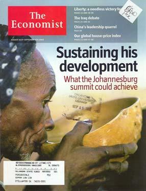
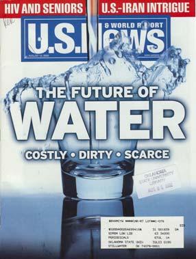


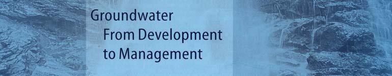
3 Ground Water - from Development to Management 2001 September 2002 Access to clean water is a continuing global challenge August 2002 February 2004 August 2002

4 Global Challenge Stress on world s major river basins, comparing the amount of water available to the amount of water humans use. Concerns about regional stability Source: World Commission on Water in the 21 st Century - MSNBC

 working water issues for the")
5 What is Needed? Shift in economic thinking ground water vs surface water Consider ground water as a regional resource Teams of scientists and concerned citizens (geology, sociology, business, government) working water issues for the common good Water from Table Mountain Group, South Africa
6 Today s Main Points Given that access to clean water is a continuing global challenge. Assessing, predicting, and managing groundwater supply / quality on a regional basis is one way to address the issue Regional formation characterization studies necessary to the above can/should be conducted by our community (more frequently) > the technology is available > the cost is not prohibitive relative to a) surface storage and b) preservation of long-term public health
7 Why Few Studies? Insufficient need? > unnecessary? we just don t do things that way (old habits) Tools and techniques unavailable? Too expensive?
8 Why Few Studies? Insufficient need? > unnecessary? we just don t do things that way (old habits) Tools and techniques unavailable? Too expensive?
9 Why Few Studies? Insufficient need? > unnecessary? we just don t do things that way (old habits) Tools and techniques unavailable? Too expensive?
10 Why Few Studies? Insufficient need? > unnecessary? we just don t do things that way (old habits) Tools and techniques unavailable? Too expensive?
11 Key Lessons from Regional Studies: Properties vary with the geologic framework at all scales Factors that control properties can be mapped > stratigraphy, depositional setting > provenance > burial history (pressure, temperature) Development of predictive models / maps requires systematic integration of skills, tools/techniques, and quality-controlled data
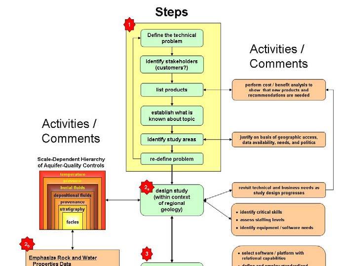
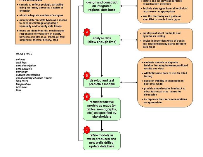

12 Steps in Performing Regional Studies
13 Regional Studies and Keys to Success 1. Design study within context of regional geology 2. Emphasize rock-properties and water-quality data 3. Build an integrated database using standardized classification schemes 4. Devote time to data analysis 5. Develop and test predictive models 6. Recast predictive models as maps and tables to satisfy needs (governmental, business, technical) 7. Refine models as new wells drilled / update data base


14 Hierarchy of Factors Influencing Formation Properties Scale Dependency Design study within context of regional geology temperature Burial Factors pressure burial fluids depositional fluids provenance Inherited Factors stratigraphy facies
15 Depositional Environment Frequency <2400m n= DARCY An example of differences expected in aquifer properties should stratigraphic section be uplifted and eroded to nearsurface environs! North Sea Brent Group North Viking Graben Frequency m n= DARCY up to 18% φ, three orders of magnitude difference in permeability across depositional settings Frequency m n=3423 Setting Offshore Marine Lower Shoreface Coastal Plain Upper Shoreface Active Channel 1 DARCY Permeability md
16 Temperature Frequency 300 n= DARCY North Sea Brent Group North Viking Graben Facies Setting An example of differences expected in aquifer properties should stratigraphic section be uplifted and eroded to near surface environs! E D C B A Offshore Marine Lower Shoreface Coastal Plain Upper Shoreface Active Channel up to 18% φ, three orders of magnitude difference in permeability across temperature threshold n= Permeability md 800m
17 Locating Favorable Quality Temperature Pressure Fluids One approach to recognizing where the best formation quality will be located a Sweet Spot will correspond to the mapped coincidence of favorable conditions for each of the formation quality controls... Provenance Optimum Facies Maps Base Map Sweet Spot
18 Why Few Studies? Insufficient need? > unnecessary? we just don t do things that way (old habits) Tools and techniques unavailable? Too expensive?
19 What Price Water? Tucurui Hydropower Complex in Brazil (US $10 Billion) Positives > water storage, generation of electricity Negatives > malaria outbreaks, increase in mercury concentrations (World Commission on Dams) > evaporation > displacement of inhabitants
20 Cost of Surface vs Ground Water Surface Water Reservoirs* - $1 billion / km 3 - Typical project cost $ million Ground Water Development - $20 K - $100 K / km 3 - Typical study cost of $100,000 - $1 million *Based on survey of dams used for water supply only and constructed in last 10 years.


21 Buckets Ground-water storage is 98% of the available freshwater storage (largest and cheapest container or bucket ) Halihan 2002 Box sizes proportional to the volume of fresh water
22 Why Few Studies? Insufficient need? Clear Need > unnecessary? But we do we just don t do things that way (old habits) Tools and techniques unavailable? Too expensive? Available Can we afford not to?
23 Today s Main Points Given that access to clean water is a continuing global challenge. Assessing, predicting, and managing groundwater supply / quality on a regional basis is one way to address the issue Regional formation characterization studies necessary to the above can/should be conducted by our community (more frequently) > the technology is available > the cost is not prohibitive relative to a) surface storage and b) preservation of long-term public health
24 Evaluating Geological Formations and Managing Ground-Water Resources: Can We Afford the Effort? Stanley T. Paxton & Todd Halihan Oklahoma State University GSA Annual Meeting Salt Lake City, Utah October, 2005
Surface Processes Focus on Mass Wasting (Chapter 10)
") Surface Processes Focus on Mass Wasting (Chapter 10) 1. What is the distinction between weathering, mass wasting, and erosion? 2. What is the controlling force in mass wasting? What force provides resistance?
Surface Processes Focus on Mass Wasting (Chapter 10) 1. What is the distinction between weathering, mass wasting, and erosion? 2. What is the controlling force in mass wasting? What force provides resistance?
Earth Science Chapter 9. Day 6 - Finish Capillary Action Lab - Quiz over Notes - Review Worksheets over Sections 9.2 and 9.3
 Earth Science Chapter 9 Day 1 Day 2 Day 3 Read Section 9.1 Surface Water Chapter 9 Term Sheet Notes over Section 9.1 Surface Water Section 9.1 Review Worksheets Quiz over Section 9.1 Notes Virtual Lab
Global Opportunities for Offshore CCS : Assessing Offshore Storage on Continental Shelves
 Global Opportunities for Offshore CCS : Assessing Offshore Storage on Continental Shelves International Workshop on Offshore Geological CO 2 Storage Austin, Texas April 19 20, 2016 Dr. Tip Meckel, Research
OIL AND GAS PLAYS OF THE MICHIGAN BASIN, SOUTHERN ONTARIO. Terry Carter, Consulting Geologist London, Ontario
 OIL AND GAS PLAYS OF THE MICHIGAN BASIN, SOUTHERN ONTARIO Terry Carter, Consulting Geologist London, Ontario 1 Ontario Petroleum Industries Oil and Natural Gas 1250 oil wells, 1200 gas wells, annual production
Question #1: What are some ways that you think the climate may have changed in the area where you live over the past million years?
 Reading 5.2 Environmental Change Think about the area where you live. You may see changes in the landscape in that area over a year. Some of those changes are weather related. Others are due to how the
Exploration research at SINTEF Petroleum
 Joining Forces 2016, Stavanger 2 nd and 3 rd of February 2016 Exploration research at SINTEF Petroleum Ane Lothe Research Manager, Basin Modelling Group Technology for a better society 1 Overview Short
Outline 16: The Mesozoic World: Formation of Oil Deposits (with a side trip to the Devonian Marcellus Shale)
") Outline 16: The Mesozoic World: Formation of Oil Deposits (with a side trip to the Devonian Marcellus Shale) The first commercial oil well was drilled by Colonel Edwin Drake in Titusville, Pennsylvania,
Outline 16: The Mesozoic World: Formation of Oil Deposits (with a side trip to the Devonian Marcellus Shale) The first commercial oil well was drilled by Colonel Edwin Drake in Titusville, Pennsylvania,
Groundwater Sequence Stratigraphy:
 Groundwater Sequence Stratigraphy: A Geology-based Approach for Developing Accurate and Representative Hydrogeologic Conceptual Models for Successful Groundwater Sustainability Plans Rick Cramer, Burns
Main Challenges and Uncertainties for Oil Production from Turbidite Reservoirs in Deep Water Campos Basin, Brazil*
 Main Challenges and Uncertainties for Oil Production from Turbidite Reservoirs in Deep Water Campos Basin, Brazil* Carlos H. Bruhn 1, Antonio Pinto 1, and Paulo R. Johann 1 Search and Discovery Article
Sedimentary Rocks, our most Valuable Rocks. Or, what you will probably find when you are outdoors exploring.
 Sedimentary Rocks, our most Valuable Rocks Or, what you will probably find when you are outdoors exploring. Sedimentary rocks give us evidence to earth s earlier history. We look at processes happening
Brad Hayes Petrel Robertson Consulting Ltd.
 Brad Hayes Petrel Robertson Consulting Ltd. DE #2 is an area designated by the ERCB, within which special drilling/completion/testing regulations promote efficient and economic gas development Facilitates
What s Shaking in the Barnett Shale? STEP Dallas, August 11, 2015
 What s Shaking in the Barnett Shale? STEP Dallas, August 11, 2015 BSEEC.org @BSEEC Barnett Shale Facts The Barnett Shale was the first energy shale to be developed and therefore is the birthplace of the
RATE OF FLUID FLOW THROUGH POROUS MEDIA
 RATE OF FLUID FLOW THROUGH POROUS MEDIA Submitted by Xu Ming Xin Kiong Min Yi Kimberly Yip Juen Chen Nicole A project presented to the Singapore Mathematical Society Essay Competition 2013 1 Abstract Fluid
Geologic Considerations of Shallow SAGD Caprock; Seal Capacity, Seal Geometry and Seal Integrity, Athabasca Oilsands, Alberta Canada
 Geologic Considerations of Shallow SAGD Caprock; Seal Capacity, Seal Geometry and Seal Integrity, Athabasca Oilsands, Alberta Canada Gordon T. Stabb, Michael Webb Durando Resources Corp, Suncor Energy
Reservoir Characterization of the Swan Hills Eastern Platform Trend; a Multi-disciplinary Approach in Building an Applied Model
 Reservoir Characterization of the Swan Hills Eastern Platform Trend; a Multi-disciplinary Approach in Building an Applied Model Thanos A. Natras*, Arcan Resources Ltd., Calgary, Alberta tnatras@arcanres.com
Karoon Awarded Exploration Permit EPP46 in Australia s Most Active Exploration Province, the Ceduna Sub Basin, Great Australian Bight
 7 October 2016 ASX Announcement Karoon Awarded Exploration Permit EPP46 in Australia s Most Active Exploration Province, the Ceduna Sub Basin, Great Australian Bight Karoon Gas Australia Ltd (ASX: KAR)
Geology and Natural Resources
 Geology and Natural Resources Brought to you by: Western Michigan University Department of Geosciences and The Michigan Geological Repository for Research and Education s K-12 Outreach Program Core Kids
Where do they come from?
 Exploring Meteorite Mysteries Lesson 7 Crater Hunters Objectives Students will: observe impact craters on Earth and other solar system bodies. discuss geologic forces that have removed most of the evidence
Dr. Kenneth B. Taylor, P.G.
 North Carolina Forestry Association 2013 Annual Meeting October 3, 2013 Shale Gas 101: Natural Gas Exploration / Development: A North Carolina Perspective presented by Dr. Kenneth B. Taylor, P.G. State
Geologic Time: Concepts and Principles
 Geologic Time: Concepts and Principles Introduction - An appreciation for the immensity of geologic time is essential for understanding the history of our planet - Geologists use two references for time
TECHNICAL STUDIES. rpsgroup.com/energy
 TECHNICAL STUDIES RPS Energy - a global energy consultancy RPS Energy is part of the RPS Group plc, a FTSE 250 company with an annual turnover of $700m and over 4700 employees. As one of the world s leading
Today s oil is yesterday s plankton
 Oil and Gas Basics 2 Today s oil is yesterday s plankton Small marine and lake organisms live in surface waters They die, fall to the bottom and get buried into an organic rich sedimentary layer If geologic
From 2D Seismic to Hydrodynamic Modelling
 From 2D Seismic to Hydrodynamic Modelling A Complex Study of Turbidites in a Petroleum-Bearing Basin Marcell Lux, HC Exploration Geologist Ahmed Amran, HC Exploration Advisor Marianna Vincze, Geomodel
Distribution of Natural Resources 7 th Grade PSI Science
 Distribution of Natural Resources 7 th Grade PSI Science Name Directions: Humans and animals use natural resources every day. But where are these resources found? The maps below show the distribution of
Section 11.1 pp Where Mountains Form
 Section 11.1 pp. 236 237 Where Mountains Form Chapter 11 Set a Purpose: TE, p. 236 Reading Study Guide, p. 36 Discussion: TE, p. 236 Differentiating ion Reading Support: TE, p. 236 Visual Teaching Interpret
The first steps in the hydropower project cycle:
 The first steps in the hydropower project cycle: Initial investigations and feasibility studies 12 September 2013 Bruce Taylor Introduction Objectives of early stage studies Tools and methods Case study
Environmental Science Institute The University of Texas - Austin
 Environmental Science Institute The University of Texas - Austin Geologic Wonders of Central Texas Dr. Leon Long This file contains suggestions for how to incorporate the material from this CDROM into
Is It Likely That Fracking the Organic-Rich Utica Shale Beneath Bowling Green, OH Would Be Environmentally Safe?
 Is It Likely That Fracking the Organic-Rich Utica Shale Beneath Bowling Green, OH Would Be Environmentally Safe? Dr. Robert K. Vincent Prof. Emeritus, Dept. of Geology Bowling Green State University How
GLY 4734/6932: Coastal Morphology and Processes
 GLY 4734/6932: Coastal Morphology and Processes In-Class Exercise think about these questions to answer at the end of class Name and where are you from? What coast are you most familiar with or are you
Exploration _Advanced geophysical methods. Research Challenges. Séverine Pannetier-Lescoffit and Ute Mann. SINTEF Petroleum Research
 Exploration _Advanced geophysical methods * Research Challenges Séverine Pannetier-Lescoffit and Ute Mann SINTEF Petroleum Research 1 Exploration and Reservoir Characterization * Research Challenges 29%
Terrain Units PALEOGEOGRAPHY: LANDFORM CREATION. Present Geology of NYS. Detailed Geologic Map of NYS
 NYS TOPOGRAPHY Why so? PALEOGEOGRAPHY: LANDFORM CREATION Prof. Anthony Grande AFG 014 Present Geology of NYS Detailed Geologic Map of NYS Generalized Geology Detailed Geology Hot links to the fold out
Geothermal Systems: Geologic Origins of a Vast Energy Resource
 Geothermal Systems: Geologic Origins of a Vast Energy Resource Energy From the Earth Energy-Land-Water Connections Speaker Series James E. Faulds, PhD Nevada State Geologist and Professor Nevada Bureau
East Texas Cotton Valley Sands: The Transmogrification of Historical Vertical Development to Horizontal Exploitation
 East Texas Cotton Valley Sands: The Transmogrification of Historical Vertical Development to Horizontal Exploitation Horizontal Exploitation of the Cotton Valley Sands in East Texas In the last 10 years,
WWDC Green River Basin Plan II, Groundwater Study (Level I) WSGS USGS WRDS October 23, 2008 Green River Basin (GRB) Basin Advisory Group
 WSGS USGS WRDS October 23, 2008 Green River Basin (GRB) Basin Advisory Group") WWDC Green River Basin Plan II, Groundwater Study (Level I) WSGS USGS WRDS 2007-20092009 October 23, 2008 Green River Basin (GRB) Basin Advisory Group (BAG) Western Wyoming Community College, Rock Springs,
WWDC Green River Basin Plan II, Groundwater Study (Level I) WSGS USGS WRDS 2007-20092009 October 23, 2008 Green River Basin (GRB) Basin Advisory Group (BAG) Western Wyoming Community College, Rock Springs,
resource and vulnerability Robineau & Join, nov
 Groundwater in tropical islands resource and vulnerability Robineau & Join, nov 2007 1 Diversity of hydrogeological environments in coastal areas of tropical islands : Hydrologic conditions (surface waters)
Activity Cupcake Geology
 Activity Cupcake Geology Drill a cupcake an analogy to offshore drilling to uncover a geologic history. Read descriptions of turbidites on previous pages. What s inside that cupcake? All is not what it
Best Practice Reservoir Characterization for the Alberta Oil Sands
 Best Practice Reservoir Characterization for the Alberta Oil Sands Jason A. McLennan and Clayton V. Deutsch Centre for Computational Geostatistics (CCG) Department of Civil and Environmental Engineering
Search and Discovery Article #10532 (2013)** Posted October 21, Abstract
** Posted October 21, Abstract") Utilizing the Delta Log R Method for Determining Total Organic Carbon of the Niobrara Formation, B Bench, Denver-Julesburg Basin, Colorado and Wyoming* Madeline K. Beitz 1, Robert Cunningham 2, and Lisa
Utilizing the Delta Log R Method for Determining Total Organic Carbon of the Niobrara Formation, B Bench, Denver-Julesburg Basin, Colorado and Wyoming* Madeline K. Beitz 1, Robert Cunningham 2, and Lisa
WATER ON AND UNDER GROUND. Objectives. The Hydrologic Cycle
 WATER ON AND UNDER GROUND Objectives Define and describe the hydrologic cycle. Identify the basic characteristics of streams. Define drainage basin. Describe how floods occur and what factors may make
Experienced specialists providing consulting services worldwide. Coalbed Methane Consulting Services
 Experienced specialists providing consulting services worldwide Coalbed Methane Consulting Services Proven technical leadership Schlumberger is a world leader in coalbed methane (CBM) engineering and geosciences.
EMEKA M. ILOGHALU, NNAMDI AZIKIWE UNIVERSITY, AWKA, NIGERIA.
 Automatic classification of lithofacies and interpretation of depositional environment using Neural Networks Technique - A Novel Computer-Based methodology for 3-D reservoir geological modelling and exploration
Tim Carr - West Virginia University
 GEOGRAPHIC EXTENT OF PETROLEUM SYSTEM A Trap Trap Trap A STRATIGRAPHIC EXTENT OF PETROLEUM SYSTEM Petroleum accumulation Top of oil window Bottom of oil window Overburden Seal Reservoir Source Underburden
Geosciences Career Pathways (Including Alternative Energy)
") Geosciences Career Pathways (Including Alternative Energy) Shale Carbonates Clastics Unconventionals Geology Characterization and Production Properties of Gas Shales Geomechanics in International Shale
Geosciences Career Pathways (Including Alternative Energy) Shale Carbonates Clastics Unconventionals Geology Characterization and Production Properties of Gas Shales Geomechanics in International Shale
Utah s s Oil Shale Deposits: Stratigraphy and Resource Evaluation
 Utah s s Oil Shale Deposits: Stratigraphy and Resource Evaluation Michael D. Vanden Berg Utah Geological Survey 27 th Oil Shale Symposium October 2007 Outline 1) Utah Oil Shale Database 2) Historical oil
Short Course. Petroleum Geochemistry & Basin Evaluation. Available to EGI Corporate Associate Members. Overview. Objectives.
 Short Course Instructor: David Thul, M.Sc. Manager of Petroleum Geochemistry Petroleum Geochemistry & Basin Evaluation Available to EGI Corporate Associate Members Course Structure Lectures, presentation
 Tutors: Huw Williams & Paul Davies (Reservoir Geology Consultants Limited) Duration: A six day field and classroom-based reservoir geology and modelling course in Grand Junction, Colorado and Green River,
Integrating Geomechanics and Reservoir Characterization Examples from Canadian Shale Plays
 Integrating Geomechanics and Reservoir Characterization Examples from Canadian Shale Plays AAPG Geosciences Technology Workshops Geomechanics and Reservoir Characterization of Shale and Carbonates July
2016 U.S. Geological Survey Assessment of Continuous Oil and Gas Resources in the Mancos Shale of the Piceance Basin
 2016 U.S. Geological Survey Assessment of Continuous Oil and Gas Resources in the Mancos Shale of the Piceance Basin U.S. Department of the Interior U.S. Geological Survey Uinta-Piceance Province Colorado
Basin & Range / Mojave Desert
 Basin & Range / Mojave Desert Basin & Range vs. Great Basin 1 2/20/2016 An overview of the last horst Basin and Range / Mojave Desert Summary: Granitic, volcanic, marine sedimentary, non marine sedimentary,
Training the Next Generation of Geoscientists to Solve Realworld Environmental Problems using Advanced Techniques: Year Two Report
 Illinois State Geological Survey 615 E. Peabody Dr. Champaign, IL 61820 Training the Next Generation of Geoscientists to Solve Realworld Environmental Problems using Advanced Techniques: Year Two Report
The Impact of Changing Winds on Estuarine Evolution, Copano Bay, TX
 The Impact of Changing Winds on Estuarine Evolution, Copano Bay, TX Purpose: The fulfillment of partial requirements for the Degree of Master of Science in Geology Oklahoma State University, Stillwater
GY 111: Physical Geology
 UNIVERSITY OF SOUTH ALABAMA GY 111: Physical Geology Lecture 14: Sedimentary Rocks Part 2: Alluvial Fans and Rivers Instructor: Dr. Douglas W. Haywick Last Time 1) Types of Sediment 2) Sedimentary Rock
EVALUATION OF KEY FACTORS AFFECTING SUCCESSFUL OIL PRODUCTION IN THE BAKKEN FORMATION, NORTH DAKOTA. Technology Status Assessment.
 EVALUATION OF KEY FACTORS AFFECTING SUCCESSFUL OIL PRODUCTION IN THE BAKKEN FORMATION, NORTH DAKOTA Technology Status Assessment Prepared by: James A. Sorensen Senior Research Manager Energy & Environmental
The Impact of Parasequence Stacking Patterns on Vertical Connectivity Between Wave-Dominated, Shallow Marine Parasequences, Book Cliffs, Eastern Utah
 The Impact of Parasequence Stacking Patterns on Vertical Connectivity Between Wave-Dominated, Shallow Marine Parasequences, Book Cliffs, Eastern Utah MALCOLM J. ARNOT and TIMOTHY R. GOOD* MALCOLM J. ARNOT
GLY 4734/6932: Coastal Morphology and Processes
 GLY 4734/6932: Coastal Morphology and Processes Narrow, but (perhaps the most) dynamic environment on Earth Influenced by both terrestrial and oceanic processes Course is organized into two parts: (1)
Deep Time: How Old Is Old?
 Deep Time: How Old Is Old? Updated by: Rick Oches, Professor of Geology & Environmental Sciences Bentley University Waltham, Massachusetts Based on slides prepared by: Ronald L. Parker, Senior Geologist
DENR s Oil and Gas Initiative. Legislative briefing March 7, 2011 by DENR s Geological Survey Program
 DENR s Oil and Gas Initiative Legislative briefing March 7, 2011 by DENR s Geological Survey Program South Dakota DOES have exploration for and production of oil and gas Taken from http://denr.sd.gov/des/og/producti.aspx
Stephanie B. Gaswirth and Kristen R. Mara
 U.S. Geological Survey Assessment of Undiscovered Resources in the Bakken and Three Forks Formations, Williston Basin, North Dakota, Montana, and South Dakota, 2013 Stephanie B. Gaswirth and Kristen R.
Search and Discovery Article #20097 (2011) Posted January 31, 2011
 Posted January 31, 2011") Integrated Geological and Engineering Studies in Support of Producing Light Oil from a Frozen Reservoir: A Case Study from Umiat Oil Field, Northern Alaska* C. Hanks 1, J. Mongrain 2, A. Dandekar 2, P.
Integrated Geological and Engineering Studies in Support of Producing Light Oil from a Frozen Reservoir: A Case Study from Umiat Oil Field, Northern Alaska* C. Hanks 1, J. Mongrain 2, A. Dandekar 2, P.
Subsurface Geology and Resource Exploration
 LAB 11. Subsurface Geology and Resource Exploration Locating earth resources such as aluminum, copper, gold and gemstones has been an important job for geologists for a long time. This lab deals with the
GEOL 1121 Earth Processes and Environments
 GEOL 1121 Earth Processes and Environments Wondwosen Seyoum Department of Geology University of Georgia e-mail: seyoum@uga.edu G/G Bldg., Rm. No. 122 Seyoum, 2015 Chapter 6 Streams and Flooding Seyoum,
Rong Jiang. Map of River. Table of Basic Data. China 14. Serial No. : China-14
 Rong Jiang Map of River Table of Basic Data Name(s): Rong Jiang Location: Guangdong Province, Coastways China Area: 4,408 km 2 Serial No. : China-14 N 23 11' ~ 23 55' E 115 37' ~ 116 38' Length of the
1- Water on Earth 2- Oceans and seas / continental waters 3- Uses, risks and problems of water
 Contents: I- Relief 1- Structure of the Earth and relief formation 2- Shaping of relief 3- Types of relief II- Water 1- Water on Earth 2- Oceans and seas / continental waters 3- Uses, risks and problems
Integrated geological approach to the study of coastal subsidence in Emilia-Romagna. Luisa PERINI Calabrese Lorenzo, Luciani Paolo, Severi Paolo,
 Integrated geological approach to the study of coastal subsidence in Emilia-Romagna Luisa PERINI Calabrese Lorenzo, Luciani Paolo, Severi Paolo, Subsidence hazard of Emilia-Romagna coastal plain Caputo
Influence of the Major Drainages to the Mississippi River and Implications for System Level Management
 Influence of the Major Drainages to the Mississippi River and Implications for System Level Management Brian M. Vosburg Geologist Louisiana Coastal Protection and Restoration Authority brian.vosburg@la.gov
depositional environment = one type of sediment/sedimentary rock = sedimentary structure =
 High School Advanced Geology Exam May 2014 Name: Provide complete short answers to the follow questions. 1. Name one depositional environment for sediment/sedimentary rocks. Name one type of sediment/sedimentary
Optimizing Completions within the Montney Resource Play Mike Seifert, Mark Lenko, Joshua Lee Canadian Discovery Ltd.
 URTeC: 2139640 Optimizing Completions within the Montney Resource Play Mike Seifert, Mark Lenko, Joshua Lee Canadian Discovery Ltd. Introduction The Montney resource play covers 57,000 square miles from
Directed Reading page
 Skills Worksheet Directed Reading page 185-190 Section: Determining Relative Age 1. How old is Earth estimated to be? 2. Who originated the idea that Earth is billions of years old? 3. On what did the
 12 10 8 6 4 2 0 40-50 50-60 60-70 70-80 80-90 90-100 Fresh Water What we will cover The Hydrologic Cycle River systems Floods Groundwater Caves and Karst Topography Hot springs Distribution of water in
Origin and Evolution of Formation Waters in the West-Central Part of the Alberta Basin
 Page No. 004-1 Origin and Evolution of Formation Waters in the West-Central Part of the Alberta Basin Karsten Michael* University of Alberta, 1-26 ESB, Edmonton, AB T6G 2E3 karsten@ualberta.ca and Stefan
Energy From the Earth Geologic Carbon Storage: Feasibility, Technology, and Challenges
 Energy From the Earth Geologic Carbon Storage: Feasibility, Technology, and Challenges Geological Requirements and Potential for Carbon Dioxide Storage in the United States Peter D. Warwick U.S. Geological
Depositional Environments. Depositional Environments
 Depositional Environments Geographic area in which sediment is deposited Characterized by a combination of geological process & environmental conditions Depositional Environments Geological processes:
What we will cover. The Hydrologic Cycle. River systems. Floods. Groundwater. Caves and Karst Topography. Hot springs
 Fresh Water What we will cover The Hydrologic Cycle River systems Floods Groundwater Caves and Karst Topography Hot springs On a piece of paper, put these reservoirs of water in to order from largest to
What we know about regional sea level rise and how we are affected by variations from the global mean
 regional sea level rise and variations from the global Magnus Hieronymus 2018 Regional and Global Sea level Global Density change: thermosteric Regional Density change: thermosteric+ halosteric Land Ice
Recap and Integrated Rock Mechanics and Natural Fracture Study on the Bakken Formation, Williston Basin Abstract Figure 1:
 Recap and Integrated Rock Mechanics and Natural Fracture Study on the Bakken Formation, Williston Basin Cosima Theloy, Department of Geology & Geological Engineering Abstract The late Devonian to early
In the space provided, write the letter of the description that best matches the term or phrase. a. any form of water that falls to Earth s
 Skills Worksheet Concept Review In the space provided, write the letter of the description that best matches the term or phrase. 1. condensation 2. floodplain 3. watershed 4. tributary 5. evapotranspiration
Cattaraugus Creek: A Story of Flowing Water and the Geology of the Channel It Flows Through Presentation to West Valley Citizen Task Force 4/27/16
 Cattaraugus Creek: A Story of Flowing Water and the Geology of the Channel It Flows Through Presentation to West Valley Citizen Task Force 4/27/16 Raymond C. Vaughan, Ph.D. What happens if you drop a
Kansas Underground Injection Control Program & Induced Seismicity. By: Benjamin Busboom Stinson Leonard Street
 Kansas Underground Injection Control Program & Induced Seismicity By: Benjamin Busboom Stinson Leonard Street What is underground injection? Unground injection is used to place fluid underground into porous
Unchain the River and Allow it to Build a Delta
 Unchain the River and Allow it to Build a Delta Harley S. Winer Atkins Harley.Winer@atkinsglobal.com Mississippi River Drainage Basin Basin Facts Drains 41% of continental U.S. Includes 31 states & 2 Canadian
Lab 9: Petroleum and groundwater
 Geology 101 Name(s): Lab 9: Petroleum and groundwater Petroleum (oil) is a multi-component liquid refined to generate different hydrocarbons, such as heptane (a component of gasoline) and waxes. For the
mountain rivers fixed channel boundaries (bedrock banks and bed) high transport capacity low storage input output
 high transport capacity low storage input output") mountain rivers fixed channel boundaries (bedrock banks and bed) high transport capacity low storage input output strong interaction between streams & hillslopes Sediment Budgets for Mountain Rivers Little
mountain rivers fixed channel boundaries (bedrock banks and bed) high transport capacity low storage input output strong interaction between streams & hillslopes Sediment Budgets for Mountain Rivers Little
Tell me what the word aggregate means and at least three things aggregate is used to make.
 Lesson Plan Scout s Geology Objective: After today s lesson, you will be able to Tell me what the word aggregate means and at least three things aggregate is used to make. List the steps in the mining
Meandering Miocene Deep Sea Channel Systems Offshore Congo, West Africa
 Meandering Miocene Deep Sea Channel Systems Offshore Congo, West Africa S. Baer* (PGS), J. E. Comstock (PGS), K. Vrålstad (PGS), R. Borsato (PGS), M. Martin (PGS), J.P. Saba (SNPC), B. Débi-Obambé (SNPC)
By: Jared T. Freiburg Illinois State Geological Survey 5/17/ cm
 Current Research on the Mt. Simon Geology; Refining the Lower Mt. Simon Depositional Interpretation By: Jared T. Freiburg Illinois State Geological Survey freiburg@illinois.edu 5/17/2016 2.5 cm Collaborators
Economic Geology Unconventional Energy Research
 Bureau of Economic Geology Unconventional Energy Research Overview for CEE meeting December, 2011 QAd2349x BUREAU OF ECONOMIC GEOLOGY Oldest research unit of The University of Texas at Austin Geological
Subsurface Mapping 1 TYPES OF SUBSURFACE MAPS:- 1.1 Structural Maps and Sections: -
 Subsurface Mapping The purpose of subsurface mapping in the geology of petroleum Is to find traps that contain oil and gas pools and the information obtained from wells forms the heart of the data upon
Modeling Great Britain s Flood Defenses. Flood Defense in Great Britain. By Dr. Yizhong Qu
 Modeling Great Britain s Flood Defenses AIRCurrents Editor s note: AIR launched its Inland Flood Model for Great Britain in December 2008. The hazard module captures the physical processes of rainfall-runoff
Soils, Hydrogeology, and Aquifer Properties. Philip B. Bedient 2006 Rice University
 Soils, Hydrogeology, and Aquifer Properties Philip B. Bedient 2006 Rice University Charbeneau, 2000. Basin Hydrologic Cycle Global Water Supply Distribution 3% of earth s water is fresh - 97% oceans 1%
GEOLOGICAL AGE OF ROCKS. Absolute geological age
 GEOLOGICAL AGE OF ROCKS Absolute geological age The pioneer of nuclear physics discovered at the turn of centuries that atoms of certain elements, the radioactive ones, spontaneously disintegrate to form
Carboniferous Stoddart Group: An integrated approach
 Carboniferous Stoddart Group: An integrated approach Abu Yousuf*, Department of Geoscience, University of Calgary, Calgary, Alberta yousufabu@hotmail.com and Charles M. Henderson, Department of Geoscience,
GEO 105 Oil and Gas Exploration Project
 GEO 105 Oil and Gas Exploration Project Modified from: Friedman, G.M., Johnson, K.G., 1982, Exercises in Sedimentology, John Wiley, p. 208 (via Reames and Carrigan at Olivet University) Student Learning
Department of Geosciences. Geology Meteorology Oceanography
 Department of Geosciences Geology Meteorology Oceanography Geoscientists study the earth Rivers Soils Lake sediments Evidence of ancient oceans Maps Volcanoes Fence offset by San Andreas fault Water quality
REGIONAL GEOLOGY IN KHMER BASIN
 CONTENTS 1-Khmere Basin 2-Regional Geology Khmer Basin 3-Regime Tectonic 4-Seismic Database -a/ Acquisition Data -b/ Prospect Angkor -C/ Cross Section Seismic 5-Play Type -a/ Play Schematic -b/ Structure
Rio Tinto Coal Mozambique. Refining the sedimentological model of the Moatize Basin Sediments, Stratigraphy & Coal
 Rio Tinto Coal Mozambique Refining the sedimentological model of the Moatize Basin Sediments, Stratigraphy & Coal Cautionary Statement This presentation has been prepared by Rio Tinto plc and Rio Tinto
2003 GCSSEPM Foundation Ed Picou Fellowship Grant for Graduate Studies in the Earth Sciences Recipient
 2003 GCSSEPM Foundation Ed Picou Fellowship Grant for Graduate Studies in the Earth Sciences Recipient Tarek A. El Shayeb University of Texas at Austin Integrated reservoir characterization and 3-D diagenetic
Geological CO 2 Storage Feasibility Study: Saline Aquifers and Depleted Oil Fields, Ordos Basin, Shaanxi Province
 U.S. - CHINA CLEAN ENERGY RESEARCH CENTER 中国清洁能源研究中心 Northwest University Geological CO 2 Storage Feasibility Study: Saline Aquifers and Depleted Oil Fields, Ordos Basin, Shaanxi Province 1 Ronald Surdam,
Sarah Jane Riordan. Australian School of Petroleum University of Adelaide March 2009
 Managing the Interdisciplinary Requirements of 3D Geological Models Sarah Jane Riordan Australian School of Petroleum University of Adelaide March 2009 Thesis submitted in accordance with the requirements
Bog Hot Valley. (updated 2012)
") Bog Hot Valley (updated 2012) Geologic setting: Bog Hot Valley is located along a major fault lineament between Soldier Meadows Hot Springs and Oregon (figure; Hose and Taylor, 1974). This lineament can
Bog Hot Valley (updated 2012) Geologic setting: Bog Hot Valley is located along a major fault lineament between Soldier Meadows Hot Springs and Oregon (figure; Hose and Taylor, 1974). This lineament can
netw rks Guided Reading Activity Essential Question: How does geography influence the way people live? Earth's Physical Geography
 Guided Reading Activity Lesson 1 Earth and the Sun Essential Question: How does geography influence the way people live? Looking at Earth Directions: What are the layers that make up Earth? Use your textbook
Modelling of CO 2 storage and long term behaviour in the Casablanca field
 Available online at www.sciencedirect.com Energy Procedia 1 (2009) (2008) 2919 2927 000 000 GHGT-9 www.elsevier.com/locate/xxx www.elsevier.com/locate/procedia Modelling of CO 2 storage and long term behaviour