12 th Polish German Seminar on Coastal Research The Baltic Sea at the middle of 21 th century
|
|
|
- Toby Ryan
- 6 years ago
- Views:
Transcription

1 Risk Analyis for Coastal Areas 12 th Polish German Seminar on Coastal Research The Baltic Sea at the middle of 21 th century M.Sc. Angelika Gruhn, Dipl.-Ing. Dörte Salecker, Prof. Dr.-Ing. Peter Fröhle Hamburg University of Technology October
2 Content What is Flood Risk Projects HoRisK Methodology of Risk Assessment Loads on Flood Defences Flood Defences and their Failure Consequences of Failure Coastal Flooding Damages and Damage Assessment Summary

3 What is Flood Risk
4 Project HoRisK - Partners November 1st, 2009 to December 31st, 2013 HoRisK-A Failure of Coast Protection Constructions and Damages Lehrstuhl und Institut für Wasserbau und Wasserwirtschaft, RWTH Aachen HoRisK-B Loads on Coast Protection Constructions and Consequences of Failure Hamburg University of Technology, Institute of River and Coastal Engineering HoRisK-C Consequences of Failure of Coast Protection Constructions and Minimization of Damages Niedersächsischer Landesbetrieb für Wasserwirtschaft, Küsten- und Naturschutz Betriebsstelle Norden-Norderney

5 Project HoRisK - Partners Other Partners Landesbetrieb für Küstenschutz, Nationalpark und Meeresschutz Schleswig-Holstein, Husum Staatliches Amt für Landwirtschaft und Umwelt Mittleres Mecklenburg, Rostock Landwirtschaftskammer Niedersachsen, Oldenburg HKV Hydrokontor GmbH, Aachen Main Goal of Reseach Additional information: http//:
6 Project HoRisK Risk Analysis & Work Packages I. Definitions and available methods Hazard Analysis II. Hazards and loads Reliability Analysis III. IV. Reliability and failure of constructions Consequences Coastal Flooding Hydrodynamic Analysis V. Consequences Damages Analysis of Consequences VI. VII. Integration Risk-Analysis Damage and Risk Minimization

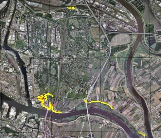
7 Project HoRisK Project Areas
8 Loads on Flood Defences Hazards and forces that act on coastal structures and might cause their failure high water levels the sea state currents ice Data collection (Waterways and Shipping Administration of the Federal Government, local authorities, own measurements, numerical simulation) Statistical analyses of single forces and assignment of probabilities of occurrence Statistical analyses of combinations of two forces and assignment of probabilities of occurrence Derivation of storm surge hydrographs for all focus areas Results are used as boundary conditions for further investigations in the following work packages
9 Loads on Flood Defences - Input data Samples of annual peak water levels are derived from the water level time series For all annual maximum water levels the corresponding fullness is calculated Fullness is the area between a threshold water level of 60 cm NHN and the water level progression over the time Erläutern des generellen Vorgehens bei der Festlegung von Bemessungsgrößen am Beispiel von Sturmflutganglinien für die Ostsee 1: Eingangsdaten Data: WSA
10 Loads on Flood Defences - Statistical analyses Univariate distribution functions are fitted to annual peak water level samples and fullness samples
11 Loads on Flood Defences - Statistical analyses Pairs of annual maximum water levels and corresponding fullness are plotted together to analyse the dependence of both measures A cumulative distribution function has to be found that is able to describe the bivariate sample A way to write a cumulative distribution of a bivariate sample is in terms of the marginal distribution functions and a copula
12 Loads on Flood Defences - Statistical analyses The marginal distribution functions describe the water level and the fullness, the copula describes the dependence structure between the components A probability of occurrence can be assign to two characteristics of storm surge hydrographs in tideless seas (water level and duration)
13 Loads on Flood Defences - Storm surge hydrograph shapes To generate random shapes both parameters (a und b) are generated randomly The time of the peak water level varies within the limits of actually measured times for each location Assuming that the shape of a storm surge is random, no probability of occurrence has to be assigned r θ = r θ = a cos θ + b 2 a sin θ + b 2 a cos θ b 2 a sin θ b 2 a) b)
14 Loads on Flood Defences - Storm surge hydrographs Shapes of storm surge hydrographs are being scaled in height and width using random combinations of water levels and fullness of a desired probability of occurrence


15 Flood Defences and their Failure Investigations of failure mechanisms and probability of failure for different flood defences Identification of the decisive failure mechanisms for flood defences and their corresponding probability of failure damage based and / or risk based approaches and methods for the determination of flood risk Dike Flood protection walls Dune Sluice 2. Dike line
 overtopping Focus on failure due to wave attack: applying different dune erosion models for assessment of probability of failure Dune 16.10.")
16 Flood Defences and their Failure Flood Defence Dunes Possible failure mechanisms for flood protection dunes: (i) erosion due to wave attack, (ii) overflow & (iii) overtopping Focus on failure due to wave attack: applying different dune erosion models for assessment of probability of failure Dune
17 Flood Defences and their Failure Dune Erosion Models Applying semi-empirical models as well as numerical models Semi-empirical dune erosion model Van Gent et.al. (2008) Based on the assumption of an equilibrium profile Input parameter direct H 0s, T p, w; indirect storm surge water level Calculation of the equilibrium profile (numerical integration Simpson rule) 7,6 y=0,4714* 7,6 H os H 0S 1,28 * 12 Tp 0,45 * w 0,0268 0,56 0,5 *x+18-2,0 x R =250* H 0S 7,6 1,28 * 0,0268 w 0,56 y R = H 0S 7,6 * 0,4714* 250* 12 T p 0, ,


18 Flood Defences and their Failure Dune Erosion Models Applying semi-empirical models as well as numerical models Numerical dune erosion model Xbeach (open source) Calibration at coastal area at the German Baltic Sea Coast Markgrafenheide
 Calibration at coastal area at the German Baltic Sea Coast Markgrafenheide 16.10.")
19 Flood Defences and their Failure Dune Erosion Models Numerical dune erosion model Xbeach (open source) Calibration at coastal area at the German Baltic Sea Coast Markgrafenheide
20 Flood Defences and their Failure Fragility Curves & their Calculation Assessment of reliability of flood defence Show the probability of failure and non-failure as function of stresses acting on the structure Shape depends on flood defence related parameters after Bachmann et.al Calculation of the fragility curve on the basis of reliability analysis for discrete points of the applied stress Determination of a limit state equation compares the strength of the flood defence with the stresses acting on this structure Z = R - S Applying Monte Carlo simulations for the calculation of the limit state equation flood defence failure occurs in the case of a negative result of the limit state equation
21 Flood Defences and their Failure Fragility Curves & their Calculation Needed limit state equation: Z = m*d Krobr_akt d KroBr_kr with: d Krobr_akt : determined by dune erosion model, d KroBr_kr : 5 m (width of the safety part), m: Model factor; m = 0,6 Calculation of failure probability by using using Monte Carlo analyses based on the limit state equation and the derived input paramters P f n fai n Carrying out a multitude of simulations for fixed values of water levels in combination with possible sea state conditions and durations of storm events of the same return period
22 Flood Defences and their Failure Resulting Fragility Curves Van Gent et.al. (2008) Xbeach (Roelvink et.al., 2009)
23 Consequences of Failure Coastal Flooding Assessment of different protection systems concerning: Protective effect Effect on inundation propagation Analyses of relevant processes and decisive parameters Breach development of dikes and dunes Influence of coastal protection systems Influence of topography within protected area Influence on polder dimension and 2. dike line Sensitivity of applied methodology
24 Consequences of Failure Coastal Flooding Systematic sensitivity analyses derivation of dependencies concerning conditions of a specific coastal area and parameters necessary for damage assessment Investigated parameters Breach width Breach location Duration of failure Return period of storm surges Storm surge fullness Influence of tides Derived inundation parameters Inundation height Flow velocity Retention time of maximum inundation Statistical analyses of potential inundation areas at the German Baltic Sea derivation of typical dimension of potential inundation areas and ground levels Baltic Sea coast => areas: 20 km² with a ground level of 0,375 m & 50 km² with a ground level of 0,875 m
25 Consequences of Failure Coastal Flooding Storm surge hydrographs Derivation of the storm surges by means of bivariate statistical models Return periods of 50 years, 100 years, 150 years & 200 years, 3 forms of the hydrographs each
26 Consequences of Failure Coastal Flooding Influence of the Breach Width Failure duration : 1hour Beginning of failure: 1 hour before storm surge water level Return period: 200 years Polder dimension [km²] Breach Width [m] , ,8 16,8 7 3, ,3 39,3 12,6 6, ,1 65,6 21, ,7 34, ,3 15, ,7 18, ,3 20,
27 Consequences of Failure Coastal Flooding Influence of the Return period Failure duration : 1hour Beginning of failure: 1 hour before storm surge water level Breach width: 50m Polder dimension [km²] Return period [years] , ,9 31,8 18,6 7, ,9 27,4 17,2 6, ,7 21,9 14 5,
28 Consequences of Failure Coastal Flooding Influence of the Storm surge fullness Failure duration : 1hour Beginning of failure: 1 hour before storm surge water level Breach width: 50m, Polder area: 5 km² Return period [years] Fullness ,3 18, ,5 24,4 27,2 3 2,4 2,8 3,

29 Consequences of Failure Coastal Flooding Influence of time of beginning of failure max. area = m² max. area = m²
30 Consequences of Failure Coastal Flooding Influence of breach width: 100m (left), 50m (right) max. area = m² max. area = m²
, T = 200a (right) max. area = 685.450 m² 16.10.")
31 Consequences of Failure Coastal Flooding Influence of storm surge water level: design storm surge (left), T = 200a (right) max. area = m²


32 Project XtremRisk German Joint Research Project XtremRisK (Extreme storm surges at open coasts and estuarine areas: Risk assessment and mitigation under climate change aspects) overall aim of the project: improvement of knowledge of the influences of morphological changes (uncertainties of storm surge predictions) the joint effect of extreme water level and sea waves and the quantification of the overall flood risk for two pilot areas
33 Damages and Damage Assessment Vulnerability assessment Spatial delineation of pilot area Definiton of damage categories Identification of elements at risk Typification of elements Value assessment & generation of damage functions Scenarios of extreme storm surges Flood propagation Direct damages Indirect damages Residential Infrastructure Commercial Agriculture Value added loss per Sektor Time for Reconstruction
![Damages and Damage Assessment Outer wall Inner wall Floor Ceiling Windows & doors Rooms Cleaning Residential Damage functions [ /m²], [%] Classes: Building (geometry,](/docs-images/75/72456607/images/34-0.jpg "construction), Inventory (configuration/furniture) Type: Absolute and Relative Intervall: 10cm steps for both inventory and building. In sections defined as linear functions. 16.")
34 Damages and Damage Assessment Outer wall Inner wall Floor Ceiling Windows & doors Rooms Cleaning Residential Damage functions [ /m²], [%] Classes: Building (geometry, construction), Inventory (configuration/furniture) Type: Absolute and Relative Intervall: 10cm steps for both inventory and building. In sections defined as linear functions


 (3) *")


35 Damages and Damage Assessment Storm surge scenarios (1) (2) (3) * Exceeding the bearable capacity of the Hinterland (~120 Mio. m³)

36 Damages and Damage Assessment Transfer of results into GIS


37 Damages and Damage Assessment Transfer of results into GIS Transfer into grid structure Intersection with risk elements Calculation of direct damages based on damage functions Damage [ ]


38 Damages and Damage Assessment (1) (2) (3) 10% 32-78% 61% 99% 52%
39 Summary Estimation of the flood risk of coastal areas by means of risk analysis Succession of different analyses results are used as input for subsequent analyses Results of statistical analysis of hydraulic loads are used as input parameters for reliability analysis & simulation of flood propagation Reliability analysis allow us to assess the probability of failure of a certain structure in case of an occurrence of a certain storm surge event Simulation flood propagation determine the flooded area and the inundation height Damage calculation combines the results of hydrodynamic simulations with an analysis of the risk element and its values Combination of results of the reliability analysis and the damage analysis defines the flood risk

40 Thank you A. Voelker
DETERMINATION OF COMBINED PROBABILITIES OF OCCURRENCE OF WATER LEVELS AND WAVE HEIGHTS FOR THE SAFTEY VALIDATION OF DIKES AT THE BALTIC SEA
 DETERMINATION OF COMBINED PROBABILITIES OF OCCURRENCE OF WATER LEVELS AND WAVE HEIGHTS FOR THE SAFTEY VALIDATION OF DIKES AT THE BALTIC SEA M. Sc. C. Kaehler 1, Dipl.-Ing. C. Schlamkow 2 and Prof. Dr.-Ing.
A probabilistic storm surge risk model for the German North and Baltic Sea coast
 A probabilistic storm surge risk model for the German North and Baltic Sea coast Jan-Henrik Grabbert 1), Jan Deepen 2), Andreas Reiner 2), Stephan Mai 3), Harvey Rodda 4), Dietmar Pfeifer 5) and Andreas
New modelling tools for coastal problems related to climate change
 New modelling tools for coastal problems related to climate change Nils Drønen Coastal and Estuarine Department, CED, DHI Climate change and coastal engineering Natural system Beach and dune system Coastal
Earth Sciences Research Centre Potsdam Telegrafenberg Potsdam, Germany
 Earth Sciences Research Centre Potsdam Telegrafenberg 14473 Potsdam, Germany Research on Levee Failure in the Framework of the German Research Network Natural Disasters www.dfnk.de First IMPACT Workshop
RISC-KIT: EWS-DSS Hotspot Tool
 RISC-KIT: EWS-DSS Hotspot Tool Robert McCall Ap van Dongeren Deltares www.risckit.eu This project has received funding from the European Union s Seventh Programme for Research, Technological Development
The probabilistic optimisation of the revetment on the dikes along the Frisian coast
 The probabilistic optimisation of the revetment on the dikes along the Frisian coast M. Hussaarts, J.K. Vrijling, P.H.A.J.M. van Gelder Subfaculty of Civil Engineering, Delft University of Technology,
Uncertainty on coastal flood risk calculations, and how to deal with it in coastal management. Case of the Belgian coastal zone.
 Uncertainty on coastal flood risk calculations, and how to deal with it in coastal management. Case of the Belgian coastal zone. By oon Verwaest 1, Wouter Vanneuville 1, Patrik Peeters 1, ina Mertens,
Numerical models in context of coastal climate change, adaptation and protection schemes. Nils Drønen Head of Innovation, CED, DHI
 Numerical models in context of coastal climate change, adaptation and protection schemes Nils Drønen Head of Innovation, CED, DHI Agenda Introduction How can we quantify coastal response to climate change
COASTAL FLOODING RISK CALCULATIONS FOR THE BELGIAN COAST
 COASTAL FLOODING RISK CALCULATIONS FOR THE BELGIAN COAST Verwaest, T. 1, Van der Biest, K. 1, Vanpouce, P. 2, Reyns, J. 2, Vanderimpen, P. 3, De Vos, L. 2, De Rouc, J. 2, Mertens, T. 4 This paper details
Predicting present and future coastal flood risk in North East Wales
 Predicting present and future coastal flood risk in North East Wales Fay Fishford & Thomas Bennett-Lloyd, JBA Consulting Benjamin Hext, Natural Resources Wales 1 st International Workshop on Waves, Storm
Integrated Design of Coastal Structures and Adaptation to Climate Change Hazards
 5 th International Conference on Environmental Science and Technology Rhodes, Greece, 3 August to 2 September 27 Integrated Design of Coastal Structures and Adaptation to Climate Change Hazards Mallıourı
Wainui Beach Management Strategy (WBMS) Summary of Existing Documents. GNS Tsunami Reports
 Summary of Existing Documents. GNS Tsunami Reports") Wainui Beach Management Strategy (WBMS) Summary of Existing Documents GNS Tsunami Reports a) Review of Tsunami Hazard and Risk in New Zealand ( National Risk Report ) b) Review of New Zealand s Preparedness
Wainui Beach Management Strategy (WBMS) Summary of Existing Documents GNS Tsunami Reports a) Review of Tsunami Hazard and Risk in New Zealand ( National Risk Report ) b) Review of New Zealand s Preparedness
Storm surges, perspectives and options
 Storm surges, perspectives and options Katja Woth and Hans von Storch Institute for Coastal Research GKSS Research Center, Geesthacht PAGE 1 Theme 3.1 - 'Natural hazards, sea level rise and coastal erosion',
South San Francisco Bay Shoreline Studies for EIA 11 with Project Conditions
 South San Francisco Bay Shoreline Studies for EIA 11 with Project Conditions U.S. Army Corps of Engineers San Francisco District Ms. Lisa Andes Mr. Craig Conner Dr. Frank Wu Dr. Jen-Men Lo Dr. Michael
Impact of Sea Level Change on Inner Coastal Waters of the Baltic Sea
 ICHE 2014, Hamburg - Lehfeldt & Kopmann (eds) - 2014 Bundesanstalt für Wasserbau ISBN 978-3-939230-32-8 Impact of Sea Level Change on Inner Coastal Waters of the Baltic Sea G. Seiß Bundesanstalt für Wasserbau,
Vulnerability of Bangladesh to Cyclones in a Changing Climate
 Vulnerability of Bangladesh to Cyclones in a Changing Climate Susmita Dasgupta Kiran Pandey Mainul Huq Zahirul Huq Khan M.M. Zahid Ahmed Nandan Mukherjee Malik Fida Khan 2010 Bangladesh: Tropical Cyclone
DUNE EROSION NEAR SEA WALLS: MODEL-DATA COMPARISON
 DUNE EROSION NEAR SEA WALLS: MODEL-DATA COMPARISON Pieter van Geer 1, Bram de Vries 2, Ap van Dongeren 1 and Jaap van Thiel de Vries 1,2 This paper describes the validation of the dune erosion model XBeach
Objective To enhance the management of defended coastlines through integration of coastal erosion and flood risk models
 School of Oriental and African Studies, 4 th October 2011 Practitioner workshop on asset management Shoreline evolution for flood risk assessment Dr Stuart Stripling EPSRC Grant: EP/FP202511/1 FRMRC2 WP4.3
Mapping of Future Coastal Hazards. for Southern California. January 7th, David Revell, Ph.D. E.
 Mapping of Future Coastal Hazards for Southern California January 7th, 2014 David Revell, Ph.D. drevell@esassoc.com E. Vandebroek, 2012 Outline Coastal erosion hazard zones Flood hazard zones: Coastal
EVALUATION TECHNIQUES FOR THE PROTECTIVE BENEFITS OF DUNE SYSTEMS TO COASTAL HAZARDS
 EVALUATION TECHNIQUES FOR THE PROTECTIVE BENEFITS OF DUNE SYSTEMS TO COASTAL HAZARDS 5 th Coastal Hazards Symposium Key West 2015 Matthew Janssen Thomas Herrington Jon Miller 1 Abstract Quantify and predict
Climate change and its impact on regional seas: What do we know? Marine weather and its impact
 Climate change and its impact on regional seas: What do we know? Marine weather and its impact Hans von Storch Institute for Coastal Research GKSS Research Center, Germany Berlin, PlanCoast Meeting, 21.
MODELLING FROST RISK IN APPLE TREE, IRAN. Mohammad Rahimi
 WMO Regional Seminar on strategic Capacity Development of National Meteorological and Hydrological Services in RA II (Opportunity and Challenges in 21th century) Tashkent, Uzbekistan, 3-4 December 2008
Storms. 3. Storm types 4. Coastal Sectors 5. Sorm Location and Seasonality 6. Storm Severity 7. Storm Frequency and grouping 8. The design storm event
 1. Introduction Storms 2. The Impact of Storms on the coast 3. Storm types 4. Coastal Sectors 5. Sorm Location and Seasonality 6. Storm Severity 7. Storm Frequency and grouping 8. The design storm event
Modeling Great Britain s Flood Defenses. Flood Defense in Great Britain. By Dr. Yizhong Qu
 Modeling Great Britain s Flood Defenses AIRCurrents Editor s note: AIR launched its Inland Flood Model for Great Britain in December 2008. The hazard module captures the physical processes of rainfall-runoff
ABSTRACT. KEY WORDS: Forelands, wave propagation, wave transmission, on site measurement, physical modelling, numerical modelling.
 Auszug aus: Proc. of the th Int. Conf. Offshore and Polar Engineering, Kitakyushu, Japan, (im Druck) Wave Transmission over Natural and Artificial Forelands Dr.-Ing. Nicole von Lieberman, Dipl.-Phys. Dipl.-Ing.
MODELLING CATASTROPHIC COASTAL FLOOD RISKS AROUND THE WORLD
 MODELLING CATASTROPHIC COASTAL FLOOD RISKS AROUND THE WORLD Nicola Howe Christopher Thomas Copyright 2016 Risk Management Solutions, Inc. All Rights Reserved. June 27, 2016 1 OUTLINE MOTIVATION What we
Process-based Long Term Morphological Modelling the present state-of-the-art and the way ahead. Dirk-Jan Walstra
 Process-based Long Term Morphological Modelling the present state-of-the-art and the way ahead Dirk-Jan Walstra Deltares Delft Hydraulics Delft University of Technology Les littoraux à l heure du changement
GIS as a tool in flood management
 GIS for the United Nations and the International Community Conference Panel: GIS and Capacity - How Territorial Planning Benefits from Geospatial Information 3-5 April 2012 Geneva, Switzerland GIS as a
Coastal Hazards System: Interpretation and Application
 Lessons Learned and Best Practices: Resilience of Coastal Infrastructure Hato Rey, PR March 8-9, 2017 Coastal Hazards System: Interpretation and Application Victor M. Gonzalez, P.E. Team: PI: Jeffrey A.
The Social Construction of Climate Adaptation Governance
 The Social Construction of Climate Adaptation Governance Thorsten Heimann, Nicole Mahlkow Folie 1 von 18 Initial: Different Handlings of Natural Science Scenarios concerning Climate Change Schleswig-Holstein,
Mapping, monitoring, and modeling: USGS Coastal and Marine Geology activities along the Northeast coast
 Mapping, monitoring, and modeling: USGS Coastal and Marine Geology activities along the Northeast coast Coastal and Marine Geology Program Woods Hole Coastal and Marine Science Center St. Petersburg Coastal
Appendix 15 Computational Methodology
 Appendix 15 Computational Methodology Introduction This Appendix describes the process used by the risk team to determine the final loss exceedence values in the risk analysis. The process involved the
DP2.8 The December 2013 storm. lessons In Flanders learned in Belgium
 DP2.8 The December 2013 storm Lessons Learned December Storm lessons In Flanders learned in Belgium Tidal Scheldt Sigmaplan Flemish Coast Coastal Safety Master Plan Lessons learnt Patrik Peeters Kathleen
Identification and Selection of Representative Storm Events from a Probabilistic Storm Data Base
 Identification and Selection of Representative Storm Events from a Probabilistic Storm Data Base by Mark B. Gravens and Dylan R. Sanderson PURPOSE: This Coastal and Hydraulics Engineering Technical Note
Probabilistic Coastal Flood Forecasting Nigel Tozer HR Wallingford
 Probabilistic Coastal Flood Forecasting Nigel Tozer HR Wallingford Peter Hawkes, Tim Pullen, HR Wallingford Angela Scott, UKCMF / Environment Agency Jonathan Flowerdew, Ken Mylne, Francois Xavier-Bocquet,
Longitudinal dams as an alternative to wing dikes in river engineering. Fredrik Huthoff
 Longitudinal dams as an alternative to wing dikes in river engineering Fredrik Huthoff Contents Introduction Why consider longitudinal dams? Room for the river in the Netherlands The pilot study The Dutch
SEDIMENT MANAGEMENT CONCEPT OF THE PORT OF HAMBURG
 International Conference - Karlsruher Flussgebietstage 2013 62 SEDIMENT MANAGEMENT CONCEPT OF THE PORT OF HAMBURG Axel Netzband Contact: Axel Netzband Hamburg Port Authority Neuer Wandrahm 4 20457 Hamburg
Coastal Vulnerability to Multiple Inundation Sources
 Overview Coastal Vulnerability to Multiple Inundation Sources Dall Osso F., Withycombe G., Summerhayes S., Dominey Howes D. 1. Storm surge and tsunamis 2. The aim of this project 3. Context and background
Improvements to Southeast Louisiana s floodwalls and pump stations since Katrina: the Hurricane and Storm Damage Risk Reduction System (HSDRRS)
") Improvements to Southeast Louisiana s floodwalls and pump stations since Katrina: the Hurricane and Storm Damage Risk Reduction System (HSDRRS) Pat Fitzpatrick Mississippi State University Review of levee
Improvements to Southeast Louisiana s floodwalls and pump stations since Katrina: the Hurricane and Storm Damage Risk Reduction System (HSDRRS) Pat Fitzpatrick Mississippi State University Review of levee
Storm surge A2-scenario for Hamburg St. Pauli, 2030; version 17/10/200712/07/200503/07/2005. Storm surge scenarios for Hamburg
 Storm surge A-scenario for Hamburg St. Pauli, 00; version 7/0/007/07/0050/07/005 Storm surge scenarios for Hamburg Abstract A scenario for future storm surge heights for the tide gauge of Hamburg St. Pauli
Karamea floodplain investigation
 Karamea floodplain investigation NIWA Client Report: CHC2010-107 October 2010 NIWA Project: ELF 10234/1 Karamea floodplain investigation Graeme Smart Jo Bind NIWA contact/corresponding author Graeme Smart
Sea Level Rise Study Summary Town of South Bethany
 Sea Level Rise Study Summary Town of South Bethany This presentation was prepared by Anchor QEA for the Town of South Bethany using Federal Funds under award NA14 NOS 419 0123 from the Delaware Coastal
FLOOD RISK OF REGIONAL FLOOD DEFENCES
 Fina l re port FLOOD RISK OF REGIONAL FLOOD DEFENCES APPENDIX 2015 26 Appendix Flood risk of regional flood defences Technical report 23 24 Flood risk of regional flood defences content Summary 29 1 Introduction
Assessing Storm Tide Hazard for the North-West Coast of Australia using an Integrated High-Resolution Model System
 Assessing Storm Tide Hazard for the North-West Coast of Australia using an Integrated High-Resolution Model System J. Churchill, D. Taylor, J. Burston, J. Dent September 14, 2017, Presenter Jim Churchill
Tool 2.1.4: Inundation modelling of present day and future floods
 Impacts of Climate Change on Urban Infrastructure & the Built Environment A Toolbox Tool 2.1.4: Inundation modelling of present day and future floods Authors M. Duncan 1 and G. Smart 1 Affiliation 1 NIWA,
National Report of Germany. J. Ihde, G. Liebsch, A. Rülke, M. Sacher, W. Söhne
 National Report of Germany J. Ihde, G. Liebsch, A. Rülke, M. Sacher, W. Söhne Modernization of the German height reference frame network configuration leveling, GNSS and gravity (mostly absolute) measurements
Preliminary Vulnerability Assessment of Coastal Flooding Threats - Taylor County, Florida
 Preliminary Vulnerability Assessment of Coastal Flooding Threats - Taylor County, Florida North Central Florida Regional Planning Council Northeast Florida Regional Council April 28, 2016 BACKGROUND This
PSA on Extreme Weather Phenomena for NPP Paks
 PSA on Extreme Weather Phenomena for NPP Paks Tamás Siklóssy siklossyt@nubiki.hu WGRISK Technical Discussion on PSA Related to Weather-Induced Hazards Paris, 9 March, 2017 Background Level 1 Seismic PSA
Scenarios for the NI coast in the 21 st Century
 Scenarios for the NI coast in the 21 st Century Prof Julian Orford Geography, Archaeology & Palaeoecology Queen s University, Belfast Challenging perspective Living by the coast is good for your health!
Ed Curtis, PE, CFM, FEMA Region IX and Darryl Hatheway, CFM, AECOM ASFPM 2016, Grand Rapids, MI
 Methodology to Determine Process-Based Total Water Level Profiles in Areas Dominated by Wave Runup Ed Curtis, PE, CFM, FEMA Region IX and Darryl Hatheway, CFM, AECOM ASFPM 2016, Grand Rapids, MI Thurs.
TO THE EFFECTIVENESS OF COASTAL AND FLOOD PROTECTION STRUCTURES UNDER TERMS OF CHANGING CLIMATE CONDITIONS. Peter Fröhle 1
 TO THE EFFECTIVENESS OF COASTAL AND FLOOD PROTECTION STRUCTURES UNDER TERMS OF CHANGING CLIMATE CONDITIONS Peter Fröhle 1 Consequences resulting from future Climate Change may be one of the most severe
COMPOUND FLOODING: EXAMPLES,
 1 COMPOUND FLOODING: EXAMPLES, METHODS, AND CHALLENGES Thomas Wahl Civil, Environmental and Construction Engineering & National Center for Integrated Coastal Research University of Central Florida Definition(s)
A methodology for impact, vulnerability and adaptation assessment in the coastal zone
 UNFCCC expert meeting on methods and tools and on data and observations under the Nairobi work programme on impacts, vulnerability and adaptation to climate change Mexico City, Mexico, 4-7 March 2008 A
Landslide Hazard Assessment Methodologies in Romania
 A Scientific Network for Earthquake, Landslide and Flood Hazard Prevention SciNet NatHazPrev Landslide Hazard Assessment Methodologies in Romania In the literature the terms of susceptibility and landslide
The simulation tool DredgeSim Predicting dredging needs in 2- and 3-dimensional models to evaluate dredging strategies
 River Flow 2010 - Dittrich, Koll, Aberle & Geisenhainer (eds) - 2010 Bundesanstalt für Wasserbau ISBN 978-3-939230-00-7 The simulation tool DredgeSim Predicting dredging needs in 2- and 3-dimensional models
Benchmarking of Hydrodynamic Models for Development of a Coupled Storm Surge Hazard-Infrastructure Modeling Method to improve Inundation Forecasting
 Benchmarking of Hydrodynamic Models for Development of a Coupled Storm Surge Hazard-Infrastructure Modeling Method to improve Inundation Forecasting Abstract Fragility-based models currently used in coastal
Annual transport rates at two locations on the fore-slope.
 Sediment Transport by Currents Fore-slope Sediment transport rates and sediment concentrations were computed from the hydrodynamic model runs as well as from direct measurements of current velocities at
ENGINEERING HYDROLOGY
 ENGINEERING HYDROLOGY Prof. Rajesh Bhagat Asst. Professor Civil Engineering Department Yeshwantrao Chavan College Of Engineering Nagpur B. E. (Civil Engg.) M. Tech. (Enviro. Engg.) GCOE, Amravati VNIT,
REPORT TO THE PLANNING, TRANSPORTATION AND PROTECTIVE SERVICES COMMITTEE MEETING OF JUNE 26, 2013
 PPS/PS 2013-07 REPORT TO THE PLANNING, TRANSPORTATION AND PROTECTIVE SERVICES COMMITTEE MEETING OF JUNE 26, 2013 SUBJECT UPDATES TO THE CAPITAL REGIONAL DISTRICT MODELLING OF POTENTIAL TSUNAMI INUNDATION
Coastal Inundation Forecasting and Community Response in Bangladesh
 WMO Coastal Inundation Forecasting and Community Response in Bangladesh Bapon (SHM) Fakhruddin Nadao Kohno 12 November 2015 System Design for Coastal Inundation Forecasting CIFDP-PSG-5, 14-16 May 2014,
Winfried Siefert ; Volker Barthel**' and
 CHAPTER 176 THE GERMAN "MORAN" PROJECT by Winfried Siefert ; Volker Barthel**' and Abstract The project "MORAN" (Morphological Analyses of the North- Sea-Coast) is an extensive program in order to try
Dynamic Coast. Coastal erosion / Management Briefing to THC
 Dynamic Coast Coastal erosion / Management Briefing to THC What is Dynamic Coast? Dynamic Coast is a Scottish Government project, funded by CREW, managed by SNH, with a research team from the University
New Jersey Department of Transportation Extreme Weather Asset Management Pilot Study
 New Jersey Department of Transportation Extreme Weather Asset Management Pilot Study Overview Prepared for: June 26, 2018 Introduction Overview of Pilot Study New Jersey s Climate New Jersey s Transportation
CONSIDERATIONS ON URBAN AREAS AND FLOATING DEBRIS IN DAM -BREAK FLOOD MODELLING. Peter Reiter *)
") 1 CONSIDERATIONS ON URBAN AREAS AND FLOATING DEBRIS IN DAM -BREAK FLOOD MODELLING. Peter Reiter *) 1. SUMMARY Every model is a story, describing real-life and more or less significant simplifications are
1 CONSIDERATIONS ON URBAN AREAS AND FLOATING DEBRIS IN DAM -BREAK FLOOD MODELLING. Peter Reiter *) 1. SUMMARY Every model is a story, describing real-life and more or less significant simplifications are
The influence of local cultural values on the governance of adaptation. A comparison between two coastal communities at the German Baltic Sea.
 The influence of local cultural values on the governance of adaptation. A comparison between two coastal communities at the German Baltic Sea. Grit Martinez/ Ecologic Institute (principle investigator)
Coastal flood protection systems Xynthia feedback experience. Case studies conclusion
 Revue Paralia, Volume 9 (2016) pp s04.1-s04.6 Keywords: Flood, Protection, System, Xynthia. Editions Paralia CFL Coastal flood protection systems Xynthia feedback experience. Case studies conclusion Marc
European Geosciences Union General Assembly Vienna, Austria 27 April - 02 May 2014
 European Geosciences Union General Assembly Vienna, Austria 27 April - 02 May 2014 Projecting the Current & Future Impact of Storm Surges on Coastal Flood Extent at Pigeon Point, South-West Tobago, through
SECTION II Hydrological risk
 Chapter 3 Understanding disaster risk: hazard related risk issues SECTION II Hydrological risk Peter Salamon Coordinating lead author Hannah Cloke Lead author 3.4 Giuliano di Baldassarre Owen Landeg Florian
History and perspectives of storm surge management in Hamburg
 History and perspectives of storm surge management in Hamburg Hans von Storch; Institut für Küstenforschung, GKSS Forschungszentrum, Geesthacht; undclisap KlimaCampus, Hamburg University, Hamburg Manfred
STORM IMPACT MODELING ANALYSIS FOR THE RESTORATION OF GULF STATE PARK, AL
 STORM IMPACT MODELING ANALYSIS FOR THE RESTORATION OF GULF STATE PARK, AL Jordon Cheifet, PE, CFM Joao Dobrochinski, MSc Morjana Signorin APTIM Senior Project Engineer APTIM Numerical Modeling Lead APTIM
Smart Flood Risk Management Solutions
 Smart Flood Risk Management Solutions - RHDHV s Experience in the Gulf of Mexico Mathijs van Ledden, Marten Hillen and Ries Kluskens Challenge Extreme weather around the world (hurricanes, cyclones, extratropical
Modelling coastal flood risk in the data poor Bay of Bengal region
 Modelling coastal flood risk in the data poor Bay of Bengal region Matt Lewis*, Kevin Horsburgh (NOC), Paul Bates (Bristol) *m.j.lewis@bangor.ac.uk Funded by the EPSRC Flood Risk Management Research Consortium
Risk and Safety in Civil, Surveying and Environmental Engineering
 Risk and Safety in Civil, Surveying and Environmental Engineering Prof. Dr. Michael Havbro Faber ETH Zurich, Switzerland Contents of Today's Lecture Introduction to structural systems reliability General
M1:Estimating past and recent extreme wave and surge conditions in the southwestern Baltic Sea
 1st International Workshop on Waves, Storm Surges, and Coastal Hazards M1:Estimating past and recent extreme wave and surge conditions in the southwestern Baltic Sea Nikolaus Groll, Lidia Gaslikova and
COASTAL VULNERABILITY DUE TO SEA-LEVEL RISE HAZARDS IN THE BANGLADESH DELTA: BAND-AID
 Band-Aid Project NASA NASA ESA ESA JAXA NASA/DLR COASTAL VULNERABILITY DUE TO SEA-LEVEL RISE HAZARDS IN THE BANGLADESH DELTA: BAND-AID R. Rietbroek, B. Uebbing, C.K. Shum, V. Ballu, S. Calmant, J. Duan,
Physical Dynamics of the Coastal Zone in the Mediterranean on Annual to Decadal Scales
 Physical Dynamics of the Coastal Zone in the Mediterranean on Annual to Decadal Scales Hans-Peter Plag Nevada Bureau of Mines and Geology and Seismological Laboratory University of Nevada, Reno, Nevada,
Climate Change Impacts and Adaptation for Coastal Transport Infrastructure in Caribbean SIDS
 UNCTAD National Workshop Saint Lucia 24 26 May 2017, Rodney Bay, Saint Lucia Climate Change Impacts and Adaptation for Coastal Transport Infrastructure in Caribbean SIDS LISCoAsT Large Scale Integrated
Overflow Pattern and the Formation of Scoured Region by the Tsunami Propagated in River Channels in Great East Japan Earthquake
 Overflow Pattern and the Formation of Scoured Region by the Tsunami Propagated in River Channels in Great East Japan Earthquake N. Tanaka 1, 2, J. Yagisawa 1, 2 and S. Yasuda 2 1 Institute for Environmental
FAILURE MECHANISMS OF SEA DIKES- INVENTORY AND SENSITIVITY ANALYSIS
 FAILURE MECHANISMS OF SEA DIKES- INVENTORY AND SENSITIVITY ANALYSIS C. Mai Van 1,2, P.H.A.J.M. van Gelder 1 & J.K. Vrijling 1 This paper aims at probabilistic investigation of various possible failure
The coastdat data set and its potential for coastal and offshore applications
 The coastdat data set and its potential for coastal and offshore applications Elke M. I. Meyer 1, Ralf Weisse 1, Janina Sothmann 1, Heinz Günther 1, Ulrich Callies 1, Hans von Storch 1, Frauke Feser 1,
Probabilistic Assessment of Coastal Storm Hazards
 Resilience of Coastal Infrastructure Conference Hato Rey, PR March 8-9, 2017 Probabilistic Assessment of Coastal Storm Hazards Dr. Norberto C. Nadal-Caraballo Leader, Coastal Hazards Group Team: Victor
Improving global coastal inundation forecasting WMO Panel, UR2014, London, 2 July 2014
 Improving global coastal inundation forecasting WMO Panel, UR2014, London, 2 July 2014 Cyclone Sidr, November 2007 Hurricane Katrina, 2005 Prof. Kevin Horsburgh Head of marine physics, UK National Oceanography
Assessing the relevance of wetlands for storm surge protection: a coupled hydrodynamic and geospatial framework
 Civil, Environmental, and Infrastructure Engineering VOLGENAU SCHOOL OF ENGINEERING Assessing the relevance of wetlands for storm surge protection: a coupled hydrodynamic and geospatial framework Jana
Run 028 (Note: error in UKC at start of exercise due incorrect tide input then corrected ok.)
") Run 027 RNZ Full Bridge Simulation Run Plots Final Report Be-Software August 2016 Prepared for Royal Haskoning DHV on behalf of Refining New Zealand Limited 27 Run 028 (Note: error in UKC at start of exercise
Run 027 RNZ Full Bridge Simulation Run Plots Final Report Be-Software August 2016 Prepared for Royal Haskoning DHV on behalf of Refining New Zealand Limited 27 Run 028 (Note: error in UKC at start of exercise
Summary of Available Datasets that are Relevant to Flood Risk Characterization
 Inter-Agency Characterization Workshop February 25-27, 2014 USACE Institute for Water Resources, Alexandria, VA, IWR Classroom Summary of Available Datasets that are Relevant to Characterization National
CLIMATE MODEL DOWNSCALING: HOW DOES IT WORK AND WHAT DOES IT TELL YOU?
 rhgfdjhngngfmhgmghmghjmghfmf CLIMATE MODEL DOWNSCALING: HOW DOES IT WORK AND WHAT DOES IT TELL YOU? YAN FENG, PH.D. Atmospheric and Climate Scientist Environmental Sciences Division Argonne National Laboratory
Meeting the New Queensland Coastal Plan Storm Surge Requirements for Redland City Council. Queensland Coastal Conference 2011
 Meeting the New Queensland Coastal Plan Storm Surge Requirements for Redland City Council Ancient Knowledge Contemporary Innovation The Pullman Reef Hotel, Cairns Daniel Niven 1 and David Taylor 2 1 Cardno
Flooding Performance Indicator Summary. Performance indicator: Flooding impacts on riparian property for Lake Ontario and the Upper St.
 Flooding Performance Indicator Summary Performance indicator: Flooding impacts on riparian property for Lake Ontario and the Upper St. Lawrence River Technical Workgroup: Coastal TWG Research by: Baird
4.17 Spain. Catalonia
 4.17 Spain Catalonia In Spain, inundation studies are the responsibility of the respective Hydrographic Confederations of each river basin (River Basin Authorities). The actual status of inundation studies
Bayesian tsunami fragility modeling considering input data uncertainty
 Bayesian tsunami fragility modeling considering input data uncertainty Raffaele De Risi Research Associate University of Bristol United Kingdom De Risi, R., Goda, K., Mori, N., & Yasuda, T. (2016). Bayesian
Peter A. Slovinsky, Marine Geologist Maine Geological Survey Department of Agriculture, Conserva=on and Forestry. Funding from:
 Peter A. Slovinsky, Marine Geologist Maine Geological Survey Department of Agriculture, Conserva=on and Forestry Funding from: 50% 40% Figure modified from Griggs, 2001 10% Global Sea Level Rise Driving
ICOLD Bulletin 164 on internal erosion of dams, dikes and levees and their foundations
 ICOLD Bulletin 164 on internal erosion of dams, dikes and levees and their foundations Rodney Bridle UK Member, ICOLD Technical Committee on Embankment Dams rodney.bridle@damsafety.co.uk Workshop on seepage-induced
Climate Change Adaptation for ports and navigation infrastructure
 Climate Change Adaptation for ports and navigation infrastructure The application of climate projections and observations to address climate risks in ports Iñigo Losada Research Director IHCantabria Universidad
Module 8. Lecture 5: Reliability analysis
 Lecture 5: Reliability analysis Reliability It is defined as the probability of non-failure, p s, at which the resistance of the system exceeds the load; where P() denotes the probability. The failure
Monte Carlo Simulations for Probabilistic Flood Hazard Assessment
 Monte Carlo Simulations for Probabilistic Flood Hazard Assessment Jemie Dababneh, Ph.D., P.E., 1 and Mark Schwartz, P.E. 1 1 RIZZO Associates, Monroeville, Pennsylvania Presentation to PSA 2017 International
COASTAL DATA APPLICATION
 2015 Coastal GeoTools Proactive By Design. Our Company Commitment COASTAL DATA APPLICATION Projecting Future Coastal Flood Risk for Massachusetts Bay Bin Wang, Tianyi Liu, Daniel Stapleton & Michael Mobile
The "Geo-Information System Coast Mecklenburg-Vorpommern"
 The "Geo-Information System Coast Mecklenburg-Vorpommern" Lars Tiepolt State Office for Environment and Nature Rostock, Germany Abstract The Division Coast of the State Office for Environment and Nature
WP4: COASTAL PROCESSES
 WP4: COASTAL PROCESSES Coordinator: G. EBERHARDS Faculty of Geography and Earth Sciences, University of Latvia Daugavpils, 2008 Goal: The objective of this study is analysis of coastal changes and forecast
The Field Research Facility, Duck, NC Warming Ocean Observations and Forecast of Effects
 The Field Research Facility, Duck, NC Warming Ocean Observations and Forecast of Effects A potential consequence of a warming ocean is more frequent and more intense wind events (Hurricanes & Typhoons)
Reliability analysis of the Caldicot Levels flood defence system by using Dutch reliability methods for flood defences. Flooding of Caldicot Levels
 Reliability analysis of the Caldicot Levels flood defence system by using Dutch reliability methods for flood defences Flooding of Caldicot Levels Failure of embankment without additional structures Failure