RIVER FLOODING AND EROSION
|
|
|
- Rhoda Walton
- 6 years ago
- Views:
Transcription
1 BACKGROUND PAPER NO. 4 OCTOBER 2006 RIVER FLOODING AND EROSION IN NORTHEAST INDIA BY NORTHWEST HYDRAULICS CONSULTANTS (NHC)* EDMONTON, ALBERTA, CANADA This paper was commissioned as an input to the study Development and Growth in Northeast India: The Natural Resources, Water, and Environment Nexus * Contact Person: Herb Wiebe
2 Table of contents Glossary...iv Executive summary...1 I. Introduction...1 II. The Brahmaputra River in Assam...1 III. The Barak River in Assam...2 IV. Flooding and related costs...3 V. Flood management strategy considerations Background Context Study purpose Study limitations Document organization The Brahmaputra River in Assam Introduction Overall river features Geology, seismicity, and geomorphology River gradients and dimensions River flows and sediment transport Channel shifting and bank erosion Key implications for control of flooding and erosion The Barak River in Assam Introduction Physiographic and morphologic features Hydrology and hydraulics Sediment transport Flooding Flooding and related costs Significance and causes of flooding Flood damage Flood relief Flood management History...29 ii
3 5.2 Institutions Flood management assets Flood management issues Future development considerations Existing plans Strategy considerations Discussion of key issues...42 Reference list...44 Appendices...45 Tables Table A. Flood damage trends in the Brahmaputra valley of Assam...3 Table 1. States of the Northeast: Selected population and natural resource indicators...8 Table 2. Flood damage trends in the Brahmaputra valley of Assam...26 Table 3. Justifiable capital expenditure for corresponding % reduction in average annual flood damage...27 Table 4. Central flood assistance sought and received and area affected...28 Table 5. Northeastern Region flood management infrastructure by state...30 Table 6. Quantity and estimated value of existing flood management infrastructure and related assets...33 Figures Figure 1. Flood-affected crop area as percentage of total cropped area...25 Figure 2. Flood-affected area as percentage of total area...25 Boxes Box 1. The flood control controversy...35 Box 2. Indus river basin In Pakistan: Control of flooding and erosion...37 Appendices Figure A-1. Brahmaputra Plan View..46 Figure A-2. Satellite Image of Upper Reach of Brahmaputra in Assam...47 Figure A-3. Satellite Image of Lower Brahmaputra in Assam...48 Figure A-4. Long Section of the Brahmaputra River...49 Figure A-5. Selected Historical Imagery for bank line assessment...50 iii
4 Glossary Accretion. Growth of floodplain land by deposition of river-borne sediment, often on the insides of bends (point bars) or on midchannel bars and islands. Alluvial (river or channel). Formed or flowing in mainly noncohesive deposits laid down by river processes. Amplitude (of meanders). Average distance between outer points of a meander pattern or belt. Bankfull. Condition where a river is flowing up to average top-of-bank level with negligible overbank flow. Bedload. That portion of the total sediment load that moves in contact with the bed. Bed sediment. Comprises those sizes of sediment that are normally found on or in the riverbed under low-flow conditions. Bifurcation. Division of a river from a single upstream channel into two downstream channels. Clay. Cohesive deposit of mineral origin, composed essentially of grain sizes finer than millimeters; or its disaggregated form suspended in water. Cutoff. New channel formed naturally or artificially, cutting across the narrow neck of an enlarged or contorted meander loop. Gradient (river). Fall in elevation per unit length, as measured along the main channel or course; usually refers to a water surface corresponding to a consistent flow condition all along the river. Morphological. Relating to geometry and shape; with respect to a river, to its appearance in plan, its cross-sections, and its longitudinal profile. Node or nodal point. Location where a river channel is constrained on both sides, either naturally or artificially, and is not free to shift by erosion. Overbank flow. That portion of a flood flow that overtops the riverbanks and is carried on the floodplain. Oxbow (lake). Part of a former meander loop left isolated by a cutoff. Planform. Appearance of a river as mapped or seen from directly above; may be straight, meandering, multichannel, braided, contorted, etc. Regime. Overall or average characteristics or behavior; with respect to a river, its long-term discharge and water-level characteristics (flow regime), or its long-term morphological characteristics and their relationships to water and sediment inputs (channel regime). Revetment. Erosion protection facing constructed on and parallel to a sloping riverbank or embankment; may consist of broken rock, boulders, sandbags, concrete, gabions, etc. Riprap. Erosion protection consisting of quarry rock or boulders. Roughness coefficient. Numerical representation of the relative resistance to flow of channel boundaries; flow velocity is inversely proportional to roughness coefficient, other things being equal. iv
5 Sand. Noncohesive granular material of mineral origin, in the grain size range of 0.06 to 2.0 millimeters. Sediment concentration. Rate of sediment transport divided by rate of water flow (discharge) when both are expressed in the same units; usually expressed in parts per million by weight. Silt. Noncohesive granular material of mineral origin, in the grain size range of to 0.06 millimeters. Sinuosity. Ratio of channel length to direct valley length over a sequence of meanders. Spur (or groyne). Erosion protection structure constructed more or less perpendicular to a riverbank or embankment. Suspended sediment. Sediment supported by turbulence and carried between the bed and the surface of a river; under flood conditions it may include finer sizes of bed sediment. Wavelength (of meanders). Average straight-line distance between corresponding points on successive meanders, viewed as full wave-forms. v
6 Executive summary Executive summary I. Introduction India s Northeastern Region consists of eight states, namely Arunachal Pradesh, Assam, Manipur, Meghalaya, Mizoram, Nagaland, Sikkim, and Tripura. With a total population of 39 million (2001 census) and covering an area of 262,179 square kilometers, the Northeastern Region is relatively sparsely populated compared to much of the rest of India. However, population density varies widely among the northeastern states. Assam and Tripura are the most densely populated (with over 300 people per square kilometer, around the Indian average), while Arunachal Pradesh is the least densely populated (13 persons per square kilometer). The region has abundant water resources. One-third of India s runoff flows from the Northeast through the Brahmaputra and the Barak rivers and there is a substantial unutilized groundwater resource. There is estimated to be about 60,000 megawatts of economically viable hydropower potential, of which only about 65 megawatts is developed or under construction. It is also clear that the abundant water resources impose severe distress and costs on the region through frequent flooding and that this needs to be managed to improve economic development. The basin of the Brahmaputra River is among the most flood prone in the world, followed closely by that of the Barak River. Floods affect an annual average of 0.8 million hectares of land, but in some years they affect more than 4 million hectares of Assam s total area of 7.54 million hectares. Such extensive floods inundate at least 2,000 villages in addition to destroying other infrastructure. The problem is further exacerbated by riverbank erosion, which destroys an annual average of about 8,000 hectares of riparian land along the Brahmaputra. This study reviews flood and erosion management infrastructure in terms of financing, operation, and maintenance, and examines options for supporting improved measures for flood and erosion management. II. The Brahmaputra River in Assam The Brahmaputra River flows through Assam from east to west over a length of approximately 650 kilometers. Its main branch originates in the Tibetan plateau, flowing from west to east as the Tsangpo River, and then turns south through the eastern Himalaya as the Dihang River to enter Assam, where it is joined by other branches to form the Brahmaputra. Near the western boundary of Assam, the river turns south to enter Bangladesh, where it is generally known as the Jamuna. Through Assam, the long-term mean discharge rises from about 8,500 to 17,000 cubic meters per second as flows are augmented by major tributaries. Under low-flow conditions, almost the entire length of the river through Assam has a multichannel character: most reaches show three to six channels separated by islands and bars, a type of planform generally known as braided. Under rising flow conditions, increasing numbers of bars and islands become submerged, and in major floods they may disappear entirely. The pattern of channels changes frequently, especially under flood conditions, accompanied by extensive erosion of floodplain banks and deposition of sand bars. The width between outer banks ranges from as low as 1.2 kilometers at one nodal point to 18 kilometers or 1
7 Executive summary more at one or two sections. Individual low-water channels can have widths of up to 1 kilometer or so. Two geological factors are dominant in determining the morphological character of the Brahmaputra River in Assam. Firstly, the Himalayan ranges to the north are uplifting at a rate in the order of 1 meter per century. Secondly, the whole region is subject to frequent seismic movements and periodic major earthquakes. The Assam earthquakes of 1897 and 1950, both of magnitude 8.7 on the Richter scale, were among the largest within historical experience anywhere in the world. Major earthquakes like that of 1950 generate large quantities of sediment that enter the river system as a slug and disturb the normal regime over a period of several decades. The complex channel pattern and erratic shifting nature of the Brahmaputra River have important implications for flood control by embankments. Unprotected embankments cannot be expected to remain immune to river erosion for many years, even if they are initially set back some distance from the banks. Also, at many locations, flood flows strike the banks or embankments at severe angles of attack, producing deep scour in the riverbed and undermining the banks. In the location and design of flood control embankments, key considerations include (a) efforts to predict future river behavior with respect to shifting and erosion; and (b) the provision of erosion protection to deflect or forestall river attack and associated embankment failures. Prediction of future river behavior is admittedly difficult, but it can be aided by study of satellite imagery. Erosion protection is currently being practiced in Assam using rock-protected spurs or groynes constructed at right angles to the embankments. Overflooding from the Brahmaputra and its tributaries has been addressed by the construction of about 3,800 kilometers of embankments, construction of drainage regulators, and excavation of drainage canals. Embankments extend along substantial lengths on both banks of the Brahmaputra as well as along selected reaches of tributary rivers. III. The Barak River in Assam The Barak River rises in the Indian state of Nagaland at an elevation of approximately 2,300 meters and passes through the Manipur Hills of Manipur state over a river length of nearly 400 kilometers. It then flows generally westward from Lakhipur through the Cachar Plains region of Assam over a river length of approximately 130 kilometers to enter Bangladesh near Bhanga. Extensive areas of the floodplain lie at lower elevations than the tops of the adjacent riverbanks, which have built up historically by overspilling and local deposition of sediments during flood periods (apart from being raised since the 1950s by construction of flood control embankments). Depressional areas (haors) within the floodplain form large expanses of water during the rainy season but dry out to form collections of ponds (beels) during the dry season. The combined dryseason area of standing water is reported to have decreased from about 133 square kilometers in 1957 to 45 square kilometers in 1978, mainly due to sedimentation and appropriation for agricultural activities. Historically, causes of flooding on the Cachar Plains have been: Overflooding from high flows in the Barak River Overflooding from high flows in tributaries from the north and the south 2
8 Executive summary Heavy rainfall on the plains, combined with insufficient slope for depressional areas to drain by gravity to the river systems Obstruction of natural drainage by road and railway embankments and other infrastructural features. Overflooding has been addressed mainly by extensive construction of embankments along the riverbanks. Design standards call for 25-year protection for agricultural land and 100-year protection for towns. Most embankments are located close to the riverbanks and are therefore susceptible to damage due to bed scour and channel migration. Efforts have been made to resist erosion using spurs in rural areas and revetments or flood walls in urban areas. Various measures have been proposed to accommodate to flooding and flood emergencies, including provision of raised platforms and more extensive use of watercraft for relief, medical support, and transport. The only physical measures meriting further consideration seem to be (a) upstream storage reservoirs; (b) river channel improvements and lower flood stages; and (c) pumping. Because of the very low slope of the Barak and its bifurcation at the Bangladesh border, deepening of the channel would probably be of little benefit. Widening could significantly increase hydraulic capacity, but would have adverse impacts on property and existing embankments. IV. Flooding and related costs Despite extensive efforts on flood control, disastrous flooding continues to affect large segments of the population, and to discourage investments. Embankments are only partially effective for numerous reasons: (a) they can contain only floods up to a certain magnitude; (b) they usually have gaps where tributary streams enter the embanked river; (c) they are susceptible to failure from river erosion or geotechnical instability; (d) they are often inadequately maintained; and (e) they may be deliberately breached to release impounded water. The social disruption and costs associated with flooding have been rising, partly because of increasing human occupation and associated economic activity but possibly also due to increased magnitude and frequency of floods. Table A provides a summary of damage trends. Table A. Flood damage trends in the Brahmaputra valley of Assam Average annual area flooded (million hectares) Period Total Cropped Flooded crop as % of total inundated Average annual population affected Affected population per ha of flooded area Average annual damage (million rupees) a Value of crop lost as % of total damage , ,520, ,000, ,550, , ,586, , a Unadjusted for inflation. Source: Assam Water Resources Department. 3
9 Executive summary The reported average annual flood damage sustained over the past five years is about US$163 million. In addition, it is estimated than an area of 386,000 hectares has eroded since This in turn has reportedly affected more than 90,000 families and about 2,500 villages, and translates into an average annual erosion rate of about 8,000 hectares. V. Flood management strategy considerations The existing plans and strategies to improve water resource management in general, and flood management in the Assam valley in particular, reflect the outcome of considerable and careful analysis of available information. The discussion below raises some general considerations associated with proposed strategies. However, the information available to this study at the time of writing is by no means sufficient to draw definitive conclusions, or even to suggest a best alternative. Consultation The Brahmaputra master plan and subbasin plans are not available in the public domain and it is not clear to what extent, if any, there was meaningful public input to the various critical issues that the plans involve. Given the reported difficulties associated with obtaining access to raw data and the general inaccessibility of the completed planning documents, it is unlikely that there is significant public awareness, let alone support for, the plans that have been prepared. The Brahmaputra and Barak are both international rivers and this is probably a contributing factor to the lack of transparency. Nevertheless, experience elsewhere has clearly demonstrated that where local stakeholders have not contributed in a significant way to resolving issues associated with management of a key resource such as water, they become adversaries of the development process particularly where plans, once implemented, cannot or do not meet expectations. This is particularly acute in the case of flood management or flood control where these terms mean the provision of a certain level of protection, not total security. Agriculture and land use adaptation The Brahmaputra master plan could benefit from more consideration of policy options to promote adaptive land use, particularly with respect to agriculture. In practice this would involve shifting agriculture production systems to the rabi (boro rice) and kharif I seasons, relying heavily on extraction of groundwater and thereby reducing reliance on the kharif II season, when crops are most susceptible to flooding. Since floods would not be eliminated, and as populations in the Northeast will continue to expand, additional measures are needed to ensure stable incomes and food production. Fisheries Fish are an important source of protein in the diet of the people of the Northeastern Region. The annual production of fish is reportedly about 170,000 metric tons, while the estimated requirement is about 280,000 metric tons (Singh, Sharma, and Ojha 2004). From the perspective of their contribution to groundwater recharge, their potential to moderate smaller floods, and their role in providing fish habitat, the lack of attention to the wetlands and beels should be of some concern. Climate change 4
10 Executive summary It is not clear to what extent climate change has been incorporated into the plan analysis. An assessment of the implications of climate change for hydrological regimes and water resources in the Brahmaputra basin using scenarios developed from the Hadley Center model simulations indicates that, by the year 2050, the average annual runoff in the Brahmaputra River will decline by 14 percent. Studies have also indicated that snow melting in the high Himalayas will increase flood discharges in the Himalayan catchments (IPCC 2001). Singh (1998) suggests that an increase in surface temperatures will lead to a rise in the snow line, increasing the risk of floods during the wet season. Climate change is likely to have extensive impacts on the land-water system. A key need is to incorporate climate change in long-term planning. Dealing with existing climate variations through good construction quality and strengthened operation and maintenance is also good preparation for dealing with climate change, since infrastructure will need to respond to conditions that approach the limits of their design. Research and monitoring The rehabilitation of flood control embankments and the location and design of spurs and other erosion management structures would benefit from improved measurements of basic river processes. This would involve increased financing for such equipment as differential global positioning systems combined with echo sounders for improved bathymetric surveys; global positioning systems with float tracking to map changes in river flow patterns; and acoustic Doppler current profilers (ADCP) for measurement of current magnitudes and directions. Satellite image-based morphological studies Sequential satellite imagery can provide an accurate picture of changes to river banklines, both temporally and spatially. As an initial step there is a need to more carefully analyze and map such changes in order to (a) provide a reliable database on river movements; (b) indicate erosion risks along the river; and (c) indicate trends of increasing or decreasing erosion. A follow-on step would be to develop on a systematic basis morphological prediction methods based on satellite imagery, with a view to assessing erosion vulnerability. With this type of approach, investments in bank and embankment protection could be applied in a more proactive manner. Levels of flood protection It would seem appropriate to establish minimum levels of flood protection, in terms of expected frequency or probability of overtopping, for different categories of land or property, for example agricultural land, villages, and larger towns or cities. The population should be made fully aware of the limitations of flood protection, and of planned emergency measures to provide warning and protect life, especially when larger events occur. Hydraulic consequences of embankments Using historical river discharge and water-level data, efforts should be made to establish whether, as alleged in some documents, existing embankments have in fact raised flood levels by eliminating overbank spill and confining flood flows within the boundaries of the river itself. Attention should be given to the consequences of further extending the embankment system, both within Assam and downstream in Bangladesh. Consideration should also be given to 5
11 Executive summary relevant experience in Bangladesh. Regardless of the findings, removal of existing embankments does not appear to be a realistic option. Feasibility of proposed storage dams The contemplated multipurpose dams on the Dihang and Subansiri rivers are extremely high and appear to be located in a seismically active region that has experienced major earthquakes. The present report was unable to ascertain to what extent this problem has been addressed by technical studies. The interjurisdictional problem associated with those dams is another question requiring investigation. The flood control benefits of those two dams alone appear to be somewhat limited. Landslide dams on tributaries On some north-side tributaries of the Brahmaputra, hazards to life resulting from the formation and breaching of temporary dams composed of landslide detritus can apparently be very high. The full geographical extent of this problem is not known, but it seems to merit more documentation and the development of systems for warning, evacuation, and perhaps controlled breaching. Erosion control As previously noted, the erosive potential of the Brahmaputra River is extremely high and has led to frequent pulling back or retiring of flood control embankments, with adverse social consequences. Assam has made limited efforts to avoid loss of embankments by constructing spurs at right angles to the embankments in some vulnerable locations. Observations and discussions in Assam indicate that the methods used have been fairly successful (in contrast with experience to date in Bangladesh) and that considerable benefits would accrue from substantial expansion and acceleration of spur construction where embankments are under immediate or near-future threat. Operation and maintenance budgets The Assam Water Resources Department reported that their annual maintenance budget allocation declined from about US$10 million in fiscal year 1985 to about US$3.8 million in fiscal year 2005, of which US$1.4 million was provided by the state and the balance as assistance from central government (Economic Finance Committee). The 2005 allocation was intended to cover maintenance of all infrastructure, including embankments, spurs, and revetments, as well as establishment costs. Based on government guidelines, the Water Resources Department s fiscal year 2005 estimate for total maintenance of all infrastructure is US$18 million; while this estimate is very much higher than the actual allocation, it still amounts to less than 2 percent of the capital cost of the embankments alone. 6
12 Chapter 1: Background 1. Background 1.1 Context 1 India s Northeastern Region consists of eight states, namely Arunachal Pradesh, Assam, Manipur, Meghalaya, Mizoram, Nagaland, Sikkim, and Tripura. With a total population of 39 million (2001 census) and covering an area of 262,179 square kilometers, the Northeast is relatively sparsely populated compared to much of the rest of India. As shown in table 1, however, population density in the northeastern states varies widely. Assam and Tripura are the most densely populated northeastern states (with over 300 people per square kilometer, around the Indian average) while Arunachal Pradesh is the least populated (13 persons per square kilometer). Overall, the Northeast benefits from a great abundance of natural resources, notably water, forest, and mineral resources. It constitutes a potentially wealthy region of India. At the same time, poverty indices are high and the Northeast is often described as a backward region. Development has taken place unevenly between the states and between population groups. At partition there were three states Assam, Manipur, and Tripura and a union territory. Later, Arunachal Pradesh. Nagaland, Meghalaya, and Mizoram were carved out of Assam. Sikkim was annexed to India in 1972 and recently included in the northeastern states. This background poses special development challenges, particularly with respect to resource management. The region has abundant water resources. One-third of India s runoff flows from the northeast through the Brahmaputra and the Barak rivers and there is a substantial unutilized groundwater resource. There is estimated to be about 60,000 megawatts of economically viable hydropower potential, of which only about 65 megawatts is developed or under construction. It is also clear that the abundant water resources impose severe distress and costs on the region through frequent flooding and that this needs to be managed to improve economic development. 1 After the Draft Concept Note (World Bank 2004). 7
13 Chapter 1: Background Table 1. States of the Northeast: Selected population and natural resource indicators Population Total area Population density Forest cover Rural population Per capita income 2001 Persons living below poverty line Scheduled caste population Scheduled tribe population State Number of people 2001 Square km Persons per square km 2001 % of total area 2001 % of total population 2001 Per capita net state domestic product (Rs) % of total population % of total population 1991 %of total population 1991 Arunachal Pradesh 1,091,117 83, , Assam 26,638,407 78, , Manipur 2,388,634 22, , Meghalaya 2,306,069 22, , Mizoram 891,058 21, Nagaland 1,988,636 16, , Sikkim 540,493 7, , Tripura 3,191,168 10, , Total 39,035, , , India 1,027,015,247 3,065, , Not available... Zero or insignificant. Source: 8
14 Chapter 1: Background 1.2 Study purpose The basin of the Brahmaputra River is among the most flood prone in the world, followed closely by that of the Barak River. Floods affect an annual average of 0.8 million hectares of land, but in some years they affect more than 4 million hectares of Assam s total area of 7.54 million hectares. Such floods inundate at least 2,000 villages in addition to destroying other infrastructure. The problem is further exacerbated by riverbank erosion, which destroys about 8,000 hectares of riparian land along the Brahmaputra annually. The purpose of this study is to review flood and erosion management infrastructure in terms of how it is financed, operated, and maintained, and to examine options for supporting improved flood and erosion management measures. 1.3 Study limitations The material that follows is based on discussions with and presentations by the Water Resources Department of Assam, discussions with the Brahmaputra Board, and a brief scanning of the Brahmaputra master plan and miscellaneous documents that were obtained from two trips into Assam (January and July 2005). While some data were provided by the Water Resources Department of Assam, and some data gleaned from briefly reviewing the Brahmaputra master plan, the available data were insufficient to undertake in-depth analysis of many flood-related issues. Nevertheless, the data that were made available supported the various discussions and, combined with field trips, provided some understanding of the issues, constraints, and options. The physical characteristics of the Brahmaputra and Barak rivers and their environment in the Indian state of Assam, and the social consequences of their behavior, have been described and analyzed in detail in numerous published reports and articles, a number of which are listed in the bibliography. Dimensions and quantities quoted herein are provided for illustrative purposes only and should not be taken as definitive. In many cases the quoted value represents a compromise among a range of values obtained from different sources. 1.4 Document organization Chapter 2 characterizes the Brahmaputra River in terms of its geology, geomorphology, and hydrology. Chapter 3 characterizes the Barak River in terms of physiographic and morphologic features, hydrology and hydraulics, sediment transport and flooding. Chapter 4 describes the flooding in Assam in terms of its extent, damage, and relief response, and briefly compares floods to other hazards. Chapter 5 describes existing flood and erosion control infrastructure, reviews its status and estimated cost, and discusses its management and financing. Chapter 6 reviews plans in the Brahmaputra and Barak basins, and suggests approaches to improved flood and erosion management. 9
15 Chapter 2: The Brahmaputra River in Assam 2. The Brahmaputra River in Assam 2.1 Introduction A short summary of the salient physical characteristics of the river, based mainly on documentary sources and on-site inspections and conversations conducted in Assam in January and July 2005, is provided in this section as background to subsequent sections dealing with flood and erosion control. Documentary sources extensively drawn upon include Goswami 1985, Sarkar and Thorne 2003, and Sarma Overall river features General The Brahmaputra River, flowing through Assam from east to west over a length of approximately 650 kilometers (figure A-1), is among the largest, most flood prone and most unstable rivers in the world. Its main branch originates in the Tibetan plateau, flowing from west to east as the Tsangpo River, and then turns south through the eastern Himalaya in a steep gorge as the Dihang River to enter the eastern part of Assam, where it is joined by other branches from the northeast to form the Brahmaputra. Near the western boundary of Assam, the river turns south to enter Bangladesh, where it is generally known as the Jamuna below the offtake of the Old Brahmaputra. The characteristics of the river itself are very similar in Assam and Bangladesh. In Assam, however, the river lies in a well-defined alluvial valley ranging from 40 to 100 kilometers in width and bounded by mountains and hills, whereas in Bangladesh the environment is more deltaic in nature Drainage basin The drainage areas of the river at the east and west ends of Assam are roughly 290,000 and 530,000 square kilometers. In its course through Assam, the long-term mean discharge rises from about 8,500 to 17,000 cubic meters per second as flows are augmented by 28 major tributaries on the north or right bank and 16 on the south or left bank. The northern tributaries drain the southern slopes of the Himalaya and together contribute much more water and sediment to the river than the southern tributaries Appearance in plan As seen from space under low-flow conditions (figure A-2), almost the entire length of the river through Assam has a multichannel character. Under low-flow conditions most reaches show three to six channels separated by islands and bars, a type of planform generally known as braided. Under rising flow conditions, increasing numbers of bars and islands become submerged, and in major floods they may disappear entirely. The pattern of channels is quite unstable and changes frequently, especially under flood conditions. These changes are accompanied by extensive erosion of floodplain banks and deposition of sand bars. Through more than 90 percent of the length through Assam, the land adjacent to the river consists of low-level floodplain deposits of fine sand and silt, with very little resistance to erosion. Spaced along the total length, however, there are eight short nodal reaches where the river is confined between resistant soils or geological formations on both banks and the braided planform is locally suppressed. 10
16 2.3 Geology, seismicity, and geomorphology Dominant factors Chapter 2: The Brahmaputra River in Assam Two geological factors are dominant in determining the morphological character of the Brahmaputra River in Assam. First, the Himalayan ranges to the north, from which the rightbank tributaries emerge, are uplifting at a rate in the order of 1 meter per century. Secondly, the whole region is subject to frequent seismic movements and periodic major earthquakes. The Assam earthquakes of 1897 and 1950, both of magnitude 8.7 on the Richter scale, were among the largest within historical experience anywhere in the world Effects of earthquakes The most important effect on the river of major earthquakes such as that of 1950 is to cause numerous landslides and rockfalls in the mountains and foothills, generating large quantities of sediment that enter the river system as a sudden slug and disturb the normal regime over a period of several decades as the extra sediment works its way downstream to the Bay of Bengal. (The effects of the 1950 earthquake, although now negligible in Assam, are still detectable in the lower reaches of the system in Bangladesh.) Another disastrous consequence of major earthquakes is that on certain tributaries landslide detritus forms temporary dams, which hold back large volumes of water for periods of a few days or as long as a number of months. When those dams eventually collapse, destructive flood waves of great height and velocity rush down the valleys. Earthquakes and seismic activity can also liquefy fine sand and silt deposits in the floodplain, causing failure of riverbanks and flood control embankments. Sudden sediment inflows to the river can also result from glacial lake outburst floods in some of the right-bank tributaries, and more generally from cloudburst floods Valley soils and sediments Sediments in the valley through Assam are predominantly either floodplain deposits created by the Brahmaputra itself, or alluvial fan deposits created by tributaries emerging from the mountains and hills onto the floodplain. The material of the riverbed consists mainly of fine and medium sand, and the floodplain deposits of silt and fine sand. Because sediment tends to accumulate in and adjacent to the river channel system, the center of the valley is apparently higher than the outer margins of the floodplain that is, the river is somewhat perched. Such a feature tends to encourage extensive lateral shifting of the channel system in major flood or earthquake events. In the 18th century, major shifts of the Brahmaputra occurred in both Assam and Bangladesh. The present Jamuna River in Bangladesh, which is the downstream extension of the Brahmaputra in Assam, has a small distributary known as the Old Brahmaputra, which represents a former course of the main river that is now largely filled with sediment. 2.4 River gradients and dimensions Gradients Along its course through Assam, the gradient of the Brahmaputra reduces from roughly 0.2 to 0.1 meters per kilometer. Such a low gradient is characteristic of large alluvial rivers with sandy 11
17 Chapter 2: The Brahmaputra River in Assam beds. Overall flattening of gradient in a downstream direction is typical of rivers in more or less uniform environments. The gradient of an alluvial river in a state of long-term equilibrium is mainly a function of water discharge (especially the bankfull discharge that fills the channel to the tops of the banks), of input of bed sediment, and of the predominant grain size of riverbed sediments. Increasing flow tends to flatten the gradient, whereas increasing sediment input and coarser bed sediment tend to steepen it. The flattening of gradient through Assam suggests that effects of increasing water flow or reducing grain size (or both) override those of increasing sediment input. The 1950 earthquake produced temporary and local increases in gradient as the riverbed was raised by sudden inputs of sediment from tributaries. At the upper end, the bed level is reported to have risen by 3 meters, with lesser rises at downstream points. Effects on overall gradient would have been comparatively small, because the river drops by nearly 100 meters in its course through Assam Widths The overall width and the range in width of the Brahmaputra are truly remarkable. The width between outer banks ranges from as low as 1.2 kilometers at one nodal point to 18 kilometers or more at one or two sections. Individual low-water channels can have widths of up to 1 kilometer or so. Some sources indicate that the average width in Assam increased from about 5.8 kilometers in the 1920s to about 7.3 kilometers in the 1990s, and that the 1950 earthquake led to short-term increases of about 200 meters per year during the 1970s. The average rate over 70 years would be about 20 meters per year. Such large overall widths, considered together with the magnitude of its water flows and the multichannel nature of its planform, suggest that, compared to other major rivers of the world, the Brahmaputra is supplied with and transports very high concentrations of bed sediment. The reported increases in width in the second half of the 20th century presumably reflect increases in bed sediment inputs resulting from the 1950 earthquake. Pending another major earthquake, the average width might be expected to reduce somewhat in the future Depths and water levels Under ordinary flow conditions, maximum depths of main channels with respect to adjacent islands or floodplain areas are typically in the range of 10 to 20 meters, tending to increase in the downstream direction. Rises in water level from low water to high flood stages are around 8 meters. At certain locations where flow impinges on hard banks or artificial structures to produce local scour holes, depths below flood level can exceed 50 meters. For a given discharge, water levels tend to be somewhat higher on the rising stage of a flood than on the falling stage, a phenomenon that occurs in many rivers. According to a longitudinal profile supplied by the Assam Water Resources Department (figure A-3), flood heights above tops of banks vary greatly from reach to reach. At some locations the 100-year flood level is shown as slightly below the north bank, whereas at other places it is 10 meters or more above it. At least on the north side, locations most susceptible to deep flooding appear to be mainly in the upstream two-thirds of the length, east of Pandu and Guwahati. 12
18 Chapter 2: The Brahmaputra River in Assam It is alleged that flood levels in the upper reaches rose by about 2 meters between 1913 and 1978, resulting in the river rising above danger level more than once every year, instead of only once every few years as before. It seems likely that a major part of this rise was associated with a rise in riverbed levels caused by the 1950 earthquake. 2.5 River flows and sediment transport Average discharges As previously noted, the long-term average discharge of the Brahmaputra increases through Assam from about 8,500 to 17,000 cubic meters per second. The distribution of flow through the year is quite uneven, most of the flow volume being carried during the monsoon season from May through October. The largest average monthly discharges at Pandu, about two-thirds of the river distance through Assam, are around 36,000 cubic meters per second for the months of June and July Flood discharges In many rivers, maximum flood discharges over a period of a day or less greatly exceed average discharges over a year or over a month, but in the Brahmaputra the ratio of flood to average discharges is relatively modest. Over the approximately 700-kilometer length through Assam, 10-year peak discharges increase from roughly 25,000 to 75,000 cubic meters per second, and 100-year peaks from roughly 30,000 to 90,000 cubic meters per second. Comparing these flood discharges with the previously quoted mean discharges, it can be seen that 100-year flood peaks are only four to five times greater than long-term mean flows a rather low ratio on a global scale Sediment transport Before quoting sediment transport rates, some key concepts will be explained. Sediment transported by rivers can be divided into two types: (a) bed sediment load, consisting of coarser particles that interact with the riverbed during high flows and rest on the bed during low flows; and (b) wash load, consisting of finer particles that remain suspended in the water under practically all flow conditions, passing through the river to its mouth. In the Brahmaputra, bed sediment load consists essentially of sand, and wash load consists of silt and clay-size particles. Available measurements of river sediment transport report suspended sediment load, which contains all of the wash load and also, in high-flow conditions, the finer fraction of the bed sediment load. A component of total sediment transport that is not routinely measured (mainly because of severe practical difficulties) is bedload the coarser fraction of the bed sediment load that rolls or slides along the bed. For the Brahmaputra, this unmeasured component is believed to represent a significant fraction of the total sediment transport, probably in the range of 5 to 15 percent. Morphologically it is the most significant fraction, because it is closely associated with bank erosion and the deposition of bars and chars. Some wash load deposits on the floodplain, but embankments tend to inhibit this. 2 In the reference material available to this exploratory study, no comprehensive listing or graphing was found of mean, maximum, and minimum annual discharges for each year of record for each gauging station on the Brahmaputra River. Such a compilation is a basic requirement for proper understanding of river hydrology. The discharge figures quoted are based on various sources and are very approximate. 13
19 Chapter 2: The Brahmaputra River in Assam Nearly all the suspended sediment in the Brahmaputra is carried in the monsoon months of May through October, with the largest monthly quantities in June through August. The longterm mean transport is believed to increase through Assam from perhaps 250 million metric tons per year at the eastern end to 500 million metric tons per year at the western end. At Pandu, about two-thirds of the distance through Assam, the mean transport is reported as approximately 400 million metric tons per year, and the average rate for June through September as 60 million metric tons per month, or 2 million metric tons daily. With a long-term mean water discharge at Pandu of approximately 16,000 cubic meters per second (1,380 million metric tons daily), the average suspended sediment concentration in the water works out to about 800 parts per million by weight. During the monsoon period, the average concentration doubles to about 1,600 parts per million. On a global scale, these are not particularly high concentrations. One reference notes that at Bessamora, towards the east end of Assam, the proportion of silt in suspended sediment, compared to fine and medium sand, decreased after It is postulated that this reduction in fine sediment is ascribable to increasing use in hill regions of terracing to replace slash-and-burn (jhum) cultivation. 2.6 Channel shifting and bank erosion Lateral shifting of river It is reported that in the vicinity of Majuli Island, about 25 percent of the total river length from the upper end, the Brahmaputra has migrated southward by at least 25 kilometers since about 250 years ago. This location is believed to be a special case, and the actual period over which the shift took place is not stated. Other sources mention a present average rate of southward migration of 10 meters per year (or 1 kilometer per century). A general tendency to migrate southward is explained as being due to the larger quantities of bed sediment delivered by north bank tributaries. Individual channels of the multiple-channel system shift frequently and rapidly during flood events. (Because satellite imagery has been available since the early 1970s, it should be possible to track shifting fairly accurately for the last 30 years, which are the most relevant years in terms of current planning needs.) Bank erosion and loss of floodplain land Statistics on rates of bank erosion and accretion and on net loss of land are given in various sources. One source indicates that in a roughly 50-year period between about 1920 and 1970, approximate total areas of (outer) bank erosion amounted to 780 square kilometers on the north bank and 750 square kilometers on the south bank, over a length of 630 kilometers. Corresponding rates of bank erosion, averaged over time and space, work out to roughly 25 meters per year on each side, or 50 meters per year counting both sides. In an alluvial river in a state of long-term equilibrium, bank erosion at some locations is generally balanced at other locations by bank accretion that is, inward growth of banks through deposition of sediment and colonization by vegetation. For the Brahmaputra, however, rates of new bank formation quoted by the same source are much less than rates of bank loss by erosion, such that net loss of land is estimated as 980 square kilometers between about 1920 and This seems to indicate an average net widening over the 50-year period of around 30 14
20 Chapter 2: The Brahmaputra River in Assam meters per year, which is quite similar to a previously quoted value of about 20 meters per year for average widening over about 70 years (see section 2.4 above). 3 The figures quoted above are averaged over nearly the whole length of the Brahmaputra in Assam. Locally, some lengths exhibit virtually zero erosion (due to presence of nodes), whereas others exhibit considerably higher rates. Lengths immediately downstream of nodes appear to have especially large widths and lateral erosion rates. 2.7 Key implications for control of flooding and erosion Periodic, often annual, overbank flooding is a characteristic of most rivers in their natural state. Traditionally, the adverse consequences of flooding for human occupation and activities have been reduced principally in two ways: (a) by provision of upstream dams and reservoirs to store floodwater and reduce downstream flood peaks; and (b) by provision of embankments alongside the river to raise the water levels at which overflooding occurs and thereby reduce the frequency of flooding on adjacent land. In the case of the Brahmaputra, jurisdictional and other difficulties have so far prevented the provision of storage reservoirs, and reliance has been placed on embankments for a partial degree of flood control. Even if upstream storage were to be provided, it would not provide complete flood control and so would not eliminate the need for embankments as a second line of defense. Embankments may be constructed near the natural riverbanks, or they may be set back some distance on the floodplain. Set-back placement has two technical advantages: (a) it provides a floodway with a larger hydraulic capacity than the river channel alone and thereby reduces the tendency of embankments to raise flood levels; and (b) where the river shifts its channel and erodes the banks, set-back provides a buffer strip of land between the eroding bank and the embankment. With a wide enough buffer strip, embankments are not so susceptible to sudden failure in a single flood, and if a buffer strip is seen to be narrowing by erosion, timely steps can be taken to provide erosion protection or to retire the embankment farther from the river. However, where floodplains are densely inhabited, these technical advantages of set-back are offset by social and economic disadvantages, since tolerable uses of land in the buffer strip become very restricted. In urban areas, set-back may be impossible because of property developments. In highly developed or constricted areas, flood walls may have to be used instead of embankments. The complex channel pattern (see section 2.2) and erratic shifting nature of the Brahmaputra River (see section 2.6) have important implications for flood control by embankments. Given the high rates of channel shift and bank erosion experienced in many places, unprotected embankments cannot be expected to remain immune to river erosion for many years, even if they are initially set back some distance from the banks. Also, the shifting channel pattern means that at many locations, flood flows can strike the banks or embankments at severe angles of attack, producing deep scour in the riverbed and thereby undermining the banks. It is thus evident that in the location and design of flood control embankments, key considerations include (a) efforts to predict future river behavior with respect to shifting and erosion; and (b) the provision of erosion protection to deflect or forestall river attack and 3 Similar results have been reported in Bangladesh, where, since 1973, erosion in the Jamuna has amounted to 87,500 hectares and accretion to 12,500 hectares. 15
21 Chapter 2: The Brahmaputra River in Assam associated embankment failures. In a multichannel river like the Brahmaputra, prediction of future river behavior is admittedly difficult, but it can be aided by study of past channel shifts using satellite imagery. Erosion protection is currently being practiced in Assam, mainly through the use of rock-protected spurs or groynes constructed more or less at right angles to the embankments. 16
22 Chapter 3: The Barak River in Assam 3. The Barak River in Assam 3.1 Introduction The salient physical characteristics of the river, mainly in its 130-kilometer length across the Cachar Plains, are described in this section, together with a discussion on flood control. 3.2 Physiographic and morphologic features General The Barak River rises in the Indian state of Nagaland at an elevation of approximately 2,300 meters and passes through the Manipur Hills of Manipur state, first in a southwesterly and then in a northerly direction, over a river length of nearly 400 kilometers. It then flows generally westward from Lakhipur through the Cachar Plains region of Assam over a river length of approximately 130 kilometers to enter Bangladesh near Bhanga. At the border it divides into the Surma River (flowing north from the bifurcation) and the Kushiyara River (flowing south from the bifurcation). On both the Surma and the Kushiyara, the international boundary follows the river center line for a certain distance, so that one bank of each river lies within India. The systems of both those distributaries (under different names) eventually reappear in lower Bangladesh as principal tributaries to the upper Meghna River. Overall, the Cachar Plains area is roughly 55 kilometers wide from north to south and 60 kilometers long from east to west, but this area includes a considerable number of short spurs or ridges extending south from the Meghalaya Hills and a few longer spurs extending north from the Tripura Hills. A number of tributaries to the lower Barak lie in low depressions between those spurs and ridges, which are said to consist of laterite. The drainage area of the Barak River is approximately 14,500 square kilometers where it enters the Cachar Plains and 25,000 square kilometers where it divides at the Bangladesh border. Of the approximately 10,500-square-kilometer increase across the Cachar Plains, alluvial floodplains constitute only about 4,000 square kilometers, the rest representing hill areas in the upper tributary basins Alluvial floodplain Extensive areas of the floodplain lie at lower elevations than the tops of the adjacent riverbanks, which have built up historically by overspilling and local deposition of sediments during flood periods (apart from being raised since the 1950s by construction of flood control embankments). Several large depressional areas (haors) within the floodplain, some located many kilometers from the river, form large expanses of water during the rainy season but dry out to form collections of scattered ponds (beels) during the dry season. The combined dry-season area of standing water is reported to have decreased from about 133 square kilometers in 1957 to 45 square kilometers in 1978, mainly due to sedimentation and appropriation for agricultural activities. Without access to topographic mapping, the elevation relationships among riverbeds and banks, cultivated areas, settlements, and haors remains unknown, though it seems likely that a substantial proportion of the plains area cannot be drained by gravity to the rivers, even when river levels are comparatively low. 17
23 Chapter 3: The Barak River in Assam River planform The pattern in plan of the river through the Cachar Plains is a single channel forming a sequence of irregular contorted meanders. The floodplain exhibits numerous narrow wooded depressions and oxbow lakes (anua) that represent former channel locations. The shapes and locations of those features indicate that a predominant mode of past channel migration involved meander loops lengthening and becoming increasingly closed in shape until cutoffs formed across their narrow necks, eventually isolating the former loop from the shortened channel. One source indicates that construction of embankments in recent decades has inhibited the formation of cutoffs, while another indicates that shifting of meanders, with erosional attack on embankments, has been more evident since These statements are not necessarily contradictory embankments may well have slowed cutoff formation but accelerated other forms of channel shifting. Rates of channel migration cannot be inferred from the planform appearance. 4 In at least two locations, the river is more or less fixed in a nodal point by coincident outcrops of resistant materials from north- and south-facing spurs. In both cases a tight bend occurs upstream of the nodal point and a long, nearly straight reach occurs downstream. These nodal points are located roughly half and three-quarters of the distance across the plains from Lakhipur to Bhanga. Typically, the meander pattern exhibits a wavelength in the order of 5 kilometers and an amplitude of 3 kilometers, but some individual meanders depart considerably from the average. Meander shapes vary widely, from long narrow hairpins to almost closed horseshoes Gradients and sinuosity At the entrance to the Cachar Plains near Lakhipur, the gradient of the river drops from about 0.33 meters per kilometer in the upstream hills to an average of less than 0.05 meters per kilometer across the plains to Bhanga. The total drop in water levels between Lakhipur and Bhanga is 6 meters or less. A gradient of less than 0.05 meters per kilometer is extremely flat even for a large river. General experience indicates that an alluvial river of similar scale to the Barak, with an active bed of fine sand in the 0.1 to 0.2 millimeter size range, would be expected to have a gradient of at least double this value. It seems reasonable to infer that the bed of the Barak consists of even finer material and that it transports very little sand coarser than about 0.1 millimeter in grain size. The direct valley length across the plains is only 60 kilometers, compared to a river length of 129 kilometers. The average sinuosity of the river is therefore 129/60 = 2.15, which is high in terms of general experience Channel width The width of the Barak channel appears to be almost constant through the plains, with only a slight increase in the downstream direction. (This contrasts markedly with the highly variable width of the Brahmaputra River.) Average bankfull and low-water widths appear to be around 300 and 150 meters respectively. Assuming an average meander wavelength of 5 kilometers, the 4 Apparently a map exists that compares historical channel locations in 1920, 1930, and However, this was not available while preparing this document. 18
24 Chapter 3: The Barak River in Assam wavelength-to-width (bankfull) ratio is 16.7 towards the upper end of the range generally found in alluvial rivers. On the basis of a well-known formula relating the width of alluvial channels to dominant or bankfull discharge, the average bankfull discharge of the lower Barak (under natural conditions without embankments) might be estimated as around 3,800 cubic meters per second. This estimate seems reasonable when compared with quoted maximum recorded discharges of approximately 6,700 cubic meters per second near the east end of the plains and 7,800 cubic meters per second near the west end Bed and bank materials It is said that bed and bank materials consist mainly of stiff clayey silt and that little sand is found even on the channel bed. However, satellite imagery indicates the presence of point bars of light-colored bed material along the inner banks of most channel bends. These bars probably consist of sandy material, possibly of very fine grain size. Channel banks are said to be quite resistant to flood flow velocities along the banks. Most bank failures are thought to be associated with eddies and scour hole formation at sharp bends, or with geotechnical conditions during falling stages, or with seepage into the banks from the domestic ponds of villages located along the banks. Several ground photographs provided in a slide presentation show bank failures in apparently silty soils, with overlying riprap in some cases. These failures appear to take the form of irregular crack formation and slumping or sloughing. The primary causes, whether hydraulic or geotechnical in nature, are not evident. 3.3 Hydrology and hydraulics Maximum and mean discharge Annual hydrographs for the upper Surma and Kushiyara rivers in Bangladesh, not far downstream of the Indian border, are shown in a 1994 report (SNC Lavalin International and others 1994). These indicate a combined maximum (daily) discharge, presumably in an average year, of approximately 5,600 cubic meters per second. As a first approximation, this could be taken as indicative of the mean annual maximum in the Barak River at the Bangladesh border. Maximum recorded discharges in the Barak near the east and west ends of the Calchar Plains, as noted previously, appear to be approximately 6,700 and 7,800 cubic meters per second respectively. Assuming that the above combined Surma-Kushiyara value is representative of the Barak at the bifurcation, the ratio of maximum recorded to average annual maximum would be 7,800/5,600 = 1.4 approximately. Another report tabulates computed average monthly discharges and annual means for the Barak at the bifurcation, based on manipulation of Bangladesh data (SNC Lavalin International and others 1993). The highest monthly discharge, for July, is given as approximately 2,570 cubic meters per second, and the annual mean as 1,000 cubic meters per second. Comparing with the first paragraph above, the apparent discrepancy in maxima can be explained by the first (5,600 cubic meters per second) being a daily maximum and the second (2,570 cubic meters per second) a monthly maximum. However, the tabulated annual mean of about 1,000 cubic meters per second is less than half of the combined Surma-Kushiyara mean suggested by the hydrographs of the referenced report. The reason for this apparent discrepancy is not known. 19
25 Chapter 3: The Barak River in Assam A 1966 report estimated 10- and 100-year flood discharges for the Barak at the bifurcation as approximately 7,000 and 9,100 cubic meters per second respectively (EPWAPDA 1966). These values appear reasonably compatible with a mean (or approximately two-year) maximum of 5,600 cubic meters per second and a recorded maximum of 7,800 cubic meters per second, as mentioned in the first paragraph above Water levels, depths, and velocities of flow Definitive information on water levels and depths of flow in the Barak River are scarce in documents available at time of writing. Reportedly, there were 18 years of high floods between 1912 and 1987 an average frequency of about once every four years. It is perhaps reasonable to suppose that these represent floods that rose significantly above a bankfull condition. Reference has also been made to an apparently record flood of 1929 that produced a water level of approximately 23 meters above mean sea level at Silchar, about halfway across the Cachar Plains, when the railway station was inundated to a depth of 1.5 meters and people lived on housetops and trees for days. It was further reported that in the decade there were five floods above danger level an average frequency of once every two years. Comparing with the period mentioned above, this may indicate an increasing frequency of damaging floods. Where the river enters Bangladesh, the elevation of the floodplain is approximately 16 meters above mean sea level. Adding 6 meters for the drop across the plains, the floodplain elevation at Lakhipur is likely to be approximately 22 meters. At Silchar it might be about 19 meters. A flood elevation of 23 meters at Silchar would therefore seem be about 4 meters above floodplain level, but probably somewhat less above the tops of the natural riverbanks. It appears that there has been a slight increasing trend of flood levels in recent decades, but it is unclear whether this is due to increasing river flows or the constricting effect of flood embankments. At Silchar, about halfway across the Cachar Plains, levels are said to have risen by 0.7 meters over the period , but the corresponding discharges are not indicated. It is also said that the effects of embankments in terms of river (morphologic) response are considered to be small. For the adjacent northeast region of Bangladesh, reports indicate that through the 20th century there was a significant increase in regionally averaged annual rainfall, and there is speculation on possible future intensification of floods and droughts as a result of climate change. In the Surma River not far inside Bangladesh territory, maximum water level (presumably in an average year) is approximately 15 meters above mean sea level and the minimum is about 4.5 meters. The mean annual maximum depth of flow might be estimated as about 12 meters. Similarly, in the Kushiyara River maximum and minimum levels are approximately 11.5 and 4 meters above mean sea level, with an estimated mean annual maximum flow depth of about 8 meters. On the basis of these figures, it seems reasonable to assume that mean annual maximum depth of flow on the Barak above the bifurcation would be around 12 meters. Assuming a gradient of meters per kilometer, a depth of 12 meters, and a boundary roughness coefficient (Manning n) of 0.024, the computed depth-averaged velocity is approximately 1.5 meters per second. Assuming a vertically averaged width of 300 meters, the bankfull discharge would then be 300 x 12 x 1.5 = 5,400 cubic meters per second, close to the 5,600 cubic meters per second estimated as mean annual maximum in the first paragraph of section above. Average velocities under overbank conditions would be slightly higher. 20
26 Chapter 3: The Barak River in Assam Near the outer banks of channel bends and at constricted sections they probably reach 2 meters per second or more. 3.4 Sediment transport The only sediment capable of being transported in substantial quantities by the Barak River consists of fine silt and clay particles in suspension. Reported suspended sediment concentrations are fairly low in a general context. It is reasonable to assume that most of the Barak's suspended sediment is carried through to the Surma and Kushiyara Rivers in Bangladesh, except for relatively small amounts deposited on channel banks during falling stages and on the floodplain under overbank flow conditions. Available information suggests suspended sediment content that converts to a concentration of about 700 part per million by weight, but it is not clear under what flow conditions. 5 A higher content converting to about 1,650 parts per million by weight is quoted for a flood discharge at Lakhipur of about 3,700 cubic meters per second, which probably represents bankfull conditions or higher. The lower value of 700 parts per million may be for ordinary or average flow conditions. It is not clear for what period of years the above figures apply. Elsewhere it is stated that soil erosion from hill areas has greatly increased in recent years, in which case an increasing trend in river sediment concentrations would be expected. 3.5 Flooding Causes of flooding On the basis of various documents consulted, it appears that historically the principal causes of flooding on the Cachar Plains have been as follows: Overflooding from high flows in the Barak River, both directly and by backup in tributaries Overflooding from high flows in tributaries from the Meghalaya Hills to the north and the Tripura Hills to the south Heavy rainfall on the plains, combined with insufficient slope for depressional areas to drain by gravity to the river systems, even when river levels are relatively low Obstruction of natural drainage by road and railway embankments and other infrastructural features. Some sources indicate that flooding problems have increased gradually from the mid-19th century, partly because of deforestation in the headwaters, increased construction of road and rail embankments and bridges, and encroachment of agricultural activity on haor areas. It is said that in the first stage of a major flood, water from the Barak (or, at the west end, from the 5 This value is based on notes taken while scanning the Barak subbasin report of the Brahmaputra master plan. 21
27 Chapter 3: The Barak River in Assam Kushiyara) backs up into haors, then in a second stage the Barak spills. Depths of water in agricultural areas can apparently reach 3 to 4 meters in severe floods Measures in place to control flooding The problem of overflooding from the Barak and its tributaries has been addressed mainly by extensive construction of embankments along the riverbanks, mostly over the period Design standards apparently call for 25-year protection for agricultural land and 100-year protection for towns. Most embankments are located close to the riverbanks and are therefore susceptible to damage or failure due to river processes such as bed scour and channel migration. Efforts have been made to resist erosion at susceptible locations using spurs in rural areas and revetments or flood walls in urban areas. The problem of draining floodwater resulting from river overflooding or generated by internal rainfall has been addressed to some extent by constructing or improving drainage channels leading back to the rivers, intended to function when river levels are comparatively low. These channels are generally provided with sluice gates that can be closed to prevent water backing up from the river when river levels are high, but it is alleged that many sluices have inadequate capacity when open. However, the real problem may be lack of sufficient gradient Other proposed flood management measures Various measures have been proposed to assist the population to accommodate to flooding and flood emergencies, for example provision of raised residences and emergency platforms, and more organized and extensive use of watercraft for flood relief, medical support, and transport. However, with respect to as yet untried physical measures for flood management, the only possibilities meriting further consideration seem to be (a) upstream storage reservoirs to reduce peak flood discharges; (b) river channel improvements to increase hydraulic capacity and lower flood stages; and (c) pumping of water from areas than cannot drain by gravity. Upstream reservoirs Considerable study and planning has been conducted for an upstream multipurpose dam and reservoir at Tipaimukh in the Tripura Hills. The dam would be approximately 160 meters high and allegedly would have mitigated 75 percent of the major floods in the last 50 years. Apart from flood control, benefits of this project would include an installed hydroelectric capacity of 1,500 megawatts and increased dry-season flows for irrigation purposes. Although the project has been mooted for some time, it has been stalled by difficulties between India and Bangladesh over potentially adverse downstream effects, of which a major one is reduction of dry-season flows by irrigation diversions in Assam. A reasonable agreement on apportionment would seem to be of potential benefit to both countries. According to Flood Action Plan 6 (FAP 6), the Bangladesh northeast water management plan, flood regulation by the Tipaimukh dam would reduce flood peak flows entering Bangladesh by about 25 percent and would reduce peak water levels by about 1.6 meters. These flood control benefits appear significant but not dramatic, and unlikely to eliminate a need to retain embankments. 6 With respect to upper basin deforestation, there seems to be a need to clarify the extent and severity of this problem, and to investigate temporal trends in river flood flows if sufficient discharge data are available. 22
28 Chapter 3: The Barak River in Assam Proposals have also been made for two other dams on tributaries of the Barak. River channel improvements Theoretically it is possible to reduce flood stages in a river by steepening its gradient or enlarging its cross-sectional area. However, in rivers transporting significant quantities of bed material, such improvements tend to be temporary because they are gradually nullified by deposition and infilling as the river attempts to regain its natural regime. In the case of the Barak, it appears that bed material transport is quite low, so that channel improvements might last for a considerable time before requiring repetition. Detailed technical studies would be required to determine the feasibility of this approach and its benefits in terms of reduced flood levels. The hydraulic slope along the Barak could be significantly increased through shortening the present contorted channel pattern by means of artificial meander cutoffs, such as was done on the lower Mississippi River in the United States in the 1930s and 1940s. However, it seems unlikely that such a program could gain acceptance, because of attendant disruption to existing property and land uses. Also, it might lead to complaints of downstream effects in Bangladesh. Because of the very low slope of the Barak and its bifurcation at the Bangladesh border, deepening of the channel would probably be of little if any benefit. Widening could significantly increase hydraulic capacity, but would have adverse impacts on property and existing embankments. Pumping There are probably substantial areas where pumping offers the only possibility for timely disposal of floodwater. Pumping has been mentioned briefly in previous reports, with the comment that it might be economically viable for towns. If plentiful electric power were available from a future Tipaimukh project, some pumping might be feasible. In such a case, energy provided by falling water at the upstream site would be used to lift downstream water from depressional areas back to the river. 23
29 Chapter 4: Flooding and related costs 4. Flooding and related costs 4.1 Significance and causes of flooding A large part of Assam is naturally subject to frequent and extensive flooding, especially from the Brahmaputra and Barak rivers. Despite extensive efforts, mainly in the period, to control flooding by the construction of embankments alongside rivers, disastrous flooding with loss of life and property continue to affect large segments of the population, to impoverish many, and to discourage investments that could generate employment and economic growth. Embankments are only partially effective for numerous reasons: (a) they can contain only floods up to a certain magnitude; (b) they usually have gaps where tributary streams enter the embanked river; (c) they are susceptible to failure from river erosion or geotechnical instability; (id) they are often inadequately maintained due to lack of funding; and (e) they may be deliberately breached in order to release water impounded behind them. With most rivers in alluvial valleys, regular overbank flooding is a natural characteristic, because the bankfull discharge that just fills the river channel without overtopping the banks is usually exceeded every two to five years. In the Brahmaputra, this tendency to frequent overbank flooding may have been aggravated by two additional factors related to sediment. First, the load of sandy bed sediment, which tends to build up the riverbed, is comparatively high in relation to the fine-grained wash load that tends to build up the floodplain, so that (as noted in section 2.3) the river is somewhat perched relative to the more distant zones of its floodplain. Second, the 1950 earthquake, which delivered unusually large quantities of bed sediment, raised Brahmaputra riverbed levels throughout Assam, by up to 3 meters at the upstream end. However, the significance of these sediment-related factors appears far from being clearly established. Flooding of valley bottom lands is also caused by rainfall floods in tributaries, which may or may not coincide with floods in the main stem rivers. Another occasional cause of devastating flooding that may occur with little or no warning is the sudden breaching of temporary dams formed by landslides in the upper reaches of tributaries. Contributory factors to the flooding include inadequate maintenance of flood embankments, excessive encroachment into vulnerable areas of the floodplain, and incomplete infrastructure. These mainly result from insufficient funding and increasing population density. According to information obtained from the Assam Water Resources Department, high flooding occurred particularly in 1954, 1959, 1962, 1966, 1972, 1987, 1988, 1993, and 2004 on average, about once every five years. Flooded areas in Assam in those years ranged from about 1 million hectares in 1959 to nearly 4 million hectares in 1988, but do not appear to show any clear trend. However, the magnitude of floods varies significantly from year to year (figures 1 and 2). The figures indicate that the proportion of total cropped area flooded was highest in 1987 and 1988, as was the proportion of total area flooded. The average area flooded for the nine years of highest flood was 2 million hectares or 20,000 square kilometers equivalent to an area 400 kilometers long by 50 kilometers wide, or about 25 percent of the area of Assam. 24
30 Chapter 4: Flooding and related costs Figure 1. Flood-affected crop area as percentage of total cropped area 40% 35% Percent of Total Cropped Area 30% 25% 20% 15% 10% 5% 0% Affected Crop Average Crop Affected Source: CSE 1992, p. 73. Figure 2. Flood-affected area as percentage of total area 60% 50% Percent of Total Area 40% 30% 20% 10% 0% Flood Area as % of Total Area Average Flooded Area Source: Discussions with and handouts from Assam Water Resources Department. Wetlands. Wetlands, most commonly represented by beels or shallow ponds, play an important role in the Assam valley, both in the Brahmaputra and the Barak basins. Wetlands are under considerable pressure from agriculture and other industries and to a large extent have been neglected. This has resulted in habitat degradation as well as a general decline in the total 25
31 Chapter 4: Flooding and related costs surface area of beels. 7 In addition to a range of ecological and socioeconomic values, wetlands are said to play an important role in reducing floods and erosion since they store and gradually release water to the major rivers. Because the volumes stored in beels is probably relatively insignificant compared to Brahmaputra flood discharges, their role in flood attenuation may not be substantial. Nevertheless, the beels serve as a substantial source of biodiversity, provide fish habitat, promote groundwater recharge, and support wildlife habitat. 4.2 Flood damage The social disruption and costs associated with flooding have been rising, partly because of increasing human occupation and associated economic activity on the floodplain but possibly also due to increased magnitude and frequency of floods in recent years. Table 2 provides a summary of damage trends. Table 2. Flood damage trends in the Brahmaputra valley of Assam Average annual area flooded (million hectares) Period Total Cropped Flooded crop as % of total inundated Average annual population affected Affected population per ha of flooded area Average annual damage (million rupees) a Value of crop lost as % of total damage , ,520, ,000, ,550, , ,586, , a Unadjusted for inflation. Source: Assam Water Resources Department. To the extent that the data are reliable, table 2 illustrates a number of important points: Contrary to the perceptions of some, the average annual area flooded (both total and cropped) does not indicate an upward trend despite inclusion of the late 2004 flood in which a total of more than 2.8 million hectares were inundated, of which almost 1.3 million hectares were cropped. Cropped area as a percent of total area has steadily increased and in all probability reflects increased cropping intensity to accommodate the food requirements of an increasing population. The affected population per hectare of flooded land reflects increasing population density. 7 The Assam Bil Fisheries Corporation estimated beel areas to be about 100,000 hectares in Rashtriya Barh Ayog 1980, Report Volume 1, reported the area under beels at 49,000 hectares. A subsequent study by D. C. Goswami and P. Sharma in 1988, Waterlogged Lands in Naogaon District Assam: A Study in Environmental Geomorphology, stated that there were approximately 1,600 such water bodies covering 35,630 hectares. 26
32 Chapter 4: Flooding and related costs Despite significant increases in the reported average annual damage due to flooding in the period from 1999 to 2005, the value of crop lost as a percentage of this total damage has fallen to 34 percent from a high of 96 percent in the 1980s. This probably reflects the value of increased economic activity and better infrastructure. The reported average annual damage sustained over the past five years is about US$163 million. Table 3 presents several scenarios that provide an indication of the scale of funding that could be economically justified to address this problem. 8 Table 3. Justifiable capital expenditure for corresponding % reduction in average annual flood damage Reduction in annual average flood damage Justifiable capital expenditure (US$ million) 100% % % 287 Erosion. The foregoing analysis does not take account of losses resulting from a related calamity erosion. The estimated area of 386,000 hectares eroded since 1954 has reportedly affected more than 90,000 families and about 2,500 villages, and translates into an annual erosion rate of about 8,000 hectares. The present value of the foregone production on the 386,000 hectares amounts to something in the order of US$790 million, and this does not include the social costs Flood relief In response to flooding between fiscal years 1983 and 1987, six of the eight northeastern states sought flood relief from the central government amounting to US$195.5 million and received assistance of US$36.1 million. The flood-prone area in these states was estimated to be 3.6 million hectares (table 4). Assam, which contained 88 percent of the flood-vulnerable area, sought and received assistance amounting to 77 percent and 72 percent respectively of the totals. Between 1999 and 2004, when average annual flood damage in Assam was estimated at US$163 million, the allocation of the Central Relief Fund averaged US$21 million. Relief is at best a short-term response to the flooding and certainly not a desirable longer-term solution. The difference between the level of assistance sought and assistance granted is a compromise resulting in part from disagreements over the assessment of damage, in part because of a general shortage of financial resources, and in part political. Nevertheless, the need for substantial postflood relief is a reflection of the technical difficulty of managing flooding and erosion and the failure to provide appropriate levels of relief further punishes the victims. 8 This analysis represents a crude estimate of foregone marginal productivity assuming that (a) economic value of crop losses are 85 percent of their market value; (b) economic value of property losses are 50 percent of the market value; and (c) the discount rate is 10 percent with a period of 35 years. 9 Based on loss of production in an area that increases by 8,000 hectares per year over a period of 50 years. Assumes yields of 1.5 metric tons per hectare, and interest rates of 10 percent. The cost of 1 metric ton of unmilled rice is about US$
33 Chapter 4: Flooding and related costs Table 4. Central flood assistance sought and received and area affected State Maximum flood area affected (million ha) Assistance sought (million US$) Ceiling approved by central government (million US$) Assam Meghalaya Manipur Nagaland Sikkim Tripura Totals Source: CSE
34 5. Flood management 5.1 History While there were ancient historical precedents for the practice of constructing flood protection embankments in India, systematic nationwide flood protection programs were initiated only after independence. Prior to independence there were some 5,000 kilometers of embankments, mostly in two regions: about 3,500 kilometers in the Sundarbans and 1,200 kilometers along the Mahanadi in Orissa. During the imperial period, committees were appointed from time to time to look at flood problems; with respect to Assam, these committees reviewed the flood problem in 1929, 1934, and However, recommendations are generally considered to have been based on an inadequate understanding of Brahmaputra River behavior and were rarely implemented. Following independence, the first plan (1951) moved conceptually away from embankments towards large dams intended to store floodwaters. However, none of these initial dams were conceived for the Brahmaputra or its tributaries. 10 Assam experienced severe flooding in 1954, which resulted in formulation of a three-pronged flood strategy. 11 As an immediate step, selected towns and other priority areas were to be afforded protection through the construction of new flood embankments. At the same time, technical investigations were initiated on extending existing embankments, improving drainage channels, raising villages, and protecting towns. The intended long-term strategy was to construct dams and additional embankments wherever necessary. Within several years of formulating the 1954 strategy, and before implementation had proceeded very far, it was increasingly recognized that more work was needed in the areas of watershed management programs and flood warning systems. Also, the appropriateness of embankments as a flood protection measure was called into question because of perceived problems such as confinement of flows, which increased flood levels and reduced natural drainage, with accompanying waterlogging. In 1958 the Government of India stated that the various flood control measures either executed or visualized should not lead to the wrong impression that complete immunity from flood damage is physically possible in some distant future. Any such illusion has to be dispelled. In 1964, a ministerial committee on flood control was constituted to assess progress since adoption of the 1954 policy statement. This committee suggested increased attention to flood management methods such as minor storages, interbasin diversion of river waters, flood warning, flood forecasting, floodplain zoning, flood insurance, and soil conservation. The committee considered that these measures, integrated with the construction of large multipurpose dams, would provide the most comprehensive approach to managing floods and mitigating their impact. A subsequent ministerial committee in 1972 reinforced these opinions, 10 The first dams were conceived on the Damodar, Mahanadi, and the Kosi. However, the proposed dam on the Kosi was considered too close to the epicenter of an earlier major earthquake so Nepal remained relatively unenthusiastic and this project was shelved at that time. 11 None of the other states experiencing flooding in 1954 were in the Northeast but included Uttar Pradesh, Bihar, and West Bengal. 29
35 but noted that flood moderation as opposed to power generation should be afforded a higher priority on multipurpose dams if the flood management objectives were to be achieved. In 1978, a new working group on flood control reiterated previous arguments but also recommended that flood-affected states should prepare master plans for each river basin. This group further noted that although embankments were providing a certain degree of protection at relatively low cost, the effects of embankments on river regime were not well understood. Throughout the more than three decades during which flood management policy was evolving, necessity dictated that physical interventions continued. Despite well-founded concerns over embankments, they were in fact the only reasonably cost-effective measure that afforded protection from lesser floods, and their construction went on practically unabated in the Brahmaputra and Barak basins of the Northeastern Region (table 5). Table 5. Northeastern Region flood management infrastructure by state State Embankments completed to 1987 (km) Area protected (million ha) Status of large dams (1986) Completed Under construction Arunachal Pradesh Assam 4, Manipur Meghalaya Mizoram Nagaland Sikkim Tripura Zero or insignificant. Source: CSE As work on flood management infrastructure progressed, it became apparent that erosion control was inextricably linked with flood management, since embankments that were intended to reduce overbank spill were being destroyed by river erosion. At the same time, drainage improvements were required to accommodate problems created by embankment construction. The significant investment in infrastructure over the almost six decades in the Brahmaputra and Barak basins therefore included measures to control flooding, improve drainage, and reduce erosion. 5.2 Institutions There are a large number of organizations that are involved in planning for and managing floods and the impacts of floods. These are located both within the central government and the state governments. Also involved are nongovernment entities, including insurance agencies Central government institutions 30
36 Key among the central government organizations directly involved in flood management and flood response are: The Planning Commission, which is tasked with assessing national resources, augmenting deficient resources, formulating plans for the most effective and balanced utilization of resources, and determining priorities. The Ministry of Development of North Eastern Region (MoDONER), which has a mission to accelerate socioeconomic development in the region by synergizing the efforts of the various stakeholders. MoDONER also assists in designing policy affecting development in the region. The North Eastern Council, chaired by the Minister of Development of North Eastern Region, is an important entity of the ministry and acts as an advisory body to ensure balanced socioeconomic development of the northeastern areas. The Ministry of Water Resources, which is responsible for policy, programs, development, and regulation of the country's water resources. Within the Ministry of Water Resources, there are a number of significant agencies directly related to flood management activities in the Northeast, including the Central Water Commission, the National Institute of Hydrology, and the Brahmaputra Board. The Central Water Commission, which manages hydrometeorological data collection, prepares flood forecasts, undertakes surveys, analyzes data, and prepares detailed project reports. The Central Water Commission has 13 regional offices, one of which is located in the Northeastern Region at Shillong. The Brahmaputra Board, which was perhaps intended to have the most significant central government function in the region s water management, has a range of responsibilities, including: o Conducting surveys and investigation in the Brahmaputra valley o Preparing a master plan for the control of floods and bank erosion and improvement of drainage in the Brahmaputra valley, taking into account irrigation, hydropower, navigation, and other beneficial uses, and indicating, as far as possible, the works and other measures that may be undertaken for such development o Preparing detailed project reports and cost estimates for dams and other projects proposed in the master plan o Establishing standards and specifications for the construction, operation, and maintenance of such dams and other projects o Constructing multipurpose dams and related infrastructure as proposed in the master plan, and maintaining and operating this infrastructure, all with the approval of central and state governments o Preparing phased programs for the construction of all projects proposed in the master plan, in consultation with the concerned state governments State institutions Planning and implementation of specific water management interventions and specific local initiatives became the responsibility of the individual states following the Government of India 31

37 Act in Subsequently, each state established its own institutional framework for managing water resources in accordance with the water management issues they were facing. In the Northeast, Assam established a Water Resources Department to deal with responses to erosion and flood management throughout the state. An Irrigation Department was also established and an Irrigation Act promulgated in To manage impacts of natural disasters, including floods and earthquakes, a disaster management cell was established within the Revenue Department of the Government of Assam. Arunachal Pradesh, Nagaland, and Meghalaya have irrigation and flood control departments. In Tripura the Public Works Department takes care of flood and irrigation-related issues. Issues related to power development are treated Photo 1. Porcupine field to promote accretion through separate power departments in Arunachal Pradesh and Nagaland. 5.3 Flood management assets The existing infrastructure in Assam includes about 4,500 kilometers of embankment (including about 700 kilometers along the Barak River), 85 major regulators (sluices), 850 kilometers of drainage channels, and more than 680 structures to manage erosion, including spurs, 13 porcupine fields (photo 1), and revetments. 14 The replacement value of the existing infrastructure is estimated at something over US$1,000 million (table 6) Embankments Embankments are generally constructed with 1V:2H side-slopes and with crest levels designed to accommodate floods with a 25-year return period plus freeboard. Around cities or other economically important infrastructure, the crest level is raised to accommodate floods with a 100-year return period. The embankments extend along substantial lengths on both banks of the Brahmaputra, as well as along selected reaches of tributary rivers flowing from both the north and the south Through this act, irrigation became a state responsibility and the role of the central government was to advise, coordinate, and settle conflicts on interprovincial rivers. 13 Groin or spur dike: An obstruction of stone, timber, brushwood, or earth constructed from the bank of a channel and projecting into it for training the flow (ASCE Task Force 1962). 14 Revetment: A type of bank protection which covers continuously the entire slope of a bank or an embankment, including the portions extending far into the riverbed, to keep the bank from receding landward owing to erosion (ASCE Task Force 1962). 15 The Brahmaputra River, if fully embanked, would only account for about 1,300 kilometers. 32
 Replacement cost (US$) Embankments 4,500 km 225,000 1,012,500,000 Revetments 25 km (est.")
38 Table 6. Quantity and estimated value of existing flood management infrastructure and related assets Photo 2. Human settlements on embankment crest Infrastructure Quantity Unit cost (US$) Replacement cost (US$) Embankments 4,500 km 225,000 1,012,500,000 Revetments 25 km (est.) 1,700,000 42,500,000 Land spurs 7 1,800,000 12,600,000 River spurs 18 1,250,000 22,500,000 Drainage channels Total 1,090,100,000 Source: Discussions with representatives of the Assam Water Resources Department. The embankments in many locations need repair. Many embankments along the Brahmaputra River have been subjected to river erosion. Where the erosion has led to breaches, the embankments have been retired or set back farther from the riverbank, in some cases numerous times. Attendant consequences have included land acquisition, new embankment construction, and impoverishment and displacement of the affected population. The embankments are also susceptible to erosion from rainfall and from settlement due to inadequate compaction during construction. Embankment stability is further threatened in places by dense human settlement on the embankment crest (photo 2). Experience elsewhere suggests that the annual cost of maintaining earthen embankments is between 2 and 3 percent of the capital cost of the earthwork. For the embankments associated with flood management within the Brahmaputra and Barak valleys, this would amount to between US$20 and 30 million annually Spurs Two types of spurs are used in Assam to direct currents away from the riverbank and thereby protect the embankments. These are locally referred to as land spurs and river spurs. Land 33
39 spurs are constructed on the floodplain and riverbank down to the low-water level, perpendicular to and usually tied into the flood embankment. They are provided with riprap 16 on the slope surfaces and a terminal rock apron placed in the river. River spurs are rock-filled protrusions that extend well into the river perpendicular to the bankline and that are protected with aprons at their outer ends. The aprons consist of rock-filled crates dumped for a distance of between 30 and 50 meters in an arc around the spur head. The costs of spurs vary widely, depending on their length and the cost of quarried rock at the time of construction. Experience with spurs in Assam has been positive. Reportedly, there have been no failures of spurs since The success of the spurs constructed by the Assam Water Resources Department is attributable to a combination of factors, especially the use of rock in their construction and of rock-filled crates to form elements of sufficient weight and density to resist erosion. In addition, stockpiles of rock are maintained at spur sites. When spurs have been threatened by erosion, they have been aggressively defended by dumping this rock where and when needed. A contemplated shift away from extensive use of rock spur construction to other materials such as concrete blocks or even geotextile-filled sandbags raises concerns. Apparently, this shift is driven by factors that include a forest department levy on contractors quarrying rock and the fact that the rock is quarried outside Assam. Whatever the reasons, it is probable that the extensive use of quarried rock has been a key factor in the success of the spur technology along the Brahmaputra in Assam. Experience with spurs constructed of other materials in the lower reaches of the Brahmaputra (Jamuna) in Bangladesh has not been encouraging Operation and maintenance budgets The Assam Water Resources Department reported that their annual maintenance budget allocation declined from about US$10 million in fiscal year to about US$3.8 million in fiscal year 2005, of which US$1.4 million was provided by the state and the balance provided as assistance from central government (Economic Finance Committee). 19 The 2005 allocation was intended to cover maintenance of all infrastructure, including embankments, spurs and revetments, as well as establishment costs. Based on government guidelines, the Water Resources Department fiscal year 2005 estimate for total maintenance of all infrastructure is US$18 million; while this estimate is considerably higher than actual allocation, it is still less than 2 percent of the capital cost of just the embankments. 5.4 Flood management issues 16 Riprap consists of broken stone or boulders placed compactly or irregularly on dams, levees, dikes, etc., for protection of earth surfaces against the action of waves or currents. 17 This is in sharp contrast to the experience on the Jamuna (Bangladesh), where spurs of various designs and costs (concrete, concrete blocks) have been constructed and all have failed within a relatively short period of time. The exception has been permeable spurs. Because of the experience with spurs, there is now a tendency to use more revetments, which are constructed with graded rock and provides better filter properties in the fine sediments. Consequently this is more stable than using uniform concrete blocks. 18 Real terms, with an exchange rate of 1US$ = 29 Indian rupees in An additional US$5.6 million was provided for specific project purposes. 34
40 These flood management assets notwithstanding, there is considerable controversy surrounding the efficacy of embankments as an appropriate means of managing floods in the Brahmaputra basin. (These controversies are not new and are not unique to the Brahmaputra basin: see Leopold and Maddock 1954, and box 1). It is alleged that devastating floods are more frequent, that each successive flood affects a larger total area, that embankments have become a major factor contributing to increased flooding, and that flood control measures have bred a false sense of security that has encouraged people to encroach further into the floodplain. Box 1. The flood control controversy Leopold and Maddock, U.S.A., 1954: Excerpts: Flood control means the provision of a certain amount of protection; the public is generally unaware that complete flood control can t be provided. Major dams on large rivers exert no control over floods on upstream tributaries. In catastrophic floods, land management measures have negligible effects. Inadequate plans encourage rapid development in risky areas and lead to self-expanding projects. Benefit-cost computations are tenuous, depend on estimating future damages, and tend to overestimate benefits and underestimate costs. Major dams involve displacing populations and destroying productive land. Project benefits occur in one location and disbenefits in another, creating discord. Largely because of these issues associated with the embankments, analysts studying options to increase security from flooding have tended to recommend the construction of large multipurpose dams. Proposed dams in Arunachal Pradesh on the Dihang and Subansiri rivers, with live storage capacities of 35,500 and 10,600 million cubic meters respectively, would generate enough power for all the northeastern states. The Dihang dam is expected to reduce flood peaks at Pandu by up to 1.75 meters and the Subansiri dam by a further 0.15 to 0.40 meters. Control of a further 22 tributaries is also considered possible with analysts initially focusing on seven of these. Based on rather limited information, the following observations may be relevant: While admittedly there are differences in hydrological characteristics between the lower Brahmaputra in Bangladesh and the upper river in Assam, data for the Brahmaputra in Bangladesh provide no statistical evidence that the frequency of major flooding has increased over the last 120 years (Hofer and Messerli 1997). Evidence is cited that overbank stages have become higher, but it is difficult to decide whether the cause is the sediment wave that moved down the Brahmaputra following the 1950 earthquake, the confinement effect of the embankments, or some other cause. Embankments generally serve to contain normal floods while failing to prevent abnormal floods. Thus they reduce the beneficial effects to agriculture of shallow flooding (Hughes, Adnan, and Dalal-Clayton 1994). The mean annual flow volumes in the Dihang and Subansiri rivers are in the order of 180,000 and 55,000 million cubic meters. Thus the live storage of the proposed dams on these rivers amounts to about 20 percent of mean annual inflows. The Dihang live storage would amount to about 30 percent of a typical four-month monsoon flow volume from June through September. 35
41 The average annual suspended sediment load in the Dihang River is about 130 million metric tons or 80 million cubic meters. Comparing this with storage volumes, reservoir sedimentation does not appear to be a serious problem, unless very much greater sediment inflows resulted from another earthquake. 36
42 Chapter 6: Future development considerations 6. Future development considerations 6.1 Existing plans Introduction A 1978 working group recommended that basin master plans be prepared for the Brahmaputra and its tributaries. Subsequently, in 1995, a master plan was completed for the main stem of the Brahmaputra. So far, of 51 major tributaries, subbasin plans have been completed for 41. A superficial scan of the documents indicates that they contain substantial amounts of detailed hydrotechnical and hydrogeological data and analysis, that they have brought together information from various related sectors such as fisheries, agriculture, navigation, energy, water supply, and sanitation, and that they have developed approaches and strategies aimed at comprehensive management of water resources in the basin Brahmaputra master plan: Summary of main stem flood-related strategy What follows is a brief summary of the Brahmaputra master plan strategy. The plan appears to address the various flood issues and strategies under selected disciplines (hydrometeorology, geology, flooding, erosion, and flood proofing) and also under solutions (embankments, drainage, navigation, irrigation, hydroelectric, and storage dams). Comparisons with similar measures on the Indus River in Pakistan are instructive (box 2). Box 2. Indus river basin In Pakistan: Control of flooding and erosion The lower Indus River in Pakistan collects flows from the five rivers of the Punjab and flows into the Arabian Sea east of Karachi. As in the case of the Brahmaputra in Assam, the Indus basin is strongly affected by seismicity, continuing uplift, and active erosion in the Himalaya. The lower river is perched above the surrounding floodplain, and its bed levels apparently continue to rise even though upstream dams have temporarily reduced sediment inflows. Starting in the 19th century, extensive works have been constructed in the basin to control flooding and erosion. These include approximately 5,000 kilometers of flood dikes or levees (known as bunds in Pakistan), spurs with riprapped ends to protect the levees, and two large dams (Tarbela and Mangla) on upstream tributaries. The system of levees and spurs appears comparable to current practice in Assam. The lower Indus is diked all along its length except where there is adjacent high ground, but the dikes there are mostly backed up with secondary dikes rather than being protected with spurs. The reservoirs behind the two large dams (which were implemented basically for hydropower production) have largely filled with sediment within a few decades of construction. This enforces runof-the-river operation and nullifies their usefulness for flood control. Sediment removal is not economically feasible. it appears that past project planning largely neglected sediment-related issues. A new sediment-trapping dam farther upstream has been proposed as a means to extend the life of the Tarbela reservoir. Similar consequences to those experienced in Pakistan could probably be expected from dams on north-side Brahmaputra tributaries in Assam. Hydrometeorology. To improve data quality and quantity and to strengthen the analysis of hydrometric data, the plan identifies the need to (a) extend the rain gauge network; and (b) to modernize data collection equipment and computational tools. 37
43 Chapter 6: Future development considerations Geology. The plan recommends (a) installation of microearthquake recording stations; and (b) seismic studies in coordination with the Geological Survey of India. Floods. To reduce flood damage potential, floodplain zoning is proposed. This would be coupled with basinwide flood forecasting and improved communications systems. Erosion. To mitigate the effects of erosion, it is proposed to: Undertake further studies of river behavior Include more physical modeling to better understand river response to proposed interventions Examine in more detail the effect of various antierosion measures Strengthen watershed management measures Construct effective antierosion measures at strategic points along the river Strengthen antierosion measures at Majuli Island and at other densely inhabited points along the river. Flood proofing. Proposed flood proofing measures include: Resuscitating primary and secondary drainage channels Providing additional waterways Improving, repairing, or upgrading (to automatic) gates as required Raising village roads to preserve communication routes As emergency measures: (a) ensuring availability of uncontaminated drinking water; (b) supplying temporary shelters; (c) providing secure storage facilities for food grains; and (d) constructing raised platforms. Embankments. The plan proposes that existing embankments be strengthened and raised and that embankments at urban and other strategic locations be designed to a more robust standard. It is also noted that careful study should precede closing any gaps in the embankment since drainage problems are a likely outcome. However, plan analysts indicate concern as to the effectiveness of embankments and further suggest that unless flood control systems included reservoirs, alternative (to embankments) measures should be pursued. The nature of these alternatives is not presented. Drainage. The plan calls for a review of the waterway opening area under bridges and through culverts and regulators to ensure adequate drainage, and the adoption of design criteria such that the waterway area is twice the design discharge and that spills are incorporated. 20 It further calls for enforcement of the Assam Embankment and Drainage Act (1962), which sets out regulations associated with encroachment. The plan specifies that beels should not be completely drained and that they should be used for fish culture. Navigation and hydroelectric potential. The plan recommends that both navigation and hydroelectric development be promoted and follows on with a supporting rationale. 20 The waterway opening area is the area between the design flood level and the channel bed level. 38
44 Chapter 6: Future development considerations Irrigation. The plan notes that jhum agriculture is problematic from an environmental perspective and suggests that this practice be discouraged in Meghalaya, Nagaland, and Arunachal Pradesh through alternative development of land and water resources. The latter would include investigating perennial tributaries to see to what extent run-of-the-river irrigation systems could be put in place and, where practicable, groundwater development should be carried out in parallel with surface water development. The plan proposed new medium and major irrigation schemes with a command area of about 220,000 hectares; some of this area would be an integral part of proposed multipurpose storage dams. Storage dams. The plan proposes that the more certain long-term measures for managing floods will be the construction of multipurpose reservoirs on major tributaries of the Brahmaputra. These tributaries would include the Dihang, Subansiri, Lohit, and Pagladiya rivers. A multipurpose dam on the Barak at Tipaimukh is also proposed Assam Water Resources Department flood management strategy In general, the strategy of the Assam Water Resources Department is consistent with that of the Brahmaputra master plan. However, since the department needs to respond to events as they occur, it proposes short-term measures that are more specific than in the longer-range planning horizon of the master plan. The department strategy includes both nonstructural and structural measures, and the structural measures are divided into immediate, medium-term. and longterm measures. Nonstructural measures Nonstructural measures in the department s strategy consist of (a) improving flood forecasting systems, mainly by installing Doppler radar weather station(s) for the northeast region; 21 (b) installing instrumentation to provide real-time rainfall data; (c) floodplain zoning; and (d) flood insurance. Short-term measures In response to the flooding that occurred in 2004, the following short-term measures have been identified as priority in the Brahmaputra valley: Plugging some 350 breaches in the embankments along the Brahmaputra and tributary rivers Repairing damaged sections of the embankments Restoring the Beki River to its original channel following the avulsion that resulted from a natural dam breach in Bhutan Constructing raised platforms in flood-prone areas of the valley as refuges. Short-term measures have also been identified to address flood issues in the Barak valley in southern Assam, and include: 21 India has experience with the proposed Megha 2700 Doppler radar system in Bangalore, where there is an existing station managed by the Indian Space Research Organization. Data that such a station would provide include characterization of weather systems, early detection of severe weather events such as cyclones and thunderstorms, and quantitative estimates of precipitation intensity, areal rainfall rates, and rainfall accumulation. 39
45 Chapter 6: Future development considerations Raising and strengthening embankments in and around Silchar town (19.7 kilometers) and in Hailakandi District (22.4 kilometers) Constructing new embankments in Hailakandi District Constructing antierosion measures for about 2 kilometers on the left bank of the Barak River and along Katakhal Constructing new regulators with a total waterway area of about 130 square meters and improving 14 existing drainage regulators. Medium-term measures The proposed medium-term measures are fundamentally an extension of the short-term measures and aim to fortify the present embankment systems in both the Barak and Brahmaputra valleys, extend measures to reduce erosion and river training, improve drainage at major towns and waterlogged areas, and dredge selected reaches, usually at tributary outfalls in the main rivers. Long-term measures As in the Brahmaputra main stem master plan, the long-term solution to flood management is considered to be the creation of reservoirs on the main tributaries through the construction of a number of multipurpose dams. The projects identified by the Assam Water Resources Department are: Pagladiya dam project Tipaimukh dam project (Barak River) Subansiri dam project Dihang dam project Kameng dam project Lohit dam project Dibang dam project 6.2 Strategy considerations Preamble The existing plans and strategies to improve water resource management in general, and flood management in the Assam valley in particular, reflect the outcome of considerable and careful analysis of available information. Clearly there are difficult issues associated with any of the proposed solutions that relate to the sheer scale, the hydrotechnical complexity, and the difficult physical terrain associated with the river systems in the Northeast. The discussion below raises some generic issues associated with proposed strategies. However, the information available to this study at this point in time is by no means sufficient to draw definitive conclusions, or even to suggest a best alternative Consultation The master plan and subbasin plans are not available in the public domain and it is not clear to what extent, if any, there was meaningful public input to the various critical issues that the 40
46 Chapter 6: Future development considerations plans involve. Given the reported difficulties associated with obtaining access to raw data and the general inaccessibility of the completed planning documents, it is unlikely that there is significant public awareness of, let alone support for, the plans that have been prepared. The Brahmaputra and Barak, however, are both international rivers and this is probably a contributing factor to the lack of transparency. Nevertheless, experience elsewhere has clearly demonstrated that where local stakeholders have not contributed in a significant way to resolving issues associated with management of a key resource such as water, they become adversaries of the development process particularly where plans, once implemented, cannot or do not meet expectations. This is particularly acute in the case of flood management or flood control, where these terms mean the provision of a certain amount of, but not total, protection Agriculture and land use adaptation The plan could benefit from more consideration of policy options to promote adaptive land use, particularly with respect to agriculture. In practice this would involve shifting agriculture production systems to the rabi (boro rice) and kharif I seasons, relying heavily on groundwater development and thereby reducing reliance on the kharif II season, when crops are most susceptible to flooding. Floods will not be eliminated, and as populations in the Northeast continue to expand, alternative measures are needed to ensure stable incomes and food production Climate change It is not clear to what extent climate change has been incorporated into the plan analysis. An assessment of the implications of climate change for hydrological regimes and water resources in the Brahmaputra basin using scenarios developed from the Hadley Center model simulations indicates that, by the year 2050, the average annual runoff in the Brahmaputra River will decline by 14 percent. Studies have also indicated that the impact of snow melting in the high Himalayas will increase flood discharges in the Himalayan catchments (IPCC 2001). Singh (1998) suggests that an increase in surface temperatures will lead to a rise in the snow line, increasing the risk of floods in northeast India during the wet season. Climate change is likely to have extensive impacts on the land-water system. A key adaptation measure is the need to incorporate climate change in long-term planning. Dealing with existing climate variations through good construction quality and strengthened operation and maintenance is also good preparation for dealing with climate change Broadening the information base: Nonstructural measures Research and monitoring The rehabilitation of flood control embankments and the location and design of spurs and other erosion management structures would be facilitated with improved measurement of basic river processes, contributing to better analysis and a more complete understanding of river behavior. This would involve increased financing for such equipment as differential global positioning systems combined with echo sounders for improved bathymetric surveys; hand-held global positioning systems to undertake float tracking to document and map changes in current vectors; and an acoustic Doppler current profiler (ADCP) for discharge and flow measurements, which is particularly useful for morphological investigations as it provides insight into where flows concentrate and their direction. 41
47 Chapter 6: Future development considerations Satellite image-based morphological studies Sequential satellite imagery can provide an accurate perspective on changes to river banklines, both temporally and spatially. As an initial step there is a need to more carefully analyze and map these changes to (a) provide a reliable database of river movement; (b) provide an indication of erosion risk along the river; and (c) indicate trends (whether the erosion is accelerating or decreasing). To undertake the initial step, imagery would need to be obtained that has a reasonable resolution and that dates back several decades. Based on preliminary investigation, Landsat images appear to be the best option and would need to be procured from various vendors (figure A-4). The methodology would involve generating three sets of mosaic images using the identified images of , , and The first set of images would be georeferenced using an image mosaic of the area as a reference. The other sets would be coregistered to the first georeferenced set. Using digital image classification techniques each set of images would be classified showing land, water, and sand classes of the study area. The bankline would be digitized from the images; channel migration maps prepared using the three sets of images; and bankline erosion and accretion maps prepared. The resulting images would enable bank erosion and accretion processes, and their magnitude and direction, to be studied. A follow-on step would be to develop, on a systematic basis, morphological prediction tools based on satellite imagery, leading to an assessment of erosion vulnerability. Based on this analysis, investments in bank and embankment protection can be applied in a proactive manner. 6.3 Discussion of key issues A number of key technical issues related to flood and erosion control emerge from this exploratory study and are discussed briefly below. Because of the very limited amount of accessible information, it is difficult to know whether these issues have been adequately addressed in previous studies. Levels of flood protection. It would seem appropriate to establish minimum levels of flood protection, in terms of expected frequency or probability of overtopping, for different categories of land or property requiring protection, for example agricultural land, villages, and larger towns or cities. The population should be made fully aware of the limitations of flood protection, and of planned emergency measures to provide warning and protect life when larger events occur. Hydraulic consequences of embankments. Using historical river discharge and water-level data, efforts should be made to establish whether, as alleged in some documents, existing embankments have in fact raised flood levels by eliminating overbank spill and confining flood flows within the boundaries of the river itself. Attention should be given to the consequences of further extending the embankment system, both within Assam and downstream in Bangladesh. Consideration should also be given to relevant experience in Bangladesh. Regardless of the findings, removal of existing embankments does not appear to be a realistic option. Feasibility of proposed storage dams. The contemplated multipurpose dams on the Dihang and Subansiri rivers are extremely high and appear to be located in a seismically active region that has experienced major earthquakes. The present report was unable to ascertain to what extent this problem has been addressed by technical studies. The interjurisdictional problem 42
48 Chapter 6: Future development considerations associated with those dams is another question requiring investigation. The flood control benefits of those two dams alone appear to be somewhat limited. Landslide dams on tributaries. On some north-side tributaries of the Brahmaputra, the hazards to life resulting from the formation and breaching of temporary dams composed of landslide detritus can apparently be very high. The full geographical extent of this problem is not known, but it seems to merit more documentation and the development of systems for warning, evacuation, and perhaps controlled breaching. Erosion control. The erosive potential of the Brahmaputra River is extremely high and has led to frequent pulling back or retiring of flood control embankments, with adverse social consequences. Assam has made limited efforts to avoid this by constructing spurs at right angles to the embankments in some vulnerable locations. Observations and discussions in Assam indicate that the methods used have been fairly successful (in contrast with experience to date in Bangladesh) and that considerable benefits would accrue from substantial expansion and acceleration of spur construction where embankments are under immediate or near-future threat. Floodplain agriculture. The National Commission on Agriculture (1976) recommended that one way to minimize the damage from flooding is to change the cropping pattern such that the flood season was avoided. It is not clear to what extent this recommendation has been acted on, though a 1997 commission noted that (a) yields of rice in the northeast averaged 1.3 metric tons per hectare, while the national average was 1.9 metric tons per hectare; (b) only 7 percent of the rabi (winter season) crop was irrigated; and (c) the irrigable area in Assam was about 2.7 million hectares, of which about 627,000 hectares were actually irrigated (Shukla and others 1997). There appears to be considerable opportunity for gains in production by better adapting agriculture production systems to the environment of the Brahmaputra valley. Fisheries. Fish are an important source of protein in the diet of the people of the Northeastern Region. The annual production of fish is reportedly about 170,000 metric tons, while the estimated requirement is about 280,000 metric tons (Singh, Sharma, and Ojha 2004). From the perspective of their contribution to groundwater recharge, their potential to moderate smaller floods, and their role in providing fish habitat, the lack of attention to the wetlands and beels should be of some concern. Public participation and disaster relief. There is a need for greater public information, education, and participation in flood and erosion control issues, and more widespread institutional arrangements to provide shelter and livelihood for the numbers of people who are displaced by flooding, erosion, and the retiring of embankments. 43
49 Reference list ASCE Task Force Nomenclature for Hydraulics. ASCE. CSE (Center for Science and Environment) Floods, Flood Plains and Environmental Myths. In State of India s Environment: A Citizen s Report. CSE, New Delhi, India. EPWAPDA (East Pakistan Water and Power Development Authority) Feasibility Study of the Upper Kushiyara Project in Sylhet District. Goswami, Dulal C Brahmaputra River, Assam, India: Physiography, Basin Denudation, and Channel Aggradation. Water Resources Research 21(7): Hofer, Thomas, and Bruno Messerli Floods in Bangladesh: Process Understanding and Development Strategies. Institute of Geography, University of Berne, Switzerland. Hughes, R., S. Adnan, and B. Dalal-Clayton Floodplains or Flood Plains? A Review of Approaches to Water Management in Bangladesh. International Institute for Environment and Development, London, U.K. IPCC Climate Change 2001: Impacts, Vulnerability and Adaptation. Edited by Cambridge University Press, Cambridge, U.K. Leopold, Luna B., and Thomas Maddock, Jr The Flood Control Controversy: Big Dams, Little Dams, and Land Management. Ronald Press Company, New York, U.S.A. Sarkar, Manimul Haque, and Colin R. Thorne Morphological Response of the Brahmaputra-Padma-Lower Meghna River System to the Assam Earthquake of Braided Rivers II, International Association of Sedimentologists 29. Sarma, J. N Fluvial Process and Morphology of the Brahmaputra River in Assam, India. Department of Applied Geology, Dibrugarh University, Dibrugarh , Assam, India 31. Shukla, S. P., and others Transforming the Northeast: Tackling Backlogs in Minimum Services and Infrastructural Needs. High-Level Report to the Prime Minister. New Delhi, India. Singh Effects of Global Warming on the Streamflow of High Altitude Spiti River. In Enhydrology of High Mountain Areas. Singh, Vijay P., Nayan Sharma, and C. Shekar P. Ojha The Brahmaputra Basin Water Resources. In Water Science and Technology Library Volume 47. Kluwer Academic Publishers, Boston (U.S.A.) and Dordrecht (Netherlands). SNC Lavalin International and others Surface Water Resources of the Northeast Region. In Bangladesh Flood Action Plan (FAP 6). Flood Plan Coordination Organization, Dhaka. SNC Lavalin International and others Northeast Regional Water Management Plan. In Bangladesh Northeast Regional Water Management Project (FAP 6). Flood Plan Coordination Organization, Dhaka. 44
50 Appendices 45
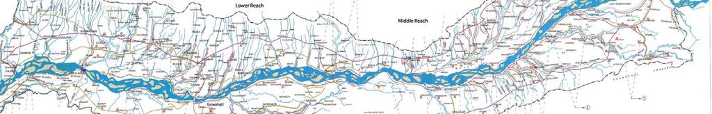
51 46


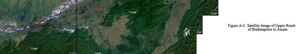
52 47

53 48
54 49 Figure A-4. Long Section of the Brahmaputra River Horizontal Scale 1:850,000 Vertical Scale 1:1,000


55 50 Figure A-5. Selected Historical Imagery for bank line assessment.
Stability Analysis of Flood Protection Embankments and Riverbank Protection Works
 Missouri University of Science and Technology Scholars' Mine International Conferences on Recent Advances in Geotechnical Earthquake Engineering and Soil Dynamics 1 - Fifth International Conference on
Tarbela Dam in Pakistan. Case study of reservoir sedimentation
 Tarbela Dam in Pakistan. HR Wallingford, Wallingford, UK Published in the proceedings of River Flow 2012, 5-7 September 2012 Abstract Reservoir sedimentation is a main concern in the Tarbela reservoir
GEOL 1121 Earth Processes and Environments
 GEOL 1121 Earth Processes and Environments Wondwosen Seyoum Department of Geology University of Georgia e-mail: seyoum@uga.edu G/G Bldg., Rm. No. 122 Seyoum, 2015 Chapter 6 Streams and Flooding Seyoum,
3/3/2013. The hydro cycle water returns from the sea. All "toilet to tap." Introduction to Environmental Geology, 5e
 Introduction to Environmental Geology, 5e Running Water: summary in haiku form Edward A. Keller Chapter 9 Rivers and Flooding Lecture Presentation prepared by X. Mara Chen, Salisbury University The hydro
NATURAL RIVER. Karima Attia Nile Research Institute
 NATURAL RIVER CHARACTERISTICS Karima Attia Nile Research Institute NATURAL RIVER DEFINITION NATURAL RIVER DEFINITION Is natural stream of water that flows in channels with ih more or less defined banks.
ES 105 Surface Processes I. Hydrologic cycle A. Distribution % in oceans 2. >3% surface water a. +99% surface water in glaciers b.
 ES 105 Surface Processes I. Hydrologic cycle A. Distribution 1. +97% in oceans 2. >3% surface water a. +99% surface water in glaciers b. >1/3% liquid, fresh water in streams and lakes~1/10,000 of water
Summary. Streams and Drainage Systems
 Streams and Drainage Systems Summary Streams are part of the hydrologic cycle and the chief means by which water returns from the land to the sea. They help shape the Earth s surface and transport sediment
Aquifer an underground zone or layer of sand, gravel, or porous rock that is saturated with water.
 Aggradation raising of the streambed by deposition that occurs when the energy of the water flowing through a stream reach is insufficient to transport sediment conveyed from upstream. Alluvium a general
Paper presented in the Annual Meeting of Association of American Geographers, Las Vegas, USA, March 2009 ABSTRACT
 Paper presented in the Annual Meeting of Association of American Geographers, Las Vegas, USA, March 2009 ABSTRACT CHANGING GEOMORPHOLOGY OF THE KOSI RIVER SYSTEM IN THE INDIAN SUBCONTINENT Nupur Bose,
Step 5: Channel Bed and Planform Changes
 Step 5: Channel Bed and Planform Changes When disturbed, streams go through a series of adjustments to regain equilibrium with the flow and sediment supply of their watersheds. These adjustments often
SCOUR AND EROSION ALONGSIDE BANK PROTECTION WORK: CASE STUDIES FROM BANGLADESH
 SCOUR AND EROSION ALONGSIDE BANK PROTECTION WORK: CASE STUDIES FROM BANGLADESH KNUT OBERHAGEMANN Northwest Hydraulic Consultants Lt. 4823 99 th Street Edmonton, Alberta T6E 4Y1, Canada ABDUN NOOR Bangladesh
APPENDIX E. GEOMORPHOLOGICAL MONTORING REPORT Prepared by Steve Vrooman, Keystone Restoration Ecology September 2013
 APPENDIX E GEOMORPHOLOGICAL MONTORING REPORT Prepared by Steve Vrooman, Keystone Restoration Ecology September 2 Introduction Keystone Restoration Ecology (KRE) conducted geomorphological monitoring in
mountain rivers fixed channel boundaries (bedrock banks and bed) high transport capacity low storage input output
 high transport capacity low storage input output") mountain rivers fixed channel boundaries (bedrock banks and bed) high transport capacity low storage input output strong interaction between streams & hillslopes Sediment Budgets for Mountain Rivers Little
mountain rivers fixed channel boundaries (bedrock banks and bed) high transport capacity low storage input output strong interaction between streams & hillslopes Sediment Budgets for Mountain Rivers Little
Pirai river (Bolivia)
") Pirai river (Bolivia) Confluent of the Amazon river which average discharge is only 6 m3/s, but with peak discharge over 5000 m3/s, a challenge for river basin management and for flood control HYDROEUROPE
Pirai river (Bolivia) Confluent of the Amazon river which average discharge is only 6 m3/s, but with peak discharge over 5000 m3/s, a challenge for river basin management and for flood control HYDROEUROPE
Natural hazards in Glenorchy Summary Report May 2010
 Natural hazards in Glenorchy Summary Report May 2010 Contents Glenorchy s hazardscape Environment setting Flood hazard Earthquakes and seismic hazards Hazards Mass movement Summary Glossary Introduction
Streams. Water. Hydrologic Cycle. Geol 104: Streams
 Streams Why study streams? Running water is the most important geologic agent in erosion, transportation and deposition of sediments. Water The unique physical and chemical properties of water make it
Earth Science Chapter 6 Section 2 Review
 Name: Class: Date: Earth Science Chapter 6 Section Review Multiple Choice Identify the choice that best completes the statement or answers the question. 1. Most streams carry the largest part of their
Surface Water Short Study Guide
 Name: Class: Date: Surface Water Short Study Guide Multiple Choice Identify the letter of the choice that best completes the statement or answers the question. 1. The three ways in which a stream carries
MORPHOLOGICAL PROCESSES AND EFFECTIVE RIVER EROSION MANAGEMENT: A CASE STUDY OF THE ARIAL KHAN RIVER IN BANGLADESH
 MORPHOLOGICAL PROCESSES AND EFFECTIVE RIVER EROSION MANAGEMENT: A CASE STUDY OF THE ARIAL KHAN RIVER IN BANGLADESH Jakia Akter* 1, Maminul Haque Sarker, Preetha Haque 1 Center for environmental and Geographic
River Response. Sediment Water Wood. Confinement. Bank material. Channel morphology. Valley slope. Riparian vegetation.
 River Response River Response Sediment Water Wood Confinement Valley slope Channel morphology Bank material Flow obstructions Riparian vegetation climate catchment vegetation hydrological regime channel
Erosion Surface Water. moving, transporting, and depositing sediment.
 + Erosion Surface Water moving, transporting, and depositing sediment. + Surface Water 2 Water from rainfall can hit Earth s surface and do a number of things: Slowly soak into the ground: Infiltration
CASE STUDY NATHPA JHAKRI, INDIA
 SEDIMENT MANAGEMENT CASE STUDY NATHPA JHAKRI, INDIA Key project features Name: Nathpa Jhakri Country: India Category: reduce sediment production (watershed management); upstream sediment trapping; bypass
11/12/2014. Running Water. Introduction. Water on Earth. The Hydrologic Cycle. Fluid Flow
 Introduction Mercury, Venus, Earth and Mars share a similar history, but Earth is the only terrestrial planet with abundant water! Mercury is too small and hot Venus has a runaway green house effect so
Surface Water and Stream Development
 Surface Water and Stream Development Surface Water The moment a raindrop falls to earth it begins its return to the sea. Once water reaches Earth s surface it may evaporate back into the atmosphere, soak
How Do Human Impacts and Geomorphological Responses Vary with Spatial Scale in the Streams and Rivers of the Illinois Basin?
 How Do Human Impacts and Geomorphological Responses Vary with Spatial Scale in the Streams and Rivers of the Illinois Basin? Bruce Rhoads Department of Geography University of Illinois at Urbana-Champaign
27. Running Water I (p ; )
") 27. Running Water I (p. 424-436; 440-444) Hydrosphere How much of the Earth s surface is covered by water? Earth's water is collectively called the and is stored in a number of so-called as follows: 1.
27. Running Water I (p. 424-436; 440-444) Hydrosphere How much of the Earth s surface is covered by water? Earth's water is collectively called the and is stored in a number of so-called as follows: 1.
Sedimentation in the Nile River
 Advanced Training Workshop on Reservoir Sedimentation Sedimentation in the Nile River Prof. Dr. Abdalla Abdelsalam Ahmed 10-16 Oct. 2007, IRTCES, Beijing, China CWR,Sudan 1 Water is essential for mankind
A STUDY ON BANK EROSION AND BANK LINE MIGRATION PATTERN OF THE SUBANSIRI RIVER IN ASSAM USING REMOTE SENSING AND GIS TECHNOLOGY
 The International Journal Of Engineering And Science (IJES) Volume 2 Issue 9 Pages 01-06 2013 ISSN(e): 2319 1813 ISSN(p): 2319 1805 A STUDY ON BANK EROSION AND BANK LINE MIGRATION PATTERN OF THE SUBANSIRI
Modeling Great Britain s Flood Defenses. Flood Defense in Great Britain. By Dr. Yizhong Qu
 Modeling Great Britain s Flood Defenses AIRCurrents Editor s note: AIR launched its Inland Flood Model for Great Britain in December 2008. The hazard module captures the physical processes of rainfall-runoff
Flash flood disaster in Bayangol district, Ulaanbaatar
 Flash flood disaster in Bayangol district, Ulaanbaatar Advanced Training Workshop on Reservoir Sedimentation Management 10-16 October 2007. IRTCES, Beijing China Janchivdorj.L, Institute of Geoecology,MAS
Solutions to Flooding on Pescadero Creek Road
 Hydrology Hydraulics Geomorphology Design Field Services Photo courtesy Half Moon Bay Review Solutions to Flooding on Pescadero Creek Road Prepared for: San Mateo County Resource Conservation District
Grant 0299-NEP: Water Resources Project Preparatory Facility
 Document Produced under Grant Project Number: 45206 May 2016 Grant 0299-NEP: Water Resources Project Preparatory Facility Final Report Volume 3 East Rapti (1 of 9) Prepared by Pvt. Ltd. For Ministry of
In the space provided, write the letter of the description that best matches the term or phrase. a. any form of water that falls to Earth s
 Skills Worksheet Concept Review In the space provided, write the letter of the description that best matches the term or phrase. 1. condensation 2. floodplain 3. watershed 4. tributary 5. evapotranspiration
Strategies for managing sediment in dams. Iwona Conlan Consultant to IKMP, MRCS
 Strategies for managing sediment in dams Iwona Conlan Consultant to IKMP, MRCS 1 Sediment trapping by dams Active storage capacity Dead storage coarse material (bed load) Fine materials (suspension) Francis
UGRC 144 Science and Technology in Our Lives/Geohazards
 UGRC 144 Science and Technology in Our Lives/Geohazards Flood and Flood Hazards Dr. Patrick Asamoah Sakyi Department of Earth Science, UG, Legon College of Education School of Continuing and Distance Education
Influence of the Major Drainages to the Mississippi River and Implications for System Level Management
 Influence of the Major Drainages to the Mississippi River and Implications for System Level Management Brian M. Vosburg Geologist Louisiana Coastal Protection and Restoration Authority brian.vosburg@la.gov
STREAM SYSTEMS and FLOODS
 STREAM SYSTEMS and FLOODS The Hydrologic Cycle Precipitation Evaporation Infiltration Runoff Transpiration Earth s Water and the Hydrologic Cycle The Hydrologic Cycle The Hydrologic Cycle Oceans not filling
Precipitation Evaporation Infiltration Earth s Water and the Hydrologic Cycle. Runoff Transpiration
 STREAM SYSTEMS and FLOODS The Hydrologic Cycle Precipitation Evaporation Infiltration Earth s Water and the Hydrologic Cycle Runoff Transpiration The Hydrologic Cycle The Hydrologic Cycle Oceans not filling
FUTURE MEANDER BEND MIGRATION AND FLOODPLAIN DEVELOPMENT PATTERNS NEAR RIVER MILES 200 TO 191 OF THE SACRAMENTO RIVER PHASE III REPORT
 FUTURE MEANDER BEND MIGRATION AND FLOODPLAIN DEVELOPMENT PATTERNS NEAR RIVER MILES 200 TO 191 OF THE SACRAMENTO RIVER PHASE III REPORT Eric W. Larsen REPORT FOR DUCKS UNLIMITED March 31, 2006-1 - Contents
The last three sections of the main body of this report consist of:
 Threatened and Endangered Species Geological Hazards Floodplains Cultural Resources Hazardous Materials A Cost Analysis section that provides comparative conceptual-level costs follows the Environmental
Environmental Geology Chapter 9 Rivers and Flooding
 Environmental Geology Chapter 9 Rivers and Flooding Flooding in Pakistan 2010-1600 killed/20000 affected The hydrologic cycle is powered by the Sun The cycle includes evaporation, precipitation, infiltration,
CASE STUDY NATHPA JHAKRI, INDIA
 SEDIMENT MANAGEMENT CASE STUDY NATHPA JHAKRI, INDIA Key project features Name: Nathpa Jhakri Country: India Category: reforestation/revegetation; upstream sediment trapping; bypass channel/tunnel; reservoir
Stream Geomorphology. Leslie A. Morrissey UVM July 25, 2012
 Stream Geomorphology Leslie A. Morrissey UVM July 25, 2012 What Functions do Healthy Streams Provide? Flood mitigation Water supply Water quality Sediment storage and transport Habitat Recreation Transportation
24.0 Mineral Extraction
 Chapter 24 - Mineral Extraction 24.0 Mineral Extraction 24.1 Introduction Apart from gravel, sand, rock, limestone and salt extraction in relatively small quantities mineral extraction is not a strong
Appendix O. Sediment Transport Modelling Technical Memorandum
 Appendix O Sediment Transport Modelling Technical Memorandum w w w. b a i r d. c o m Baird o c e a n s engineering l a k e s design r i v e r s science w a t e r s h e d s construction Final Report Don
Project (Project No. US-CA-62-2) Maintenance Inspection and Reports (Subtask 14.1) Inspection Report No.2
 Maintenance Inspection and Reports (Subtask 14.1) Inspection Report No.2") MEMORANDUM TO: FROM: Jim Well, Ducks Unlimited Mike Harvey, PhD, PG SUBJECT: M&T/ Llano Seco Fish Screen Project (Project No. US-CA-62-2) Maintenance Inspection and Reports (Subtask 14.1) Inspection Report
MEMORANDUM TO: FROM: Jim Well, Ducks Unlimited Mike Harvey, PhD, PG SUBJECT: M&T/ Llano Seco Fish Screen Project (Project No. US-CA-62-2) Maintenance Inspection and Reports (Subtask 14.1) Inspection Report
What is weathering and how does it change Earth s surface? Answer the question using
 7 th Grade Lesson What is weathering and how does it change Earth s surface? Answer the question using the sentence frame. You have 4 minutes. Weathering is. This changes the Earth s surface because. 1
Why Geomorphology for Fish Passage
 Channel Morphology - Stream Crossing Interactions An Overview Michael Love Michael Love & Associates mlove@h2odesigns.com (707) 476-8938 Why Geomorphology for Fish Passage 1. Understand the Scale of the
Streams. Stream Water Flow
 CHAPTER 14 OUTLINE Streams: Transport to the Oceans Does not contain complete lecture notes. To be used to help organize lecture notes and home/test studies. Streams Streams are the major geological agents
3.12 Geology and Topography Affected Environment
 3 Affected Environment and Environmental Consequences 3.12 Geology and Topography 3.12.1 Affected Environment 3.12.1.1 Earthquakes Sterling Highway MP 45 60 Project Draft SEIS The Kenai Peninsula is predisposed
Floods Lecture #21 20
 Floods 20 Lecture #21 What Is a Flood? Def: high discharge event along a river! Due to heavy rain or snow-melt During a flood, a river:! Erodes channel o Deeper & wider! Overflows channel o Deposits sediment
Running Water Earth - Chapter 16 Stan Hatfield Southwestern Illinois College
 Running Water Earth - Chapter 16 Stan Hatfield Southwestern Illinois College Hydrologic Cycle The hydrologic cycle is a summary of the circulation of Earth s water supply. Processes involved in the hydrologic
Geographical location and climatic condition of the
 Geographical location and climatic condition of the study sites North eastern region of India is comprised of eight states namely; Arunachal Pradesh, Assam, Manipur, Meghalaya, Mizoram, Nagaland, Sikkim
Temporal changes of Fluvio-Morphological scenario and its impact on Settlement: A GIS based study for Mandia block, Barpeta District, Assam
 Temporal changes of Fluvio-Morphological scenario and its impact on Settlement: A GIS based study for Mandia block, Barpeta District, Assam R.K. Sarmah 1, U. Sarma 2 1,2 Assam Remote Sensing Application
CASE STUDY BINGA, PHILIPPINES
 SEDIMENT MANAGEMENT CASE STUDY BINGA, PHILIPPINES Key project features Name: Binga Country: Philippines Category: modify operating rule (focus or redistribute sediment); adaptive strategies Reservoir volume
Landscape Development
 Landscape Development Slopes Dominate Natural Landscapes Created by the interplay of tectonic and igneous activity and gradation Deformation and uplift Volcanic activity Agents of gradation Mass wasting
UNIT 11 SOUTH ASIA SG 1 - PHYSICAL GEOGRAPHY & THE ENVIRONMENT
 UNIT 11 SOUTH ASIA SG 1 - PHYSICAL GEOGRAPHY & THE ENVIRONMENT I. PHYSICAL GEOGRAPHY TAKE OUT YOUR PHYSICAL MAP OF SOUTH ASIA A. The Himalayan Mountains form the northern boundary of the region (color
A STUDY OF LOCAL SCOUR AT BRIDGE PIERS OF EL-MINIA
 A STUDY OF LOCAL SCOUR AT BRIDGE PIERS OF EL-MINIA Dr. Gamal A. Sallam 1 and Dr. Medhat Aziz 2 ABSTRACT Bridges are critical structures that require a substantial investment to construct and serve an important
Science EOG Review: Landforms
 Mathematician Science EOG Review: Landforms Vocabulary Definition Term canyon deep, large, V- shaped valley formed by a river over millions of years of erosion; sometimes called gorges (example: Linville
What do you need for a Marathon?
 What do you need for a Marathon? Water and a snack? What about just a normal day? 1 flush = 3.5 gallons 1 flush = 3.5 gallons 10 minute shower = 20 gal 1 flush = 3.5 gallons 10 minute shower = 20 gal Jeans
Rivers T. Perron
 1 Rivers T. Perron 12.001 After our discussions of large-scale topography, how we represent topography in maps, and how topography interacts with geologic structures, you should be frothing at the mouth
Dolores River Watershed Study
 CHAPTER 4: RIVER AND FLOODPLAIN ISSUES The Dolores River falls into a category of streams in Colorado that share some unique characteristics. Like some other mountain streams in the state, it has a steep
Degradation Concerns related to Bridge Structures in Alberta
 Degradation Concerns related to Bridge Structures in Alberta Introduction There has been recent discussion regarding the identification and assessment of stream degradation in terms of how it relates to
GLG362/GLG598 Geomorphology K. Whipple October, 2009 I. Characteristics of Alluvial Channels
 I. Characteristics of Alluvial Channels Self-formed morphology set by entrainment, transport, and deposition They move unconsolidated sedimentary materials present in the valley fill flood plain/bank flow
ADDRESSING GEOMORPHIC AND HYDRAULIC CONTROLS IN OFF-CHANNEL HABITAT DESIGN
 ADDRESSING GEOMORPHIC AND HYDRAULIC CONTROLS IN OFF-CHANNEL HABITAT DESIGN Conor Shea - Hydrologist U.S. Fish and Wildlife Service Conservation Partnerships Program Arcata, CA Learning Objectives Examine
Fresh Water: Streams, Lakes Groundwater & Wetlands
 Fresh Water:, Lakes Groundwater & Wetlands Oct 27 Glaciers and Ice Ages Chp 13 Nov 3 Deserts and Wind and EXAM #3 Slope hydrologic cycle P = precip I = precip intercepted by veg ET = evapotranspiration
Domino Effect of River Training in Large Sand-Bed Braiding Rivers
 6 th International Conference on Structural Engineering and Construction Management 2015, Kandy, Sri Lanka, 11 th -13 th December 2015 SECM/15/176 Domino Effect of River Training in Large Sand-Bed Braiding
STUDY GUIDE FOR CONTENT MASTERY. Surface Water Movement
 Surface Water SECTION 9.1 Surface Water Movement In your textbook, read about surface water and the way in which it moves sediment. Complete each statement. 1. An excessive amount of water flowing downslope
3l NATURAL HAZARDS AND UNSTABLE GROUND
 Page 1 of Section 3l 3l NATURAL HAZARDS AND UNSTABLE GROUND 3l.1 Introduction A natural hazard is the result of natural processes that form, shape and change the environment and interact or potentially
6.4 Sensitivity Tests
 6.4 Sensitivity Tests 6.4.1 Sensitivity of Floodplain Inundation to Width of Dry Culvert The preliminary design for the Expressway based on consideration of possible future climate effects to 2090 assumed
FAILURES IN THE AMAZON RIVERBANKS, IQUITOS, PERU
 FAILURES IN THE AMAZON RIVERBANKS, IQUITOS, PERU A.Carrillo-Gil University of Engineering & A.Carrillo Gil S.A.,Consulting Engineering,Lima,Peru L. Dominguez University of Engineering,Lima & The Maritime
The Effects of Hydraulic Structures on Streams Prone to Bank Erosion in an Intense Flood Event: A Case Study from Eastern Hokkaido
 Symposium Proceedings of the INTERPRAENENT 2018 in the Pacific Rim The Effects of Hydraulic Structures on Streams Prone to Bank Erosion in an Intense Flood Event: A Case Study from Eastern Hokkaido Daisuke
WATER ON AND UNDER GROUND. Objectives. The Hydrologic Cycle
 WATER ON AND UNDER GROUND Objectives Define and describe the hydrologic cycle. Identify the basic characteristics of streams. Define drainage basin. Describe how floods occur and what factors may make
TABLE OF CONTENTS LIST OF TABLES. Page
 TABLE OF CONTENTS Page 11.0 EFFECTS OF THE ENVIRONMENT ON THE PROJECT... 11-1 11.1 Weather Conditions... 11-1 11.2 Flooding... 11-2 11.3 Forest Fires... 11-2 11.4 Permafrost and Subsidence Risk... 11-3
Chapter 11. Rivers: Shaping our landscape
 Chapter 11 Rivers: Shaping our landscape Learning outcomes In this presentation you will learn: Common terms associated with rivers About the three stages of a river About the processes of river erosion
Chapter 3 Erosion in the Las Vegas Wash
 Chapter 3 Erosion in the Las Vegas Wash Introduction As described in Chapter 1, the Las Vegas Wash (Wash) has experienced considerable change as a result of development of the Las Vegas Valley (Valley).
Debris flow: categories, characteristics, hazard assessment, mitigation measures. Hariklia D. SKILODIMOU, George D. BATHRELLOS
 Debris flow: categories, characteristics, hazard assessment, mitigation measures Hariklia D. SKILODIMOU, George D. BATHRELLOS Natural hazards: physical phenomena, active in geological time capable of producing
Final Exam. Running Water Erosion and Deposition. Willamette Discharge. Running Water
 Final Exam Running Water Erosion and Deposition Earth Science Chapter 5 Pages 120-135 Scheduled for 8 AM, March 21, 2006 Bring A scantron form A calculator Your 3 x 5 paper card of formulas Review questions
1 City of Edmonton Quesnell Bridge, Roads and Associated Structures Assessment
 1 City of Edmonton Quesnell Bridge, Roads and Associated Structures Assessment 1.1 Background Within the First National Engineering Vulnerability Assessment, the Public Infrastructure Engineering Vulnerability
Mountain Rivers. Gutta cavat lapidem. (Dripping water hollows out a stone) -Ovid, Epistulae Ex Ponto, Book 3, no. 10, 1. 5
 -Ovid, Epistulae Ex Ponto, Book 3, no. 10, 1. 5") Mountain Rivers Gutta cavat lapidem (Dripping water hollows out a stone) -Ovid, Epistulae Ex Ponto, Book 3, no. 10, 1. 5 Mountain Rivers Fixed channel boundaries (bedrock banks and bed) High transport
Mountain Rivers Gutta cavat lapidem (Dripping water hollows out a stone) -Ovid, Epistulae Ex Ponto, Book 3, no. 10, 1. 5 Mountain Rivers Fixed channel boundaries (bedrock banks and bed) High transport
Carmel River Bank Stabilization at Rancho San Carlos Road Project Description and Work Plan March 2018
 Carmel River Bank Stabilization at Rancho San Carlos Road Project Description and Work Plan March 2018 EXISTING CONDITION The proposed Carmel River Bank Stabilization at Rancho San Carlos Road Project
HYDRAULIC STRUCTURES, EQUIPMENT AND WATER DATA ACQUISITION SYSTEMS - Vol. I - Hydraulics of Two-Phase Flow: Water and Sediment - G R Basson
 HYDRAULICS OF TWO-PHASE FLOWS: WATER AND SEDIMENT G R Basson Dept. of Civil Engineering, University of Stellenbosch, South Africa. Keywords: sediment, sediment transport, turbulence, river regime, stream
Flooding in Dolgellau
 Flooding in Dolgellau Graham Hall MMath, PhD University of Wales, Bangor Background Flooding has historically been a cause for concern in Dolgellau. Following a serious flood in December 1964 when shops
Opportunities to Improve Ecological Functions of Floodplains and Reduce Flood Risk along Major Rivers in the Puget Sound Basin
 Opportunities to Improve Ecological Functions of Floodplains and Reduce Flood Risk along Major Rivers in the Puget Sound Basin Christopher Konrad, US Geological Survey Tim Beechie, NOAA Fisheries Managing
Stream Restoration and Environmental River Mechanics. Objectives. Pierre Y. Julien. 1. Peligre Dam in Haiti (deforestation)
") Stream Restoration and Environmental River Mechanics Pierre Y. Julien Malaysia 2004 Objectives Brief overview of environmental river mechanics and stream restoration: 1. Typical problems in environmental
Stream Restoration and Environmental River Mechanics Pierre Y. Julien Malaysia 2004 Objectives Brief overview of environmental river mechanics and stream restoration: 1. Typical problems in environmental
CASE STUDY BINGA, PHILIPPINES
 SEDIMENT MANAGEMENT CASE STUDY BINGA, PHILIPPINES Key project features Name: Binga Country: Philippines Category: modify operating rule (focus or redistribute sediment); adaptive strategies Binga hydropower
Physical landscapes River landscapes in the UK
 Physical landscapes River landscapes in the UK The shape of river valleys change s as rivers flow downstream - PROCESSES Erosion Abrasion or corrasion Attrition Hydraulic Action Solution or corrosion Deposition
Summary of Hydraulic and Sediment-transport. Analysis of Residual Sediment: Alternatives for the San Clemente Dam Removal/Retrofit Project,
 Appendix N SUMMARY OF HYDRAULIC AND SEDIMENT-TRANSPORT ANALYSIS OF RESIDUAL SEDIMENT: ALTERNATIVES FOR THE SAN CLEMENTE DAM REMOVAL/RETROFIT PROJECT, CALIFORNIA the San Clemente Dam Removal/Retrofit Project,
Section 5. Low-Gradient Streams. What Do You See? Think About It. Investigate. Learning Outcomes
 Chapter 4 Surface Processes Section 5 Low-Gradient Streams What Do You See? Learning Outcomes In this section, you will Use models and real-time streamflow data to understand the characteristics of lowgradient
Need of Proper Development in Hilly Urban Areas to Avoid
 Need of Proper Development in Hilly Urban Areas to Avoid Landslide Hazard Dr. Arvind Phukan, P.E. Cosultant/Former Professor of Civil Engineering University of Alaska, Anchorage, USA RI District Governor
Impact of Climate Change on Riverbank Erosion
 International Journal of Sciences: Basic and Applied Research (IJSBAR) ISSN 2307-4531 http://gssrr.org/index.php?journal=journalofbasicandapplied Impact of Climate Change on Riverbank Erosion Most. Nazneen
SCOPE OF PRESENTATION STREAM DYNAMICS, CHANNEL RESTORATION PLANS, & SEDIMENT TRANSPORT ANALYSES IN RELATION TO RESTORATION PLANS
 DESIGN METHODS B: SEDIMENT TRANSPORT PROCESSES FOR STREAM RESTORATION DESIGN PETER KLINGEMAN OREGON STATE UNIVERSITY CIVIL ENGINEERING DEPT., CORVALLIS 2 ND ANNUAL NORTHWEST STREAM RESTORATION DESIGN SYMPOSIUM
Diagnostic Geomorphic Methods for Understanding Future Behavior of Lake Superior Streams What Have We Learned in Two Decades?
 Diagnostic Geomorphic Methods for Understanding Future Behavior of Lake Superior Streams What Have We Learned in Two Decades? Faith Fitzpatrick USGS WI Water Science Center, Middleton, WI fafitzpa@usgs.gov
MATHEMATICAL MODELING OF FLUVIAL SEDIMENT DELIVERY, NEKA RIVER, IRAN. S.E. Kermani H. Golmaee M.Z. Ahmadi
 JOURNAL OF ENVIRONMENTAL HYDROLOGY The Electronic Journal of the International Association for Environmental Hydrology On the World Wide Web at http://www.hydroweb.com VOLUME 16 2008 MATHEMATICAL MODELING
What are the different ways rocks can be weathered?
 Romano - 223 What are the different ways rocks can be weathered? Weathering - the breakdown of rocks and minerals at the Earth s surface 1. 2. PHYSICAL WEATHERING Rock is broken into smaller pieces with
CLIMATE READY BOSTON. Climate Projections Consensus ADAPTED FROM THE BOSTON RESEARCH ADVISORY GROUP REPORT MAY 2016
 CLIMATE READY BOSTON Sasaki Steering Committee Meeting, March 28 nd, 2016 Climate Projections Consensus ADAPTED FROM THE BOSTON RESEARCH ADVISORY GROUP REPORT MAY 2016 WHAT S IN STORE FOR BOSTON S CLIMATE?
Do you think sediment transport is a concern?
 STREAM RESTORATION FRAMEWORK AND SEDIMENT TRANSPORT BASICS Pete Klingeman 1 What is Your Restoration Project Like? k? Do you think sediment transport is a concern? East Fork Lewis River, WA Tidal creek,
Overview of fluvial and geotechnical processes for TMDL assessment
 Overview of fluvial and geotechnical processes for TMDL assessment Christian F Lenhart, Assistant Prof, MSU Research Assoc., U of M Biosystems Engineering Fluvial processes in a glaciated landscape Martin
Technical note about the monitoring of hydromorphological restoration/management of the Drava River in Slovenia
 Technical note about the monitoring of hydromorphological restoration/management of the Drava River in Slovenia 1 Project: HyMoCARES Work package: WPC. Communication Activity: Web Site Deliverable: Case
GOAL 7 AREAS SUBJECT TO NATURAL DISASTERS AND HAZARDS. To protect life and property from natural disasters and hazards.
 GOAL 7 AREAS SUBJECT TO NATURAL DISASTERS AND HAZARDS A. GOALS: To protect life and property from natural disasters and hazards. B. POLICIES: 1. Floodplains shall be maintained as natural drainage-ways.