NATURAL RIVER. Karima Attia Nile Research Institute
|
|
|
- Marilyn Willis
- 5 years ago
- Views:
Transcription
1 NATURAL RIVER CHARACTERISTICS Karima Attia Nile Research Institute

2 NATURAL RIVER DEFINITION

3 NATURAL RIVER DEFINITION Is natural stream of water that flows in channels with ih more or less defined banks. It flows into an ocean, lake, or other body of water Fed along its course by tributaries. Form a drainage basin, or watershed that collects runoff with eroded sediments materials into the river
4
5 NATURAL RIVER DEFINITION The sediments are typically deposited most heavily along the river's lower course, forming floodplains along its banks and a delta at its mouth. It is considered as a fundamental link in the hydrologic cycle, and they play a major role in shaping the surface features of the Earth. In a few words, Natural rivers, which are selfconstructed, self-maintained, and seek their own stability
6
7 NATURAL RIVER CLASSIFICATION Natural river classifications started Davis: since 1899 by Youthful river; Mature river and; Old river


8 YOUTHFUL RIVERS A river with a steep gradient that has very few tributaries and flows quickly. Its channels erode deeper rather than wider. Brazos Ebro Trinity


9 MATURE RIVERS A river with a gradient that is less steep than those of youthful rivers and flows more slowly. A mature river is fed by many tributaries and has more discharge than a youthful river. Its channels erode wider rather than deeper. Danube Ohio


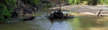
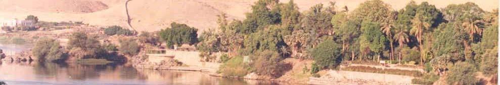
10 OLD RIVERS A river with a low gradient and low erosive energy. Old rivers are characterized by flood plains. Indus Nile
11 CLASSIFICATION BASED ON QUANTITATIVE SLOPE DISCHARGE RELATIONSHIP Lane (1957); SQ 0.25 = K SQ SQ Meandering Braided In between the channel is considered as In between the channel is considered as intermediate sand bed stream
12 CLASSIFICATION BASED ON QUANTITATIVE SLOPE DISCHARGE RELATIONSHIP Leopold and Wolman (1957) braided (found plotted above the relationship) meandering rivers (found plotted below the relationship).

13 CLASSIFICATION BASED ON QUANTITATIVE SLOPE DISCHARGE RELATIONSHIP Ramsahoye in 1992, for straight and for meandering
14
15 CLASSIFICATION BASED ON QUANTITATIVE SLOPE DISCHARGE RELATIONSHIP Khan (1971), developed classification based on: sinuosity, slope, and channel pattern Schumm and Khan (1972) proposed a valley slope relation: Straight: S < Meandering thalweg: < S < Braided: S > 0.016
16
17 CLASSIFICATION C BASED ON CHARACTERISTICS DESCRIPTION Schumm, (1963) based on channel stability: stable, eroding, or depositing Based on mode of sediment transport: mixed load, suspended load, and bed load Saltation
18 CLASSIFICATION C BASED ON CHARACTERISTICS DESCRIPTION Culbertson et al. (1967) based on: Depositional features; Vegetation; Braiding patterns; Sinuosity; Meander scrolls; bank heights; Levee formations and Floodplain types.
19 CLASSIFICATION BASED ON THE BASIS OF STABILITY Schumm (1977) Sediment transport Channel stability Measured channel dimensions
20 CLASSIFICATION BASED ON THE BASIS OF STABILITY Croke (1992) presented a classification of flood plains that involved: Particle size, Morphology of channels, and Bank materials
21 CLASSIFICATION BASED ON THE BASIS OF STABILITY Parker (1976) Indicates that rivers with sediment transport and depth to width ratio (d/b) << 1 at formative discharge have a tendency toward meandering or braiding. His classification is based on the relative magnitude of the depth-width ratio to the channel slope-froude number ratio (S/F). Meandering occurs when S/F << d/b, braiding occurs for S/F >> d/b and transition between the two occurs when S/F ~ d/b.
22 LOAD CLASSIFICATIONS The low sinuosity i and high h width/depth h ratio place the river in the bed load category Bed load stream has width/depth ratios greater than 40, sinuosity is less than about 1.3, and bed load (sand and gravel) is greater than about 10% of the total sediment load.
23 CLASSIFICATION C ACCORDING TO THE SYSTEM TYPE RELATED TO ALLUVAIM Alluviam Diluvial Alluviam refers to loose, unconsolidated materials. Alluvium is typically made up of a variety of materials, including fine particles of silt and clay and larger particles of sand and gravel.
24 DILUVIAL RIVER There is no unique relations between discharge, sediment transport, and bed materials Morphological changes are absent Morphologically stable Found in the upper reaches with a rock bed and mountainous or torrential flow characteristics.

25 DILUVIAL RIVER
26 DILUVIAL RIVER
27 ALLUVIAL RIVERS A clear relation exists between the hydraulic characteristics, discharge, sediment transport, and the bed material. width/depth ratio is in the order of 100 Morphologically unstable Found in the downstream reaches with alluvial bed
28 LONGITUDINAL PROFILE


29 UPPER PART OF THE RIVER The upper river charterstics: High degree of confinement Confined and narrow valley General erosion.
30 MIDDLE PART OF THE RIVER The middle river where erosion and deposition are more or less in equilibrium. The dominant characteristic of the river s central reaches is: Relatively wide valley, Reduction in profile gradient. In theory the middle river is only a very short stretch (in the limit of a point), but for practical purposes the longest part of a river is often regarded as middle river.


31 LOWER PART OF THE RIVER The lower river, where sedimentation takes place. The sediment input is larger than output.

32 PLAN FORM Plan form is the river configuration i as viewed on maps or from aerial photographs or other spectral images
33
34 PARAMETERS RESPONSIBLE ABOUT FORMING RIVER PLAN FORM There is a range of flows responsible for creating channel plan form, rather than one single flow magnitude Effective discharge refers to the range of flow magnitudes that transports the majority of a river s annual sediment load over the longterm
35 PARAMETERS RESPONSIBLE ABOUT FORMING RIVER PLAN FORM The dominant discharge refers to the flow magnitude that determines channel shape, or cross section width and depth
36 THE CALCULATION OF THE RANGE OF DISCHARGES RESPONSIBLE FOR FORMING AND MAINTAINING CHANNEL FORM Dominant or effective discharge
37 PARAMETERS RESPONSIBLE ABOUT FORMING RIVER PLAN FORM Bankfull discharge is the flow magnitude that is contained within a channel without overtopping its banks. This flow is significant in creating the shape and size of alluvial channels. It is the discharge magnitude when the channel depth to width ratio in its minimum value. It is the break point between channel formation and flood plain formation.
38 Bank full Discharge
39 PLAN FORM DEFORMATION The plan form deformation is controlled in nature by: Lithology and its variation along the river length; Discharge; Sediment load variation during the flood, Outside controls and Human intervention.
40 PLAN FORM CLASSIFICATION Rivers can be classified in terms of channel pattern (plan form) that three different types can be distinguished: Straight river, Meandering river and Braiding river.
41 Braided Meandering Straight
42 STRAIGHT RIVER CHARACTERISTICS The straight channel can be defined d as the stretch of the river which has sinuosity less than 1.5 It is the transition stage between meandering and braiding Attributed to outside controls
43 MEANDERING RIVER CHARACTERISTICS Consists of a number of consecutive bends. Hilicoidal flow resulting in scouring near the outer bend and sedimentation near the inner bend. More predictable, than braiding rivers They normally have one relatively deep channel
44 MEANDER GEOMETRICAL RELATIONS crest tough
45 MEANDER GEOMETRICAL RELATIONS Radius of curvature (r): 2.3 to 2.7 times the bankfull width
46 MEANDER GEOMETRICAL RELATIONS Meander Wavelength (λ): A full meander wavelength is the distance between two similar points along the channel between which waveform is complete. It was found to occur between 6 and 15 times the bankfull width.
47 MEANDER GEOMETRICAL RELATIONS Sinuosity: i Is a measure used to quantify the difference between meandering and straight channels. It is defined as the channel length (L) measured along the center of the channel divided by the valley length (Lv) measured along the valley axis s = L/Lv Sinuosity = 1 (straight channels) Sinuosity = 3.0 (highly sinuous, or tortuous meanders).
48 MEANDER GEOMETRICAL RELATIONS Arc angle (θ): the angle swept out by the radius of curvature between adjacent inflexion points. Meander arc length (Z): the distance measured along the meander path between repeating (inflexion) points. Amplitude (a): width of meander belt measured perpendicular p to the valley or straight line axis.
49 MEANDER GEOMETRICAL RELATIONS
50 CROSS SECTION IN MEANDER CHANNEL


51 TYPES OF BENDS Three types of bends can be defined, free, limited, and forced bends. These types are defined according to the different external constrains and degree of freedom to attain lateral formation.
52 FREE BEND TYPE The free bend is usually associated with broad flood plains consisting of relatively erodible material. In this type, the river bends follow the curves of the valley so that each river bend includes a promontory of the parent plateau. It is found that this type is not disturbed by the external factors and experienced the highest degree of freedom to form the bend shape.
53 LIMITED BEND TYPE In this type, the bend cut into solid rock or hard strata in deep gorges and exhibit meandering gpattern similar to that of rivers in flood plains. In this type, the banks of the channel are composed of consolidated parent material that limits the lateral erosion. Such rivers are called incised rivers and these bends are called incised bends or entrenched bends. However, no much information about the origin i of incised bends is found.
54 FORCED BEND TYPE In this type the channel is highly hl restricted from external movements. The bank line movements are mainly controlled by either natural or man made activities. Sometimes in this type the river impinges onto an almost straight parent bank at large angle (60 0 to 90 0 ). The free bend has the smallest sinuosity and arc angle. Next in values is the limited bend followed by the forced bend to some extent.
55 THE BRAIDED RIVER Channel divided id d around islands. Can have several more or less parallel branches which are not fixed but tend to change alignment continually. The braiding river has many disadvantages, being less stable and less predictable than meandering rivers.
56 THE BRAIDED RIVER The characteristics i of braided d channel can be presented as follows: Wide Banks are poorly defined and unstable Two or more channels Sand bars are found between sub-channels Sand bars and sub-channels change their position posto very rapidly apdy Often steep slopes with large suspensions Sediment overload
57 CROSS SECTION OF BRAIDED CHANNEL In a braided river each branch separately tends to form sections similar to those in a single meandering channel. As the discharge and, therefore, the water level of a river varies, one can distinguish between a low water channel and a high water channel, with flood plains separated by natural levees from the main flow channel. The flood plain generally fills rapidly when natural levees are overtopped during extreme high h levels, l but drains only slowly via small channels through the natural levees. Back swamps may then be formed, due to the slow drainage.
58 THE BRAIDED RIVER
59
Surface Water and Stream Development
 Surface Water and Stream Development Surface Water The moment a raindrop falls to earth it begins its return to the sea. Once water reaches Earth s surface it may evaporate back into the atmosphere, soak
Erosion Surface Water. moving, transporting, and depositing sediment.
 + Erosion Surface Water moving, transporting, and depositing sediment. + Surface Water 2 Water from rainfall can hit Earth s surface and do a number of things: Slowly soak into the ground: Infiltration
Streams. Water. Hydrologic Cycle. Geol 104: Streams
 Streams Why study streams? Running water is the most important geologic agent in erosion, transportation and deposition of sediments. Water The unique physical and chemical properties of water make it
Stream Classification
 Stream Classification Why Classify Streams? Communication Tool Describe Existing Conditions & Trends Describe Restoration Goals Research Tool Morphologic Stream Classification Systems Schumm (1977) Alluvial
Aquifer an underground zone or layer of sand, gravel, or porous rock that is saturated with water.
 Aggradation raising of the streambed by deposition that occurs when the energy of the water flowing through a stream reach is insufficient to transport sediment conveyed from upstream. Alluvium a general
Streams. Stream Water Flow
 CHAPTER 14 OUTLINE Streams: Transport to the Oceans Does not contain complete lecture notes. To be used to help organize lecture notes and home/test studies. Streams Streams are the major geological agents
11/12/2014. Running Water. Introduction. Water on Earth. The Hydrologic Cycle. Fluid Flow
 Introduction Mercury, Venus, Earth and Mars share a similar history, but Earth is the only terrestrial planet with abundant water! Mercury is too small and hot Venus has a runaway green house effect so
PHYSICAL GEOGRAPHY. By Brett Lucas
 PHYSICAL GEOGRAPHY By Brett Lucas FLUVIAL PROCESSES Fluvial Processes The Impact of Fluvial Processes on the Landscape Streams and Stream Systems Stream Channels Structural Relationships The Shaping and
Running Water Earth - Chapter 16 Stan Hatfield Southwestern Illinois College
 Running Water Earth - Chapter 16 Stan Hatfield Southwestern Illinois College Hydrologic Cycle The hydrologic cycle is a summary of the circulation of Earth s water supply. Processes involved in the hydrologic
Riparian Assessment. Steps in the right direction... Drainage Basin/Watershed: Start by Thinking Big. Riparian Assessment vs.
 Riparian Assessment vs. Monitoring Riparian Assessment What is a healthy stream? Determine stream/riparian health Determine change or trend, especially in response to mgmt Classification = designation
Summary. Streams and Drainage Systems
 Streams and Drainage Systems Summary Streams are part of the hydrologic cycle and the chief means by which water returns from the land to the sea. They help shape the Earth s surface and transport sediment
OBJECTIVES. Fluvial Geomorphology? STREAM CLASSIFICATION & RIVER ASSESSMENT
 STREAM CLASSIFICATION & RIVER ASSESSMENT Greg Babbit Graduate Research Assistant Dept. Forestry, Wildlife & Fisheries Seneca Creek, Monongahela National Forest, West Virginia OBJECTIVES Introduce basic
27. Running Water I (p ; )
") 27. Running Water I (p. 424-436; 440-444) Hydrosphere How much of the Earth s surface is covered by water? Earth's water is collectively called the and is stored in a number of so-called as follows: 1.
27. Running Water I (p. 424-436; 440-444) Hydrosphere How much of the Earth s surface is covered by water? Earth's water is collectively called the and is stored in a number of so-called as follows: 1.
Earth Science Chapter 6 Section 2 Review
 Name: Class: Date: Earth Science Chapter 6 Section Review Multiple Choice Identify the choice that best completes the statement or answers the question. 1. Most streams carry the largest part of their
GEOL 1121 Earth Processes and Environments
 GEOL 1121 Earth Processes and Environments Wondwosen Seyoum Department of Geology University of Georgia e-mail: seyoum@uga.edu G/G Bldg., Rm. No. 122 Seyoum, 2015 Chapter 6 Streams and Flooding Seyoum,
Rivers and Streams. Streams. Hydrologic Cycle. Drainage Basins and Divides. Colorado River Drainage Basin. Colorado Drainage Basins.
 Chapter 14 Hydrologic Cycle Rivers and Streams Streams A stream is a body of water that is confined in a channel and moves downhill under the influence of gravity. This definition includes all sizes of
The Hydrologic Cycle STREAM SYSTEMS. Earth s Water and the Hydrologic Cycle. The Hydrologic Cycle. Hydrologic Cycle
 STREAM SYSTEMS Earth Science: Chapter 5 Reading pages 114-124 The Hydrologic Cycle Oceans not filling up Evaporation = precipitation System is balanced Earth s Water and the Hydrologic Cycle Earth s Water
STREAM SYSTEMS and FLOODS
 STREAM SYSTEMS and FLOODS The Hydrologic Cycle Precipitation Evaporation Infiltration Runoff Transpiration Earth s Water and the Hydrologic Cycle The Hydrologic Cycle The Hydrologic Cycle Oceans not filling
Precipitation Evaporation Infiltration Earth s Water and the Hydrologic Cycle. Runoff Transpiration
 STREAM SYSTEMS and FLOODS The Hydrologic Cycle Precipitation Evaporation Infiltration Earth s Water and the Hydrologic Cycle Runoff Transpiration The Hydrologic Cycle The Hydrologic Cycle Oceans not filling
Why Stabilizing the Stream As-Is is Not Enough
 Why Stabilizing the Stream As-Is is Not Enough Several examples of alternatives to the County s design approach have been suggested. A common theme of these proposals is a less comprehensive effort focusing
Final Exam. Running Water Erosion and Deposition. Willamette Discharge. Running Water
 Final Exam Running Water Erosion and Deposition Earth Science Chapter 5 Pages 120-135 Scheduled for 8 AM, March 21, 2006 Bring A scantron form A calculator Your 3 x 5 paper card of formulas Review questions
Landscape Development
 Landscape Development Slopes Dominate Natural Landscapes Created by the interplay of tectonic and igneous activity and gradation Deformation and uplift Volcanic activity Agents of gradation Mass wasting
Year 6. Geography. Revision
 Year 6 Geography Revision November 2017 Rivers and World knowledge How the water cycle works and the meaning of the terms evaporation, condensation, precipitation, transpiration, surface run-off, groundwater
ADDRESSING GEOMORPHIC AND HYDRAULIC CONTROLS IN OFF-CHANNEL HABITAT DESIGN
 ADDRESSING GEOMORPHIC AND HYDRAULIC CONTROLS IN OFF-CHANNEL HABITAT DESIGN Conor Shea - Hydrologist U.S. Fish and Wildlife Service Conservation Partnerships Program Arcata, CA Learning Objectives Examine
Earth Science Chapter 9. Day 6 - Finish Capillary Action Lab - Quiz over Notes - Review Worksheets over Sections 9.2 and 9.3
 Earth Science Chapter 9 Day 1 Day 2 Day 3 Read Section 9.1 Surface Water Chapter 9 Term Sheet Notes over Section 9.1 Surface Water Section 9.1 Review Worksheets Quiz over Section 9.1 Notes Virtual Lab
WATER ON AND UNDER GROUND. Objectives. The Hydrologic Cycle
 WATER ON AND UNDER GROUND Objectives Define and describe the hydrologic cycle. Identify the basic characteristics of streams. Define drainage basin. Describe how floods occur and what factors may make
Stream Geomorphology. Leslie A. Morrissey UVM July 25, 2012
 Stream Geomorphology Leslie A. Morrissey UVM July 25, 2012 What Functions do Healthy Streams Provide? Flood mitigation Water supply Water quality Sediment storage and transport Habitat Recreation Transportation
River/Stream Erosion Notes
 Name Date ES per Mr. Williams River/Stream Erosion Notes Erosion: the of weathered material. FACT: Running water moves more sediment than ANY other type of erosion. 1. The Water Cycle What happens when
Laboratory Exercise #3 The Hydrologic Cycle and Running Water Processes
 Laboratory Exercise #3 The Hydrologic Cycle and Running Water Processes page - 1 Section A - The Hydrologic Cycle Figure 1 illustrates the hydrologic cycle which quantifies how water is cycled throughout
ES 105 Surface Processes I. Hydrologic cycle A. Distribution % in oceans 2. >3% surface water a. +99% surface water in glaciers b.
 ES 105 Surface Processes I. Hydrologic cycle A. Distribution 1. +97% in oceans 2. >3% surface water a. +99% surface water in glaciers b. >1/3% liquid, fresh water in streams and lakes~1/10,000 of water
Science EOG Review: Landforms
 Mathematician Science EOG Review: Landforms Vocabulary Definition Term canyon deep, large, V- shaped valley formed by a river over millions of years of erosion; sometimes called gorges (example: Linville
Chapter 11. Rivers: Shaping our landscape
 Chapter 11 Rivers: Shaping our landscape Learning outcomes In this presentation you will learn: Common terms associated with rivers About the three stages of a river About the processes of river erosion
Ways To Identify Background Verses Accelerated Erosion
 Ways To Identify Background Verses Accelerated Erosion Establish Background Condition From Old Ground Photos, Aerial Photos, and Maps Compare Rate Over Time At the Same Location, or for Reaches Channel
Weathering, Erosion, Deposition, and Landscape Development
 Weathering, Erosion, Deposition, and Landscape Development I. Weathering - the breakdown of rocks into smaller particles, also called sediments, by natural processes. Weathering is further divided into
What is weathering and how does it change Earth s surface? Answer the question using
 7 th Grade Lesson What is weathering and how does it change Earth s surface? Answer the question using the sentence frame. You have 4 minutes. Weathering is. This changes the Earth s surface because. 1
Business. Meteorologic monitoring. Field trip? Reader. Other?
 Business Meteorologic monitoring Field trip? Reader Other? Classification Streams Characterization Discharge measurements Why classify stream channels? Why Classify Stream Channels? Provides a common language
Fresh Water: Streams, Lakes Groundwater & Wetlands
 Fresh Water:, Lakes Groundwater & Wetlands Oct 27 Glaciers and Ice Ages Chp 13 Nov 3 Deserts and Wind and EXAM #3 Slope hydrologic cycle P = precip I = precip intercepted by veg ET = evapotranspiration
Rivers and Landslides
 Rivers and Landslides Path of desire or path of least resistance? Desire Path: A term in landscape architecture used to describe a path that isn t designed but rather is worn casually away by people finding
Chapter 10. Running Water aka Rivers. BFRB Pages
 Chapter 10 Running Water aka Rivers BFRB Pages 101-116 Stream Erosion and Transportation Running water is all precipitation (rain, snow, etc) that falls on Earth and is pulled downhill by gravity. Running
RIVERS, GROUNDWATER, AND GLACIERS
 RIVERS, GROUNDWATER, AND GLACIERS Delta A fan-shaped deposit that forms when a river flows into a quiet or large body of water, such as a lake, an ocean, or an inland sea. Alluvial Fan A sloping triangle
PolyMet NorthMet Project
 RS 26 Draft-01 December 8, 2005 RS26 Partridge River Level 1 Rosgen Geomorphic Survey Rosgen Classification Partridge River from Headwaters to Colby Lake Prepared for PolyMet NorthMet Project December
STUDY GUIDE FOR CONTENT MASTERY. Surface Water Movement
 Surface Water SECTION 9.1 Surface Water Movement In your textbook, read about surface water and the way in which it moves sediment. Complete each statement. 1. An excessive amount of water flowing downslope
mountain rivers fixed channel boundaries (bedrock banks and bed) high transport capacity low storage input output
 high transport capacity low storage input output") mountain rivers fixed channel boundaries (bedrock banks and bed) high transport capacity low storage input output strong interaction between streams & hillslopes Sediment Budgets for Mountain Rivers Little
mountain rivers fixed channel boundaries (bedrock banks and bed) high transport capacity low storage input output strong interaction between streams & hillslopes Sediment Budgets for Mountain Rivers Little
FLUVIAL LANDFORMS. Floodplains
 FLUVIAL LANDFORMS Floodplains fairly flat & continuous surface occupying much of a valley bottom normally underlain by unconsolidated sediments subject to periodic flooding (usually once every year or
Rivers. Regents Earth Science Weathering & Erosion
 Regents Earth Science Weathering & Erosion Name: Rivers Use your notes, the handout Weathering and Erosion and your review book to answer the following questions on Rivers. Be sure to read the information
Channel Pattern. Channel Pattern, Meanders, and Confluences. Description of Channel Pattern. Bridge (2003)
") Channel Pattern Channel Pattern, Meanders, and Confluences Outline Description of channel pattern Alternate bars Channel pattern continua and evolution Controls of channel pattern Description of Channel
Channel Pattern Channel Pattern, Meanders, and Confluences Outline Description of channel pattern Alternate bars Channel pattern continua and evolution Controls of channel pattern Description of Channel
Running Water: The Geology of Streams and Floods Running Water Chapter 14
 Geology 800 Today Running Water: The Geology of Streams and Floods Running Water Chapter 14 Next Class Oceans and Coasts 15 Stream Flow Streams Ribbons of water that flow down channels. Runoff Water in
Fluvial Geomorphology
 Geomorphic Components of Riparian Ecosystems W. Barry Southerland, Ph.D. Fluvial Geomorphologist, CPESC #514 West National Technology Support Center Water Quality and Quantity Technology Development Team
GLG362/GLG598 Geomorphology K. Whipple October, 2009 I. Characteristics of Alluvial Channels
 I. Characteristics of Alluvial Channels Self-formed morphology set by entrainment, transport, and deposition They move unconsolidated sedimentary materials present in the valley fill flood plain/bank flow
Overview of fluvial and geotechnical processes for TMDL assessment
 Overview of fluvial and geotechnical processes for TMDL assessment Christian F Lenhart, Assistant Prof, MSU Research Assoc., U of M Biosystems Engineering Fluvial processes in a glaciated landscape Martin
6.1 Water. The Water Cycle
 6.1 Water The Water Cycle Water constantly moves among the oceans, the atmosphere, the solid Earth, and the biosphere. This unending circulation of Earth s water supply is the water cycle. The Water Cycle
Rosgen Classification Unnamed Creek South of Dunka Road
 Rosgen Classification Unnamed Creek South of Dunka Road Prepared for Poly Met Mining Inc. September 2013 Rosgen Classification Unnamed Creek South of Dunka Road Prepared for Poly Met Mining Inc. September
Field Methods to Determine/ Verify Bankfull Elevation, XS Area & Discharge
 Module # 6 Field Methods to Determine/ Verify Bankfull Elevation, XS Area & Discharge Iowa s River Restoration Toolbox Level 1 / Base Training Overview of Basic Field Data Collection Site Map Cross Sections
Prentice Hall EARTH SCIENCE
 Prentice Hall EARTH SCIENCE Tarbuck Lutgens Running Water and Groundwater Running Water The Water Cycle Water constantly moves among the oceans, the atmosphere, the solid Earth, and the biosphere. This
Rivers T. Perron
 1 Rivers T. Perron 12.001 After our discussions of large-scale topography, how we represent topography in maps, and how topography interacts with geologic structures, you should be frothing at the mouth
Tom Ballestero University of New Hampshire. 1 May 2013
 Tom Ballestero University of New Hampshire 1 May 2013 1 Hydrology 2 Basic Hydrology Low flows most common Flows that fill the stream to the banks and higher are much less common Filling the stream to the
The Equilibrium Channel & Channel Change. Peter Wilcock 3 August 2016
 The Equilibrium Channel & Channel Change Peter Wilcock 3 August 2016 1 The search for common empirical attributes of streams Luna B. Leopold M. Gordon ( Reds ) Wolman Watts Branch, MD A meandering stream
Geography Notes for Plonk Meeting
 Geography Notes for Plonk Meeting Hydrologic Cycle 1. Rainfall Water falls as rain or snow if the air is cold enough. 2. Groundwater Water that seeps into the ground may be absorbed by plants or flow into
NATURE OF RIVERS B-1. Channel Function... ALLUVIAL FEATURES. ... to successfully carry sediment and water from the watershed. ...dissipate energy.
 1 2 Function... Sevier River... to successfully carry sediment and water from the watershed....dissipate energy. 3 ALLUVIAL FEATURES 4 CHANNEL DIMENSION The purpose of a stream is to carry water and sediment
Dynamique des rivières. res
 Dynamique des rivières res 1 Rivers are enormously diverse size: varies by many orders of magnitude geometry: highly variable substrate: bedrock or sediment sediment type: sediment size ranges from mud
River Morphology. EAD 511 River management
 River Morphology EAD 511 River management Introduction FLUVIAL GEOMORPHOLOGY Webster's New World Dictionary defines fluvial as: of, found in, or produced by a river or rivers. The same reference defines
Lectures Hydrology & Fluvial Geomorphology. Gauley River Images. Ancients' (= Biblical) Model of Water (Hydrologic) Cycle
 Model of Water (Hydrologic) Cycle") Lectures 11-13 13 Hydrology & Fluvial Geomorphology Gauley River Images http://www.youtube.com/watch?v=eulmuyegtz4&feature=related Ancients' (= Biblical) Model of Water (Hydrologic) Cycle Stream Water
Lectures 11-13 13 Hydrology & Fluvial Geomorphology Gauley River Images http://www.youtube.com/watch?v=eulmuyegtz4&feature=related Ancients' (= Biblical) Model of Water (Hydrologic) Cycle Stream Water
Discharge. Discharge (Streamflow) is: Q = Velocity (L T -1 ) x Area (L 2 ) Units: L 3 T -1 e.g., m 3 s -1. Velocity. Area
 is: Q = Velocity (L T -1 ) x Area (L 2 ) Units: L 3 T -1 e.g., m 3 s -1. Velocity. Area") Discharge Discharge (Streamflow) is: Q = Velocity (L T -1 ) x Area (L 2 ) Units: L 3 T -1 e.g., m 3 s -1 Velocity Area Where is the average velocity?? 3 Source: Brooks et al., Hydrology and the Management
Discharge Discharge (Streamflow) is: Q = Velocity (L T -1 ) x Area (L 2 ) Units: L 3 T -1 e.g., m 3 s -1 Velocity Area Where is the average velocity?? 3 Source: Brooks et al., Hydrology and the Management
Do you think sediment transport is a concern?
 STREAM RESTORATION FRAMEWORK AND SEDIMENT TRANSPORT BASICS Pete Klingeman 1 What is Your Restoration Project Like? k? Do you think sediment transport is a concern? East Fork Lewis River, WA Tidal creek,
May 7, Roger Leventhal, P.E. Marin County Public Works Laurel Collins Watershed Sciences
 May 7, 2013 Roger Leventhal, P.E. Marin County Public Works Laurel Collins Watershed Sciences Background Funded in 2009 under EPA 2100 Grant for $30k and managed by SFEP Project Goals: Update original
GY 111 Lecture Note Series Sedimentary Environments 2: Rivers and Deltas
 GY 111 Lecture Notes D. Haywick (2008-09) 1 GY 111 Lecture Note Series Sedimentary Environments 2: Rivers and Deltas Lecture Goals A) Rivers and Deltas (types) B) Water Flow and sedimentation in river/deltas
Fluvial Systems Lab Environmental Geology Lab Dr. Johnson
 Fluvial Systems Lab Environmental Geology Lab Dr. Johnson *Introductory sections of this lab were adapted from Pidwirny, M. (2006). "Streamflow and Fluvial Processes". Fundamentals of Physical Geography,
Appendix E Rosgen Classification
 Appendix E Stream Type s Using the morphometric parameters described above, stream reaches are classified into 7 major stream types (Aa+ through G) based on s (1996) criteria. The relevant stream classifications
Page 1. Name:
 Name: 1) Which event is the best example of erosion? dissolving of rock particles on a limestone gravestone by acid rain breaking apart of shale as a result of water freezing in a crack rolling of a pebble
Step 5: Channel Bed and Planform Changes
 Step 5: Channel Bed and Planform Changes When disturbed, streams go through a series of adjustments to regain equilibrium with the flow and sediment supply of their watersheds. These adjustments often
Vermont Stream Geomorphic Assessment. Appendix E. River Corridor Delineation Process. VT Agency of Natural Resources. April, E0 - April, 2004
 Vermont Stream Geomorphic Assessment Appendix E River Corridor Delineation Process Vermont Agency of Natural Resources - E0 - River Corridor Delineation Process Purpose A stream and river corridor delineation
GY 111: Physical Geology
 UNIVERSITY OF SOUTH ALABAMA GY 111: Physical Geology Lecture 14: Sedimentary Rocks Part 2: Alluvial Fans and Rivers Instructor: Dr. Douglas W. Haywick Last Time 1) Types of Sediment 2) Sedimentary Rock
What do you need for a Marathon?
 What do you need for a Marathon? Water and a snack? What about just a normal day? 1 flush = 3.5 gallons 1 flush = 3.5 gallons 10 minute shower = 20 gal 1 flush = 3.5 gallons 10 minute shower = 20 gal Jeans
Factors affecting confluence scour
 & Wang (eds) River Sedimentation 1999., Balkema, Rotterdam. ISBN 9 9 3. 17 19 Factors affecting confluence scour R. B. Rezaur & A. W. Jayawardena. Department of Civil Engineering, The University of Hong
River Processes. A) Write definitions for the terms erosion, transportation & deposition.
 Write definitions for the terms erosion, transportation & deposition.") River Processes Lesson Aims To learn what is erosion, transportation and deposition. To learn which processes carry out erosion, transportation and deposition in river systems. Within rivers a number of
River Processes Lesson Aims To learn what is erosion, transportation and deposition. To learn which processes carry out erosion, transportation and deposition in river systems. Within rivers a number of
Technical Supplement 3E. Rosgen Stream Classification Technique Supplemental Materials. (210 VI NEH, August 2007)
") Technical Supplement 3E (210 VI NEH, August 2007) Issued August 2007 Cover photo: The Rosgen stream classification system uses morphometric data to characterize streams. Advisory Note Techniques and approaches
Technical Supplement 3E (210 VI NEH, August 2007) Issued August 2007 Cover photo: The Rosgen stream classification system uses morphometric data to characterize streams. Advisory Note Techniques and approaches
A floodplain is the flat land immediately surrounding a stream channel and innundated at 5mes of high flow.
 A floodplain is the flat land immediately surrounding a stream channel and innundated at 5mes of high flow. Aggrada5on occurs when deposi5on is greater than erosion. Aggrada&on of the Rivière des Ha! Ha!
Chapter 8: Learning objectives
 Chapter 8: Learning objectives Understand concept of sedimentary facies Signinifance of lateral and vertical facies associations Walther s Law Understand the sedimentary facies of alluvial fans, eolian
River Processes. Learning Objective: Discover how a river erodes, transports and deposits material
 River Processes Learning Objective: Discover how a river erodes, transports and deposits material Learning Outcomes: Compare vertical and lateral erosion Describe how a river erodes, transports and deposits
Lab 13: Fluvial Processes and Landforms
 Name: Lab 13: Fluvial Processes and Landforms Geomorphology is the study of Earth s surface and of the processes acting to shape it. Streams, for example, are significant continental land-shaping agents.
Geo 302D: Age of Dinosaurs. LAB 2: Sedimentary rocks and processes
 Geo 302D: Age of Dinosaurs LAB 2: Sedimentary rocks and processes Last week we covered the basic types of rocks and the rock cycle. This lab concentrates on sedimentary rocks. Sedimentary rocks have special
Meander Growth in Artificially Straightened Streams
 Proceedings of the Iowa Academy of Science Volume 75 Annual Issue Article 34 1968 Meander Growth in Artificially Straightened Streams Calvin A. Noble Iowa State University Robert C. Palmquist Iowa State
 1.3.1.1 Incipient Motion Particle movement will occur when the instantaneous fluid force on a particle is just larger than the instantaneous resisting force related to the submerged particle weight and
CR AAO Bridge. Dead River Flood & Natural Channel Design. Mitch Koetje Water Resources Division UP District
 CR AAO Bridge Dead River Flood & Natural Channel Design Mitch Koetje Water Resources Division UP District Old County Road AAO Bridge Map courtesy of Marquette County Silver Lake Basin McClure Basin
1. Base your answer to the following question on the map below, which shows the generalized bedrock of a part of western New York State.
 1. Base your answer to the following question on the map below, which shows the generalized bedrock of a part of western New York State. 3. The table below describes the deposits that an observer saw while
Annotated Bibliography of River Avulsions Pat Dryer Geography 364 5/14/2007
 Annotated Bibliography of River Avulsions Pat Dryer Geography 364 5/14/2007 1 Table of Contents Introduction 2 Annotations I. River avulsions and their deposits 2 II. Channel avulsion on alluvial fans
Avoiding Geohazards in the Mid-Atlantic Highlands by Using Natural Stream Principles
 Avoiding Geohazards in the Mid-Atlantic Highlands by Using Natural Stream Principles J. Steven Kite, WVU Neal Carte, WVDOT Will Harman, Michael Baker Corp. Donald D. Gray, WVU Photo: W. Gillespie North
Chapter 2. Wearing Down Landforms: Rivers and Ice. Physical Weathering
 Chapter 2 Wearing Down Landforms: Rivers and Ice Physical Weathering Weathering vs. Erosion Weathering is the breakdown of rock and minerals. Erosion is a two fold process that starts with 1) breakdown
Mangyeong River Hydraulic Modeling Analysis
 Mangyeong River Hydraulic Modeling Analysis Draft Prepared For: Korea Institute of Construction Technology, Republic of Korea by: Dr. Pierre Y. Julien Jaehoon Kim Colorado State University Engineering
The effectiveness of check dams in controlling upstream channel stability in northeastern Taiwan
 Erosion, Debris Mows and Environment in Mountain Regions (Proceedings of the Chengdu Symposium, July 1992). IAHS Publ. no. 209, 1992. 423 The effectiveness of check dams in controlling upstream channel
Dolores River Watershed Study
 CHAPTER 4: RIVER AND FLOODPLAIN ISSUES The Dolores River falls into a category of streams in Colorado that share some unique characteristics. Like some other mountain streams in the state, it has a steep
Morphology and Sedimentology of Panther Creek, Montgomery County Preserve
 Morphology and Sedimentology of Panther Creek, Montgomery County Preserve, Ph.D. Houston, Texas February, 2014 This guide is for educational use. The author gives permission to reproduce this guide for
Probabilistic Evaluation of a Meandering Low-Flow Channel. February 24 th, UMSRS
 Probabilistic Evaluation of a Meandering Low-Flow Channel February 24 th, 2014 2014 UMSRS 1 2 acknowledgments Low- Flow Channel (LFC) overview Proposed Diversion Channel collects runoff from: The Rush
In the space provided, write the letter of the description that best matches the term or phrase. a. any form of water that falls to Earth s
 Skills Worksheet Concept Review In the space provided, write the letter of the description that best matches the term or phrase. 1. condensation 2. floodplain 3. watershed 4. tributary 5. evapotranspiration
1. The map below shows a meandering river. A A' is the location of a cross section. The arrows show the direction of the river flow.
 1. The map below shows a meandering river. A A' is the location of a cross section. The arrows show the direction of the river flow. Which cross section best represents the shape of the river bottom at
BZ471, Steam Biology & Ecology Exam 1
 BZ471, Exam1, p.1 BZ471, Steam Biology & Ecology Exam 1 Name Matching. Select the single best (most precise) answer for each of the following. Use each answer no more than once. No partial credit is given.
(3) Sediment Movement Classes of sediment transported
 Sediment Movement Classes of sediment transported") (3) Sediment Movement Classes of sediment transported Dissolved load Suspended (and wash load ) Important for scouring algae Bedload (5-10% total load Moves along bed during floods Source of crushing for
(3) Sediment Movement Classes of sediment transported Dissolved load Suspended (and wash load ) Important for scouring algae Bedload (5-10% total load Moves along bed during floods Source of crushing for
River floodplain regime and stratigraphy. Drs. Nanette C. Kingma.
 River floodplain regime and stratigraphy. Drs. Nanette C. Kingma. Formation of floodplain. Formation of floodplains: lateral channel migration in channel deposition suspended-load fall out during higher
Diagnostic Geomorphic Methods for Understanding Future Behavior of Lake Superior Streams What Have We Learned in Two Decades?
 Diagnostic Geomorphic Methods for Understanding Future Behavior of Lake Superior Streams What Have We Learned in Two Decades? Faith Fitzpatrick USGS WI Water Science Center, Middleton, WI fafitzpa@usgs.gov
(3) Sediment Movement Classes of sediment transported
 Sediment Movement Classes of sediment transported") 9/17/15 (3) Sediment Movement Classes of sediment transported Dissolved load Suspended load Important for scouring algae Bedload (5-10% total load) Moves along bed during floods Source of crushing for
9/17/15 (3) Sediment Movement Classes of sediment transported Dissolved load Suspended load Important for scouring algae Bedload (5-10% total load) Moves along bed during floods Source of crushing for