Daniel Koning, Peggy Johnson, and John Hawley. New Mexico Bureau of Geology and Mineral Resources
|
|
|
- Charity Russell
- 5 years ago
- Views:
Transcription


1 Daniel Koning, Peggy Johnson, and John Hawley Daniel Koning 1, Gary Smith 2, and Adam Read 1 1 New Mexico Bureau of Geology and Mineral Resources 2 University of New Mexico
2
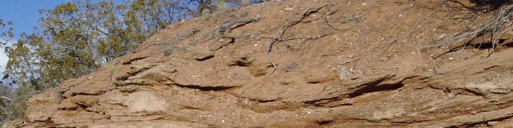
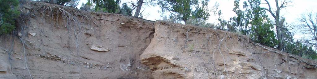
3 Santa Fe Group Definition (Spiegel and Baldwin, 1963): Sediment and intercalated volcanic flows that fill the Rio Grande rift above the extensive Oligocene-age intermediate-felsic volcanic rocks (Espinaso Fm) Constitutes the basin-fill for the Española basin In Española basin east of Los Alamos, strata generally dip to west and exposed strata becomes younger to west


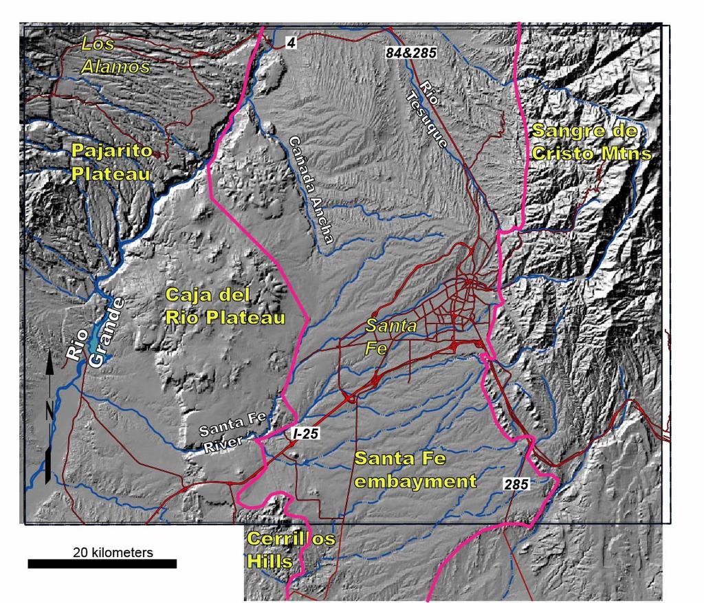
4 west east West-east cross-section at the latitude of Buckman southwest northeast NE-SW cross-section ~1 mile south, and parallel to, Arroyo Hondo
5 Santa Fe Group near S.F. Age: 26 Ma to 1.5 Ma (Baldridge et al., 1980; Koning et al., 2002; Koning, 2013) Two formations: Ancha Formation that overlies the Tesuque Formation (Galusha and Blick, 1971; Spiegel and Baldwin)
, provides a hydrologically relevant way of subdividing the Tesuque Fm.")
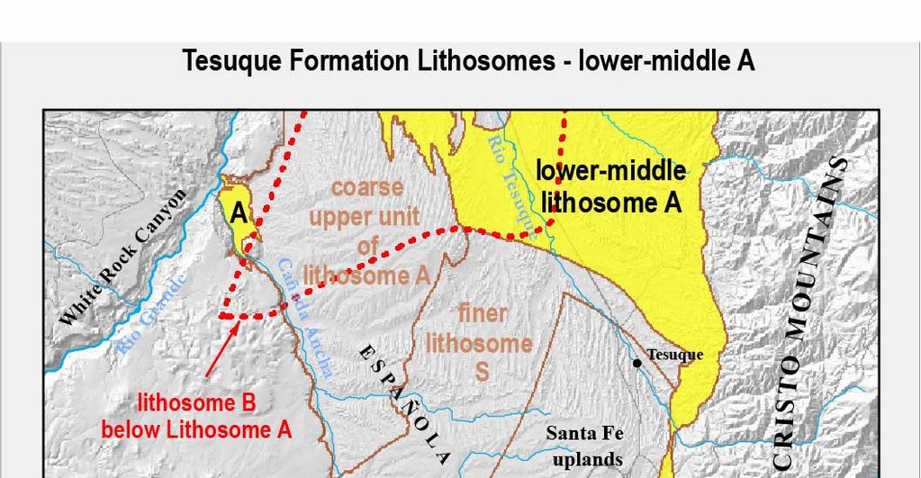
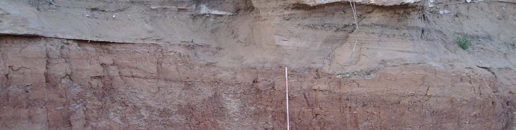
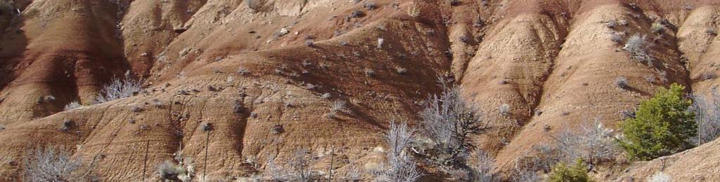
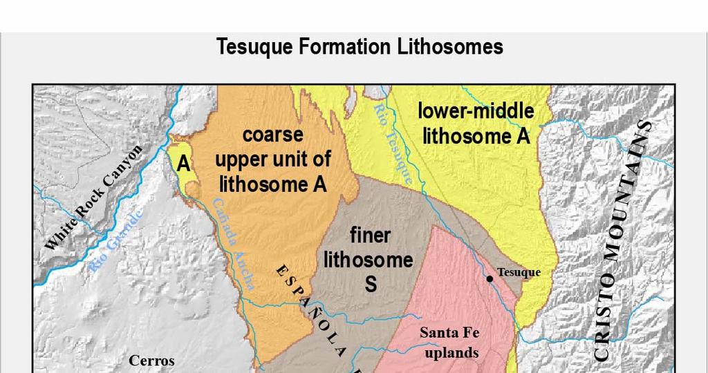
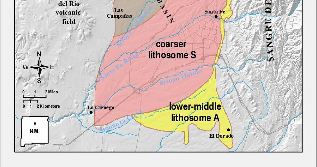
6 Subdividing the Santa Fe Group Formalized members up north are difficult to recognize south of Tesuque Pueblo. Lithosome nomenclature, expanded from Cavazza (1986), provides a hydrologically relevant way of subdividing the Tesuque Fm. Lithosomes are relatively uniform and distinctive bodies of sediment that intertongue with one another. Lithosomes correspond to unique paleo-drainage systems in the Santa Fe area.
7
8
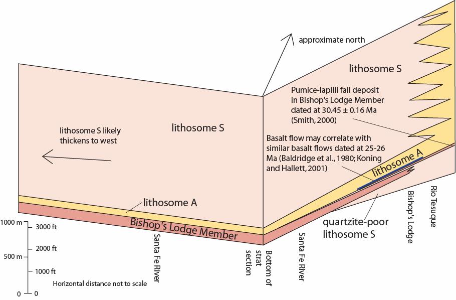
9 Lithosomes A, S, and E were deposited in specific paleodrainage system tracts. A marked coarsening of sedimentation occurs at Ma; this coarser, younger sediment correlates to the Chamita Fm west of the Rio Grande

10
11
 Muddy very fine to very coarse sand with minor silt")


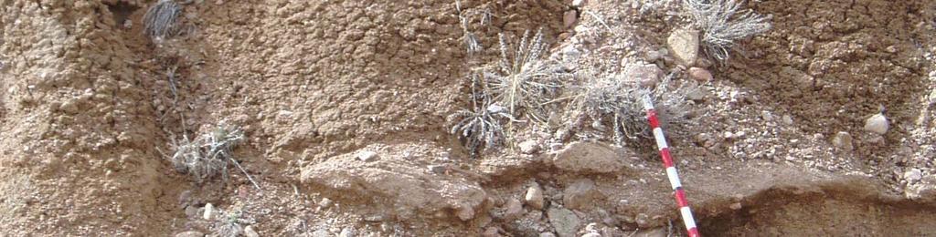
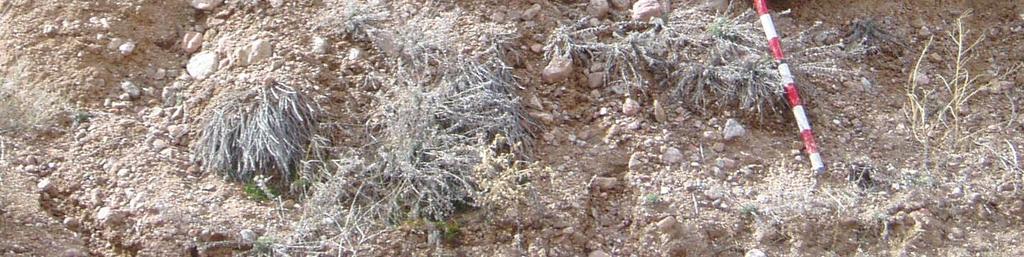
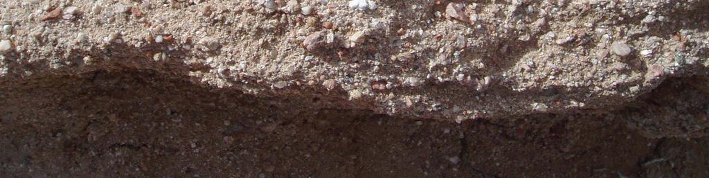
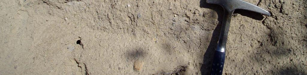
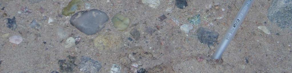
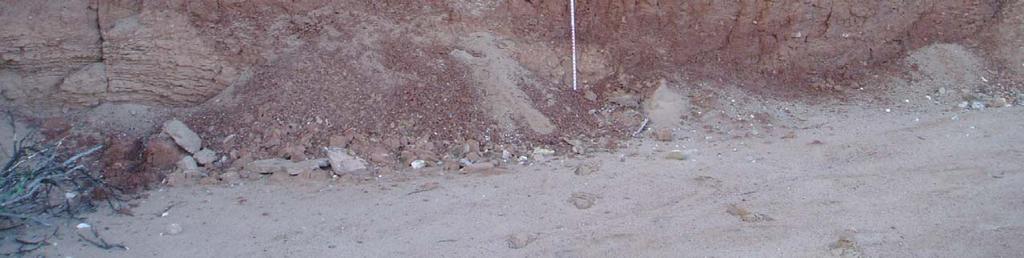
12 Coarse lower-middle lithosome A (medial proximal alluvial slope) Muddy very fine to very coarse sand with minor silt and clay beds Greater than ~15% coarse channel sediment; ribbon to broadly lenticular beds Sand is arkosic; ; gravel dominated by granite with <2% Paleozoic clasts and <3% quartzite clasts Color: Pink to light brown to very pale brown
13


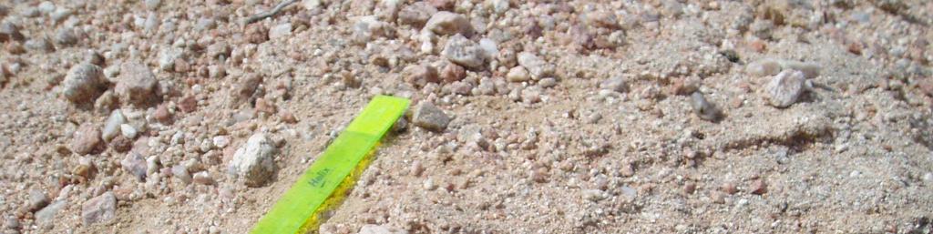
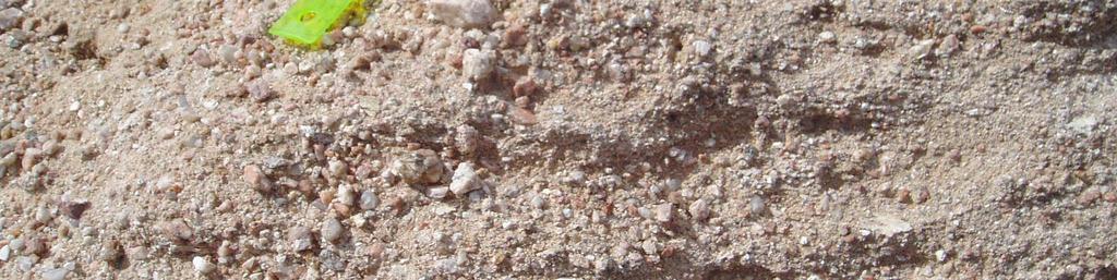
14 ine lower-middle lithosome A (distal alluvial slope) Silty very fine- to medium-grained sand with subordinate silt and clay beds Coarse channel sediment generally minor; ribbon to broadly lenticular beds Gravel dominated by granite with <2% Paleozoic clasts and <3% quartzite clasts Sand is arkosic Color: light brown to pink
15

16

17

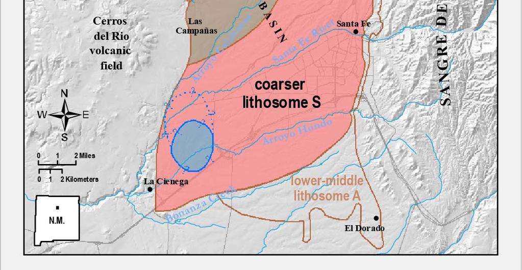
18 Lithosome S
19

20 Lithosome S clast composition
21


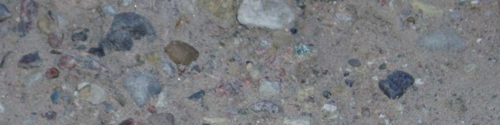
22 Coarse sediment near fan axis and near mtn front Pebbly sand and sand channel deposits with minor clay and silt beds Channel complexes are very thick and possess very thin to medium, planar to lenticular internal bedding Sand is arkosic Reddish color Gravel is composed of granite with 3-40% Paleozoic clasts and 5-30% quartzite
 Pebbly sand and sand channel")


23 Coarser lithosome S (ancestral Santa Fe River) Pebbly sand and sand channel deposits with minor clay and silt beds Channel complexes are very thick and possess very thin to medium, planar to lenticular internal bedding Sand is arkosic Reddish color


24


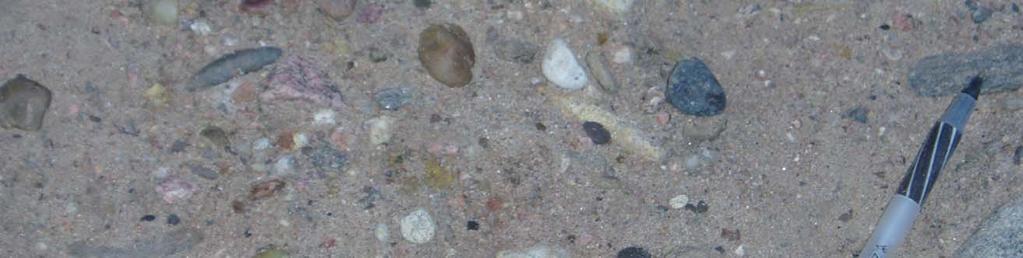
25 Finer lithosome S (ancestral Santa Fe River) Pebbly sand and sand channel deposits with about subequal very fine to fine sand, clay, and silt beds Channel complexes are thick and possess very thin to medium, planar to lenticular internal bedding Sand is arkosic Reddish color
26
27 Interfingering zone between northern lithosome S and southern lithosome A
28

29 Lithosome S


30 Medium unit Coarser unit Fine Lith A Fine unit Medium unit Fine unit Lithosome S upward coarsening La Cañada exploratory borehole
31 Hydrogeo xsect
32 From Koning and Read (2010)
33 Tesuque Fm hydrogeology Potentiometric surface and groundwater flow regimes
34 Tesuque Fm hydrogeology Hydrogeologic cross section through the Agua Fria well, Canada borehole, Baca St well, and Hickox well.

35 Hydrogeologic differences between lithosomes
Geologic Map of the Hatch Quadrangle, Doña County, New Mexico
 Geologic Map of the Hatch Quadrangle, Doña County, New Mexico By William R. Seager May 1995 New Mexico Bureau of Geology and Mineral Resources Open-file Digital Geologic Map OF-GM 213 Scale 1:24,000 This
SIEVING FOR CLAST SIZE Teacher s Guide
 SIEVING FOR CLAST SIZE Teacher s Guide ABSTRACT: Students take samples from two different geological layers and sieve for clast size mass data. They will also make sketches of some of the clasts and describe
GEOLOGIC MAP OF SETON VILLAGE QUADRANGLE, SANTA FE COUNTY, NEW MEXICO
 GEOLOGIC MAP OF SETON VILLAGE QUADRANGLE, SANTA FE COUNTY, NEW MEXICO Adam S. Read, John B. Rodgers, Steven Ralser, Brad R. Ilg, Shari Kelly and Daniel J. Koning New Mexico Bureau of Geology and Mineral
=%REPORT RECONNAISSANCE OF CHISHOLM LAKE PROSPECT. October 25, 1977
 =%REPORT ON FIELD RECONNAISSANCE OF CHISHOLM LAKE PROSPECT October 25, 1977 Bruce D. Vincent Imperial Oil Limited, Minerals - Coal, CALGARY, ALBERTA CHISHOLM LAKE PROSPECT Introduction The Chisholm Lake
New Mexico Geological Society
 New Mexico Geological Society Downloaded from: http://nmgs.nmt.edu/publications/guidebooks/58 Where is the water? - A preliminary assessment of hydrogeologic characteristics of lithostratigraphic units
SOUTH CERRO AZUL STRATIGRAPHIC SECTION. Upper Cerro Azul flow of the Servilleta Basalt (Tsbcau) Lower Sandlin unit (Tsl)
 Lower Sandlin unit (Tsl)") Figure A3-01 cobbles claysilt general grain size sand pebbles vf f m c vc SOUTH CERRO AZUL STRATIGRAPHIC SECTION Top at 18 m. Upper Cerro Azul flow of the Servilleta Basalt (Tsbcau) 15 Basalt: Very dark
Figure A3-01 cobbles claysilt general grain size sand pebbles vf f m c vc SOUTH CERRO AZUL STRATIGRAPHIC SECTION Top at 18 m. Upper Cerro Azul flow of the Servilleta Basalt (Tsbcau) 15 Basalt: Very dark
Geologic Map of the Chimayo Quadrangle, Rio Arriba and Santa Fe Counties, New Mexico
 Geologic Map of the Chimayo Quadrangle, Rio Arriba and Santa Fe Counties, New Mexico By Daniel J. Koning May, 2003 New Mexico Bureau of Geology and Mineral Resources Open-file Digital Geologic Map OF-GM
13 th Annual Española Basin Technical Advisory Group (EBTAG) Workshop & Field Trip May 13, 2014 Santa Fe Community College, Santa Fe, New Mexico
 Workshop & Field Trip May 13, 2014 Santa Fe Community College, Santa Fe, New Mexico") 13 th Annual Española Basin Technical Advisory Group (EBTAG) Workshop & Field Trip May 13, 2014 Santa Fe Community College, Santa Fe, New Mexico Open-file Report 565 By Charles Nylander, editor New Mexico
13 th Annual Española Basin Technical Advisory Group (EBTAG) Workshop & Field Trip May 13, 2014 Santa Fe Community College, Santa Fe, New Mexico Open-file Report 565 By Charles Nylander, editor New Mexico
Geologic Map of the San Juan Pueblo 7.5-Minute Quadrangle, Rio Arriba and Santa Fe Counties, New Mexico.
 Geologic Map of the San Juan Pueblo 7.5-Minute Quadrangle, Rio Arriba and Santa Fe Counties, New Mexico. By Daniel J. Koning and Kim Manley September 2014 New Mexico Bureau of Geology and Mineral Resources
Redefinition of the Ancha Formation and Pliocene Pleistocene deposition in the Santa Fe embayment, north-central New Mexico
 Redefinition of the Ancha Formation and Pliocene Pleistocene deposition in the Santa Fe embayment, north-central New Mexico D. J. Koning, 14193 Henderson Dr., Rancho Cucamonga, CA 91739; S. D. Connell,
Sources and controls of arsenic in the Santa Fe embayment, Santa Fe County, New Mexico
 University of New Mexico UNM Digital Repository Water Resources Professional Project Reports Water Resources 8-1-2013 Sources and controls of arsenic in the Santa Fe embayment, Santa Fe County, New Mexico
Geologic Map of the Trampas Quadrangle, Rio Arriba, Taos Counties, New Mexico
 Geologic Map of the Trampas Quadrangle, Rio Arriba, Taos Counties, New Mexico By Bauer, Paul W.; Helper, Mark A.; Aby, Scott June, 2005 New Mexico Bureau of Geology and Mineral Resources Open-file Digital
Evolution of the conceptual hydrogeologic and ground-water flow model for Las Vegas Valley, Clark County, Nevada
 Evolution of the conceptual hydrogeologic and ground-water flow model for Las Vegas Valley, Clark County, Nevada Geological Society of America Annual Meeting November 14, 2 David J. Donovan Southern Nevada
Geo c h e m i c a l Cha r a c t e r i z at i o n of Gro u n d Wat e r in th e Sou t h e r n Es pa Ño l a Ba s i n,
 Geo c h e m i c a l Cha r a c t e r i z at i o n of Gro u n d Wat e r in th e Sou t h e r n Es pa Ño l a Ba s i n, San ta Fe, Ne w Me x i c o Open File Report - 511 DRAFT - Subject to Revision December
Field Logs of Boreholes for Nested Piezometers, Nancy Lopez Site, Valencia County, New Mexico
 Field Logs of Boreholes for Nested Piezometers, Nancy Lopez Site, Valencia County, New Mexico Prepared for: New Mexico Office of the State End 0 neer Sean D. Connell, Field Geologist Patricia B. Jackson,
Sediment and sedimentary rocks Sediment
 Sediment and sedimentary rocks Sediment From sediments to sedimentary rocks (transportation, deposition, preservation and lithification) Types of sedimentary rocks (clastic, chemical and organic) Sedimentary
Sediments and. Sedimentary Rocks
 Sediments and Sedimentary Rocks Bottom Line Sedimentary rocks form from particles accumulated in sedimentary layers Sedimentary layers can be formed by clastic or detrital particles (e.g., sand grains,
Geology (Mellow) Hike, Santa Lucia Memorial Park February 16, I. Overview of Santa Lucia Range geology and tectonic history
 Hike, Santa Lucia Memorial Park February 16, I. Overview of Santa Lucia Range geology and tectonic history") Geology (Mellow) Hike, Santa Lucia Memorial Park February 16, 2015 I. Overview of Santa Lucia Range geology and tectonic history A. Basement Rocks 1. Salinian Block Rocks Sierra Nevada Type, continental
Geology (Mellow) Hike, Santa Lucia Memorial Park February 16, 2015 I. Overview of Santa Lucia Range geology and tectonic history A. Basement Rocks 1. Salinian Block Rocks Sierra Nevada Type, continental
Sediment and Sedimentary rock
 Sediment and Sedimentary rock Sediment: An accumulation of loose mineral grains, such as boulders, pebbles, sand, silt or mud, which are not cemented together. Mechanical and chemical weathering produces
MEMO. TO: Dennis Lapoint CC: FROM: Eriaan Wirosono DATE: April, 20 th 2014 SUBJECT: Exploration activity report March-April 2014_EW
 TO: Dennis Lapoint CC: FROM: Eriaan Wirosono DATE: April, 20 th 2014 SUBJECT: Exploration activity report March-April 2014_EW MEMO 1. Highlights and Productivity Overview pan sampling on target Areas 1
12th ANNUAL ESPAÑOLA BASIN WORKSHOP THE LOWER SANTA FE RIVER AND THE VISION FOR WATER SUSTAINABILITY IN SANTA FE COUNTY, NEW MEXICO
 12th ANNUAL ESPAÑOLA BASIN WORKSHOP THE LOWER SANTA FE RIVER AND THE VISION FOR WATER SUSTAINABILITY IN SANTA FE COUNTY, NEW MEXICO Open-file Report 557 By Charles Nylander, editor New Mexico Bureau Geology
STUDY PERFORMANCE REPORT
 STUDY PERFORMANCE REPORT State: Michigan Project No.: F-80-R-8 Study No.: 230702 Title: Effects of sediment traps on Michigan river channels Period Covered: October 1, 2006 to September 30, 2007 Study
Soils, Hydrogeology, and Aquifer Properties. Philip B. Bedient 2006 Rice University
 Soils, Hydrogeology, and Aquifer Properties Philip B. Bedient 2006 Rice University Charbeneau, 2000. Basin Hydrologic Cycle Global Water Supply Distribution 3% of earth s water is fresh - 97% oceans 1%
Structural Geology Lab. The Objectives are to gain experience
 Geology 2 Structural Geology Lab The Objectives are to gain experience 1. Drawing cross sections from information given on geologic maps. 2. Recognizing folds and naming their parts on stereoscopic air
SUPPLEMENTAL INFORMATION DELFT 3-D MODELING: MODEL DESIGN, SETUP, AND ANALYSIS
 GSA DATA REPOSITORY 2014069 Hajek and Edmonds SUPPLEMENTAL INFORMATION DELFT 3-D MODELING: MODEL DESIGN, SETUP, AND ANALYSIS Each experiment starts from the initial condition of a straight channel 10 km
The San Benito Gravels: Fluvial Depositional Systems, Paleocurrents, and Provenance
 ES120 FIELD TRIP #2 10 April 2010 NAME: The San Benito Gravels: Fluvial Depositional Systems, Paleocurrents, and Provenance Introduction The San Benito Gravels (SBG) consists of a 500 m thick section of
New Mexico Geological Society
 New Mexico Geological Society Downloaded from: http://nmgs.nmt.edu/publications/guidebooks/55 Sedimentology of the Tesuque Formation and tectonics of the Embudo fault system Near Dixon, New Mexico S. B.
Geology 252, Historical Geology, California State University, Los Angeles - professor: Dr. Alessandro Grippo
 LAB # 1 - CLASTIC ROCKS Background: - Mechanical and Chemical Weathering - Production of Clastic Sediment - Classification of Sediment according to size: Gravel, Sand, Silt, Clay - Erosion, Transportation
Principles of Geology
 Principles of Geology Essential Questions What is Uniformitarianism? What is Catastrophism? What is Steno s s Law? What are the other geologic principles? How is relative age determined using these principles?
Enhanced Characterization of the Mississippi River Valley Alluvial Aquifer Using Surface Geophysical Methods
 Photo by Shane Stocks, U.S. Geological Survey Enhanced Characterization of the Mississippi River Valley Alluvial Aquifer Using Surface Geophysical Methods Presented by Ryan F. Adams US Geological Survey
Ministry of Minerals Geological Research Authority of Sudan (GRAS)
") ﺑﺴﻢ اﷲ اﻟﺮﺣﻤﻦ اﻟﺮﺣﯿﻢ Ministry of Minerals Geological Research Authority of Sudan (GRAS) Bentonite Deposits of Omm Ali Area (River Nile State) Sudan By: El Gizouli Ahmed Hamid. February 2011 Abstract The
ﺑﺴﻢ اﷲ اﻟﺮﺣﻤﻦ اﻟﺮﺣﯿﻢ Ministry of Minerals Geological Research Authority of Sudan (GRAS) Bentonite Deposits of Omm Ali Area (River Nile State) Sudan By: El Gizouli Ahmed Hamid. February 2011 Abstract The
Geologic Map of the Tesuque Quadrangle, Santa Fe County, New Mexico
 Geologic Map of the Tesuque Quadrangle, Santa Fe County, New Mexico By Claudia I. Borchert, Steven J. Skotnicki, Adam S. Read, Daniel J. Koning, and David J. McCraw February, 2003 New Mexico Bureau of
REPORT ACCOMPANYING: GEOLOGIC MAP OF SANTA FE QUADRANGLE, SANTA FE COUNTY, NEW MEXICO
 OF-GM 032 REPORT ACCOMPANYING: GEOLOGIC MAP OF SANTA FE QUADRANGLE, SANTA FE COUNTY, NEW MEXICO Adam S. Read, Daniel J. Koning, Gary A. Smith, Steven Ralser, John B. Rodgers, Paul A Bauer New Mexico Bureau
SUPPLEMENTAL MATERIAL
 SUPPLEMENTAL MATERIAL DESCRIPTIONS OF OTHER STRATIGRAPHIC SECTIONS Cherry Creek In its middle reaches, Cherry Creek meanders between three paired terraces within a narrow bedrock valley. The highest is
DOWNSTREAM SORTING OF SEDIMENT (additional control on channel width, depth and slope)
") DOWNSTREAM SORTING OF SEDIMENT (additional control on channel width, depth and slope) Image removed due to copyright concerns As the gravel gets finer, it is transported at lower slopes. The result is
DOWNSTREAM SORTING OF SEDIMENT (additional control on channel width, depth and slope) Image removed due to copyright concerns As the gravel gets finer, it is transported at lower slopes. The result is
LINGUAU DEPOSITION IN THE WOODBINE SANDS ALONG COPPERAS BRANCH, DENTON COUNTY. TEXAS: A STUDY IN MARINE SEDIMENTATION
 LINGUAU DEPOSITION IN THE WOODBINE SANDS ALONG COPPERAS BRANCH, DENTON COUNTY. TEXAS: A STUDY IN MARINE SEDIMENTATION Ellis W. Shuler and Olin M. Millican The lack of outcrops in three dimensions often
 UNIT DESCRIPTIONS: Artificial Fill, Undocumented (Afu): Locally derived sandy silt and silty sand, locally with clay and varying amounts of gravel and man-made debris. Abundant concrete rubble, in places
GEOLOGY MEDIA SUITE Chapter 5
 UNDERSTANDING EARTH, SIXTH EDITION GROTZINGER JORDAN GEOLOGY MEDIA SUITE Chapter 5 Sedimentation Rocks Formed by Surface Processes 2010 W.H. Freeman and Company Mineralogy of sandstones Key Figure 5.12
Field boring log for Sandia Pueblo Well City of Albuquerque Piezometer Nest FY Prepared for Office of State Engineer
 Field boring log for Sandia Pueblo Well City of Albuquerque Piezometer Nest FY 1998 Prepared for Office of State Engineer Richard M. Chamberlin, Senior Field Geologist Patricia Jackson, Geological Lab
LESSONS LEARNED FROM MINING-INFLUENCED WATERS STUDIES AT THE NEW MEXICO BUREAU OF GEOLOGY AND MINERAL RESOURCES
 LESSONS LEARNED FROM MINING-INFLUENCED WATERS STUDIES AT THE NEW MEXICO BUREAU OF GEOLOGY AND MINERAL RESOURCES Virginia T. McLemore New Mexico Bureau of Geology and Mineral Resources New Mexico Institute
Correlation of gravel deposits from trenching project on Alder Creek fluvial terrace near Point Arena, California
 Correlation of gravel deposits from trenching project on Alder Creek fluvial terrace near Point Arena, California Aletha Lee Department of Geology and Geography, West Virginia University, White Hall, Morgantown,
Data Repository item
 Data Repository (B25407): Localities and descriptions of measured sections of study areas Table 1. Localities of the measured sedimentary sections in the NW Sichuan Basin Section Number Stratigraphy Locality
New Mexico Geological Society
 New Mexico Geological Society Downloaded from: http://nmgs.nmt.edu/publications/guidebooks/35 Development and deformation of Quaternary surfaces on the northeastern flank of the Jemez Mountains Charles
SURFACE GEOLOGY AND LIQUEFACTION SUSCEPTIBILITY IN THE INNER RIO GRANDE VALLEY NEAR ALBUQUERQUE, NEW MEXICO
 SURFACE GEOLOGY AND LIQUEFACTION SUSCEPTIBILITY IN THE INNER RIO GRANDE VALLEY NEAR ALBUQUERQUE, NEW MEXICO Keith I. Kelson, Christopher S. Hitchcock, and Carolyn E. Randolph William Lettis & Associates,
RESISTIVITY IMAGING AND BOREHOLE INVESTIGATION OF THE BANTING AREA AQUIFER, SELANGOR, MALAYSIA. A.N. Ibrahim Z.Z.T. Harith M.N.M.
 JOURNAL OF ENVIRONMENTAL HYDROLOGY The Electronic Journal of the International Association for Environmental Hydrology On the World Wide Web at http://www.hydroweb.com VOLUME 11 2003 RESISTIVITY IMAGING
Appendix D. Sediment Texture and Other Soil Data
 5 6 7 8 Appendix D. Sediment Texture and Other Soil Data This appendix describes the sediment texture of the aquifer system in the Restoration Area. The contents of this appendix describe the: Importance
Sedimentary Rocks. Origin, Properties and Identification. Physical Geology GEOL 101 Lab Ray Rector - Instructor
 Sedimentary Rocks Origin, Properties and Identification Physical Geology GEOL 101 Lab Ray Rector - Instructor Sedimentary Rock Origin and Identification Lab Pre-Lab Internet Link Resources 1) http://www.rockhounds.com/rockshop/rockkey/index.html
Anthill Resources Yukon - An Update on the Einarson Project
 Anthill Resources Yukon - An Update on the Einarson Project The Eastern Extension of a Carlin-type Gold Trend in the Selwyn Basin Anthill Resources Ltd Yukon Claim Holdings Over 2400 km 2 Property Location
Journal of Sedimentary Environments Published by Universidade do Estado do Rio de Janeiro SM2: doi: /jse SUPPLEMENTARY MATERIAL
 Appendix 2 Citation: Bergamaschi, S., Duarte, A.C.F., Serrano, J.S., Figueiredo, A.M.B., Vasconcelos, L.C., Oliveira, R.M.A.G., Ade, M.V.B., Pinheiro, A.E.P.P., Martins, M.V.A., 2016. Regional outcrops
Field Logs of Borehole Drilled for Nested Piezometers, Montesa Park Site. Prepared for City of Albuquerque
 Field Logs of Borehole Drilled for Nested Piezometers, Montesa Park Site Prepared for City of Albuquerque Richard M. Chamberlin, Senior Field Geologist - Bruce D. Allen, Field Geologist John W. Hawley,
11/22/2010. Groundwater in Unconsolidated Deposits. Alluvial (fluvial) deposits. - consist of gravel, sand, silt and clay
 deposits. - consist of gravel, sand, silt and clay") Groundwater in Unconsolidated Deposits Alluvial (fluvial) deposits - consist of gravel, sand, silt and clay - laid down by physical processes in rivers and flood plains - major sources for water supplies
Groundwater in Unconsolidated Deposits Alluvial (fluvial) deposits - consist of gravel, sand, silt and clay - laid down by physical processes in rivers and flood plains - major sources for water supplies
GEOLOGIC MAP OF THE THREE RIVERS 7.5-MINUTE QUADRANGLE, OTERO COUNTY, NEW MEXICO
 GEOLOGIC MAP OF THE THREE RIVERS 7.5-MINUTE QUADRANGLE, OTERO COUNTY, NEW MEXICO BY DANIEL J. KONING New Mexico Bureau of Geology and Mineral Resources, New Mexico Tech, 801 Leroy Place, Socorro, NM 87801-4796;
Ecoregions Glossary. 7.8B: Changes To Texas Land Earth and Space
 Ecoregions Glossary Ecoregions The term ecoregions was developed by combining the terms ecology and region. Ecology is the study of the interrelationship of organisms and their environments. The term,
Some Geological Features at Smalls Falls, Maine
 Maine Geologic Facts and Localities July, 2005 Some Geological Features at Smalls Falls, Maine 44 51 30.47 N, 70 30 58.74 W Text by Robert Marvinney, Department of Agriculture, Conservation & Forestry
Sedimentary Rocks. Origin, Properties and Identification. Geology Laboratory GEOL 101 Lab Ray Rector - Instructor
 Sedimentary Rocks Origin, Properties and Identification Geology Laboratory GEOL 101 Lab Ray Rector - Instructor Sedimentary Rock Origin and Identification Lab Pre-Lab Internet Link Resources 1) http://www.rockhounds.com/rockshop/rockkey/index.html
Land subsidence due to groundwater withdrawal in Hanoi, Vietnam
 Land Subsidence (Proceedings of the Fifth International Symposium on Land Subsidence, The Hague, October 1995). 1AHS Publ. no. 234, 1995. 55 Land subsidence due to groundwater withdrawal in Hanoi, Vietnam
Bulletin of Earth Sciences of Thailand
 Quantitative Seismic Geomorphology of Early Miocene to Pleistocene Fluvial System of Northern Songkhla Basin, Gulf of Thailand Oanh Thi Tran Petroleum Geoscience Program, Department of Geology, Faculty
New Mexico Geological Society
 New Mexico Geological Society Downloaded from: http://nmgs.nmt.edu/publications/guidebooks/30 Tertiary and Quaternary stratigraphy of the northeast plateau, Espanola Basin, New Mexico Kim Manley, 1979,
OPOSURA PROJECT, MOCTEZUMA, SONORA, MÉXICO, A HIGH GRADE ZN-PB, AG (CU, MO), ADVANCED STAGE, SKARN DEPOSIT (34) Expositor Día Hora Sala
, ADVANCED STAGE, SKARN DEPOSIT (34) Expositor Día Hora Sala") OPOSURA PROJECT, MOCTEZUMA, SONORA, MÉXICO, A HIGH GRADE ZN-PB, AG (CU, MO), ADVANCED STAGE, SKARN DEPOSIT (34) Expositor Día Hora Sala Cruz Paez Viernes 26 12:30 13:00 Sala A Cruz Enrique Paez Minera
OPOSURA PROJECT, MOCTEZUMA, SONORA, MÉXICO, A HIGH GRADE ZN-PB, AG (CU, MO), ADVANCED STAGE, SKARN DEPOSIT (34) Expositor Día Hora Sala Cruz Paez Viernes 26 12:30 13:00 Sala A Cruz Enrique Paez Minera
Sedimentary System Characteristics of Deng-3 Section on Paleo-central. Uplift Belt in Northern Songliao Basin. Siyang Li1,a*
 Sedimentary System Characteristics of Deng-3 Section on Paleo-central Uplift Belt in Northern Songliao Basin Siyang Li1,a* 1 School of Earth Sciences and Resources, China University of Geosciences, Beijing,
Supplementary material
 Supplementary material 1. Stratigraphic sections measured in the Dripping Spring Quartzite The measured sections (A, B, and C; Fig. 1 in main text), correspond to the Barnes Conglomerate, the Middle Member,
UPPER MANZANILLA FORMATION AT FISHING POND VILLAGE FIELDTRIP GUIDE
 UPPER MANZANILLA FORMATION AT FISHING POND VILLAGE FIELDTRIP GUIDE Saturday 10 th March 2012 Trip Leader: Georgia Huggins INTRODUCTION MANZANILLA Formation Author of name: WARING (G.A.) (1926.). The geology
Lab 7: Sedimentary Structures
 Name: Lab 7: Sedimentary Structures Sedimentary rocks account for a negligibly small fraction of Earth s mass, yet they are commonly encountered because the processes that form them are ubiquitous in the
High-resolution Sequence Stratigraphy of the Glauconitic Sandstone, Upper Mannville C Pool, Cessford Field: a Record of Evolving Accommodation
 Page No. 069-1 High-resolution Sequence Stratigraphy of the Glauconitic Sandstone, Upper Mannville C Pool, Cessford Field: a Record of Evolving Accommodation Thérèse Lynch* and John Hopkins, Department
Fluid-Mud Deposits of the Lower Jurassic Tilje Formation, Offshore Mid-Norway By Aitor A. Ichaso and Robert W. Dalrymple 1
 Fluid-Mud Deposits of the Lower Jurassic Tilje Formation, Offshore Mid-Norway By Aitor A. Ichaso and Robert W. Dalrymple 1 Search and Discovery Article #50107 (2008) Posted August 10, 2008 *Adapted from
The Nature of Sedimentary Rocks
 The Nature of Sedimentary Rocks Sedimentary rocks are composed of: Fragments of other rocks Chemical precipitates Organic matter or biochemically produced materials The Nature of Sedimentary Rocks Sedimentary
Depositional Environment
 Depositional Environment Sedimentary depositional environment describes the combination of physical, chemical and biological processes associated with the deposition of a particular type of sediment. Types
The hole of Bad Aussee. An unexpected overdeepened area in NW Steiermark, Austria.
 Austrian Journal of Earth Sciences Volume 100 Vienna 2007 The hole of Bad Aussee. An unexpected overdeepened area in NW Steiermark, Austria. Dirk van HUSEN1)*) & Michael MAYR2) KEYWORDS 1) Simetstrasse
Paleo Lab #4 - Sedimentary Environments
 Paleo Lab #4 - Sedimentary Environments page - 1. CHARACTERISTICS OF SEDIMENT Grain size and grain shape: The sizes and shapes of sedimentary particles (grains) are modified considerably during their transportation
B) color B) Sediment must be compacted and cemented before it can change to sedimentary rock. D) igneous, metamorphic, and sedimentary rocks
 color B) Sediment must be compacted and cemented before it can change to sedimentary rock. D) igneous, metamorphic, and sedimentary rocks") 1. Which characteristic of nonsedimentary rocks would provide the least evidence about the environment in which the rocks were formed? A) structure B) color C) crystal size D) mineral composition 2. Which
1. Which characteristic of nonsedimentary rocks would provide the least evidence about the environment in which the rocks were formed? A) structure B) color C) crystal size D) mineral composition 2. Which
Structural Geology Lab. The Objectives are to gain experience
 Geology 2 Structural Geology Lab The Objectives are to gain experience 1. Drawing cross sections from information given on geologic maps. 2. Recognizing folds and naming their parts on stereoscopic air
Chapter 8: Learning objectives
 Chapter 8: Learning objectives Understand concept of sedimentary facies Signinifance of lateral and vertical facies associations Walther s Law Understand the sedimentary facies of alluvial fans, eolian
Facies Analysis Of The Reservoir Rocks In The. Sylhet Trough, Bangladesh. Abstract
 Facies Analysis Of The Reservoir Rocks In The Sylhet Trough, Bangladesh Joyanta Dutta Petroleum Geoscience Program, Department of Geology, Faculty of Science, Chulalongkorn University, Bangkok 10330, Thailand
Starting at Rock Bottom: A Peculiar Central Texas PreClovis Culture
 Starting at Rock Bottom: A Peculiar Central Texas PreClovis Culture Background Brushy Creek grades, overall, west-northwest (WNW) to east-southeast (ESE) through the easternmost portions of the central
Sedimentary Rocks. Origin, Properties and Identification. Physical Geology GEOL 100. Ray Rector - Instructor
 Sedimentary Rocks Origin, Properties and Identification Physical Geology GEOL 100 Ray Rector - Instructor Sedimentary Rock Origin and Identification Lab Pre-Lab Internet Link Resources 1) http://www.rockhounds.com/rockshop/rockkey/index.html
I. Uniformitarianism- James Hutton s 2-part theory states: A. The geologic processes now at work were also active in the past B. The present physical
 How Earth s Rocks Were Formed I. Uniformitarianism- James Hutton s 2-part theory states: A. The geologic processes now at work were also active in the past B. The present physical features of Earth were
GEL 109 Midterm W05, Page points total (1 point per minute is a good pace, but it is good to have time to recheck your answers!
 GEL 109 Midterm W05, Page 1 50 points total (1 point per minute is a good pace, but it is good to have time to recheck your answers!) 1. Are the following flow types typically laminar or turbulent and
Chapter 5. The Sedimentary Archives
 Chapter 5 The Sedimentary Archives Factors affecting Sedimentary Characteristics 1. Tectonic setting 2. Physical, chemical, and biological processes in the depositional environment 3. Method of sediment
Outcrops from Every Continent and 20 Countries in 140 Contributions. Tor H. Nilsen, Roger D. Shew, Gary S. Steffens, and Joseph R.J. Studlick.
 Paper VIII Tor H. Nilsen, Roger D. Shew, Gary S. Steffens, and Joseph R.J. Studlick Editors Outcrops from Every Continent and 20 Countries in 140 Contributions http://bookstore.aapg.org Length ~ 23 m (75.5
' International Institute for Land Reclamation and Improvement. 2 Groundwater Investigations. N.A. de Ridder'? 2.1 Introduction. 2.
 2 Groundwater Investigations N.A. de Ridder'? 2.1 Introduction Successful drainage depends largely on a proper diagnosis of the causes of the excess water. For this diagnosis, one must consider: climate,
Igneous Rocks. Sedimentary Rocks. Metamorphic Rocks
 Name: Date: Igneous Rocks Igneous rocks form from the solidification of magma either below (intrusive igneous rocks) or above (extrusive igneous rocks) the Earth s surface. For example, the igneous rock
New Mexico Geological Society
 New Mexico Geological Society Downloaded from: http://nmgs.nmt.edu/publications/guidebooks/62 Geology of southern Black Mesa, Espanola Basin, New Mexico: New stratigraphic age control and interpretation
Feet. SAND; clayey, fine grained; shells are common; rounded quartz grains. SHELLS; muddy; almost no sand, shells and fragments common
 SAND; clayey, fine grained; shells are common; rounded quartz grains SHELLS; muddy; almost no sand, shells and fragments common SAND; back to medium to fine; has a mottled appearance and looks burrowed;
Chapter 8 Fetter, Applied Hydrology 4 th Edition, Geology of Groundwater Occurrence
 Chapter 8 Fetter, Applied Hydrology 4 th Edition, 2001 Geology of Groundwater Occurrence Figure 8.42. Alluvial Valleys ground-water region. Fetter, Applied Hydrology 4 th Edition, 2001 Fetter, Applied
New Mexico Geological Society
 New Mexico Geological Society Downloaded from: http://nmgs.nmt.edu/publications/guidebooks/56 Stratigraphy and depositional trends in the Santa Fe Group near Espanola, north-central New Mexico: tectonic
Application of Transition Probability Geostatistics in a Detailed Stratigraphic Framework. Gary Weissmann University of New Mexico
 Application of Transition Probability Geostatistics in a Detailed Stratigraphic Framework Gary Weissmann University of New Mexico ACKNOWLEDGEMENTS National Science Foundation American Chemical Society
TAMPA BAY TRIBUTARIES BASIN. Hydrogeological Setting
 TAMPA BAY TRIBUTARIES BASIN Hydrogeological Setting Aquifers within the Tampa Bay Tributaries Basins ground water flow system include the Floridan aquifer system, the intermediate aquifer system, and the
Your teacher will show you a sample or diagram of each, and show you a settling column. Draw these, and label your diagrams (8 pts) Ungraded:
 Ungraded:") From Sand to Stone: How do we recognize and interpret sedimentary rocks in the rock record? (Based closely on the University of Washington ESS 101 Lab 5: Sedimentary Rocks) Introduction: This lab consists
From Sand to Stone: How do we recognize and interpret sedimentary rocks in the rock record? (Based closely on the University of Washington ESS 101 Lab 5: Sedimentary Rocks) Introduction: This lab consists
Data Repository item DATA REPOSITORY
 Data Repository item 2003053 1 DATA REPOSITORY Stable isotope and trace-element geochemistry of the basal Bouse Formation carbonate, southwestern USA: Implications for the Pliocene uplift history of the
STUDY GUIDE FOR CONTENT MASTERY. Surface Water Movement
 Surface Water SECTION 9.1 Surface Water Movement In your textbook, read about surface water and the way in which it moves sediment. Complete each statement. 1. An excessive amount of water flowing downslope
Chapter 6 Sedimentary and Metamorphic Rock
 Chapter 6 Sedimentary and Metamorphic Rock Weathering and Erosion Wherever rock is exposed at Earth s surface, it is continuously being broken down by weathering a set of physical and chemical processes
ES120 Sedimentology/Stratigraphy
 Midterm Exam 5/05/08 NAME: 1. List or describe 3 physical processes that contribute to the weathering of rocks (3pts). exfoliation frost wedging many others. roots, thermal expansion/contraction also credit
Geologic Map of the Chili Quadrangle, Rio Arriba County, New Mexico
 Geologic Map of the Chili Quadrangle, Rio Arriba County, New Mexico By Daniel Koning, Steve Skotnicki, Shari Kelley, and Jessica Moore May, 2005 New Mexico Bureau of Geology and Mineral Resources Open-file
Facies Cryptic description Depositional processes Depositional environments Very well sorted. Desert dunes. Migration of straight crested mega ripples
 Very well sorted Travelled grate distance, effective sorting 5 medium-grained sandstone with well rounded grains; large scale high angle planar cross-beds. Migration of straight crested mega ripples Desert
Starting at Rock Bottom
 Starting at Rock Bottom At rock bottom of the Brushy Creek site s geological column lies the first clue to human habitation: A smelting and heattreating furnace, and mold, carved into Bed Ked: Figure 15
SEASONAL WATER STORAGE AND REPLENISHMENT OF A FRACTURED GRANITE AQUIFER USING ASR WELLS
 SEASONAL WATER STORAGE AND REPLENISHMENT OF A FRACTURED GRANITE AQUIFER USING ASR WELLS Mario R. Lluria; Phillip M. Paski; Gary G. Small HydroSystems, Incorporated Phoenix, Arizona USA Presentation Contents
Geologic Map of the Table Mountain Quadrangle, Socorro County, New Mexico.
 Geologic Map of the Table Mountain Quadrangle, Socorro County, New Mexico. By Steven M. Cather and W. Scott Baldridge May 2008 New Mexico Bureau of Geology and Mineral Resources Open-file Digital Geologic
GEOLOGIC MAP OF THE EL RITO 7.5- MINUTE QUADRANGLE, RIO ARRIBA COUNTY, NEW MEXICO
 GEOLOGIC MAP OF THE EL RITO 7.5- MINUTE QUADRANGLE, RIO ARRIBA COUNTY, NEW MEXICO DESCRIPTIONS AND REPORT BY DANIEL J. KONING 1, GARY A. SMITH 2, AND SCOTT ABY 3 Year 2 of 2-Year STATEMAP Quadrangle May,
Seismic Reflection Imaging across the Johnson Ranch, Valley County, Idaho
 Seismic Reflection Imaging across the Johnson Ranch, Valley County, Idaho Report Prepared for the Skyline Corporation Lee M. Liberty Center for Geophysical Investigation of the Shallow Subsurface (CGISS)
The Hydrologic Cycle
 CONTINENTAL DEPOSITIONAL ENVIRONMENTS fluvial desert lacustrine (lake) Glacial KEY PARAMETERS (VARIABLES) 1. Climate (Hydrologic Cycle) Annual Precip vs. Seasonality 2. Tectonics (Mountains) The Hydrologic