Field boring log for Sandia Pueblo Well City of Albuquerque Piezometer Nest FY Prepared for Office of State Engineer
|
|
|
- Nancy Osborne
- 5 years ago
- Views:
Transcription
1 Field boring log for Sandia Pueblo Well City of Albuquerque Piezometer Nest FY 1998 Prepared for Office of State Engineer Richard M. Chamberlin, Senior Field Geologist Patricia Jackson, Geological Lab Assistant Sean D. Connell, Field Geologist New Mexico Bureau of Mines and Mineral Resources Open-file 444-D November 1998
2 . Field Boring Log for Sandia Pueblo Well City of Albuquerque Piezometer Nest FY 1998 I The following borehole logs were completed for the piezometer nest located on the Sandia Indian Reservation, Sandoval County, New Mexico, in May-June The logs describe sample intervals, general lithologic characteristics and interpretations, supplemental drilling information, borehole geophysical logging information and limited interpretations, and hydrogeologic interpretations. The lithologic descriptions were made from mud-rotary. cuttings taken from the well head. Drilling fluids prevent a complete evaluation of the tine-' grained fraction; no sieve testing was conducted. The field lithologic descriptions include the following information: 1. Major textural class; 2. Estimatedgrain-sizedistribution by major textural class:silt/clay (~0.05 mm), sand ( mm), and gravel (>2 mm); 3. Sorting and range of grainandclastsize; 4. Shape of grains and clasts; 5. Clast composition; 6. Color (Munsell,1992) for R mm matrix, unless otherwise noted; 7. Other characteristics andriller's comments. Hydrogeologic interpretations classify materials according to a system of nomenclature developed for alluvial deposits of continental rift basins of New Mexico (Hawley and Haase, 1992; Hawley and Whitworth, 1996). This system describes major hydrostratigraphic units (RA, TA, VA, PA, USF, MSF, LSF) and component lithofacies (I to X). Deposits described in this borehole are provisionally assigned to Santa Fe Group nomenclature discussed in Connell and others (1998). It is important to note that the lithologic summary provides descriptions based on gain-size characteristics, supplemental information on driller's logs and geophysical logs, whereas, lithofacies and hydrogeologic interpretations are based on several integrated criteria including gain size, clast composition, geographic location within the basin and data from neighboring wells. A summary of lithologic descriptions, hydrostratigraphic interpretations and lithofacies are illustrated in the stratigraphic column (Fig. 1). A detailed log of the field descriptions by 10-foot sample interval is provided in Attachment A. Photographs of cuttings are provided in Attachment B. Borehole geophysical logs (three logs) are included as Attachment C.
3 References Connell, S.D., Allen, B.D., and Hawley, J.W., 1998, Subsurface stratigraphy of the Santa Fe Group using borehole geophysics, Albuquerque area, central New Mexico: New Mexico Geology, v.20, n.1, p.2-7. Hawley, J.W., Hasse, C.S., and Lozinsky, R.P., 1995, An underground view of the Albuquerque basin, in The water future of Albuquerque and middle Rio Grande basin: New Mexico Water Resources Research Institute, 1994 conference, p Hawley, J.W., and Whitworth, T.M., eds., 1996, Hydrogeology of potential recharge areas and hydrogeochemical modeling of proposed artificial-recharge methods in basinand valley-fill aquifer systems, Albuquerque Basin, New Mexico: New Mexico Bureau of Mines and Mineral Resources Open-File Report 402-D, 5 chapters, various appendices and pagination. Munsell, 1992, Soil Color Chart: New York, Munsell Company, Kollmorgen Instruments Corporation. 2
4 Name: Location: Elevation: Drilling Method Drillers: Drilling Staxted Drilling Completed Sample Interval: Screened Intervals: Total Depth: Water Table: Sample Logging: Geophysical Logging: Geophysical Logs: Sandia Pueblo Well (SPW) /a Section 29, T12N, RO4E. MN.4E ) AIameda 7.5-minute quadrangle. Pueblo of Sandia Tribal Lands. Latitude: Longitude: (NAD 27) 5435 ft (1657 m), estimated from topographic map Mud Rotary Steve Grant, assisted by Brian Bretz, USGS April 30,1998 May 31, feet to ft (Elev: ft) 1015 to 1020 ft (Elev: ft) to ft (Elev: ft) 1323 feet (403 m) Bottom Hole Elevation: ft (1254 m) 482 ft (Elevation: 4949 ft),based on abrupt increase in At on acoustic log M. Heynekamp & S.D. Connell U.S. Geological Survey-Water Resources Division (USGS), Albuquerque, New Mexico Southwest Geophysical Services, Inc. (SWGlj, Farmington, New Mexico USGS: Caliper, Induction Resistivity (below 400 ft), and Natural Gamma Ray (below 400 ft) SWGI Spontaneous Potential (SP), Single-Point Resistivity (SPR), Acoustic, Resistivity (16 and 64 inch coil spacing) and Induction Conductivity 3
5 Sandia Pueblo Well (T13N, R4E, Section 29,344) Alameda 7.5-minute Quadrangle Stratigraphic Column QTsag (USF-2): Gravel &sand (I) QTsas (USF-2): Sand & interbedded gravel (11) Tma (MSF-2): Silt. clay and sand (IX) Tmu (MSF-2): Clayey sand with minor clayey gravel (Ill, IX) 1400 L, "-" & WO W 300 1W aw Caliper (inches) Resistivity Conductivity SPR SP Delta 1 Drilling Rate Estimated lexture (omhm) (mmhodm) (ohm) (mv) (WH) (minlft) (percent) b e Texture
6 * # " Lithologic Summary and Borehole Geophysical Interpretations Sandia Pueblo Well Site Lithologic Description L Depth (ft) Description (all colors are moist) 0-25 Quatemarv uiedmont-slope deposits (Ope] GRAVEL (75% gravel, 20% sand, <5% silty-clay): Brown (7.5YR 5/4) to reddish-yellow (7.5YR 6/6), angular to subangular, poorly sorted gravel containing.granite, schist, white quartz (aplite) and rare limestone. Clasts are broken &d less than 20 mm &&iter Sierra Ladrones Formation-eastem maroin (piedmont) facies (OTSD~ GRAVEL (80% gavel, 15-20% sand, 0-5% silt-clay): Brown (7.5YR 5/4 to 4/4) to reddish-yellow (7.5YR 6/6), angular to subangular, moderately to well sorted, fine-grained gravel containing granite, schist, white quartz (aplite) and rare limestone. Clasts are less than 4 mm in diameter SAND (10% gavel, 90% sand): Brown (7.5YR 7/4), subangular to subrounded, well sorted, fine-to coarse-grained sand GRAVEL (SO-SO% gavel, 10-20% sand): Brown (7.5YR 5/4 to 4/4), suban,plar to subrounded, moderately sorted gravel containing granite, schist, white quartz (aplite) and rare limestone. Sand is medium to very coarse gained. Clasts are less than 4 mm in diameter Sierra Ladrones Formation-transitional fluvial-piedmont facies (OTstl GRAVEL (70-80% gravel, 10-20% sand, 0-20% silt-clay): Brown (7.5YR 5/4 to 4/4) to yellowish-brown (10YR 5/4 to 3/4), subangular to rounded gravel containing dominantly quartzite, granite and schist with subordinate silicic volcanic clasts. Missing sample interval: ft Sierra Ladrones Formation-axial-fluvial facies, uuuer gavel member (OTsad SAND and GRAVEL with minor, thin SILTY to CLAYEY SAND interbeds associated with the ancestral Rio Grande fluvial system. Coarsens upward from the top of the Atrisco member contact. Clasts are dominantly quartzite and silicic to intermediate porphyritic volcanic rocks and basalt with subordinate granite GRAVEL and coarse-grained SAND (75-90% gravel, 5-20% sand, 5-10% silt-clay): Brown (7.5YR 414) to yellowish-brown (1OYR 5/4 to 4/4), subangular to subrounded gavel with interbedded sandy gravel beds. Clasts are broken and contain dominantly quartzite with subordinate red-brown to brown volcanic tuff and basalt. Clasts are up to 20 mm in diameter GRAVELLY SAND (20-25% gravel, 75-80% sand, 0-5% silt-clay): Brown to dark yellowish-brown (IOYR 4/3 to 4/4) and brown to yellowish-brown (7.5YR 5/4 and IOYR 5/4), fine-to coarse-grained gravelly sand. Clasts are up to 10 mm in diameter. Many clasts are less than 4 mm in diameter GRAVEL (60% gravel, 40% sand): Dark yellowish-brown to yellowishbrown (loyr 4/4 to 5/4) rounded to subrounded gravel. Missing sample interval: ft. 4
7 L SANDandGRAVEL (40-80%gravel,20-60%sand): Brown to ~ yellowish-brown ( loyr 414 to 4/3) sandy gravel to gravelly sand GRAVEL and coarse-grained SAND (60-75% gravel, 40-25% sand) Brown (7.5YR 5/4 and loyr 573) to yellowish-brown (1OYR 4/4) rounded to subrounded quartzite-bearing gravel. Clasts are dominantly quartzite and reddish-brown, brown and greenish-gray volcanic rock with minor granite, chert and sandstone GRAVEL (60% gravel, 40% sand): Fine-grained gravel ( 4 mm maximum diameter) GRAVEL and SAND (8045% gravel, 1520% sand): Medium-grained gravel (<25 mm maximum diameter) SAND and GRAVEL (30-80% gravel, 20-70% sand): Light yellowishbrown to dark yellowish-brown (1OYR 4/4, 5/3, and (74) SANDY GRAVEL (540% gravel, 60-90% sand, 0-15% silt-clay): Brown to yellowish-brown (loyr 5/4,5/3) sandy gravel. Lower sandv member (OTsasl GRAVELLY to SILTY SAND (525% gravel, 570% sand, 1570% silt-clay): Yellowish-brown to dark yellowish-brown (1OYR 5/4,4/3) GRAVEL (40% gravel, 50% sand, 10% silt-clay): Brown (1OYR 513, 7.5YR 5/4), suban,dar to subrounded, fine-grained gravel. Clasts are less then 5 mm maximum diameter SILTY to SANDY GRAVEL (20-60% gravel, 30-70% sand, 540% siltclay): Brownish-yellow to dark yellowish-brown (1OYR 6/6,4/4, & 5YR 5/4), subangular to subrounded sand and gravel. Clasts are less than 5 mm maximum diameter GRAVEL and SAND (40-50% gravel, 40-50% sand, 10% silt-clay): Grayish-brown to light brown (1OYR 5/2,7.5YR 6/4) gravel and sand. Clasts are less than 5 mm maximum diameter : SILTY SAND TO SANDY SILT BED SAND (10-30% gravel, 60-70% sand, 10-20% silt-clay): Light yellowish-brown to grayish-brown (IOYR 6/4,5/2), subangular to subrounded, moderately sorted sand : SILTY SAND to SANDY SILT BED GRAVEL (40% gravel, 50% sand, 10% silt-clay): Brown to light-brown (IOYR 5/3,7.5YR 6/4), subangular to subrounded, poorly sorted, finegrained gravel. Clasts are less than 5 mm maximum diameter SAND (10-40% gravel, 60-70% sand, 10-20% silt-clay): Gray-brown to light reddish-brown (IOYR 5/3,5/4,5YR 5/4,6/4), subangular to subrounded very-fine to coarse-grained sand : SILTY SAND or SANDY SILT BED : SILTY SAND 01 SANDY SILT BED GRAVEL, small pebble (30-70% gravel, 30-40% sand, 20% silt-clay): Light brown to yellowish brown (1OYR 5/3, 5/4,7.5YR 6/4), suban,dar to subrounded, fine-grained gravel containing quartzite, granite and chert. Clasts are less than 10 mm maximum diameter GRAVELLY SAND (30-50% gravel, 30-50% sand, 20% silt-clay): Light brown to yellowish-brown (1OYR 5/3, 5/4,7.5YR 6/4), suban,dar to subrounded sand and gravel. 5
8 ... t Atrisco middle member of red formation (Tma) I SILT and CLAY with minor SAND. Provisionally assigned to the Atrisco member of Connell and others (1998) SANDY CLAY to CLAYEY SAND (45% sand, 55% silt-clay): Pale brown (1OYR 6/3), subangular to subrounded, very fine- to coarsegrained sand SILTY CLAY to CLAYEY SAND (45-60% sand, 40-55% silt-clay): Pale brown (1OYR 6/3), subangular to subrounded, moderately sorted, fine-grained gravel SILTY CLAY to SANDY CLAY (0-5% gravel, 40-45% sand, 55% siltclay): Pale brown (1OYR 6/3), sticky clay to clayey sand with light greenish-gray (5GY 7/1) and gray (1OYJX 5/1) discontinuous mottles CLAY (10% sand, 90% silt-clay): Dark gray to brown (7.5YR 4/1, loyr 5/4,5/3) very sticky clay. Fine-grained sequence is composed of three prominent clay intervals at , , and ft. These are recognized by prominent low resistivity (15 to 25 o h ) and moderately high natural gamma ray (160 to 200 GAP0 log responses SANDY CLAY (0-5% gravel, 30-35% sand, 65% silt-clay): Gray to yellowish-brown (1OYR 5/1,5/4) sticky, sandy clay SANDY CLAY to CLAYEY SAND (0-5% gravel, 40-45% sand, 55-60% silt-clay): Pale-brown to yellowish-brown (1OYR 613,614,516) silty to clayey sand Middle redformation:undividedfluvial facies ITmu) SILTY to CLAYEY SAND with minor very small pebble to granule GRAVEL. Clasts are predominantly quartzite, reddish-brown and brown silicic tuff, granite and minor non-vesiculated basalt CLAYEY SAND TO GRAVELLY CLAY (0-5% gravel, 40-55% sand, 40-60% silt-clay). Yellowish-brown (1OYR 5/4 to 5/6) clayey sand to gravelly clay. Clasts are less then 5 mm maximum diameter and composed of quartzite, silicic volcanic rocks, granite and rare basalt. Contains 2 to 5-ft thick clayey sand interbeds SANDY CLAY (0-5% gravel, 55-65% sand, 40-65% silt-clay): Yellowish-brown (1OYR 5/4) subangular to subrounded sand. Clasts are c4 mm maximum diameter and include quartzite and volcanic lithologies SILTY SAND to GRAVELLY SAND (2040% gravel, 50-60% sand, 10-20% silt/clay): Grayish-brown (1OYR 5/2) to brown (1OYR 5/3) moderately to well sorted, subangular to subrounded silty sand and muddy gravel. Clasts include quartzite and volcanic lithologies SILTY SAND to GRAVELLY SAND (10-40% gravel, 50-75% sand, 10-20% silt-clay): Pale-brown (1OYR 6/3), moderately to well sorted, subangular to subrounded. Clasts include quartzie, volcanic and granitic lithologies SILTY to CLAYEY SAND and GRAVEL (0-30% gravel, 60-85% sand, 0-25% silt-clay): Brown (10-7.5YR 5/3), subangular to subrounded, very fine- to medium-grained sand. Clasts contain quartzite, reddish-brown, brown and gray volcanic tuff and basalt, granite and sandstone. 6
9 Hydrogeologic Interpretation Sandia Pueblo Well Site drostratigraphic (ft) Depth Units Lithofacies 0-25 Alluvium Piedmont-slope (PA) V Ancestral Sandia Mountains piedmont-slope alluvium v, VI (USF-1) Ancestral river valleyandpiedmont-slopealluvium: (USFlM) Ancestral river valley and basin-floor deposits, gravel I dominated (USF-2) Ancestral river valley and basin-floor deposits, sand I dominated (USF-2) Ancestral basin-floor deposits, dominantly silt-clay with M interbedded sand (MSF-2) Ancestral basin-floor and river valley deposits, a, E dominantly silty to clayey sand with interbedded granule gravel and sand interbeds. (MSF-2) Note: The identifkation of lithofacies units is interpretive and based on several criteria, including texture, composition (provenance), and geographic location of the described sample within the basin. The interpretation of lithofacies is tentative and preliminary due to the limitations of the data and the fact that correlation adjacent to wells has not been fully established; accordingly, these lithofacies interpretations are subject to revision. L 7
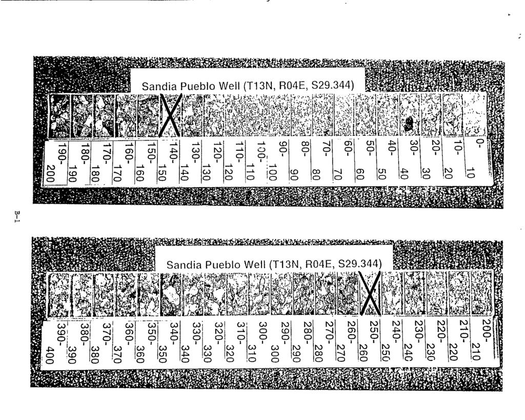
10 Attachment A Field Lithologic Descriptions Sandia Pueblo Well (T13N, R4E, Section ) Sample Depth NO. Interval (ft) SPW SPW SPW SPW SPW SPW SPW SPW SPW SPW SPW I SPW SPW Description Gravel (75% gravel, 20% sand, 4% sildclay); moderately to poorly sorted, angular. Granite, schist, and aplite clasts. Reddish yellow (7.5YR 6/6) siltklay; brown (7.5YR 5/4) sand. Driller s log: 0-5 ft: cobble sand; 5-10 ft: sand, gravel. Gravel (75% gravel, 25% sand); moderately sorted, subangular sand, and angular gravel. Granite, schist, and aplite clasts. Strong brown (7.5YR 5/6). Driller s log: sand, small gravel. Gravel (80% gravel, 15% sand <5% silt/clay); moderately to well sorted, angular to subangular. Granite, schist, and aplite clasts. Reddish-yellow (7.5YR 6/6) siltlclay; brown (7.5YR 4/4) sand. Driller s log: ft: sand, small gravel; fc: sand, sandy clay. Gravel (85% gravel, 15% sand); moderately to well sorted, angular to subangular. Granite, schist, and aplite clasts. Brown (7.5YR 5/4). Light gray concrete chips from grout used to set surface casing. Driller s log: ft: sand, coarse sand, gravel. Gravel (80% gravel, 20% sand); well sorted, angular to subangular. Granite, aplite, and schist clasts. Brown (7.5YR 5/4). Driller s log: sand, gravel, coarse sand. Same as above. Driller s log: sand, gravel, coarse sand. Sand (90Y0 sand, 10% gravel); well sorted, angular to subangular. Granite, aplite, schist, and limestone clasts. Brown (7.5YR 5/4). Silt- or clay-rich bed at 62 fi. Driller s log: sand,coarse sand. Gravel (80% gravel, 20% sand); angular to subangular. Granite, aplite, schist, and limestone clasts. Brown (7.5YR 5/5). Driller s log: sand, coarse sand, gravel. Gravel (85% gravel, 15% sand); well sorted, angular to subangular. Granite, schist, and aplite clasts. Brown (7.5YR 5/4). Driller s log: sand, coarse sand, gravel. Same as above. Driller s log: sand, coarse sand, gravel. Gravel (90% gravel, 10% sand); moderately to well sorted, angular to subangular. Granite and schist clasts. Brown (7.5YR 5/2). Driller s log: sand, coarse sand, gravel. Gravel (80% gravel, 20% sand); moderately to well sorted, angular to subangular. Granite and schist clasts. Brown (7.5YR 4/2). Driller s log: sand, coarse sand, gravel. Gravel (80% gravel, 10% sand, 10% siltlclay); moderately sorted, angular to subangular (sand), subangular to rounded (gravel). Granite, schist, and quartzite clasts. Yellowish-brown (1OYR 514) siltlclay; brown (7.5YR 5/4) sand. Rounded quartzite clasts mark top of ancestral Rio Grande fluvial facies. Driller s log: fk coarse sand, gavel; ft: sand, silty clay. A-1
11 Sample Depth No. Interval (ft) Description SPW (70% aavel. 20% siltfclav, 10% sand): moderately to well sorted, subanwlar. SPW-15 SPW-16 SPW-17 SPW-18 SPW-19 SPW-20 SPW-2 1 SPW-2$ SPW-23 SPW Granite, schist, quartzite,&d chert clasts. Dark yellowish-brown (10YR3/4) siltfclay; brown (7.5YR 4/4) sand. Driller s log: ft sand, silty; ft: silty clay, gravel, small cobble. No sample. Driller s log: ft: coarse sand, gravel; ft: gravel, small cobble. Gravel (80% gravel, 10% sand, 10% silt/clay); well sorted, subangular to subrounded (sand), subangular (gravel). Granite, basalt, sandstone, quartzite, and schist clasts. Yellowish-brown (1OYR 5/4) siltfclay; brown (7.5YR 4/4) sand. Driller s lob: ft gravel, coarse sand, silty clay; ft gravel, coarse sand, small cobble. Gravel (80% Favel, 15% sand, 5% siltfclay); well sorted, angular to subangular. Quartzite, schlst, granite, and basalt clasts. Yellowish-brown (1OYR 5/4) silt/clay; brown (7.5YR 4/4) sand. Driller s log: ft: cobble, coarse sand; ft coarse sand, sand, sandy clay. Sandy gravel (75% gravel, 20% sand, 5% siltfclay); well sorted, angular to subangular (sand), subrounded to rounded (gravel). Quartzite, schist, granite, and basalt clasts. Yellowish-brown (1OYR 5/4) siltfclay; brown (7.5YR 4/4) sand. Driller s log: ft coarse sand, sand, sandy clay; ft gravel, coarse sand. Gravel (90% gravel, 5% sand, 5% siltfclay); well sorted, angular to subangular (sand), subrounded to rounded (gravel). Quartzite, schist, granite, silicic (reddishbrown)-volcanic, and basalt clasts. Yellowish-brown (1OYR 516) siltlclay; brown (7.5YR4/4) sand. Driller s log: ft: coarse sand, gravel; A: gravel, cobble, coarse sand. Gravel (90% gravel, 5% sand, 5% silt/clay); well sorted, angular to subangular sand, and subrounded to rounded gravel. Schist, quartzite, granite, and silicic (reddish-brown)-volcanic clasts. Yellowish-brown (1OYR 5/6) siltfclay; brown (7.5YR 4/4) sand. Driller s log: gravel, cobble, coarse sand. Sandy gravel (80% sand, 20% gravel);. well sorted, angular to subangular sand, and subangular to subrounded gravel. Volcanic (andesite), quartzite, and granite clasts. Brown (1OYR 4/3). Driller s log: ft: gravel, coarse sand; ft: sand, silty clay. Sandy gravel (75% sand, 20% gravel, 5% siltfclay); well sorted, angular to subangular sand, and subrounded gravel. Quartzite, granite, and schist clasts. Brown (7.5YR 5/4 and IOYR 4/3). Driller s log: sand, silty clay. Sandy gravel (70% sand, 25% gravel, 5% siltlclay); well sorted, angular to subangular sand, and subrounded gravel. Quartzite, granite, and schist clasts. Yellowish-brown (1OYR 5/4) siltlclay; brown (1OYR 4/3) sand. Driller s log: ft coarse sand, silty clay; ft: small gravel, silty clay. Sandy gravel (75% sand, 20% gravel, <5% silt/clay); well sorted, angular to subangular sand, and subangular to subrounded gravel. Quartzite, andesite, granite, and schist clasts. Yellowish-brown (1OYR 5/4) siltfclay; dark yellowishbrown (1OYR 4/4) sand. Driller s log: ft sand, coarse sand; ft coarse sand, silty clay, gravel. A-2
12 Sample Depth Description No. Interval (ft) SPW Sandy gravel (60% gravel, 40% sand, 5% siltlclay); moderately to well sorted, angular to subangular sand, and subrounded to rounded gravel. Quartzite, granite, schist, and chert clasts. Yellowish-brown (1OYR 5/4) silt/clay; dirk yellowishbrown (IOYR 4/4) sand. Driller s log: coarse sand, sandy clay. SPW No sample. Driller s log: ft: coarse sand, sandy clay; : gravel, coarse sand. SPW Sandy gravel (60% gravel, 40% sand); well sorted, angular sand, and subrounded to rounded gravel. Quartzite, basalt, and granite clasts. Dark yellowish-brown (IOYR 414). Driller s log: ft: sand, coarse sand; ft: gravel. SPW Gravel (80% gravel, 20% sand); well sorted, angular sand, and subangular to subrounded gravel. Quartzite, schist, and granite clasts. Dark yellowish-brown (IOYR 4/4). Drillr s log: ft: gravel, coarse sand; ft: sand, sandy clay, coarse sand. SPW-29 SPW-30 SPW-3 1 SPW Sandy gravel (60% sand, 40% gravel); moderately to well sorted, subangular sand, and subangular to subrounded gravel. Quartzite, andesite, and schist clasts. Brown (1OYR 413). Driller s log: coarse sand, sand. Sandy gravel (60% gravel, 40% sand); moderately to well sorted, subangular sand, and subrounded to rounded gravel. Granite, andesite, basalt, volcanic, and quadte clasts. Brown (IOYR 4/3). Abundant volcanic clasts. Driller s log: ft: coarse sand, gravel; ft: gravel, coarse sand. Gravel (75% gravel, 20% sand, 5% silt/clay); well sorted, angular, subrounded to rounded. Quartzite and granite clasts. Brown (7.5YR 5/4) siltlclay; dark yellowish-brown (1OYR 414) sand. Driller s log: ft: sand, coarse sand; : sand, coarse sand with sandy clay. Gravel (75% gravel, 20% sand, 5% siltlclay); moderately to well sorted, subangular sand, and subrounded gravel. Granite, quartzite, and schist clasts. Yellowish-brown (1OYR 5/4) siltlclay; brown (1OYR 5/3) sand. Driller s log: sand, small gravel. SPW Sandy gavel (60% gravel, 40% sand); well sorted, subangular sand, and subrounded to rounded gravel. Granite, quartzite, and schist clasts. Brown (IOYR 5/3). Driller s log: sand, gravel. SPW Sandy gravel (60% gravel, 40% sand); well sorted, angular to subangular sand, and subrounded to rounded gravel. Quartzite, granite, schist, and basalt clasts. Brown (IOYR 513). Driller s log: ft: sand, gravel; ft: sand, gravel, cobble. SPW Gravel (85% gravel, 15% sand); well sorted, angular to subangular sand, and rounded gravel. Quartzite and granite clasts. Dark yellowish-brown (IOYR 4/4). Driller s log: ft: gravel, coarse sand; ft: gravel, coarse sand, silty clay. SPW Gravel (80% gravel, 20% sand); well sorted, angular sand, and subrounded gravel. Quartzite, granite, and chert clasts. Brown (IOYR 4/3). Driller s log: coarse sand, sandy clay. SPW Gravel (70% gravel, 30% sand); well sorted, angular sand, and subrounded to rounded gavel. Quartzite, granite, and chert. Dark yellowish-brown (IOYR 4/4). Driller s log: ft: sand, coarse sand; ft: gravel coarse sand. A-3
13 Sample Depth Description NO. Interval (ft) SPW Sandy gravel (60% sand, 40% gravel); well sorted, angular sand, and SPW-39 SPW-40 SPW-41 SPW-42 SPW-43 SPW-44 SPW-45 SPW subrounded to rounded gravel. Granite, quartzite, and chert clasts. Dark yellowish-brown (1OYR 414). Driller s lob: coarse sand, sancy clay, sand. Gravel (70% sand, 30% gravel); well sorted, angular sand, and subangular to subrounded gravel. Granite, quartzite, and chert clasts. Dark yellowish-brown (IOYR 4/4). Driller s log: coarse sand, sandy clay. Gravel (80% gravel, 20% sand); well sorted, angular sand, and subangular to subrounded gravel. Silicic (reddish-brown)-volcanic, andesite, quartzite, and granite clasts. Dark yellowish-brown (1OYR 4/4). Driller s log: : coarse sand, sandy clay; ft:coarse sand, sandy clay, gravel. Sandy gravel (50% gravel, 40% sand, 10% siltlclay); well sorted, angular sand, and subangular to subrounded gravel. Quartzite, chert, silicic-volcanic, granite, and andesite clasts. Light yellowish-brown (1OYR 6/4) siltlclay; brown (1OYR 5/3) sand. Driller s log: ft: sand, silty clay; fr: sand, sandy clay Sand (70% sand, 15% gravel, 15% siltlclay); well to moderately sorted, angular sand, and subangular to subrounded gravel. Quartzite and granite clasts. Yellowish-brown (IOYR 5/4) siltlclay; brown (1OYR 5/3) sand. Driller s log: sand, sandy clay. Gravel (90% sand, 5% gravel, 5% siltklay); moderately sorted, angular sand, and subrounded gravel. Quartzite and granite clasts. Light yellowish-brown (1OYR 6/4) siltklay; dark yellowish-brown (IOYR 4/4) sand. Driller s log: sand, sandy clay. Sand (SOYO sand, 10% gravel, 10% siltlclay); moderately to well sorted, an,dar sand, and subangular to subrounded graver. Quartzite and granite clasts. Yellowish-brown (1OYR 5/4) silt/clay; brown (1OYR 5/3) sand. Driller s log: sand, sandy clay. Gravelly sand (70% sand, 30% gravel); well to moderately sorted, angular sand, and well sorted, subangular to subrounded gravel. Granite, quartzite, and chert clasts. Brown (IOYR 513). Possible clasts of volcanic ash. Driller s log: sand, sandy clay, coarse sand. Gravelly sand (60% sand, 40% gravel); well sorted, angular to subangular sand, and well sorted, subrounded to rounded (gravel). Quartzite, granite, and chert clasts. Brown (IOYR 5/3). Driller s log: ft: sand, sandy clay; h ft: sand, sandy clay, gravel. SPW Sandy to gravelly silt and clay (70% siltlclay, 15% sand, 15% gravel); well sorted, angular to subangular sand, and subrounded to rounded gravel. Quartzite, granite, and chert. Yellowish-brown (1OYR 5/4) siltlclay; dark yellowish-brown (1OYR 4/4) sand. Driller s log: ft sand, gravel, sandy clay; R: sand, coarse sand. SPW Gravelly sand (70% sand, 20% gravel, 10% siltlclay); well to moderately sorted, angular to subangular sand, and subangular to subrounded gravel. Quartzite, granite, and chert clasts. Brown (7.5YR 5/4) siltlclay; brown (1OYR 4/3) sand. Driller s log: ft: sand, coarse san R: sand, coarse sand with sandy clay. A-4
14 Sample Description No. Interval (ft) SPW-49 SPW-50 SPW-51 SPW-52: SPW-53 SPW-54 SPW-55 SPW Silty to gravelly sand (70% sand, 15% gravel, 15% siltlclay); well to moderately sorted, angular - sand, and subangular to subrounded gravel. Quartzite, granite, and chert. Brown (1OYR 513). Water table at 482 ft. Driller s log: ft: sand, sandy clay; ft: sand, sandy clay, gravel. Gravelly to silty sand (60% sand, 25% gravel, 15% siltlclay); well to moderately sorted, angular sand, and subangular to subrounded gravel. Quartzite, granite, and chert clasts. Brown (7.5YR 5/4) siltfclay; brown (1OYR 5/3)sand. Driller s log: sand, sandy clay, gravel. Gravelly sand (50% sand, 40% gravel, 10% siltlclay); moderately sorted, angular sand, and subangular to subrounded gravel. Quartzite, granite, and chert clasts. Brown (7.5YR 5/4 and loyr 5/3). Driller s log: ft: sand, coarse sand, sandy clay; ft: sand, coarse sand. Gravelly sand (60% sand, 35% gravel, 5% siltfclay); well to moderately sorted, angular sand, and subrounded to rounded gravel. Quartzite, granite, and chert clasts. Brown (7.5YR 5/4 and loyr 5/3). Driller s log: ft: sand, coarse sand; ft: sand, coarse sand, gravel. Gravelly sand (70% sand, 25% gravel, 5% siltlclay); moderately sorted, angular sand, and subrounded gravel. Quartzite, granite, and chert clasts. Brown (7.5YR 5/4) siltfclay; dark yellowish-brown (1OYR 4/4) sand. Driller s log: ft: sand, coarse sand; ft: sand, coarse sand, silty clay. Gravelly sand (70% sand, 20% gravel, 10% siltfclay); moderately to well sorted, angular sand, and subangular to subrounded gravel. Granite, quartzite, and chert clasts. Brownish-yellow (1OYR 6/6) SiltJclay; dark yellowish-brown (1OYR 4/4) sand. Driller s log: fi: sand, coarse sand, silty clay; ft: sand, coarse sand with sandy clay. Silty sand and gravel (40% gravel, 40% sand, 20% siltlclay); moderately to well sorted, angular sand, and subangular to rounded gravel. Quartzite, granite, and chert clasts. Brown (7.5YR 514) siltfclay; yellowish-brown (1OYR 5/4) sand. Driller s log: coarse sand, sandy clay. Gravelly to silty sand (40% sand, 30% gravel, 30% siltlclay); moderately sorted, subangular sand, and subrounded to rounded gravel. Quartzite, granite, schist, and chert. Light reddish-brown (5YR 6/4) siltlclay; yellowish-brown (1OYR 5/4) sand. Driller s log: ft: coarse sand, sandy clay, silty clay; e ft sand, coarse sand. SPW Gravelly sand and siltlclay (40% sand, 40% siltfclay, 20% gravel); moderately sorted, angular sand, and subrounded to rounded gravel. Quartzite, granite, chert, and schist. Light reddish-brown (5YR 6/4) siltfclay; brown (1OYR 5/3) sand. Driller s log: ft: sand, coarse sand, silty clay; ft: small gravel, coarse sand. SPW Sandy gravel (60% gravel, 30% sand, 10% siltlclay); moderately to well sorted, angular sand, and subangular to subrounded gravel. Quartzite, granite, and schist. light-brown (7.5YR 6/4) siltlclay; brown (1OYR 5/3) sand. Driller s log: small gravel, coarse sand, sandy clay. A-5
15 Sample Depth No. Interval (ft) Description SPW Sandy ravel (50%.gravel, 40% sand, 10% siltlclay); moderately sorted, annular SPW-60 SPW-61 SPW-62 SPW-63 SPW-64 SPW-65 SPW-66 SPW47 SPW sand,-&d sub&gul& to subrounded gravel. Quartzite, granite, &d schist clasts. Light-brown (7.5YR 6/4) siltlclay; brown ( 1OyR 5/4) sand. Driller s log: ft coarse sand, sand; ft: coarse sand, sand, sandy clay. Sandy gravel (50% gravel, 40% sand, 10% siltlclay); moderately sorted, angular sand, and subangular to subrounded gravel. Quartzite, granite, and schist clasts. Light-brown (7.5YR 6/4) siltlclay; grayish-brown (1OYR 5/2) sand. Driller s log: ft: coarse sand, sand, sandy clay; ft: coarse sand, sand. Sandy gravel (50% gravel, 40% sand, 10% siltlclay); well to moderately sorted, angular sand, and subangular to subrounded gravel. Quartzite, granite, schist, and chert clasts. Light-brown (7.5YR 6/4) siltlclay; brown (1OYR 5/3) sand. Driller s log: sand, coarse sand, silty clay. Gravelly sand (70% sand, 20% gravel, 10% siltlclay); moderately to well sorted, anglar sand, and subrounded to rounded gravel. Quartzite, granite, and schist clasts. Light reddish-brown (5YR 6/4) siltklay; brown (1OYR 5/3) sand. Driller s log: ft: sand, silty clay; ft: sand, coarse sand, sandy clay. Gravelly sand (70% sand, 20% gravel, 10% siltlclay); moderately to well sorted, angular sand, and subrounded to rounded gravel. Quartzite, granite, and schist clasts. Light reddish-brown (5YR 6/4) siltlclay; brown (IOYR 5/29 sand. Driller s log: ft: sand, coarse sand, clay; ft: sand, silty clay. Gravelly sand (60% sand, 30% gravel, 10% siltlclay); moderately sorted, angular to subangular sand, and subangular to subrounded gravel. Quartzite, granite, and schist clasts. Light yellowish-brown (1OYR 6/4) siltklay; grayish-brown (1OYR 5/2) sand. Driller s log: ft: sand, coarse sand, sandy clay. Gravelly sand (50% sand, 40% gravel, 10% siltlclay); well to moderately sorted, angular to subangular sand, and subangular to subrounded gravel. Quartzite, granite, and schist clasts. Light-brown (7.5YR 6/4) siltlclay; brown (1OYR 5/3) sand. Driller s log: ft: sand, coarse sand; ft: same with sandy clay. Gravelly sand (50% sand, 40% gravel, 10% siltlclay); moderately to well sorted, angular sand, and subrounded to rounded gravel. Quartzite, granite, chert, and schist clasts. Light reddish-brown (5YR 6/4) siltlclay; brown (1OYR 5/3) sand. Driller s log: ft: sand, coarse sand with sandy clay. Gravelly sand (60% sand, 30% gravel, 10% siltlclay); well sorted, angular sand, and subrounded to rounded gravel. Quartzite, granite, chert, and schist clasts. Reddish-brown (5YR 5/4) siltklay; brown (1OYR 5/3) sand. Driller s log: ft: sand, course sand; ft sand, silty clay Gravelly sand (60% sand, 20% gravel, 20% siltklay); well sorted, angular sand, and subangular to subrounded gravel. Quartzite and granite clasts. Reddishbrown (5YR 514) siltklay; yellowish-brown (1OYR 5/4) sand. Driller s log: ft: sand, silty clay. A-6
16 Sample Depth Description NO. Interval (ft) SPW Gravelly to silty sand (60% sand, 20% gravel, 20% silt'clay); moderately to well SPW-70 SPW-71 SPW-72 SPW-73 SPW-74 SPW-75 SP W-76 SPW-h SPW sorted, angular to subangular sand, and well sorted, subrounded to rounded gravel. Quartzite and granite clasts. Reddish-brown (5YR 5/4) silt'clay; grayishbrown (1OYR 512) sand. Driller's log: fi: sand, silty clay. Gravelly sand (70% sand, 30% gravel, 10% silt'clay); moderately sorted, angular sand, and subangular to subrounded gravel. Quartzite, granite, and schist clasts. Reddish-brown (5YR 5/4) sildclay; brown (IOYR 5/3) sand. Driller's log: ft: sand, silty clay; ft sand, sandy clay. Graveily sand (60% sand, 30% gravel, 10% silt'clay); moderately to well sorted, angular to subangular sand, and subrounded to rounded (ravel. Quartzite, chert, and granite clasts. Brown (7.5YR 5/4) sildclay; brown (1OYR 5/3) sand. Driller's log: ft: sand, sandy clay. Silty sand to gravelly sand (70% sand, 20% siltlclay, 10% gravel); moderately to well sorted, angular sand, and well sorted, subrounded to rounded gravel. Quartzite and granite clasts. Light-brown (7.5YR 6/4) silt'clay; brown (1OYR 5/4) sand. Driller's log: ft: sand, sandy clay. Silty sand to gravelly sand (70% sand, 20% silt'clay, 10% gravel); well sorted, angular sand, and subrounded to rounded gravel. Quartzite and granite clasts. Light-brown (7.5YR 6/4) silt'clay; grayish-brown (1OYR 5/2) sand. Driller's log: fi: sand, sandy clay; ft: small gravel, sand.. Silty sand to gravelly sand (70% sand, 20% silt'clay, 10% gravel); moderately to well sorted, angular sand, and subrounded to rounded (gravel). Quartzite, granite, and schist clasts. Brown (7.5YR 5/4 & IOYR 5/3). Driller's log: ft small gravel, sand. Sandy gravel (60% gravel, 30% sand, 10% silt'clay); moderately sorted, angular sand, and moderately to well sorted, subangular to subrounded gravel. Quartzite, granite, and schist clasts. Light-brown (7.5YR 6/4) siltlclay; yellowish-brown (1OYR 5/4) sand. Driller's log: ft: sand, coarse sand; ft: sand, coarse sand with small gravel. Sandy gravel (60% gravel, 30% sand, 10% silt/clay); moderately sorted, an,dar to subangular sand, and subangular to subrounded gravel. Granite, quartzite, and chert clasts. Light-brown (7.5YR 6/4) sildclay; Brown (IOYR 5/3) sand. Driller's log: ft: sand, coarse sand with small gravel; fi: sand, coarse sand with small gravel and sandy clay. Gravelly to silty sand (40% sand, 30% gravel, 30% silt'clay); moderately sorted, angular sand, and well sorted, subangular gravel. Quartzite, granite, and chert clasts. Light-brown (7.5YR 6/4) silt'clay; Brown (IOYR 5/3) sand. Driller's log: ft: sand, sandy clay; ft: sand, coarse sand. Silty sand and gravel (40% gravel, 40% sand, 20% silt'clay); moderately sorted, angular sand, and subangular to subrounded gravel. Quartzite, granite, and schist clasts. 7.5YR 6/4, siltklay; IOYR 513, sand. Driller's log: ft: sand, sandy clay. A-7
17 Depth Sample No. Interval (ft) Description SPW Gravelly to silty sand (50% sand, 30% gravel, 20% siltklay); moderately sorted, angular~(sand),~subangular to subrounded (gravel). Granite, quartzite, schist. Light-brown (7.5YR 6/4) siltlclay; Brown (1OYR 5/3) sand. Driller s log: ft: sand, coarse sand. SPW Gravelly to silty sand (50% gravel, 30% sand, 20% silthlay); moderately sorted, angular sand, and subangular to subrounded gravel. Granite, quartzite, andesite, and schist clasts. Light-brown (7.5YR 6/4) silt clay; Brown (1OYR 5/3) sand. Driller s log: ft: sand, coarse sand. SPW Silty to sandy clay (55% sildclay, 45% sand (m-vc)); moderately to well sorted, angular to subrounded sand and clay. Pale-brown (1OYR 6/3). Very sticky. Driller s log: ft: sand, sandy clay; ft: coarse sand, small gravel. SPW Silty to sandy clay (55% siltklay, 45% sand (f-c)); well to moderately sorted, subangular to subrounded sand, and clay. Pale-brown (1OYR 6/3). Very sticky. Driller s log: fi: coarse sand, small gravel; ft coarse sand, sand. SPW-83 SPW Same as above. Driller s log: ft: sand, coarse sand, sandy clay. Clayey sand (55% sand (f-vc), 45% sildclay); well to moderately sorted, angular to subrounded sand. Pale-brown (1OYR 6/3). Very sticky. Driller s log: ft: sand, coarse sand, sandy clay. SPW Clayey sand (55% sand, 40% sildclay, YO gravel); moderately sorted, angular to subrounded sand, and angular gravel. Granite, quartzite, rounded basalt and volcanic clasts. Pale-brown (1OYR 6/3). Driller s log: ft: coarse sand, small gravel; ft: coarse sand, small gravel with sandy clay. SPW Silty clay to clayey sand (55% sildclay, 45% sand); moderately sorted, angular to subrounded sand. Pale-brown (1OYR 6/3). Sticky. Driller s log: ft coarse sand, small gravel, with sandy clay; : gravel, coarse sand. SPW Clayey sand (60% sand, 40% sildclay); moderately sorted, angular to subrounded. Pale-brown (1OYR 6/3). Driller s log: ft: sand, coarse sand; ft: sand, coarse sand with sandy clay. SPW Same as above. Driller s log: ft: sand, coarse sand with sandy clay; ft: coarse sand, gravel. SPW-89 SPW-9b SPW-91 SPW-92 SPW Silty clay to clayey sand (55% siltlclay, 40% sand (vf-vc), <5% gravel); moderately sorted. Quartzite and volcanic (rhyolite, basalt) clasts. Pale-brown (IOYR 6/3) with light greenish-gray (5GY 7/1) discountinuous mottles. Driller s log: fc: sand, coarse sand; ft: sand, silty clay. Silty clay to clayey sand (55% silt/clay, 45% sand); angular to subrounded. Pale-brown (1OYR 6/3) and gray loyr 5/1). Driller s log: ft: coarse sand, sand; ft: sand, silty clay. Clay (90% sildclay, 40% sand). Dark-gray (7.5YR 4/1). Very sticky. Driller s log: Pt: sand, sandy clay; ft sand, coarse sand. Clay (90% siltlclay, <lo% sand). Yellowish-brown (1OYR 5/4) and very darkgray (IOYR 3/1) with light greenish-gray (5GY 7/1) discontinuous mottles. Very sticky. Driller s log: ft: sand, coarse sans ft: silty clay, sand. Sandy clay (75% siltlclay, 25% sand (vf-c)). Gray (1OYR 5/1) and yellowishbrown (1OYR 514). Sticky. Driller s log: ft sand clay; ft silty clay, sand. A-8
18 Depth Sample NO. Interval (ft) Description SPW Same as above. Driller s log: A: coarse sand, sand. SPW SPW SPW-97 96&970 SPW SPW SPW SPW SPW SPW SPW SPW SPW SPW SPW SPW SPW SPW SPW Sandy clay (65% sildclay, 30% sand, 5% gravel); angular to subrounded. Palebrown (1OYR 613). Very sticky. Driller s log: ft: sand, silty clay. Same as above. Driller s log: ft: sand, coarse sand. Same as above. Sand and silt clay. Driller s log: ft: coarse sand, sand. Sandy clay (65% sil dclay, 30% sand, <5? 0 gravel); angular to subrounded. Palebrown (1OYR 6/3) to light yellowish-brown (1OYR 6/4). Sand grades coarser downhole. Driller s log: A: coarse sand, sand. Sandy clay (65% silt/clay, 30% sand, 15% gravel); angular to subrounded. Palebrown (1OYR 6/3) to light yellowish-brown (1OYR 6/4). Driller s log: ft:sand, coarse sand. Sandy clay (55% siltklay, 40% sand, 5% gravel); well to moderately sorted, subangular to subrounded. Quartzite, volcanic, and granite clasts. Yellowish brown (IOYR 5/6). Driller s log: ft: sandy clay, sand. Clayey sand (60% silt/clay, 40% sand); well to moderately sorted, subangular to subrounded. Granite, quartzite, and volcanic clasts. Yellowish-brown (1OYR 5/4-5/6). Driller s log: ft sand; A: sand, coarse sand. Same as above. Driller s log: ft: coarse san ft: sand, coarse sand. Clayey sand to sandy clay (50% sand, 45% siltlclay, 5% gravel); well sorted. Subrounded pebbles. Yellowish-brown (1OYR 5/4). Driller s log: ft: sand, coarse sand; ft: coarse sand, gravel. Clayey sand (55% sand, 40% siltlclay, 5% gravel); moderately to well sorted. Granite, quartzite, and volcanic (basalt?) clasts. Yellowish-brown (IOYR 5/4). Driller s log: ft: coarse sand, gravel; A: coarse sand, gravel, with sandy clay. Same as above. Driller s log: ft: sand, coarse sand. Same as above. Driller s log: ft: sand, coarse sand; fk sand, coarse sand, sandy clay. Silty sand and gravelly silty sand (50% sand, 30% siltlclay, 20% gravel); moderately to well sorted, subangular to subrounded. Quartzite, granite, and volcanic (reddish-brown rhyolite, and dark gray basalt?) clasts. Brown (1OYR 5/3). Driller s log: ft: coarse sand, sand. Same as above. Driller s log: ft: coarse sand, sand. Same as above. Driller s log: ft: sand, silty clay; ft silty clay. Sandy clay (65% silty/clay, 35% sand(vf-m)); subangular to subrounded sand. Brown (1OYR 5/3). Sticky. Driller s log: ft: silty clay, sand. Same as above. Driller s log: ft: sandy clay, sand. Sandy silt and clay (55% sand, 40% siltlclay, 5% gravel); subangular to subrounded sand. Yellowish-brown (1OYR 5/4). Driller s log: fk sandy clay, sand; ft: coarse sand, sand. A-9
19 Sample Depth Description No. Interval (ft) SPW Silty sand (60% sand, 20% siltfclay, 20% gavel); moderately to well sorted, sub&gular.to subrounded sand, &d subangular gravel. Qukite and volcanic (reddish-brown rhyolite) clasts. Grayish-brown (1OYR 5/2) to brown (1OYR 5/3). Driller s log: ft: sand, coarse sand. SPW Gravelly sand (50% sand, 40% gravel, 40% siltklay); well to moderately sorted, subangular to rounded sand and gravel. Grayish-brown (1OYR 5/2) to brown (IOYR 5/3). Vesicular basalt not recognized. Driller s log: ft sand, coarse sand; ft: sand, coarse sand with gravel. SPW Same as above. Driller s log: ft: small gravel, sand, coarse. sand. SPW Silty sand (65% sand, 25% silt/clay, 10% gravel); subangular to subrounded sand and gravel. loyr 5/2-513, fines; grayish brown green, coarse. Driller s log: ft: small gravel, sand, coarse sand; ft: coarse sand, sand. SPW Silty sand and gravel (60% sand, 20% siltlclay, 20% gravel). Qumzite, volcanic (rhyolite, minor basalt), and granite clasts. Pale-brown (1OYR 6/3). No vesicular basalt. Driller s log: ft: sand, sandy clay. SPW Gravelly sand (70% sand, 20% gravel, 10% silt/clay); angular to subrounded sand and gravel. Quartz, quartzite, volcanic (rhyolite, basalt, brown porphyritic), granite, and sandstone clasts. Yellowish-brown ( 1OYR 5/4) to strong-brown (5YR 5B). Driller s log: ft: coarse sand, sandy clay. SPW Gravelly sand (50% sand, 40% gravel, 10% siltfclay); well to moderately sorted, angular to subrounded sand and gravel. Quartz, quartzite, and volcanic clasts. No basalt. Pale-brown (1OYR 613). Driller s log: ft: sand, coarse sand. SPW Gravelly sand (75% sand, 15% gravel, 10% silt/clay); well to moderately sorted, subangular to subrounded sand and gravel. Quartzite, granite, volcanic, and sandstone clasts. Pale-brown (1OYR 6/3). Driller s log: ft: sand, coarse sand; ft: sand, coarse sand with sandy clay. SPW Silty sand (75% sand, 15% siltfclay, 10% gravel); moderately sorted, subangular to subrounded sand and gravel. Brown (1OYR 5/3). Driller s log: ft: coarse sand; ft: sand, sandy clay. SPW Gravelly sand (65% sand, 25% gravel, 10% siltfclay); well sorted, subangular to rounded sand and gravel. Quartzite, volcanic, and granite clasts. Pale-brown (1OYR 6/3). Driller s log: ft: sand, sandy clay; ft sand, coarse sand. SPW SPW SPW Silty sand (70% sand, 25% siltfclay, 5% gravel); moderately to well sorted, subangular to subrounded sand and gravel. Brown (7.5-lOYR 5/3). Driller s log: ft: coarse sand, sand; ft: sand, sandy clay. Same as above. Driller s log: ft: sand, sandy clay; ft sand, coarse sand. Gravelly sand (65% sand, 30% gravel, <5% siltklay); well to moderately sorted, subangular to subrounded sand and gravel. Quartzite, volcanic, granite. Brown (7.5-1OYR 5/3). Driller s log: ft: coarse sand, sand; ft: sand, sandy clay. A- 10
20 Sample Description No. Interval (ft) SPW Gravelly silty sand (60% sand,. 30% gravel, 10% siltlclay); well to moderately SPW sorted, subangular to rounded sand i d gravel. Quartzite and granite. Brown (7.5-1OYR 5/3). Driller slog: fc: sand, sandy clay; ft: come sand, sand. Same as above. Driller s log: ft: sand, coarse sand, sandy clay. SPW Silty sand (75% sand, 15% siltlclay, 10% gravel); well to moderately sorted, subangular to subrounded sand and gravel. Quartzite, volcanic, granite, and sandstone clasts. Brown (7.5-IOYR 5/3). Driller s.log: ft: sandy clay, sand. SPW Sand (85% sand, 10% siltlclay, 5% gravel); well to moderately sorted, subangular to subrounded sand and gravel. Quartzite, volcanic, granite, and sandstone clasts. Brown (1OYR 5/3). Driller s log: ft: coarse sand, sand. SPW Silty sand (75% sand, 25% siltlclay). well to moderately sorted, subangular to subrounded sand. Brown (7.5-1OYR 573). Driller s log: fc: coarse sand, sand; ft: sand, silty clay. SPW Same as above. Driller s log: ft: sand, silty clay. SPW Silty sand (65% sand (vf-m), 35% silthlay); well to moderately sorted,.. subangular to subrounded sand. Brown (10YR6/3). Driller s.log: fk silty sand,.. L A-1 1
21

22

23 m I W

24 B-4

25 B- 1

26 B-2

27 B-3

28 m I c
Field Logs of Borehole Drilled for Nested Piezometers, Montesa Park Site. Prepared for City of Albuquerque
 Field Logs of Borehole Drilled for Nested Piezometers, Montesa Park Site Prepared for City of Albuquerque Richard M. Chamberlin, Senior Field Geologist - Bruce D. Allen, Field Geologist John W. Hawley,
Field Logs of Boreholes for Nested Piezometers, Nancy Lopez Site, Valencia County, New Mexico
 Field Logs of Boreholes for Nested Piezometers, Nancy Lopez Site, Valencia County, New Mexico Prepared for: New Mexico Office of the State End 0 neer Sean D. Connell, Field Geologist Patricia B. Jackson,
Daniel Koning, Peggy Johnson, and John Hawley. New Mexico Bureau of Geology and Mineral Resources
 Daniel Koning, Peggy Johnson, and John Hawley Daniel Koning 1, Gary Smith 2, and Adam Read 1 1 New Mexico Bureau of Geology and Mineral Resources 2 University of New Mexico Santa Fe Group Definition (Spiegel
Log of Monitoring Well D58B
 Project: Motiva - Monitoring Well and Soil Boring Data Project Location: Delaware City Refinery Project Number: 20240412.W1000 Log of Monitoring Well D58B Sheet 1 of 7 Date(s) Drilled Drilling Method Drill
Feet. SAND; clayey, fine grained; shells are common; rounded quartz grains. SHELLS; muddy; almost no sand, shells and fragments common
 SAND; clayey, fine grained; shells are common; rounded quartz grains SHELLS; muddy; almost no sand, shells and fragments common SAND; back to medium to fine; has a mottled appearance and looks burrowed;
OWNER: Lone Star Cement Corporation DRILLER: R. L. Magette Well Drilling Corp. COUNTY: Norfolk (S. Norfolk). GEOLOGIC LOG. feet.
. GEOLOGIC LOG. feet.") Lone Star Cement Corporation DRILLER: R. L. Magette Well Drilling Corp. COUNTY: Norfolk (S. Norfolk). W: 2111 C: 165 TOTAL DEPTH: 800' GEOLOGIC LOG Depth feet in 0-40 No Samples YORKTOWN FORMATION (40-360')
Lone Star Cement Corporation DRILLER: R. L. Magette Well Drilling Corp. COUNTY: Norfolk (S. Norfolk). W: 2111 C: 165 TOTAL DEPTH: 800' GEOLOGIC LOG Depth feet in 0-40 No Samples YORKTOWN FORMATION (40-360')
Geologic Map of the Hatch Quadrangle, Doña County, New Mexico
 Geologic Map of the Hatch Quadrangle, Doña County, New Mexico By William R. Seager May 1995 New Mexico Bureau of Geology and Mineral Resources Open-file Digital Geologic Map OF-GM 213 Scale 1:24,000 This
Feet. Cape May Core #51 Start depth: 240 ft Stop depth: 245 ft Recovery (ft): 5.1 ft Date: 3/21/94 Described by: JVB, KGM, CL. 5.
: 5.1 ft Date: 3/21/94 Described by: JVB, KGM, CL. 5.") SAND; medium to fine sand with abundant silt, homogenous slightly mottled appearance; mica on outside, mostly quartz; few darks; peat layer.9 - ft; cnv - same as above; the last few cores are all the same;
SAND; medium to fine sand with abundant silt, homogenous slightly mottled appearance; mica on outside, mostly quartz; few darks; peat layer.9 - ft; cnv - same as above; the last few cores are all the same;
APPENDIX C HYDROGEOLOGIC INVESTIGATION
 Figure B-5.7 Figure B-5.8 Preliminary Geotechnical and Environmental Report Appendix C Hydrogeologic Investigation APPENDIX C HYDROGEOLOGIC INVESTIGATION December 21, 2011 WESTSIDE SUBWAY EXTENSION PROJECT
SOUTH CERRO AZUL STRATIGRAPHIC SECTION. Upper Cerro Azul flow of the Servilleta Basalt (Tsbcau) Lower Sandlin unit (Tsl)
 Lower Sandlin unit (Tsl)") Figure A3-01 cobbles claysilt general grain size sand pebbles vf f m c vc SOUTH CERRO AZUL STRATIGRAPHIC SECTION Top at 18 m. Upper Cerro Azul flow of the Servilleta Basalt (Tsbcau) 15 Basalt: Very dark
Figure A3-01 cobbles claysilt general grain size sand pebbles vf f m c vc SOUTH CERRO AZUL STRATIGRAPHIC SECTION Top at 18 m. Upper Cerro Azul flow of the Servilleta Basalt (Tsbcau) 15 Basalt: Very dark
GEOLOGIC LOG Sand - orange-brown, slightly clayey; fine- to medium-grained, very well-sorted, subangular to subrounded; trace of feldspar
 OWNER: Fred W. Haislip DRILLER: Douglas & Dickinson, Inc. COUNTY: Northumberland (Burgess) Depth in feet GEOLOGIC LOG VDMR: WWCR: TOTAL DEPTH: 2000 140 673' COLUMBIA GROUP (0-42') 0-10 Sand - orange-brown,
 UNIT DESCRIPTIONS: Artificial Fill, Undocumented (Afu): Locally derived sandy silt and silty sand, locally with clay and varying amounts of gravel and man-made debris. Abundant concrete rubble, in places
Geology 252, Historical Geology, California State University, Los Angeles - professor: Dr. Alessandro Grippo
 LAB # 1 - CLASTIC ROCKS Background: - Mechanical and Chemical Weathering - Production of Clastic Sediment - Classification of Sediment according to size: Gravel, Sand, Silt, Clay - Erosion, Transportation
GEOLOGIC LOG. sandy. coarse-grained, dark-green autochthonous glauconite; minor amount of sand-grade shell debris, foraminifers rare
 OWNER: William E. Hackney o (Rivercliff Subdivision) DRILLER: Pittman wood & Metal Products Co. COUNTY: Nansemond (Driver) VDMR: WWCR: TOTAL DEPTH: 2092 173 607' GEOLOGIC LOG Depth in feet COLUMBIA GROUP
LAB 2 IDENTIFYING MATERIALS FOR MAKING SOILS: ROCK AND PARENT MATERIALS
 LAB 2 IDENTIFYING MATERIALS FOR MAKING SOILS: ROCK AND PARENT MATERIALS Learning outcomes The student is able to: 1. understand and identify rocks 2. understand and identify parent materials 3. recognize
u. S. Geological Survey,
 VDMR Well No. Operator: Southwestern Oil and 'Gas Company Farm: Hagan Well No.: 1 Location: Wise County 9300' S. of 36 055') 600' E. of 82030,)approximate Elevation: 2500' Total Depth:3751' Drill'ing Comrilenced:
COM MONWEAL TH OF VIRGINIA DEPARTMENT OF CONSERVATION AND ECONOMIC DEVELOPMENT. Mo i1in9 Address:..:..:=======_====-
 MAILING ADDRESS, B0-3667 COM MONWEAL TH OF VIRGINIA DEPARTMENT OF CONSERVATION AND ECONOMIC DEVELOPMENT W-3589 C-356 DIVISION OF MINERAL RESOURCES OFFICE ADDRESS, JAMES L. CALVER, COMMISSIONER ( ollesville,
Ground-Water Exploration in the Worthington Area of Nobles County: Summary of Seismic Data and Recent Test Drilling Results
 Ground-Water Exploration in the Worthington Area of Nobles County: Summary of Seismic Data and Recent Test Drilling Results Jim Berg and Todd Petersen Geophysicists, DNR Waters January 2000 Table of Contents
DIVISION OF MINERAL RESOURCES OFFICE ADDRESS, JAMES L. CALVER, COMMISSIONER Co. Iollesville, VA WATER WELL COMPLETION REPORT
 MAILING ADDRESS, B- 3667 W#: 5141 COMMONWEAL TH OF VIRGINIA C#: 211 DEPARTMENT OF CONSERVATION AND ECONOMIC DEVELOPMENT DIVISION OF MINERAL RESOURCES OFFICE ADDRESS, JAMES L CALVER, COMMISSIONER Co Iollesville,
DRILL HOLE # BH-BGC13-FN-01
 DILL HOLE # BH-BGC3-FN-0 Drill Method: Mud otary/coring Depth To ock (m): N/A Page of 7 eviewed by: AJB 0 GAVEL (GW) Fine to coarse, sandy, well graded, dense, max particle size = 30 mm, angular to subrounded,
 Project: ITHACA-TOMPKINS REGIONAL AIRPORT EXPANSION Project Location: ITHACA, NY Project Number: 218-34 Key to Soil Symbols and Terms TERMS DESCRIBING CONSISTENCY OR CONDITION COARSE-GRAINED SOILS (major
 Photo 1 - Southerly view across 2700 parking lot toward existing building. Multi-residential building borders western side of property in upper right of view. Photo 2 - Southerly view across 2750 parking
Figure DR3. Constraints on the depth of the hiatus surface based on 10 Be concentration of middle core sample.
 GSA Data Repository Item 2018099 Del Vecchio, J., DiBiase, R.A., Denn, A.R., Bierman, P.R., Caffee, M.W., and Zimmerman, S.R., 2018, Record of coupled hillslope and channel response to Pleistocene erosion
Feet CLAY; silty, greenish gray and clayey fine sand; Color: 5Y 3/1
 -. CLAY; silty, greenish gray and clayey fine sand; Color: Y /. -. SAND; fine-medium, clayey, with sandy clay layers; very abundant broken thin, tiny shells; shell hash at several horizons, heavily burrowed;
APPENDIX C SUBSURFACE EXPLORATIONS
 APPENDIX C SUBSURFACE EXPLORATIONS 51-1-52-021 APPENDIX C SUBSURFACE EXPLORATIONS TABLE OF CONTENTS Page C.1. C.2. C.3. C.4. C.5. C.6. GENERAL...C-1 DRILLING PROCEDURES...C-1 SAMPLING PROCEDURES...C-2
APPENDIX C. Borehole Data
 APPENDIX C Borehole Data MAJOR DIVISIONS SOIL CLASSIFICATION CHART SYMBOLS GRAPH LETTER TYPICAL DESCRIPTIONS ADDITIONAL MATERIAL
Hydro One (Sept 2014) Hydro One (Sept 2014) Hydro One (Sept 2014)
 Hydro One (Sept 2014) Hydro One (Sept 2014)") TABLE 1 WELL CONSTRUCTION DETAILS MOE WWR No Well ID Location Installation Date Status Easting Coordinates Northing Source Elevation Screened Interval Screened Material Borehole Well Stick-up Ground Top
TABLE 1 WELL CONSTRUCTION DETAILS MOE WWR No Well ID Location Installation Date Status Easting Coordinates Northing Source Elevation Screened Interval Screened Material Borehole Well Stick-up Ground Top
DIVISION OF MINERAL RESOURCES JAMES L. CALVER, COMMISSIONER WATER WELL COMPLETION REPORT
 MAILING ADDRESS, Bc 3667 C. Jiottesville, VA 22903 COMMONWEALTH OF VIRGI N IA DEPARTMENT OF CONSERVATION AND ECONOMIC DEVELOPMENT DIVISION OF MINERAL RESOURCES JAMES L. CALVER, COMMISSIONER WATER WELL
Depth (ft) USCS Soil Description TOPSOIL & FOREST DUFF
 USCS Soil Description TOPSOIL & FOREST DUFF") Test Pit No. TP-6 Location: Latitude 47.543003, Longitude -121.980441 Approximate Ground Surface Elevation: 1,132 feet Depth (ft) USCS Soil Description 0 1.5 1.5 5.0 SM 5.0 8.0 SM Loose to medium dense,
Test Pit No. TP-6 Location: Latitude 47.543003, Longitude -121.980441 Approximate Ground Surface Elevation: 1,132 feet Depth (ft) USCS Soil Description 0 1.5 1.5 5.0 SM 5.0 8.0 SM Loose to medium dense,
DIVISION OF MINERAL RESOURCES OFFICE ADDRESS, JAMES L. CALVER, COMMISSIONER
 MAILING ADDRESS, B- 3667 COMMONWEALTH OF VIRGI N IA DEPARTMENT OF CONSERVATION AND ECONOM IC DEVELOPMENT W# : 3795 C#: 77 DIVISION OF MINERAL RESOURCES OFFICE ADDRESS, JAMES L. CALVER, COMMISSIONER C.
APPENDIX III. COMPOSITION AND SOURCE OF DETRITAL SAND LAYERS FROM THE GUAYMAS BASIN 1
 APPENDIX III. COMPOSITION AND SOURCE OF DETRITAL SAND LAYERS FROM THE GUAYMAS BASIN J. Eduardo Aguayo> instituto Mexicano del Petróleo, Mexico, D.F., Mexico QAL 0 After: Geological chart, Instituto de
Sediment and sedimentary rocks Sediment
 Sediment and sedimentary rocks Sediment From sediments to sedimentary rocks (transportation, deposition, preservation and lithification) Types of sedimentary rocks (clastic, chemical and organic) Sedimentary
KANSAS GEOLOGICAL SURVEY Open File Report LAND SUBSIDENCE KIOWA COUNTY, KANSAS. May 2, 2007
 KANSAS GEOLOGICAL SURVEY Open File Report 2007-22 LAND SUBSIDENCE KIOWA COUNTY, KANSAS Prepared by Michael T. Dealy L.G., Manager, Wichita Operations SITE LOCATION The site was approximately four miles
WELL NUMBER 14-BW03 PAGE 1 OF 5
 WELL 14-BW03 PAGE 1 OF 5 IENT PROJECT DATE STARTED 4/30/14 COMPLETED 5/1/14 GROUND ELEVATION 1157.89 ft HOLE SIZE 9 5/8 inches DRILLING CONTRACTOR Cascade Drilling NORTHING 670592.2 EASTING 1937845.8 DRILLING
SUPPLEMENTARY INVESTIGATION AND LABORATORY TESTING Aggregate Resource Evaluation Proposed Bernand Quarry San Diego County, California
 October 3, 2 Mr. Mark San Agustin Project No. 28-- Home Land Investments Document No. -92 2239 Curlew Street San Diego, CA 92 SUBJECT: SUPPLEMENTARY INVESTIGATION AND LABORATORY TESTING Aggregate Resource
STATE OF OKLAHOMA DEPARTMENT OF TRANSPORTATION GEOTECHNICAL SPECIFICATIONS FOR ROADWAY DESIGN June 29, 2011
 STATE OF OKLAHOMA DEPARTMENT OF TRANSPORTATION GEOTECHNICAL SPECIFICATIONS FOR ROADWAY DESIGN June 29, 2011 APPENDIX 3. STANDARD GUIDE FOR THE DESCRIPTION OF SURFACE AND SUBSURFACE GEOLOGICAL ROCK FORMATIONS
How to Identify and Properly Classify Drill Cuttings
 How to Identify and Properly Classify Drill Cuttings (Creating Useful Borehole Logs) Dave Larson Hydrogeology and Geophysics Section Accurate information about the borehole location and a careful description
REPORT OF FAULT SURFACE RUPTURE HAZARD EVALUATION PROPOSED WALDORF-ASTORIA LUXURY HOTEL AND CONFERENCE CENTER
 REPORT OF FAULT SURFACE RUPTURE HAZARD EVALUATION PROPOSED WALDORF-ASTORIA LUXURY HOTEL AND CONFERENCE CENTER 9876 WILSHIRE BOULEVARD BEVERLY HILLS, CALIFORNIA Prepared for: OASIS WEST REALTY, LLC Beverly
PARQUE COLON AGUADILLA (LAND PROPERTY OF MUNICIPIO AGUADA) LOT PROPERTY OF SUNC. ESTEVEZ BW-1 BW-5 BW-2 DB1 BW-3 DB2 BW-4 DB3 GWS-1
 LOT PROPERTY OF SUNC. ESTEVEZ BW-1 BW-5 BW-2 DB1 BW-3 DB2 BW-4 DB3 GWS-1") N 64650 N 64600 N 64550 N 64500 N 64450 N 64400 N 64350 N 64300 N 64250 N 64200 N 64150 N 64100 N 64050 N 64000 N 63950 N 63900 N 63850 N 63800 N 63750 N 63700 N 63650 N 63600 N 63550 N 63500 N 63450 N
N 64650 N 64600 N 64550 N 64500 N 64450 N 64400 N 64350 N 64300 N 64250 N 64200 N 64150 N 64100 N 64050 N 64000 N 63950 N 63900 N 63850 N 63800 N 63750 N 63700 N 63650 N 63600 N 63550 N 63500 N 63450 N
MAFF Ministry of IfiriLE Agriculture Fisheries and Food
 MAFF Ministry of IfiriLE Agriculture Fisheries and Food STATEMENT OF PHYSICAL CHARACTERISTICS AND AGRICULTURAL LAND CLASSIFICATION UPSLAND, KIRKLINGTON NORTH YORKSHIRE EXTRACTION OF SAND AND GRAVEL MARCH
DATA REPOSITORY FIGURES AND TABLES
 GSA Data Repository Item 2016322 Sweeney, K.E., and Roering, J.J., 2016, Rapid fluvial incision of a late Holocene lava flow: Insights from lidar, alluvial stratigraphy, and numerical modeling: GSA Bulletin,
CUTTINGS SUMMARY FOR THE MINNESOTA DEPARTMENT OF NATURAL RESOURCES SOUTH-CENTRAL DRILLING PROGRAM
 MINNESOTA GEOLOGICAL SURVEY Harvey Thorleifson, Director CUTTINGS SUMMARY FOR THE MINNESOTA DEPARTMENT OF NATURAL RESOURCES SOUTH-CENTRAL DRILLING PROGRAM Alan R. Knaeble, Gary N. Meyer, and John H. Mossler
Sedimentary Rocks. Origin, Properties and Identification. Geology Laboratory GEOL 101 Lab Ray Rector - Instructor
 Sedimentary Rocks Origin, Properties and Identification Geology Laboratory GEOL 101 Lab Ray Rector - Instructor Sedimentary Rock Origin and Identification Lab Pre-Lab Internet Link Resources 1) http://www.rockhounds.com/rockshop/rockkey/index.html
 SOIL CLASSIFICATION CHART COARSE-GRAINED SOILS MORE THAN 50% RETAINED ON NO.200 SIEVE FINE-GRAINED SOILS 50% OR MORE PASSES THE NO.200 SIEVE PRIMARY DIVISIONS GRAVELS MORE THAN 50% OF COARSE FRACTION RETAINED
Integration of Seismic Refraction and 2D Electrical Resistivity in Locating Geological Contact
 Open Journal of Geology, 2013, 3, 7-12 doi:10.4236/ojg.2013.32b002 Published Online April 2013 (http://www.scirp.org/journal/ojg) Integration of Seismic Refraction and 2D Electrical Resistivity in Locating
Sedimentary Rocks. Origin, Properties and Identification. Physical Geology GEOL 101 Lab Ray Rector - Instructor
 Sedimentary Rocks Origin, Properties and Identification Physical Geology GEOL 101 Lab Ray Rector - Instructor Sedimentary Rock Origin and Identification Lab Pre-Lab Internet Link Resources 1) http://www.rockhounds.com/rockshop/rockkey/index.html
DATE: 5/17/2012. LOGGED BY: Geoff Richards. COMPANY: Tetra Tech EM, Inc. DRILL FOREMAN: Walter
 ATTACHMENT 2 Page 1 of 1 B1 0 1 2 FILL, Dry; brownish red; clayey silt and gravel; ~30% gravel size fragments of dark grey microcrystalline (aphanetic), extrusive, igneous, rock 3 B1-4a 1100 B1-4b-duplicate
Sedimentary Structures in Metamorphic Rocks
 Maine Geologic Facts and Localities November, 2006 Primary Sedimentary Structures in Some Metamorphic Rocks Text by Thomas K. Weddle, Department of Agriculture, Conservation & Forestry 1 Photo by Thomas
Dundy County Test Hole Logs
 University of Nebraska - Lincoln DigitalCommons@University of Nebraska - Lincoln Conservation and Survey Division Natural Resources, School of 2007 Test Hole Logs Duane A. Eversoll University of Nebraska-Lincoln
 TP-1 N61E 0 DARK BROWN SANDY SILT (ML) stiff, wet with roots (Disturbed Surficial Soil) DEPTH (FEET) 5 REDDISH BROWN SANDSTONE intensely fractured, weak to friable, deeply weathered, tight (Franciscan
Sediment. Weathering: mechanical and chemical decomposition and disintegration of rock and minerals at the surface
 Sediment Some basic terminology Weathering: mechanical and chemical decomposition and disintegration of rock and minerals at the surface Erosion: removal of weathered rock and minerals from one place to
SURFACE GEOLOGY AND LIQUEFACTION SUSCEPTIBILITY IN THE INNER RIO GRANDE VALLEY NEAR ALBUQUERQUE, NEW MEXICO
 SURFACE GEOLOGY AND LIQUEFACTION SUSCEPTIBILITY IN THE INNER RIO GRANDE VALLEY NEAR ALBUQUERQUE, NEW MEXICO Keith I. Kelson, Christopher S. Hitchcock, and Carolyn E. Randolph William Lettis & Associates,
REMARKS. NANNOFOSSIL CLAYSTONE, CLAYSTONE, and CALCAREOUS SANDY SILTSTONE
 SITE 069 HOLE A CORE R CORED 78.8-78. mbsf 069A-R ACCEORIES NANNOFOIL CLAYSTONE, CLAYSTONE, and CALEOUS SANDY SILTSTONE CC AGE: middle Eocene Major Lithologies: Greenish gray (G 6/) to moderate yellowish
Correlation of Tills Exposed in Toledo Edison Dam Cut, Ohio
 The Ohio State University Knowledge Bank kb.osu.edu Ohio Journal of Science (Ohio Academy of Science) Ohio Journal of Science: Volume 60, Issue 2 (March, 1960) 1960-03 Correlation of Tills Exposed in Toledo
Sedimentary Rocks. Origin, Properties and Identification. Physical Geology GEOL 100. Ray Rector - Instructor
 Sedimentary Rocks Origin, Properties and Identification Physical Geology GEOL 100 Ray Rector - Instructor Sedimentary Rock Origin and Identification Lab Pre-Lab Internet Link Resources 1) http://www.rockhounds.com/rockshop/rockkey/index.html
(Refer Slide Time: 1:25)
") Earth Sciences for Civil Engineering Professor Javed N Malik Department of Earth Sciences Indian Institute of Technology Kanpur Module 2 Lecture No 10 Rock types and their Properties (Part-4) So welcome
Earth Sciences for Civil Engineering Professor Javed N Malik Department of Earth Sciences Indian Institute of Technology Kanpur Module 2 Lecture No 10 Rock types and their Properties (Part-4) So welcome
11/22/2010. Groundwater in Unconsolidated Deposits. Alluvial (fluvial) deposits. - consist of gravel, sand, silt and clay
 deposits. - consist of gravel, sand, silt and clay") Groundwater in Unconsolidated Deposits Alluvial (fluvial) deposits - consist of gravel, sand, silt and clay - laid down by physical processes in rivers and flood plains - major sources for water supplies
Groundwater in Unconsolidated Deposits Alluvial (fluvial) deposits - consist of gravel, sand, silt and clay - laid down by physical processes in rivers and flood plains - major sources for water supplies
Table 9. FAI accession log
 Table 9. FAI-02045 accession log UA Accession # FS # Depth (cm BS) Artifact Type n= Material Color UA2010-187-0001 1 5-10 utilized flake 1 basalt black UA2010-187-0002 2 5-10 flake 1 chert black UA2010-187-0003
VDMR #1306 WWCR #63 TOTAL DEPTH: 10ISO" OWNER: Bayberry Estates DRILLER: J. T. Ellington COUNTY: King George (Dahlgren) GEOLOGIC LOG No sample.
 GEOLOGIC LOG No sample.") () DRILLER: J. T. Ellington COUNTY: King George (Dahlgren) VDMR WWCR #63 TOTAL DEPTH: 10ISO" GEOLOGIC LOG 0-240 No sample. Aquia Formation (240-300') 240-255 -255-270 270-285 285-300 Sand - dark-gray with
() DRILLER: J. T. Ellington COUNTY: King George (Dahlgren) VDMR WWCR #63 TOTAL DEPTH: 10ISO" GEOLOGIC LOG 0-240 No sample. Aquia Formation (240-300') 240-255 -255-270 270-285 285-300 Sand - dark-gray with
Airborne Geophysics to Map Groundwater. Bill Brown
 Airborne Geophysics to Map Groundwater Bill Brown bb@skytem.com A 6 borehole represents 1 millionth of an acre Aquifer Materials An aquifer is an underground layer of water bearing permeable rock, rock
SIEVING FOR CLAST SIZE Teacher s Guide
 SIEVING FOR CLAST SIZE Teacher s Guide ABSTRACT: Students take samples from two different geological layers and sieve for clast size mass data. They will also make sketches of some of the clasts and describe
THE STRUCTURE AND THICKNESS OF THE CLINTON AND BEREA FORMATIONS IN THE VICINITY OF WOOSTER, OHIO
 THE STRUCTURE AND THICKNESS OF THE CLINTON AND BEREA FORMATIONS IN THE VICINITY OF WOOSTER, OHIO KARL VER STEEG College of Wooster INTRODUCTION AND ACKNOWLEDGMENTS The data used in the construction of
& $ CORED mbsf SITE 932 HOLE A. Graphic Lith. Section Age. Sample. Disturb. Meter. Color. Description. Structure. CALCAREOUS CLAY and CLAY
 SITE 932 HOLE A Meter 1_ 2_ 3_ 4_ 5_ 6 : 3 α IV.V.V a πt = π 4..-.V. Section Age 1 2 3 4 CC late Pleistocene \ Holocene CORE & & $ Disturb 1H Sample S S S S I M Color 1YR 5/3 2. 4/2 4/1 CORED.-6. mbsf
Rock Identification Lab, 60 Points This is a BIG lab! Work carefully and thoroughly
 Rock Identification Lab, 60 Points This is a BIG lab! Work carefully and thoroughly Name: Date: Period: Lab Skills and Objectives 1. You will examine, classify, and identify several samples of igneous,
Earth Science Chapter 6 Rocks
 Earth Science Chapter 6 Rocks I. Rocks and the Rock Cycle * Material that makes up the solid part of the Earth. * Made of a variety of different combinations of minerals and organic matter. A. Three Major
Lab 7: Sedimentary Structures
 Name: Lab 7: Sedimentary Structures Sedimentary rocks account for a negligibly small fraction of Earth s mass, yet they are commonly encountered because the processes that form them are ubiquitous in the
BURIED SOILS OF GLOBE HILL, UPPER OHIO VALLEY
 BURIED SOILS OF GLOBE HILL, UPPER OHIO VALLEY HEBER D. LESSIG Soil Scientist, Box 248, Lisbon, Ohio A terrace, 5 mi downstream from Wellsville, Ohio, standing about 200 ft above the Ohio River, was recently
Igneous Rocks. Sedimentary Rocks. Metamorphic Rocks
 Name: Date: Igneous Rocks Igneous rocks form from the solidification of magma either below (intrusive igneous rocks) or above (extrusive igneous rocks) the Earth s surface. For example, the igneous rock
=%REPORT RECONNAISSANCE OF CHISHOLM LAKE PROSPECT. October 25, 1977
 =%REPORT ON FIELD RECONNAISSANCE OF CHISHOLM LAKE PROSPECT October 25, 1977 Bruce D. Vincent Imperial Oil Limited, Minerals - Coal, CALGARY, ALBERTA CHISHOLM LAKE PROSPECT Introduction The Chisholm Lake
INTERVAL SHEET. Page 1 of 1. VDMR Well No: Date rec 'd: Sample Interval : from 8' 6" to: 114'6
 INTERVAL SHEET Page 1 of 1 Date rec 'd: PROP : BLM A-050367 Hole No.: COMP o Minerals Development Corp. VDMR Well No: 2128 Sample Interval : from 8' 6" to: 114'6 Number of samples: 50 Total Depth: 11 4'6"
Rock Identification. invisible rhyolite andesite basalt komatiite. visible granite diorite gabbro peridotite
 Rock Identification The samples in this lab are arranged into four groups: igneous, sedimentary, metamorphic, and unknown. Study the igneous, sedimentary, and metamorphic collections to get an idea of
Evolution of the conceptual hydrogeologic and ground-water flow model for Las Vegas Valley, Clark County, Nevada
 Evolution of the conceptual hydrogeologic and ground-water flow model for Las Vegas Valley, Clark County, Nevada Geological Society of America Annual Meeting November 14, 2 David J. Donovan Southern Nevada
Monitoring and modelling hydrological fluxes in support of nutrient cycling studies in Amazonian rain forest ecosystems Tobon-Marin, C.
 UvA-DARE (Digital Academic Repository) Monitoring and modelling hydrological fluxes in support of nutrient cycling studies in Amazonian rain forest ecosystems Tobon-Marin, C. Link to publication Citation
LAB 6: TRINIDAD BEACH FIELD TRIP
 OBJECTIVES: LAB 6: TRINIDAD BEACH FIELD TRIP 1) to develop your powers of observation, especially of geological phenomena; 2) to identify the rocks exposed at Trinidad Beach; 3) to reconstruct some of
Enhanced Characterization of the Mississippi River Valley Alluvial Aquifer Using Surface Geophysical Methods
 Photo by Shane Stocks, U.S. Geological Survey Enhanced Characterization of the Mississippi River Valley Alluvial Aquifer Using Surface Geophysical Methods Presented by Ryan F. Adams US Geological Survey
Sedimentary Rocks. Weathering. Mechanical & Chemical Weathering. Sediments. Lithification. Deposition. Transport. Erosion.
 Lithification Sedimentary Rocks Sediments Deposition Transport Erosion Weathering Weathering The sediments that make up sedimentary rocks are produced by: Mechanical & Chemical Weathering Mechanical Weathering
Metamorphism / Metamorphic Rocks
 Metamorphism / Metamorphic Rocks Metamorphism: occurs when rocks are subjected to heat, pressure, and/or other environmental conditions - The rock remains a solid during this time period - Why Should You
Data Repository item
 Data Repository (B25407): Localities and descriptions of measured sections of study areas Table 1. Localities of the measured sedimentary sections in the NW Sichuan Basin Section Number Stratigraphy Locality
Exercise 3 Texture of siliciclastic sediments
 Exercise 3 Texture of siliciclastic sediments Siliciclastic sediments are derived from the weathering and erosion of preexisting rocks. Once a sedimentary particle is loosened from its parent rock, it
Chapter 10. Chapter Rocks and the Rock Cycle. Rocks. Section 1 Rocks and the Rock Cycle
 Chapter 10 Rocks 1 Chapter 10 Section 1 Rocks and the Rock Cycle 2 10.1 Rocks and the Rock Cycle Magma is the parent material for all rocks. Once the magma cools and hardens, many changes can occur. Geology:
Sedimentary and Metamorphic Rocks: Interpreting Ancient Environments of Painted Canyon (Lab 2)
") Sedimentary and Metamorphic Rocks: Interpreting Ancient Environments of Painted Canyon (Lab 2) Synopsis This week you will examine some common environments and the rocks formed in these environments. You
Sedimentary and Metamorphic Rocks: Interpreting Ancient Environments of Painted Canyon (Lab 2) Synopsis This week you will examine some common environments and the rocks formed in these environments. You
Paleo Lab #4 - Sedimentary Environments
 Paleo Lab #4 - Sedimentary Environments page - 1. CHARACTERISTICS OF SEDIMENT Grain size and grain shape: The sizes and shapes of sedimentary particles (grains) are modified considerably during their transportation
EPS 50 Lab 4: Sedimentary Rocks
 Name: EPS 50 Lab 4: Sedimentary Rocks Grotzinger and Jordan, Chapter 5 Introduction In this lab we will classify sedimentary rocks and investigate the relationship between environmental conditions and
GEOLOGY OF THE SKY VILLAGE SE 7.5-MINUTE QUADRANGLE, SANDOVAL COUNTY, NEW MEXICO
 Open-File Digital Map 9 Printed on 10/7/14 Arroyo de Las Calabacillas OF-DM 9 GEOLOGY OF THE SKY VILLAGE SE 7.5-MINUTE QUADRANGLE, SANDOVAL COUNTY, NEW MEXICO by S.M. Cather, S.D. Connell, M.R. Heynekamp
Field trip guide to the Marin Headlands (Golden Gate National Recreation Area) and the Point Reyes National Seashore
 and the Point Reyes National Seashore") Name: Field trip guide to the Marin Headlands (Golden Gate National Recreation Area) and the Point Reyes National Seashore Geology of the National Parks San Francisco State University April 20, 2002 DRIVING
Name: Field trip guide to the Marin Headlands (Golden Gate National Recreation Area) and the Point Reyes National Seashore Geology of the National Parks San Francisco State University April 20, 2002 DRIVING
Parsons APPENDIX A BORING LOGS AND DEVELOPMENT LOG
 Parsons APPENDIX A BORING LOGS AND DEVELOPMENT LOG GEOLOGIC LOG DATE STARTED: DATE COMPLETED: 08-Sep-09 08-Sep-09 LOGGER: Quin Kinnebrew WEATHER: Clear & Warm PAGE 1 OF 2 WELL NO. GMW-66 COMPANY NAME:
GEOLOGIC MAP OF THE LAUREL AREA YELLOWSTONE COUNTY, MONTANA. Montana Bureau of Mines and Geology Open File Report MBMG
 GEOLOGIC MAP OF THE LAUREL AREA YELLOWSTONE COUNTY, MONTANA mapped by David A. Lopez Montana Bureau of Mines and Geology Open File Report MBMG 580 2009 Research supported by the U.S. Geological Survey,
o - 399' ' ' ' ' T. D.
 Ii I I' I: VDMRWellNo W-1142 Operator: J W Miloncus Farm: Browning Wynn Well No. : 1 Location: Lee County 3300' N of 36 042'30" 1800' E of 83005' approx Elevation: 1975' (reported altimeter elevation)
Clastic Sedimentary Rocks
 Clastic Sedimentary Rocks Alessandro Grippo, Ph.D. Alternating sandstones and mudstones in Miocene turbidites Camaggiore di Firenzuola, Firenze, Italy Alessandro Grippo review Mechanical weathering creates
Date Submitted: June General Nature of Report: Examination of Placer Samples
 General Nature of Report: Examination of Placer Samples Claim: Gold Channel, Record Number 3775!8 1 (Gold Channel Placer Property) Mining Division: Cariboo NTS 093 G 09 W and E Latitude 520 23 N' Longitude1210
COMPOSITIONAL TERMS: FELSIC : light colored INTERMEDIATE : medium shades MAFIC : dark colored ULTRAMAFIC : rare (composition of the mantle)
") GEOLOGY 306 Laboratory NAME: Instructor: TERRY J. BOROUGHS SECTION: Common Rocks (Chapter 2) For this assignment, you will require: a streak plate, glass plate, magnet, dilute hydrochloric (HCl) acid,
GEOLOGY 306 Laboratory NAME: Instructor: TERRY J. BOROUGHS SECTION: Common Rocks (Chapter 2) For this assignment, you will require: a streak plate, glass plate, magnet, dilute hydrochloric (HCl) acid,
GeoCanada 2010 Working with the Earth
 Lithofacies Identification and the Implications for SAGD Well Planning in the McMurray Formation, Christina Lake Area, Alberta Travis Shackleton*, Robert Gardner, Sung Youn, Grace Eng and Lori Barth Cenovus
Although not essential, a good quality hand lens is a valuable addition to your field kit.
 Field Sediment Card Sediment characteristics are an important element in understanding marine and estuarine environments.there are thus a wide range of people (perhaps you!) who regularly use measurements
VDMR Well No GEOLOGIC LOG. Depth in feet. NO sample 0-3 COLUMBIA GROUP 3-5 (3-13')
") VDMR Well No. 2214 Well: DVL (Drewryville Property: state road right-of-way Driller: Froehling and Robertson Location: near Drewryville, on Rte. 659 and 0.4 mile N of Rte. 652 Elevation: 50 feet Total
VDMR Well No. 2214 Well: DVL (Drewryville Property: state road right-of-way Driller: Froehling and Robertson Location: near Drewryville, on Rte. 659 and 0.4 mile N of Rte. 652 Elevation: 50 feet Total
Geology 229 Engineering Geology. Lecture 6. Basic Rock Classification and Engineering Considerations (West, Chs. 2, 3, 4, 5)
") Geology 229 Engineering Geology Lecture 6 Basic Rock Classification and Engineering Considerations (West, Chs. 2, 3, 4, 5) Outline of this Lecture 1. Rock types and rock cycle 2. Geological and engineering
Geology 229 Engineering Geology Lecture 6 Basic Rock Classification and Engineering Considerations (West, Chs. 2, 3, 4, 5) Outline of this Lecture 1. Rock types and rock cycle 2. Geological and engineering
Your teacher will show you a sample or diagram of each, and show you a settling column. Draw these, and label your diagrams (8 pts) Ungraded:
 Ungraded:") From Sand to Stone: How do we recognize and interpret sedimentary rocks in the rock record? (Based closely on the University of Washington ESS 101 Lab 5: Sedimentary Rocks) Introduction: This lab consists
From Sand to Stone: How do we recognize and interpret sedimentary rocks in the rock record? (Based closely on the University of Washington ESS 101 Lab 5: Sedimentary Rocks) Introduction: This lab consists
Engineering Geology and Seismology. Geological Identification of Rocks
 Lecture # 6 Engineering Geology and Seismology Geological Identification of Rocks Instructor: Prof. Dr. Attaullah Shah Department of Civil Engineering City University of Science and IT Peshawar 1 Characterizing
DIVISION OF MINERAL RESOURCES OFFICE ADDRESS, JAMES L. CALVER, COMMISSIONER WATER WELL COMPLETION REPORT
 MAILING ADDRESS, B~ 3667 C..Iottesville, VA 22903 COM M ONWEAL TH OF VIRGINIA DEPARTMENT OF CONSERVATION AND ECONOMIC DEVELOPMENT W-4232 C-399 DIVISION OF MINERAL RESOURCES OFFICE ADDRESS, JAMES L. CALVER,
Data Report for White Point Landslide Boring B-12 W.O. E Task Order Solicitation San Pedro District Los Angeles, California
 Data Report for White Point Landslide Boring B-12 W.O. E1907483 Task Order Solicitation 11-087 San Pedro District Los Angeles, California Submitted To: Mr. Christopher F. Johnson, P.E., G.E. City of Los