GIS, SPATIAL INTERPOLATION AND MODELS FOR DECISION MAKING IN AGRICULTURE
|
|
|
- Clyde Tyler
- 5 years ago
- Views:
Transcription
1 GIS, SPATIAL INTERPOLATION AND MODELS FOR DECISION MAKING IN AGRICULTURE Anna Dalla Marta, Simone Orlandini Department of Agronomy and Land Management University of Florence
2 Nowadays, the existing relationships between biological organisms and agrometeorological variables are well known and deeply investigated in many different fields: - Plant protection - Insect control - Human health - etc.
3 Study variable Study territory Simulation models GIS Interpolation techniques Data base and thematic maps BASE OF DATA AND INFORMATION SUPPORT FOR DECISION MAKING
4 Cases study - Olive fly (Bactrocera oleae) - Simulation model - Spatial interpolation (output interpolation) - Grapevine downy mildew (Plasmopara viticola) -Simulation models - Plasmo - Fuzzy - Integrated system (input interpolation) - Tiger mosquito (Aedes albopictus) - Relations with environmental parameters - Spatial interpolation

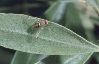
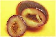
5 CASE STUDY 1: Olive Fly
6 The model is based on thermal summation. The driving variable is mean daily temperature: the number of generation is calculated through the summation of degree day taking in consideration two constants of development at variable temperature (8.99 C for zero development and C for thermal constant). The model begins the simulation starting from the stone hardening (oviposition) and finishes at the harvest time.

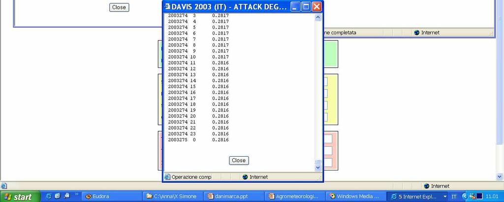
7 Olifly model Fly Simulator - Main Menu - Ver. 1.0

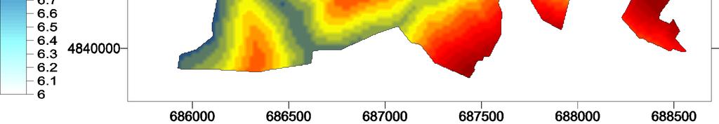
8 Model output
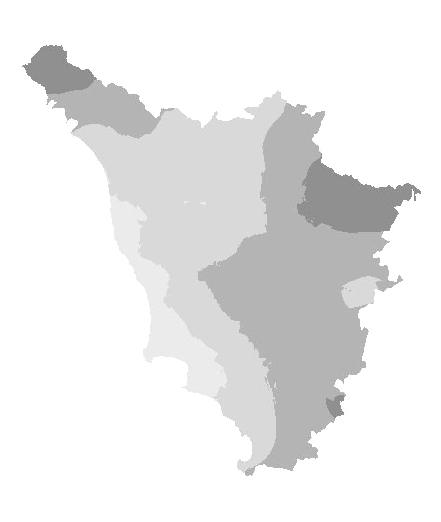
9 Kriging
10 Multiple Regression
11 Smart Kriging
12 Kriging Multiple Regression Smart Kriging Residual distribution
13 Interpolation errors MAE MA%E RMSE Neural Network Kriging Informed Kriging Multiple Regression
14 Identification of micro areas with different risk of attack: possibility to find zones where the organic olive oil production is practicable Optimization/identification of intervention time The management of technical assistance can be improved


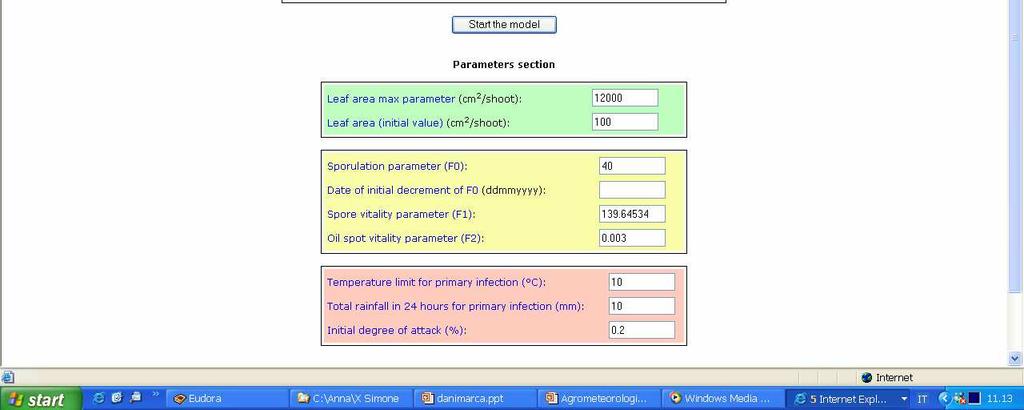
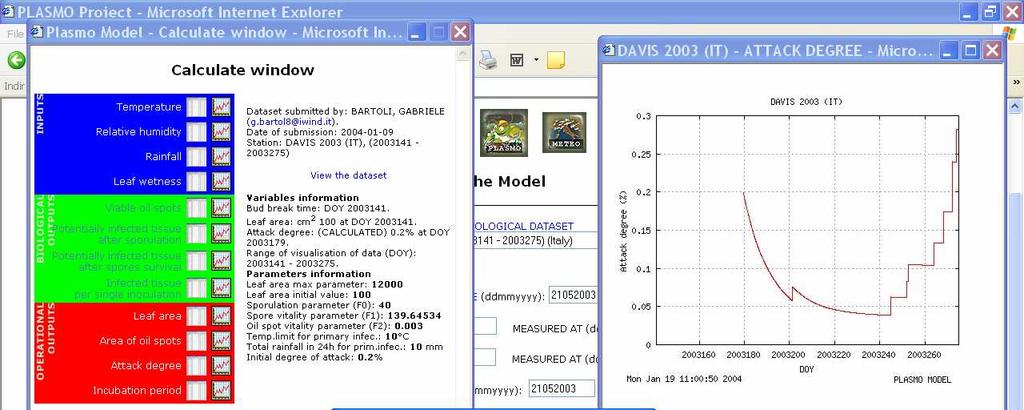
15 CASE STUDY 2: Grapevine Downy Mildew
16 PLASMO Leaf area growth T Primary inoculum Sporulation F0 Survival F1 T, RH T, RH Inoculation Incubation m T, LW T, RH
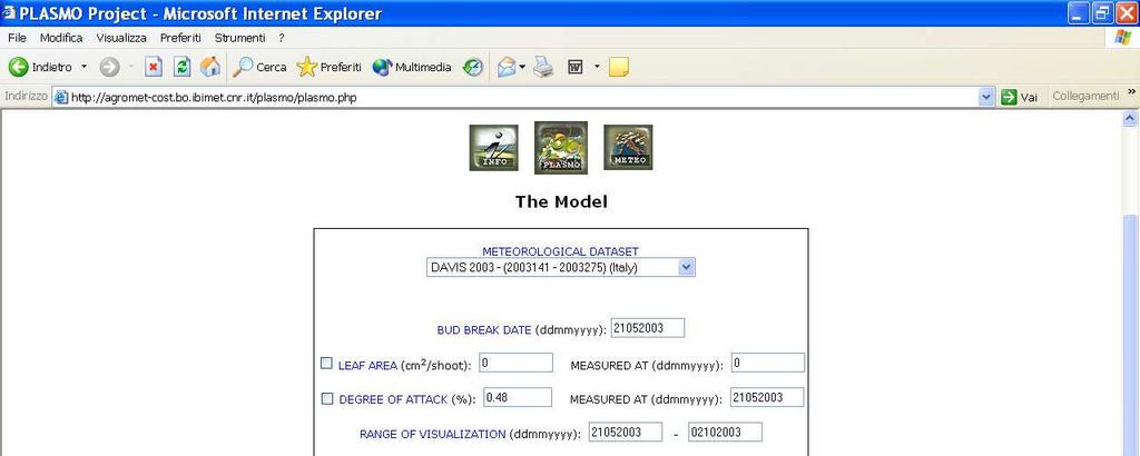
17 agromet-cost.bo.ibimet.cnr.it
18
19 Oilspot FUZZY MODEL F devitalization sporulation advancement F Sporangia F devitalization germination advancement F Zoospores F devitalization inoculation Mycelium incubation advancement F
20 Fuzzy logic handles the concept of partial truth - truth values between "completely true" and "completely false". Fuzzy logic includes 0 and 1 as extreme cases of truth but also includes the various states of truth in between. T RH fuzzification fuzzification fuzzy inference defuzzification Adv or Dev Quantitative information Qualitative information & base of rules
21
22 Simulation models, GIS and spatial interpolation techniques can be integrated in more or less complex systems The systems outputs represent an additional information by which the decision making activity can be improved
23 LOADING AND READING OF WEATHER, CROP AND GEO-TOPOGRAPHICAL DATA SPATIAL INTERPOLATION LEAF WETNESS SIMULATION P. VITICOLA SIMULATION GRIDS TEXT FILES MAPS The integrated system
24 Map of relative humidity (day 157)
25 Map of temperature (day 140)
26 Map of leaf wetness (day 153)
27 Map of number of current infections (day 154)
28 Map of number of days for the outbreak of the current infection (day 154)
29 Available thematic maps Minimum, maximum and mean temperature Relative humidity Leaf wetness Global radiation Number of current and total infections Number of days for the outbreak of infections Severity
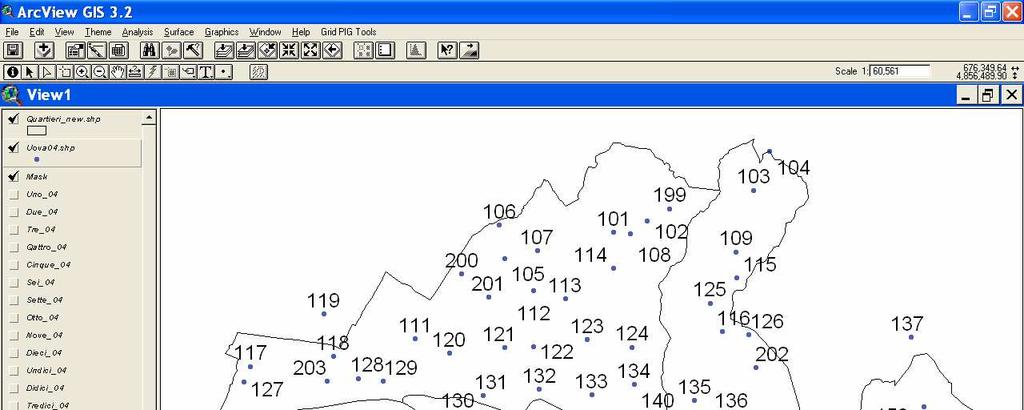
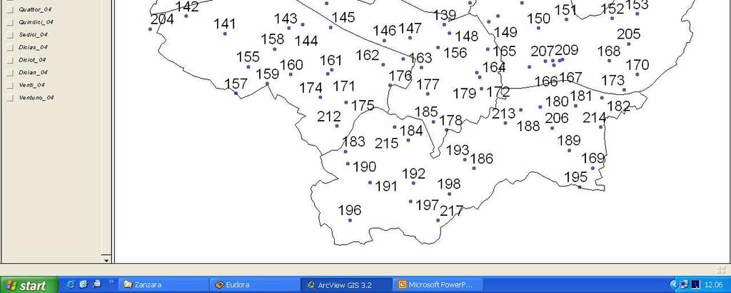
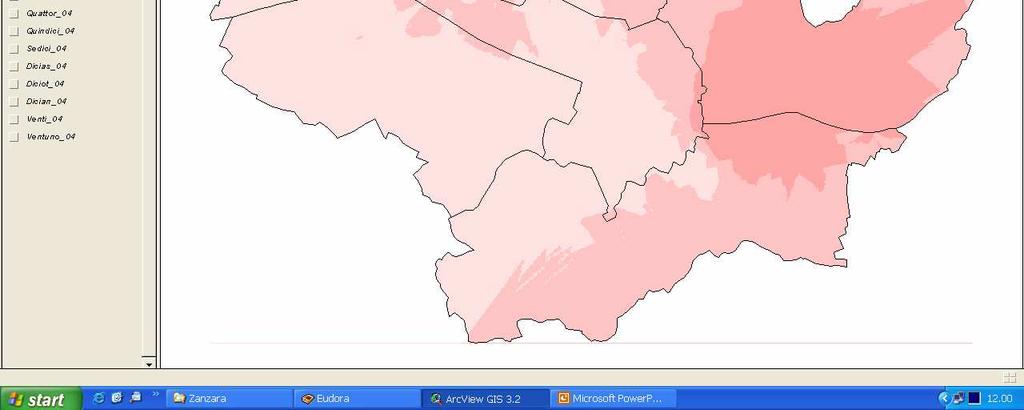
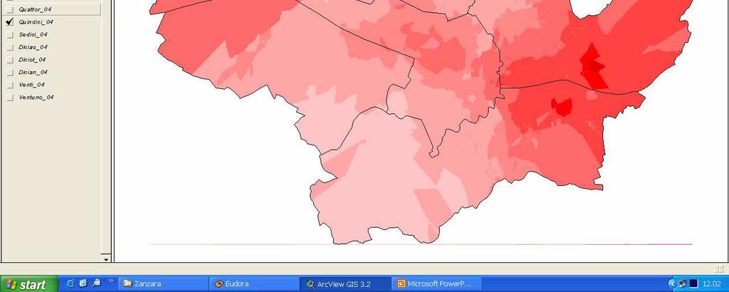
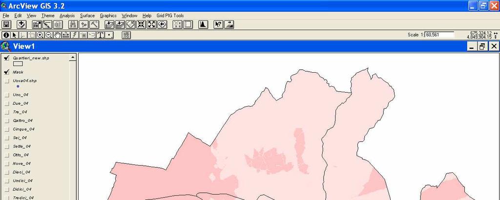
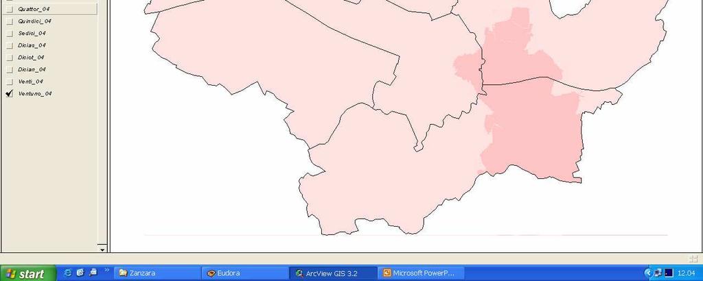
30 CASE STUDY 3: Tiger Mosquito In the last years, Florence, like many other urban centers, is experiencing the always larger presence of Tiger mosquito. This species is considered dangerous for human health because its prerogative to be a carrier of many diseases (dengue, etc.). The use of GIS allows to study the relations between the mosquito distribution and some important parameters, such as the proximity of public parks and gardens, the population density, the air humidity, etc. Such a study can be used by public administration to face the problem and to find some solution to stem the infestation.
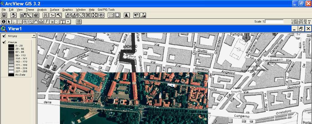
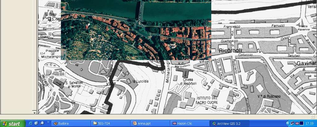
31 CONDOMINIAL/PRIVATE GARDENS ARNO RIVER SOWED FIELDS PUBLIC PARKS
32
33
34
35
36
37
38
39
40
41
42
43
44
45
46
47
48
49
50
51
52
53 Identification of the infestation beginning (where and when) Identification of the relations between the insect and the other parameters (water sources, public gardens, etc.) Planning for prevention and intervention Production of warnings and suggestions for the population (watering, presence of backwater in the gardens, identification of places suitable for oviposition, etc.).
54 The use of models allows the users to know the current situation (real time), to know how it can evolve (forecasts), or how it is stabilized during years (historical series). The use of GIS and spatial interpolation techniques allows the user to have the information spread on the study area and to find the interactions between the variable and the territory parameters (altitude, slope, distance from valleys bottom, etc.). The integration between models and GIS, then, allows to produce a complete information that is the basis for decision making
Agrometeorological network and information systems based on meteorological informations in Slovenia., Vlasta Knapič,
 Agrometeorological network and information systems based on meteorological informations in Slovenia Stanislav Gomboc, Tomaž Seliškar, Vlasta Knapič, 1 2 1 1 Phytosanitary Adninistration of Republic of
Agrometeorologists for farmers in hotter, drier, wetter future, 9-10 November 2016, Ljubljana, Slovenia
 AGRICULTURE IN CHANGING CLIMATE Branislava Lalić Faculty of Agriculture, University of Novi Sad Novi Sad, Serbia branka@polj.uns.ac.rs; lalic.branislava@gmail.com CC assessment studies GE IN NUMBER OF
Using NEWA Resources in a Vineyard IPM Strategy. Tim Weigle and Juliet Carroll NYS IPM Program, Cornell Cooperative Extension
 Using NEWA Resources in a Vineyard IPM Strategy Tim Weigle and Juliet Carroll NYS IPM Program, Cornell Cooperative Extension Historically, control practices for vineyard pests in the eastern United States
THE LATE BLIGHT MODELING SOFTWARE «Pameseb Late Blight»
 THE LATE BLIGHT MODELING SOFTWARE «Pameseb Late Blight» Pameseb a.s.b.l http://www.pameseb.be Walloon Agricultural Research Center http://www.cra.wallonie.be Armstatehydromet and Ministry of Agriculture
A sensitivity and uncertainty analysis. Ministry of the Walloon Region Agricultural Research Centre
 Development of an agrometeorological model integrating leaf wetness duration estimation and weather radar data to assess the risk of head blight infection in wheat A sensitivity and uncertainty analysis
Guide to the Late Blight Decision Support System (DSS) For Potatoes and Tomatoes
 For Potatoes and Tomatoes") Guide to the Late Blight Decision Support System (DSS) For Potatoes and Tomatoes 1 Setting up an Account: The first step in using the Decision Support System (DSS) is to obtain an account. Laura Joseph
Guide to the Late Blight Decision Support System (DSS) For Potatoes and Tomatoes 1 Setting up an Account: The first step in using the Decision Support System (DSS) is to obtain an account. Laura Joseph
Application of Unified Model (UM) weather prediction data for rice disease forecast
 weather prediction data for rice disease forecast") Application of Unified Model (UM) weather prediction data for rice disease forecast Ki Seok Do, Hyo-suk Kim, and Eun Woo Park National Center for Agricultural Meteorology Seoul National University Moon
Application of Unified Model (UM) weather prediction data for rice disease forecast Ki Seok Do, Hyo-suk Kim, and Eun Woo Park National Center for Agricultural Meteorology Seoul National University Moon
Wheat disease forecasting using weather radar observations
 Wheat disease forecasting using weather radar observations A. Mahtour 1, M. El Jarroudi 1, L. Delobbe 2, L. Hoffmann 3, H. Maraite 4, B. Tychon 1 1 Université de Liège, B-6700 Arlon, Belgium, amahtour@alumni.ulg.ac.be
Simulation of Grape Downy Mildew Development Across Geographic Areas Based on Mesoscale Weather Data Using Supercomputer
 Plant Pathol. J. 21(2) : 111-118 (2005) Mini-Review The Plant Pathology Journal The Korean Society of Plant Pathology Simulation of Grape Downy Mildew Development Across Geographic Areas Based on Mesoscale
FOREST FIRE HAZARD MODEL DEFINITION FOR LOCAL LAND USE (TUSCANY REGION)
") FOREST FIRE HAZARD MODEL DEFINITION FOR LOCAL LAND USE (TUSCANY REGION) C. Conese 3, L. Bonora 1, M. Romani 1, E. Checcacci 1 and E. Tesi 2 1 National Research Council - Institute of Biometeorology (CNR-
FOREST FIRE HAZARD MODEL DEFINITION FOR LOCAL LAND USE (TUSCANY REGION) C. Conese 3, L. Bonora 1, M. Romani 1, E. Checcacci 1 and E. Tesi 2 1 National Research Council - Institute of Biometeorology (CNR-
Unit G: Pest Management. Lesson 2: Managing Crop Diseases
 Unit G: Pest Management Lesson 2: Managing Crop Diseases 1 Terms Abiotic disease Bacteria Biotic disease Cultural disease control Disease avoidance Disease resistance Disease tolerance Fungi Infectious
4/17/2015. Overview. Introduction to decision support systems. Introduction to decision support systems. Introduction to decision support systems
 PLP 6404 Epidemiology of Plant Diseases Spring 2015 Lecture 29: Decision support systems Prof. Dr. Ariena van Bruggen Emerging Pathogens Institute and Plant Pathology Department, IFAS University of Florida
Walloon Agricultural Research Centre (CRA-W) Meteorological data and lateblight modeling
 Meteorological data and lateblight modeling") (CRA-W) Meteorological data and lateblight modeling China-Europe Workshop of Potato Sustainable and Efficient Productions Harbin, 24th of July 2015 Damien Rosillon Version 25/04/2014 CRA-W : A public agricultural
(CRA-W) Meteorological data and lateblight modeling China-Europe Workshop of Potato Sustainable and Efficient Productions Harbin, 24th of July 2015 Damien Rosillon Version 25/04/2014 CRA-W : A public agricultural
pest management decisions
 Using Enviroweather to assist pest management decisions Emily Pochubay 2014 Integrated Pest Management Academy February 19, 2014 Okemos, MI www.enviroweather.msu.edu Enviro-weather An online resource that
Yield Crop Forecasting: A Non-linear Approach Based on weather Variables
 Yield Crop Forecasting: A Non-linear Approach Based on weather Variables Sanjeev Panwar, K. N. Singh, Anil Kumar and Abhishek Rathore Indian Agricultural Statistics Research Institute, New Delhi, India
Calculating Land Values by Using Advanced Statistical Approaches in Pendik
 Presented at the FIG Congress 2018, May 6-11, 2018 in Istanbul, Turkey Calculating Land Values by Using Advanced Statistical Approaches in Pendik Prof. Dr. Arif Cagdas AYDINOGLU Ress. Asst. Rabia BOVKIR
Display and analysis of weather data from NCDC using ArcGIS
 Display and analysis of weather data from NCDC using ArcGIS Helen M. Cox Associate Professor Geography Department California State University, Northridge and Stephen Krug Graduate Student Geography Department
The Potential Benefits of GIS Techniques in Disease and Pest Control: an Example Based on a Regional Project in Central Africa
 The Potential Benefits of GIS Techniques in Disease and Pest Control: an Example Based on a Regional Project in Central Africa H. Bouwmeester 1, S. Abele 1, V.M. Manyong 1, C. Legg 2, M. Mwangi 3, V. Nakato
Workshop on Drought and Extreme Temperatures: Preparedness and Management for Sustainable Agriculture, Forestry and Fishery
 Workshop on Drought and Extreme Temperatures: Preparedness and Management for Sustainable Agriculture, Forestry and Fishery 16-17 Feb.2009, Beijing, China Modeling Apple Tree Bud burst time and frost risk
Meteorological Information for Locust Monitoring and Control. Robert Stefanski. Agricultural Meteorology Division World Meteorological Organization
 Meteorological Information for Locust Monitoring and Control Robert Stefanski Agricultural Meteorology Division World Meteorological Organization Objectives of Workshop Presentation Meteorological requirements
Sanjeev Kumar Jha Assistant Professor Earth and Environmental Sciences Indian Institute of Science Education and Research Bhopal
 Sanjeev Kumar Jha Assistant Professor Earth and Environmental Sciences Indian Institute of Science Education and Research Bhopal Email: sanjeevj@iiserb.ac.in 1 Outline 1. Motivation FloodNet Project in
SPATIAL-TEMPORAL TECHNIQUES FOR PREDICTION AND COMPRESSION OF SOIL FERTILITY DATA
 SPATIAL-TEMPORAL TECHNIQUES FOR PREDICTION AND COMPRESSION OF SOIL FERTILITY DATA D. Pokrajac Center for Information Science and Technology Temple University Philadelphia, Pennsylvania A. Lazarevic Computer
CIMIS. California Irrigation Management Information System
 CIMIS California Irrigation Management Information System What is CIMIS? A network of over 130 fully automated weather stations that collect weather data throughout California and provide estimates of
Climate change in the U.S. Northeast
 Climate change in the U.S. Northeast By U.S. Environmental Protection Agency, adapted by Newsela staff on 04.10.17 Word Count 1,109 Killington Ski Resort is located in Vermont. As temperatures increase
The Arable Mark: Accuracy and Applications
 The Arable Mark: Accuracy and Applications January 7, 2018 Overview Physical and Biological Observations Precipitation Air temperature, humidity, pressure Shortwave (SW) radiation (down & upwelling) Longwave
Application of Seasonal Climate Prediction in Agriculture in China
 Application of Seasonal Climate Prediction in Agriculture in China Wang Shili (Chinese Academy of Meteorological Science) Brisbane, 15-18, Feb. 2005 CONTENTS 1 Importance of Seasonal Climate Prediction
Available online at ScienceDirect
 Available online at www.sciencedirect.com ScienceDirect Procedia Technology 8 ( 2013 ) 580 586 6th International Conference on Information and Communication Technologies in Agriculture, Food and Environment
USING REMOTELY SENSED DATA FOR LEAF WETNESS DURATION MEASUREMENT
 USING REMOTELY SENSED DATA FOR LEAF S. Dietrich (1), R. Alilla (1), A. Cicogna (2), R. Fabbo (3), M. Gani (2), R. Giovanardi (4), S. Orlandini (5), M. Sandra (2,4), M. Severini (1), G. Maracchi (5) (1)
USING GIS CARTOGRAPHIC MODELING TO ANALYSIS SPATIAL DISTRIBUTION OF LANDSLIDE SENSITIVE AREAS IN YANGMINGSHAN NATIONAL PARK, TAIWAN
 CO-145 USING GIS CARTOGRAPHIC MODELING TO ANALYSIS SPATIAL DISTRIBUTION OF LANDSLIDE SENSITIVE AREAS IN YANGMINGSHAN NATIONAL PARK, TAIWAN DING Y.C. Chinese Culture University., TAIPEI, TAIWAN, PROVINCE
Plant Pathology Fact Sheet
 Plant Pathology Fact Sheet PP-22 Selerotinia Diseases of Vegetable and Field Crops in Florida Ken Pernezny and L. H. Purdy, Professor, Everglades Research and Education Center, Belle Glade; and Professor,
Fusarium Head Blight (FHB)
") Fusarium Head Blight (FHB) FHB is a Fungal disease of cereal crops that affects kernel development 1999 declared a pest under the Agricultural Pest Act 2002 Alberta released Fusarium Risk Management Plan
Fusarium Head Blight (FHB) FHB is a Fungal disease of cereal crops that affects kernel development 1999 declared a pest under the Agricultural Pest Act 2002 Alberta released Fusarium Risk Management Plan
Confronting Climate Change in the Great Lakes Region. Technical Appendix Climate Change Projections EXTREME EVENTS
 Confronting Climate Change in the Great Lakes Region Technical Appendix Climate Change Projections EXTREME EVENTS Human health and well-being, as well as energy requirements, building standards, agriculture
ONLINE DECISION SUPPORT TOOL FOR AVALANCHE RISK MANAGEMENT. Patrick Nairz* Avalanche Warning Center Tyrol, Austria
 ONLINE DECISION SUPPORT TOOL FOR AVALANCHE RISK MANAGEMENT Patrick Nairz* Avalanche Warning Center Tyrol, Austria Karel Kriz and Michaela Kinberger Department of Geography and Regional Research, University
Chapter-1 Introduction
 Modeling of rainfall variability and drought assessment in Sabarmati basin, Gujarat, India Chapter-1 Introduction 1.1 General Many researchers had studied variability of rainfall at spatial as well as
Founding of a Grower-based Weather/Pest Information Network to Aid IPM Adoption
 Founding of a Grower-based Weather/Pest Information Network to Aid IPM Adoption December, 1996 Final Report Agricultural Telecommunications Project No. 95-EATP-1-0065 Project Coordinator: Curtis Petzoldt,
AgWeatherNet and WA Climate Nic Loyd Meteorologist and Associate in Research AgWeatherNet
 AgWeatherNet and WA Climate Nic Loyd Meteorologist and Associate in Research AgWeatherNet February 23, 2017 Lewis County WSU Extension; Chehalis, WA AgWeatherNet Background WA Climate: Past, Present, and
Climate Change and Biomes
 Climate Change and Biomes Key Concepts: Greenhouse Gas WHAT YOU WILL LEARN Biome Climate zone Greenhouse gases 1. You will learn the difference between weather and climate. 2. You will analyze how climate
2/9/2015. Dispersal. Light. Chemical. Spatial and temporal scales of atmospheric motion systems are cross dependent.
 Dispersal Light Nicholas Dufault Epidemiology Lecture February 8, 2015 Chemical That atmosphere extends 700 km above the earth. We focus on less than 0.05% for biota. Spatial and temporal scales of atmospheric
PRINCIPLES OF PHOTO INTERPRETATION
 PRINCIPLES OF PHOTO INTERPRETATION Photo Interpretation the act of examining photographic images for the purpose of identifying objects and judging their significance an art more than a science Recognition
Spatio-temporal modeling of weekly malaria incidence in children under 5 for early epidemic detection in Mozambique
 Spatio-temporal modeling of weekly malaria incidence in children under 5 for early epidemic detection in Mozambique Katie Colborn, PhD Department of Biostatistics and Informatics University of Colorado
Abstract: Contents. Literature review. 2 Methodology.. 2 Applications, results and discussion.. 2 Conclusions 12. Introduction
 Abstract: Landfill is one of the primary methods for municipal solid waste disposal. In order to reduce the environmental damage and to protect the public health and welfare, choosing the site for landfill
Landslide Hazard Assessment Methodologies in Romania
 A Scientific Network for Earthquake, Landslide and Flood Hazard Prevention SciNet NatHazPrev Landslide Hazard Assessment Methodologies in Romania In the literature the terms of susceptibility and landslide
Gridded Spring Forecast Maps for Natural Resource Planning
 Gridded Spring Forecast Maps for Natural Resource Planning Alyssa Rosemartin Partner and Application Specialist USA National Phenology Network National Coordinating Office What s Phenology Phenology refers
Impact on Agriculture
 Weather Variability and the Impact on Agriculture InfoAg 2017 Copyright 2017, awhere. All Rights Reserved The Problem: The Earth s Atmosphere is a Heat Engine In transition 1 C warming of atmosphere Triples
Using Artificial Neural Networks to Predict Local Disease Risk Indicators with Multi-Scale Weather, Land and Crop Data
 International Congress on Environmental Modelling and Software Brigham Young University BYU ScholarsArchive 4th International Congress on Environmental Modelling and Software - Barcelona, Catalonia, Spain
1/30/2015. Overview. Measuring host growth
 PLP 6404 Epidemiology of Plant Diseases Spring 2015 Lecture 8: Influence of Host Plant on Disease Development plant growth and Prof. Dr. Ariena van Bruggen Emerging Pathogens Institute and Plant Pathology
REVIEW MAPWORK EXAM QUESTIONS 31 JULY 2014
 REVIEW MAPWORK EXAM QUESTIONS 31 JULY 2014 Lesson Description In this lesson we: Focus on key concepts and exam questions relating to GIS. Question 1 Test Yourself The most important component of a GIS
WMO Guide on Integrated Urban Weather, Environment and Climate Services for Cities (IUWECS) Hong Kong- an experience from a high-density city
 Hong Kong- an experience from a high-density city") WMO Guide on Integrated Urban Weather, Environment and Climate Services for Cities (IUWECS) Hong Kong- an experience from a high-density city Dr. Chao REN Associate Professor School of Architecture The
WMO Guide on Integrated Urban Weather, Environment and Climate Services for Cities (IUWECS) Hong Kong- an experience from a high-density city Dr. Chao REN Associate Professor School of Architecture The
Role of GIS in Tracking and Controlling Spread of Disease
 Role of GIS in Tracking and Controlling Spread of Disease For Dr. Baqer Al-Ramadan By Syed Imran Quadri CRP 514: Introduction to GIS Introduction Problem Statement Objectives Methodology of Study Literature
An assessment of the risk of aerial transport of rust pathogens to the Western Hemisphere and within North America
 An assessment of the risk of aerial transport of rust pathogens to the Western Hemisphere and within North America Scott A. Isard Departments of Plant Pathology and Meteorology Pennsylvania State University
The Water and the Land (WATL) project; balancing farmer needs, atmospheric science, and information delivery.
 project; balancing farmer needs, atmospheric science, and information delivery.") The Water and the Land (WATL) project; balancing farmer needs, atmospheric science, and information delivery. Andrew Watkins National Climate Centre Bureau of Meteorology (Member: WMO CAgM ET on the Impact
The Water and the Land (WATL) project; balancing farmer needs, atmospheric science, and information delivery. Andrew Watkins National Climate Centre Bureau of Meteorology (Member: WMO CAgM ET on the Impact
Application of the Integrated Aerobiology Modeling System to Soybean Rust Forecasting in 2006
 Application of the Integrated Aerobiology Modeling System to Soybean Rust Forecasting in 2006 Scott A. Isard Penn State University & Joseph M. Russo ZedX Inc. Integrated Aerobiology Modeling System (IAMS)
Comparison of two interpolation methods for modelling crop yields in ungauged locations
 Comparison of two interpolation methods for modelling crop yields in ungauged locations M. Dubrovsky (1), M. Trnka (2), F. Rouget (3), P. Hlavinka (2) (1) Institute of Atmospheric Physics ASCR, Prague,
Sustainable and Harmonised Development for Smart Cities The Role of Geospatial Reference Data. Peter Creuzer
 Sustainable and Harmonised Development for Smart Cities The Role of Geospatial Reference Data Peter Creuzer 1. Introduction - Smart Cities and Geodata 2. Geodata in Germany 3. Examples 4. Data and Service
Agronomy at scale Principles and approaches with examples from
 Agronomy at scale Principles and approaches with examples from Pieter Pypers, 22-11-2016 What is agronomy at scale? Definition: agronomy = the science of soil management and crop production at scale =
9/9/ May 2013 JRC CROP YIELD FORECASTING IN SEE Skopje (Macedonia) May 2013 JRC CROP YIELD FORECASTING IN SEE Skopje (Macedonia)
 May 2013 JRC CROP YIELD FORECASTING IN SEE Skopje (Macedonia)") Application of different NWP products in crop modelling Branislava Lalić, Maria Francia & Marija Ninkov branka@polj.uns.ac.rs; lalic.branislava@gmail.com Source: Republic Hydrometeorological Service of
Application of different NWP products in crop modelling Branislava Lalić, Maria Francia & Marija Ninkov branka@polj.uns.ac.rs; lalic.branislava@gmail.com Source: Republic Hydrometeorological Service of
IDEBarcelona: Cooperating for a Smart Region Infrastructure
 IDEBarcelona: Cooperating for a Smart Region Infrastructure Marta Codinachs Serra Diputació de Barcelona Territory and Sustainability Area Territorial Information Systems Department SMART CITY EXPO WORLD
Effect of temperature and storage conditions on seed germination of Avena strigosa and Avena fatua
 Effect of temperature and storage conditions on seed germination of Avena strigosa and Avena fatua D o s t a t n y D. F. 1, C h o j n o w s k i, M. 2, M a ł u s z y ń s k a E. 3, P o d y m a W. 4, 1 N
AgWeatherNet A Tool for Making Decisions Based on Weather
 AgWeatherNet A Tool for Making Decisions Based on Weather Gerrit Hoogenboom Director, AgWeatherNet & Professor of Agrometeorology Washington State University Prosser, Washington November 14, 2013 Washington
Geospatial Tactical Decision Aids
 Geospatial Tactical Decision Aids Miguel Pacheco Abstract Environmental conditions are known to affect the efficiency and effectiveness of military platforms, weapon systems and personnel. The translation
Better Decisions for Your Business Drive your company forward with ultra-precise weather forecasts
 Better Decisions for Your Business Drive your company forward with ultra-precise weather forecasts Problem: Inaccurate Forecasts, Especially over Mountainous Regions Which weather data are you using? What
GIS to Support West Nile Virus Program
 GIS to Support West Nile Virus Program 2008 Community Excellence Awards Leadership and Innovation Regional District Regional District Okanagan Similkameen July 2008 2008 UBCM Community Excellence Awards
Improving and Sustaining the NEWA System
 Improving and Sustaining the NEWA System Investigators Juliet Carroll, NYS IPM Program, Cornell University, jec3@cornell.edu Art DeGaetano, Northeast Regional Climate Center, Cornell University, atd2@cornell.edu
Regional Variability in Crop Specific Synoptic Forecasts
 Regional Variability in Crop Specific Synoptic Forecasts Kathleen M. Baker 1 1 Western Michigan University, USA, kathleen.baker@wmich.edu Abstract Under climate change scenarios, growing season patterns
Extensibility of Measurement Results of Point Samples of the Soil Protection Information and Monitoring System by different methods
 Extensibility of Measurement Results of Point Samples of the Soil Protection Information and Monitoring System by different methods L. Várallyai a, B. Kovács b, and J. Prokisch b a University of Debrecen,
Water information system advances American River basin. Roger Bales, Martha Conklin, Steve Glaser, Bob Rice & collaborators UC: SNRI & CITRIS
 Water information system advances American River basin Roger Bales, Martha Conklin, Steve Glaser, Bob Rice & collaborators UC: SNRI & CITRIS Opportunities Unprecedented level of information from low-cost
Transboundary water management with Remote Sensing. Oluf Jessen DHI Head of Projects, Water Resources Technical overview
 Transboundary water management with Remote Sensing Oluf Jessen DHI Head of Projects, Water Resources Technical overview ozj@dhigroup.com Transboundary water management Water management across national
Plant Protection Information Systems for Public use in Slovenia use of meteorological information's. Andrej Hocevar 2
 Plant Protection Information Systems for Public use in Slovenia use of meteorological information's Stanislav Gomboc, Tomaz Seliskar, Vlasta Knapic, 1 2 1 Andrej Hocevar 2 1 Phytosanitary Adninistration
Development of Agrometeorological Models for Estimation of Cotton Yield
 DOI: 10.5958/2349-4433.2015.00006.9 Development of Agrometeorological Models for Estimation of Cotton Yield K K Gill and Kavita Bhatt School of Climate Change and Agricultural Meteorology Punjab Agricultural
Transactions on Information and Communications Technologies vol 18, 1998 WIT Press, ISSN
 STREAM, spatial tools for river basins, environment and analysis of management options Menno Schepel Resource Analysis, Zuiderstraat 110, 2611 SJDelft, the Netherlands; e-mail: menno.schepel@resource.nl
Student Name: Teacher: Date: Test: 9_12 Agriculture AP41 - Horticulture I Test 2 Description: Pest Management District: Wake County Form: 501
 Student Name: Teacher: Date: Test: 9_12 Agriculture AP41 - Horticulture I Test 2 Description: Pest Management District: Wake County Form: 501 1. Aimee uses traps in her garden to: 2. Which is MOST true
Predicting Malaria Epidemics in Ethiopia
 Predicting Malaria Epidemics in Ethiopia Eskindir Loha, Hawassa University Torleif Markussen Lunde, UoB 5th Conference on Global Health and Vaccination Research: Environmental Change and Global Health
VCS MODULE VMD0018 METHODS TO DETERMINE STRATIFICATION
 VMD0018: Version 1.0 VCS MODULE VMD0018 METHODS TO DETERMINE STRATIFICATION Version 1.0 16 November 2012 Document Prepared by: The Earth Partners LLC. Table of Contents 1 SOURCES... 2 2 SUMMARY DESCRIPTION
TEXTBOOK QUESTIONS AND ANSWERS
 1 NUTRITION IN PLANTS TEXTBOOK QUESTIONS AND ANSWERS Q.1. How do plants prepare their own food? Ans. In plants, water and minerals present in the soil are absorbed by roots and transported to leaves. Carbon
Tao Tang and Jiazhen Zhang Department of Geography and Planning, and the Great Lakes Research Center State University of New York Buffalo State
 Tao Tang and Jiazhen Zhang Department of Geography and Planning, and the Great Lakes Research Center State University of New York Buffalo State College 1300 Elmwood Ave., Buffalo, NY 14222-1095 Email:
EXAMINATION OF MODELS FOR THE PREDICTION OF THE ONSET AND SEVERITY OF POTATO LATE BLIGHT IN OREGON
 EXAMINATION OF MODELS FOR THE PREDICTION OF THE ONSET AND SEVERITY OF POTATO LATE BLIGHT IN OREGON Clinton C. Shock, Cedric A. Shock, Lamont D. Saunders, and Brad Coen Malheur Experiment Station Lynn Jensen
Geo-statistical Dengue Risk Model Case Study of Lahore Dengue Outbreaks 2011
 Geo-statistical Dengue Risk Model Case Study of Lahore Dengue Outbreaks 2011 BILAL TARIQ Department of Remote Sensing & Geo-information Science Institute of Space Technology (IST) Karachi Campus, Pakistan
Supplementary Information
 Supplementary Information This document shows the supplementary figures referred to in the main article. The contents are as follows: a. Malaria maps b. Dengue maps c. Yellow fever maps d. Chikungunya
Creating a Staff Development Plan with Esri
 Creating a Staff Development Plan with Esri Michael Green David Schneider Guest Presenter: Shane Feirer, University of California Esri UC 2014 Technical Workshop Agenda What is a Staff Development Plan?
Soybean stem fly outbreak in soybean crops
 Soybean stem fly outbreak in soybean crops By Kate Charleston Published: April 10, 2013 An estimated 4,000 ha of soybeans near Casino in Northern NSW have been affected to varying degrees by soybean stem
MxVision WeatherSentry Web Services Content Guide
 MxVision WeatherSentry Web Services Content Guide July 2014 DTN 11400 Rupp Drive Minneapolis, MN 55337 00.1.952.890.0609 This document and the software it describes are copyrighted with all rights reserved.
Geospatial framework for monitoring SDGs/Sendai targets By Shimonti Paul Sr. Assistant Editor Geospatial Media & Communications
 Geospatial framework for monitoring SDGs/Sendai targets By Shimonti Paul Sr. Assistant Editor Geospatial Media & Communications Outline 1. Introduction to Geospatial Media and Communications 2. Geospatial
Geographical Information System (GIS)-based maps for monitoring of entomological risk factors affecting transmission of chikungunya in Sri Lanka
-based maps for monitoring of entomological risk factors affecting transmission of chikungunya in Sri Lanka") Geographical Information System (GIS)-based maps for monitoring of entomological risk factors affecting transmission of chikungunya in Sri Lanka M.D. Hapugoda 1, N.K. Gunewardena 1, P.H.D. Kusumawathie
Geographical Information System (GIS)-based maps for monitoring of entomological risk factors affecting transmission of chikungunya in Sri Lanka M.D. Hapugoda 1, N.K. Gunewardena 1, P.H.D. Kusumawathie
KEY WORDS: Palmer Meteorological Drought Index, SWAP, Kriging spatial analysis and Digital Map.
 PALMER METEOROLOGICAL DROUGHT CLASSIFICATION USING TECHNIQUES OF GEOGRAPHIC INFORMATION SYSTEM IN THAILAND S. Baimoung, W. Waranuchit, S. Prakanrat, P. Amatayakul, N. Sukhanthamat, A. Yuthaphan, A. Pyomjamsri,
The advantages of the services on the web-gis:
 The advantages of the services on the web-gis: Availability - Get access to the system can be in any place and at any time, it is enough to have at his workplace Internet access. Easy - Work in an ordinary
Combining Deterministic and Probabilistic Methods to Produce Gridded Climatologies
 Combining Deterministic and Probabilistic Methods to Produce Gridded Climatologies Michael Squires Alan McNab National Climatic Data Center (NCDC - NOAA) Asheville, NC Abstract There are nearly 8,000 sites
EVALUATION OF PEANUT DISEASE DEVELOPMENT FORECASTING. North Carolina State University, Raleigh, North Carolina
 P244 EVALUATION OF PEANUT DISEASE DEVELOPMENT FORECASTING John A. McGuire* 1, Mark S. Brooks 1, Aaron P. Sims 1, Barbara Shew 2, and Ryan Boyles 1 1 State Climate Office of North Carolina, 2 Department
UNCERTAINTY AND ERRORS IN GIS
 Christos G. Karydas,, Dr. xkarydas@agro.auth.gr http://users.auth.gr/xkarydas Lab of Remote Sensing and GIS Director: Prof. N. Silleos School of Agriculture Aristotle University of Thessaloniki, GR 1 UNCERTAINTY
Utilization of seasonal climate predictions for application fields Yonghee Shin/APEC Climate Center Busan, South Korea
 The 20 th AIM International Workshop January 23-24, 2015 NIES, Japan Utilization of seasonal climate predictions for application fields Yonghee Shin/APEC Climate Center Busan, South Korea Background Natural
Plant Disease Introduction
 Utah State University DigitalCommons@USU All Archived Publications Archived USU Extension Publications 6-30-2006 Plant Disease Introduction Larry A. Sagers Utah State University Follow this and additional
SITMUN: Cooperating to Build Local SDIs in the Barcelona Region
 SITMUN: Cooperating to Build Local SDIs in the Barcelona Region Diputació de Barcelona Territory and Sustainability Area Territorial Information Systems Department INSPIRE CONFERENCE Barcelona, September
Italian experience with the interpretation of FOCUS surface water scenarios from a regulatory point of view
 Italian experience with the interpretation of FOCUS surface water scenarios from a regulatory point of view G. Azimonti, G. Triacchini, D. Auteri, E. Redolfi, International Centre for Pesticides and Health
Fuzzy Controller. Fuzzy Inference System. Basic Components of Fuzzy Inference System. Rule based system: Contains a set of fuzzy rules
 Fuzz Controller Fuzz Inference Sstem Basic Components of Fuzz Inference Sstem Rule based sstem: Contains a set of fuzz rules Data base dictionar: Defines the membership functions used in the rules base
Pages in the Montana Master Gardener Handbook
 Insect Identification Pages 309-326 in the Montana Master Gardener Handbook Integrated Pest Management Integrated Pest Management is an effective and environmentally sensitive approach to pest management
8-km Historical Datasets for FPA
 Program for Climate, Ecosystem and Fire Applications 8-km Historical Datasets for FPA Project Report John T. Abatzoglou Timothy J. Brown Division of Atmospheric Sciences. CEFA Report 09-04 June 2009 8-km
The GeoCLIM software for gridding & analyzing precipitation & temperature. Tamuka Magadzire, FEWS NET Regional Scientist for Southern Africa
 The GeoCLIM software for gridding & analyzing precipitation & temperature Tamuka Magadzire, FEWS NET Regional Scientist for Southern Africa Outline What is GeoCLIM GeoCLIM Development Team GeoCLIM: objectives
U S I N G D ATA M I N I N G T O P R E D I C T FOREST FIRES IN AN ARIZONA FOREST
 Sanjeev Pandey CSC 600, Data Mining 5/15/2013 Table of Contents 1. Introduction 2. Study Area and Data Set 3. Data Mining Approaches 4. Results 5. Conclusions U S I N G D ATA M I N I N G T O P R E D I
A geo - knowledge - based surface modelling of agricultural climate resources
 39 5 2011 10 Journal of Fuzhou University Natural Science Edition Vol 39 No 5 Oct 2011 DOI CNKI 35-1117 /N 20111014 1017 013 1000-2243 2011 05-0719 - 08 1 2 1 350002 2 100101 1951 ~ 2002 735 1 km 1 km
The Infrastructure for Spatial Information in the European Community vs. regional SDI: the shortest way for reaching economic and social development
 The Infrastructure for Spatial Information in the European Community vs. regional SDI: the shortest way for reaching economic and social development Mauro Salvemini EUROGI PRESIDENT Professor at Sapienza
TYPES AND MECHANISMS. Course teacher Dr. A. Prabhuraj Professor Department of Entomology UAS, Raichur
 TYPES AND MECHANISMS Course teacher Dr. A. Prabhuraj Professor Department of Entomology UAS, Raichur Host Plant Resistance (HPR) Those characters that enable a plant to avoid, tolerate or recover from