Better Decisions for Your Business Drive your company forward with ultra-precise weather forecasts
|
|
|
- Aubrey Ramsey
- 5 years ago
- Views:
Transcription


1 Better Decisions for Your Business Drive your company forward with ultra-precise weather forecasts


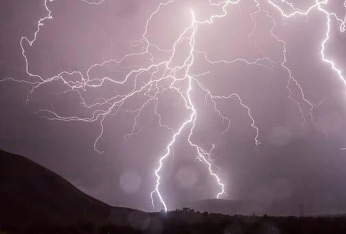
2 Problem: Inaccurate Forecasts, Especially over Mountainous Regions Which weather data are you using? What about the spatial and temporal resolution of your forecasts? How accurate are they? Conventional forecasts are in many cases not sufficiently precise for important decisions!

3 Solution by a Team of Internationally Leading Experts Moskau, Russia Moscow State Univ. Boulder, USA Alden/WELS Davos, Switzerland WSL/SLF Vienna, Austria IMG, Univ. of Vienna Nagaoka, Japan NIED/NISIS International expertise: Meteorology Geoinformatics Snow science Software development Lima, Peru SENAMHI Santiago de Chile DGF, Univ. de Chile Mendoza, Argentina CRICYT/IANIGLA


4 Development & Verification of the MetGIS Algorithm Meteorological observation data Conventional forecast systems Limit of conventional forecasts High resolution terrain data Ultra-precise weather forecasts (resolution of up to 30 m)
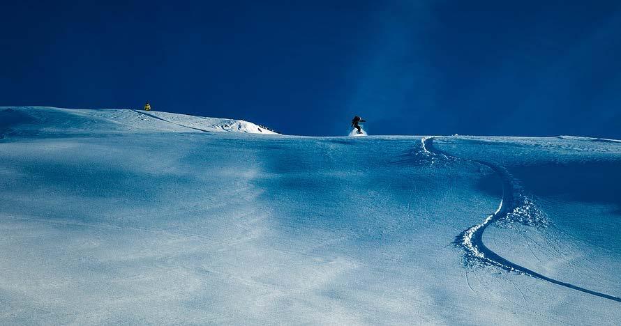
5 MetGIS Highlights Ultra-precise forecasts (resolution of up to 30 m) Much higher accuracy than conventional forecasts! Available worldwide in highest quality Ideal for international projects and remote areas! Designed and optimized for mountainous regions Thanks to extremely detailed geographic data!

6 Industry Focus Websites, apps & info screens Winter tourism & ski regions Avalanche warning services Road operators, railway & logistics Civil protection & disaster control Expedition teams & organizers Open-pit mining Agriculture & smart farming Energy (solar, wind, hydro)


7 Overview: Products & Services Point API for professional demands Weather layers for Google Maps & co Individual weather reports via PDF Interactive forecast maps Historic weather data Consulting & expert opinion


8 Point-based Weather API for Websites, Apps and Business Applications Calculated on the basis of exact coordinates (not on geo tags etc.) Highest data quality, even in the most remote regions worldwide Easy to implement (JSON) Location Resolution: up to 30 m! Standard parameters Air temperature Precipication Precipition probability Fresh snow Cloudiness Wind speed Wind direction Felt temperature Wind chill Humidity Sunshine duration Special parameters Wet-bulb temperature Snow line Short-wave radiation Long-wave radiation Soil temperature Soil humidity Vertical cloud distribution Heat index...
9 Add Extremely Detailed Weather Layers to Existing Map Applications (Maps API) World innovation: 30 m resolution & super zoom Tiles (PNG) and point data (UTF Grids) Forecast layers for the next 72 hours
10 Weather Reports Daily in Your Inbox Ideal tool for agriculture, large construction sites, tourism and many more To be used on a PC or a smartphone and as a printout Individual parameters, design and various languages Example: Ski Cockpit Fast overview: temperature, weather symbol, short text Organize slope preparation: fresh snow, precipitation, wind Plan snow production: wet-bulb temperature
 Ready to use: 24/7 online availability via web")
 Example: 7 day forecast for specific")
11 Interactive Forecast Maps (MetGIS Pro) Forecast maps with extremely high resolution (up to 30 m) Ready to use: 24/7 online availability via web browser 2-day forecast in form of an animation 7-day forecast for marked locations (individual POIs possible) Example: 7 day forecast for specific locations
12 Historic Weather Data Reconstruction of past weather data with special MetGIS procedures Especially for mountainous and remote regions with no/few weather stations Back as far as the year 1950 (depending on requirements and methods) Parameters: precipitation, temperature, wind and many more Temporal resolution: hourly, 3-hourly or daily values For any desired coordinates and areas (catchment areas!) worldwide
: Europe s leading weather portal")
 Ticketing and")

 Road")

13 These Organizations Already Trust in MetGIS (Excerpt): Europe s leading weather portal (Germany) Europe s leading platform for outdoor enthusiasts (Germany) Ticketing and access solutions (Austria) Avalanche warning services from Spain to India Energy providers (especially hydropower) Leading open-pit mining corporations (Latin America) Road operators from Austria to Chile And many more satisfied customers: from various startups and apps to the King of Bhutan


14 Get in Touch With Us! MetGIS GmbH Lange Gasse 16/ Vienna, Austria +43 / 1 / Dr. Gerald Spreitzhofer CEO gerald.spreitzhofer@metgis.com
SuperPack North America
 SuperPack North America Speedwell SuperPack makes available an unprecedented range of quality historical weather data, and weather data feeds for a single annual fee. SuperPack dramatically simplifies
The Kentucky Mesonet: Entering a New Phase
 The Kentucky Mesonet: Entering a New Phase Stuart A. Foster State Climatologist Kentucky Climate Center Western Kentucky University KCJEA Winter Conference Lexington, Kentucky February 9, 2017 Kentucky
New applications using real-time observations and ECMWF model data
 New applications using real-time observations and ECMWF model data 12 th Workshop on Meteorological Operational Systems Wim van den Berg [senior meteorological researcher, project coordinator] Overview
CustomWeather Statistical Forecasting (MOS)
") CustomWeather Statistical Forecasting (MOS) Improve ROI with Breakthrough High-Resolution Forecasting Technology Geoff Flint Founder & CEO CustomWeather, Inc. INTRODUCTION Economists believe that 70% of
CustomWeather Statistical Forecasting (MOS) Improve ROI with Breakthrough High-Resolution Forecasting Technology Geoff Flint Founder & CEO CustomWeather, Inc. INTRODUCTION Economists believe that 70% of
Website Phone Mobile OVERVIEW Davis Vantage Pro2 Weather Station
 OVERVIEW If you're looking for a superior weather station, the Davis Vantage Pro2 Weather Station is as good as they come! Vantage Pro2 offers the professional weather observer and the serious weather
MeteoGroup RoadMaster. The world s leading winter road weather solution
 MeteoGroup RoadMaster The world s leading winter road weather solution Discover why RoadMaster is the world s leading winter road weather solution. Managing winter road maintenance means that you carry
MxVision WeatherSentry Web Services Content Guide
 MxVision WeatherSentry Web Services Content Guide July 2014 DTN 11400 Rupp Drive Minneapolis, MN 55337 00.1.952.890.0609 This document and the software it describes are copyrighted with all rights reserved.
Web GIS Based Disaster Portal Project ESRI INDIA
 Web GIS Based Disaster Portal Project ESRI INDIA Contents Requirements Overview Product Technology Used KSNDMC Application Architecture Tool Developed Benefits for the End User Problems faced during implementation
MaxiMet. Compact Weather Stations. gillinstruments.com
 MaxiMet Compact Weather Stations gillinstruments.com Compact Weather Stations MaxiMet is an advanced compact weather station, designed and manufactured by Gill Instruments using proven technology to measure
Use of the models Safran-Crocus-Mepra in operational avalanche forecasting
 Use of the models Safran-Crocus-Mepra in operational avalanche forecasting Coléou C *, Giraud G, Danielou Y, Dumas J-L, Gendre C, Pougatch E CEN, Météo France, Grenoble, France. ABSTRACT: Avalanche forecast
Climate services in support of the energy transformation
 services in support of the energy transformation EGU 11 April 2018, Vienna, Austria Climate Alberto Troccoli, Sylvie Parey, and the C3S ECEM team O u t l i n e Background of the C3S European Climatic Energy
Wind Resource Assessment Practical Guidance for Developing A Successful Wind Project
 December 11, 2012 Wind Resource Assessment Practical Guidance for Developing A Successful Wind Project Michael C Brower, PhD Chief Technical Officer Presented at: What We Do AWS Truepower partners with
Climate Variables for Energy: WP2
 Climate Variables for Energy: WP2 Phil Jones CRU, UEA, Norwich, UK Within ECEM, WP2 provides climate data for numerous variables to feed into WP3, where ESCIIs will be used to produce energy-relevant series
Agrometeorological services in Greece
 Eleftheria Tsiniari Hellenic National Meteorological Service Operational Forecaster MSc in Meteorology MSc in Prevention and Management of Natural Disasters Email: elefth.tsiniari@gmail.com 1 Past (last
Road weather forecast for different customer systems in Switzerland
 Proceedings of the 10th SIRWEC Conference. 22-24 March 2000. Davos. Switzerland 10 Road weather forecast for different customer systems in Switzerland Foreword André-Charles Letestu and Urs Keller Swiss
Model Output Statistics (MOS)
") Model Output Statistics (MOS) Numerical Weather Prediction (NWP) models calculate the future state of the atmosphere at certain points of time (forecasts). The calculation of these forecasts is based on
Model Output Statistics (MOS) Numerical Weather Prediction (NWP) models calculate the future state of the atmosphere at certain points of time (forecasts). The calculation of these forecasts is based on
12/07/2017. Flash Flood Warning Service, an advanced approach towards flood resilient cities Floodplain Management Association Conference, Newcastle
 12/07/2017 Worldwide problem: Flash Floods Flash Floods are a Global Problem Flash Flood Warning Service, an advanced approach towards flood resilient cities Floodplain Management Association Conference,
personal weather station
 personal weather station Master your own climate measurements on your smartphone TRAINING BOOK Pitch The Netatmo Personal Weather Station helps you master your own climate measurements on your smartphone.
TRIVIS WEATHER GRAPHIX PRODUCT PACKAGES
 PRODUCT PACKAGES TRIVIS WEATHER GRAPHIX PRODUCT PACKAGES TriVis is the professional television weather graphics solution that delivers highest quality with legendary reliability daily on-air since over
Trusted Spotter Network Austria Towards a New Standard in the Field of Crowd- Sourced Weather- and Impact- Observations?
 Trusted Spotter Network Austria Towards a New Standard in the Field of Crowd- Sourced Weather- and Impact- Observations? Thomas Krennert (1), Rainer Kaltenberger (1), Georg Pistotnik (1), Alois M. Holzer
Speedwell High Resolution WRF Forecasts. Application
 Speedwell High Resolution WRF Forecasts Speedwell weather are providers of high quality weather data and forecasts for many markets. Historically we have provided forecasts which use a statistical bias
Development of Innovative Technology to Provide Low-Cost Surface Atmospheric Observations in Data-sparse Regions
 Development of Innovative Technology to Provide Low-Cost Surface Atmospheric Observations in Data-sparse Regions Paul Kucera and Martin Steinson University Corporation for Atmospheric Research/COMET 3D-Printed
About Nnergix +2, More than 2,5 GW forecasted. Forecasting in 5 countries. 4 predictive technologies. More than power facilities
 About Nnergix +2,5 5 4 +20.000 More than 2,5 GW forecasted Forecasting in 5 countries 4 predictive technologies More than 20.000 power facilities Nnergix s Timeline 2012 First Solar Photovoltaic energy
International and regional network status
 WORLD METEOROLOGICAL ORGANIZATION JOINT MEETING OF CBS EXPERT TEAM ON SURFACE-BASED REMOTELY- SENSED OBSERVATIONS (Second Session) AND CIMO EXPERT TEAM ON OPERATIONAL REMOTE SENSING (First Session) CBS/ET-SBRSO-2
Commercialisation. Lessons learned from Dutch weather market
 Commercialisation Lessons learned from Dutch weather market Where information comes together weather traffic public transport Weather, traffic and public transport. Daily actual information that influences
Watershed Application of WEPP and Geospatial Interfaces. Dennis C. Flanagan
 Watershed Application of WEPP and Geospatial Interfaces Dennis C. Flanagan Research Agricultural Engineer USDA-Agricultural Research Service Adjunct Professor Purdue Univ., Dept. of Agric. & Biol. Eng.
AWOS. Automated Weather Observing Systems COASTAL
 AWOS Automated Weather Observing Systems COASTAL Environmental Systems Monitor Monitor Your Your World World Coastal s Experience & Expertise Since 1981, Coastal Environmental Systems, Inc. (Coastal) has
Monitoring Extreme Weather Events. February 8, 2010
 Monitoring Extreme Weather Events February 8, 2010 Extensive network of over 800 stations across the Prairies Good coverage across entire agriculture production region Network of networks strategy includes
Complete Weather Intelligence for Public Safety from DTN
 Complete Weather Intelligence for Public Safety from DTN September 2017 White Paper www.dtn.com / 1.800.610.0777 From flooding to tornados to severe winter storms, the threats to public safety from weather-related
ÖBB Natural Hazard Management
 ÖBB Natural Hazard Management Management of Weather Events in the Austrian Federal Railways MOWE-IT, Brussels 17 th of September 2013 DI Günther Kundela Integrated Track Management Integration Technic
Innovative Ways to Monitor Land Displacement
 ARTICLE Innovative Ways to Monitor Land Displacement When people think about landslides, they usually imagine large mud streams which cause considerable loss of life. Whereas such large-scale disasters
Global 3D Machine Vision Market Report- Forecast till 2022
 Report Information More information from: https://www.marketresearchfuture.com/reports/1538 Global 3D Machine Vision Market Report- Forecast till 2022 Report / Search Code: MRFR/SEM/1009-HCRR Publish Date:
INCA-CE achievements and status
 INCA-CE achievements and status Franziska Strauss Yong Wang Alexander Kann Benedikt Bica Ingo Meirold-Mautner INCA Central Europe Integrated nowcasting for the Central European area This project is implemented
Weather Analysis and Forecasting
 Weather Analysis and Forecasting An Information Statement of the American Meteorological Society (Adopted by AMS Council on 25 March 2015) Bull. Amer. Meteor. Soc., 88 This Information Statement describes
Application and verification of ECMWF products 2018
 Application and verification of ECMWF products 2018 National Meteorological Administration, Romania 1. Summary of major highlights In the field of numerical model verification, the daily GRID_STAT method
Proceedings, International Snow Science Workshop, Breckenridge, Colorado, 2016
 COUPLING OPERATIONAL SNOWCOVER SIMULATIONS WITH AVALANCHE DYNAMICS CALCU- LATIONS TO ASSESS AVALANCHE DANGER IN HIGH ALTITUDE MINING OPERATIONS Vera Valero, César 1 *, Wever, Nander 2 and Bartelt, Perry
WMO AMDAR Programme Overview
 WMO AMDAR Programme Overview Bryce Ford - presenting on behalf of WMO and NOAA FPAW Nov 1, 2012 The WMO AMDAR Program AMDAR Programme Current Status WMO World Meteorological Organization (http://www.wmo.int)
Know and Respond AQ Alert Service. Paul Willis SCOTTISH AIR QUALITY DATABASE AND WEBSITE ANNUAL SEMINAR Stirling 30 th March 2011
 Know and Respond AQ Alert Service Paul Willis SCOTTISH AIR QUALITY DATABASE AND WEBSITE ANNUAL SEMINAR Stirling 30 th March 2011 Outline: Know and Respond AQ Alert Service Introduction. The Website. How
ONLINE DECISION SUPPORT TOOL FOR AVALANCHE RISK MANAGEMENT. Patrick Nairz* Avalanche Warning Center Tyrol, Austria
 ONLINE DECISION SUPPORT TOOL FOR AVALANCHE RISK MANAGEMENT Patrick Nairz* Avalanche Warning Center Tyrol, Austria Karel Kriz and Michaela Kinberger Department of Geography and Regional Research, University
Amita Mehta and Ana Prados
 Building Capacity in Utilizing NASA Remote Sensing Observations in SWAT for Water Resources and Agricultural Management Applications Amita Mehta and Ana Prados NASA - University of Maryland Baltimore County
DRIVING ROI. The Business Case for Advanced Weather Solutions for the Energy Market
 DRIVING ROI The Business Case for Advanced Weather Solutions for the Energy Market Table of Contents Energy Trading Challenges 3 Skill 4 Speed 5 Precision 6 Key ROI Findings 7 About The Weather Company
Smart use of Geographic Information System (GIS) platform for delivering weather information and nowcasting services
 platform for delivering weather information and nowcasting services") Smart use of Geographic Information System (GIS) platform for delivering weather information and nowcasting services C. K. Pan Hong Kong Observatory Hong Kong, China It is a world of beauty Source: Image
Smart use of Geographic Information System (GIS) platform for delivering weather information and nowcasting services C. K. Pan Hong Kong Observatory Hong Kong, China It is a world of beauty Source: Image
Your Virtual Workforce. On Demand. Worldwide. COMPANY PRESENTATION. clickworker GmbH 2017
 Your Virtual Workforce. On Demand. Worldwide. COMPANY PRESENTATION 2017 CLICKWORKER AT A GLANCE Segment: Paid Crowdsourcing / Microtasking Services: Text Creation (incl. SEO Texts), AI-Training Data, Internet
Horizon 2020 : PROSNOW
 Provision of a predictionsystem allowingfor management and optimization of snow in Alpine ski resorts Horizon 2020 : PROSNOW Provision of a prediction system allowing for management and optimization of
Proceedings, International Snow Science Workshop, Banff, 2014
 SIMULATION OF THE ALPINE SNOWPACK USING METEOROLOGICAL FIELDS FROM A NON- HYDROSTATIC WEATHER FORECAST MODEL V. Vionnet 1, I. Etchevers 1, L. Auger 2, A. Colomb 3, L. Pfitzner 3, M. Lafaysse 1 and S. Morin
Geospatial Fire Behavior Modeling App to Manage Wildfire Risk Online. Kenyatta BaRaKa Jackson US Forest Service - Consultant
 Geospatial Fire Behavior Modeling App to Manage Wildfire Risk Online Kenyatta BaRaKa Jackson US Forest Service - Consultant Fire Behavior Modeling and Forest Fuel Management Modeling Fire Behavior is an
Deutscher Wetterdienst. German Climate Services - A contribution to the Global Framework for Climate Services (GFCS) Tobias Fuchs and Paul Becker
 Tobias Fuchs and Paul Becker") Deutscher Wetterdienst German Climate Services - A contribution to the Global Framework for Climate Services (GFCS) Tobias Fuchs and Paul Becker Deutscher Wetterdienst (DWD) Business Area Climate and Environment
Deutscher Wetterdienst German Climate Services - A contribution to the Global Framework for Climate Services (GFCS) Tobias Fuchs and Paul Becker Deutscher Wetterdienst (DWD) Business Area Climate and Environment
Austria s Information Portal Climate Change Getting climate science across
 Zentralanstalt für Meteorologie und Geodynamik Johann Hiebl, Barbara Chimani, Klaus Haslinger, Daniel Binder, Harald Bamberger, Ingeborg Auer Getting climate science across Overview 1. Climate service
CALIOPE EU: Air Quality
 CALIOPE EU: Air Quality CALIOPE EU air quality forecast application User Guide caliope@bsc.es Version 30/09/2015 TABLE OF CONTENTS 1. Description... 1 2. Installation... 1 3. User Guide... 2 3.1 Air quality
W. Douglas Wewer 1,2 *, Michael J. Jenkins 1
 A PRACTITIONER S PERSPECTIVE: PROVIDING TIMELY AND RELEVANT MOUNTAIN WEATHER INFORMATION TO AVALANCHE WORKERS AT SNOWBASIN, A SUN VALLEY RESORT AND THE FOREST SERVICE UTAH AVALANCHE CENTER W. Douglas Wewer
Leveraging ArcGIS Online Elevation and Hydrology Services. Steve Kopp, Jian Lange
 Leveraging ArcGIS Online Elevation and Hydrology Services Steve Kopp, Jian Lange Topics An overview of ArcGIS Online Elevation Analysis Using Elevation Analysis Services in ArcGIS for Desktop Using Elevation
Global Data Catalog initiative Christophe Charpentier ArcGIS Content Product Manager
 Global Data Catalog initiative Christophe Charpentier ArcGIS Content Product Manager ccharpentier@esri.com We are in a global economy Global Economy Business and Operations are now global Strategic need
September 2016 New ArcGIS Solutions
 September 2016 New ArcGIS Solutions Hydroelectric https://profservices.maps.arcgis.com/apps/mapjournal/index.html?appid=0ef98f74f8fb4f9da88 1adc521e1c90f Adopta Engage the public in the maintenance and
Bentley Map Advancing GIS for the World s Infrastructure
 Bentley Map Advancing GIS for the World s Infrastructure Presentation Overview Why would you need Bentley Map? What is Bentley Map? Where is Bentley Map Used? Red text signifies new things in Bentley Map
THE METEOROLOGICAL DATA QUALITY MANAGEMENT OF THE ROMANIAN NATIONAL SURFACE OBSERVATION NETWORK
 THE METEOROLOGICAL DATA QUALITY MANAGEMENT OF THE ROMANIAN NATIONAL SURFACE OBSERVATION NETWORK Ioan Ralita, Ancuta Manea, Doina Banciu National Meteorological Administration, Romania Ionel Dragomirescu
The analysis and nowcasting system INCA. T. Haiden, A. Kann, K. Stadlbacher, G. Pistotnik, M. Steinheimer, F. Wimmer, C. Wittmann
 The analysis and nowcasting system INCA T. Haiden, A. Kann, K. Stadlbacher, G. Pistotnik, M. Steinheimer, F. Wimmer, C. Wittmann Contents INCA system overview INCA performance Applications & cooperations
Enabling ENVI. ArcGIS for Server
 Enabling ENVI throughh ArcGIS for Server 1 Imagery: A Unique and Valuable Source of Data Imagery is not just a base map, but a layer of rich information that can address problems faced by GIS users. >
Development of new products by operational forecasters
 Development of new products by operational forecasters Probability of Thunder -algorithm Paavo Korpela Operational meteorologist & developer Safety Weather Centre Finnish Meteorological Institute Content
CWB Weather Outlook & Weather Network Initiative. January 11, 2008
 CWB Weather Outlook & Weather Network Initiative January 11, 2008 Weather Outlook Fall and Winter Situation in Western Canada Global Crop/Weather Situation Strong La Nina off South America Impacts for
Cartographic analysis of avalanche hazard maps A comparison of relevant cartographic factors for the visualization of the avalanche bulletin
 Cartographic analysis of avalanche hazard maps A comparison of relevant cartographic factors for the visualization of the avalanche bulletin Markus Eckerstorfer, Karel Kriz University of Vienna, Department
METADATA MANAGEMENT TOOL (LIO)
") METADATA MANAGEMENT TOOL (LIO) Climate data - High resolution projections Metadata Metadata (XML) Title Climate data - High resolution projections Date Date type Creation Date Date type Abstract Publication
METADATA MANAGEMENT TOOL (LIO) Climate data - High resolution projections Metadata Metadata (XML) Title Climate data - High resolution projections Date Date type Creation Date Date type Abstract Publication
A SMART SYSTEM FRAMEWORK ENABLING AN INNOVATIVE WEATHER AWARENESS SYSTEM FOR AIRPORTS AND BEYOND
 A SMART SYSTEM FRAMEWORK ENABLING AN INNOVATIVE WEATHER AWARENESS SYSTEM FOR AIRPORTS AND BEYOND Christian Schiefer, Sebastian Kauczok, Andre Weipert WSN16 WMO WWRP 4th International Symposium on Nowcasting
H2020-TWINN Guest lecture. 9May2018 Vienna, Austria
 H2020-TWINN-2015 Meteorological data: sources, representativeness & use + Brčko Ao. Prof. Branislava Lalic Guest lecture 9May2018 Vienna, Austria Institution: Faculty of Agriculture, University of Novi
Augmented Reality Market Research Report- Global Forecast till 2023
 Report Information More information from: https://www.marketresearchfuture.com/reports/1143 Augmented Reality Market Research Report- Global Forecast till 2023 Report / Search Code: MRFR/ICT/0637-HCRR
The Colorado Climate Center at CSU. residents of the state through its threefold
 The CoAgMet Network: Overview History and How It Overview, Works N l Doesken Nolan D k and d Wendy W d Ryan R Colorado Climate Center Colorado State University First -- A short background In 1973 the federal
Impact on Agriculture
 Weather Variability and the Impact on Agriculture InfoAg 2017 Copyright 2017, awhere. All Rights Reserved The Problem: The Earth s Atmosphere is a Heat Engine In transition 1 C warming of atmosphere Triples
Leveraging Web GIS: An Introduction to the ArcGIS portal
 Leveraging Web GIS: An Introduction to the ArcGIS portal Derek Law Product Management DLaw@esri.com Agenda Web GIS pattern Product overview Installation and deployment Configuration options Security options
Earth Networks ENcast 6- Day Hourly Lat- Lon Forecast Feed
 Earth Networks ENcast 6- Day Hourly Lat- Lon Forecast Feed Introduction: The Earth Networks ENcast 6- Day Hourly Lat- Lon Forecast Feed will provide you with a variety of hourly forecast variables up to
MTO s Road Weather Information System (RWIS)
") MTO s Road Weather Information System (RWIS) Ontario Good Roads Association Managing Winter Operations Workshop October 19, 2017 Overview of MTO s Road Weather Information Station (RWIS) RWIS for Winter
MTO s Road Weather Information System (RWIS) Ontario Good Roads Association Managing Winter Operations Workshop October 19, 2017 Overview of MTO s Road Weather Information Station (RWIS) RWIS for Winter
Group on Earth Observations (GEO) Cold Regions Work Plan Item WA-01-C3
 Cold Regions Work Plan Item WA-01-C3") EC Panel of Experts on Polar Observations, Research and Services Group on Earth Observations (GEO) Cold Regions Work Plan Item WA-01-C3 Barbara J. Ryan Secretariat Director Lanzhou, China 13 March 2013
EC Panel of Experts on Polar Observations, Research and Services Group on Earth Observations (GEO) Cold Regions Work Plan Item WA-01-C3 Barbara J. Ryan Secretariat Director Lanzhou, China 13 March 2013
SolarGIS: Online Access to High-Resolution Global Database of Direct Normal Irradiance
 SolarGIS: Online Access to High-Resolution Global Database of Direct Normal Irradiance Marcel Suri PhD Tomas Cebecauer, PhD GeoModel Solar Bratislava, Slovakia Conference Conference SolarPACES 2012, 13
Overview of the Tropical Cyclone Guidance Project
 Overview of the Tropical Cyclone Guidance Project Dr. Jonathan L. Vigh With thanks to Mahsa Mirzargar (Univ. of Miami) Shanghai Typhoon Institute 09 July 2018 NCAR is sponsored by the National Science
Development of High Resolution Gridded Dew Point Data from Regional Networks
 Development of High Resolution Gridded Dew Point Data from Regional Networks North Central Climate Science Center Open Science Conference May 20, 2015 Ruben Behnke Numerical Terradynamic Simulation Group
HYPERLOCAL WEATHER FORECASTS IN REAL-TIME FOR INCREASED SAFETY AND EFFICIENCY
 HYPERLOCAL WEATHER FORECASTS IN REAL-TIME FOR INCREASED SAFETY AND EFFICIENCY YOUR CHALLENGES HOW TO PROTECT GOLFERS FROM LIGHTNING HOW TO ENSURE ALL PARTIES ARE PROPERLY INFORMED IN CASE OF LIGHTNING
6. Forum Digital City
 Titelmasterformat durch Klicken bearbeiten 35. CADFEM ANSYS Simulation Conference 6. Forum Digital City 6. Forum Digital City CASCON 2017 Koblenz 1 CADFEM Digital City Initiative 6. Forum Digital City
Web GIS Based Weather and Soil information System
 Web GIS Based Weather and Soil information System Designed and Developed by IIITMK as part of National Agriculture Innovation Project Radhakrishnan.T Indian Institute of Information Technology and Management
APPMODULE WEATHER App Documentation
 REAL SMART HOME GmbH APPMODULE WEATHER App Version: 1.2.0 Type: Application Article No.: BAB-022 version I Actual state 03/2017 Date: 30. Mai 2017 EN WEATHER App REAL SMART HOME GmbH STILWERK Dortmund
BARON END-TO-END HYDROLOGICAL MODELING SOLUTION NOW AVAILABLE IN NEW BARON LYNX DISPLAY
 4930 Research Drive Huntsville, AL 35805 (256)-881-8811 www.baronweather.com FOR IMMEDIATE RELEASE BARON END-TO-END HYDROLOGICAL MODELING SOLUTION NOW AVAILABLE IN NEW BARON LYNX DISPLAY Powerful scientific
Ingo Meirold-Mautner Yong Wang Alexander Kann Benedikt Bica Georg Pistotnik
 INCA-CE: The challenge of severe weather warnings Ingo Meirold-Mautner Yong Wang Alexander Kann Benedikt Bica Georg Pistotnik INCA Central Europe Integrated nowcasting for the Central European area BALTRAD
Geographical Bias on Social Media and Geo-Local Contents System with Mobile Devices
 212 45th Hawaii International Conference on System Sciences Geographical Bias on Social Media and Geo-Local Contents System with Mobile Devices Kazunari Ishida Hiroshima Institute of Technology k.ishida.p7@it-hiroshima.ac.jp
The Delaware Environmental Monitoring & Analysis Center
 The Delaware Environmental Monitoring & Analysis Center Tina Callahan Delaware Estuary Science & Environmental Summit 2013 January 27-30, 2013 What is DEMAC? Delaware Environmental Monitoring & Analysis
Weather Forecasting. pencils, colored daily weather maps for consecutive days (5)
") Long-Term Projects Weather Forecasting Every three hours, the National Weather Service collects data from about 800 weather stations located around the world. Daily newspapers summarize this weather data
Long-Term Projects Weather Forecasting Every three hours, the National Weather Service collects data from about 800 weather stations located around the world. Daily newspapers summarize this weather data
QualiMET 2.0. The new Quality Control System of Deutscher Wetterdienst
 QualiMET 2.0 The new Quality Control System of Deutscher Wetterdienst Reinhard Spengler Deutscher Wetterdienst Department Observing Networks and Data Quality Assurance of Meteorological Data Michendorfer
Types of Forecast and Weather- Related Information Used among Tourism Businesses in Coastal North Carolina. Emily P. Ayscue
 Types of Forecast and Weather- Related Information Used among Tourism Businesses in Coastal North Carolina Emily P. Ayscue Purpose Methods Analysis/Results User Profile Implications Purpose Create a NC
ROAD WEATHER INFORMATION SYSTEM DEVICE TESTING LEVEL C
 Page 1 of 11 Date: Jan. 05, 2009 This procedure outlines Level C device test to be performed on Road Weather Information System. Level C device testing demonstrates that each device is fully operational
AVALANCHE FORECASTER EXCHANGE PROGRAM U.S. SWITZERLAND
 AVALANCHE FORECASTER EXCHANGE PROGRAM U.S. SWITZERLAND Matt Hill* Mount Shasta Avalanche Center, USDA Forest Service, Mt. Shasta City, CA, U.S.A. Thomas Wiesinger Swiss Federal Institute for Snow and Avalanche
Esri Maps for Office
 2013 Europe, Middle East, and Africa User Conference October 23-25, 2013 Munich, Germany Maps for Office Tony Howser Technical Product Manager Agenda Location Analytics Maps for Office 2.1.2 Road Ahead
July 5-6, 2010 Mytilene, Greece
 Web GIS platform for forest fire management Prof. Kostas Kalabokidis Principal Investigator Univ. of the Aegean, Dept. of Geography, Greece Prof. George Kallos Univ. of Athens, Dept. of Physics, Greece
FORENSIC WEATHER CONSULTANTS, LLC
 MOST INFORMATION HAS BEEN CHANGED FOR THIS SAMPLE REPORT FORENSIC WEATHER CONSULTANTS, LLC Howard Altschule Certified Consulting Meteorologist 1971 Western Avenue, #200 Albany, New York 12203 518-862-1800
Operational MRCC Tools Useful and Usable by the National Weather Service
 Operational MRCC Tools Useful and Usable by the National Weather Service Vegetation Impact Program (VIP): Frost / Freeze Project Beth Hall Accumulated Winter Season Severity Index (AWSSI) Steve Hilberg
Wali Ullah Khan Pakistan Meteorological Department
 An overview of Weather Observation practices over Pakistan By Wali Ullah Khan Pakistan Meteorological Department JMA/WMO TRAINING WORKSHOP ON CALIBRATION AND MAINTENANCE OF METEOROLOGICAL INSTRUMENTS IN
Data QC within the Belgian synoptic and climatological networks: an overview
 Data QC within the Belgian synoptic and climatological networks: an overview Cédric Bertrand & Michel Journée (Cedric.Bertrand@meteo.be, Michel.Journee@meteo.be) Royal Meteorological Institute of Belgium
2014 HIGHLIGHTS. SHC Task 46 is a five-year collaborative project with the IEA SolarPACES Programme and the IEA Photovoltaic Power Systems Programme.
 2014 HIGHLIGHTS SHC Solar Resource Assessment and Forecasting THE ISSUE Knowledge of solar energy resources is critical when designing, building and operating successful solar water heating systems, concentrating
Finnish Open Data Portal for Meteorological Data
 18.11.2013 1 Finnish Open Data Portal for Meteorological Data 14th Workshop on meteorological operational systems Roope Tervo Finnish Meteorological Institute Example of Data Sets -- Observations Data
What is CERA? Coastal Emergency Risks Assessment
 What is CERA? Coastal Emergency Risks Assessment Visualization tool using OGC standards Displays the outputs from the ADCIRC storm surge model or other coastal models Represents the maps on interactive
Presented by Jerry A. Gomez, P.E. National Hydropower Association Northeast Regional Meeting - September 17, 2009
 Presented by Jerry A. Gomez, P.E. National Hydropower Association Northeast Regional Meeting - September 17, 2009 Defining Probable Maximum Precipitation (PMP) PMP is the theoretically greatest depth of
Event Date(s): 12:01 AM December 8th, 2013 through 2:00 PM December 12th, 2013
: 12:01 AM December 8th, 2013 through 2:00 PM December 12th, 2013") CLAIM Location: 123 Sample Road, Duluth, MN Event Date(s): 12:01 AM December 8th, 2013 through 2:00 PM December 12th, 2013 Prepared for: Sample Enterprises, Inc. Scope: Review best available records of
CLAIM Location: 123 Sample Road, Duluth, MN Event Date(s): 12:01 AM December 8th, 2013 through 2:00 PM December 12th, 2013 Prepared for: Sample Enterprises, Inc. Scope: Review best available records of
CIMIS. California Irrigation Management Information System
 CIMIS California Irrigation Management Information System What is CIMIS? A network of over 130 fully automated weather stations that collect weather data throughout California and provide estimates of
Data Aggregation with InfraWorks and ArcGIS for Visualization, Analysis, and Planning
 Data Aggregation with InfraWorks and ArcGIS for Visualization, Analysis, and Planning Stephen Brockwell President, Brockwell IT Consulting, Inc. Join the conversation #AU2017 KEYWORD Class Summary Silos
The AIR Severe Thunderstorm Model for the United States
 The AIR Severe Thunderstorm Model for the United States In 2011, six severe thunderstorms generated insured losses of over USD 1 billion each. Total losses from 24 separate outbreaks that year exceeded