The Colorado Climate Center at CSU. residents of the state through its threefold
|
|
|
- Annabel Rose
- 5 years ago
- Views:
Transcription
1 The CoAgMet Network: Overview History and How It Overview, Works N l Doesken Nolan D k and d Wendy W d Ryan R Colorado Climate Center Colorado State University


2 First -- A short background In 1973 the federal government abolished the State Climatologist program nationwide leaving Colorado without Later that same year, Colorado re-established established the State Climate program with support through the Colorado Agricultural Experiment Station at Colorado State University.
3 Our Mission The Colorado Climate Center at CSU provides valuable climate expertise to the residents of the state through its threefold program of: 1) Climate Monitoring (data acquisition, analysis, and archiving), 2) Climate Research 3) Climate Services.(providing data, analysis, climate education and outreach)
4 Monitoring our Climate Elements: temperature, precipitation, snow, wind, solar, evaporation, soil temperatures, humidity, clouds, etc. Fort Collins CSU Historic Weather Station Continuous monitoring since the 1880s
5 Vail Mountain Snotel
6
7
8
9 Montrose Annual Precipitation ( )
10
11
12 CoAgMet = Colorado Agricultural Meteorological Network
13


14 History of CoAgMet In the early 1990 s, CSU extension plant pathologists and USDA Ag. Research Service scientists decided to collaborate efforts to collect agricultural weather data. Standard automated instruments and data collection platforms were selected and a small network of stations was deployed in fully irrigated agriculture. As the network grew, the Colorado Climate Center became increasingly interested in using the data, began daily data collection, quality control and built a web interface to distribute data and products to users across the state.
15 CoAgMet 1992
16 CoAgMet 1997
17 CoAgMet 2002
18 CoAgMet Today
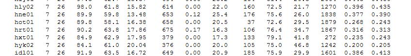
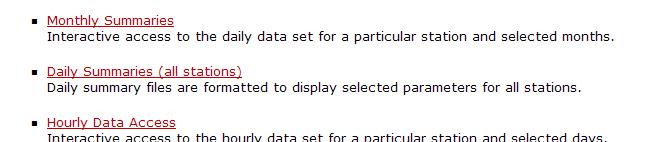
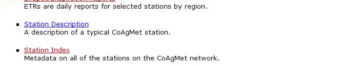
19 Overview Currently there are 65 stations Data are collected on hourly and daily time steps and include: temperature, humidity, solar radiation, wind speed and direction, and soil temperatures. Data and graphics are available online: ccc.atmos.colostate.edu/~coagmet t t coagmet
20 What do the stations measure?
21 Cup anemometer and wind vane: Wind speed, direction and gusts 2 m Above all else facing South Pyranometer: Solar radiation Temperature/Humidity sensor in radiation shield Solar panel powers the station 2 m 1-3 m Tipping bucket rain gage Data collection platform (DCP) -5/-15 cm Soil temperatures
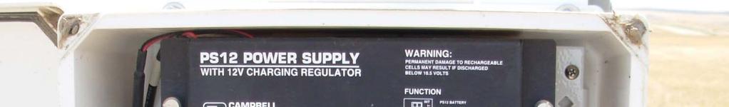
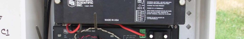


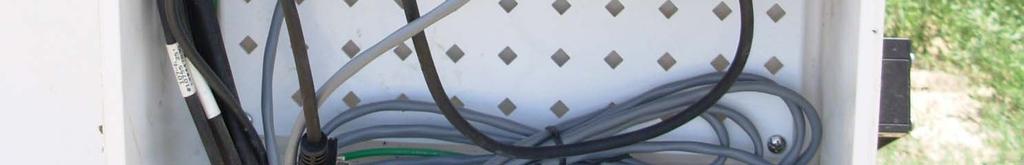
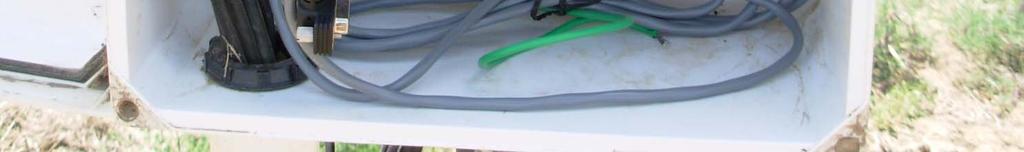
22 Data Collection Platform Power supply Datalogger Communications device (cellular modem) Incoming sensor cables
23 Why these measurements? The main goal of CoAgMet is to calculate evapotranspiration (ET) from meteorological measurements. Several models exist that vary by input data and complexity: Penman-Monteith physically based Kimberly-Penman physically based Hargreaves empirical temperature based Standardized ASCE Equation attempts to standardize calculations to make them more comparable The standard d CoAgMet station collects the elements needed to calculate evapotranspiration.
24 Temperature/Humidity Temperature: During the growing season, higher temperatures during daylight hours cause the plant stomata to open more resulting in greater transpiration. Humidity: The higher the humidity the less transpiration will occur (more transpiration occurs in dryer air)
25
26 Wind Movement As air movement across plant canopies increase, higher transpiration rates occur as the saturated air (from transpiration) ti around the plant is mixed with and replaced by and dryer air.
27
28 Solar Radiation Alfalfa only reflects about 25% of incoming solar energy which leaves ample solar energy to drive ET rates. ET trends follow a similar pattern as seasonal solar radiation and air temperature.
29


30 Precipitation Precipitation data are not used explicitly in the ET equations, but precipitation data are essential in determining crop water needs Monitoring precipitation also provides an idea of soil moisture availability at the station.
31 Soil Temperatures Having the temperature of the soil aids in knowing when the soil has warmed enough to plant. Soil temperature also gives an indication of the amount of ground cover at the station.
32
33 CoAgMet example ET Data Growing season Alfalfa reference ET for 2011 growing season comparing an unirrigated site near Delta to a partially irrigated site near Olathe
34
35 Please note: CoAgMet instrumentation are high quailty and the CoAgMet data are easily accessibly..... However
36 Problems with CoAgMet Missing data Site exposure Routine maintenance
37 Missing/Questionable Data Due to various problems that occur to remote weather stations, missing data causes problems for users. Battery failure and communications problems are the most common. Even if the whole station doesn t fail, sensors go bad and can leave some elements missing until the station is serviced.
38 Unfortunately, data are not complete at all stations Peckham, Mean Monthly Wind Run (May Sept) p) Missing Data Mean Wind Run (m mi) March April May June July August September October Month
39 Some Data are Questionable CSU Fruita Experimental Station, Monthly Vapor Pressure ( ) Vapor Pressure ( mb) Vapor Pressure (mb) March April May June July August September October Month Lamar 01, Mean Monthly Vapor Pressure ( ) Mean Mean Solar Radiation (Lgly) Avondale, Mean Monthly Solar Radiation ( ) March April May June July August September October Month Mean March April May June July August September October Month
40 Site Exposure One of the assumptions s of the evapotranspiration a at o equations is that water is not limited (i.e. in full irrigation). Some stations are not located in ideal reference conditions. Some stations have obstructions (buildings/crops) that affect the amount of wind in certain directions. The exposure of the site can have an impact on the data and over/under estimate reference ET.


41 Siting and Exposure The Good and the Not so Good FTC01 Fort Collins AERC has appropriate p citing for reference ET calculations HOT01 Hotchkiss is not ideally cited for reference ET calculations
42 Routine Maintenance Due to the fact that CoAgMet is run by collaborations and operates on a limited budget, routine maintenance is difficult with such a large network. There is no full time CoAgMet technician. Our goal is to visit each station once a year to make sure the station is operating properly. Sensor are swapped out once every 2 years. Data users should be cautious and thoroughly quality control the data they are using.
43 Possible Solutions? Efforts are being made to fill in missing data using relationships with nearby stations. This data would be flagged when presented on the website. Our website now color codes stations according to their irrigation are classified as: full irrigation, partial irrigation and dryland. Making this information available to the public allows them to know more about their data source.
44
45 Possible Solutions? We do our best with limited funds to keep a maintenance schedule but it is very difficult. If we are not able to keep high standards for our weather stations, some current stations may need to be discontinued in the near future.
46 CoAgMet Website Demonstration
47 The Colorado Climate Center Home Page


48 Hourly Climate Data Plots Click Here
49 Hourly Climate Data Plots Temperature GLY03 Greely June 9, 2007 through h June 15, 2007 Relative Humidity


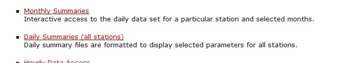
50 Click Here Daily Climatic Summary

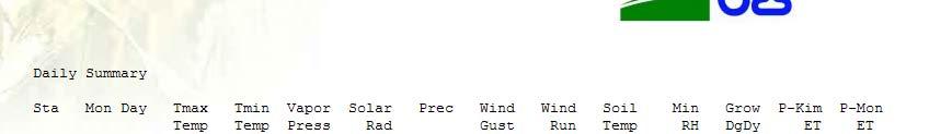
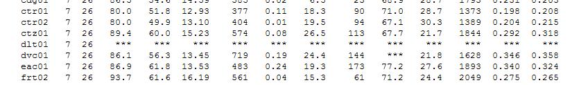
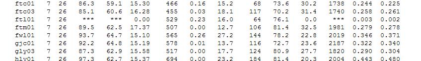
51 Daily Climatic Summary


52 Monthly Station Summaries Click Here


53 Monthly Station Summaries KSY01 Kersey Aug. 2007


54 Daily Regional Climatic and ET Comparison Click Here
55 Daily Regional Climatic and ET Comparison North Central Region, May 30, 2007


56 Click Here Crop Specific ET Reports
57 Crop Specific ET Reports Calculates multi-day ET for: alfalfa, corn, dry beans, small grain, sugar beets, potatoes, t onion, winter wheat, turf grass, and reference ET, via Penman-Monteith or Kimberly-Penman


58 CoAgMet web access:
Detecting Trends in Evapotranspiration in Colorado
 Detecting Trends in Evapotranspiration in Colorado W. Austin Clifford and Nolan J. Doesken Colorado Climate Center Department of Atmospheric Science Colorado State University Presented at Colorado Water
Applications/Users for Improved S2S Forecasts
 Applications/Users for Improved S2S Forecasts Nolan Doesken Colorado Climate Center Colorado State University WSWC Precipitation Forecasting Workshop June 7-9, 2016 San Diego, CA First -- A short background
The Colorado Agricultural no Meteorological Network (CoAgMet) and Crop ET Reports
 and Crop ET Reports") C R O P S E R I E S Irrigation Quick Facts The Colorado Agricultural no. 4.723 Meteorological Network (CoAgMet) and Crop ET Reports A.A. Andales, T. A. Bauder and N. J. Doesken 1 (10/09) CoAgMet is a network
C R O P S E R I E S Irrigation Quick Facts The Colorado Agricultural no. 4.723 Meteorological Network (CoAgMet) and Crop ET Reports A.A. Andales, T. A. Bauder and N. J. Doesken 1 (10/09) CoAgMet is a network
Let s Talk Climate! Nolan Doesken Colorado Climate Center Colorado State University. Yampatika Seminar February 16, 2011 Steamboat Springs, Colorado
 Let s Talk Climate! Nolan Doesken Colorado Climate Center Colorado State University Yampatika Seminar February 16, 2011 Steamboat Springs, Colorado First -- A short background In 1973 the federal government
Tracking the Climate Of Northern Colorado Nolan Doesken State Climatologist Colorado Climate Center Colorado State University
 Tracking the Climate Of Northern Colorado Nolan Doesken State Climatologist Colorado Climate Center Colorado State University Northern Colorado Business Innovations November 20, 2013 Loveland, Colorado
CIMIS. California Irrigation Management Information System
 CIMIS California Irrigation Management Information System What is CIMIS? A network of over 130 fully automated weather stations that collect weather data throughout California and provide estimates of
2003 Moisture Outlook
 2003 Moisture Outlook Nolan Doesken and Roger Pielke, Sr. Colorado Climate Center Prepared by Tara Green and Odie Bliss http://climate.atmos.colostate.edu Through 1999 Through 1999 Fort Collins Total Water
Long-term Precipitation Trends in Colorado. Nolan Doesken Colorado State Climatologist Presented: Friday, December 12, 2008
 Long-term Precipitation Trends in Colorado Nolan Doesken Colorado State Climatologist Presented: Friday, December 12, 28 Colorado Mean Annual Precipitation (1971-2) Of All Our Climate Observing Stations
Colorado s 2003 Moisture Outlook
 Colorado s 2003 Moisture Outlook Nolan Doesken and Roger Pielke, Sr. Colorado Climate Center Prepared by Tara Green and Odie Bliss http://climate.atmos.colostate.edu How we got into this drought! Fort
Drought in Southeast Colorado
 Drought in Southeast Colorado Nolan Doesken and Roger Pielke, Sr. Colorado Climate Center Prepared by Tara Green and Odie Bliss http://climate.atmos.colostate.edu 1 Historical Perspective on Drought Tourism
2003 Water Year Wrap-Up and Look Ahead
 2003 Water Year Wrap-Up and Look Ahead Nolan Doesken Colorado Climate Center Prepared by Odie Bliss http://ccc.atmos.colostate.edu Colorado Average Annual Precipitation Map South Platte Average Precipitation
Vermont Soil Climate Analysis Network (SCAN) sites at Lye Brook and Mount Mansfield
 sites at Lye Brook and Mount Mansfield") Vermont Soil Climate Analysis Network (SCAN) sites at Lye Brook and Mount Mansfield 13 Years of Soil Temperature and Soil Moisture Data Collection September 2000 September 2013 Soil Climate Analysis Network
Vermont Soil Climate Analysis Network (SCAN) sites at Lye Brook and Mount Mansfield 13 Years of Soil Temperature and Soil Moisture Data Collection September 2000 September 2013 Soil Climate Analysis Network
Variability of Reference Evapotranspiration Across Nebraska
 Know how. Know now. EC733 Variability of Reference Evapotranspiration Across Nebraska Suat Irmak, Extension Soil and Water Resources and Irrigation Specialist Kari E. Skaggs, Research Associate, Biological
The TexasET Network and Website User s Manual
 The TexasET Network and Website http://texaset.tamu.edu User s Manual By Charles Swanson and Guy Fipps 1 September 2013 Texas AgriLIFE Extension Service Texas A&M System 1 Extension Program Specialist;
CoCoRaHS Monitoring Colorado s s Water Resources through Community Collaborations
 CoCoRaHS Monitoring Colorado s s Water Resources through Community Collaborations Nolan Doesken Colorado Climate Center Atmospheric Science Department Colorado State University Presented at Sustaining
Highlights of the 2006 Water Year in Colorado
 Highlights of the 2006 Water Year in Colorado Nolan Doesken, State Climatologist Atmospheric Science Department Colorado State University http://ccc.atmos.colostate.edu Presented to 61 st Annual Meeting
5B.1 DEVELOPING A REFERENCE CROP EVAPOTRANSPIRATION CLIMATOLOGY FOR THE SOUTHEASTERN UNITED STATES USING THE FAO PENMAN-MONTEITH ESTIMATION TECHNIQUE
 DEVELOPING A REFERENCE CROP EVAPOTRANSPIRATION CLIMATOLOGY FOR THE SOUTHEASTERN UNITED STATES USING THE FAO PENMAN-MONTEITH ESTIMATION TECHNIQUE Heather A. Dinon*, Ryan P. Boyles, and Gail G. Wilkerson
An Online Platform for Sustainable Water Management for Ontario Sod Producers
 An Online Platform for Sustainable Water Management for Ontario Sod Producers 2014 Season Update Kyle McFadden January 30, 2015 Overview In 2014, 26 weather stations in four configurations were installed
Eric. W. Harmsen Agricultural and Biosystems Engineering Department, University of Puerto Rico Mayaguez Campus
 AN OPERATIONAL WATER AND ENERGY BALANCE ALGORITHM FOR PUERTO RICO Eric. W. Harmsen Agricultural and Biosystems Engineering Department, University of Puerto Rico Mayaguez Campus DÉCIMA REUNIÓN NACIONAL
November 2018 Weather Summary West Central Research and Outreach Center Morris, MN
 November 2018 Weather Summary Lower than normal temperatures occurred for the second month. The mean temperature for November was 22.7 F, which is 7.2 F below the average of 29.9 F (1886-2017). This November
Eric. W. Harmsen 1, John Mecikalski 2, Vanessa Acaron 3 and Jayson Maldonado 3
 Estimating Ground-Level Solar Radiation and Evapotranspiration In Puerto Rico Using Satellite Remote Sensing Eric. W. Harmsen 1, John Mecikalski 2, Vanessa Acaron 3 and Jayson Maldonado 3 1 Department
The Kentucky Mesonet: Entering a New Phase
 The Kentucky Mesonet: Entering a New Phase Stuart A. Foster State Climatologist Kentucky Climate Center Western Kentucky University KCJEA Winter Conference Lexington, Kentucky February 9, 2017 Kentucky
September 2018 Weather Summary West Central Research and Outreach Center Morris, MN
 September 2018 Weather Summary The mean temperature for September was 60.6 F, which is 1.5 F above the average of 59.1 F (1886-2017). The high temperature for the month was 94 F on September 16 th. The
Colorado s AMAZING Climate
 Colorado s AMAZING Climate Nolan Doesken, State Climatologist Colorado Climate Center Atmospheric Science Department Colorado State University Fort Collins, CO Graphics assistance provided by Wendy Ryan,
North Carolina Climate July 2011
 North Carolina Climate July 2011 Online: http://www.nc-climate.ncsu.edu/office/newsletters North Carolina Climate, the monthly newsletter of the State Climate Office of NC, covers a monthly climate summary
Evapotranspiration. Rabi H. Mohtar ABE 325
 Evapotranspiration Rabi H. Mohtar ABE 325 Introduction What is it? Factors affecting it? Why we need to estimate it? Latent heat of vaporization: Liquid gas o Energy needed o Cooling process Saturation
Colorado State University, Fort Collins, CO Weather Station Monthly Summary Report
 Colorado State University, Fort Collins, CO Weather Station Monthly Summary Report Month: December Year: 2017 Temperature: Mean T max was 47.2 F which is 4.4 above the 1981-2010 normal for the month. This
The Colorado Drought of 2002 in Perspective
 The Colorado Drought of 2002 in Perspective Colorado Climate Center Nolan Doesken and Roger Pielke, Sr. Prepared by Tara Green and Odie Bliss http://climate.atmos.colostate.edu Known Characteristics of
Funding provided by NOAA Sectoral Applications Research Project CLIMATE. Basic Climatology Colorado Climate Center
 Funding provided by NOAA Sectoral Applications Research Project CLIMATE Basic Climatology Colorado Climate Center Remember These? Factor 1: Our Energy Source Factor 2: Revolution & Tilt Factor 3: Rotation!
Research Note COMPUTER PROGRAM FOR ESTIMATING CROP EVAPOTRANSPIRATION IN PUERTO RICO 1,2. J. Agric. Univ. P.R. 89(1-2): (2005)
: (2005)") Research Note COMPUTER PROGRAM FOR ESTIMATING CROP EVAPOTRANSPIRATION IN PUERTO RICO 1,2 Eric W. Harmsen 3 and Antonio L. González-Pérez 4 J. Agric. Univ. P.R. 89(1-2):107-113 (2005) Estimates of crop
Research Note COMPUTER PROGRAM FOR ESTIMATING CROP EVAPOTRANSPIRATION IN PUERTO RICO 1,2 Eric W. Harmsen 3 and Antonio L. González-Pérez 4 J. Agric. Univ. P.R. 89(1-2):107-113 (2005) Estimates of crop
Taking the Pulse of Colorado s Climate
 Taking the Pulse of Colorado s Climate Nolan Doesken State Climatologist, Colorado Climate Center Atmospheric Science Department Colorado State University Presented 5 August 2011 Colorado State University,
Taking the Pulse of Colorado s Climate
 Taking the Pulse of Colorado s Climate Nolan Doesken State Climatologist, Colorado Climate Center Atmospheric Science Department Colorado State University Presented 5 May 2012 Univ. of Colorado, Boulder,
Development of Innovative Technology to Provide Low-Cost Surface Atmospheric Observations in Data-sparse Regions
 Development of Innovative Technology to Provide Low-Cost Surface Atmospheric Observations in Data-sparse Regions Paul Kucera and Martin Steinson University Corporation for Atmospheric Research/COMET 3D-Printed
Colorado State University, Fort Collins, CO Weather Station Monthly Summary Report
 Colorado State University, Fort Collins, CO Weather Station Monthly Summary Report Month: December Year: 2016 Temperature: Mean T max was 39.7 F which is 3.1 below the 1981-2010 normal for the month. This
2002 Drought History in Colorado A Brief Summary
 1 2002 Drought History in Colorado A Brief Summary Colorado Climate Center Roger Pielke, Sr, Director and Nolan Doesken, Research Associate Prepared by Odie Bliss & Tara Green http://climate.atmos.colostate.edu
Climate Change Impact on Air Temperature, Daily Temperature Range, Growing Degree Days, and Spring and Fall Frost Dates In Nebraska
 EXTENSION Know how. Know now. Climate Change Impact on Air Temperature, Daily Temperature Range, Growing Degree Days, and Spring and Fall Frost Dates In Nebraska EC715 Kari E. Skaggs, Research Associate
Estimating Summertime Evapotranspiration Across Indiana. Principal Investigators: Johnny Nykiel. Ryan Knutson. Jesse Steinweg-Woods
 Estimating Summertime Evapotranspiration Across Indiana Principal Investigators: Johnny Nykiel Undergraduate Department of Earth and Atmospheric Science Ryan Knutson Undergraduate Department of Earth and
Colorado State University, Fort Collins, CO Weather Station Monthly Summary Report
 Colorado State University, Fort Collins, CO Weather Station Monthly Summary Report Month: January Year: 2019 Temperature: Mean T max was 47.2 F which is 3.0 above the 1981-2010 normal for the month. This
NIDIS Intermountain West Drought Early Warning System September 4, 2018
 NIDIS Drought and Water Assessment NIDIS Intermountain West Drought Early Warning System September 4, 2018 Precipitation The images above use daily precipitation statistics from NWS COOP, CoCoRaHS, and
North Carolina Climate Variations
 North Carolina Climate Variations Sethu Raman Professor of Atmospheric and Marine Sciences and State Climatologist State Climate Office of North Carolina North Carolina State University Latest Drought
INTER-COMPARISON OF REFERENCE EVAPOTRANSPIRATION ESTIMATED USING SIX METHODS WITH DATA FROM FOUR CLIMATOLOGICAL STATIONS IN INDIA
 INODUCTION The reference evapotranspiration is one of the most important things to consider for irrigation management to crops. Evapotranspiration (ET) is important to irrigation management because crop
Midwest and Great Plains Drought and Climate Summary 20 February 2014
 Midwest and Great Plains Drought and Climate Summary 20 February 2014 Wendy Ryan Assistant State Climatologist Colorado Climate Center Colorado State University wendy.ryan@colostate.edu 970-491-8506 General
COOP Modernization: NOAA s Environmental Real-time Observation Network in New England, the Southeast and Addressing NIDIS in the West
 COOP Modernization: NOAA s Environmental Real-time Observation Network in New England, the Southeast and Addressing NIDIS in the West Ken Crawford NWS Office of Science and Technology Special Presentation
The Climate of Bryan County
 The Climate of Bryan County Bryan County is part of the Crosstimbers throughout most of the county. The extreme eastern portions of Bryan County are part of the Cypress Swamp and Forest. Average annual
Local Precipitation Variability
 Local Precipitation Variability Precipitation from one storm can vary from neighborhood to neighborhood. What falls in your yard may not fall in the next. The next time it rains see how the precipitation
Alberta Climate Information Service (ACIS) Definitions. Disclaimer. Overview
 Definitions. Disclaimer. Overview") Alberta Climate Information Service (ACIS) Definitions Disclaimer Please note that due to technical difficulties AF s IT team has only committed to having ACIS and Roping the web services achieve a 95%
Alberta Climate Information Service (ACIS) Definitions Disclaimer Please note that due to technical difficulties AF s IT team has only committed to having ACIS and Roping the web services achieve a 95%
What Does It Take to Get Out of Drought?
 What Does It Take to Get Out of Drought? Nolan J. Doesken Colorado Climate Center Colorado State University http://ccc.atmos.colostate.edu Presented at the Insects, Diseases and Drought Workshop, May 19,
AgWeatherNet A Tool for Making Decisions Based on Weather
 AgWeatherNet A Tool for Making Decisions Based on Weather Gerrit Hoogenboom Director, AgWeatherNet & Professor of Agrometeorology Washington State University Prosser, Washington November 14, 2013 Washington
Innovative Sustainable Technology
 Innovative Sustainable Technology DIG is committed to practices that contribute to irrigation and energy efficiency, creating healthy living conditions while maintaining environmentally sound operating
N ew York State Agricultural Experiment S tation vnrfx* NYSAES I Publications I Latest Press Releases
 N ew York State Agricultural Experiment S tation vnrfx* NYSAES I Publications I Latest Press Releases CORNELL U N I V E R S I T Y GENEVA NEW YORK. 100 Years of New York Weather August 16th, 2000 CONTACT:
AN INTERNATIONAL SOLAR IRRADIANCE DATA INGEST SYSTEM FOR FORECASTING SOLAR POWER AND AGRICULTURAL CROP YIELDS
 AN INTERNATIONAL SOLAR IRRADIANCE DATA INGEST SYSTEM FOR FORECASTING SOLAR POWER AND AGRICULTURAL CROP YIELDS James Hall JHTech PO Box 877 Divide, CO 80814 Email: jameshall@jhtech.com Jeffrey Hall JHTech
Climate Change or Climate Variability?
 Climate Change or Climate Variability? Key Concepts: Greenhouse Gas Climate Climate change Climate variability Climate zones Precipitation Temperature Water cycle Weather WHAT YOU WILL LEARN 1. You will
Evapotranspiration and Irrigation Water Requirements for Washington State
 Evapotranspiration and Irrigation Water Requirements for Washington State R. Troy Peters, PE, PhD Extension Irrigation Specialist Washington State University Irrigated Ag. Research and Extension Cntr Prosser,
The Climate of Payne County
 The Climate of Payne County Payne County is part of the Central Great Plains in the west, encompassing some of the best agricultural land in Oklahoma. Payne County is also part of the Crosstimbers in the
Dependence of evaporation on meteorological variables at di erent time-scales and intercomparison of estimation methods
 Hydrological Processes Hydrol. Process. 12, 429±442 (1998) Dependence of evaporation on meteorological variables at di erent time-scales and intercomparison of estimation methods C.-Y. Xu 1 and V.P. Singh
The Climate of Kiowa County
 The Climate of Kiowa County Kiowa County is part of the Central Great Plains, encompassing some of the best agricultural land in Oklahoma. Average annual precipitation ranges from about 24 inches in northwestern
Memo. I. Executive Summary. II. ALERT Data Source. III. General System-Wide Reporting Summary. Date: January 26, 2009 To: From: Subject:
 Memo Date: January 26, 2009 To: From: Subject: Kevin Stewart Markus Ritsch 2010 Annual Legacy ALERT Data Analysis Summary Report I. Executive Summary The Urban Drainage and Flood Control District (District)
Quality Assurance and Quality Control
 Quality Assurance and Quality Control of Surface Observations in JMA Japan Meteorological Agency Hakaru MIZUNO "Guide to Meteorological Instruments and Methods of Observation", WMO-No.8, 7th ed., 2008.
The Climate of Murray County
 The Climate of Murray County Murray County is part of the Crosstimbers. This region is a transition between prairies and the mountains of southeastern Oklahoma. Average annual precipitation ranges from
The Climate of Marshall County
 The Climate of Marshall County Marshall County is part of the Crosstimbers. This region is a transition region from the Central Great Plains to the more irregular terrain of southeastern Oklahoma. Average
Range Cattle Research and Education Center January CLIMATOLOGICAL REPORT 2016 Range Cattle Research and Education Center.
 1 Range Cattle Research and Education Center January 2017 Research Report RC-2017-1 CLIMATOLOGICAL REPORT 2016 Range Cattle Research and Education Center Brent Sellers Weather conditions strongly influence
Website Phone Mobile OVERVIEW Davis Vantage Pro2 Weather Station
 OVERVIEW If you're looking for a superior weather station, the Davis Vantage Pro2 Weather Station is as good as they come! Vantage Pro2 offers the professional weather observer and the serious weather
The Delaware Environmental Monitoring & Analysis Center
 The Delaware Environmental Monitoring & Analysis Center Tina Callahan Delaware Estuary Science & Environmental Summit 2013 January 27-30, 2013 What is DEMAC? Delaware Environmental Monitoring & Analysis
The Climate of Grady County
 The Climate of Grady County Grady County is part of the Central Great Plains, encompassing some of the best agricultural land in Oklahoma. Average annual precipitation ranges from about 33 inches in northern
A summary of the weather year based on data from the Zumwalt weather station
 ZUMWALT PRAIRIE WEATHER 2016 A summary of the weather year based on data from the Zumwalt weather station Figure 1. An unusual summer storm on July 10, 2016 brought the second-largest precipitation day
NIDIS Intermountain West Drought Early Warning System December 18, 2018
 NIDIS Intermountain West Drought Early Warning System December 18, 2018 Precipitation The images above use daily precipitation statistics from NWS COOP, CoCoRaHS, and CoAgMet stations. From top to bottom,
The Climate of Pontotoc County
 The Climate of Pontotoc County Pontotoc County is part of the Crosstimbers. This region is a transition region from the Central Great Plains to the more irregular terrain of southeast Oklahoma. Average
PAM-Station Land-Owner Information Guide Project: CuPIDO, Tucson AZ, Jul/Aug 2006
 PAM-Station Land-Owner Information Guide Project: CuPIDO, Tucson AZ, Jul/Aug 2006 PropVane Anemometer mounted at 10-m Lightning Spike Two-Way radio antenna Sonic Anemometer Solar and Net Radiation sensors.
CLIMATOLOGICAL REPORT 2002
 Range Cattle Research and Education Center Research Report RC-2003-1 February 2003 CLIMATOLOGICAL REPORT 2002 Range Cattle Research and Education Center R. S. Kalmbacher Professor, IFAS, Range Cattle Research
Making a Climograph: GLOBE Data Explorations
 Making a Climograph: A GLOBE Data Exploration Purpose Students learn how to construct and interpret climographs and understand how climate differs from weather. Overview Students calculate and graph maximum
P1.34 MULTISEASONALVALIDATION OF GOES-BASED INSOLATION ESTIMATES. Jason A. Otkin*, Martha C. Anderson*, and John R. Mecikalski #
 P1.34 MULTISEASONALVALIDATION OF GOES-BASED INSOLATION ESTIMATES Jason A. Otkin*, Martha C. Anderson*, and John R. Mecikalski # *Cooperative Institute for Meteorological Satellite Studies, University of
Range Cattle Research and Education Center January CLIMATOLOGICAL REPORT 2012 Range Cattle Research and Education Center.
 1 Range Cattle Research and Education Center January 2013 Research Report RC-2013-1 CLIMATOLOGICAL REPORT 2012 Range Cattle Research and Education Center Brent Sellers Weather conditions strongly influence
Evapotranspiration forecast using SWAT model and weather forecast model
 Evapotranspiration forecast using SWAT model and weather forecast model Pedro Chambel-Leitão (1), Carina Almeida (1), Eduardo Jauch (1), Rosa Trancoso (1), Ramiro Neves (1), José Chambel Leitão (2) (1)
A Century of Meteorological Observations at Fort Valley Experimental Forest: A Cooperative Observer Program Success Story
 A Century of Meteorological Observations at Fort Valley Experimental Forest: A Cooperative Observer Program Success Story Daniel P. Huebner and Susan D. Olberding, U.S. Forest Service, Rocky Mountain Research
NIDIS Intermountain West Drought Early Warning System October 17, 2017
 NIDIS Drought and Water Assessment NIDIS Intermountain West Drought Early Warning System October 17, 2017 Precipitation The images above use daily precipitation statistics from NWS COOP, CoCoRaHS, and
Colorado State University, Fort Collins, CO Weather Station Monthly Summary Report
 Colorado State University, Fort Collins, CO Weather Station Monthly Summary Report Month: February Year: 2017 Webcam catching a hawk watching over the station. Temperature: Mean T max was 54.4 F which
The Oklahoma Mesonet: Why We Did It & Lessons Learned (Its Value to the Citizens of Oklahoma)
") The Oklahoma Mesonet: Why We Did It & Lessons Learned (Its Value to the Citizens of Oklahoma) Chris Fiebrich, Manager The Oklahoma Mesonet Oklahoma Climatological Survey University of Oklahoma The Purpose
The Oklahoma Mesonet: Why We Did It & Lessons Learned (Its Value to the Citizens of Oklahoma) Chris Fiebrich, Manager The Oklahoma Mesonet Oklahoma Climatological Survey University of Oklahoma The Purpose
Your Farm Weather Station: Installation and Maintenance Guidelines 1
 AE502 Your Farm Weather Station: Installation and Maintenance Guidelines 1 Clyde W. Fraisse, George W. Braun, William R. Lusher, and Lee R. Staudt 2 Introduction Weather is a prominent factor in the success
Colorado weather and climate update: a bit more than halfway through the water year (Or: What s going on with the weather?? )
") Colorado weather and climate update: a bit more than halfway through the water year (Or: What s going on with the weather?? ) Russ S. Schumacher Colorado State Climatologist Director, Colorado Climate
Colorado weather and climate update: a bit more than halfway through the water year (Or: What s going on with the weather?? ) Russ S. Schumacher Colorado State Climatologist Director, Colorado Climate
Microclimate. Climate & scale. Measuring a Microclimate Microclimates VARY. Microclimate factors. Aboveground environment.
 Microenvironments Microenvironments Aboveground environment Belowground environment Edaphic factors soil environment Macroclimate Climate & scale Mesoclimate factors Temperature s VARY I. In Time Long
The Climate of Seminole County
 The Climate of Seminole County Seminole County is part of the Crosstimbers. This region is a transition region from the Central Great Plains to the more irregular terrain of southeastern Oklahoma. Average
Regional Precipitation and ET Patterns: Impacts on Agricultural Water Management
 Regional Precipitation and ET Patterns: Impacts on Agricultural Water Management Christopher H. Hay, PhD, PE Ag. and Biosystems Engineering South Dakota State University 23 November 2010 Photo: USDA-ARS
The Colorado Drought : 2003: A Growing Concern. Roger Pielke, Sr. Colorado Climate Center.
 The Colorado Drought 2001-2003: 2003: A Growing Concern Roger Pielke, Sr. Colorado Climate Center Prepared by Tara Green and Odie Bliss http://climate.atmos.colostate.edu 2 2002 Drought History in Colorado
NIDIS Intermountain West Drought Early Warning System May 1, 2018
 NIDIS Intermountain West Drought Early Warning System May 1, 2018 Precipitation The images above use daily precipitation statistics from NWS COOP, CoCoRaHS, and CoAgMet stations. From top to bottom, and
Table of Contents. Page
 Eighteen Years (1990 2007) of Climatological Data on NMSU s Corona Range and Livestock Research Center Research Report 761 L. Allen Torell, Kirk C. McDaniel, Shad Cox, Suman Majumdar 1 Agricultural Experiment
The Climate of Texas County
 The Climate of Texas County Texas County is part of the Western High Plains in the north and west and the Southwestern Tablelands in the east. The Western High Plains are characterized by abundant cropland
A Review of the 2007 Water Year in Colorado
 A Review of the 2007 Water Year in Colorado Nolan Doesken Colorado Climate Center, CSU Mike Gillespie Snow Survey Division, USDA, NRCS Presented at the 28 th Annual AGU Hydrology Days, March 26, 2008,
Appendix C. AMEC Evaluation of Zuni PPIW. Appendix C. Page C-1 of 34
 AMEC s Independent Estimate of PPIW Crop Water Use Using the ASCE Standardized Reference Evapotranspiration via Gridded Meteorological Data, and Estimation of Crop Coefficients, and Net Annual Diversions
Precipitation. Standardized Precipitation Index. NIDIS Intermountain West Regional Drought Early Warning System January 3, 2017
 1/3/2017 NIDIS Drought and Water Assessment NIDIS Intermountain West Regional Drought Early Warning System January 3, 2017 Precipitation The images above use daily precipitation statistics from NWS COOP,
Applications. Remote Weather Station with Telephone Communications. Tripod Tower Weather Station with 4-20 ma Outputs
 Tripod Tower Weather Station with 4-20 ma Outputs Remote Weather Station with Telephone Communications NEMA-4X Enclosure with Two Translator Boards and Analog Barometer Typical Analog Output Evaporation
Meteorological Data recorded at Armagh Observatory from 1795 to 2001: Volume I - Daily, Monthly and Annual Rainfall
 Meteorological Data recorded at Armagh Observatory from 1795 to 2001: Volume I - Daily, Monthly and Annual Rainfall 1838-2001 A. M. García-Suárez, C.J. Butler, D. Cardwell, A.D.S. Coughlin, A. Donnelly,
Evapotranspiration monitoring with Meteosat Second Generation satellites: method, products and utility in drought detection.
 Evapotranspiration monitoring with Meteosat Second Generation satellites: method, products and utility in drought detection. Nicolas Ghilain Royal Meteorological Institute Belgium EUMeTrain Event week
Promoting Rainwater Harvesting in Caribbean Small Island Developing States Water Availability Mapping for Grenada Preliminary findings
 Promoting Rainwater Harvesting in Caribbean Small Island Developing States Water Availability Mapping for Grenada Preliminary findings National Workshop Pilot Project funded by The United Nations Environment
LE Accumulation, Net Radiation, and Drying with Tipped Sensors
 LE Accumulation, Net Radiation, and Drying with Tipped Sensors Three different situations were examined, where the influence that the deployment angle of the sensor has on the accumulation of latent heat
2008 Growing Season. Niagara Region
 28 Growing Season Niagara Region Weather INnovations Staff November 14, 28 Overview The start of the 28 growing season looked promising. After an extremely dry 27 growing season, soil moisture levels had
Quality assurance for sensors at the Deutscher Wetterdienst (DWD)
") Quality assurance for sensors at the Deutscher Wetterdienst (DWD) Quality assurance / maintenance / calibration Holger Dörschel, Dr Tilman Holfelder WMO International Conference on Automatic Weather Stations
Quality assurance for sensors at the Deutscher Wetterdienst (DWD) Quality assurance / maintenance / calibration Holger Dörschel, Dr Tilman Holfelder WMO International Conference on Automatic Weather Stations
NIDIS Intermountain West Drought Early Warning System November 21, 2017
 NIDIS Drought and Water Assessment NIDIS Intermountain West Drought Early Warning System November 21, 2017 Precipitation The images above use daily precipitation statistics from NWS COOP, CoCoRaHS, and
MxVision WeatherSentry Web Services Content Guide
 MxVision WeatherSentry Web Services Content Guide July 2014 DTN 11400 Rupp Drive Minneapolis, MN 55337 00.1.952.890.0609 This document and the software it describes are copyrighted with all rights reserved.
Accessing and Using National Long Term Ecological Research (LTER) Climate and Hydrology Data from ClimDB and HydroDB: A Tutorial
 Climate and Hydrology Data from ClimDB and HydroDB: A Tutorial") Accessing and Using National Long Term Ecological Research (LTER) Climate and Hydrology Data from ClimDB and HydroDB: A Tutorial Gordon M. Heisler USDA Forest Service, Syracuse, NY Gary Fisher U.S. Geological
Accessing and Using National Long Term Ecological Research (LTER) Climate and Hydrology Data from ClimDB and HydroDB: A Tutorial Gordon M. Heisler USDA Forest Service, Syracuse, NY Gary Fisher U.S. Geological
The Climate of Haskell County
 The Climate of Haskell County Haskell County is part of the Hardwood Forest. The Hardwood Forest is characterized by its irregular landscape and the largest lake in Oklahoma, Lake Eufaula. Average annual