Profiling Burglary in London using Geodemographics. Chris Gale 1, Alex Singleton 2, Paul Longley 1
|
|
|
- Marvin Davidson
- 5 years ago
- Views:
Transcription


1 Profiling Burglary in London using Geodemographics Chris Gale 1, Alex Singleton 2, Paul Longley 1 1 2
2 Geodemographic Classifications A Geodemographic Classification: Simplifies a large and complex body of information about a population, where and how they live and work Based on premise that similar people live in similar locations, undertake similar activities and have similar lifestyles and that such area types will be distributed in different locations across a geographical space Clustering algorithms partition demographic data into groups sharing similar characteristics Commercial (such as Mosaic created by Experian and Acorn created by CACI) and free (2011 OAC) classifications available
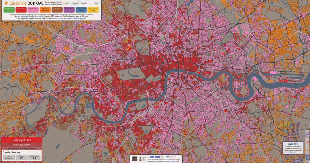
3 Geodemographic Classifications of London
4 2011 LOAC and coding crime data Coding crime data to the 2011 LOAC Police.UK data from December 2010 to July 2014 Burglary the only crime category used
5 2011 LOAC and coding crime data Assignment of different 2011 LOAC Supergroups to Output Areas in London

6 2011 LOAC and coding crime data Road network overlaid on the 2011 LOAC Supergroups
7 2011 LOAC and coding crime data Police.UK reported crime centroids added (for 4 million crime events)


8 2011 LOAC and coding crime data 94,667 Voronoi polygons created based on reported crime centroids Provides an estimation of the geography used to report crime on Police.UK
9 Assigning crime events to the 2011 LOAC Two methods of attributing reported crime events to 2011 LOAC Supergroups tested: Centroid location Proportional assignment

10 Example of centroid location method 100 burglary events assigned to centroid = 100 burglary events assigned to High Density and High Rise Flats
11 Example of proportional assignment method 100 burglary events assigned to centroid = 80 burglary events assigned to High Density and High Rise Flats
12 Example of proportional assignment method 100 burglary events assigned to centroid = 20 burglary events assigned to City Vibe
13 Assigning crime events to the 2011 LOAC Only small differences between the two methods However, if fewer crime event records and/or a smaller geographic area of study then greater discrepancies between the two methods are likely 32 BOROUGHS OF LONDON Recorded crimes based on centroid locations Recorded crimes based on proportional assignment Difference A: Intermediate Lifestyles 10.25% 10.26% 0.02% B: High Density and High Rise Flats 13.88% 13.56% -0.31% C: Settled Asians 11.38% 11.09% -0.28% D: Urban Elites 16.36% 16.51% 0.16% E: City Vibe 15.28% 15.48% 0.20% F: London Life-Cycle 8.69% 8.52% -0.18% G: Multi-Ethnic Suburbs 18.34% 19.10% 0.76% H: Ageing City Fringe 5.84% 5.47% -0.36%
14 Index Scores of burglary rates by 2011 LOAC Supergroup Score of 100 equates to London s 2010 to 2014 average of 98 burglaries being committed per 1,000 dwellings

15 MPS Neighbourhood Classification Built by the GLA Based on the 2011 OAC methodology Uses a different geography and 99 variables (from the 2011 Census and the London Datastore Ward Atlas)
 21 questions used to measure public confidence in the MPS 33 to 34 interviews carried out per month")
16 Public Attitude Survey (PAS) Used to elicit the public s perceptions of policing needs, priorities and experiences with the Metropolitan Police Service (MPS) 21 questions used to measure public confidence in the MPS 33 to 34 interviews carried out per month per Borough

17 Neighbourhood Confidence & Crime Comparator Interactive web-tool built visualising the 12 MPS Neighbourhood Classification clusters, Public Attitude Survey data and crime data Overall confidence in the MPS across London
18 Neighbourhood Confidence & Crime Comparator MPS Neighbourhoods assigned to the Single- Living Centre cluster Overall confidence in the MPS
19 Neighbourhood Confidence & Crime Comparator MPS Neighbourhoods assigned to the Settled Multi-Ethnic cluster Overall confidence in the MPS
20 Neighbourhood Confidence & Crime Comparator MPS Neighbourhoods assigned to the Crowded Outer Suburbia cluster How well do the MPS communicate?
21 Neighbourhood Confidence & Crime Comparator MPS Neighbourhoods assigned to the Stressed Urban cluster How well do the MPS understand issues that affect the community?
22 Neighbourhood Confidence & Crime Comparator MPS Neighbourhoods assigned to the Single- Living centre cluster Overall crime rate
23 Summary Profiling Police.UK data with the 2011 LOAC is an example of using geodemographics to derive insight from open data sources MPS Neighbourhood Classification and Neighbourhood Confidence & Crime Comparator are examples of creating bespoke geodemographic applications to contextualise public confidence in the police and crime levels in London
24

25

26 geogale.github.io/2011oac
27 oac.datashine.org.uk
28 plus.google.com/u/0/communities/
29 Thank You This work was supported by EPSRC grants EP/J004197/1 (Crime, policing and citizenship (CPC) - space-time interactions of dynamic networks) and EP/J005266/1 (The uncertainty of identity: linking spatiotemporal information between virtual and real worlds) and ESRC grants ES/K004719/1 (Using secondary data to measure, monitor and visualise spatio-temporal uncertainties in geodemographics) and ES/L011840/1 (Retail Business Datasafe).
Profiling Burglary in London using Geodemographics
 Profiling Burglary in London using Geodemographics C G Gale *1, A D Singleton 2 and P A Longley 3 1 UCL Department of Civil, Environmental & Geomatic Engineering 2 University of Liverpool Department of
Open Data Sources for Domain Specific Geodemographics
 Open Data Sources for Domain Specific Geodemographics Matthew D. Pratt 1, Paul A. Longley 1, James Cheshire 2, Chris Gale 1 1 Department of Geography, University College London, Gower Street, London, WC1E
Application Issues in GIS: the UCL Centre for Advanced Spatial Analysis. Paul Longley UCL
 Application Issues in GIS: the UCL Centre for Advanced Spatial Analysis Paul Longley UCL GIS: inclusive, shared understanding Geodemographics as a focus of interest Profiling public goods and services
Understanding Your Community A Guide to Data
 Understanding Your Community A Guide to Data Alex Lea September 2013 Research and Insight Team LeicestershireCounty Council Understanding Geographies Important to understand the various geographies that
An Open Source Geodemographic Classification of Small Areas In the Republic of Ireland Chris Brunsdon, Martin Charlton, Jan Rigby
 An Open Source Geodemographic Classification of Small Areas In the Republic of Ireland Chris Brunsdon, Martin Charlton, Jan Rigby National Centre for Geocomputation National University of Ireland, Maynooth
A new metric of crime hotspots for Operational Policing
 A new metric of crime hotspots for Operational Policing Monsuru Adepeju *1, Tao Cheng 1, John Shawe-Taylor 2, Kate Bowers 3 1 SpaceTimeLab for Big Data Analytics, Department of Civil, Environmental and
The Building Blocks of the City: Points, Lines and Polygons
 The Building Blocks of the City: Points, Lines and Polygons Andrew Crooks Centre For Advanced Spatial Analysis andrew.crooks@ucl.ac.uk www.gisagents.blogspot.com Introduction Why use ABM for Residential
Transport Planning in Large Scale Housing Developments. David Knight
 Transport Planning in Large Scale Housing Developments David Knight Large Scale Housing Developments No longer creating great urban spaces in the UK (Hall 2014) Transport Planning Transport planning processes
A Note on Methods. ARC Project DP The Demand for Higher Density Housing in Sydney and Melbourne Working Paper 3. City Futures Research Centre
 A Note on Methods ARC Project DP0773388 The Demand for Higher Density Housing in Sydney and Melbourne Working Paper 3 City Futures Research Centre February 2009 A NOTE ON METHODS Dr Raymond Bunker, Mr
Assessing the impact of seasonal population fluctuation on regional flood risk management
 Assessing the impact of seasonal population fluctuation on regional flood risk management Alan Smith *1, Andy Newing 2, Niall Quinn 3, David Martin 1 and Samantha Cockings 1 1 Geography and Environment,
Rural Alabama. Jennifer Zanoni. Geography Division U.S. Census Bureau. Alabama State Data Center 2018 Data Conference Tuscaloosa, Alabama
 Rural Alabama Jennifer Zanoni Geography Division U.S. Census Bureau Alabama State Data Center 2018 Data Conference Tuscaloosa, Alabama May 17, 2018 Agenda Census Geography Urban/Rural Definitions County-based
Advances in Geographic Data Science and Urban Analytics
 Advances in Geographic Data Science and Urban Analytics Alex Singleton Professor of Geographic Information Science Department of Geography and Planning Consumer Data Research Centre www.cdrc.ac.uk www.geographicdatascience.com
Using Social Media for Geodemographic Applications
 Using Social Media for Geodemographic Applications Muhammad Adnan and Guy Lansley Department of Geography, University College London @gisandtech @GuyLansley Web: http://www.uncertaintyofidentity.com Outline
Hennig, B.D. and Dorling, D. (2014) Mapping Inequalities in London, Bulletin of the Society of Cartographers, 47, 1&2,
 Mapping Inequalities in London, Bulletin of the Society of Cartographers, 47, 1&2,") Hennig, B.D. and Dorling, D. (2014) Mapping Inequalities in London, Bulletin of the Society of Cartographers, 47, 1&2, 21-28. Pre- publication draft without figures Mapping London using cartograms The
Hennig, B.D. and Dorling, D. (2014) Mapping Inequalities in London, Bulletin of the Society of Cartographers, 47, 1&2, 21-28. Pre- publication draft without figures Mapping London using cartograms The
Geographical Inequalities and Population Change in Britain,
 Geographical Inequalities and Population Change in Britain, 1971-2011 Chris Lloyd, Nick Bearman, Gemma Catney Centre for Spatial Demographics Research, University of Liverpool, UK Email: c.d.lloyd@liverpool.ac.uk
The geography of domestic energy consumption
 The geography of domestic energy consumption Anastasia Ushakova PhD student at CDRC UCL Ellen Talbot PhD student at CDRC Liverpool Some important research questions How can we classify energy consumption
Creating a Geodemographic Classification
 Creating a Geodemographic Classification Dr Daniel Vickers Department of Geography, University of Sheffield D.Vickers@sheffield.ac.uk www.shef.ac.uk/sasi www.areaclassification.org.uk Why classify areas?
Mapping Welsh Neighbourhood Types. Dr Scott Orford Wales Institute for Social and Economic Research, Data and Methods WISERD
 Mapping Welsh Neighbourhood Types Dr Scott Orford Wales Institute for Social and Economic Research, Data and Methods WISERD orfords@cardiff.ac.uk WISERD Established in 2008 and funded by the ESRC and HEFCW
Monsuru Adepeju 1 and Andy Evans 2. School of Geography, University of Leeds, LS21 1HB 1
 Investigating the impacts of training data set length (T) and the aggregation unit size (M) on the accuracy of the self-exciting point process (SEPP) hotspot method Monsuru Adepeju 1 and Andy Evans 2 1,
Clustering Analysis of London Police Foot Patrol Behaviour from Raw Trajectories
 Clustering Analysis of London Police Foot Patrol Behaviour from Raw Trajectories Jianan Shen 1, Tao Cheng 2 1 SpaceTimeLab for Big Data Analytics, Department of Civil, Environmental and Geomatic Engineering,
Measuring connectivity in London
 Measuring connectivity in London OECD, Paris 30 th October 2017 Simon Cooper TfL City Planning 1 Overview TfL Connectivity measures in TfL PTALs Travel time mapping Catchment analysis WebCAT Current and
Visualisation of Uncertainty in a Geodemographic Classifier
 Visualisation of Uncertainty in a Geodemographic Classifier Aidan Slingsby 1, Nicholas J. Tate 2, and Peter F. Fisher 2 1 gicentre, Department of Computer Science, City University London, Northampton Square,
Assessing spatial distribution and variability of destinations in inner-city Sydney from travel diary and smartphone location data
 Assessing spatial distribution and variability of destinations in inner-city Sydney from travel diary and smartphone location data Richard B. Ellison 1, Adrian B. Ellison 1 and Stephen P. Greaves 1 1 Institute
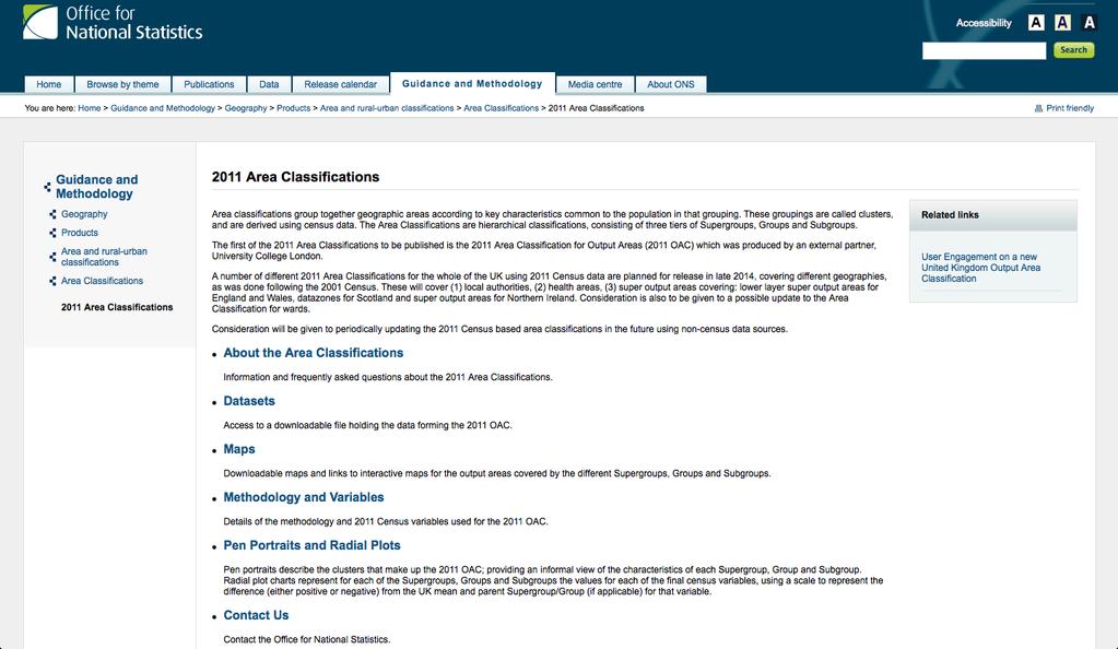
National Statistics 2001 Area Classifications
 National Statistics 2001 Area Classifications John Charlton, ONS see http://neighbourhood.statistics.gov.uk areaclassifications@ons.gov.uk Copyright ONS What are the Area Classifications Summarise 2001
Urban Spatial Scenario Design Modelling (USSDM) in Dar es Salaam: Background Information
 in Dar es Salaam: Background Information") Urban Spatial Scenario Design Modelling (USSDM) in Dar es Salaam: Background Information Modelling urban settlement dynamics in Dar es Salaam Revision: 2 (July 2013) Prepared by: Katja Buchta TUM team
Urban Spatial Scenario Design Modelling (USSDM) in Dar es Salaam: Background Information Modelling urban settlement dynamics in Dar es Salaam Revision: 2 (July 2013) Prepared by: Katja Buchta TUM team
An Open Source Geodemographic Classification of Small Areas in the Republic of Ireland
 Appl. Spatial Analysis DOI 10.1007/s12061-016-9212-4 An Open Source Geodemographic Classification of Small Areas in the Republic of Ireland Christopher Brunsdon 1 & Martin Charlton 1 & Janette E. Rigby
Modelling Spatial Behaviour in Music Festivals Using Mobile Generated Data and Machine Learning
 Modelling Spatial Behaviour in Music Festivals Using Mobile Generated Data and Machine Learning Luis Francisco Mejia Garcia *1, Guy Lansley 2 and Ben Calnan 3 1 Department of Civil, Environmental & Geomatic
Detecting Emerging Space-Time Crime Patterns by Prospective STSS
 Detecting Emerging Space-Time Crime Patterns by Prospective STSS Tao Cheng Monsuru Adepeju {tao.cheng@ucl.ac.uk; monsuru.adepeju.11@ucl.ac.uk} SpaceTimeLab, Department of Civil, Environmental and Geomatic
Non-parametric bootstrap and small area estimation to mitigate bias in crowdsourced data Simulation study and application to perceived safety
 Non-parametric bootstrap and small area estimation to mitigate bias in crowdsourced data Simulation study and application to perceived safety David Buil-Gil, Reka Solymosi Centre for Criminology and Criminal
RESIDENTIAL SATISFACTION IN THE CHANGING URBAN FORM IN ADELAIDE: A COMPARATIVE ANALYSIS OF MAWSON LAKES AND CRAIGBURN FARM, SOUTH AUSTRALIA
 RESIDENTIAL SATISFACTION IN THE CHANGING URBAN FORM IN ADELAIDE: A COMPARATIVE ANALYSIS OF MAWSON LAKES AND CRAIGBURN FARM, SOUTH AUSTRALIA by Michael Chadbourne BEPM (Hons) University of Adelaide Thesis
A Modified DBSCAN Clustering Method to Estimate Retail Centre Extent
 A Modified DBSCAN Clustering Method to Estimate Retail Centre Extent Michalis Pavlis 1, Les Dolega 1, Alex Singleton 1 1 University of Liverpool, Department of Geography and Planning, Roxby Building, Liverpool
GLA small area population projection methodology
 Update 2017-04 GLA small area population projection methodology 2015-based projections February 2017 Introduction The GLA produces a range of annually updated demographic projections for London. Among
USING CENSUS OUTPUT AREAS FOR MARKET RESEARCH SAMPLING
 USING CENSUS OUTPUT AREAS FOR MARKET RESEARCH SAMPLING Martin van Staveren Small Area Geography Planning for the Future MRS CGG Seminar, 5 th February 2007 INITIAL USE OF GEODEMOGRAPHICS BMRB was first
Edexcel Geography Advanced Paper 2
 Edexcel Geography Advanced Paper 2 SECTION B: SHAPING PLACES Assessment objectives AO1 Demonstrate knowledge and understanding of places, environments, concepts, processes, interactions and change, at
C) Discuss two factors that are contributing to the rapid geographical shifts in urbanization on a global scale.
 Discuss two factors that are contributing to the rapid geographical shifts in urbanization on a global scale.") AP Human Geography Unit VII. Cities and Urban Land Use Free Response Questions FRQ 1 Rapid urbanization in Least Developed Countries (LDCs) has many profound impacts for the world. Answer the following
AP Human Geography Unit VII. Cities and Urban Land Use Free Response Questions FRQ 1 Rapid urbanization in Least Developed Countries (LDCs) has many profound impacts for the world. Answer the following
Space-time modelling of sexually transmitted infections in London with focus on Chlamydia trachomatis
 Space-time modelling of sexually transmitted infections in London with focus on Chlamydia trachomatis Desislava Petrova 1, Prof Tao Cheng 1, Dr Ian Simms 2 1 Department for Civil, Environmental and Geomatic
Diverse Places 3 days
 AS Level Geography Edexcel Diverse Places 3 days Deliver two days of fieldwork within a dynamic human environment and cover the recommended themes in depth. Fieldwork in these locations provides a contrast
Examining the extent to which hotspot analysis can support spatial predictions of crime
 Examining the extent to which hotspot analysis can support spatial predictions of crime Spencer Paul Chainey Thesis submitted in accordance with the requirements of the Degree of Doctor of Philosophy University
Achieving the Vision Geo-statistical integration addressing South Africa s Developmental Agenda. geospatial + statistics. The Data Revolution
 Achieving the Vision Geo-statistical integration addressing South Africa s Developmental Agenda geospatial + statistics The Data Revolution humble beginnings, present & future - South Africa UN World Data
Spatial Pattern of Burglary in South Yorkshire Using Geographic Information System (GIS)
") International Journal of Astrophysics and Space Science 2016; 4(1): 1-11 Published online January 22, 2016 (http://www.sciencepublishinggroup.com/j/ijass) doi: 10.11648/j.ijass.20160401.11 ISSN: 2376-7014
International Journal of Astrophysics and Space Science 2016; 4(1): 1-11 Published online January 22, 2016 (http://www.sciencepublishinggroup.com/j/ijass) doi: 10.11648/j.ijass.20160401.11 ISSN: 2376-7014
Unit 2 Rebranding: Fieldwork Questions Preparation
 Unit 2 Rebranding: Fieldwork Questions Preparation According to Mr Nevill, there are 4 possible rebranding questions: 1. Describe the fieldwork and research you would undertake to investigate if an area
Urban Expansion of the City Kolkata since last 25 years using Remote Sensing
 [ VOLUME 5 I ISSUE 2 I APRIL JUNE 2018] E ISSN 2348 1269, PRINT ISSN 2349-5138 Urban Expansion of the City Kolkata since last 25 years using Remote Sensing Soumita Banerjee Researcher, Faculty Council
Land Accounts in Canada
 Land Accounts in Canada 22 nd meeting of the London Group September 29 th, 2016 Statistics Norway, Oslo Gabriel Gagnon Statistics Canada Land accounts in Canada OVERVIEW Context Strategic direction Latest
Topic 4: Changing cities
 Topic 4: Changing cities Overview of urban patterns and processes 4.1 Urbanisation is a global process a. Contrasting trends in urbanisation over the last 50 years in different parts of the world (developed,
Towards real-time geodemographic information systems: design, analysis and evaluation
 Towards real-time geodemographic information systems: design, analysis and evaluation Muhammad Adnan Department of Geography University College London (UCL) Thesis submitted in the fulfillment of the requirement
Too Close for Comfort
 Too Close for Comfort Overview South Carolina consists of urban, suburban, and rural communities. Students will utilize maps to label and describe the different land use classifications. Connection to
Population health across space & time: geographical harmonisation of the ONS Longitudinal Study for England & Wales
 British Society for Population Studies Annual Conference, York, September 2011 Population health across space & time: geographical harmonisation of the ONS Longitudinal Study for England & Wales Paul Norman
Introducing GIS analysis
 1 Introducing GIS analysis GIS analysis lets you see patterns and relationships in your geographic data. The results of your analysis will give you insight into a place, help you focus your actions, or
British Household Panel Survey, waves 1-17 ( )
") UK Data Archive Study Number 6032 - British Household Panel Survey, Waves 1-17, 1991-2008: Conditional Access, Rural-Urban s British Household Panel Survey, waves 1-17 (1991-2008) User Documentation: Rural-Urban
UK Data Archive Study Number 6032 - British Household Panel Survey, Waves 1-17, 1991-2008: Conditional Access, Rural-Urban s British Household Panel Survey, waves 1-17 (1991-2008) User Documentation: Rural-Urban
Esri s Living Atlas of the World Community Maps
 Esri s Living Atlas of the World Community Maps Seth Sarakaitis Wednesday May 7, 2014 ArcGIS Living Atlas Concept Living Atlas Content Tour Contributing to the Living Atlas (Community Maps) Seth Sarakaitis
A Guide to Census Geography
 Research Briefing 2013-05 July 2013 A Guide to Census Geography Contents 1 About this Briefing... 3 2 Sub Ward Geography... 3 3 The Geographical Hierarchies... 3 4 The Statistical Hierarchy... 4 5 Nesting...
Techniques for Science Teachers: Using GIS in Science Classrooms.
 Techniques for Science Teachers: Using GIS in Science Classrooms. After ESRI, 2008 GIS A Geographic Information System A collection of computer hardware, software, and geographic data used together for
Links between socio-economic and ethnic segregation at different spatial scales: a comparison between The Netherlands and Belgium
 Links between socio-economic and ethnic segregation at different spatial scales: a comparison between The Netherlands and Belgium Bart Sleutjes₁ & Rafael Costa₂ ₁ Netherlands Interdisciplinary Demographic
Regionalizing and Understanding Commuter Flows: An Open Source Geospatial Approach
 Regionalizing and Understanding Commuter Flows: An Open Source Geospatial Approach Lorraine Barry School of Natural and Built Environment, Queen's University Belfast l.barry@qub.ac.uk January 2017 Summary
Trip Generation Model Development for Albany
 Trip Generation Model Development for Albany Hui (Clare) Yu Department for Planning and Infrastructure Email: hui.yu@dpi.wa.gov.au and Peter Lawrence Department for Planning and Infrastructure Email: lawrence.peter@dpi.wa.gov.au
A Land Use Transport Model for Greater London:
 Spatio-Temporal Analysis of Network Data and Road Developments Launch Event Workshop UCL Monday 18 May 2009 A Land Use Transport Model for Greater London: With Applications to an Integrated Assessment
The History Behind Census Geography
 The History Behind Census Geography Michael Ratcliffe Geography Division US Census Bureau Tennessee State Data Center August 8, 2017 Today s Presentation A brief look at the history behind some of the
Globally Estimating the Population Characteristics of Small Geographic Areas. Tom Fitzwater
 Globally Estimating the Population Characteristics of Small Geographic Areas Tom Fitzwater U.S. Census Bureau Population Division What we know 2 Where do people live? Difficult to measure and quantify.
Population 24/7. David Martin, University of Southampton
 Population 24/7 David Martin, University of Southampton Demographics User Group 18 March 2011 Presentation overview Acknowledgement: Samantha Cockings and Samuel Leung; ESRC award RES-062-23-181 Small
The Efficacy of Focused Enumeration. Patten Smith, IpsosMORI Kevin Pickering, NatCen Joel Williams, TNS-BMRB Rachel Hay, Ipsos-MORI
 The Efficacy of Focused Enumeration Patten Smith, IpsosMORI Kevin Pickering, NatCen Joel Williams, TNS-BMRB Rachel Hay, Ipsos-MORI Structure of session 1. Introduction: identifying ethnic minorities in
A new type of RICEPOTS
 A new type of RICEPOTS Alan Parkinson Geography teaching resource College Crown Copyright and Database Right 2014. Ordnance Survey (Digimap Licence) This is one of a series of teaching resources for use
Kernel Density Estimation (KDE) vs. Hot-Spot Analysis - Detecting Criminal Hot Spots in the City of San Francisco
 vs. Hot-Spot Analysis - Detecting Criminal Hot Spots in the City of San Francisco") Kernel Density Estimation (KDE) vs. Hot-Spot Analysis - Detecting Criminal Hot Spots in the City of San Francisco Maja Kalinic University of Augsburg/Department for Applied Geoinformatics Alter Postweg
Kernel Density Estimation (KDE) vs. Hot-Spot Analysis - Detecting Criminal Hot Spots in the City of San Francisco Maja Kalinic University of Augsburg/Department for Applied Geoinformatics Alter Postweg
GOVERNMENT MAPPING WORKSHOP RECOVER Edmonton s Urban Wellness Plan Mapping Workshop December 4, 2017
 GOVERNMENT MAPPING WORKSHOP 12.4.17 RECOVER Edmonton s Urban Wellness Plan Mapping Workshop December 4, 2017 In July of 2017, City Council directed administration to develop RECOVER, Edmonton s Urban Wellness
Spatial Statistical Analysis of burglary Crime in Chennai City Promoters Apartments: A CASE STUDY
 Spatial Statistical Analysis of burglary Crime in Chennai City Promoters Apartments: A CASE STUDY M.Vijaya Kumar Assistant Professor K.S.R.College of Engineering Tiruchengode Dr.C.Chandrasekar Associate
Fuzzy Geographically Weighted Clustering
 Fuzzy Geographically Weighted Clustering G. A. Mason 1, R. D. Jacobson 2 1 University of Calgary, Dept. of Geography 2500 University Drive NW Calgary, AB, T2N 1N4 Telephone: +1 403 210 9723 Fax: +1 403
Do the Causes of Poverty Vary by Neighborhood Type?
 Do the Causes of Poverty Vary by Neighborhood Type? Suburbs and the 2010 Census Conference Uday Kandula 1 and Brian Mikelbank 2 1 Ph.D. Candidate, Maxine Levin College of Urban Affairs Cleveland State
CORRIDORS OF FREEDOM Access Management (Ability) Herman Pienaar: Director City Transformation and Spatial Planning
 Herman Pienaar: Director City Transformation and Spatial Planning") CORRIDORS OF FREEDOM Access Management (Ability) 2016 Herman Pienaar: Director City Transformation and Spatial Planning PLANNING DEVELOPMENT PROCESS RATHER THAN A PLAN CAPITAL INVESTMENT DEVELOPMENT FACILITATION
CORRIDORS OF FREEDOM Access Management (Ability) 2016 Herman Pienaar: Director City Transformation and Spatial Planning PLANNING DEVELOPMENT PROCESS RATHER THAN A PLAN CAPITAL INVESTMENT DEVELOPMENT FACILITATION
Spotlight on Population Resources for Geography Teachers. Pat Beeson, Education Services, Australian Bureau of Statistics
 Spotlight on Population Resources for Geography Teachers Pat Beeson, Education Services, Australian Bureau of Statistics Population Population size Distribution Age Structure Ethnic composition Gender
Chapter 12 Google Maps Mashups for Local Public Health Service Planning
 Chapter 12 Google Maps Mashups for Local Public Health Service Planning Maurizio Gibin, Pablo Mateos, Jakob Petersen and Phil Atkinson 12.1 Introduction One of the key challenges in public health service
EVALUATING CHANGING RESIDENTIAL SEGREGATION IN AUCKLAND, NEW ZEALAND, USING SPATIAL STATISTICS
 EVALUATING CHANGING RESIDENTIAL SEGREGATION IN AUCKLAND, NEW ZEALAND, USING SPATIAL STATISTICS RON JOHNSTON, MICHAEL POULSEN, AND JAMES FORREST THIS PAPER HAS BEEN SUBMITTED FOR PUBLICATION Not to be cited
Title: Attracting and retaining knowledge workers: the strengths and weaknesses of Northern-European cities
 Title: Attracting and retaining knowledge workers: the strengths and weaknesses of Northern-European cities Bart Sleutjes, University of Amsterdam General theme: S Regional economic modeling --------------------------------------------------------------------------------------------------------------------------------------
Sample assessment task. Task details. Content description. Year level 7
 Sample assessment task Year level 7 Learning area Subject Title of task Task details Description of task Type of assessment Purpose of assessment Assessment strategy Evidence to be collected Suggested
TOWARDS THE DEVELOPMENT OF A MONITORING SYSTEM FOR PLANNING POLICY Residential Land Uses Case study of Brisbane, Melbourne, Chicago and London
 TOWARDS THE DEVELOPMENT OF A MONITORING SYSTEM FOR PLANNING POLICY Residential Land Uses Case study of Brisbane, Melbourne, Chicago and London Presented to CUPUM 12 July 2017 by Claire Daniel Urban Planning/Data
Workshop on Modelling Population 24/7
 Workshop on Modelling Population 24/7 26 January 2010 Welcome, introductions and context Programme for day 10.30 Welcome, introductions and context 11.30 Guest presentations 12.30 Pop24/7 project overview
HSC Geography. Year 2013 Mark Pages 10 Published Jul 4, Urban Dynamics. By James (97.9 ATAR)
") HSC Geography Year 2013 Mark 92.00 Pages 10 Published Jul 4, 2017 Urban Dynamics By James (97.9 ATAR) Powered by TCPDF (www.tcpdf.org) Your notes author, James. James achieved an ATAR of 97.9 in 2013 while
HSC Geography Year 2013 Mark 92.00 Pages 10 Published Jul 4, 2017 Urban Dynamics By James (97.9 ATAR) Powered by TCPDF (www.tcpdf.org) Your notes author, James. James achieved an ATAR of 97.9 in 2013 while
World Geography. WG.1.1 Explain Earth s grid system and be able to locate places using degrees of latitude and longitude.
 Standard 1: The World in Spatial Terms Students will use maps, globes, atlases, and grid-referenced technologies, such as remote sensing, Geographic Information Systems (GIS), and Global Positioning Systems
Luc Anselin Spatial Analysis Laboratory Dept. Agricultural and Consumer Economics University of Illinois, Urbana-Champaign
 GIS and Spatial Analysis Luc Anselin Spatial Analysis Laboratory Dept. Agricultural and Consumer Economics University of Illinois, Urbana-Champaign http://sal.agecon.uiuc.edu Outline GIS and Spatial Analysis
Mapping the Route Identifying and Consulting with HS2 s Impacted Populations
 Tuesday 6 December 2016 Mapping the Route Identifying and Consulting with HS2 s Impacted Populations Carry Stephenson, Evelyn Robertson SYSTRA Michael Flynn HS2 Summary Study Context and Objectives Methodology
Towards indicators of proximity to services in Europe's major cities
 Towards indicators of proximity to services in Europe's major cities Enhancing the analytical use of the GMES Urban Atlas in combination with population distribution data Hugo Poelman European Commission
Assessment Schedule 2014 Geography: Demonstrate understanding of how interacting natural processes shape a New Zealand geographic environment (91426)
") NCEA Level 3 Geography (91426) 2014 page 1 of 5 Assessment Schedule 2014 Geography: Demonstrate understanding of how interacting natural processes shape a New Zealand geographic environment (91426) Evidence
NCEA Level 3 Geography (91426) 2014 page 1 of 5 Assessment Schedule 2014 Geography: Demonstrate understanding of how interacting natural processes shape a New Zealand geographic environment (91426) Evidence
Dr Spencer Department of Security and Crime Science, University College London
 The Crime Prediction Framework: a spatial temporal framework for targeting patrols, crime prevention and strategic policy National Security Summit, San Diego 18 July 2015 Dr Spencer Chainey @SpencerChainey
Measuring Perceived Accessibility to Urban Green Space: An Integration of GIS and Participatory Map
 Measuring Perceived Accessibility to Urban Green Space: An Integration of GIS and Participatory Map Fariba Sotoudehnia, Lex Comber 1,2 Department of Geography, University of Leicester, UK ABSTRACT Urban
Hennepin GIS. Tree Planting Priority Areas - Analysis Methodology. GIS Services April 2018 GOAL:
 Hennepin GIS GIS Services April 2018 Tree Planting Priority Areas - Analysis Methodology GOAL: To create a GIS data layer that will aid Hennepin County Environment & Energy staff in determining where to
APPLIED FIELDWORK ENQUIRY SAMPLE ASSESSMENT MATERIALS
 GCSE GEOGRAPHY B Sample Assessment Materials 85 GCSE GEOGRAPHY B COMPONENT 3 APPLIED FIELDWORK ENQUIRY SAMPLE ASSESSMENT MATERIALS 1 hour 30 minutes For examiner s use only SPaG Part A 18 0 Part B 18 0
Introduction: Name Redacted November 17, 2017 GSP 370 Research Proposal and Literature Review
 Name Redacted November 17, 2017 GSP 370 Research Proposal and Literature Review Introduction: The study of spatial patterns and distributions has been conducted for many years. Over the last few decades,
A Comprehensive Method for Identifying Optimal Areas for Supermarket Development. TRF Policy Solutions April 28, 2011
 A Comprehensive Method for Identifying Optimal Areas for Supermarket Development TRF Policy Solutions April 28, 2011 Profile of TRF The Reinvestment Fund builds wealth and opportunity for lowwealth communities
INDIANA ACADEMIC STANDARDS FOR SOCIAL STUDIES, WORLD GEOGRAPHY. PAGE(S) WHERE TAUGHT (If submission is not a book, cite appropriate location(s))
 WHERE TAUGHT (If submission is not a book, cite appropriate location(s))") Prentice Hall: The Cultural Landscape, An Introduction to Human Geography 2002 Indiana Academic Standards for Social Studies, World Geography (Grades 9-12) STANDARD 1: THE WORLD IN SPATIAL TERMS Students
Prentice Hall: The Cultural Landscape, An Introduction to Human Geography 2002 Indiana Academic Standards for Social Studies, World Geography (Grades 9-12) STANDARD 1: THE WORLD IN SPATIAL TERMS Students
Understanding patterns of deprivation
 Understanding patterns of deprivation By The Area Based Analysis Unit, Office for National Statistics Abstract The Index of Multiple Deprivation (IMD) provides a measure of relative deprivation across
Urban form, resource intensity & renewable energy potential of cities
 Urban form, resource intensity & renewable energy potential of cities Juan J. SARRALDE 1 ; David QUINN 2 ; Daniel WIESMANN 3 1 Department of Architecture, University of Cambridge, 1-5 Scroope Terrace,
AFRICAN URBANIZATION: SOME KEY ISSUES. Patricia Jones University of Oxford IGC Conference, Dar es Salaam 25 th February 2015
 AFRICAN URBANIZATION: SOME KEY ISSUES Patricia Jones University of Oxford IGC Conference, Dar es Salaam 25 th February 2015 Introduction New project on urbanization in Africa. World Bank funded but independent
Exploring the Impact of Ambient Population Measures on Crime Hotspots
 Exploring the Impact of Ambient Population Measures on Crime Hotspots Nick Malleson School of Geography, University of Leeds http://nickmalleson.co.uk/ N.S.Malleson@leeds.ac.uk Martin Andresen Institute
Belfairs Academy GEOGRAPHY Fundamentals Map
 YEAR 12 Fundamentals Unit 1 Contemporary Urban Places Urbanisation Urbanisation and its importance in human affairs. Global patterns of urbanisation since 1945. Urbanisation, suburbanisation, counter-urbanisation,
Spatiotemporal Analysis of Urban Traffic Accidents: A Case Study of Tehran City, Iran
 Spatiotemporal Analysis of Urban Traffic Accidents: A Case Study of Tehran City, Iran January 2018 Niloofar HAJI MIRZA AGHASI Spatiotemporal Analysis of Urban Traffic Accidents: A Case Study of Tehran
The Church Demographic Specialists
 The Church Demographic Specialists Easy-to-Use Features Map-driven, Web-based Software An Integrated Suite of Information and Query Tools Providing An Insightful Window into the Communities You Serve Key
Census Transportation Planning Products (CTPP)
") Census Transportation Planning Products (CTPP) Penelope Weinberger CTPP Program Manager - AASHTO September 15, 2010 1 What is the CTPP Program Today? The CTPP is an umbrella program of data products, custom
Census Transportation Planning Products (CTPP) Penelope Weinberger CTPP Program Manager - AASHTO September 15, 2010 1 What is the CTPP Program Today? The CTPP is an umbrella program of data products, custom
Integrated Modelling of the Spatial Impacts of Climate Change In Greater London
 Megacities, Vulnerability and Global Climate Change: FAPESP: City of São Paulo, July 20 th 22 nd 2009 Integrated Modelling of the Spatial Impacts of Climate Change In Greater London Michael Batty University
International Journal of Advancements in Research & Technology, Volume 2, Issue 7, July ISSN
 International Journal of Advancements in Research & Technology, Volume 2, Issue 7, July-2013 34 Remote Sensing & GIS Tools for Urban Studies in Akola city, Maharashtra. Khadri, S.F.R Chaitanya Pande and
GEOG 3340: Introduction to Human Geography Research
 GEOG 3340: Introduction to Human Geography Research Lecture 1: Course Overview Guofeng Cao www.myweb.ttu.edu/gucao Department of Geosciences Texas Tech University guofeng.cao@ttu.edu Fall 2015 Course Description
Urban GIS for Health Metrics
 Urban GIS for Health Metrics Dajun Dai Department of Geosciences, Georgia State University Atlanta, Georgia, United States Presented at International Conference on Urban Health, March 5 th, 2014 People,
Exploring the Geography of Access to Fixed Line Broadband Services in England using Crowd Sourced Speed Check Data
 Exploring the Geography of Access to Fixed Line Broadband Services in England using Crowd Sourced Speed Check Data Dean Riddlesden 1, Alex D. Singleton 2 1 Department of Geography and Planning, School