Quantifying the unquantifiable: How to measure the success of habitat creation or restoration?
|
|
|
- Briana Wright
- 5 years ago
- Views:
Transcription

1 Quantifying the unquantifiable: How to measure the success of habitat creation or restoration? Dr Alistair Headley PlantEcol Mobile:
2 Phase 1 habitat surveys Can Phase 1 surveys be used to assess the success of habitat restoration or re-creation? Possibly for distinguishing between some categories, e.g. wet modified blanket bog and dry modified blanket bog? But one surveyors assessment of wet modified blanket bog may be different from another s. Does a plantation of native broad-leaved trees in a former improved pasture make it a native broad-leaved woodland? Is the presence of associated woodland herbs, insects and other animals necessary before it can be called native broad-leaved woodland?


3 They showed that the average consistency between any two surveyors doing a Phase 1 survey of the same farm in Northumberland was only 26%. The most consistent pair of surveyors had the same categories for 39% of the farm and the worst was 17%.
4 What about assessing habitat quality using the National Vegetation Classification (NVC) system to map the different vegetation types? Advantages Certain plant communities are associated with better quality habitats. They give greater detail. Disadvantages Low level of consistency between surveyors in assigning areas to different communities. A plant community does not equal a habitat (despite the correspondence tables provided at the back of Phase 1 manual).

.")
5 The average proportion of the area that had the same NVC community for each pair-wise comparison of the maps produced by the seven surveyors was 34%. The level of agreement ranged from 5 to 70%. The average level of spatial agreement at the sub-community level was 19% (9-29%). The more experienced professional surveyors had greater levels of agreement.
6 The mapping of vegetation using the NVC sytem does not work for the following reasons: The NVC was not constructed for the mapping of vegetation and it was originally meant to be a communication tool. The separation of the different NVC communities is based largely on frequency and not on abundance/dominance of species (look at the range of Domin values of the constant and preferential species), but stands are usually separated visually on areas of similar texture and composition of the dominants! Many plant communities can vary enormously in their diversity and using matching programs can give false matches. They are flawed for a variety of reasons. A particular plant community is NOT necessarily equivalent to a particular habitat. For example heather hare s-tail cotton-grass mire (M19) can be found on peat <0.5 m thick.


7 An example of why NVC plant communities alone should not be used for mapping habitats. A comparison of three different survey methods for the same 511 hectares of upland in Scotland Birks & Ratcliffe Phase 1 survey Classification NVC survey
8 So how do we measure the success of habitat creation and restoration schemes? The system should be reproducible The implementation of the method of assessment should be feasible, realistic and not onerous Fit for purpose Based on ecosystem function and not biodiversity or other measures of habitat quality. - How do you measure ecosystem function? Assess whether the majority of energy flow and nutrient cycling is being performed by species characteristic of that habitat (biotope). The abiotic and biotic attributes will vary between habitat types and thresholds will need some adjustment. Surrogates (biological indicators) may be needed for some physical attributes.
 the restoration of typical bog vegetation?")
9 Example The restoration of bogs by blocking grips and drains What is the aim of the restoration work? Is it a) the restoration of peat-forming conditions? or b) the restoration of typical bog vegetation? or c) the restoration of plant and/or animal diversity For aim a) Monitor the cover of Sphagnum along transects at 90 to the drain and/or Assess the frequency and depth of the acrotelm Achieving aim b) does not necessarily achieve aim a) Do not monitor water-levels unless you have a lot of spare kit or money to spend as water-levels fluctuate considerably depending on rainfall events and evapotranspiration rates and therefore detecting a statistically significant change takes a lot of data.
 Native broad-leaved woodland on former improved pasture (herb paris and many woodland herbs spread laterally very slowly by rhizomes) 2)")
10 Habitat (Biotope) Creation Which habitats can or cannot be created? Some habitats will take many hundreds of years to create 1) Native broad-leaved woodland on former improved pasture (herb paris and many woodland herbs spread laterally very slowly by rhizomes) 2) Bog (it would take a minimum of 1,000 years to build up 0.5 metre of ombrotrophic peat) 3) Limestone pavement (another ice-age or very sophisticated quarrying techniques) Where does that leave DEFRA s biodiversity offsetting?
11

12 Woodland creation Plantings should be at low densities Mixture of trees and shrubs with c. 50% gaps in tree canopy Random clusters to produce naturalistic plantings
13 Some suggested targets for the creation of native broad-leaved woodland For all native broad-leaved woodlands the targets would be the area covers at least 0.5 ha with a minimum width at any one point of 20 m; the tree (one or two stemmed woody perennials and abandoned coppiced trees) canopy is at least 5m high; canopy cover from native species of trees is between 30 and 90% and the combined canopy cover from trees, understorey (trees at least 2 m tall) and shrub layers (multistemmed woody plants at least 1 m tall) is at least 50%; at least 80% of the canopy cover is composed of native woodland species relevant to the appropriate BAP woodland category; at least 50% of the cover of the field layer (herbaceous perennials) is composed of native woodland plant species relevant to the BAP woodland category; at least one species of native woodland bird species is breeding; more than 90% of each of the canopy, understorey and shrub canopy cover should be of native species of broad-leaved tree or shrub. For example Lowland Beech and Yew woodlands the targets could be: at least 25% of the canopy cover is from beech and/or yew; at least 50% of the cover of the field layer (herbaceous perennials) composed of native woodland plant species characteristic of lowland beech and yew woods.
14 Native species (69) of herbaceous (mostly non-woody) plants (field layer species) indicative of beech and yew woodland: Agrostis capillaris Ajuga reptans Alliaria petiolata Allium ursinum Anemone nemorosa Arctium minus agg. Arum maculatum Asplenium scolopendrium Blechnum spicant Brachypodium sylvaticum Bromopsis ramosa Calluna vulgaris Campanula trachelium Carex pilulifera Carex remota Carex sylvatica Cephalanthera damasonium Circaea lutetiana Clematis vitalba Cynoglossum offiicinale Daphne laureola Deschampsia cespitosa Deschampsia flexuosa Digitalis purpurea Dryopteris dilatata Dryopteris filix-mas Epilobium montanum Epipactis helleborine Euphorbia amygdaloides Festuca gigantea Fragaria vesca Galium odoratum Geranium robertianum Geum urbanum Glechoma hederacea Hedera helix Holcus lanatus Holcus mollis Hyacinthoides non-scripta Hypericum pulchrum Iris foetidissima Lamiastrum galeobdolon Lonicera periclymenum Luzula pilosa Luzula sylvatica Melampyrum pratense Melica uniflora Mercurialis perennis Milium effusum Moehringia trinervia Mycelis muralis Neottia ovata Oxalis acetosella Poa nemoralis Primula vulgaris Ranunculus ficaria Ranunculus repens Rubus fruticosus agg. Rubus idaeus Rumex sanguineus Ruscus aculeatus Sanicula europaea Silene dioica Stachys sylvatica Tamus communis Teucrium scorodonia Vaccinium myrtillus Viola reichenbachiana Viola riviniana
15 Potential bird indicators of lowland mixed deciduous woodland Blue tit Coal tit Great tit Long-tailed tit Marsh tit Willow tit Blackbird Mistle thrush Song thrush Nightingale Redstart Robin Blackcap Chiffchaff Garden warbler Willow warbler Wood warbler Firecrest Goldcrest Wren Pied flycatcher Spotted flycatcher Bullfinch Chaffinch Hawfinch Lesser redpoll Siskin Treecreeper Nuthatch Great spotted woodpecker Green woodpecker Lesser spotted woodpecker Jay Stock dove Wood pigeon
.")
16 Some suggested targets for the creation of calcareous grassland The canopy of trees should be no more than 5%. Shrubs should cover no more than 30% of the area. Grasses should make up between 10 and 70% of the herbaceous vegetation cover. At least one strict calcicolous perennial should be at least frequent (in >40% of sample quadrats). At least three characteristic perennials should be constant (i.e. in more than 60% of sample quadrats). At least one characteristic annual/biennial at a frequency of at least 20%. At least one species of butterfly typical of calcareous grassland should be present (e.g. common blue). Cover of agriculturally favoured species should be <5% and each species have a frequency of less than 40%.
. Clearly define the objectives of the scheme. Set targets for those objectives that can be achieved within the life-time of the restoration period.")

17 Some key points to consider in assessing the success of habitat restoration and creation schemes Phase 1 habitat and NVC mapping are not sufficiently robust to monitor change (these off-the-shelf classifications need revisiting). Clearly define the objectives of the scheme. Set targets for those objectives that can be achieved within the life-time of the restoration period. Set up a reproducible monitoring scheme that can give unambiguous answers as to whether the restoration objectives have been met. Planning officers should raise big red flags for schemes with vague objectives and poorly-defined monitoring regimes that will give ambiguous results. There is only thing worse than not having any data and that is: having data that is of no use. You need data from before as well as after the scheme has started.

18 How do you produce a restoration and/or habitat creation scheme with an appropriate monitoring regime that will work? Do you need me to tell you the answer? Use a plant-ecologist
County Wildlife Action Plant List
 County Wildlife Action Plant List Site Name: East Hills (CWS 242) Date/s site visits: 16 th March 2017, 12 th May 2017, 20 th May 2017, 11 th June 2017, 24 th June 2017, 18 th July 2017, 23 rd July 2017,
Appendix A.8.4 Galway City Transport Project Assessment of Annex I habitats in the Ballygarraun survey area (Perrin, 2014)
") Appendix A.8.4 Galway City Transport Project Assessment of Annex I habitats in the Ballygarraun survey area (Perrin, 2014) A.8.4 N6 Galway City Transport Project Assessment of Annex I habitats in the Ballygarraun
Appendix A.8.4 Galway City Transport Project Assessment of Annex I habitats in the Ballygarraun survey area (Perrin, 2014) A.8.4 N6 Galway City Transport Project Assessment of Annex I habitats in the Ballygarraun
Vegetation Surveys (by Alice Hadley)
") Vegetation Surveys (by Alice Hadley) Background In 27 vegetation quadrats were set up of which 9 were made permanent. In 76 of these were resurveyed and 13 in 15. Due to time constraints and the fact that
Vegetation Surveys (by Alice Hadley) Background In 27 vegetation quadrats were set up of which 9 were made permanent. In 76 of these were resurveyed and 13 in 15. Due to time constraints and the fact that
Classification. Classification is the ordering of organisms into groups on the basis of their relationships. The groups are known as Taxon s.
 Classification What is classification? Classification is the ordering of organisms into groups on the basis of their relationships. The groups are known as Taxon s. Why do we classify? Biologists classify
Appendix A.8.21 Lackagh Quarry Petrifying Spring Survey Results
 Appendix A.8.21 Lackagh Quarry Petrifying Spring Survey Results A.8.21 Lackagh Quarry Petrifying Spring Survey The results of the Petrifying spring survey at Lackagh Quarry are presented below in Table
GEOLOGY AND SOILS
 GEOLOGY AND SOILS 22 Tel 0300 067 4800 www.forestry.gov.uk WHERE ARE WE NOW? The distinctive and diverse landscape of the Forest of Dean is determined by the nature of the rocks that lie beneath the surface
Global Biogeography. Natural Vegetation. Structure and Life-Forms of Plants. Terrestrial Ecosystems-The Biomes
 Global Biogeography Natural Vegetation Structure and Life-Forms of Plants Terrestrial Ecosystems-The Biomes Natural Vegetation natural vegetation is the plant cover that develops with little or no human
Variability of Abies alba-dominated forests in Central Europe
 Cent. Eur. J. Biol. 9(5) 2014 495-518 DOI: 10.2478/s11535-013-0281-y Central European Journal of Biology Variability of Abies alba-dominated forests in Central Europe Krzysztof Świerkosz 1, Kamila Reczyńska
SIF_7.1_v2. Indicator. Measurement. What should the measurement tell us?
 Indicator 7 Area of natural and semi-natural habitat Measurement 7.1 Area of natural and semi-natural habitat What should the measurement tell us? Natural habitats are considered the land and water areas
Main Issues Report - Background Evidence 5. Site Analysis
 Main Issues Report - Background Evidence 5. Site Analysis 134 Cairngorms National Park Local Development Plan 135 Main Issues Report - Background Evidence 5. Site Analysis 136 Cairngorms National Park
GLYN RHONWY BOTANICAL SURVEY. DR ROD GRITTEN PhD PGCE CBiol MSB GRITTEN ECOLOGY
 GLYN RHONWY BOTANICAL SURVEY DR ROD GRITTEN PhD PGCE CBiol MSB GRITTEN ECOLOGY 1.0 METHODOLOGY Botanical surveys of the Glyn Rhonwy Quarry complex were carried out on a number of occasions during the spring
Global Patterns Gaston, K.J Nature 405. Benefit Diversity. Threats to Biodiversity
 Biodiversity Definitions the variability among living organisms from all sources, including, 'inter alia', terrestrial, marine, and other aquatic ecosystems, and the ecological complexes of which they
Development of a nitrophobe/nitrophile classification for woodlands, grasslands and upland vegetation in Scotland.
 Development of a nitrophobe/nitrophile classification for woodlands, grasslands and upland vegetation in Scotland. Carole Pitcairn, Ian Leith, Lucy Sheppard and Mark Sutton Centre for Ecology and Hydrology
Favourable Condition of Blanket Bog on Peak District SSSIs. Richard Pollitt Lead Adviser, Conservation & Land Management, Dark and South West Peak
 Favourable Condition of Blanket Bog on Peak District SSSIs Richard Pollitt Lead Adviser, Conservation & Land Management, Dark and South West Peak Definitions SSSI Site of Special Scientific Interest statutory
An ecological basis for the management of grassland field margins
 Aspects of Applied Biology 108, 2011 Vegetation Management An ecological basis for the management of grassland field margins By S E SPRATT, A COOPER and T McCANN Environmental Sciences Research Institute,
Spaunton Quarry, Appleton Le Moors Ryenats Trial Study 2014
 Spaunton Quarry, Appleton Le Moors Ryenats Trial Study 2014 Photos of flowers and insects below Spaunton Quarry is a disused limestone quarry west of Appleton Le Moors, SE7187-SE7286. It measures approximately
A QUANTITATIVE ANALYSIS OF SHOOT PHENOLOGY AND DOMINANCE IN HERBACEOUS VEGETATION
 J. Ecol. (1977), 65, 759-791 A QUANTITATIVE ANALYSIS OF SHOOT PHENOLOGY AND DOMINANCE IN HERBACEOUS VEGETATION M. M. AL-MUFTI, C. L. SYDES, S. B. FURNESS, J. P. GRIME AND S. R. BAND Unit of Comparative
USING GRIME S MATHEMATICAL MODEL TO DEFINE ADAPTATION STRATEGY OF VASCULAR PLANTS IN THE NORTH OF RUSSIA
 USING GRIME S MATHEMATICAL MODEL TO DEFINE ADAPTATION STRATEGY OF VASCULAR PLANTS IN THE NORTH OF RUSSIA A.B. Novakovskiy, Y.A. Dubrovskiy. S.P. Maslova, I.V. Dalke Institute of Biology, Komi Science Centre,
SPECIES STRUCTURE OF PLANTS IN THE BÁB FOREST CLEARCUTS
 DOI: 10.1515/aree-2014-0009 Acta regionalia et environmentalica 2 Nitra, Slovaca Universitas Agriculturae Nitriae, 2014, p. 52 58 SPECIES STRUCTURE OF PLANTS IN THE BÁB FOREST CLEARCUTS Constantine the
Abiotic Dominant Dominant Factors Plants Animals
 TERRESTRIAL BIOMES Abiotic Dominant Dominant Factors Plants Animals Tropical Rain Forest Hot & wet year round Ferns Woody vines Broad leaved evergreen trees Sloths Jaguars Monkeys Toucans Tropical Dry
Blake Mere. Summary. Introduction SJ Wildlife Site quality Small area of W5 Alnus glutinosa woodland Too heavily wooded along the shoreline.
 Blake Mere SJ416338 Summary Wildlife Site quality Small area of W5 Alnus glutinosa woodland Too heavily wooded along the shoreline. Introduction Bake Mere and Kettle Mere are essentially one site a peat-filled
Earth s Major Terrerstrial Biomes. *Wetlands (found all over Earth)
") Biomes Biome: the major types of terrestrial ecosystems determined primarily by climate 2 main factors: Depends on ; proximity to ocean; and air and ocean circulation patterns Similar traits of plants
Biomes Biome: the major types of terrestrial ecosystems determined primarily by climate 2 main factors: Depends on ; proximity to ocean; and air and ocean circulation patterns Similar traits of plants
Identifying faithful neighbours of rare plants in Britain; an application of the TPP dataset
 Identifying faithful neighbours of rare plants in Britain; an application of the TPP dataset Simon Smart (ssma@ceh.ac.uk), Kevin Walker, Peter Henrys, Oli Pescott, Rob Marrs Centre for Ecology & Hydrology,
Continue 59 Invasive. Yes. Place on invasive plant list, no further investigation needed. STOP. No. Continue on to question 2.
 Ohio Plant Assessment Protocol Posted Date: 7/2/ Step II Outcome: Directions: Place an "" in the Score column next to the selected answer to each of the four questions.. Is this plant known to occur in
Southwest LRT Habitat Analysis. May 2016 Southwest LRT Project Technical Report
 Southwest LRT Habitat Analysis Southwest LRT Project Technical Report This page intentionally blank. Executive Summary This technical report describes the habitat analysis that was performed to support
Biodiversity indicators for UK habitats: a process for determining species-weightings. Ed Rowe
 Biodiversity indicators for UK habitats: a process for determining species-weightings Ed Rowe Outline Progress with UK model chain What can our models predict? Why weight species? Alternative species weightings
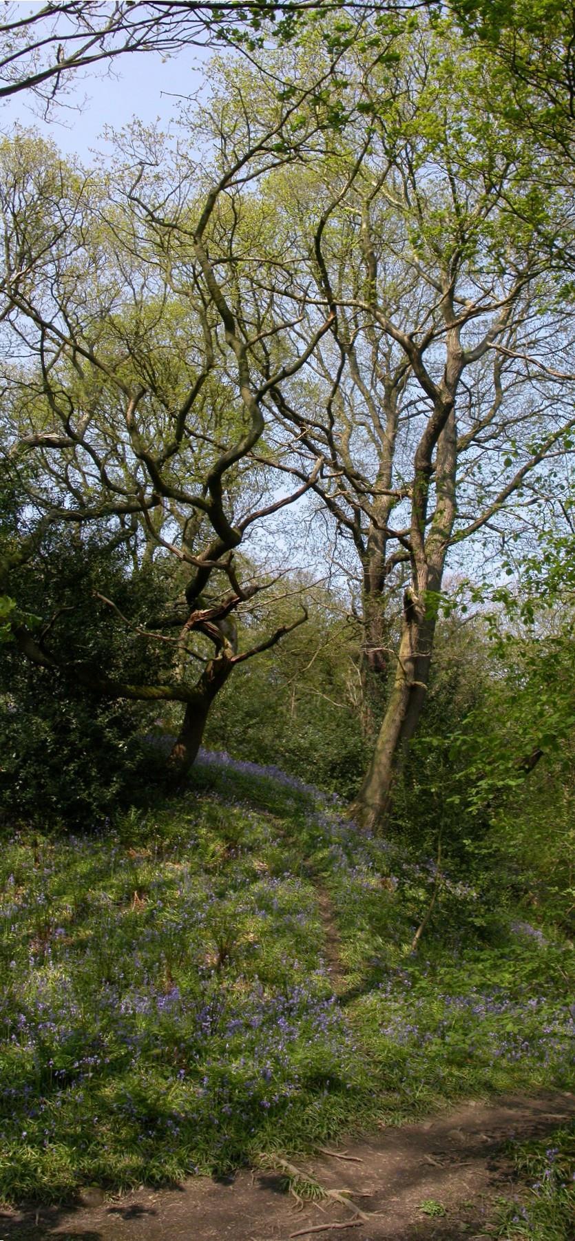
It was small group of us who set out on a sunny but windy day, and just being in such a beautiful spot made us all feel good!
 U3A field trip to Anchor Bottom, May 13 th 2016. It was small group of us who set out on a sunny but windy day, and just being in such a beautiful spot made us all feel good! As we walked in we spotted
North Lowther Energy Initiative National Vegetation Classification Survey Report Technical Appendix 8.1
 Document Quality Record Version Status Person Responsible Date 1 Draft Brian Henry 19/09/2016 2 Reviewed Rafe Dewar 21/09/2016 3 Updated Brian Henry 21/09/2016 4 Internal Approval Brian Henry 08/03/2017
Name Block Date. The Quadrat Study: An Introduction
 Name Block Date The Quadrat Study: An Introduction A quadrat study can almost be thought of as a snapshot of the ecosystem during a particular year and at a particular time of that year. The plant and
PURPOSE... i. Abbreviations... i. 1 Introduction Methods Compliance with Management Plans Results Discussion...
 PURPOSE... i Abbreviations... i 1 Introduction... 1 2 Methods... 3 3 Compliance with Management Plans... 5 4 Results... 6 5 Discussion... 8 6 Next Steps... 9 Appendix A... 1 Table 1 Flora monitoring
Environmental Science: Biomes Test
 Name: Date: Pd. VERSION 1 Environmental Science: Biomes Test 1. Eland are large herbivores with loose skin under the throat and neck. This patch of skin aids in lowering the body temperature when temperatures
Questions. Questions. Biodiversity. Biodiversity. Questions. Questions
 How can management effectively restore / recreate / How can management effectively restore / recreate / How can we determine the effectiveness of these biodiversity conservation efforts? Biological Scale
Organism Species Population Community Ecosystem
 Name: Date: Period: Ecosystems and Their Interactions S8.B.3.1 Getting the idea The environment is everything that surrounds an organism. Organisms cooperate and compete with each other to get everything
Between-observer variation in the application of a standard method of habitat mapping by environmental consultants in the UK
 Journal of Applied Ecology 1999, 36, Between-observer variation in the application of a standard method of habitat mapping by environmental consultants in the UK ANDREW CHERRILL and COLIN MCCLEAN* Ecology
CONTRIBUTIONS TO THE STUDY OF VEGETATION FROM THE NATURAL PARK VANATORI NEAMT
 DARABAN MIHAELA J. Plant Develop. 15 (2008): 89 98 CONTRIBUTIONS TO THE STUDY OF VEGETATION FROM THE NATURAL PARK VANATORI NEAMT DARABAN MIHAELA Sumary: As a result of the researches carried out between
RHOSYDD LLANPUMSAINT SITE OF SPECIAL SCIENTIFIC INTEREST
 RHOSYDD LLANPUMSAINT SITE OF SPECIAL SCIENTIFIC INTEREST Sam Bosanquet 2008 YOUR SPECIAL SITE AND ITS FUTURE Your Special Site and its Future is part of our commitment to improve the way we work with Site
5 th Grade Ecosystems Mini Assessment Name # Date. Name # Date
 An ecosystem is a community of organisms and their interaction with their environment. (abiotic, biotic, niche, habitat, population, community)- 1. Which effect does a decrease in sunlight have on a pond
Biome- complex of terrestrial communities that cover a large area; characterized by soil, climate, plants, and animals Plants and animals vary by
 Major Land Biomes Biome- complex of terrestrial communities that cover a large area; characterized by soil, climate, plants, and animals Plants and animals vary by tolerance to temperature and precipitation
Jeddah Knowledge International School
 Jeddah Knowledge International School Individuals and Societies Revision Pack ANSWER KEY 2016-2017 Quarter 3 Grade 7 Name: Section: Individual and Societies Revision Pack Grade Seven Quarter 3 Page 1 Question
Name Hour. Chapter 4 Review
 Name Hour Chapter 4 Review 1. The average, year-after-year conditions of temperature and precipitation within a particular region are its weather. climate. greenhouse effect. d. biotic factors. 2. The
Bell Ringer: February 6, 2013
 Bell Ringer: Please take 5 minutes to work on/ finish PBL BIOME MAP and PBL SCAVENGER HUNT! If you are finished with this, please take 5 minutes to write any last second questions about SCIENCE FAIR TONIGHT!
Chapter 7 Part III: Biomes
 Chapter 7 Part III: Biomes Biomes Biome: the major types of terrestrial ecosystems determined primarily by climate 2 main factors: Temperature and precipitation Depends on latitude or altitude; proximity
Environmental Statement South Kyle Wind Farm August Appendix 12.9: The Habitat Loss and Disturbance Calculations
 Appendix 12.9: The Habitat and Disturbance Calculations 1.1 Introduction 1 This appendix details the approach, assumptions and results of the process adopted to quantify habitat loss and degradation as
BIOMES. Copyright Cmassengale
 BIOMES Continental drift - slow motion of continents Dispersal of organisms Movement of organisms from 1 place to another Dispersal is usually caused by wind, water or living things Species that evolve
Lesson 9: California Ecosystem and Geography
 California Education Standards: Kindergarten, Earth Sciences 3. Earth is composed of land air, and water. As a basis for understanding this concept: b. Students know changes in weather occur from day to
Lecture 24 Plant Ecology
 Lecture 24 Plant Ecology Understanding the spatial pattern of plant diversity Ecology: interaction of organisms with their physical environment and with one another 1 Such interactions occur on multiple
ECOFACT Volume 1. The main objectives of the work which produced the present book were therefore:
 ECOFACT Volume 1 Introduction and Approach: Introduction The vegetation and land cover of the British countryside were surveyed in 199 by the Institute of Terrestrial Ecology under a contract from the
Our Living Planet. Chapter 15
 Our Living Planet Chapter 15 Learning Goals I can describe the Earth s climate and how we are affected by the sun. I can describe what causes different climate zones. I can describe what makes up an organisms
A Natura 2000 Monitoring Framework Using Plant Species Gradients for Spectral Habitat Assessment
 A Natura 2000 Monitoring Framework Using Plant Species Gradients for Spectral Habitat Assessment Carsten Neumann, Gabriele Weiß, Sibylle Itzerott Department 1 Section 1.4 Döberitzer Heide ASD spectroradiometer
Soil is formed from the weathering of rocks. Weathering: the breaking down of parent material (rock). There are 3 types of weathering:
. There are 3 types of weathering:") Soil is formed from the weathering of rocks. Weathering: the breaking down of parent material (rock). There are 3 types of weathering: Physical, Chemical Biological. The natural forces carry this out:
Soil is formed from the weathering of rocks. Weathering: the breaking down of parent material (rock). There are 3 types of weathering: Physical, Chemical Biological. The natural forces carry this out:
ARCH PROJET Activity 1 -Synthesis-
 ARCH PROJET Activity 1 -Synthesis- CONTENT 1 ARCH project context... 3 1.1. General context... 3 1.2. The ARCH Project... 3 1.3. The Project ARCH partners... 3 1.4. The ARCH project content... 4 2 Activity
Karr J.R. and D.R. Dudley Ecological perspective on water quality goals. Environmental Manager 5:55-68.
 Ecological Integrity Assessment: An Approach for Assessing Ecosystem Condition to Guide Conservation and Management Ecological Integrity " the ability of an ecosystem to support and maintain i a balanced
What determines: 1) Species distributions? 2) Species diversity? Patterns and processes
 Species distributions? 2) Species diversity? Patterns and processes") Species diversity What determines: 1) Species distributions? 2) Species diversity? Patterns and processes At least 120 different (overlapping) hypotheses explaining species richness... We are going to
Species diversity What determines: 1) Species distributions? 2) Species diversity? Patterns and processes At least 120 different (overlapping) hypotheses explaining species richness... We are going to
A contribution to the knowledge of Abies alba woodlands in the Campania and Basilicata regions (southern Italy)
") Fitosociologia vol. 42 (1): 71-95, 25 71 A contribution to the knowledge of Abies alba woodlands in the Campania and Basilicata regions (southern Italy) R. Di Pietro R. 1 & S. Fascetti 2 1 Dipartimento
Fitosociologia vol. 42 (1): 71-95, 25 71 A contribution to the knowledge of Abies alba woodlands in the Campania and Basilicata regions (southern Italy) R. Di Pietro R. 1 & S. Fascetti 2 1 Dipartimento
Pollen signals of ground flora in managed woodlands
 1 Pollen signals of ground flora in managed woodlands 2 3 4 5 6 7 8 9 10 Bunting, M.J. a*, Grant, M.J. b and Waller, M. c a Department of Geography, Environment and Earth Sciences, University of Hull,
Barcode UK: saving plants and pollinators using DNA barcoding
 Barcode UK: saving plants and pollinators using DNA barcoding Natasha de Vere National Botanic Garden of Wales Gwyddoniaeth yng Ngardd Cymru Science @ the Garden of Wales Cefnogi planhigion, peillwyr a
Chapter 3 Populations and interactions
 Chapter 3 Populations and interactions Worksheet 1: Definitions Worksheet 2: Succession *Practical 1: Investigating the distribution of plants using random sampling *Practical 2: Investigating the distribution
Ecosystems Chapter 4. What is an Ecosystem? Section 4-1
 Ecosystems Chapter 4 What is an Ecosystem? Section 4-1 Ecosystems Key Idea: An ecosystem includes a community of organisms and their physical environment. A community is a group of various species that
Object based modelling of habitats with EO data: Semantic and technical challenges to achieve interoperability
 Object based modelling of habitats with EO data: Semantic and technical challenges to achieve interoperability Michael Bock, DLR Space Agency 1.07.2010 Folie 1 Vortrag > Autor > Dokumentname > 09.11.2005
New Results of Critical Load Calculation including Biodiversity
 33 rd ICP M & M Task Force Meeting New Results of Critical Load Calculation including Biodiversity Hans-Dieter Nagel, Angela Schlutow & Yolandi Bouwer (OEKO-DATA) Markus Geupel & Thomas Scheuschner (UBA)
Salix are the UK s largest grower of native wetland and wildflowering plants in the UK.
 Habitat Plant Mixes: Salt Marsh Sand Dune Moorland Salix are the UK s largest grower of native wetland and wildflowering plants in the UK. In response to demand for a wider range of species for specific
Evaluating Wildlife Habitats
 Lesson C5 4 Evaluating Wildlife Habitats Unit C. Animal Wildlife Management Problem Area 5. Game Animals Management Lesson 4. Evaluating Wildlife Habitats New Mexico Content Standard: Pathway Strand: Natural
Managing uncertainty when aggregating from pixels to parcels: context sensitive mapping and possibility theory
 Department of Geography Managing uncertainty when aggregating from pixels to parcels: context sensitive mapping and possibility theory Dr Lex Comber ajc36@le.ac.uk www.le.ac.uk/gg/staff/academic_comber.htm
20 Common Urban Plants in Ireland
 20 Common Urban Plants in Ireland Leaflet produced by Phoebe O'Brien based on species seen during a Heritage Week walk in August 2017 Annual Meadow-grass (Poa annua) The small Annual Meadow-grass has white
3 Communities, Biomes, and Ecosystems BIGIDEA Write the Big Idea for this chapter.
 3 Communities, Biomes, and Ecosystems BIGIDEA Write the Big Idea for this chapter. Use the What I Know column to list the things you know about the Big Idea. Then list the questions you have about the
What IS a biological community?
 BES 36 00 What IS a biological community? Describing Biological Communities Spatial Scales of Organization in Biological Systems How do we describe a biological community? Physical characteristics of the
Biomes Section 1. Chapter 6: Biomes Section 1: What is a Biome? DAY ONE
 Chapter 6: Biomes Section 1: What is a Biome? DAY ONE What is a Biome? Biomes are large regions characterized by a specific type of climate and certain types of plant and animal communities. The climate
Biosphere Biome Ecosystem Community Population Organism
 Ecology ecology - The study of living things and how they relate to their environment Levels of Organization in Ecology organism lowest level one living thing population collection of organisms of the
Background information of groundwater dependent ecosystems (GDE) on Estonian Gauja-Koiva river basin
 on Estonian Gauja-Koiva river basin") Background information of groundwater dependent ecosystems (GDE) on Estonian Gauja-Koiva river basin Elve Lode & Martin Küttim Content Some facts about the Koiva river Something about GDEs Ecological data
Background information of groundwater dependent ecosystems (GDE) on Estonian Gauja-Koiva river basin Elve Lode & Martin Küttim Content Some facts about the Koiva river Something about GDEs Ecological data
Crossword puzzles! Activity: stratification. zonation. climax community. succession. Match the following words to their definition:
 Activity: Match the following words to their definition: stratification zonation climax community succession changing community structure across a landscape changing community composition over time changes
STUDIES IN PHRENOLOGY, No. 2, BY FRANCIS DARWIN.
 FRANCS DARWN STUDS N PHRNOOGY,, 10. BY FRANCS DARWN. s paper is a continuation of my "Phaenological Study" pub- 1 lished in Nos. and of The New Phytologist, 1, November and December, 11. All my earlier
Weeds, Exotics or Invasives?
 Invasive Species Geography 444 Adopted from Dr. Deborah Kennard Weeds, Exotics or Invasives? What is a weed? Invasive species? 1 Weeds, Exotics or Invasives? Exotic or non-native: Non-native invasive pest
C1 Weeds in North Queensland
 C1 Weeds in North Queensland Introduction This presentation covered Siam weed (Chromolaena odorata), the Four Tropical Weeds (Miconia spp., Mikania macrantha, Clidemia hirta, Limnocharis flava), and Mimosa
Habitats and Adaptations
 The Unit Organizer 4 BIGGER PICTURE NAME DATE 2 8 LAST UNIT/Experience CURRENT CURRENT UNIT UNIT NEXT UNIT/Experience 1 3 Biomes UNIT SCHEDULE 1 intro 2 Abiotic and Biotic 3 Terrestrial and aquatic 4 creation
The table below shows the number of plants he found in a sample area of 1 m 2. Common heather 2. Red fescue 14. Vetch 2.
 Q1.A student investigated the distribution of plants in a heathland. The table below shows the number of plants he found in a sample area of 1 m 2. Species of plant Number counted in 1 m 2 Common heather
Chapter 8: Biogeography. Biotic Provinces. Biotic Provinces. Biotic Provinces 10/4/2012
 Chapter 8: Biogeography Why were introductions of new species into Europe so popular long ago? In 1749 Linneaus sent a colleague to NA to collect plants Desired for use in decorative gardens Climate similar
Chapter 52 An Introduction to Ecology and the Biosphere
 Chapter 52 An Introduction to Ecology and the Biosphere Ecology The study of the interactions between organisms and their environment. Ecology Integrates all areas of biological research and informs environmental
What Shapes an Ecosystem? Section 4-2 pgs 90-97
 What Shapes an Ecosystem? Section 4-2 pgs 90-97 What Shapes an Ecosystem? If you ask an ecologist where a particular organism lives, that person might say the organism lives on a Caribbean coral reef,
Quizizz. Mean Green Science: Interdependency Date and: Life Science Quiz 2. Name : Class : What is a producer?
 Quizizz Name : Class : Mean Green Science: Interdependency Date and: Life Science Quiz 2 1. What is a producer? a) an organism that gets energy from eating other organisms c) an organism that gets energy
Grade Level Suggestion: Grades 4 th to 8 th. Time Frame: minutes.
 I Have, Who Has? An Interactive Vocabulary Game Prairie Ecosystem Study Vocabulary Grades 4 th -8th Introduction: Below is a collection of cards that connect to the Prairie Study Vocabulary for 4 th -
Introduction. Ecology is the scientific study of the interactions between organisms and their environment.
 Introduction Ecology is the scientific study of the interactions between organisms and their environment. 1. The interactions between organisms and their environments determine the distribution and abundance
Most natural ecosystems are in a state of equilibrium. This means that their biotic and abiotic features remain relatively constant over time.
 Most natural ecosystems are in a state of equilibrium. This means that their biotic and abiotic features remain relatively constant over time. The major biomes, for example, usually maintain a characteristic
Biomes. What is a Biome?
 Biomes What is a Biome? Ecosystems can be grouped into larger categories called biomes Biome A collection of ecosystems that are related to each other, usually based on the type of places they support
Pollen signals of ground flora in managed woodlands. M.J. Bunting, M.J. Grant, M. Waller
 Accepted Manuscript Pollen signals of ground flora in managed woodlands M.J. Bunting, M.J. Grant, M. Waller PII: S0034-6667(15)00182-7 DOI: doi: 10.1016/j.revpalbo.2015.10.001 Reference: PALBO 3691 To
D. Adaptive Radiation
 D. Adaptive Radiation One species new species: A new species: B new species: C new species: D Typically occurs when populations of a single species... invade a variety of new habitats, evolve under different
Ecological Succession
 Ecological Succession Most natural ecosystems are in a state of equilibrium. This means that their biotic and abiotic features remain relatively constant over time. The major biomes, for example, usually
Dune habitat conservation status assessment review
 Annotated document key - Item Summary Emphasis Dune habitat conservation status assessment review CCW carried out an assessment of the condition of the dune habitats of the SAC in the summer of 2005 and
Organism Interactions in Ecosystems
 Organism Interactions in Ecosystems Have you ever grown a plant or taken care of a pet? If so, you know they have certain needs such as water or warmth. Plants need sunlight to grow. Animals need food
Higher Geography Biosphere Vegetation Succession: Sand Dunes
 Higher Geography Biosphere Vegetation Succession: Sand Dunes A PowerPoint resource to accompany the posters available at: http://www.macaulay.ac.uk/soilposters/education_vegetation_6v2.pdf http://www.macaulay.ac.uk/soilposters/education_vegetation_7v2.pdf
CARMEN AONCIOAIE * Introduction
 Analele ştiinţifice ale Universităţii Al. I. Cuza Iaşi Tomul LVII, fasc. 2, s. II a. Biologie vegetală, 2011 NEW CONTRIBUTIONS TO THE STUDY OF THE ASSOCIATIONS FROM QUERCO FAGETEA BR. BL. ET VLIEGER IN
Vegetation and Terrestrial Wildlife
 Vegetation and Terrestrial Wildlife Vegetation Plant Communities Disturbance Unique Communities Wildlife Amphibians and Reptiles Birds Mammals Terrestrial Ecology: Vegetation Goals of vegetation sampling
Visualising Types of Uncertainty in Spatial Information
 Visualising Types of Uncertainty in Spatial Information Peter Fisher City University, London National Academy of Sciences, 3-4 March 2005 Outline Issues The Problem The variety and levels of uncertainty
Section A: Multiple choice (30 Marks)
") Grade 7 Science Unit 1 SAMPLE TEST Section A: Multiple choice (30 Marks) 1. Which term defines a group of interacting living and non-living things? A. community B. ecosystem C. habitat D. niche 2. Which
Grade 7 Science Unit 1 SAMPLE TEST Section A: Multiple choice (30 Marks) 1. Which term defines a group of interacting living and non-living things? A. community B. ecosystem C. habitat D. niche 2. Which
Listening. The Air. Did you know? Did you know?
 Listening 1. Find a place to sit. 2. Close your eyes and listen carefully to all the sounds you can hear. Cup your hands around your ears and turn your head to help you listen in particular directions.
PHYTOCOENOLOGIC STUDY OF THE EUROPEAN BEECH STAND FOREST FROM ORMANU VALLEY SPRINGS (CODRU- MOMA MOUNTAINS)
") Analele Universităţii din Oradea, Fascicula Protecţia Mediului Vol. XXV, 15 PHYTOCOENOLOGIC STUDY OF THE EUROPEAN BEECH STAND FOREST FROM ORMANU VALLEY SPRINGS (CODRU- MOMA MOUNTAINS) Păşcuţ Călin Gheorghe*
Analele Universităţii din Oradea, Fascicula Protecţia Mediului Vol. XXV, 15 PHYTOCOENOLOGIC STUDY OF THE EUROPEAN BEECH STAND FOREST FROM ORMANU VALLEY SPRINGS (CODRU- MOMA MOUNTAINS) Păşcuţ Călin Gheorghe*
BIOMES. Copyright Cmassengale
 BIOMES Biogeography - study of where organisms live Continental drift - slow motion of continents Dispersal of organisms Movement of organisms from 1 place to another Dispersal is usually caused by wind,
Community Ecology Bio 147/247 Species Richness 3: Diversity& Abundance Deeper Meanings of Biodiversity Speci es and Functional Groups
 Community Ecology Bio 147/247 Species Richness 3: Diversity& Abundance Deeper Meanings of Biodiversity Speci es and Functional Groups The main Qs for today are: 1. How many species are there in a community?
The area on and near the Earth s surface where living things exist. The biosphere:
 The area on and near the Earth s surface where living things exist The biosphere: The Biosphere If you use an apple to model the world, which part of the apple would represent the biosphere? Today define:
Utilization. Utilization Lecture. Residue Measuring Methods. Residual Measurements. 24 October Read: Utilization Studies and Residual Measurements
 Utilization Utilization Lecture 24 October Read: Utilization Studies and Residual Measurements Utilization is the proportion or degree of current year s forage production that is consumed or destroyed