EMODnet data. Flanders Marine Institute. Simon Claus. A. Giorgetti, D. Schaap, A. Novellino, A. Pititto, H.Lilis, V. Henry, T.
|
|
|
- Abraham Elvin Barrett
- 5 years ago
- Views:
Transcription

1 EMODnet data Simon Claus A. Giorgetti, D. Schaap, A. Novellino, A. Pititto, H.Lilis, V. Henry, T. Schmitt Flanders Marine Institute
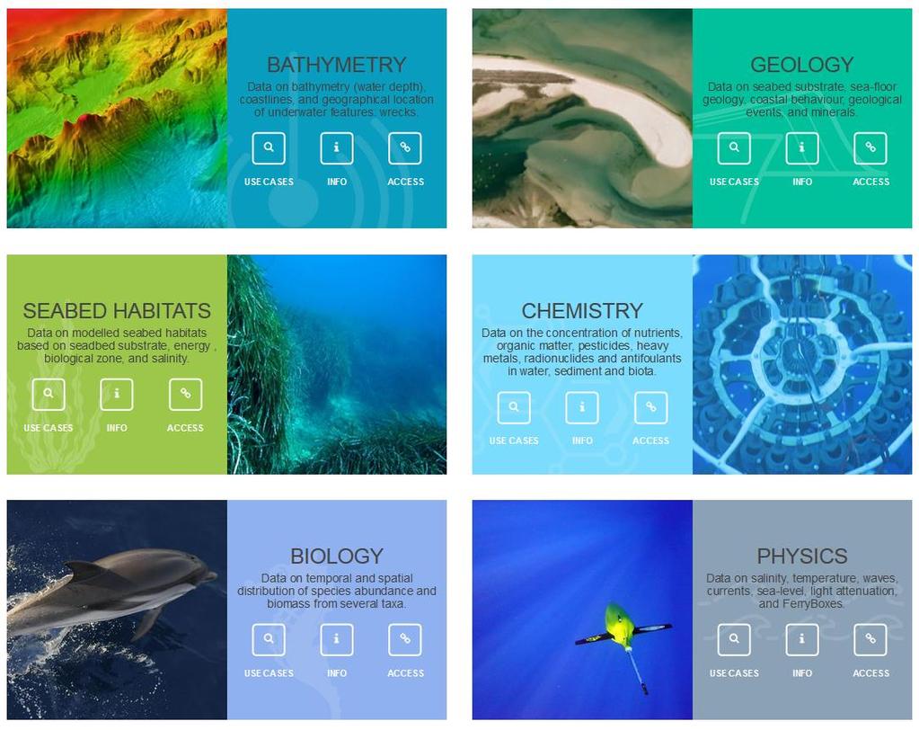
2 EMODnet data themes Types of Data Vocabularies Data Exchange Format Metadata 11/16/2017 2

3


4 Overall objectives The objective is to assemble data from public and private organisations relating to the state of sea basins; processing them into interoperable formats which includes agreed standards, assessments of their accuracy and precision, making them available and creating data products; 4 EMODnet November 16, 2017
5 Bathymetry
 - Minimum cell water depth - Maximum cell water depth - Average cell water depth - Standard deviation of cell water")

6 Types of data Water depth (Referring to the Lowest Astronomical Tide LAT) in gridded form on a DTM grid of 1/8 * 1/8 arc minute (ca 230 * 230 m) - Minimum cell water depth - Maximum cell water depth - Average cell water depth - Standard deviation of cell water depth - Number of values used for interpolation of depth Products: Depth contours Mean depth full coverage with land coverage Mean depth in multi colour Mean depth rainbow colour ramp Source references Raw data: Plummet, single beam, multibeam echosoundings, LIDAR data
7 Vocabularies Water depth (Referring to the Lowest Astronomical Tide LAT) in gridded form on a DTM grid of 1/8 * 1/8 arc minute (ca 230 * 230 m) Products: Depth contours Mean depth full coverage with land coverage Mean depth in multi colour Mean depth rainbow colour ramp Source references Raw data: Plummet, single beam, multibeam echosoundings, LIDAR data Standard terms using SeaDataNet Vocabs P01 & P02 (SeaDataNet Parameter Discovery)
8 Data Exchange Format Water depth (Referring to the Lowest Astronomical Tide LAT) in gridded form on a DTM grid of 1/8 * 1/8 arc minute (ca 230 * 230 m) WMS Rest Service Products: Depth contours Mean depth full coverage with land coverage Mean depth in multi colour Mean depth rainbow colour ramp Source references Raw data: Plummet, single beam, multibeam echosoundings, LIDAR data WMS/WFS Two standard data exchange formats : ASCII ODV spreadsheet binary SeaDataNet NetCDF
9 Metadata Water depth (Referring to the Lowest Astronomical Tide LAT) in gridded form on a DTM grid of 1/8 * 1/8 arc minute (ca 230 * 230 m) Products: Depth contours Mean depth full coverage with land coverage Mean depth in multi colour Mean depth rainbow colour ramp Source references Raw data: Plummet, single beam, multibeam echosoundings, LIDAR data INSPIRE (see: INSPIRE (see: Common Data Index (CDI) (xml ISO 19139) for data points
10 Geology


11 Types of data Seabed substrate Scale 1: Scale 1: WP3: Seabed substrate, scale 1:1 M and 1:250k, later 1:100k WP3: Sedimentation rate Other Products: Sediment accumulation rate Sea-floor geology Seabed lithology Stratigraphy Coastline migration Geological events Aggregate resources WP4: Sea-floor geology, lithology, geomorphology WP5: Coastal behaviour
12 Vocabularies Seabed substrate Scale 1: Scale 1: Other Products: Sediment accumulation rate Sea-floor geology Seabed lithology Stratigraphy Coastline migration Aggregate resources Geological events Submerged landscapes Four substrate classes using the Folk triangle (mud to sandy mud; sand; coarse sediment; and mixed sediment) and one additional substrate class (rock and boulders)
13 Data Exchange Format Seabed substrate Scale 1: Scale 1: WMS/WFS Other Products: Sediment accumulation rate Sea-floor geology Seabed lithology Stratigraphy Coastline migration Aggregate resources Geological events Submerged landscapes WMS/WFS
14 Metadata Seabed substrate Scale 1: Scale 1: Other Products: Sediment accumulation rate Sea-floor geology Seabed lithology Stratigraphy Coastline migration Aggregate resources Geological events Submerged landscapes INSPIRE - Geonetwork See: eonetwork/emodnet/eng/ catalog.search#/home
15 Seabed Habitats


16 Compilation of existing data Types of data Year 1 key outputs Year 2 key outputs * New schema and process for exchanging habitat point data Additional data pub Points - sample data (e.g. * Data owned by project at least one dataset from grabs, imagery) partners published via the partner country in e portal Polygons - habitat maps from surveys Rasters predictions of individual habitat likelihood from models Maps identified as part of tender proposal, published Model outputs identified as part of the review, published * Additional maps p including at least on non-partner countr * Composite data p combine & harmon habitat maps in diff Additional model ou
17 Compilation of existing data Vocabularies Year 1 key outputs Year 2 key outputs * New schema e.g. and process for exchanging habitat point data Additional data pub Points - sample data (e.g. * Data owned EUNIS by habitat project classification at least one dataset from grabs, imagery) partners system: published via the partner country in e portal ulary/biodiversity/eunishabitats/vi * Additional maps p ew (on EIONET) including at least on Polygons - habitat maps Maps identified as part of non-partner countr from surveys tender proposal, Habitats published Directive Annex * Composite I: data p combine & harmon ulary/biodiversity/n2000habitats/ maps in diff Rasters predictions of view (on EIONET) Model outputs identified as part individual habitat Additional model ou of the review, published likelihood from models
18 Compilation of existing data Data exchange formats Year 1 key outputs Year 2 key outputs * New schema and process for exchanging OBIS habitat Env point datascheme Additional (cfr data pub Points - sample data (e.g. * Data owned Biology) by project from grabs, imagery) Polygons - habitat maps from surveys Rasters predictions of individual habitat likelihood from models partners published via the portal Maps identified as part of tender proposal, published Model outputs identified as part of the review, published at least one dataset partner country in e * Additional maps p including at least on non-partner countr * Composite data p combine & harmon habitat maps in diff See (standardised attribute tables associated to shape files) Additional model ou
 habitat point data Additional data pu Points - sample data (e.g. from grabs, imagery) Polygons - habitat maps from surveys Rasters predictions of individual")

19 Compilation of existing data Metadata Year 1 key outputs Year 2 key output * New INSPIRE schema and process for exchanging (see: habitat point data Additional data pu Points - sample data (e.g. from grabs, imagery) Polygons - habitat maps from surveys Rasters predictions of individual habitat likelihood from models * Data owned by project partners published via the portal Maps identified as part of tender proposal, published Model outputs identified as part of the review, published at least one datase partner country in * Additional maps including at least o non-partner count * Composite data combine & harmon habitat maps in dif Additional model o
20 Chemistry


21 Types of data Group Examples Point - sample data on 3 matrices: - water column; - biota; - sediment Eutrophication Ocean acidification Pollution Marine Litter nutrients, dissolved gasses... acidity hydrocarbons, heavy metals, pesticides, beach litter, seabed litter, microlitter N, P, Si, Oxy, Chl-a ph, pco2 anthracene, fluroanthene, Me, Cd, Produces polygons concentration maps - main nutrients - oxygen - chlorophyll Time series of data points dynamic plots
22 Vocabularies Point - sample data on 3 matrices: - water column; - biota; - sediment Standard terms using SeaDataNet Vocabs P01 & P02 (SeaDataNet Parameter Discovery Vocabulary) Produces polygons concentration maps - main nutrients - oxygen - chlorophyll Time series of data points dynamic plots
23 Data Exchange Format Point - sample data on 3 matrices: - water column; - biota; - sediment Two standard data exchange formats : ASCII ODV spreadsheet binary SeaDataNet NetCDF Produces polygons concentration maps - main nutrients - oxygen - chlorophyll Time series of data points dynamic plots One NetCDF CF format for gridded maps WMS/WFS One NetCDF CF format for dynamic plots
24 Metadata Point - sample data on 3 matrices: - water column; - biota; - sediment Common Data Index (CDI) (xml ISO 19139) for data points Produces polygons concentration maps - main nutrients - oxygen - chlorophyll Time series of data points dynamic plots INSPIRE (see: INSPIRE (see:
25 Biology

26 Types of data Point occurrence data: - Species - Abundance - Biomass - Linked environmental data Biological Components Phytoplankton Zooplankton Benthos Fish Birds Mammals Reptiles Seagrasses Microalgae Macroalgae Produces polygons gridded abundance maps - Zooplankton - Fish & benthos - Some mammals, birds, reptiles Species traits & attributes - Invasive; protected, indicator species - Bodysize, skeleton, feeding type, functional group
27 Vocabularies Point occurrence data: - Species - Abundance - Biomass - Linked environmental data Produces polygons gridded abundance maps - Zooplankton - Fish & benthos - Some mammals, birds, reptiles Species traits & attributes - Invasive; protected, indicator species - Bodysize, skeleton, feeding type, functional group Taxonomy: World Register of Marines Species (WoRMS) Functional traits: World Register of Marine Traits ( aits/wiki/)
28 Data Exchange Format Point occurrence data: - Species - Abundance - Biomass - Linked environmental data Produces polygons gridded abundance maps - Zooplankton - Fish & benthos - Some mammals, birds, reptiles Species traits & attributes - Invasive; protected, indicator species - Bodysize, skeleton, feeding type, functional group OBIS ENV Data Exchange Scheme (Darwin Core Terms) Occurrence Scheme Events Scheme Measurements or Facts WMS/WFS One NetCDF format for gridded maps WMS/WFS WoRMS Data Scheme
29 Metadata Point occurrence data: - Species - Abundance - Biomass - Linked environmental data Produces polygons gridded abundance maps - Zooplankton - Fish & benthos - Some mammals, birds, reptiles IMIS (ISO 19115) INSPIRE ( odnet/eng/catalog.search#/home) Species traits & attributes - Invasive; protected, indicator species - Bodysize, skeleton, feeding type, functional group
30 Physics
 Atmospheric parameters at sea level River data Physical parameters Sea water salinity or density Sea level Water clarity (light attenuation) Underwater")
31 Types of data Near real-time (NRT) data at fixed measuring stations and by automatic observatories at sea Archived data derived from further elaboration and validation Sea water temperature Sea water currents Waves and winds (speed & direction) Atmospheric parameters at sea level River data Physical parameters Sea water salinity or density Sea level Water clarity (light attenuation) Underwater noise Data products Sealevel; Ice coverage Temp/Sal; Sea surface currents River runoff
32 Vocabularies Near real-time (NRT) data at fixed measuring stations and by automatic observatories at sea Standard terms using CF convention and SeaDataNet Vocabs P02 Archived data derived from further elaboration and validation Standard terms using SeaDataNet Vocabs P02 (SeaDataNet Parameter Discovery Vocabulary) Data products Sealevel; Ice coverage Temp/Sal; Sea surface currents River runoff
33 Data Exchange Format Near real-time (NRT) data at fixed measuring stations and by automatic observatories at sea Archived data derived from further elaboration and validation Data products Sealevel; Ice coverage Temp/Sal; Sea surface currents River runoff NetCDF format WMS/WFS THREDDS OpenDAP/ERDDAP Two standard data exchange formats : ASCII ODV spreadsheet binary SeaDataNet NetCDF NetCDF CF format for gridded maps WMS/WFS THREDDS OpenDAP/ERDDAP
34 Metadata Near real-time (NRT) data at fixed measuring stations and by automatic observatories at sea Embedded into the NetCDF files Archived data derived from further elaboration and validation Data products Sealevel; Ice coverage Temp/Sal; Sea surface currents River runoff Common Data Index (CDI) (xml ISO 19139) for data points INSPIRE (see:
35 Human Activities
 Polygons Spatial extent and intensity of the different human activities (e.g. dumped munition, fish catches, wind farms, etc.")
36 Types of data Point Spatial extent and intensity of the different human activities (e.g. aggregate extraction, cultural heritage, aquaculture, main ports, etc.) Polygons Spatial extent and intensity of the different human activities (e.g. dumped munition, fish catches, wind farms, etc.) Aggregate Extraction Cultural Heritage Dumped munitions First sales of fish Main ports (traffic) Pipelines and Cables State of bathing waters Waste Disposal Activities Aquaculture Dredging Fish catches Hydrocarbon Extraction Ocean Energy Facilities Protected areas Wind Farms Other forms of area management Raster Vessel density maps of EU waters, based on AIS data (soon to be available)
37 Vocabularies Point Spatial extent and intensity of the different human activities (e.g. aggregate extraction, cultural heritage, aquaculture, main ports, etc.) Polygons Spatial extent and intensity of the different human activities (e.g. dumped munition, fish catches, wind farms, etc.) No previous existing vocabulary. Now terms have been added to SeaDataNet P02 P03 vocabularies Raster Vessel density maps of EU waters, based on AIS data (soon to be available)
38 Data Exchange Format Point Spatial extent and intensity of the different human activities (e.g. aggregate extraction, cultural heritage, aquaculture, main ports, etc.) Polygons Spatial extent and intensity of the different human activities (e.g. dumped munition, fish catches, wind farms, etc.) Raster Vessel density maps of EU waters, based on AIS data (soon to be available) Standardised attribute tables associated to shape files WMS/WFS Coverages representing space/time-varying phenomena that relate a spatio-temporal domain to a range of properties WCS
39 Metadata Point Spatial extent and intensity of the different human activities (e.g. aggregate extraction, cultural heritage, aquaculture, main ports, etc.) Polygons Spatial extent and intensity of the different human activities (e.g. dumped munition, fish catches, wind farms, etc.) INSPIRE - Geonetwork See: eonetwork/emodnet/eng/ catalog.search#/home Raster Vessel density maps of EU waters, based on AIS data (soon to be available)

40

41

42
v=7tat9croynk&feature=youtu.be
 https://www.youtube.com/watch? v=7tat9croynk&feature=youtu.be Malta Summer School 2018 Operational Oceanography for Blue Growth EMODnet in a nutshell: unlocking, and offering access to, European marine
Data and data product catalogue. Preliminary version May 2018
 Data and data product catalogue Preliminary version May 2018 This document has been produced by the EMODnet Secretariat. All the maps have been extracted from the EMODnet thematic portals. Data Data products
The European Marine Observation and Data Network. EU-China Blue Year Event 1 June,
 The European Marine Observation and Data Network EU-China Blue Year Event 1 June, 2017 secretariat@emodnet.eu info@emodnet.eu There is only one Earth, with only one history, and we get only one chance
Introduction to EMODnet
 Introduction to EMODnet Antonio Novellino Torino, 14-15 Ottobre 2015 What is EMODnet? Initiated by the European Commission in response to the EU Future Maritime Policy and Blue Growth, launched in June
EMODnet High Resolution Seabed Mapping - further developing and providing a high resolution digital bathymetry for European seas
 EMODnet High Resolution Seabed Mapping - further developing and providing a high resolution digital bathymetry for European seas EGU Fall 2017 meeting New Orleans USA, December 2017 Schaap Dick MARIS,
New EU efforts to assess the state of the marine environment: the EMODnet Chemistry pilot project
 New EU efforts to assess the state of the marine environment: the EMODnet Chemistry pilot project Matteo Vinci and Alessandra Giorgetti, OGS NODC group, OCE September 2013 - IMDIS 2013, Lucca Overview
EMODnet High Resolution Seabed Mapping - further developing a high resolution digital bathymetry for European seas
 EMODnet High Resolution Seabed Mapping - further developing a high resolution digital bathymetry for European seas IMDIS 2018 Conference, 7 November 2018, Barcelona - Spain Thierry Schmitt Dick M.A. Schaap
Bathymetry. EMODnet Stakeholder Conference & Sea-basin Workshops February Bathymetry
 EMODnet Stakeholder Conference & Sea-basin Workshops 14-15 February 2017 Arctic checkpoint Belinda Kater On behalf of all Checkpoints http://www.emodnet.eu 1 ? is the study of the "beds" or "floors" of
Spatial Data Infrastructure for Marine Environnement Ifremer initiatives in France and in Europe
 E. Quimbert, M. Bellouis, F. Lecuy, M. Treguer Centre de Bretagne BP 70, Plouzané 29280 France E-mail: sextant@ifremer.fr Spatial Data Infrastructure for Marine Environnement Ifremer initiatives in France
BalticBOOST Appendix 1, WP 3.3 Deliverable 1 Final report 14 February 2017
 Theme 1: Biodiversity This is a deliverable from the BalticBOOST project that was coordinated by HELCOM and co-financed by the European Union in 2015-2016 as part of the programme DG ENV/MSFD Action Plans/2016.
GEBCO 2013 TSCOM. EMODNET Hydrography status report
 www.emodnet-hydrography.eu GEBCO 2013 TSCOM EMODNET Hydrography status report Eric Moussat, Ifremer on behalf of the Emodnet consortium 1 Background and objectives EU proposed to take steps in 2008 towards
European Commission STUDY ON INTERIM EVALUATION OF EUROPEAN MARINE OBSERVATION AND DATA NETWORK. Executive Summary
 European Commission STUDY ON INTERIM EVALUATION OF EUROPEAN MARINE OBSERVATION AND DATA NETWORK Executive Summary by NILOS Netherlands Institute for the Law of the Sea June 2011 Page ii Study on Interim
Physiography Ocean Provinces p. 1 Dimensions p. 1 Physiographic Provinces p. 2 Continental Margin Province p. 2 Deep-Ocean Basin Province p.
 Physiography Ocean Provinces p. 1 Dimensions p. 1 Physiographic Provinces p. 2 Continental Margin Province p. 2 Deep-Ocean Basin Province p. 2 Mid-Ocean Ridge Province p. 3 Benthic and Pelagic Provinces
Introduction to Acoustic Remote Sensing and Seafloor Mapping (AE4-E13) May 19, 2010
 May 19, 2010") Introduction to Acoustic Remote Sensing and Seafloor Mapping (AE4-E13) May 19, 2010 1 Delft Vermelding Institute onderdeel of Earth organisatie Observation and Space Systems Why Acoustic Remote Sensing?
Introduction to Acoustic Remote Sensing and Seafloor Mapping (AE4-E13) May 19, 2010 1 Delft Vermelding Institute onderdeel of Earth organisatie Observation and Space Systems Why Acoustic Remote Sensing?
Inspire Conference Istanbul, 2012 Ralf Lindgren. Inspire Conference Istanbul, 2012 Ralf Lindgren
 Background A Baltic Sea Bathymetry Database Concept and Hans Öiås Swedish Maritime Administration Hydrographic Office A national directive: The Swedish Maritime Administration shall, in cooperation with
INDICATORS FOR INTEGRATED COASTAL ZONE MANAGEMENT (ICZM)
") IOC UNESCO / Leader Task 4.1 Contact Francesca Santoro, Julian Barbiere E-mail: f.santoro@unesco.org, j.barbiere@unesco.org Phone: +33 1 45683952 How to cite this factsheet: PEGASO Consortium. 2013. Area
IOC UNESCO / Leader Task 4.1 Contact Francesca Santoro, Julian Barbiere E-mail: f.santoro@unesco.org, j.barbiere@unesco.org Phone: +33 1 45683952 How to cite this factsheet: PEGASO Consortium. 2013. Area
Data Exchange Formats (DEFs)
") Data Exchange Formats (DEFs) Contents A: Original Habitat DEF... 2 B: Translated Habitat DEF... 5 C: Habitats Directive DEF... 8 D: Study Area DEF... 9 Introduction This document describes the Data Exchange
Data Exchange Formats (DEFs) Contents A: Original Habitat DEF... 2 B: Translated Habitat DEF... 5 C: Habitats Directive DEF... 8 D: Study Area DEF... 9 Introduction This document describes the Data Exchange
Inspire Marine OF and SR TWG Keiran Millard, Group Manager, SeaZone
 Inspire Marine OF and SR TWG Keiran Millard, Group Manager, SeaZone On behalf og the Inspire TWG OF+SR Keiran Millard, Marc Roesbeke, Hans Mose Jensen, Dominic Lowe, Alessandro Serratta, Nuria Hermida,
Mapping of marine habitats in shallow coastal areas in Denmark
 6 th Workshop Seabed Acoustics, Rostock, November 14/15, 2013 P11-1 Mapping of marine habitats in shallow coastal areas in Denmark Dr. Zyad Al-Hamdani Geological Survey of Denmark and Greenland - GEUS
MESMA: An integrated tool box to support an ecosystem based spatial management of marine areas
 MESMA: An integrated tool box to support an ecosystem based spatial management of marine areas Stelzenmüller, V., Stamford, T., Vassilopoulou, V., Kastanevakis, S., Vincx, M, Vanaverbeke, J., Rabaut, M.,
Dynamic preservation of the coastline
 Dynamic preservation of the coastline Content Introduction The Dutch coastal defence by dynamic processes Data collection Management of the sand resources Growing importance of marine sand and gravel resources
Environmental impact assessment study of the new offshore dumping sites for Šventoji port in Lithuania
 Environmental impact assessment study of the new offshore dumping sites for Šventoji port in Lithuania Introduction Summary In 2003 Lithuanian Ministry of Transport initiated the preparation of feasibility
9693 MARINE SCIENCE. Mark schemes should be read in conjunction with the question paper and the Principal Examiner Report for Teachers.
 CAMBRIDGE INTERNATIONAL EXAMINATIONS GCE Advanced Subsidiary Level and GCE Advanced Level www.xtremepapers.com MARK SCHEME for the May/June 01 series 969 MARINE SCIENCE 969/01 Paper 1 (AS Structured Questions),
ESBN. Working Group on INSPIRE
 ESBN Working Group on INSPIRE by Marc Van Liedekerke, Endre Dobos and Paul Smits behalf of the WG members WG participants Marc Van Liedekerke Panos Panagos Borut Vrščaj Ivana Kovacikova Erik Obersteiner
The Baltic Sea Region Maritime Spatial Planning Data Expert Sub-group. First Report 2015/2016/
 The Baltic Sea Region Maritime Spatial Planning Data Expert Sub-group First Report 2015/2016/2017 21.04.2017. Contents 1. Glossary 2 2. Introduction. 3 3. MSP Data. 5 3.1. Input Data. 5 3.2 Output Data.
Harmonisation of Spatial Planning Data
 INSPIRE Conference 18 June 2011 Edinburgh, Great Britain Harmonisation of Spatial Planning Data Tomas Mildorf University of West Bohemia mildorf@centrum.cz Pilsen, Czech Republic Co-funded by the Community
Specification & Content of Marine Reference Information
 Specification & Content of Marine Reference Information By Mike Osborne and James Rapaport SeaZone Solutions Limited CONTENTS 1. History of Marine Data 2. User Requirements 3. Geographic Content 4. SeaZone
INSPIREd solutions for Air Quality problems Alexander Kotsev
 INSPIREd solutions for Air Quality problems Alexander Kotsev www.jrc.ec.europa.eu Serving society Stimulating innovation Supporting legislation The European data puzzle The European data puzzle 24 official
MARINE SPATIAL PLANNING & MARINE CADASTRE: CHALLENGES AND ISSUES
 MARINE SPATIAL PLANNING & MARINE CADASTRE: CHALLENGES AND ISSUES Roger Longhorn Secretary General, GSDI Association rlonghorn@gsdi.org Member, IHO Marine SDI Working Group ral@alum.mit.edu Member, UNESCO
Issues in standard harmonization of GRID and Units in both marine science and geographical information system. The 7 th Science Day of GEBCO meetings
 Issues in standard harmonization of GRID and Units in both marine science and geographical information system The 7 th Science Day of GEBCO meetings Ⅰ. Issues in the past Purposes of work Issues in standardization
Relevant INSPIRE clusters/themes
 Relevant INSPIRE clusters/themes Marine and Atmosphere Cluster (III-13) Atmospheric conditions (AC) Ozone, composition (SO2, CH4, CO2), aerosols (III-14) Meteorological geographical features (MF) Temperature,
C M E M S O c e a n C o l o u r S a t e l l i t e P r o d u c t s
 Implemented by C M E M S O c e a n C o l o u r S a t e l l i t e P r o d u c t s This slideshow gives an overview of the CMEMS Ocean Colour Satellite Products Marine LEVEL1 For Beginners- Slides have been
Sand extraction in the Belgian part of the North Sea: European context and lessons from 10 years of EMS control and bathymetric monitoring
 Sand extraction in the Belgian part of the North Sea: European context and lessons from years of EMS control and bathymetric monitoring M. Roche, K. Degrendele, L. De Mol, P. Schotte & H. Vandenreyken
Providing Marine Data. The German Marine Data Infrastructure (MDI-DE) as an example for best practice
 as an example for best practice") Providing Marine Data The German Marine Data Infrastructure (MDI-DE) as an example for best practice Data Originators 18 Agencies and Institutions in the EEZ and 12 Mile Zone Federal Government BSH Schleswig-Holstein
Providing Marine Data The German Marine Data Infrastructure (MDI-DE) as an example for best practice Data Originators 18 Agencies and Institutions in the EEZ and 12 Mile Zone Federal Government BSH Schleswig-Holstein
BIOLOGICAL OCEANOGRAPHY
 BIOLOGICAL OCEANOGRAPHY AN INTRODUCTION 0 ^ J ty - y\ 2 S CAROL M. LALLI and TIMOTHY R. PARSONS University of British Columbia, Vancouver, Canada PERGAMON PRESS OXFORD NEW YORK SEOUL TOKYO ABOUT THIS VOLUME
Geophysical Site Surveys
 Geophysical Site Surveys Simon Oakley Geoscience Team Leader Fugro Survey Limited 16/04/2014 Contents Menu Introduction Section 1 - Geophysical Site Surveys - Seabed Bathymetry - Shallow Geology - Seabed
Estonian approach to implementation of INSPIRE directive. Sulev Õitspuu Head of Bureau of Geoinfosystems Estonian Land Board
 Estonian approach to implementation of INSPIRE directive Sulev Õitspuu Head of Bureau of Geoinfosystems Estonian Land Board 13.06.2016 Contents - INSPIRE coordination in Estonia - INSPIRE implementation
European Drought Observatory Progress on Drought Monitoring
 European Drought Observatory Progress on Drought Monitoring Alfred de Jager Diego Magni European Commission Joint Research Centre (JRC) Disaster Risk Management Unit Outline 1. Introduction Philosophy
INSPIRE Basics. Vlado Cetl European Commission Joint Research Centre. https://ec.europa.eu/jrc/
 INSPIRE Basics Vlado Cetl European Commission Joint Research Centre https://ec.europa.eu/jrc/ Serving society Stimulating innovation Supporting legislation Outline SDI? Why European SDI? INSPIRE Policy
FINMARINET: Inventories and Planning for the Marine Natura 2000 Network in Finland. A.2 Geological inventories of the seafloor Final Report
 LIFE07 NAT/FIN/000151 FINMARINET: Inventories and Planning for the Marine Natura 2000 Network in Finland A.2 Geological inventories of the seafloor Final Report Geological Survey of Finland, GTK 1. Introduction
OCEANOGRAPHY CURRICULUM. Unit 1: Introduction to Oceanography
 Chariho Regional School District - Science Curriculum September, 2016 OCEANOGRAPHY CURRICULUM Unit 1: Introduction to Oceanography OVERVIEW Summary In this unit students will be introduced to the field
SITMUN: Cooperating to Build Local SDIs in the Barcelona Region
 SITMUN: Cooperating to Build Local SDIs in the Barcelona Region Diputació de Barcelona Territory and Sustainability Area Territorial Information Systems Department INSPIRE CONFERENCE Barcelona, September
Crustose algae communities on Baltic infralittoral rock and mixed substrata
 European Red List of Habitats Marine: Baltic Habitat Group Crustose algae communities on Baltic infralittoral rock and mixed substrata Summary This benthic habitat is present throughout the Baltic where
Detailed mapping of seabed topography,
 MAREANO program Detailed mapping of seabed topography, sediments, bottom fauna and pollutants in Norwegian waters HYDROGRAPHIC DATA FOR THE BENEFIT OF SOCIETY MAREANO program - Detailed mapping of seabed
Rob Thomas, Adam Leadbetter and Roy Lowry BODC
 Rob Thomas, Adam Leadbetter and Roy Lowry BODC Controlled vocabularies Reduce ambiguity inherent in normal human languages where the same concept can be given different names and ensure consistency. Takes
GEOSPATIAL DATA IN MARINE SDI SERVICES
 IMSC 2014 1 GEOSPATIAL DATA IN MARINE SDI SERVICES Duplančić Leder 1, Tea; Leder, Nenad 2, Tavra, Marina 1 ( 1 Faculty of Civil Engineering, Architecture and Geodesy, Matice hrvatske 15, 21000 Split, Croatia)
2017 ESRI CANADA GIS SCHOLARSHIP REPORT CURRENT POLLUTION PROBLEMS IN THE OCEANS
 MAY 31, 2017 2017 ESRI CANADA GIS SCHOLARSHIP REPORT CURRENT POLLUTION PROBLEMS IN THE OCEANS HASSAAN RAFIQUE BACHELOR OF APPLIED TECHNOLOGY GEOGRAPHIC INFORMATION SYSTEMS SOUTHERN ALBERTA INSTITUTE OF
TASMANIAN SEAGRASS COMMUNITIES
 TASMANIAN SEAGRASS COMMUNITIES by Christopher Grant Rees, B.Ed (}Ions.) Submitted in partial fulfilment of the requirement for the degree of Master of Environmental Studies (By Coursework) Centre for Environmental
Updating the GEBCO Grid
 Updating the GEBCO Grid PAULINE WEATHERALL, GEBCO DIGITAL ATLAS MANAGER, BRITISH OCEANOGRAPHIC DATA CENTRE (BODC), NATIONAL OCEANOGRAPHY CENTRE (NOC), LIVERPOOL, UK. GEBCO TSCOM and SCRUM meeting, Kuala
The story of sharing environmental data
 The story of sharing environmental data Kallio, Pyhälahti, Harju, Teiniranta, Lahtinen, Finnish Environment Institute SYKE OKFestival, Finnish Open Data, 18. Sep 2012 Contents Call for environmental knowledge
Geological information for Europe : Towards a pan-european Geological Data Infrastructure
 Geological information for Europe : Towards a pan-european Geological Data Infrastructure Integrating geoscientific information for EU competitiveness Co-funded by the European Union European societal
The Danish Maritime Spatial Data Infrastructure (MSDI) Geodata of the Sea
 Geodata of the Sea") MSDI/MSP The Danish Maritime Spatial Data Infrastructure (MSDI) Geodata of the Sea Components of an infrastructure: DATA - metadata, datasets FUNCTIONALITY - spatial data services, web services and other
MSDI/MSP The Danish Maritime Spatial Data Infrastructure (MSDI) Geodata of the Sea Components of an infrastructure: DATA - metadata, datasets FUNCTIONALITY - spatial data services, web services and other
Observations on CSDI/MGDI Data Themes
 Observations on CSDI/MGDI Data Themes Roger Longhorn Secretary-General, GSDI Association - rlonghorn@gsdi.org Member, IHO Marine SDI Working Group ral@alum.mit.edu Member, UNESCO IOC IODE International
The Index to Marine and Lacustrine Geological Samples
 The Index to Marine and Lacustrine Geological Samples Community access to common information on sample collections Kelly J. Stroker 1, Jennifer Jencks 2 1 Cooperative Institute for Research in Environmental
Economic and Social Council 10 July 2013
 ADVANCE UNEDITED VERSION UNITED NATIONS E/C.20/2013/10/Add.1 Economic and Social Council 10 July 2013 Committee of Experts on Global Geospatial Information Management Third session Cambridge, United Kingdom
The Australian Integrated Marine Observing System: Present and Future Possibilities
 The Australian Integrated Marine Observing System: Present and Future Possibilities Roger Proctor, IMOS/eMII emarine Information Infrastructure IMOS is supported by the Australian Government through the
Black Sea Data Access services
 Black Sea Data Access services PERSEUS Oceanographic Mediterranean and Black Sea Data Management Cast Data Base with vertical profiles of physical, chemical and biological data acquired with Bottle casts
Marine biologists have identified over 250,000 marine species. This number is constantly increasing as new organisms are discovered.
 A wide variety of organisms inhabit the marine environment. These organisms range in size from microscopic bacteria and algae to the largest organisms alive today blue whales, which are as long as three
Mapping of marine ecosystems and their services in the Bulgarian Black Sea region. Evaluation of current condition
 Mapping of marine ecosystems and their services in the Bulgarian Black Sea region. Evaluation of current condition V. Karamfilov, D. Berov, V. Biserkov, G. Daskalov, S. Klayn,Y. Biserkov- IBER-BAS V. Todorova,
INSPIRE Directive. Status June 2007
 INSPIRE Directive INfrastructure for SPatial InfoRmation in Europe Status June 2007 European Commission Directorate-General Environment Research, Science and Innovation Unit Rue de la Loi, 200 1049 Brussels
National Marine Sanctuary Program
 National Marine Sanctuary Program NMSP/USGS Joint Seabed Mapping Initiative: September 2004 AA National Ocean Service National Marine Sanctuaries Interim Report September 2004 Background: Since 2002,
Current Hydrographic Projects at BSH
 7 th Workshop Seabed Acoustics, Rostock, November 19/20, 2015 P01-1 Current Hydrographic Projects at BSH Thomas Dehling Federal Maritime and Hydrographic Agency (BSH) Germany Contact Address Website BSH
Leibniz Institute for Baltic Sea Research Warnemünde (Germany)
") Leibniz Institute for Baltic Sea Research Warnemünde (Germany) C r u i s e R e p o r t r/v "Poseidon" Cruise No. P 475 This report based on preliminary data and results Institut für Ostseeforschung Warnemünde
Leibniz Institute for Baltic Sea Research Warnemünde (Germany) C r u i s e R e p o r t r/v "Poseidon" Cruise No. P 475 This report based on preliminary data and results Institut für Ostseeforschung Warnemünde
A National Outer Continental Shelf Sand / Sediment Inventory
 A National Outer Continental Shelf Sand / Sediment Inventory Sand Resource Areas Lease Areas Lora Turner December 15, 2016 Restoring and Protecting Our Nation s Coasts through Stewardship of OCS Resources
INSPIRE General Introduction & Service Architecture
 INSPIRATION Spatial Data Infrastructure in the Western Balkans INSPIRE General Introduction & Service Architecture 1st National INSPIRATION Workshop Croatia November 21-22, 2012 A multi-countryprojectfunded
MARK SCHEME for the October/November 2015 series 9693 MARINE SCIENCE
 CAMBRIDGE INTERNATIONAL EXAMINATIONS Cambridge International Advanced Subsidiary Level MARK SCHEME for the October/November 2015 series 9693 MARINE SCIENCE 9693/01 Paper 1 (AS Structured Questions), maximum
Earth-Space Science 6 12
 Earth-Space Science 6 12 Section 08 1 Knowledge of the nature of science 1. Identify the components of scientific inquiry. 2. Identify the consistent patterns that govern the occurrence of most natural
Food for thoughts. Jon Davies MESH Project Coordinator
 Food for thoughts Jon Davies MESH Project Coordinator You are not alone.. There is someone out there.. Habmap UKSeaMap MESH Why is he here? Introduce the MESH Project, give a brief overview of other marine
Evolution and Life in the Ocean
 Characteristics of All Living Things Contain matter in a highly organized state Capture, store and transmit energy; all organisms require energy Capable of reproduction Change through time and adapt to
Marine Base Maps in Coastal Norway: A Case for Developing Sustainable Blue Growth in Coastal Communities
 Marine Base Maps in Coastal Norway: A Case for Developing Sustainable Blue Growth in Coastal Communities Minika Ekanem Project Manager IMDIS 2018 The Norwegian Coastal Areas 422 municipalities in Norway
Data Specification Elevation v2.0
 INSPIRE DS Stream Data Specification Elevation v2.0 Jordi Escriu Paradell - TWG EL Editor Institut Cartogràfic de Catalunya (ICC) INSPIRE Conference 2011 Edinburgh, 29 th June -1 st July 2011 1 This presentation
Contents. Preface. IC. Introductory Chapter. 1. The Ocean in the Earth System. Ocean Studies and Pedagogy Acknowledgments
 Contents Preface Ocean Studies and Pedagogy Acknowledgments IC. Introductory Chapter IC.1 Why the Ocean is Important to Us? IC.1.1 Biological Resources IC.1.1.1 Fisheries IC.1.1.2 Other Biological Resources
Update on INSPIRE; interoperable framework for natural hazards
 Update on INSPIRE; interoperable framework for natural hazards Robert Tomas EC-DG Joint Research Centre 16 th Meeting of Working Group F on Floods 2014, Rome www.jrc.ec.europa.eu Serving society Stimulating
MUDMAP TM. Software Description
 ASA Applied Science Associates, Inc. 70 Dean Knauss Drive Narragansett, RI 02882-1143 U.S.A. Tel: 401-789-6224 Fax: 401-789-1932 asa@asascience.com www.asascience.com MUDMAP TM Software Description MUDMAP
Using seascapes to help predict Australia s benthic marine habitat diversity in the development of a national system of marine protected areas
 Using seascapes to help predict Australia s benthic marine habitat diversity in the development of a national system of marine protected areas A.D. Heap 1, T. Whiteway 1, V. Lucieer 2, S. Nichol 1 1. Geoscience
Marine Ecology Pacing Guide
 Marine Ecology Pacing Guide Course Description: The focus of the course is the interrelationships among marine organisms and the physical, chemical, geological and biological factors. North Carolina coastal
Storm surge forecasting and other Met Office ocean modelling
 Storm surge forecasting and other Met Office ocean modelling EMODnet stakeholder meeting Clare O Neill + many others Outline Ocean modelling at the Met Office Storm surge forecasting Current operational
Marine Biodiversity: Global Ocean to the Salish Sea Design Your Own Salish Sea Creature
 Science Unit: Lesson #2 Marine Biodiversity: Global Ocean to the Salish Sea Design Your Own Salish Sea Creature Summary: Lesson type: Grade level: Duration of lesson: Developed by: Developed for: Based
A Temporal Hydrologic Database for Rapidly Changing Landscapes
 A Temporal Hydrologic Database for Rapidly Changing Landscapes Using Mt. St. Helens in Washington as a Pilot Site Adam Mosbrucker Geog 575 BACKGROUND: Client / User U.S. Geological Survey Cascades Volcano
EuroGeographics & INSPIRE. Nick Land, Executive Director of EuroGeographics
 EuroGeographics & INSPIRE Nick Land, Executive Director of EuroGeographics EuroGeographics A growing association 49 Members, 42 countries Topographic mapping, cadastre, land registry + Networked organisation
WP4: COASTAL PROCESSES
 WP4: COASTAL PROCESSES Coordinator: G. EBERHARDS Faculty of Geography and Earth Sciences, University of Latvia Daugavpils, 2008 Goal: The objective of this study is analysis of coastal changes and forecast
MARINE GEOLOGY & GEOGRAPHY
 MARINE GEOLOGY MARINE GEOLOGY & GEOGRAPHY Marine Geology 4 LAYERS OF THE EARTH CRUST THICKNESS: VARIES BETWEEN OCEAN & CONTINENTS 5-40 KM STATE: SOLID ELEMENTS: SILICON, ALUMINUM, CALCIUM, SODIUM, POTASSIUM
The Water Planet Ch. 22
 The Water Planet Ch. 22 What is Oceanography? the study of the Earth s oceans using chemistry, biology, geology, and physics. Oceans cover 70% of the Earth s surface Ocean Research 22.1 The use of submarines
Infrastructure for Spatial Information in Europe (INSPIRE) Steve Peedell
 Steve Peedell") Infrastructure for Spatial Information in Europe (INSPIRE) Steve Peedell European Commission DG Joint Research Centre Institute for Environment and Sustainability ESDI Action Overview JRC, European Commission
Infrastructure for Spatial Information in Europe (INSPIRE) Steve Peedell European Commission DG Joint Research Centre Institute for Environment and Sustainability ESDI Action Overview JRC, European Commission
Weekly summary of Tropic101x as posted by student Lucia_Agudelo
 Weekly summary of Tropic101x as posted by student Lucia_Agudelo With minor grammatical and content edits by Tropic101x team Summary of Week 6 FIELD METHODS LECTURE 6.1.1 Being able to measure the distribution,
Marine Information Objects: What, Why and How
 Marine Information Objects: What, Why and How Dr. Lee Alexander, Univ. of New Hampshire Michel Huet, IHB Marine Information Objects (MIOs) - Chart and navigation-related information that supplement the
Marine Information Objects (MIOs)
") Marine Information Objects (MIOs) Part 1: What They Are and Why Important Dr. Lee Alexander, Univ. of New Hampshire Michel Huet, IHB Marine Information Objects (MIOs) - Chart and navigation-related information
Marine Information Objects (MIOs) Part 1: What They Are and Why Important Dr. Lee Alexander, Univ. of New Hampshire Michel Huet, IHB Marine Information Objects (MIOs) - Chart and navigation-related information
Marine benthic habitats of the George V Land shelf, Antarctica
 Marine benthic habitats of the George V Land shelf, Antarctica Linking geophysical and biological data in a polar environment Robin J. Beaman Project acknowledgements Geoscience Australia seismic profiles,
EDUCATION PROGRAMS GUIDE
 EDUCATION PROGRAMS GUIDE Inner Space Center University of Rhode Island Graduate School of Oceanography innerspacecenter.org ABOUT THE ISC The Inner Space Center (ISC) is an international leader in ocean
HydroSpatial II Practical application of INSPIRE in Marine Mapping Data
 HydroSpatial II Practical application of INSPIRE in Marine Mapping Data INSPIRE Conference 30 th June 2011 Carlos Berná Esteban, GIS Analyst, SeaZone carlos.berna-esteban@seazone.com Overview HydroSpatial
Phytoplankton. Zooplankton. Nutrients
 Phytoplankton Zooplankton Nutrients Patterns of Productivity There is a large Spring Bloom in the North Atlantic (temperate latitudes remember the Gulf Stream!) What is a bloom? Analogy to terrestrial
Lower 8.3 Miles of the Lower Passaic River Operable Unit 2 Presentation to The Passaic River Community Advisory Group. September 14, 2017
 Lower 8.3 Miles of the Lower Passaic River Operable Unit 2 Presentation to The Passaic River Community Advisory Group September 14, 2017 Agenda Pre-Design Investigation (PDI) Status Geophysical, Bathymetric,
Photosynthetic Habitats
 6. Kelps, Mangroves & Photosynthetic Habitats Photosynthetic Habitats Kelps Anatomy Community Ecosystem Mangroves Anatomy Community Ecosystem Other photosynthetic habitats Seagrasses Dr Rhian G. Waller
MARINE GEOLOGY & GEOGRAPHY
 MARINE GEOLOGY & GEOGRAPHY Bathymetry BATHYMETRY BATHYMETRY THE UNDERWATER EQUIVALENT TO TOPOGRAPHY THE STUDY OF WATER DEPTH A BATHYMETRIC MAP SHOWS FLOOR RELIEF OR TERRAIN AS CONTOUR LINES Bathymetry
an accessible interface to marine environmental data Russell Moffitt
 an accessible interface to marine environmental data Russell Moffitt The Atlas Project GOAL: To provide a single point of access to oceanographic and environmental data for use by marine resource researchers,
Introduction: The Gulf of Mexico Alliance. The Gulf GAME project MERMAid and PHINS Results & Conclusions What s next? Examples
 AAG Las Vegas March 25, 2009 Introduction: Ocean governance and Ecosystem-Based Management The Gulf of Mexico Alliance Habitat Identification and Characterization The Gulf GAME project MERMAid and PHINS
Data Specification Elevation v3.0
 INSPIRE DS Highlights Data Specification Elevation v3.0 Jordi Escriu - TWG EL Editor Institut Cartogràfic de Catalunya (ICC) INSPIRE Conference 2012 Istanbul, 25 th - 27 th June 2012 1 This presentation
Overview. Gulf of Mexico Alliance Ocean and Coastal Mapping Regional Ecosystem Data Management (REDM) Q2O (QARTOD to OGC) Things to Consider
 Q2O (QARTOD to OGC) Things to Consider") 1 Overview Gulf of Mexico Alliance Ocean and Coastal Mapping Regional Ecosystem Data Management (REDM) Q2O (QARTOD to OGC) Things to Consider 2 Gulf Of Mexico Alliance Partnership of the states of Alabama,
1 Overview Gulf of Mexico Alliance Ocean and Coastal Mapping Regional Ecosystem Data Management (REDM) Q2O (QARTOD to OGC) Things to Consider 2 Gulf Of Mexico Alliance Partnership of the states of Alabama,
Lecture 26: Marine Geology Read: Chapter 21 Homework due December 3
 Learning Objectives (LO) Lecture 26: Marine Geology Read: Chapter 21 Homework due December 3 What we ll learn today:! 1. Describe the world s five oceans! 2. Understand patterns of ocean circulation! 3.