The Index to Marine and Lacustrine Geological Samples
|
|
|
- Hannah Nash
- 5 years ago
- Views:
Transcription
, University of Colorado,")

1 The Index to Marine and Lacustrine Geological Samples Community access to common information on sample collections Kelly J. Stroker 1, Jennifer Jencks 2 1 Cooperative Institute for Research in Environmental Sciences (CIRES), University of Colorado, Boulder, Colorado 2 NOAA National Centers for Environmental Information (NCEI), Boulder, Colorado 2017 Meeting of the Curators of Marine, Lacustrine, and Geological Samples Oregon State University Marine and Geology Repository April 25th 27th 2017, Corvallis, Oregon

2 Data discoverability 1. Where do geological repositories fit in Rolling Deck to Repository (R2R)? Bob Arko s talk 2. Moving sample collections and repositories into the digital age Where we are and where we are going or should go? 3. Is there a need for common data portals: How to improve online discovery? IMLGS is one portal for marine and lacustrine sample information (metadata and in some cases data)

3 NGDC to NCEI In early 2015, NOAA s data centers merged This includes the former National Geophysical Data Center, National Oceanographic Data Center, and National Climatic Data Center Enhance integration across science disciplines Includes the World Data Centers for Geophysics, Oceanography, Paleoclimate, and Meteorology and the International Hydrographic Organization s Data Center for Digital Bathymetry Build upon the full spectrum of weather/climatic, oceanographic, coastal, and geophysical products and services that the National Data Centers previously delivered

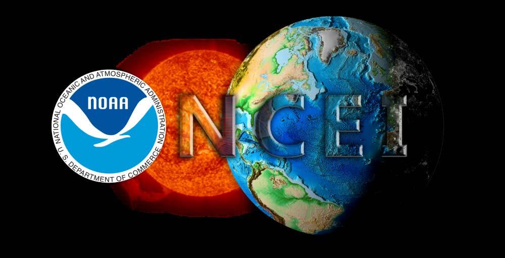
4 National Centers for Environmental Information (NCEI) Responsible for hosting and providing access to one of the most significant archives on Earth, with comprehensive oceanic, atmospheric, and geophysical data From the depths of the ocean to the surface of the sun and from million-year-old sediment records to near realtime satellite images Revealing the Past, Interpreting the Present, and Informing the Future

5 Commitment to Long-term Data Stewardship Archive We re in it for the long haul, preserving data for your great-grandchildren Stewardship in Service of Science
6 The IMLGS The Index to Marine and Lacustrine Geological Samples (IMLGS) is, at it s core, community access to common information on sample collections. The IMLGS is a community designed and maintained resource enabling researchers to locate and request sea floor and lakebed geologic samples archived by partner institutions. The Index is based on core concepts of community oversight, common vocabularies, consistent metadata and a shared interface. The Curators Consortium, now international in scope, meets at partner institutions biennially to share ideas and discuss best practices. NCEI serves the group by providing database access and maintenance, a list server, digitizing support (resource dependent) and long-term archival of sample metadata, data and imagery


7 What is in the Index? Over three decades, participating curators have performed the laborious task of creating and contributing metadata for over 209,000 sea floor and lake-bed cores, grabs, and dredges archived in their collections. Some partners use the Index for primary web access to their collections while others use it to increase exposure of more in-depth institutional systems. The IMLGS has a persistent URL/Digital Object Identifier (DOI), as well as DOIs assigned to partner collections for citation and to provide a persistent link to curator collections.


8 The Index to Marine and Lacustrine Geological Samples Community access to common information on sample collections 209,000 Samples (a core, grab, dredge, or drill hole) > 6,900 additions since the June 2015 Curators meeting April 2017 Status of the Index to Marine & Lacustrine Geological Samples World Data Service for Geophysics

9 How Can You Access the IMLGS? Curator Home page with access to both text and map based interfaces:
10 Web Services Geospatially-enabled relational database ArcGIS Interactive Map: ArcGIS REST Services Supported Internet Protocols: JSON, SOAP, WMS, WFS Supported interfaces: REST, SOAP, SiteMap, Geo SiteMap Supported operations: Export Map, Identify, Find, Return Updates Metadata Catalogs: Geoportal, GCMD, Data.gov Linked Data interface maintained by the Rolling Deck to Repository R2R The IMLGS has a persistent URL/Digital Object Identifier (DOI)


 GRID")
11 JSP Text/Forms Web Interface ArcGIS REST Services & Interactive Map Linked Data Interface maintained by R2R (need to fix) GRID Arendal annual GoogleEarth KMZ

12 Since the April 2015 Curators Meeting Carla Moore retired from Federal service after 40 years! Minted DOIs for each agency dataset A complete inventory of sample data in the IMLGS for each repository was sent out at the end of 2015 Data management for IMLGS and IODP archive in the hands of Kelly Stroker and Jennifer Jencks No sustained funding plan currently in place since Carla s retirement IMLGS is a priority NOAA/NESDIS dataset

13 Since the April 2015 Curators Meeting 6,918 Cores, Grabs, Dredges & Drill Holes added/in review Repository # Samples/Holes Added ARF/FSU 308 BOSCORF 271 BPCRR 2,776 ECS 2 France 2 IODP 44 LacCore 419 LDEO 208 OSU/OER 68 OSU 107 SIO 1 SOEST 743 URI 450 USGS 1,453 WHOI 62
14 DOI: /V5H41PB8 Persistent URL:

15 DOI for each Repository Collection

16 Geosample Deep (Offline) Archive 12TB, >1.3M files NARA standards/oais framework ISO standard documentation Periodic migration to new archive media DOIs: 16 assigned (e.g., IMLGS, DSDP, ODP, IODP archives) In progress: API / Public access to all 12TB of geosample data in the offline archive 7-/9-track tape LTO-2 LTO-3 LTO

 We will work on all")
17 API Access International Scientific Drilling, 1967-Present (DSDP, ODP, IODP) Large Volume Data High-resolution Core Photographs ~20 Data types as text files ISO metadata (hole/datatype) For years, the community has wanted API access to files in the archive We are in the process of setting this up through NEXT (NCEI Extract System) We will work on all geology after SOD
18 Goals and Future Work 1. An up to date IMLGS database 2. Public access to all geosample files in the offline archive via an API 3. More filtering options for the ArcGIS map viewer 4. Adding all IGSNs for more samples in the IMLGS and coordinating with SESAR 5. A completed Submission Agreement between IEDA & NCEI, resulting in improved interoperability between SESAR and the IMLGS Most important: 1. What do curators want? I would like to hear from you!

19 Questions/comments?
GeoLink: Semantics and Linked Data for the Geosciences. The Web is the API.
 GeoLink: Semantics and Linked Data for the Geosciences The Web is the API. Goal: Bring together experts from the geo sciences, computer science, and library science; to develop Semantic Web components;
Spatial Data Infrastructure Concepts and Components. Douglas Nebert U.S. Federal Geographic Data Committee Secretariat
 Spatial Data Infrastructure Concepts and Components Douglas Nebert U.S. Federal Geographic Data Committee Secretariat August 2009 What is a Spatial Data Infrastructure (SDI)? The SDI provides a basis for
Discovery and Access of Geospatial Resources using the Geoportal Extension. Marten Hogeweg Geoportal Extension Product Manager
 Discovery and Access of Geospatial Resources using the Geoportal Extension Marten Hogeweg Geoportal Extension Product Manager DISCOVERY AND ACCESS USING THE GEOPORTAL EXTENSION Geospatial Data Is Very
An introduction to the Data Library PANGAEA. Stefanie Schumacher, Rainer Sieger & Hannes Grobe (2010)
") An introduction to the Data Library PANGAEA Stefanie Schumacher, Rainer Sieger & Hannes Grobe (2010) Data sharing and archiving Nature: Vol 461, 10 September 2009 doi:10.1038/461145a DFG Recommendations
An introduction to the Data Library PANGAEA Stefanie Schumacher, Rainer Sieger & Hannes Grobe (2010) Data sharing and archiving Nature: Vol 461, 10 September 2009 doi:10.1038/461145a DFG Recommendations
An Arctic Perspective NCEI's Prototype Arctic Data Viewer
 An Arctic Perspective NCEI's Prototype Arctic Data Viewer NCEI Arctic Action Team Kate Rose NOAA National Environmental Satellite, Data, and Information Service National Centers for Environmental Information
Geoscience Information Network (US GIN)
") Geoscience Information Network (US GIN) 1,000 s of databases 1,000 s of collections 80,000+ geologic maps Distributed Web-based Interoperable Open source A different business model Traditional Lobby Congress
Geoscience Information Network (US GIN) 1,000 s of databases 1,000 s of collections 80,000+ geologic maps Distributed Web-based Interoperable Open source A different business model Traditional Lobby Congress
The Open Geospatial Consortium and EarthCube
 The Open Geospatial Consortium and EarthCube An EarthCube Technology Paper Prepared by David Maidment 1, Ben Domenico 2, Alastair Gemmell 3, Kerstin Lehnert 4, David Tarboton 5 and Ilya Zaslavsky 6 Introduction
Overview. Project Background Project Approach: Content and Application Development Application Demonstration Future Developments
 Overview Project Background Project Approach: Content and Application Development Application Demonstration Future Developments Southeast Pressures: Continued Population Growth Transportation Corridors
Access to IOOS Data Relevant to OOI. Kathleen Bailey NOAA/NOS/IOOS January 6, 2016
 Access to IOOS Data Relevant to OOI Kathleen Bailey NOAA/NOS/IOOS January 6, 2016 The U.S. Integrated Ocean Observing System (IOOS) Federal Regional Satellites 600+: Buoys, Water Level stations, Coastal
2017 Scientific Ocean Drilling Bibliographic Database Report
 2017 Scientific Ocean Drilling Bibliographic Database Report Covering records related to the Deep Sea Drilling Project, Ocean Drilling Program, Integrated Ocean Drilling Program, and International Ocean
Estonian approach to implementation of INSPIRE directive. Sulev Õitspuu Head of Bureau of Geoinfosystems Estonian Land Board
 Estonian approach to implementation of INSPIRE directive Sulev Õitspuu Head of Bureau of Geoinfosystems Estonian Land Board 13.06.2016 Contents - INSPIRE coordination in Estonia - INSPIRE implementation
Introduction. Elevation Data Strategy. Status and Next Steps
 1 2 Introduction Elevation Data Strategy Status and Next Steps 3 Canada is the 2nd largest country in the world - 9.9 million sq km Surrounded by 3 oceans with 202 000 km of coastline Population over 35
The Open Geospatial Consortium and EarthCube
 The Open Geospatial Consortium and EarthCube An EarthCube Technology Paper Prepared by David Maidment 1, Ben Domenico 2, Alastair Gemmell 3, Kerstin Lehnert 4, David Tarboton 5 and Ilya Zaslavsky 6 Introduction
BalticBOOST Appendix 1, WP 3.3 Deliverable 1 Final report 14 February 2017
 Theme 1: Biodiversity This is a deliverable from the BalticBOOST project that was coordinated by HELCOM and co-financed by the European Union in 2015-2016 as part of the programme DG ENV/MSFD Action Plans/2016.
Image Services Providing Access to Scientific Data at NOAA/NCEI
 Image Services Providing Access to Scientific Data at NOAA/NCEI Jesse Varner Cooperative Institute for Research in Environmental Sciences (CIRES), University of Colorado John Cartwright NOAA National Centers
an accessible interface to marine environmental data Russell Moffitt
 an accessible interface to marine environmental data Russell Moffitt The Atlas Project GOAL: To provide a single point of access to oceanographic and environmental data for use by marine resource researchers,
Applied Geoscience and Technology Division SOPAC. Joy Papao, Risk Information Systems Officer
 Joy Papao, Risk Information Systems Officer Secretariat of the Pacific Community SPC 22 Pacific Island States Head office in Noumea, New Caledonia 2 Regional offices (Pohnpei and Honiara) 600 staff 9 Technical
Introduction: The Gulf of Mexico Alliance. The Gulf GAME project MERMAid and PHINS Results & Conclusions What s next? Examples
 AAG Las Vegas March 25, 2009 Introduction: Ocean governance and Ecosystem-Based Management The Gulf of Mexico Alliance Habitat Identification and Characterization The Gulf GAME project MERMAid and PHINS
The route towards a new GEBCO grid
 The route towards a new GEBCO grid Pauline Weatherall, GEBCO Digital Atlas Manager British Oceanographic Data Centre (BODC) GEBCO TSCOM/SCRUM meeting, Monaco, October 2012 The route towards a new GEBCO
Bathymetric Attributed Grids (BAGs): Discovery of Marine Datasets and Geospatial Metadata Visualization
: Discovery of Marine Datasets and Geospatial Metadata Visualization") University of New Hampshire University of New Hampshire Scholars' Repository Center for Coastal and Ocean Mapping Center for Coastal and Ocean Mapping 2010 Bathymetric Attributed Grids (BAGs): Discovery
University of New Hampshire University of New Hampshire Scholars' Repository Center for Coastal and Ocean Mapping Center for Coastal and Ocean Mapping 2010 Bathymetric Attributed Grids (BAGs): Discovery
Spatial data interoperability and INSPIRE compliance the platform approach BAGIS
 Spatial data interoperability and INSPIRE compliance the platform approach BAGIS BAGIS Voluntary, independent, public, non-profit organization; Organization with main mission to promote the growth of the
INSPIREd solutions for Air Quality problems Alexander Kotsev
 INSPIREd solutions for Air Quality problems Alexander Kotsev www.jrc.ec.europa.eu Serving society Stimulating innovation Supporting legislation The European data puzzle The European data puzzle 24 official
Harmonisation of Spatial Planning Data
 INSPIRE Conference 18 June 2011 Edinburgh, Great Britain Harmonisation of Spatial Planning Data Tomas Mildorf University of West Bohemia mildorf@centrum.cz Pilsen, Czech Republic Co-funded by the Community
GIS Building Communities beyond National Borders (Building Successful Spatial Data Infrastructures) Nick Land, ESRI Europe
 Nick Land, ESRI Europe") GIS Building Communities beyond National Borders (Building Successful Spatial Data Infrastructures) Nick Land, ESRI Europe UK worst flooding in the last 60 years 350,000 households without drinking water
GIS Building Communities beyond National Borders (Building Successful Spatial Data Infrastructures) Nick Land, ESRI Europe UK worst flooding in the last 60 years 350,000 households without drinking water
Introducing the. a partnership of
 Introducing the a partnership of Background Need for online atlas identified by managers and researchers to make coastal data available Shoreline data Ocean and coastal resources Sea-level rise potential
GIS at UCAR. The evolution of NCAR s GIS Initiative. Olga Wilhelmi ESIG-NCAR Unidata Workshop 24 June, 2003
 GIS at UCAR The evolution of NCAR s GIS Initiative Olga Wilhelmi ESIG-NCAR Unidata Workshop 24 June, 2003 Why GIS? z z z z More questions about various climatological, meteorological, hydrological and
Coast Survey Providing Improved Access to Maritime Navigation Products and Services
 Coast Survey Providing Improved Access to Maritime Navigation Products and Services Kurt A. Nelson, Branch Chief CGTP Leland Snyder, Branch Chief FADS Office of Coast Survey Agenda Current Coast Survey
Geological information for Europe : Towards a pan-european Geological Data Infrastructure
 Geological information for Europe : Towards a pan-european Geological Data Infrastructure Integrating geoscientific information for EU competitiveness Co-funded by the European Union European societal
Hosted by Esri Official Distributor
 Hosted by Esri Official Distributor Esri European User Conference October 15-17, 2012 Oslo, Norway Hosted by Esri Official Distributor Interoperability and Standards Support in ArcGIS 10.1 Roberto Lucchi
THE WASHINGTON COASTAL ATLAS
 THE ICAN COASTAL ATLAS MEDIATOR PROTOTYPE AND CONNECTING THE WASHINGTON COASTAL ATLAS Liz O Dea 1, Yassine Lassoued 2, Tanya Haddad 3, Declan Dunne 2 1 GIS Services Unit, WA State Dept. of Ecology 2 Coastal
U s i n g t h e E S A / E U M E T C A S T N a v i g a t o r s
 U s i n g t h e E S A / E U M E T C A S T N a v i g a t o r s Copernicus User Uptake Information Sessions Copernicus EU Copernicus EU Copernicus EU www.copernicus.eu I N T R O D U C T I O N O F U S E C
a national geological survey perspective François ROBIDA BRGM (French Geological Survey)
") a national geological survey perspective François ROBIDA BRGM (French Geological Survey) Pre-Conference Seminar on Socio-Economic Value of Geospatial for National and Regional Development 21 August 2017,
a national geological survey perspective François ROBIDA BRGM (French Geological Survey) Pre-Conference Seminar on Socio-Economic Value of Geospatial for National and Regional Development 21 August 2017,
ArcGIS for INSPIRE. Marten Hogeweg Satish Sankaran
 ArcGIS for INSPIRE Marten Hogeweg Satish Sankaran Outline What is ArcGIS ArcGIS for INSPIRE Web GIS Case Studies Roadmap Q&A What is INSPIRE? INSPIRE is the legal framework for a European Spatial Data
Open Data meets Big Data
 Open Data meets Big Data Max Craglia, Sven Schade, Anders Friis European Commission Joint Research Centre www.jrc.ec.europa.eu Serving society Stimulating innovation Supporting legislation JRC is Technical
OCEANOGRAPHIC DATA MANAGEMENT
 OCEANOGRAPHIC DATA MANAGEMENT Presented to: Environmental Disaster Data Management Meeting Russ Beard Director, National Coastal Data Development Center Interim Science Coordinator, Gulf Restoration Council
European Commission STUDY ON INTERIM EVALUATION OF EUROPEAN MARINE OBSERVATION AND DATA NETWORK. Executive Summary
 European Commission STUDY ON INTERIM EVALUATION OF EUROPEAN MARINE OBSERVATION AND DATA NETWORK Executive Summary by NILOS Netherlands Institute for the Law of the Sea June 2011 Page ii Study on Interim
RHOAPS. Real-time Hydrology Ocean Atmosphere Prediction System. Pronunciation: Ropes Motto: More than just THREDDS
 RHOAPS Real-time Hydrology Ocean Atmosphere Prediction System Pronunciation: Ropes Motto: More than just THREDDS Key Aspects Integrated real-time data systems Atmospheric Hydrologic Coastal oceans Societal
Underway Data Management via the SAMOS Initiative
 Underway Data Management via the SAMOS Initiative Shawn R. Smith 1, Jeremy Rolph 1, Kristen Briggs 1, Mark A. Bourassa 1,2, Daniel Wolfe 3, and Chris Fairall 4 1 COAPS, Florida State University, Tallahassee,
INDONESIA S S UPDATE: GEOSPATIAL INFORMATION FOR SUSTAINABLE DEVELOPMENT RELATED TO INA SDI Dr. Asep Karsidi, M.Sc
 INDONESIA S S UPDATE: GEOSPATIAL INFORMATION FOR SUSTAINABLE DEVELOPMENT RELATED TO INA SDI Dr. Asep Karsidi, M.Sc GEOSPATIAL INFORMATION AGENCY 08 August, 2012 OUTLINE 1. Transformation Bakosurtanal into
ArcGIS for INSPIRE. Marten Hogeweg
 ArcGIS for INSPIRE Marten Hogeweg Please Take Our Survey on the App Download the Esri Events app and find your event Select the session you attended Scroll down to find the feedback section Complete answers
NOKIS - Information Infrastructure for the North and Baltic Sea
 NOKIS - Information Infrastructure for the North and Baltic Sea Carsten Heidmann 1 and Jörn Kohlus 2 Abstract 1. General The initial motivation for the project NOKIS (German title: Nord- und Ostsee-Küsteninformationssystem)
Study on Data Integration and Sharing Standard and Specification System for Earth System Science
 Study on Data Integration and Sharing Standard and Specification System for Earth System Science Juanle Wang and Jiulin Sun Information Sharing Center for Earth System Science Institute of Geographic Sciences
The PREVIEW Global Risk Data Platform: a geoportal to serve and share global data on risk to natural hazards
 The PREVIEW Global Risk Data Platform: a geoportal to serve and share global data on risk to natural hazards Gregory Giuliani (UNEP/GRID-Geneva & University of Geneva/enviroSPACE ) http://www.grid.unep.ch
8 th Arctic Regional Hydrographic Commission Meeting September 2018, Longyearbyen, Svalbard Norway
 8 th Arctic Regional Hydrographic Commission Meeting 11-13 September 2018, Longyearbyen, Svalbard Norway Status Report of the Arctic Regional Marine Spatial Data Infrastructures Working Group (ARMSDIWG)
Spatial Data Infrastructure for Marine Environnement Ifremer initiatives in France and in Europe
 E. Quimbert, M. Bellouis, F. Lecuy, M. Treguer Centre de Bretagne BP 70, Plouzané 29280 France E-mail: sextant@ifremer.fr Spatial Data Infrastructure for Marine Environnement Ifremer initiatives in France
Roadmap to interoperability of geoinformation
 Roadmap to interoperability of geoinformation and services in Europe Paul Smits, Alessandro Annoni European Commission Joint Research Centre Institute for Environment and Sustainability paul.smits@jrc.it
1) make sure folks know what s available in terms of geospatial data and resources that could contribute to their decision support toolkits;
 make sure folks know what s available in terms of geospatial data and resources that could contribute to their decision support toolkits;") Introduction 1 2001 It was born out of the recognition that several of the regions prominent resource management agencies have similar, if not shared, requirements for GIS data. Some of the underlying
Introduction 1 2001 It was born out of the recognition that several of the regions prominent resource management agencies have similar, if not shared, requirements for GIS data. Some of the underlying
Curating and Maintenance of the Sediment Library and Dredge Collection
 Curating and Maintenance of the Sediment Library and Dredge Collection Gerard C. Bond Lamont-Doherty Earth Observatory Deep-Sea Sample Repository of Columbia University Palisades, New York 10964 Phone:
Northwestern Hawaiian Islands Coral Reef Research Partnership: Ocean Mapping, Ecosystem Threats, and Information Management
 Northwestern Hawaiian Islands Coral Reef Research Partnership: Ocean Mapping, Ecosystem Threats, and Information Management Malia Chow Papahanaumokuakea Marine National Monument National Oceanic and Atmospheric
Key Points Sharing fosters participation and collaboration Metadata has a big role in sharing Sharing is not always easy
 Sharing Resources Geoff Mortson esri, Inc. SDI Solutions Team Key Points Sharing fosters participation and collaboration Metadata has a big role in sharing Sharing is not always easy Data Sharing is Good
Making Data Accessible: Suggestions from the Scientific Community. Gerold Wefer, Universität Bremen 21. September 2007
 Making Data Accessible: Suggestions from the Scientific Community Gerold Wefer, Universität Bremen 21. September 27 The Ocean in the Earth System Sea-bed photos doi:1.1594/pangaea.319877 Sediment core
GERSVIEW: A New Database for Web Mapping
 GERSVIEW: A New Database for Web Mapping William J. Hernández, M.S. Graduate Student Department of Marine Sciences-UPRM Fernando Gilbes, Ph.D. Associate Professor Department of Geology-UPRM Overview Introduction
A National Outer Continental Shelf Sand / Sediment Inventory
 A National Outer Continental Shelf Sand / Sediment Inventory Sand Resource Areas Lease Areas Lora Turner December 15, 2016 Restoring and Protecting Our Nation s Coasts through Stewardship of OCS Resources
Geospatial Decision Support Tools for Planning of Marine Protected Areas in California
 Geospatial Decision Support Tools for Planning of Marine Protected Areas in California WILL MCCLINTOCK (UNIVERSITY OF CALIFORNIA SANTA BARBARA), MATT MERRIFIELD (THE NATURE CONSERVANCY), SOPHIE DE BEUKELAER
WEB MAP SERVICE (WMS) FOR GEOLOGICAL DATA GEORGE TUDOR
 FOR GEOLOGICAL DATA GEORGE TUDOR") WEB MAP SERVICE (WMS) FOR GEOLOGICAL DATA GEORGE TUDOR WEB MAP SERVICE (WMS) - GENERALITIES Projects with data from different sources Geological data are in different GIS software format Large amount of
WEB MAP SERVICE (WMS) FOR GEOLOGICAL DATA GEORGE TUDOR WEB MAP SERVICE (WMS) - GENERALITIES Projects with data from different sources Geological data are in different GIS software format Large amount of
Portals: Standards in Action
 Portals: Standards in Action David Danko ISO TC 211 Metadata Project Leader GIS Standards Consultant-ESRI. Metadata Portals Portal gateway, place of entry Producers Advertise, expose products Share information
Open Geospatial Consortium activities in the Maritime domain
 Open Geospatial Consortium activities in the Maritime domain Scott Simmons Executive Director, Standards Program General Maritime efforts participants Alliance partners IHO ISO / TC 211 Members Danish
Geoíndex: a public data dissemination service from the IGC. Geoíndex IGC Team Reporter: Carme Puig
 Geoíndex: a public data dissemination service from the IGC Geoíndex IGC Team Reporter: Carme Puig 2 Brief IGC introduction The IGC was created through the Law 19/2005 of the Catalan Parliament. The IGC
Appendix E: Oceanographic Databases
 Appendix E: Oceanographic Databases Many of the principal U.S. and international database depositories for worldwide ocean observations are listed below, as are a few technical reports with descriptions
Enabling Geospatial Killer Apps Interfaces, Visualizations and APIs Imaging the World
 International Open Government Data Conference Enabling Geospatial Killer Apps Interfaces, Visualizations and APIs Imaging the World Jim Barrett, Data.gov Geospatial Architect Pat Cummens, Government Strategist,
Water Data Sharing an Update
 Water Data Sharing an Update By David R. Maidment Leader, CUAHSI Hydrologic Information System Project and Director, Center for Research in Water Resources, University of Texas at Austin Prepared for Subcommittee
Vision: The National Oceanography Centre will, by 2015, be recognised as the world-leading Centre for integrated ocean sciences and technology".
 National Oceanography Centre from coast to deep ocean Waterfront Campus, Southampton Vision: Joseph Proudman Building, Liverpool The National Oceanography Centre will, by 2015, be recognised as the world-leading
Billions of measurements for millions of square kilometres
 Billions of measurements for millions of square kilometres Dr. Mathias Jonas Secretary-General of the : History and Constitution 2 1 All waters on earth 3 20 th Century idea: GEBCO General bathymetric
Enabling Access to Arctic Location Based Information - the Arctic SDI
 Enabling Access to Arctic Location Based Information - the Arctic SDI Jani Kylmäaho Head of Arctic SDI Geoportal WG National Land Survey of Finland SAO Chair, WG Chairs and Executive Secretaries meeting
Technical Specifications. Form of the standard
 Used by popular acceptance Voluntary Implementation Mandatory Legally enforced Technical Specifications Conventions Guidelines Form of the standard Restrictive Information System Structures Contents Values
THE DESIGN AND IMPLEMENTATION OF A WEB SERVICES-BASED APPLICATION FRAMEWORK FOR SEA SURFACE TEMPERATURE INFORMATION
 THE DESIGN AND IMPLEMENTATION OF A WEB SERVICES-BASED APPLICATION FRAMEWORK FOR SEA SURFACE TEMPERATURE INFORMATION HE Ya-wen a,b,c, SU Fen-zhen a, DU Yun-yan a, Xiao Ru-lin a,c, Sun Xiaodan d a. Institute
African Coastal Atlas developments. 10 July 2008 EEA Copenhagen, Denmark
 African Coastal Atlas developments 10 July 2008 EEA Copenhagen, Denmark Africa Overview Africa has approximately 40 000 km of coast across 32 mainland countries and four island states. Africa's coastal
Digital Elevation Model of Tutuila, American Samoa: Procedures, Data Sources, and Analysis
 Digital Elevation Model of Tutuila, American Samoa: Procedures, Data Sources, and Analysis Prepared for the National Tsunami Hazard Mitigation Program (NTHMP) by the NOAA National Geophysical Data Center
GEBCO 2013 TSCOM. EMODNET Hydrography status report
 www.emodnet-hydrography.eu GEBCO 2013 TSCOM EMODNET Hydrography status report Eric Moussat, Ifremer on behalf of the Emodnet consortium 1 Background and objectives EU proposed to take steps in 2008 towards
ADVANTAGES OF GIS-INTEGRATED MARITIME DATA IN THE BLACK SEA REGION FOR MULTIPURPOSE USE
 INTERAGENCY INTERACTION IN CRISIS MANAGEMENT AND DISASTER RESPONSE 2017 ADVANTAGES OF GIS-INTEGRATED MARITIME DATA IN THE BLACK SEA REGION FOR MULTIPURPOSE USE Lyubka Pashova 1, Anna Kortcheva 2, Vasko
Spatial Data Availability Energizes Florida s Citizens
 NASCIO 2016 Recognition Awards Nomination Spatial Data Availability Energizes Florida s Citizens State of Florida Agency for State Technology & Department of Environmental Protection Category: ICT Innovations
Climate Data for Non-experts: Standards-based Interoperability
 Climate Data for Non-experts: Standards-based Interoperability Ben Domenico Unidata Program Center University Corporation for Atmospheric Research April 2010 Working Together on A Mosaic for Atmospheric
The Canadian Ceoscience Knowledge Network. - A Collaborative Effort for Unified Access to Ceoscience Data
 The Canadian Ceoscience Knowledge Network - A Collaborative Effort for Unified Access to Ceoscience Data The Canadian Geoscience Knowledge Network A Collaborative Effort for Unified Access to Geoscience
Malaysia. Country Report. Oil and Gas Database Management. April 1-3, 2009
 April 1-3, 2009 Malaysia Country Report Oil and Gas Database Management The Legislative Framework of the Malaysian Petroleum Industry Relationship between the Government, PETRONAS and PSC Contractors Objectives
The IHPT Marine Spatial Data infrastructure and its contribution to the INSPIRE Directive
 The IHPT Marine Spatial Data infrastructure and its contribution to the INSPIRE Directive INSPIRE - GWF 2015 - Coastal & Marine session Lisbon Congress Center, Portugal - Thursday, 28 May 2015 Summary
Proper Data Management Responsibilities to Meet the Global Ocean Observing System (GOOS) Requirements
 Requirements") Data Buoy Cooperation Panel XXVI Oban, Scotland, UK 27 September 2010 Proper Data Management Responsibilities to Meet the Global Ocean Observing System (GOOS) Requirements William Burnett Data Management
Data Buoy Cooperation Panel XXVI Oban, Scotland, UK 27 September 2010 Proper Data Management Responsibilities to Meet the Global Ocean Observing System (GOOS) Requirements William Burnett Data Management
Paper UC1351. Conference: User Conference Date: 08/10/2006 Time: 8:30am-9:45am Room: Room 23-B (SDCC)
") Conference: User Conference Date: 08/10/2006 Time: 8:30am-9:45am Room: Room 23-B (SDCC) Title of Paper: Increasing the Use of GIS in the Federal Government Author Name: Miss Abstract This presentation
Conference: User Conference Date: 08/10/2006 Time: 8:30am-9:45am Room: Room 23-B (SDCC) Title of Paper: Increasing the Use of GIS in the Federal Government Author Name: Miss Abstract This presentation
Global Geospatial Information Management Country Report Finland. Submitted by Director General Jarmo Ratia, National Land Survey
 Global Geospatial Information Management Country Report Finland Submitted by Director General Jarmo Ratia, National Land Survey Global Geospatial Information Management Country Report Finland Background
Overview. Gulf of Mexico Alliance Ocean and Coastal Mapping Regional Ecosystem Data Management (REDM) Q2O (QARTOD to OGC) Things to Consider
 Q2O (QARTOD to OGC) Things to Consider") 1 Overview Gulf of Mexico Alliance Ocean and Coastal Mapping Regional Ecosystem Data Management (REDM) Q2O (QARTOD to OGC) Things to Consider 2 Gulf Of Mexico Alliance Partnership of the states of Alabama,
1 Overview Gulf of Mexico Alliance Ocean and Coastal Mapping Regional Ecosystem Data Management (REDM) Q2O (QARTOD to OGC) Things to Consider 2 Gulf Of Mexico Alliance Partnership of the states of Alabama,
Introduction to EMODnet
 Introduction to EMODnet Antonio Novellino Torino, 14-15 Ottobre 2015 What is EMODnet? Initiated by the European Commission in response to the EU Future Maritime Policy and Blue Growth, launched in June
Kentucky Collaborates in GeoMAPP Project: The Advantages and Challenges of Archiving in a State with a Centralized GIS
 Kentucky Collaborates in GeoMAPP Project: The Advantages and Challenges of Archiving in a State with a Centralized GIS Geospatial Multistate Archive and Preservation Partnership By Glen McAninch Best Practices
Jay Lawrimore NOAA National Climatic Data Center 9 October 2013
 Jay Lawrimore NOAA National Climatic Data Center 9 October 2013 Daily data GHCN-Daily as the GSN Archive Monthly data GHCN-Monthly and CLIMAT messages International Surface Temperature Initiative Global
Updating the GEBCO Grid
 Updating the GEBCO Grid PAULINE WEATHERALL, GEBCO DIGITAL ATLAS MANAGER, BRITISH OCEANOGRAPHIC DATA CENTRE (BODC), NATIONAL OCEANOGRAPHY CENTRE (NOC), LIVERPOOL, UK. GEBCO TSCOM and SCRUM meeting, Kuala
GIS ADMINISTRATOR / WEB DEVELOPER EVANSVILLE-VANDERBURGH COUNTY AREA PLAN COMMISSION
 GIS ADMINISTRATOR / WEB DEVELOPER EVANSVILLE-VANDERBURGH COUNTY AREA PLAN COMMISSION SALARY RANGE INITIATION $43,277 SIX MONTHS $45,367 POSITION GRADE PAT VI The Evansville-Vanderburgh County Area Plan
Norwegian spatial data infrastructure supporting disaster risk management Norwegian Mapping Authority
 Norwegian spatial data infrastructure supporting disaster risk management Norwegian Mapping Authority Arvid Lillethun, Norwegian Mapping Authority Land and Poverty 2018 Conference, World Bank 19.-23. March
EMODnet High Resolution Seabed Mapping - further developing and providing a high resolution digital bathymetry for European seas
 EMODnet High Resolution Seabed Mapping - further developing and providing a high resolution digital bathymetry for European seas EGU Fall 2017 meeting New Orleans USA, December 2017 Schaap Dick MARIS,
OPEN ACCESS GEOLOGY: USING THE INSTITUTIONAL REPOSITORY TO HOST STATE GEOLOGICAL SURVEY PUBLICATIONS
 OPEN ACCESS GEOLOGY: USING THE INSTITUTIONAL REPOSITORY TO HOST STATE GEOLOGICAL SURVEY PUBLICATIONS Lisa Johnston and Harvey Thorleifson Science and Engineering Library, University of Minnesota, 108 Walter
Some of the underlying goals of the GIS Library are to:
 1 2001 It was born out of the recognition that several of the regions prominent resource management agencies have similar, if not shared, requirements for GIS data. Some of the underlying goals of the
National Climatic Data Center Data Management Issues Tom Karl Director, NOAA s National Climatic Data Center
 National Climatic Data Center Data Management Issues Tom Karl Director, NOAA s National Climatic Data Center Opening Meeting NOAA Science Advisory Board s Data Archiving and Access Requirements Working
Briefing on the work of GEBCO (GENERAL BATHYMETRIC CHART OF THE OCEANS)
") Briefing on the work of GEBCO (GENERAL BATHYMETRIC CHART OF THE OCEANS) 7th ROPME Sea Area Hydrographic Commission Meeting, Muscat, Oman 20-22 February 2017 What is GEBCO? The General Bathymetric Chart
Briefing on the work of GEBCO (GENERAL BATHYMETRIC CHART OF THE OCEANS) 7th ROPME Sea Area Hydrographic Commission Meeting, Muscat, Oman 20-22 February 2017 What is GEBCO? The General Bathymetric Chart
Richard R. Heim Jr. Michael J. Brewer
 Linking GDIS Data Sets Using the NIDIS Drought Portal Richard R. Heim Jr. Michael J. Brewer NOAA/NESDIS/ Asheville, North Carolina International Global Drought Information System Workshop: Next Steps Caltech
NAG-City Expert Workshop Oslo 8-9. October 2012 SOSI standards and mapping for Europe (INSPIRE)
") NAG-City Expert Workshop Oslo 8-9. October 2012 SOSI standards and mapping for Europe (INSPIRE) Per Ryghaug, Geomatics The Norwegian national standard on geographic information - SOSI Started in 1984 NGU
NAG-City Expert Workshop Oslo 8-9. October 2012 SOSI standards and mapping for Europe (INSPIRE) Per Ryghaug, Geomatics The Norwegian national standard on geographic information - SOSI Started in 1984 NGU
GIScience: Current Technology. Michael F. Goodchild University of California Santa Barbara
 GIScience: Current Technology Michael F. Goodchild University of California Santa Barbara What is a GIS? A class of software designed to handle geographic information and perform virtually any conceivable
Reprint of article that appeared in Hydro INTERNATIONAL November 2006 Volume 10 Issue 9
 Reprint of article that appeared in Hydro INTERNATIONAL November 2006 Volume 10 Issue 9 While Google Earth is the best known 3D web-mapping viewer currently in the public domain, there are alternative
The state-of-the-art of the Finnish SDI. Arctic SDI WG Meeting
 The state-of-the-art of the Finnish SDI Arctic SDI WG Meeting Moscow 8.9.2011 Esa Tiainen Development Centre 1 NATIONAL LAND SURVEY DOWN TO EARTH Contents Legal framework Coordination structure Network
ESTABLISHMENT OF KARNATAKA GEOPORTAL AND ITS ROLE IN PLANNING
 ESTABLISHMENT OF KARNATAKA GEOPORTAL AND ITS ROLE IN PLANNING By H. Hemanth Kumar Karnataka State Council for Science & Technology (KSCST), Indian Institute of Science, Bangalore, India Abstract Natural
Bathymetry Data and Models: Best Practices
 Bathymetry Data and Models: Best Practices Barry Eakins & Lisa Taylor The NOAA National Geophysical Data Center Over 600 data types - from the core of the Earth to the surface of the Sun NGDC Bathymetry
European Location Framework data in the ArcGIS platform
 European Location Framework data in the ArcGIS platform Presentation to: Author: Date: INSPIRE Conference 2016 Clemens Portele 26 September 2016 Why ELF? Global (e.g. UN GGIM) Regional Europe (INSPIRE
Initiatives in Using Crowdsourcing, Satellite Derived Bathymetry, and Other Non-Traditional Hydrographic/Bathymetric Measurements
 University of New Hampshire University of New Hampshire Scholars' Repository Center for Coastal and Ocean Mapping Center for Coastal and Ocean Mapping 10-5-2015 Initiatives in Using Crowdsourcing, Satellite
2012 OCEAN DRILLING CITATION REPORT
 2012 OCEAN DRILLING CITATION REPORT Covering Citations Related to the Deep Sea Drilling Project, Ocean Drilling Program, and Integrated Ocean Drilling Program from GeoRef Citations Indexed by the American