Making Data Accessible: Suggestions from the Scientific Community. Gerold Wefer, Universität Bremen 21. September 2007
|
|
|
- Brandon Flowers
- 5 years ago
- Views:
Transcription

1 Making Data Accessible: Suggestions from the Scientific Community Gerold Wefer, Universität Bremen 21. September 27

2 The Ocean in the Earth System


3 Sea-bed photos doi:1.1594/pangaea

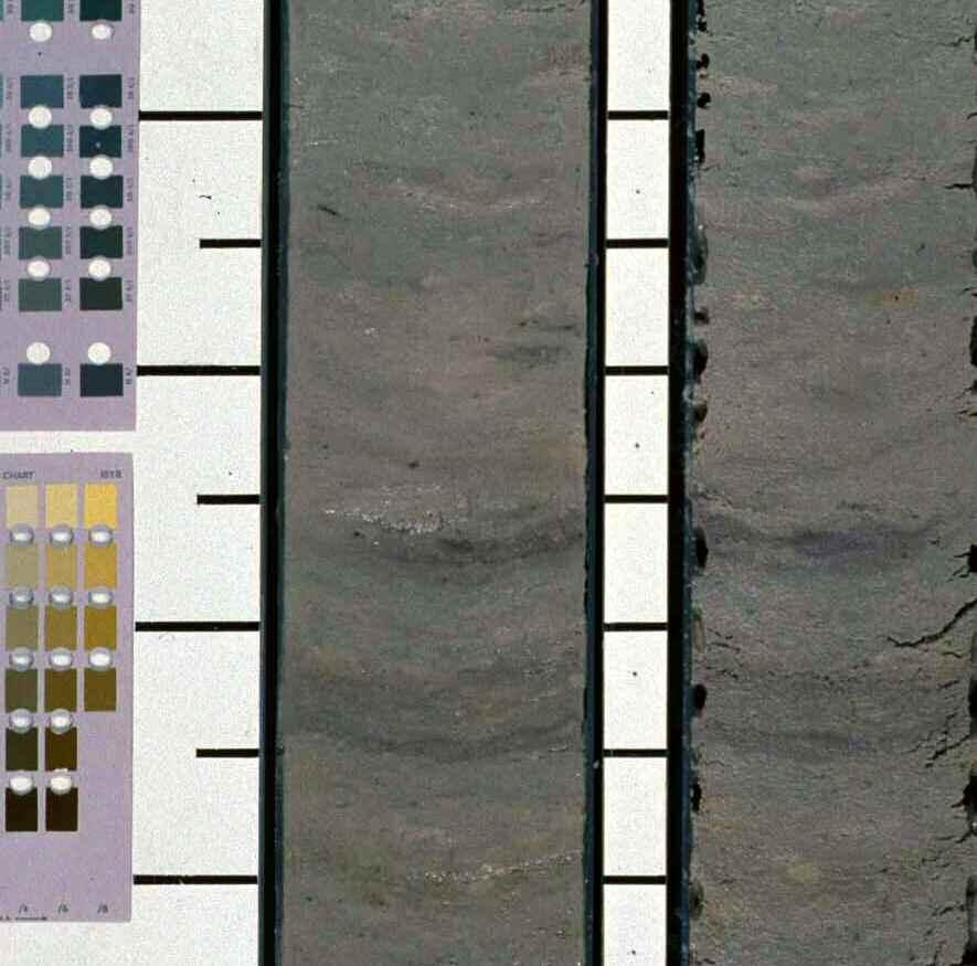


4 Sediment core documentation doi:1.1594/pangaea.1879


5 NW SE seismic multichannel seismic line over Chapopote/ Campeche Bight migration pathway intermediate reservoir in: shallow gas, gas hydrate, oil, asphalt Uplifted hemipelagic sediments Salt MCS Line M672a-GeoB m CDP spacing, FD migrated
6 Data types in PANGAEA PS PS139-3 IRD Sand (grav/1 cm3) CaCO3 2 TOC 1 Radio 15 Smect (% /sand).5 PS IRD (% /clay) 5 Sand (grav/1 cm3) 1 CaCO3 2 TOC 1 Radio 15 Smect (% /sand).5 PS164-1 IRD (% /clay) 5 Sand (grav/1 cm3) 1 CaCO3 2 TOC 1 Radio 15 Smect (% /sand).5 PS IRD (% /clay) 5 Sand (grav/1 cm3) 1 CaCO3 2 TOC 1 Radio 15 Smect (% /sand).5 IRD (% /clay) 5 Sand (grav/1 cm3) 1 CaCO3 2 TOC 1 Radio 15 Smect (% /sand).5 (% /clay) Profiles -> doi:1.1594/pangaea Time series -> doi:1.1594/pangaea Sea bed photos -> doi:1.1594/pangaea Distributes samples -> doi:1.1594/pangaea Complex data -> doi:1.1594/pangaea.1879 Air photos -> doi:1.1594/pangaea Audio record -> doi:1.1594/pangaea Age (kyr) max. : kyr PS1389-3ff ' 55 3' 55 ' 55 ' 54 3' 54 3' 54 ' 54 ' Scale: 1: at Latitude Source: Baltic Sea Research Institute, Warnemünde. World vector shore line Grain size class KOLP A Grain size class KOEHN2 Grain size class KOEHN Geochemistry Grain size class KOLP B Grain size class KOLP DIN
7 PANGAEA our data information system

8 doi:1.1594/pangaea
9 Challenges Long-term operation - hardware, software, backup, network Simple and flexible data model - extensible and adjustable to evolving science Scientific and technical standards - for science and web integration Scalable access - depending on different user needs User driven and controlled - to avoid a technical end in itself
10 PANGAEA / WDC-MARE - organisation Project & data managers + - AWI Computer Center MARUM Univ. Bremen technical & scientific organization Bremen network internet


11 Operating Institutions Center for Marine Environmental Sciences, Bremen Alfred Wegener Institute for Polar and Marine Research Bremerhaven


12 PANGAEA dissemination of data and metadata via portal networks

 SOPRAN (SOLAS) ESONET www.wdc-mare.")
13 PANGAEA - services & activities current: Data management IODP (European part) Data publication Data infrastructures (networking) HERMES - Editorial Final report environment for data management for preparation of data and metadata of projects - Data - Citable portals, data networking sets - Distribution through 3 libraries - with referenced focus on with marine Digital research Object Identifiers (DOI) CARBOOCEAN EUR-OCEANS - Accompanied by CD/DVD with data and local search engine SPP1144 (Interrigde) SOPRAN (SOLAS) ESONET
14 PANGAEA - Statistics (7/27) Corals Atmosphere Ice unclassified Sediment Water Total number of data sets 541,468 Data items > 1.8 billions


15 WDC-MARE - World Data Center for Marine Environmental Sciences Biogeochemistry, Circulation, and Life of Present and Past Oceans PANGAEA - Publishing Network for Geoscientific and Environmental Data

16


17 World Data Center System of ICSU established during the International Geophysical Year 1957/58

18 Principles of the World Data Center System operation for the benefit of the scientific community long-term archival freely available Principles data exchange
19 Project STD-DOI Data Publishing Technische Informationsbibliothek Coordination (TIB, Hannover) World Data Center Climate - WDC-Climate (MPI, Hamburg) World Data Center for Marine Environmental Sciences - WDC- MARE(AWI/MARUM, Bremen) World Data Center for Remote Sensing - WDC-RSAT (DLR, Oberpfaffenhofen) GeoForschungszentrum - WDC-TERRA? (GFZ, Potsdam)


20 Scientific Earth Drilling Information Service (S E D I S) MARUM WDC MARE is developing SEDIS Phase I for IODP-MI: central metadata catalogue listing of all IODP, ODP, and DSDP datasets
21 Summary Acceptance of a data system stands or falls with symplicity Data must be accompanied by standard descriptions Data must include in its description a usable citation Data storage must be managed by established centers

22 Long term preservation Lifetime of storage media (years): Hard disk 5 CD / DVD 2 Tape 3 Paper > 1 Papyrus > 1 Stone of Rosette
23 Recommendations We have already well establised data information systems. What we need are more data submitted to the centers. Funding agencies should formulate their data policies with appropiate explanations and regulations and special funding should be provided
24
An introduction to the Data Library PANGAEA. Stefanie Schumacher, Rainer Sieger & Hannes Grobe (2010)
") An introduction to the Data Library PANGAEA Stefanie Schumacher, Rainer Sieger & Hannes Grobe (2010) Data sharing and archiving Nature: Vol 461, 10 September 2009 doi:10.1038/461145a DFG Recommendations
An introduction to the Data Library PANGAEA Stefanie Schumacher, Rainer Sieger & Hannes Grobe (2010) Data sharing and archiving Nature: Vol 461, 10 September 2009 doi:10.1038/461145a DFG Recommendations
Dataset citation and identification. Max Wilkinson, PhD. Programme Manager, Datasets. The British Library. December, 2009
 Dataset citation and identification Max Wilkinson, PhD Programme Manager, Datasets. The British Library December, 2009 Widening gap A widening gap in the scientific record between published research and
The Index to Marine and Lacustrine Geological Samples
 The Index to Marine and Lacustrine Geological Samples Community access to common information on sample collections Kelly J. Stroker 1, Jennifer Jencks 2 1 Cooperative Institute for Research in Environmental
Study on Data Integration and Sharing Standard and Specification System for Earth System Science
 Study on Data Integration and Sharing Standard and Specification System for Earth System Science Juanle Wang and Jiulin Sun Information Sharing Center for Earth System Science Institute of Geographic Sciences
Integrated Ocean Drilling Program Expedition 316 Scientific Prospectus Addendum
 Integrated Ocean Drilling Program Expedition 316 Scientific Prospectus Addendum NanTroSEIZE Stage 1: NanTroSEIZE Shallow Megasplay and Frontal Thrusts Gaku Kimura Co-Chief Scientist Department of Earth
Proposal to Include a Grid Referencing System in S-100
 1 st IHO-HSSC Meeting The Regent Hotel, Singapore, 22-24 October 2009 Paper for consideration by HSSC Proposal to Include a Grid Referencing System in S-100 Submitted by: Executive Summary: Related Documents:
Black Sea Data Access services
 Black Sea Data Access services PERSEUS Oceanographic Mediterranean and Black Sea Data Management Cast Data Base with vertical profiles of physical, chemical and biological data acquired with Bottle casts
New EU efforts to assess the state of the marine environment: the EMODnet Chemistry pilot project
 New EU efforts to assess the state of the marine environment: the EMODnet Chemistry pilot project Matteo Vinci and Alessandra Giorgetti, OGS NODC group, OCE September 2013 - IMDIS 2013, Lucca Overview
MERSEA Marine Environment and Security for the European Area
 MERSEA Marine Environment and Security for the European Area Development of a European system for operational monitoring and forecasting of the ocean physics, biogeochemistry, and ecosystems, on global
IODP drilling and core storage facilities
 4 IODP drilling and core storage facilities Neville Exon As the knowledge obtainable from ocean drilling is various and extensive, its end-users are similarly various and extensive. Scientific ocean drilling
INTAROS Integration of the existing Arctic observing systems into a common data frame. Roberta Pirazzini, Finnish Meteorological Institute
 INTAROS Integration of the existing Arctic observing systems into a common data frame Roberta Pirazzini, Finnish Meteorological Institute Outline 1. Overview of the INTAROS project 2. Overview of the INTAROS
IHO STAKEHOLDERS FORUM. Hydrographic data and its role in MSDI. Thursday 27 September Jens Peter Hartmann KMS
 IHO STAKEHOLDERS FORUM Hydrographic data and its role in MSDI Thursday 27 September Jens Peter Hartmann KMS Agenda Traditional approach to hydrographic data Expectations within the marine / maritime field
Bathymetry. EMODnet Stakeholder Conference & Sea-basin Workshops February Bathymetry
 EMODnet Stakeholder Conference & Sea-basin Workshops 14-15 February 2017 Arctic checkpoint Belinda Kater On behalf of all Checkpoints http://www.emodnet.eu 1 ? is the study of the "beds" or "floors" of
The European Marine Observation and Data Network. EU-China Blue Year Event 1 June,
 The European Marine Observation and Data Network EU-China Blue Year Event 1 June, 2017 secretariat@emodnet.eu info@emodnet.eu There is only one Earth, with only one history, and we get only one chance
Extending the scope of journal articles: Certifying and publishing experimental data
 Extending the scope of journal articles: Certifying and publishing experimental data 237 th ACS-Meeting 2009/03/25 Irina Sens 1, Jan Brase 1, Susanne Haak 2, Guido F. Herrmann 2 1 German National Library
Management of Geological Information for Mining Sector Development and Investment Attraction Examples from Uganda and Tanzania
 Mineral Wealth Conference 2016 Kampala / Uganda Management of Geological Information for Mining Sector Development and Investment Attraction Examples from Uganda and Tanzania Andreas Barth 1, Andreas Knobloch
Marine Geosciences / Oceanography Fields and disciplines
 Marine Geosciences / Oceanography Fields and disciplines Marine Geosciences; Oceanography Chemical Oceanography Marine chemistry; marine geochemistry Biological Oceanography Marine biology; marine biogeochemistry
Curating and Maintenance of the Sediment Library and Dredge Collection
 Curating and Maintenance of the Sediment Library and Dredge Collection Gerard C. Bond Lamont-Doherty Earth Observatory Deep-Sea Sample Repository of Columbia University Palisades, New York 10964 Phone:
Research Programme Polar, Marine and Coastal Systems. Current and future Arctic research priorities of Germany Nicole Biebow, AWI
 Research Programme Polar, Marine and Coastal Systems Current and future Arctic research priorities of Germany Nicole Biebow, AWI Arctic Science and Technology (S&T) Collaboration and Engagement Workshop,
INSPIRE in Sweden.
 INSPIRE in Sweden Swedish National Data Service Established 2008. SND is a service organisation for Swedish research within the Humanities, Social Sciences and Medicine. SND is the Swedish node in an international
11. DATA REPORT: RELATIVE ABUNDANCE
 Gersonde, R., Hodell, D.A., and Blum, P. (Eds.) Proceedings of the Ocean Drilling Program, Scientific Results Volume 177 11. DATA REPORT: RELATIVE ABUNDANCE AND RANGES OF SELECTED DIATOMS FROM PLIOCENE
2017 Scientific Ocean Drilling Bibliographic Database Report
 2017 Scientific Ocean Drilling Bibliographic Database Report Covering records related to the Deep Sea Drilling Project, Ocean Drilling Program, Integrated Ocean Drilling Program, and International Ocean
GIS at UCAR. The evolution of NCAR s GIS Initiative. Olga Wilhelmi ESIG-NCAR Unidata Workshop 24 June, 2003
 GIS at UCAR The evolution of NCAR s GIS Initiative Olga Wilhelmi ESIG-NCAR Unidata Workshop 24 June, 2003 Why GIS? z z z z More questions about various climatological, meteorological, hydrological and
In situ Geothermal Lab Groß Schönebeck
 In situ Geothermal Lab Groß Schönebeck As a member of the Helmholtz Association, the GeoForschungsZentrum (GFZ) is the National Research Centre for Geosciences in Germany Foundation under public law Founded
Downloaded 11/20/12 to Redistribution subject to SEG license or copyright; see Terms of Use at
 AVO crossplot analysis in unconsolidated sediments containing gas hydrate and free gas: Green Canyon 955, Gulf of Mexico Zijian Zhang* 1, Daniel R. McConnell 1, De-hua Han 2 1 Fugro GeoConsulting, Inc.,
THE USE OF GIS IN GEOTHERMAL RESOURCE MANAGEMENT: A CASE STUDY OF OLKARIA GEOTHERMAL PROJECT
 Presented at SDG Short Course II on Exploration and Development of Geothermal Resources, organized by UNU-GTP, GDC and KenGen, at Lake Bogoria and Lake Naivasha, Kenya, Nov. 9-29, 2017. Kenya Electricity
2012 OCEAN DRILLING CITATION REPORT
 2012 OCEAN DRILLING CITATION REPORT Covering Citations Related to the Deep Sea Drilling Project, Ocean Drilling Program, and Integrated Ocean Drilling Program from GeoRef Citations Indexed by the American
Introduction to EMODnet
 Introduction to EMODnet Antonio Novellino Torino, 14-15 Ottobre 2015 What is EMODnet? Initiated by the European Commission in response to the EU Future Maritime Policy and Blue Growth, launched in June
2011 SEG SEG San Antonio 2011 Annual Meeting 771. Summary. Method
 Geological Parameters Effecting Controlled-Source Electromagnetic Feasibility: A North Sea Sand Reservoir Example Michelle Ellis and Robert Keirstead, RSI Summary Seismic and electromagnetic data measure
Geological information for Europe : Towards a pan-european Geological Data Infrastructure
 Geological information for Europe : Towards a pan-european Geological Data Infrastructure Integrating geoscientific information for EU competitiveness Co-funded by the European Union European societal
Relevant INSPIRE clusters/themes
 Relevant INSPIRE clusters/themes Marine and Atmosphere Cluster (III-13) Atmospheric conditions (AC) Ozone, composition (SO2, CH4, CO2), aerosols (III-14) Meteorological geographical features (MF) Temperature,
Climate Data Records (CDR) provided by CM SAF. Martin Werscheck Deutscher Wetterdienst
 provided by CM SAF. Martin Werscheck Deutscher Wetterdienst") Climate Data Records (CDR) provided by CM SAF Martin Werscheck Deutscher Wetterdienst CM SAF: EUMETSAT Satellite Application Facility on Climate Monitoring GCOS SCIENCE DAY IMPORTANCE OF THE CLIMATE OBSERVATIONS
Climate Data Records (CDR) provided by CM SAF Martin Werscheck Deutscher Wetterdienst CM SAF: EUMETSAT Satellite Application Facility on Climate Monitoring GCOS SCIENCE DAY IMPORTANCE OF THE CLIMATE OBSERVATIONS
IODP Science Evaluation Panel: Guidelines and Rationale for Site Characterization Data (Revised: August 2013)
") Site Characterization Data Guidelines IODP Science Evaluation Panel: Guidelines and Rationale for Site Characterization Data (Revised: August 2013) This document outlines the method and rationale for data
Site Characterization Data Guidelines IODP Science Evaluation Panel: Guidelines and Rationale for Site Characterization Data (Revised: August 2013) This document outlines the method and rationale for data
Lecture 11. Data Standards and Quality & New Developments in GIS
 Lecture 11 Data Standards and Quality & New Developments in GIS Lecture 11: Outline I. Data Standards and Quality 1. Types of Spatial Data Standards 2. Data Accuracy II. New Developments/The Future of
Forecast of Nearshore Wave Parameters Using MIKE-21 Spectral Wave Model
 Forecast of Nearshore Wave Parameters Using MIKE-21 Spectral Wave Model Felix Jose 1 and Gregory W. Stone 2 1 Coastal Studies Institute, Louisiana State University, Baton Rouge, LA 70803 2 Coastal Studies
The Integration of Land and Marine Spatial Data Set As Part of Indonesian Spatial Data Infrastructure Development
 UNITED NATIONS E/CONF.97/6/IP. 46 ECONOMIC AND SOCIAL COUNCIL Seventeenth United Nations Regional Cartographic Conference for Asia and the Pacific Bangkok, 18-22 September 2006 Item 7 of the provisional
NOKIS - Information Infrastructure for the North and Baltic Sea
 NOKIS - Information Infrastructure for the North and Baltic Sea Carsten Heidmann 1 and Jörn Kohlus 2 Abstract 1. General The initial motivation for the project NOKIS (German title: Nord- und Ostsee-Küsteninformationssystem)
Analysis of Regional Fundamental Datasets Questionnaire
 Permanent Committee on GIS Infrastructure for Asia and the Pacific Working Group 2 Regional Fundamental Data Summary Report on Analysis of Regional Fundamental Datasets Questionnaire ABBAS RAJABIFARD and
German Remote Sensing Data Center (DFD) of DLR Department on Environment and Security. Training Course. Introduction to Geospatial Data Analysis
 of DLR Department on Environment and Security. Training Course. Introduction to Geospatial Data Analysis") Training Course Introduction to Geospatial Data Analysis 11-15 February 2008, NAM Center, Jakarta German Aerospace Center - DLR Information about the German Aerospace Center (DLR) DLR is Germany s national
Training Course Introduction to Geospatial Data Analysis 11-15 February 2008, NAM Center, Jakarta German Aerospace Center - DLR Information about the German Aerospace Center (DLR) DLR is Germany s national
ALOS PRISM DEM V2 product guide
 ESA DUE Permafrost ALOS PRISM DEM V2 product guide Vienna University of Technology Institute of Photogrammetry and Remote Sensing Gamma Remote Sensing Department of Geography and Environmental Management
The IHPT Marine Spatial Data infrastructure and its contribution to the INSPIRE Directive
 The IHPT Marine Spatial Data infrastructure and its contribution to the INSPIRE Directive INSPIRE - GWF 2015 - Coastal & Marine session Lisbon Congress Center, Portugal - Thursday, 28 May 2015 Summary
ESASky, ESA s new open-science portal for ESA space astronomy missions
 ESASky, ESA s new open-science portal for ESA space astronomy missions Bruno Merín ESAC Science Data Centre European Space Agency bruno.merin@esa.int Visit to NAOC, Beijing, 19/05/2017 ESA UNCLASSIFIED
Data Origin. Ron van Lammeren CGI-GIRS 0910
 Data Origin Ron van Lammeren CGI-GIRS 0910 How to obtain geodata? Geo data initiative Executive Order 12906, "Coordinating Geographic Data Acquisition and Access: The National Spatial Data Infrastructure,"
GTZ Partner for the Future. Worldwide.
 GTZ Partner for the Future. Worldwide. Multidisciplinary approach of information system for integrated water resources management and biodiversity data gathering: an example for benefits from cross-linking
Status after Six Years
 German-Indonesian Tsunami Early Warning System () Status after Six Years Joern Lauterjung and the -Team Challenge Indonesia Short Early Warning Time Tsunamis are generated at the trench (orange line) Traveltimes
The Saudi Experience
 The Saudi Experience The need for NSDI A national GIS Concept Study 1992 NSDI Basic Components Formation of the National Committee Obstacles Conclusion Sharing and utilizing the Geospatial data Cost effective
Data Origin. How to obtain geodata? Ron van Lammeren CGI-GIRS 0910
 Data Origin How to obtain geodata? Ron van Lammeren CGI-GIRS 0910 Spatial Data interest Improvement of policy making. ± 90% of all information used by government has spatial characteristics SPATIAL INFORMATION
ADVANTAGES OF GIS-INTEGRATED MARITIME DATA IN THE BLACK SEA REGION FOR MULTIPURPOSE USE
 INTERAGENCY INTERACTION IN CRISIS MANAGEMENT AND DISASTER RESPONSE 2017 ADVANTAGES OF GIS-INTEGRATED MARITIME DATA IN THE BLACK SEA REGION FOR MULTIPURPOSE USE Lyubka Pashova 1, Anna Kortcheva 2, Vasko
Geoíndex: a public data dissemination service from the IGC. Geoíndex IGC Team Reporter: Carme Puig
 Geoíndex: a public data dissemination service from the IGC Geoíndex IGC Team Reporter: Carme Puig 2 Brief IGC introduction The IGC was created through the Law 19/2005 of the Catalan Parliament. The IGC
Ministry of ICT of I.R.IRAN
 The ECO 8/6 mill km 2 10 Slamic countries ~330 mill people Oil, Gas, Industries,Tourism 2 Issue transformation in last decade Problem solving needs more integrated approach More interaction &complexity
EMODnet High Resolution Seabed Mapping - further developing a high resolution digital bathymetry for European seas
 EMODnet High Resolution Seabed Mapping - further developing a high resolution digital bathymetry for European seas IMDIS 2018 Conference, 7 November 2018, Barcelona - Spain Thierry Schmitt Dick M.A. Schaap
Evaluating Sustainability of the Georesources Observation System
 Evaluating Sustainability of the Georesources Observation System Michael Mente Federal Institute for Geosciences and Natural Resources Germany, Hannover GEOSS-CBC Meeting Athens April 27th 28th, 2009 GEOSS-CBC
GRUAN Site Report for Ny-Ålesund
 WMO/IOC/UNEP/ICSU GLOBAL CLIMATE OBSERVING SYSTEM (GCOS) Doc. 7.14 (13.IV.2018) 10th GRUAN Implementation- Coordination Meeting (ICM-10) Potsdam, Germany 23-27 April 2018 Session 7 GRUAN Site Report for
Oxygen observation activities within the FP7 EU-project HYPOX: a step towards hypoxia monitoring a rapidly changing world
 ...Effects of Climate Change on the World s Oceans, Yeosu 2012 Oxygen observation activities within the FP7 EU-project HYPOX: a step towards hypoxia monitoring a rapidly changing world Felix Janssen 1,
The NOAA Meteorological Assimilation Data Ingest System (MADIS)
") The NOAA Meteorological Assimilation Data Ingest System (MADIS) Patricia A. Miller, Michael F. Barth, Leon A. Benjamin, Randall S. Collander, Thomas B. Kent, and Gopa Padmanabhan (OAR/ESRL/GSD) Steven
The NOAA Meteorological Assimilation Data Ingest System (MADIS) Patricia A. Miller, Michael F. Barth, Leon A. Benjamin, Randall S. Collander, Thomas B. Kent, and Gopa Padmanabhan (OAR/ESRL/GSD) Steven
Digital Object Identifier (DOI)
") Digital Object Identifier (DOI) Jan Brase, DataCite, IDF Metadata and Persistent Identifiers for Social Science Data May 7th, Berlin Digital Object Identifier (DOI) 1998 Founding of the International DOI
Digital Object Identifier (DOI) Jan Brase, DataCite, IDF Metadata and Persistent Identifiers for Social Science Data May 7th, Berlin Digital Object Identifier (DOI) 1998 Founding of the International DOI
CHAPTER 7 PRODUCT USE AND AVAILABILITY
 CHAPTER 7 PRODUCT USE AND AVAILABILITY Julie Prior-Magee Photo from SWReGAP Training Site Image Library Recommended Citation Prior-Magee, J.S. 2007. Product use and availability. Chapter 7 in J.S. Prior-Magee,
Tutorial on Methane Hydrate. Presented by Ad Hoc Group on Methane Hydrate Research March 24, 2004
 Tutorial on Methane Hydrate Presented by Ad Hoc Group on Methane Hydrate Research March 24, 2004 Tutorial on Methane Hydrate What is it and how is it formed? Where is it found? How much may exist? Multi-National
The German Marine Data Infrastructure (MDI-DE)
") The German Marine Data Infrastructure (MDI-DE) Marine Data Infrastructure (MDI-DE) German EEZ Marine Data Infrastructure (MDI-DE) Data Originators 18 Agencies and Institutions in the EEZ and 12 Mile Zone
The German Marine Data Infrastructure (MDI-DE) Marine Data Infrastructure (MDI-DE) German EEZ Marine Data Infrastructure (MDI-DE) Data Originators 18 Agencies and Institutions in the EEZ and 12 Mile Zone
v=7tat9croynk&feature=youtu.be
 https://www.youtube.com/watch? v=7tat9croynk&feature=youtu.be Malta Summer School 2018 Operational Oceanography for Blue Growth EMODnet in a nutshell: unlocking, and offering access to, European marine
The story of sharing environmental data
 The story of sharing environmental data Kallio, Pyhälahti, Harju, Teiniranta, Lahtinen, Finnish Environment Institute SYKE OKFestival, Finnish Open Data, 18. Sep 2012 Contents Call for environmental knowledge
Providing Marine Data. The German Marine Data Infrastructure (MDI-DE) as an example for best practice
 as an example for best practice") Providing Marine Data The German Marine Data Infrastructure (MDI-DE) as an example for best practice Data Originators 18 Agencies and Institutions in the EEZ and 12 Mile Zone Federal Government BSH Schleswig-Holstein
Providing Marine Data The German Marine Data Infrastructure (MDI-DE) as an example for best practice Data Originators 18 Agencies and Institutions in the EEZ and 12 Mile Zone Federal Government BSH Schleswig-Holstein
SUPPLEMENTARY INFORMATION
 SUPPLEMENTARY INFORMATION DOI: 1.138/NGEO168 "Strength and geometry of the glacial Atlantic Meridional Overturning Circulation" S2 Map of core locations Core locations of the Holocene and LGM 231 / 23
Overview of Ongoing and Planned Coordination Activities for the Year of Polar Prediction
 An Update from the International Coordination Office for Polar Prediction (ICO) WWRP Kirstin Werner, Thomas Jung, Helge Goessling, Stefanie Klebe, Winfried Hoke Alfred Wegener Institute, Bremerhaven, Germany
Coastal Mapping Follow on? Bruno Frachon Corine Lochet Gaël Morvan
 Coastal Mapping Follow on? Bruno Frachon Corine Lochet Gaël Morvan Shared objectives; IHO DG MARE CPMR Development of a Joint European Coastal Mapping Programme (JECMaP) within the IHO EU network with
New perspectives of climate change impacts on marine anthropogenic radioactivity in Arctic regions
 New perspectives of climate change impacts on marine anthropogenic radioactivity in Arctic regions M. Karcher 1,3, I. Harms 2, R. Gerdes 3, W.J.F. Standring 4, M. Dowdall 4, P. Strand 4 1 O.A.Sys Ocean
EMODnet High Resolution Seabed Mapping - further developing and providing a high resolution digital bathymetry for European seas
 EMODnet High Resolution Seabed Mapping - further developing and providing a high resolution digital bathymetry for European seas EGU Fall 2017 meeting New Orleans USA, December 2017 Schaap Dick MARIS,
A Governance Framework for Geographic Data, Services, and Applications. Colin MacDonald Esri UC 2017
 A Governance Framework for Geographic Data, Services, and Applications Colin MacDonald Esri UC 2017 Some Context Nova Scotia, Canada Population ~1,000,000 Photos copyright Province of Nova Scotia Geomatics
Product Guide: TerraSAR-X derived Cliff Top Retreat
 Product Guide: TerraSAR-X derived Cliff Top Retreat Stettner, Samuel 1), Bartsch, Annett 2),3), Widhalm, Barbara 2,3), Heim, Birgit 1), Günther, Frank 1), Morgenstern, Anne 1) 1) Alfred-Wegener-Institut,
STAMP Spa)al Tools for Arc)c Mapping & Planning. Creating an interactive data tool to improve access and usability of Arctic data
al Tools for Arc)c Mapping & Planning. Creating an interactive data tool to improve access and usability of Arctic data") STAMP Spa)al Tools for Arc)c Mapping & Planning Creating an interactive data tool to improve access and usability of Arctic data Mission Provide easy access to physical, chemical, and biological data Network
STAMP Spa)al Tools for Arc)c Mapping & Planning Creating an interactive data tool to improve access and usability of Arctic data Mission Provide easy access to physical, chemical, and biological data Network
Lecture 12. Data Standards and Quality & New Developments in GIS
 Lecture 12 Data Standards and Quality & New Developments in GIS Lecture 12: Outline I. Data Standards and Quality 1. Types of Spatial Data Standards 2. Data Accuracy 3. III. Documenting Spatial Data Accuracy
NOKIS an ISO Based Metadata System
 NOKIS an ISO 19115 Based Metadata System Carsten Heidmann BAW Hamburg (Tyskland) Overview Project NOKIS/NOKIS++ NOKIS Editor Metadata Infrastructure Germany NOKIS Tools: Survey Planning Tool Conclusions
A Spatial Data Infrastructure dedicated to scientific research and observation of the coastal environment
 A Spatial Data Infrastructure dedicated to scientific research and observation of the coastal environment http://indigeo.fr Mathias ROUAN - Research Engineer - UMR 6554 LETG CNRS Littoral, Environment,
Date(s) available: 2006 (Map View, yearly Statistic), Model Tool (time resolution: hourly)
 available: 2006 (Map View, yearly Statistic), Model Tool (time resolution: hourly)") Shear Stress by wave GENERAL OVERVIEW Dataset name: North Sea Bed Shear Stress by Waves (2006) Project: North Sea Observation and Assessment of Habitats (NOAH) Co-Principal Investigator: Ulrike Kleeberg
Shear Stress by wave GENERAL OVERVIEW Dataset name: North Sea Bed Shear Stress by Waves (2006) Project: North Sea Observation and Assessment of Habitats (NOAH) Co-Principal Investigator: Ulrike Kleeberg
Open Data meets Big Data
 Open Data meets Big Data Max Craglia, Sven Schade, Anders Friis European Commission Joint Research Centre www.jrc.ec.europa.eu Serving society Stimulating innovation Supporting legislation JRC is Technical
Feasibility Study: GEOSCIENTIFIC KNOWLEDGE AND SKILLS OF AFRICAN GEOLOGICAL SURVEYS. WP 3 - Gap analysis of geoscientific mapping
 Feasibility Study: GEOSCIENTIFIC KNOWLEDGE AND SKILLS OF AFRICAN GEOLOGICAL SURVEYS WP 3 - Gap analysis of geoscientific mapping Acquisition of metadata to geological maps as base for the compilation of
GEBCO 2013 TSCOM. EMODNET Hydrography status report
 www.emodnet-hydrography.eu GEBCO 2013 TSCOM EMODNET Hydrography status report Eric Moussat, Ifremer on behalf of the Emodnet consortium 1 Background and objectives EU proposed to take steps in 2008 towards
2nd Joint SIG 3D and OGC Workshop - CityGML EnergyADE for building energy calculation. Working group metadata
 2nd Joint SIG 3D and OGC Workshop - CityGML EnergyADE for building energy calculation Working group metadata TOC Metadata standards for spatial data CityGML Metadata discussion at SIG3D and OGC Closer
Northwestern Hawaiian Islands Coral Reef Research Partnership: Ocean Mapping, Ecosystem Threats, and Information Management
 Northwestern Hawaiian Islands Coral Reef Research Partnership: Ocean Mapping, Ecosystem Threats, and Information Management Malia Chow Papahanaumokuakea Marine National Monument National Oceanic and Atmospheric
Overview. Gulf of Mexico Alliance Ocean and Coastal Mapping Regional Ecosystem Data Management (REDM) Q2O (QARTOD to OGC) Things to Consider
 Q2O (QARTOD to OGC) Things to Consider") 1 Overview Gulf of Mexico Alliance Ocean and Coastal Mapping Regional Ecosystem Data Management (REDM) Q2O (QARTOD to OGC) Things to Consider 2 Gulf Of Mexico Alliance Partnership of the states of Alabama,
1 Overview Gulf of Mexico Alliance Ocean and Coastal Mapping Regional Ecosystem Data Management (REDM) Q2O (QARTOD to OGC) Things to Consider 2 Gulf Of Mexico Alliance Partnership of the states of Alabama,
MesoWest Accessing, Storing, and Delivering Environmental Observations
 MesoWest Accessing, Storing, and Delivering Environmental Observations John Horel, University of Utah John.horel@utah.edu http://mesowest.utah.edu Goal: promote and support access, storage, and use of
European Commission STUDY ON INTERIM EVALUATION OF EUROPEAN MARINE OBSERVATION AND DATA NETWORK. Executive Summary
 European Commission STUDY ON INTERIM EVALUATION OF EUROPEAN MARINE OBSERVATION AND DATA NETWORK Executive Summary by NILOS Netherlands Institute for the Law of the Sea June 2011 Page ii Study on Interim
Introduction: The Gulf of Mexico Alliance. The Gulf GAME project MERMAid and PHINS Results & Conclusions What s next? Examples
 AAG Las Vegas March 25, 2009 Introduction: Ocean governance and Ecosystem-Based Management The Gulf of Mexico Alliance Habitat Identification and Characterization The Gulf GAME project MERMAid and PHINS
NEW CGMS BASELINE FOR THE SPACE-BASED GOS. (Submitted by the WMO Secretariat) Summary and Purpose of Document
 Summary and Purpose of Document") WORLD METEOROLOGICAL ORGANIZATION COMMISSION FOR BASIC SYSTEMS OPEN PROGRAMME AREA GROUP ON INTEGRATED OBSERVING SYSTEMS EXPERT TEAM ON SATELLITE SYSTEMS ET-SAT-7/Inf. 2 (12.III.2012) ITEM: 8.1 SEVENTH
WORLD METEOROLOGICAL ORGANIZATION COMMISSION FOR BASIC SYSTEMS OPEN PROGRAMME AREA GROUP ON INTEGRATED OBSERVING SYSTEMS EXPERT TEAM ON SATELLITE SYSTEMS ET-SAT-7/Inf. 2 (12.III.2012) ITEM: 8.1 SEVENTH
Marine Sediments Chapter Four Chapter Overview Marine Sediments Approaching the bottom (Alvin) Marine Sediments Classification of Marine Sediments
 Marine Sediments Classification of Marine Sediments") 1 2 3 4 5 6 7 8 9 10 11 Marine Sediments Chapter Four Chapter Overview Marine sediments contain a record of Earth history. Marine sediments provide many important resources. Marine sediments have origins
1 2 3 4 5 6 7 8 9 10 11 Marine Sediments Chapter Four Chapter Overview Marine sediments contain a record of Earth history. Marine sediments provide many important resources. Marine sediments have origins
Applied Geoscience and Technology Division SOPAC. Joy Papao, Risk Information Systems Officer
 Joy Papao, Risk Information Systems Officer Secretariat of the Pacific Community SPC 22 Pacific Island States Head office in Noumea, New Caledonia 2 Regional offices (Pohnpei and Honiara) 600 staff 9 Technical
INFORMATION RESOURCES FOR MARINE AND AQUATIC SCIENCES RESEARCH IN TRINIDAD AND TOBAGO
 INFORMATION RESOURCES FOR MARINE AND AQUATIC SCIENCES RESEARCH IN TRINIDAD AND TOBAGO Introduction Sharida Hosein The University of the West Indies Campus Libraries St Augustine, Trinidad and Tobago. West
Investigating Coastal Polynya Thin Sea Ice State in the Laptev Sea Using TerraSAR-X Dual-Pol Stripmap Data
 Investigating Coastal Polynya Thin Sea Ice State in the Laptev Sea Using TerraSAR-X Dual-Pol Stripmap Data Thomas Busche (1), Irena Hajnsek (1), Thomas Krumpen (2), Lasse Rabenstein (2), Jens Hoelemann
Group on Earth Observations (GEO) Cold Regions Work Plan Item WA-01-C3
 Cold Regions Work Plan Item WA-01-C3") EC Panel of Experts on Polar Observations, Research and Services Group on Earth Observations (GEO) Cold Regions Work Plan Item WA-01-C3 Barbara J. Ryan Secretariat Director Lanzhou, China 13 March 2013
EC Panel of Experts on Polar Observations, Research and Services Group on Earth Observations (GEO) Cold Regions Work Plan Item WA-01-C3 Barbara J. Ryan Secretariat Director Lanzhou, China 13 March 2013
BRINGING MARINE DATA ASSETS TO THE FUTURE INTERNET
 ENVIROfying the Future Internet BRINGING MARINE DATA ASSETS TO THE FUTURE INTERNET Leveraging the Future Internet for the Marine Usage Area Dr.Conor Delaney Galway Bay Smart Bay - Ireland MARINE SCENARIOS
Sea Ice Model for Marginal Ice Zone
 Sea Ice Model for Marginal Ice Zone Max D. Coon Northwest Research Associates, Inc. 14508 N.E. 20 th Street Bellevue, WA 98007-3713 Phone: (425) 644-9660 ext. 332 Fax: (425) 644-8422 E-mail: max@nwra.com
Outreach Products integrated under Virtual Observatories and IDIS
 Europlanet N4 Outreach Products integrated under Virtual Observatories and IDIS Pedro Russo (Max Planck Institute for Solar System Research) russo@mps.mpg.de Virtual Observatories European Virtual Observatory
Copernicus Today and Tomorrow GEO Week Group on Earth Observation Geneva, 16 January 2014 The Copernicus Space Infrastructure
 Copernicus Today and Tomorrow GEO Week Group on Earth Observation Geneva, 16 January 2014 The Copernicus Space Infrastructure Thomas Beer, Policy Coordinator, Copernicus Space Office, ESA-ESRIN, Frascati
Oregon Department of Transportation. Geographic Information Systems. Implementation Plan. Adopted November, 2000 By the GIS Steering Committee
 Oregon Department of Transportation Geographic Information Systems Implementation Plan Adopted November, 2000 By the GIS Steering Committee Introduction The Oregon Department of Transportation (ODOT) GIS
ENC and SDI: Convergence Issues. Tatiana DELGADO Fernández GEOCUBA, Hydrographic and Geodetic Service of Cuba
 ENC and SDI: Convergence Issues Tatiana DELGADO Fernández GEOCUBA, Hydrographic and Geodetic Service of Cuba tatiana@geocuba.co.cu Michel HUET International Hydrographic Bureau, Monaco mhuet@ihb.mc ABSTRACT
GSCB Workshop 2009: EUMETSAT Missions
 GSCB Workshop 2009: EUMETSAT Missions Dr. Harald Rothfuss, EUMETSAT. GSCB Workshop 2007, ESRIN, Frascati, 18-19 June 2009. Slide: 1 Introduction To EUMETSAT The European Organisation for the Exploitation
Essentials of Oceanography
 Chapter Chapter 1 4 Clickers Lecture Essentials of Oceanography Eleventh Edition Marine Sediments Alan P. Trujillo Harold V. Thurman Chapter Overview Marine sediments contain a record of Earth history.
NC Geospatial Data Archiving Project
 NC Geospatial Data Archiving Project 1. Frequency of Capture of Geospatial Data We seek your advice and experience in creating geospatial data snapshots for your archives -- versions of vector data and
SEAS-OI Spatial Data Infrastucture : A tool for the diffusion of satellite imagery in the South Western Indian Ocean
 SEAS-OI Spatial Data Infrastucture : A tool for the diffusion of satellite imagery in the South Western Indian Ocean Christophe Révillion, Didier Bouche, Thibault Catry, Julien Padeau, Stéphane Guyard,
Who is TPAC? TPAC. Located at University of Tasmania, Hobart Partnership between: University of Tasmania CSIRO Marine Atmos. Res.
 Who is? Tasmanian Partnership for Advanced Computing Partner in ARCS (Australian Research Collaboration Services Strengths, Earth Systems Science, Compute and storage facilities Located at University of