Feasibility Study: GEOSCIENTIFIC KNOWLEDGE AND SKILLS OF AFRICAN GEOLOGICAL SURVEYS. WP 3 - Gap analysis of geoscientific mapping
|
|
|
- Cornelia Marsh
- 5 years ago
- Views:
Transcription

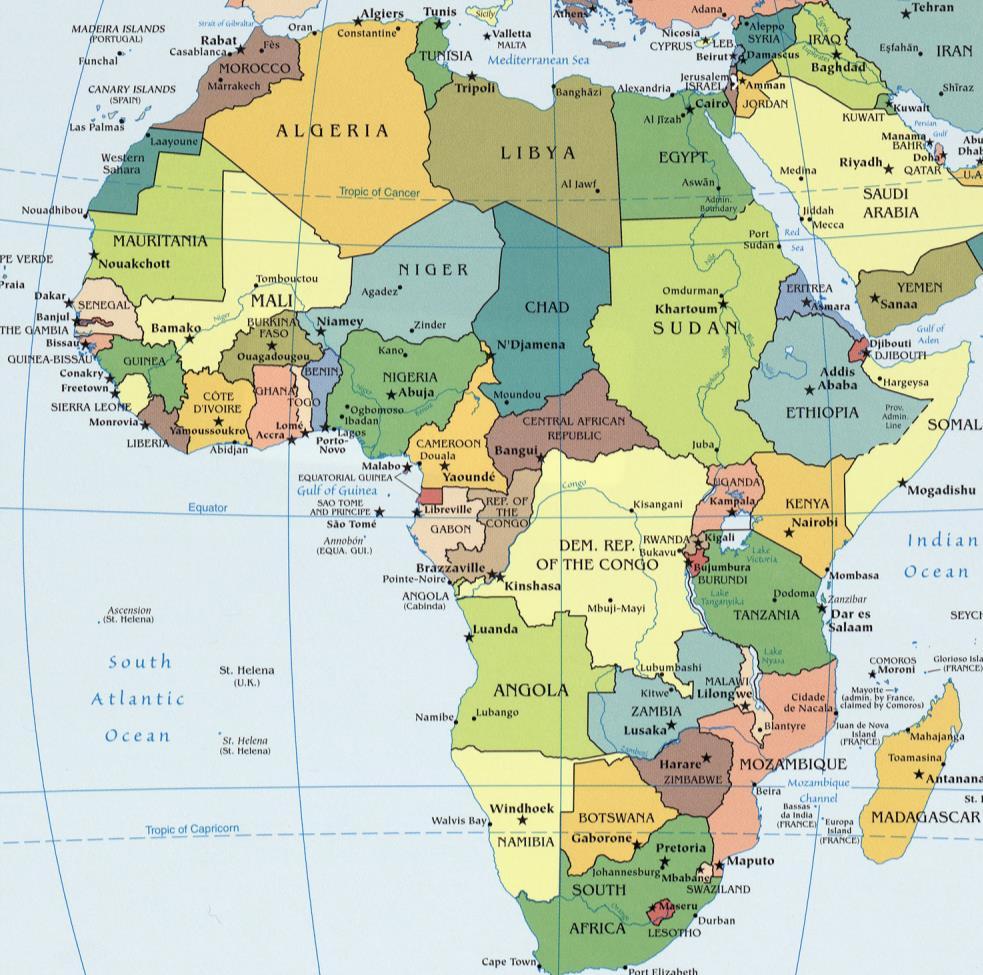
1 Feasibility Study: GEOSCIENTIFIC KNOWLEDGE AND SKILLS OF AFRICAN GEOLOGICAL SURVEYS WP 3 - Gap analysis of geoscientific mapping Acquisition of metadata to geological maps as base for the compilation of an index map and map catalogue of available maps Kristine Asch & Markus Toloczyki (BGR)


 GIRAF - Network Geoscience")
2 WP3: Partner organisations BGR BGS British Geological Survey BRGM - Bureau de Recherches Géologiques et Minières CzGS Ceska geologicka sluzba IGME Greece - Institute of Geology & Mineral Exploration PGI-NRI Polish Geological Institute - National Research Institute SGUDS - State Geological Institute of Dionýz Štúr (Slowakia) GIRAF - Network Geoscience Information in Africa
3 WP3: Objectives Compilation of a map catalogue / index maps of available maps on: Geology Mineral occurrences, e.g. raw materials, energetic minerals Groundwater occurences and quality Geochemistry Geophysics Remote Sensing data Identification of areas where detailed geological mapping is required
4 WP 3: Methods Collection of all necessary geospatial metadata of published and unpublished digital and analogue maps for geology, mineral resources, groundwater, geophysics, geochemistry and imageries on international, national, regional and local scales; Identification of areas where more detailed field mapping is needed (= white areas ); Identification of actual and potential users needs; Recommendations to better the situation.
5 Activity 3: GAP analysis of geoscientific mapping Task 3.1, Create and disseminate a questionnaire no 1.2 to assess the present situation of all African Geological Surveys and similar institutions in Africa for activities in geoscientific fieldwork and map production. Task 3.2: Evaluate gathered information to show the present situation with African Geological Surveys; Task 3.3: Write a concept note with recommendations for strengthening mapping activities and the provision of geoscientific information and geodata by Geological Surveys in Africa. Task 3.4: Present the assessment results and recommendations at the Project Workshop for comments, feedback discussion and refine with the OAGS members. Task 3.5: Present the assessment results and recommendations at the Project Workshop for comments, feedback discussion and refine with the OAGS members.
6 WP3: Deliverables - Internal reports IR3.1: Overview on existing available geoscience maps and geodata in Africa as well as a description of the present situation on mapping activities in African countries by national geological surveys IR3.2: Concept Note on strategies to strengthen the capacities of African geological surveys in the field of geological mapping and the provision of geodata (maps and web services) IR3.3: Dissemination result
7 As-Is Analysis Overview of existing available maps and geodata and Description of the present situation on mapping activities with African Geological Surveys.


8 Database for metadata Data Entry Form Graphic User Interface 20,10000 Visualisation of bounding box

9 Database for metadata Table metadata


10 Generation of index maps: e.g. Geological Maps (Ghana) All themes, var. scales Geology, 1 : Geology, 1 : Geology, 1 :


11 WP3: Concept Note Strategies and recommendations to strengthen the capacities of African Geological Surveys in the field of geological mapping and the provision of geodata (maps and web services)
12 Interaction with other WPs Tasks Task 3.1 Task 3.2 Task 3.3 Involved work package all all WP6 Task 3.4 Task 3.5
13 Thank you
Evaluating Sustainability of the Georesources Observation System
 Evaluating Sustainability of the Georesources Observation System Michael Mente Federal Institute for Geosciences and Natural Resources Germany, Hannover GEOSS-CBC Meeting Athens April 27th 28th, 2009 GEOSS-CBC
EO-MINERS and Minerals 4EU
 GEO-CRADLE pre-kick-off Meeting Friday, 18 th of February, 2016 Veronika Kopačková, Czech Geological Survey EO-MINERS and Minerals 4EU IONIC Centre, 11 Lysiou Street Athens, Greece EO-MINERS (2010-2013)
EU GeoCapacity. Assessing European Capacity for Geological Storage of Carbon Dioxide. Thomas Vangkilde-Pedersen, GEUS
 EU GeoCapacity Assessing European Capacity for Geological Storage of Carbon Dioxide Thomas Vangkilde-Pedersen, GEUS GeoCapacity results and the future for geological storage of CO 2 EU GeoCapacity open
Geoscience Information in Africa (GIRAF):
:") Geoscience Information in Africa (GIRAF): Kristine Asch GIRAF coordinator Dar es Salaam, CAG 25 15 th August, 2014 Agenda: 5 W s What is the GIRAF network Why the GIRAF network Who is the GIRAF network
Geoscience Information in Africa (GIRAF): Kristine Asch GIRAF coordinator Dar es Salaam, CAG 25 15 th August, 2014 Agenda: 5 W s What is the GIRAF network Why the GIRAF network Who is the GIRAF network
GEO-CRADLE Regional Event Access to raw materials. Veronika Kopačková, Czech Geological Survey EO-MINERS
 GEO-CRADLE Regional Event Access to raw materials Veronika Kopačková, Czech Geological Survey EO-MINERS Morocco&Algeria 17-23 October 2016 EO-MINERS (2010-2013) EO-MINERS was a Research and Technological
Call for Applications
 Call for Applications for a PanAfGeo Training «WP1 Geoscientific Mapping, part WP1E1 Remote Sensing» 20-30 November 2017, Bishoftu, Ethiopia in English 1. MAIN CONTEXT OF PANAFGEO PanAfGeo for Pan-African
econtentplus GS Soil
 econtentplus GS Soil General aims Assessment and strategic development of INSPIRE compliant Geodata-Services for European Soil Data BPN on basis of the EU 2007/2/EC (INSPIRE) Directive for Annex III theme
A Joint European GIS Under Construction: The 1:5 Million International Geological Map of Europe and Adjacent Areas (IGME 5000)
") Abstract 2001 Annual Conference of the International Association for Mathematical Geology Technical Program - Session I (Poster) Building National and Regional Geologic Map Databases A Joint European GIS
Abstract 2001 Annual Conference of the International Association for Mathematical Geology Technical Program - Session I (Poster) Building National and Regional Geologic Map Databases A Joint European GIS
Activity 6.3 Geoscience information infrastructure and management
 G E O S C I E N T I F I C K N O W L E D G E A N D S K I L L S I N A F R I C A N G E O L O G I C A L S U R V E Y S Activity 6.3 Geoscience information infrastructure and management CAG25 - TW4 Workshop
A contribution to GEOSS from the SDI for Georesources in Africa
 A contribution to GEOSS from the SDI for Georesources in Africa A. TELLEZ-ARENAS BRGM, France in behalf of: Dr. Marc URVOIS Project Coordinator BRGM, France Mineral Resources Division INSPIRE Conference
Outline Brief Overview MapPlace Website Data Delivery & Map Themes Digital Geology
 BRITISH COLUMBIA GEOLOGICAL SURVEY Kirk Hancock Pat Desjardins Nick Massey BRITISH COLUMBIA Ministry of Energy and Mines Ward Kilby acknowledged developer of MapPlace Outline Brief Overview MapPlace Website
The AMGI project: A Brief Overview
 The AMGI project: A Brief Overview World Bank Group (Energy & Extractives Global Practice) GEEDR Francisco Igualada (figualada@worldbank.org) Presented by Ash Johnson, Geosoft Inc. The AMGI Project: Vision
Call for Applications
 Call for Applications for a PanAfGeo Training «WP7 Geoscientific information Management» 20 November - 1 st December 2017 Accra, Ghana in English 1. MAIN CONTEXT OF PANAFGEO PanAfGeo for Pan-African Support
GEO-CRADLE Project Meeting 2 Thursday, 17 th November, 2016
 GEO-CRADLE Project Meeting 2 Thursday, 17 th November, 2016 T4.3 EGS-PGI NRI Marek Graniczny (EGS PGI) Maria Przyłucka (EGS PGI) Eleftheria Poyiadji (EGS-IGME-Greece) Zbigniew Kowalski (EGS PGI) Christodoulos
EMODne Entry Portal Steering Committee, Brussels, 16 December Alan Stevenson, Jonathan Lowndes (British Geological Survey) and the project team
 and the project team") EMODnet Geology EMODne Entry Portal Steering Committee, Brussels, 16 December 2013 Alan Stevenson, Jonathan Lowndes (British Geological Survey) and the project team Background 14 organisations participated
EMODnet Geology EMODne Entry Portal Steering Committee, Brussels, 16 December 2013 Alan Stevenson, Jonathan Lowndes (British Geological Survey) and the project team Background 14 organisations participated
New COST Action: Towards a European Network on Chemical Weather Forecasting and Information Systems
 New COST Action: Towards a European Network on Chemical Weather Forecasting and Information Systems Proposer: Mikhail Sofiev Finnish Meteorological Institute Historical background EUMETNET Workshop on
Outline. What is MapPlace? MapPlace Toolbar & PopUp Menu. Geology Themes 1:5M 1:1M BCGS 1:250,000. Terranes
 Outline BRITISH COLUMBIA Overview and Explore MapPlace Website Data Delivery & Map Themes Data Sources & Updates Feature Topics New Data & Maps New MINFILE Online Exploration Assistant with Image Analysis
OVERALL PROGRAMME. Sunday 16 October 2016:
 Sunday 16 October 2016: OVERALL PROGRAMME - Arrival in Morocco (landing either in Casablanca, with transfers to hotel to be organized by EGS, or Rabat) - Hosted dinner for the European Geological Surveys,
German-Peruvian Workshop on Research Cooperation on Raw Materials of Strategic Economic Importance
 German-Peruvian Workshop on Research Cooperation on Raw Materials of Strategic Economic Importance Friday, 25 of September 2015 Sonesta Hotel El Olivar Research activities in the field of economical strategic
The Spatial Data Infrastructure for the Geological Reference of France
 The Spatial Data Infrastructure for the Geological Reference of France Marc Urvois, Thierry Baudin, Florence Cagnard, Philippe Calcagno, Nicolas Chauvin, Ulrich Clain, Santiago Gabillard, Sandrine Grataloup,
The Global Statistical Geospatial Framework and the Global Fundamental Geospatial Themes
 The Global Statistical Geospatial Framework and the Global Fundamental Geospatial Themes Sub-regional workshop on integration of administrative data, big data and geospatial information for the compilation
James Francis Natukunda
 James Francis Natukunda Department of Geological Surveys and Mines Ministry of Energy and Mineral Development, Uganda Regional stakeholders workshop for EARS countries and partners Nairobo, Kenya 15-17
The INSPIRE compliant Geological Map of Germany 1:1,000,000 (GK1000)
") The INSPIRE compliant Geological Map of Germany 1:1,000,000 (GK1000) Marc Filip Wiechmann, Stephanie Bellenberg, Susanne Glück, Andreas Alexander Maul Federal Institute for Geosciences and Natural Resources
The INSPIRE compliant Geological Map of Germany 1:1,000,000 (GK1000) Marc Filip Wiechmann, Stephanie Bellenberg, Susanne Glück, Andreas Alexander Maul Federal Institute for Geosciences and Natural Resources
Data Origin. Ron van Lammeren CGI-GIRS 0910
 Data Origin Ron van Lammeren CGI-GIRS 0910 How to obtain geodata? Geo data initiative Executive Order 12906, "Coordinating Geographic Data Acquisition and Access: The National Spatial Data Infrastructure,"
Data Origin. How to obtain geodata? Ron van Lammeren CGI-GIRS 0910
 Data Origin How to obtain geodata? Ron van Lammeren CGI-GIRS 0910 Spatial Data interest Improvement of policy making. ± 90% of all information used by government has spatial characteristics SPATIAL INFORMATION
The Canadian Ceoscience Knowledge Network. - A Collaborative Effort for Unified Access to Ceoscience Data
 The Canadian Ceoscience Knowledge Network - A Collaborative Effort for Unified Access to Ceoscience Data The Canadian Geoscience Knowledge Network A Collaborative Effort for Unified Access to Geoscience
a national geological survey perspective François ROBIDA BRGM (French Geological Survey)
") a national geological survey perspective François ROBIDA BRGM (French Geological Survey) Pre-Conference Seminar on Socio-Economic Value of Geospatial for National and Regional Development 21 August 2017,
a national geological survey perspective François ROBIDA BRGM (French Geological Survey) Pre-Conference Seminar on Socio-Economic Value of Geospatial for National and Regional Development 21 August 2017,
West African exploration Initiative
 West African exploration Initiative Working together to explore West Africa 1 of 29 African Minerals Geoscience Landscape Networking Training GeoData Management and Delivery AMV AMDC Research & Data Acquisition
IHO STAKEHOLDERS FORUM. Hydrographic data and its role in MSDI. Thursday 27 September Jens Peter Hartmann KMS
 IHO STAKEHOLDERS FORUM Hydrographic data and its role in MSDI Thursday 27 September Jens Peter Hartmann KMS Agenda Traditional approach to hydrographic data Expectations within the marine / maritime field
Spatial Data Infrastructure Concepts and Components. Douglas Nebert U.S. Federal Geographic Data Committee Secretariat
 Spatial Data Infrastructure Concepts and Components Douglas Nebert U.S. Federal Geographic Data Committee Secretariat August 2009 What is a Spatial Data Infrastructure (SDI)? The SDI provides a basis for
GeoERA Raw Materials Mineral Intelligence for Europe (MINTELL4EU)
") GeoERA Raw Materials Mineral Intelligence for Europe (MINTELL4EU) Improving and sustaining the EURMKB Pedro Delgado Department of Geological Resources Research GEOLOGICAL SURVEY OF SPAIN Horizon 2020 Co-funded
GeoERA Raw Materials Mineral Intelligence for Europe (MINTELL4EU) Improving and sustaining the EURMKB Pedro Delgado Department of Geological Resources Research GEOLOGICAL SURVEY OF SPAIN Horizon 2020 Co-funded
CGS Europe. Pan-European coordination action on CO 2 Geological Storage. (Coordination and support action)
") CGS Europe Pan-European coordination action on CO 2 Geological Storage (Coordination and support action) THEME [ENERGY.2010.5.2-2] [Trans-national cooperation and networking in the field of geological
CGS Europe Pan-European coordination action on CO 2 Geological Storage (Coordination and support action) THEME [ENERGY.2010.5.2-2] [Trans-national cooperation and networking in the field of geological
Introduction. Elevation Data Strategy. Status and Next Steps
 1 2 Introduction Elevation Data Strategy Status and Next Steps 3 Canada is the 2nd largest country in the world - 9.9 million sq km Surrounded by 3 oceans with 202 000 km of coastline Population over 35
CHALLENGES WITH THE FUNDAMENTAL GEOSPATIAL DATA IN AFRICA
 CHALLENGES WITH THE FUNDAMENTAL GEOSPATIAL DATA IN AFRICA Dr Derek Clarke Chair: UN-GGIM: Africa WG on Fundamental Geospatial Data and Standards derek.clarke.dr@gmail.com International Workshop on Fundamental
Challenges and Successes in Sharing Geospatial Data in Africa
 Challenges and Successes in Sharing Geospatial Data in Africa 2018 GeoNode Summit Torino, Italy March 26-28, 2018 Bernard Justus Muhwezi Manager, Geo-Information Services Uganda Bureau of Statistics, Kampala,
Addressing GEO-CRADLE regional challenges - Access to raw materials MINUTES
 Observation Activities in the regions of North Africa, Middle East, and Addressing GEO-CRADLE regional challenges - Access to raw materials MINUTES The GEO-CRADLE project has received funding from the
S/He reports to the Programme Effectiveness Manager. Lead, review and process the development of NO GIS framework and tools.
 GIS Coordinator Location: [Africa] [Ghana] Town/City: Accra Category: Knowledge Management GIS Coordinator To provide leadership and management to cluster staff (of 2 to 3 Area Programs) by ensuring that
Management of Geological Information for Mining Sector Development and Investment Attraction Examples from Uganda and Tanzania
 Mineral Wealth Conference 2016 Kampala / Uganda Management of Geological Information for Mining Sector Development and Investment Attraction Examples from Uganda and Tanzania Andreas Barth 1, Andreas Knobloch
INTAROS Integration of the existing Arctic observing systems into a common data frame. Roberta Pirazzini, Finnish Meteorological Institute
 INTAROS Integration of the existing Arctic observing systems into a common data frame Roberta Pirazzini, Finnish Meteorological Institute Outline 1. Overview of the INTAROS project 2. Overview of the INTAROS
GEOGRAPHIC INFORMATION SYSTEMS Session 8
 GEOGRAPHIC INFORMATION SYSTEMS Session 8 Introduction Geography underpins all activities associated with a census Census geography is essential to plan and manage fieldwork as well as to report results
EuroSDR (European Spatial Data Research)
") EuroSDR (European Spatial Data Research) ROLLING RESEARCH PLAN 2015-2018 EuroSDR Secretariat Public Governance Institute KU Leuven Parkstraat 45 bus 3609 3000 Leuven Belgium Tel.: +32 16 32 31 80 Fax:
EuroSDR (European Spatial Data Research) ROLLING RESEARCH PLAN 2015-2018 EuroSDR Secretariat Public Governance Institute KU Leuven Parkstraat 45 bus 3609 3000 Leuven Belgium Tel.: +32 16 32 31 80 Fax:
INSPIRE in Sweden.
 INSPIRE in Sweden Swedish National Data Service Established 2008. SND is a service organisation for Swedish research within the Humanities, Social Sciences and Medicine. SND is the Swedish node in an international
Data Collection & Sample Storage
 Development, Implementation and Regulation of Exploration Programmes for Uranium Mineral Resources Data Collection & Sample Storage Regional Training Course: RAF 3007-2 Malawi, 24-28 May 2010 International
Implementation of Inspire in Denmark - How we get it flying! Olav Eggers National Survey & Cadastre -Denmark
 Implementation of Inspire in Denmark - How we get it flying! Olav Eggers oe@kms.dk National Survey & Cadastre -Denmark Introduction Overview Infrastructure for Spatial Information Act National Survey and
Sharing soil information with the help of INSPIRE, key challenges with soil data management
 Sharing soil information with the help of INSPIRE, key challenges with soil data management Katharina Feiden e-mail: gssoil@portalu.de GS Soil: project outline GS Soil: Assessment and strategic development
THE USE OF GIS IN GEOTHERMAL RESOURCE MANAGEMENT: A CASE STUDY OF OLKARIA GEOTHERMAL PROJECT
 Presented at SDG Short Course II on Exploration and Development of Geothermal Resources, organized by UNU-GTP, GDC and KenGen, at Lake Bogoria and Lake Naivasha, Kenya, Nov. 9-29, 2017. Kenya Electricity
EO-MINERS. Contribution of Earth Observation in monitoring the environmental and societal impact of mining. The EO-MINERS project
 EO-MINERS Contribution of Earth Observation in monitoring the environmental and societal impact of mining The EO-MINERS project Geospatial World Forum Amsterdam April 25, 2012 Stéphane CHEVREL Project
European Research Network of Excellence on the Geological Storage of CO 2
 European Research Network of Excellence on the Geological Storage of CO 2 CO2GeoNet Dr Nick Riley MBE (British Geological Survey, Nottingham, UK; CO2GeoNet Coordinator) njr @bgs.ac.uk www.co2geonet.com
EuroGeoSource: sharing data and services on energy and mineral resources in Europe following INSPIRE
 EuroGeoSource: sharing data and services on energy and mineral resources in Europe following INSPIRE Rubén Béjar 1, Miguel Usón 2, Jesús Barrera 2, Rocío Recio 1, José M. Agudo 1, F. Javier Zarazaga-Soria
EuroGeoSurveys. Minerals, metals and mining statistics: The role of Geological Surveys in building continental-scale official data sets
 EuroGeoSurveys Minerals, metals and mining statistics: The role of Geological Surveys in building continental-scale official data sets 40 Years Listening to the Beat of the Earth 1 EuroGeoSurveys 37 Geological
THE ROLE OF SEAMIC IN SUSTAINABLE MINERAL RESOURCES DEVELOPMENT IN AFRICA
 THE ROLE OF SEAMIC IN SUSTAINABLE MINERAL RESOURCES DEVELOPMENT IN AFRICA Ketema Tadesse Director General-SEAMIC Dar es Salaam, Tanzania August 11, 2009 SEAMIC BACKGROUND SEAMIC was established in 1977
Regional Report. Asia
 OneGeology Board Meeting #15, Vancouver, Canada, 14 June 2018 Regional Report Asia Masahiko Makino Geological Survey of Japan, AIST OneGeology Board Meeting #15, Vancouver, Canada, 14-15 June 2018 Contents
SWEDISH SDI DEVELOPMENT & IMPLEMENTATION OF INSPIRE
 SWEDISH SDI DEVELOPMENT & IMPLEMENTATION OF INSPIRE Christina Wasström, Lantmäteriet, 801 82 Gävle, Sweden, christina.wasstrom@lm.se ABSTRACT The Swedish Government and Parliament has given Lantmäteriet
Geospatial Information for Disease Prevention and Control. INSPIRE Conference 2013
 Geospatial Information for Disease Prevention and Control Dr. Virginia Estevez, Senior Expert GIS Florence, 25 th June 2013 ECDC overview ECDC The European Centre for Disease Prevention and Control (ECDC),
Geoíndex: a public data dissemination service from the IGC. Geoíndex IGC Team Reporter: Carme Puig
 Geoíndex: a public data dissemination service from the IGC Geoíndex IGC Team Reporter: Carme Puig 2 Brief IGC introduction The IGC was created through the Law 19/2005 of the Catalan Parliament. The IGC
NAG-City Expert Workshop Oslo 8-9. October 2012 SOSI standards and mapping for Europe (INSPIRE)
") NAG-City Expert Workshop Oslo 8-9. October 2012 SOSI standards and mapping for Europe (INSPIRE) Per Ryghaug, Geomatics The Norwegian national standard on geographic information - SOSI Started in 1984 NGU
NAG-City Expert Workshop Oslo 8-9. October 2012 SOSI standards and mapping for Europe (INSPIRE) Per Ryghaug, Geomatics The Norwegian national standard on geographic information - SOSI Started in 1984 NGU
GST Geosciences in Space and Time
 A TEAM COLLABORATION TOOL AND PLATFORM TO SHARE 3D GEOMODELS GST Geosciences in Space and Time Paul Gabriel 1,2, Jan Gietzel 1,2, Helmut Schaeben 2 1 GiGa infosystems, Freiberg, Germany 2 Geophysics and
GEO Coastal Zone Community of Practice (CZCP)
") ! "#$%&" $'( )$*+,-.'// Global, regional and local trends in natural processes and human demands on coastal ecosystems jeopardize the ability of these ecosystems to support commerce, living resources,
! "#$%&" $'( )$*+,-.'// Global, regional and local trends in natural processes and human demands on coastal ecosystems jeopardize the ability of these ecosystems to support commerce, living resources,
Final report for the Expert Group on the Integration of Statistical and Geospatial Information, May 2015
 Final report for the Expert Group on the Integration of Statistical and Geospatial Information, May 2015 Global geographic classification and geocoding practices Executive summary This final report was
National Atlas of Groundwater Dependent Ecosystems (GDE)
") National Atlas of Groundwater Dependent Ecosystems (GDE) Dr. Zaffar Sadiq Mohamed-Ghouse Executive Consultant & Practice Head-Spatial SKM, Australia zsadiq@globalskm.com Geospatial World Forum 2013, Rotterdam,
National Atlas of Groundwater Dependent Ecosystems (GDE) Dr. Zaffar Sadiq Mohamed-Ghouse Executive Consultant & Practice Head-Spatial SKM, Australia zsadiq@globalskm.com Geospatial World Forum 2013, Rotterdam,
Use of the ISO Quality standards at the NMCAs Results from questionnaires taken in 2004 and 2011
 Use of the ISO 19100 Quality standards at the NMCAs Results from questionnaires taken in 2004 and 2011 Eurogeographics Quality Knowledge Exchange Network Reference: History Version Author Date Comments
40 Years Listening to the Beat of the Earth
 EuroGeoSurveys The role of EuroGeoSurveys in Europe-Africa geoscientific cooperation 40 Years Listening to the Beat of the Earth EuroGeoSurveys 32 Albania Lithuania Austria Luxembourg Belgium The Netherlands
Together4Water project. Implementing an open-source database to monitor water-related SDG in Tunisia
 Linked Open Data in Agriculture Together4Water project Implementing an open-source database to monitor water-related SDG in Tunisia Ir. Raed Fehri Supervisors: Prof. Marnik Vanclooster Prof. Kim Mens Berlin,
Land Use / Land Cover Mapping in
 Land Use / Land Cover Mapping in Eastern and Southern African Regions RCMRD Experience by 6/24/2013, Nairobi Kenya Dr. Tesfaye Korme Director of RS, GIS and Mapping, RCMRD I. About RCMRD, Its Vision and
Spatially Enabled Society
 International Seminar on Land Administration Trends and Issues in Asia and the Pacific Region Spatially Enabled Society Abbas Rajabifard Vice Chair PCGIAP-WG3 Vice-President (President Elect), GSDI Association
GIS MODEL OF THE BASIC GEOLOGICAL MAP AS A BASIS FOR GEODATABASE OF THE REPUBLIC OF MACEDONIA
 GIS MODEL OF THE BASIC GEOLOGICAL MAP AS A BASIS FOR GEODATABASE OF THE REPUBLIC OF MACEDONIA M.Sc. Blagoj Delipetrev 1, Prof. Dr. Todor Delipetrov 2, M.Sc. Blagica Doneva 3, Eng. Dejan Boskovski 4 1,2,3
Methodological Chain for Hydrological Management with Web-GIS Applications
 Advances in Geosciences Konstantinos Perakis & Athanasios Moysiadis, Editors EARSeL, 2012 Methodological Chain for Hydrological Management with Web-GIS Applications Alexandros Konstantinidis 1, Eleni Tzanou
GTK GeoKernel and Data Management. Material from Niina Ahtonen, Esa Kauniskangas and Tero Rönkkö
 GTK GeoKernel and Data Management Esa Kauniskangas 31.5.2010 Material from Niina Ahtonen, Esa Kauniskangas and Tero Rönkkö 1 GTK s operational areas Northern Finland Office Rovaniemi Western Finland Office
Study program: Geology. Semester I Required subject Code Subject ECTS. Hours per week
 Study program: Geology Semester I 2FI100112 Math 1 8 3+2+2 216 2FP100212 Physics 1 8 3+2+2 216 UGD101312 Computer Science 6 2+2+1 156 1 4 2+1+1 120 2 4 2+1+1 120 : 2FP110112 Basics geology 2FP101212 Fundamentals
BY: Daniel Kwame Ladzagla (Bsc Eng.,Msc I.T) The Energy Centre, KNUST-Kumasi. July 27 Dakar, Senegal
 The Energy Centre, KNUST-Kumasi. July 27 Dakar, Senegal") 1 BY: Daniel Kwame Ladzagla (Bsc Eng.,Msc I.T) The Energy Centre, KNUST-Kumasi July 27 2016 @ Dakar, Senegal Presentation Outline 2 The Energy Center Work Package(WP) WP Implementation IntiGIS Model Methodology
1 BY: Daniel Kwame Ladzagla (Bsc Eng.,Msc I.T) The Energy Centre, KNUST-Kumasi July 27 2016 @ Dakar, Senegal Presentation Outline 2 The Energy Center Work Package(WP) WP Implementation IntiGIS Model Methodology
3-04 東 東南アジアの地質情報総合データベースの構築 : CCOP 地質情報総合共有プロジェクト
 3-04 東 東南アジアの地質情報総合データベースの構築 : CCOP 地質情報総合共有プロジェクト 宝田晋治 1 Joel Bandibas 1 Constructing a comprehensive geoscience database in East and Southeast Asia: CCOP Geoinformation Sharing Infrastructure for East
National Cartographic Center
 National Cartographic Center NCC activities and accomplishments Activities of national organizations, institutions and universities in field of geomatics Large scale maps Medium scale maps Small scale
Copernicus for Raw Materials Workshop
 Copernicus for Raw Materials Workshop Copernicus 40 User Years Forum Listening Industry Workshop, to the Beat 5th September of the Earth 2016, Brussels About http://copernicus.eu/raw-materials-workshop
geonorge.no The New Norwegian geoportal An implementation of a geoportal using Arc_IMS Portal toolkit
 geonorge.no The New Norwegian geoportal An implementation of a geoportal using Arc_IMS Portal toolkit Roy Mellum, Norwegian Mapping Autorithy Abstract In January this year, the Norwegian geoportal was
The Safeland Project General Overview and Monitoring Technology Development
 Ber. Geol. B. A., 82, ISSN 1017 8880 Landslide Monitoring Technologies & Early Warning Systems The Safeland Project General Overview and Monitoring Technology Development The SafeLand Consortium a), N.
EuroGeoSurveys An Introduction
 EGS -ASGMI Workshop, Madrid, 2015 EuroGeoSurveys An Introduction 40 Years Listening to the Beat of the Earth Click to edit Master title Albania style EuroGeoSurveys Austria Lithuania Luxembourg Belgium
INSPIRE - A Legal framework for environmental and land administration data in Europe
 INSPIRE - A Legal framework for environmental and land administration data in Europe Dr. Markus Seifert Bavarian Administration for Surveying and Cadastre Head of the SDI Office Bavaria Delegate of Germany
The Added Value of Geospatial Data in a Statistical Office. Pedro Diaz Munoz Director Sectoral and Regional Statistics EUROSTAT European Commission
 The Added Value of Geospatial Data in a Statistical Office Pedro Diaz Munoz Director Sectoral and Regional Statistics EUROSTAT European Commission Why integrate Responsibility of all the information we
7 th WMO RAI Dissemination Expert working Group RAIDEG report. Mariane Diop Kane, Chair
 7 th WMO RAI Dissemination Expert working Group RAIDEG report Mariane Diop Kane, Chair Overview Established in 2010 by WMO, in cooperation with EUMETSAT Endorsed by WMO RA-I at its 16 th session in 2015,
THE IMPACT OF THE INSPIRE DIRECTIVE ON GEOLOGIC DATA MODELS OF GEOLOGICAL SURVEYS. THE IGME (SPAIN) CASE
 CASE") THE IMPACT OF THE INSPIRE DIRECTIVE ON GEOLOGIC DATA MODELS OF GEOLOGICAL SURVEYS. THE IGME (SPAIN) CASE Fernando Pérez Cerdán, María J. Mancebo Mancebo & Francisco Rubio Pascual Instituto Geológico y
THE IMPACT OF THE INSPIRE DIRECTIVE ON GEOLOGIC DATA MODELS OF GEOLOGICAL SURVEYS. THE IGME (SPAIN) CASE Fernando Pérez Cerdán, María J. Mancebo Mancebo & Francisco Rubio Pascual Instituto Geológico y
Study on Data Integration and Sharing Standard and Specification System for Earth System Science
 Study on Data Integration and Sharing Standard and Specification System for Earth System Science Juanle Wang and Jiulin Sun Information Sharing Center for Earth System Science Institute of Geographic Sciences
Polish Geological Institute National Research. Tasks, people and equipment
 Polish Geological Institute National Research Institute Tasks, people and equipment Warsaw, 08.07.2013 Established in the year 1919 The PGI-NRI is a research institute supervised by the Minister of the
INSPIRE General Introduction & Service Architecture
 INSPIRATION Spatial Data Infrastructure in the Western Balkans INSPIRE General Introduction & Service Architecture 1st National INSPIRATION Workshop Croatia November 21-22, 2012 A multi-countryprojectfunded
African Coastal Atlas developments. 10 July 2008 EEA Copenhagen, Denmark
 African Coastal Atlas developments 10 July 2008 EEA Copenhagen, Denmark Africa Overview Africa has approximately 40 000 km of coast across 32 mainland countries and four island states. Africa's coastal
GEOMATICS. Shaping our world. A company of
 GEOMATICS Shaping our world A company of OUR EXPERTISE Geomatics Geomatics plays a mayor role in hydropower, land and water resources, urban development, transport & mobility, renewable energy, and infrastructure
INSPIRE in Sweden - an Important Part of the National Geodata Strategy
 INSPIRE in Sweden - an Important Part of the National Geodata Strategy Ewa RANNESTIG and Monica LAGERQVIST NILSSON, Sweden Key words: National Geodata Strategy, National Infrastructure for Spatial Information,
The Architecture of the Georgia Basin Digital Library: Using geoscientific knowledge in sustainable development
 GEOLOGIJA 46/2, 343 348, Ljubljana 2003 The Architecture of the Georgia Basin Digital Library: Using geoscientific knowledge in sustainable development B. BRODARIC 1, M. JOURNEAY 2, S. TALWAR 2,3, R. HARRAP
Proposal for a DIRECTIVE OF THE EUROPEAN PARLIAMENT AND OF THE COUNCIL. establishing an infrastructure for spatial information in the Community
 Proposal for a DIRECTIVE OF THE EUROPEAN PARLIAMENT AND OF THE COUNCIL establishing an infrastructure for spatial information in the Community INSPIRE http://inspire.jrc.it/ Alessandro Annoni 1 EU Commission
Mineral Resources Branch. Natural Resources
 Mineral Resources Branch Natural Resources ! Brian Fisher - Geologist / GIS Specialist - supervisor! Jeff Poole - Geologist / GIS Specialist - IMS specialist! John MacNeil - Geologist / GIS Specialist
Presentation of the Cooperation Project goals. Nicola Ferrè
 Presentation of the Cooperation Project goals Nicola Ferrè Project goals Capacity development for implementing a Geographic Information System (GIS) applied to surveillance, control and zoning of avian
Status of interoperability issues in the Chilean SDI. Álvaro Monett Pablo Morales Executive Secretariat NSDI-Chile
 Status of interoperability issues in the Chilean SDI Álvaro Monett Pablo Morales Executive Secretariat NSDI-Chile Outline Background - Chilean SDI working areas Background Interoperability, standards and
(2008) 8 (6) ISSN
 8 (6) ISSN") Le Cozannet, Gonéri and Hosford, Steven and Douglas, John and Serrano, Jean-Jacques and Coraboeuf, Damien and Comte, Jérémie (2008) Connecting hazard analysts and risk managers to sensor information. Sensors,
Le Cozannet, Gonéri and Hosford, Steven and Douglas, John and Serrano, Jean-Jacques and Coraboeuf, Damien and Comte, Jérémie (2008) Connecting hazard analysts and risk managers to sensor information. Sensors,
Sustainable Management of Mineral Resources Project
 AIRBORNE GEOPHYSICS AS A TOOL TO PROM OTE M INERAL INVESTMENT IN AFRICA Stephen Re ford,k arl KwaiT2^Julius Nyakama3,Andre w Katum wehe4, Oumar Wane5 Paterson,Grant % Watson Limited,Toronto,Canada,Stephen.
GEOGRAPHICAL INFORMATION SYSTEMS. GIS Foundation Capacity Building Course. Introduction
 GEOGRAPHICAL INFORMATION SYSTEMS. GIS Foundation Capacity Building Course. Introduction In recent times digital mapping has become part and parcel of our daily lives with experience from Google Maps on
The Danish Maritime Spatial Data Infrastructure (MSDI) Geodata of the Sea
 Geodata of the Sea") MSDI/MSP The Danish Maritime Spatial Data Infrastructure (MSDI) Geodata of the Sea Components of an infrastructure: DATA - metadata, datasets FUNCTIONALITY - spatial data services, web services and other
MSDI/MSP The Danish Maritime Spatial Data Infrastructure (MSDI) Geodata of the Sea Components of an infrastructure: DATA - metadata, datasets FUNCTIONALITY - spatial data services, web services and other
SPECCHIO for Australia: taking spectroscopy data from the sensor to discovery for the Australian remote sensing community
 University of Wollongong Research Online Faculty of Science, Medicine and Health - Papers Faculty of Science, Medicine and Health 2013 SPECCHIO for Australia: taking spectroscopy data from the sensor to
Country Report of Nigeria *
 HIGH LEVEL FORUM ON GLOBAL CONFERENCE ROOM PAPER GEOSPATIAL MANAGEMENT INFORMATION NO. 17 First Forum Seoul, Republic of Korea, 24-26 October 2011 Country Report of Nigeria * * Submitted by: Mr. Ganiyu
Work Packages. RECROS Project development workshop. Prague, 30 th April 2015
 Work Packages Prague, 30 th April 2015 Main principles - remarks Protected areas, regions, cities, not only comparison cities/rural areas HU most of cities have their climate strategies good contacts to
KENYA NATIONAL BUREAU OF STATISTICS Workshop on
 KENYA NATIONAL BUREAU OF STATISTICS Workshop on Capacity Building in Environment Statistics: the Framework for the Development of Environment Statistics (FDES 2013) Coordination with Sector Ministries
What is OneGeology in 2015?
 What is OneGeology in 2015? 25th May 2015 Marko Komac OneGeology Managing Director Presentation Outline Background quick OneGeology history Consortium The vehicle to achieve the goal Current status Where