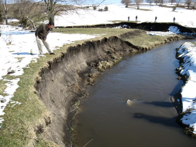
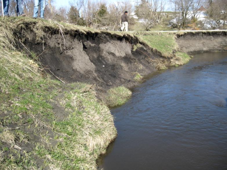
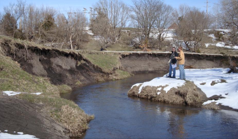
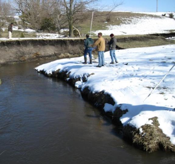
NREM 407/507 April Jordan River today Danube on Tuesday. 2. Quiz. 3. Discuss Stream Bank Stabilization
|
|
|
- Britney Nash
- 5 years ago
- Views:
Transcription


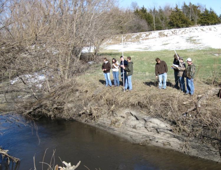
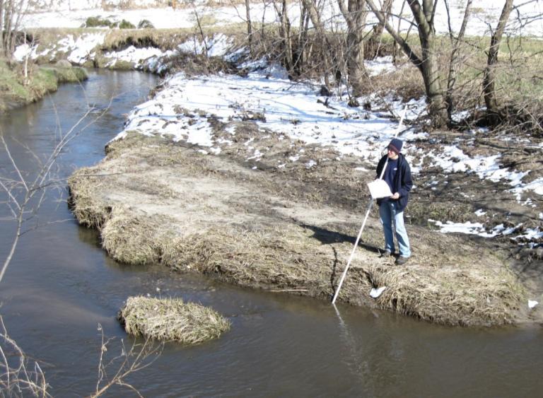
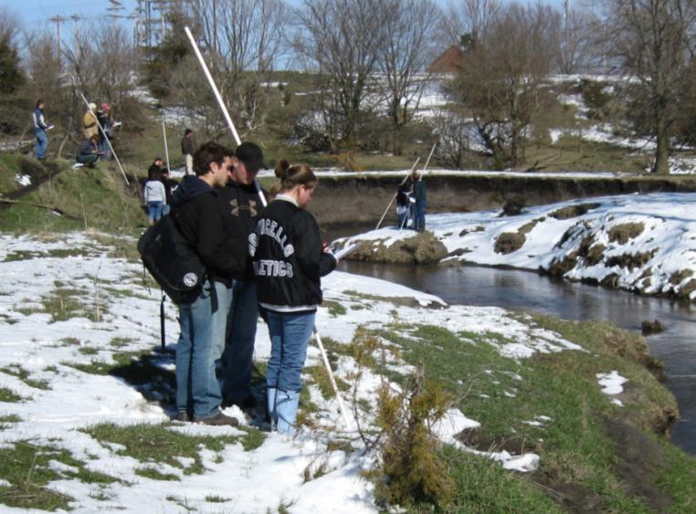
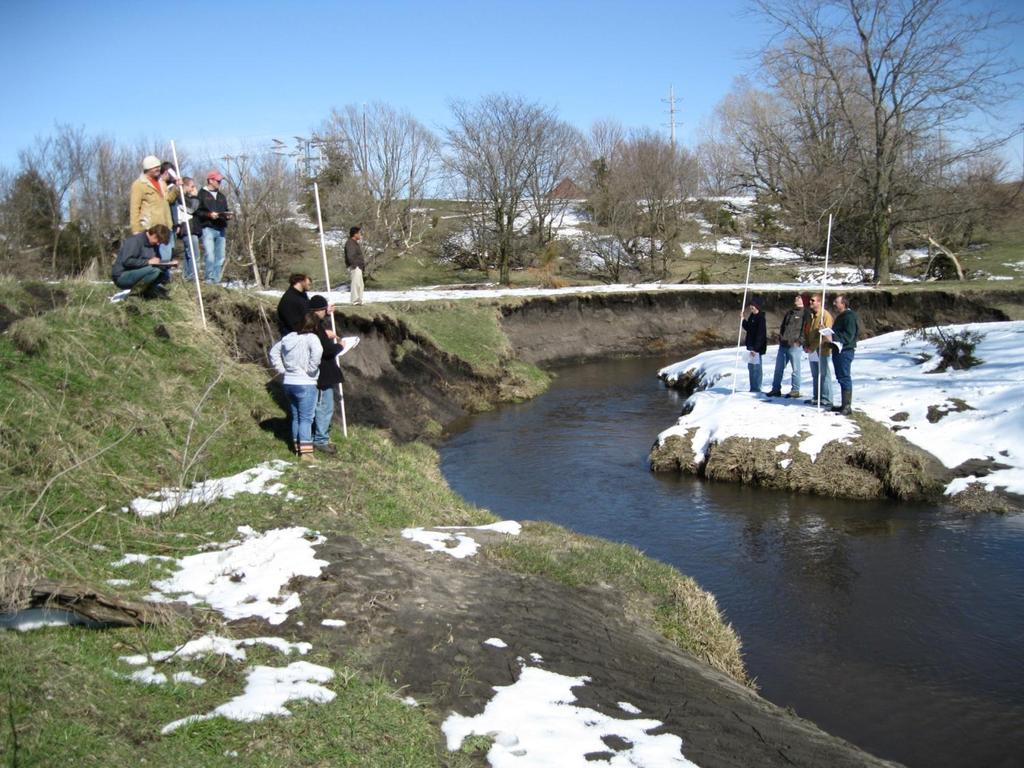
1 NREM 407/507 April 9 1. Jordan River today Danube on Tuesday 2. Quiz 3. Discuss Stream Bank Stabilization 4. Lab Tuesday bring gloves, waders if you have them & be ready to get muddy, learn & have fun. 5. Read paper: Riparian forest buffers in agroecosystems - in RMS Packet

2
3
4

5

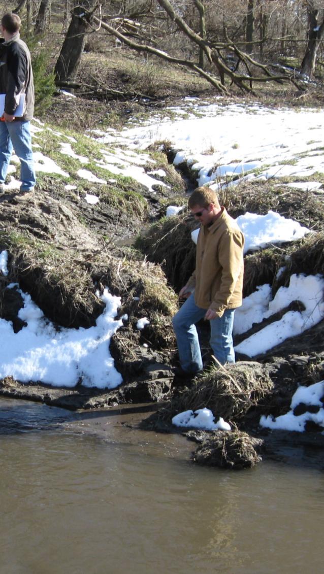
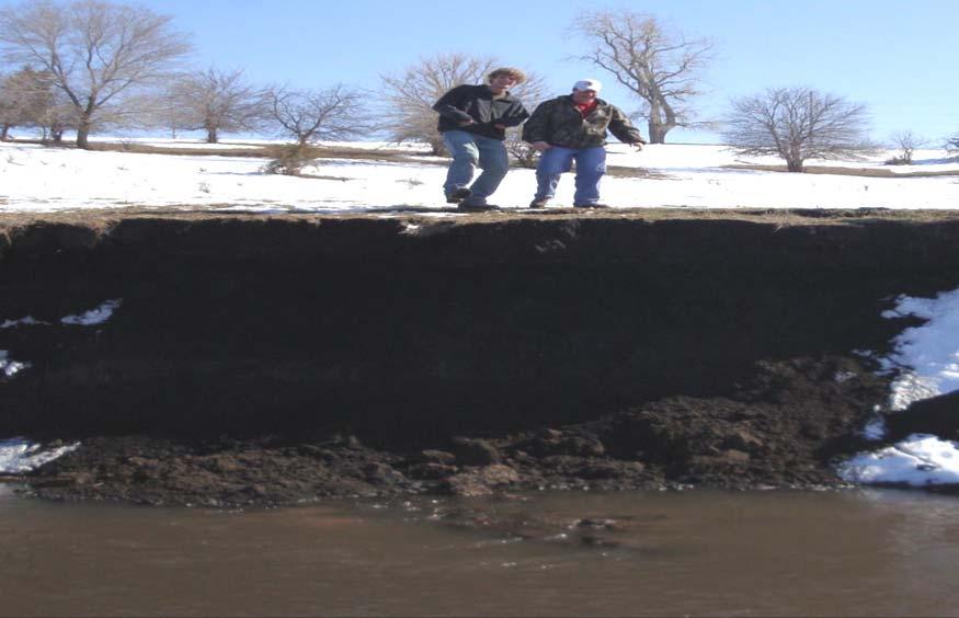
6 Channel Junction Bar


7 Mid-channel bars Onion Creek Channel junction bars Squaw Creek

8 International Rivers Project Syr Darya & Amu Darya Aral Sea Jordan River Ob & Irtysh Rivers Yellow River Niger/Benue Nile River Paraguay & Parana Rivers Congo Ganges Mekong/Tonle Sap Tigris & Euphrates
 Timed d) No Return to")
9 Quiz Rules: a) All Group b) Closed Book/Notes c) Timed d) No Return to Questions

10 6 am Today X X X What is the direction of the wind in Ames? What is the direction of the wind in Chicago? What is the direction of the wind in Atlanta? 1 3 minutes
11 6 am Today N/NE/NW X X X CALM What is the direction of the wind in Ames? What is the direction of the wind in Chicago? What is the direction of the wind in Atlanta? 3 minutes 3 points 1
12 West-side Cascades British Columbia Compare the following by stating BC is >, =, < than Moab: 2 a) Mass movement vs erosion (think carefully) b) Drainage density Moab Utah c) Total annual discharge as % of total annual precip. d) Base flow as % of total annual discharge e) Sediment load in channel f) Perennial vs intermittency 5 minutes
 b) Drainage density (>MOAB) Moab Utah c) Total annual")
 d) Base flow as % of total annual discharge (>BC) e) Sediment load in channel (>MOAB) f)")
13 West-side Cascades British Columbia Compare the following by stating BC is >, =, < than Moab: 3 a) Mass movement vs erosion (BC MASS; MOAB EROSION) b) Drainage density (>MOAB) Moab Utah c) Total annual discharge as % of total annual precip. (>MOAB) d) Base flow as % of total annual discharge (>BC) e) Sediment load in channel (>MOAB) f) Perennial vs intermittency (BC PERENNIAL; MOAB INTERMITTENT) 5 minutes 2 points each
14 List major factors that control soil erosion by water & explain why for each Hint: USLE A = RKLSCP (no definitions also pictures) 3 6 minutes
 3 6 minutes 1. Rainfall erosivity (intensity, raindrop size, duration) 2.")
 5. Cropping practice (land-use) 6.")
15 List major factors that control soil erosion by water & explain why for each Hint: USLE A = RKLSCP (no definitions also pictures) 3 6 minutes 1. Rainfall erosivity (intensity, raindrop size, duration) 2. Soil erosivity (texture, structure influence erosion) 3. % slope (steeper more erosion) 4. Slope length (longer slope more speed, more erosion) 5. Cropping practice (land-use) 6. Conservation practices (perennial vs annual vs urban also land-use) 2 points each
16 The most sensitive portion of a watershed in terms of water quality is its floodplain. Name the numbered features minutes


17 The most sensitive portion of a watershed in terms of water quality is its floodplain. Name the numbered features. 4 Or by-pass 4 minutes 1 point each

 2.")
 3. Intermittent channels in contact with WT during the wet season so run seasonally (2 pts) 4.")

18 Differentiate between ephemeral gullies, classic gullies also called ephemeral channels & intermittent & perennial channels & relate their dynamics to the variable source area concept A channel system is dynamic may begin with rills that connect to gullies which connect to stream channels their water content expands & contracts (12 pts) # 5-8 minutes 1. Ephemeral small gully, can be tilled over, leaves depression, no WT contact, runs only during & shortly after rains (2 pts) 2. Classic gully or ephemeral channels large gully, can no longer be crossed, no WT contact, runs only during & shortly after rains (2 pts) 3. Intermittent channels in contact with WT during the wet season so run seasonally (2 pts) 4. Perennial channels in contact with WT 90% or more during the year (2 pts) VSA only area near streams provides most of the base flow as soil wets during spring WT rises more channels have flow channel system expands as season dries WT drops more and more channels dry up during storms active channel system extends up into gullies and rills. (4 pts) 5
19 Ames 2008 North Grand Mall Diagram a fully labeled Storm Flow Hydrograph For Ames 2008 & th St Both on same axis Label parts of hydrograph Target Walmart North Grand Mall Jack Trice #6 5 minutes 13 th St Ames 1930 JT T W

20 Ames 2008 North Grand Mall 13 th St Diagram a fully labeled Storm Flow Hydrograph For Ames 2008 & 1930 Both on same axis #6 5 minutes Label parts of hydrograph Target Walmart North Grand Mall Jack Trice stormflow pt each red circle 4 pts for curve shapes Peaks apart & 2008 higher, antecedent higher for 1930, baseflow higher for 1930, less stormflow area under 1930 curve (12 points total) 13 th St 1930 Ames 1930 JT T W
21 5 minutes 7 There are major changes in stream dynamics moving down stream from the headwaters to the mouth of a river. Describe whether there are increases or decreases in the following variables as you move from upstream to downstream. Channel: a) Slope b) Width c) Depth d) Sinuosity e) Velocity f) Discharge g) Size of bed material h) Relative volume of stored alluvium


 e) Velocity (decreases) f) Discharge (increases) g) Size of")
22 5 minutes 7 There are major changes in stream dynamics moving down stream from the headwaters to the mouth of a river. Describe whether there are increases or decreases in the following variables as you move from upstream to downstream. Channel: a) Slope (decreases) b) Width (increases) c) Depth (increases) d) Sinuosity (increases) e) Velocity (decreases) f) Discharge (increases) g) Size of bed material (decreases) h) Relative volume of stored alluvium (increases) 1 point each 8 total
23 Water availability & quality varies by major watersheds around the world Name each numbered watershed #8 4 minutes
24 Water availability & quality varies by major watersheds around the world Name each numbered watershed. Syr Darya & Amu Darya Aral Sea 10 Ob & Irtysh Rivers #8 4 minutes Niger/Benue 6 Nile River Ganges 1 2 Yellow River Mekong/Tonle Sap Paraguay & Parana Rivers 8 9 Congo Tigris & Euphrates 1 point each 10 points
25 #9 5 minutes a) What major river in Africa has a major inland delta? b) What major river(s) we studied flow primarily north? c) What major Rivers that we discussed this semester have their headwaters on the Tibetan Plateau? d) What is the name of the longest river in the world that is located in Africa & begins in Lake Victoria & Burundi? e) The second largest hydroelectric dam in the world behind the Three Gorges Dam in China is located on the main channel of what South American River? f) What river(s) begin in Turkey? g) What river carries the largest sediment load in the world?
 What major river(s) we studied flow primarily north? (Nile, Ob, Aral Sea) #9 5 minutes (Niger) c) What major Rivers that we discussed this semester have their headwaters on the Tibetan Plateau?")
26 What river carries the largest sediment load in the world? Yellow 10 points one for each correct river a) What major river in Africa has a major inland delta? b) What major river(s) we studied flow primarily north? (Nile, Ob, Aral Sea) #9 5 minutes (Niger) c) What major Rivers that we discussed this semester have their headwaters on the Tibetan Plateau? (Yellow, Mekong, Ganges Don t need Ganges but OK if given) d) What is the name of the longest river in the world that is located in Africa & begins in Lake Victoria & Burundi? (Nile) e) The second largest hydroelectric dam in the world behind the Three Gorges Dam in China is located on the main channel of what South American River? (Parana) f) What river(s) begin in Turkey? (Tigris & Euphrates)
27 That s It! Have a Great Weekend Be Prepared for Stream Bank Rumble Next Week
NREM 407/507 - March 26. International Rivers Project. 1. Yellow River Presentation today Nile River next Tuesday
 NREM 407/507 - March 26 1. Yellow River Presentation today Nile River next Tuesday 2. Calculate stream bank erosion, gully erosion and sheet and rill erosion for the Swenson Farm that we visited on Tuesday
Streams. Stream Water Flow
 CHAPTER 14 OUTLINE Streams: Transport to the Oceans Does not contain complete lecture notes. To be used to help organize lecture notes and home/test studies. Streams Streams are the major geological agents
Running Water Earth - Chapter 16 Stan Hatfield Southwestern Illinois College
 Running Water Earth - Chapter 16 Stan Hatfield Southwestern Illinois College Hydrologic Cycle The hydrologic cycle is a summary of the circulation of Earth s water supply. Processes involved in the hydrologic
Year 6. Geography. Revision
 Year 6 Geography Revision November 2017 Rivers and World knowledge How the water cycle works and the meaning of the terms evaporation, condensation, precipitation, transpiration, surface run-off, groundwater
Erosion Surface Water. moving, transporting, and depositing sediment.
 + Erosion Surface Water moving, transporting, and depositing sediment. + Surface Water 2 Water from rainfall can hit Earth s surface and do a number of things: Slowly soak into the ground: Infiltration
Fresh Water: Streams, Lakes Groundwater & Wetlands
 Fresh Water:, Lakes Groundwater & Wetlands Oct 27 Glaciers and Ice Ages Chp 13 Nov 3 Deserts and Wind and EXAM #3 Slope hydrologic cycle P = precip I = precip intercepted by veg ET = evapotranspiration
Squaw Creek. General Information
 General Information is a tributary to the Salmon River. It enters the north side of the river about 0 miles downstream of North Fork, Idaho. The study reach is about a 30 ft length of stream about 2 miles
Landscape Development
 Landscape Development Slopes Dominate Natural Landscapes Created by the interplay of tectonic and igneous activity and gradation Deformation and uplift Volcanic activity Agents of gradation Mass wasting
3/3/2013. The hydro cycle water returns from the sea. All "toilet to tap." Introduction to Environmental Geology, 5e
 Introduction to Environmental Geology, 5e Running Water: summary in haiku form Edward A. Keller Chapter 9 Rivers and Flooding Lecture Presentation prepared by X. Mara Chen, Salisbury University The hydro
Objectives: After completing this assignment, you should be able to:
 Data Analysis Assignment #1 Evaluating the effects of watershed land use on storm runoff Assignment due: 21 February 2013, 5 pm Objectives: After completing this assignment, you should be able to: 1) Calculate
River Response. Sediment Water Wood. Confinement. Bank material. Channel morphology. Valley slope. Riparian vegetation.
 River Response River Response Sediment Water Wood Confinement Valley slope Channel morphology Bank material Flow obstructions Riparian vegetation climate catchment vegetation hydrological regime channel
6.1 Water. The Water Cycle
 6.1 Water The Water Cycle Water constantly moves among the oceans, the atmosphere, the solid Earth, and the biosphere. This unending circulation of Earth s water supply is the water cycle. The Water Cycle
Prentice Hall EARTH SCIENCE
 Prentice Hall EARTH SCIENCE Tarbuck Lutgens Running Water and Groundwater Running Water The Water Cycle Water constantly moves among the oceans, the atmosphere, the solid Earth, and the biosphere. This
Sedimentation in the Nile River
 Advanced Training Workshop on Reservoir Sedimentation Sedimentation in the Nile River Prof. Dr. Abdalla Abdelsalam Ahmed 10-16 Oct. 2007, IRTCES, Beijing, China CWR,Sudan 1 Water is essential for mankind
Stream Geomorphology. Leslie A. Morrissey UVM July 25, 2012
 Stream Geomorphology Leslie A. Morrissey UVM July 25, 2012 What Functions do Healthy Streams Provide? Flood mitigation Water supply Water quality Sediment storage and transport Habitat Recreation Transportation
Each basin is surrounded & defined by a drainage divide (high point from which water flows away) Channel initiation
 Channel initiation") DRAINAGE BASINS A drainage basin or watershed is defined from a downstream point, working upstream, to include all of the hillslope & channel areas which drain to that point Each basin is surrounded &
DRAINAGE BASINS A drainage basin or watershed is defined from a downstream point, working upstream, to include all of the hillslope & channel areas which drain to that point Each basin is surrounded &
How Do Human Impacts and Geomorphological Responses Vary with Spatial Scale in the Streams and Rivers of the Illinois Basin?
 How Do Human Impacts and Geomorphological Responses Vary with Spatial Scale in the Streams and Rivers of the Illinois Basin? Bruce Rhoads Department of Geography University of Illinois at Urbana-Champaign
Conceptual Model of Stream Flow Processes for the Russian River Watershed. Chris Farrar
 Conceptual Model of Stream Flow Processes for the Russian River Watershed Chris Farrar Several features of creeks affect the interactions between surface and groundwater. This conceptual model uses the
Rivers T. Perron
 1 Rivers T. Perron 12.001 After our discussions of large-scale topography, how we represent topography in maps, and how topography interacts with geologic structures, you should be frothing at the mouth
Riparian Assessment. Steps in the right direction... Drainage Basin/Watershed: Start by Thinking Big. Riparian Assessment vs.
 Riparian Assessment vs. Monitoring Riparian Assessment What is a healthy stream? Determine stream/riparian health Determine change or trend, especially in response to mgmt Classification = designation
In the space provided, write the letter of the description that best matches the term or phrase. a. any form of water that falls to Earth s
 Skills Worksheet Concept Review In the space provided, write the letter of the description that best matches the term or phrase. 1. condensation 2. floodplain 3. watershed 4. tributary 5. evapotranspiration
Earth Science Chapter 6 Section 2 Review
 Name: Class: Date: Earth Science Chapter 6 Section Review Multiple Choice Identify the choice that best completes the statement or answers the question. 1. Most streams carry the largest part of their
Laboratory Exercise #3 The Hydrologic Cycle and Running Water Processes
 Laboratory Exercise #3 The Hydrologic Cycle and Running Water Processes page - 1 Section A - The Hydrologic Cycle Figure 1 illustrates the hydrologic cycle which quantifies how water is cycled throughout
GEOL 1121 Earth Processes and Environments
 GEOL 1121 Earth Processes and Environments Wondwosen Seyoum Department of Geology University of Georgia e-mail: seyoum@uga.edu G/G Bldg., Rm. No. 122 Seyoum, 2015 Chapter 6 Streams and Flooding Seyoum,
The effectiveness of check dams in controlling upstream channel stability in northeastern Taiwan
 Erosion, Debris Mows and Environment in Mountain Regions (Proceedings of the Chengdu Symposium, July 1992). IAHS Publ. no. 209, 1992. 423 The effectiveness of check dams in controlling upstream channel
PHYSICAL GEOGRAPHY. By Brett Lucas
 PHYSICAL GEOGRAPHY By Brett Lucas FLUVIAL PROCESSES Fluvial Processes The Impact of Fluvial Processes on the Landscape Streams and Stream Systems Stream Channels Structural Relationships The Shaping and
Aquifer an underground zone or layer of sand, gravel, or porous rock that is saturated with water.
 Aggradation raising of the streambed by deposition that occurs when the energy of the water flowing through a stream reach is insufficient to transport sediment conveyed from upstream. Alluvium a general
Surface Water and Stream Development
 Surface Water and Stream Development Surface Water The moment a raindrop falls to earth it begins its return to the sea. Once water reaches Earth s surface it may evaporate back into the atmosphere, soak
Patrick Baskfield. Scott Matteson. Minnesota Pollution Control Agency. Minnesota State University Water Resource Center
 Regression Analysis of Total Suspended Solids Concentrations to Estimate Streambank, Upland Field, and Classic Gully Sediment Contributions to Minnesota River Tributaries Patrick Baskfield Minnesota Pollution
Application of SWAT Model to Estimate the Runoff and Sediment Load from the Right Bank Valleys of Mosul Dam Reservoir
 Application of SWAT Model to Estimate the Runoff and Sediment Load from the Right Bank Valleys of Mosul Dam Reservoir Dr Mohammad Ezeel Deen Prof. Nadhir Al-Ansari Prof Sven Knutsson Figure 1.Map of Iraq
Dynamique des rivières. res
 Dynamique des rivières res 1 Rivers are enormously diverse size: varies by many orders of magnitude geometry: highly variable substrate: bedrock or sediment sediment type: sediment size ranges from mud
Surface Processes Focus on Mass Wasting (Chapter 10)
") Surface Processes Focus on Mass Wasting (Chapter 10) 1. What is the distinction between weathering, mass wasting, and erosion? 2. What is the controlling force in mass wasting? What force provides resistance?
Surface Processes Focus on Mass Wasting (Chapter 10) 1. What is the distinction between weathering, mass wasting, and erosion? 2. What is the controlling force in mass wasting? What force provides resistance?
The City School PAF Chapter
 The City School PAF Chapter Geography Intervention workbook (1 st Term) Class 7 Topic: weather and climate Section A Q1. Fill in the blanks. [ /10] 1. The world can be divided into three broad climatic
Geog Lecture 19
 Geog 1000 - Lecture 19 Fluvial Geomorphology and River Systems http://scholar.ulethbridge.ca/chasmer/classes/ Today s Lecture (Pgs 346 355) 1. What is Fluvial Geomorphology? 2. Hydrology and the Water
Working with Natural Stream Systems
 Working with Natural Stream Systems Graydon Dutcher Delaware County Soil & Water Conservation District Stream Corridor Management Program Tropical Storm Sandy October 29,2012 What is a Watershed?
Science of Natural Disasters: RIVERS& FLOODS! 27 April 2016
 Science of Natural Disasters: RIVERS& FLOODS! 27 April 2016 Rebecca Clotts Department of Geology, University of St Thomas Flood in St Paul, 2014, Star Tribune 1 2 What is a watershed? 3 4 5 6 7 What is
Rivers and Streams. Streams. Hydrologic Cycle. Drainage Basins and Divides. Colorado River Drainage Basin. Colorado Drainage Basins.
 Chapter 14 Hydrologic Cycle Rivers and Streams Streams A stream is a body of water that is confined in a channel and moves downhill under the influence of gravity. This definition includes all sizes of
Kaskaskia Morphology Study Headwaters to Lake Shelbyville
 Kaskaskia Morphology Study Headwaters to Lake Shelbyville KWA Mini Summit 5 March 2012 1 Kaskaskia Morphology Study Headwaters to Lake Shelbyville Conducted by U.S. Army Corps of Engineers, St. Louis District
Impacts of Upstream Disturbances on Downstream Sediment Yield and Morphology in the Presence of Best Management Practices
 Impacts of Upstream Disturbances on Downstream Sediment Yield and Morphology in the Presence of Best Management Practices Ilkim Cavus M.S. Student Dr. Latif Kalin Professor Auburn University, School of
ES 105 Surface Processes I. Hydrologic cycle A. Distribution % in oceans 2. >3% surface water a. +99% surface water in glaciers b.
 ES 105 Surface Processes I. Hydrologic cycle A. Distribution 1. +97% in oceans 2. >3% surface water a. +99% surface water in glaciers b. >1/3% liquid, fresh water in streams and lakes~1/10,000 of water
Overview of fluvial and geotechnical processes for TMDL assessment
 Overview of fluvial and geotechnical processes for TMDL assessment Christian F Lenhart, Assistant Prof, MSU Research Assoc., U of M Biosystems Engineering Fluvial processes in a glaciated landscape Martin
Chapter 11. Rivers: Shaping our landscape
 Chapter 11 Rivers: Shaping our landscape Learning outcomes In this presentation you will learn: Common terms associated with rivers About the three stages of a river About the processes of river erosion
Science EOG Review: Landforms
 Mathematician Science EOG Review: Landforms Vocabulary Definition Term canyon deep, large, V- shaped valley formed by a river over millions of years of erosion; sometimes called gorges (example: Linville
CR AAO Bridge. Dead River Flood & Natural Channel Design. Mitch Koetje Water Resources Division UP District
 CR AAO Bridge Dead River Flood & Natural Channel Design Mitch Koetje Water Resources Division UP District Old County Road AAO Bridge Map courtesy of Marquette County Silver Lake Basin McClure Basin
Observations on Surface Water in the Seminary Fen in Spring, Prepared 6/4/13 by Sam Wetterlin; updated 7/28/13
 Observations on Surface Water in the Seminary Fen in Spring, 2013 Prepared 6/4/13 by Sam Wetterlin; updated 7/28/13 Ordinarily, a calcareous fen is primarily dependent on upwelling mineral-rich, oxygen-poor
AP Environmental Science. Earth Systems: Part 3
 AP Environmental Science Earth Systems: Part 3 River Deep, Mountain High Geomorphology-the scientific study of landforms and the processes that shape them Water, water everywhere.. Oceans Arctic Ocean
Bank Erosion and Morphology of the Kaskaskia River
 Bank Erosion and Morphology of the Kaskaskia River US Army Corps Of Engineers St. Louis District Fayette County Soil and Water Conservation District Team Partners : Carlyle Lake Ecosystem Partnership Vicinity
NATURAL RIVER. Karima Attia Nile Research Institute
 NATURAL RIVER CHARACTERISTICS Karima Attia Nile Research Institute NATURAL RIVER DEFINITION NATURAL RIVER DEFINITION Is natural stream of water that flows in channels with ih more or less defined banks.
SPECIFIC DEGRADATION AND RESERVOIR SEDIMENTATION. By Renee Vandermause & Chun-Yao Yang
 SPECIFIC DEGRADATION AND RESERVOIR SEDIMENTATION By Renee Vandermause & Chun-Yao Yang Outline Sediment Degradation - Erosion vs Sediment Yield - Sediment Yield - Methods for estimation - Defining Sediment
Earth Science Chapter 9. Day 6 - Finish Capillary Action Lab - Quiz over Notes - Review Worksheets over Sections 9.2 and 9.3
 Earth Science Chapter 9 Day 1 Day 2 Day 3 Read Section 9.1 Surface Water Chapter 9 Term Sheet Notes over Section 9.1 Surface Water Section 9.1 Review Worksheets Quiz over Section 9.1 Notes Virtual Lab
Watershed Conservation Management Planning Using the Integrated Field & Channel Technology of AnnAGNPS & CONCEPTS
 Watershed Conservation Management Planning Using the Integrated Field & Channel Technology of AnnAGNPS & CONCEPTS Eddy Langendoen Ron Bingner USDA-ARS National Sedimentation Laboratory, Oxford, Mississippi
True or False: The Earth s surface has stayed the same for thousands of years
 True or False: The Earth s surface has stayed the same for thousands of years True or False: The Earth s surface has stayed the same for thousands of years The Earth s surface is always changing! Weathering
Environmental Geology Chapter 9 Rivers and Flooding
 Environmental Geology Chapter 9 Rivers and Flooding Flooding in Pakistan 2010-1600 killed/20000 affected The hydrologic cycle is powered by the Sun The cycle includes evaporation, precipitation, infiltration,
Overview of a Changing Climate in Rhode Island
 Overview of a Changing Climate in Rhode Island David Vallee, Hydrologist in Charge, National Weather Service Northeast River Forecast Center, NOAA Lenny Giuliano, Air Quality Specialist, Rhode Island Department
Cambridge International Examinations Cambridge International General Certificate of Secondary Education
 Cambridge International Examinations Cambridge International General Certificate of Secondary Education *3123242964* GEOGRAPHY 0460/22 Paper 2 October/November 2014 Candidates answer on the Question Paper.
Lecture Outlines PowerPoint. Chapter 5 Earth Science 11e Tarbuck/Lutgens
 Lecture Outlines PowerPoint Chapter 5 Earth Science 11e Tarbuck/Lutgens 2006 Pearson Prentice Hall This work is protected by United States copyright laws and is provided solely for the use of instructors
Suspended sediment yields of rivers in Turkey
 Erosion and Sediment Yield: Global and Regional Perspectives (Proceedings of the Exeter Symposium, July 1996). IAHS Publ. no. 236, 1996. 65 Suspended sediment yields of rivers in Turkey FAZLI OZTURK Department
Geomorphology Geology 450/750 Spring Fluvial Processes Project Analysis of Redwood Creek Field Data Due Wednesday, May 26
 Geomorphology Geology 450/750 Spring 2004 Fluvial Processes Project Analysis of Redwood Creek Field Data Due Wednesday, May 26 This exercise is intended to give you experience using field data you collected
low turbidity high turbidity
 What is Turbidity? Turbidity refers to how clear the water is. The greater the amount of total suspended solids (TSS) in the water, the murkier it appears and the higher the measured turbidity. Excessive
WATER ON AND UNDER GROUND. Objectives. The Hydrologic Cycle
 WATER ON AND UNDER GROUND Objectives Define and describe the hydrologic cycle. Identify the basic characteristics of streams. Define drainage basin. Describe how floods occur and what factors may make
Defining the Limit of Regulated Areas. C.1 Defining the River or Stream Flood Hazard 138. C.2 Defining the River or Stream Erosion Hazard 139
 C.1 Defining the River or Stream Flood Hazard 138 C.2 Defining the River or Stream Erosion Hazard 139 C.3 Defining Watercourses 141 C.4 Defining the Lake Ontario Shoreline Flood, Erosion and Dynamic Beach
Floods Lecture #21 20
 Floods 20 Lecture #21 What Is a Flood? Def: high discharge event along a river! Due to heavy rain or snow-melt During a flood, a river:! Erodes channel o Deeper & wider! Overflows channel o Deposits sediment
Elevations are in meters above mean sea level. Scale 1:2000
 12.001 LAB 7: TOPOGRAPHIC MAPS Due: Monday, April 11 PART I: CONTOURING AND PROFILES (20 PTS) 1. Contour this area map using a 5 meter contour interval. Remember some fundamental rules of contour lines,
Stop 1: Marmot Dam Stop 1: Marmot Dam
 Stop 1: Marmot Dam Stop 1: Marmot Dam Following the removal of Marmot Dam in 2007, the fate of the reservoir sediments has been monitored through a series of surveys and sediment transport measurements.
Influence of the timing of flood events on sediment yield in the north-western Algeria
 Calabria, 5-7 Septembre 2 4th International Workshop on Hydrological Extremes Session A : Modelling and forecast of hydrological extreme event Influence of the timing of flood events on sediment yield
NATURE OF RIVERS B-1. Channel Function... ALLUVIAL FEATURES. ... to successfully carry sediment and water from the watershed. ...dissipate energy.
 1 2 Function... Sevier River... to successfully carry sediment and water from the watershed....dissipate energy. 3 ALLUVIAL FEATURES 4 CHANNEL DIMENSION The purpose of a stream is to carry water and sediment
APPENDIX E. GEOMORPHOLOGICAL MONTORING REPORT Prepared by Steve Vrooman, Keystone Restoration Ecology September 2013
 APPENDIX E GEOMORPHOLOGICAL MONTORING REPORT Prepared by Steve Vrooman, Keystone Restoration Ecology September 2 Introduction Keystone Restoration Ecology (KRE) conducted geomorphological monitoring in
Technical Memorandum No
 Pajaro River Watershed Study in association with Technical Memorandum No. 1.2.10 Task: Evaluation of Four Watershed Conditions - Sediment To: PRWFPA Staff Working Group Prepared by: Gregory Morris and
Which map shows the stream drainage pattern that most likely formed on the surface of this volcano? A) B)
 B)") 1. When snow cover on the land melts, the water will most likely become surface runoff if the land surface is A) frozen B) porous C) grass covered D) unconsolidated gravel Base your answers to questions
1. When snow cover on the land melts, the water will most likely become surface runoff if the land surface is A) frozen B) porous C) grass covered D) unconsolidated gravel Base your answers to questions
Natural hazards in Glenorchy Summary Report May 2010
 Natural hazards in Glenorchy Summary Report May 2010 Contents Glenorchy s hazardscape Environment setting Flood hazard Earthquakes and seismic hazards Hazards Mass movement Summary Glossary Introduction
What is weathering and how does it change Earth s surface? Answer the question using
 7 th Grade Lesson What is weathering and how does it change Earth s surface? Answer the question using the sentence frame. You have 4 minutes. Weathering is. This changes the Earth s surface because. 1
Consequences of river regulation works: altered fluvial processes + increasing flood hazard
 Consequences of river regulation works: altered fluvial processes + increasing flood hazard Dr. Tímea Kiss assistant professor Department of Physical Geography and Geoinformatics, University of Szeged,
Forest Hydrology: Lect. 9. Contents. Runoff, soil water and infiltration
 Forest Hydrology: Lect. 9 Contents Runoff, soil water and infiltration Learning objectives:. - Hillslope runoff generation processes; - Dynamics of runoff generation processes; - Hortonian and Dunnian
Learning Objectives: I can identify and interpret river flows and directions.
 Learning Objectives: I can identify and interpret river flows and directions. Bellringer Review: Check for Understanding Questions: 1 2 What Are The Key Parts Of A River s Anatomy? In your data notebooks
Soil and Water Conservation Engineering Prof. Rajendra Singh Department of Agricultural and Food Engineering Indian Institute of Technology, Kharagpur
 Soil and Water Conservation Engineering Prof. Rajendra Singh Department of Agricultural and Food Engineering Indian Institute of Technology, Kharagpur Lecture 04 Soil Erosion - Mechanics Hello friends
Stream Restoration and Environmental River Mechanics. Objectives. Pierre Y. Julien. 1. Peligre Dam in Haiti (deforestation)
") Stream Restoration and Environmental River Mechanics Pierre Y. Julien Malaysia 2004 Objectives Brief overview of environmental river mechanics and stream restoration: 1. Typical problems in environmental
Stream Restoration and Environmental River Mechanics Pierre Y. Julien Malaysia 2004 Objectives Brief overview of environmental river mechanics and stream restoration: 1. Typical problems in environmental
Assessment of the Hood River Delta Hood River, Oregon
 Assessment of the Hood River Delta Hood River, Oregon Pacific Northwest Waterways Association Annual Meeting October 13, 2010 Michael McElwee, Executive Director Port of Hood River Overview U.S. Army Corps
Sediment Deposition LET THE RIVER RUN T E A C H E R. Activity Overview. Activity at a Glance. Time Required. Level of Complexity.
 Activity at a Glance Grade: 6 9 Subject: Science Category: Physical Science, Earth Science Topic: Deposition, River Systems Time Required Two 45-minute periods Level of Complexity Medium Materials* TI-73
ADDRESSING GEOMORPHIC AND HYDRAULIC CONTROLS IN OFF-CHANNEL HABITAT DESIGN
 ADDRESSING GEOMORPHIC AND HYDRAULIC CONTROLS IN OFF-CHANNEL HABITAT DESIGN Conor Shea - Hydrologist U.S. Fish and Wildlife Service Conservation Partnerships Program Arcata, CA Learning Objectives Examine
27. Running Water I (p ; )
") 27. Running Water I (p. 424-436; 440-444) Hydrosphere How much of the Earth s surface is covered by water? Earth's water is collectively called the and is stored in a number of so-called as follows: 1.
27. Running Water I (p. 424-436; 440-444) Hydrosphere How much of the Earth s surface is covered by water? Earth's water is collectively called the and is stored in a number of so-called as follows: 1.
Gully Erosion Part 1 GULLY EROSION AND ITS CAUSES. Introduction. The mechanics of gully erosion
 Gully Erosion Part 1 GULLY EROSION AND ITS CAUSES Gully erosion A complex of processes whereby the removal of soil is characterised by incised channels in the landscape. NSW Soil Conservation Service,
Figure 1. Which part of the river is labelled in Figure 1? a) Mouth b) Source c) Lower course d) channel
 Mouth b) Source c) Lower course d) channel") Rivers 1. Study Figure 1 showing the long profile of a river Figure 1 A Which part of the river is labelled in Figure 1? a) Mouth b) Source c) Lower course d) channel (1 mark) 2. Complete the sentences
Rivers 1. Study Figure 1 showing the long profile of a river Figure 1 A Which part of the river is labelled in Figure 1? a) Mouth b) Source c) Lower course d) channel (1 mark) 2. Complete the sentences
Black Gore Creek 2013 Sediment Source Monitoring and TMDL Sediment Budget
 Black Gore Creek 2013 Sediment Source Monitoring and TMDL Sediment Budget Prepared for: Prepared By: - I. Introduction The Black Gore Creek Total Maximum Daily Load (TMDL) was developed in collaboration
Workshop: Build a Basic HEC-HMS Model from Scratch
 Workshop: Build a Basic HEC-HMS Model from Scratch This workshop is designed to help new users of HEC-HMS learn how to apply the software. Not all the capabilities in HEC-HMS are demonstrated in the workshop
Statement of Impact and Objectives. Watershed Impacts. Watershed. Floodplain. Tumblin Creek Floodplain:
 Tumblin Creek Floodplain: Impacts Assessment and Conceptual Restoration Plan Casey A. Schmidt Statement of Impact and Objectives Urbanization has increased stormflow rate and volume and increased sediment,
Great Lakes Tributary Modeling: Canaseraga Creek Watershed
 Great Lakes Tributary Modeling: Canaseraga Creek Watershed SWAT Model Authority: Section 516(e) of WRDA 1996 US Army Corps of Engineers Canaseraga Creek Project Location - Encompasses portions of Livingston,
Tracking the Salt Front
 Tracking the Salt Front Students will use Hudson River salinity data to practice math skills as they track movements of the salt front in response to storms and other weather events. Objectives: Students
Monitoring Headwater Streams for Landscape Response to
 Monitoring Headwater Streams for Landscape Response to Climate Change Matthew Connor, PhD Connor nvironmental, nc. www.oe-i.com icom Healdsburg, California verview Headwater stream geomorphology Response
SCOPE OF PRESENTATION STREAM DYNAMICS, CHANNEL RESTORATION PLANS, & SEDIMENT TRANSPORT ANALYSES IN RELATION TO RESTORATION PLANS
 DESIGN METHODS B: SEDIMENT TRANSPORT PROCESSES FOR STREAM RESTORATION DESIGN PETER KLINGEMAN OREGON STATE UNIVERSITY CIVIL ENGINEERING DEPT., CORVALLIS 2 ND ANNUAL NORTHWEST STREAM RESTORATION DESIGN SYMPOSIUM
1. The map below shows a meandering river. A A' is the location of a cross section. The arrows show the direction of the river flow.
 1. The map below shows a meandering river. A A' is the location of a cross section. The arrows show the direction of the river flow. Which cross section best represents the shape of the river bottom at
Rivers and Landslides
 Rivers and Landslides Path of desire or path of least resistance? Desire Path: A term in landscape architecture used to describe a path that isn t designed but rather is worn casually away by people finding
STUDY GUIDE FOR CONTENT MASTERY. Surface Water Movement
 Surface Water SECTION 9.1 Surface Water Movement In your textbook, read about surface water and the way in which it moves sediment. Complete each statement. 1. An excessive amount of water flowing downslope
11/12/2014. Running Water. Introduction. Water on Earth. The Hydrologic Cycle. Fluid Flow
 Introduction Mercury, Venus, Earth and Mars share a similar history, but Earth is the only terrestrial planet with abundant water! Mercury is too small and hot Venus has a runaway green house effect so
Erosional Features. What processes shaped this landscape?
 Have you ever looked at the land around you and wondered what processes shaped what you see? Perhaps you see mountains, valleys, rivers, or canyons. Do you know how long these geologic features have been
Geography Notes for Plonk Meeting
 Geography Notes for Plonk Meeting Hydrologic Cycle 1. Rainfall Water falls as rain or snow if the air is cold enough. 2. Groundwater Water that seeps into the ground may be absorbed by plants or flow into
Chapter 12: River Systems and Landforms
 Chapter 12: River Systems and Landforms Base Levels: Local and Ultimate Figure 12.6 Figure 12.2 A Drainage Basin Rills and Gullies feeding into small Streams in Iowa North American Drainage Basins Figure
Controlling Processes That Change Land
 1 Name Date Controlling Processes That Change Land People try to control some of the processes that change land. To do this, people apply technology- the use of science to solve problems in everyday life.
Important Copyright Information
 Important Copyright Information The following content is provided for educational purposes by the workshop presenter. This content may or may not have been peer reviewed. Information, opinions and recommendations
Rosgen Classification Unnamed Creek South of Dunka Road
 Rosgen Classification Unnamed Creek South of Dunka Road Prepared for Poly Met Mining Inc. September 2013 Rosgen Classification Unnamed Creek South of Dunka Road Prepared for Poly Met Mining Inc. September
If a Woodchuck Could Chuck Wood
 1/19/2018 If a Woodchuck Could Chuck Wood If a Woodchuck Could Chuck Wood The easiest way to get to the creek behind the geology museum is shown below. The red circle indicates the entrance. The yellow